Pen-Y-Pass
 Location: Gwynedd, Snowdonia/Wales
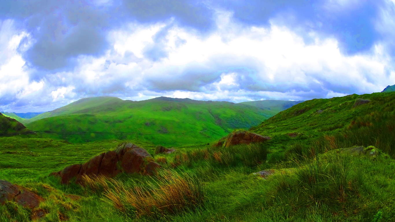
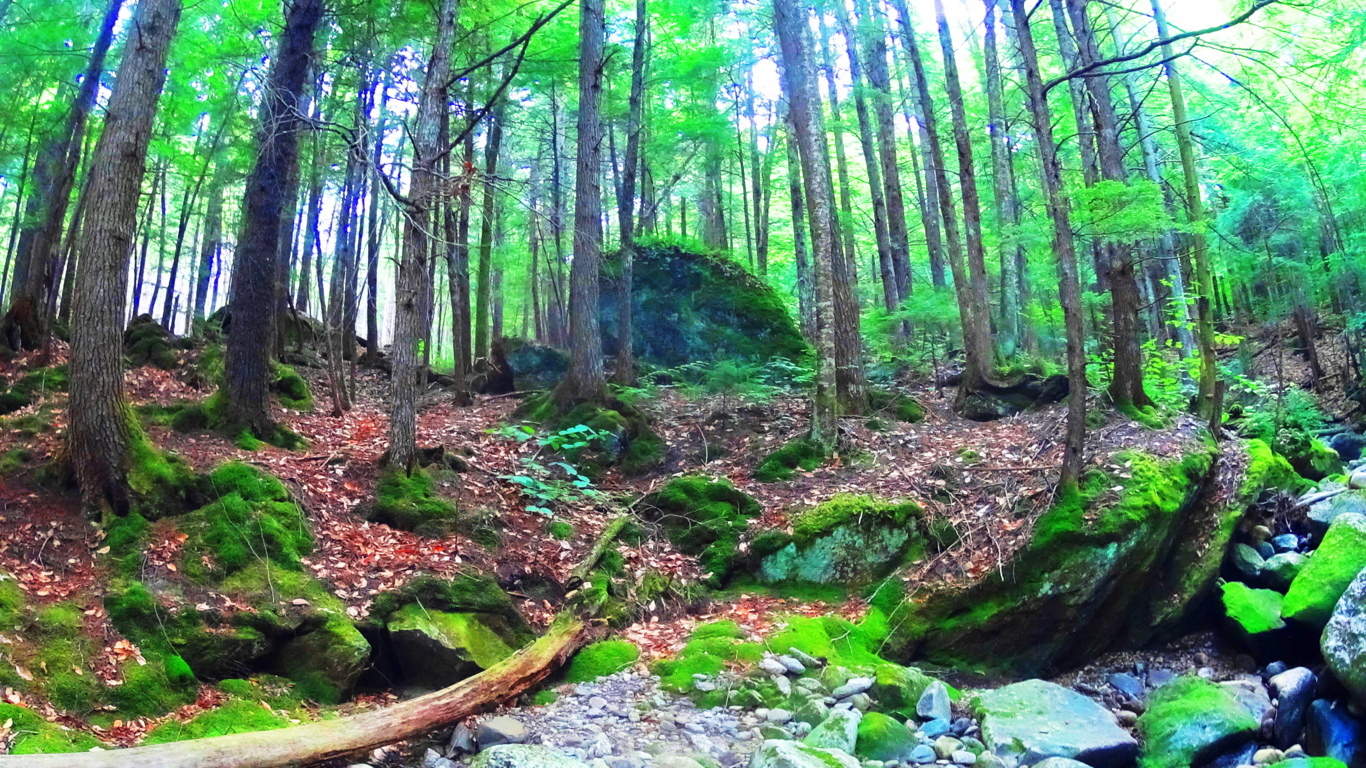
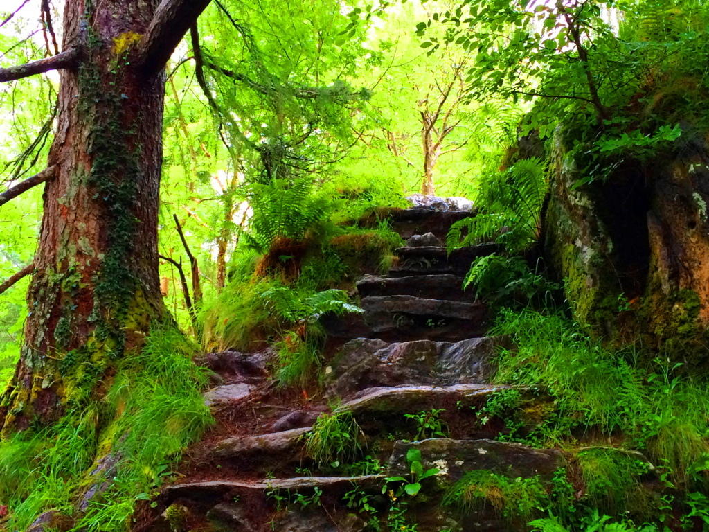
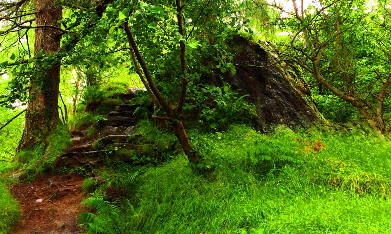
Note: About 10 miles south east of Mount Snowdon , tucked behind rocky passes and elevated clear-water lakes, is the wonderfully serene and scenic ‘Pen-Y-Pass’. With wide trails wrapping around massive mossy basins and jagged rocky caverns, this cinematic trail will carry you all the way to the peak of Snowdon if you so choose, following a north westerly course.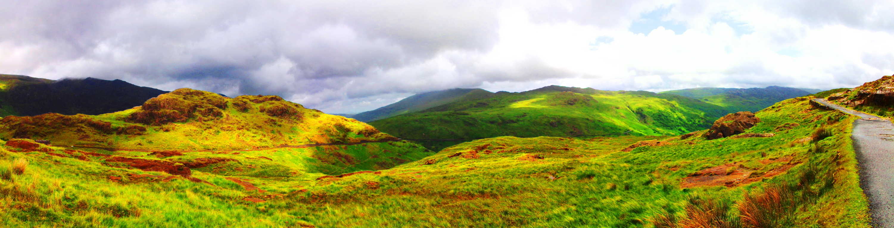 Along the way waterfalls cut the mountainsides and streams trickle in the distance. This is a classic Celtic scene, with a minimal amount of forestry, but a wonderful collage of every shade of green imaginable.
 Reeds drift in the wind, blended with moss and grass on huge knolls and hills that roll, and roll again, in every distant direction. In the heights above cut-boulders and grand shafts of granite slice dramatic angles into the peaks.
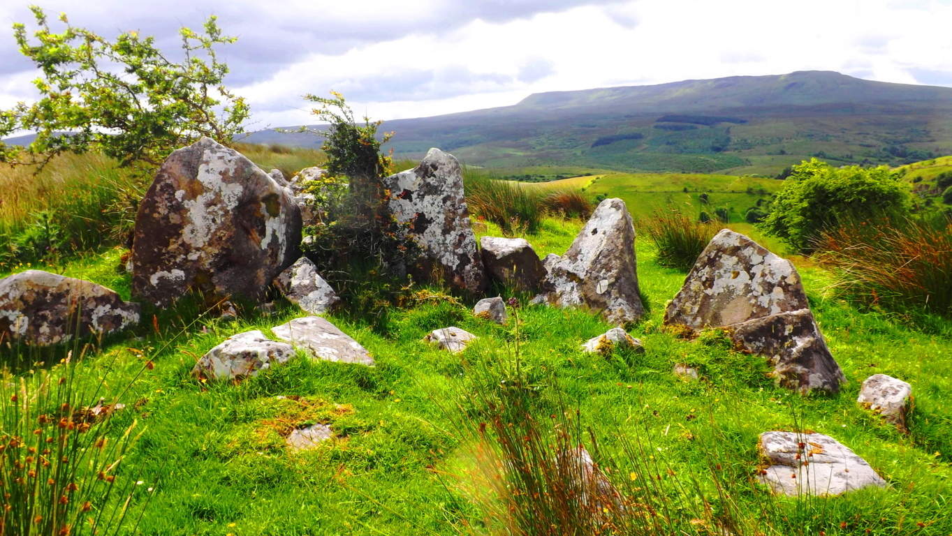
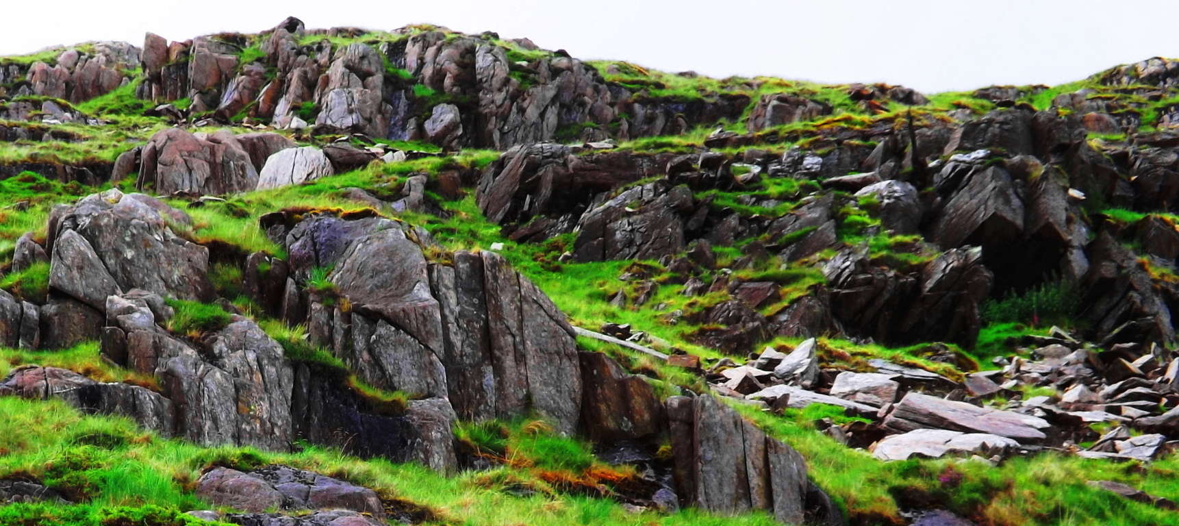 In the valley below, for those who have the eyes to see, are ancient Celtic alters dug into the landscape; Circular stone Cairns with centerpieces that are so old they seem to be almost consumed by the earth, sitting eternally in wait to be rediscovered.
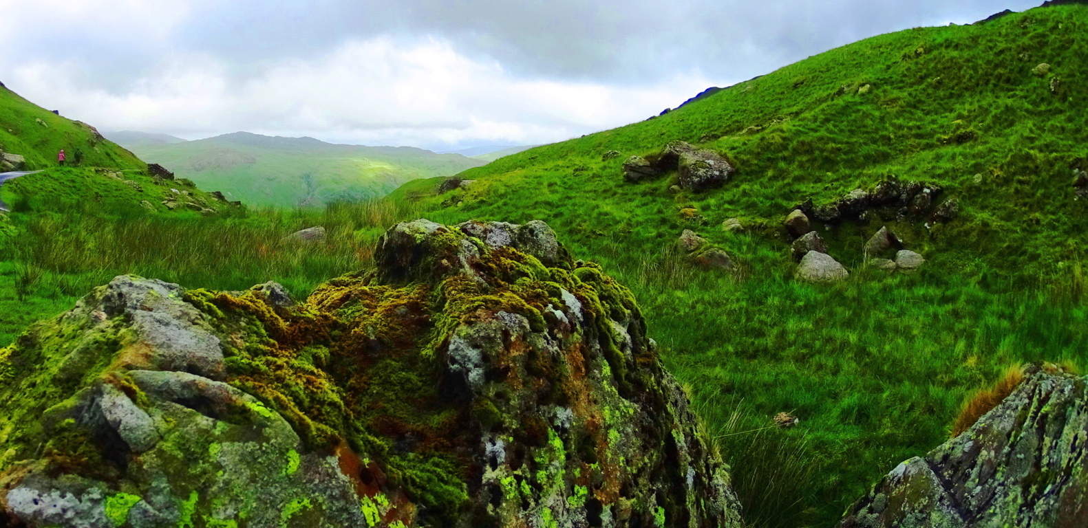 Circular stone alters with centering fixtures of very similar style exist in the forest of Foxboro Massachusetts, although there, they are covered by an ocean of foliage, and equally hard to decipher
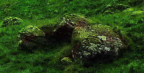
 (An example of the circular alter is shown below, white granite and quartz stones covered by the classic red/orange leaves of New England trails/Please click on photos to look closer). Another wonderful feature of Pen-Y-Pass are the old stone dwellings, most likely of the medieval period, that have been long since abandoned by herdsman and farmers for lack of resources in the valley. The hills of this landscape are huge,
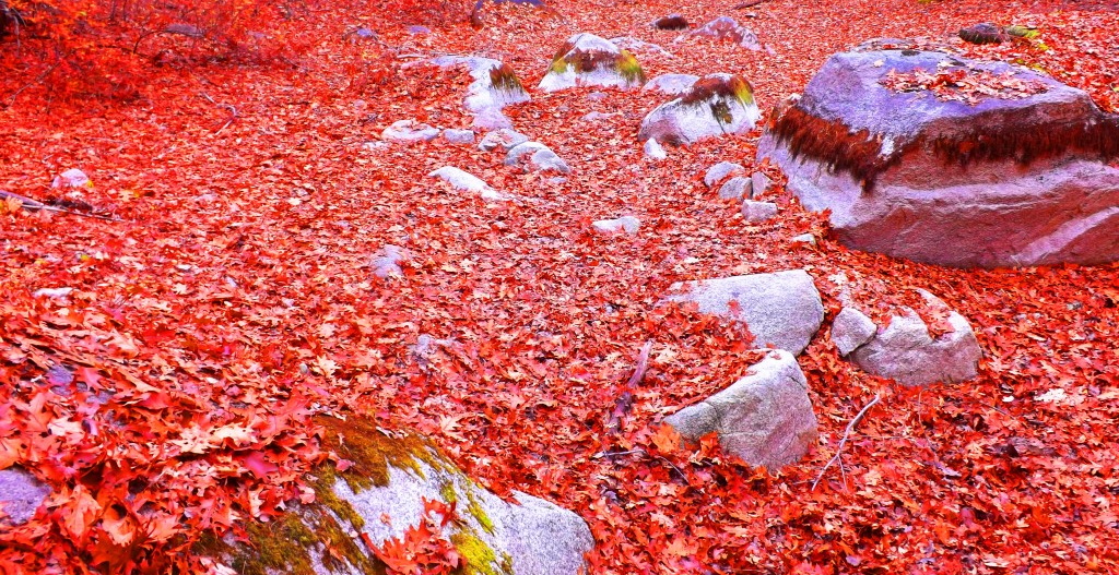
 with entire sections quarried out and abandoned. Some portions of the quarrying look to have been carried out perhaps no more than five hundred years ago, with less growth upon it, while other massive stones are completely grown over with moss, as if it were done perhaps thousands of years ago. Perhaps Pen-Y-Pass’s most shining quality is the feeling there. The air, when the weather is agreeable, is comfortably cool and clear. Everything you see: mountain, lake, hill, valley, look to be cut from the sky by a diamond. There is an echo in the soft and subtle movements of rams, water, and distant trailblazers.
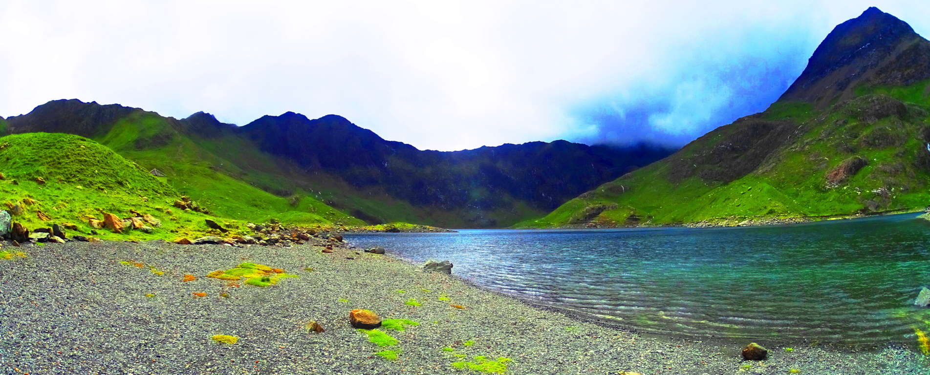 The car-park for this trail is just off the A4086 highway. If you ever come through this valley, do yourself a fantastic favor and plan at least one day to walk the timeless Celtic trail at Pen-Y-Pass, it just shouldn’t be missed.
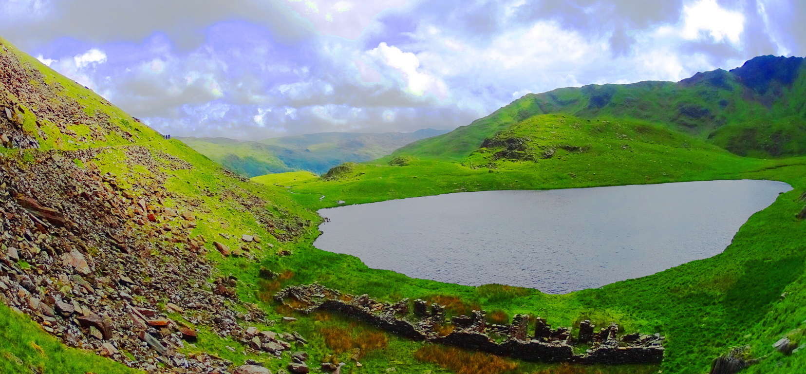
The Conwy Valley
 Location: Rowen, Wales
Elevation: 1,500 feet
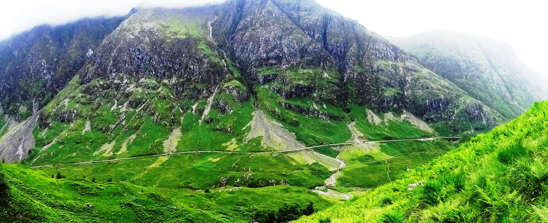
Note: Hiking experiences in the ancient Celtic high country of Wales are, simply put, breathtaking. Snowdonia National Park deservedly hosts a substantial amount of visitors in the north-west portion of Wales, centered around the majestic Mount Snowdon, which is the highest peak in the British Isles south of the Scottish Highlands at 3,560 feet. The history of Wales is interwoven with the preservation of Celtic peoples to its core, known as the last bastion of land that Celtic chieftains would not concede to the invading hoards of Gauls, Visigoths, and Vikings after the Roman withdrawal, circa 410 C.E. The Arthur Legend was born here. This is the very land that King Arthur and his knights defended to preserve the Celtic peoples. This landscape is the original backdrop for the Knights of The Round Table, for Sir Percival’s search for the Holy Grail, King Arthur’s battling of giants at the foot of Mount Snowdon, and Sir Gawain’s search for the mystical Green Knight, among hundreds of other wonderful tales. The countryside has a time honored mythical history that seems to have always inspired adventurers that reach boldly into the next valley for wonderful and magical zones. With that in mind, just 45 minutes north of the popularized Snowdonia tourist scene, sits a more conspicuous, but no less beautiful, opportunity for a truly rustic Celtic hiking experience in the serene Conwy Valley. At the top of this valley, above the small medieval town of Rowen, sits one of the most beautiful Dolmen’s in the world, the Maen Y Bardd Dolmen, and the hike to see it is epic. 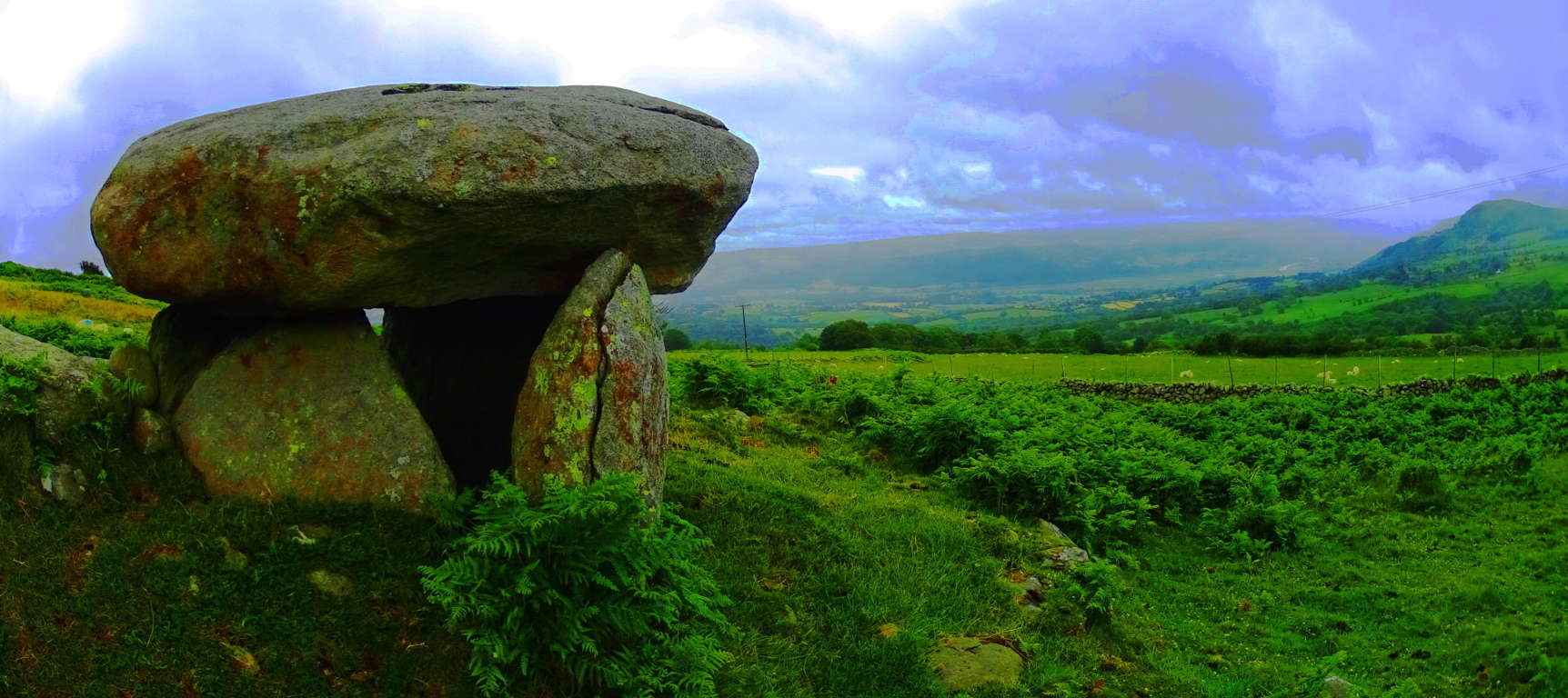 The Legend associated with this particular Dolmen is that of an ancient giant that would toss spears from one end of the Valley to the next, asserting his claim over the landscape, warding off any trespassers. In order to get to the Dolmen a hiker must follow a Roman road that runs beside the spot where it sits today, indicating that this megalith has existed from time immemorial. The Roman incursion of Wales took place around 40 C.E, and they were not known for the tender preservation of the opposing culture, yet they obviously let this Dolmen stand as they passed by. I can only think that they themselves saw that the Dolmen was sacred. The Roman’s were certainly aware of megaliths throughout the known world, and they were perhaps the most aware having conquered so much of it. There are Megaliths in Israel, Greece, Spain, France, England, Scotland, and Wales, and the Romans would have considered them. It’s makes sense that they would have known that the Dolmen had stood for perhaps as long as 3000 to 4000 years prior, and they simply did not dare to destroy something so rare, especially if it had no strategic purpose. In terms of ‘era’s’, this is a hike that will take you from the Modern, to Medieval, from Medieval to the Roman, and from the Roman to the Celtic, all in one day.
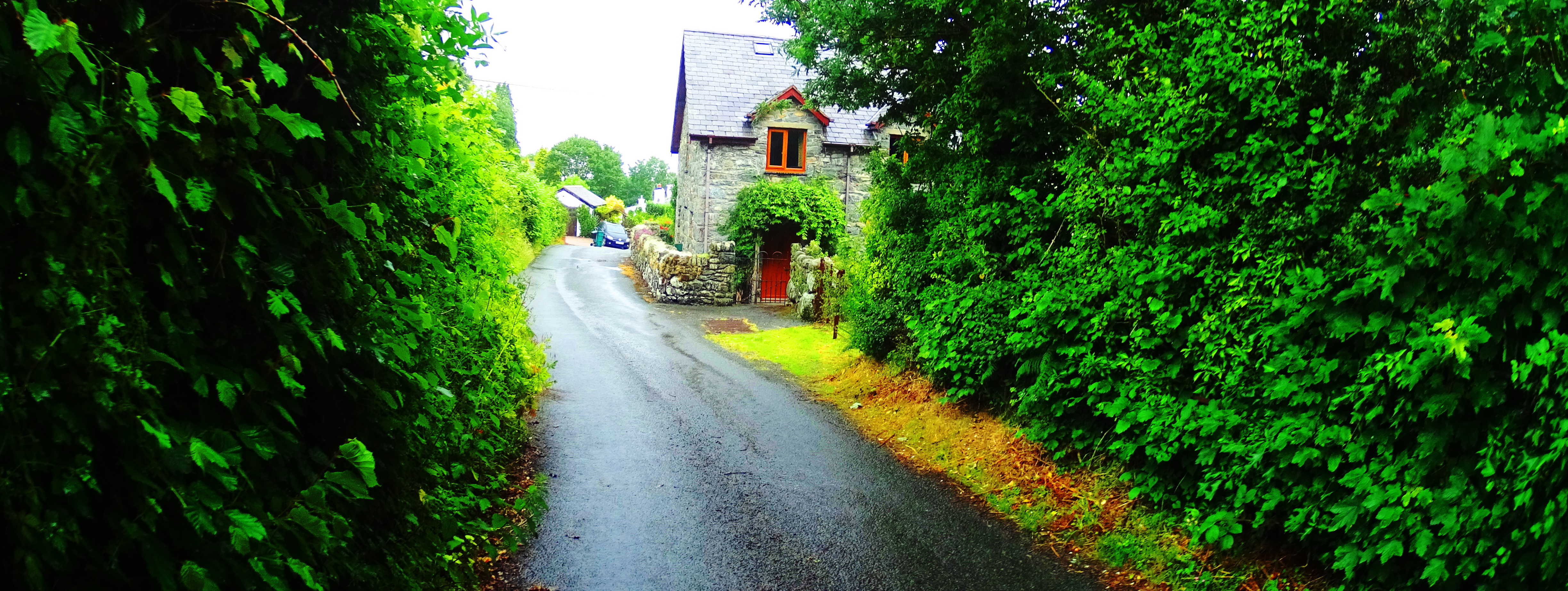 To begin get an early start, and park in Rowen. Head towards the Gwersyll Cefn Cae Campsite road, and pass by it on your right. Continue to follow this road out of town and follow the first farmers-road slightly left towards Parciau Farm. Pass by the last farms on the edge of town to where the road narrows into a country lane, slowly elevating through classic moss blanketed Celtic forest.
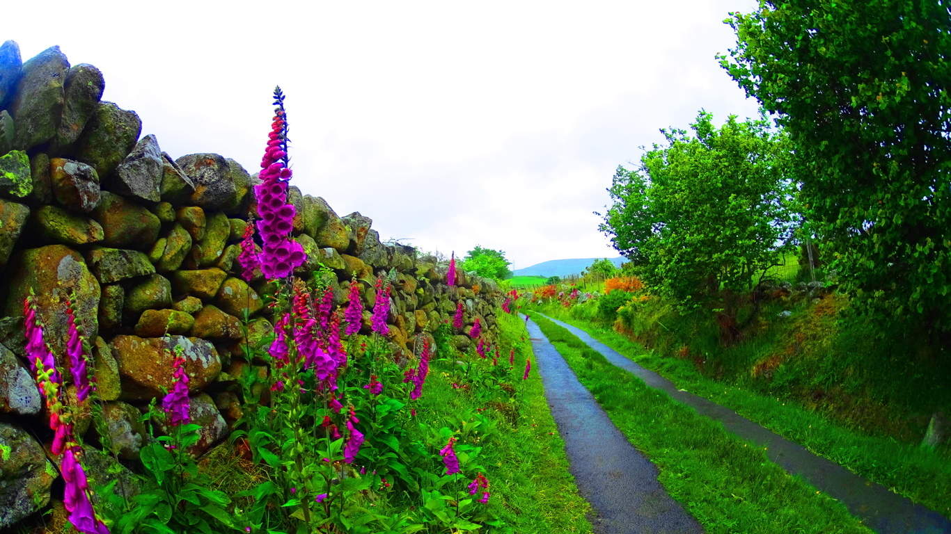
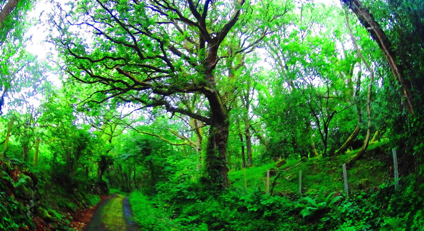 Push for roughly 1 mile through the trees to get above the tree line, where the path changes dramatically. Your trail will become lined with stoic stone-walls and Hawthorn hedges. Knolls and free-standing boulders emerge in every direction. Flocks of sheep scatter and glance from a distance. Fairy Foxglove flowers emerge all around with their striking and small lavender towers.
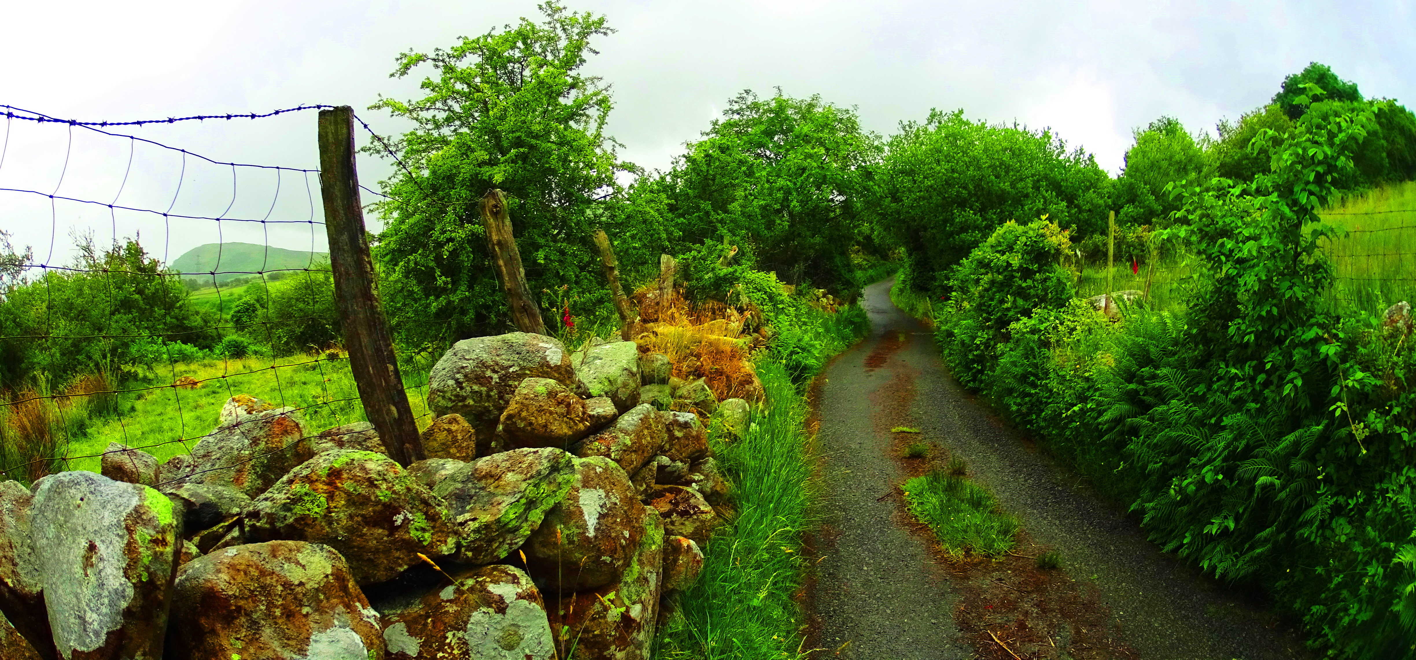 The valley begins to emerge in a beautiful way. Continue for about a mile on this path and you will finally come to an elevated intersection with a panoramic view of the valley.
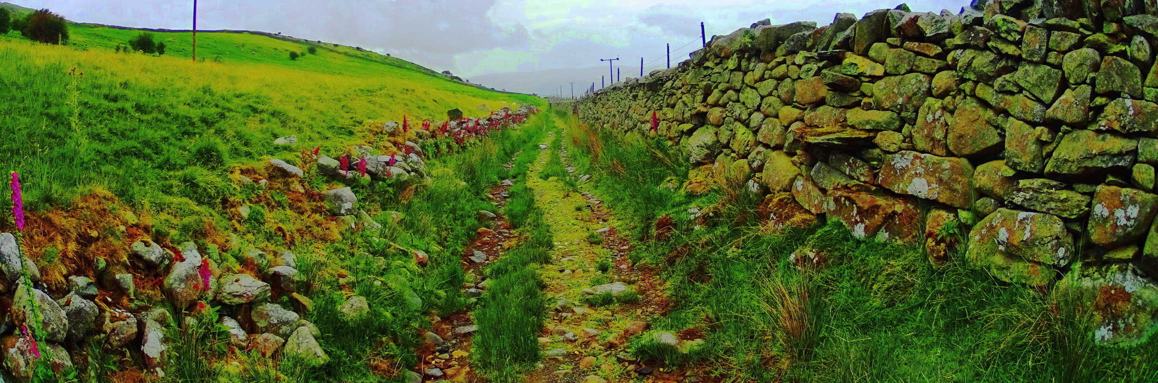 Take the path to the right here, further upward, which is lined with another solid stone wall on your right. You will see, straight ahead and slightly above you, about 1.5 miles away, another road lining the valley above. This is the old Roman road. When you reach this ancient rocky causeway take a right, then follow it for about 1/4 of a mile. On the left of the causeway you will first see a beautiful 8 foot high, 3.5 feet wide granite Standing Stone, roughly 40 yards away.
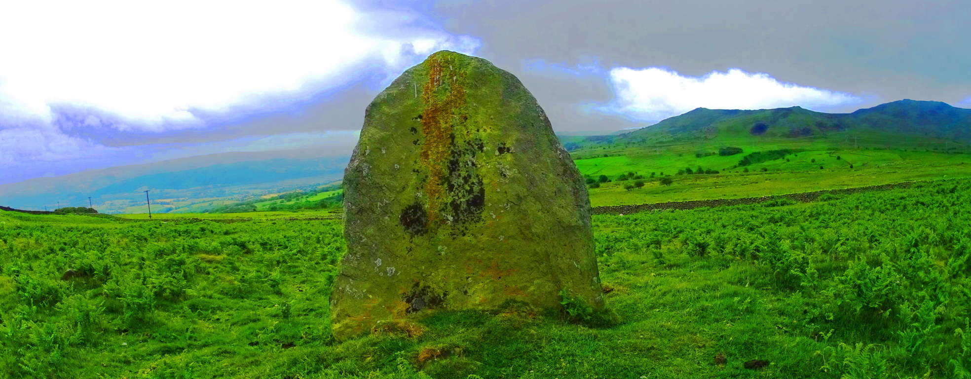 After stopping to appreciate this magnificent stone, continue in the same direction further along the Roman road, and look left again. The Dolmen sits about 50 yards away and can be seen from the road facing the valley below. It is a sight to behold. This is a classic “Portal Tomb” of the same era as the legendary Poulnabrone Dolmen in The Burren Ireland , across the Celtic Sea. Although it may look somewhat small against the broad valley, a closer look reveals a capstone weighing at least 5 tons.
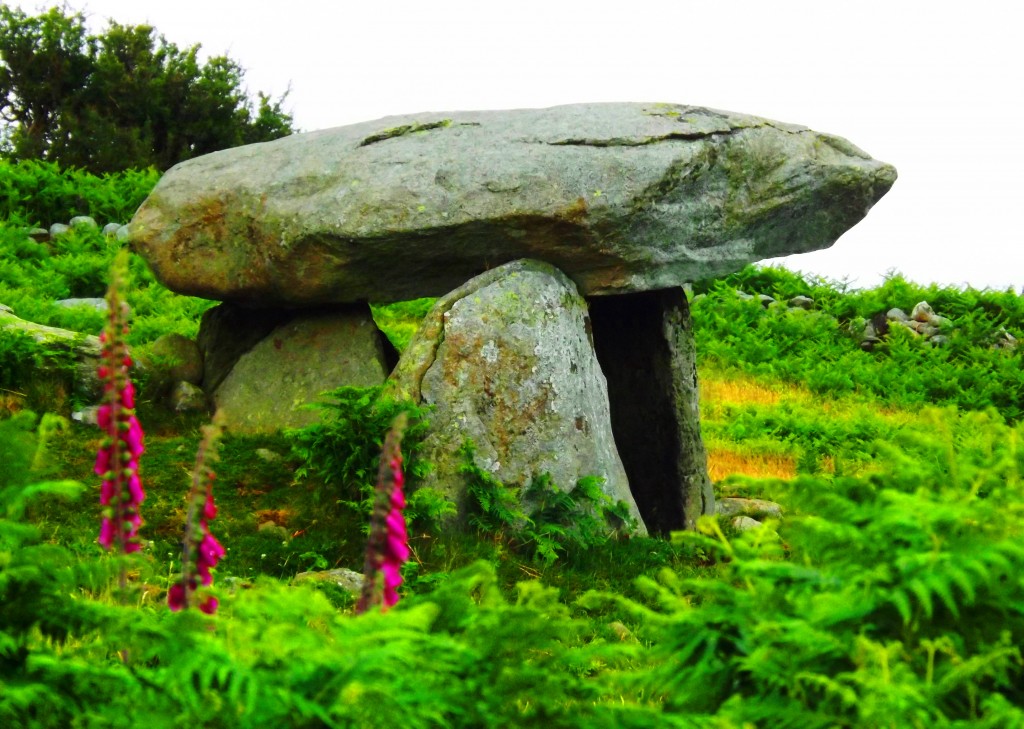 This capstone is directly aligned to a beautiful peak roughly ten miles away across the valley. This is a trait that most Dolmens display: the facing of the most beautiful vantage in the area.
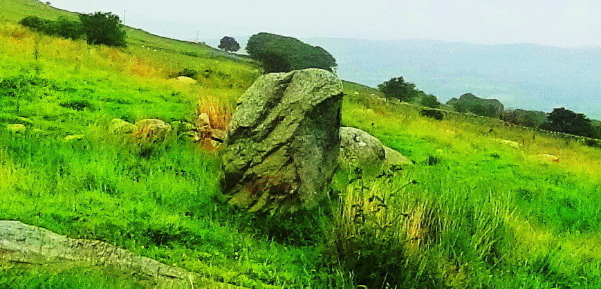 This would indicate that whoever built this Dolmen, even in deep antiquity, had a wonderful sense of Beauty, not to mention the engineering skill to build a megalith at a significant, and somewhat secluded, elevation. After finding the Dolmen hikers have several options on the return.
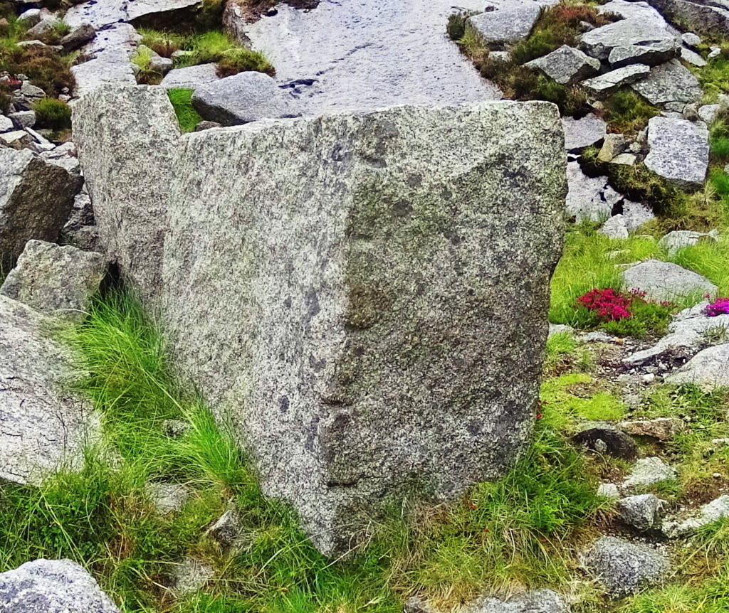
 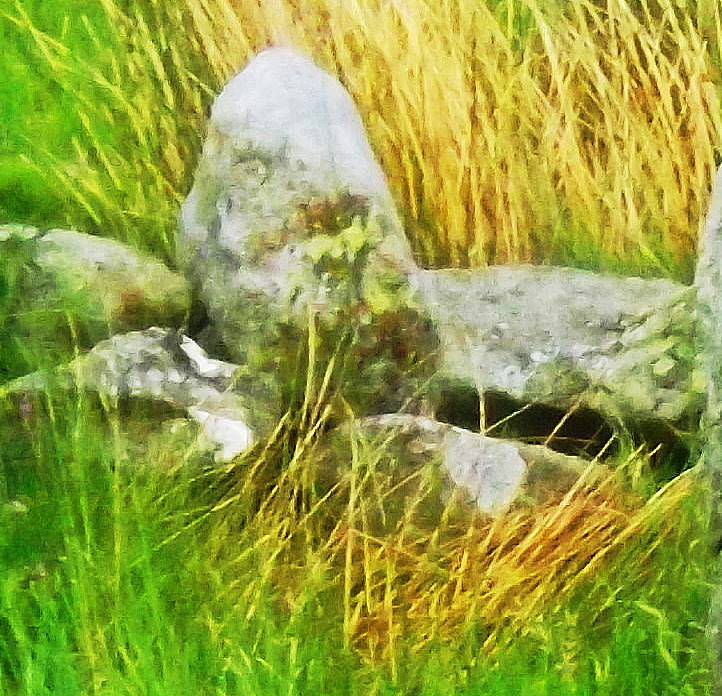 You could continue along the Roman road for about 3 miles and veer to the right, back to Rowan, or go back the way you entered. If you return the way you came, just off the trail, there will emerge other standing stones, much more discreet, but no less significant, mixed into the hedges and knolls. This second Standing Stone stood along the long farmers road connected to the Roman road, 30 yards off to the left. Standing about 7 feet high and three feet wide; It looked to weight at least 5 tons. It has a significant curved incision on its right side, and the remaining piece from that incision was set as a fixture behind it, just to the left.
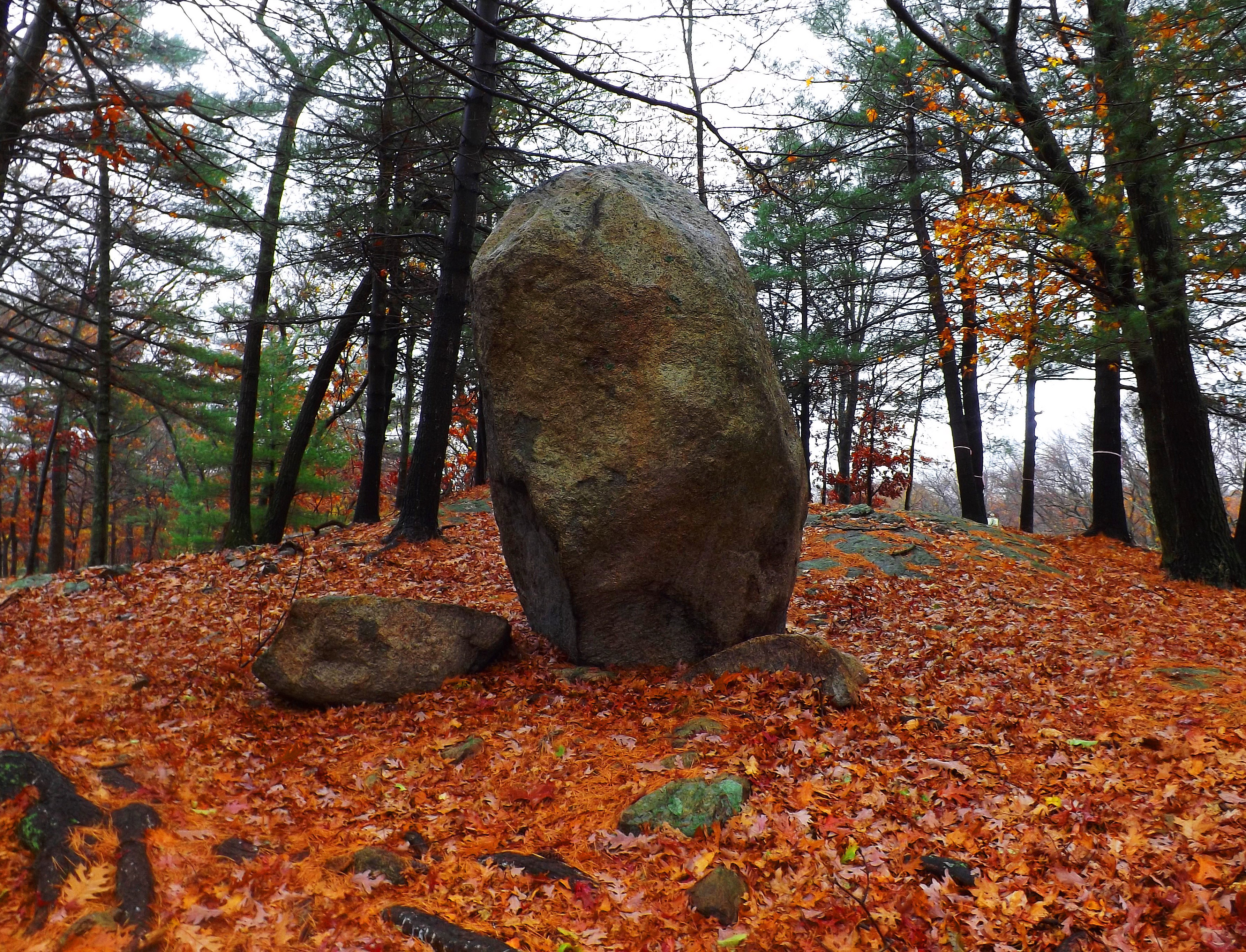 This style can be found at a Standing Stone far across the Atlantic ocean at Lynn Woods in Massachusetts, where cut pieces from the main Standing Stone remain as fixtures in the immediate vicinity (Shown here in the red/orange leaves on the left). Another incredible option for your descent are the stone labyrinth pathways that wind down the valley like something out of a dream.
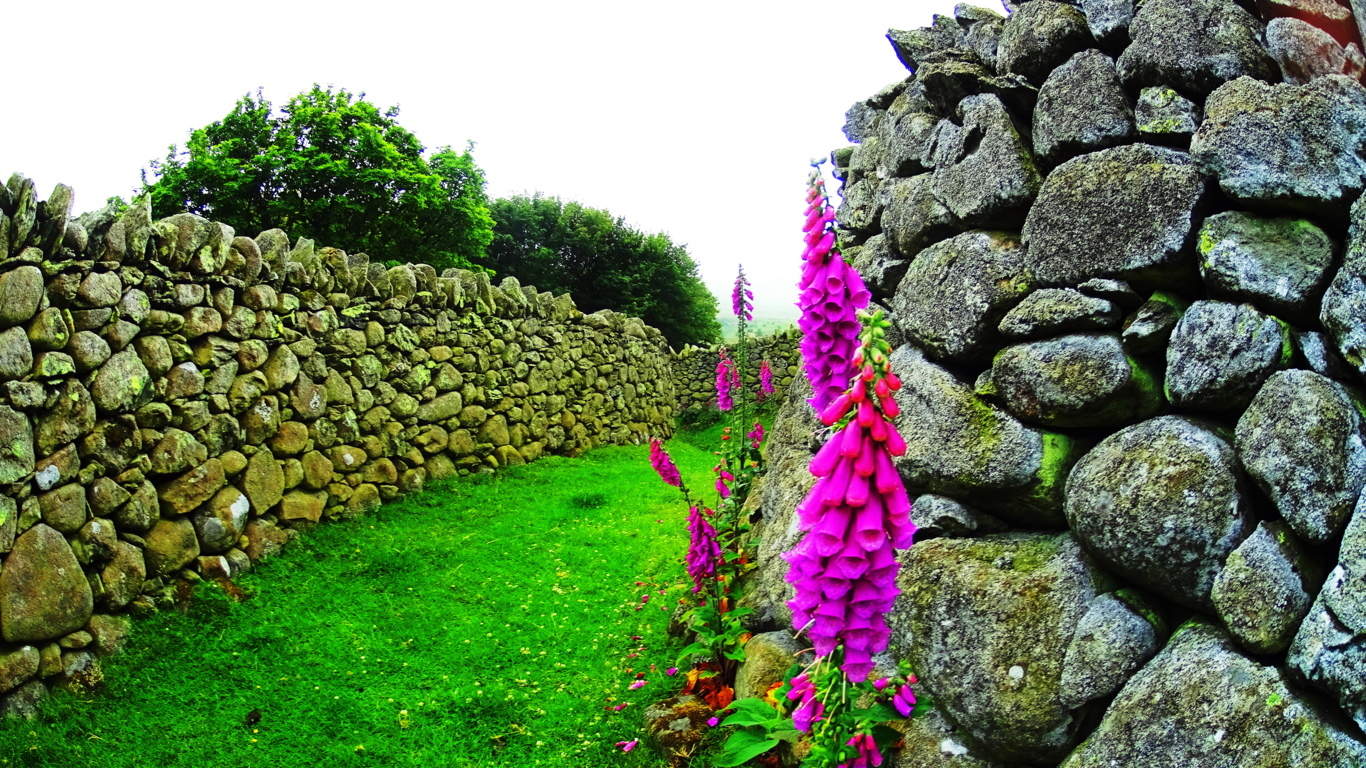 If you choose to explore these options make sure you hike responsibly and mark a fixed point in the landscape in order not to get lost, or even better, bring a compass. The valley is massive; Hiking this high above Rowen there is a good chance that you will be the only individual(s) for possibly five or six miles in every direction. This particular pathway came out near the farmers road that ran down to the forest, just before the farms of Rowen, but be mindful that others exist, and in the valley there are unknown exit points. With all this considered, enjoy the exhilaration of what is obviously a sacred landscape that we know, due to the megaliths it contains, has been appreciated for an incedible span of time that literally reaches back beyond recorded history. This place truly reminded me of a valley in the game Skyrim I love so much. Seeking it out was an achievement born of the inspiration taken from that game, sitting in my room in the dead of winter four months earlier, dreaming of Celtic valleys in Summer. I have to pay it tribute here. If you can dream of these places, you can find them. Seek and find.
Lynn Woods Trail/Secret Megaliths
 Location: Lynn Woods/Massachusetts/North West of Boston
Lynn Woods/Long Piece

Ireland/Long Piece
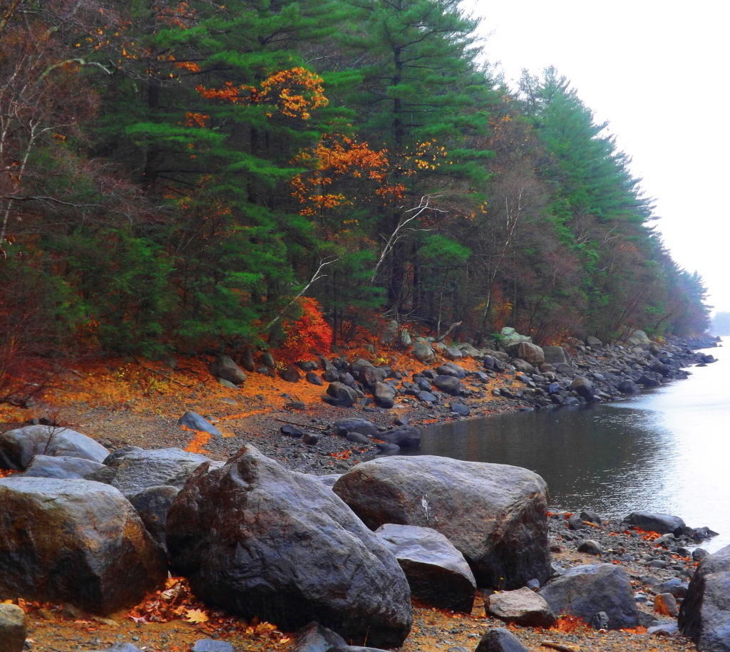
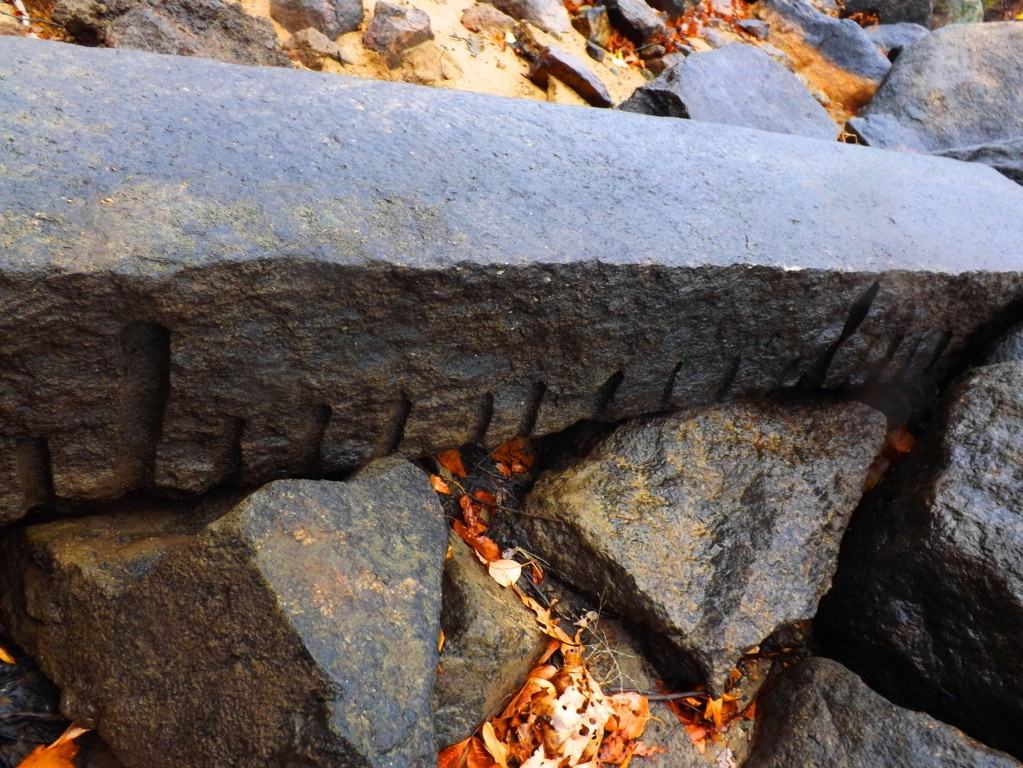
The beautiful trails at Lynn Woods are roughly 8 miles of preserved old forestry, centered around a crystal-blue lake. The small but exquisite area is surrounded by the little city of Lynn, north-west of Boston. Paths run along the lake to the east, or west into the forest, where after roughly 2.5 miles of elevated trail, a scenic stone tower appears on top of the most significant elevation in the reserve. Mountain bikers, dog-lovers, and runners utilize the area to the fullest in the Summer, continuing well into the Fall, when the trees begin to glow a luminary red, yellow, and orange. Bright Birch groves emerge with swaying Maple’s and Pines that reflect off the water while trekking along.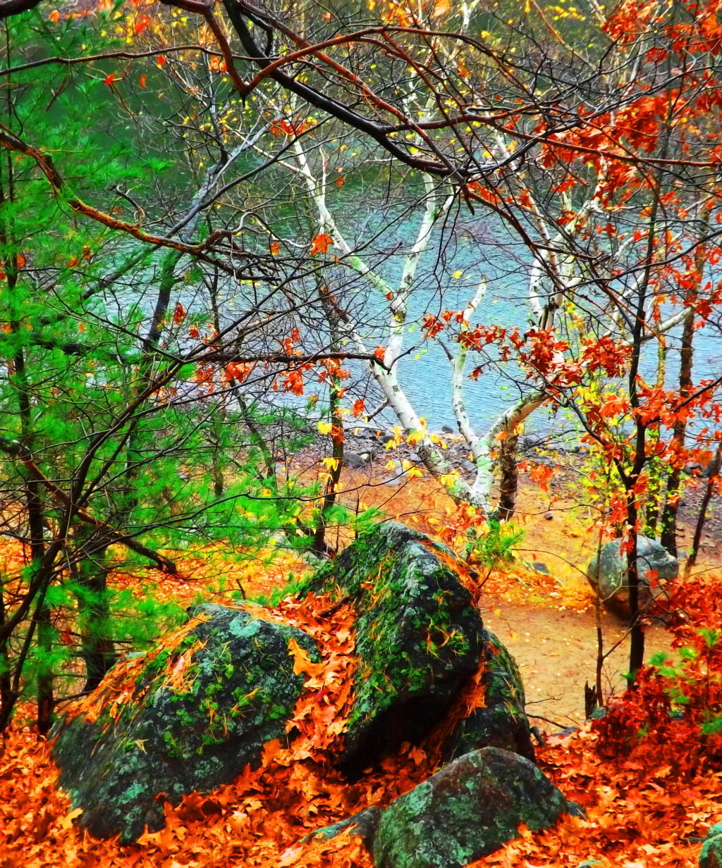 Anyone visiting this particular area of Massachusetts looking not to venture too far from Boston, but wanting to experience quintessential New England fauna and foliage, should hike right into Lynn Woods for a picturesque day. Although signs are posted for patrons to stay on the trail, there is an abundance of anthropological statements in the beautiful stone fixtures deep in the woods, and along the lake waterline. A careful and experienced hiker can certainly take the time to appreciate some of these incredible stone fixtures that host markings with measurement styles and stone types similar to those found in the Celtic heights of the mountains of Donegal Ireland, making them potentially 4000 to 6000 years old. A marvelous long piece sits close to the water at the start of the eastern trail, among other cut stones with distinct markings. The measurements on this long piece reveal 9 spaces of smaller cuts between the longer cuts: a system based on 11 spaces as a ‘full span’. The colonial ‘foot; is not represented in these works. A fantastic crafted boulder sits just off the eastern trail directly along the waterline. It displays an enigmatic 45* degree set of linear incisions running directly across the face of the rock.
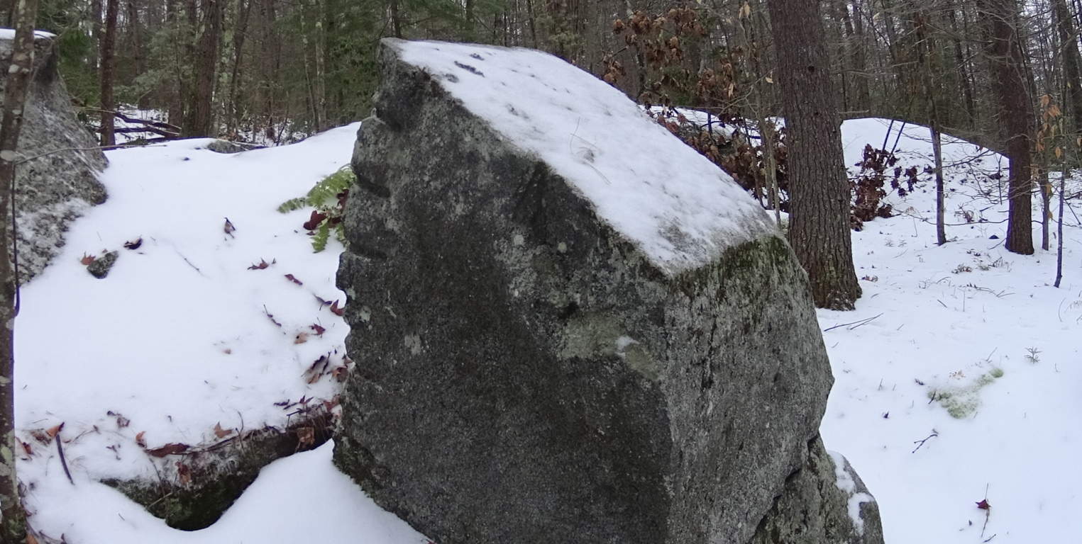
 Interestingly enough, Lynn Woods is a also home to the largest Standing Stone in Massachusetts, found just a half mile into the very beginning of the trail from the parking area: take an immediate left after walking the short distance, an climb to the very top of the hill, just outside of the woods, and you will find the Standing Stone.
 It is beautifully set standing roughly 11 feet high and 3 feet in width. I am guessing that this stone weighs at least 5 tons. Similar to many Celtic standing stones, there is a second smaller stone that was obviously cut off from the main standing piece, ‘smaller’ meaning it weighs about 900 pounds or so. It sits eternally just to the left of the megalith. For real antiquarians, in the deeper forest, there are free standing boulders and massive megalithic fixtures on the top of the rolling hills continuing away from the lake.
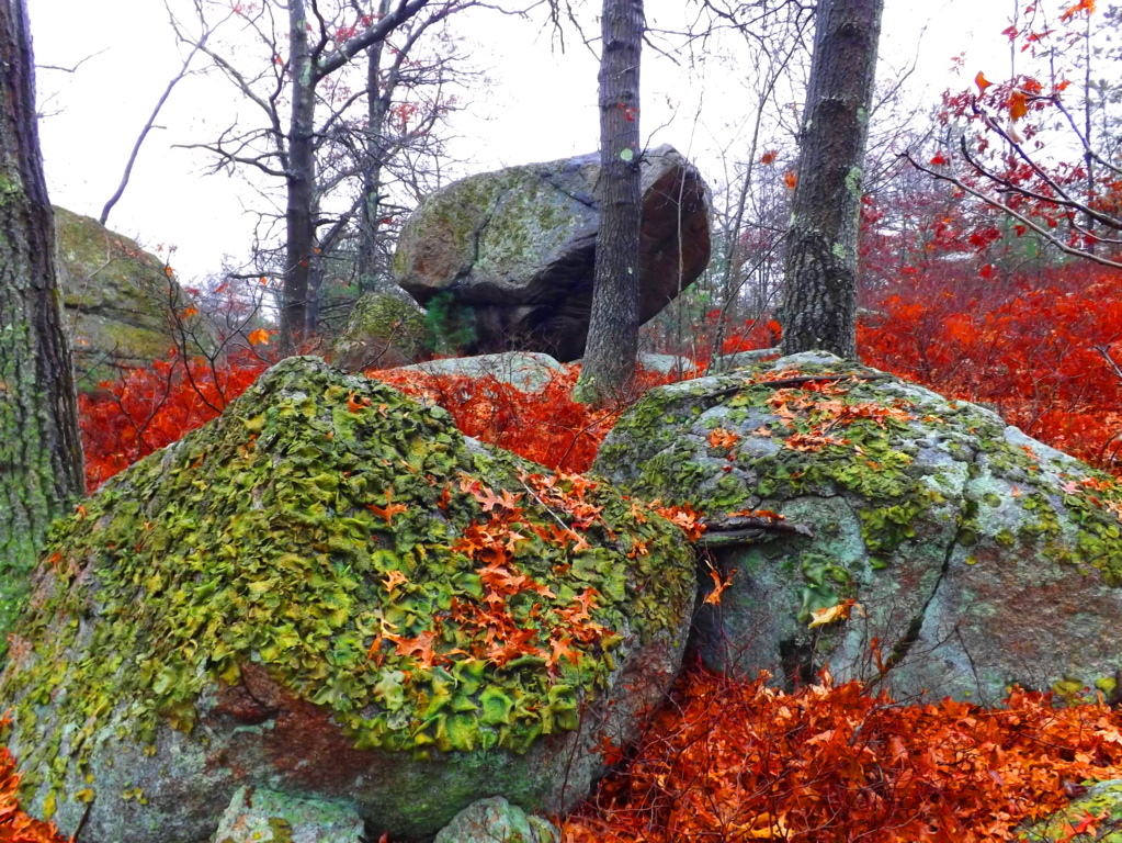 One of the most amazing pieces in all of New England is 4 miles into the eastern trail, just to the right of the path. This massive 20 ton granite stone stands 8 feet high, and is an incredible display of precision made parallel cuts, and measuring metrics. The stone is incised through nothing less than four full feet of solid granite rock. There are mathematical statements in this stone still to be deciphered, and it is truly priceless. When considering the megaliths of Lynn Woods it has to transcend the simple label of ‘nature reserve’. Lynn Woods makes the roll of Stonestrider.com due to these obviously sacred statements of megalithic expressions, so similar to the Celtic world, making it extremely likely that they are from deep antiquity. Unfortunately, all of these stones are not even noted in New England anthropological society, until now; Yet if they were in Ireland, England, Wales, or Scotland, they would be revered and protected. This place is one of the best kept anthropological secrets in all of New England.
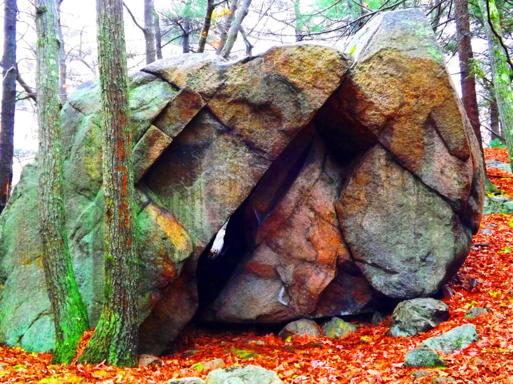
Tully Lake/Forest of Neolithic Engineering
 Location: Athol Massachusetts
Ireland
Tully Lake
Note: Tully Lake Trail is nothing less than a kingdom of cut stones enveloped by gorgeous old growth forest in the heart of New England. The main trail loops down along the lake for about two miles, and then back into the elevated forest for another five. It is a challenging hike in winter, but enchanting. As you begin to progress into the glades of tall pines, birch, and maple, it becomes impossible to ignore the crafted megaliths lining the hillsides. It becomes abundantly clear that whoever engineered these incredible stones wanted them to be noticed. It is a venerable masonic work area, with standing stones, cut boulders, stone linings, and ancient stone dwellings. Furthermore, the stonework is not arbitrarily placed, but is clearly set in a specific manner, although beneath a blanket of snow it is difficult to decipher on a blustery December day. The clarity of the markings on these stones is astonishing. Similar styles of measurement for the cutting of megaliths exist at Mount Bearnagh in the Mourne Range of Ireland, and also most notably in the Lynn Woods further east of here in Massachusetts. Observing the scale of what are clearly measurement markings for cutting, (which I must add is certainly not inches, but some other grand standard) allows us to consider what the craftsman of the stones considered to be ‘scale’.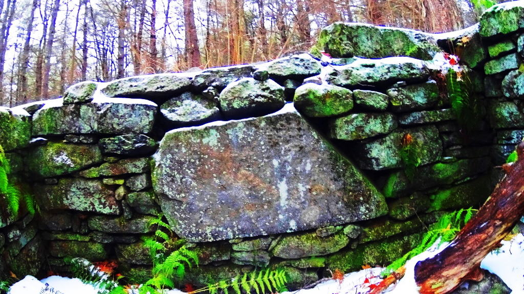 And that scale is MASSIVE. The stones also reveal incredibly complicated curvatures, extremely hard to create in large granite pieces.
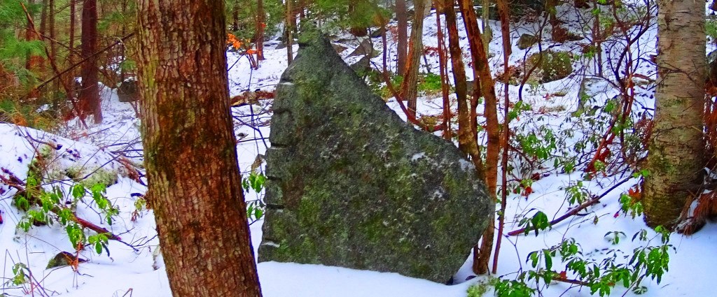 The entire forest is inundated with stone statements that cry out for observation. Consistent with other old-growth trails all over the world, this forest contains the remnants of what I believe is the one time home of the craftsman of this area. Sitting roughly four miles into the loop of the main trail, unlabelled in any way, to the right of the pathway while heading back towards the entrance, I saw an incredible stone foundation of what was once clearly someones home. This site featured a beautifully dry-laid and grand cut-stone looking to weigh at least 2 tons, embedded perfectly into the foundation. The amount of care and effort that went into placing just this one megalithic center-piece must have been challenging. With sites like this, a trail becomes a priceless anthropological zone on the level of Tollymore Forest in Ireland, and Monument Mountain in the southern Berkshires of Massachusetts.
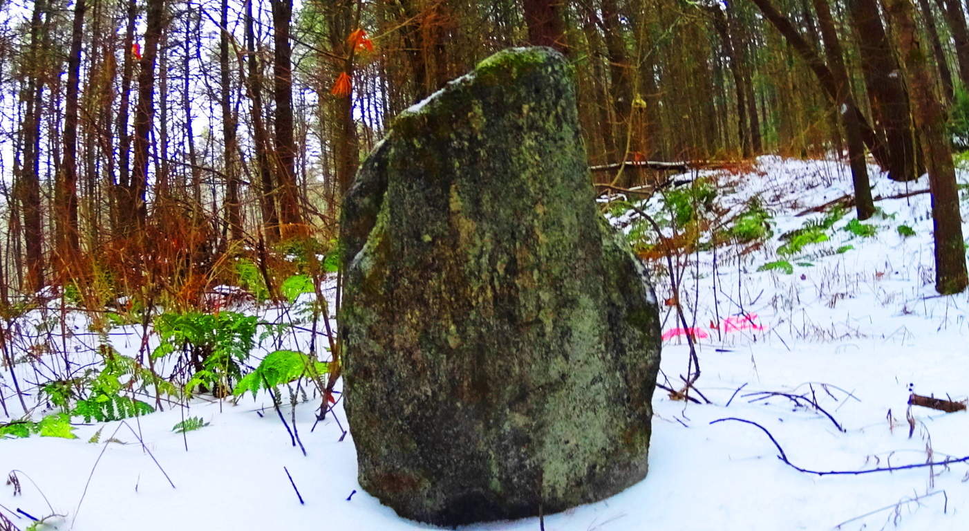 To find an ancient dwelling, or one definitive standing stone in a single New England forest is rare, but to find several is truly exhilarating. Further along the trail there is a stone connected to a stone-lining (‘wall’) looking very much like a Celtic ‘directional stone’, almost identical to types I have seen in England.
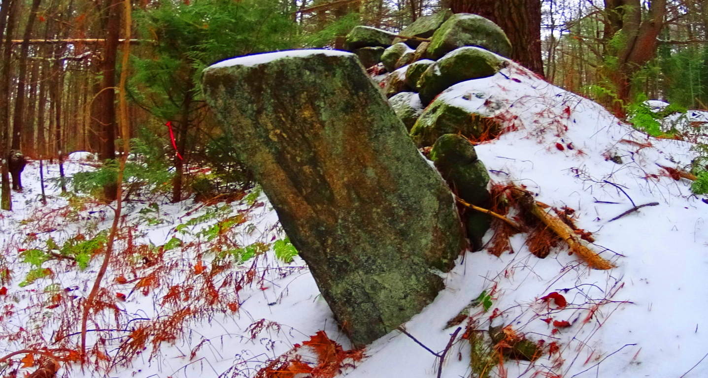 Celtic areas have preserved these stones and properly noted them as important anthropological statements from a culture perhaps 6000 years in the past, but New England has failed to do so here. Ironically, this somehow makes New England’s ancient sites feel a bit more pristine than even Celtic areas that are well known, because the stones have not been touched, or even visited by anyone knowingly seeking the works of a neolithic culture. When considering that almost every massive boulder in the forest contains some form of crafting, whether it be boulders split in half, or simply marked by incisions of some type, the amount of energy that would have been put into this effort is astounding, and so worth noting. And all the time, behind fixture after fixture of colossal craftsmanship, is mile upon mile of zig-zagging stone linings sliding through the trees.
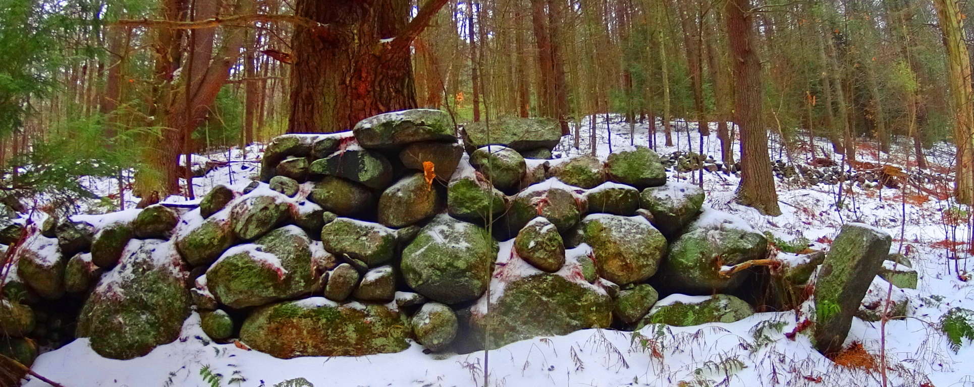 Close consideration of these works reveal that these efforts are not mere random ‘holes’ in the rock, but linearly lined incisions.
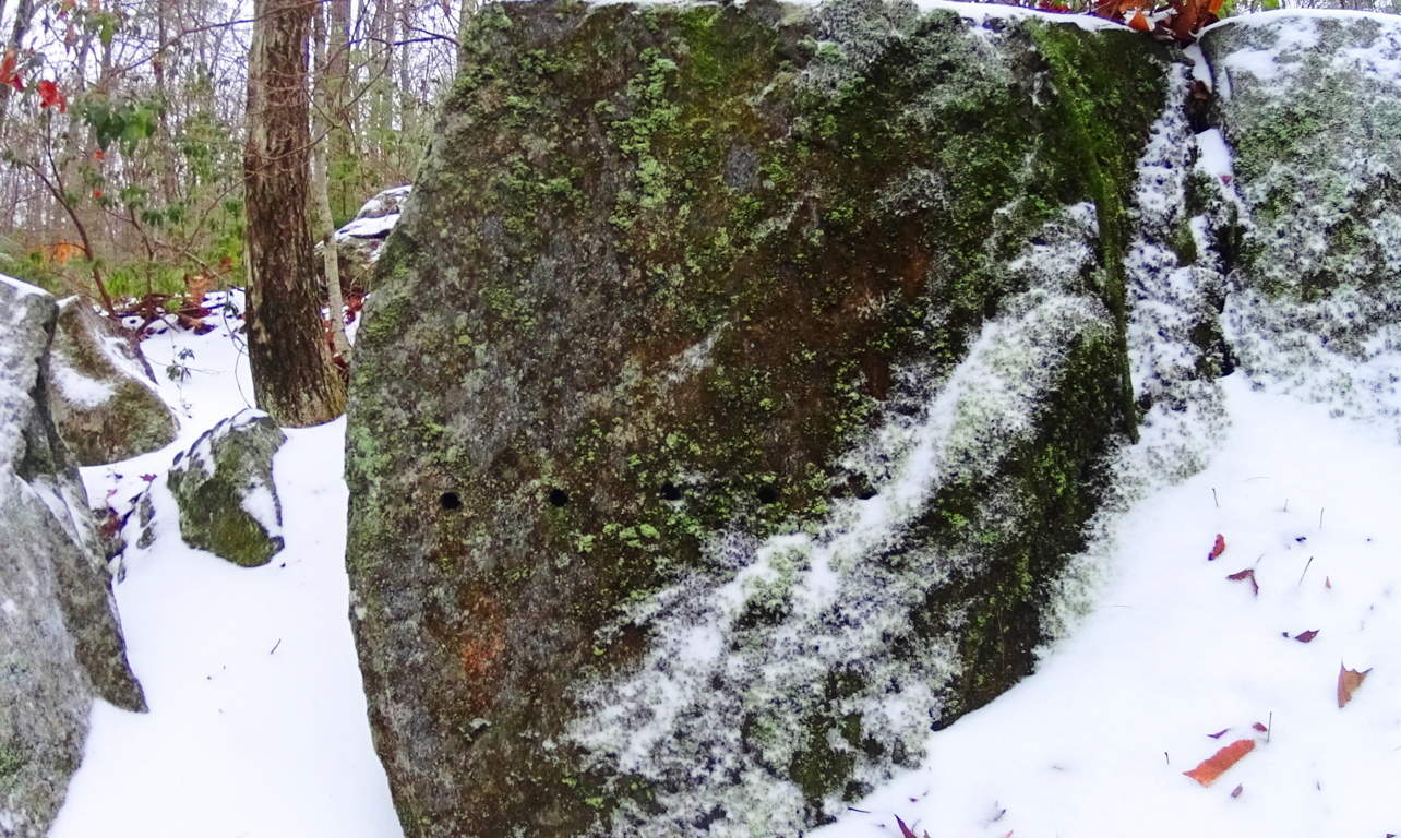 And cuts along the edges of these megaliths are measurements, not random markings. Some of the craft work is truly artistic, revealing a joy in the artistry. Some stones are set in pairs, others are laid out as massive fixtures, seeming to have a functional flare. Hiking through these pathways is a pure wonder that pushes the boundaries of our understanding of what might have taken place clear back to the beginning of Time.
 The stones themselves seem to insist that it may not be the linear evolutionary line that postmodern texts have been pushing for the last 100 years. It is clear that technology existed in antiquity, and was utilized in this incredible daydream of a forest. On an international scale of 1 to 10 for sacred forests, Tully Lake is a 15. Seek and find it out for yourself, something truly magical took place here.
Cavan Burren National Park (Part 1: Celtic Altar)
 Location: Blacklion/County Cavan Ireland/Cavan Burren National Park
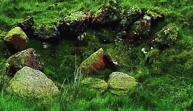
Note: If the quintessential Celtic ‘dreamscape’ is what you are hoping to find in a hiking experience, Cavan Burren National Park is the place for you.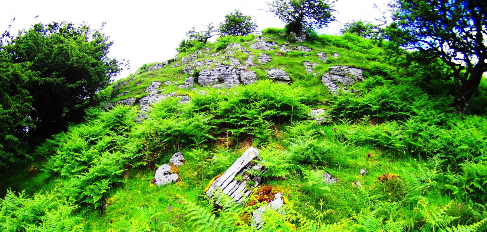 This pristine pre-history landscape is sacred on every possible level, with roughly ten square miles of Celtic wildlife preserve. Embedded in the surreal panoramic vistas surrounding Cuilcagh Mountain, on which the park is mainly canvased, are priceless 5000 year old Wedge Tombs, Alters, Dolmens, and megaliths. A fantastic trail runs from the main entrance/visitors-center of the park to beautiful anthropological sites. The area is absolutely worthy of several specified reviews for each of the sites along this main route, but the real wonder of the region, and perhaps it’s most establishing distinction as a truly Celtic reserve for both exquisitely rare natural fauna and neolithic cultural gems, is that the off trail hiking reveals supremely beautiful works of ancient stone engineering as well. I discovered this incredible alter, featured in the title image above, by interpreting the lay of the engineered stones expressed over the landscape. Postmodern anthropologists have taken a dismissively poor perspective on what they have lazily identified as “farmers walls” looping over the hillsides. These “farmers walls” are not “walls” at all; functionally they do not limit the movements of grazing flocks in any way. Herds can simply walk over these stones if they so choose, so by literal definition, it is not a wall. The function of these special stones that look to our modern eyes as “walling” is actually a type of primitive ‘cable system’ that connects each sacred alter, from one to the next.
 These stone linings are like the wire that runs between a battery’s charge points, to the base-tip of a light bulb, passing energy from one end-point of energy to the next. I found this alter by following the lined stones running north west off the main trail.
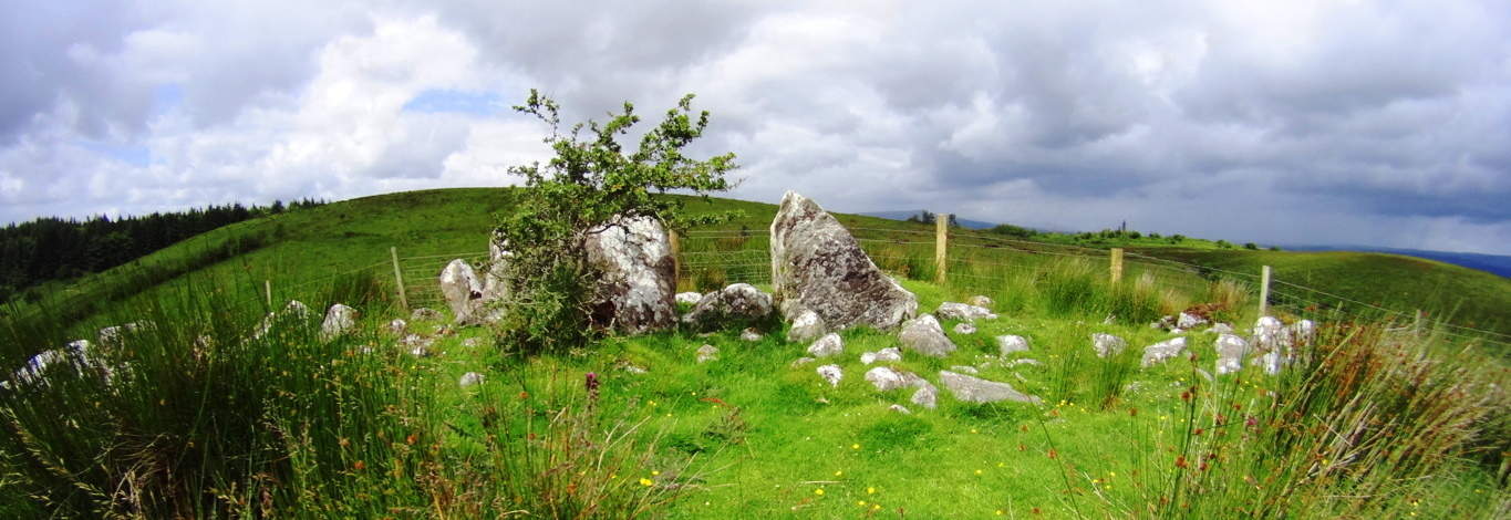 My educated guess was therefore to follow the lined stones I observed to see what special feature it was connected to. I arrived at this incredible Celtic alter wonderfully positioned at the next hilltop, approximately 1.5 miles northwest of the main trails (Top Image).
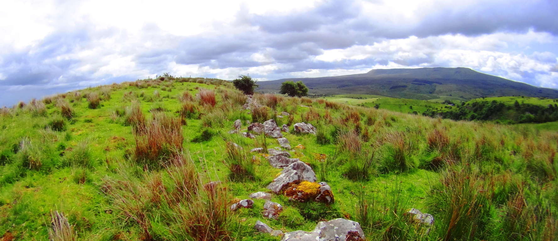 Here again was another moment where my firm belief in the premise of engineered landscapes was vindicated. The earliest Celtic cultures attempted to harness and designate the transfer of energy in the landscape with stones that absorb the energy from the sun and connect the alters sitting strategically at the top the hills. These lined stones funneled energy from peak to peak, alter to alter. Most modern anthropologists fall victim to assuming that a ‘defined sacred space’ requires a specific ‘central temple’ that celebrates the area in a basically singular declaration. What they refuse to consider is that an even higher expression of the sacredness of the landscape is of course to utilize it while celebrating it, making the entire area a type of living, functional temple which connects each elevated corner. This engineering is also present in the mountains and forests of New England. I encourage hikers to prepare appropriate gear for deeply experiencing the landscape, for trekking into wilder corners of the reserves. If you follow the stone-linings of ancient Celtic zones to areas away from the designated trail, you will soon find that the premise of engineered landscapes is absolutely real. Aside form this, the natural beauty of the area is stellar. To deeply experience any ancient landscape equip yourself with cinema-capable cameras and capture your trek.
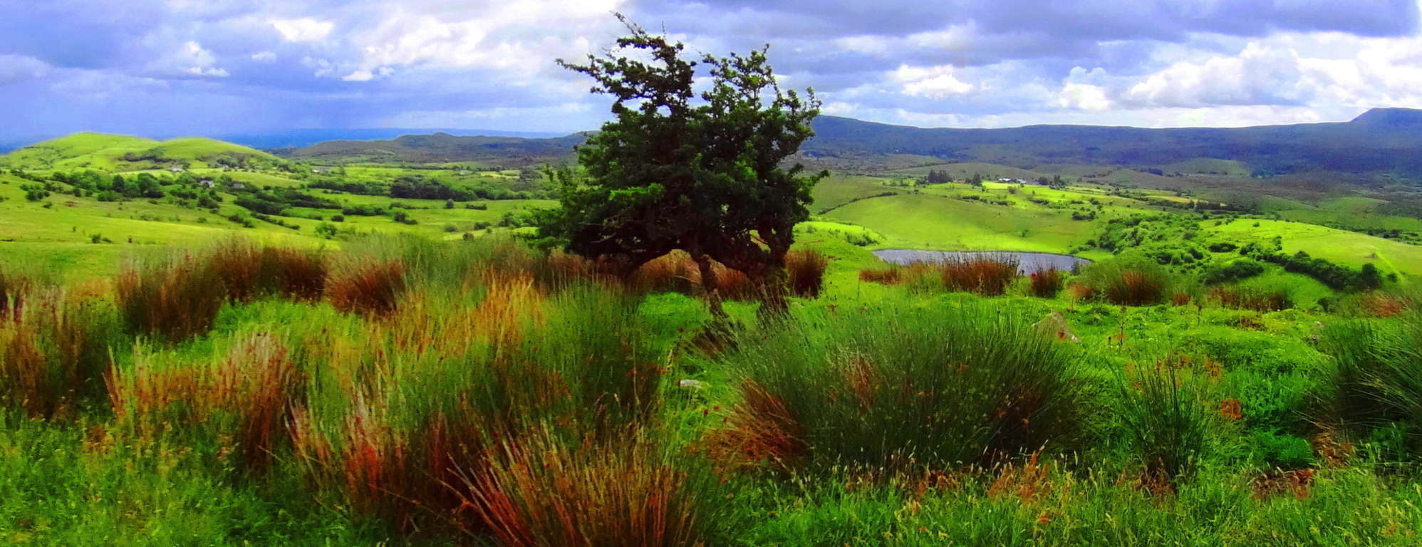 Cavan Burren National Park is a portal into the primordial era of the earths most fantastic expressions, with priceless anthropological expressions of engineering from the first culture on earth. Seek, and find it out for yourself.
Sculptured Rocks Reserve/Groton, New Hampshire/U.S.A
 Location: Cockermouth River, Groton New Hampshire
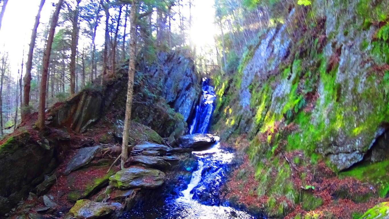
Note: Sculptured Rock Natural Reserve is a watery wonderland of falls rushing within the forests and small mountains of Groton New Hampshire. A hiker has the option of following the falls as far as they wish by hopping from stone to stone, or perhaps stopping to splash around in the amazing still pools created by the rocks.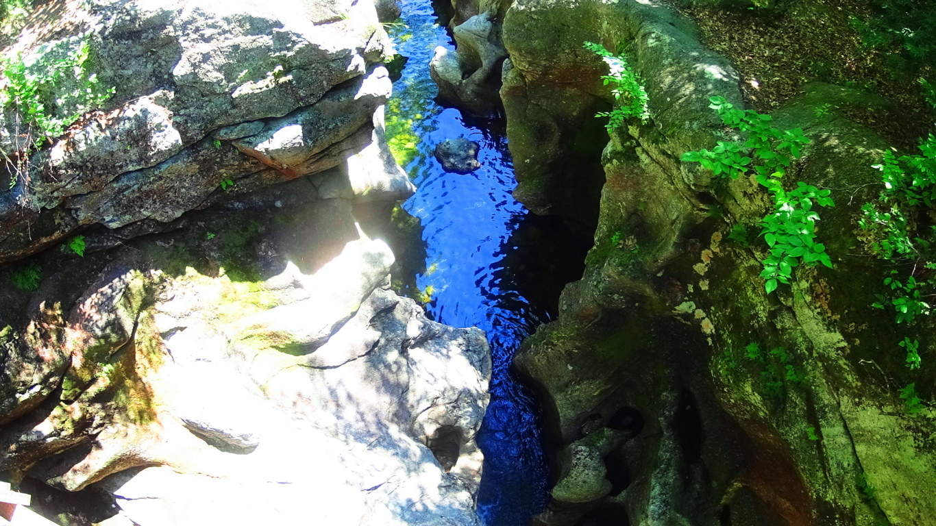 Trails also run away from the fall into the forest, where other works of ancient stone and crafting can be found, such as Cairns, and ‘directional stones’ from another epoch. The area is a notable anthropological site, with an authentic ancient stone dwelling nestled close to the designated forest trail, and several massive stone enclosures of megalithic scale further down the fall to the south.
 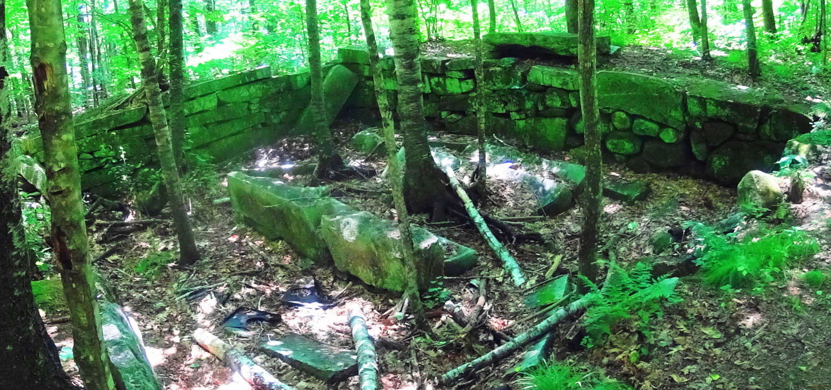 I believe these works, due to their scale and placement, to be PRE Native American, built by a culture yet to be acknowledged by current anthropological historians.
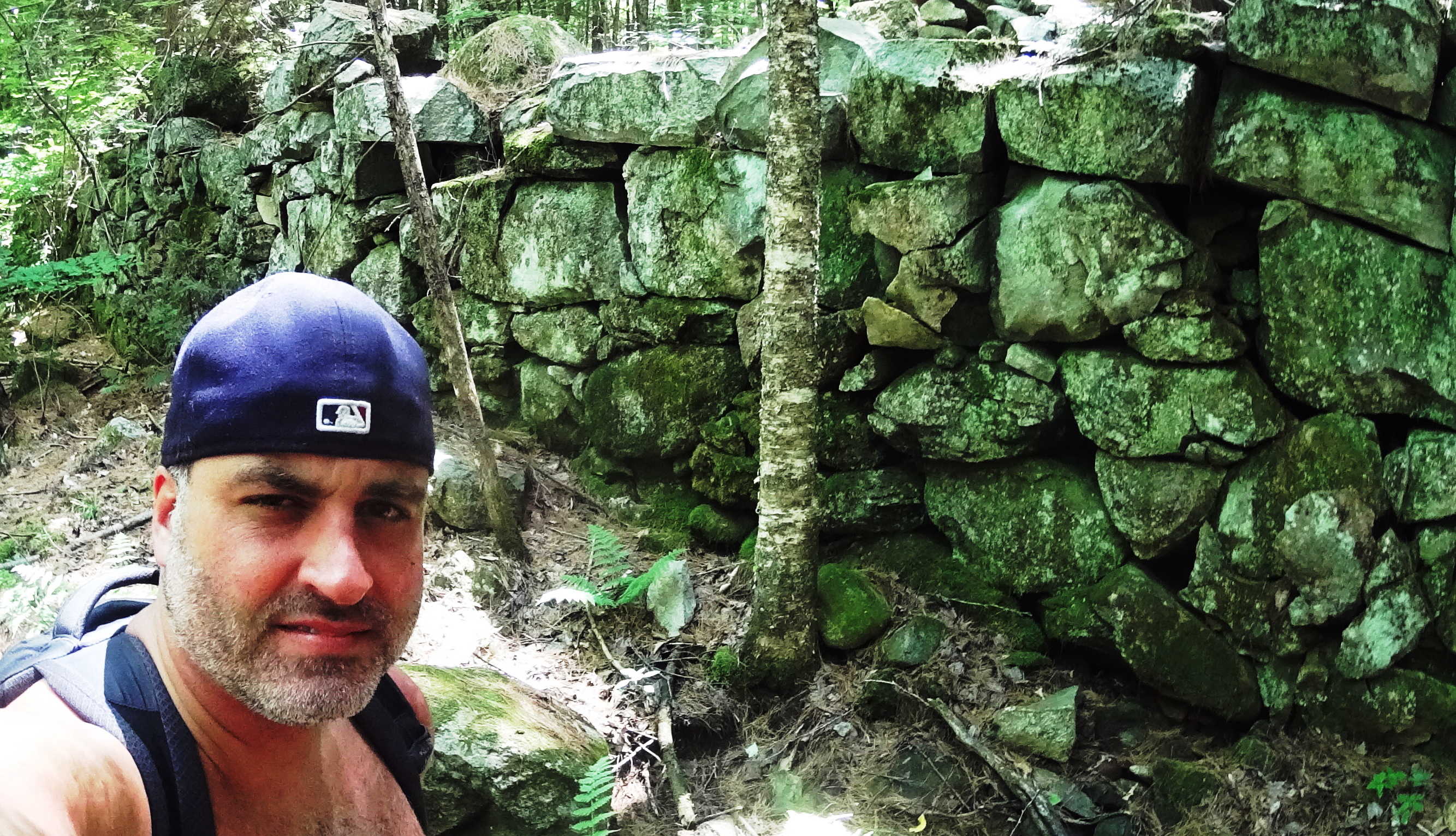 The main water artery, the Cockermouth River, is filled with free standing boulders that sit in an incredibly smooth stone tunnel of what looks to be sculpted rocks. This is very similar to the style of many free standing boulders in Northern Ireland’s rivers, but on a much larger scale. There are literally thousands of these free standing boulders. Away from the Cockermouth River, further north, are several wild rivers without trails running up small mountains enclosing the area.
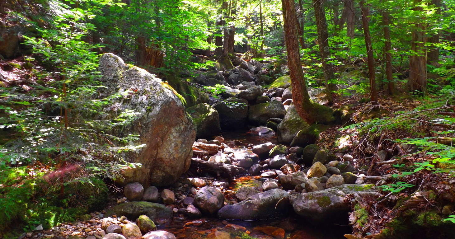 For an experienced and prepared hiker, I recommend the very real adventure of following a waterfall up the mountain by stepping on its stones. Following small mountain falls is an amazing experience due to the fact that the features of the fall become increasingly impressive the higher up you go. Wide stone porches and steps that look to be carved right out of the mountain support fully flowing falls that dance down the stones. Somehow these features leave plenty of dry space along the way, allowing for great footing beside stone porches and pools while ascending the fall.
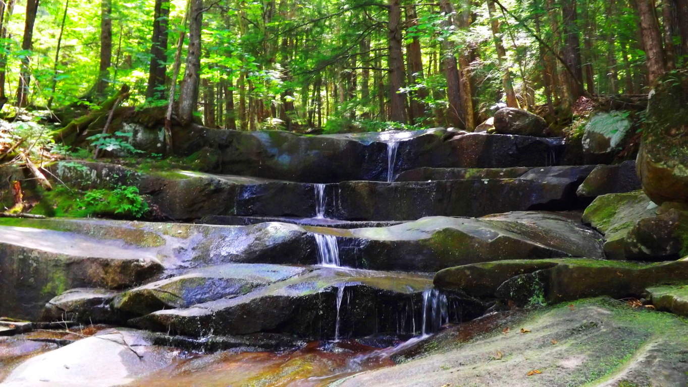 One of the best parts of following a wild fall in New Hampshire is the option to jump in, or plop down in the middle of water-slide like tube of water-flow, and cool down along the way.
  The beautiful combination of sculpted waterways, dynamic waterfalls, ancient forestry/ stonework, literally from the beginning of time, make Sculptured Rock Reserve one of the best kept secrets for outdoor enthusiasts. It is one part water-filled canyon, another part Celtic rock haven, with waterfalls that truly spark the imagination. Sculptured Rock has a sacred feel. Seek it out.
Mount Katahdin
 Location: Baxter State Park/ Millinocket, Maine/USA
Elevation: 5,267 feet
Note: The Penobscot Native-American tribe that once lived in this region referred to this mountain as “Katahdin”, which means: “The Greatest Mountain”. It’s expansive natural reserve is protected by the State of Maine as Baxter State Park, inclusive of incredible rivers, rapids, high mountain streams, and cascading waterfalls cutting through one-hundred miles of Appalachian forest. Hiking Katahdin is a multidimensional experience with marvelous variations in the fauna and stone while ascending. I followed the ‘Katahdin Stream Trail’ on the western face of the mountain, which requires a parking reservation and 7 a.m arrival time, easily made through Baxter State Park Office. The initial portion of ‘Katahdin Stream Trail’ follows a beautiful and wide rocky stream, with grand free-standing boulders guiding the water that rushes down the mountain. Ancient works of masonry appear in unique stone pathways fully enclosed by beautiful Pines and Birches. Some steps are refined and delicately thin, while others are wide and loosely fit, with blatant cuts and incisions, a full half-mile above ground level.
 A spectacular waterfall can be found about an hour into the hike. The necessary level of skill increases after the waterfall, where the trail mingles with dried stream-beds and stacked boulders. From here, branches and roots surround the trail increasingly, and it is necessary to begin using climbing techniques. The terrain continues in this way for roughly another hour before breaking the tree-line, and encountering another major challenge. Above and beyond the tree’s is a venerable wonderland of massive rocks and boulders, lining the last ledge to the peak like a giant’s pathway. Free-climbing is required in order to work steadily along the massive ridge, weaving between and over colossal boulders sitting almost a mile above the world. To both the left and right of the boulder-trail the valleys below unfold like a brilliant blanket with peaks to the edge of the skyline.
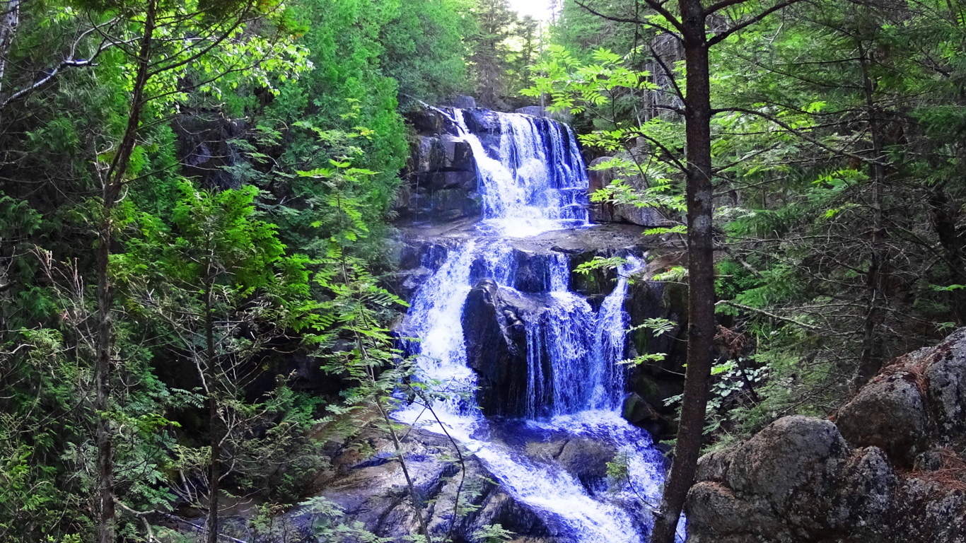 The pine trees below undulate and sparkle with a static electricity when the Sun is shinning, and all of New England unfolds before you.
 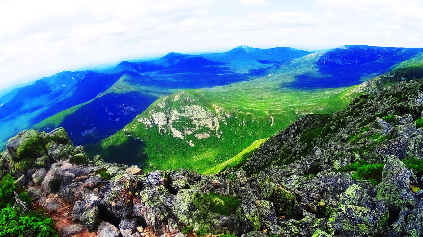 Steadily climb through the boulder-trail following the white-dot markers, and it is roughly 45 minutes to an amazing peak.
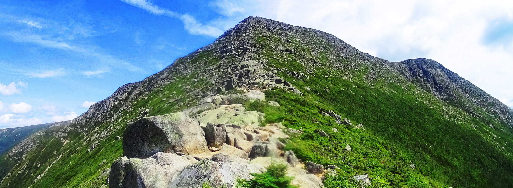 The Katahdin peak is a magical collage of unique dark granite colors combined with Celtic looking green moss, and interlocking stones. There are anthropologically notable standing-stones unlike any I have ever seen on this enchanted plateau, pointing and aligning to peaks to the west and east.
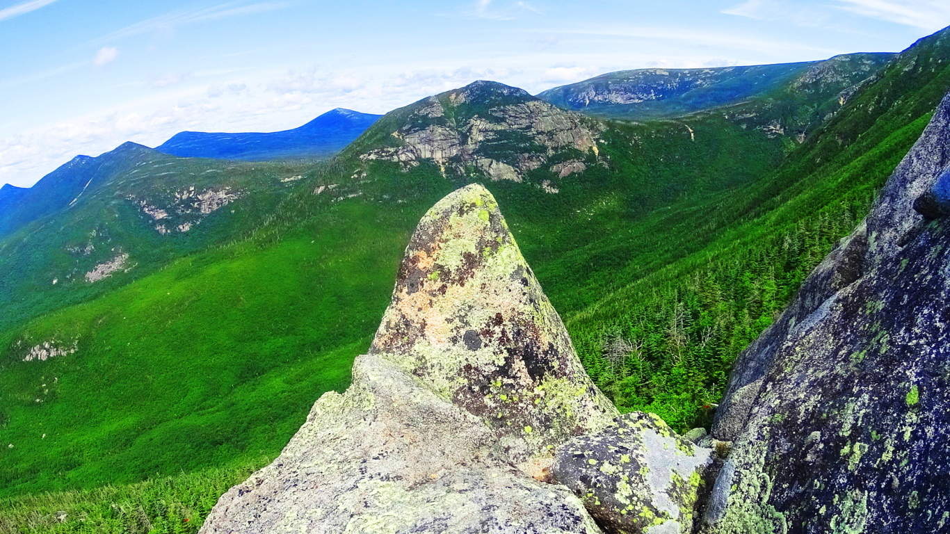 Some standing stones include signature fixtures, such as miniature counterparts supporting the front facade and drawing attention to the work.
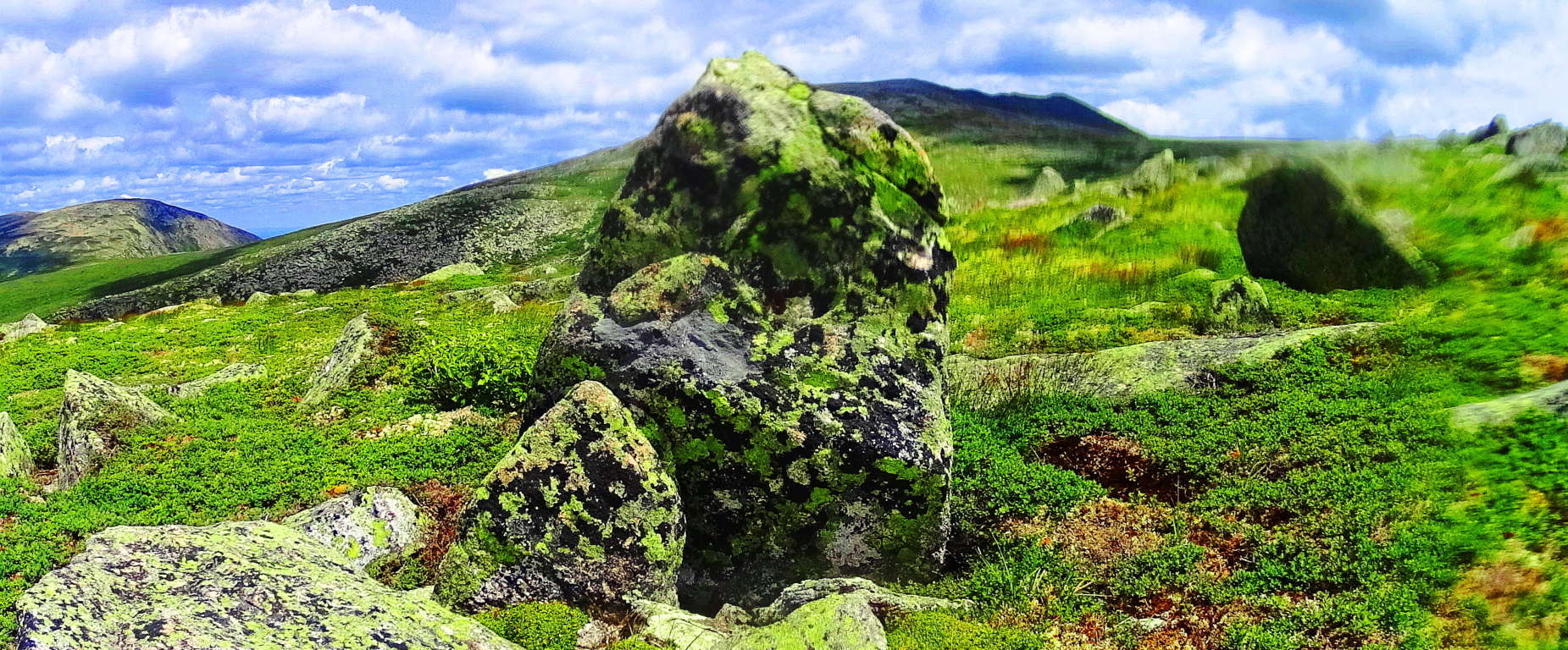 The entire elevation is covered in this unique moss so similar to the heights in the Mourne Mountains of Ireland, the Cornwall coast of England, and gritty heights of Glencoe Scotland. This is one of the best hiking experiences in all of New England, and should be experienced by all sincere nature lovers and ancient culture enthusiasts.
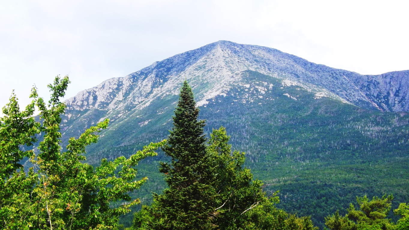
Tollymore Forest/Mourne Mountains
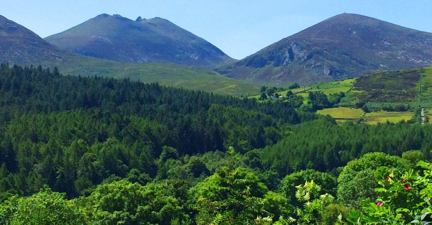 Location: Tollymore Forest/Bryansford Ireland; Newcastle
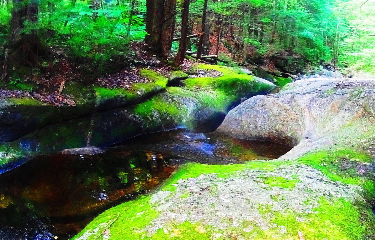
Note: Here is the now infamous Tollymore forest, the gorgeous setting chosen for much of the first epic season of Game of Thrones. The elevated peak directly behind the vivid pine glades is Croob Mountain, mingled with the greater Mourne Mountain Range. In real-time it is not hard to see why Tollymore was chosen by HBO as the back-drop for its mystical, Celtic/Medieval imaginary masterpiece.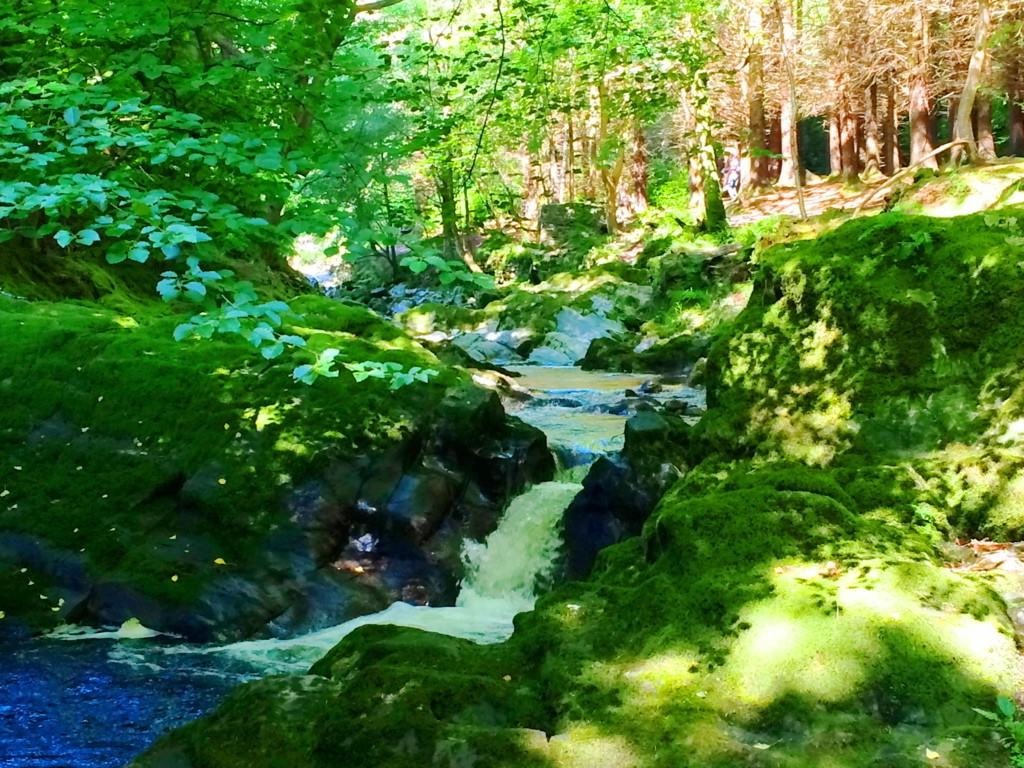 The glowing moss on the stones and tress indicate a pristine, ancient, and untouched aspect to the forest. Older places have this moss, which if touched by human hand, will not grow otherwise. It is everywhere in Tollymore, creating the feeling that one has stepped through a window into the way things once were. Several streams and rivers run through the woods, filled with glades of Oak, Beech, and even ancient Redwood. The stones within the streams reveal signs of equally ancient engineering, with directional layouts to influence the flow of water, or contain it in leveled pools with crafted rock faces.
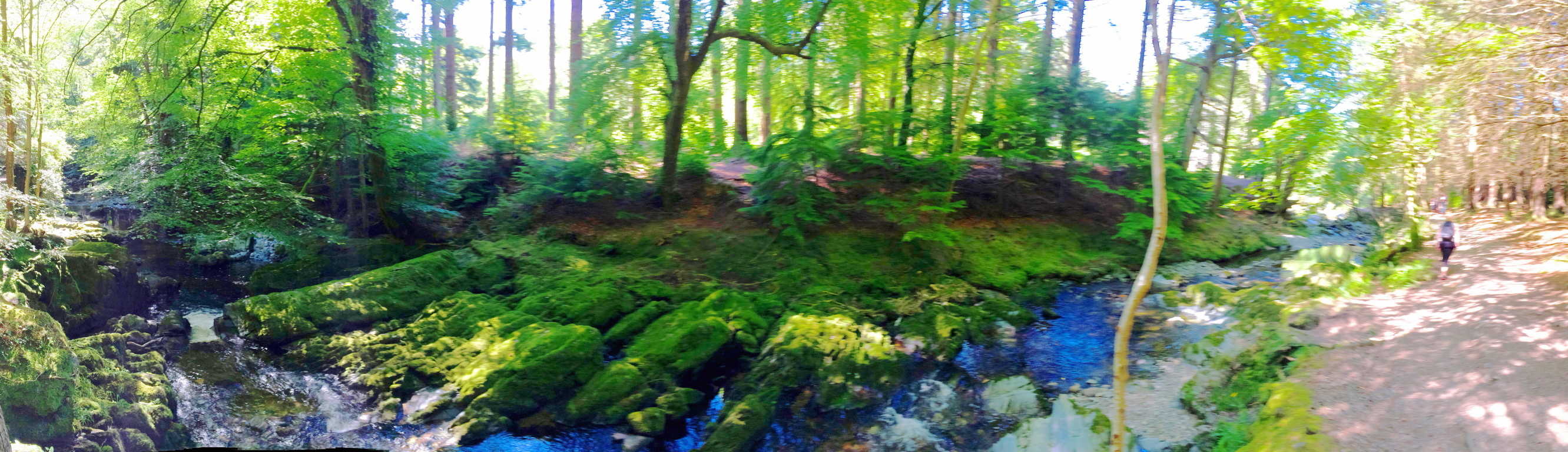 I was able to identify several focal points where the rock had been hewn into a funnel, or spout, which is an amazing feat of controlling/pacing the active elements in the landscape. Again, the moss along the stones of these streams is luminary, especially in the sunlight, like something out of hallowed fairy tales.
 More significant anthropology exists in Tollymore, of classic rock fixtures, also found in the deep woods of New England. To our modern eyes they look like “walls”, but a closer look reveals that they were not built as “walls”. The location of these ‘aligned rocks’ are most often from one peak to the next. Animals are in no way contained by these aligned rocks. They must have had some other purpose, if not just to define the space, but more to connect zones, like a cord of some kind. The stone alignments at Tollymore were inundated with mossy overgrowth, giving it the engaging and magical look that Celtic trails exude.
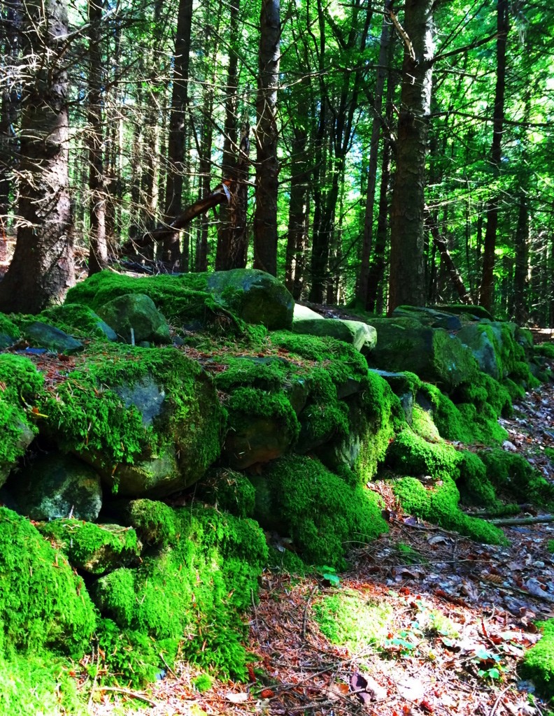 Other glades hosting taller Oaks and dry beds of grass were speckled with the captivating Fairy Foxglove. These violet towers stand guard to some of the most enchanted zones in the forest. Tollymore is absolutely worth a visit. The trails are clear and wide, running along the streams or into the mountain; it’s a Celtic daydream.
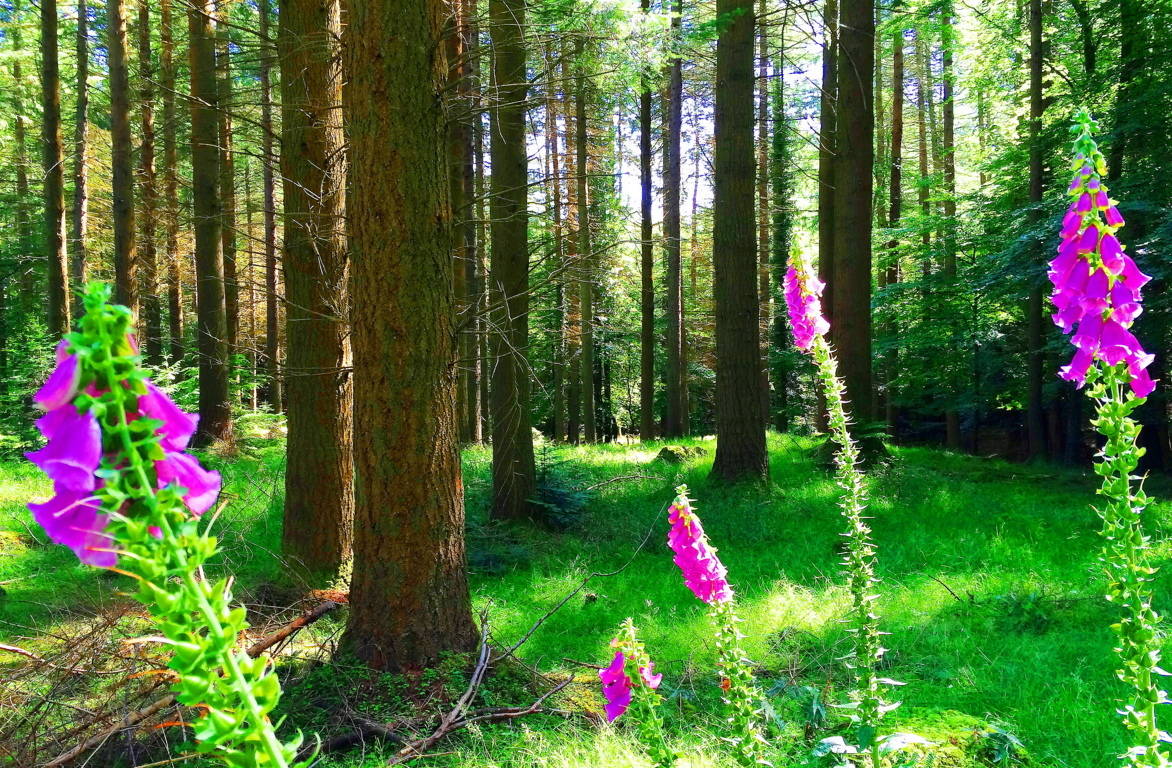
Knoll of The Sun/Glencoe, Scotland
 Location: Glencoe, Scotland
Elevation: 150ft
Note: Here is the truly epic gateway to the Highlands of Scotland. Tucked deeply into an ancient forest trail that is dotted with free-standing-boulders and gorgeous Celtic pines, is a rock alter known as The Knoll of The Sun.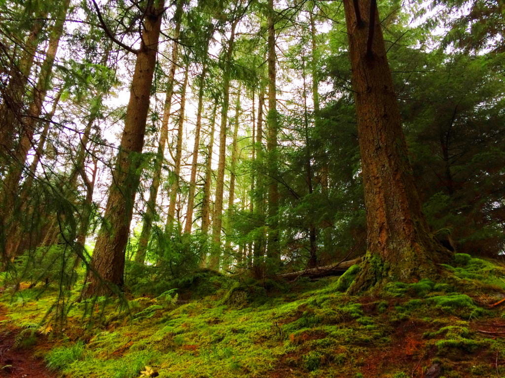 The relatively short trail that winds from the beautiful river into dark mossy glades and root-running pathways, leads to a small but distinct rocky porch in the midst of the forest. This alter is understood to have been used in ancient times by Druids as an observatory of the Sun, or for rituals, although I do not believe the Druids built the alter. The Knoll of The Sun is certainly an engineered area dating back to the beginning of Time, with small boulders lining the mystical forest as directional stones leading to the the Knoll, and potentially marking other significant points.
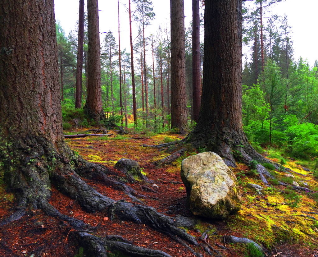 There are incredibly old stone stairs that lead up the alter after a hike of a few miles. The stairs are supported by a siding of massive granite slabs built into the knoll, emphasizing the feature. The top of the knoll is a strange set of long smooth and level granite crevices, distinctly different from the rounded and knobby boulders below. All of these features have a marvelous similarity to sacred stone engineering sites in New England, Ireland, and Wales.
The perimeter of alter marked by a distinct standing stones which is clearly cut, lends serious significance to the sacred spot. Time has tilted the stone and altered it’s original visage, but it remains the small slanted guardian to this Celtic alter.The Scottish elements in July are often a rainy, but even so, the area exudes all the best aspects of the hiking experience, combined with enticing ancient anthropology.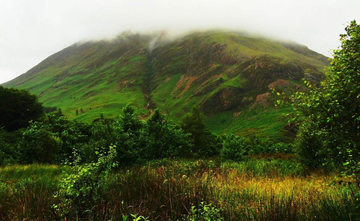 The megalithic culture that was present in the southerly Celtic areas was definitely also present here as well. To navigate these particularly drastic mountain passes and trails the ancients would’ve been that much more stout and determined than the average megalithic culture.
 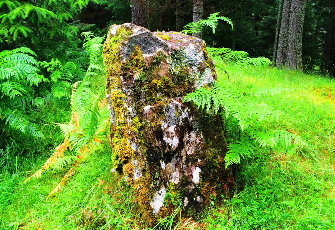 When the Sun comes out in Scotland, it is truly hard to picture wanting to be anywhere else, which is the very idea that this alter, in my opinion, must have been dedicated to. Glencoe is a hikers heaven, go for it.
Savoy Falls Trail/Standing Stone
Location: Savoy, Massachusetts
Scale: Standing Stone weight 1 ton, 5 feet height, 3 feet width: crafted to indicate Solar Noon.
Note: The trail along Savoy Falls in the forests of Massachusetts is as breathtaking as any Celtic scene in Ireland, England, Wales, or Scotland. The ancient stonework here is of the exact same style and period one might find in places like Tollymore Forest, or Cavan National Park, both thousands of miles away in Ireland.
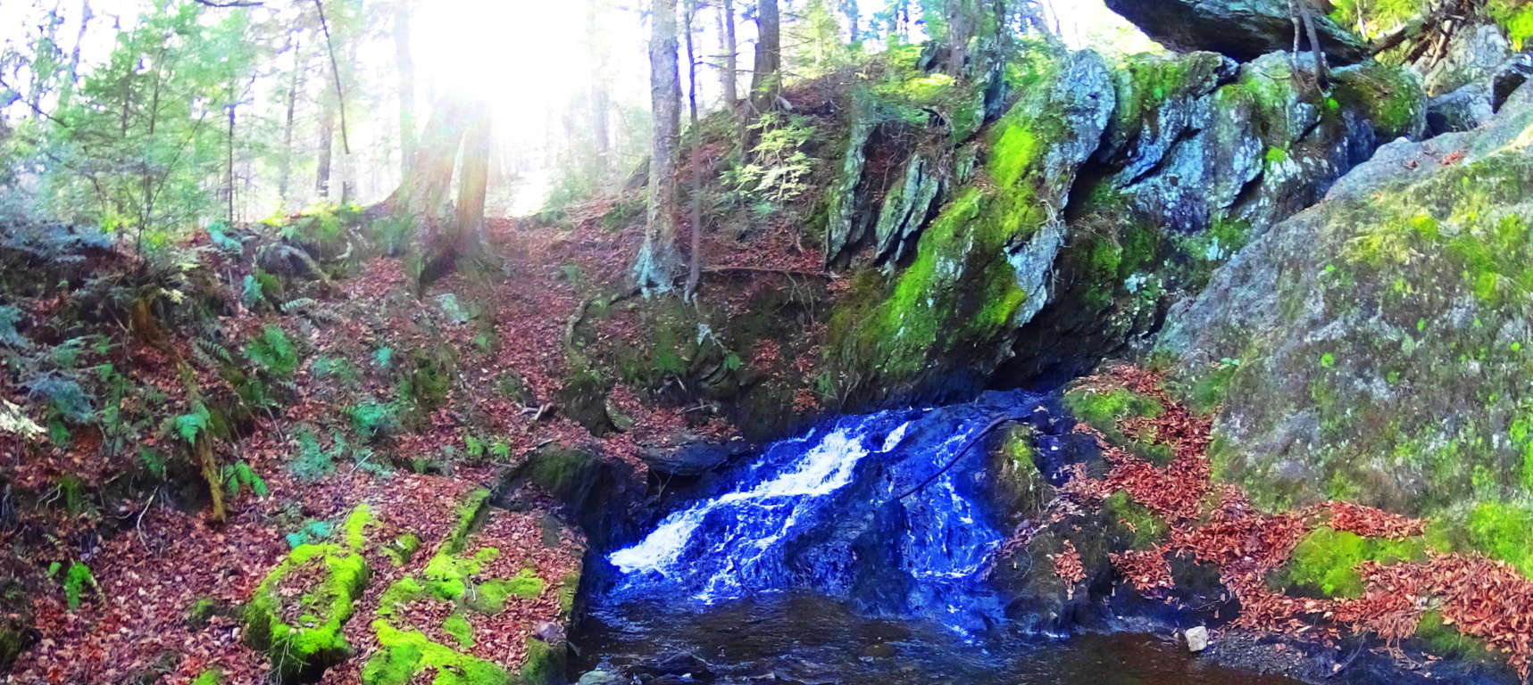 These are not simple “walls”, but they are most certainly engineering efforts put in place to influence the flow of the water in the area. Native Americans did not build these structures, and they did not claim to. They were therefor present in the area before the natives arrived, making them perhaps some of the first engineered works ever, at the beginning of what we know as Time. A more astonishing standing stone is present at the mid-point of the first of two massive waterfalls along the trail. It is my belief that this stone was placed specifically in order to point directly at the Sun at its highest point in the sky.
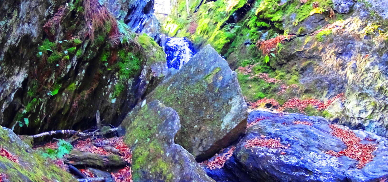 The first image above shows the Sun at mid-day, the waterfall flowing directly along its path, with the stone pointing directly to Noon slightly to the left-center. It is a truly magical and spectacular scene, and I believe the entire waterfall was engineered to create this effect. These are energy centers, not the arbitrary rippings of ice sheets long ago.
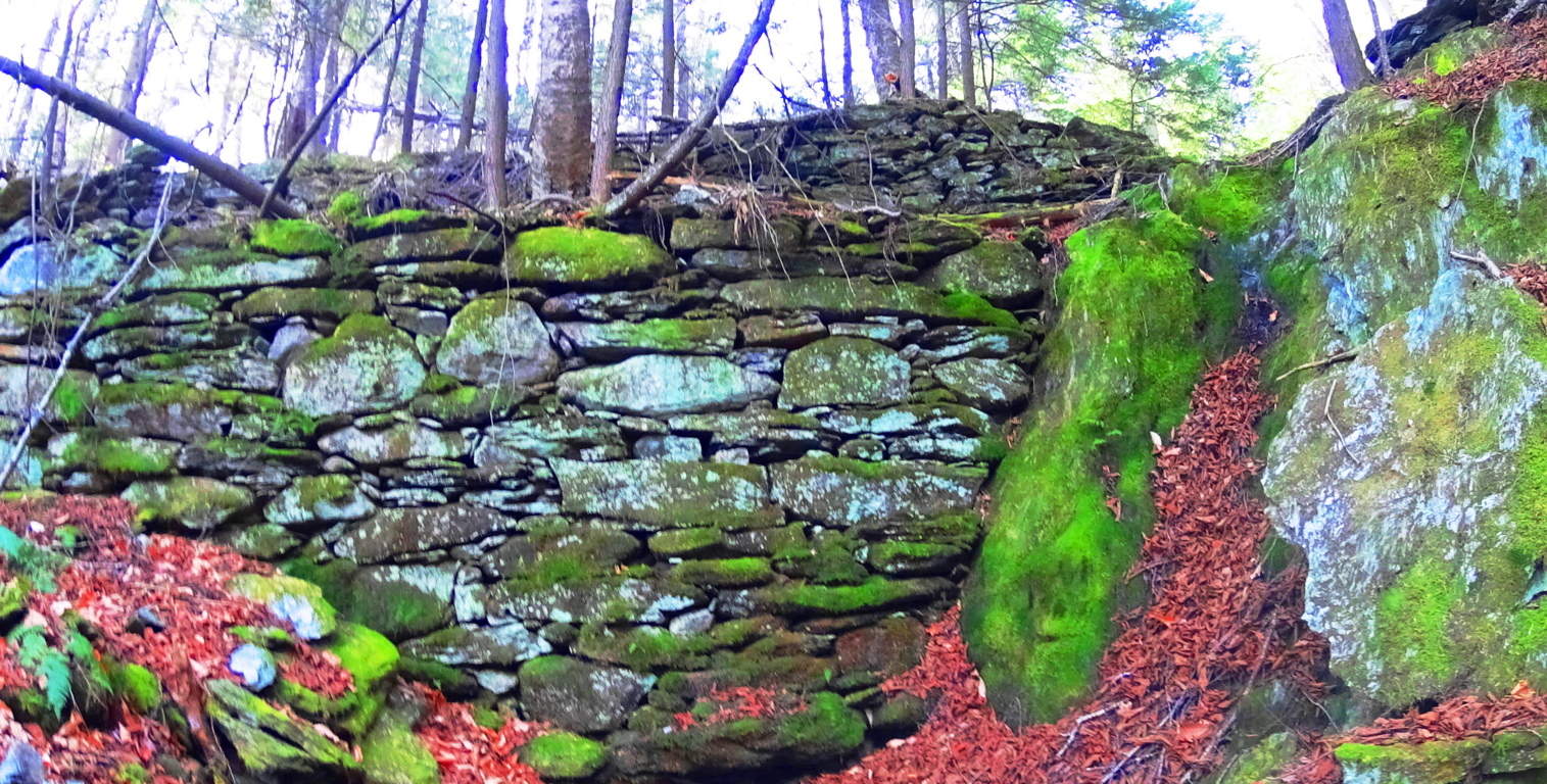
Other areas along the gigantic waterfall trail that runs for miles into the valley reveal wonderful pools and smaller features that are just as mystical as any scene from a Celtic fairy tale. I am convinced that the same culture that crafted the ancient stonework in Celtic places also crafted these sacred sites in New England. There was an era before native cultures, where the original culture existed; The first culture on Earth built these places.
Whats more, not far from this area are sites where standing stones sit in farmers fields just as they do in Europe, again indicating a culture at work in this area ‘once upon a time’. This particular stone below is roughly six feet high and three feet in width, with a beautiful view of the Savoy forestry beyond.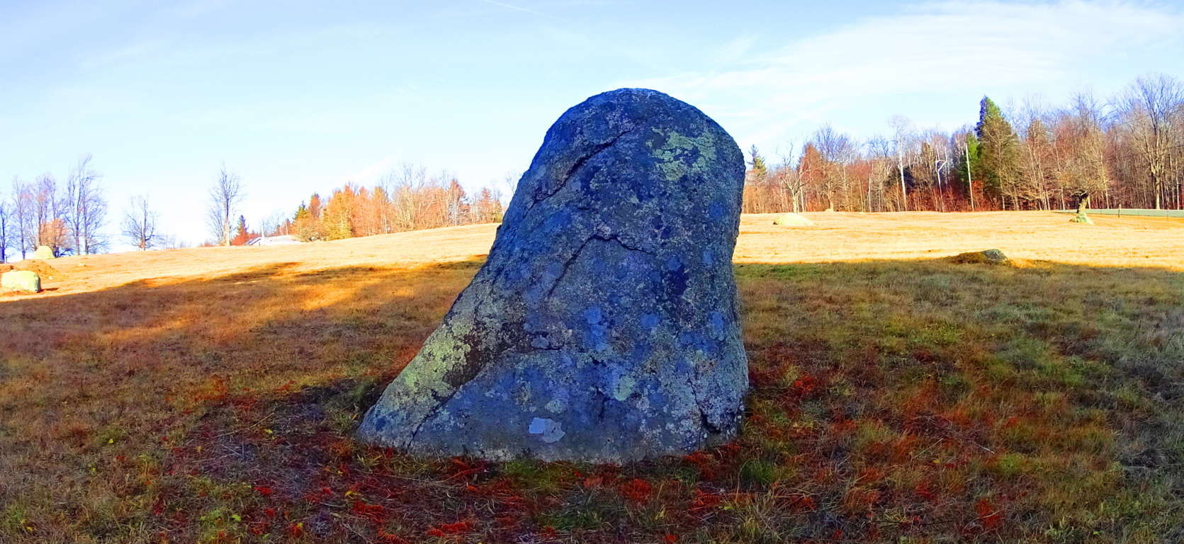 Getting to Savoy Falls is a challenge. GPS will direct you to the extremely rugged dirt road you need to find in the town of Savoy, but drive slowly and carefully or you could damage your exhaust beneath your car. About 3/4 of a mile down the dirt road you can park your car to the right where there is a small designated space. The trail will be just off to the right revealing a waterside path downward. This is one of the most beautiful places in the world, if you come to New England, find Savoy Falls, you’ll never forget it.