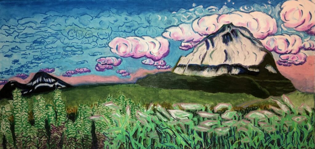
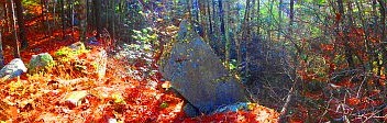
Painting: Glen Coe Trail/Scotland/still available for purchase. Please contact jpvigneau@yahoo.com

Mount Errigal/Painted by Stonestrider
Original Now Sold: $1000.oo
Note: If interested in original paintings for purchase, please contact: Stonestrider.com.
Shenandoah National Park
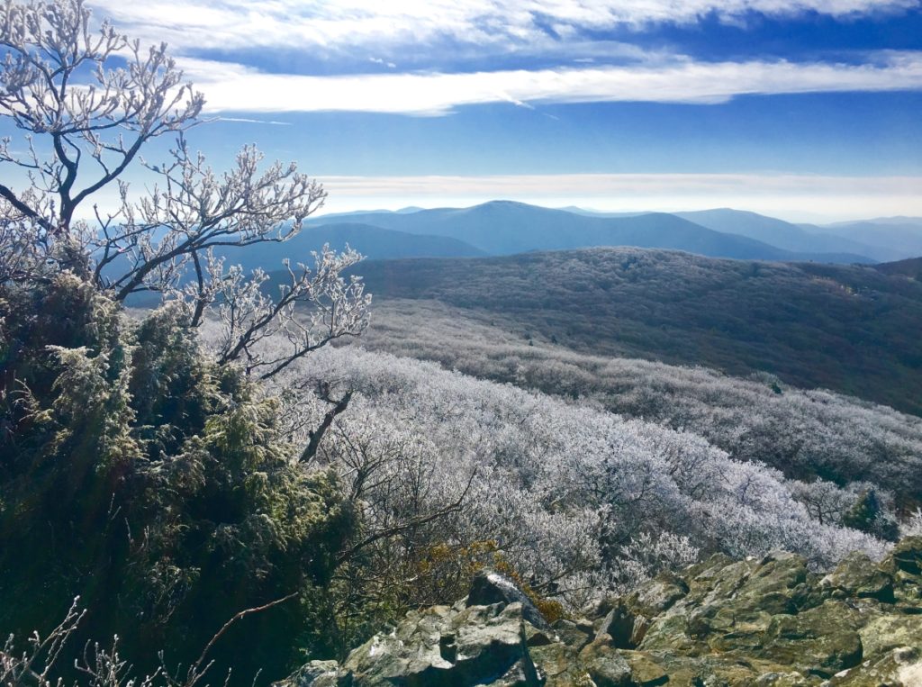
Elevation: 4000 ft
Location: Stony Man Mountain/Blue Ridge Mountains
Note: The chill of New Hampshire in January can be challenging for cross-training hikers, and mountain climbers. Temperatures reach into the teens, and often below zero, making “megalithic-mountain research” a dangerous endeavor. I brainstormed less dangerous possibilities this month; North North America is massive Continent. Ultimately I figured I would go where the cold wasn’t. Enter the possibility of: Virginia.
With my work at Bentley University at an unfortunate impasse, due to Covid19, I decided to make a move, driving 550 miles south to the Shenandoah Mountain Range of Virginia. I finally entered the dimension that is beautiful Virginia. It was gorgeous, even in January. 
With temperatures at 45-50 degrees, and the Sun shining, I cruised into the hidden caverns and valleys at the heart of Virginia. It is literally a golden zone of hidden valleys, crafted by the massive parallels of the Blue Ridge Mountains. Within those outer parallel shafts, other peaks ripple massively in an asymmetrical miasma that crafts miniature valleys within valleys below. 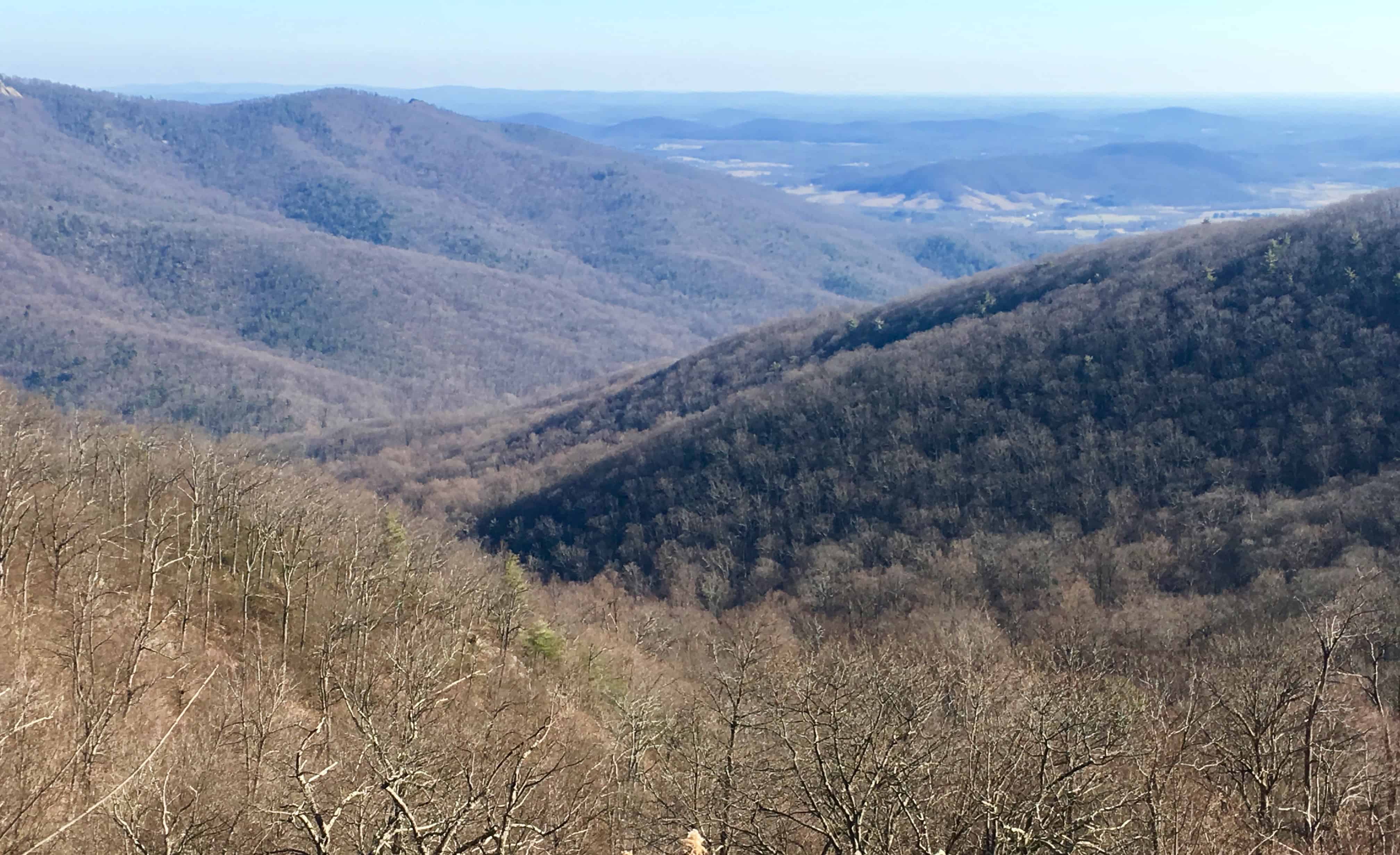
The entirety of Shenandoah National Park can be driven on the single Highway known as Skyline Drive, running straight through the Blue Ridge. There is a $30 entry fee at the elevated entrance of this incredible Park, and then you are set free to choose a trail. There are dozens of forest-trails and peaks to choose from along Skyline’. I had read some interesting commentaries about Stony Man Mountain Trail, a 4000 foot peak about half-way up Skyline Drive, where the stones have been noted by hikers as having interesting fixtures and shapes, depicting a “man in the mountain“. That was the place for me. I immediately I was struck by what I saw. There was magic in this place, right from the start. 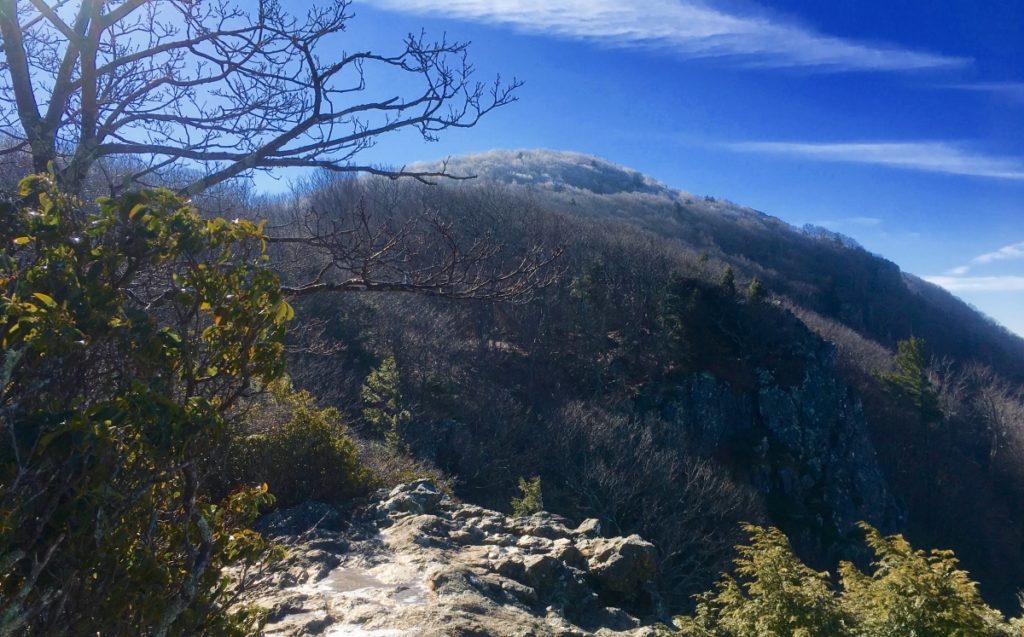
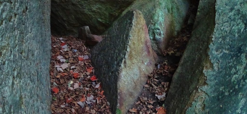
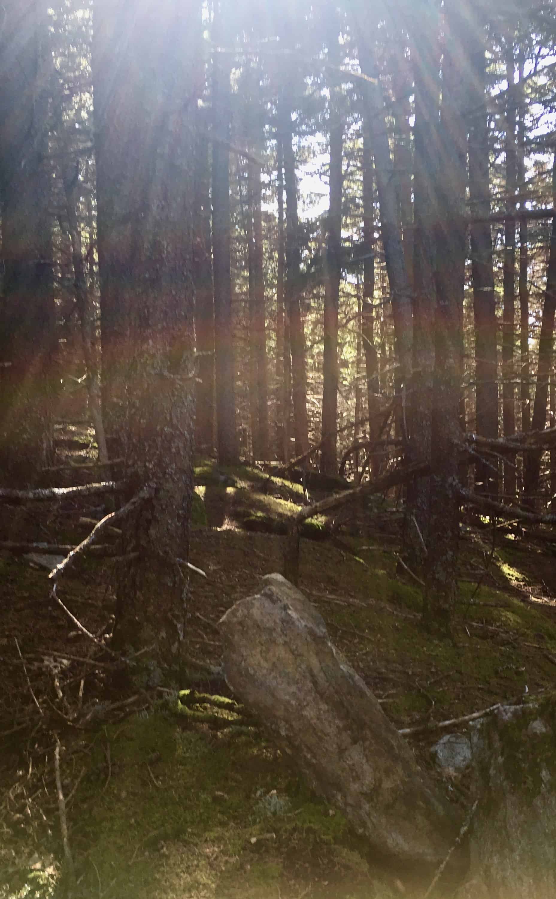
Note2: Stony Man Mountain: One of the major themes of Stonestrider.com is identifying unique and sacred zones that distinguish themselves through Anthropological Geology. These vast rocky cultural zones show practically impossible fixtures of stone(s), found in finely focused areas. There are serious mathematical patterns and indicators within these fixtures indicating an intended meaning, rather than merely random glacial spasms. The beginning of the Trail leads directly into an explosion of mossy green stone fixtures, with a straightforward path.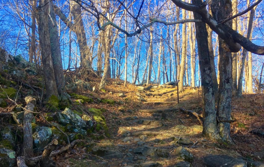 The golden-brown wintery haze of leafless trees and soily hills in the vast lower valleys below abruptly changes into a temple of mossy megalithic stone, beginning just off Skyline Drive. Virginia very suddenly looks like New England, or Northern Ireland. The stones seem to always converge, almost manically, at the peaks of Ranges all throughout the Western Hemisphere.
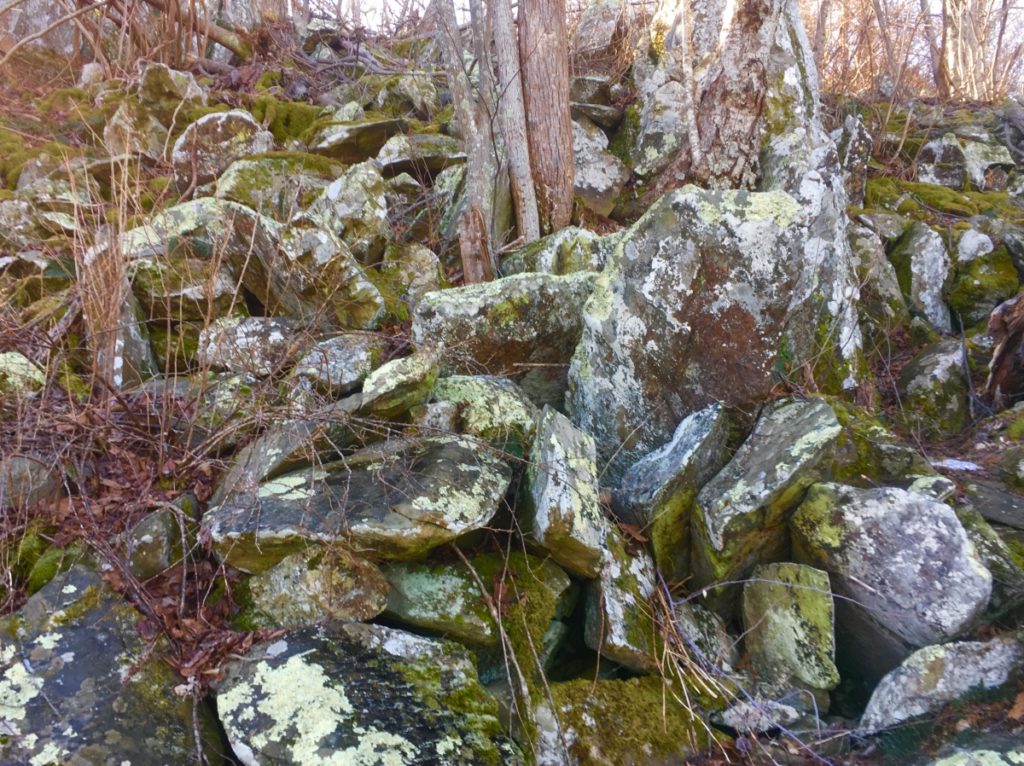
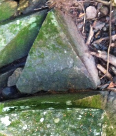
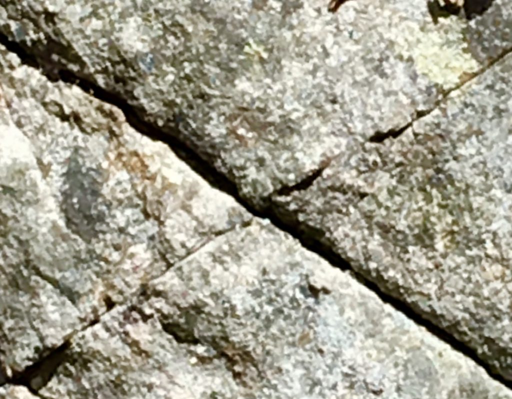
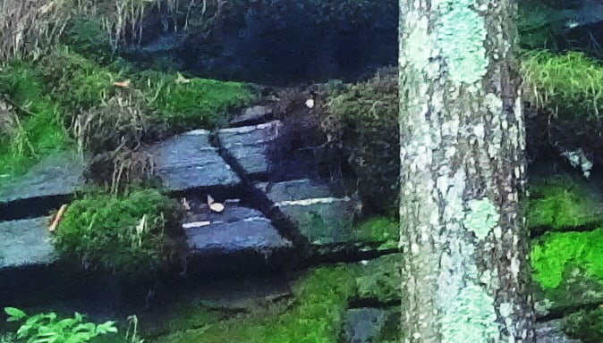
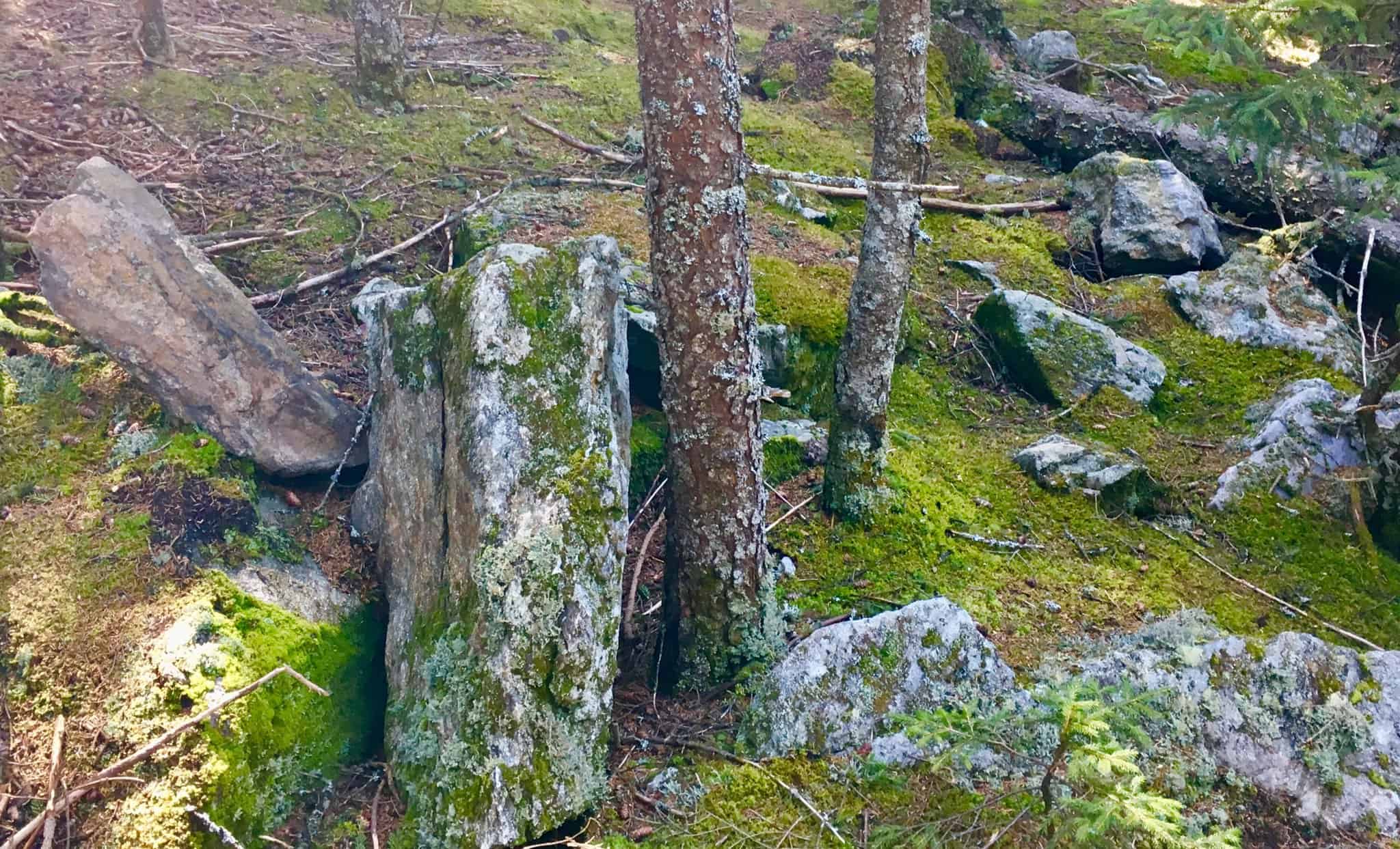
There are also indicators for alternate meanings literally etched into the overall pathway, leading to the peak. Imagine the shape of a spiral, carved into the mountain, radiating centrally from the peak, like the shape of a conch sea-shell. The phenomenon of thresholds appear here at Stony Man’. These are specifically sized, and lined, linear stone markers, placed in a planned ratio of size scale and space. This pattern creates what appears to be levels of a spiral path, purposefully written into the Mountain. Below is an image of the first threshold at Stony Man’. Notice that the stones are fitted, and quite large, against the reference of my foot. 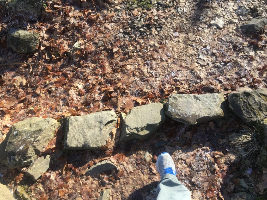 Roughly 150 yards further up the Trail, and almost 35 feet higher in elevation, is as second threshold, with stones roughly 1/3rd the size larger than the stones of the previous threshold. (Image/Below)
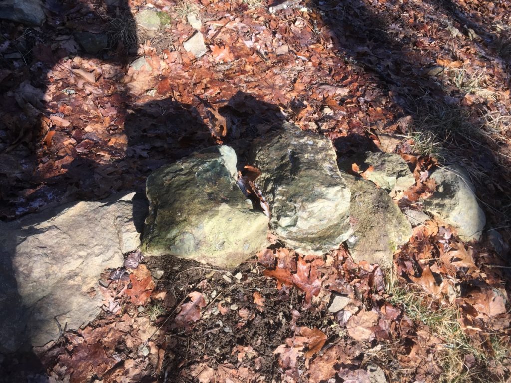
This pattern continues, increasing in terms of size, scale, and distance, with at least 7 more thresholds winding up the Mountain. The point of acknowledging these thresholds is to recognize that the megalithic stones of these sacred peaks seem to be relating specific meanings and fixtures of stone on a grand scale. For emphasis, thresholds are also found along sacred peaks at Monument Mountain in Massachusetts, Mount Katahdin Maine, Clark Peak in the Rockies of Colorado, Rocky Woods in Massachusetts, Mount Bearnagh in Ireland, and The Half Dome at Yosemite. This is a consistently identified megalithic event of a specific crafting type, other than ‘linings’ and Dolmens, that appears to be indicating a mathematical marking of the landscape, towards the peaks.
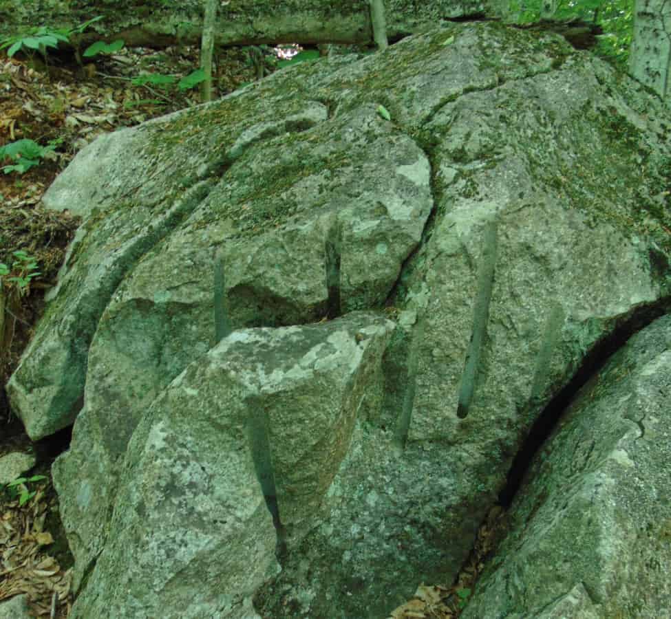
There also appears to be collections of crafted-stone, fixtures carved distinctly into the stony ramparts of the hillside. Just as it is with many of the megalithic stones of Greece and Egypt, there seems to be a molten shaping of these long linear stones, as seen below. The heat it would take to congeal, and then craft these stones, is technologically intense, and extremely hard to justify, if the proof of the stones were not directly before us. This appears to be exactly what happened: Molten heat for mingling the stones, then crafting of long linear interlinking pieces. 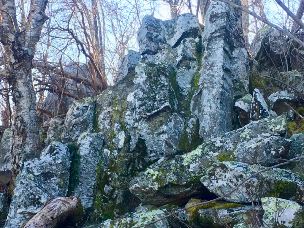
I have seen similar fixtures at the peak at Mount Bearnagh. As you can see below, at Mount Bearnagh’s peak the stones appear to be randomly stacked at first glance, but a closer more considerate glance, reveals crafted indented intervals of markings that measure the fixture. Also note that the measurement is not inches, or centimeters. It is some other system, entirely. 
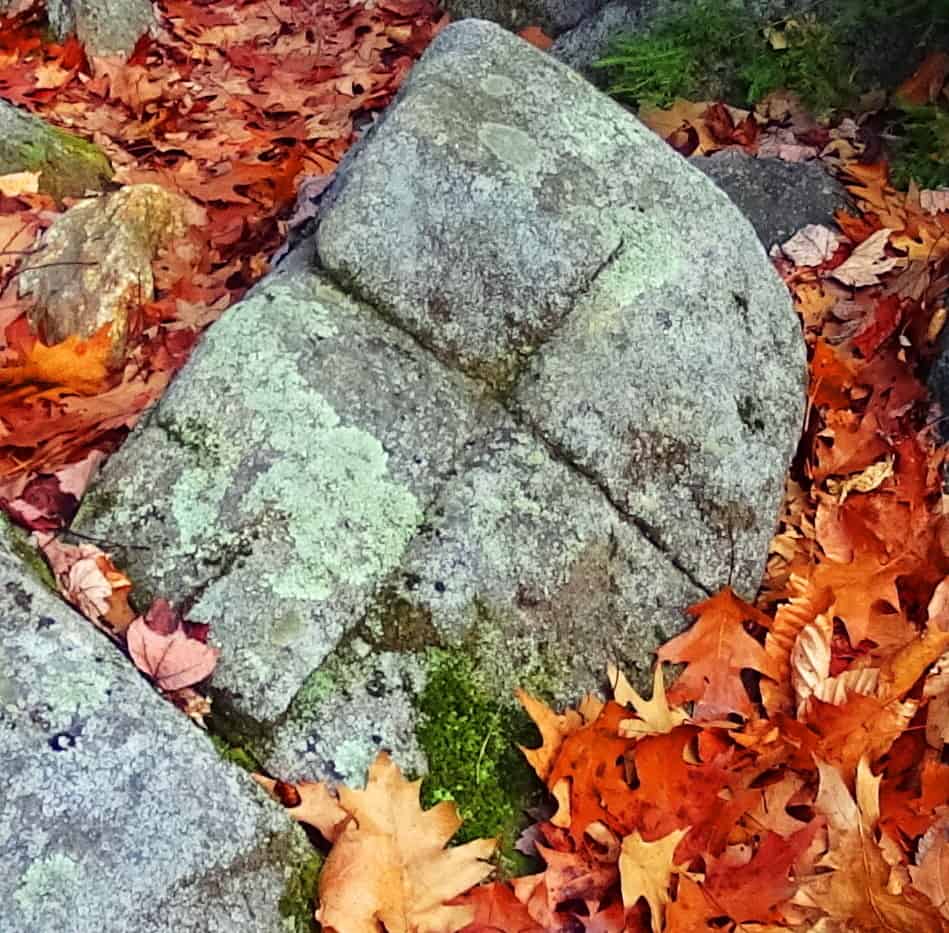
Continuing along the Trail at Stony Man’ there are other crafted fixtures that seem to have meaning. Several stones seem to have been crafted to indicate the directionality of the Sun’s route across the sky. These identically fixed and cut boulders that eternally depict directional apexes, seem to be pointing to the point of the setting Sun in the skyline. (Image/Below) 
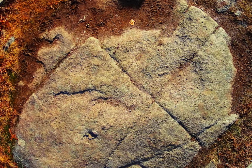
I came across stones very similar in form in New Hampshire just six months earlier: (Image/Below) 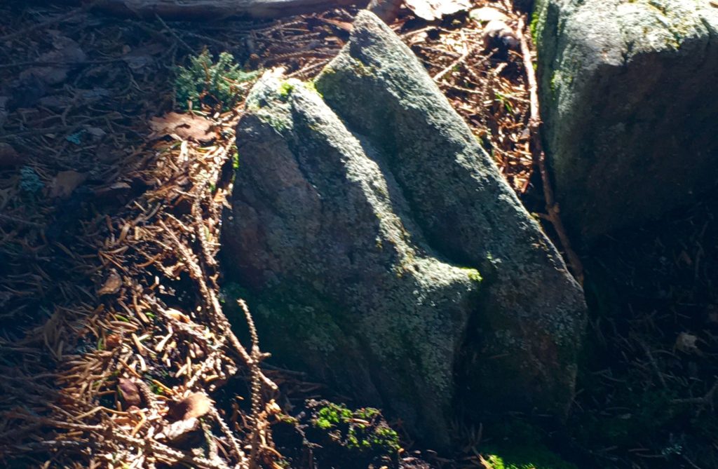 At the half way point of the Trail, an incredible outlook appears on a high cliff facing cardinal South. All of Virginia is laid-out before you, like a golden-fleece flowing low, and lovely, into the distant ground level beyond.
 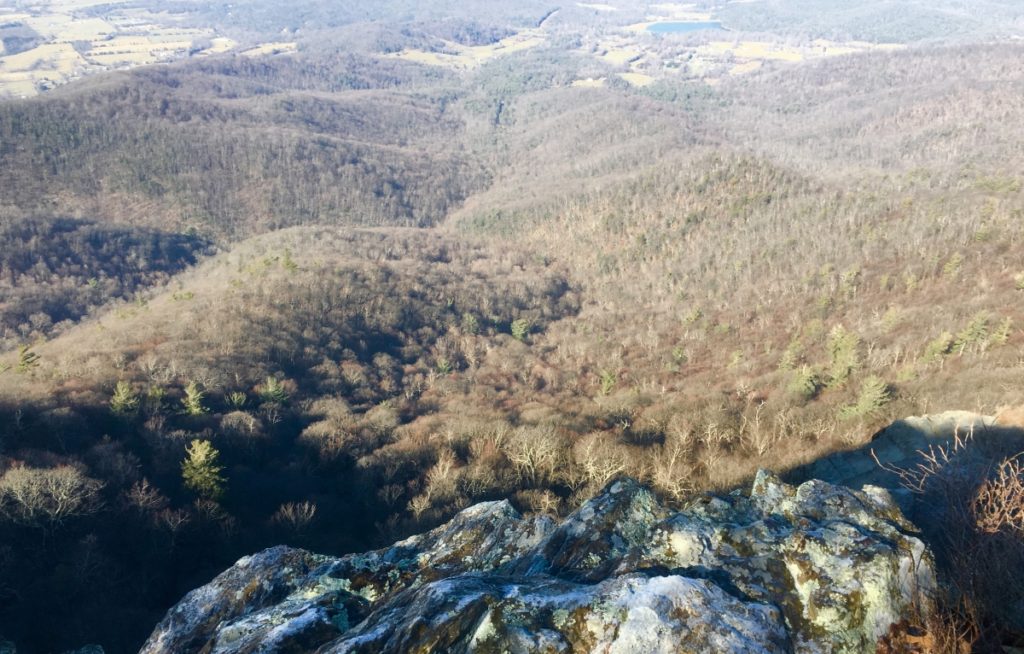 The Trail continues at a comfortable incline back into the upper forest, and into the upper 3rd of the Peak. Consistent with the pattern of ‘intensified stone statements, the higher you go’, there are what look like sets of fixtures, craftings for sitting in specific positions, centrications, and cliff supports made of overflowing stacked-stone.
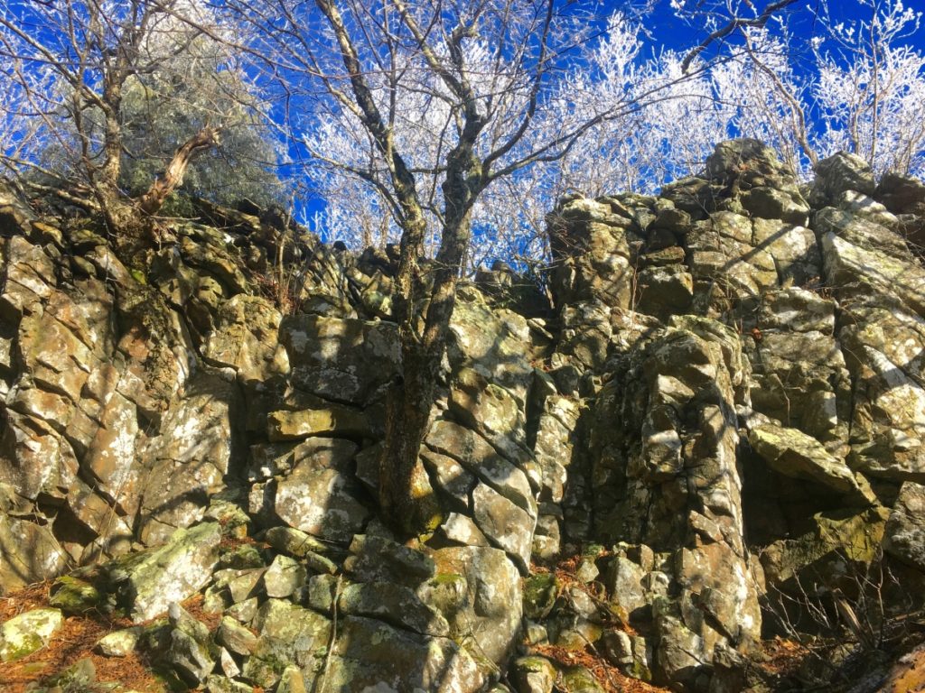
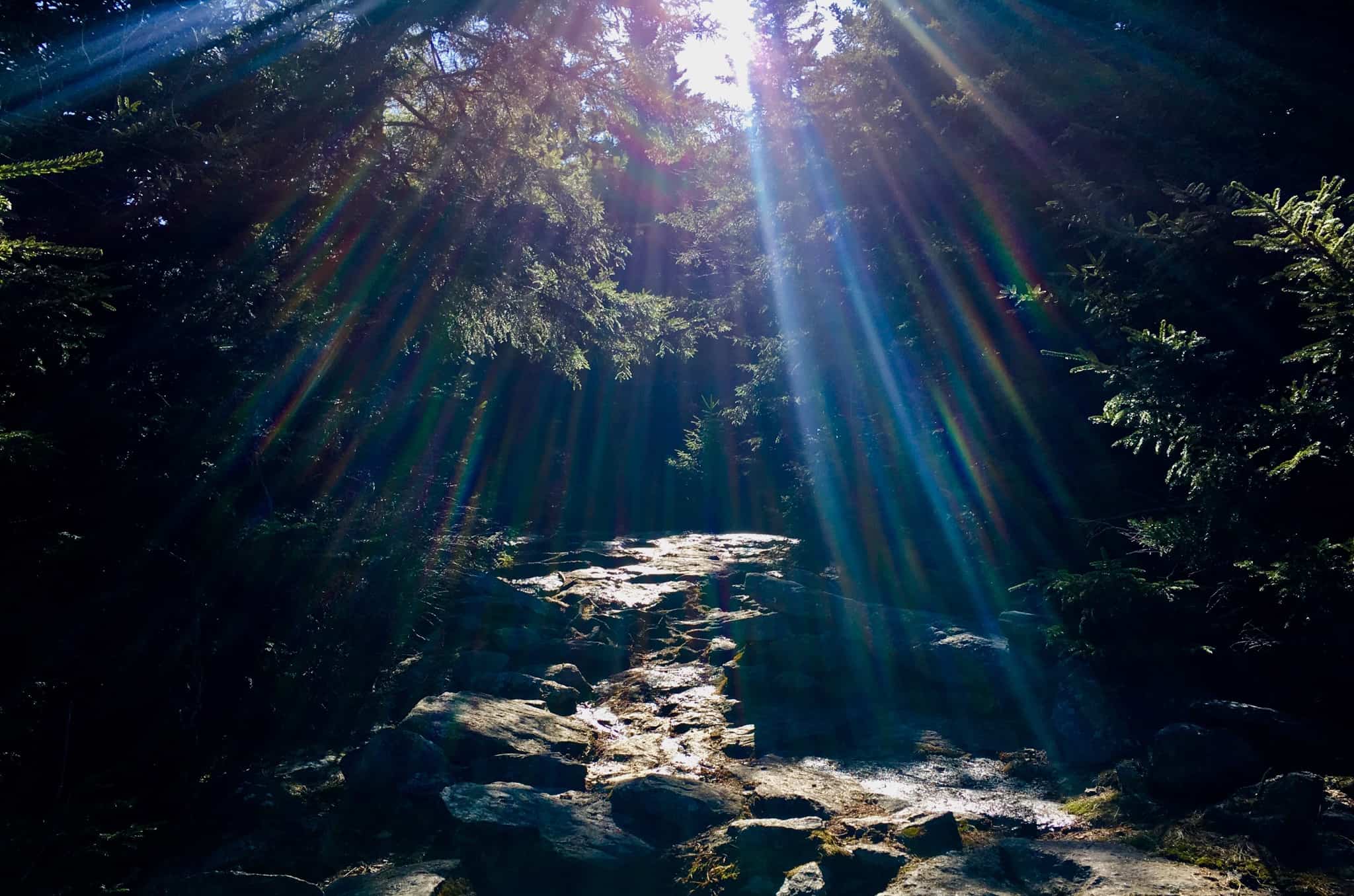
As you ascend through these incredible caverns towards the peak, the Trail takes on a magical cinematic look, with a glowing frost fixed to the fingers of the thousands of branches above. 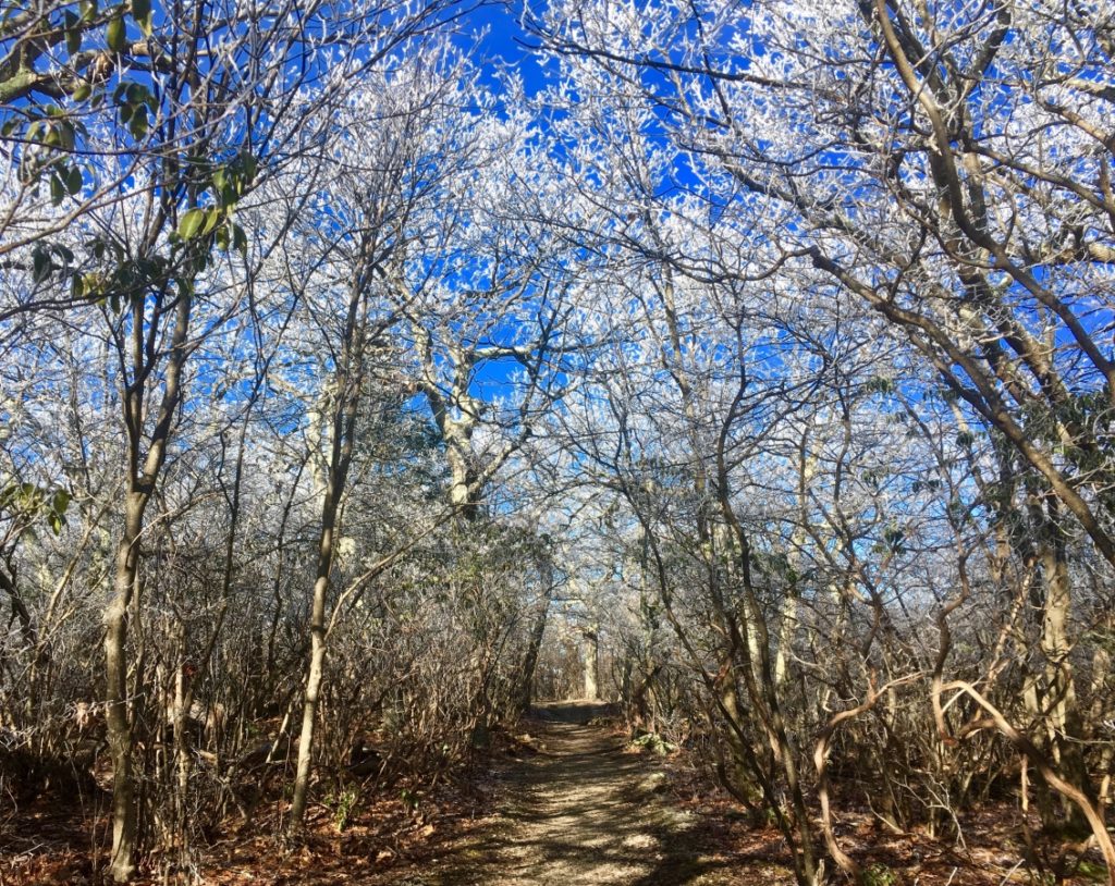
This upper Trail reminded me of the scene at various points of Monument Mountain in Massachusetts, where outlooks just off the main trail emerge just before the peak. The path to these porches look like magical frost portals lit by the Sun. 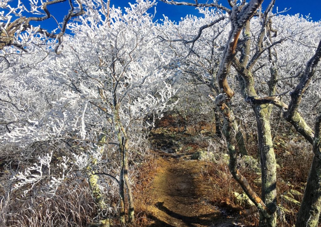
The inner thickets also have this glowing quality: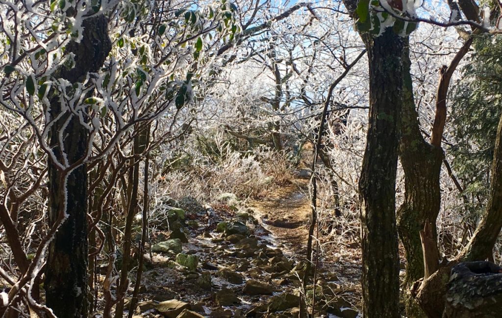
Here, at the vista just before the Peak, the view is stellar, with domes of frost folding over hundreds of times, into the Shenandoah Valley. (Image/Below)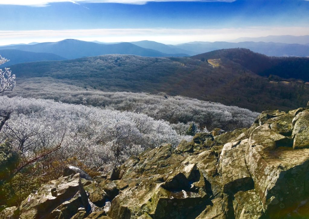
There are crafted megalithic indents on these stone porches as well: (Image/Below)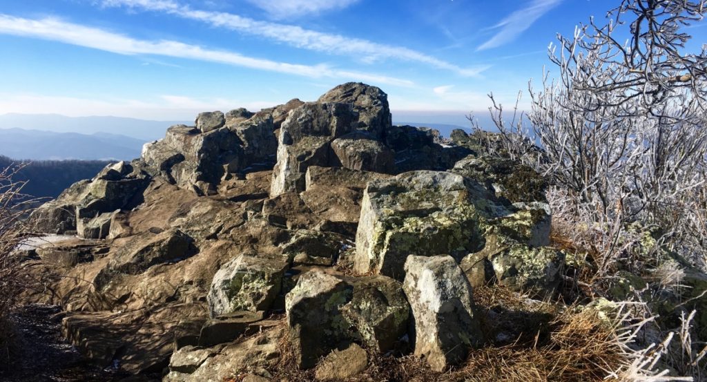 And just 50 yards beyond this vista, is the Peak. (Image/Below)
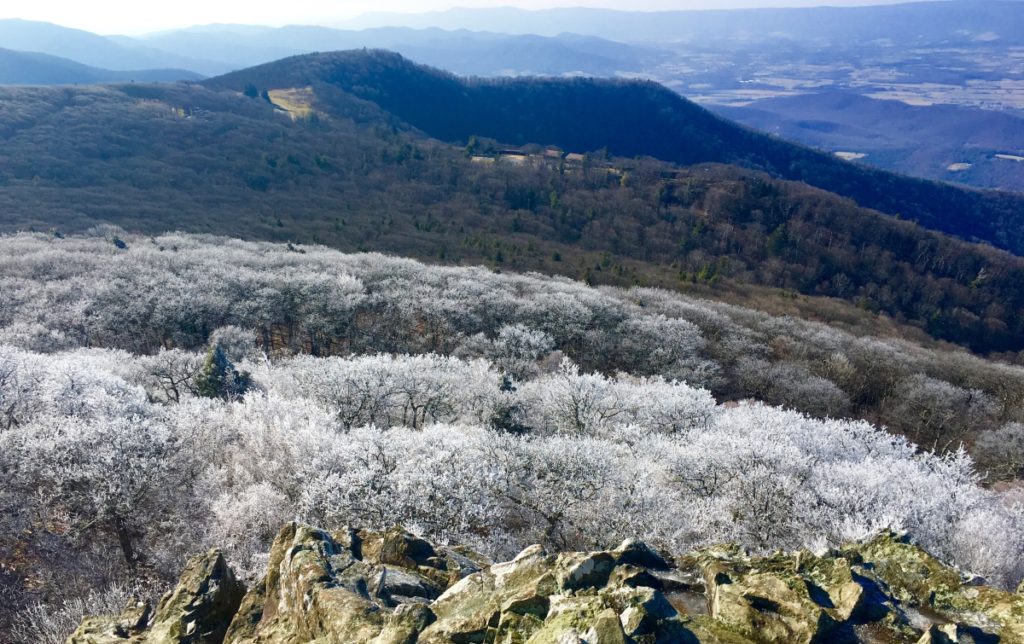 There also appears to be a stone design at the Peak porch, looking back at the Mountain path: (Image/Below)
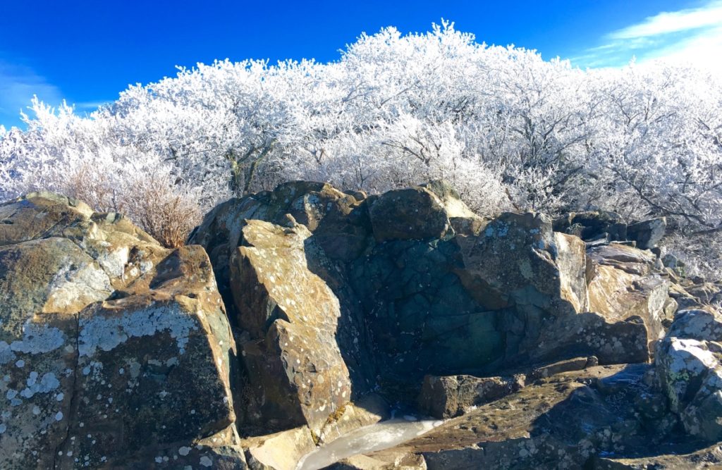
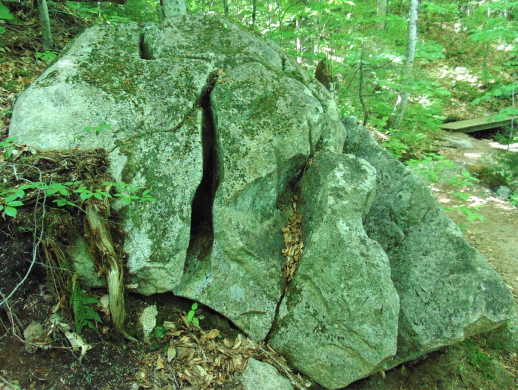
In my single experience at Stony Man Mountain I did not find specific standing-stones, or the typical cross-sections (X) I am accustomed to finding, cut into the stone. I believe that with more time to study Stony Man’ these specific markings could be found. Still, this Trail and Peak is clearly and suddenly inundated with distinctly crafted hillsides of Celtic looking stone, entirely different from the soily persuasion of the overall Valley. (Image/Below)
It is a strong possibility that thePeak at Stony Man’ was sanctified by craftsmanship, and among the earliest forms of functional temples mingled into the landscape itself, as in New England, Ireland, Massachusetts, Sardinia, Wales, Colorado, Maine, Greece, Spain, Peru, and many more places besides.
I recommend hiking this Trail in Autumn if you can, but even in Winter, it surprises even a seasoned climber with elements of unpredictable beauty. In this place, recharge, get away from the fake news-cycle, and pray for protection in the coming days. Just beyond the boarders of these vast views of Virginia, in Washington D.C, a haunt of vipers and spiders are now dropping the most massive iron-curtain upon freedom loving humans in the history of the world. Reject them. Continue to cross-train in the hills and peaks of the Ranges of the world; Breath deep; Think bright thoughts, and pray for the United States of America, and the World, to overcome this new evil . And as always, do what you need to do, to go strong.
Love and thanks to dear friends Kathy and Paul, who helped make this much needed venture possible, with a beautiful homestead to stay in Virginia,
Please send any comments, or thoughts to: jpv@stonestrider.com.
Lonesome Lake
Elevation: 2,730ft
Location: Franconia Notch Range/White Mountains/New Hampshire/USA
Note: Tucked deep into the heart of the White Mountains of New Hampshire, facing the stellar Franconia Notch Range, sits an elevated Lake that is forever embraced by thick Forests, and glowing Mountains. This is Lonesome Lake, a secret shining pendant-piece hanging high upon the neck of the Franconia Notch Forests, 2,730 feet above the valley. This hike is the best overall trek in the White Mountains., and that’s saying a lot!
The view of Franconia Notch from the valley is straight-forward enough. The Mountains are so broad, that it is a real challenge to get a full view of the Range, before finding the Trailhead for Lonesome Lake. 
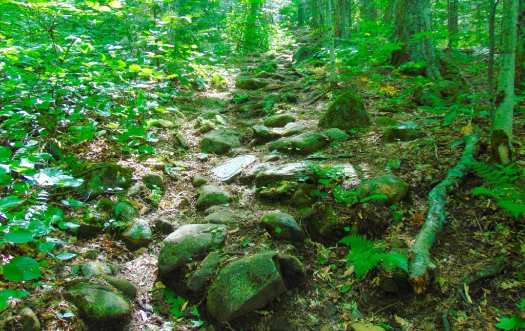
Lonesome Lake Trailhead is easy to find. Located just 10 minutes, by car, from the Franconia Notch State Park’s main facility. Continue along 93-North for ten minutes, extending from Franconia’s Main Entrance Park. You will actually pass the Trailhead, on the other side of the highway. You will need to take a left at Exit 34 B, and drive 93 South, back in the other direction, for about 4 minutes. You will see signs for the Lonesome Lake Trailhead on the Right, with provided parking. Your Iphone will have no problem identifying the Trailhead, as Route 93 is the major highway running directly through these Mountains ( just like the A82 in Scotland, which splits The incredible Three-Sisters-Mountain Range at Glen Coe. (Image/Below) 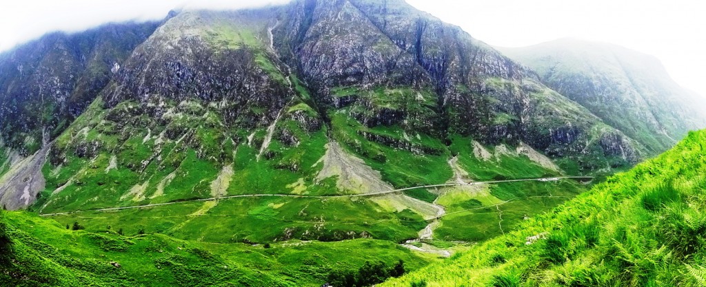
The White Mountains have a very similar feel to Scotland’s gateway Range at Glen Coe. Similar in scale, these are both incredibly massive Mountain Ranges, that somehow depict a rare ‘cozy closeness’ between cleaved peaks, protecting the valleys below, in both locations. The White Mountains in Fall, however, have something that Scotland does not, glowing gold and booming orange-brown colors for just a month out of the year. (Image/Below)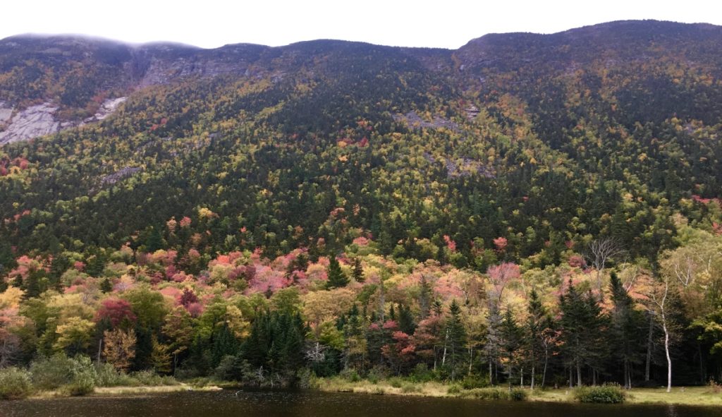
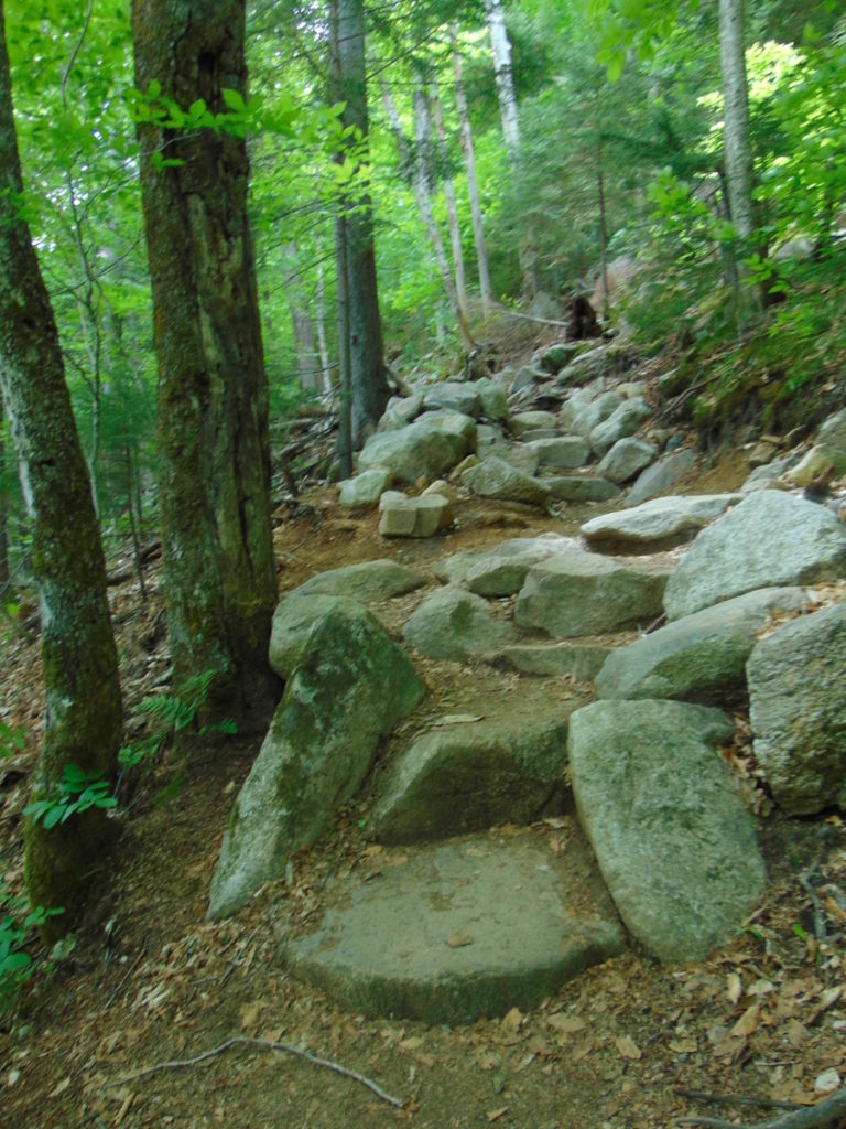
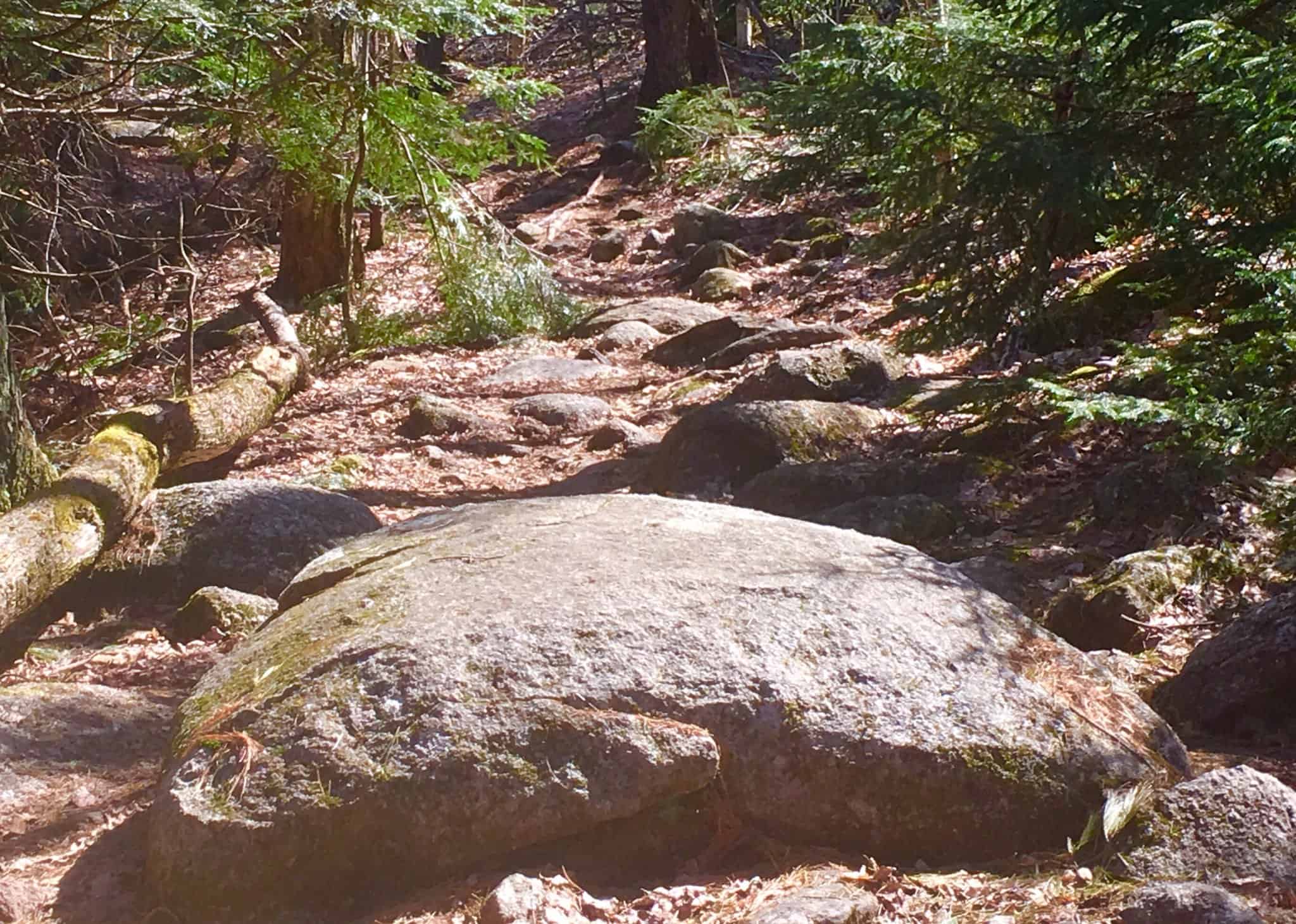
Lonesome Lake Trail: At the opening of the Trailhead you will find a path of collected boulders that climbs straight up, like a winding discheveled stair. As it is with almost every trail in the New England Region, it seems that these boulders were collected, cut, and placed in this specific way (As hard as that might be to believe).
If, for example, people believe that the National Park Service placed these boulders, they are seriously mistaken. It would take millions of dollars, Bobcat-machines, and perhaps 50 to 100 men to align these boulders, straight up a mountain. (Image/Below/Lonesome Lake Trail)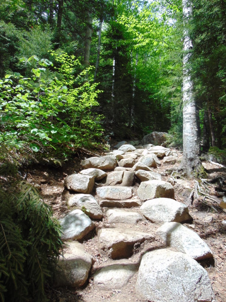 Native Americans did not move these boulders either. The reality is that these trails were created by megalithic builders, just like New Grange in Ireland, Macchu Picchu in Peru, and Stonehenge in England. These trails are monuments. I realize this changes the modern Western conceptualization of what a sacred space, or temple, truly is. These megalithic statements are sprawled and connected all over the landscape. The constructs make the landscape itself a monument. It is not confined to a singular space, like the Parthenon in Greece, or, Notre Dame in France. This has been incredibly difficult to explain. The conceptualization of megalithic building for todays “Anthropologists”, who simply cannot fathom megalithic constructs embedded into a landscape, is not confined to the basic idea of a “building”, but rather, a connective grid, capable of synergizing an entire landscape. The megalithic designer responsible for this Trail, may have left us some clues about the constructs here at Lonesome Lake; Let’s take a look…(Image/Below/Lonesome Lake Trail)
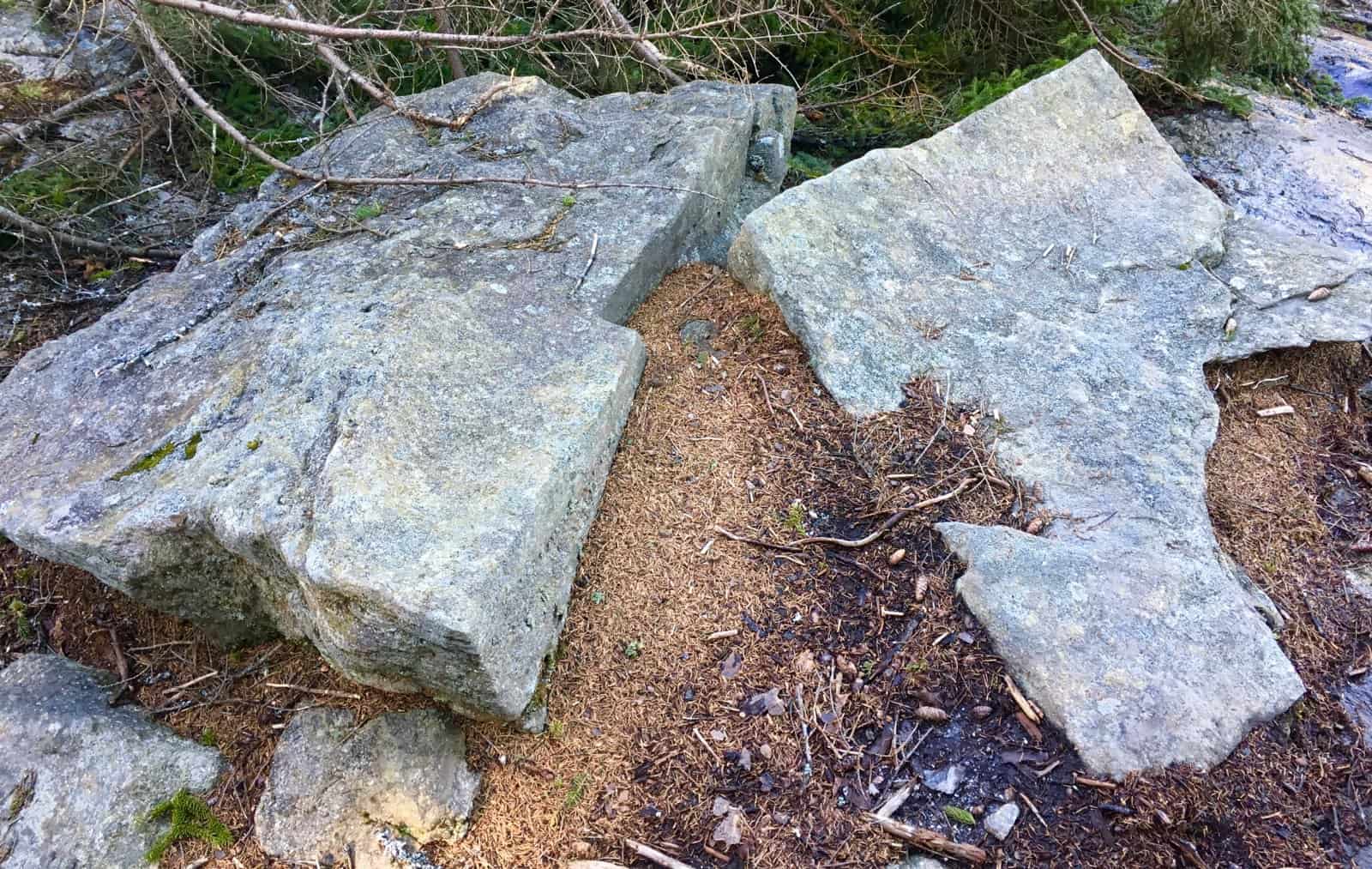
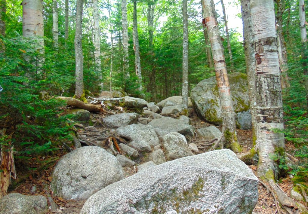 At the base of this Trail sits an extremely unique boulder (Images/Below), with parallel indented markings, and curvy cut sections, like a rounded ‘rubix-cube’. It is clear that this was intended work upon this boulder. There is a dimensional framework to these sections, perhaps indicating some kind of understanding about “perspective”, and vantage. If you look closely at the image (Image/Left/Below) it is crafted into sections: The first frontal section is completely separate, with a symmetrical and penetrating cyndrilical line, seemingly drilled, and at an intense speed, running straight through the rock. The second and third sections, standing behind this first boulder, are cut similarly, and are perhaps aligned in a specific way. There are clearly separate sections to be seen, as if the boulder was once singular, heated, penetrated and then sliced into sections; Like a knife through butter. The side view shows the clear sections; The frontal view show the connectivity. This is a multi-meaningful statement, which deserve mathematical analysis. It is enticing, and adds excitement to this Trail.
As you progress up the significant climb, there are beautiful settings in the stones, awesome trees, and groves that compliment the experience. One particular tree, near the 2000 ft elevation range, grows right through the middle of the trail, on its own.
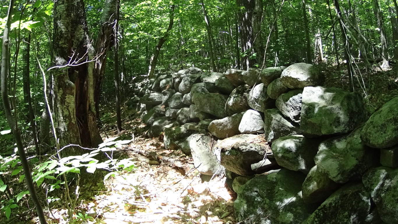
 There is a possibility that the stones were left behind in a very specific way, in order that the Forest would grow up in a specific order. This too is very hard for anthropologists and archaeologists to comprehend. But a great deal of megalithic works seem to have multi-layers of meaning. For example, many of the stone-linings (“walls”) that are found winding infinitely through the Forests, directly up mountains, and across streams in the valleys, clearly have nothing to do with the classical usage of “walls”, which is to restrict the movement of cattle and trespassing humans. These ‘Linings’ do not limit movement, at roughly 3 feet high, and three feet thick. If they do not restrict movement, why are they there? And why the monumental effort to create them, if they are not restrictive? It is because there is a megalithic context to these ‘Linings’. These stones are intended to connect the landscape, the way quartz cables connect energy centers on a digital grid within a phone, or computer. It synergizes the landscape; The stones absorb the energy from the Sun, plus subtle electric current from the rolling streams below, sending energy throughout the landscape. The stone-lining pictured below, is found near the peak at Watatic Mountain in Massachusettsm, at around 2400 feet of prominence. It is a good example of the basic width, and depth, of the construct of these ‘Linings’, found at tough elevations. The point of all of this is realizing that these megalithic works are engineered spaces, harnessing the landscape energy, constructing irrigation zones, cairns, standing stones, and much more.
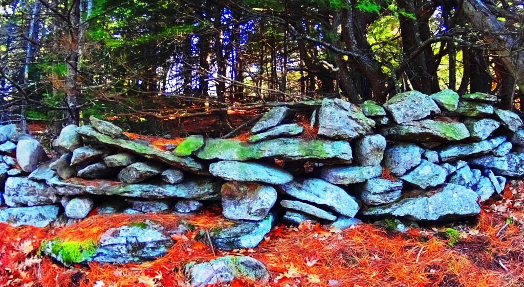
This is megalithic historic view is actually the more logical explanation for these megalithic ‘Linings’ inundating the landscape of New England, and Europe. The megalithic context depicts works of intense utility and scale. To credit the Native American Tribes with these works, would require a massive amount of advanced tools, evidence, and oral-traditional depictions of Native Tribes spending lifetimes building “walls”, with megalithic size stones, directly up mountains. It makes zero sense. There is no such evidence. These works were here before the Native tribes arrived, and at the earliest possible point in Cultural History. The pathway here at Lonesome Lake is an awesome example of megalithic trails. (Image/Below/Left)
To be clear: to say that this path is merely the work of A State Park Service, Native tribes of seasonal and minimal possessions, or “glaciers” . is absolutely absurd. It is a blatant collection of massive boulders, intended as a walkway to the sacred areas above.The work is meant to be seen, just like any work is.
One thing that the builders of these beautiful pathways knew, was that these stones would be here forever. And they were right. What has faded though, is human beings ability to interpret the over-obvious, in plain sight! The evidence embedded in the stonework itself, from all corners of the Western Hemisphere, say something cultural happened, on a megalithic scale.
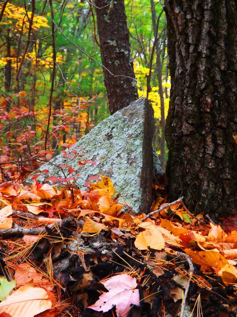
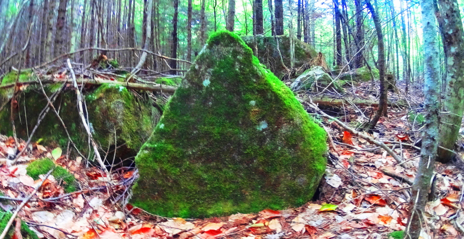
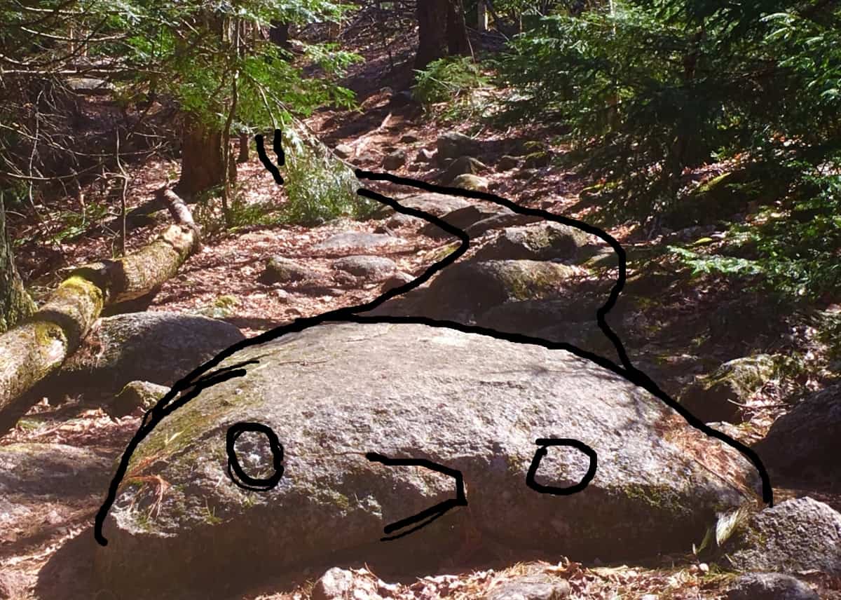
As you make your way to the top of the Trail there is an interesting boulder that marks the point where the ground finally becomes level again. The shape of this boulder (First Image/Below) coincides with the shape of hundreds of boulders that remain unacknowledged by Post-modern ‘anthropologists’ and authors, with agendas, married to their desks, at colleges across New England. Take a look at the examples of these Triangular Megaliths below: 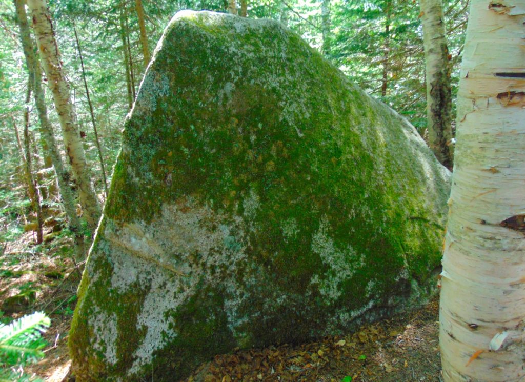
The triangular shape of singular megaliths, as readers of this site well know, is found throughout Forests, from Maine, to Massachusetts, as well as Ireland, Austria, Arizona, and California:


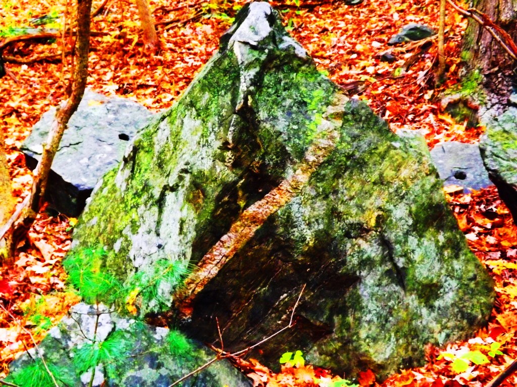
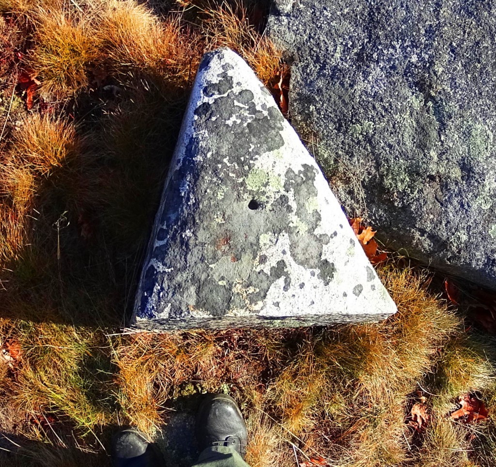
The reason for these triangular megaliths is probably multi-dimensional. It might be a cultural marker for the megalithic culture itself. A ‘calling card’. In mathematics, the first shape to arrive from a linear set of points, is the Triangle. Perhaps this Megalithic Culture is messaging us, via this symbol: Just as the Triangle is the first symbol from any set of given points; The Megalithic Culture is the first Culture, from any set of Cultures. It makes sense. Look at the construct of any set of points reaching a logical triangle shown below:
Ex:
- A
- A to B
- A to B to C
- A to B to C to D…….etc….
- A
- B C
As you can see, the first shape from any set of given linear points possible, is the Triangle. Forever. Its a Law.
Continuing into the level ground of the upper end of the Trail, a beautiful grove emerges, and you actually step down for a few moments, before the second part of this amazing trail unfolds. 
As you step forward towards Lonesome Lake, mountains emerge in the distance beyond, and the Trail reveals an option to go right or left. Take the left side path, clockwise, around the Lake. On the other side is the area which is the main focus of this trek, where everything comes together. This is a scene with multiple mountain vantages, perhaps relating to the mulit-layered rubix-cube-boulder at the beginning of the Trail, indicating something about the vantages and perspectives to be found here.
The breezy jaunt around the circular Trail begins to reveal mountains, in every direction. The first view, to the West, is of Kinsman Mountain. (Image/Above) Making your way to the other side of the Lake, Mount Kinsman looms like a Sun-dial; As the Sun makes it way towards its 4,265 ft peak, a shadow slowly cools the hidden Lake below. Reaching the other side, you will turn to look back to the East, and Franconia Notch Range is laid beautifully bare, above the Forest, like a Tigress looms over her cubs. It’s spectacular. This is the place to rest, and eat, and take some pictures. 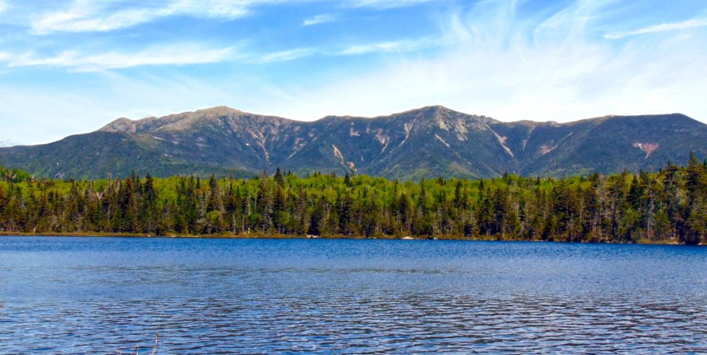
After some time taking in this scene, begin your trek again, continuing clockwise around the Lake. A glowing green Cannon-Ball Mountain radiates brightly to the North. The bright contrast compared to the darker hues of Franconia Notch Range and Mount Kinsman is a super-pleasant shock. A three sided, mountain-sized, protection for this Lonesome Lake. 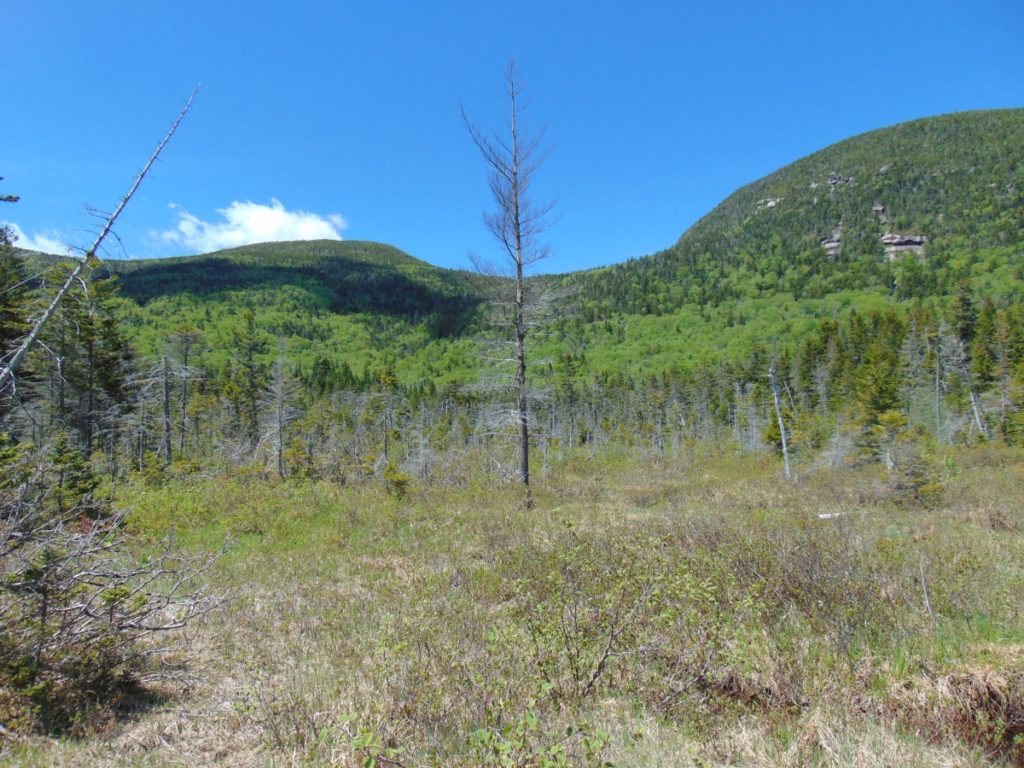
There are platform-pathways that run through the Forest, beside Cannon Ball Mountain, as you make your way.  Some of the enclosures give a few different vantages on Franconia Notch Range…
You will come full circle, and head back down the way you came. You took in a brilliant scene.
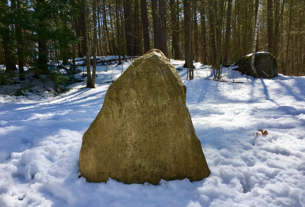
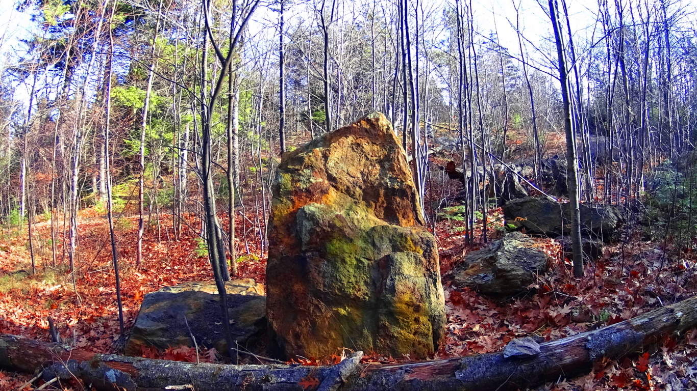
I hope readers will understand that relating these cultural points is not easy, or prideful. There was a time that I myself absolutely did not believe that any of these megalithic indicators were possible. It was a fairy tale, at best. But what I discovered, first hand, in person, as I engaged these trails, is the miasma of academic level evidence pointing towards this earliest anthropological Culture on Earth; This is The Megalithic Culture. You can see it too. The ironic thing, is that this earliest Culture was capable of creating almost anything they decided to build. They were engineers of entire landscapes! We find solid evidence for this Culture in Ireland, England, Wales, Scotland, France, New England, Virginia, Arizona, California, Mexico, Peru, Russia, and many more places. I still remember the first standing-stone I came across randomly, hiking in the dead of Winter in New England, some years ago. I was totally freaked out. It changed my perspective about so many things. (Image/Below)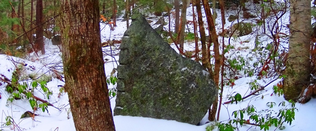
If there was an advanced Culture at the beginning of Time, how could we say that Cultural development is Evolution based? Why is none of this mentioned in our K-12 text books? In other words, why don’t the people funding Public Education not want you to even think about this Megalithic Culture? Are they afraid that it might change your perspective on some things? Your damn right they are! Get free. Open your mind. Look logically. It’s not what “Public Education” told you it is. Lonesome Lake is yet another wonderland, full of natural beauty and cultural mystery. It’s a place I hope you won’t miss. Covid-whatever, or no Covid-whatever. Go strong!
Mount Moosilauke
Elevation: 4,805 ft.
Location: The White Mountains/Benton, New Hampshire/USA
Introduction: Welcome to the dramatic western edge of The White Mountain Range, in New Hampshire/USA!
Mount Moosilauke (Moos-ih-lahk-ee) retains a title given by the Abenaki Native American Tribe; It means: “Rocky face above the trees”. As we will see, the high place at the top of this Mountain, is a definitive and distinct megalithic spiritual zone, where the enchanted stones of the peak mingle intimately with the clouds.
This unique title given by the Abenaki, also indicates a deeper meaning, beyond the name itself. Almost every one of the many White Mountain Peaks has a ‘rocky face above the trees’. Mount Washington, Mount Chocorua, Mount Adams, and Mount Jefferson, all have a ‘rocky face above the trees’. Why single out Mount Moosilauke? There is something special going on here.
I believe that The Abenaki were acknowledging this particular ‘rocky-face’ due to the many unique features that they encountered, and considered spiritually significant when they first saw it. In our time, we see them as Neolithic anthropological features, so ancient, that it seems clear to me that they were there before the Abenaki people had arrived. I can support this with evidence. Let’s take a look at the multi-layered experience of megalithic evidence during this phenomenal climb at Mount Moosilauke.
A Note About ‘Culture’: The ancient stone works found at Mount Moosilauke pre-date the Native American Tribes of New England. The Neolithic Culture you are about to experience on Mount Moosilauke, through this article, created monumental works of stone, in extremely difficult locations, and ways, all of which existed long before any Native American tribes had arrived.
This Megalithic Culture has specific memes (symbols), fixtures (arrangements of stone), and structures (functional centers, small temples,) in the highest elevations all over the world, that mirror, and mimic directly with European Megalithic memes, fixtures, and structures, entire continents away. This would support the idea of a single Megalithic Culture, with a single, common, source of systems. Not hundreds of individual, nomadic, Native America Tribes; Each with its own traditions, with basic tools, and migrations that moved seasonally in the valleys, planting crops, hunting, and fishing game.
I understand that this is very hard for many local researchers to accept, defending the idea that Native Americans created these Neolithic statements; but the evidence and cultural history clearly, and definitively, indicate otherwise. Of course, that statement must be supported with the evidence. So here is yet more evidence, and common Megalithic memes, and structures, from Mount Moosilauke, in New Hampshire, that relate directly to Mountains in Ireland, Arizona, Maine, and other sacred locations and high elevations, thousands of miles away; All these locations crafted in challenging, sophisticated, Megalithic stone.
Ancient Megalithic Memes in New England: Walking along the forest streams of the Franconia Notch Range, some 6 miles west of Mount Moosliauke, just a day before my intense climb, I came upon a six foot tall, equilateral-triangular standing stone, set perfectly in the midst of a quiet stream near Route 3. 
The meme of Megalithic-stone-equilateral-triangles in the Forests of New England, from Massachusetts to Maine, and everywhere in between, is one of the most prevalent and abundant symbols/memes that can be found. On this website alone, there are compiled, and permanently documented, several dozen equilateral triangle memes cut in massive stone in the wilderness.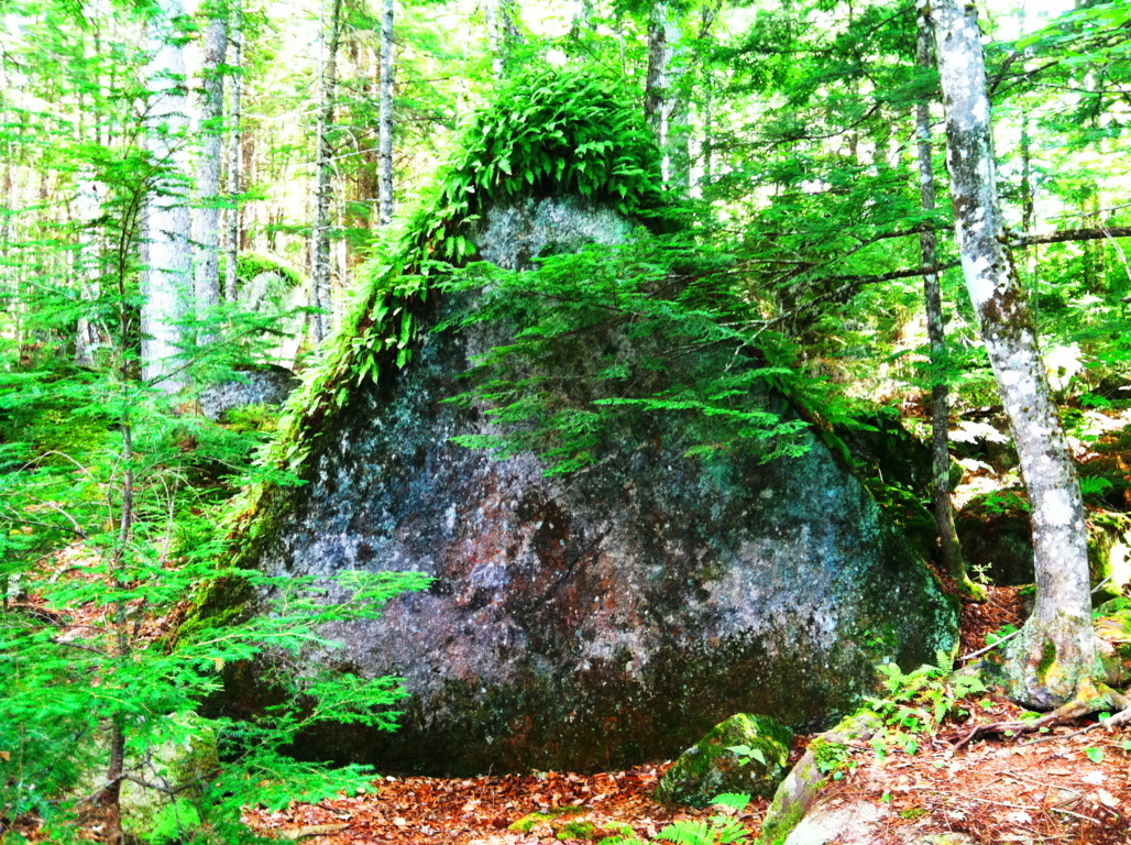
These stones have significant ‘directionality’, and meaning, yet to be fully understood, or even acknowledge by current anthropology. Academics want us to believe a glacier created these statements? I’m sorry to be blunt here, but how intensely-stupid do these current Post-modern anthropologists think we are? Not to mention the fact that I have NEVER ONCE encountered, in any of the mountain ranges I have climbed, in the entire Western Hemisphere, a single real-time Anthropologist, or Professor, in a DECADE.
Very soon, these arm-chair-anthropologists, that dispute the Megalithic memes, are going to be absolutely disproven, and in the most blatant scientific way possible. With EVIDENCE. The evidence is mounting, and couldn’t be any clearer, that these are intentionally crafted, Megalithic, Neolithic-Period works. So, lets take a look at some examples: 
The green equilateral triangle stone pictured in the above image, has a perfectly cut, flat face, standing ten feet high. It might weigh 100 tons. I said 100 tons! It LOOKS LIKE AN ANNOUNCEMENT! BEGGING TO BE NOTICED! THEY ALL DO! It is located in the immense Forest surrounding the sacred Mount Katahdin, in Maine.
The perfectly equilateral stone pictured to the right, is located in a beautiful Forest in Upton Massachusetts. This example is relatively small compared to many of the other statements, at about 3 feet, on each side. It is absolutely set to a stone below it. You could not budge this stone with all your strength. The point is, someone crafted it, fixed into the rock-face below, perfectly, with a tool capable of doing so, cut directly out of the rock. Look at it. It’s perfect.
To add to this Neolithic context, not far from this very spot, is a megalithic chamber, designed in the the exact same internal, structural-fashion, as the Megalithic Chamber at New Grange. An inside (and outside) that most sacred Megalithic chamber at New Grange is….yes, you guessed it, dancing equilateral triangles, cut into the stones.
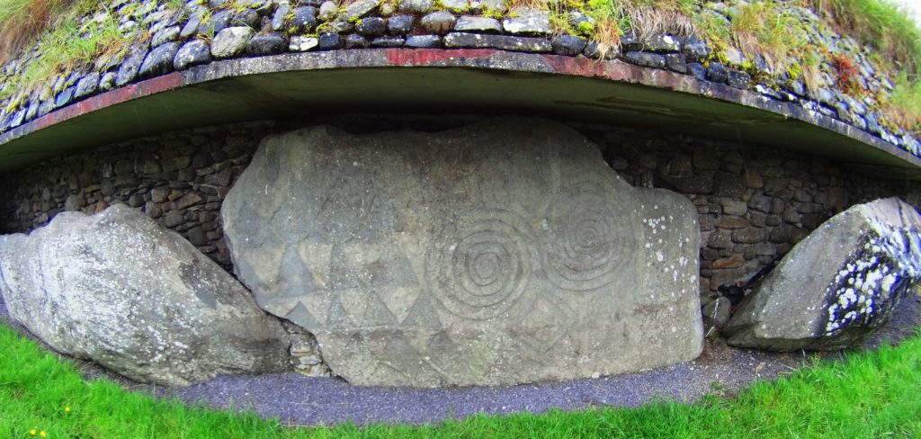
(Images of triangles: Above/Right/Left: New Grange Megalithic Temple, Ireland. One of the oldest in the world.)
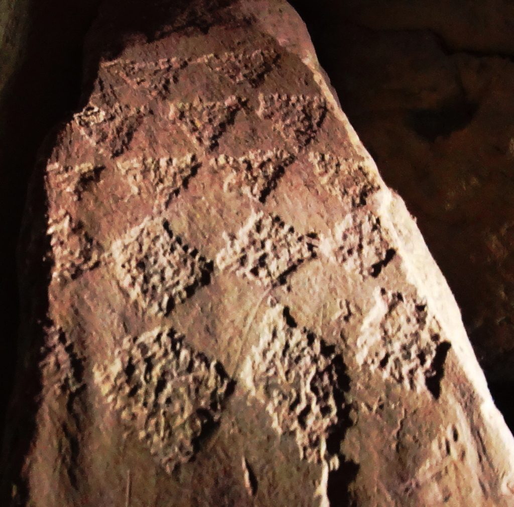
The image below is yet another massive crafted equilateral triangular-stone, found in the Forests of Maine, near Katahdin. Notice the moss covering this stone. For this stone to be cut, and then so covered with moss in this way, means it has been like this for an extremely long period of time; most likely, the very beginning of time, not crafted in the last 500, or even 1000 years. More like 6000 years…
Pictured here, to the right, is another cut, equilateral triangular stone, that is not located in the forest of Maine, but rather, in the forests of Austria. Again, notice the similarity to the stone in Maine, 2500 miles away. And also, notice the indicator of construction in antiquity, alpine moss.
This stunning image to the right, was sent to me by my friend, and researcher, Gunnar Hiptmair, who continues to discover dozens of Neolithic anthropological statements and zones in the Austria and the Alps today. His Facebook profile can be reached directly, here: https://www.facebook.com/profile.php?id=100010469927936
Stemming from this, are countless other examples of equilateral triangles fixed into stone, in New England, and elsewhere. They are so abundant that it suffices to leave these examples to get the point across, and continue forward with the experience at Mount Moosilauke.
Logic About Constructing Megaliths: The ashlar-cut technology in creating these perfectly cut, flattened frontal faces of stone, does not indicate a technologically primitive Native American or Celtic culture(s). These stones were cut, and placed, in specific ways, weighing up to 50 to 100 tons. For Native tribes to move each one, would take a set of completely illogical circumstances, requiring human labor, a time frame, resources, and out-and-out permanence and dedication, that Native American or Celtic tribes would have found absolutely repugnant, annoying, and even ridiculous.
The Winter season in New England is long, deep, and hard. When Spring arrived for the Native tribes, after surviving the deadly Winters, do anthropologists actually think and defend the idea that the very first thing Native Tribes would do after migrating back to the newly warm northern temperatures is, first: go straight back to those impossibly massive stones that they were supposedly moving, before the previous Winter began, (utilizing every ounce of energy, and voluntarily-primitive ingenuity they had) They would immediately abandon their villages, loved ones, and their potential planting/fishing season, and crops, all to move giant rocks?
No. This never happened. It is absurd.
Something else is going on.
This is where things become extremely difficult for local researchers. They are limited to local narratives, local evidence, and local History. They simply cannot comprehend any possibilities outside of the Native American presence. They are forcing a narrative to credit Native American Cultures with the crafting of these megalithic statements, because it is the limit, contextually, historically, and logically, to what these local researchers can understand.
The fact is, there was an earlier Culture, in the Americas, as well as Europe and Israel, as described in every ancient account, and mythic history, which was dominant in these regions of the world. They were Megalithic builders, capable of incredible works of strength and design, that are so permanent, they are still around for us to see today. Let’s turn to the hiking experience for the moment, and move forward with the evidence at this beautiful Mountain.
Hiking Experience And Evidence at Moosliauke: As it is with every serious climb, you need to make sure you are prepared. This is a 4,805 foot climb. Please make sure you are being honest with yourself about how healthy you have been in the last year. Have you been eating right? Are you rested and calm? Have you been training for a tough incline for a few months previous? Do you have a portable water strainer to use in the flowing streams along the trail? And will you be ready to carry your portion of bottled water up the Mountain, on your back? Remember, you need to be hydrating, little by little, the whole way, up, and back. Like myself, you can bring a fully charged iPhone for safety purposes, and music. Bring some kick-ass headphones, and deepen your experience in portions of your climb. Choose a day with good weather, starting as early as possible, with the cool temperatures in the morning, and off you go.
Glencliff Trailhead: Glencliff Traihead, in Glencliff New Hampshire, is located on the ‘Benton State Forest’ side of the Mountain, known as the westerly approach to the peak. From Highway 25 in Glencliff , you will connect and turn right onto High St. You will see Mount Moosilauke to the right. The small trailhead sign, and sandy-square parking lot, about 1.5 miles down the country road on the right. If you reach Glencliff Elderly Home beyond the Trailhead, you’ve gone to far. Turn back, you’ll see it.
Making your way into Glencliff Trailhead, this lower 3rd of the Mountain takes you across a stream, a wide, open wild-field, and into a steady incline of a fairly wide, softened dirt trail in Benton State Forest.
There is a distinct rocky trail that emerges as you steadily make your way up the path. Curiously, the stones seem funneled, collected specifically, in one distinct lining. It is clear that the stones are not sprawled out, as if by a rolling glacier. Stones are collected in one distinct line, straight through the Forest. Although it may be hard to consider for some, this is not random, or the work of The Park Service. As we continue up the Trail, evidence to this effect will emerge.
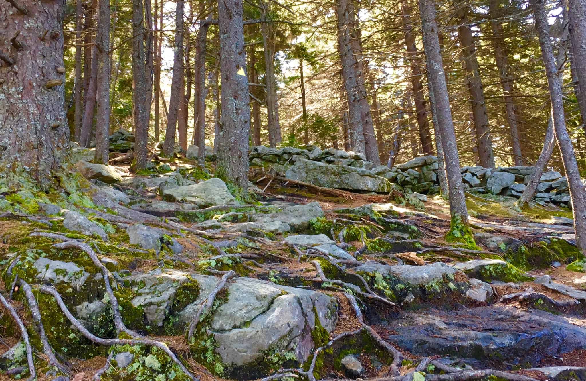
As the elevation increases the alpine aspects of the Trail emerge, with glowing mossy enclosures and tightening thickets of trees, growing right over the stones, in the cooler temperatures.
Here is strong natural evidence for the chronology of the ecological process in this area, dating all the way back to the beginning of time, if you know how to look, ecologically. It is abundantly clear, as you can see in the image above, that the geology, the rocks, were in the initial layer of the landscape, first. The forest clearly came long after. 
It is a challenge to established how many thousands of years the stones here sat without overgrowth on the open face of the Mountain (like they do in most Celtic Ranges). But it is clear that the Forest, in most areas, has grown up directly over the stones, as we see in the image above.
Please pay attention to the following ecological and anthropological points:
As you can see from the clear grey color of the stones on the pathway, there is no moss at all. This is because alpine moss is extremely sensitive to the touch, and will dissipate growth when contacted externally. The grey stones along the path look to have been ashlar-cut, and worked, distinct from the mossy stones that literally surrounding them. Notice how the pathway stones, the cut stones, have zero amounts of trees, or moss, on top of them? How is that possible? It is because from the earliest possible time, before the Forest had even grown over the rocks here, these stones were touched, and cut specifically as an approach to the peak? Yes. This is an intended pathway of Megalithic construct. It has remained as such, in use by the Native Culture that came long after, as sacred trails, continuing into modern use today.
Just think for a moment. Did the Native Americans cut the pathway stones on these mountains?
They didn’t claim to, so no. Did the Park Service use machines or tools, up to 4,805 ft, to literally cut chronologically related, and level boulders, into flattened halves specifically for stepping up the Mountain? And did they cut down all the trees along the way too? Or was the path always like this, from the very beginning? Please believe me when I tell you, readers and friends, that it would cost millions of dollars in this little country Town, to do such a thing. That never happened. This path, and the hundreds of stony mountain ashlar-cut paths in the Western hemisphere, are specifically crafted, by a Megalithic Culture; a Culture that was gifted technologically, and intent on possessing the Mountain, leaving codes of craftsmanship, from the beginning of Time.
I know this is intensely hard for laymen, and local researchrs to consider, with a locally controlled, “post-modern”-emphasized, public education system, that literally is designed to keep your mental framework historically revised, disconnected from any terrestrial evidence, and ignorant of what actual elite scientists, ecologists, antrhopologists in the government, and Universities, are well aware of. The evidence, scientific, chronological, and logical, indicates a highly advanced Megalithic Culture at the beginning of Time. The Native Americans, and Celts in Europe, knew these constructed paths and stoneworks were present long before they arrived. Just like Peruvian Inca Natives at Machu Piccu, the Megalithic works were there when they arrived. Natives had nothing to do with constructing them.
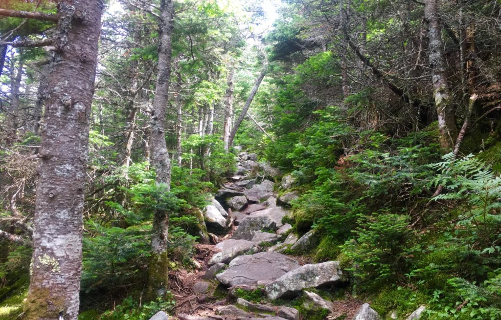
Hiking The Trail: Continuing up theTrail, you should take your time. You will pass two streams running across the path. Pause and take water here, cool off. Jump in! Fill your water bottles. From here, there is no more running water, and you will be on your own. The pathway in the upper 3rd of the Mountain begins to narrow intensely (Image/Above).
Alpine Pine Trees will begin to enclose the stone-steps before you. Here is a chance to pause, speak to the endearingly cool people that are coming and going along this path. While making big climbs, hikers often think and say things that are not common to their lives down below. It may be cathartic for you. Hikers might be needing to get a feeling, or statement out, especially during covid19’s quixotic grip on our society at the moment. Listen to what people are saying. Be kind. These moments could be profound. Singular elevated pathways like this are rare moments in your life. Pay attention.
As you breach the narrow path of the Pines, looking to your left. You begin to realize just how high you’ve climbed. (Image/Below) This is just a preview before completely breaking the tree-line. On a good day, visual potential could be up to 70 miles away, maybe further. Pause and realize, you’re doing a great job. 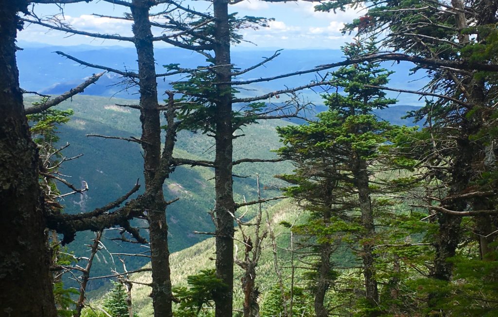
Things start to become pretty special as you continue the quest to break the alpine tree-line. The singular stony path ultimately ends, and you reach a stellar area of level ground with a crossroad of signs. There is the choice to head towards the South Peak, which is 20 minute interlude path to making the actual peak. Make sure you have the energy to take this 20 minute diversion to the view at The South Peak. I did not. I followed the sign pointing to the left, towards Moosilauke Peak.
The pathway here is magical. The relief and surprise of level ground after so much climbing is almost hilarious. It feels easy. This is a high porch, a singular pathway, like a rolled-out soily-soft-carpet, just for you to now come into this upper kingdom in the clouds that you’ve worked so hard to see. You can speedily make your way along the last 1.5 miles of your trek. 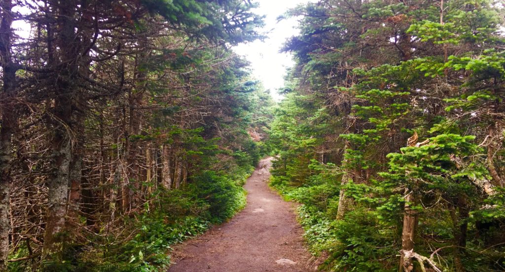
Along this rare level path, you can try to gather your strength. Take your time and enjoy what you’ve earned. It’s the same in life. Don’t go passing by quickly, what took a hard fight to find.
Along this regal and rare path, small stones begin to emerge. The stones are intricate, enchanted, and strange. They seem to be cut in a refined fashion. I have seen this manner of cut before. Take a good look at these stones.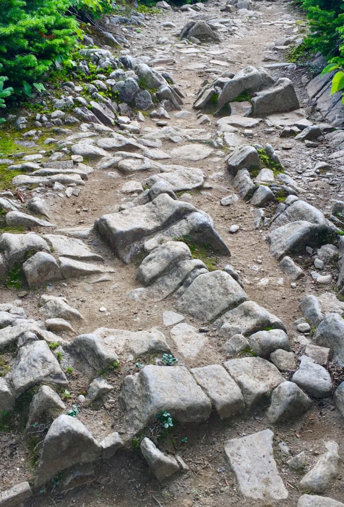 I am willing to bet, that digital analysis of these stone would reveal linearity, symmetry, modeling, and meaning. I am currently working on an ecological analysis system of these rare fixtures. The possibility that this is a miniature map, or modeled version of the overall area, is very real. As we will see, modeling the Mountain Range of the area was an essential practice for the Megalithic builders, in New England, and Europe.
Aside from these theoretic connections, there is a location in Massachusetts that is one of the most sacred groves in the entire world. it is called ‘Bears Den’. At this location there is a hidden waterfall, with a dwelling near by. The entire area seems to have been engineered by a Megalithic builder. There are cut stones, leveled platforms, and the waterfall itself, which is engineered and dedicated, in stone, to (you guessed it) the equilateral triangle.
Images of the rear-side of the waterfall reveal some pretty incredible markings. They will look familiar to you now. Lets have a look at the markings in the rear of that altar. Look at the similarity of these small cut fixtures.
As I mentioned, on the frontal side of this waterfall, there are, etched in permanent stone, undeniable anthropological evidence of the equilateral triangle meme of the Megalithic Culture. 
There it is, again. Perfectly etched in stone. The Equilateral Triangle. Do you think a glacier did that? If you do, then you need to think about how much of your thinking, is someone elses influence.
When are local researchers going to understand that the implications for this clear, and sometimes multi-layered Megalithic evidence, is far beyond the potential of any local nomadically oriented tribes, that have long since vanished? There would be literally millions complicated tools, and an emphasized ‘stone orientation to’ Native-American Culture, beyond anything that we know of them, if infact they constructed these works. They simply could not have done it.
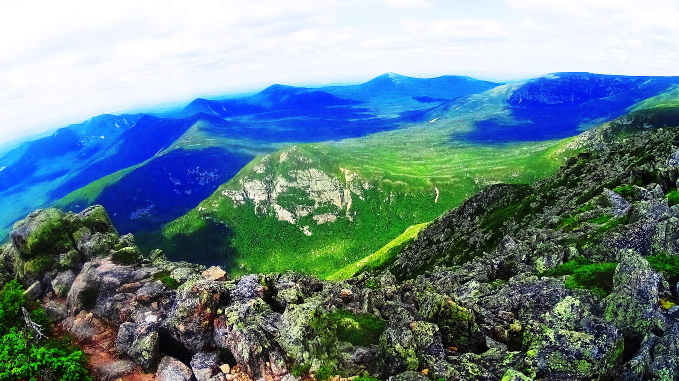
Continuing passed many of these wonderful markings, the path unfolds into a miniature valley, leading up into what looks like a distinctly separate, miniature alpine-mountain. You’ve broken the tree-line. Here before you is what looks like a version the Sacred Mount of Arunachula in Southern India. The majesty of this 4,500 foot piece of elevated earth, is stellar, supreme, and absolutely sacred. 
This zone is protected by the State for its ecological rarity, but in truth, I believe that at the elite level, there are individuals who know that this area is a sacred anthropological zone. The stones here are doubly significant in meaning, compared to the moss.
The approach to the peak is pristine. In every direction, mountains and clouds.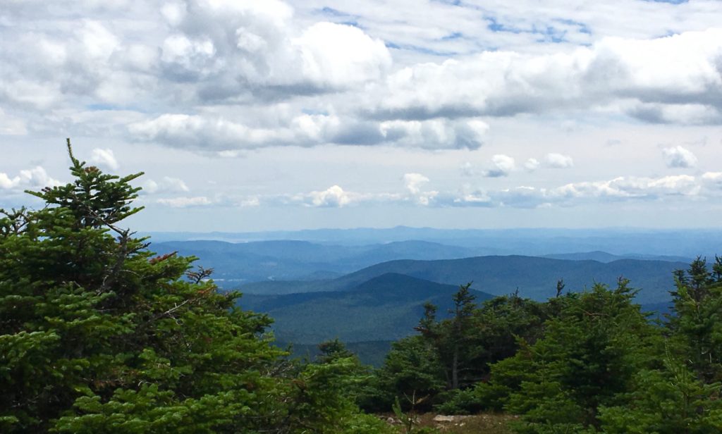
The trees fade out, while stone Cairns line the path. I believe these Cairns are Megalithic statements, perhaps refined by hikers in the last Century, but more likely crafted in antiquity. These Cairns are found even at minor peaks in the hill country. 
Certain stones along the final approaches at sacred mountains are cut with directionality, pointing directly to the peak. Here is a centrally placed directional stone, directly along the path, just before the peak. Perhaps it will help if readers can see some examples of this Megalithic meme on other locations.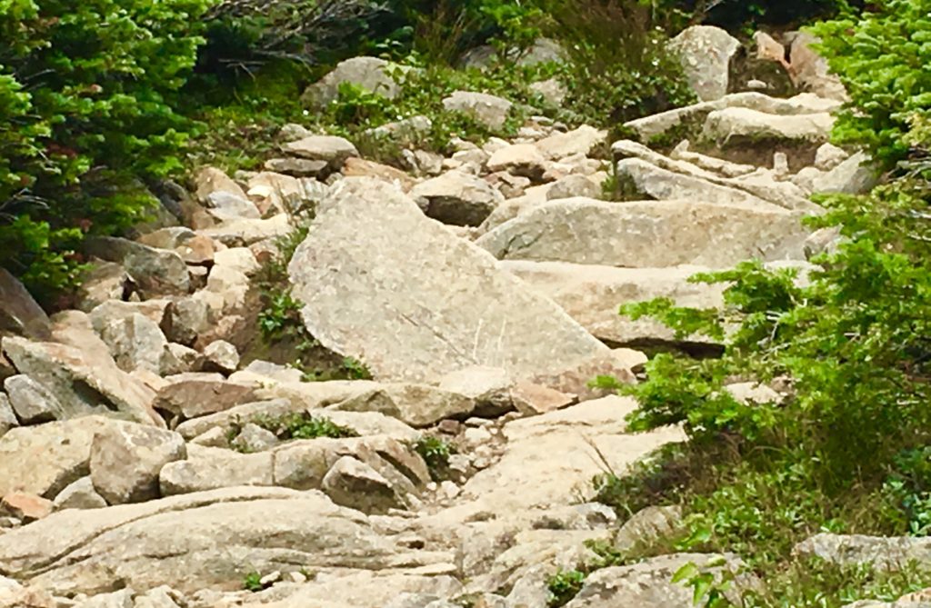 Directional stones have specific parallel sides, leading up to a right-angle-apex of exactly45 degrees.
Sample 1: The image above, as you know, is located near the peak at Mount Moosilauke, New Hampshire.  Sample 2: Directional stone located near The Altar at Heath Mass.
 Sample 3: Located near the peak at Watatic Mountain, Massachusetts.
 Sample 4: Located near the peak at Monument Mountain in the Berkshire Range.
Finally arriving at the peak, people are resting and taking in the scene. A large square stone sitting at the very peak is marked with a perfect equilateral cross-section, supported by a triangle in the lower corner. (Image/Below) These particular meme can also be found at dozens of peaks throughout New England, the American West, and Europe. Here are just a few examples below the one here at Mount Moosilauke. 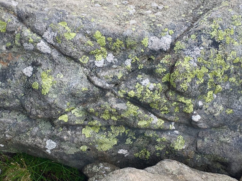
After this stone, the entire White Mountain Range comes into view. In the image below, Mount Washington can be seen in the distance, the highest point in the center. Mount Chocorua can also be seen to the right, below. Stunning. 
The view to the south, as seen below, is a rolling and rotund descent, with Massachusetts off in the descending peripheral distance.
Another interesting fixture here at the peak is a very special arrangement of stones, with a leveled rock layer at the base of these specially stacked rocks, seemingly made specifically to imitate the cut of the mountain-tops, in the secondary background, of the peaks in the greater distance. Although dozens of people sat here at the peak, not one of them noticed this incredible fixture. Notice in the image below, the leveled work in the bottom portion of the rock, with what looks like distance markings of measure along it’s side. What is this doing at the top pf 4,805 foot mountain? This is no accident. These massive stones are placed to mimic the peaks in the secondary distance. 
Let’s show another location that displays this type of fixture in Europe. At the peak at Mount Bearnagh, in The Mourn Range of Ireland, the peak contains a set of megalithic fixtures that absolutely imitate the peak of the mountains beyond. The stones are clearly cut, and fixed, into positions to imitate the angles of the ledges beyond. Again, this is clearly no accident, it’s incredible engineering, in stone. 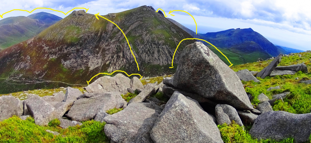 Here is a megalith also located at Mount Bearnagh in Ireland, absolutely crafted to imitate the curvature of the lower valley. At the peak, just one mile from this spot, the boulders are arranged to mimic the mountains of the Range beyond. There is no way that this is random! It’ s intentional, and cultural. How could we not see this!?
 Other examples of stones-marking of peaks, at other mountains, can be found at Mount Katahdin, near the Knifes Edge approach. Look at this exquisite marker, roughly 5 feet tall, pointing directly to the peak in the distance.
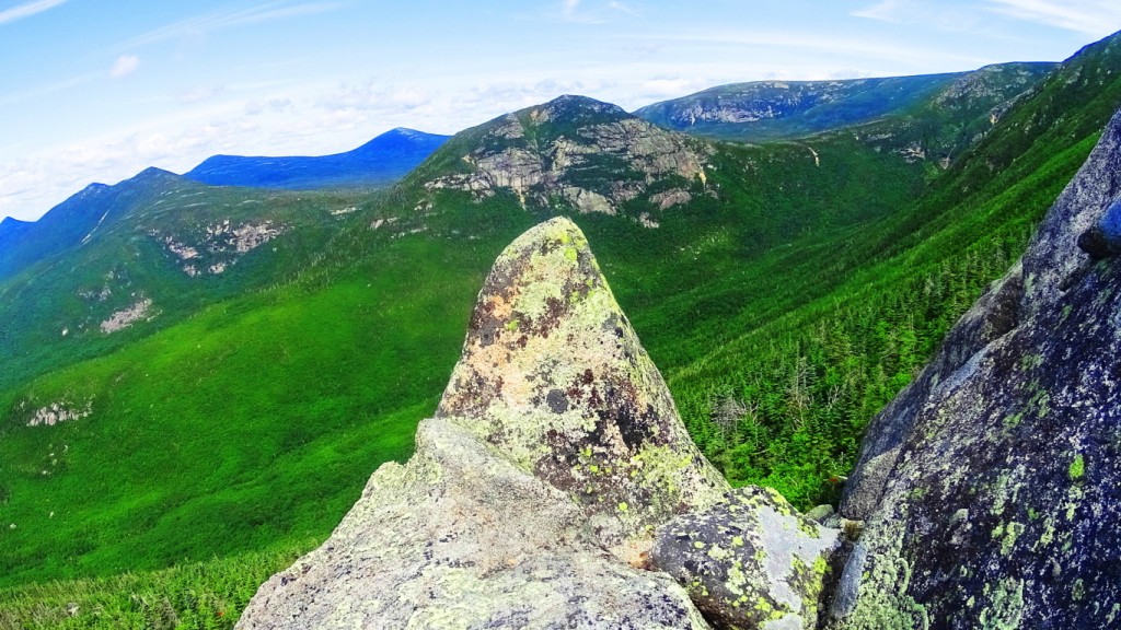
Here is a specifically crafted and placed-megalithic boulder, on the edge of the Sierra Nevada Mountains, in a lake, and shaped to look exactly like the mountains behind. Notice the 3 distinct indents in the boulder as well…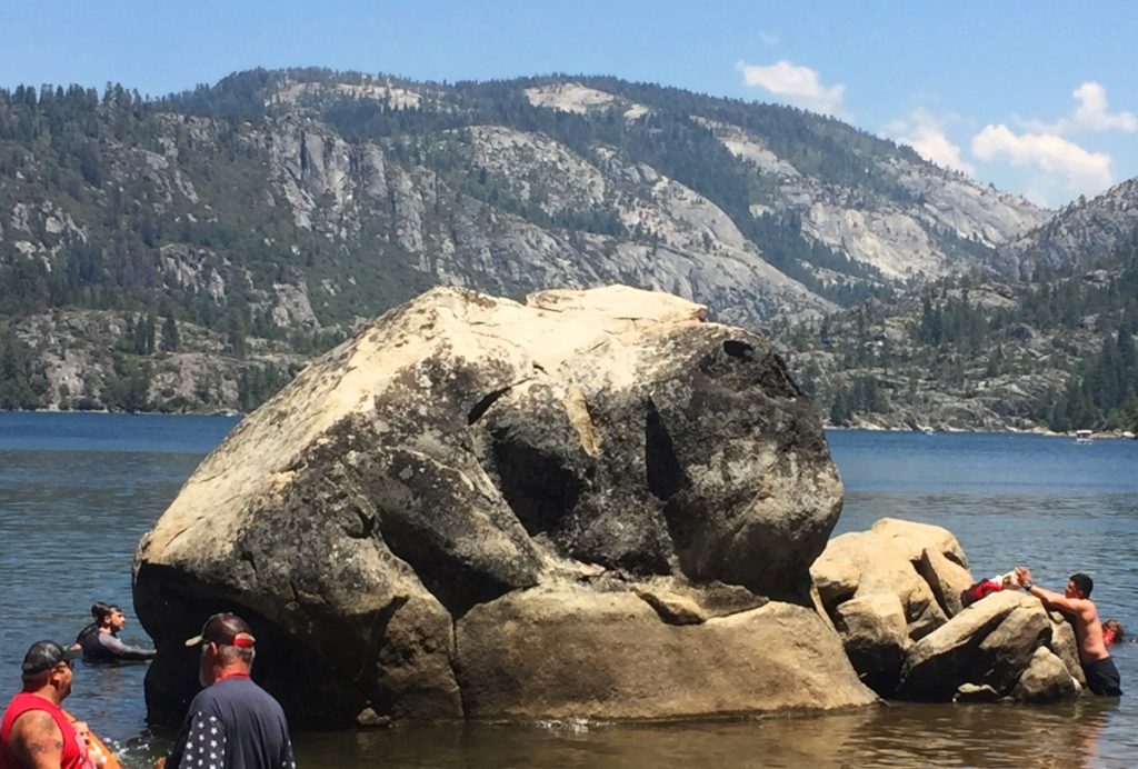
And here is a megalithic boulder at small peak at Upton Massachusetts. It is imitating the small mountain beyond, pointed perfectly to its center. Notice again, 3 distinct indents on the boulder. 
Not two miles from this very beautiful spot in Upton, is one of the finest megalithic chambers in all of New England. To think that these megalithic works are not related would be a serious mistake. They are absolutely related. The Culture that created these works was obviously capable of megalithic design, and large scale. 
The accumulating Megalithic evidence here at Mount Moosilauke, with multiple supported examples from other locations, of memes and fixtures of the exact same stylization, should begin to give serious academic pause for those who have not had the capability to see this evidence, but are now clearly seeing it collected here. Site after site, peak after peak, from Glenn Coe Scotland, to the Sierra Nevada, (and everything in between) are consistent similarities of a single Megalithic Culture, not variations of statements from hundreds of Native Tribes, both Celtic, and American. The evidence point to a Culture that had a singular source of related concepts.
The final Megalithic constructs statements here at the peak of Mount Moosilauke, are perhaps the most important. We find nothing less than an entire complex of leveled stones, stacked into defined sections, spanning perhaps 70 by 30 yards. In its current state it is dilapidated, but a closer look reveals definite distinction, and intended design.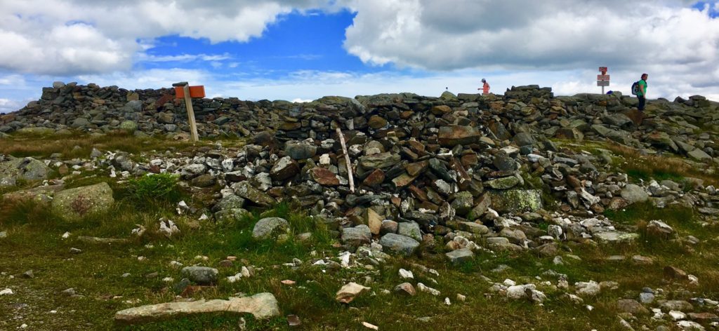
There a several divided square sections of cut, stacked, and leveled stones, which appear to define a particular function within. The section in the image below is absolutely level with the dramatic skyline to the north. There are clearly long and level cut stones worked into this construct, as can be seen, and were most likely crafted specifically for this purpose. 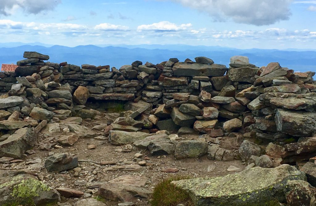
A frontal view of this square space reveals a significant 7 foot high lining of stone, which has clearly been tampered with over time, without any real protections. This particular view shows the significant amount of substance that this Megalithic Chamber once contained. 
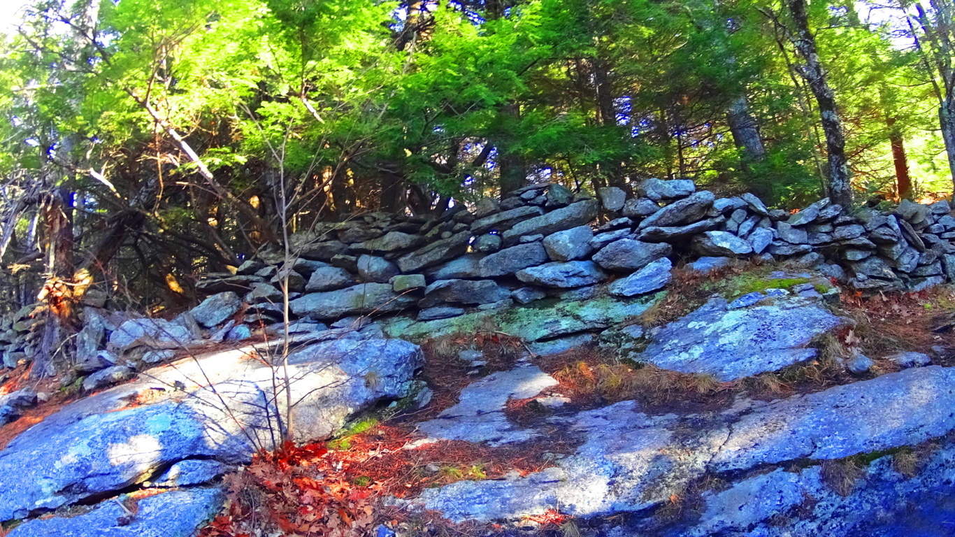
In stark contrast to the square spaces, there is a rounded space, separate from the main constructs, that may have had an alternate purpose, with its alternate shape.  This rounded setting immediately reminded me of another set of rounded Megalithic stones, found in a highly megalithic area, and at a significant elevationm in the Mourn Mountains of Ireland. (Image/Below)
 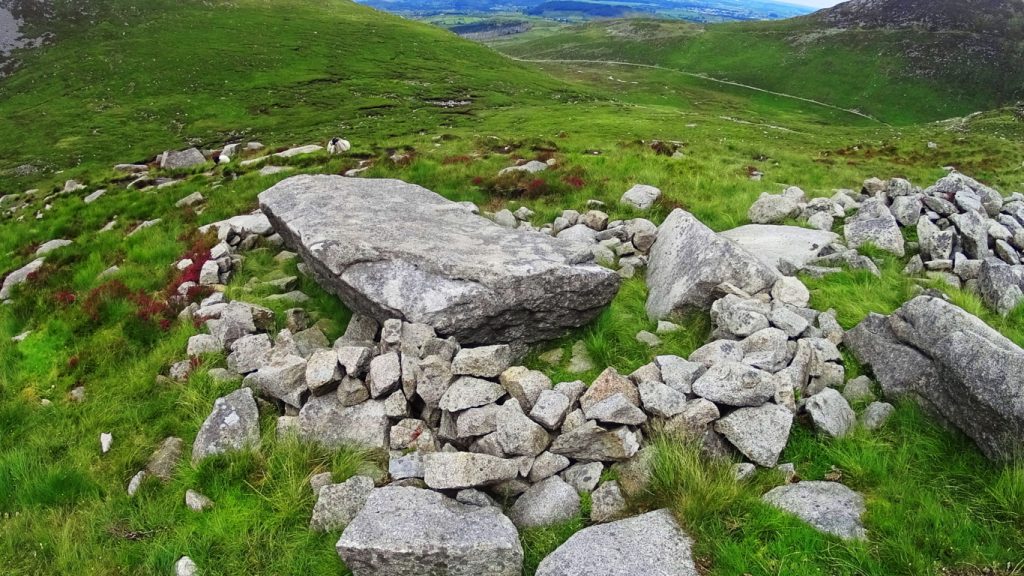 These areas should absolutely be considered National Heritage Sites and archaeological zones, fully acknowledged as a Megalithic Cultural spaces. And yet most passersby simply believe them to be random piles of rocks. How this is being allowed to remain the case is beyond me. There is meaning and intent attached to every one of these works, yet to be understood by so many.
For day hikers, the journey is only halfway done at the peak.
After resting, you need to steadily make your way back down the Mountain. When you make it to the first bubbling stream of water, about 1/3rd the way down, to refill your bottles with your strainer, you will be safe for the rest of the journey. During a trek along a decline, be careful to set your feet squarely, to choose your steps, in order not to turn your ankle. As you make your way, the path will widen, and inevitably drift with the gravity back to the Valley below. I hope hiking sojourners decide to try this climb for themselves, and experience what has been described here. Don’t let anything stop you from continuing to seek out sacred landscapes; Not others, not yourself, and not Covid19, in all its bizarre quixotic strangeness. So many people are waking-up, and truly realizing, that time in the Sun, and in the sacred landscape, is the answer. Thanks for reading. 
North-Pack Monadnock Mountain
Elevation: 2,300ft
Location: Greenfield New Hampshire/USA
Note1: It is hard to write lately. Spring is here, but its pretty hard to feel.
This is usually the time of year that I’m pretty psyched, where I’m making plans, studying maps, getting strong. The lull and strangeness of life under quarantine, and social distancing, has thrown everybody off. Most importantly, there are people who are sick, and some who have passed away, and it is sharply disheartening. I think to myself: “How can I write of my love of newly explored mountain ranges, without seeming somewhat tone-deaf…”
And then I realize…
This is absolutely the most important time to write of my deep love for mountain ranges, and all the mysteries therein. I want to charge-up people to get out there. So I keep writing. Plus, I have something new to share, something special, rugged, and beatific. New Hampshire, USA.
New Hampshire is truly special, for more reasons than I had previously known. The stones here, are incredible. The forests, intimidatingly dense, even by Colorado Rockies, or Sierra Nevada standards. 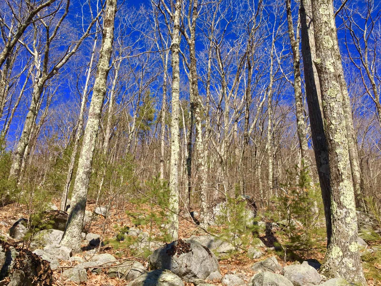
Now, more than ever, people need to experience rolling hills, and rocky heights!
Note2: Aware of the seriousness of the conflicts looming in the valleys of the world down below, I’ve wandered into the hills of New Hampshire merely to cope with what my heart is telling me. And right on time, I’ve discovered the Hillsborough-Small-Mountain Range, here in southern New Hampshire. This is a place of magical beauty, strong signs of profound Neolithic history, and scenes with so much old stone, and alpine moss, that at times I feel I am back in the forests of Blacklion, Ireland, drifting along the glowing, moss-engrossed forest glades. (Image/Below)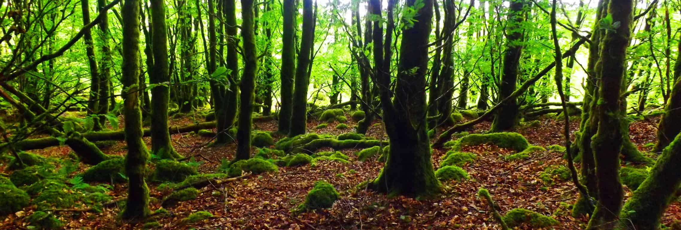
A symmetry-conscious look at this very image below, ‘flips a switch’ in my thinking; the same switch that has sent me packing out to the Highlands of Scotland, the Sierra Nevada’s of California, and Irelands incredible Ranges; searching for the incredible angular-codes in the stones. There are parallels, directional indicators, centricity, apex’s, alignments, magnetic orientations, massive irrigated engineering zones, interlocking-fixtures, and statements that are cut literally into the faces of full Standing Stones, in specific locations across the world.(Mt.Watatic/Massachusetts Standing Stone/Images/Right).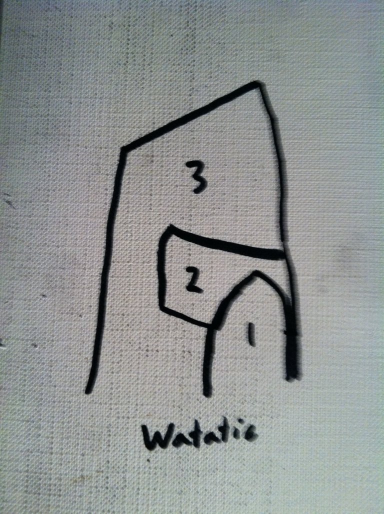
New Hampshire is absolutely part of this epic story, and it is on full display, from mountain to forest to stream. (Megalith found along the stone-lining at Wapack’/Image/Below). It is a cut megalith on its surface, on an exact a parallel plane, in direct accordance with the nearest, flatly-cut surface, of the foreground boulder)
Note3/Trail: The Trail to climb North-Pack-Monadnock-Mountain is found by drifting into the Wapack National Wildlife Refuge pathway, in Greenfield New Hampshire. You can find the trail on the edge of the Forest, cascading down onto ‘Mountain Road’. There is so much stone in this region, from the lower valleys, to the stone-linings running all the way up to the peaks, that I was utterly stunned. The forest here is an abyss of verdant tops, layers of green-upon-green, where from above, nothing might be seen of the stones, and their presence, but from beneath, a Neolithic world is abundant. (Image/ New Hampshire Forest/Below)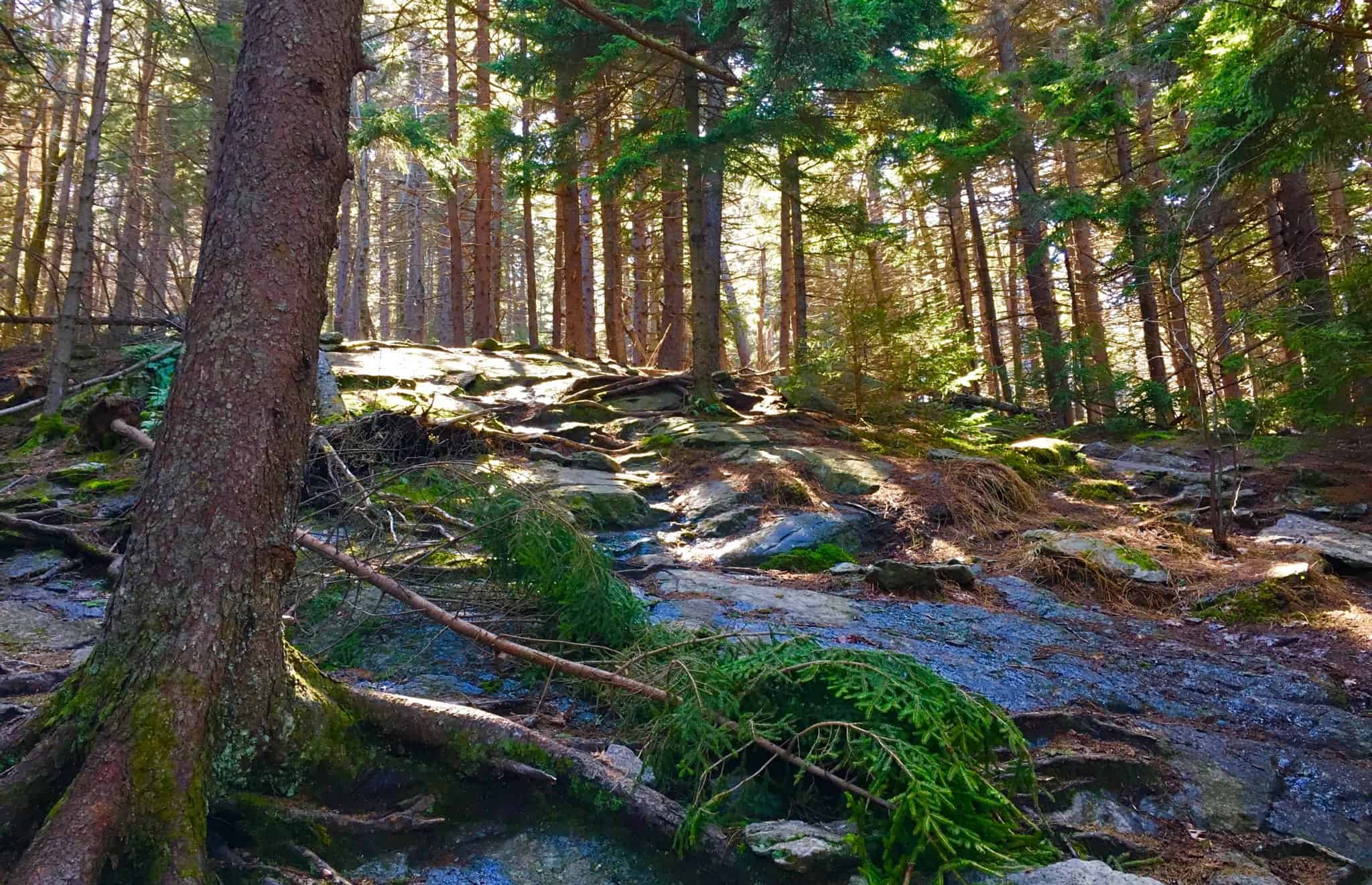 Beneath the rolling massive canvas of leaves, each and every peak in New Hampshire (Image/Below/Right) is inundated with anthropologically-geological statements, cut stones, aligned with the rocky trails, very similar to the Mourn Mountains of Ireland, (Image/Below/Left).
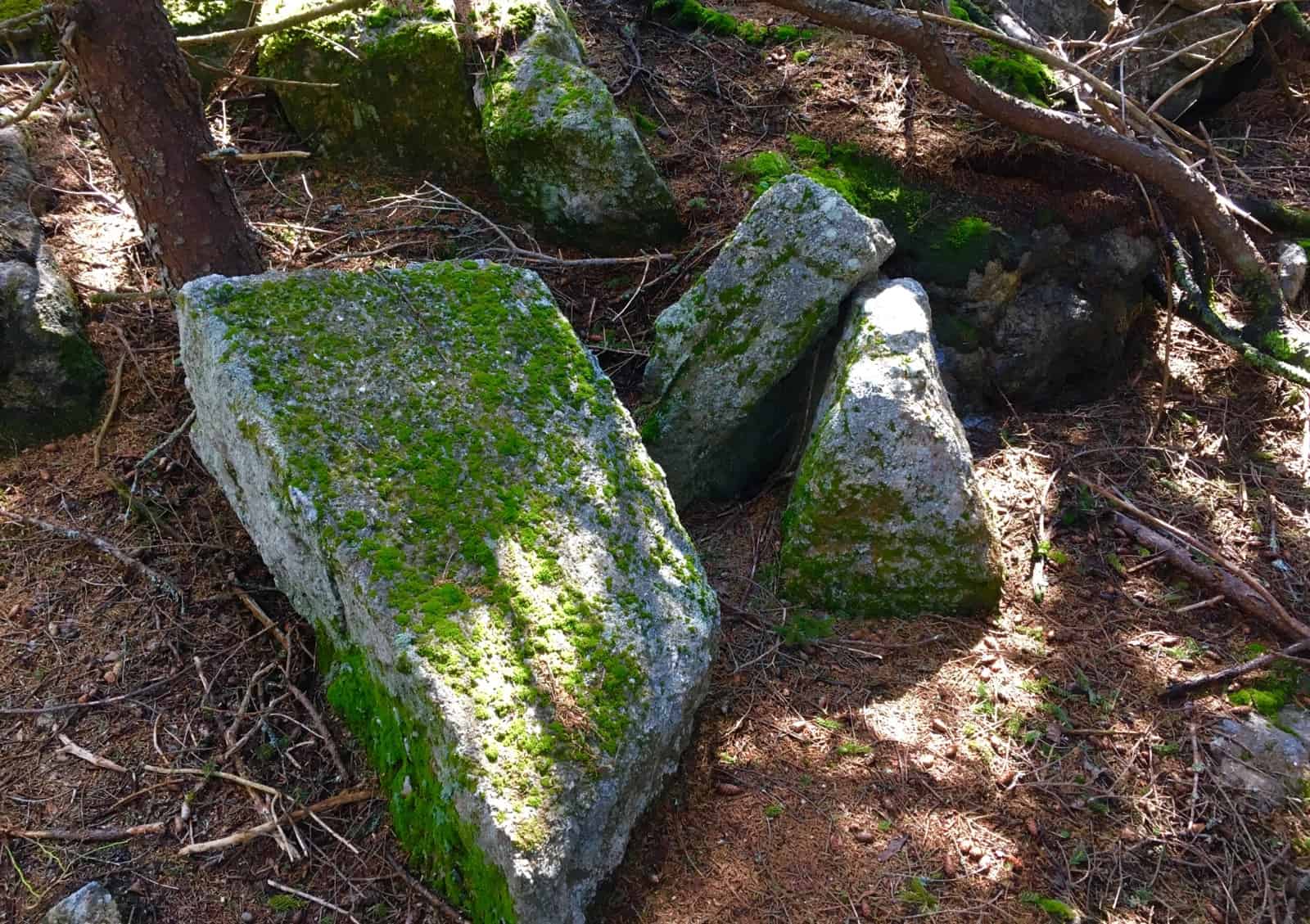
 -Lets take a moment to define what “anthropologically-geological” means, and specifically why we do not attribute these stone-works to Native American, or Celtic Tribes.
I realize it’s a mouthful; the term: “anthropological geology”. But all that means, is that these stones were intentionally crafted by someone at the earliest point in history; someone capable of incredible strength, judging from the statement they left behind, but also capable of incredible engineering and intellect, represented in stone.
 CULTURAL NOTE:
Identifying Fixtures And Cultures: There is a scientific process for identifying anthropological-geological fixtures in the landscape. We are most likely identifying the first culture on Earth, as hard as that is to swallow. This can be a raw challenge for so many people to accept, but accrued evidence points to this conclusion. To give you some historic context, These global stone statements are pre-Mycenaean, pre-Egytian, pre-Native American, and pre-Celtic. If you are lucky enough to encounter South American Native-wisdom-keepers, in Peru; the Mashco-Piro or Nanti Tribes clearly express that the earliest megalithic stones, at the base of various structures at Macchu Picchu, Indigenous tribes will tell you, in no-certain terms, that the ancestors did not build them. The megaliths were already there when the earliest natives arrived. Other cultures, likeThe Mayans of Mexico, attribute the earliest megaliths, to the gods.
It is also the same for North-Eastern Native-American tribes. Not only are the massive amount of tools required to construct ashlar-cut megaliths, nowhere to be found, but there is absolutely no record, even within the oral tradtion of these seasonally nomadic tribes, of any massive megalithic building-teams. The effort would have to be significant enough to circle the Earth 6 to 7 times! REALLY!? Would’t this effort be the absolute hallmark of the Native Americans in the Northeast? Sorry, but it simply doesn’t exist. Someone else built the stones, before the natives.
To support this premise historically and logically, not one of the Northeastern Native Tribes is called: “The Stone Builders” or “Mountain Lining Buillders”. Not one!?
Instead, northeastern Native American tribes called the original stony trails “the pathways of the gods”. It’s not hard to see why. The Natives understood, and honored, the obvious solar and lunar acclamations of these massive stone-linings, which literally run straight-up the sides of mountains, kinetically-connecting rolling valleys and streams, directly up to the sun-kissed peaks. Countless mountains display this. Just a few blatant examples include: Mt.Monadnock, in Massachusetts where there are Massive Stone Linings to the Peak (Image/Left), +Mt. Bearnagh, Ireland (Image/Right), Mt. Watatic in Massachusetts (Image/2nd Below/Left), Mt Katahdin in Maine (Image/2nd Below/Right) as well as thousands of other examples in the world.
Look at the angle of these stone-lingings, running straight up to the peaks, like connecting cables. It’s so obvious that they are intended to connect and synergize the landscape, like power chords. They are not, and have never been, “walls.” 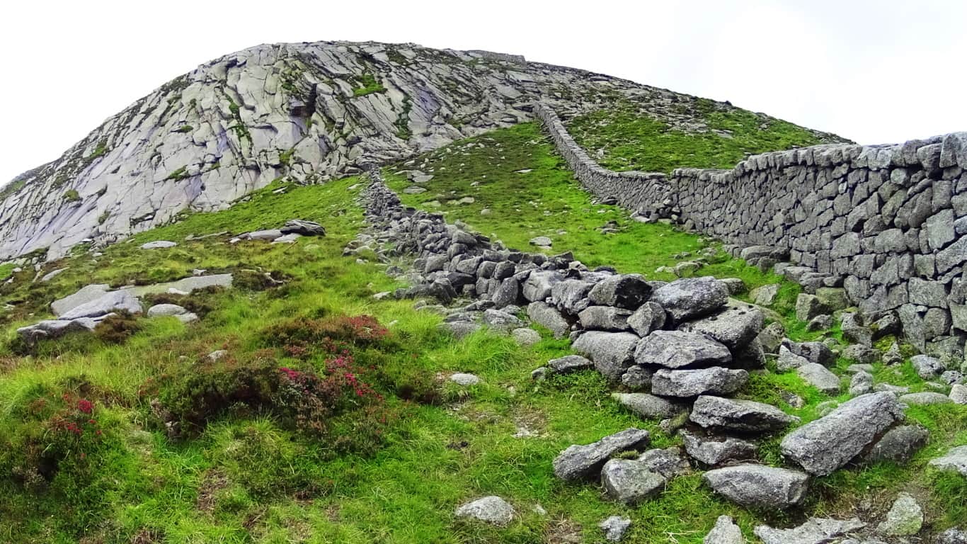
These are statements so massive, even with all our modern equipment and digital ability today, we would not be able to do it. To build this amount of intentionally et stones would take Billions, perhaps Trillions of dollars. Imagine the effort?! Are we actually saying that seasonally nomadic North-Eastern Native American tribes, with simple stone pics, spent literally all of their leisure time, when Spring finally came, after long, challenging, and sometimes brutal winters, working against gravity and logic, building “walls”, which literally impede nothing, and exhaust the warriors of the tribe with this work? No. It’s is a fantasy. It simply did not happen. And theorists espousing mis-information that Native Americans did do this, are dead wrong. 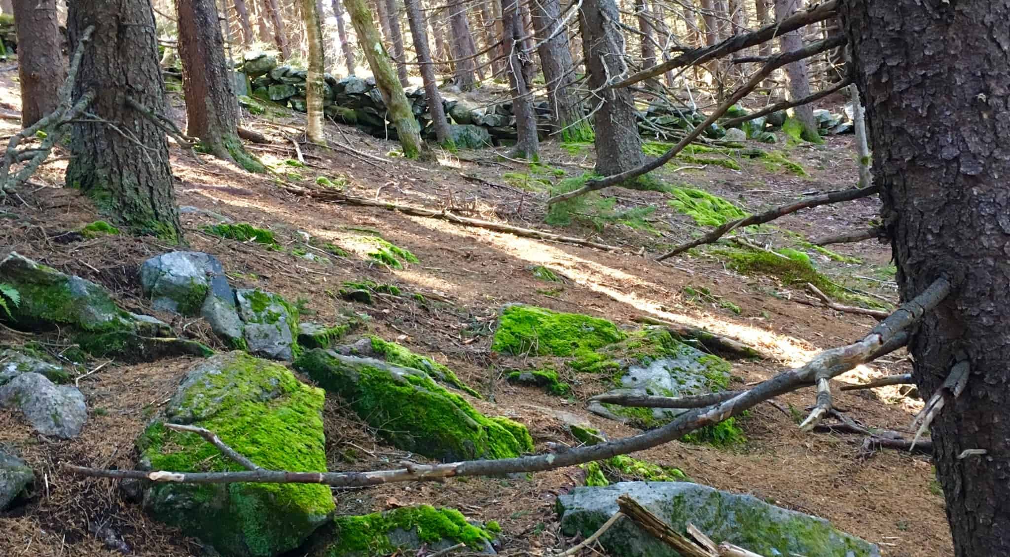
Peer-reviewed study after peer-reviewed study, identifies the seasonal and nomadic nature of Native American tribes in the Northeast. Building massive stone monuments would have been absolutely repugnant to them, and positively the best way for any harshly mandating chief, to get himself beheaded, or banished at best. Ordering the making of “stone walls” which impedes nothing, “walls” nothing, constructing straight up the sides of as many mountains as possible, is absurd in light of North East Native American Culture. It never happened. 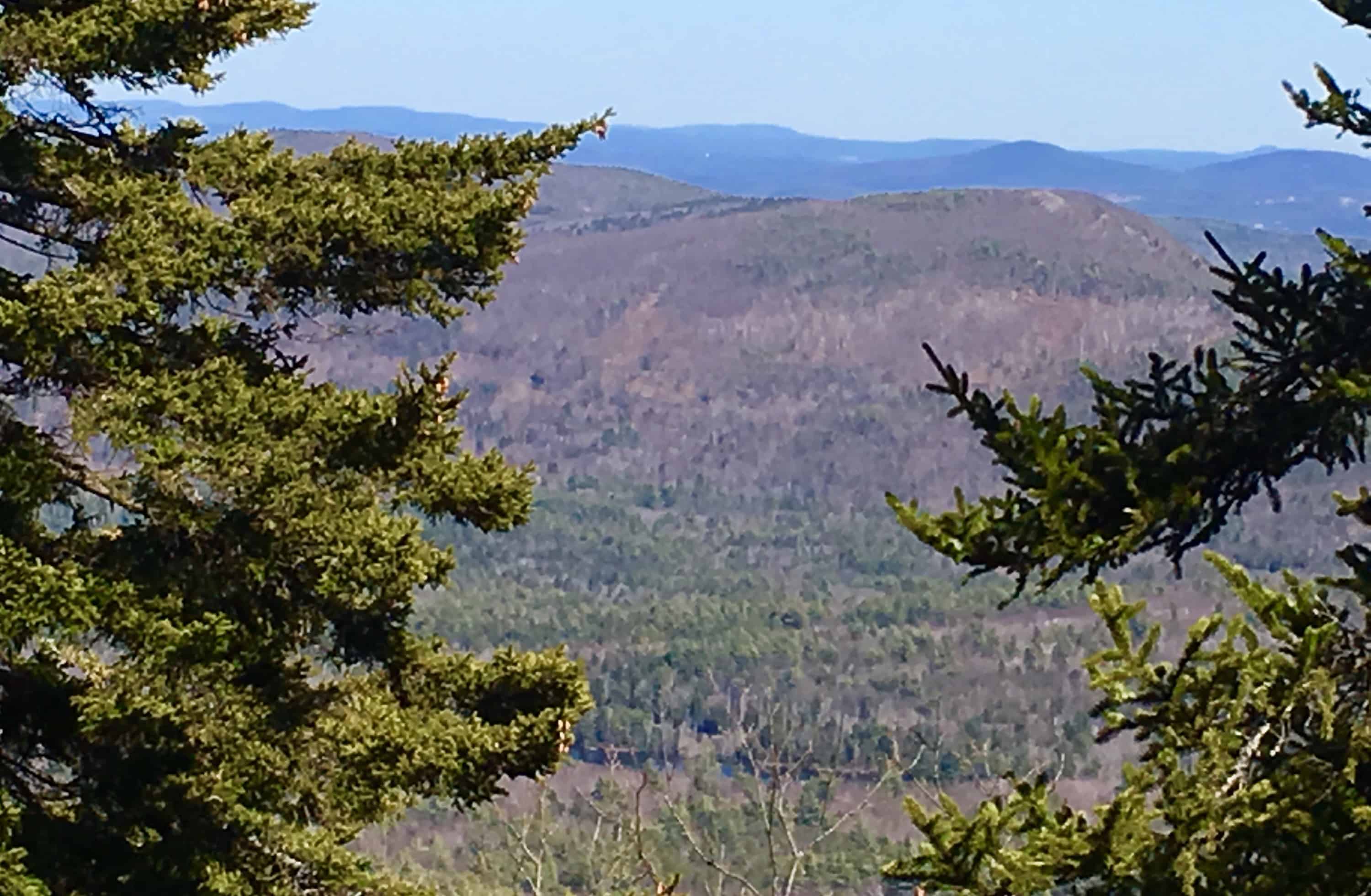
Native American Tribes were, and are, distinctly autonomous, proud, and often at odds with other tribes. If they were out in the forest, completely aloof, voluntarily slaving away, building these stone-“walls”, how could they plant crops, hunt, or be ready to defend themselves from invasive groups in the planting season? Please understand; this does not in any way disrespect the incredibly spiritual beauty, and accomplishments, of the Native American people.
Part of the reason we see them as beautiful, is due to their incredibly minimal, ecologically responsible, imprint upon the landscape. Their attitude was to be part of the landscape, and changing with the seasons; not to build stone-centers, which they would constantly need to defend, in all that permanence. Again, this simply did not happen.
Note4 Trail: Along the initial lower trail at Wapack’, a minor incline weaves into a pristine pathway that leads to a playful set of cascading streams, rolling down the hillsides. (Image/Below) 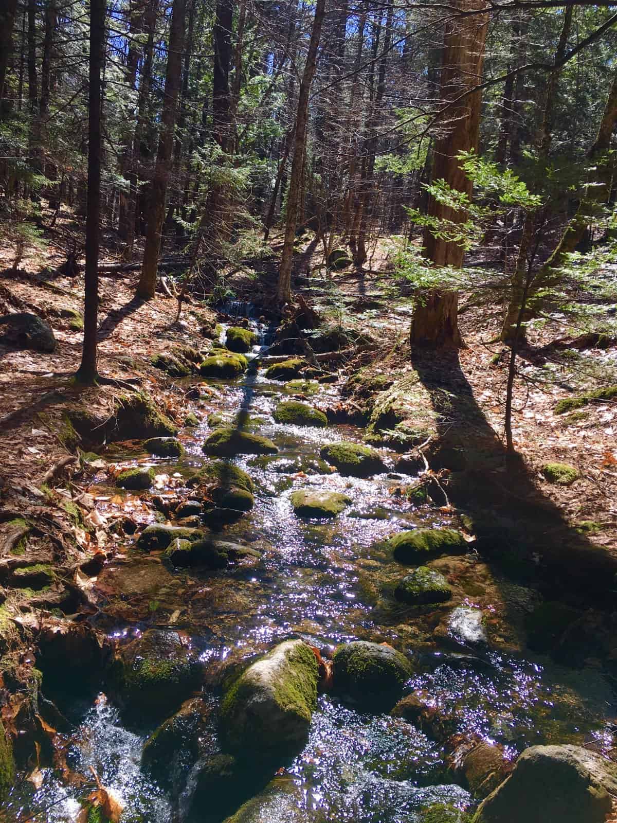
There are some really interesting patterns to the note about the pathway itself, as you begin your trek towards the peak. First, it becomes abundantly clear that the higher up in elevation you climb, the more stones you will find embedded into the trail. Secondly, those stones do not look randomly embedded at all. If you observe many of the stones at your feet, it is clear that they have been cut, like scraps from a carpenters table, and dropped into the ground. Thirdly, the trail itself, where the stones are laid, is wound into a specific ‘S’ shape. Why is the distinct area where the stones are found wound into a distinct ‘S’? Why not a straight line to the peak? If the trail was designed by the State, why not the fastest route to the peak. The trail was there before the state ever existed.
 Also, there are massive flat, distinctly oblong, rounded boulder, sitting centrally along the initial trail, radiating the effigy of a snake, winding its way through the woods.(Image/Right+Below) ‘Snake effigy’s’as studied by the excellent research of Matt Adams at New England’s Stones Sites , are currently being researched to be discovered, as an abundant Neolithic meme, found in the patterns of the stones.
Note4: It is impossible to lose the trail, due to the stones. It’s that clear. After passing the streams, you will come to a small ledge. You will need to climb for a moment. (Image/Below)
After working your way above the ledge, you have reached the upper shelf of the mountain. There is another half mile of steady, low-incline hiking, before reaching the real pearl of the experience, a plateau of semi-alpine Pine Forest. 
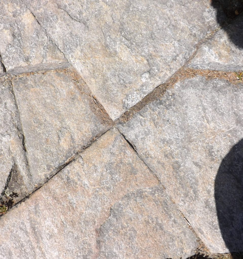
The natural late-afternoon light is tossed through the trees, like slanted pillars, made of light. The stones here tell some sort of story, like peices of a jigsaw puzzle, layed-out sporadically. (4 Images/Below) 

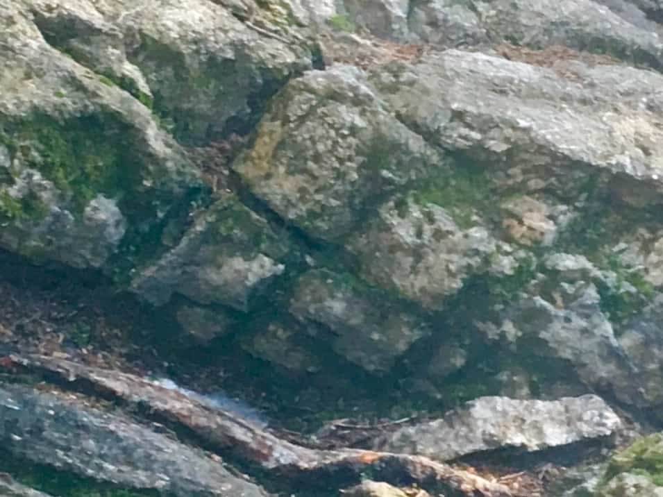
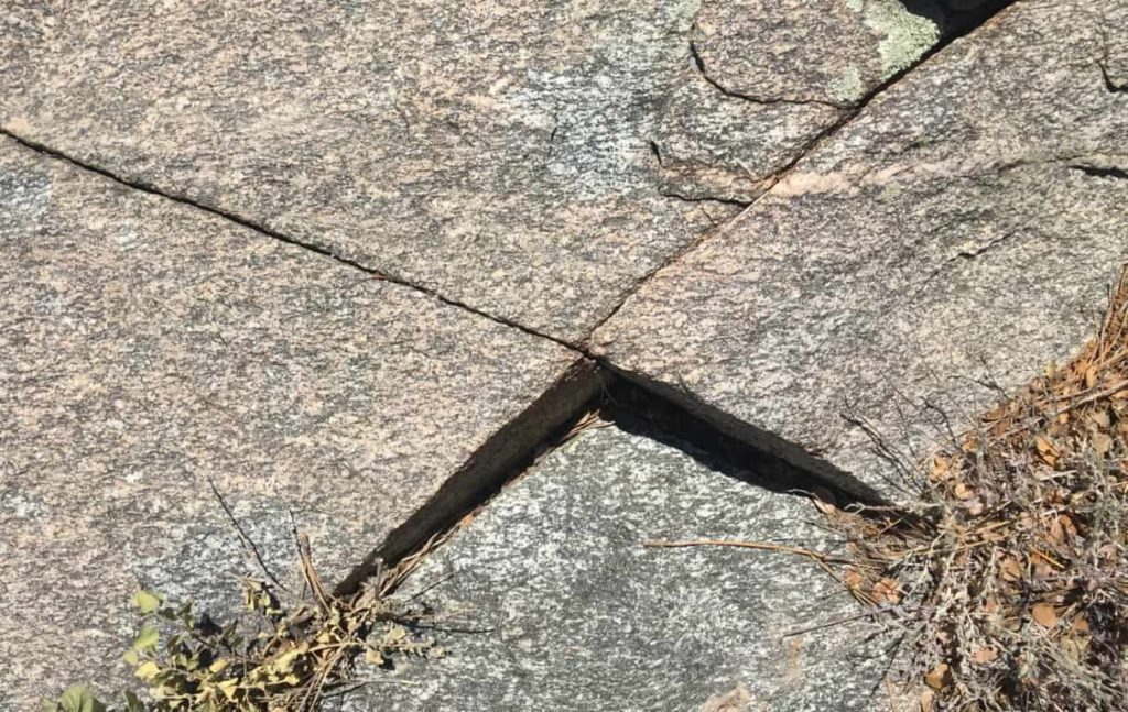
 There are cut-squared slabs, laid side by side, as if to hint at a relationship between the two. There is a full cross-section at the center of the trail, displayed at the rocky edge of the forest above. There are smaller fixtures, fixed perfectly against each other, and cut into apex’s which are also parallel. This is craftsmanship, not mere chance. In addition, the apex’s, or top corners, point directionally to the summit, along the line of the continued trail. That is directionality, and symmetry, as a function of the work of the stones. Another interesting statement of a clearly cut ‘apex-stone’ is found sitting along the trail of the upper forest’s edge (Image/Left) At the moment I found this stone, in mid early April, the Sun was at its highest point in the sky around 1:45. The apex was pointing straight at it. The connection of light to this very spot where I took the photo, created an issue for my camera; but clearly you can see the Sun’s rays, directly above this 4 foot stone, with a 45 degree angle, running parallel, up to an apex section. Perhaps I would not have noticed this if I were a common sojourner, but I have seen this phenomenon many times before, particularly at ancient sites in Western Massachusetts. The comparison to that site is lock-fit. Please compare the two. (Apex-stone at Health Altar Stones/Image/Below)
  Other statements, such as directly cut cross-sections, are also found along the upper trail at Wapack’. The first two cross-sections below, the first located on Wapack trail, colored grey; and the second section, colored white, (pictured in a row on the left side below) are both from this Hillsborough Region of New Hampshire. The other sections are from Arizona, Killarney/ Ireland, and western Massachusetts.
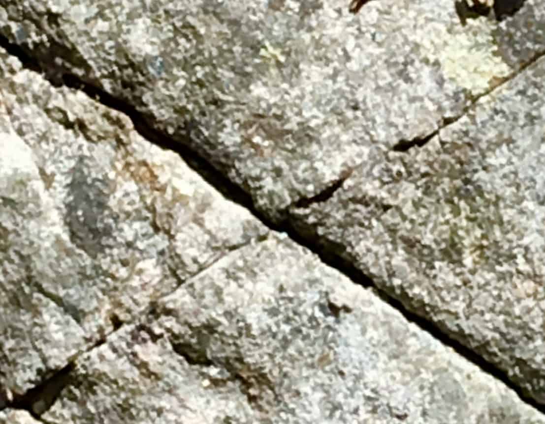
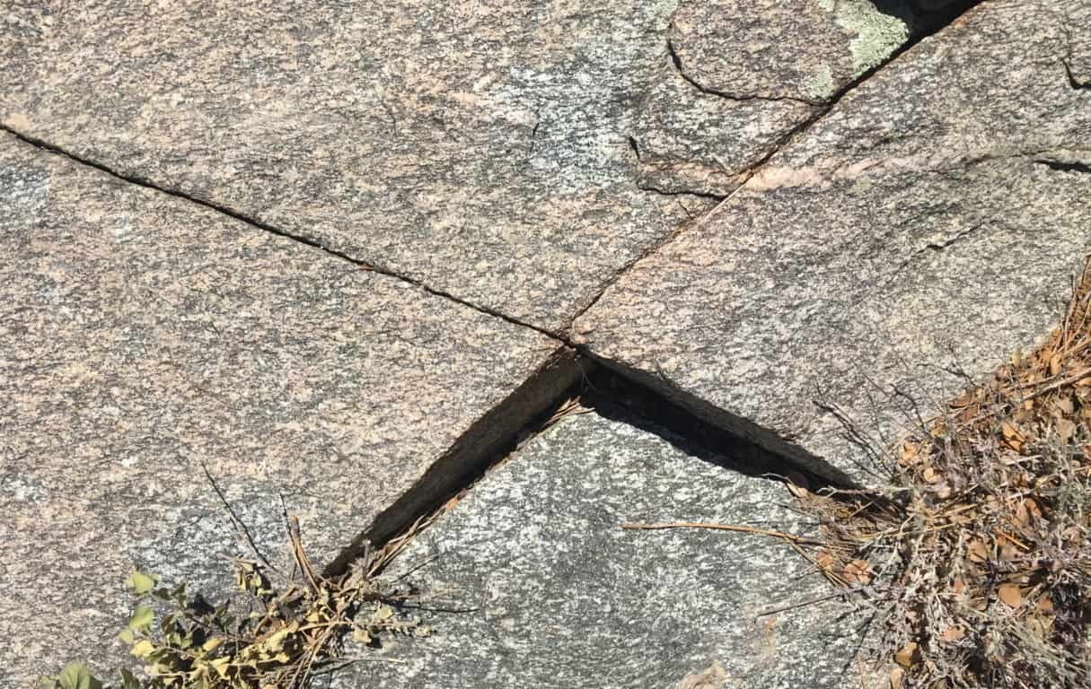
As consistent and mounting evidence continues to build for these X sections, it is becoming hard to dismiss as mere “geological phenomena“. The fact that all of these X sections are found specifically along mountain peak trails is a strong indicator for the idea of engineered landscapes, with distinct memes that identify a single Culture. The meaning of the cross-section is a philosophically mathematical principle, that can be written out, a little dynamic process.
Attributes of the Cross-Section: A cross-section is a centricator.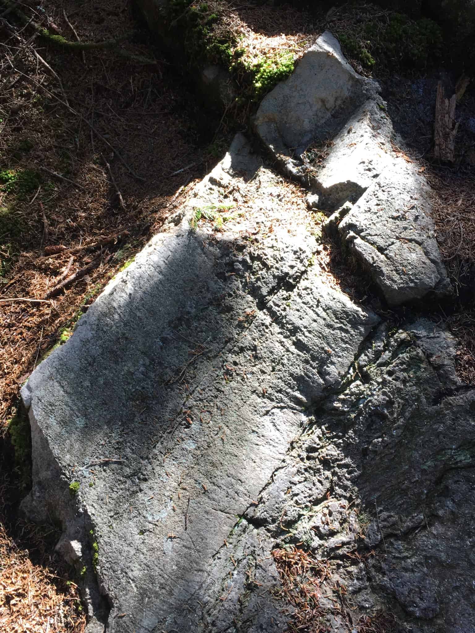 That means it creates a center, symmetry, and distinction, all at once. (Centricated Stone found in Wapack’ Forest/Image/Left)
The logic is: In order to make any starting mark, the mechanism that person’s mind must use, like a primordial computer program, is the function of centrication. You “find your center’, then make your mark”, so to speak. It is the precursor to all marked expression, just as the Culture that utilized it, and made this symbol their ‘calling card’, is the precursor to all Cultures; the First Culture. I believe that this is the exact reason why we find this particular meme, cut in stone, sometimes in nearly perfect precision, as you can see from the images.
Notes5: The upper forest is the last challenge before making the peak. There is a breeze that comes from the West, through the trees, that can be felt in early April, scented with Pine. Watching a multitude of pines bend in unison to the wind creates a sound impossible to imitate. The green universe literally activates a part of your brain associated with calm, just as blue is associated with cold, or cool.  The last path before the peak is a beautiful and distinct little rocky road, with the Sun within view. there are several stone patches with distinctions that again, have that jigsaw feeling. Some with distinctly cut right angles, (like a literal ‘Right-Angle tool’ of a mason), as well as standing-square blocks, with four clear-cut sides, with giant level-cut boulders in the background, along with the earlier mentioned, apex stone.
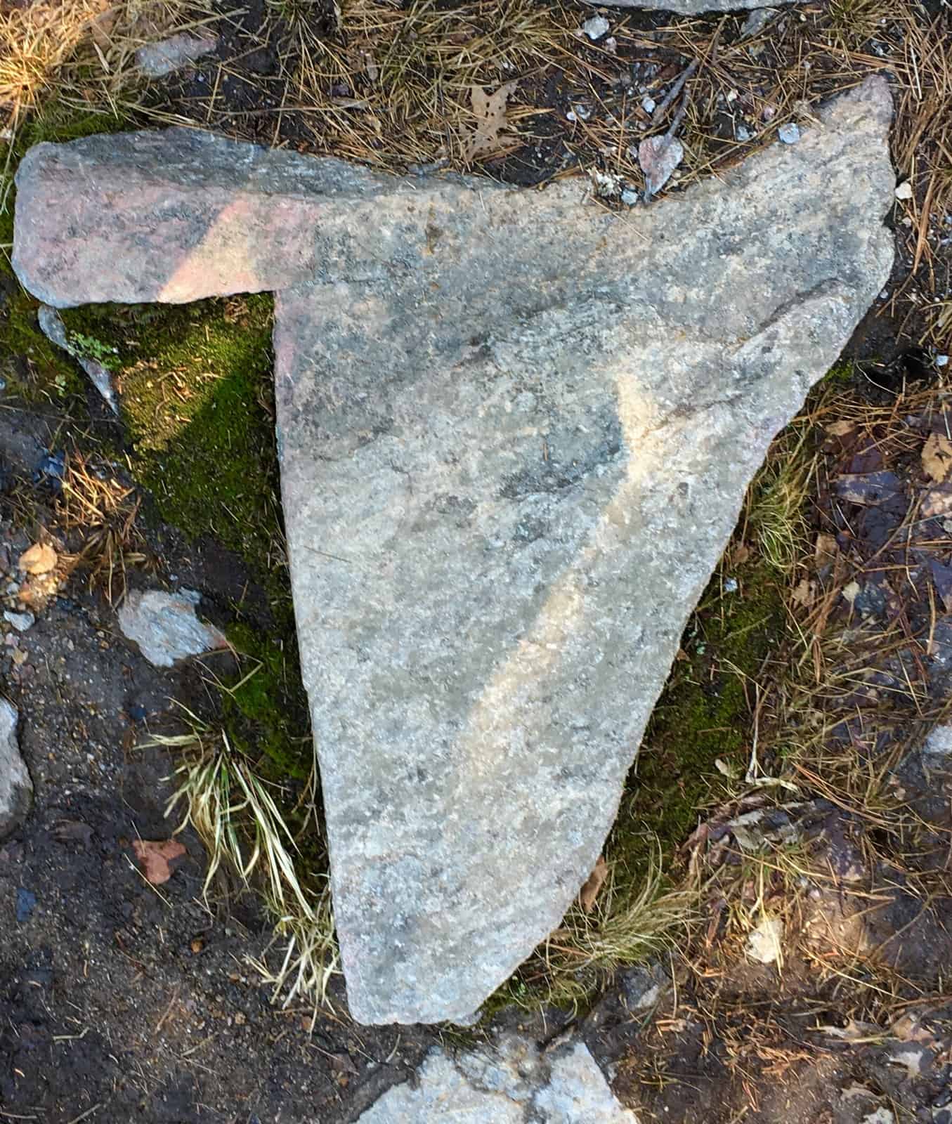
After a long winter of bad news, and now a stressful quarantine debate , all keeping us indoors too much this season, I may have been a bit more sensitive to the light, than usual for this climb. I was particularly struck by the force of the light of the Sun on this day; the silver and bluish hue pervading the subtle jade needles in the trees. The Sun seemed more like a small silver star looming just above my head. And of course, there it was, lined up centrally, with the small ‘rocky road’, directly above the peak. Only if the path were made of chocolate and pistachio would I have been more delighted by the possible meaning here.
 After about 100 yards, the peak appears like a doorway through the hedge. As you breach the trees there is a small cairn which looks to have been placed as an obvious marker of the peak. The odds are that it is neolithic in origin, and modern in additions.
  To the West is a view of Mt. Monadnock, the Senior-sister-Mountain to Wapack’. The distinct straightness of its sides can be distinguished, even from about 2o miles away. It is also inundated with neolithic statements, and reviewed here at Stonestrider.com. Connectivity.
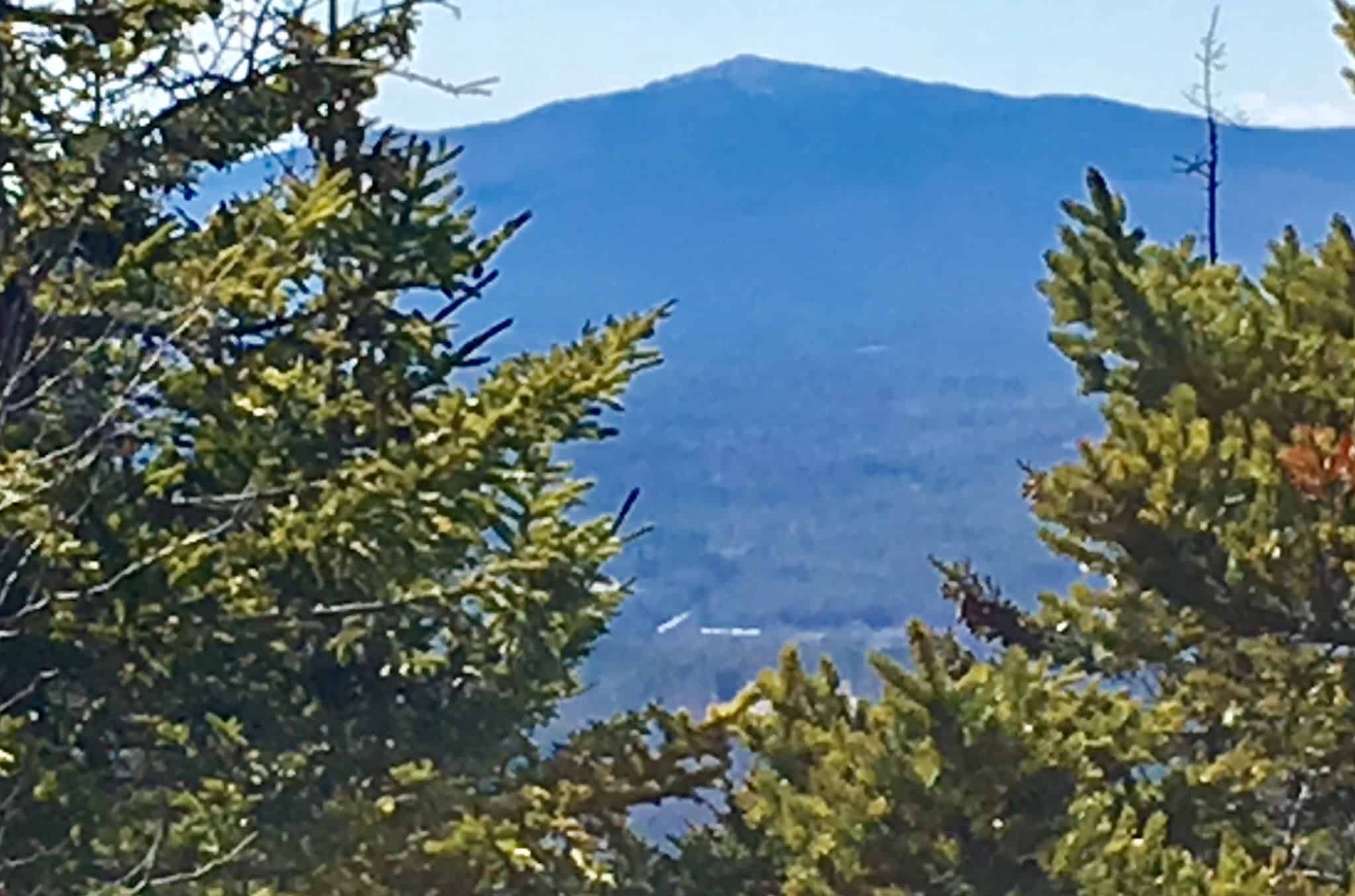 Wapack is a sacred trail, by all of the standards of this mountaineer. It as a 2,200 foot climb, and fun. There is so much to discover in New Hampshire Hills, and New England. On the way back down I sat and watched the valley below, undulating subtly. I tried to remind myself that what is going on down there, is not of my doing, and never could be.
 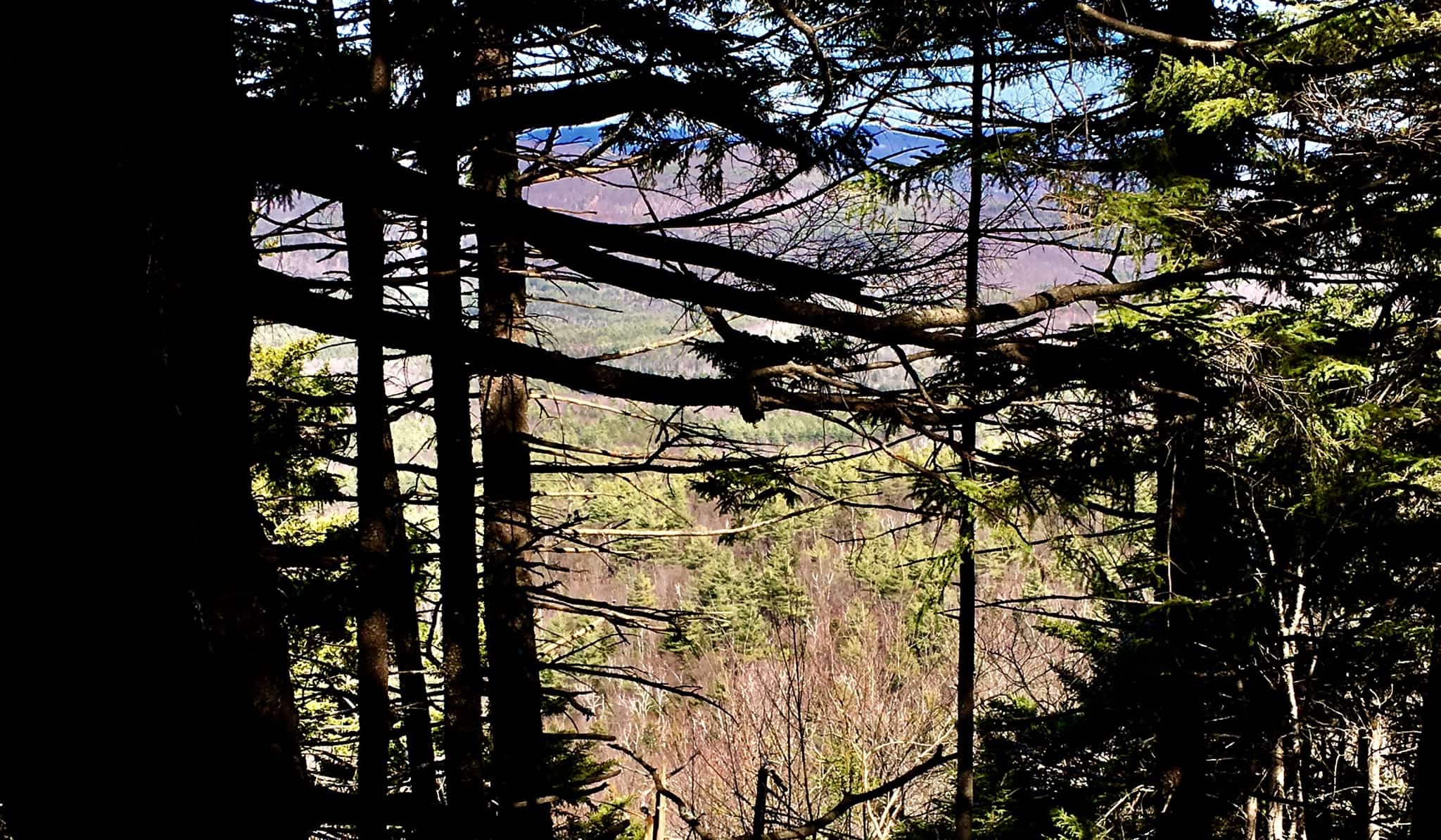 To readers across the globe, may you find health, wellness, and plenty of sunlight, in the days ahead. Thanks for reading.
Pinecrest Lake
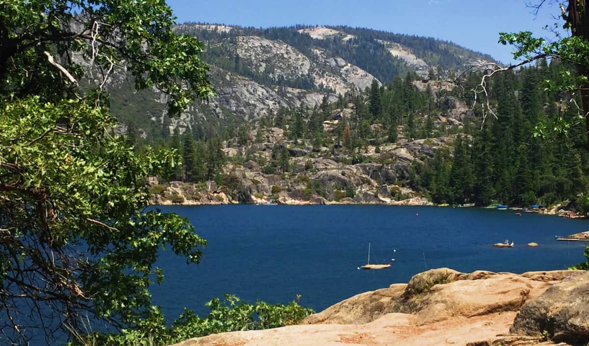 Location: Stanislaus National Forest/California/USA
Elevation: 5,500ft
Note: The booming beauty of California is truly a thing all its own, as distinct as places like Ireland, Jamaica, or The Southern Alps of Italy, and France. The legendary Californian Valley can easily be seen from outside the atmosphere, perfectly ensconced, like an elongated womb, by the limitation of the Pacific Ocean to the West, and the Stanislaus National Forest rising into the Sierra Nevada Mountain Range to the East. The vast variations in morphology, from the Sea-levels of San Francisco, to the Valley, filled with golden hills and glades of Orange groves, rising to the rugged rocky pinnacle at Yosemite’s Half Dome some 5000 feet above, could make a heart glow through the eyes. Fixed like a Jurassic rain-drop, between the eyes of Stanislaus National Forest and the Sierra Nevada Mountains, is Pinecrest Lake; a deep sapphire jewel, against a golden and green-grey wilderness.
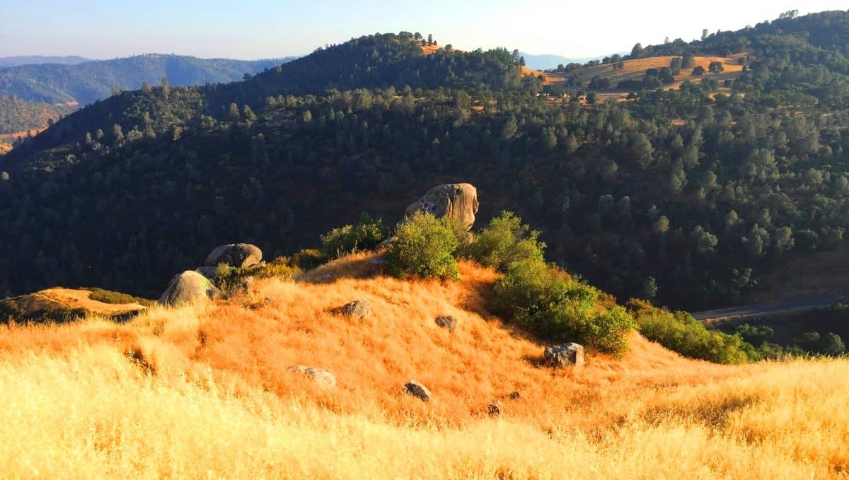 If you are lucky enough to find Sonoma California (Image/Right) you will have found the main mountain-port village, tucked quiantly into the gorgeous golden hills on the very edge of the overall wilderness of West Coast Forest and Mountains, for jumping off into Stanislaus National Forest. Sonoma is like a Seaport town would be, to the wide-open Ocean, except it is a landward port. Highway 108 shoots-out like a lightning bolt from Sonoma, north-east, into an ocean of rising Pine and Sequoia trees. Just an hour driving along Highway 108 and you will arrive at the mountain-town of Strawberry, California, and Pinecrest Lake (which is a slight right turn-off from 108.) Pincrest is a small resort with the option of swimming, hiking, and just sitting on the mountain-view beach. It’s spectacular, with a view of the first ridges of the Sierras.
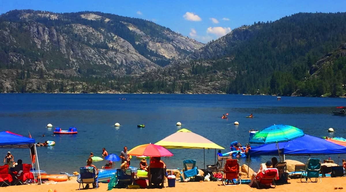
Hiking any lake is a lesson in circumambulance, the eternal cycle of starting where you finish, and finishing where you start. Renown German psychologist and dream specialist Carl Yung considered the discovery of The Self to be a process of circumambulation, rather than any basic linear process. The experiential side of hiking can often times leave you feeling a little different by the end of an excursion, as opposed to when you started; and yet you are the same person. The larger the challenge, the more likely the hike will bring an interaction, or feeling, that is new to you. Appreciation, confidence, tranquility, perseverance, less inhibited feelings, all result from hiking circular routes. And a circular route with a view like this, with the option to swim, or just sit in the Sun, can inevitably combine all of those feelings into a humble, but supreme joy. Even a few short moments of this rare feeling is enough to sustain you for the year to come. Off you go.
The trail at Pinecrest begins at a playful beach where families are enjoying the scene. One of the comforting aspect of lake trails is that you can’t get lost, so you can step boldly. If you begin to the right side of the beach, you will see a fairly impressive megalith set on the shallow water. The boulder appears to model the arch of the Sierra Nevada Mountains, in this incredible background, with 3 distinct indents near its core. It is aligned parallel to the scene of the mountains behind, which may be an indicator that this place might have megalithic secrets to share.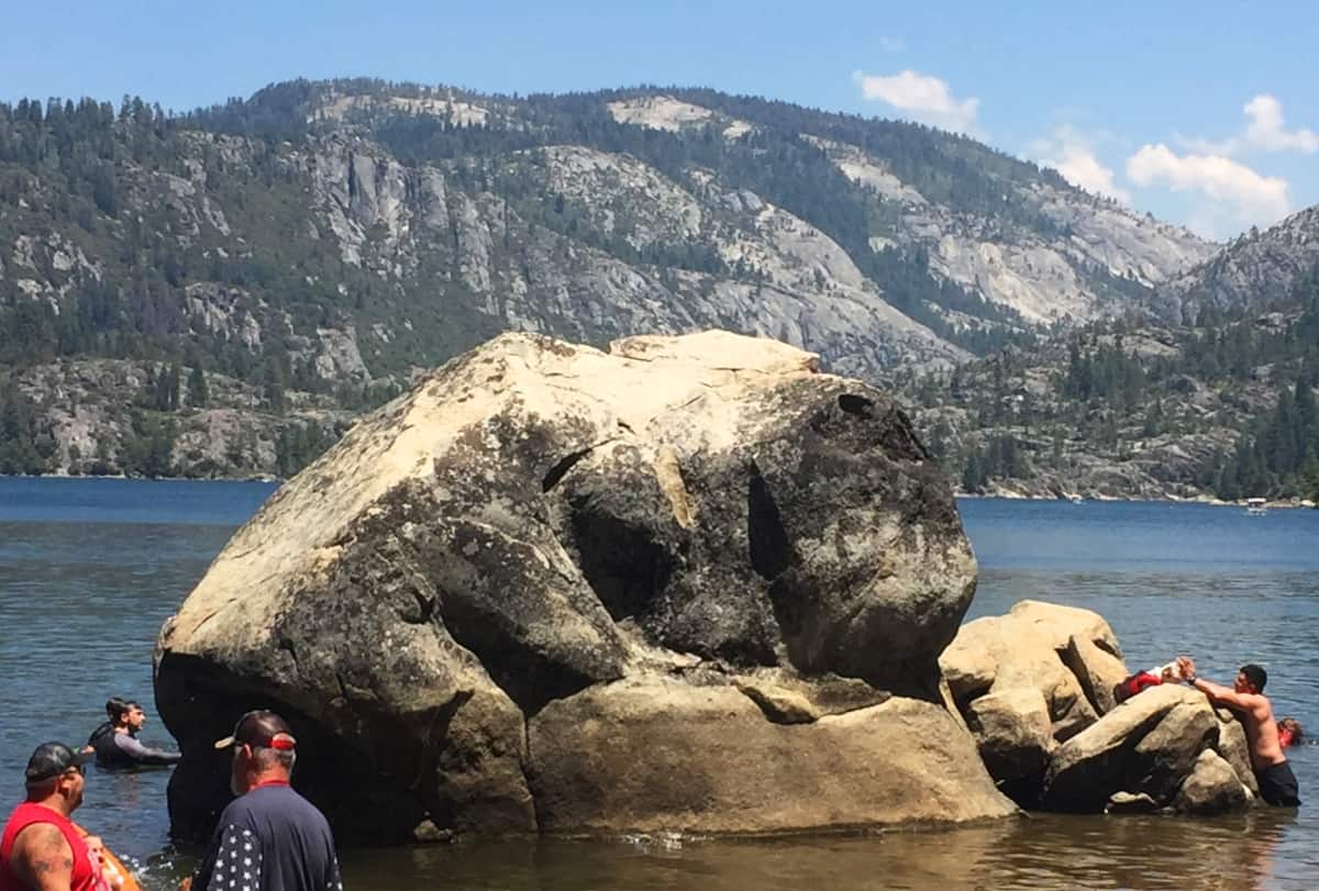 In sacred sites in Ireland, Scotland, Arizona, and New England, Stonestrider.com has documented hundreds of locations where fixed boulders model the landscape. In these zones, free standing boulders sit at the top of rocky pinnacles, or imitate the arch of the valley below. Below is a megalith that was carved to fit the exact curvature of the lower Valley at Mount Bearnagh, Ireland (Image/Below/Left), and a marker-stone high on Mount Katahdin, in Maine USA, pointing directly at the peak in the distance.(Below/Right)
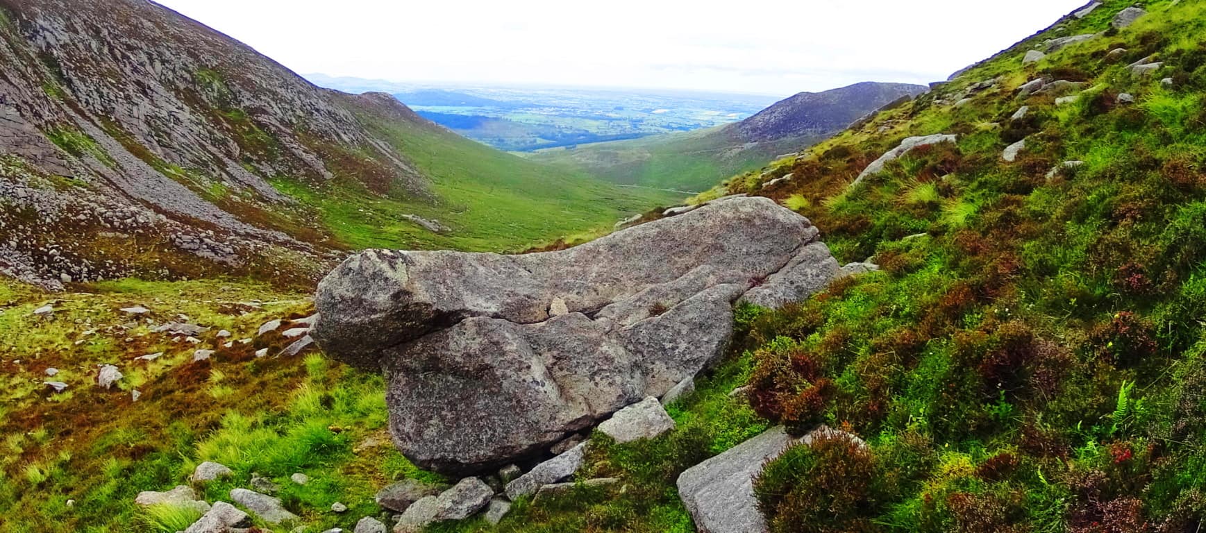

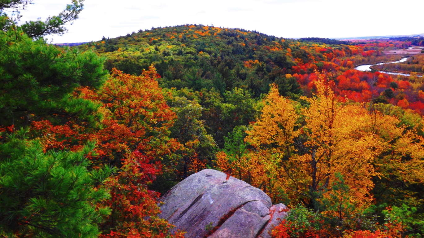
Another example of a fixed boulder is this stone (Image/Left), set among incredible foliage in the heights above the Blackstone Valley in Upton Massachusetts. The stone is pointing directly at the apex of the small mountain beyond. This stone, interestingly enough, also has three distinctly indented slashed gashes, just like the megalith at Pinecrest.
The trail at Pinecrest dallies through small rock gardens, contrasted by tall stones and gnarly Oaks and Pines. The right-side path of the lake, running counter-clockwise through these rocks and brambles, includes the option to swim at any given moment. This a joyful retreat for families, not the typical reclusive cultural jag of many stonestrider.com sites. Elder folks, children, extended families, and couples, are cruising through, conversing on every type of topic, while attempting the entirety of the trail. 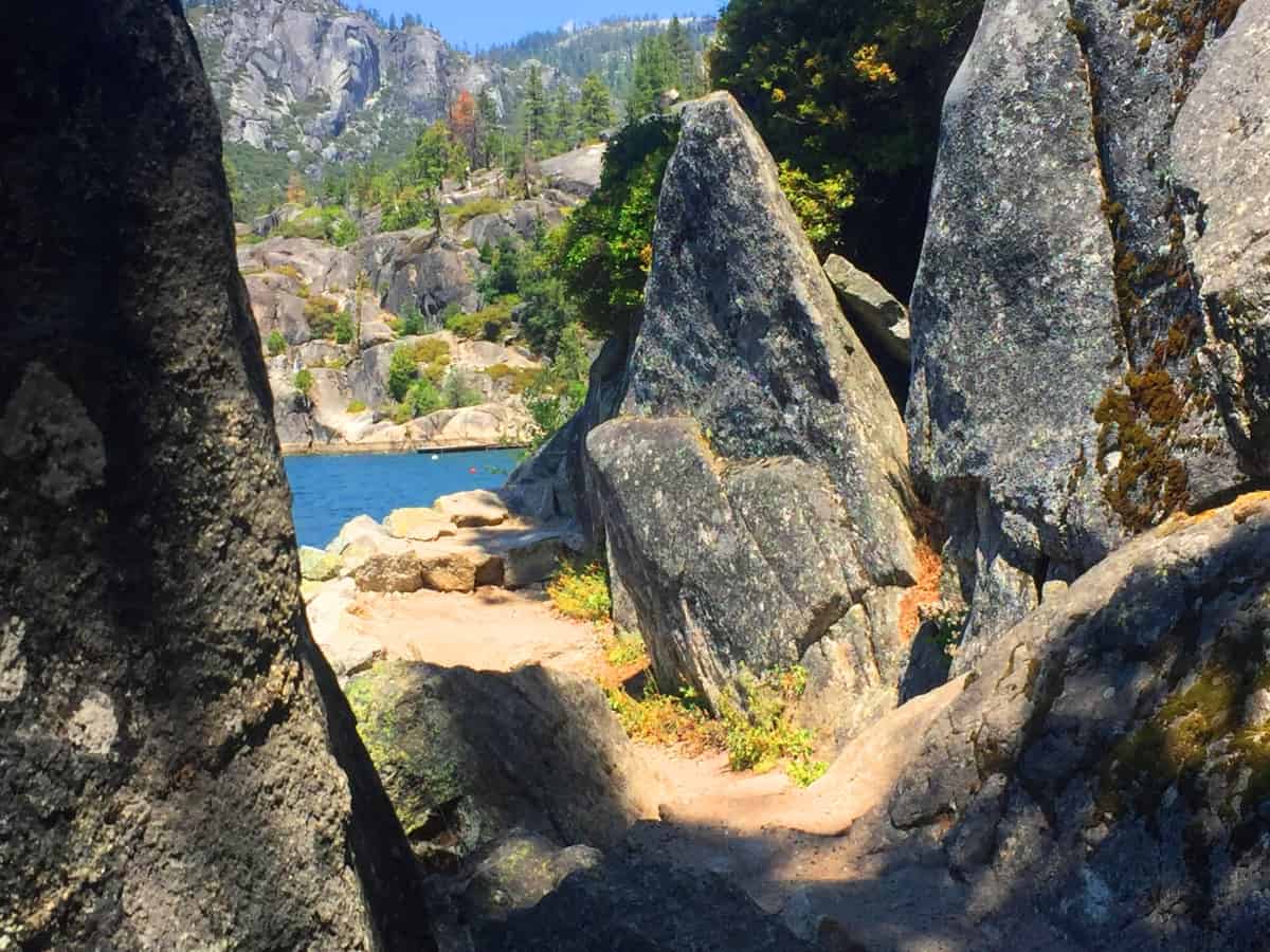 At the 2.5 mile mark, hikers will come to the opposite side of the beachhead starting point. There are a set of miniature cliffs reaching right up to the lake; elevated ridges and points of vantage over the entire scene. Interestingly, at the center of gravity of one of these high-points, is a perfectly placed, free-standing boulder. (Image/Below) There hundreds of thousands of these gravitational-fixed, strategically placed, boulders in the high points of many such beautific scenes across the Continent, and Western Europe. I need to address this glacial argument for a moment. Please consider the rediculous logic post-modern scientists are force-feeding us:
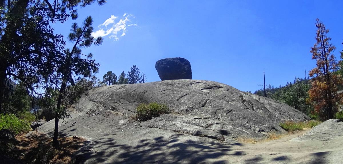 Take a look at some other free-standing boulders in different places beautiful locations in New England, Arizona, Colorado. Ireland. Are scientists saying that the same glacial-sheet, from Ireland to Arizona, placed these boulders in gravitational perfection? Really? I have to struggle just to make this theory make sense.
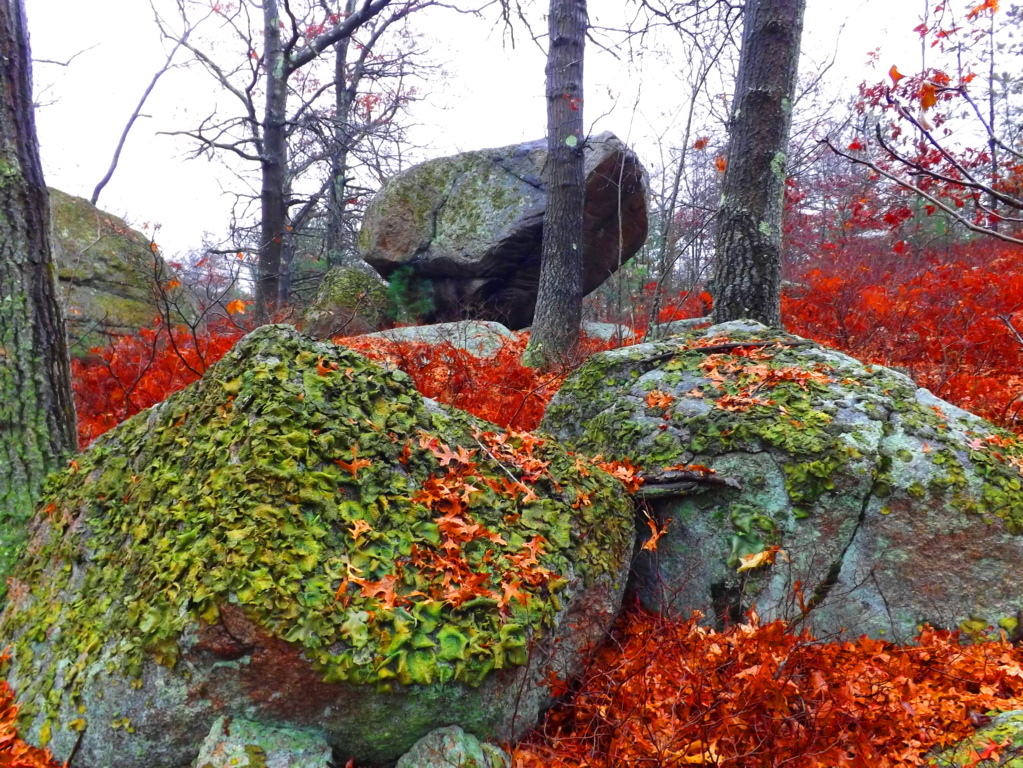
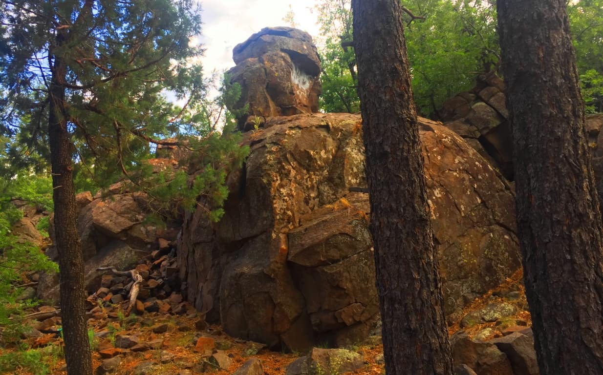
Does anyone ever raise the point of fact that these boulders are placed at the precise center of gravity for balancing, all at grand scenic points across America, and Western Europe?
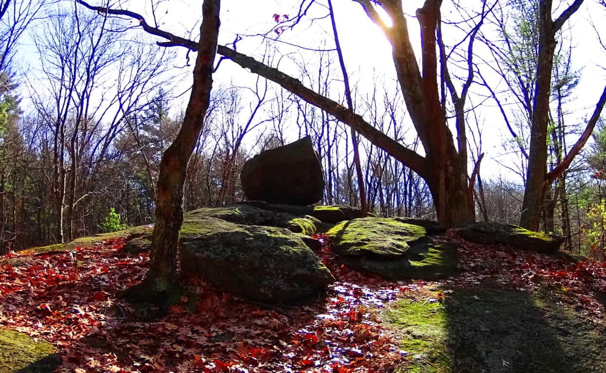 What shafts of ‘glacial-ice’ could lay these boulders in the perfect gravitational center, literally hundreds of thousands of times? This boulder in Red Rocks National Park in Arizona (Orange/Below) is literally lock-fitted, and tilted towards the course of the Sun. This is scientifically significant points of observation totally dismissed by the ‘scientific community’. The Neolithic zones around these boulders are also amazing. It so obvious that these boulders are skillful markers of once-occupied sociological spaces. Scientists are incredibly pompous to
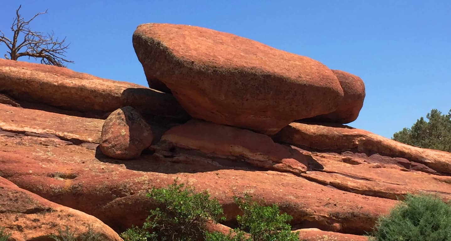 ignore the gravitational aspect of these sociological statements. What irks me most is that these control-freaks honestly think you are dumb enough to believe that glacial-ice is responsible for these gravitationally-perfect, lock-fit, solar oriented Neoliths, always found in zones filled with incredible statements? I’m so completely exhausted fro
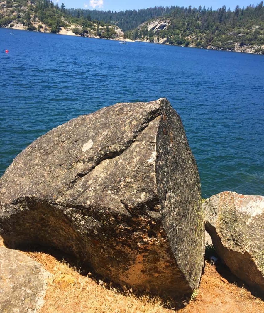 m presenting the evidence, scientifically, only to listen to stuffy, passe, agenda-freak-concerned ‘scientists’ that give me their robotic, totally inconsiderate of the mathematical physics, response to the mounting evidence. I’m sorry to burst everyones bubble, but History is not what you were told in High School or Undergraduate. It is far deeper, and even mystical in nature, with miraculous evidence to challenge our very cognitive abilities. I used to believe what other people believed, but you have to acknowledge the evidence, or consider yourself voluntarily blind. Just take a look at the digital cut of this boulder along the Pinecrest lake side, not far from the free-standing boulder. It looks like a wood piece, cut from a carpenters table. It reminded me of a cut stone I found a few seasons prior to this, that was almost identical, in the forests of western Massachusetts. (Image/Below).
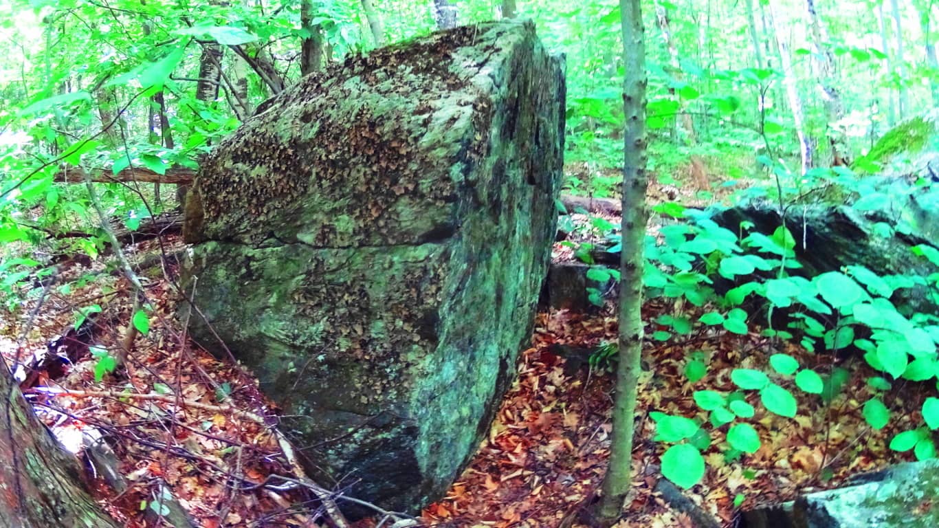 Scientists say that this phenomenon is natural? If this happened naturally, a split from an earthquake or something, how does that explain the perfection of the cut? New England does not experience Earth quakes. Where is the other half of the stone, if it simply, split? How does a boulder just split, perfectly? These don’t exactly move, EVER. to go one step further, consider an example of a cut-boulder that does have an adjacent face, at Mount Watatic in Massachusetts. It literally looks as if someone intentionally sliced this boulder, like a hot knife through butter, and then sanded a perfectly level and centered stone, directly between them. Look at the flatness and levelness of that middle stone. The centricity alone sets off all sorts mathematical principles, and design. As you can see, the rocky pathway behind, goes up the mountain, and stems directly through this cut ‘gateway’. How can scientists claim this is random? It is absurd to me that they claim this is mere chance. Totally absurd.
 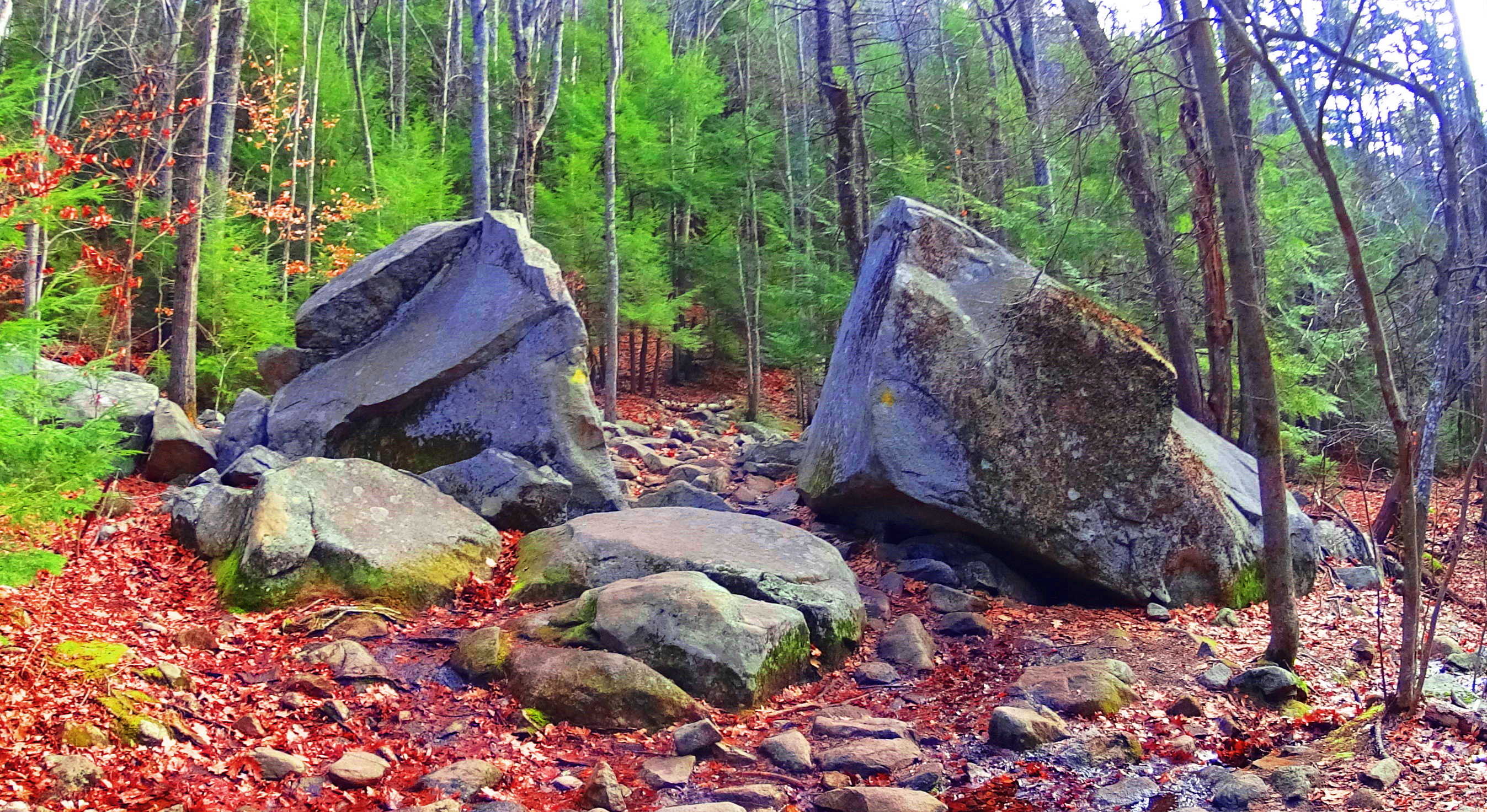 And just as the trails wind through amazing works of Neolithic Stone at Watatic Mountain in New England, the trail here at Pinecrest seem to portray the exact same portfolio. These are ‘worked’ areas. Who did it, and how, is something people are allowed to consider without the bizarre ‘science-ing’ that ruins the entire process of thought for which these works are meant to inspire. Why can’t we understand that if they are ‘worked’ cultural statements, then they were left behind intentionally, for the very purpose of consideration. “Scientific” theories are pushing the ridiculous idea of ice-sheets placing boulders in perfectly fit gravitational porches…. in Arizona? And that same force did the same thing in Massachusetts? It’s ridiculous. There are so many geographic and physical absurdities to the glacial-ice displacement theory, that it is hard for me to believe that people actually sit through classes at Universities, listening to it.
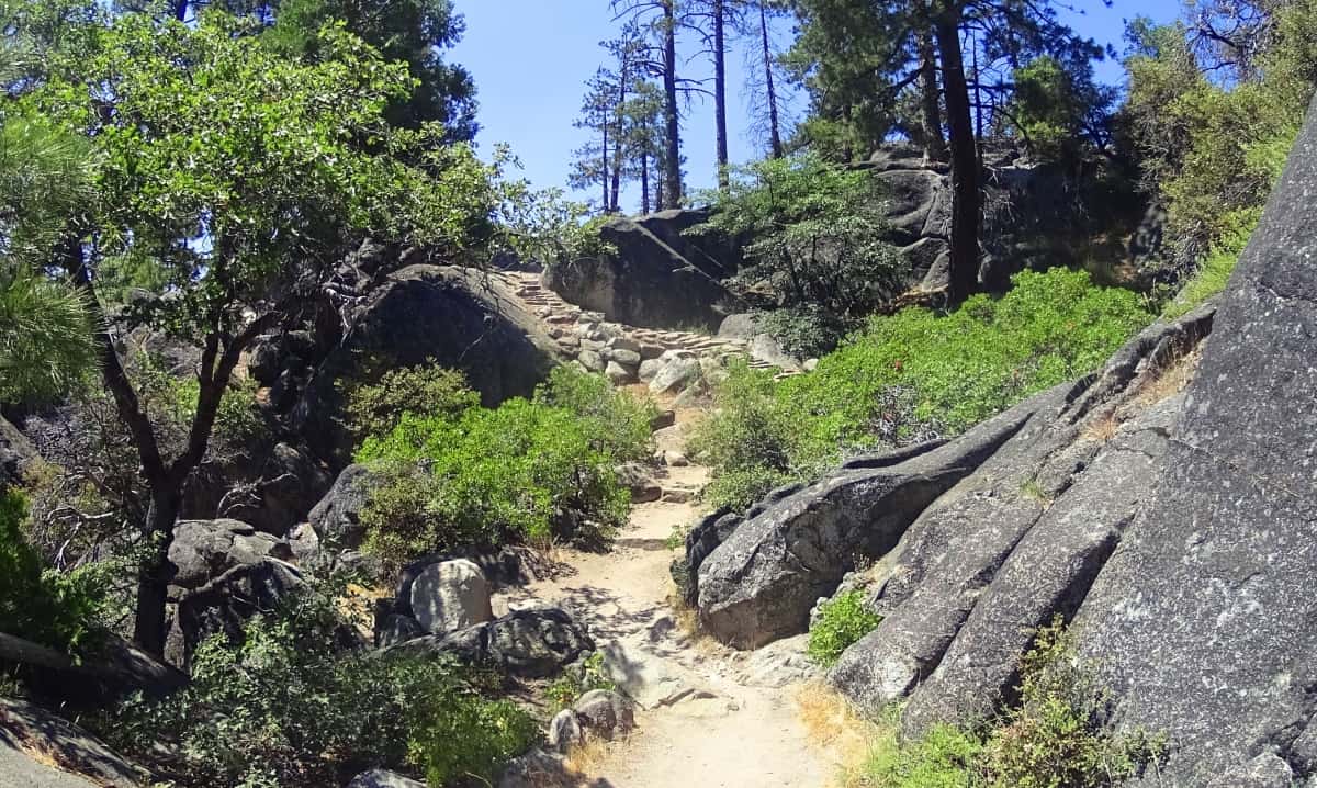 The scenic hike at Pinecrest continues to a rocky, river-cut, plateau, overlooking the lake. Here, there is a flow to the hike, a trust in the ruts, roots, and rocks, as you make your way.
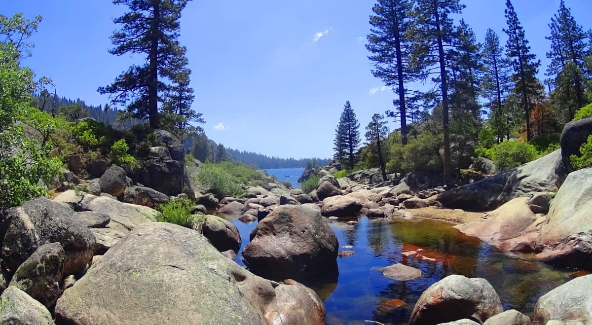 It is such an encapsulated beauty, the feeling of hiking along a practically hidden lake, at a high elevation. This whole area is surrounded by Stanislaus National Forest. This is the sister Lake of ‘Lake Tahoe’, which is just to the north of here. Pinecrest is one of the most majestic mountain/lake scenes in the world. It has that far-away feeling, that deep distance from all things ‘controlling’, safely away from the grind of every day life, and observational angst and overload.
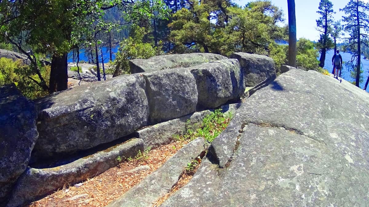
As you continue passed this halfway point of the rocky porch, you can stop and swim, enjoy the Sunny scene. The rocky ridges mingle with the trail, in a nearly perfect picturesque way.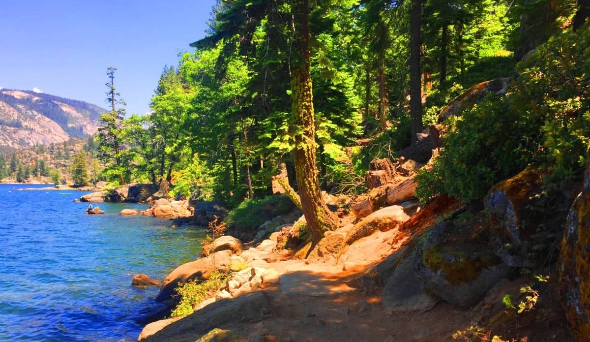
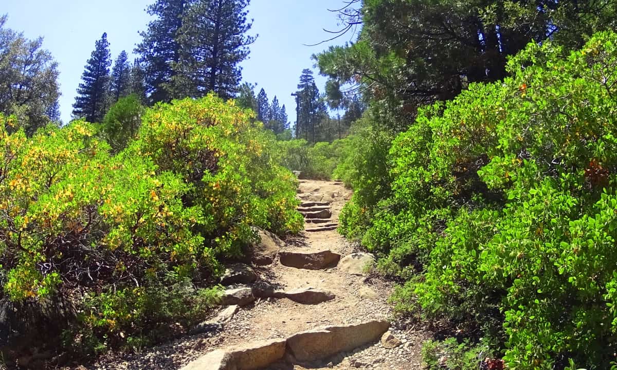
The milkiness of these hedges hugging-into the rocky ridges, is endearing. Nature is constantly embracing itself, exfoliating and observing at the same time. It really is something to think about, that absorption and exertion in one; The relief of the blue softness of water, against eternally sun-kissed stone. Stanislaus National Forest is a treasure, in scale, and vibrance; A massive force, pushing us to the edges of our understanding.
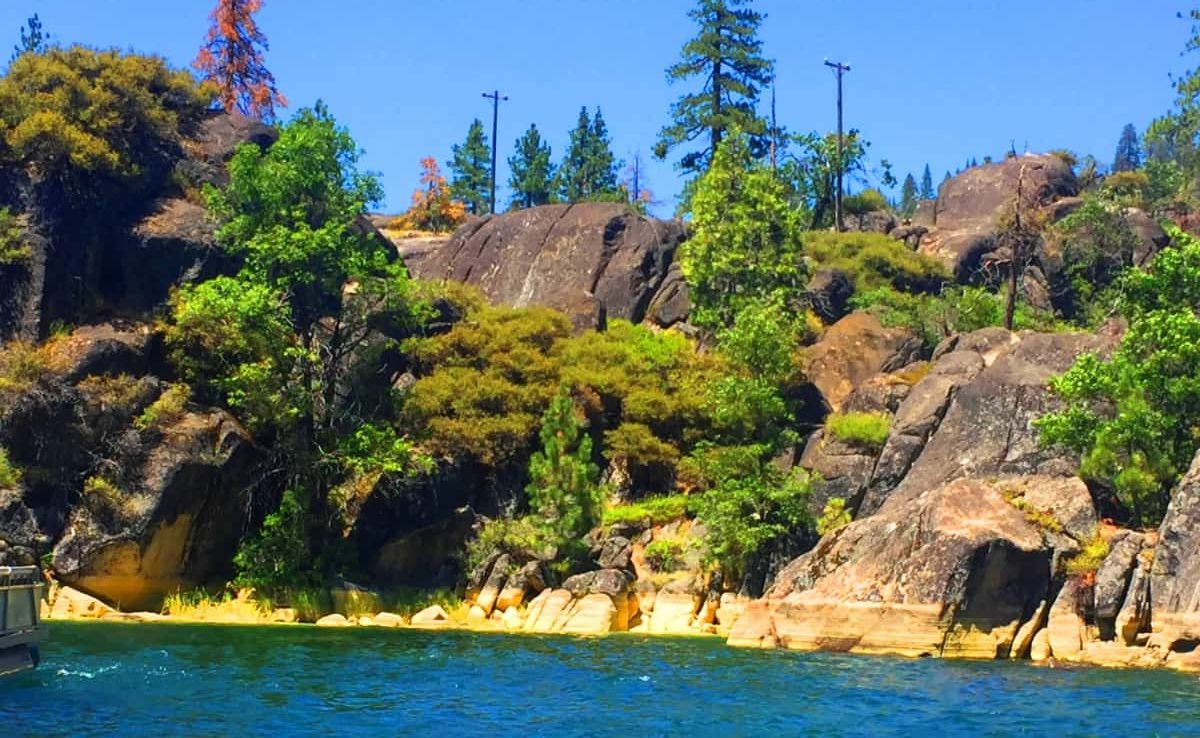
The trail bends as the Sun ambulates above. There are small Redwood groves mingled with Ponderosa, Oak, and Birch, arching over the water. The trees have a luminosity hard to describe. The refractory light of this particularly clear and mineralized water, reflects upwardly along the bark, making it seem like the trees are reflecting inner light from below, while receiving the Sun above. It all glows. This water is a priceless commodity in the density of the Forest. In indigenous times, before modernization, when this vast wilderness was uninterrupted, this place would have been a briliant magnet for every form of life, for as long as the lake has existed. There are booming crevices with stacking boulders so large that fallen trees look like broken branches in their embrace. There is a grandeur here.
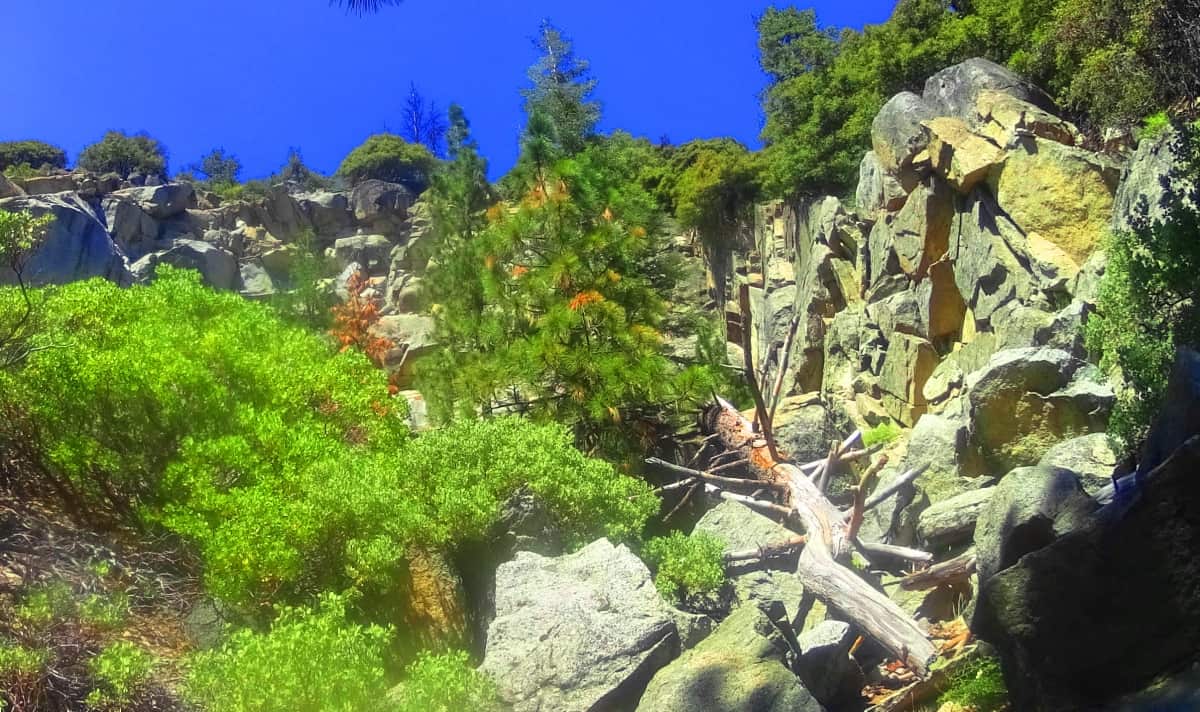 You will cross a small water-bound bridge towards the last stretch of pathway and have a look back at the edge of the Sierra Nevada Mountain Range in the distance.
 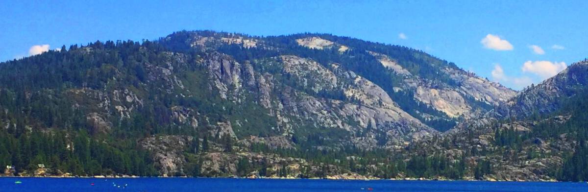 Beyond the Sierra Mountains is an intimidating and elevated wilderness that stretches East into deserts, then more massive mountains, then the Great Plains. This is a fine place to be, compared to all that vastness to the East. The last portion of the trail winds back into the Forest, and then to the beach where you began. It is truly endearing to consider the delicateness of the flowers that flourish here, at the final portion of this 7 mile circular jaunt, against the backdrop of the absolute severity beyond. (Image/Below/Left) It reminded me of a trail of lavender foxgloves I once wandered into in the ancient heights of Wales, north of Mount Snowdon. (Image/Below/Right)
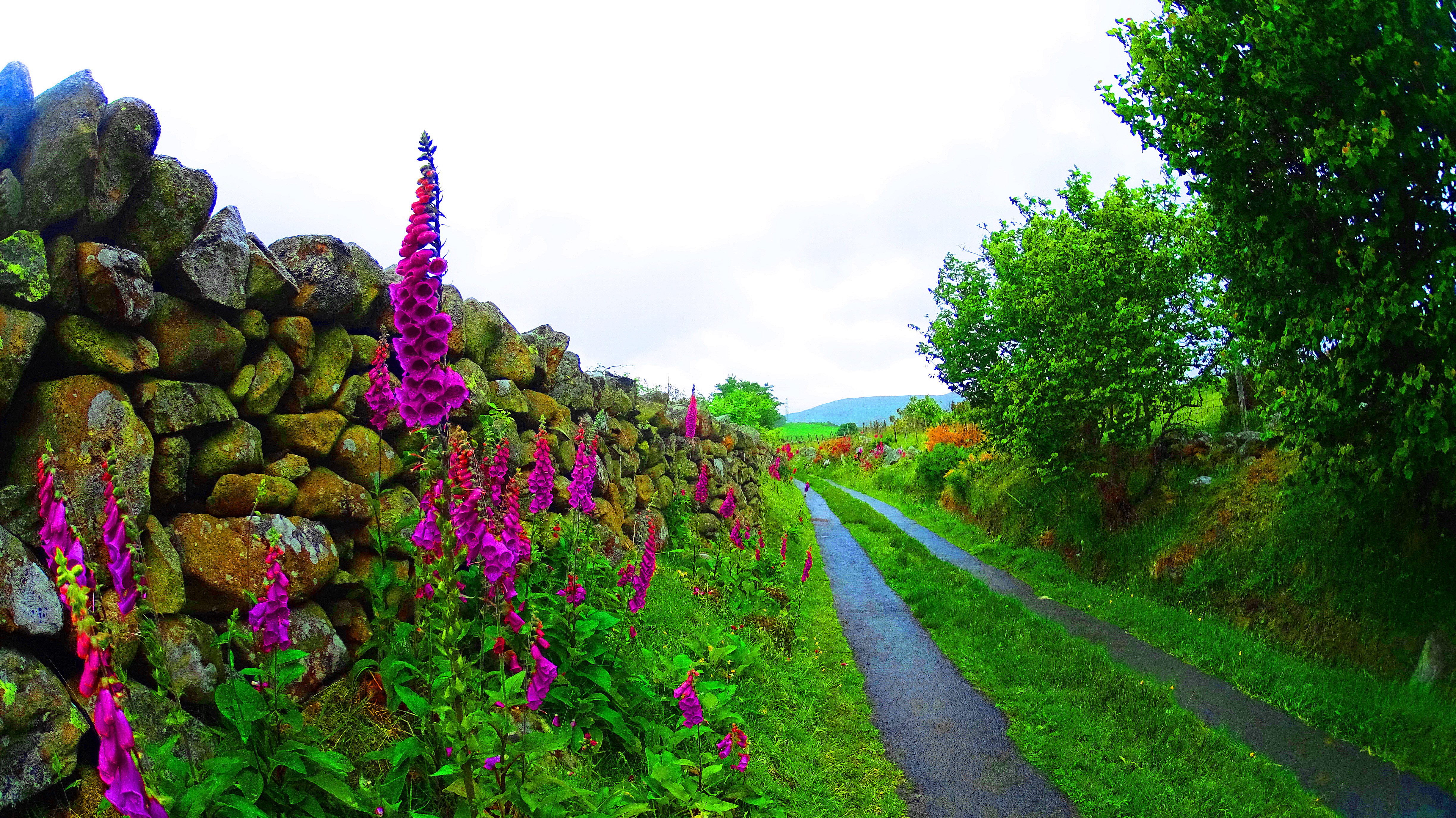
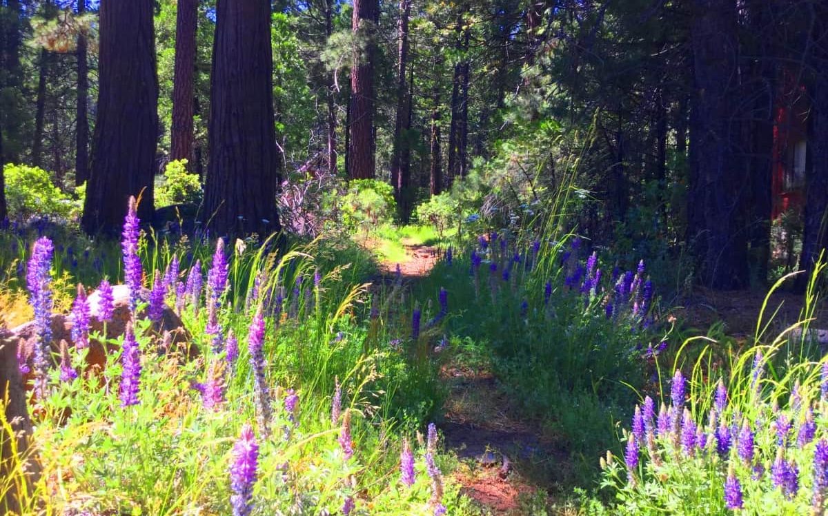 .
.
It is this type of ‘connectivity-of-thought’ that is the real marrow of mountaineering; when you have visions of another similar location, while passing through a real-time moment. You are literally alive in your past, present, and future, when this happens. It is so hard to produce this spiritual transcendence in the clamor of modern “interactions”, if you can call them that, these days; With texting and emailing, and constant bullshitting to no end, it is hard to find this frame. The realness and delicateness of these flowers struck me, after all that craggy rock on trail. It was humbling to see. I will quote the illustrious Dr. Seuss, while mentioning these flowers, flourishing in a stadium of extremity; That after all that effort, of working through the large-scale challenges of this rugged place, these flowers should remind us, finally and after all, that “A person is a person, no matter how small.” Thanks for reading. And for God’s sake, go for it.
The White Mountains
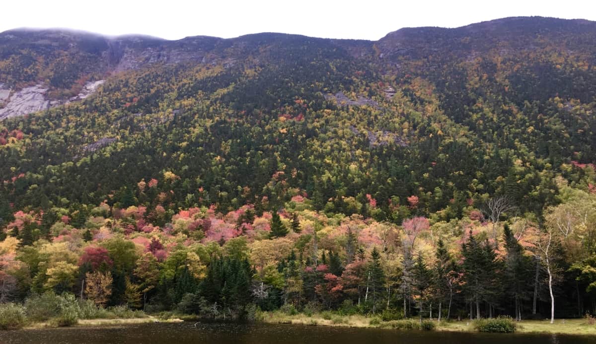 Location: New Hampshire/USA
Elevation: 2000-5000 feet
Note: I have wandered into countless forests, to find mysteries that date back to the beginning of time. I never expected to find anything of the sort, just trees and hedge, mingling with the moonrise. At certain times in my life, that would’ve been reason enough to dissipate into the hills with my cameras. I have been that individual, in the far away distance, in one moment, an acknowledging speck in the distant glances of happy travelers from the valley down below, and in the next moment, vanished.
Once I began to see the legitimacy of what is clearly an oppressed anthropological Culture in the woodsy places of the world, I simply couldn’t tell people fast enough. But as I began to inform people, friends and family, I realized that I was actually performing a new type of vanishing. This vanishing was related to the idea of who I used to be, what I used to say and think. I have one friend, in particular, who, when I would point out some fixture in the stones, would say to me: “It can’t just be beautiful can it? It has to be something… more?” Well, I‘m here today, to say to the entire world, in my least vanished state, that yes, sometimes, if you are truly lucky, it can just be beautiful.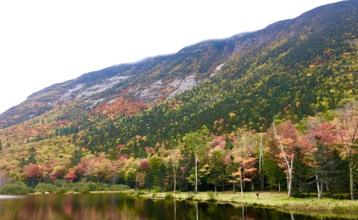
Just look at The White Mountains.
I have travelled many times to the White Mountains intent on the discovery of The Megalithic Culture. In truth, Mount Chocorua, Mount Washington, and more than a half-dozen more of the mingling granite peaks here, in the heart of New Hampshire, hold world-class evidence. But on this excursion, in the Autumn of 2019, although I knew they were certainly there, I would not allow myself to see a single rolling stone. This is the time for trees.
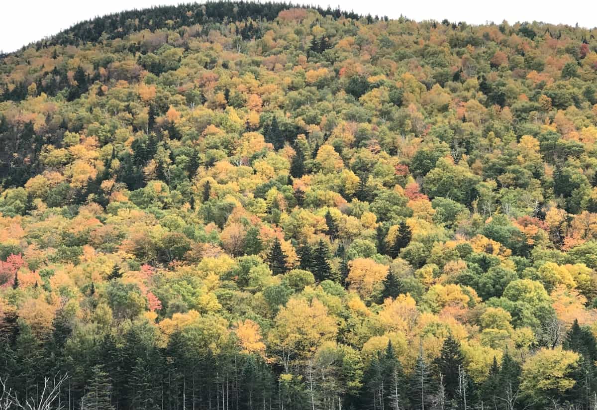
Autumn in New England is a rolling tapestry of trees, an impressionism in real-time, an ocean of foliage. The Mountains roll like stilled tsunamis, continual colors into continual colors, until the sky contrasts the distance. The backdrop of blue, when the Sun is in the sky, fills the scene with brightened colors, deeper shadows, and depth. When a grey mist rolls over the peaks, the shadows seem to vanish, and the colors become slightly more miraculous, against the grey. Ingesting scenes like this somehow creates a mechanism in the heart for turning natural miasmas into rather simple suggestions; like the idea that there is an infinity of everything, spanning in all directions, over the one majestic scene. A true understanding of Nature, that humans are created with a literal connectivity to the lessons of the landscape, becomes clearer in scenes like this. The beauty of the moment is enhanced by the knowledge that it is soon to pass. It underscores the very nature of our lives. To spend time in a space like this is in fact to come many steps closer to what it would be like to wander freely among the stars, blazing against the backdrop of an infinite blackness by the starry billions, and long after you are gone.
Note 2: Mount Pemigewasset Trail/Franconia Notch State Park/NH
The White Mountains sit at the central heart of the State of New Hampshire. It would be a good guess that the State itself established its original boarders in order to encapsulate this Mountain Range gem. To the West is Vermont, and the beauty of the Green Mountain Range, running throughout. To the Northeast is the massive State of Maine, where Mount Katahdin looms in awe inspiring autonomy, like a section of the Rocky Mountains of Colorado. (Image/Below)
The main highway that runs straight into the White Mountains is Route 93. One of the most popular and beautiful stretches of road in all of New England in Autumn. Make the choice to drive route 93 through the southern portion of the White Mountain Range, and connect to Route 302, which makes an incredibly visceral swing to the East, through the gorgeous White Mountain passes. Just like any of the Celtic Ranges abroad, this region offers excursions into National Parks, Waterfalls, Lakes, and photogenic stretches of valley, all along the main highways. Due to the amount of incredible choices for hiking, as well as its proximity as a gateway to the central Range along Route 93, Franconia Notch State Park was chosen for this Review. Trail choices here include Flume Gorge (easy), Mount Pemigewasset (medium), Little Haystack Falls (hard), and many more. A Ranger on site recommended the stellar view of Mount Pemigewasset Trail (Image/Below), which is achieved by a moderate hiking experience through absolutely classic New England forestry, with very few rocky formations along the way, for a change.
The trail begins on the north side of the Franconia Notch Parking lot. This is an active scene in Autumn, with cars piled along the side of the highway due to the amount of hikers intent on capturing the views of the region. There is a central lodge with a cafeteria, and information center for guided tours into the Mountains. A sign marks the trail for Mount Pemigewasset, along with a distance description of 1.5 miles to the peak. This measure is significantly off. Understand that it is about 2.1miles to the gorgeous peak at Mount Pemigewasset, obviously making the total hiking experience about 4.2 miles. This hike begins beneath a small picturesque bridge which passes beneath a bustling Route 93. 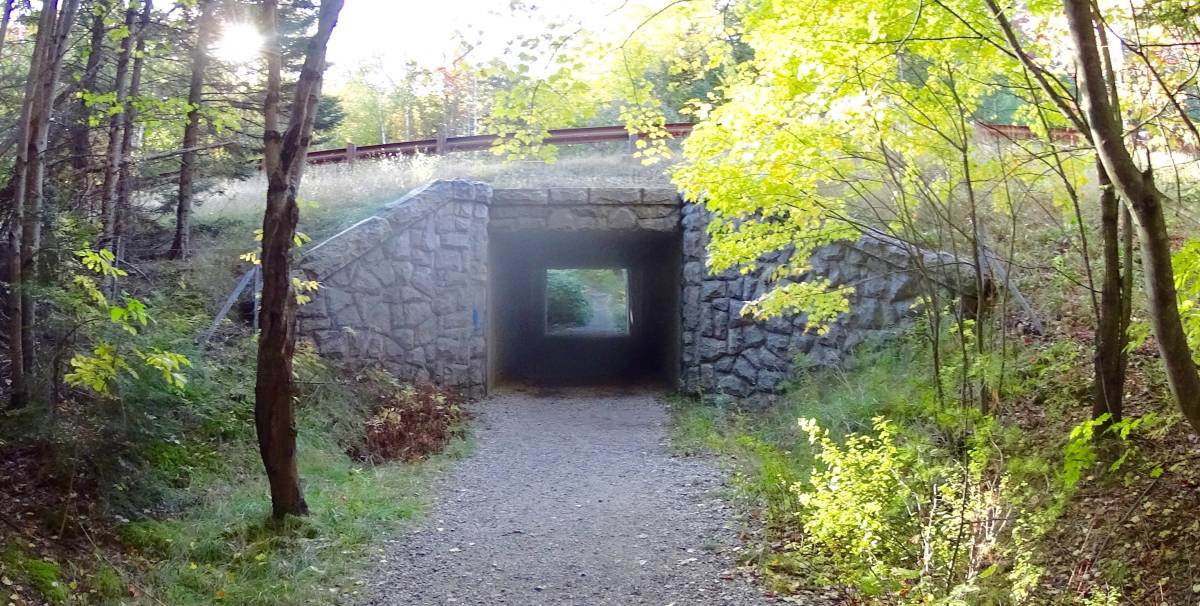 If anything, this bustling is an indicator of exactly what it is you are hoping to get some distance from. Drifting into these Woods is a sonorous escape, where the sound of sifting leaves slowly overcomes the constant murmur of automotive assertion taking place down below. As you slowly climb, the woods whisper over a wide clear path, with roots, rocks, and golden-red leaves. This is a gorgeous forest, on par with the Black Forest of Germany, and beauty of the Scottish Pines in Glen Coe.
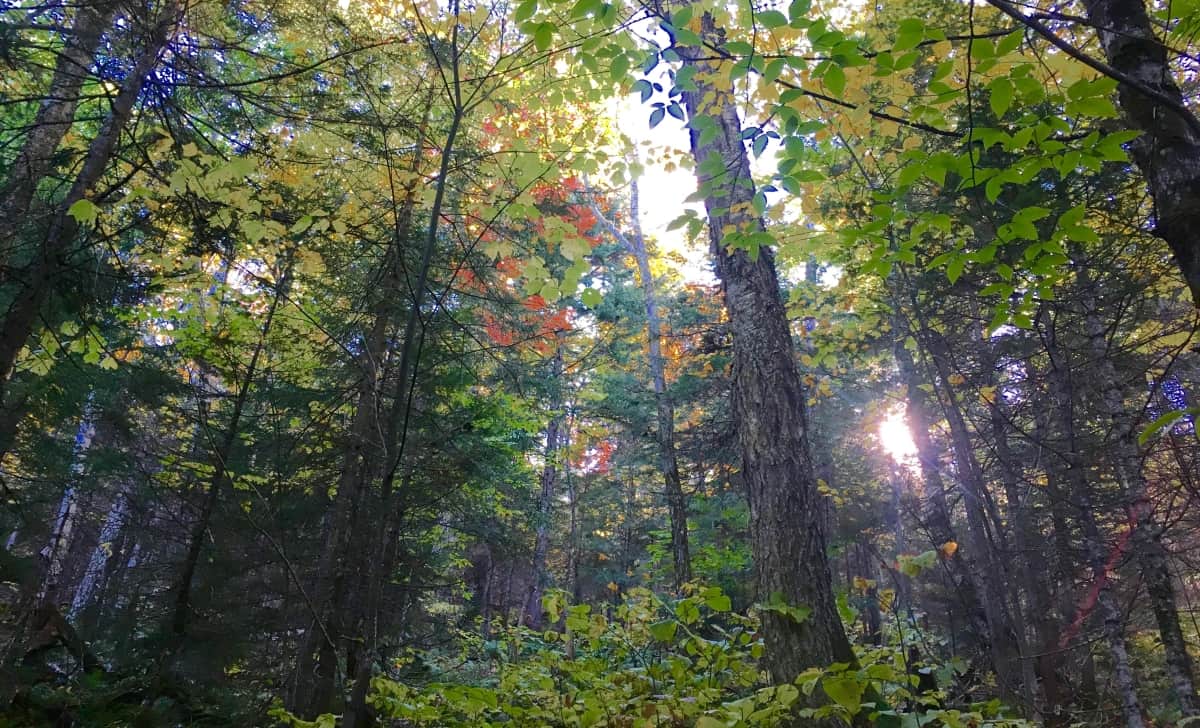
There are no variations on Pemigewasset Trail. You follow the clear rocky path, inundated with gold and rouge. The stones do seem deliberate, but this is not that type of Trail. This is a place to admire the raw and massive force that a New England forest can be, a venerable wonderland of the greatest depth, and degree of beauty. 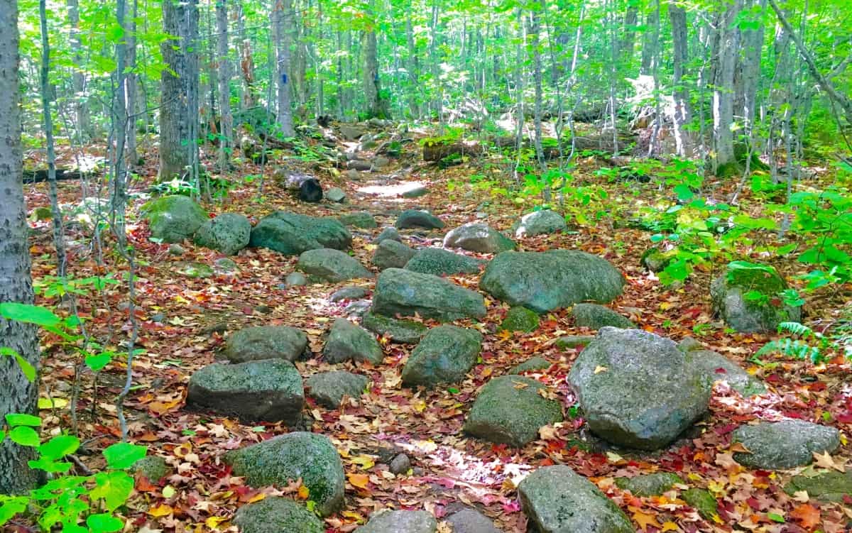 As the incline of the Trail continues the glades begin to change. Families of Birches emerge to greet you at about 2000 feet. Even while hiking in the elevated forests of Wyoming, for example, you might unexpectedly wander into a vast family of Birch trees. They simply pop-up wherever they wish, offering a gorgeous glimpse at the often whimsical mentality of trees; something that many of us just don’t consider in our constant ‘problem-solving state’ of ‘corporate function’, and bullshit. The beauty of where glades decide to grow is a marvel made specifically for hikers to ponder, and has a magic all its own, especially when walking through the miniature white pillars of a plentiful Birch boardwalk, closer to the clouds than the clamoring cars below.
 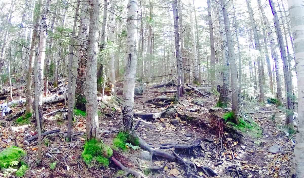 If you reach these Birches you know you are close to one the prettiest small-Mountain views in all of New Hampshire. As you pass through a narrow corridor of small trees, the vista emerges before you. Take your time breaking through, and prepare to receive your reward.
 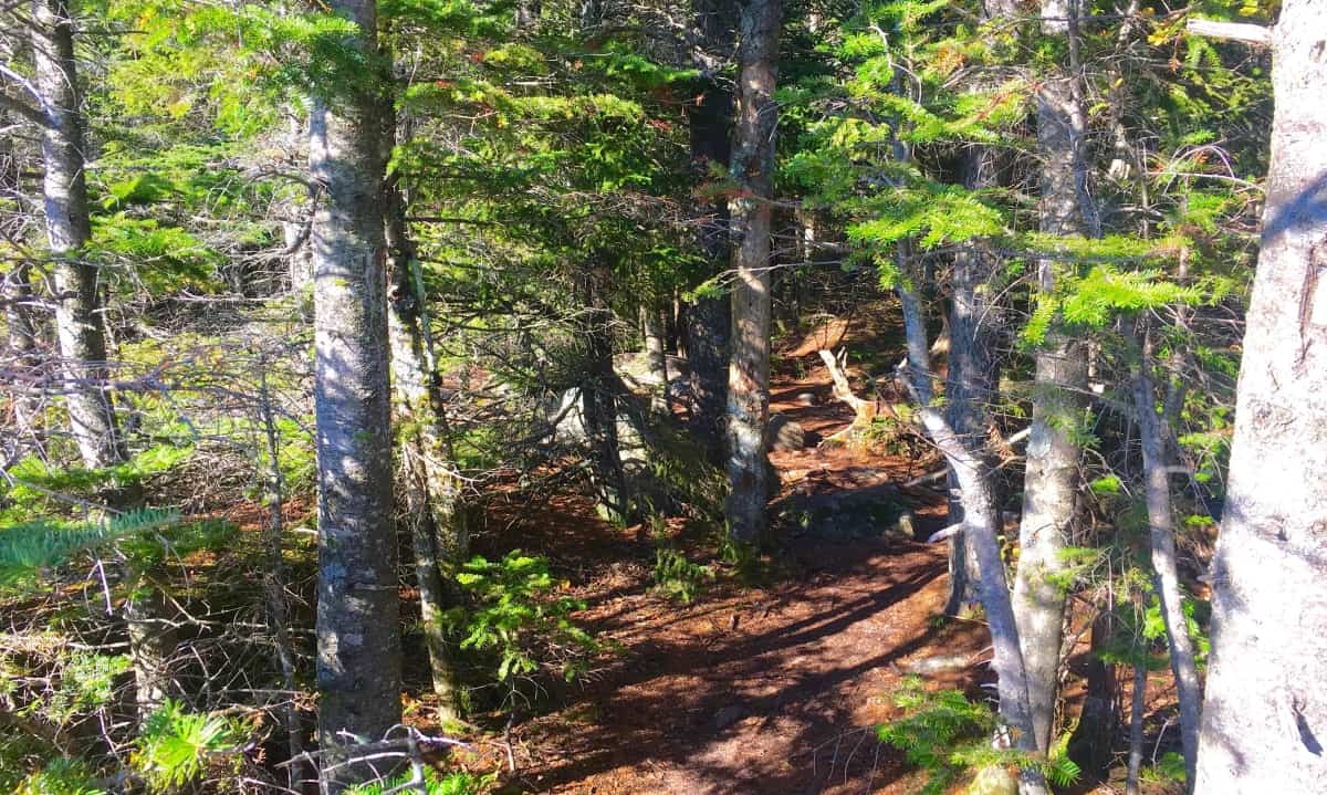 This is a once in a lifetime scene. For those just visiting New England, it may be the only time they see such a vision. This is vista that offers a glimpse of the southerly course leading across New Hampshire back into Massachusetts. The multiplicity of the colors can be disorienting, so do not stand too close to the edge at first, and don’t take selfies near the ledge as well. At the Grand Canyon last year, many people died due to this tendency to ignore the significance of the ledge while leaning-back for their photos. Sit down with your friends, and loved ones, then take the pictures. There is a little bit of forever in the foliage here, sitting down is a small price to ask.
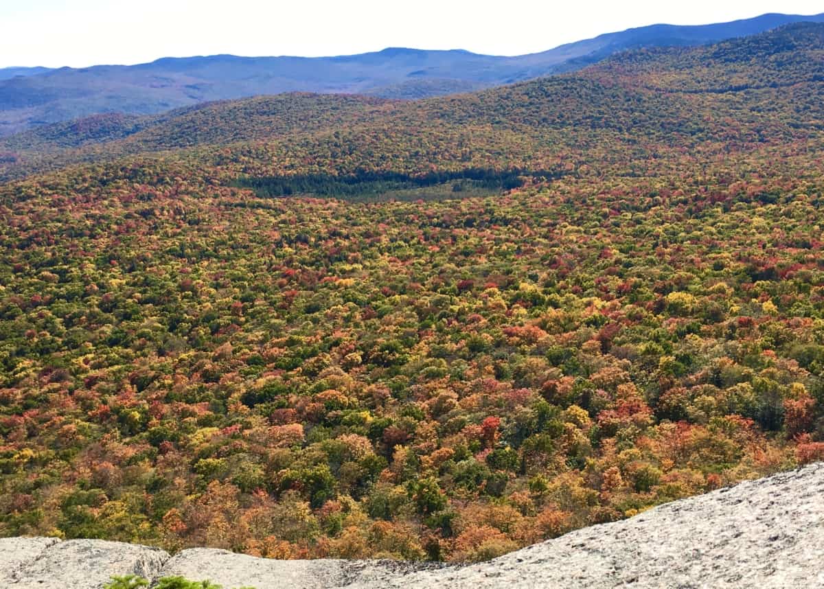 To the West is a view along the edge of the Forest, revealing the edge of the immediate Valley. Somehow, it feels as if you could leap down into the softness of the tree-tops, and bounce out of view in just a few bounds. The scene is that surreal. The stony top-platform feels like a fortress beneath your feet, as the contrast of the soft foliage drifts off over the Valley, and through the woods.
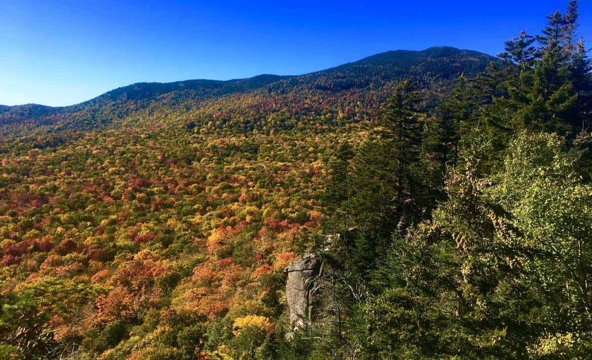 The way back down is doubly easy, as it always is. When you finally arrive back to your car, having seen the foliage, continue onward to the North, up Route 93 to Rt 302, and follow. This is one of the most wonderful drives in all of North America, winding through the Passes of the White Mountains, where hundreds of Waterfalls lay hidden, while some roll down completely open to the road. Silver Cascade Falls is just such an open view along Route 302. (Image/Below)
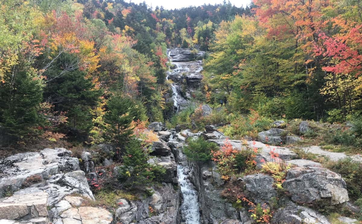 The White Mountains have a blessed status among Ranges; They blush before sleeping, as the Winter sets in and the trees let go. Let it be a lesson to all of us, that all of our growth, and gain, and loss, will one day hang loose, and simply let go. For those who become sad at the notion of this, just remember that the universe of colors for the following year to come, has already been coded. This code, of course, is unable to be seen, but you better believe is more permanent, than even the White Mountain stone. Get into it, and good luck as you go.
Sequioa National Forest
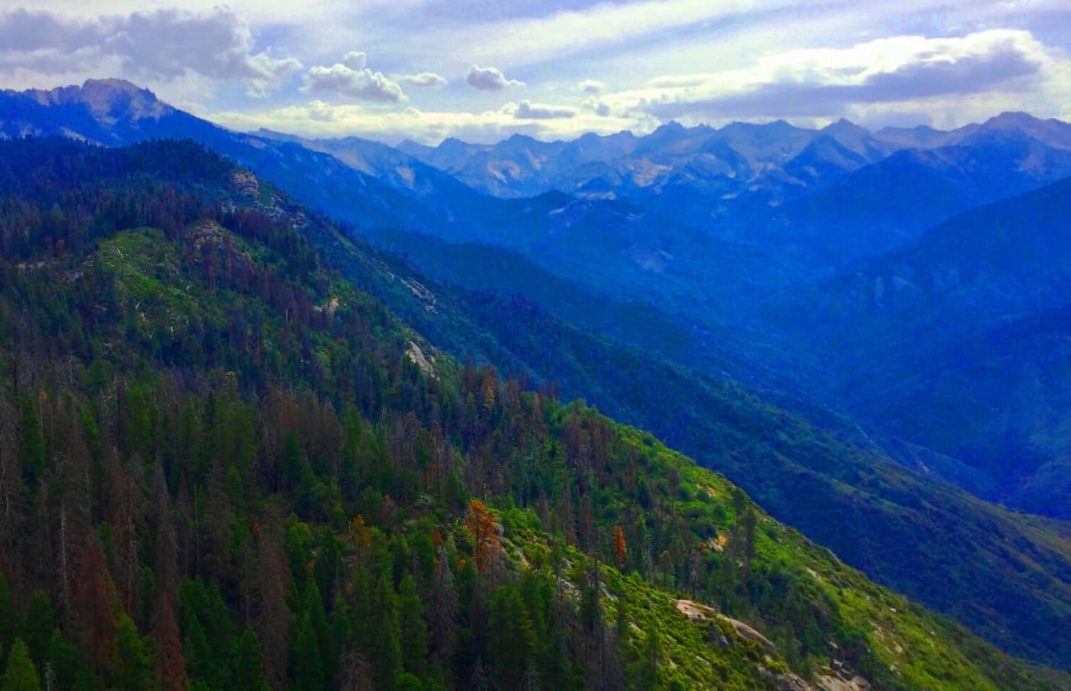
Location: Sequoia National Park/California/USA
Elevation: 13,000 ft
Note: I guess this is as good a place as any to talk about Fire. It was no mistake that at this point in my life I was brought to a Forest which is most ultimately and most intimately connected to Fire. Even the smallest most myopic little spark can begin a blaze so vast in a place like this, it could easily be seen from Space. If that isn’t an aphorism for how even the smallest falsity to a loved one can lead ultimately to total distrust, then I don’t know what is. In this way, different lessons emerge in different forests, which is just another reason why some adventurers get hooked on the next hike; Reading a forest is more often like reading a novel, as experiences culminate you want to see more. learn more. It is eye-opening that the very existence of these exquisite and hallowed pillars of arbos depend upon a practically sentient process of distributing this most prophetic fourth Element. There is also another lesson, no less profound, relative to Fire here: if there is no fire the forest will inevitably stack its dry-brush and suffocate, blocking-out the sunlight from the soil; Too much fire, and the forest will obviously be destroyed, and in the most drastic way possible; But finally, say a thresh-level, low-glowing, and slow-rolling fire begins crackling distinctly beneath the stellar Sierra night; Amazingly, this specific type of fire cleans out the waste. and the Forest is literally reborn.
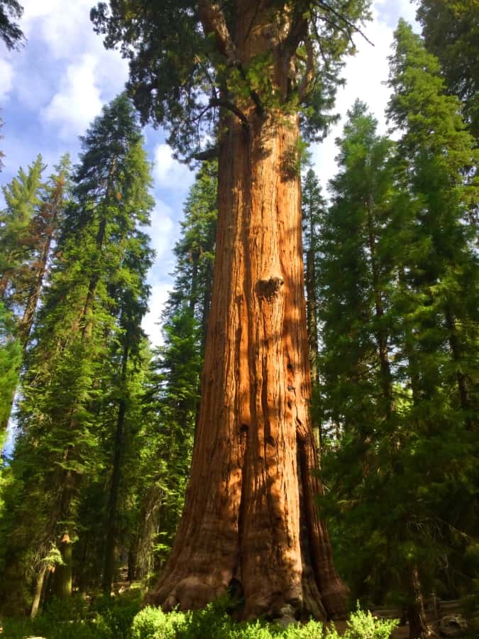 Studies have shown that many of the trees, in a nearly human display of maternity, will not let go of their seeds until this specific thresh-level fire has taken place. The fact that Fire is scientifically the biological nemesis of any tree is just an incredible lesson on the subtleties of Nature’s relationships, and so our human relationships. We can’t go through life holding-on to our mistakes. At some point, to flourish, you must risk the burn, and leave all the waste, for the fire and wind. Some forests are in harmony, while others struggle in the era.
And just look at the results here. We have the oldest Forest on Earth, in one of the highest elevations on Earth, with the tallest trees on Earth. Many people in other parts of the world are not aware that this particularly rare and ageless Forest requires a quest into the upper elevations of the Sierra Mountains. Sequoia’ sits on the high rocky corner of a massive mountain rim (Image/Top). I myself have lived in the United States all my life, and never realized that Sequoia is literally a Forest that touches the clouds, not just the average woods that could be arrived at by crossing a mere stretch of common roads.
The approach to Sequoia National Park begins on the south-eastern edge of the massive Californian Valley. 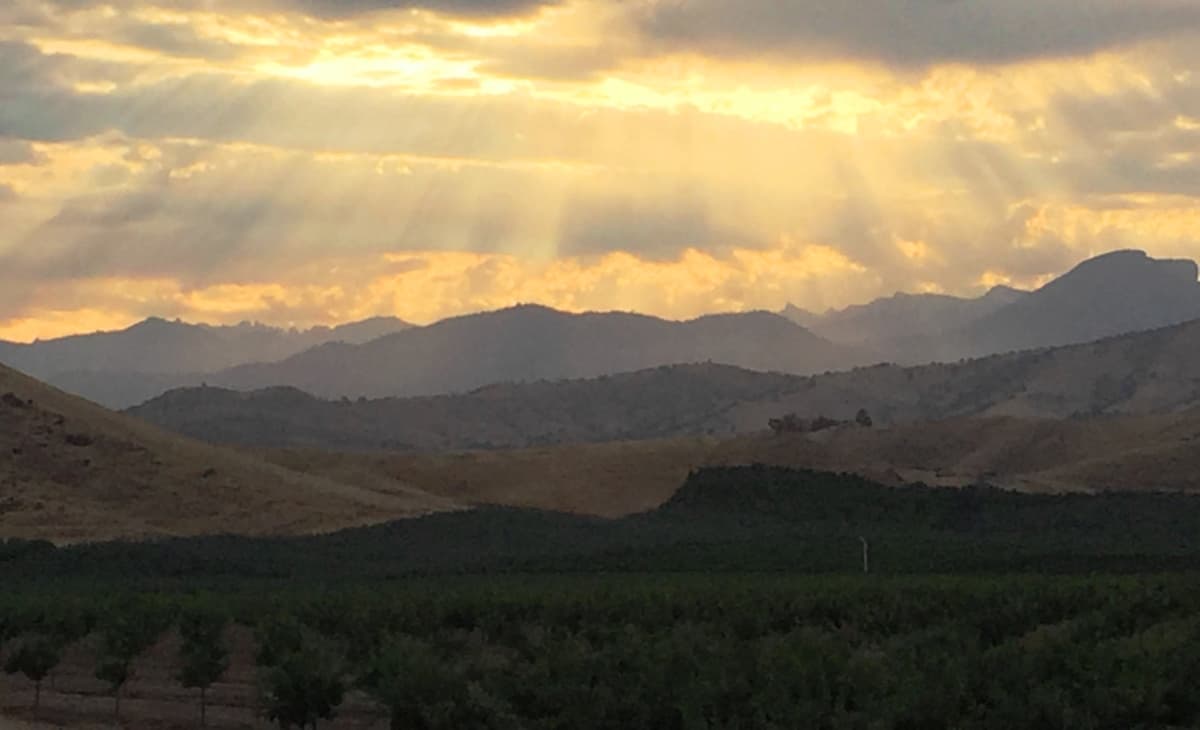 Porterville, Lyndsay, or Exeter are all classic Californicana’ overnight points for an early morning approach into the initial elevations of Tulare County, a small rolling region blissfully tucked into the golden foothills of the Sierra Mountains.
 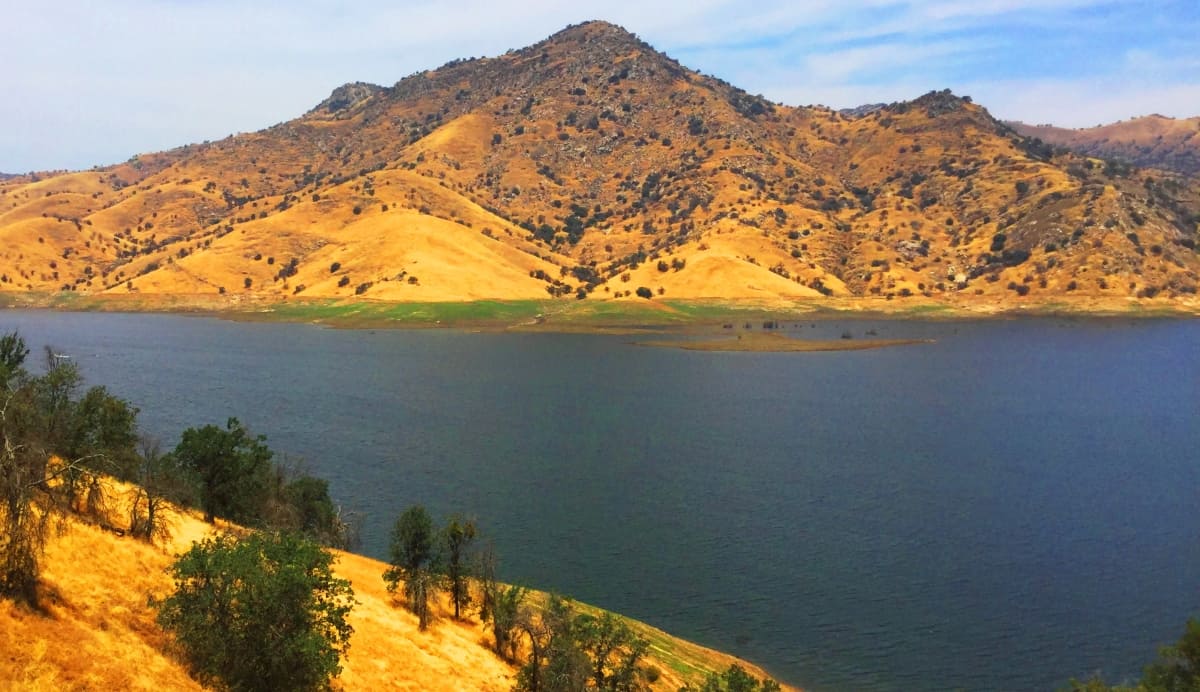 Forests begin to emerge along Three-Rivers Road, Route 198, which is also known as General’s Highway. The entire world changes from gold to green in a matter of miles. This is the main labyrinthian route into the 10,500-foot heights above-sea-level, leading ultimately into Sequoia National Park, and a supreme vantage of the Sierra-Nevada Rim at Moro Rock Trail. There are 39 additionally exquisite options to hike here at the most hallowed Forest in the world, and for a look at the largest and oldest Sequoia Tree, the ‘General Sherman Tree Trail’ is here too.
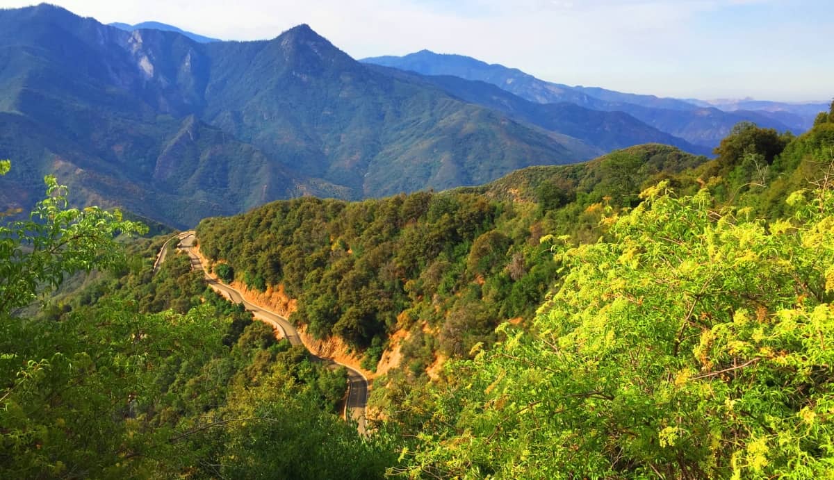 General Sherman Tree Trail: The most ancient and massive tree in the world is found here at Sequoia, known by the rather crass title of “General Sherman”. American Civil War General William T. Sherman is best known, ironically, for burning every major industrial center of the American South in 1865. ‘Fire’ as a historical theme emerges here again. The stupidity in naming the most sacred Tree on Earth (a Tree that is extremely vulnerable and threatened by Fire) for the name of a man who is known chiefly for burning half the country to the ground, is embarrassing. Whatever the real name of this Tree is, I can guarantee you, it is not anything like “General Sherman”. Nevertheless, follow the signs along the Park’ road for several minutes until you arrive at the designated parking ground. The simple singular trail loops gradually down…
 through a grove of gorgeous Ponderosa and Sequoia, where “General Sherman” looms irreverently above all else. It’s a short looping walk around, before heading back up.
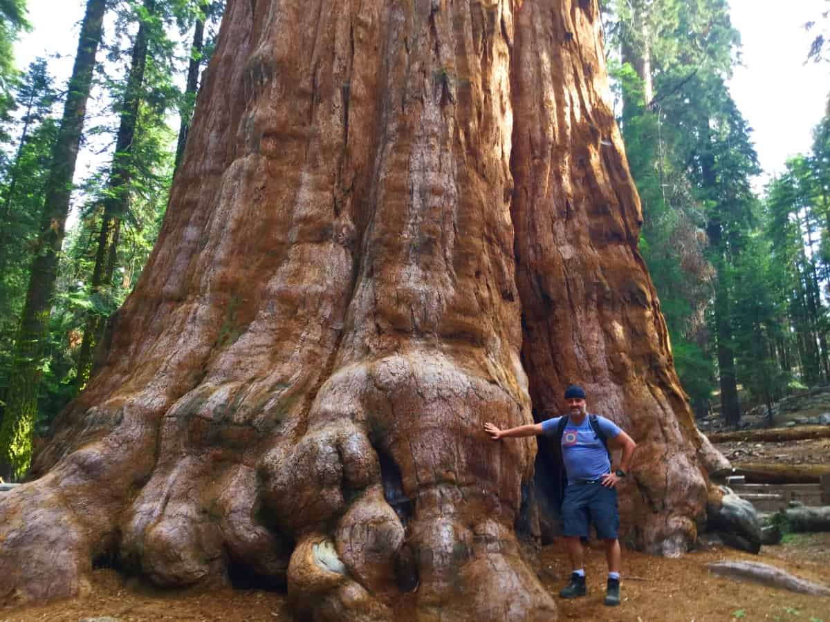 It would be best to choose a secondary hike, a more significant one, through these woods. I chose to get back in the car and drive over to the main car-park, near the entrance, and have a walk up to the incredible vista at Moro Rock Trail.
Moro Rock Trail: The walk along the Forest road from the main car-park to Moro Rock is the first and most basic option for seeing the precious Sequoia glades here on the high south rim of the Sierra’s. Just a few miles of slightly elevated walking gives a marvelous glimpse of both the Jurassic scale, and serenity here. Soldier Trail can be found to the left along the lower road, or near the entrance at the top of the road, by Moro Rock. 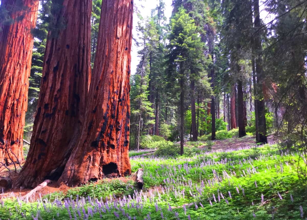 There are lavender rushes that run for hundreds of yards beneath the ancient wooden monoliths, so strong,. yet so vulnerable, as shown by the charcoal bruises of the bark. forever resisting the burn. Pathways weave beneath trees that are, in their own right, perhaps one thousand to several thousand years in growth.
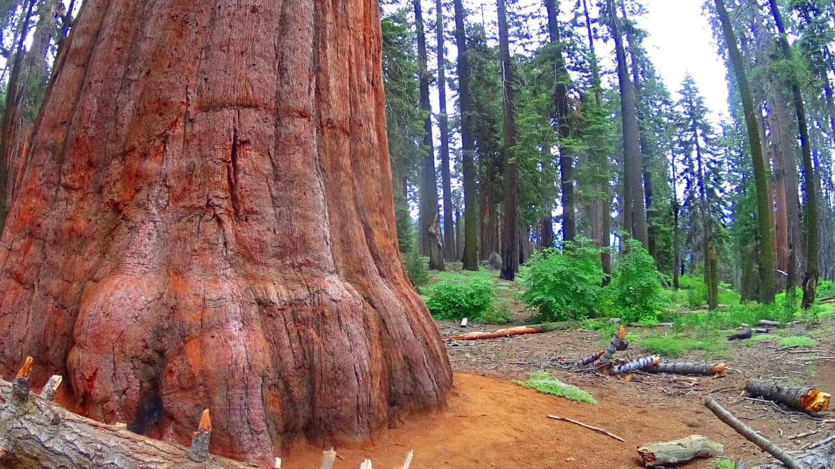
If you follow the short Soldier Trail or the road, you will break through the Forest and come to the climb for Moro Rock. This is only a ten minute jaunt up some granite stairs and cuts in the rock. Aside from the grand overall view of the Sierra Rim, it is also an opportunity to see just how rare, and skyward, this elevated Forest really is. A look at the Forest from here reveals the exquisite nature of this place; The altitude, the edge-of-the-Earth vibe, the familial feeling of this relatively rare corner of related giant glades, just takes your breath away. From above, nothing seems to be in jeopardy; But within the glades, we know full well about the battle taking place against the severe weather patterns of the last decade. Sequoia’ is so ancient, so connected to the earliest Earthly realm, that it is a wonder these timeless trees have not yet literally learned to speak. The Peak at Moro Rock is an opportunity to ingest all of this.
Mortality. Time. Grandeur. Family. Rarity. All themes that touch the heart here. The subtle relationship of the Elements to the natural world, and the naturals world’s relationship to us, is on massive display. You must sometimes extend yourself to find the rare places, and the ancient places, the sacred places. Try to understand that seeing a place like this is not important because of its raw natural beauty, or heavenly scale; Sequoia is not important because it may one day burn; It is important because it whispers to you, with every bending branch, that our time will be up in the relative blink of an eye, in the sight of these glades. Here is one of the most sacred scenes in nearly all incomprehensible Time. See it if you can. Stonestrider.com
Zucca Mountain
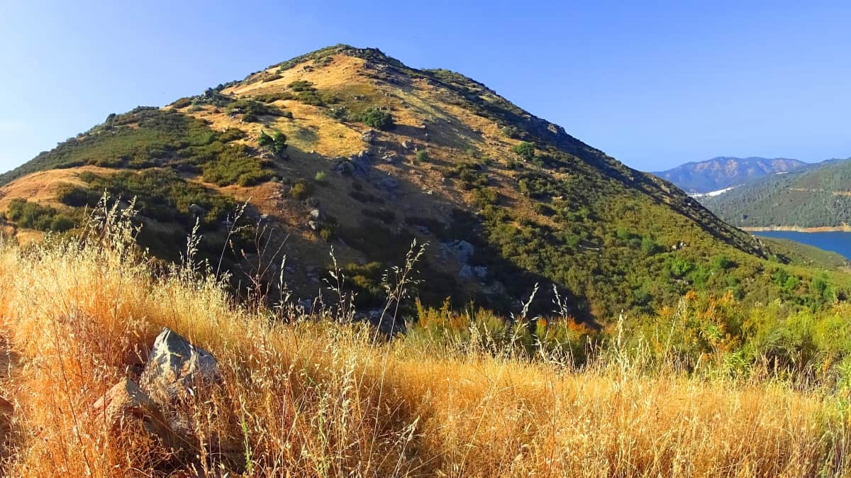
Location: Sonora, California/USA
Elevation:1,925 ft
Prominence: 2200 ft
Note: It takes a single day driving east from the nightmare that is San Francisco to reach the dreamscape that is the Californian countryside. Sonora California sits about 130 miles east of the Pacific Ocean, amidst a set of small golden mountains, on the epic edge of a rising continental landscape. This classically Western country town, where Mormons still mingle wearing their 18th Century attire, among hikers, shopkeepers, bikers, and laid-back locals, is an ultimate jumping-off-point for the definitive hiking experience of the American West. Like a Californian version of Tolkien’s Shire, Sonora rests on the peaceful but ominous precipice of several mysterious mountain ranges and wastelands that rise thousands upon thousands of feet, both above and beyond into the east. The comforting colors, the cinematic warmth of the hills, is truly one of the most inviting regions one could ever imagine. (Image/Below)
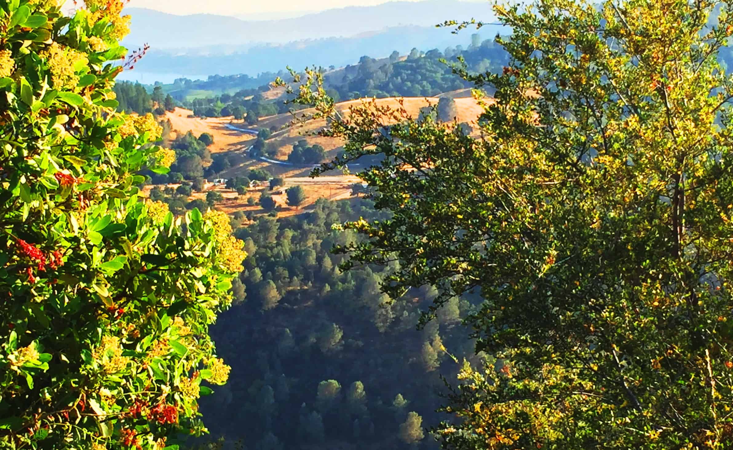 Looming just beyond Sonora is a vast Sierra Nevada Range, encompassing Stanislaus National Forest, Yosemite National Park, Sierra National Forest, Kings Canyon, booming with peaks reaching all the way down to Sequoia National Forest, some 300 miles to the south. When crossing the continent from the east in the 18oo’s, many settlers found crossing the Rocky Mountains to be much less of a challenge than the extremity of the Sierras, which should give you some idea about the intense ruggedness of this final American Range, before reaching the Pacific. (Image/Below)
 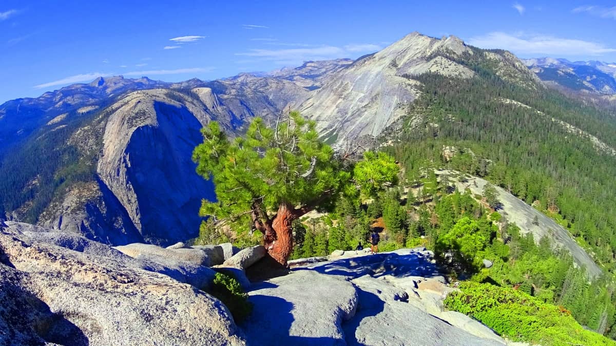 The town of Sonora sits atop an elevation 2000 feet above New Melones Lake. The incredibly scenic E18 highway runs down from town to a bridge- crossing. On the west side of the water, looming above the bridge, is a small but beautiful solitary Mountain known as Mount Zucca. (Image/Below)
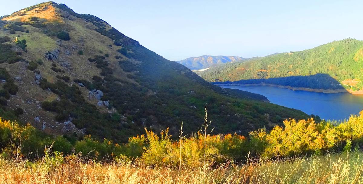 Rumors of the “goldscape” of California were enough to bring minors, prospectors, and contractors all the way from Europe, and as far away as China. Mount Zucca is the perfect image of what was described to family and friends back east; a glowing, flowing, and beautiful scene of golden hills. It was as if the landscape itself, the very colors of the hills, were scintillatingly hinting at its valuable core. Two billion dollars worth of pure gold was literally pulled from the rivers of California from 1849 t0 1855, which is the equivalent of about sixty-seven billion dollars worth today. It was enough to bring the myth of American Manifest-Destiny into an undeniable reality in the newspapers of the Nation, even as the Native population was being brutally eviscerated. The Hupa, Wintu, and Yana tribes would’ve been found among the gorgeous hills near Zucca Mountain.
Some mountains are more like elongated ridges at their tops, running long, like Mount Katahdin in the State of Maine/USA. (Image/Below/Left) Other mountains cluster, like the Three Sisters at Glen Coe Scotland. (Image/Below/Right) Aesthetically, solitary mountains have a unique and special effect on the mind, like the Cross in a Church, or a Buddha in the Temple. Mountains that stand alone, like Errigal in Ireland, have a central peak.
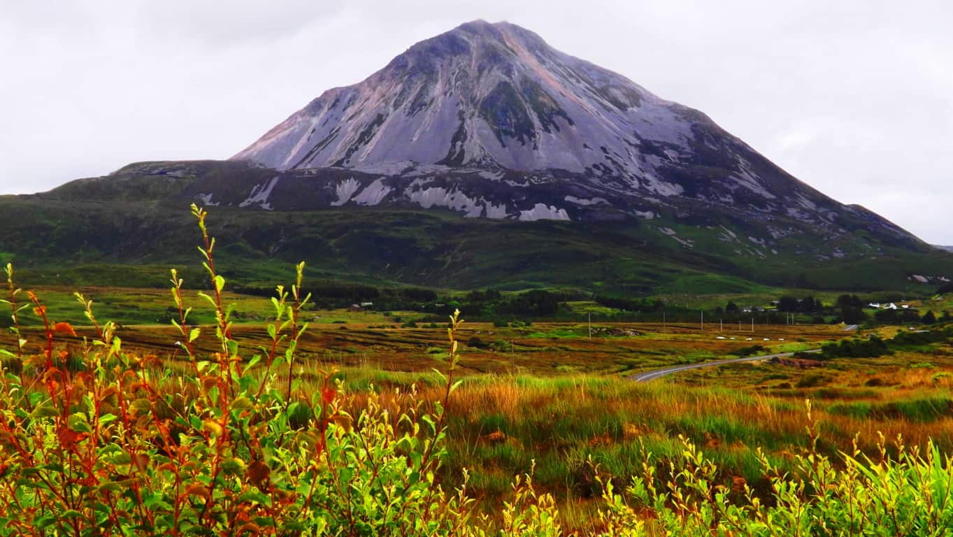 It doesn’t matter what size a particular mountain is, to have this quality, as long as it stands alone. That’s why, even though Mount Zucca is three times smaller than Mount Errigal, it still has the same epically solitary and stoic quality.
So when I looked at Mount Zucca for the first time I actually had a momentary vision of Mount Errigal, some three thousand miles away. Flashes like this are valuable; so I took notice and decided to Climb Zucca’ that very moment.
Trail: Californian small mountains have the cool Celtic quality of treeless sides. It is much easier to gauge the hike from below with mountains like this. It’s a good feeling.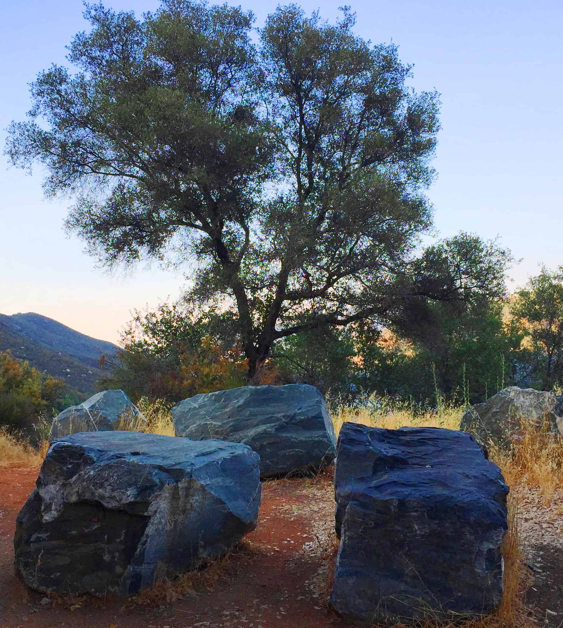 The trail here is absolutely clear from below; a slightly winding incline, with a fine path throughout. It looks to be about 2000 feet to the top, a perfect practice-hike for greater challenge of The Sierras, about an hour-and-a-half to the east. Starting out, about seventy-five yards from the bridge-crossing below, on the western side, you will see the trail head stones just above the road, for Mount Zucca. (Image/Left)
The lower path is lovely. Glowing rushes surround you as you float up the hillside. I chose to take this path a few hours before Sunset, so as to catch that Sunset, and still have enough light left to make the way down. You can take advantage of the long shade in the late day, cooling you down if you so choose to utilize it. The angle of the sunlight is cinematic, making for some really solid images.
Every mountain has a unique story to tell. If you heighten your senses, and move mindfully, you may start to see signs that someone may have lived here once. As someone who has climbed in dozens of peaks, I can say, with a strong amount of evidence-supported confidence, that those ancient cultural signs tend to have specific similarities, and are usually carved into the stones. Heading up this trail, those signs are abundant. Get ready for a sacred scene.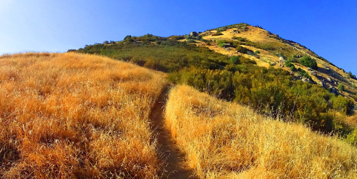
Mount Zucca would’ve been an ideal place of habitation, tucked into the overall Valley, and just above the River, where fish would be readily available. Several signs of ancient habitation appear in the qualities of the stones here in this beautiful place. It looks like someone else has noticed the somewhat distinct features of these fixtures of stone as well. (Image/Left)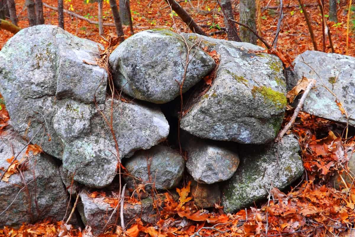
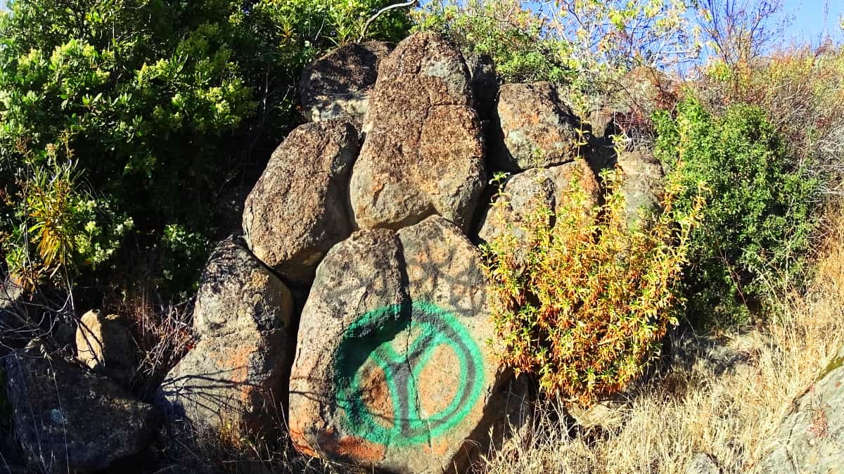
Someone cut these stones to be noticed. Look at the fitted, subtle angles, quaint notches, fitting this setting together like a puzzle. This is not the product of any random natural process. Fixtures like this can be found in forests in New England by the thousands, on the other coast. (Image/Right) It’s a great sign. It would make sense that a valley as beautiful as this would sponsor Neolithic Culture.
Continuing steadily upward, the terrain is dry, and the air is breezy in the late light. The path slowly rises above some gorgeous forest on the northwest side of the Valley. In contrast to this wide open skyline a distinct Neolith appears. It is not uncommon to see large boulders in the heights, but it’s the cut angles in stones that are meant to pull us closer. Often times the cuts on these stones specify a vantage on the Sun, or the Moon. Interestingly enough, this massive protruding rock is cut distinctly on it’s face, and looks upward into the path of where the Sun would rise.
 It isn’t just the stones that gives a mountain like this a special feeling. Many years ago now, I was hiking on a small Mountain in Kinnitty Ireland, similar to the size of Zucca’, and at the top of that small Mountain I found seashells along the footpath. It’s a cool feeling finding seashells in the heights. It seems that once upon a time, just like in the Celtic heights, this Valley was flooded.
 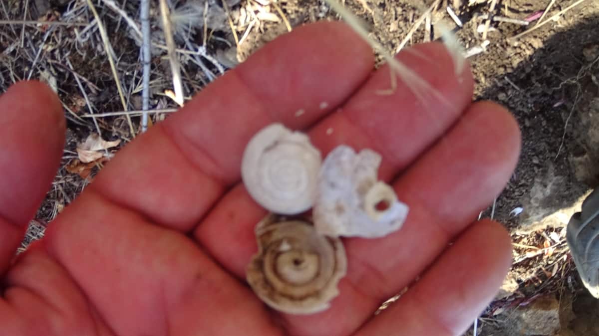 Why is it that National Geographic articles don’t cover the fact that there are seashells in the heights of so many mountains across the globe? Why haven’t we read about this phenomenon in our Highschool Biology books? Why wouldn’t they want yo to know about this obvious phenomenon? Halfway up the trail, Mount Zucca already shows many of the signs that the mythical Celtic Mountains do, signs of the earliest Culture on Earth, the Neolithic. The boulders in the heights are specific and angular. For many portions of this you don’t see any boulders at all; just a beautiful ultimately calming vantage of swaying dry brush and soft light. The specificity of where the stones are found is important.
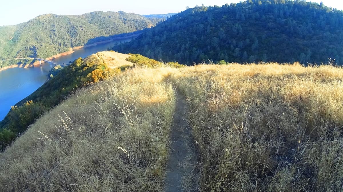
As you make your way into the heights there are additional stones that have the strangest look, carven, cut, molded, all in one. And what a view. These redundant earthy mounds climb softly up and ahead, while the Sun looms behind. The temperature is pleasant, and the air is wonderfully clear up here.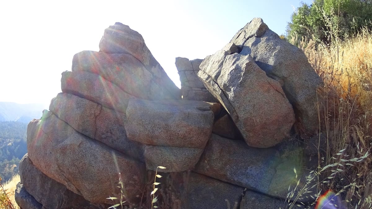 In the delightful heights of New England and Ireland we find similar strange stones guarding the upper heights, like small towers protecting the edges of a miniature empire. The special thing about stones like these is that they often contain a 3 dimensional surprise; looking from the front you find a unique expression of specially stacked stones, layered and fitted. But from above, looking down, you see an almost impossible X-cut straight through each level of stones! This precision cut, passing all the way through each layer of rock is meant to impress us. The delicate detail, combined with the brute force necessary to make a cut like this is mind boggling. And furthermore, this X is an international Neolithic symbol, used the world over. What a creative way to express it here! Take a look:
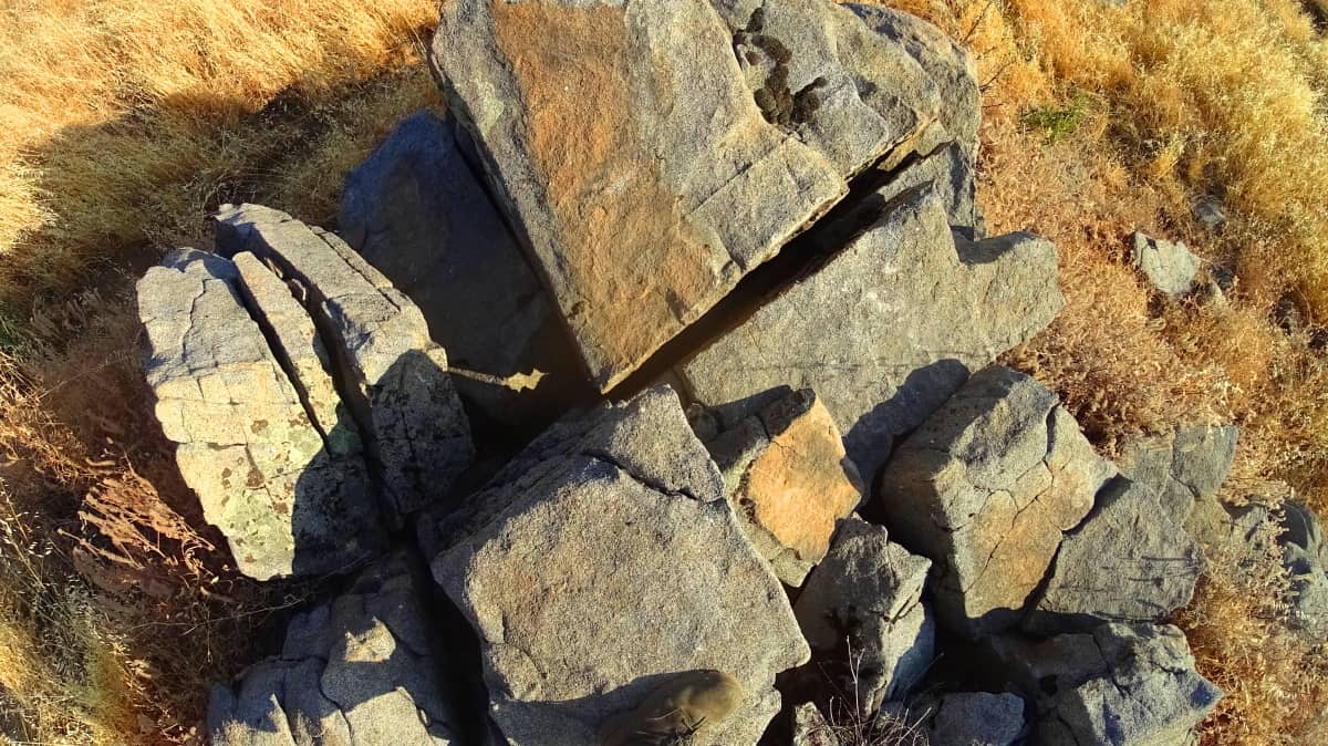
From the side it would be almost inconceivable to think that such a unique and impossible expression exists in these rocks. The straightness of these lines is absolutely modern looking, and yet we know it is not. Here are more X…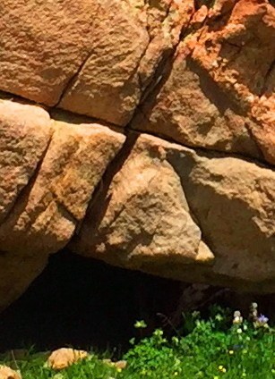
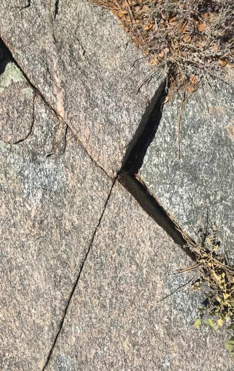
…sections near the sacred peaks of mountains across America (Images/Above); Clark Mountain C.O (Right), Hulapai Mountain A.Z (Middle) and Monument Mountain (Right). Are geologists or anthropologists blind? Do they even climb these mountains? I’ve never seen a single one up there. I’ve found enough X sections to write a study on them alone. But for the moment, in seeing this, the full realization that Mount Zucca is a sacred peak should sink in. What a gorgeous scene.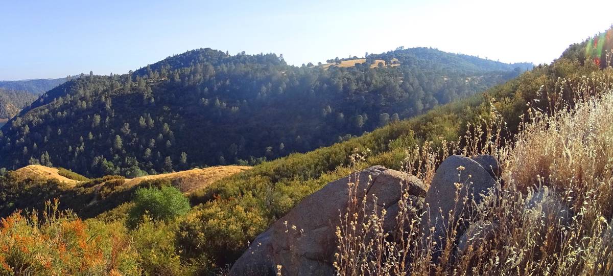 Continuing towards the peak, you will work your way up around several small boulders to emerge to the peak. The full spectrum effect of the California vibe hits you in this place. To the north is a scene that looks more like Mexico, with brittle earthy toned shrubs and chocolaty-gold soil. Other peaks are not tree-less like Zucca, and perhaps that in itself holds some kind of meaning yet to be determined. It’s altogether heart warming.
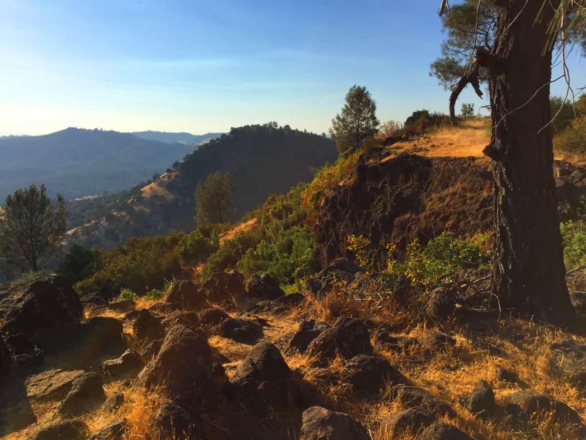 To the south is a near perfect vision of the lake stretching along the Valley. This is a doubly advantageous height, with a clear line of sight on anyone approaching, along with access to the water.
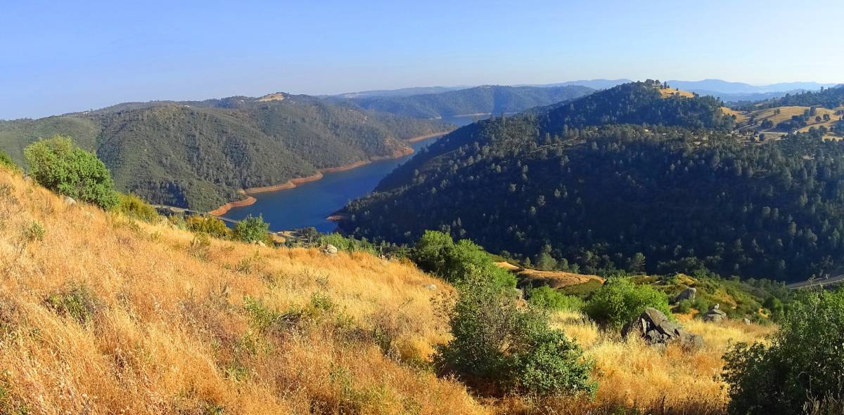 If you look along the right-side line of the picture just above, you will see each stone fixture, each with unique characteristic, lining the trail to the top. It is not at all disheveled, but rather, super organized, as if someone put their particular mark all along this Mountain, a long, long time ago. From the highest point of Zucca, there are cut boulders settled into the peak that look like parallel cut stones overlooking the entire Valley. It’s a nearly perfect parallel vista.
 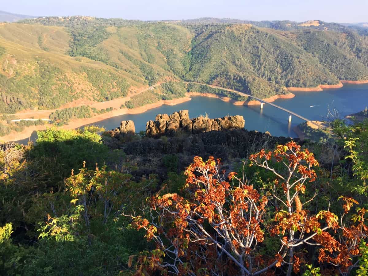 The Californian experience is encapsulated in this small Mountain. Just like in New England, Ireland, Wales, Scotland, and most likely the world over, there are signs in the stones of magical things. The reason they are magical is because many of them are nearly impossible. These signs are almost always in the most beautiful heights. Achieving a peak is rewarding on every level. This a spiritual zone, a place literally lit up with impossible things, mingled with panoramic natural beauty. Further up the valley, in the forests of the town of Sonora, there are stones with cut triangles embedded in the rock. It is hard to believe. Clearly this was a Neolithic haven.
 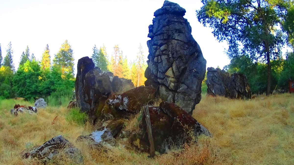 The equilateral triangle is impossible to miss, even at a distance, at the center of this massive fixture within this pristine grove. Of course, equilateral triangles are specifically carved into the rocks in New England on the East coast.
 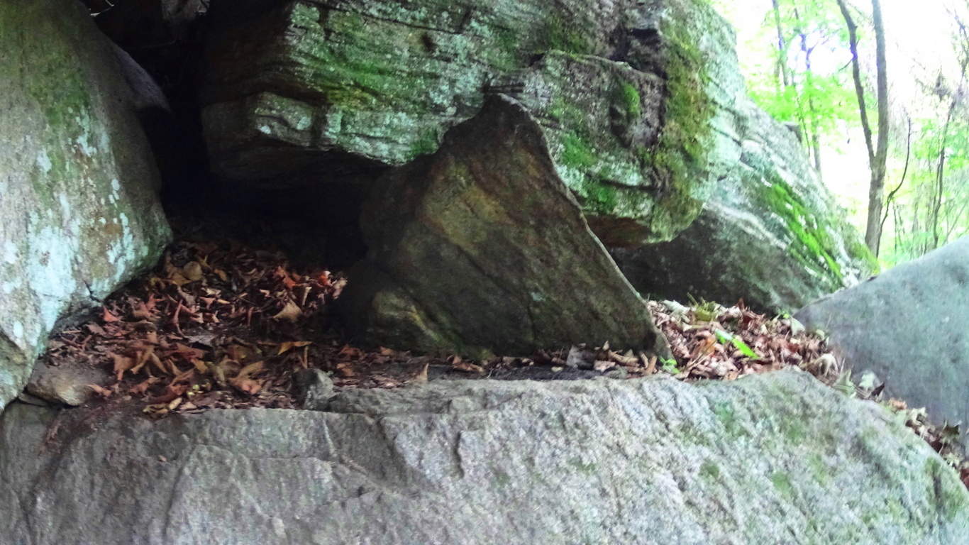 This image on the left is just one of hundreds to be found in the forests.
It appears that Californian small mountains are as enchanted as the rolling heights of New England and southern Ireland. As opposed to the infinity of green in the Celtic parts of the world, everything here is sun-kissed, including any person who stays in this region for more than a week. This is a nearly flawless area for everything that hiking can be, sacred stones, gorgeous heights, clear paths, and Sun through the day. Come to California and discover the sacred aspects of this scene for yourself. Sonora is the perfect spot for small-mountain mystic experiences, and only an hour and a half away from one of the most massive mountain ranges on Earth. Seek it out! Stonestrider.com