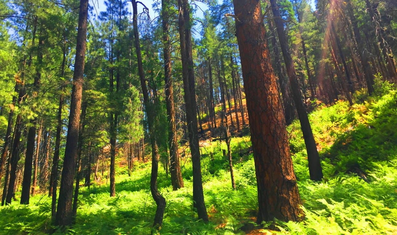
Shenandoah National Park
Elevation: 4000 ft
Location: Stony Man Mountain/Blue Ridge Mountains
Note: The chill of New Hampshire in January can be challenging for cross-training hikers, and mountain climbers. Temperatures reach into the teens, and often below zero, making “megalithic-mountain research” a dangerous endeavor. I brainstormed less dangerous possibilities this month; North North America is massive Continent. Ultimately I figured I would go where the cold wasn’t. Enter the possibility of: Virginia.
With my work at Bentley University at an unfortunate impasse, due to Covid19, I decided to make a move, driving 550 miles south to the Shenandoah Mountain Range of Virginia. I finally entered the dimension that is beautiful Virginia. It was gorgeous, even in January. 
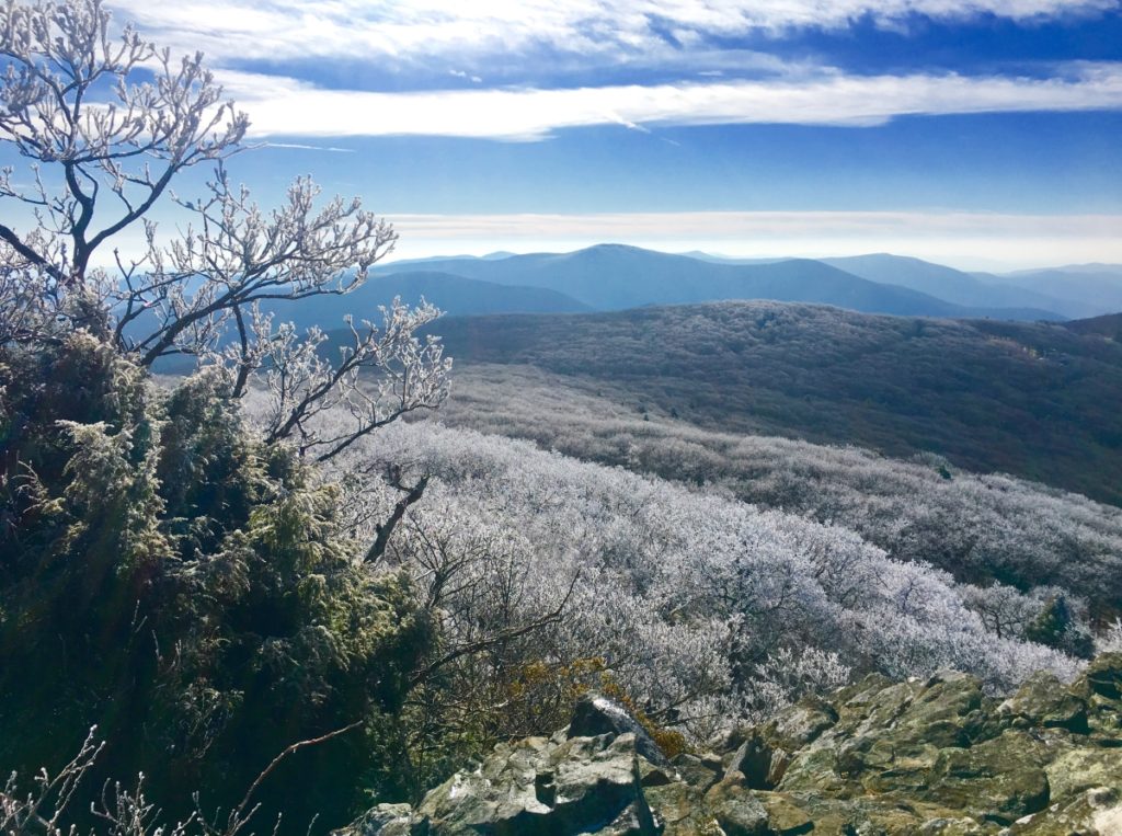
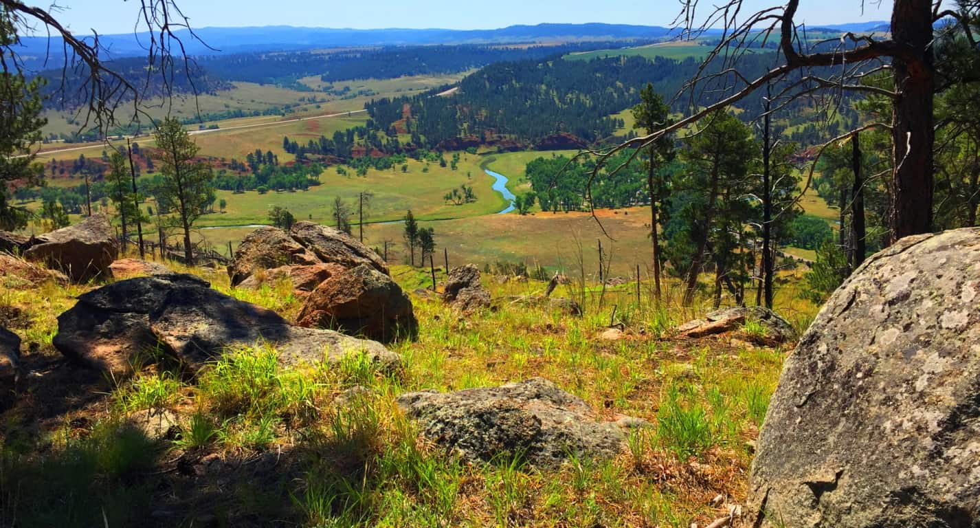
With temperatures at 45-50 degrees, and the Sun shining, I cruised into the hidden caverns and valleys at the heart of Virginia. It is literally a golden zone of hidden valleys, crafted by the massive parallels of the Blue Ridge Mountains. Within those outer parallel shafts, other peaks ripple massively in an asymmetrical miasma that crafts miniature valleys within valleys below. 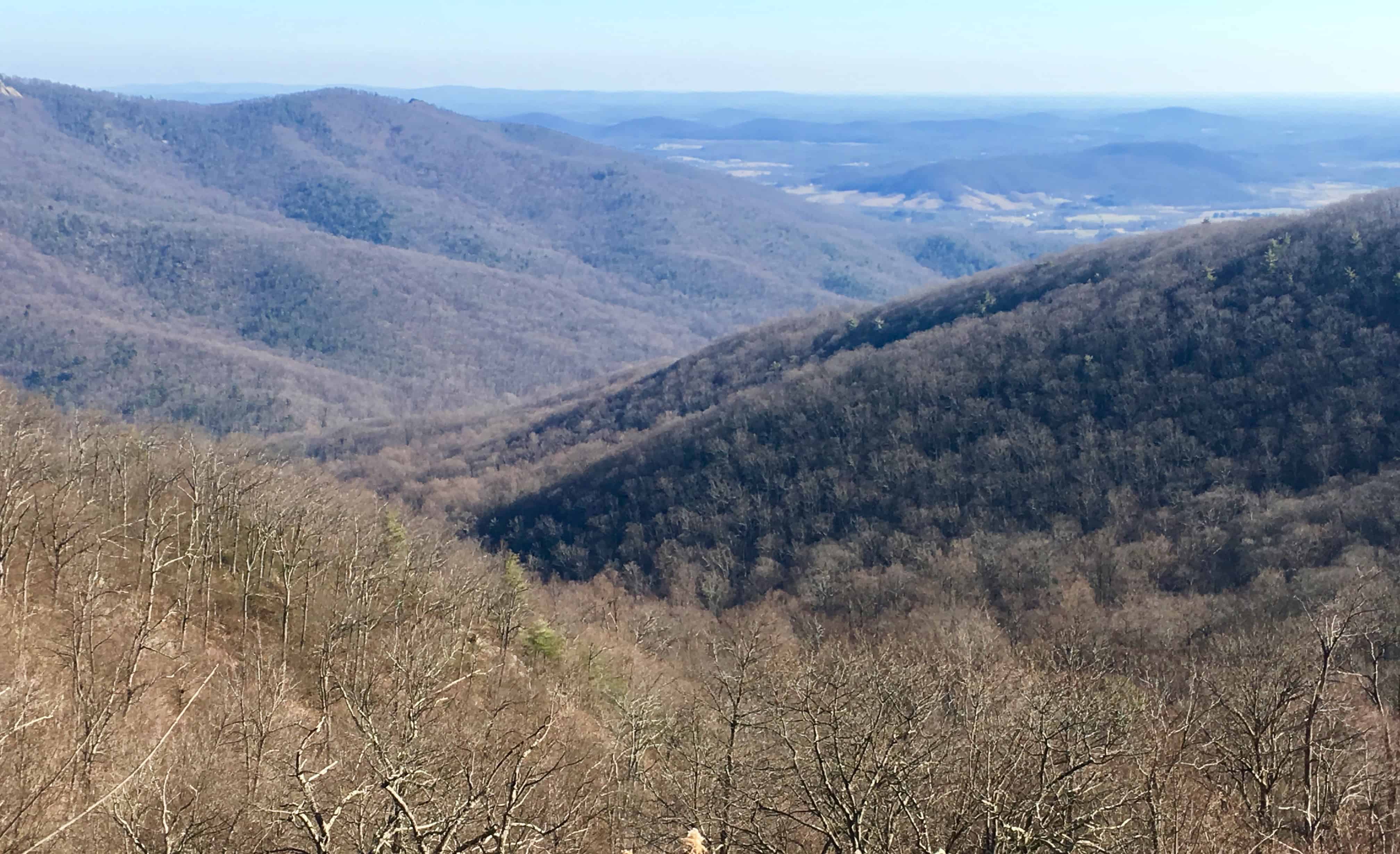
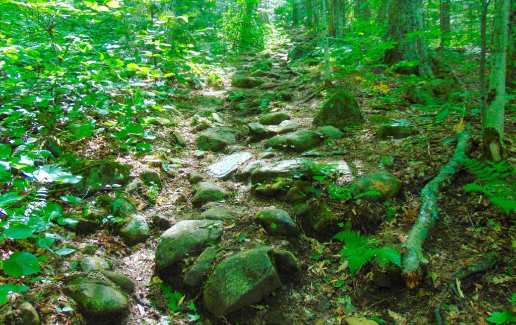
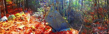
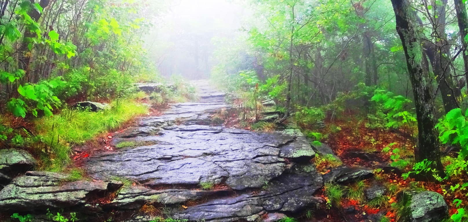
The entirety of Shenandoah National Park can be driven on the single Highway known as Skyline Drive, running straight through the Blue Ridge. There is a $30 entry fee at the elevated entrance of this incredible Park, and then you are set free to choose a trail. There are dozens of forest-trails and peaks to choose from along Skyline’. I had read some interesting commentaries about Stony Man Mountain Trail, a 4000 foot peak about half-way up Skyline Drive, where the stones have been noted by hikers as having interesting fixtures and shapes, depicting a “man in the mountain“. That was the place for me. I immediately I was struck by what I saw. There was magic in this place, right from the start. 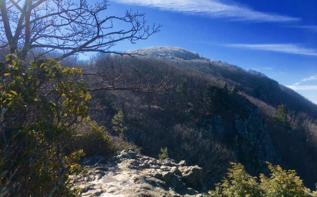
Note2: Stony Man Mountain: One of the major themes of Stonestrider.com is identifying unique and sacred zones that distinguish themselves through Anthropological Geology. These vast rocky cultural zones show practically impossible fixtures of stone(s), found in finely focused areas. There are serious mathematical patterns and indicators within these fixtures indicating an intended meaning, rather than merely random glacial spasms. The beginning of the Trail leads directly into an explosion of mossy green stone fixtures, with a straightforward path.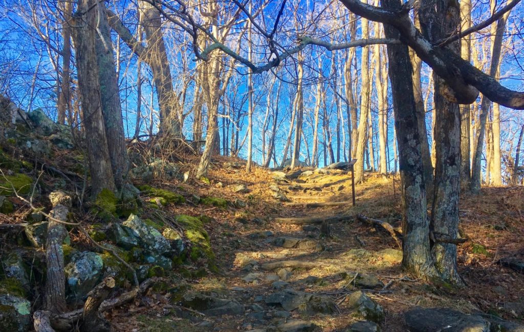 The golden-brown wintery haze of leafless trees and soily hills in the vast lower valleys below abruptly changes into a temple of mossy megalithic stone, beginning just off Skyline Drive. Virginia very suddenly looks like New England, or Northern Ireland. The stones seem to always converge, almost manically, at the peaks of Ranges all throughout the Western Hemisphere.
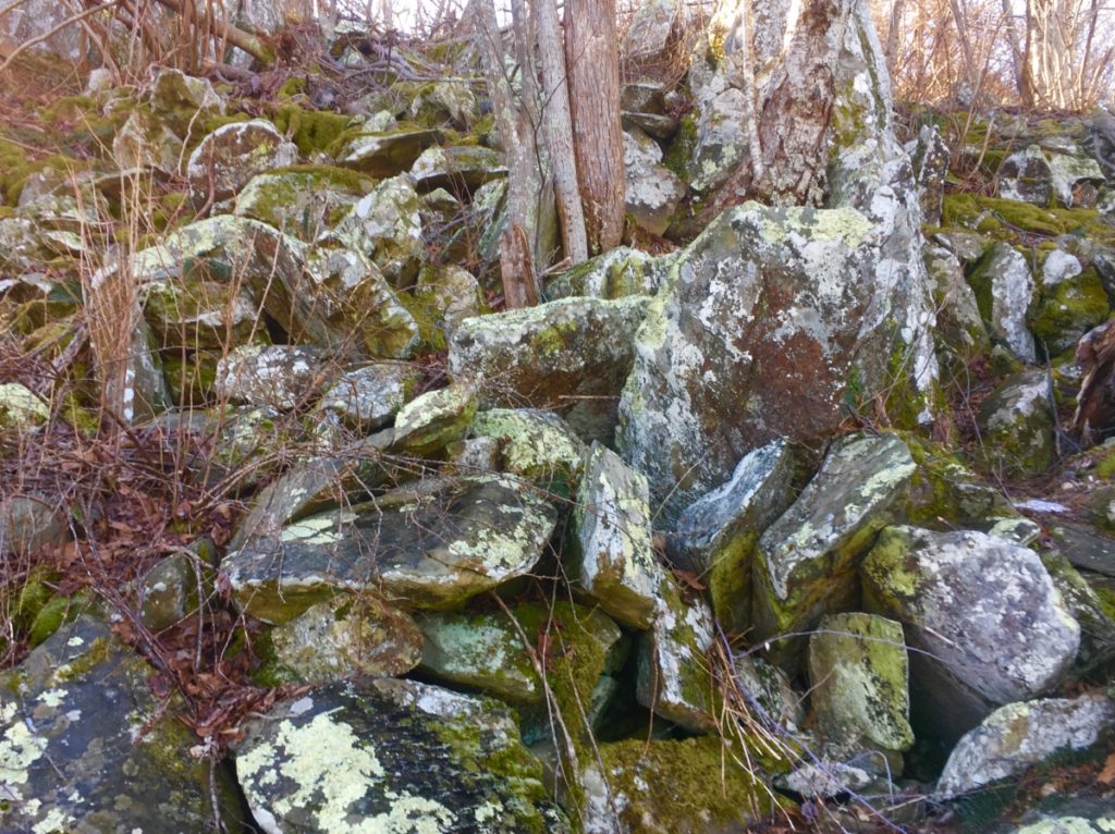
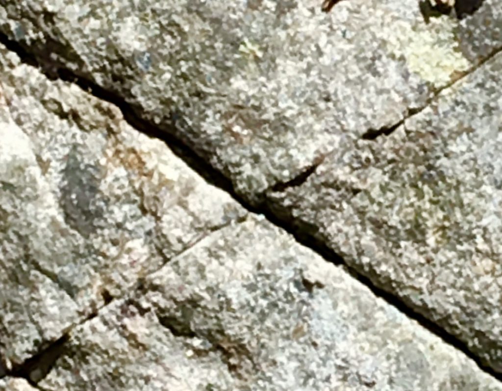
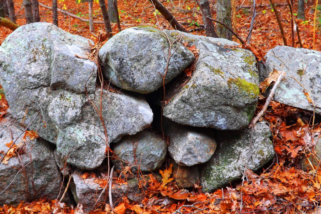
There are also indicators for alternate meanings literally etched into the overall pathway, leading to the peak. Imagine the shape of a spiral, carved into the mountain, radiating centrally from the peak, like the shape of a conch sea-shell. The phenomenon of thresholds appear here at Stony Man’. These are specifically sized, and lined, linear stone markers, placed in a planned ratio of size scale and space. This pattern creates what appears to be levels of a spiral path, purposefully written into the Mountain. Below is an image of the first threshold at Stony Man’. Notice that the stones are fitted, and quite large, against the reference of my foot. 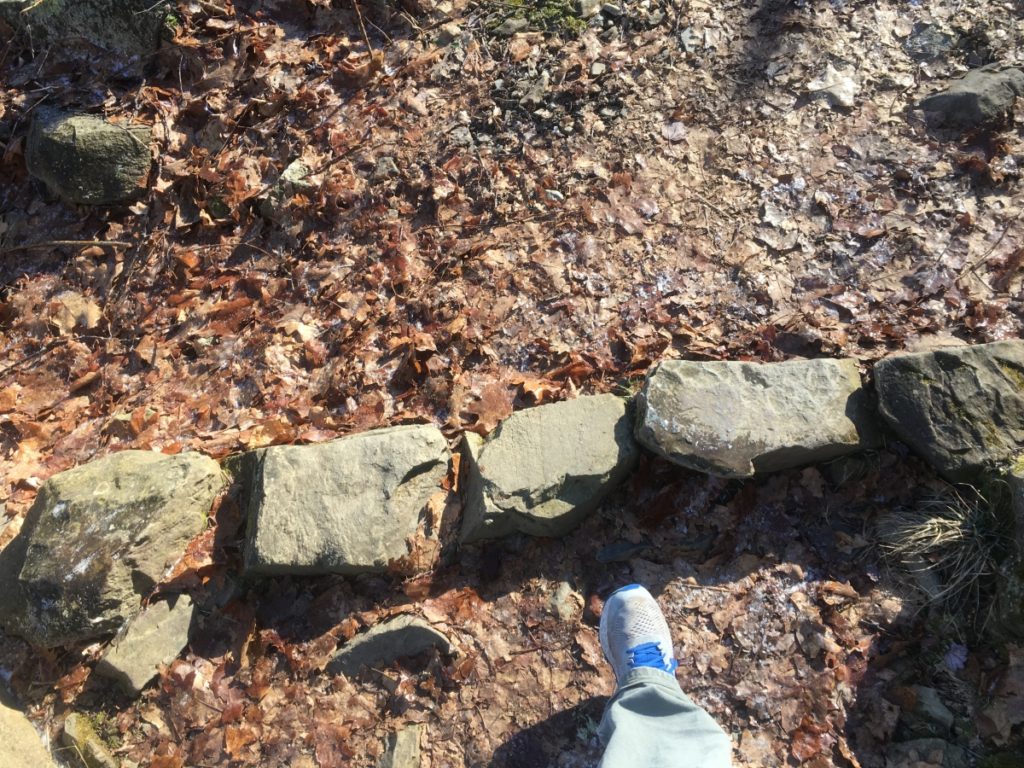 Roughly 150 yards further up the Trail, and almost 35 feet higher in elevation, is as second threshold, with stones roughly 1/3rd the size larger than the stones of the previous threshold. (Image/Below)
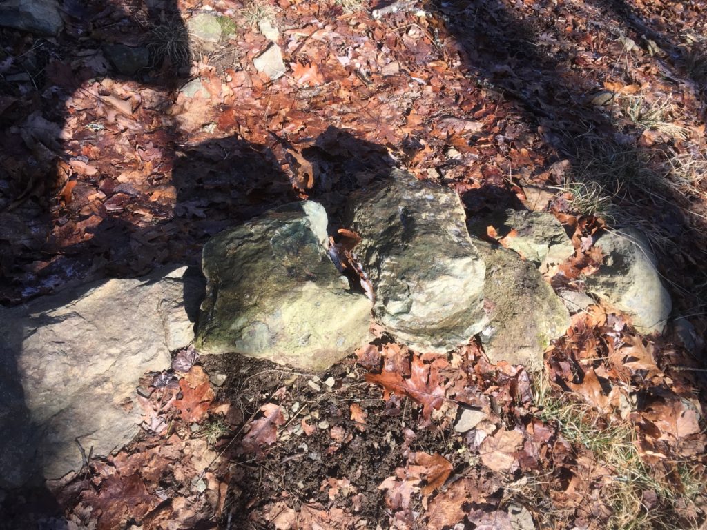
This pattern continues, increasing in terms of size, scale, and distance, with at least 7 more thresholds winding up the Mountain. The point of acknowledging these thresholds is to recognize that the megalithic stones of these sacred peaks seem to be relating specific meanings and fixtures of stone on a grand scale. For emphasis, thresholds are also found along sacred peaks at Monument Mountain in Massachusetts, Mount Katahdin Maine, Clark Peak in the Rockies of Colorado, Rocky Woods in Massachusetts, Mount Bearnagh in Ireland, and The Half Dome at Yosemite. This is a consistently identified megalithic event of a specific crafting type, other than ‘linings’ and Dolmens, that appears to be indicating a mathematical marking of the landscape, towards the peaks.
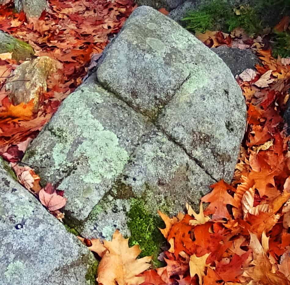
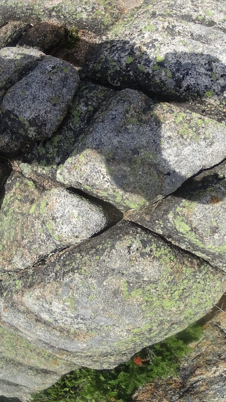
There also appears to be collections of crafted-stone, fixtures carved distinctly into the stony ramparts of the hillside. Just as it is with many of the megalithic stones of Greece and Egypt, there seems to be a molten shaping of these long linear stones, as seen below. The heat it would take to congeal, and then craft these stones, is technologically intense, and extremely hard to justify, if the proof of the stones were not directly before us. This appears to be exactly what happened: Molten heat for mingling the stones, then crafting of long linear interlinking pieces. 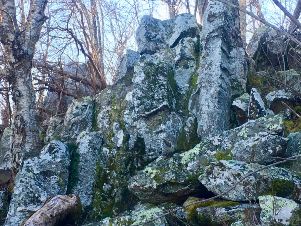
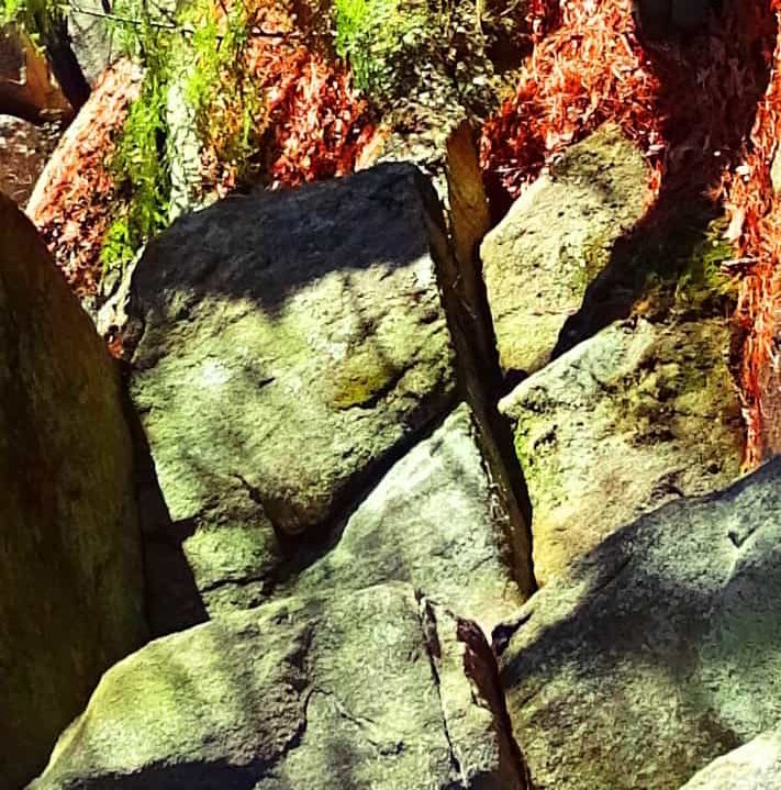
I have seen similar fixtures at the peak at Mount Bearnagh. As you can see below, at Mount Bearnagh’s peak the stones appear to be randomly stacked at first glance, but a closer more considerate glance, reveals crafted indented intervals of markings that measure the fixture. Also note that the measurement is not inches, or centimeters. It is some other system, entirely. 
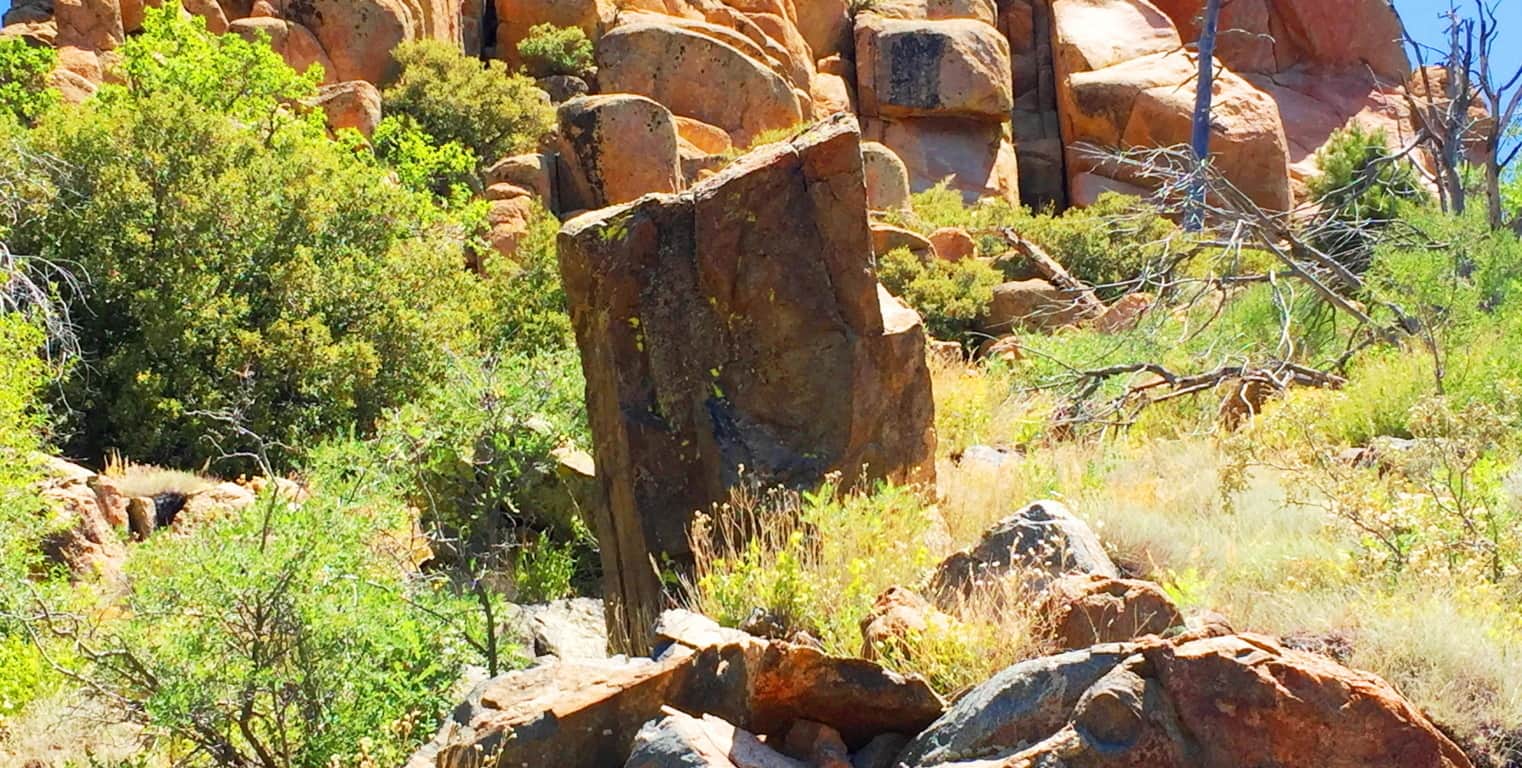
Continuing along the Trail at Stony Man’ there are other crafted fixtures that seem to have meaning. Several stones seem to have been crafted to indicate the directionality of the Sun’s route across the sky. These identically fixed and cut boulders that eternally depict directional apexes, seem to be pointing to the point of the setting Sun in the skyline. (Image/Below) 
I came across stones very similar in form in New Hampshire just six months earlier: (Image/Below)  At the half way point of the Trail, an incredible outlook appears on a high cliff facing cardinal South. All of Virginia is laid-out before you, like a golden-fleece flowing low, and lovely, into the distant ground level beyond.
 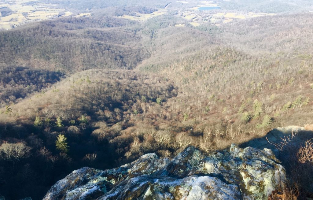 The Trail continues at a comfortable incline back into the upper forest, and into the upper 3rd of the Peak. Consistent with the pattern of ‘intensified stone statements, the higher you go’, there are what look like sets of fixtures, craftings for sitting in specific positions, centrications, and cliff supports made of overflowing stacked-stone.
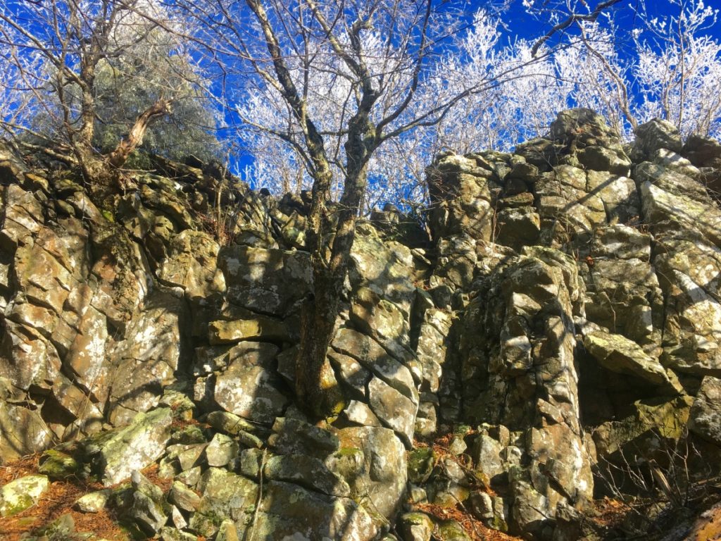
As you ascend through these incredible caverns towards the peak, the Trail takes on a magical cinematic look, with a glowing frost fixed to the fingers of the thousands of branches above. 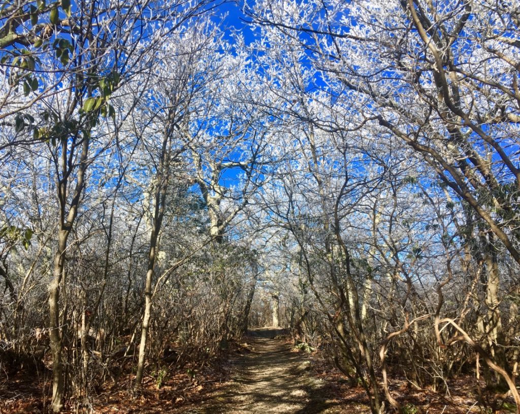
This upper Trail reminded me of the scene at various points of Monument Mountain in Massachusetts, where outlooks just off the main trail emerge just before the peak. The path to these porches look like magical frost portals lit by the Sun. 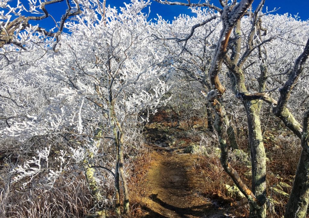
The inner thickets also have this glowing quality: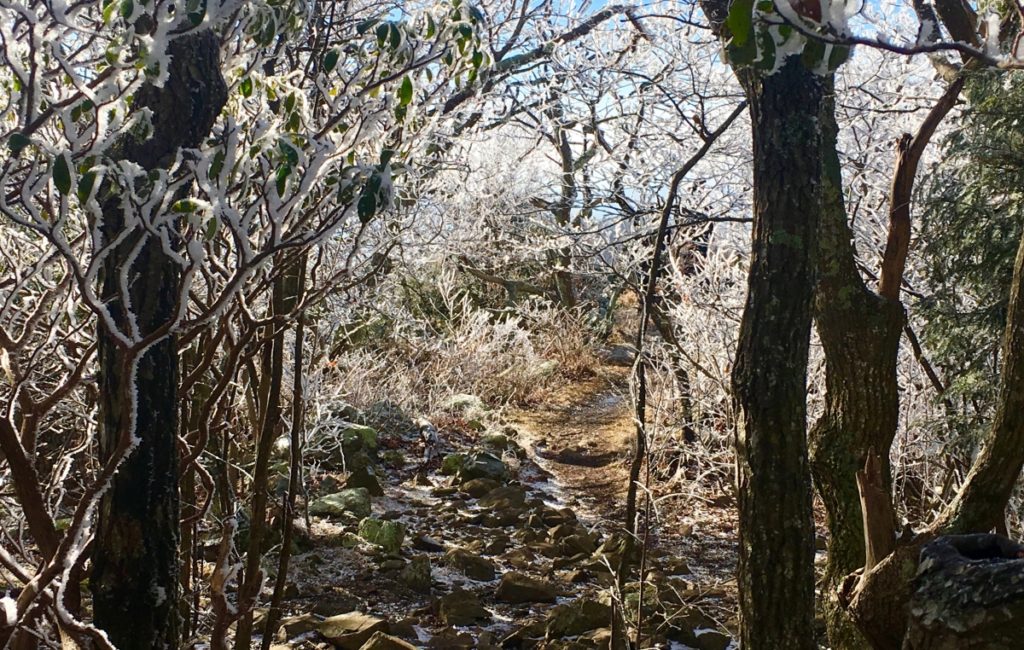
Here, at the vista just before the Peak, the view is stellar, with domes of frost folding over hundreds of times, into the Shenandoah Valley. (Image/Below)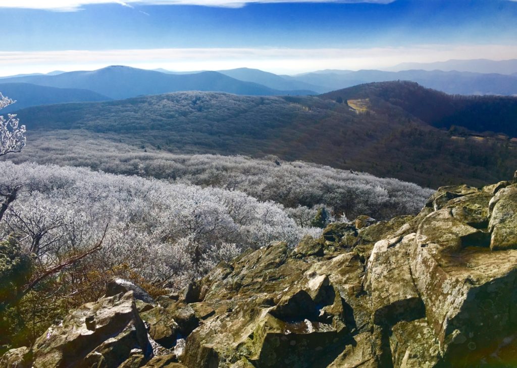
There are crafted megalithic indents on these stone porches as well: (Image/Below)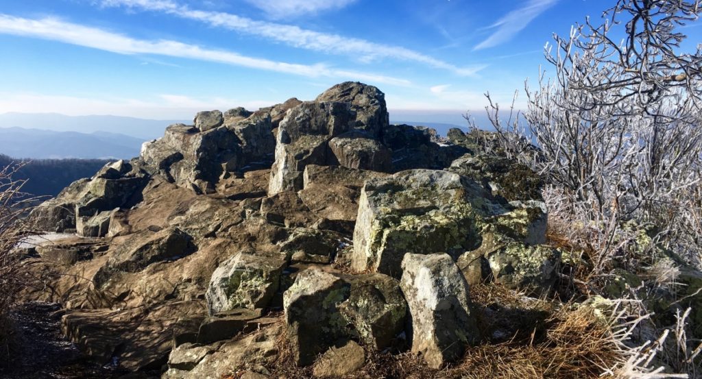 And just 50 yards beyond this vista, is the Peak. (Image/Below)
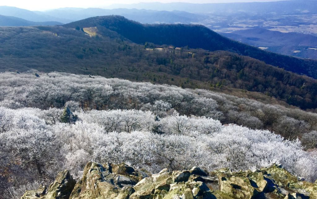 There also appears to be a stone design at the Peak porch, looking back at the Mountain path: (Image/Below)
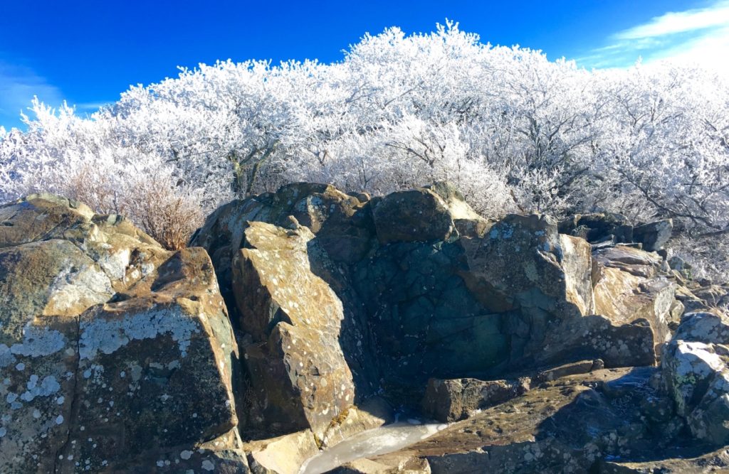
In my single experience at Stony Man Mountain I did not find specific standing-stones, or the typical cross-sections (X) I am accustomed to finding, cut into the stone. I believe that with more time to study Stony Man’ these specific markings could be found. Still, this Trail and Peak is clearly and suddenly inundated with distinctly crafted hillsides of Celtic looking stone, entirely different from the soily persuasion of the overall Valley. (Image/Below)
It is a strong possibility that thePeak at Stony Man’ was sanctified by craftsmanship, and among the earliest forms of functional temples mingled into the landscape itself, as in New England, Ireland, Massachusetts, Sardinia, Wales, Colorado, Maine, Greece, Spain, Peru, and many more places besides.
I recommend hiking this Trail in Autumn if you can, but even in Winter, it surprises even a seasoned climber with elements of unpredictable beauty. In this place, recharge, get away from the fake news-cycle, and pray for protection in the coming days. Just beyond the boarders of these vast views of Virginia, in Washington D.C, a haunt of vipers and spiders are now dropping the most massive iron-curtain upon freedom loving humans in the history of the world. Reject them. Continue to cross-train in the hills and peaks of the Ranges of the world; Breath deep; Think bright thoughts, and pray for the United States of America, and the World, to overcome this new evil . And as always, do what you need to do, to go strong.
Love and thanks to dear friends Kathy and Paul, who helped make this much needed venture possible, with a beautiful homestead to stay in Virginia,
Please send any comments, or thoughts to: jpv@stonestrider.com.
Mount Moosilauke
Elevation: 4,805 ft.
Location: The White Mountains/Benton, New Hampshire/USA
Introduction: Welcome to the dramatic western edge of The White Mountain Range, in New Hampshire/USA!
Mount Moosilauke (Moos-ih-lahk-ee) retains a title given by the Abenaki Native American Tribe; It means: “Rocky face above the trees”. As we will see, the high place at the top of this Mountain, is a definitive and distinct megalithic spiritual zone, where the enchanted stones of the peak mingle intimately with the clouds.
This unique title given by the Abenaki, also indicates a deeper meaning, beyond the name itself. Almost every one of the many White Mountain Peaks has a ‘rocky face above the trees’. Mount Washington, Mount Chocorua, Mount Adams, and Mount Jefferson, all have a ‘rocky face above the trees’. Why single out Mount Moosilauke? There is something special going on here.
I believe that The Abenaki were acknowledging this particular ‘rocky-face’ due to the many unique features that they encountered, and considered spiritually significant when they first saw it. In our time, we see them as Neolithic anthropological features, so ancient, that it seems clear to me that they were there before the Abenaki people had arrived. I can support this with evidence. Let’s take a look at the multi-layered experience of megalithic evidence during this phenomenal climb at Mount Moosilauke.
A Note About ‘Culture’: The ancient stone works found at Mount Moosilauke pre-date the Native American Tribes of New England. The Neolithic Culture you are about to experience on Mount Moosilauke, through this article, created monumental works of stone, in extremely difficult locations, and ways, all of which existed long before any Native American tribes had arrived.
This Megalithic Culture has specific memes (symbols), fixtures (arrangements of stone), and structures (functional centers, small temples,) in the highest elevations all over the world, that mirror, and mimic directly with European Megalithic memes, fixtures, and structures, entire continents away. This would support the idea of a single Megalithic Culture, with a single, common, source of systems. Not hundreds of individual, nomadic, Native America Tribes; Each with its own traditions, with basic tools, and migrations that moved seasonally in the valleys, planting crops, hunting, and fishing game.
I understand that this is very hard for many local researchers to accept, defending the idea that Native Americans created these Neolithic statements; but the evidence and cultural history clearly, and definitively, indicate otherwise. Of course, that statement must be supported with the evidence. So here is yet more evidence, and common Megalithic memes, and structures, from Mount Moosilauke, in New Hampshire, that relate directly to Mountains in Ireland, Arizona, Maine, and other sacred locations and high elevations, thousands of miles away; All these locations crafted in challenging, sophisticated, Megalithic stone.
Ancient Megalithic Memes in New England: Walking along the forest streams of the Franconia Notch Range, some 6 miles west of Mount Moosliauke, just a day before my intense climb, I came upon a six foot tall, equilateral-triangular standing stone, set perfectly in the midst of a quiet stream near Route 3. 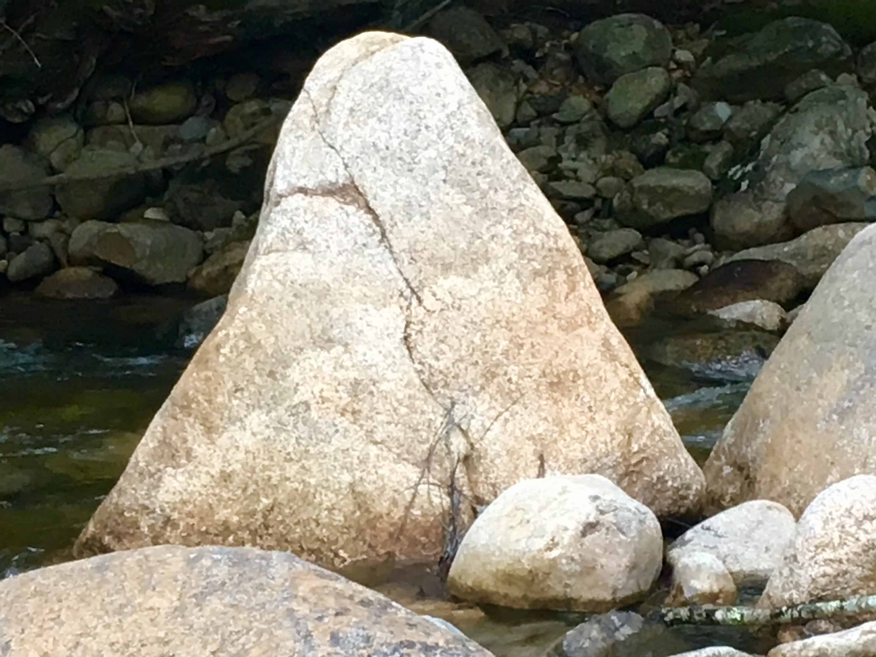
The meme of Megalithic-stone-equilateral-triangles in the Forests of New England, from Massachusetts to Maine, and everywhere in between, is one of the most prevalent and abundant symbols/memes that can be found. On this website alone, there are compiled, and permanently documented, several dozen equilateral triangle memes cut in massive stone in the wilderness.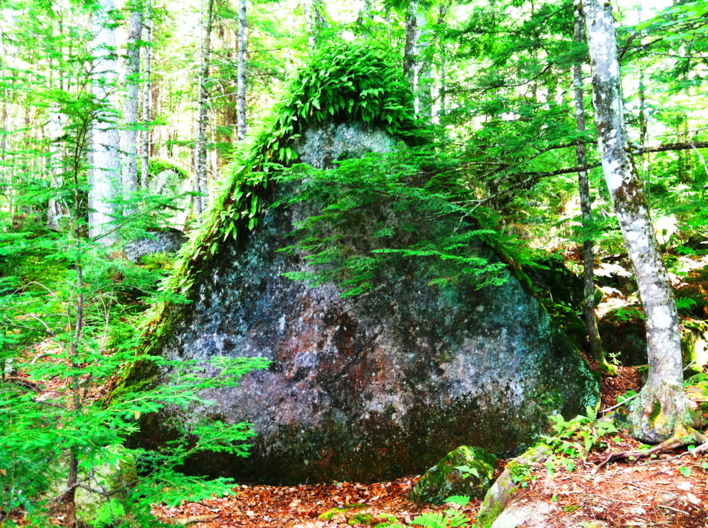
These stones have significant ‘directionality’, and meaning, yet to be fully understood, or even acknowledge by current anthropology. Academics want us to believe a glacier created these statements? I’m sorry to be blunt here, but how intensely-stupid do these current Post-modern anthropologists think we are? Not to mention the fact that I have NEVER ONCE encountered, in any of the mountain ranges I have climbed, in the entire Western Hemisphere, a single real-time Anthropologist, or Professor, in a DECADE.
Very soon, these arm-chair-anthropologists, that dispute the Megalithic memes, are going to be absolutely disproven, and in the most blatant scientific way possible. With EVIDENCE. The evidence is mounting, and couldn’t be any clearer, that these are intentionally crafted, Megalithic, Neolithic-Period works. So, lets take a look at some examples: 
The green equilateral triangle stone pictured in the above image, has a perfectly cut, flat face, standing ten feet high. It might weigh 100 tons. I said 100 tons! It LOOKS LIKE AN ANNOUNCEMENT! BEGGING TO BE NOTICED! THEY ALL DO! It is located in the immense Forest surrounding the sacred Mount Katahdin, in Maine.
The perfectly equilateral stone pictured to the right, is located in a beautiful Forest in Upton Massachusetts. This example is relatively small compared to many of the other statements, at about 3 feet, on each side. It is absolutely set to a stone below it. You could not budge this stone with all your strength. The point is, someone crafted it, fixed into the rock-face below, perfectly, with a tool capable of doing so, cut directly out of the rock. Look at it. It’s perfect.
To add to this Neolithic context, not far from this very spot, is a megalithic chamber, designed in the the exact same internal, structural-fashion, as the Megalithic Chamber at New Grange. An inside (and outside) that most sacred Megalithic chamber at New Grange is….yes, you guessed it, dancing equilateral triangles, cut into the stones.
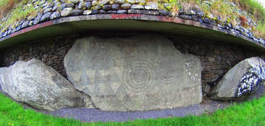

(Images of triangles: Above/Right/Left: New Grange Megalithic Temple, Ireland. One of the oldest in the world.)
The image below is yet another massive crafted equilateral triangular-stone, found in the Forests of Maine, near Katahdin. Notice the moss covering this stone. For this stone to be cut, and then so covered with moss in this way, means it has been like this for an extremely long period of time; most likely, the very beginning of time, not crafted in the last 500, or even 1000 years. More like 6000 years…
Pictured here, to the right, is another cut, equilateral triangular stone, that is not located in the forest of Maine, but rather, in the forests of Austria. Again, notice the similarity to the stone in Maine, 2500 miles away. And also, notice the indicator of construction in antiquity, alpine moss.
This stunning image to the right, was sent to me by my friend, and researcher, Gunnar Hiptmair, who continues to discover dozens of Neolithic anthropological statements and zones in the Austria and the Alps today. His Facebook profile can be reached directly, here: https://www.facebook.com/profile.php?id=100010469927936
Stemming from this, are countless other examples of equilateral triangles fixed into stone, in New England, and elsewhere. They are so abundant that it suffices to leave these examples to get the point across, and continue forward with the experience at Mount Moosilauke.
Logic About Constructing Megaliths: The ashlar-cut technology in creating these perfectly cut, flattened frontal faces of stone, does not indicate a technologically primitive Native American or Celtic culture(s). These stones were cut, and placed, in specific ways, weighing up to 50 to 100 tons. For Native tribes to move each one, would take a set of completely illogical circumstances, requiring human labor, a time frame, resources, and out-and-out permanence and dedication, that Native American or Celtic tribes would have found absolutely repugnant, annoying, and even ridiculous.
The Winter season in New England is long, deep, and hard. When Spring arrived for the Native tribes, after surviving the deadly Winters, do anthropologists actually think and defend the idea that the very first thing Native Tribes would do after migrating back to the newly warm northern temperatures is, first: go straight back to those impossibly massive stones that they were supposedly moving, before the previous Winter began, (utilizing every ounce of energy, and voluntarily-primitive ingenuity they had) They would immediately abandon their villages, loved ones, and their potential planting/fishing season, and crops, all to move giant rocks?
No. This never happened. It is absurd.
Something else is going on.
This is where things become extremely difficult for local researchers. They are limited to local narratives, local evidence, and local History. They simply cannot comprehend any possibilities outside of the Native American presence. They are forcing a narrative to credit Native American Cultures with the crafting of these megalithic statements, because it is the limit, contextually, historically, and logically, to what these local researchers can understand.
The fact is, there was an earlier Culture, in the Americas, as well as Europe and Israel, as described in every ancient account, and mythic history, which was dominant in these regions of the world. They were Megalithic builders, capable of incredible works of strength and design, that are so permanent, they are still around for us to see today. Let’s turn to the hiking experience for the moment, and move forward with the evidence at this beautiful Mountain.
Hiking Experience And Evidence at Moosliauke: As it is with every serious climb, you need to make sure you are prepared. This is a 4,805 foot climb. Please make sure you are being honest with yourself about how healthy you have been in the last year. Have you been eating right? Are you rested and calm? Have you been training for a tough incline for a few months previous? Do you have a portable water strainer to use in the flowing streams along the trail? And will you be ready to carry your portion of bottled water up the Mountain, on your back? Remember, you need to be hydrating, little by little, the whole way, up, and back. Like myself, you can bring a fully charged iPhone for safety purposes, and music. Bring some kick-ass headphones, and deepen your experience in portions of your climb. Choose a day with good weather, starting as early as possible, with the cool temperatures in the morning, and off you go.
Glencliff Trailhead: Glencliff Traihead, in Glencliff New Hampshire, is located on the ‘Benton State Forest’ side of the Mountain, known as the westerly approach to the peak. From Highway 25 in Glencliff , you will connect and turn right onto High St. You will see Mount Moosilauke to the right. The small trailhead sign, and sandy-square parking lot, about 1.5 miles down the country road on the right. If you reach Glencliff Elderly Home beyond the Trailhead, you’ve gone to far. Turn back, you’ll see it.
Making your way into Glencliff Trailhead, this lower 3rd of the Mountain takes you across a stream, a wide, open wild-field, and into a steady incline of a fairly wide, softened dirt trail in Benton State Forest.
There is a distinct rocky trail that emerges as you steadily make your way up the path. Curiously, the stones seem funneled, collected specifically, in one distinct lining. It is clear that the stones are not sprawled out, as if by a rolling glacier. Stones are collected in one distinct line, straight through the Forest. Although it may be hard to consider for some, this is not random, or the work of The Park Service. As we continue up the Trail, evidence to this effect will emerge.
As the elevation increases the alpine aspects of the Trail emerge, with glowing mossy enclosures and tightening thickets of trees, growing right over the stones, in the cooler temperatures.
Here is strong natural evidence for the chronology of the ecological process in this area, dating all the way back to the beginning of time, if you know how to look, ecologically. It is abundantly clear, as you can see in the image above, that the geology, the rocks, were in the initial layer of the landscape, first. The forest clearly came long after. 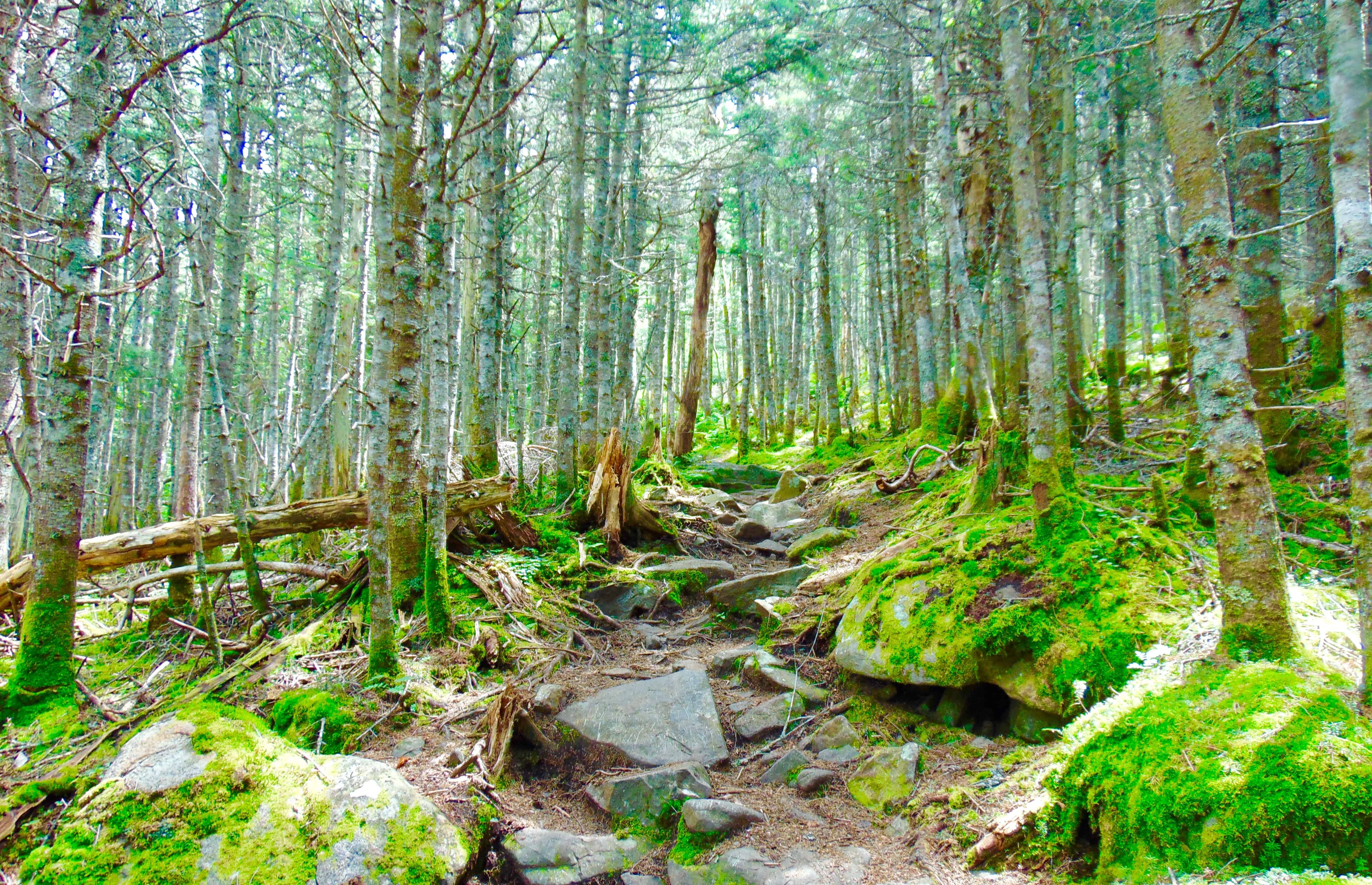
It is a challenge to established how many thousands of years the stones here sat without overgrowth on the open face of the Mountain (like they do in most Celtic Ranges). But it is clear that the Forest, in most areas, has grown up directly over the stones, as we see in the image above.
Please pay attention to the following ecological and anthropological points:
As you can see from the clear grey color of the stones on the pathway, there is no moss at all. This is because alpine moss is extremely sensitive to the touch, and will dissipate growth when contacted externally. The grey stones along the path look to have been ashlar-cut, and worked, distinct from the mossy stones that literally surrounding them. Notice how the pathway stones, the cut stones, have zero amounts of trees, or moss, on top of them? How is that possible? It is because from the earliest possible time, before the Forest had even grown over the rocks here, these stones were touched, and cut specifically as an approach to the peak? Yes. This is an intended pathway of Megalithic construct. It has remained as such, in use by the Native Culture that came long after, as sacred trails, continuing into modern use today.
Just think for a moment. Did the Native Americans cut the pathway stones on these mountains?
They didn’t claim to, so no. Did the Park Service use machines or tools, up to 4,805 ft, to literally cut chronologically related, and level boulders, into flattened halves specifically for stepping up the Mountain? And did they cut down all the trees along the way too? Or was the path always like this, from the very beginning? Please believe me when I tell you, readers and friends, that it would cost millions of dollars in this little country Town, to do such a thing. That never happened. This path, and the hundreds of stony mountain ashlar-cut paths in the Western hemisphere, are specifically crafted, by a Megalithic Culture; a Culture that was gifted technologically, and intent on possessing the Mountain, leaving codes of craftsmanship, from the beginning of Time.
I know this is intensely hard for laymen, and local researchrs to consider, with a locally controlled, “post-modern”-emphasized, public education system, that literally is designed to keep your mental framework historically revised, disconnected from any terrestrial evidence, and ignorant of what actual elite scientists, ecologists, antrhopologists in the government, and Universities, are well aware of. The evidence, scientific, chronological, and logical, indicates a highly advanced Megalithic Culture at the beginning of Time. The Native Americans, and Celts in Europe, knew these constructed paths and stoneworks were present long before they arrived. Just like Peruvian Inca Natives at Machu Piccu, the Megalithic works were there when they arrived. Natives had nothing to do with constructing them.
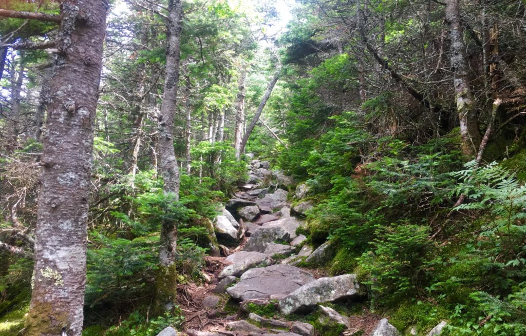
Hiking The Trail: Continuing up theTrail, you should take your time. You will pass two streams running across the path. Pause and take water here, cool off. Jump in! Fill your water bottles. From here, there is no more running water, and you will be on your own. The pathway in the upper 3rd of the Mountain begins to narrow intensely (Image/Above).
Alpine Pine Trees will begin to enclose the stone-steps before you. Here is a chance to pause, speak to the endearingly cool people that are coming and going along this path. While making big climbs, hikers often think and say things that are not common to their lives down below. It may be cathartic for you. Hikers might be needing to get a feeling, or statement out, especially during covid19’s quixotic grip on our society at the moment. Listen to what people are saying. Be kind. These moments could be profound. Singular elevated pathways like this are rare moments in your life. Pay attention.
As you breach the narrow path of the Pines, looking to your left. You begin to realize just how high you’ve climbed. (Image/Below) This is just a preview before completely breaking the tree-line. On a good day, visual potential could be up to 70 miles away, maybe further. Pause and realize, you’re doing a great job. 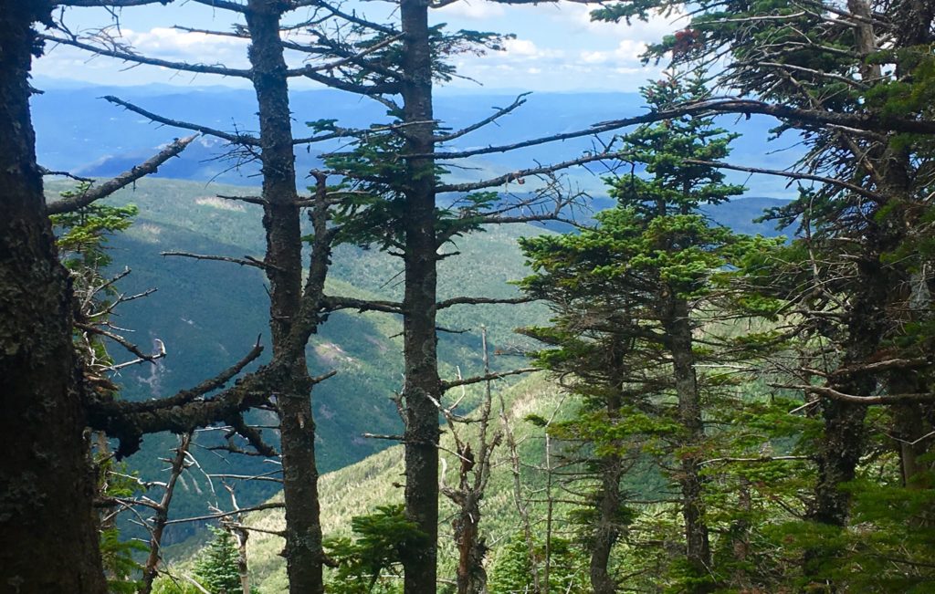
Things start to become pretty special as you continue the quest to break the alpine tree-line. The singular stony path ultimately ends, and you reach a stellar area of level ground with a crossroad of signs. There is the choice to head towards the South Peak, which is 20 minute interlude path to making the actual peak. Make sure you have the energy to take this 20 minute diversion to the view at The South Peak. I did not. I followed the sign pointing to the left, towards Moosilauke Peak.
The pathway here is magical. The relief and surprise of level ground after so much climbing is almost hilarious. It feels easy. This is a high porch, a singular pathway, like a rolled-out soily-soft-carpet, just for you to now come into this upper kingdom in the clouds that you’ve worked so hard to see. You can speedily make your way along the last 1.5 miles of your trek. 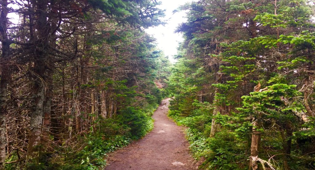
Along this rare level path, you can try to gather your strength. Take your time and enjoy what you’ve earned. It’s the same in life. Don’t go passing by quickly, what took a hard fight to find.
Along this regal and rare path, small stones begin to emerge. The stones are intricate, enchanted, and strange. They seem to be cut in a refined fashion. I have seen this manner of cut before. Take a good look at these stones.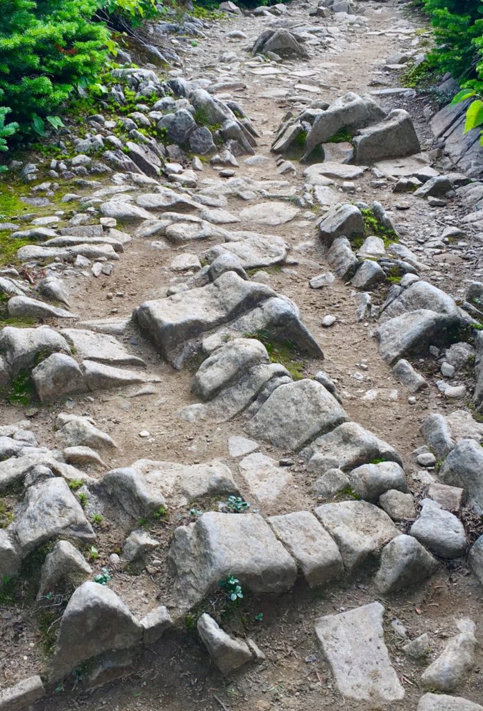 I am willing to bet, that digital analysis of these stone would reveal linearity, symmetry, modeling, and meaning. I am currently working on an ecological analysis system of these rare fixtures. The possibility that this is a miniature map, or modeled version of the overall area, is very real. As we will see, modeling the Mountain Range of the area was an essential practice for the Megalithic builders, in New England, and Europe.
Aside from these theoretic connections, there is a location in Massachusetts that is one of the most sacred groves in the entire world. it is called ‘Bears Den’. At this location there is a hidden waterfall, with a dwelling near by. The entire area seems to have been engineered by a Megalithic builder. There are cut stones, leveled platforms, and the waterfall itself, which is engineered and dedicated, in stone, to (you guessed it) the equilateral triangle.
Images of the rear-side of the waterfall reveal some pretty incredible markings. They will look familiar to you now. Lets have a look at the markings in the rear of that altar. Look at the similarity of these small cut fixtures.
As I mentioned, on the frontal side of this waterfall, there are, etched in permanent stone, undeniable anthropological evidence of the equilateral triangle meme of the Megalithic Culture. 
There it is, again. Perfectly etched in stone. The Equilateral Triangle. Do you think a glacier did that? If you do, then you need to think about how much of your thinking, is someone elses influence.
When are local researchers going to understand that the implications for this clear, and sometimes multi-layered Megalithic evidence, is far beyond the potential of any local nomadically oriented tribes, that have long since vanished? There would be literally millions complicated tools, and an emphasized ‘stone orientation to’ Native-American Culture, beyond anything that we know of them, if infact they constructed these works. They simply could not have done it.
Continuing passed many of these wonderful markings, the path unfolds into a miniature valley, leading up into what looks like a distinctly separate, miniature alpine-mountain. You’ve broken the tree-line. Here before you is what looks like a version the Sacred Mount of Arunachula in Southern India. The majesty of this 4,500 foot piece of elevated earth, is stellar, supreme, and absolutely sacred. 
This zone is protected by the State for its ecological rarity, but in truth, I believe that at the elite level, there are individuals who know that this area is a sacred anthropological zone. The stones here are doubly significant in meaning, compared to the moss.
The approach to the peak is pristine. In every direction, mountains and clouds.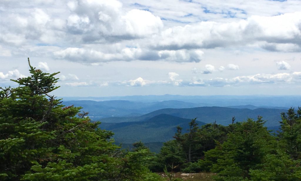
The trees fade out, while stone Cairns line the path. I believe these Cairns are Megalithic statements, perhaps refined by hikers in the last Century, but more likely crafted in antiquity. These Cairns are found even at minor peaks in the hill country. 
Certain stones along the final approaches at sacred mountains are cut with directionality, pointing directly to the peak. Here is a centrally placed directional stone, directly along the path, just before the peak. Perhaps it will help if readers can see some examples of this Megalithic meme on other locations.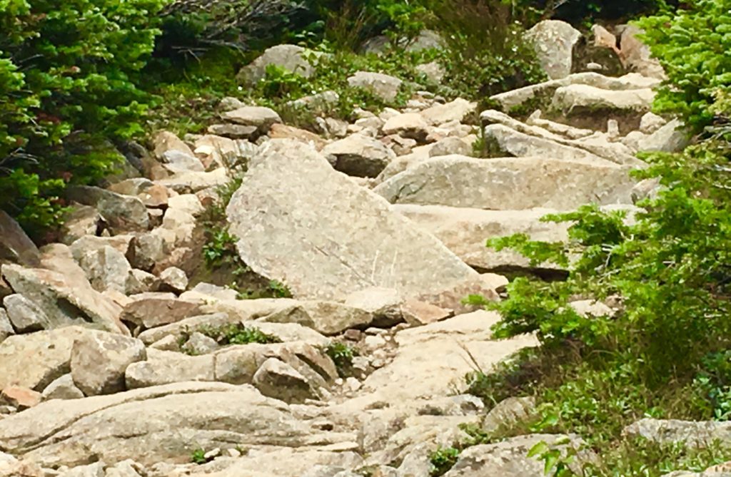 Directional stones have specific parallel sides, leading up to a right-angle-apex of exactly45 degrees.
Sample 1: The image above, as you know, is located near the peak at Mount Moosilauke, New Hampshire.  Sample 2: Directional stone located near The Altar at Heath Mass.
 Sample 3: Located near the peak at Watatic Mountain, Massachusetts.
 Sample 4: Located near the peak at Monument Mountain in the Berkshire Range.
Finally arriving at the peak, people are resting and taking in the scene. A large square stone sitting at the very peak is marked with a perfect equilateral cross-section, supported by a triangle in the lower corner. (Image/Below) These particular meme can also be found at dozens of peaks throughout New England, the American West, and Europe. Here are just a few examples below the one here at Mount Moosilauke. 

After this stone, the entire White Mountain Range comes into view. In the image below, Mount Washington can be seen in the distance, the highest point in the center. Mount Chocorua can also be seen to the right, below. Stunning. 
The view to the south, as seen below, is a rolling and rotund descent, with Massachusetts off in the descending peripheral distance.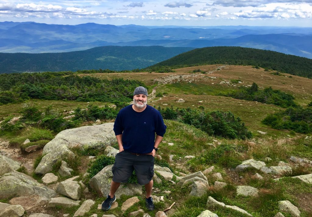
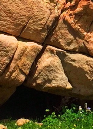
Another interesting fixture here at the peak is a very special arrangement of stones, with a leveled rock layer at the base of these specially stacked rocks, seemingly made specifically to imitate the cut of the mountain-tops, in the secondary background, of the peaks in the greater distance. Although dozens of people sat here at the peak, not one of them noticed this incredible fixture. Notice in the image below, the leveled work in the bottom portion of the rock, with what looks like distance markings of measure along it’s side. What is this doing at the top pf 4,805 foot mountain? This is no accident. These massive stones are placed to mimic the peaks in the secondary distance. 
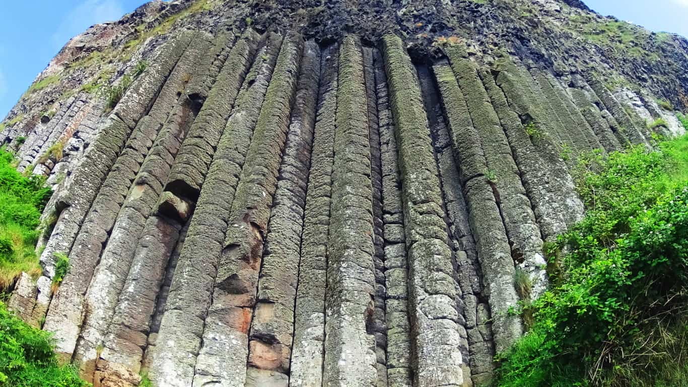
Let’s show another location that displays this type of fixture in Europe. At the peak at Mount Bearnagh, in The Mourn Range of Ireland, the peak contains a set of megalithic fixtures that absolutely imitate the peak of the mountains beyond. The stones are clearly cut, and fixed, into positions to imitate the angles of the ledges beyond. Again, this is clearly no accident, it’s incredible engineering, in stone. 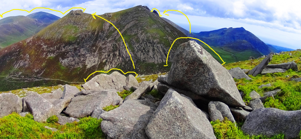 Here is a megalith also located at Mount Bearnagh in Ireland, absolutely crafted to imitate the curvature of the lower valley. At the peak, just one mile from this spot, the boulders are arranged to mimic the mountains of the Range beyond. There is no way that this is random! It’ s intentional, and cultural. How could we not see this!?
 Other examples of stones-marking of peaks, at other mountains, can be found at Mount Katahdin, near the Knifes Edge approach. Look at this exquisite marker, roughly 5 feet tall, pointing directly to the peak in the distance.
Here is a specifically crafted and placed-megalithic boulder, on the edge of the Sierra Nevada Mountains, in a lake, and shaped to look exactly like the mountains behind. Notice the 3 distinct indents in the boulder as well…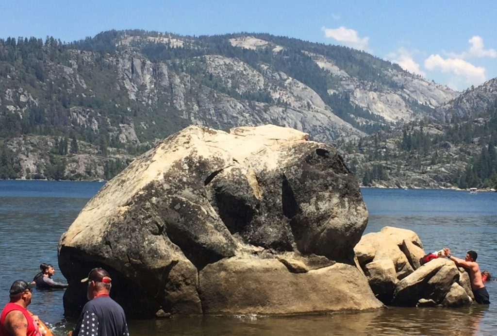
And here is a megalithic boulder at small peak at Upton Massachusetts. It is imitating the small mountain beyond, pointed perfectly to its center. Notice again, 3 distinct indents on the boulder. 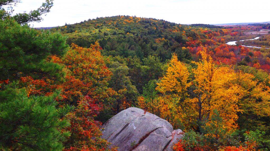
Not two miles from this very beautiful spot in Upton, is one of the finest megalithic chambers in all of New England. To think that these megalithic works are not related would be a serious mistake. They are absolutely related. The Culture that created these works was obviously capable of megalithic design, and large scale. 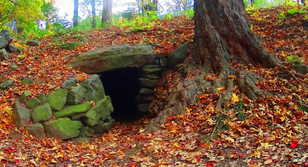
The accumulating Megalithic evidence here at Mount Moosilauke, with multiple supported examples from other locations, of memes and fixtures of the exact same stylization, should begin to give serious academic pause for those who have not had the capability to see this evidence, but are now clearly seeing it collected here. Site after site, peak after peak, from Glenn Coe Scotland, to the Sierra Nevada, (and everything in between) are consistent similarities of a single Megalithic Culture, not variations of statements from hundreds of Native Tribes, both Celtic, and American. The evidence point to a Culture that had a singular source of related concepts.
The final Megalithic constructs statements here at the peak of Mount Moosilauke, are perhaps the most important. We find nothing less than an entire complex of leveled stones, stacked into defined sections, spanning perhaps 70 by 30 yards. In its current state it is dilapidated, but a closer look reveals definite distinction, and intended design.
There a several divided square sections of cut, stacked, and leveled stones, which appear to define a particular function within. The section in the image below is absolutely level with the dramatic skyline to the north. There are clearly long and level cut stones worked into this construct, as can be seen, and were most likely crafted specifically for this purpose. 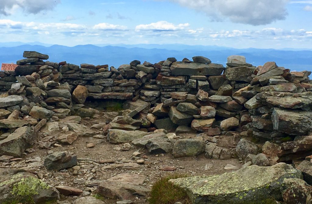
A frontal view of this square space reveals a significant 7 foot high lining of stone, which has clearly been tampered with over time, without any real protections. This particular view shows the significant amount of substance that this Megalithic Chamber once contained. 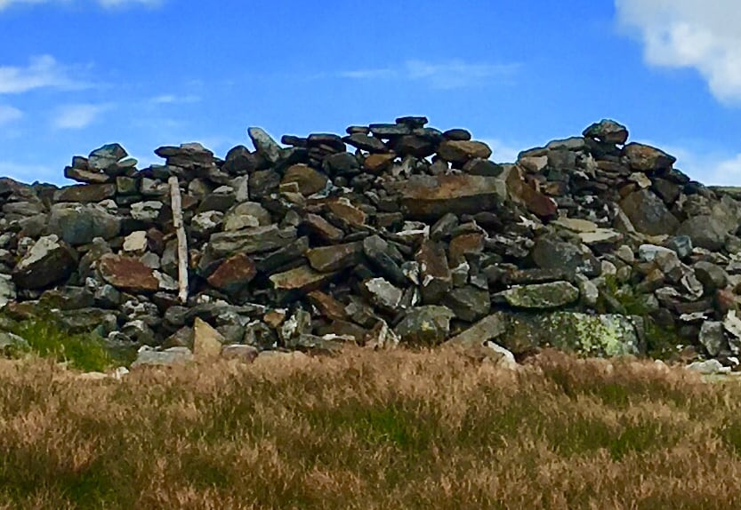
In stark contrast to the square spaces, there is a rounded space, separate from the main constructs, that may have had an alternate purpose, with its alternate shape. 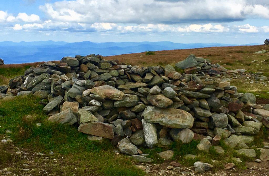 This rounded setting immediately reminded me of another set of rounded Megalithic stones, found in a highly megalithic area, and at a significant elevationm in the Mourn Mountains of Ireland. (Image/Below)
  These areas should absolutely be considered National Heritage Sites and archaeological zones, fully acknowledged as a Megalithic Cultural spaces. And yet most passersby simply believe them to be random piles of rocks. How this is being allowed to remain the case is beyond me. There is meaning and intent attached to every one of these works, yet to be understood by so many.
For day hikers, the journey is only halfway done at the peak.
After resting, you need to steadily make your way back down the Mountain. When you make it to the first bubbling stream of water, about 1/3rd the way down, to refill your bottles with your strainer, you will be safe for the rest of the journey. During a trek along a decline, be careful to set your feet squarely, to choose your steps, in order not to turn your ankle. As you make your way, the path will widen, and inevitably drift with the gravity back to the Valley below. I hope hiking sojourners decide to try this climb for themselves, and experience what has been described here. Don’t let anything stop you from continuing to seek out sacred landscapes; Not others, not yourself, and not Covid19, in all its bizarre quixotic strangeness. So many people are waking-up, and truly realizing, that time in the Sun, and in the sacred landscape, is the answer. Thanks for reading. 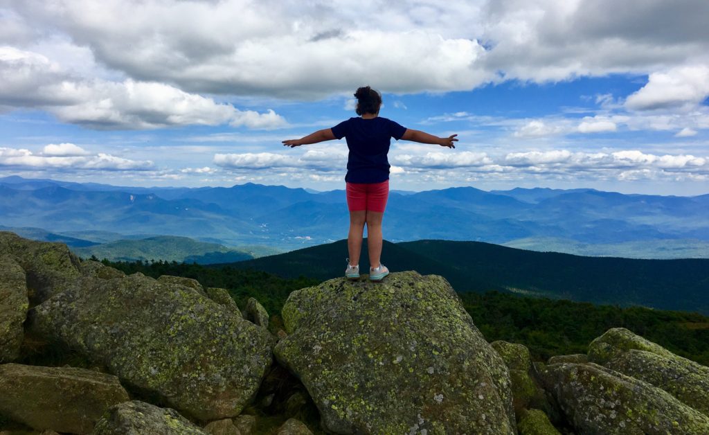
Devil’s Tower National Park
Location: Crook County/Wyoming/USA
Elevation: 5,100 feet above Sea Level
Prominence: 1,267 feet
Note: The only way to introduce the most mysterious small Mountain in America, which looms 1000 feet above the Black Hills Forest of Wyoming/USA, is to contextualize it by mentioning other places with very similar megalithic traits. Just to get you in the mood, take a look at these places: A coastline in Northern Ireland made entirely of hexagonal stones (Image/Left); 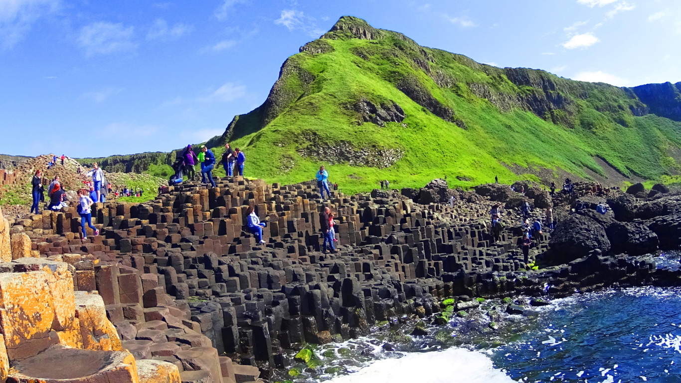 an elegantly scenic mountain ridge where three perfectly square slabs of stone, with absolutely concentric rings imprinted on its face, sits stoically above the beautiful Black Valley of Killarney, Ireland. (Image/Below); or a secret grove where a…
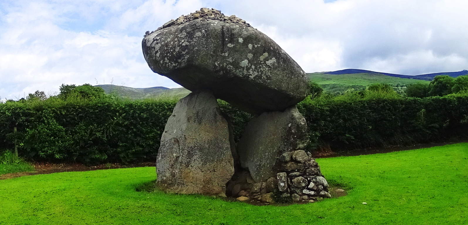
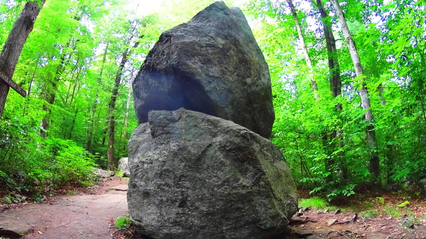
  40 ton boulder balancing 15 feet high, supported by three standing stones, in Ravensdale Ireland, looms just south of the Mourn Mountains (Image/Left); or how about two colossally stacked, and perfectly balanced boulders, tucked deep within a Forest in Massachusetts/USA, each weighing about 30 tons, where the top boulder is balanced at about ten feet high. (Image/Right);
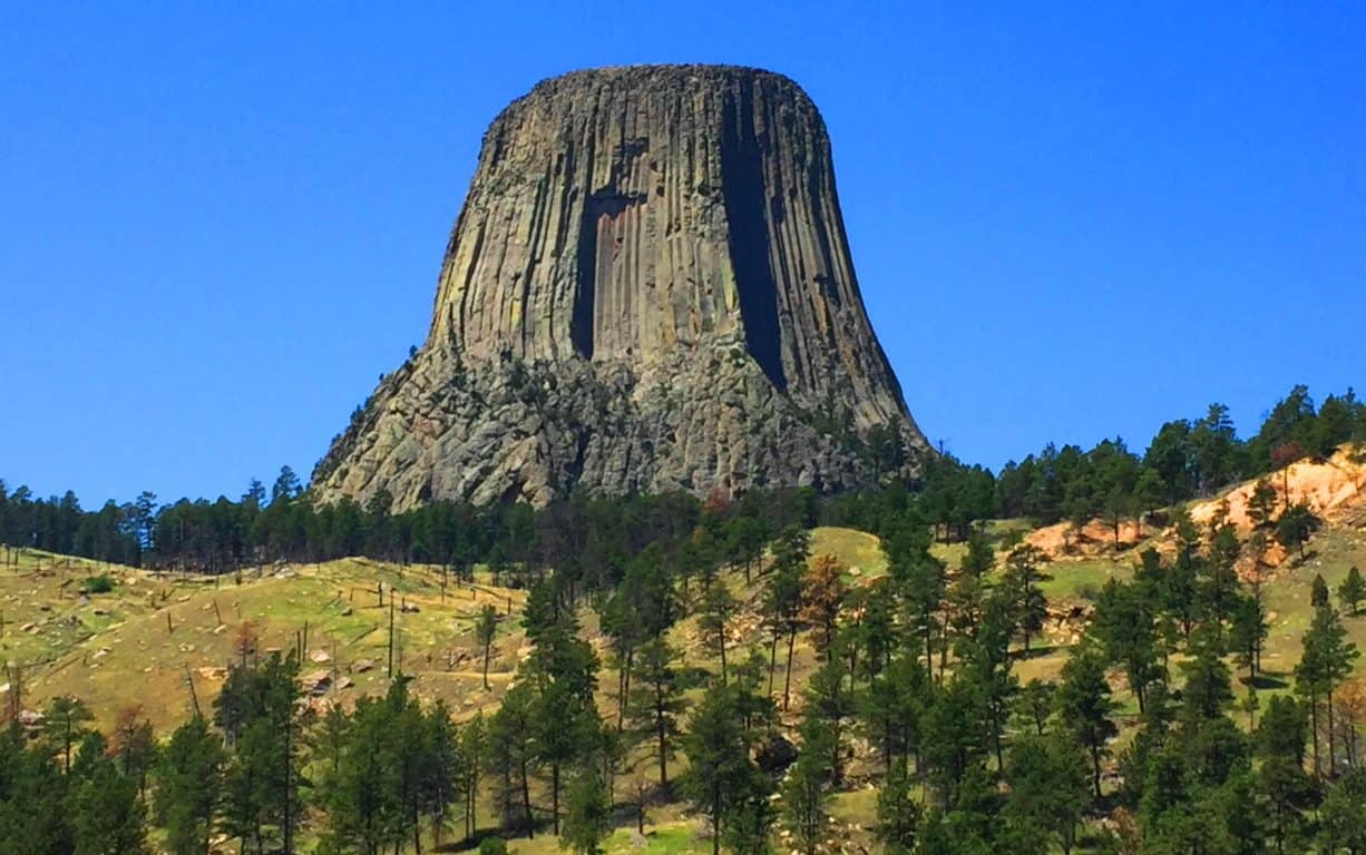
and last, there is an entire Mountain in Wyoming/USA that is completely sculpted into perfectly parallel square shafts reaching 1000 feet high for over a mile in circumference.(Images/Top/and Below) This is The Devil’s Tower National Park.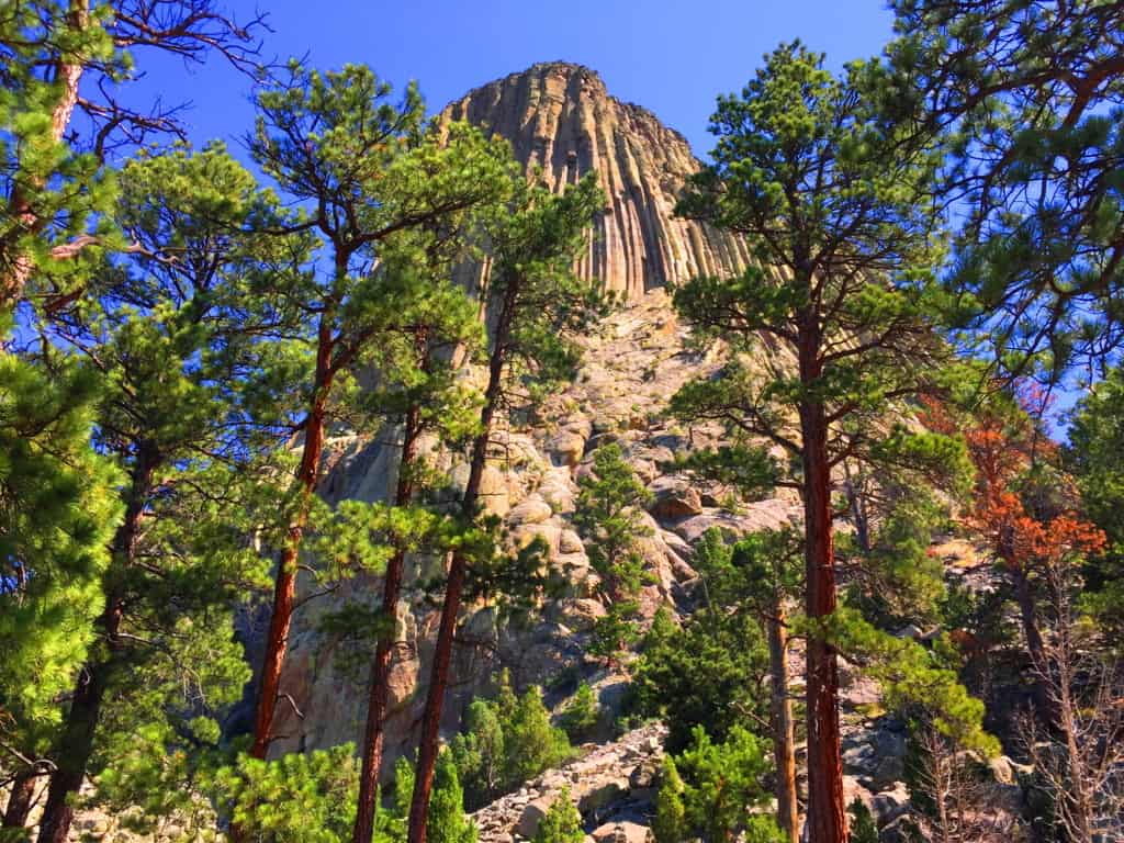 In this era of informational sharing, places that were once thought to be singular anomalies on Earth are now being connected to similar statements across the globe. Not only are these places being connected through physical similarities, but we find that the strange explanations that have been used to justify their unique features are also very similar, (as if it was decided uniformly in some boardroom far from the public, perhaps in the Smithsonian’s basement in the early Century) The bizarre explanations don’t make sense, especially when you see these places first hand, and get a look at the attributes that are not described online; traits like the elevated parallel shafts above the coastline at Giant’s Causeway Ireland, which is the most similar place to the Devil’s Tower in the World. We will look at the problems with the explanations, and the disregarding of certain evidence later in the article; but for the moment lets enjoy the mysterious scene above the grand Plain in Wyoming. The Devil’s Tower is an exceptional place, making it very hard to look away. It is almost guaranteed that you haven’t seen anything like this in your life. The Tower’ sits isolated above the golden-green landscape, an absolute silhouette. Even from far away, it is easy to see the unique exterior of geometric stones. Seniors and children alike will stare wide-eyed as they approach the Trail surrounding the Tower’. Human’s have wondered about this place forever. Lets have a look…
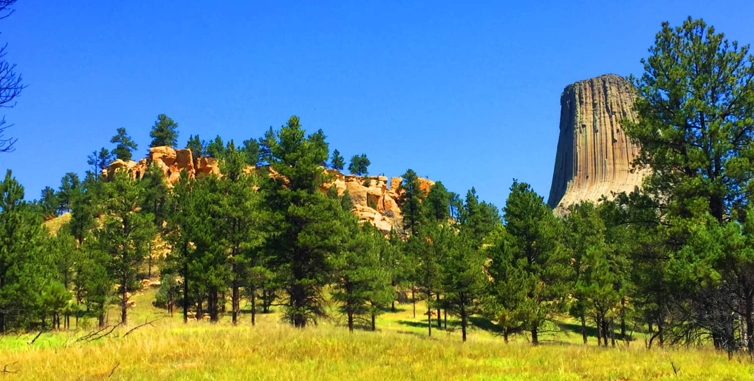 Trails at Devil’s Tower National Park: The main Trail here is straight-forward and interactive; it basically circles the Tower’, winding past massive boulders which can be climbed, all surrounded by Ponderosa Pine Forest. The Forest supports wildlife in abundance; Deer, Hedgehogs, Hawks, and Grey Squirrels wander freely.
 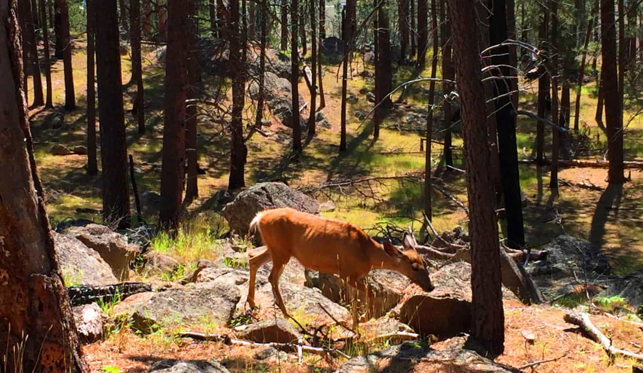 There are other trails that drift away from The Tower’ if you are interested in a longer trek. Everything sort of circumambulates Devil’s Tower, the longer trails being the more distant concentric from the small Mountain.
 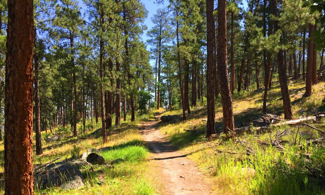 The broad and beautiful landscape of Wyoming is what makes the Devil’s Tower so significant; there is simply nothing else like it on the North American Continent. It is the tranquility of this scene that is striking once you arrive. The Tower’, however, does not look as if it was quietly created, but rather, it seems is as if whatever sculpted it was most likely the loudest sound this valley ever heard. It just looks that way, with huge boulder’s all disheveled at the base, perhaps like giant crumbs from the most massively creased cake of all time.
 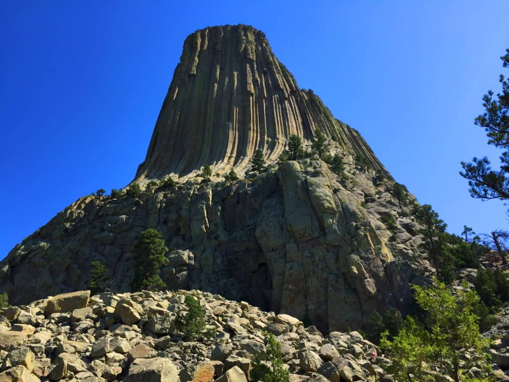 A Confusing Geological Scene: A geologic diversity exists throughout the Park’, with variations in specific stone and coloration. Below is an image of the lower portion of the Park’, where hundreds of hedgehogs have burrowed opposite these bright red ledges. The difference between these ‘red-ledges’ and the upper Tower’s white stone ridge is so distinct, so completely different, that it is hard to accept the current “volcanic explanation” about the birth of the Tower’. “Scientists” have basically stated that The Tower’ was created through a “volcanic event”, and yet the lava dispersion is restricted absolutely to the Tower’, while the lower scene reveals absolutely no similarity, or any other signs relating to this…”volcanic event“. If both areas experienced the same flow of lava, why are they so completely different? How did the lava-flow go upward, or simply stop flowing downward, to build The Tower without affecting the ridge below’?! No other active lava flow that we currently see on earth, like in Hawaii, Italy, or Japan, does anything remotely like this. And where is the active lava here in this landlocked and level landscape? How could the information centers possibly endorse this explanation? There is no sign of any active volcanic source beneath, or around, The Tower’. Amazingly, there is another small Mountain, in another part of the world, with exactly the same logical dilemma concerning the “lava-flow explanation“. Now lets compare both scenes…
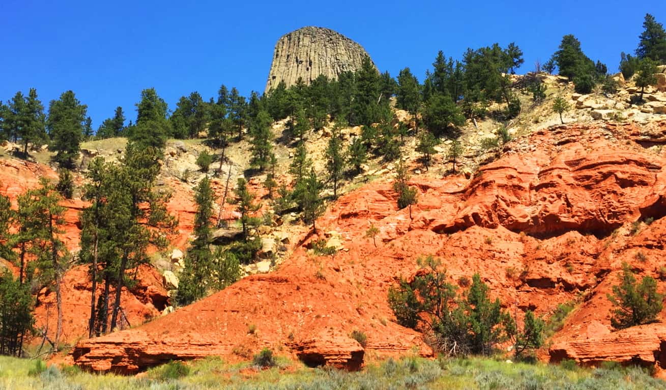 International Connections to Devil’s Tower: Many times, if international hiking and anthropology become part of your life, synchronicity and moments of wonder will happen. It’s one of the reasons hiking becomes a lifestyle. Crazy connections happen. On July 13th 2016, I would first see the inexplicable parallel hexagons carved into the mountainside at Giant’s Causeway, in Northern Ireland. And exactly one year to the very day, July 13th 2017, I would be standing 2,300 miles away, beneath another impossible set of parallel shafts, etched into a Mountainside in Wyoming/USA. The similarities between these sites are astounding, in every possible way
Take a look at the parallel shafts along the side of Devil’s Tower; do they look at all like flowing liquid/lava?(Image/Below/Left) At “The Giant’s Causeway”in Northern Ireland, look at the parallel shafts etched into that small Mountain above the coastline.(Image/Below/Right) Again,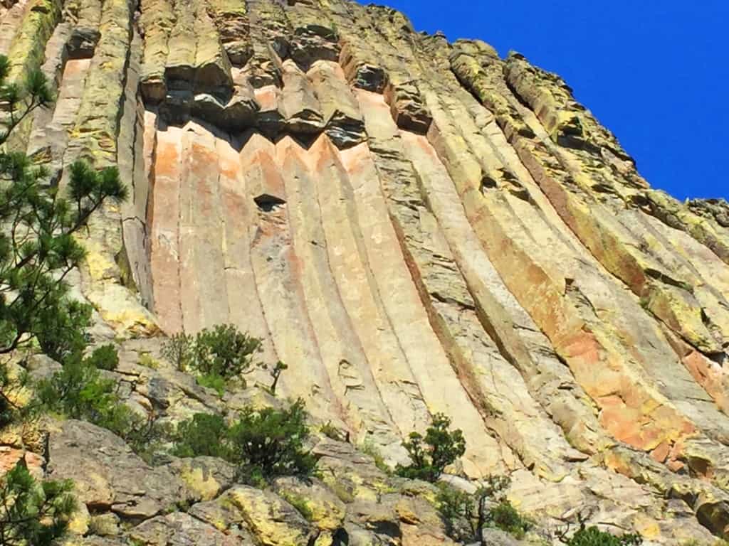
 there is no look of lava-flow whatsoever, but the very same parallel shafts. This is cause for true wonder. It is interesting that the parallel shafts in the small Mountainside at Giant’s Causeway are not advertised. Most people would never know or see anything about them unless they had hiked the trail personally. It is a good bet that the people who control the information about these sites know full-well that most people have a hard time carving out the time to see them for themselves. At Giant’s Causeway only the famous hexagonal stones on the coastline are advertised. Why wouldn’t the shafts in the mountain be advertised? Perhaps because it doesn’t fit the “lava-flow” narrative. The lower portion of the coastline is a patio of hexagonal stones, which is what they say was created by a lava-flow coming out of the Ocean; but how did the lava come out of the water, and then up a small Mountain 200 yards away, without leaving any trail of lava between the Coastline and the Mountain? (Image/Above/Right) Look at the coastline of hexagonals below, this distinct statement simply stops! And then almost 300 yards away, and 200 yards up, a section of parallel hexagonal shafts is carved right into the ledge, as you see above? Totally illogical. There is nothing but consistent green ledge and rounded regular stone between the two places, NOT lava flow.
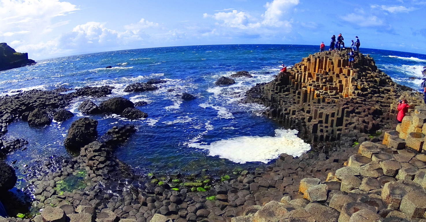 Below is another perspective on the separate statements at Giant’s Causeway. Clearly these are two very separate sections of geometric stones from the coast to the upper ridge. What in God’s name are these scientists talking about? It’s as if they give us explanations that sound….
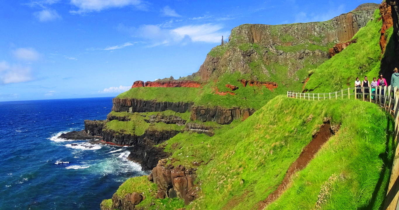 just “scientific” enough to keep less informed people totally bewildered. And there are more places of parallel stone shafts in the world; on the island of Sardinia/Italy, Scotland, and Russia, to name a few. How can these explanations hold up for us? These are the moments that people should start to see that if you just accept the explanations of others, you can pass up your universal human right to know the truth. I hope my readers are starting to understand that connecting the dots in the world for yourself is possible, and places like Devil’s Tower and Giant’s Causeway are literally there to inspire you into galvanizing your own perspective.
Dreamscape Wyoming: Returning to the landscape at Devil’s Tower in Wyoming, the hills and ledges drift away with a steady consistency, making Devil’s Tower that much more incredible, and bizarre.
The vastness of Wyoming is supremely humbling. You can drive, and drive, and drive, and drive, and the land just keeps going. It was only after I experienced this spacious dimension that I had a realization about how the Native Americans must have felt about the land. The Lakota and the Cheyenne must have been so deeply connected that it must have seemed that no one and nothing could ever displace them; they were fully embraced, protected, and immersed in the land.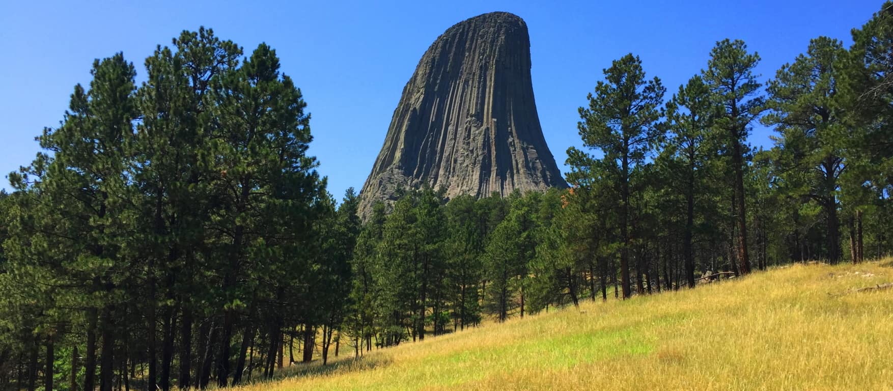 The Union Army arriving on the Prairie would’ve been like an invading army of Aliens emerging, in the hundreds of thousands, from the clouds over the world of today. And the Native Americans say that there were people here before them, tribes of violent Giants that they were forced to hunt, and finally exterminate. If you feel that this ancient story is completely absurd, just understand that the account of the Tribes of Israel upon entering the Promised Land in the Old Testament is exactly the same. Moses sends Joshua with his spies to explore the new land before them, and they return with reports of Giants inhabiting the heights of what is now the Mountains of Israel (Numbers 13:33) Most “educated” people simply choose to ignore this information, and dismiss it as myth. What are these people afraid of? The Devil’s Tower forces us to reconsider the information we accept in our lives; how we accept information. It is a place that challenges you, and pushes you to consider possibilities that are hard to fathom. Whatever the actual case may be, the Devil’s Tower is a magnet for our imaginations, a mysterious refuge that pulls us boldly towards it. This has been a sacred refuge for as long as anyone can possibly remember, and should be shown to the entire world in this unique and wonderful light. There are connections and relations at megalithic sites that make a difference in how we perceive and understand the world. That in itself is enough reason to get out there, and take a look. Thanks for reading, and please share this article with a friend. Stonestrider.com
Mount Wachusett State Reservation
Location: Princeton/ Massachusetts/USA
Elevation: 2006ft
Prominence: 998ft
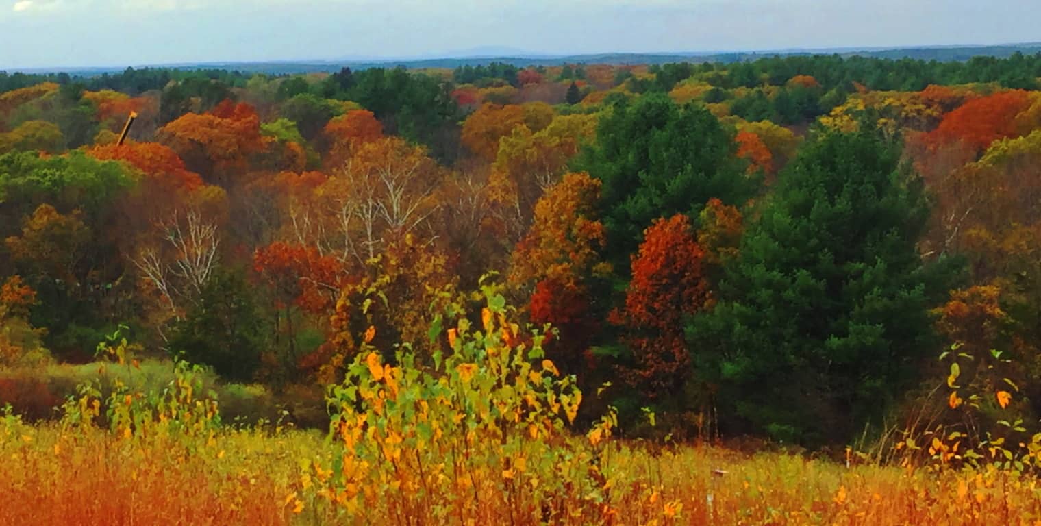
Note: The small mountains of Massachusetts are a cozy set of elevations that generally rise to about 1700 feet. This description isn’t exactly awe inspiring. One thing that is awe inspiring and of the most pinnacle quality, among these small ranges, are the ecosystems, the fauna, the rivers, the trees, and the soil. This is similar to the reputation of the ancient British heartland, Wessex, where Danes and Saxons carried out brutal campaigns to possess the nutrient rich soil. The Viking homelands of Denmark and Norway were at an extreme agricultural disadvantage, with a majority of un-plantable mountain faces and temperatures too cool and damp to create any consistent crop. Also take a look, for example, at Irish grounds; the grass is often brackish, and inundated with stone. In less modern periods, you could spend your entire life trying to clear a set of Irish fields to produce a crop, and still lack success. Imagine an Irish farmer’s response to the soil in the ‘New World’. In most of New England the soil runs consistent and deep, soft and rich, producing beautiful crops. The image above is a long glance at the beautiful Wachusett Valley, in Massachusetts, in Fall. This multicolored Valley runs from Concord all the way to Princeton Massachusetts, to Wachusett Mountain itself, with many towns between. The Mountain is just barely to be seen in the image above, at the back-center, a shadowy statement against the horizon. It’s just an amazingly beautiful place in Autumn. And just like in Old Europe, any tribe passing through this region would want to stay.  Some History: For this land, Natives fought other Natives. Then Natives fought the Colonials for this land. Then Colonials fought the British for this land. Seems like everyone agrees, this land is a good place to be. A hike up Wachusett Mountain (Image/Above) is an opportunity to feel this regions beauty and value. After recognizing all this, there is yet one more culture that seems to have been here, before anyone else. There are mysterious megalithic signs in the landscape, and yet this earliest Era is never discussed in New England. This is an Era most of us just don’t really consider. Our undergraduate textbooks usually begin with the Greeks, progressing to the Romans, to the Medieval, the Renaissance, Colonialism, and finally the Industrial Revolution; but our classes really never offered information about pre-Grecian cultures, and more importantly, the implications of these unresolved mysteries. The Egyptians had roughly 30 Dynasties over the course of a thousand years, and built the most perfect megaliths the world has ever known (to-date engineers still cannot replicate them) yet the implications of Egyptian mysteries were never discussed in our western classrooms. Why? To keep them obscure; to relegate that portion of history into “conspiracy theory”, rather than part of our overall discussion. The one thing that Western academia couldn’t do is hide the megaliths and the dramatic statements that remain in the granite. The woods at Wachusett State Forest are not unassuming at all; the megaliths here, in several different ways, are trying to tell us something. But first, lets wander in.
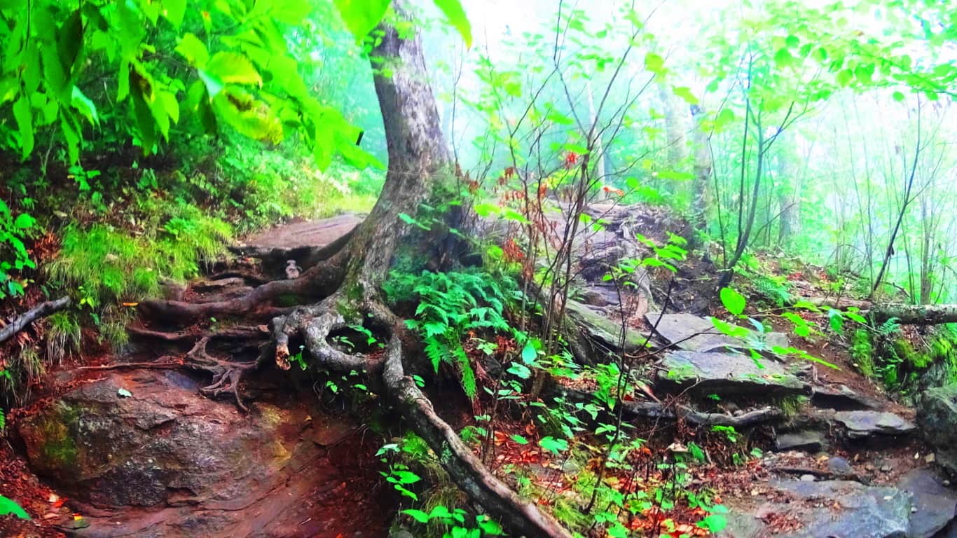
Trails: To arrive at Wachusett Mountain State Reservation in central Massachusetts simply take Route 2 West, which runs across the entire State. Connect to Route 140 South, and drive just for a few minutes. Turn onto Mountain Road into the Reserve, where you will see the sign for the Trailhead parking. There are essentially 8 trails here. Most popular are the “Mountain Loop”, which almost circumambulates the Mountain in an 5.8 mile hike with solid views; “West Side Trail”, a moderate 2.8 mile loop featuring paths strewn with wildflowers, and classic 400 year old forest groves; and “Summit Loop”, a 4.9 mile stretch that includes a serious effort to the peak gaining roughly 1000 feet for the best view of the region. After achieving the peak, the trail will take you down to a full New England Dolmen which sits in the forest (quixotically named: “Balance Rock”)
Featured Trail: “Summit Loop Trail”/Upper trail: This is the most popular trail at Wachusett. The lower trail is a stony path with curious patterns in the rock. It legitimately looks as if the stones here have been hewn into a criss-cross pattern, like a quilt. The stones are distinct, separate, pieces laid in parallel sections. (Image/Below) I just can’t understand how an of this could be considered natural. In one swift diagnostic you can see the math in the stones.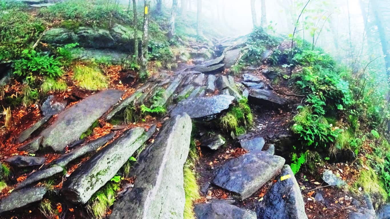 As the path rises, it then changes. A different set of large, individuated, flat plates of rock emerge in a spotty but specifically patterned line up the trail. How could the lower path set be so distinctly different from the one just 100 feet further up? And look at the distribution of the stones; each plate is essentially equal in size and spacing on this second path. Very strange. (Image/Below) Native Americans of this region considered these trails sacred, serving as miniature highways through the mountains. They must have seen the strange distinctions in these stones and considered the place enchanted in some way. Wachusett indeed was considered a holy place by the ancient tribes of the area.
 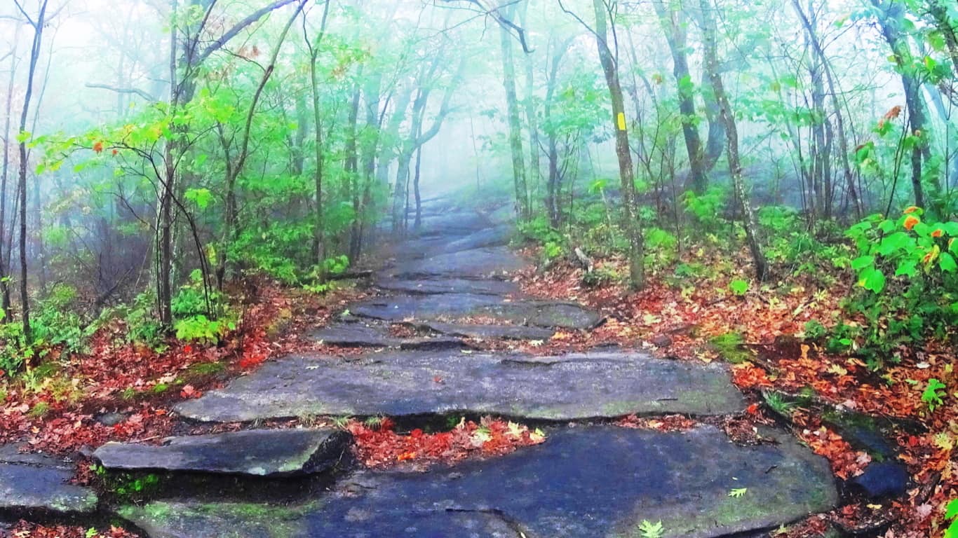 On a misty day such as this, these pathways are like woodsy tunnels. There is a strange comfort in the distinctness of the path that rises before you through the fog. Here is yet a third trail with a unique style of a singular layer of stone spread like butter, evenly, just before the upper clearing. (Image/Below) This a third style of stone along the same path within a thousand feet.How can we not notice this?
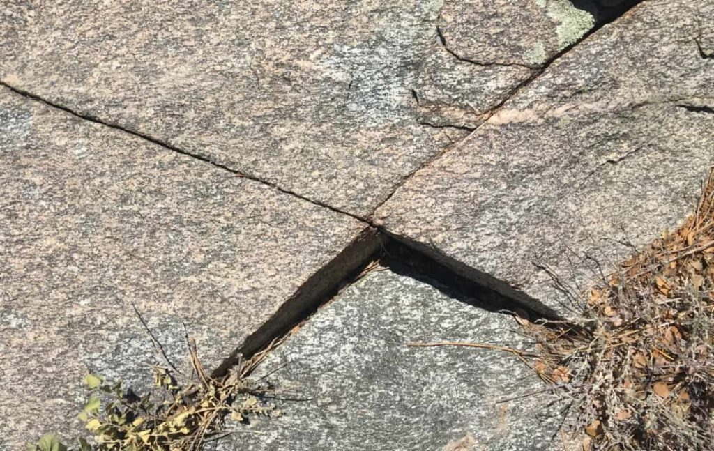
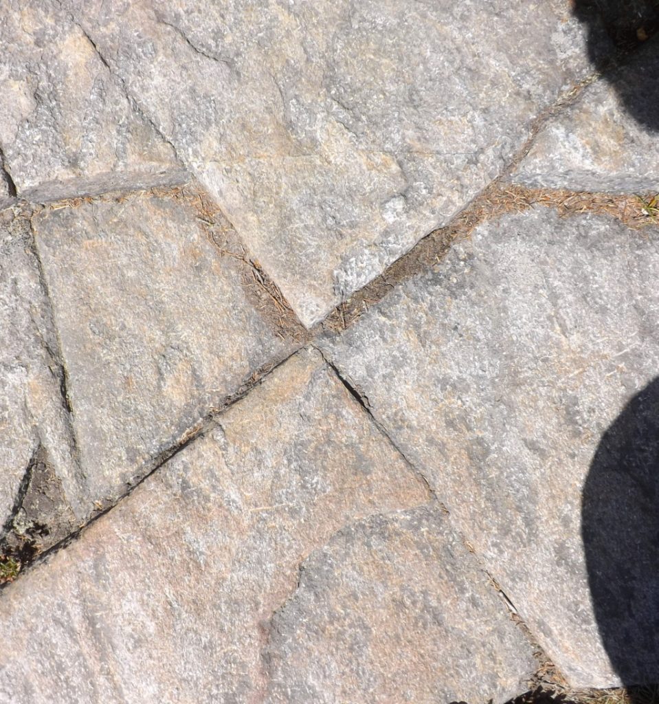
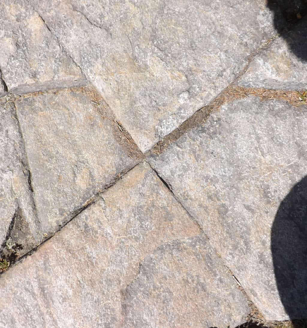
 No one is expected to concede to the idea of an ancient culture that could hew massive mountain stones into patterns and structures, and yet, ancient cultures are seemingly beckoning us to accept that very thing. Although it is not written in our textbooks, megalithic craftsmanship is in the antiquity of literally every nation. Russia, Peru, France, Italy, Ireland, China, America, England, Scotland, Greece, Turkey, Korea, Indonesia, Australia, Mexico, and many, many, more. Just google any of these nations, along with the term ‘megaliths’, and hundreds of variations of examples from forests and mountains worldwide will appear, most of them very hard to explain. You will begin to realize that the trail you are on is most likely a sacred one, one that sponsored megalithic culture, with several incredible supporting statements. And if you visit several sacred trails over time, you will see the pattern of those trademarks. One such trademark appeared embedded in the lower rock face of the mountain here, an “X” section. (Image/Below)
 Now, taken on its own, this could be dismissed as a singular fracture in the granite. But these “X” sections have a way of popping up all over New England. Here is another one at “Monument Mountain”, a sacred mountain to the west of here…(Image/Below/Left) This colossal “X” section is also located about 100 yards from a beautifully cut Standing Stone. (image/right) This is no accident.
The two “X: sections just above, one located at the sacred Mountain of Monadnock/New Hampshire/USA (Left), and the other literally hewed into one of the the stone linings at Monument Mountain/Massachusetts/USA (Image/Above/Right), reveal varying levels of intensity, but are clearly crafted. It is as if the tool used to create these markings was of intense and focused heat that hewed the rock in exact ways. It clearly was not chiseled into the stone.
 Take a look a this massive “X” section on the left; it is located near the peak of Mount Clark in Colorado/USA. This “X” section is located on a 40 ton boulder sitting just 30 yards from a large Standing Stone (Image/Below), legitimizing the anthropology of the entire scene.
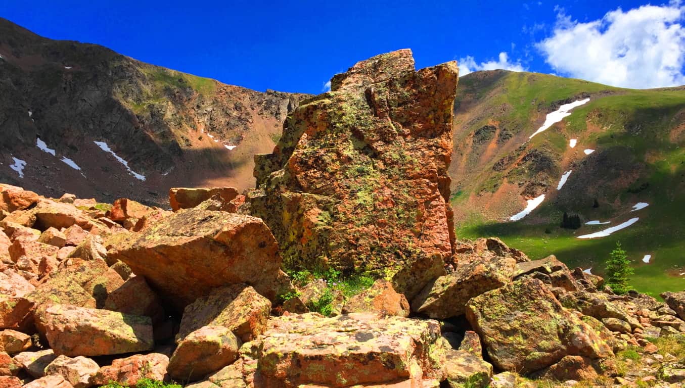
As I have written many times over the years, it seems that the “X” sections are type of logo that signifies a sacred zone. It is no accident that they are most often found near the peaks of mountains that were considered sacred to the Native Americans and Celts. The “X” is a “calling card” of the ancient megalithic culture.  On the left is an image of an “X” section near the peak at Hulapai Mountain /Arizona/USA. Look at the precision of this section! It’s on an isolated trail 7,300 feet above sea level, incised into a mountain side! It looks like modern water-cut stone. This “X” section is also located roughly 30 yards away from a Standing Stone, of equally unique precision. (Image/Below)
At Watatic Mountain in Massachusetts/USA there are several “X” sections of less intensity, but exact precision sliced into the stones, and yes, they are located near a Standing Stone close to the peak. (Images/Below) These sections are obviously cut to be noticed. We may very well be looking at the first axiomatic and intrinsic symbolism of all language. Whoever created these sections absolutely wanted us to see them, that much is clear. And below/right, again, is the Standing Stone that the two Watatic Mountain “X” sections are near to.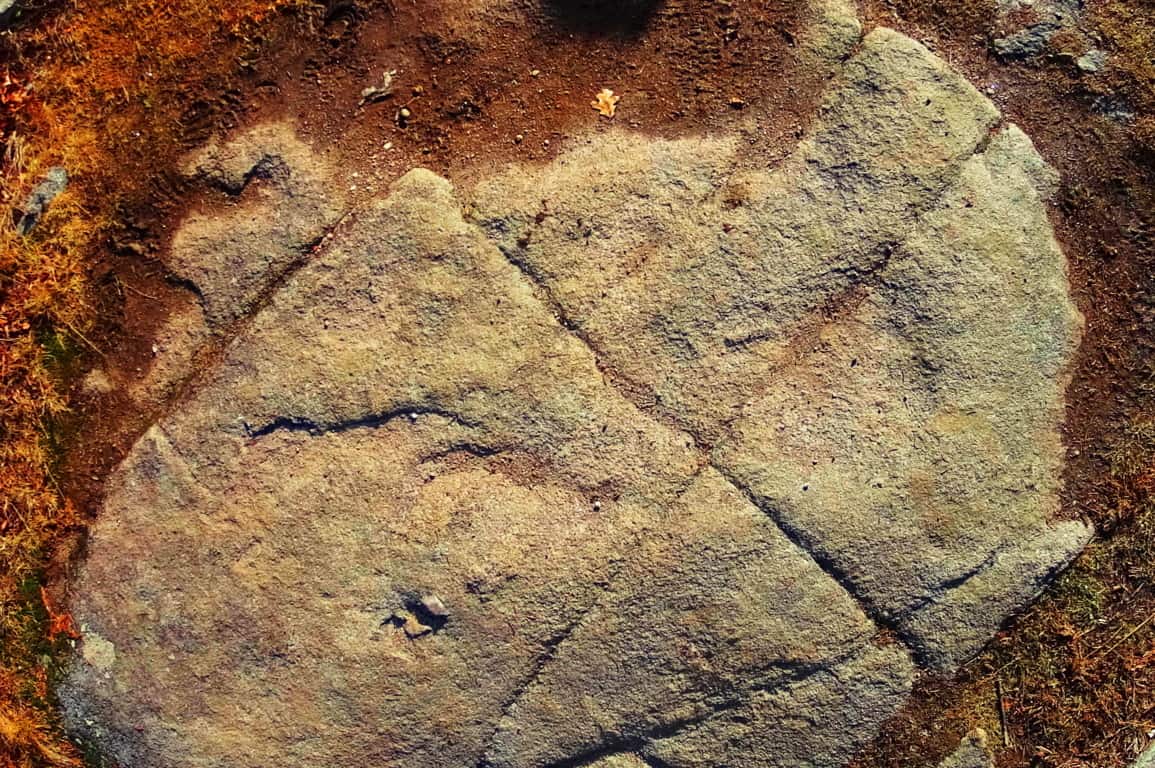
Are you seeing the pattern here? How is it that in a 100 years of modern anthropology, not a single anthropologist, geologist, or even social scientist, has now marked the obvious patterns and trends found in the heights of megalithic spaces of New England? How can Harvard or M.I.T professors, continue to belittle the most blatant and obvious patterns of evidence in these distinct spaces, from their desks? They will refuse to acknowledge, even with the related patterns of evidence, which literally point to a megalithically capable culture existing in the beginning of Time. The academics bully their narrative against the evidence because they can’t handle being dynamically refuted with evidence from people in the field. I hope that the readers will consider the evidence, not the theories of desk-chained theorists.
Returning to Wachusett Peak, at the top of the Summit Loop Trail, there is a solid rock dome over the uppermost mountain face. Carved into that ‘rock-dome’ are geometric patterns with distinct right-angles which could never occur in Nature; entire sections of rock cut with parallels, triangles, and right angles. (Image/Below) This is at the top of a mountain, not near a street corner! It almost looks modern! If people do not see this, it is because they have been programed not to. This is what you will find at the peak of Wachusett Mountain.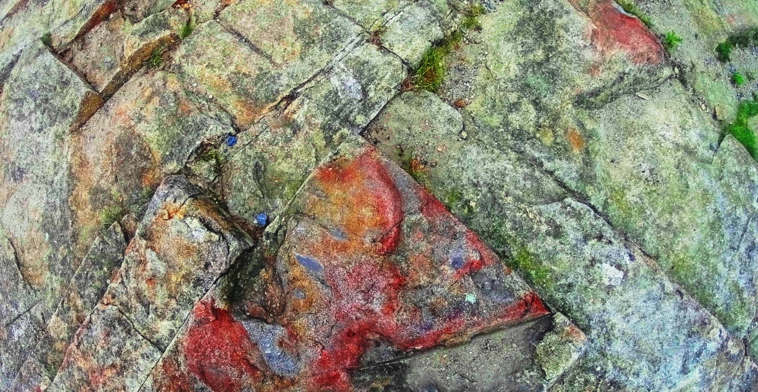
“Summit Loop Trail” Lower trail: Heading back down the trail there are the classic stone-linings running through the lower vale. These are beautiful stone-fixtures that run like cables from one peak to the next in the hills, literally connecting, and synergizing the landscape. 
Continuing down the ‘Lower Loop Trail’ you will find autonomous boulders near the Linings, very similar to Cavan Burren national Park’s megalithic statements in Ireland. These are the literal signs of megalithic culture all over the world.
Above is an image of a unique boulder at Wachusett. Below is an image of the Boulder at Cavan Burren National Park/Ireland, which is near many megalithic altars. The Wachusett boulder, which is subject to the same pattern, is guarding by a sacred area where a full New England Dolmen sits at the bottom of the Loop-Trail path.
Here is a look at A Dolmen that has been ridiculously labelled “Balance rock” at Wachusett Mountain (Image/Below). This Dolmen is not simply two boulders sitting on top of each other, they are two colossal stones, fixed and set, in a observably crafted style. Each stone looks to be a bout 30 tons! The lower boulder was clearly angled, and cut, to support the upper. It is set before an altar of smaller boulders, which are set in a pattern in the foreground. This entire scene is a magnificent and extremely powerful statement about how important Wachusett was to someone, in the beginning of Time. This is a good place to stop and consider what it must have taken to create this Dolmen!
In other parts of the woods, off trail, there are small Cairns that have been toppled. Look at the similarity of the toppled Cairn at Wachusett (Image/Left) and the toppled Cairn at the Dolmen of Kilclooney Ireland (Image/Right)
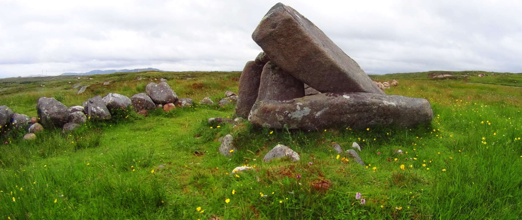
Mount Wachusett State Reservation is yet another sacred megalithic zone full of natural beauty and wonder, on par with any Celtic or American Western zone. The best time to experience this place is in early Autumn, as it is with all New England sites. Although I was unlucky in my excursion to see Wachusett in a veil of incredibly thick fog, the statements here are still overwhelming and inspiring. Yet again, you are being introduced to a trail that, through several subtle, and not so subtle signs, is trying to get your attention. Aside from that, the Forest here is gorgeous. Open your eyes and heart to see which way the evidence here truly leads; touch the markings and stones for yourself. Hike, climb, and meditate on the energy of this synergized landscape. Wachusett is a miniature-wonderland that has been endeared by every single group that passes through, since the very beginning. There must be something much more than typical about this place; the megaliths are indicating that very thing! I hope you will take your turn as well. May the road rise to meet you! And thanks for reading.
Coconino National Forest
Location: Flagstaff, Arizona.
Elevation: 7000 ft
Note: Coconino National Forest raises some amazing questions and answers about what has really taken place in the beautiful forests of the world. Before wandering into any part of the massive Coconino’, it seems appropriate to have a discussion about the very real enchanted statements that exist in sacred zones. Coconino is certainly one of those sacred zones. Therefore, this article begins with a “Forward” in order to offer logical evidence, rather than tired theories from post-modern science, theories which are quickly being understood as totally ridiculous. Here at Stonestrider is some of the most vanguard and comprehensive work on what is actually revealed by these megalithic stone works, and you will learn something incredible from it. There is an anthropological side of hiking in ancient places, and every so often it is important to review connections, patterns, and evidence. By looking at this material, please understand that you are stepping into something truly magical. I thank everyone who takes the time to consider the evidence in the beautiful places of the world by reading an article like this, and we will wander into Coconino after explaining a few wonderful things about what is taking place here.
Forward: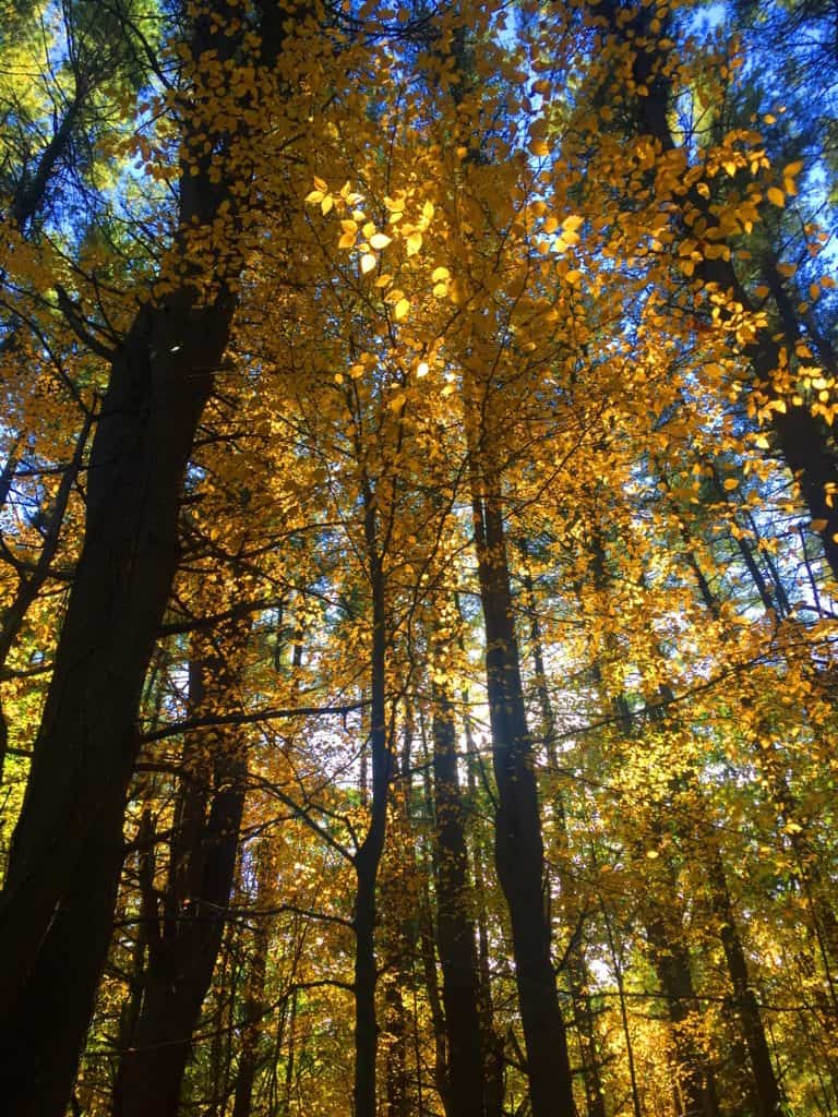 After drifting into roughly 30 forests internationally, and sponsoring this website with many truly challenging expeditions over the course of the last five years, I’m gonna take the chance of going full-on anecdotal for the first time, due to the relevance to The Coconino National Forest featured at the moment, which is one of the largest and most beautiful Pine forests in the entire World (and obviously the continental U.S) Allow me to step back for a moment to set a scene about what Forests mean to me. As a teenager I read, and re–read the works of J.R.R Tolkien, which many students utilized to break the boredom of raw academic classes, ever since the massive novel was first published in the 1950’s. Intrinsic to my photo’s, if you look with a certain eye, are Tolkien’s descriptions; images of mountains, river-glades, and forests which certainly engage all of our imaginations to this day! I realized, while going-over the content for this particular article, that in my mind, before I wander into any forest while out on the trail, that I am always comparing it to one forest in particular from Tolkien’s fictional masterpiece, that forest being Lothlorien. In this regard, I have searched for many years for forests that most closely resembled an enchanted experience, where the deeper you walked in, the more magical and dimensional the experience became. And amazingly enough, from this inspiration I discovered the real-time magic of forests internationally. These are profound discoveries that should be shared, which is the focus of this article.
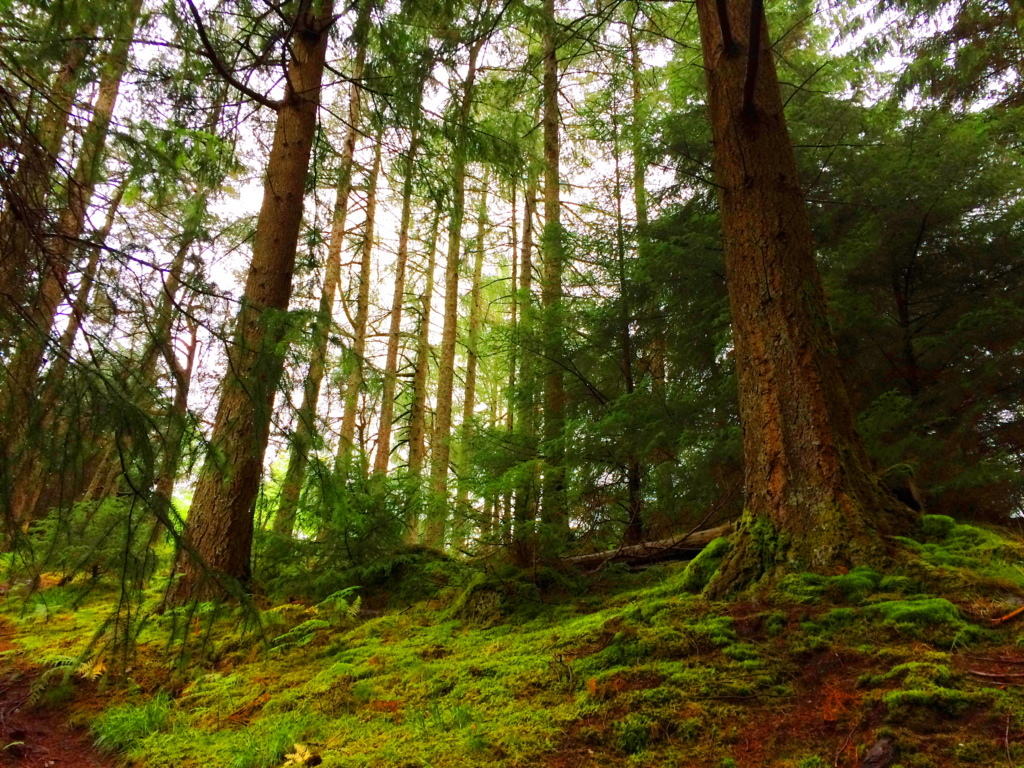 Forests often have particular emotional effects on people. Tolkien, in the Lord of The Rings, also creates a polarity about forests. His characters journey through the beautiful, mystical, spacious, ageless, enchanted Forest of Lothlorien; and then later into the dark, rustic, knarly, timeless Forest of Fanghorn. Some are light, and some are dark. And darker still, is Mirkwood Forest in The Hobbit, the epic prequel to L.O.T.R. (There are other forests as well, like the heart-warming Buckland Forest in the opening of LOTR,(#TolkienNerd), plus what you find in Grimm’s Fairy Tales, or Science Fiction stories of today)
The main point of all this ‘fictional forest referencing’ is to understand that forests have, and promote, specific styles and characteristics all their own, just like people. Some are bright and carefree, with pleasant pathways, and golden Autumn leaves, as in New England (Image/Upper-Left); while Other forests, like Ballachulish in Glen Coe Scotland, are dark and looming, with strong and rustic ancient knolls. Walking through Scottish forest is truly intimidating, with a fear of getting lost in the fog and rain; yet the glens are gorgeous! (Image/Upper-Right). Take a look at another Glen in the Snowdon Forests of Wales, which is as pleasant-a-vale you will ever walk through in your life. This particular glade, which almost looks fictional in real-time, are woods made of an extended family of trees, spacious and airy, with an obvious brightness that nearly forces you to squint just to decipher the full scene. (Image/Lower-Left).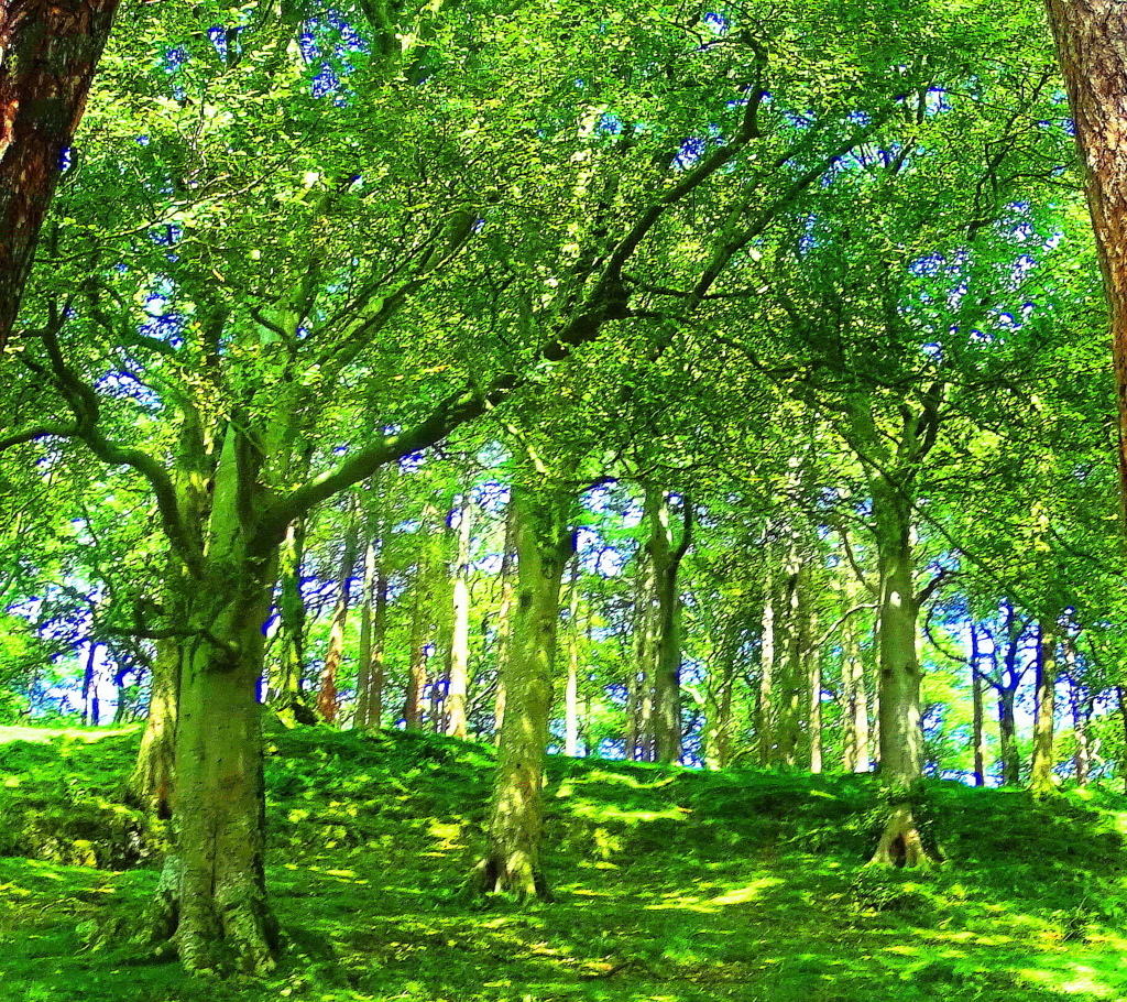 There is a small standing stone at the top of the knoll in this image, which can’t be seen from this spot.
And along those lines, how could I exclude a forest which is, in my opinion, one of the most enchanting paths that has ever been, which is the smaller, but incredibly beautiful, Kinnitty Forest, in the absolute heart of Ireland. This is a rare Celtic Wood, that has been vanishing steadily since the Colonial Period. Irish forests are particularly rare due the British need for resources across the Celtic Sea just 100 miles away. Kinnittty is a rare gem.(Image/Lower-Right)
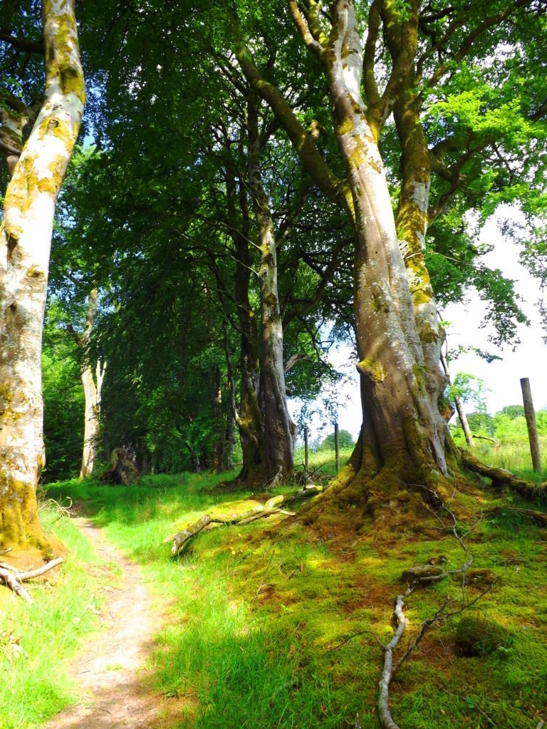
And before finally moving into the deeper meaning of forests, I could not complete this small tour without having a quick glance at the most dense and intimidating forest I’ve ever seen, which is the brilliant Rawah Forest of Medicine Bow National Park in Colorado USA. These are shimmering glades that sway and sift through each other like green-ghosts. In almost all the forests I’ve been I have disappeared into dells that looked to be harboring some kind of clearing or stone-altar; but in Colorado I dared not wander in any away from the old rocky paths. As I have described in other articles, it would be like wondering into the depths of the ocean at night, and like the ocean, it is an overwhelmingly profound statement about the abundance of Nature’s forces, ever blooming in our complicated world. (Image/Below) Forest Mysteries: I hope with this brief set of examples that it’s a little more clear how forests have enchanting and unique personalities. This “enchanting” vibe, if you look even closer, doesn’t come from the glades alone; there is something even more strange and mysterious beneath the tree tops. There are megaliths and impossibly crafted stones. This mysterious trend is an international phenomenon, where specific geometric patterns of stones, along with incredible feats of megalithic engineering, emerge deep within the woods, beneath sacred mountainsides, from Glen Coe, Scotland, all the way to Arizona, USA. After establishing proper anthropological and mathematical similarities in stones from forests nearly 3000 latitudinal miles away from each other (that’s North to South) the obvious question emerges: “How can this “glacial” arguement continue to hold up?
  Free-sitting boulders at advantageous vantage points in the forests of New England (Image/Below/Right) Ireland (Image/Left) England, Scotland, and Wales are technically similar to free-sitting boulders in Wyoming, Colorado, and Arizona.
 How the hell is this possible? Did the most recent Ice-Age glacier of roughly 40,000 years ago reach all the way down to Arizona’s volcanic mountain deserts? It just doesn’t make sense. Technically, the continent-sized ice mass that covered what would be the American West was called the Cordilleran, which looks to have stopped on the border of what would eventually be Canada. So, simply put, how are scientists claiming that free-sitting boulders like this one in the Coconino Forest in central Flagstaff was moved by the same glacier as the boulders in New England and Ireland? (Image/Lower/Left)
 I examined this Arizona boulder, and more importantly, the slope of the ledge it sits on, and the angle is very telling of how unlikely it is that this boulder remained on this ledge from an at-random geologic process. There is 15 degree slope on the ledge-top, as you can see. To counter that, on the boulder’s base, is a cut of about 15 degrees, fitting the boulder to the ledge perfectly. This is a fixture; an intentional fit, in my opinion. Additionally, there are markings all over this boulder, which is a type of “ledge-boulder” found in sacred zones all over the country. The odds that all of these boulders are placed at random at the very edge of vantage-giving ledges is, to put it blatantly: gastronomical multiplied by gastronomical; impossible.
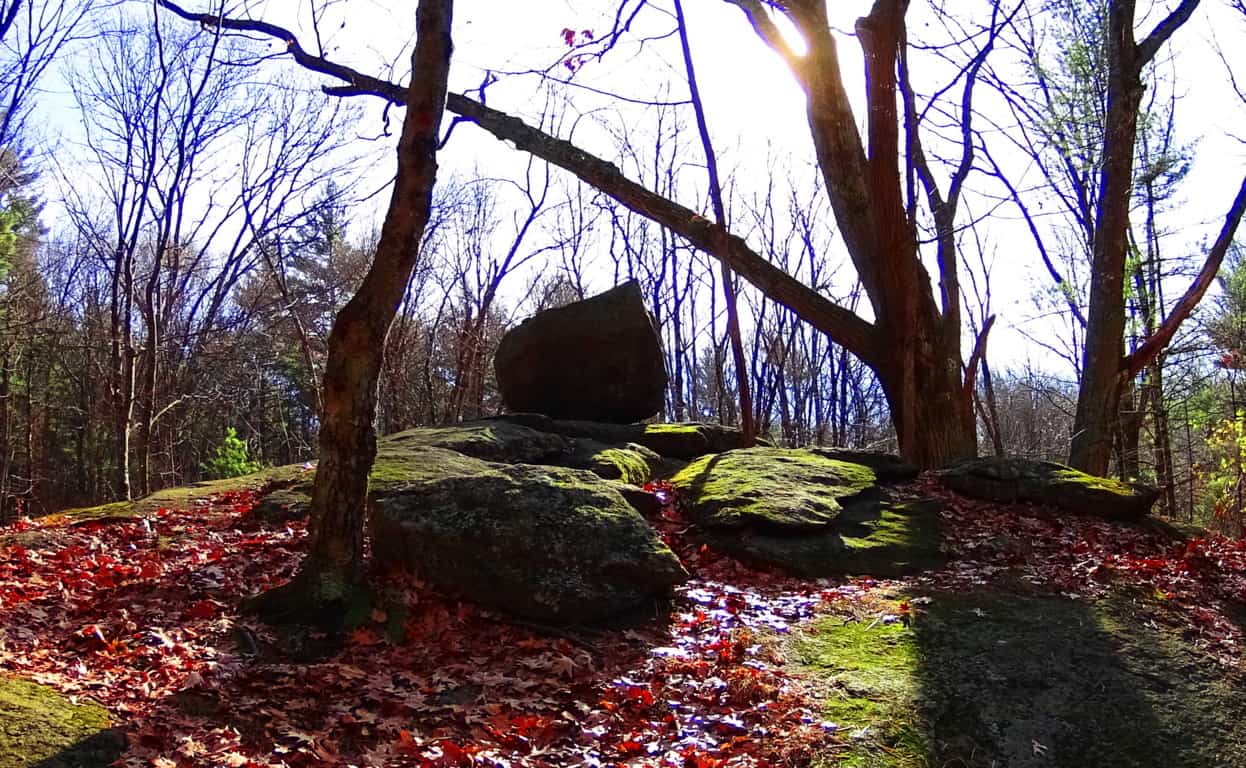
Take a look at yet another free-sitting boulder on a rounded ledge which is ‘vantage-giving’. This boulder is 2500 miles away, in New England. See how rounded this ledge is? For this boulder to remain fixed on top of this rounded precipice it would have to sit in the absolute gravitational center, which it does. Again this an example where if you use logic, and not simply dismiss the statement with brazen theories about ancient ice-sheets, the truth will come out. Someone, or something put this boulder here in order to say: “This is my zone; see how strong I am; beware!”
If this “territorial fixture” still doesn’t seem realistic to you, take a look at this amazing statement at Cavan Burren National Park in Ireland. It should be understood by the reader that Cavan Burren is filled with sacred megaliths; altars with standing stones, small temples, and Neolithic engineering. Someone claimed this space for themselves in antiquity, and in this space what do we find? A free-sitting boulder perfectly placed on a tiny platform of bedrock. Modern “science” is telling us to believe a massive glacier rolled this single boulder hundreds, or even thousands of miles, only to land it perfectly square and set on this minuscule 4 by 3 foot space of embedded rock? No. Impossible. Absurd. Illogical. And to me, insulting. Again, this is clearly an example of a boulder which was placed by an individual(s) in ancient times, as a statement to others that this zone is occupied, and by someone with incredible strength and know-how. Furthermore, here are some of the Neoliths found within just 25 yards of this boulder:
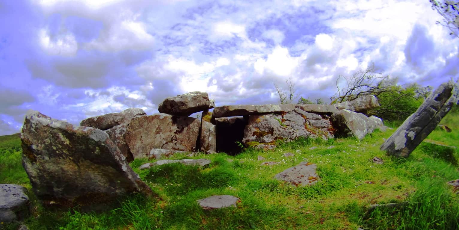 (Image/Left) and (Image/Below/Right). How can we go on believing the academic narrative of the post-modernists? They are blatantly lying to us in their white-papers, mini-museums, and gift shops. Why? What do they not want us to conclude? Well, regardless, perhaps these academics didn’t expect someone with a Degree in Western Literature, and some perspective, to make the effort to actually study these places in detail. Perhaps they are RELYING on the fact that people don’t make the effort to stride into these sacred zones from one continent to the next. And these free-standing statements can be found in forests all over the world. Here’s a look at some of the very strange and distinct boulders that remain in Cavan Burren Forest, just 100 yards from the Wedge Tombs. Celtic glades in Ireland are rare, and these boulders are strewn into the landscape like an above ground cable system. Covered in glowing green moss, they just looked to have some positional secret yet to be understood…
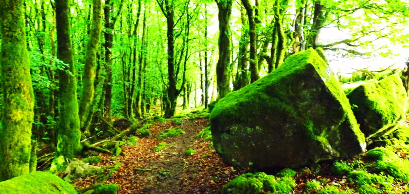
And now take a look at a similarly stoic boulder in the forest of Cococino, 4000 miles away. It has precise indents on its side, also with a strange glow, which is of course rusty orange, rather than mossy green. These boulders seem plotted, or planted, rather than randomly tossed about by ice. They are both squared and monumental, as opposed to disheveled. Another very real possibility is that the stones were there long before the forests grew. Were the stones there before the glacier came along? In some forests you can easily see that the stones were there first, as the trees grow straight over the rock. The point is, there are a great many questions that are not answered by the one size fits all modern answers of “glacial displacement.”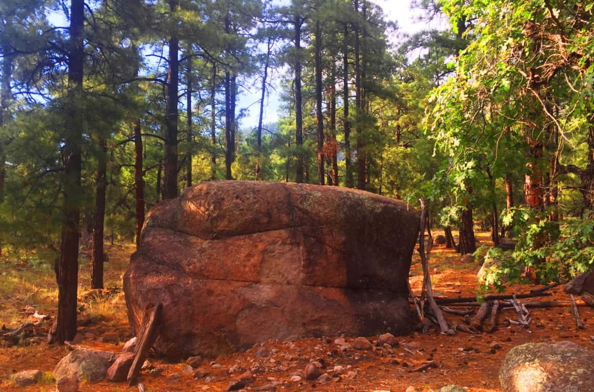 Coconino National Forest: Welcome to a Ponderosa Pine vale that stretches from the northern to southern heart of Arizona. Grand sections of forest emerge all the way from the Grand Canyon down to Sunset Crater Flagstaff, continuing even further down through Oak Creek Canyon, in Sedona. In this environment entire glades of trees are literally on the edge of burning at any given moment. Many trees are already lying prostrate on the ground with limbs seemingly reaching to the heavens, begging to be finally ignited by the Sun. I had just never seen trees like this before.
 Even with the challenge of an extremely arid climate, many incredibly delicate and beautiful statements emerge in the dry hedge and shade. These wildflowers just look so resilient against a massive canvas dry-wood in the background.
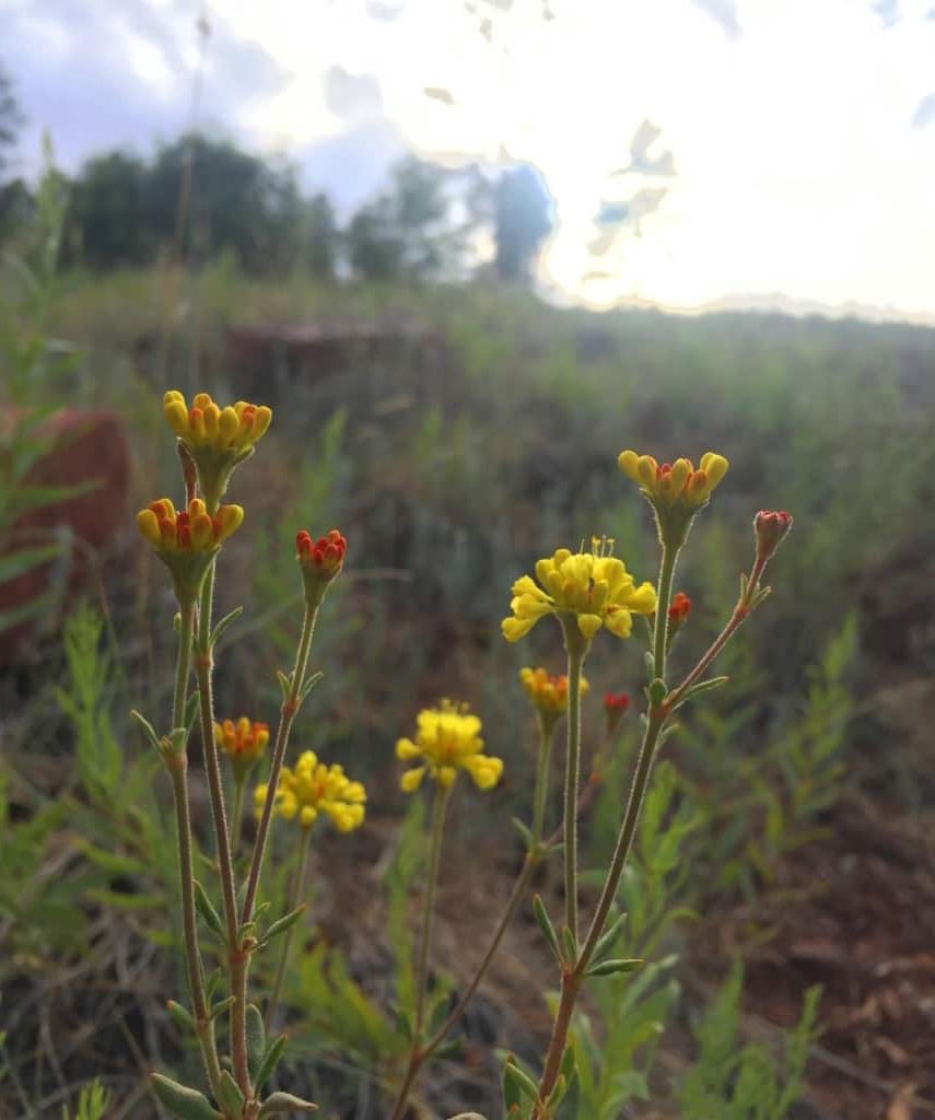
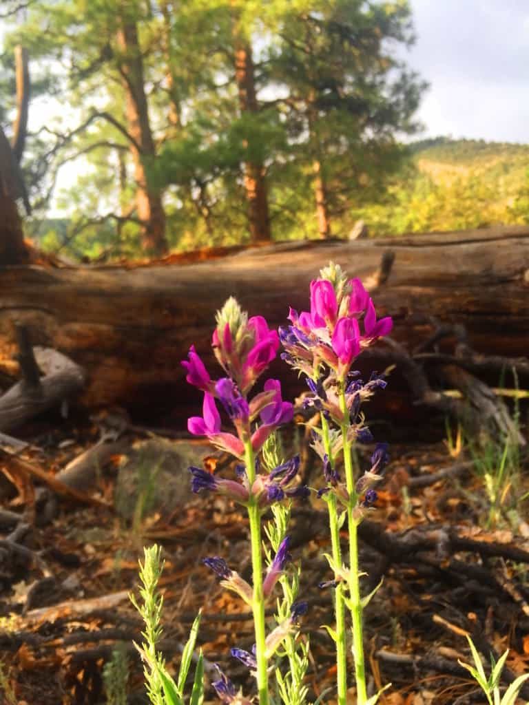
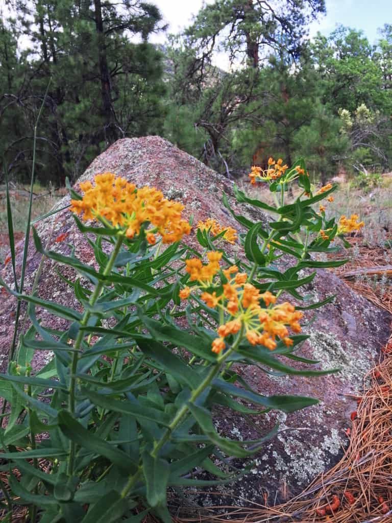 You will have to make a decision about where and when you want to wander into the Coconino’. The northern section of the Forest sits at the edge of the Grand Canyon, near the great Southern Rim. This requires traveling through the beautiful desert plain to arrive at the Canyon. The central section of the Forest is roughly 150 miles south of the Grand Canyon, stretching from Sunset Crater National Park to the The San Francisco Peaks, which are the rugged mountains that engulf the city of Flagstaff. Much of the Forest can be found at the base of Mount Humphries, climbing all the way to the peak, which stands at 12,365 feet above Sea Level, and offering 6000 feet of Prominence. That’s a pretty serious climb, and one which I did not make during this particular excursion. The area is truly a wonderland, with possibilities in every direction, and it is nearly impossible to miss a mountain, canyon, or forest trail, in this part of Arizona. Flagstaff is the place where I chose to enter the Coconino first.
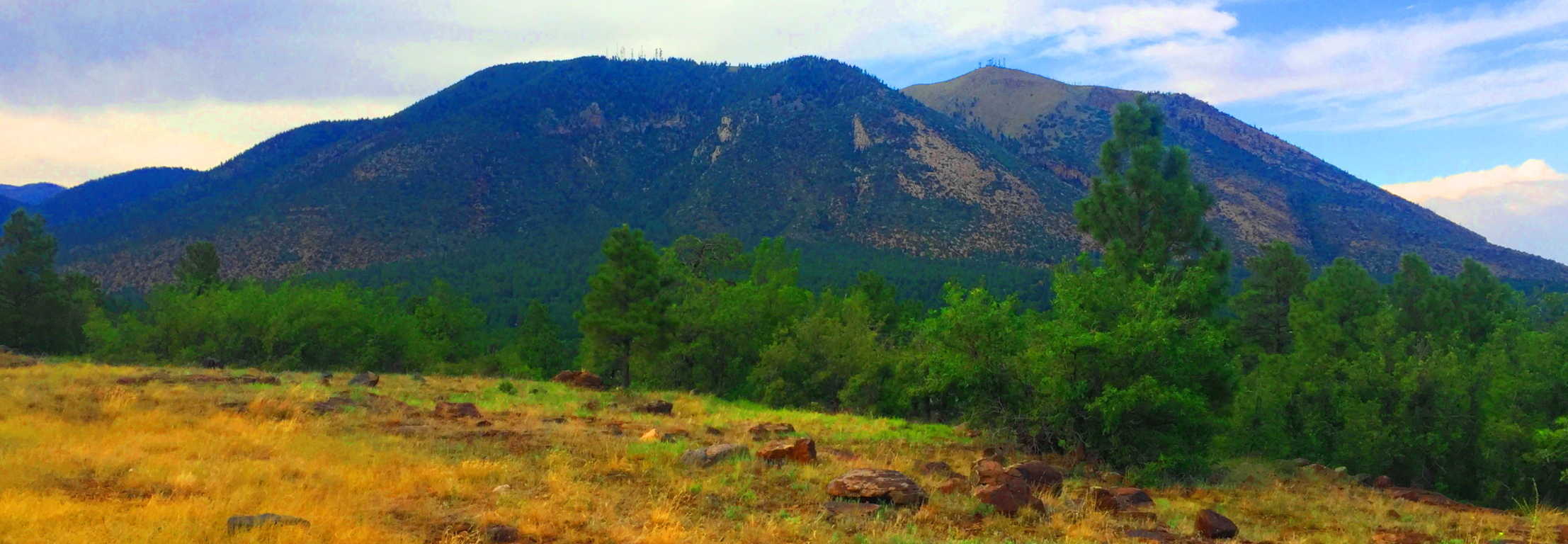 The Coconino Forest at Buffalo Park: There are half a dozen parks and entries for the Forest in Flagstaff. Buffalo Park is a 700 foot elevation hill encompassing about 5 by 15 miles of quiet grassland above, and on the edge of Flagstaff.
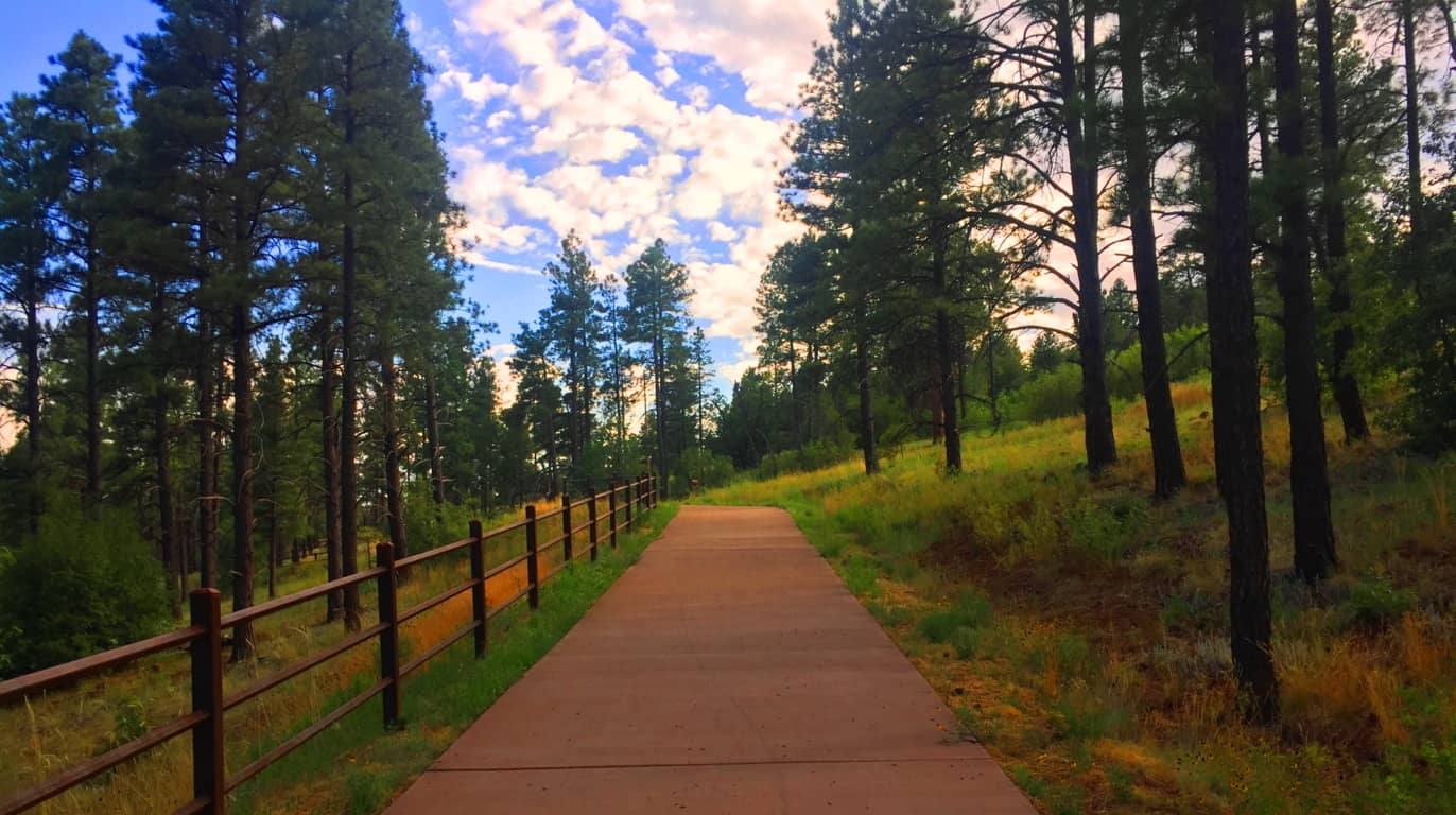 At the top, after sifting through the Forest, the area opens up to a surprisingly vast and peaceful scene. (Image/Below)
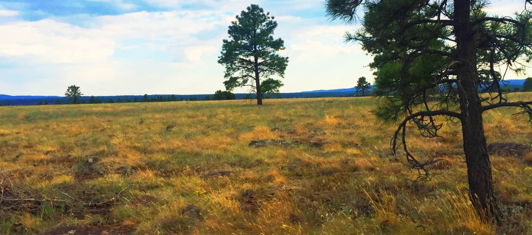 This plateau is like the American West’s rustic version of Ireland’s Hill of Tara (Image/Below/Left) although it was far less lush than the near perfect setting of Tara’. The quiet was very similar though, both hills were places to feel the high winds and absorb the day. It was easy to see that this hill, perhaps 500 years ago, would’ve certainly been a serene place for the Natives, who built stone huts in the deeper forest just a 1000 yards away from here. The size and scale of Coconino and Tara’ is eerily similar.
 The trees and stone-fixtures surrounding the Hill at Buffalo Park seems as enchanted as the megaliths in, say, the Mourne Range in Ireland, or the Berkshire Range in Massachusetts. As explained at the beginning of the article, certain areas felt more like claimed cliff-spaces from the beginning of Time. Buffalo Park is just a teaser to the more dense forest which is closer to Mount Humphries, a beautiful wilderness looming in the immediate distance.
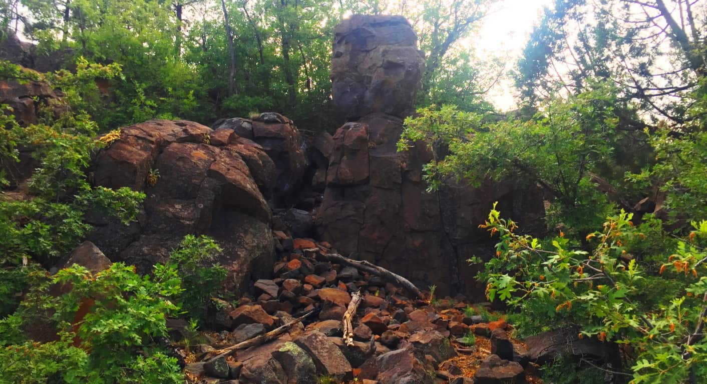
The image above is another look at the small cliff-face with a distinctly placed free-sitting boulder, etched just below the top of the broad hill beyond. I can’t stress it enough, how similar this is to places in New England, where magical things often loom in deep gully’s, which unless you stop and dip down into them, you would simply pass by, gaining no knowledge of the concealed area at all. Here’s another look at the surprising frequency of boulders beneath the trees in this wonderful place. (Image/Below) 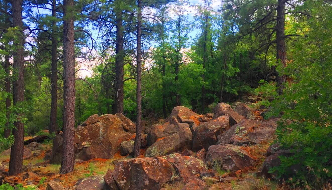
Once you are ready to step into the larger Coconino Forest at the base of Mount Humphries, you can simply drive up to one of the many Trailheads. I used the entrance at Trinity Methodist Church, sitting on the literal edge of the vast woods.  There are dozens of trails winding through this spacious and beautiful set of glades, with massive stones set in incredible positions that give serious pause. This amazing stone was there to greet me as soon as I walked in. (Image/Below) You just can’t make this stuff up.
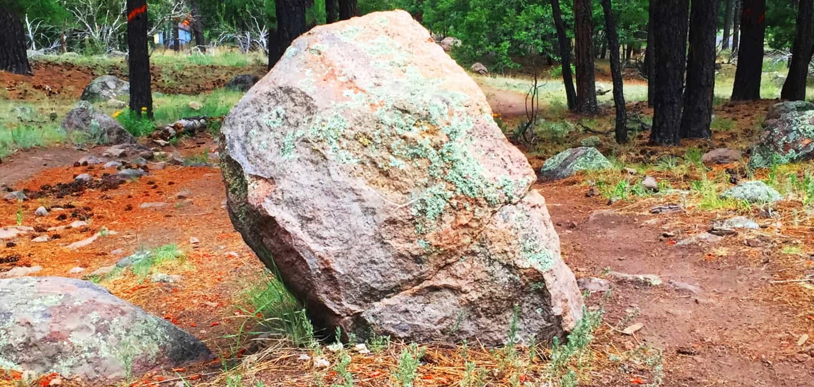
This stone is essentially standing straight up at about 4 feet high, with only a five inch width, which is relatively thin. It is also buried deep within the ground, and make no mistake, this a massive rock. There is a type of streak across the center, with an oblong leaning of the overall shape. I was excited to see a type of “statement stone” as soon as I began my hike. The forest felt strange, mysterious and beautiful. Stones like these in New England are very similar, but this seemed a different style all together! As I progressed further towards the base of the mountain, another stone, more convincing as a Standing Stone, emerged. (image/Below)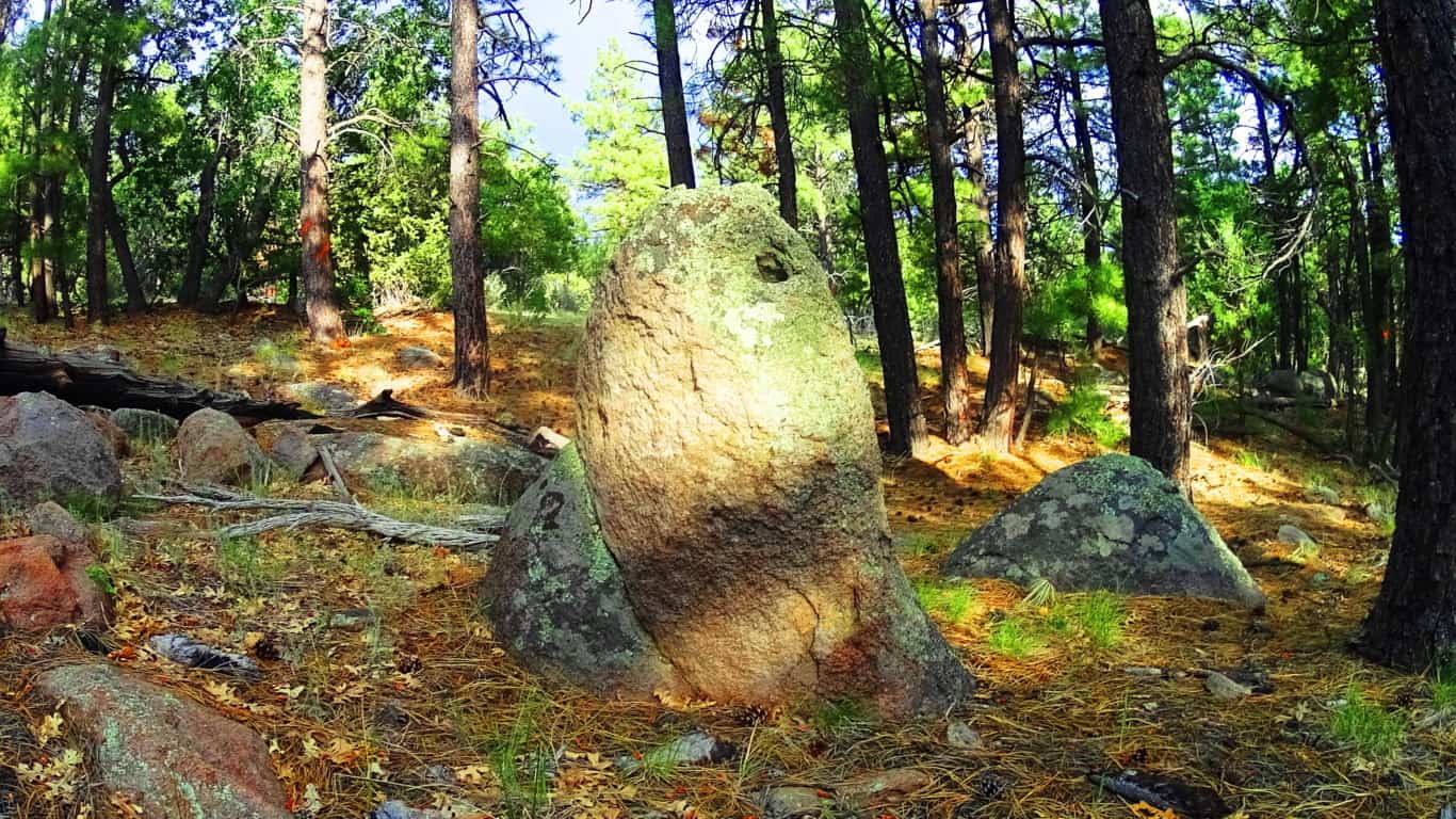
Here is another huge stone standing straight up at about 5 feet tall, and about three inches in width. At this point I was having that moment, just like I’ve had at Cavan Burren National Park in Ireland, and Monument Mountain in Massachusetts, when I said to myself: “O.k, what in God’s name is going on in this enchanted place?” And that feeling of ‘Lothlorien’ begins to sink in, all over again…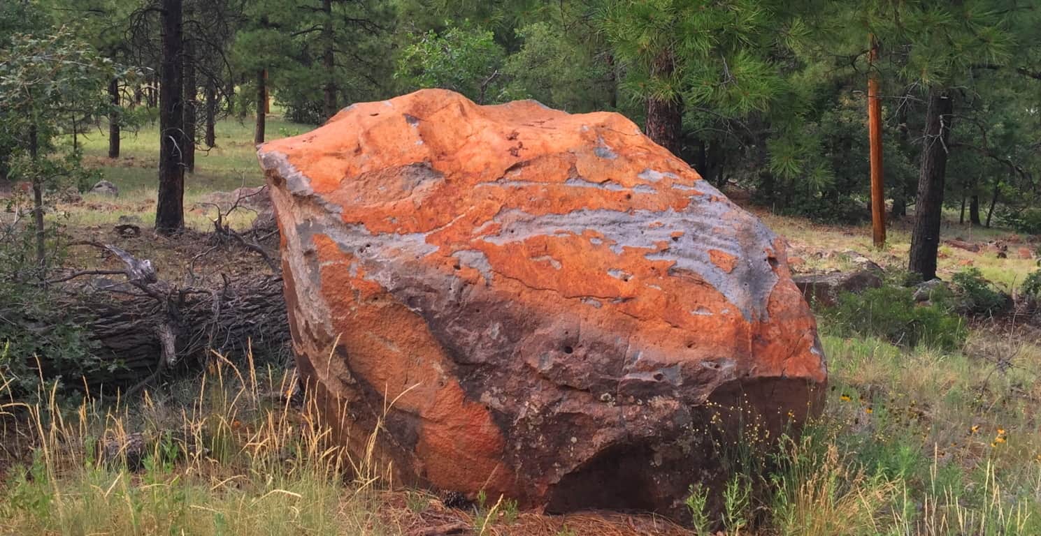
Take a look at this boulder above, which was on the edge of the woods. It was so isolated and stoic, extremely similar to the boulder at Cavan Burren National Park I described above. I could not help but feel that this was another territorial marker, just like at Celtic sites. I even pictured it painted with various markings to increase its distinction, as they are depicted in the mythical xbox game Skyrim, protected by giants living their primordial existence.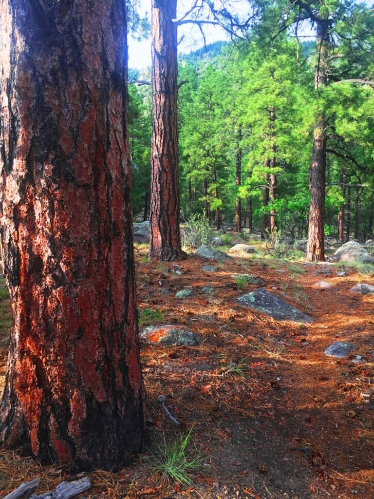 Hundreds of distinct statements like this can be found in the Flagstaff Coconino. Something spectacular is going in this place, so spectacular, that its hard to totally understand. Aside from the threat of fire in July, the place was incredibly peaceful. Against Mount Humphries, the forest seemed ultimately protected from the North, tucked-in enough for the natives to build there homes here, which of-course they did. The trees are spaciously placed with a rusty orange glow along the tough exteriors and the forest floor, very much like New England Pine glades. The air is so dry that you can taste the hovering heat in the pocket of your tongue, like the taste of charcoal in the wind at a barbecue. Any spot is a great spot to sit down, take a nap, take a picture or video, and just fall into the peace and quiet of this massive natural space. It is pure medicine for your mind, against a modern world constantly driving us into the lower aspects of existence, which is the material and monetary contest we experience to survive. The Coconino’ makes you forget, in the best possible way; through the wind in the trees.
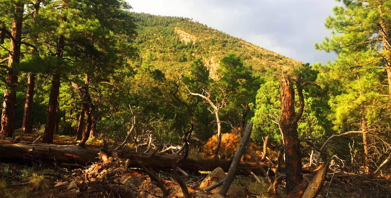
Coconino Forest at Oak Creek Canyon/Sedona: After walking out of the Forest at Flagstaff, I had real and tangible reasons to believe that the Neolithic Culture inhabited this place, just like the myths of the Natives speak of. The following day, heading down to the southern extreme of the Coconino’ from Flagstaff, to Oak Creek Canyon, there are two southerly highways. Take the 89A, not Route 17. The 89A is one of the most beautiful back-highways in the country, and scenic Coconino forestry all the way down into the Canyon. The distance from Flagstaff to Oak Creek is only about an hour, the entire trip a wonderful experience. Bring cameras and water, and be ready to freak-out on the beautiful southern extension of the Coconino!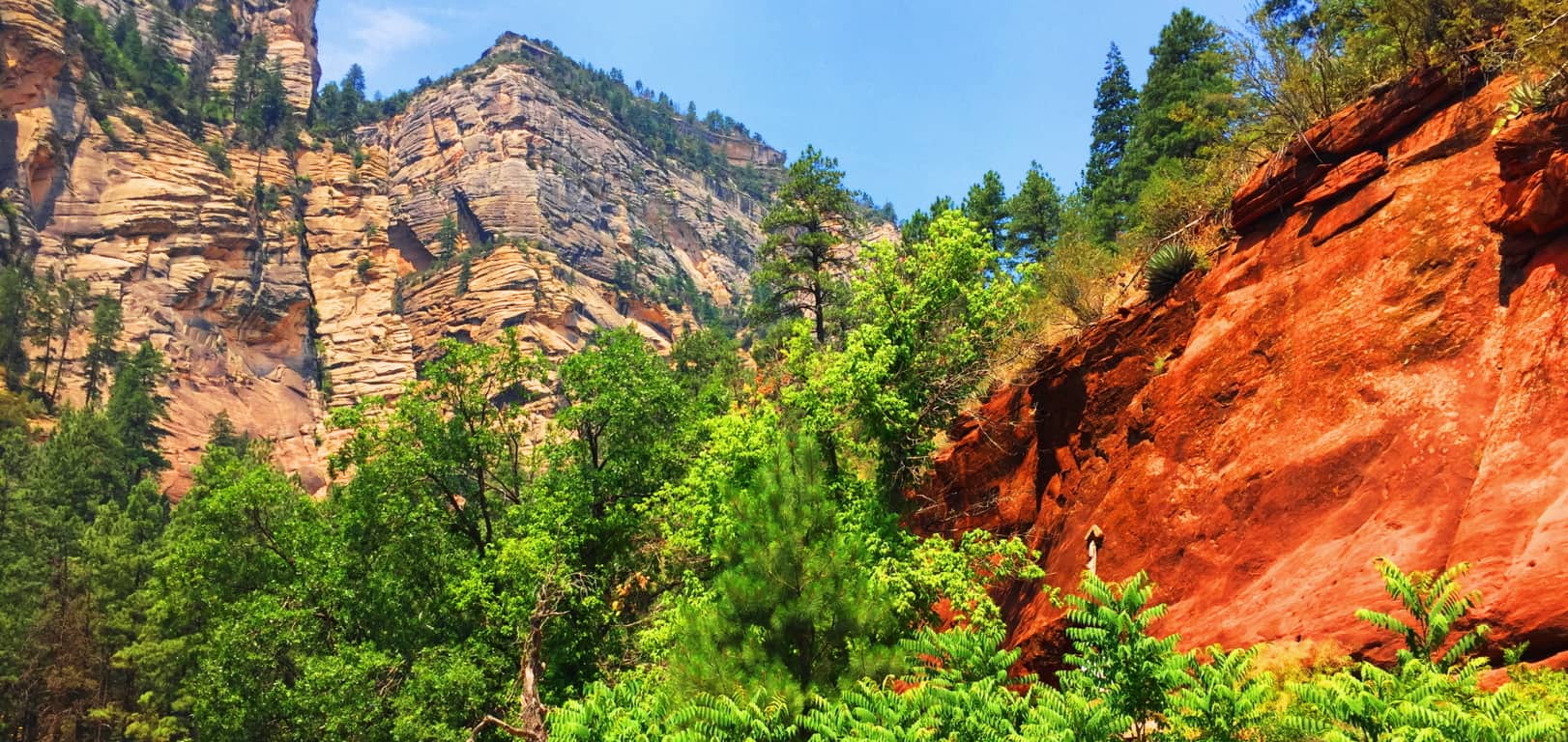
Oak Creek is its own excursion, with magical stones, free-sitting boulders, and habitations well worth several treks. (See “Oak Creek Canyon” at Stonestrider.com for the complete experience.) The most important thing to understand is that the Coconino forest reaches all the way to this southern tip of the central portion of Arizona. This forest is massive and gorgeous, and as mysterious as any Celtic place I’ve ever seen. The trails here are cool and distinct, marked by lonely boulders that seem to be markers, yet again. The Forest grows thickly, with perhaps the tallest of Ponderosa Pines in all Arizona, featured in the very top image of this article. The Coconino Forest is enchanted with a rare Trinity of locations; found in Canyon, Mountain, and Desert. 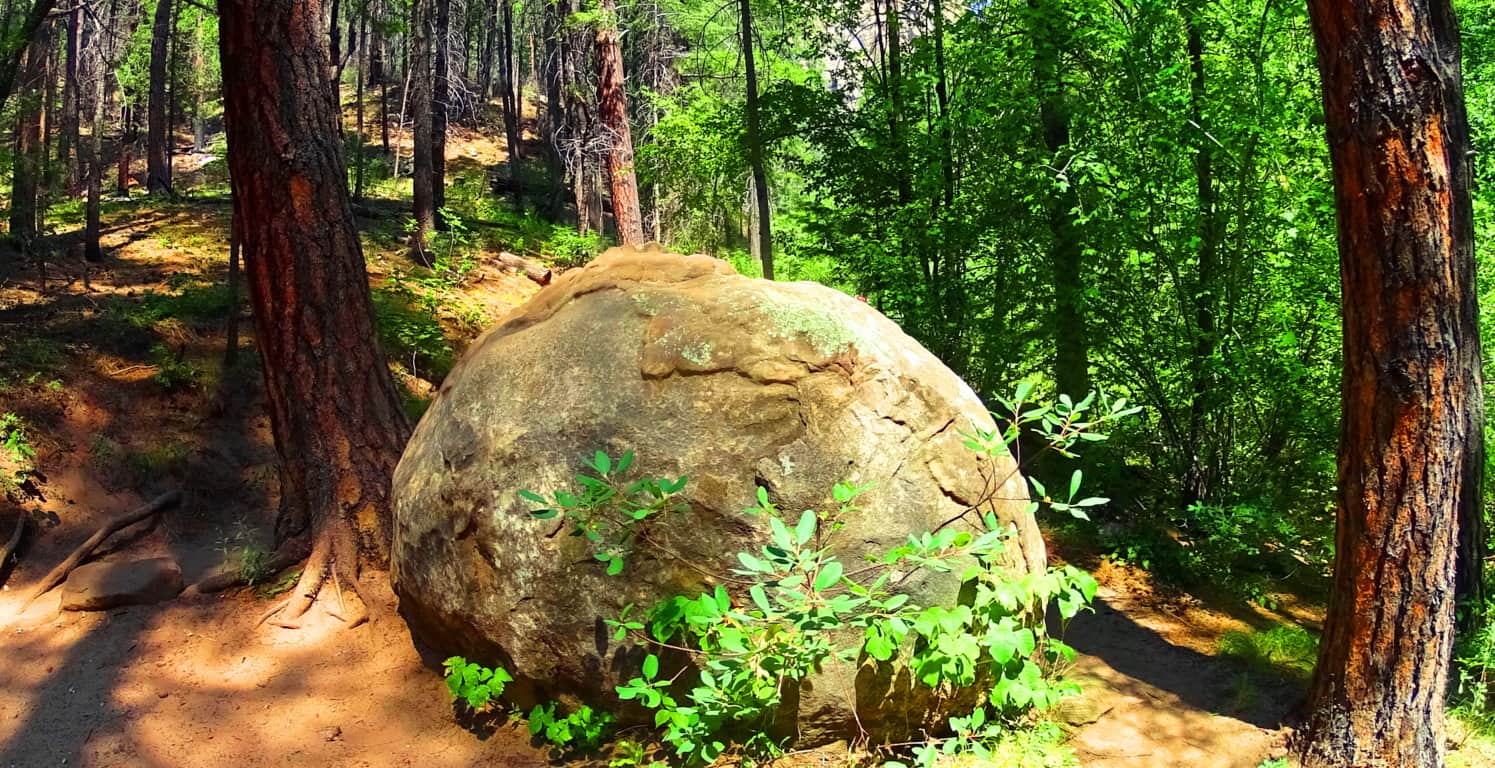
The Coconino Forest of Arizona is another dreamscape with mysterious statements strewn throughout the gigantic woods. It is the majestic wood-belt of Arizona, and in terms of scale, trumping Celtic forests in every possible way. Did the same Neolithic Culture which I believe existed in the forests of Celtic places exist here? I believe they did. Let yourself wander beneath these Pondersa Pines. There are mountains, volcanos, canyons, deserts, and grassy plateaus, where you find this Forest’s trails. It is an all-embracing Forest that pushes through the most arid of environments to ultimately give life and shade to this part of the world. The most important message I can convey at the end of this article is that reading about a forest is all well and good, but entering into one is the overall goal. You can get there and experience this massive life-force for yourself; it’s not a cliche. Seek it out, and find it out. Use your own mind to experience places like this, and don’t let the information-comptrollers and false-history writers deny you your allotted connection and interaction with this amazing primordial source of life in our world. Look and decide for yourself what happened in this gorgeous place. Go strong. Stonestrider.com.
Red Rocks National Park

Location: Sedona/Arizona/USA
Elevation: 3,900 ft
Note: Welcome to the place in every persons imagination where ‘epic Quests’ take place. This is the ‘impossible wasteland’ of mythic tales, like Don Quixote, or The Song of Roland. This is the backdrop that provides ultimate silhouettes, and inexplicable skylines. Colors radiate from both the sky and stones, and these stones are nothing less than solid-rock skyscrapers. People come here to turn monumental pages in their lives, and to leave the East behind. 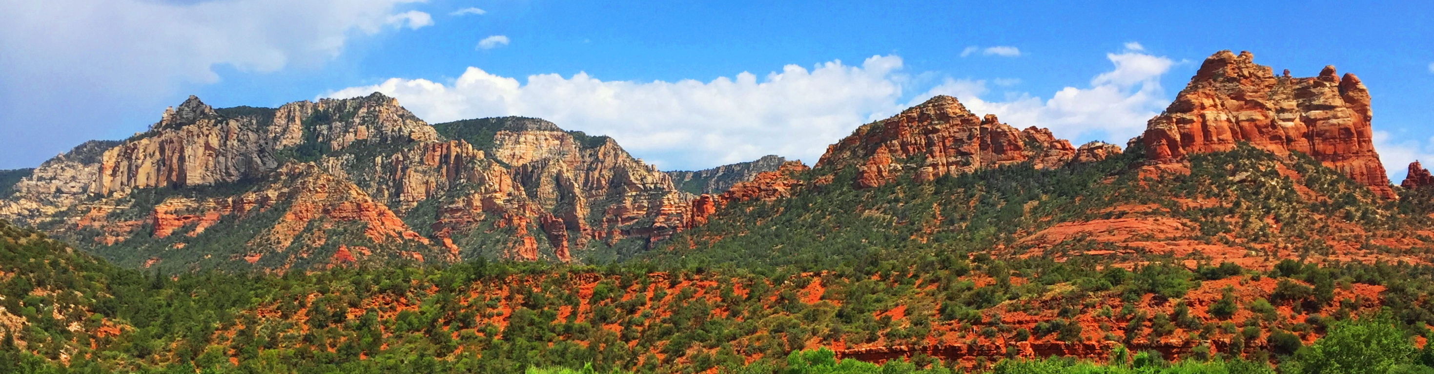 Nearly every conversation from the local people, from artists and hikers alike, includes the idea that Sedona changes lives. The trails at Red Rocks National Park, where Sedona is located, feels like the natural stage for the places in which Jesus preached, or The Crusades. Precious waterways roll beneath tunnels of reeds, cutting through a universe of rock, looking like miniatures of The River Jordan. The river is actually Oak Creek, which is also the name for the main trail leading from the visitors center. (Image/Below)
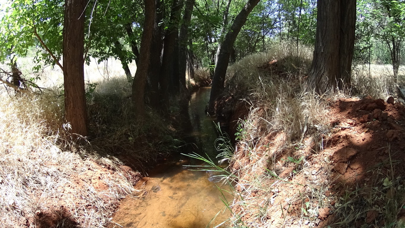 Their are just so many associations that are possible in one glance, that all you can really do is catch your breath…
………………………………………………………………………………………………………………………………………………………………………………………………………..

Myths: Native to this landscape are the Anasazi, a people that carved their dwellings out of the highest livable portions of the upper canyons, as well as concealed rock dwellings on the Plain. The upper Anasazi dwellings are so elevated that they can only be reached by rope. Why would an entire culture build homes so high above their essential resources? What was roaming the plain that required a great height to steer clear from? Interestingly enough, the Anasazi myths, just like the Celtic ones, are of Giants.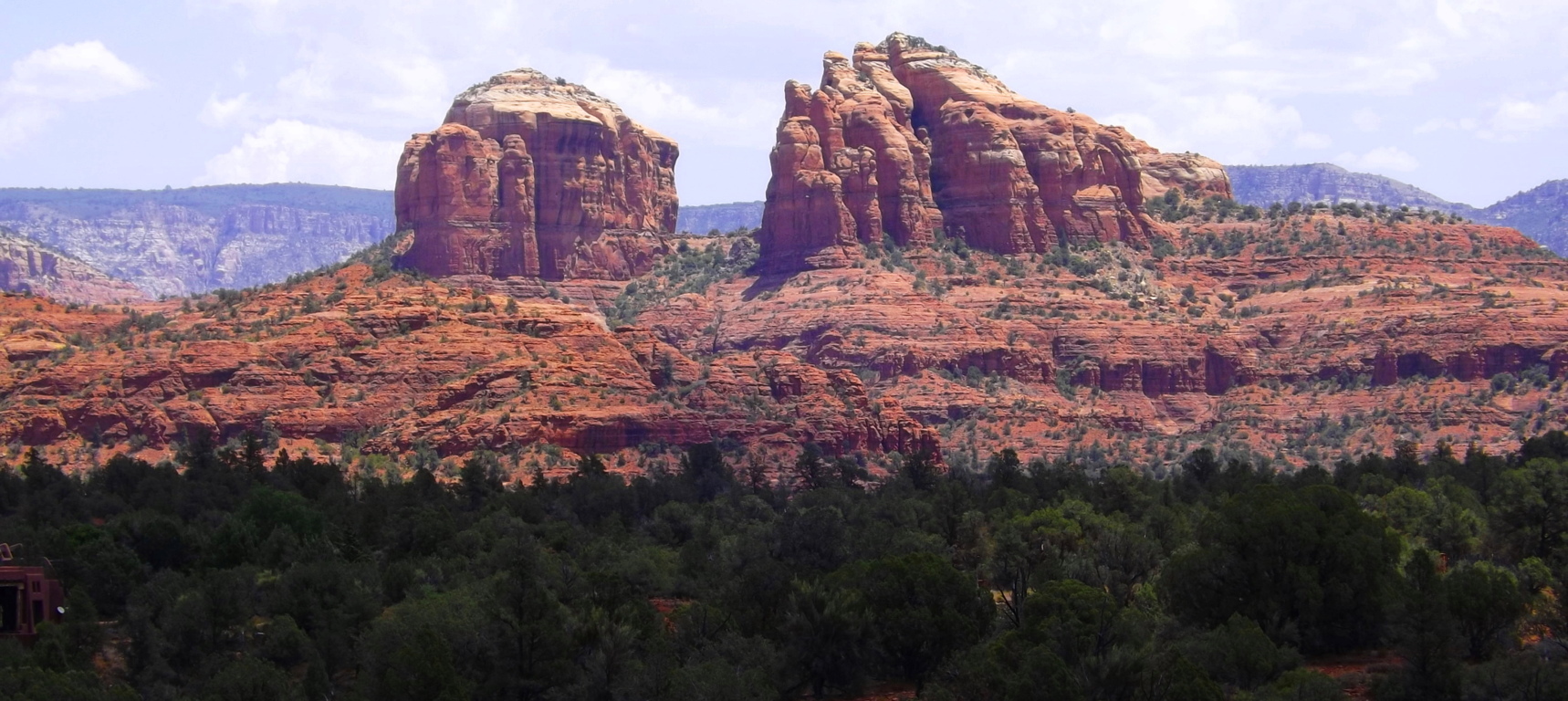 Why do all the oldest cultures insist that they experienced Giants? Something to think about, and this is the place to do it. As it is with so many places in the American West, there is a toughness to everything you see, but even with that toughness, a delicate beauty refuses to be ignored, which can be seen in the color of the wildflowers at Oak Creek Trail.
Oak Creek Trail: Red Rocks’ is sprawled-out massively to the east of Sedona. Oak Creek Trail is the best introductory experience here, with about five miles of options that head into ridges where photos can be beautifully made. You cross the Oak Creek Bridge and wander into a rare reality. The amazing thing here, in 105 degrees of heat in July, is that the fauna finds a way, and colorful statements emerge in the landscape. (Image/Below)
After crossing the bridge and heading up a few of the ridges you can turn north and see this epic space. There are hills and rock towers, forests and grand ridges, with miniature canyons, all in one glance.
  The concentrated ridges truly look like temples. Perhaps that is why one of the more major statements in the park is called Cathedral Rock.
Cathedral Rock Trail: Cathedral Rock’ has its own trailhead, but can be reached by a 8 mile trail from the Oak Creek route. This longer route required preparation and expertise. Any trail passing through the High Plain will require 1.5 gallons of water and food in your pack, along with a small med kit. Respect this wilderness. From the trailhead at Cathedral Rock, which can be reached by a simple and brief car ride, there is a fantastic loop that takes you around the ‘Cathedral’. There is a type of reverence here, with the Cathedral in sight, as if something otherworldly once happened at this beautiful place. 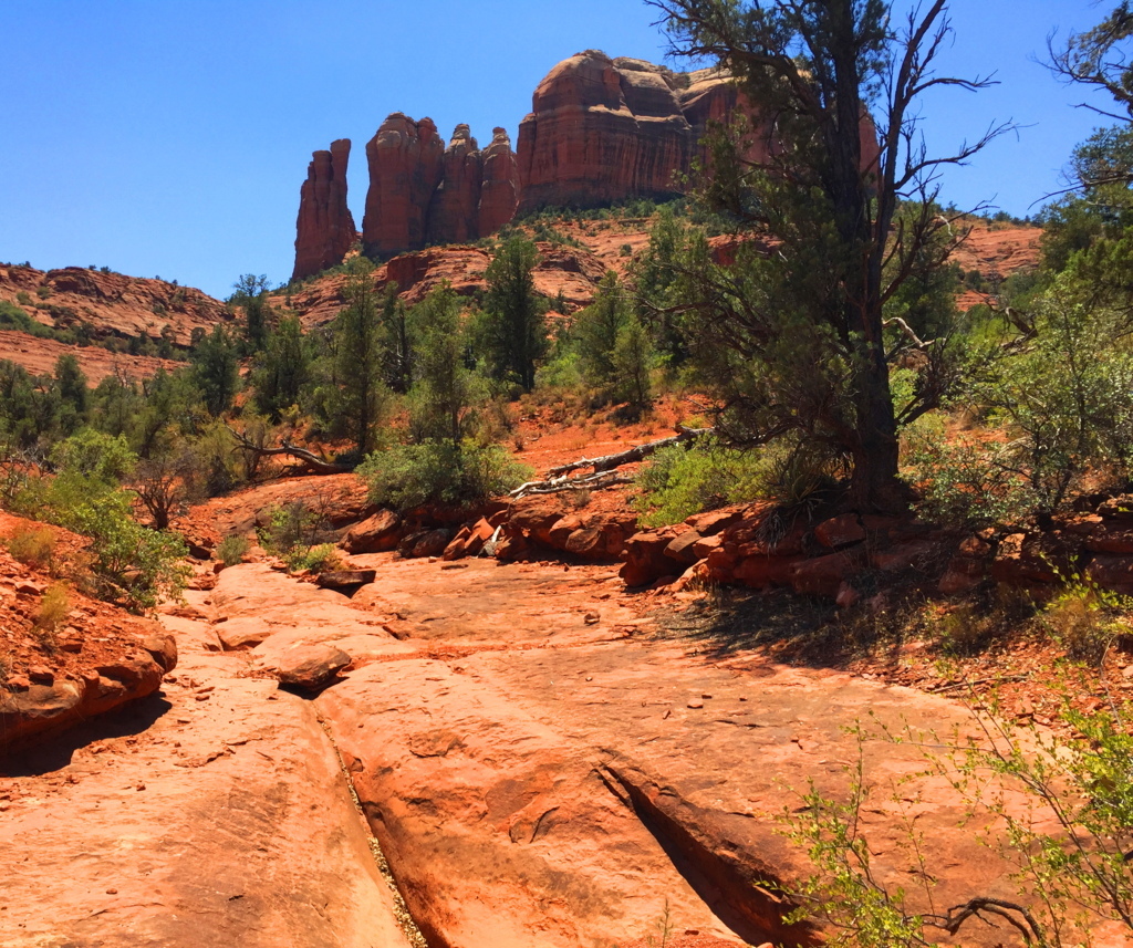 Like a meditation center, hikers can be found circulating the massive Rock, and camping out in groups of spiritual seekers. There are trails for biking as well, for those who are prepared for the rocky terrain..
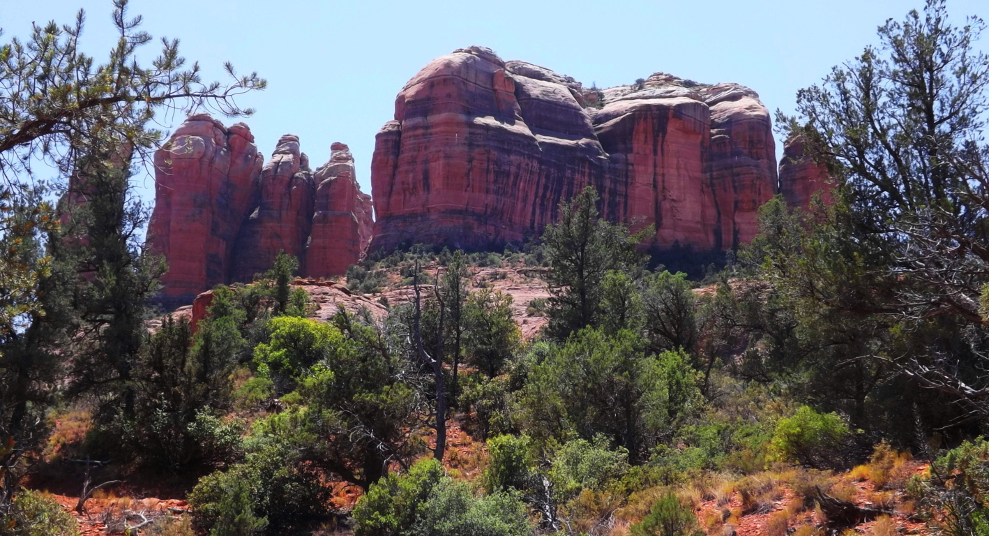 There are offshoots of the main trail here that are hard to understand. Some of the bedding of the rocks look as if water once rushed over the stone, obviously in another Era. Amazingly, there are cross section here, delicately etched into the stone, just like in the rocks of the trails back East.
 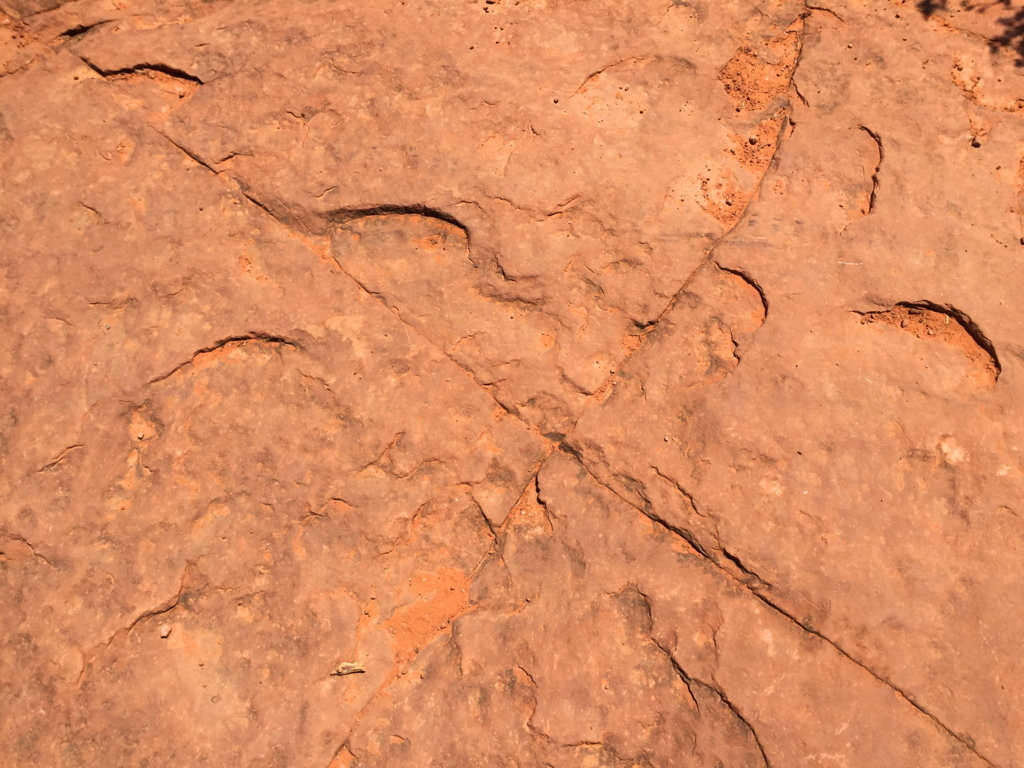 This one, pictured on the left, is at Cathedral Rock Trail; the one on the right is at Watatic Trail, 1800 miles away.
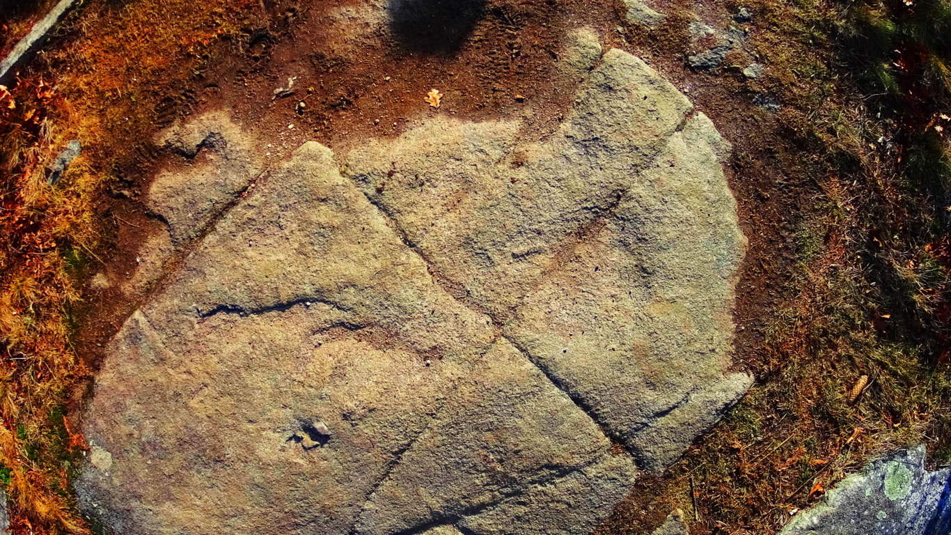 What is the meaning of these cross sections, which are found in the ancient rocky sites of the world? As described in other articles, I believe they are the “calling card” of a Neolithic Culture, which created cross section of triangles as a utility for building, as well as a tribute to the divine concept, which is The Axis of creation, a philosophical concept from the beginning of Time.
There are deep cuts in the landscape leading away from the wide bed-rock faces. They are tempting to climb into, but beware of snakes, and other wildlife. There are also stones that are clearly cut, and not average debris, but the amount of possibilities as to who may have done this work are too general to specify. 
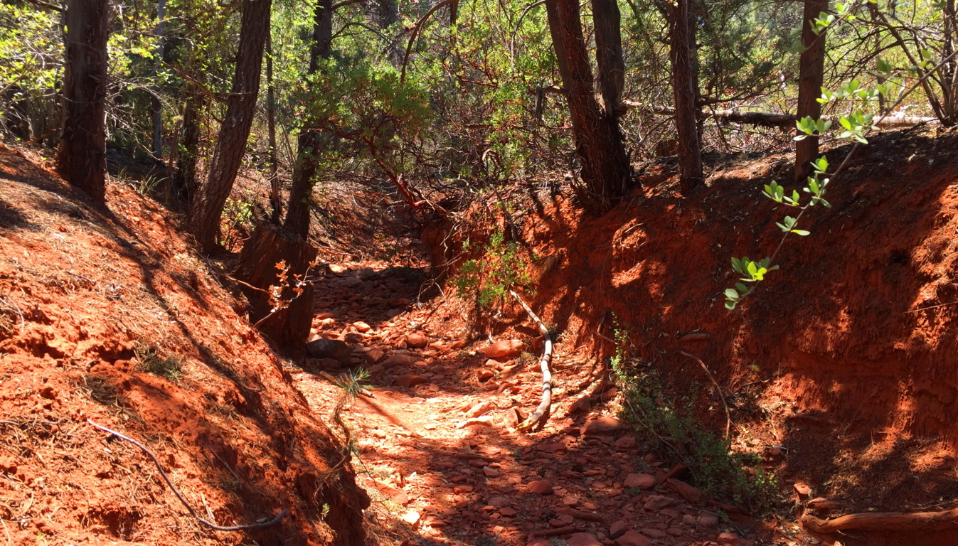
Red Rocks National Park is a place unlike any other in the world. One could spend a life time hiking and researching its epic features and indigenous mysteries. The colors here, the scale of everything you see, is overwhelming. For those first-timers, try these basic trails first, and make time to visit Sedona. There is a vibrant Arts community here, with a social scene to match. Arizona, overall, is a hiking paradise. You can feel that something incredible took place her once, however hard it is to put your finger on. Perhaps the myths are just a hint as to what this place was before the West invaded.
Red Rocks National Park is just one of just dozens of national parks, each one being an absolute gem, like Oak Creek Canyon, Grand Canyon, Hulapai Mountain, and Sunset Crater, just to name a few. An experience here increases your overall ability as a hiker, drastically, as you are moving in 105 degree heat, roughly 4000 feet above Sea-Level. When you go home you will be significantly stronger. The energy is obviously radiant, but purifying and straight-forward, without any room for wasted effort or lazy mistakes; yet in places where the stakes are higher, the value of the experience enters into that realm of spiritual appreciation that makes hiking the very real meditation that it is. Red Rocks National Park is that experience. Give it a shot if you can, and go strong.
Medicine Bow National Park
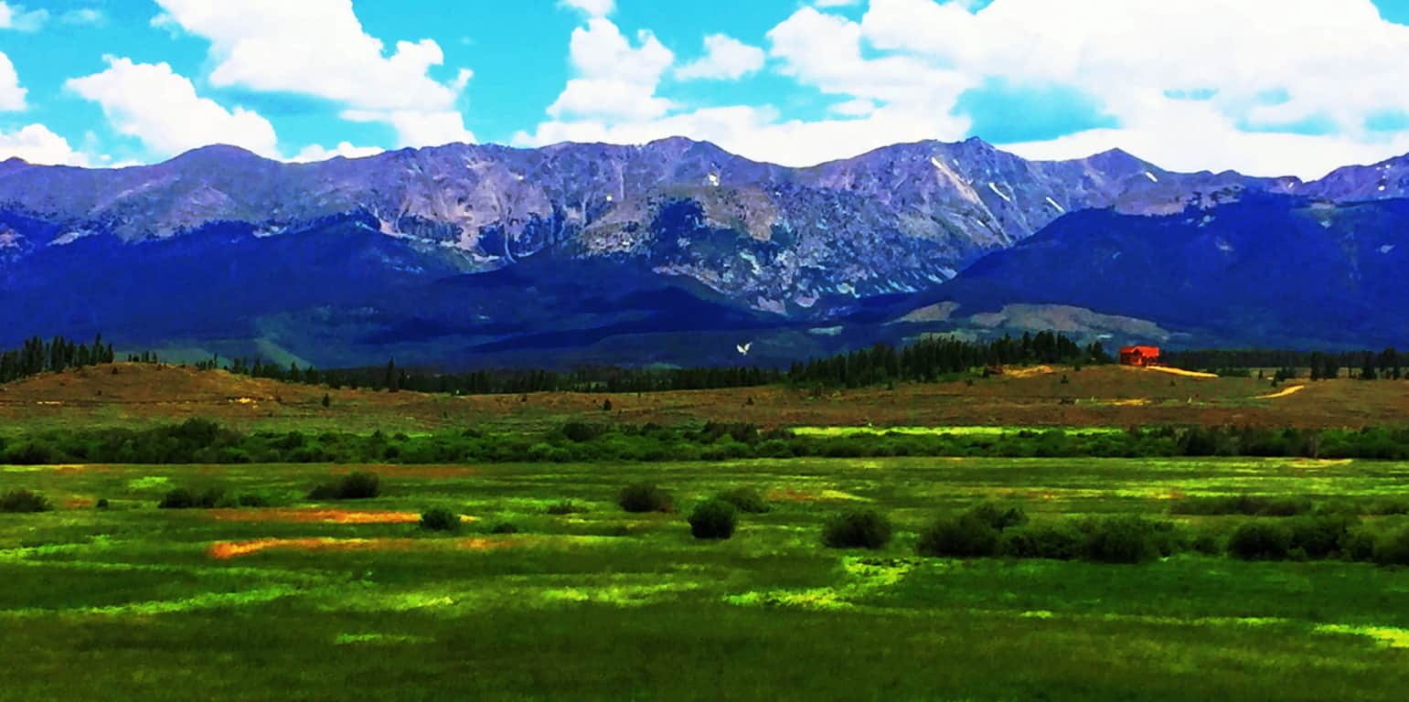
Location: Clark Peak/Rocky Mountains/Colorado
Elevation: 12,953
Prominence: 2,753
Note: If the mountain ranges of Ireland, Wales, and England could be said to be like rolling waves of infinite green…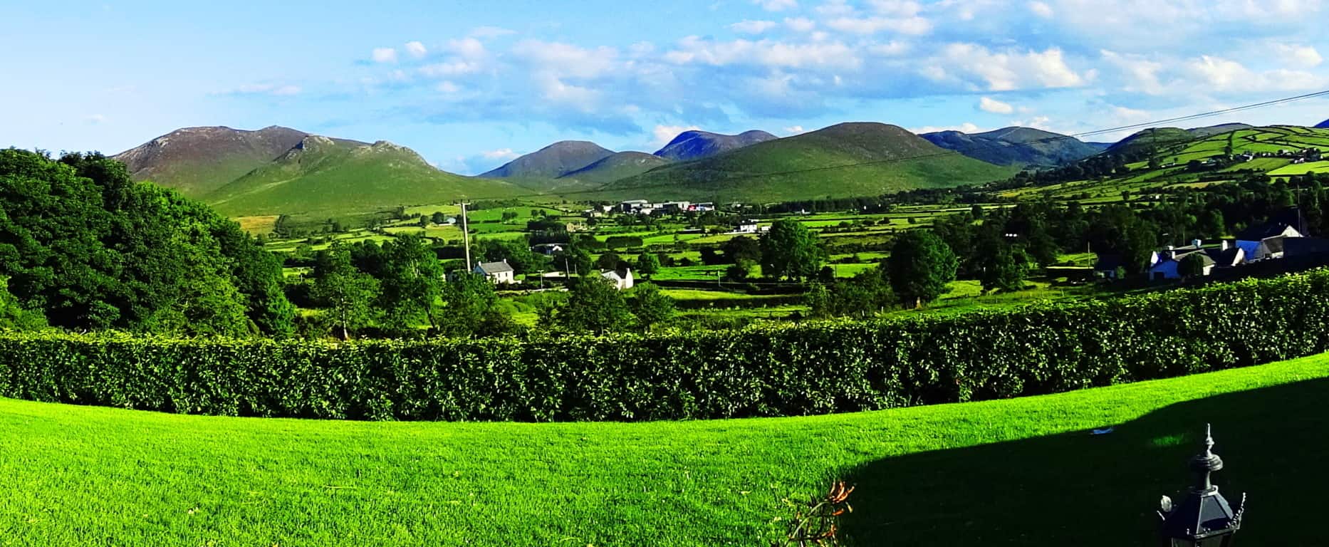 …then the Colorado Rockies of the northwest United States could be said to be nothing less than a rock-solid “tsunami of blue stone”, frozen forever along the landscape, above the western world.
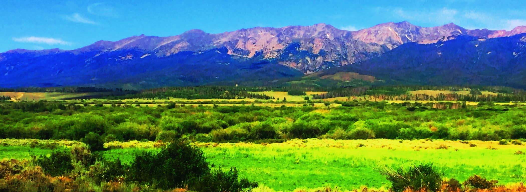 There is no other possible introduction to this juggernaut of a mountain range. Clark Peak, our destination for this article, sits in the southern Medicine Bow National Park. The northern Medicine Bow National Park, across the state line in Wyoming, is an auspicious type of “warm-up” for the grandeur of The Rockies. Southern Wyoming’s Medicine Bow’ features a unique lessor-known range, with ‘chocolate-milk’ looking soil, seemingly poured all over the ledges, standing at what looks to be about 2000 inviting feet of prominence with the highway running right through them. (Image/Below)
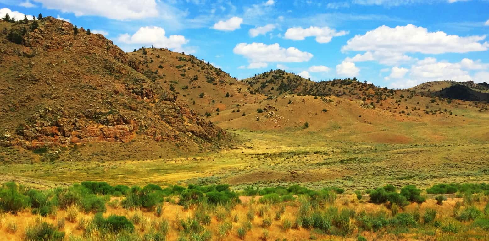 These are surprisingly dramatic yet relatively anonymous mountains, a mere preview to what looms just across the State line. They are absolutely worthy of many an expedition for certain, but remain in the reputational shadow of what awaits in Colorado. To its credit, a mere glimpse of these small peaks reveals a warm and distinct beauty, truly inviting. Everything about this small range says “jump up here for a day!” Like so many people just passing through, this place was passed by in order to reach the Rocky Mountains of Colorado.
Clark Peak Trail: The feel of Colorado is vast and rustic, and yet it leaves natural space for significant delicate statements also. Trails are thickly bedded with wildflowers of every possible color, like the approach to the mythical city of Oz. Brown Bears and Moose roam the mountains and forests, but for the most part steer clear of the trails. The high plain sits about 9000 feet above sea-level, supporting a universe of fauna. 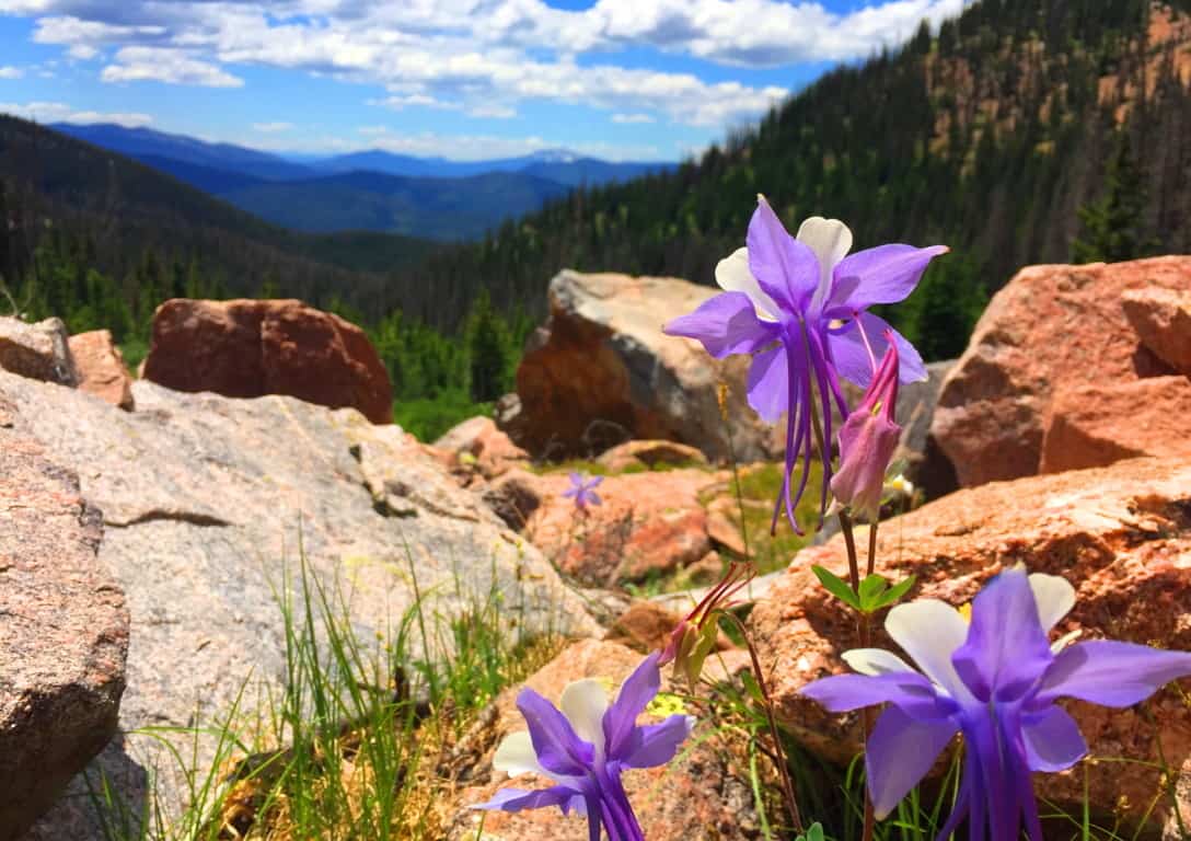 Accessing the elevated trails of Medicine Bow National Park in high country like this requires a 4×4 vehicle, plain and simple. The highest peak of Medicine Bow’, above the northern Rockies, is Clark Peak, looming just shy of 13,000 feet above sea-level. There are basically three levels of trail-heads, each a bit further up the Trail than the next. The first trail-head approaching Clark Peak is at the end of a wide dirt track that passes a small lake on the far edge of the mountains. To start from the first trail-head could basically take more than a day to complete the ascent and return. Most hikers attempting the peak desire an entry that reaches to at least the second trail-head. You should not attempt the second or third trail-head without a 4×4 truck, and prepare to rent a 4×4 for your excursion. Below is an image of the Clark Peak approach. Above the high basin on the left is your destination, where a large still-water pool awaits.
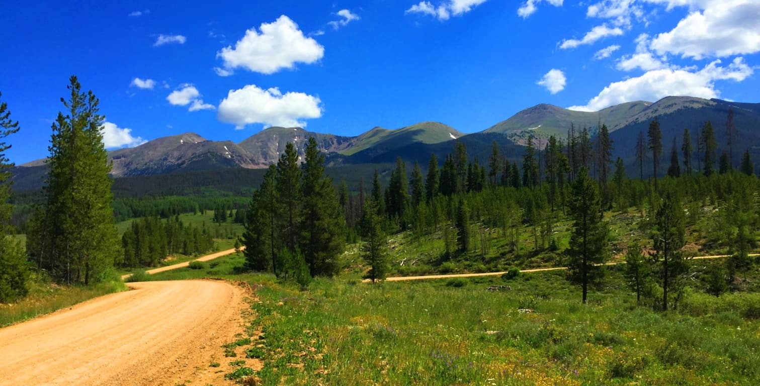 The second trail-head begins about 5 miles into the lower vale, so when you ditch the truck on the side of the track, the forest will already be surrounding you, and perhaps in a way it has never done before (even for seasoned cross trainers.) If this is your first hike in Colorado, you are stepping into a type of hiking phantasy from the moment you get out of the truck.
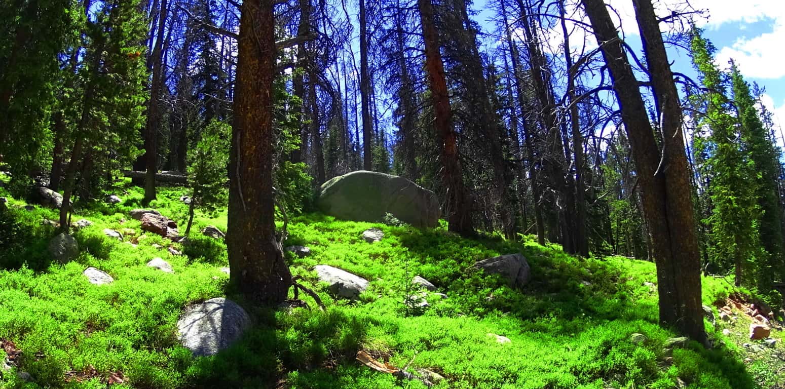 The tallness and fineness of the Aspen trees, Blue Spruces, Douglas Firs, Ponderosa Pines, and Lodgepole Pines, creates a literal euphoric vibe in the forest. From a distance, the woodlands seem to be blending into each other somehow. When the shafts of sunlight hit these trees, it is hard to focus on any single thing; it’s as if the trees are literally vibrating into each other.
 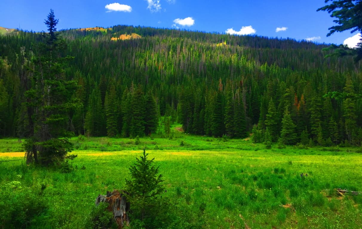 There is a type of enchantment here, a vastness to these glades that gives a very physical impression. The thickets here look as dense and deep as any ocean, and just like the ocean, to go too deep un-prepared could prove fatal. Respect this wilderness, pack properly, study-up, and stay on the trail when inside the forest. The basics here are about being aware of ‘forest-fire warning-levels’ and the restrictions to using flame, the possibility of bringing bear-spray (or even a fire-arm), and never leaving cooked food/food goods unburied or littered in the forest; it will draw the Brown Bears if you are lazy and careless with your goods. Stay sharp and aware, ready to have a great experience.
Very much like in the Mourn Mountains in Ireland, after the lower valley roads begin to elevate, they usually blend into a stone road trail that is almost certainly an ancient pathway. I wondered if I would find such a thing in a wilderness so far removed from Celtic characteristics, and to my delight I did. The look of these rocky tracks are surprising in the initial heights of any mountain range. In many places it seems that these ancient pathways were the very first roads on Earth, navigating the high mountain passes built by the most ancient Culture on Earth, the Neolithic Culture. Here is a look at the ancient stone-road at Mount Bearnagh in Ireland. (Image/Below) 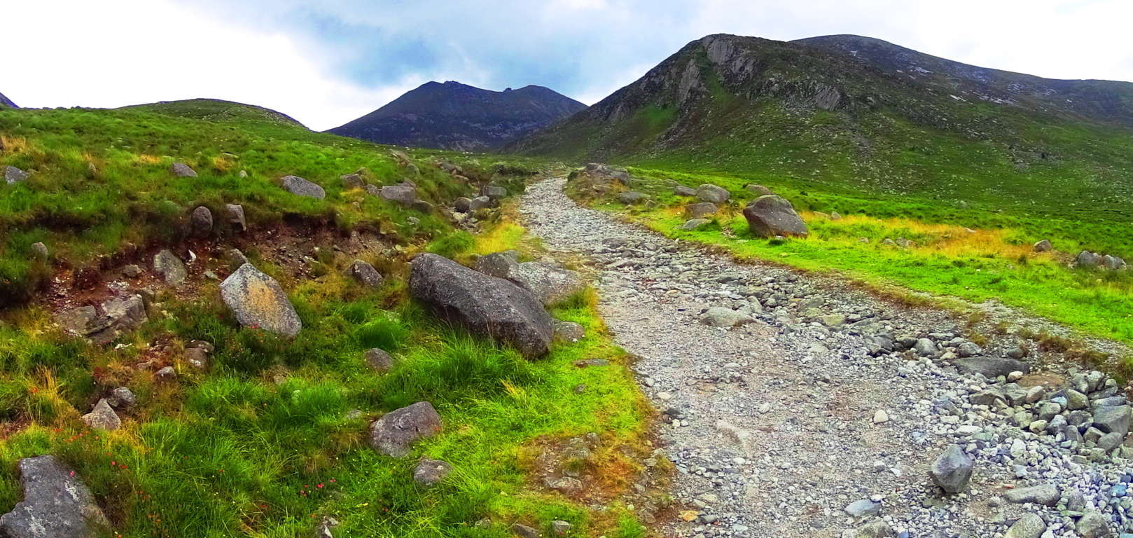 And now here is a look at the nearly identical width grade, and angle of an ancient stone-path in Colorado.(Image/Below) Many of these approaches have been re-worked from a much older original path that has been there (for all intents and purposes) forever. In Ireland it would be the Gaelic/Celtic Culture that identified and revised the ancient paths, while in Colorado, the Native Americans would have been the first to observed and acknowledge these trails as “sacred pathways”, or “pathways of the spirits.” These origin roads had existed long before even their earliest ancestors had arrived. The point is, there is very good reason to believe that an even more ancient culture existed here before the natives, a culture capable of building and engineering with megalithic stones. To my great wonder, some of these signs of “cut stones” and a singular pathways with a specific measurement (roughly 4.5 feet across) in the high mountains appeared here on Clark Peak Trail. A deciphering look at the old pathways alone, however, is not enough evidence to support the idea of a Neolithic existence in this place; it will be in the heights that Wedge Tombs, Cairns, Standing Stones, and Vantage Stones reveal themselves, as we know from Celtic ranges. I admit that this was on my mind as I ascended the beautiful valley with one of my oldest and best friends.
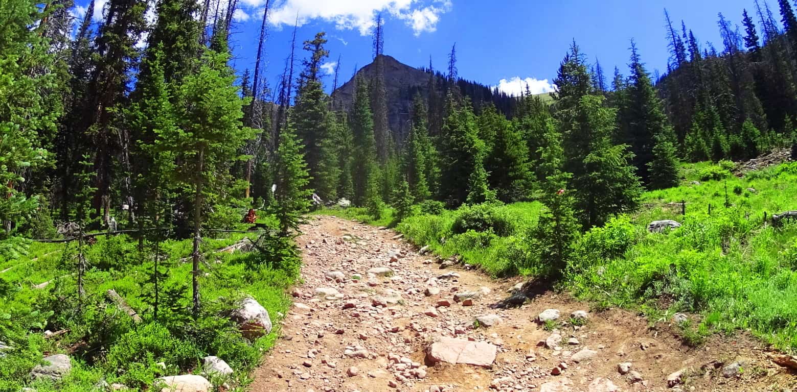
As the old rocky road begins to narrow into a winding path, bustling streams and narrow log bridges emerge. The stream runs almost directly towards Clark Peak, in a line of sight that is classic Colorado; Pines and abundant overgrowth pointing to the peak as if it were a temple corner stone. The basin at the upper portion of the trail comes into clear view here, along with a grand clearing in the middle of the vale, about a mile ahead on the trail. A clearing of this scale, where the tree-line abruptly ends, is indicative of a glacial rockslide, which is what we found. The trail continues across the fallen rocks where you catch a first glimpse of the curvature of the glowing moss and speckled glades of the upper basin, which still had somewhat miraculous patches of snow, in July! The absolute dryness of the comfortable cool air preserves the snow in the heights, giving subtle surreal contrast against the hillsides. 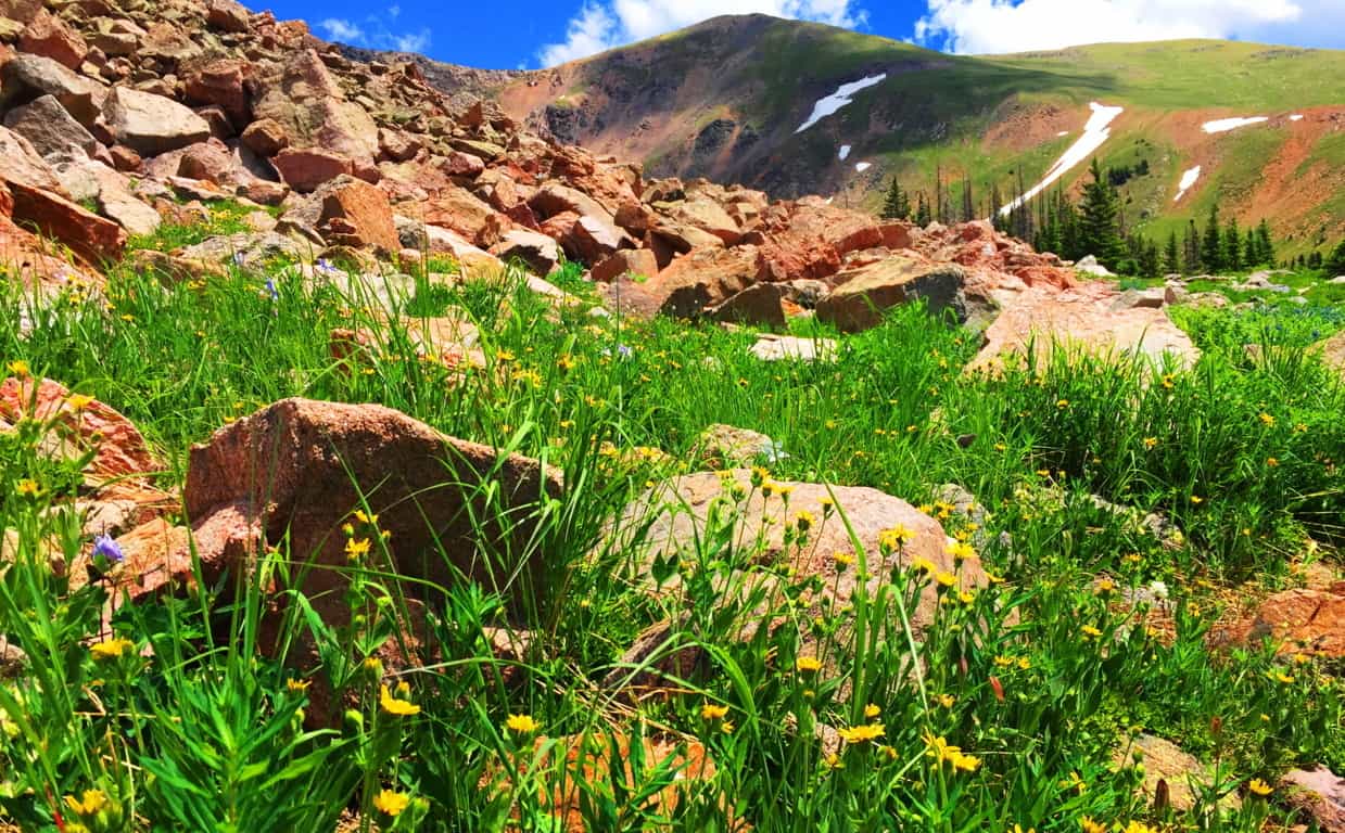 While trekking through a massive rockslide a chronology of the natural events of the mountain comes into perspective. The receding of the last Ice Age left entire mountainsides inundated with random boulders in spastic shambles. Intriguingly, some of the boulders seem to have broken away from the riotously random placement-pattern. One massive ‘squared’ boulder, at the base of the rockslide, seems to be sitting perfectly centered on the incredible scene of the mountains below and beyond. In the upper valley at Mount Bearnagh, of the Mourn Mountain Range of Ireland, not only are there boulders that seem cinematically placed, but they also seem to have been, somehow, hewn to match the shape of the valley beyond. (Image/Below)
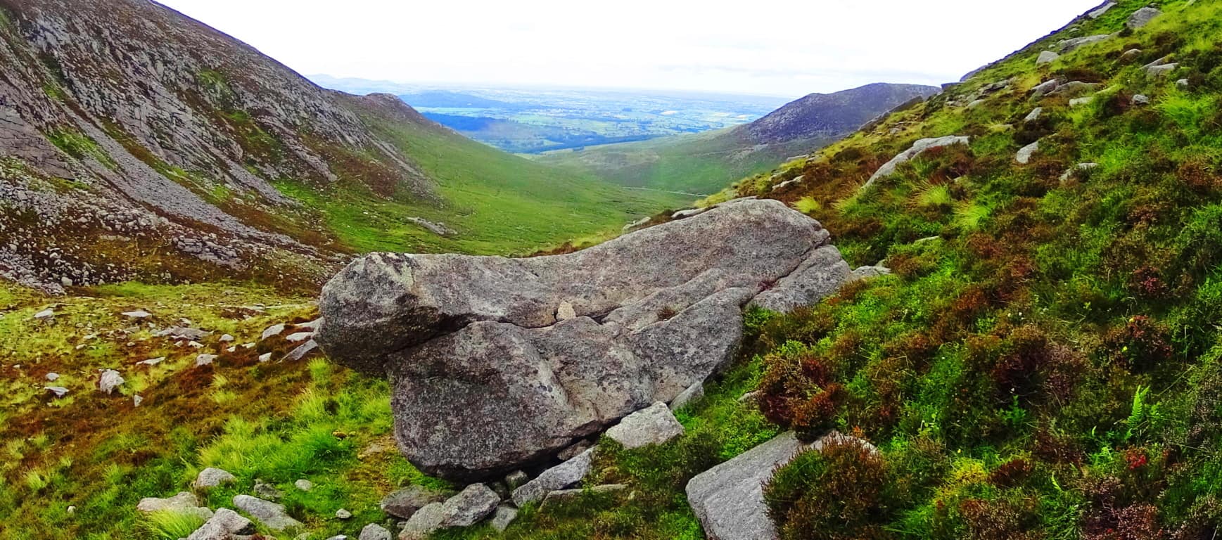
There are also “seat boulders” at the pass at Bearnagh, which absolutely look to have been placed at a cinematic point on the valley, as a place where you could sit and watch anyone approaching slowly from below.(Image/Below)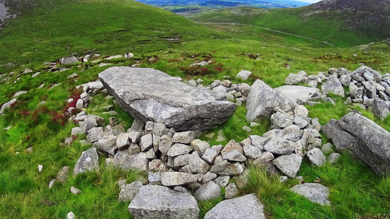 Here at Clark Peak Trail there sits an auspiciously placed boulder which looks more like a “seat” then a random resting place from a rockslide. This ‘squared’ boulder is perfectly centered on the vision that is the brilliant view of The Rockies beyond.(Image/Below) The other stones of this scene are compiled in stacks, tightly packed together, way off to the side of this beautiful seat; and the possibility that it was intentionally placed there becomes very real after considering its perfect symmetrical placement at the dead center of the valley. Only the Neolithic culture, the culture that had the strength and skills to build New Grange, or arrange massive stones in The Mourn Mountains; or masterfully craft the Sarsons at Stonehenge, has the capability to do something of this scale in antiquity. Clark Peak Trail, as you progress, begins to show signs of Neolthic Culture. Clark Peak Trail may very well have been home to the very same Neolithic Culture that marked and roamed the peaks of ancient Europe.
 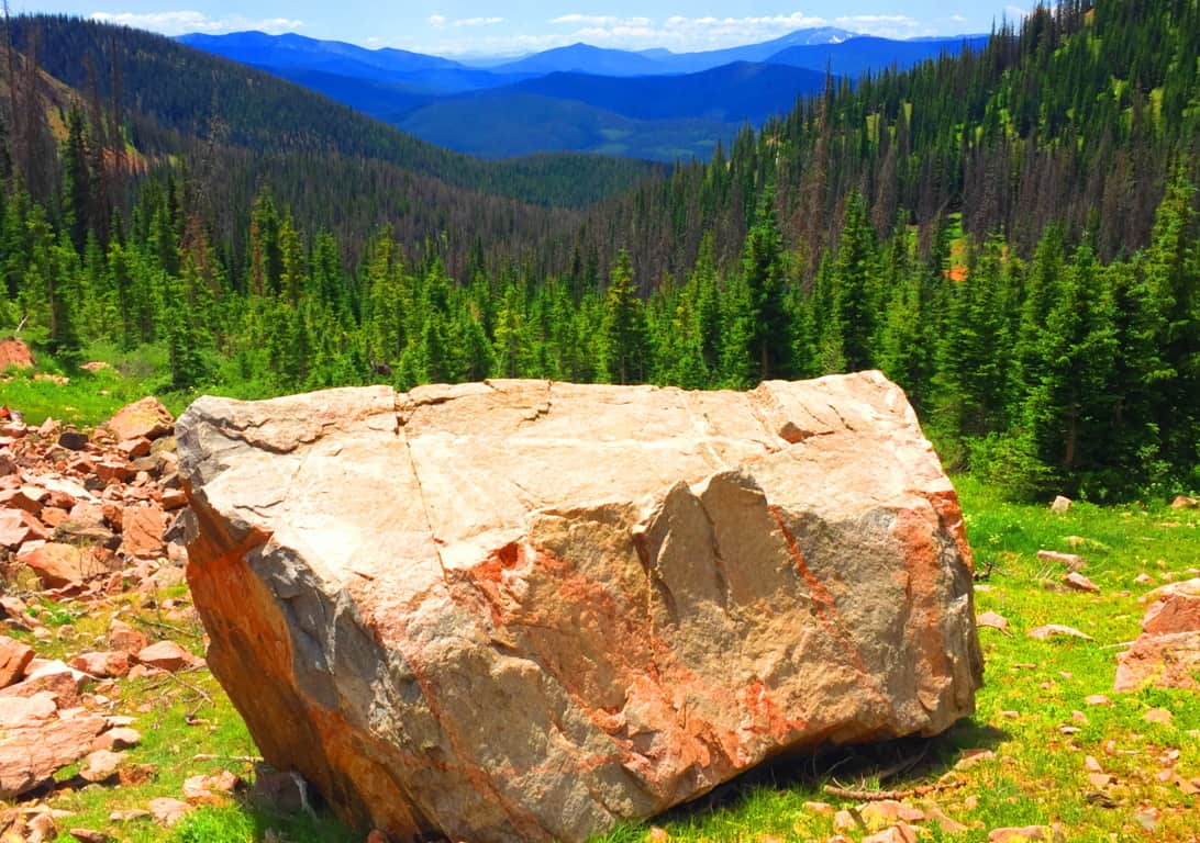 From this gorgeous spot the Trail runs over the landslide stones and into the curvature of the upper basin, where the scene becomes truly surreal. Beautiful fields of wildflowers decorate the mouth of the basin. Campers pitch their tents here on soft glowing beds of grass and singular Pines. The view is like trekking the natural porch taking you straight to Valhalla.
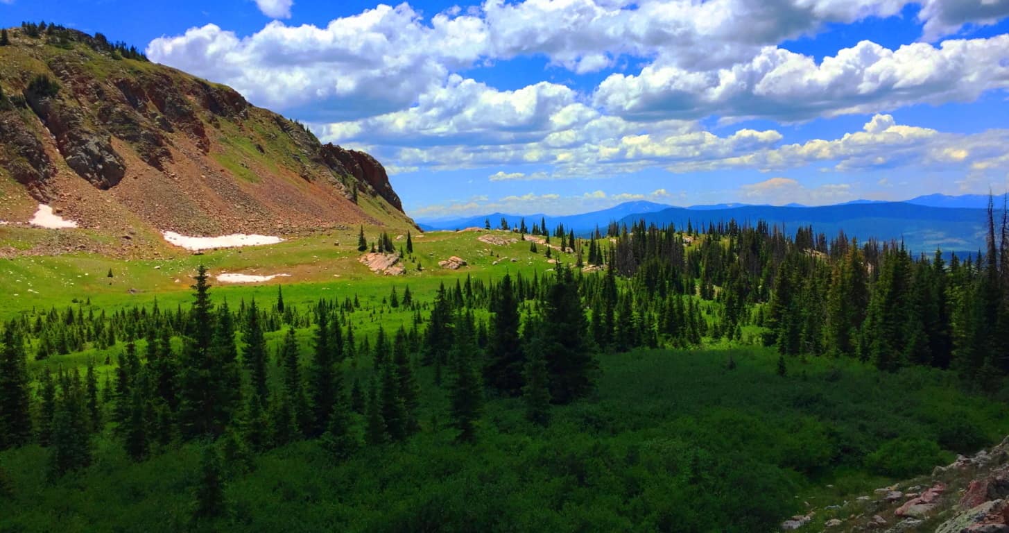
Neolithic Cultures seem to have had the capacity to recognize sites of great beauty. In many places, for example, Standing Stones and Dolmens are found facing the most gorgeous scenes of the heights they occupy. The Standing Stone of the Conwy Valley in Wales overlooks the sacred valley just north of the most revered mountain of the entire Celtic World, Mount Snowdon. (Image/Below) That’s pretty significant placement…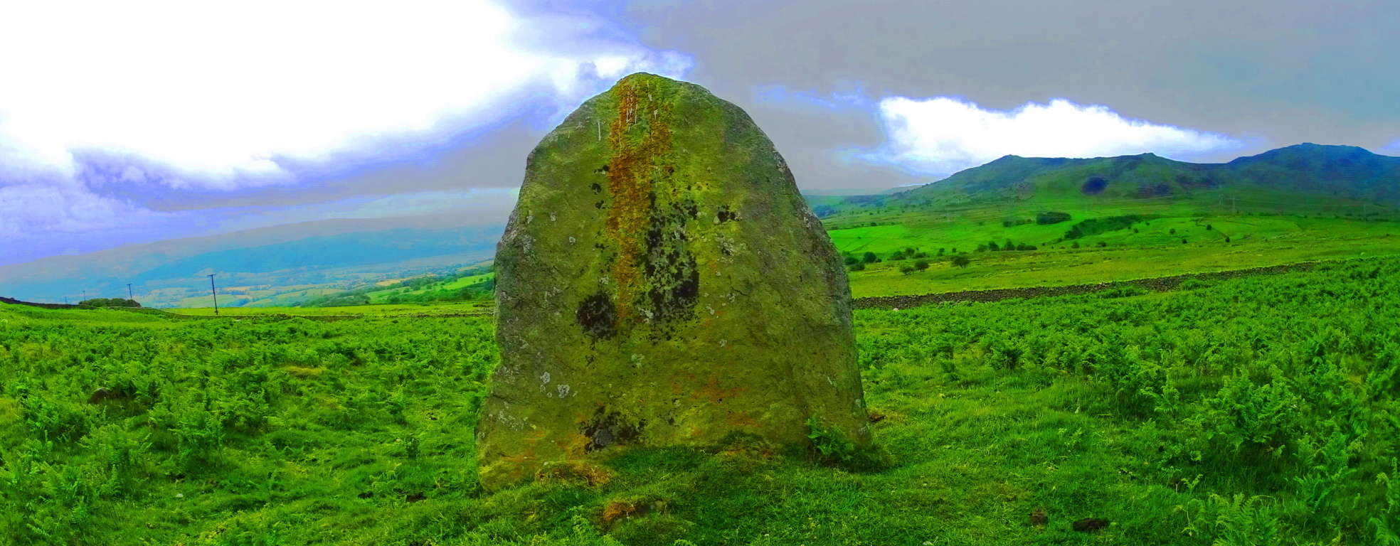 Here at Clark Peak Trail, standing distinctly above the glacial rubble is an equally significant statement, a Standing Stone that was almost certainly placed to acknowledge the incredible beauty of the valley beyond, along with the elevated basin on which it sits. This is an incredible statement of epic proportion that signals an anthropological link to the cultural practices of a Neolithic Culture a Continent, and Ocean away. To find this here was one of the most exciting moments of my life. It vindicates the idea that the heights of the world, mountain ranges in Celtic, Semitic, and Native American places, were once occupied by a Neolithic Culture that had significantly similar practices in marking-out sacred territories with megaliths. Those who dismiss America as a place void of Celtic-esque culture are slowy being dismissed as academic charlatans, theorizing from afar, never to be found in the heights where the answers are, only in the cities where the money is. This may be the worlds first international glimpse at an absolutely gorgeous American Standing Stone in the heights of the Colorado Rockies, on Clark Peak Trail, of Medicine Bow National Park. (Image/Below)
This Standing Stone is 6 feet high and 4 feet thick, looming on the left ridge just above the main Trail along the upper basin fields. The most distinct crafted cut of this Stone’ is along the entirety of Its right side. At the top of the Stone’ there is a distinctly straight top ‘cut’, with an indented ‘top’ slant above it. The left side contains two smaller ‘levelly’ crafted indents. It is so distinctly different than any of the other stones in the basin that I was left to wonder how it was possible that not one person had acknowledged it before?! Additionally, like so many Standing Stones, there is a distinctly marked Cairn on the ledge below, a fairly large crafted cavern where the designers of this Stone would’ve kept objects of value tucked-away. A set of large parallel streaks marks the stone above the trademark opening at the bottom right of the boulder. Do you see any streaks in any of the stones around the area? No, you don’t. The stone is marked for a reason, it was obviously a valued setting in the basin for whoever claimed it.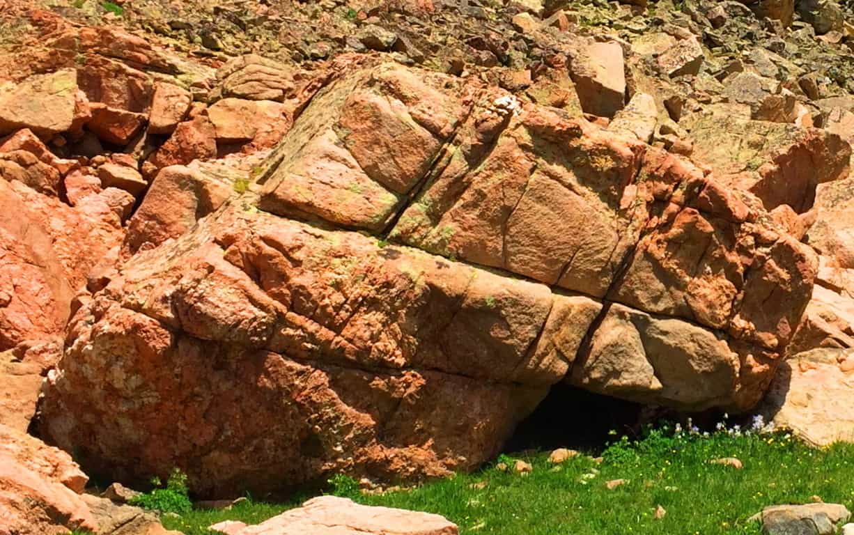 This Cairn Colorado was one of the largest I had ever seen. Other Cairns of this nature could be found in Ireland, New England and practically ever other Celtic peak. Take a look at these very similar Cairns to be found in Ireland and New England: It is true that they look very natural, but their attributes are almost always the same, containg an emblematic “side” which covers a specific gap on the right side, and are in areas where other amazing stones have been blatantly crafted. These Cairns are almost always found near sacred stone statements in the landscape, meaning they are indicative of a specific area that was inhabited by craftsman of the Neolithic Era.
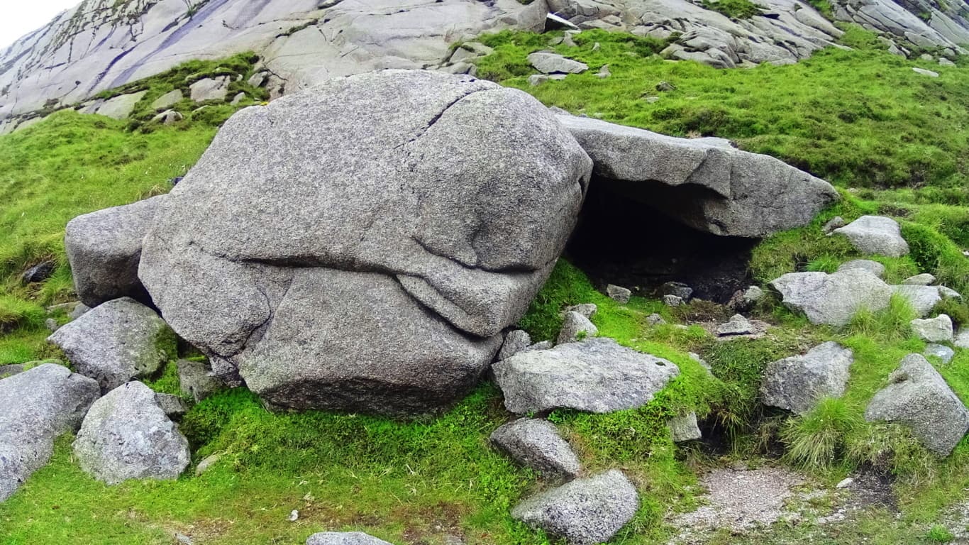
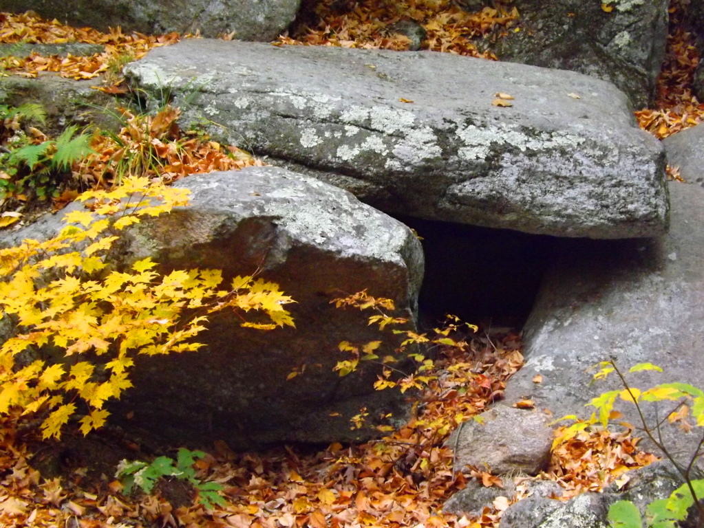
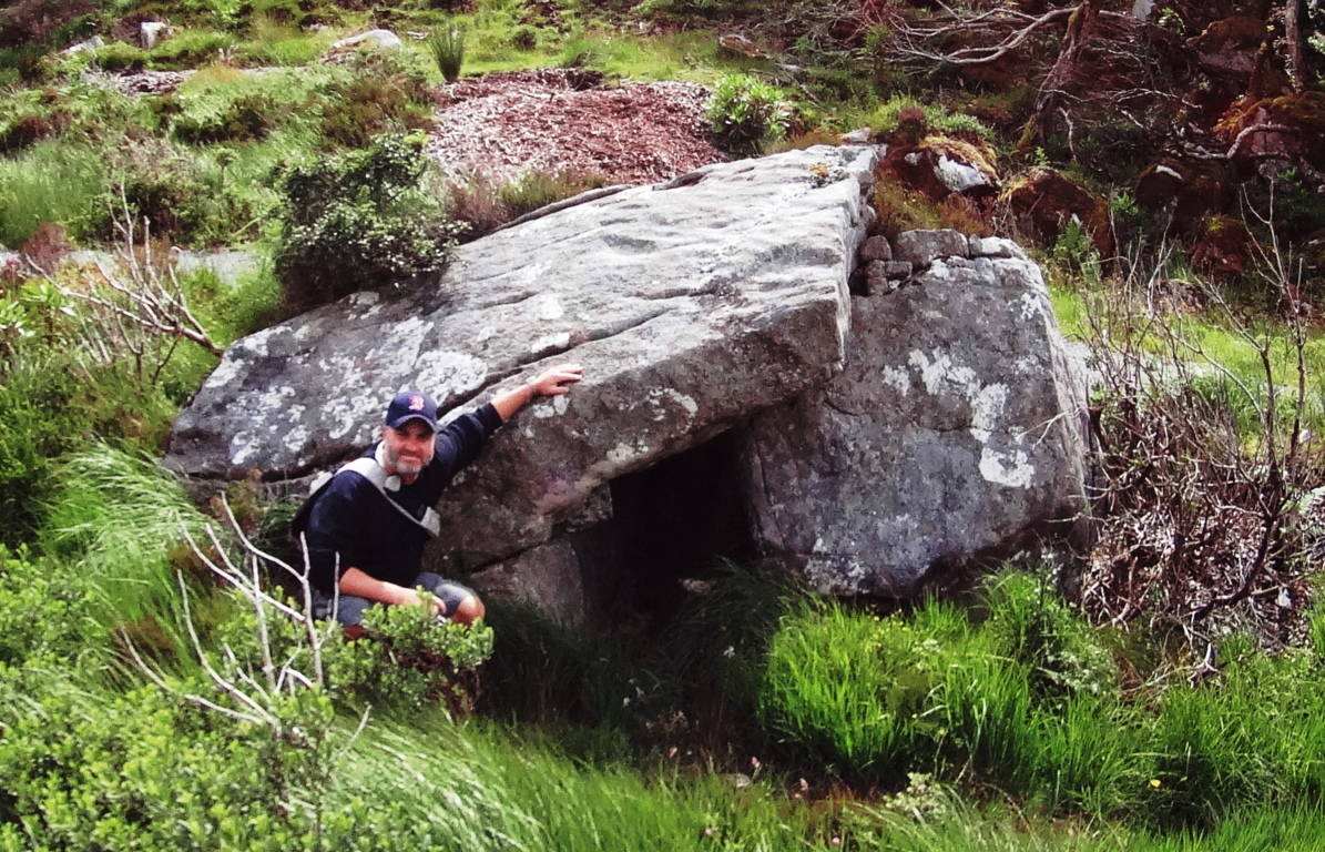 From the Standing Stone here in Colorado, the last portion of the Trail runs up the Basin. Tucked into the Basin is a lovely hidden lake, which at one time would’ve been a perfect source of drinking water for anyone trying to occupy these heights. All the elements for survival are there. Make your way up the final narrow pathway, where beneath a ledge of millions of stones, none of which look anything like the ones that we have identified as ‘crafted’, sits the stellar pool. Here is the final elevated path into the high basin the image below:
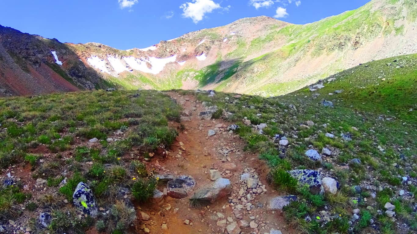 And here is the reflective pool. Imagine looking down on this pool on a clear night to look at the stars! It may very well be that the Standing Stone is pointing to a specific constellation in the night sky, or some meaningful designation of that nature. It would require more time than I had on this fine day to discover such things. But it is truly safe to say that most Standing Stones have a multi-contextual meaning, and here in Colorado, with a crystalline clear sky in July, that possibility is very real.
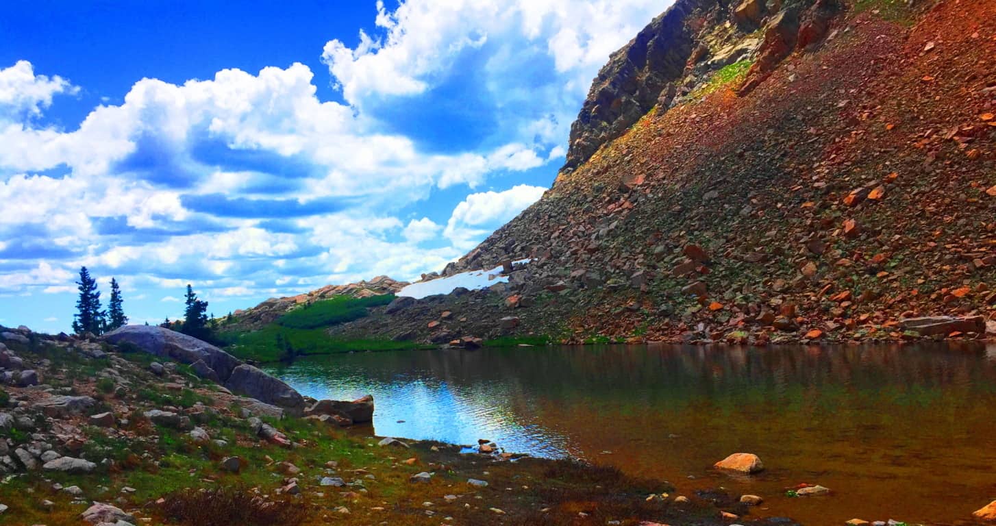
This is one of the highest basins in Colorado, and the country. Like so many beautiful Celtic trails, things here slowly blend into child-like wonder. You are humbled. A look back from the Lake displays a gorgeous jade animation of the entire basin, with the High Plain of the Rocky Mountains beyond, along with drifting clouds that practically touch the upper crags. There is a very real temptation to break all convention and remain in this place, however reclusive it may sound. If a Neolithic individual did decide to live here, the set up for a fantastic existence seems perfectly clear; you could keep a flock in the lower basin, keep a fire by the upper lake, drink a never ending supply of water, and monitor the entire scene from the Standing Stone vantage. Logically it makes sense here.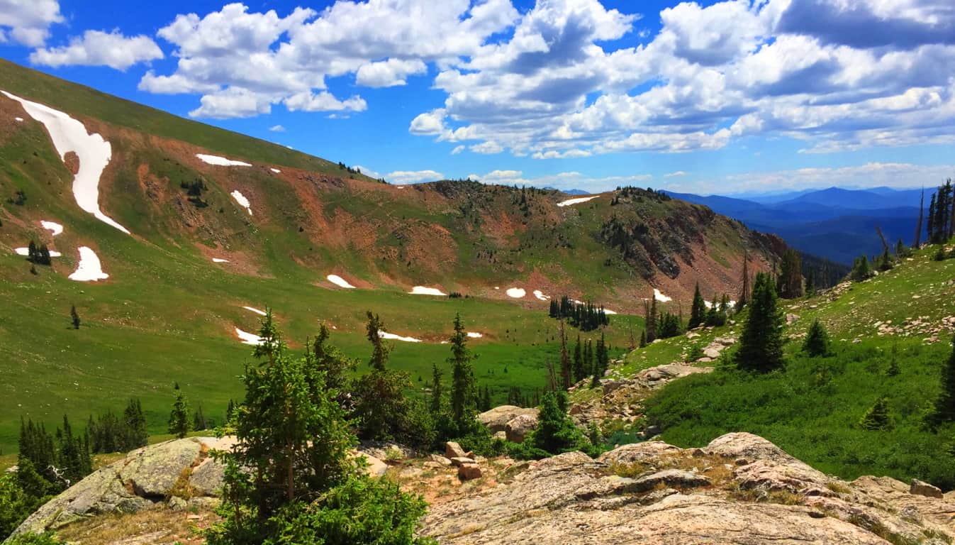 As someone who was trying to scale the heights of Glen Coe Scotland while caught in a rain storm exactly one year earlier, I could not help but feel that Clark Peak Colorado is one of the most comfortable challenges you will ever engage in the month of July. The air temperature and quality in near perfect, pristine, and so delightful. The wildflowers exude an overwhelming spectrum of statements, where entire mountain glens are covered in violet, steel-blue, glowing wild yellow, and subtle bits of auburn.(Image/Below)
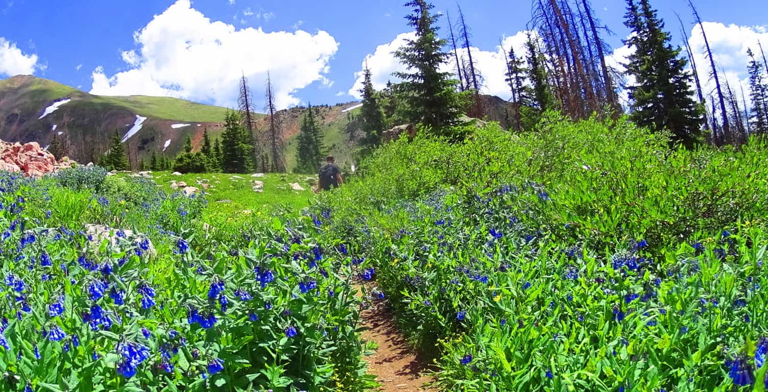 It is understandable if readers are still not sold on the idea of a Neolithic Culture in the heights of these mountains. To some people they might see a mere stone where there is an actual cultural statement. It has taken six years of challenging research in some of the most off-the-grid locations on earth to finally begin to see the patterns of a very real Neolithic Culture. Only after dozens of expeditions have the specific memes begun to reveal themselves. It is not just the evidence itself, but the context of the evidence: the position of a stone in a particular way in a valley; the paring of stone statements in not just one valley, but dozens. There is a very real consistency. It is hard to tell if the Standing Stone here at Clark Peak was there before the rockslide, and was later engulfed by the rush of stone, or if it was placed squarely into the stones after the fact? But the most important, and truly obvious thing, is that there is no other stone even remotely like it in the entire basin, which is what I mean by context. And moreover, the place where it stands, like so many other Standing Stones across the world, is most likely the most advantageous, as well as beautiful, vantage on the entire valley; it’s as if someone wanted to claim the best of what the valley had to offer. I’ve seen this in literally dozens of mountain ranges. The overall point is that hiking and ‘striding’ will take YOU there. You can go and size up the strangeness of these megaliths for YOURSELF. You don’t need my opinion, you can get there and judge on your own! When you do I believe the realness of these statement will hit you….will make it real.
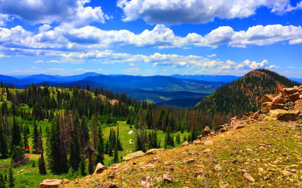 Clark Peak, from the second level trail-head, is one of the single most relaxing and cool hikes in the entire world.The reward in this place far outweighs the work, which is not usually the case for international hiking. Aside from the evidence, there is also that feeling of total tranquility in the Colorado heights, a feeling in all honesty, I have only felt once before in my life, ironically, by the Standing Stone in Wales, at the top of the gorgeous Conwy Valley. At Conwy, a Standing Stone and a Cairn both sit atop the heights, just like in this gorgeous basin in Colorado, paired together like a chair and table, but in an ancient-stone kind of way. So… plan a week or so at the cottages of the tiny American hamlet of Walden Colorado. Take the time to do what it takes to get to the trailheads for Clark Peak, which sits at the eastern edge of Medicine Bow National Park, one of the most scintillated and stellar National Parks on Earth. Find your way, and the way, amazingly, will find you. Go strong. A special thanks to my great friend and confidant Christopher Frohlich for providing his style, skill, and understanding of the grand Colorado landscape. Couldn’t have done this without you Fro’, thank you.
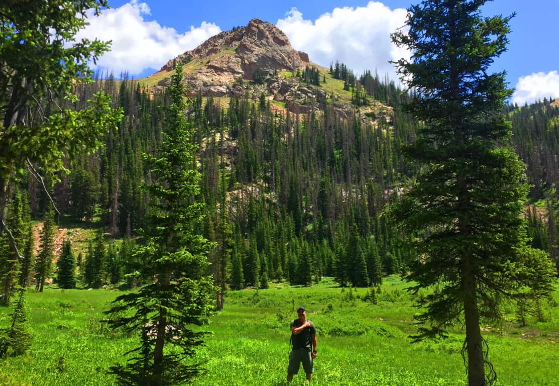
New Grange
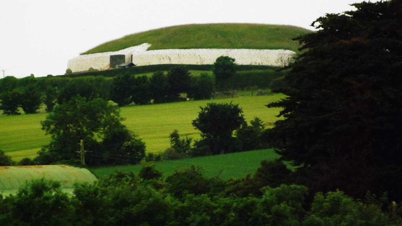
Location: County Meath, Ireland
Note: Every so often, with a little luck and determination, you come across things that give cosmic pause. This article is dedicated to those rare moments rather than the beautiful trails to be found in Ireland that are usually reviewed. Hiking starts to take on a next-level significance when you stumble upon practically impossible things. Sometimes they are small things, like perfectly circular concentric rings imprinted on a stone, high above the Black Valley in Killarney.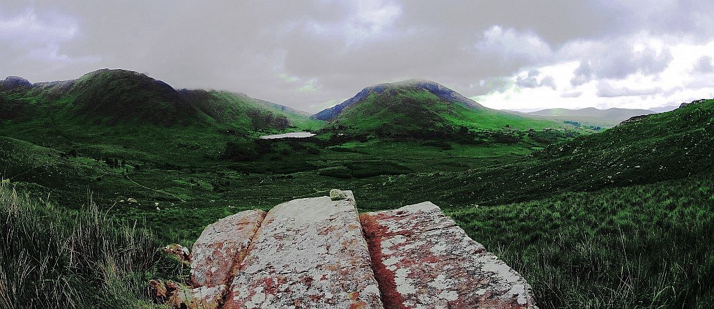 (Image/Below) Sometimes they are jaw-dropping big things, like the balancing Capstone on a giant-sized ‘Proleek Dolmen’ on the boarders of the Mourne Mountains, north of Dublin. (Image/Below) This Dolmen is one of the most massive and well hidden miraculous secrets in all of Ireland, with a 40 ton capstone standing at roughly 15 feet high! Incredible. And yet this pales in comparison to the temple at New Grange. The more you look at that specific area north of Dublin, the more amazing mystery you will find. Just as Egypt’s mystical culture was birthed out of the Nile river, and Babylon’s from the Tigris and Euphrates, Ireland’s incredible spiritual origins were born along the Boyne-River-Valley. Although the Boyne-River-Valley culture was most likely not featured in your mandatory History 2.0 undergraduate course requirements, it definitely should’ve been. Egypt has the Great Pyramid; Babylon had it’s great Tower, and Ireland has the incomprehensible, magical, mystical, temple of New Grange, literally tucked into a curvature above the Boyne River.(Image/Below) New Grange also sponsors other megalithic masterpieces like Knowth, which is an incredible megalithic chamber also located on these grounds.
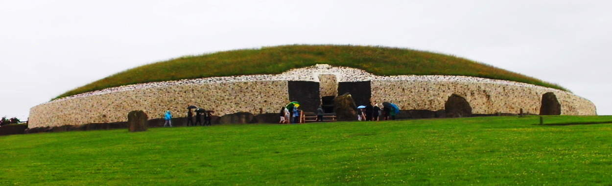
The hedgy river-road that runs along the Boyne River from the hamlet of Rosnaree, just a mile south of New Grange, is the best, and only way to get there. New Grange sits on the highest elevation above the solitary hedge rows and roads without names. You can walk these practically fictional looking hedge-row-paths for days if you are looking to get some trekking in before seeing the Temple, but beware, it would be easy to get lost in this green labyrinth of fields and cart-roads with no names, so make sure you have your device on you to at least navigate at all times. 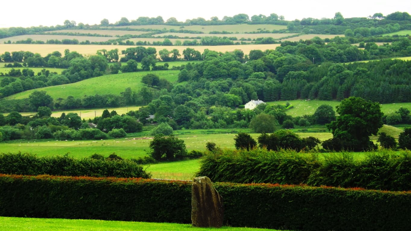
If you are ready to go directly to the Monument go to the Bru-na-Boinne Vistors Center along Staleen Road. Here you will find a ticketed bus line which will take you there. The ride is only 10 minutes, through the hedgy maze. When you arrive at the top of the hill you will be looking at nothing less than a Temple which has stood 2000 years before Moses climbed Mount Sinai. New Grange is older than Stonehenge, The Great Pyramid, and The Parthenon, which puts it in the running for the the oldest Temple on Earth. 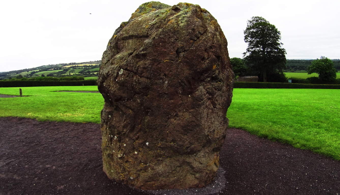 That’s quite a title. The way history has been explained in recent years, you might think that the oldest temple on Earth would look fairly primitive, as human history is generally thought to have gone from basic abilities to very complex ones, but the actual fact appears to be the utter opposite. The construction of New Grange is a study of the highest levels of engineering and accomplishment, bordering on the impossible for a culture not yet capable of using metal tools!? This is a circular mound centered on a main-chamber pathway constructed of roughly 34 level megalithic slabs, each weighing roughly 10 tons (20,000 pounds). Imagine 30 Proleek Dolmens lined perfectly together! Some of the slabs came all the way from the Mourne Mountains to the north, as well as other far off sacred zones. These facts alone start the mind reeling on the impossible story of the stones, which were moved from afar, and finally fit in dry-laid corbel fashion with such perfection that the light of the Solstices shines straight to the heart of the chamber two times a year. This Temple is a celestially connected megalithic miracle. It is surrounded by several massive Standing Stones which are roughly 15-20 tons, and most of them are over 8 feet in height. Moving these stones alone, to what is the highest elevation in this small River Valley, is hard to imagine.
 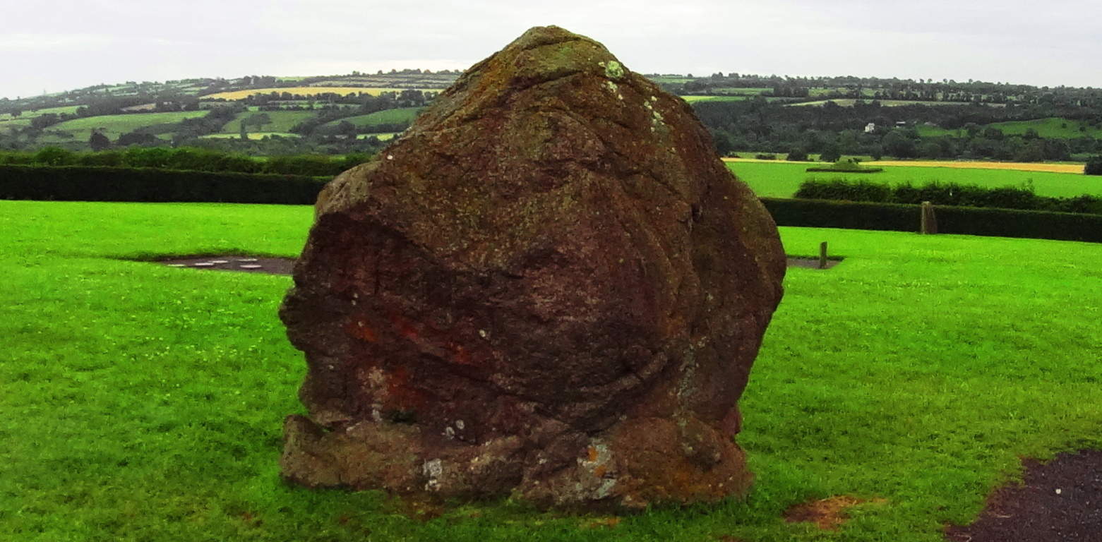 These Standing Stones are territorial markers, and once upon a time, if you passed by these Standing Stones without permission it would certainly have cost you your life. The larger the Standing Stone, the more serious the warning, and sacred the place. In this regard, you will realize that you are standing on truly holy ground.
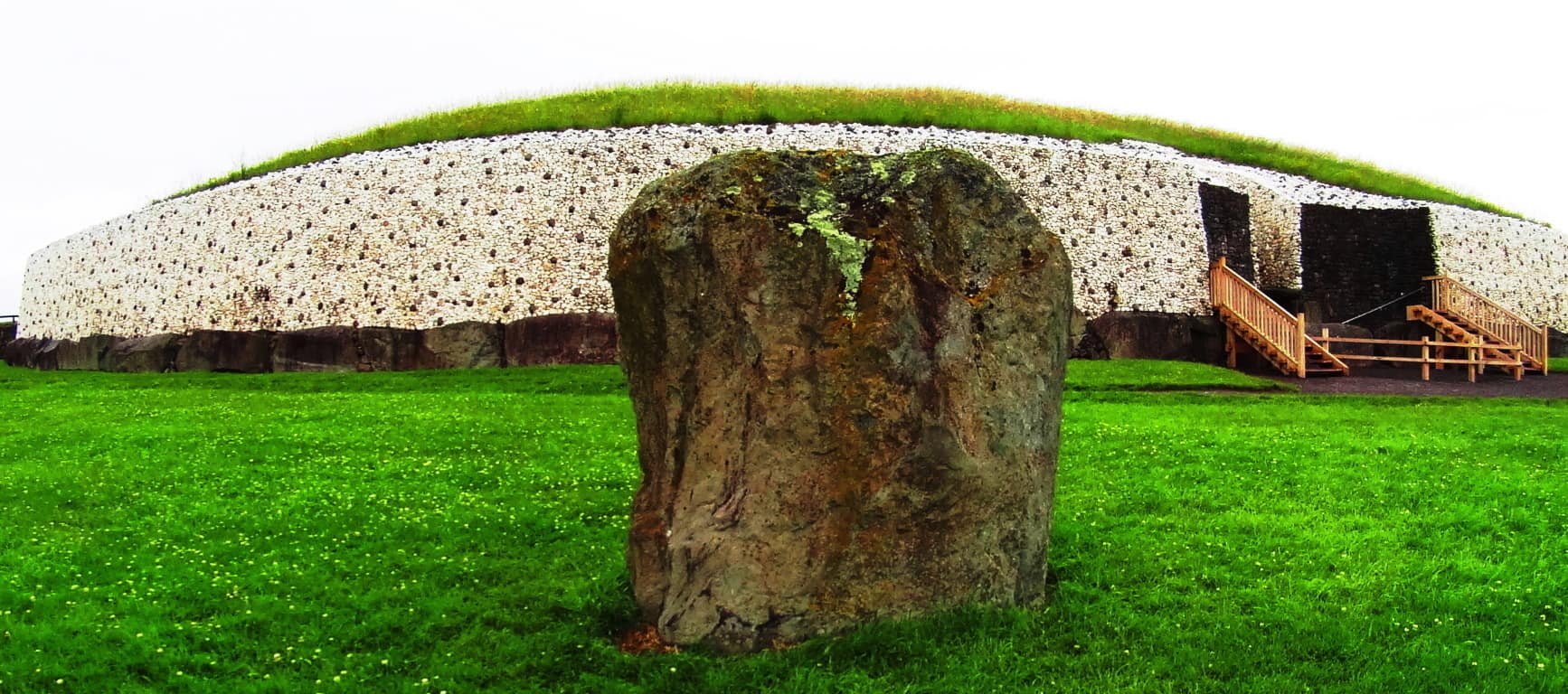 The exterior of the Temple is now lined in a modern white-quartz stone ring. The original Temple was much more concealed and blended into the hill for strategic reasons. It was literally part of the valley. The monumental stone slab at the entrance is one of the most important Celtic relics in the world, with gorgeous iconic Celtic rings imprinted into the megalith. This iconic stone is laid-out in a protective fashion, guarding the entrance, but is also clearly a display. It is a truly magical statement from the beginning of time. Imagine a solitary bean of light on the solstice day shining for only half a minute above this beautiful stone, making it glow, and continuing into the heart of the chamber! It just doesn’t get any better than this. And what’s more, the chambers in New England frequently have the same precise solstice feature. The connections between Celtic and New England antiquity cultures just grows from here, literally.
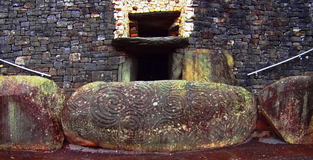
There are several other monumental stones with designs on them around the exterior of the Temple. with specific geometric features to observe on these stones, aside from the spirals.  A closer look at this slab opposite the entrance reveals several iconic shapes, and more specifically, interconnected equilateral triangles, as well as mesmerizing Celtic spirals. These are not the only triangles to be found on the megaliths at New Grange. To see the others, we will need to step inside.
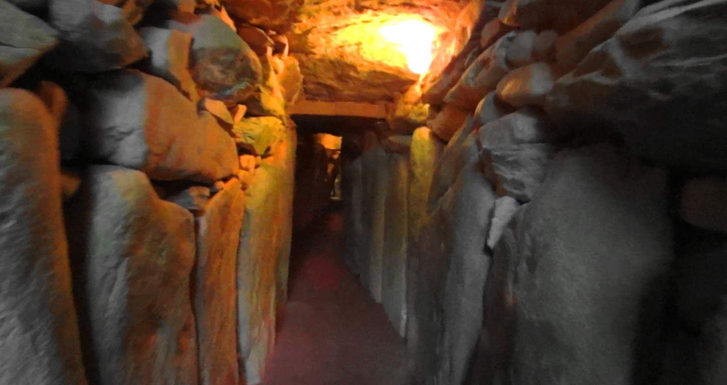 Welcome to the impossible. Here you are entering a chamber of what is the equivalent of 40 Dolmens in one corridor, all fit to perfection leading into a central chamber perfectly aligned to the stars, with a roughly 20 ft high corbel ceiling.
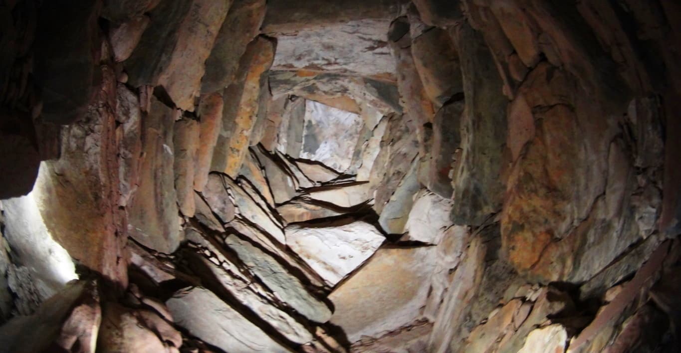 Imagine ancient Ireland, a land where giants roamed across the hills, and dangers unknown lurked beyond the next valley; and then imagine the absolute strength and safety you would feel walking through these impossible stone pillars. Here at least, in the ancient times, you were as safe as any Celt could be. The holistic benefits of living in a synergetic stone temple would most likely be wonderful, in comparison to the huts and wood fortresses of less fortunate clans. At the end of the long singular corridor from the entrance you will encounter stones with imprinted triangles and diamonds before entering the central chamber.
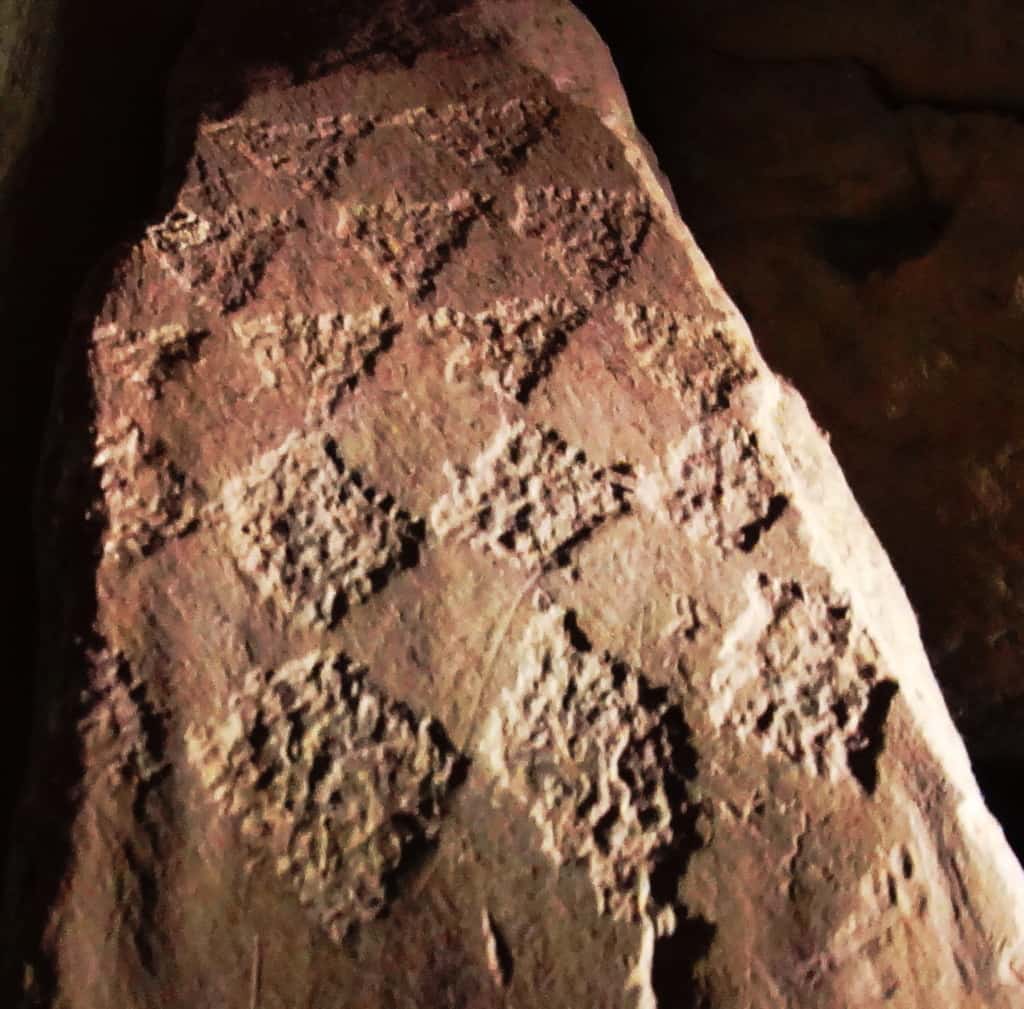
Imprinted on this entryway stone at the main-chamber are distinct equilateral triangles that are seemingly transitioning into diamond shapes. There is profound connection here to the megalithic sites in New England, which utilizes this exact same meme at practically all the megalithic sites. Specifically in New England, you will find equilateral triangles etched into granite by waterfalls, and massive diamond cut stones along ancient trail ways. This is the central megalithic meme in New England, and here are those very same shapes in the heart of the oldest megalithic chamber in the world. Here are some examples of New England megaliths cut exactly into triangles and diamonds.
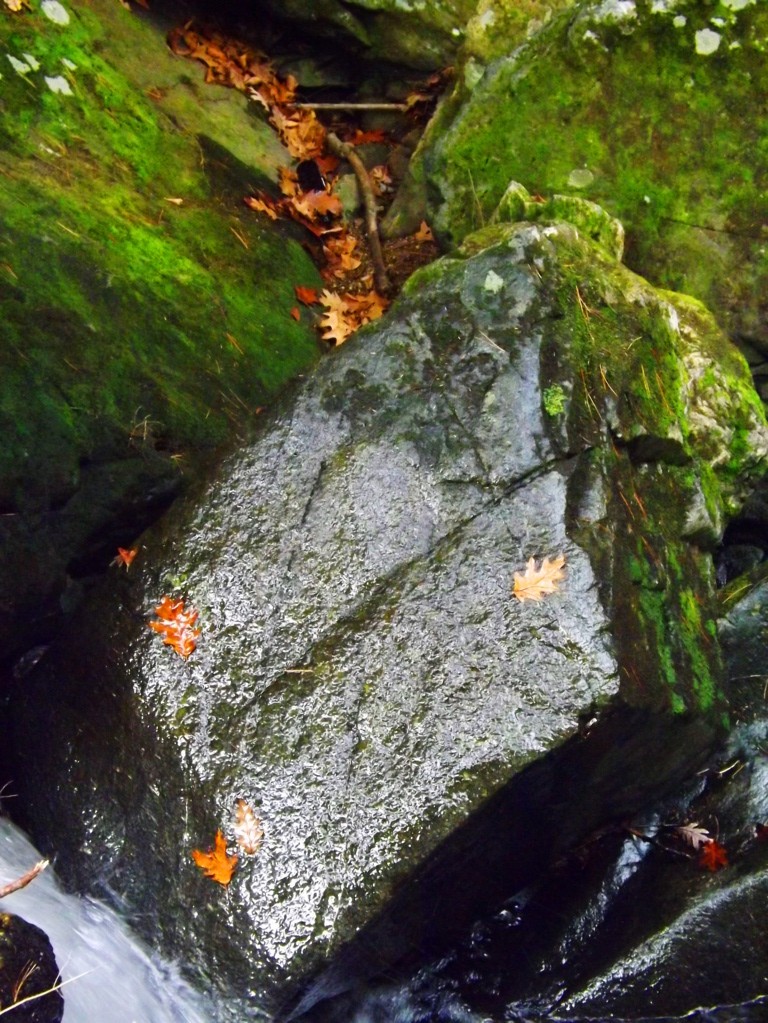
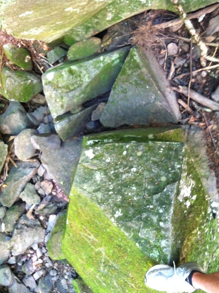
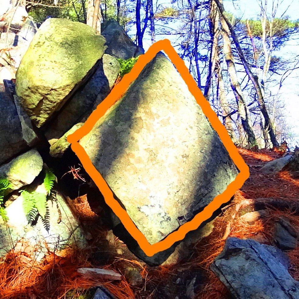
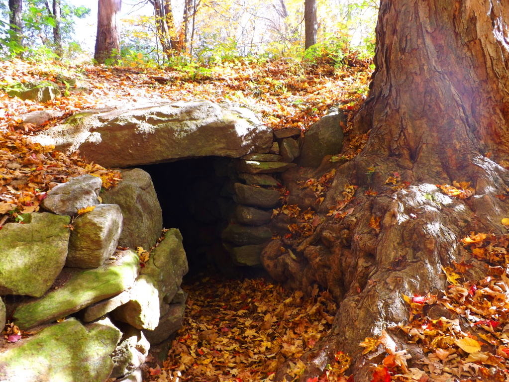
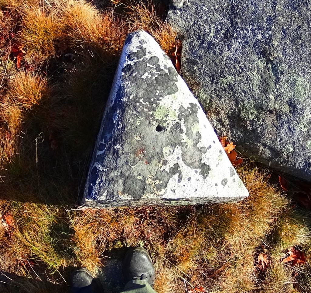
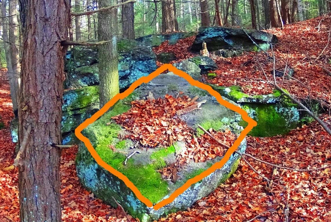
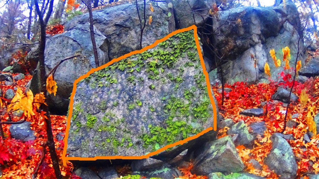
The evidence is too strong to dismiss. It seems highly likely that the megalithic culture that existed in Ireland had a relative culture across the Atlantic in New England. The question will arise: what is so important about triangles and diamond shapes? It might be that the Triangle is the first shape to develop from any linear set of points, and this culture was the first to develop in linear history, and so they claimed the Triangle as their calling card symbol. The ‘diamond’ is the result of the functionary crafting of cross-sections and equilaterals. If you cut a proper X into a stone, the result is four diamond shapes that are consistent with each other, and these utility cross-sections that create diamonds are found all over New England mountain trails. It as if the Neolithic culture were marking zones and territories as a warning to those passing through, and letting us know that the original culture once claimed this area.
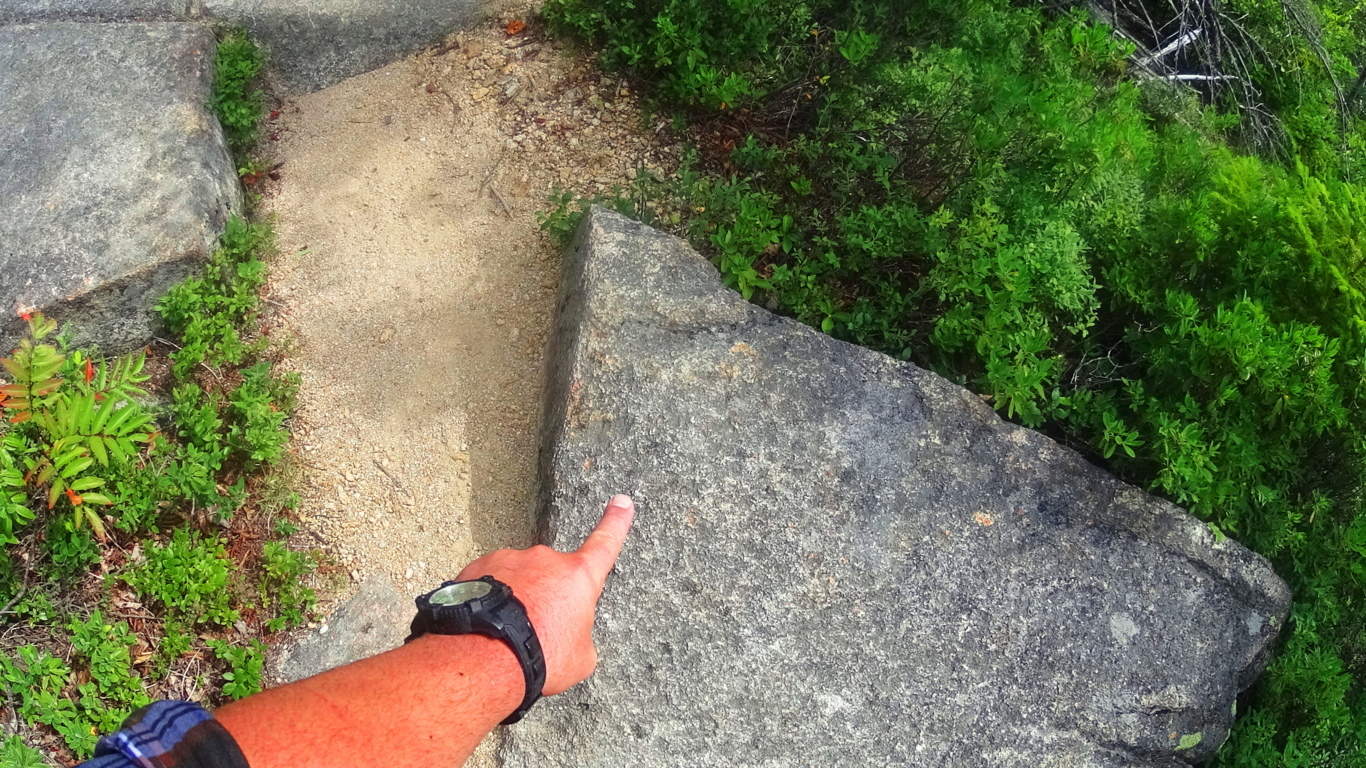
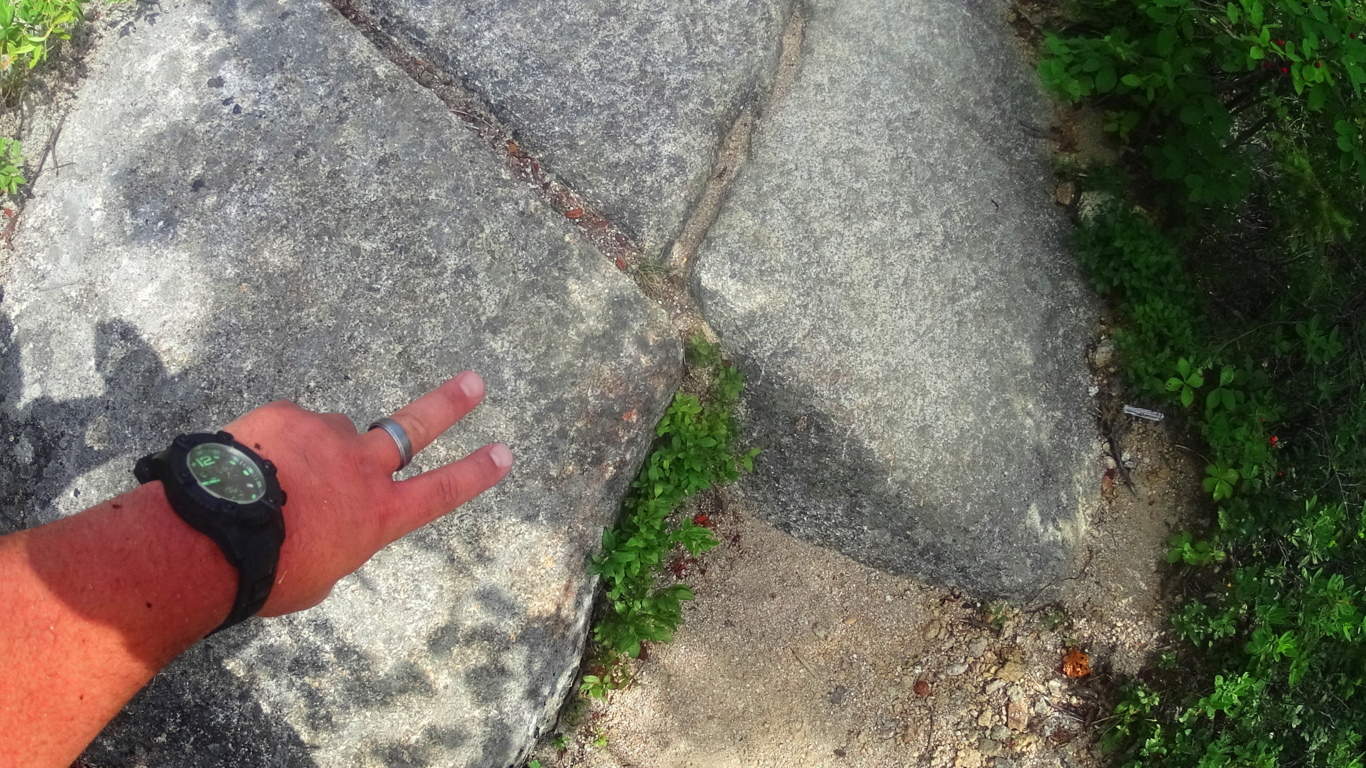
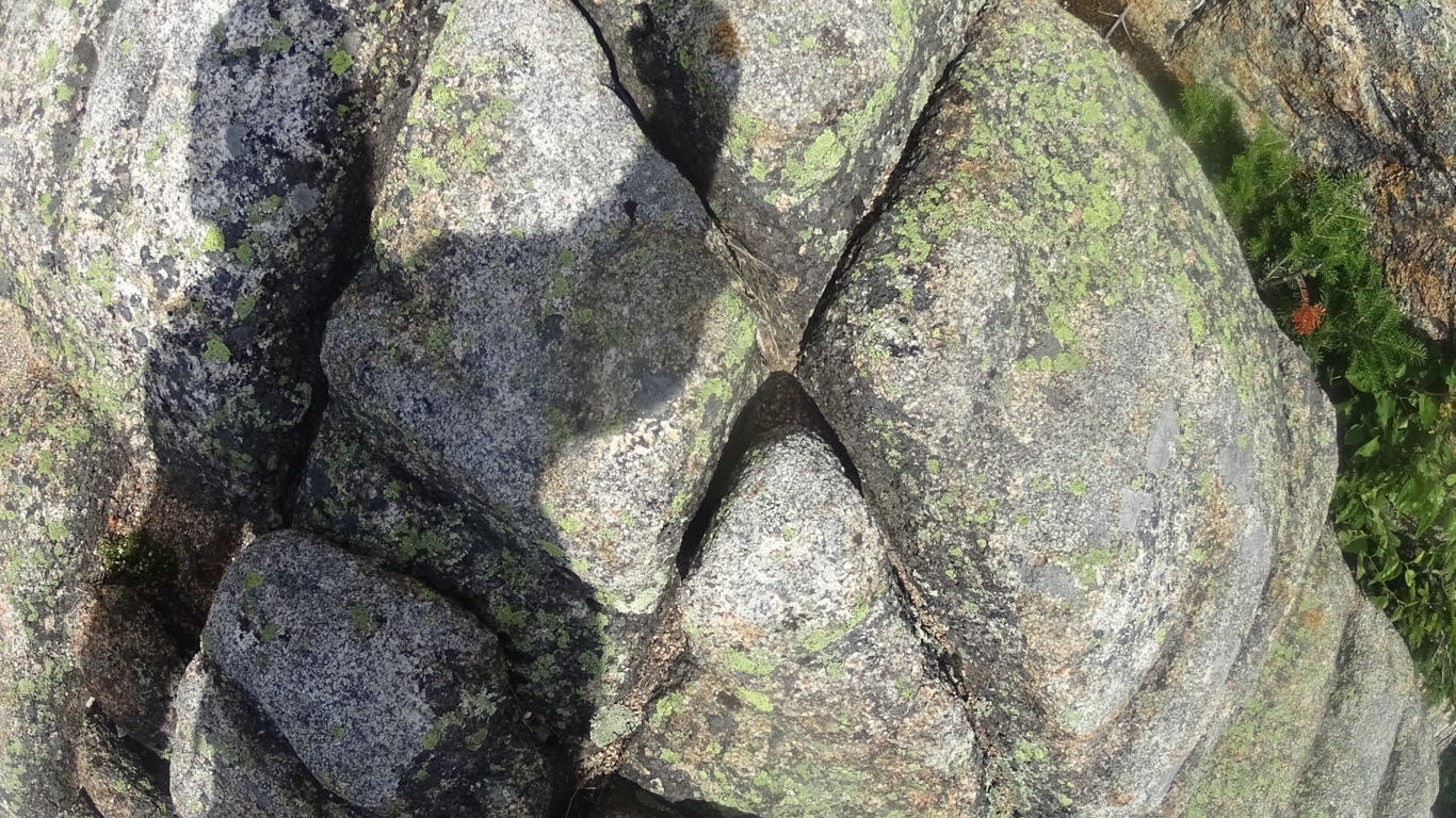
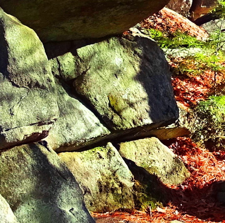
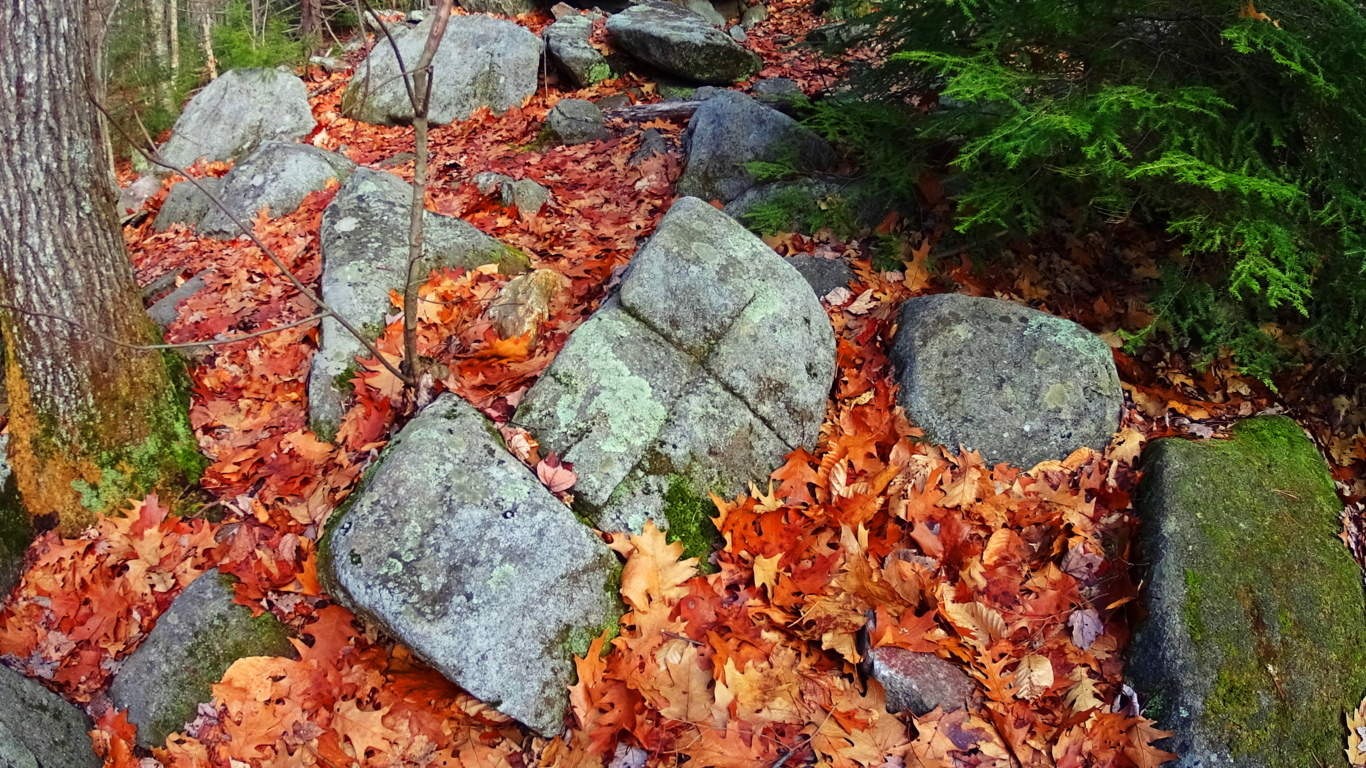
Anther stone in the interior of the chamber at New Grange displays dozens of whimsical triangles and diamonds cascading all over the stone. This just can’t be a coincidence; there must be some relation between New England’s and Ireland’s oldest cultures. 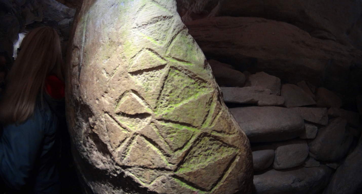 Neolithic Culture: Here is the part of the article that gets surreal and a bit ‘heady’. The history and chronology of how neolithic cultures relate, if they relate, must be found in their works. The works are obviously similar in structure, and also in symbolism. As New Grange is considered the oldest temple in the world, it seems logical that these geometric themes originated here, and spanned-out to the rest of the world. If this is true, then the pre-Celtic neolithic culture in Europe is the original ancestor of the neolithic culture that somehow crossed the Atlantic and ultimately made it’s way to New England. Their works are massive, beyond human in scale, like the Standing Stones outside New Grange.There is also the philosophical aspect of the Triangle, which is a shape specifically relevant to consciousness and divine comprehension. Is the neolithic culture referencing a direct connection to God Itself, like the neolithic tribes of Genesis? This is an intense reference, but according to the Bible the first generation on earth was the ‘Nephilim, meaning: “those who fell from heaven”. The offspring of these angels came from their copulating with human women, and that offspring was said to be Giants. (Genesis: 6) It sounds like extreme science fiction, and yet that’s exactly what the biblical accounts say. Moreover, when the Israelites went into the Promise Land and Joshua scouted out the territory, he found tribes of Giants. Joshua says the tribes he encountered made him feel he was ‘the size of a grasshopper’. What is going there?
With that in mind, you might eventually ask yourself: are these works the productions of these Giants in both Ireland and New England? Why are so many myths based upon Giants? The relations are there, and the relevant meaning of the chosen memes and symbols are there too.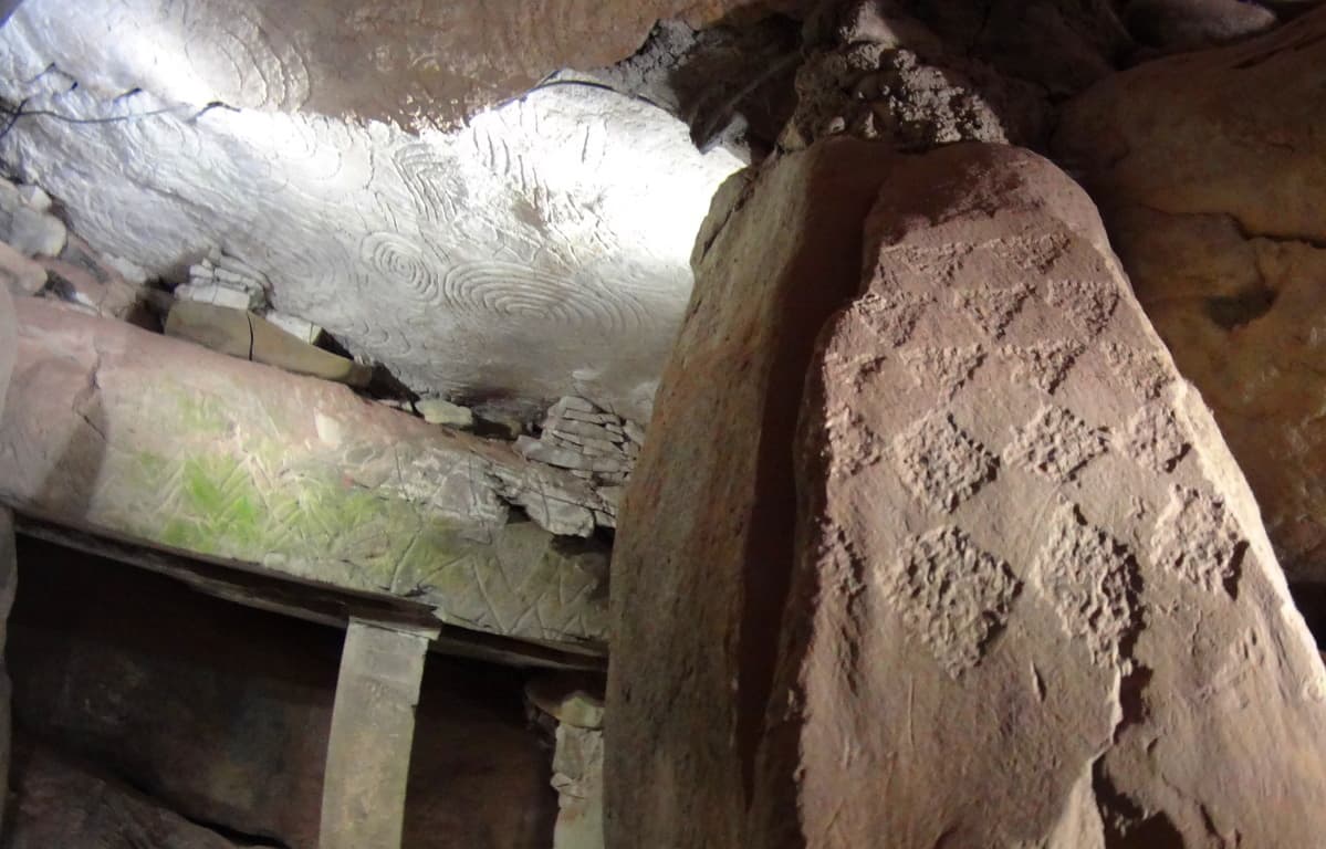 The hard part is, it utterly changes the current story of history, which is evolution based. New Grange is truly an otherworldly ancient temple that evokes wonder and humbling respect for the course of hallowed Time. Our particular modern era looks increasingly like ‘life in a controlled bubble’ when we look at the grand scheme of History. Almost all of our information is pre-packaged and funneled into specific themes, and if you disagree with them, you will be found to be disagreeable and ultimately failed in your assigned studies. The revised history that is given to our children is a set of theories sponsored by commercial academic institutions. The ‘technological era’ is a mere blip of 100 small years at the tail end of 40,000 years of human culture. When we look closely at what the antiquity suggest, it increasingly looks as if our culture is intentionally turning its back on the evidence in order to passively inject a more “convenient” theory of culture, based on erroneous assumptions. New Grange is one of the holiest places in the world, as a temple that has been here since the beginning of anthropological history, it is exquisitely rare. If we are truly sincere about going where the evidence leads us, then we must be prepared to challenge memes that don’t add up. Stonestrider.com isn’t a religious website; it’s about finding the best trails and photos you can, but it is impossible to deny that places like New Grange challenge so many things we assume about human progress. So, even if you are in Dublin just for a few days, plan a morning to visit New Grange. It is something, even with all our modern answers, we still don’t completely understand.
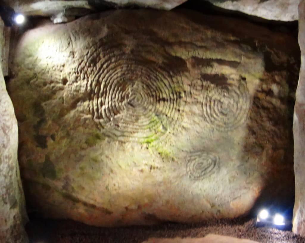 Something incredible, almost otherworldly, took place in antiquity in order to build this temple. Walking into it’s main chamber is like walking into a miracle. It just doesn’t get more sacred than this, and a hillside is sometimes so much more than a hillside, so keep hiking.
Hulapai Mountain
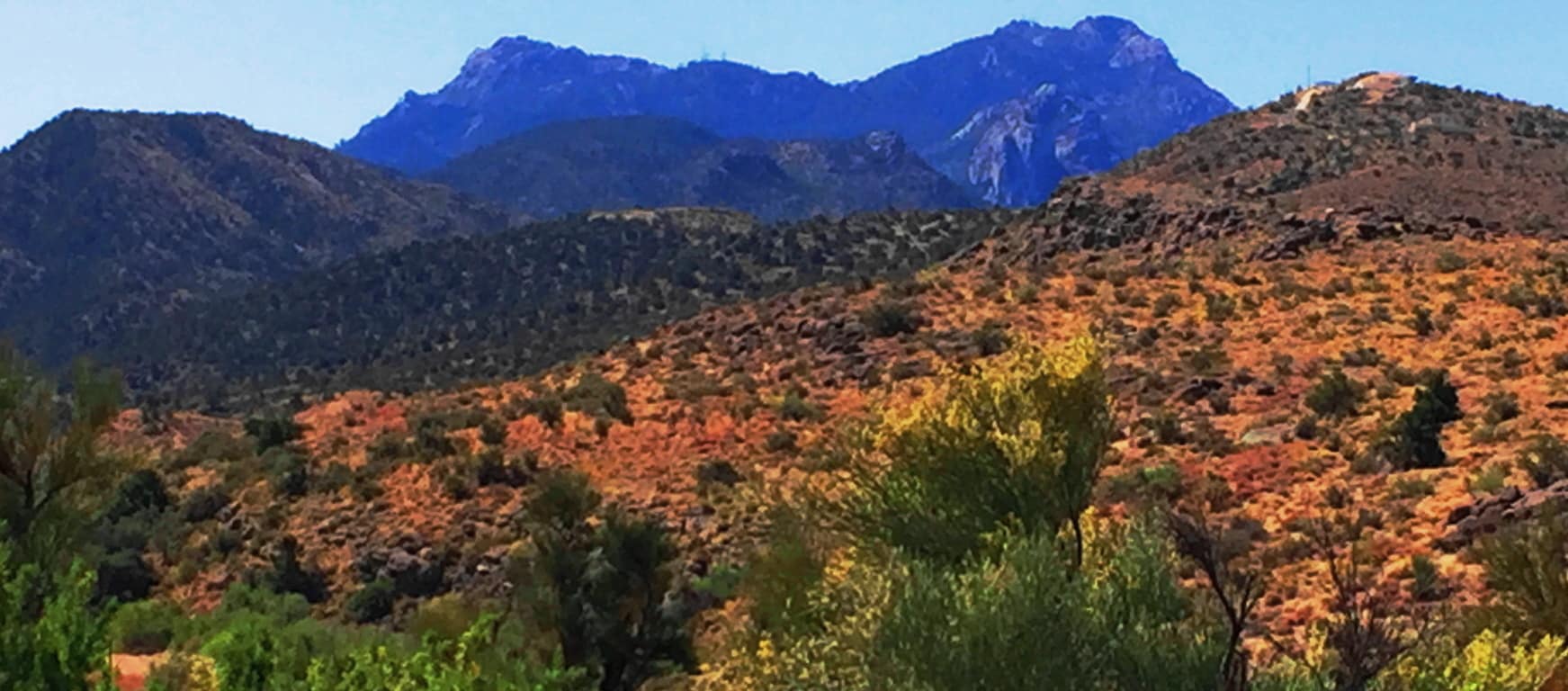
Location: Aspen Peak/Kingman, Arizona/USA
Elevation: 8,417 ft
Prominence: 1700 ft
Note: Half a world away from the ancient Celtic Ranges, where Standing Stones guard the mythical heights of Wales, Ireland, Scotland, and England, are the epic mountains of the American West. Among the vast options of the grand natural spaces that dominate northern California, Montana, Oregon, and Colorado, are the mysterious high Ranges of Arizona. The Hulapai Range is a few miles south-east of Kingman Arizona. From Kingman you will take the ‘Hulapai Mountain Road’ straight into the heart of the Range, climbing slowly upward into a set of elevations that look like an American Mount Sinai. The comparison is a good one. The air here is absolutely void of humidity. With temperatures that climb up to 116 degrees in July, the trees, some half burnt, radiate a charcoal scent which carries on the wind; and you can taste that scent on the back of your tongue. 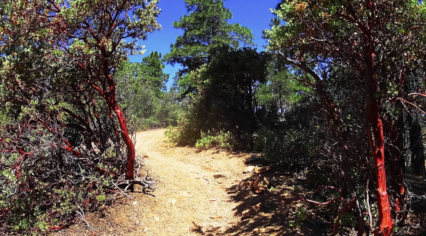 Amazingly, there are some similarities to Celtic mountain ranges here, if you have the right perspective. There are other-worldly rock fixtures, free standing boulders that stack the mountainside, and an amazing magical stone near the peak, which you will see in this article.
 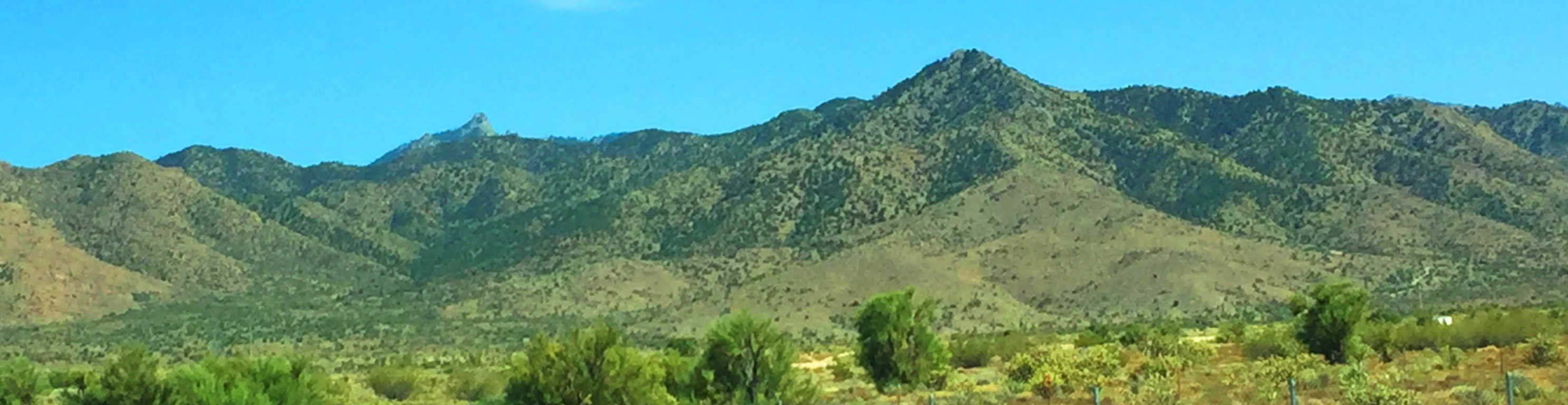 Aspen Peak Trail at Hulapai: As you approach the Range you will notice golden glades, not purely green zones. The bright Ponderosa forest at the belt of these mountains is spacious and inviting . In Celtic Ranges, the signs of the Neolithic Culture usually increase the further up you go. By this logic, if there is Neolithic cultural evidence at Hulapai, the highest peak would most likely yield the most evidence. Aspen Peak is the highest vista in this range, and the focus of this hike. Make sure to bring at least 1.5 gallons of water along with a sports drink for necessary electrolyte/sugar replenishment. Ration your intake. Also bring an extra shirt due to perspiration, several granola bars/ carb eating options, including jellybeans for when you reach the peak.
 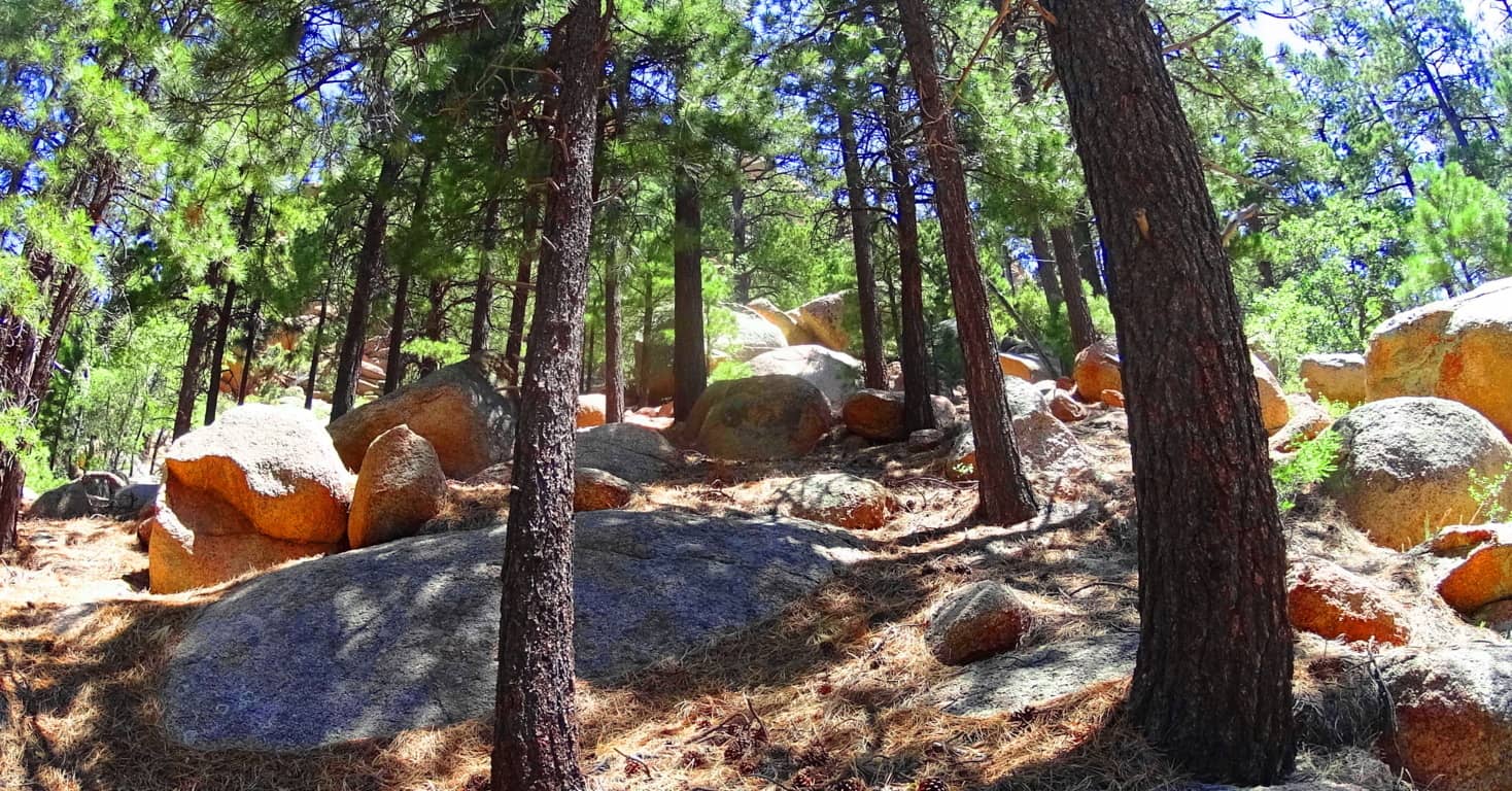 There are options for approaching Aspen Trail. There is a lower entry through the hills and woods off the Hulapai Mountain Road marked by a sign on the left, which is more of a challenge with an extra 1000 ft below the campground trailhead (and about 1.5 miles of extra trail through rocky glades and curiously rounded stones).
  If you want to cut that part of the approach off, you can make your way, by car, passing the Hulapai Ranger Station on the road, and then take the right onto the main campground, which is the more popular entry. After passing the numbered cottages and the RV’s in their designated areas, and you will see the marker for the ‘Aspen Trail’; here you will begin your challenge. Aspen Peak Trail’ is marked with signs on the way up, but remember on the way down to follow the signs that say “Campground” to get back.
The first portion of Aspen Trail is a bold introduction to the Ponderosa Pine “vibe”. Dragonflies with a shiny blue armor orbit dazzling red cactus flowers beneath the forest. (Image/Left) This initial 1000 feet of incline is a winding set of switchbacks and vistas. The boulders here are rounded like leavened bread, adding a unique surreality to the openings in the glades, and there are hundreds of thousands of these rounded fixtures. 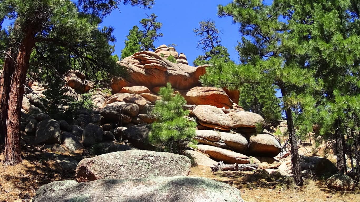
How it is that these boulders came came to be rounded and stacked individually is hard to imagine. As you continue into the 1500 foot level of prominence you will come to the ridge which opens up on the northern view of Kingman and the overall desert plateau.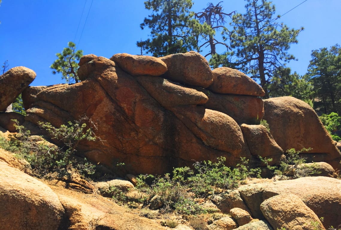 It isn’t just the vastness of this view over the northern ridge, but the stillness that presides over the radiating gold that takes your breath away. Arizona is like “spirituality that happens at a glance”; there’s truly an underlying force that imposes an evolved slowness over everything; it’s the ‘un-rushed’ spirit that survives among the high desert winds. If you move too fast, you just won’t make it. Everything you see is whispering “Pace yourself, and take your time.” The land feels like natures assigned setting for prophecy, which is one hell of a calling card.
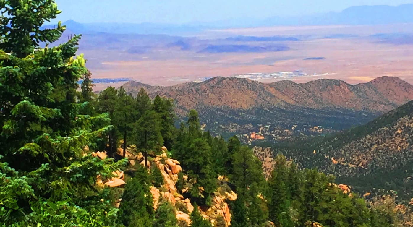
After taking in the northern vista on Aspen Trail’ you will begin to see the peak as you curve slowly around the mountain face, eventually making your way to the southern side. There is a view of the southern ridges beyond as the path first crosses a rickety wooden bridge that is your ‘gateway’ to the uppermost vale.(Image/Below)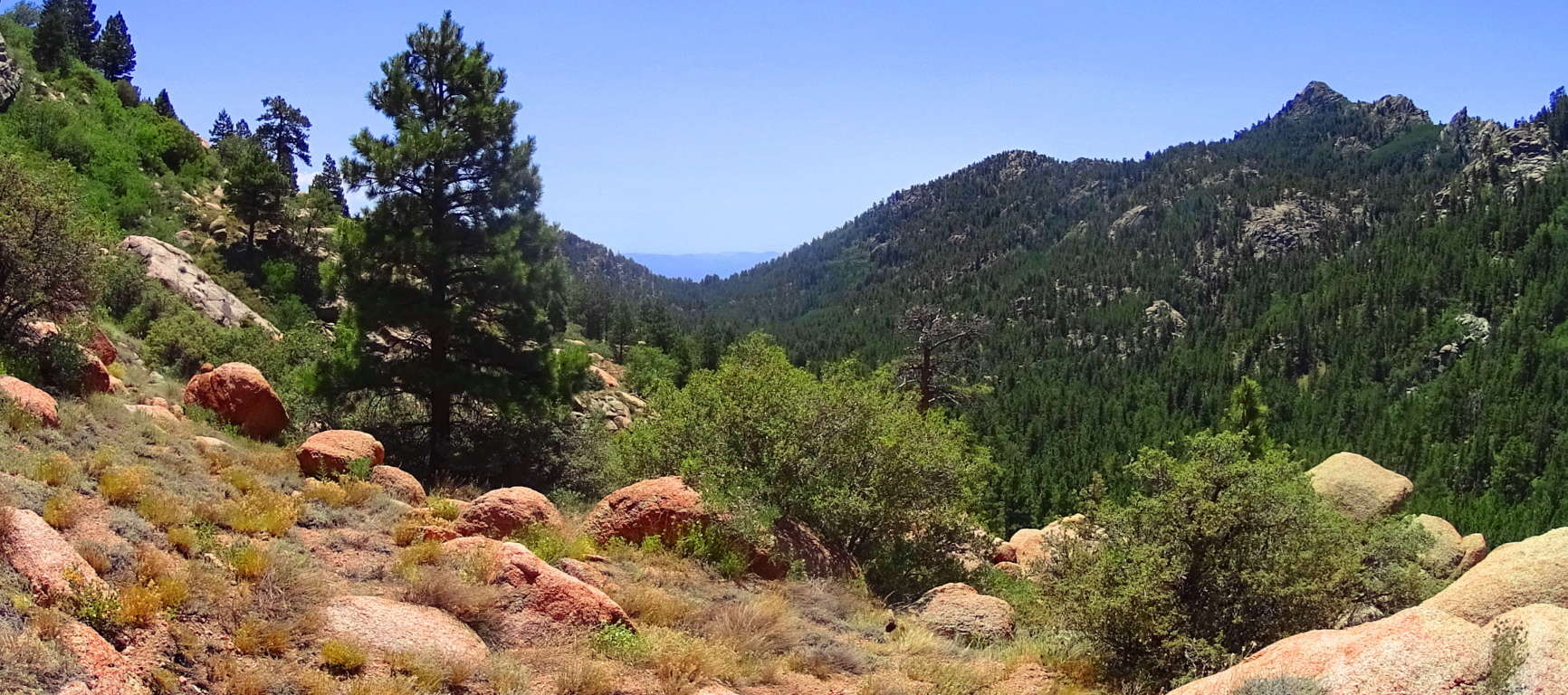
From here something otherworldly happens. Just like in the Celtic heights of enchanted places like the Rowan Valley in Wales, where massive ‘cut’ stones just start to appear out of nowhere, Hulapai seems to support similar ancient stoneworks specifically in the advantageous heights, where anyone approaching would be seen for miles before arrival. There are several stone-linings along the upper path. It is a good possibility that these stones were placed by the Neolithic culture, then supported by the Hulapai tribe, and reinforced in modern times. Clearly the area was sacred for someone if they were taking the time to create stones-works at 8000 feet, which is what we see here. 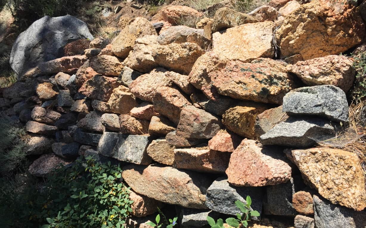 In Celtic elevations, often times when you find stone-linings that begins to announce a sacred zone, there is a singular solitary statement monumentalizing that sacredness. It is beyond astonishing that as you travel a little further along this last 200 yards of trail you will find a single Standing Stone unlike any of the other hundreds-of-thousands of rounded stones you’ve passed. The Standing Stone is cut abruptly on the top, with a a right angle cut into its right side. It stands about 6 feet high, with an absolutely flat-cut face, like a table standing up at about 4 inches in width. It is totally opposite the rounded features of the common boulders here, in every possible way; and it faces the peak.
This Standing Stone is most likely one of the oldest sociological statements in all of Arizona, among hundreds of such statements. If it is related to the Neolithic culture of ancient Celtic places, then this stone is no less than 4000 to 6000 years old. It is truly priceless. It might very well be that this is what is known as a ‘Solar Stone’, marking mid-day on this mountain for eternity. ‘Solar Stones’ appear in Celtic highlands, as well as the New England mountains. It is no mistake that from here you can follow the last portion of Aspen Trail towards a grand monolithic peak laid out dramatically before you. 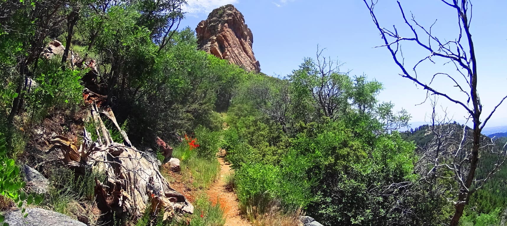 Continue towards this massive pinnacle to make the dramatic Aspen Peak. Even looking at the rock features in this uppermost area, you will see that there is not a single stone cut with right angles at the top and sides, like the Standing Stone that marks the upper trail.
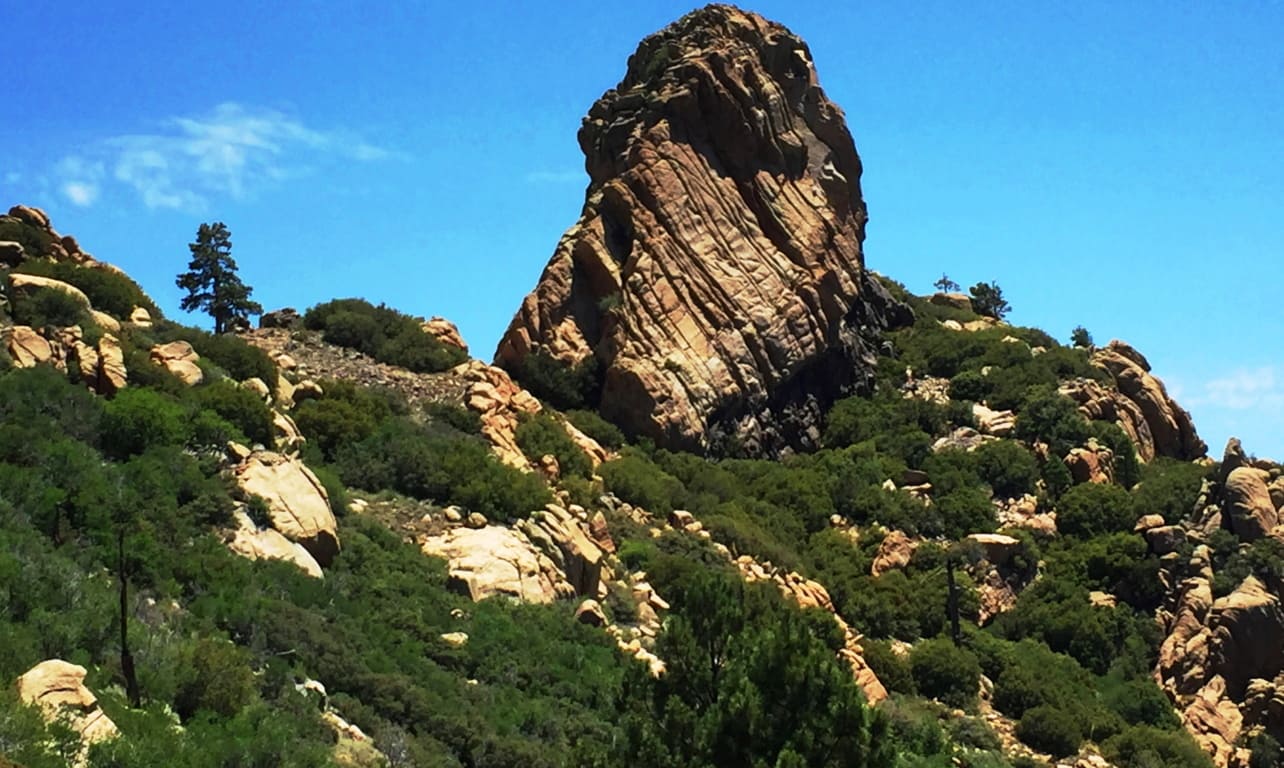
At the peak you are able to see a beautiful northern desert plateau. At this point you are 8,417 feet above Sea-level. 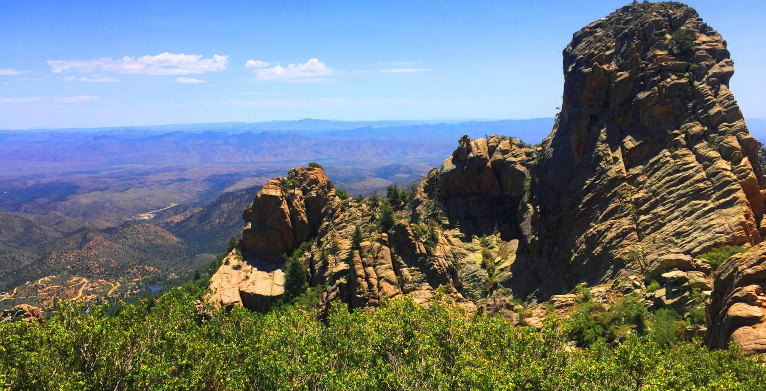
Aspen Trail at Hulapai is a spiritual challenge. You will have to put aside your usual hiking tendencies and regular comforts. Plan carefully. This is a stellar place. There are deer running through the forest below, and a high wind rushing over the desert; it may carry all the way to the Pacific Ocean in California! The Peak here is like an epic guard tower for the entirety of the ‘American West’; Hulapai being on the western edge of the mountain ranges of Arizona, which continue all the way up to the Rockies of Colorado at its eastern edge. The wonders that exist deeper into the Arizona interior are astoundingly worthy of such a “tower”, where the ancients once dwelled, high above the world. Just let it all sink in.
Sunset Crater Volcano National Park
 Location: Flagstaff, Arizona/America
Elevation: 8,042 feet/Prominence 1000 feet
Note: When seeking out sacred places, signs for Neolithic Culture will not always reveal themselves. The world is a wide place, teaming with variation and regeneration. In places like Sunset Crater, you will experience real wonder about the regenerative ability of Nature, as well as its explosive potential. This is a relatively new landscape compared to the Ranges of Ireland, Scotland, England, and New England. Just like the Celts of the Atlantic coastlines, there are native tribes that have been in this particular place basically forever. These indigenous tribes can attest to the age and variation of the landscape, along with Neolithic legends of their own, which bear striking similarities to those of the Celtic tradition. The Hopi of the Coconino Desert tell stories of “Red-Headed Giants” that ‘terrorized’ this region once upon a time. Isn’t that ironic. Many tribes, such as the Wupakti, migrated away from this scene, out to the very edge of the desert, into mountains and forests, perhaps to get away from the threats that existed out in the wide-open-wild. They came to live in the shadowy-cool forests of what is now Sunset Crater Volcano National Park, the ever-young landscape on the edge of the abyss.
Some places, just by hiking through them, can literally change your dreams at night. After hiking the countryside in Ireland with eyes wide open for just a few days, the only thing you will see when you eventually close your eyes at night, is a bright residual green. (Image/ Below/Left/Glenveagh Mountains/Ireland).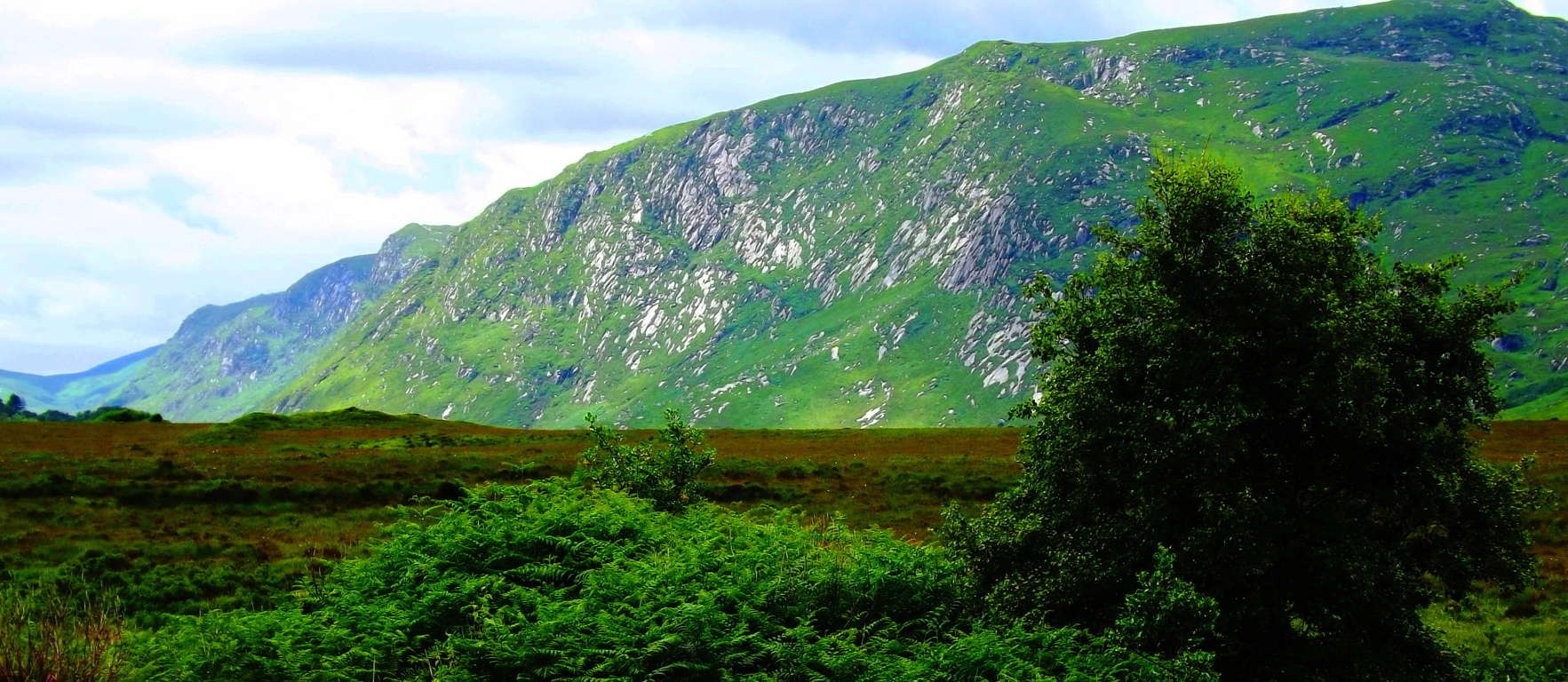 It truly happens. In the high Cococino Desert Plateau of Arizona (Image/Below) where everything you see is, at a minimum, 8000 feet in elevation, the altitude seeps slowly into all five of your senses, and even pushes you into a sixth.
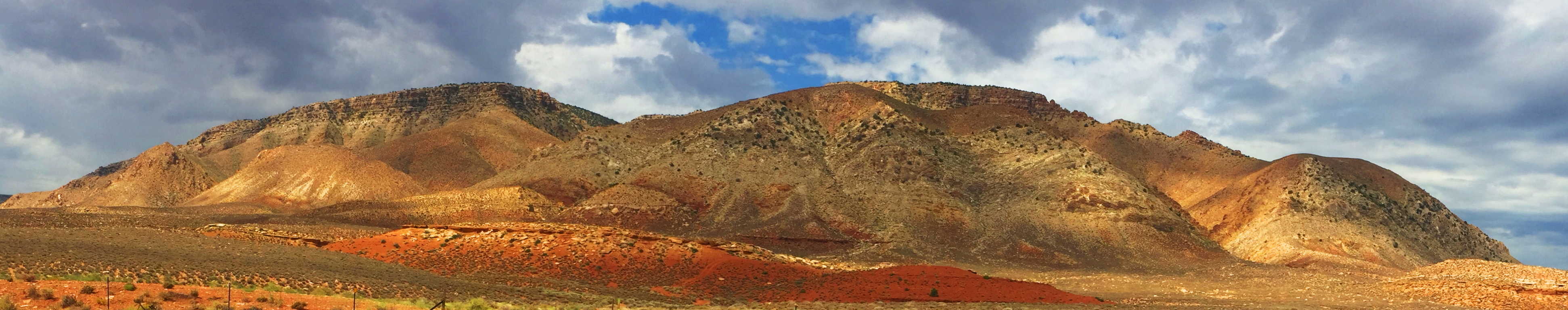 Here your body will begin to sense that it has moved into another world entirely. After a few days on the Cococino Plain of Arizona, the only thing you will see, when you eventually close your eyes at night, is residual white-gold. The perfect example of this is the wide-open panorama of the Grey Mountain (Image/Above), just south of the Grand Canyon. Grey Mountain sits like a white-gold monument welded by the timeless high-winds of the Cococino Plateau. On the extreme southern edge of this “white and gold dimension” is the surreal and vivid oasis of the ‘Sunset Crater Volcano National Park’. (Image/Below)
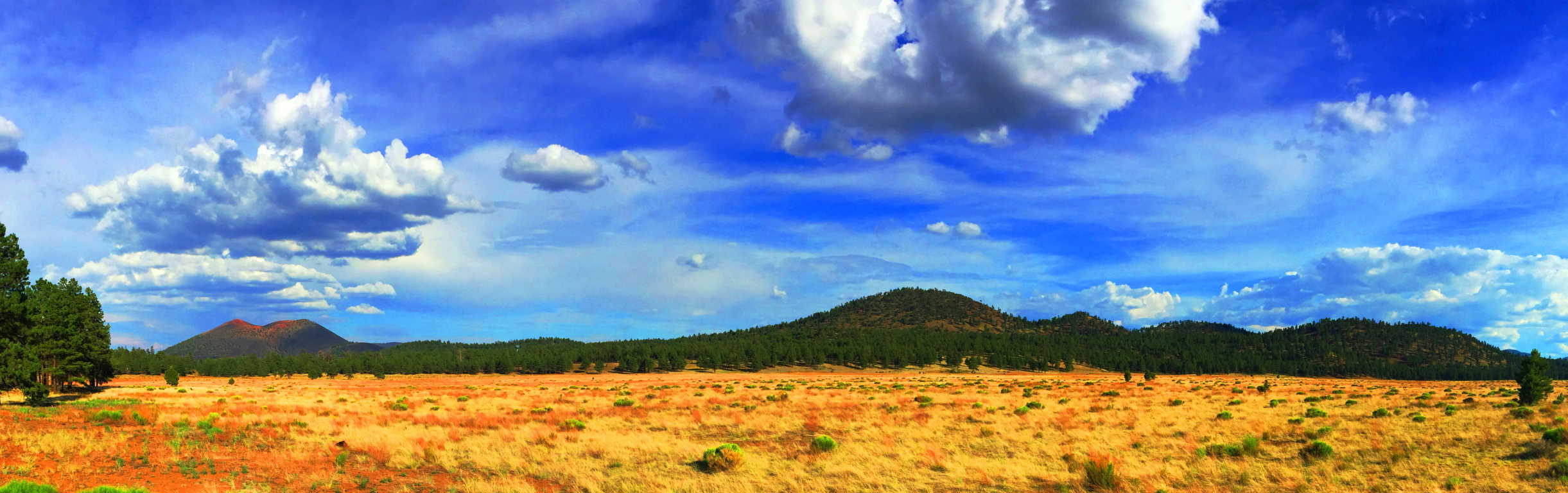 Sunset Crater’ is the captivating edge of the intimidating, but totally scintillated, Cococino Desert scene. From a distance, Sunset’ is the first life-giving glimpse of green after a dauntingly vast span of high desert bush. The Crater’s’ black rock and golden brown soil stand outs like a holy mountain against this dramatic golden-white backdrop, and it is highly likely that the native Americans of this area believed it to be a spiritual monument.
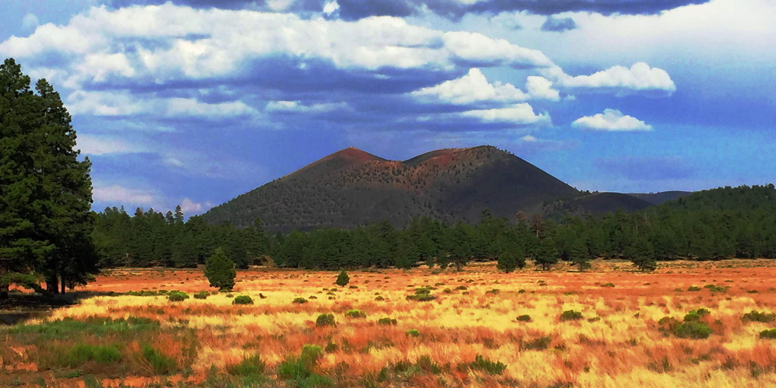 From the base of the Volcano, Sunset’ becomes a deep and jagged black-sea of solidified magma, an other-worldly terrain displaying a tangible timeline of life and death, and then life again, in a single glance.(Image/Below)
 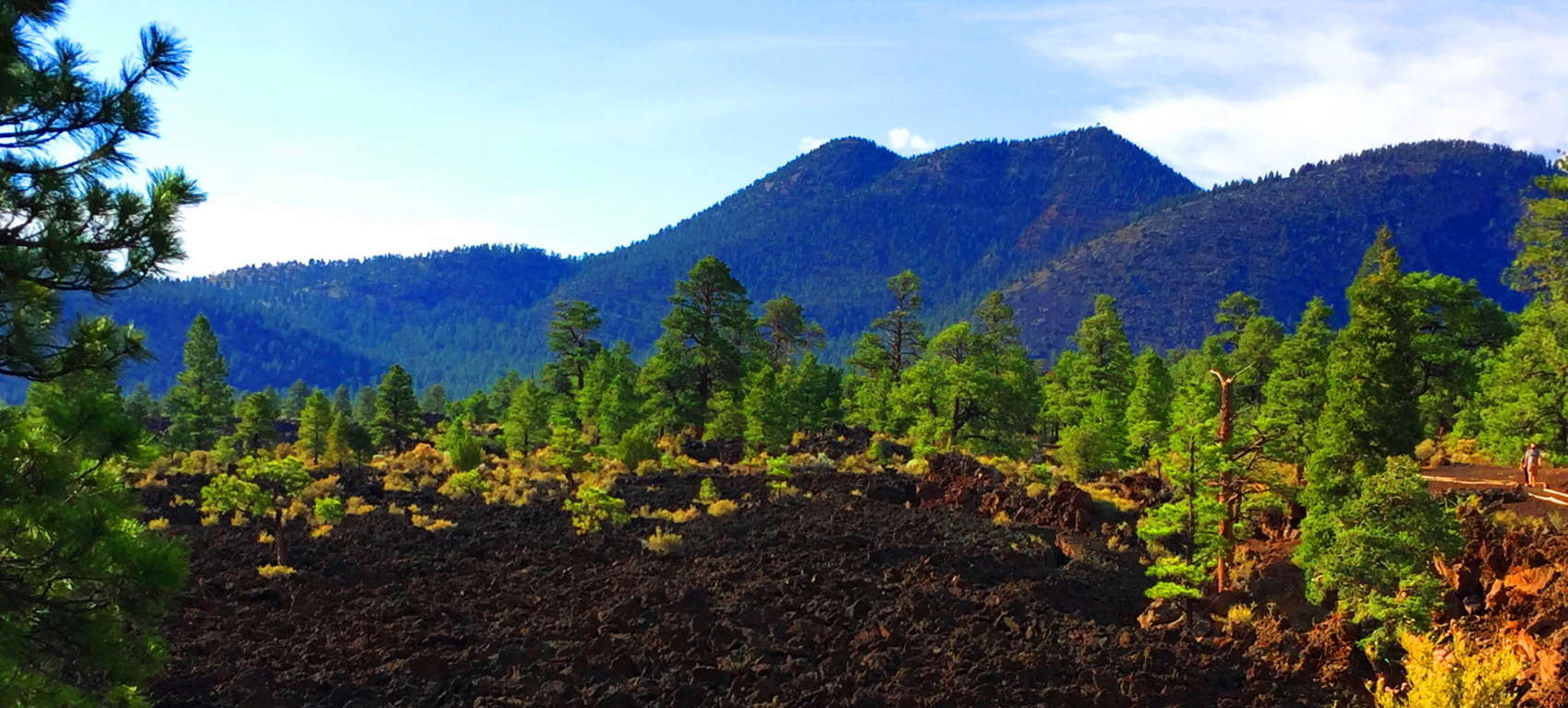 The trail design here at Sunset’ is a short set of ‘Wizard of Oz-looking’ pathways that run through the incredible magma remains. The rocks are sharp and drastic shafts which cut deep into the earth. The smooth white stone platform built for hikers here couldn’t contrast the experience more (Image/Below). It is one surreal stroll.
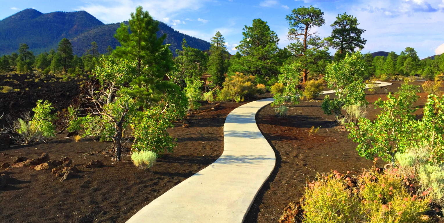 The best trail here is the small road which runs northwest into the newborn forest, around the Volcano. To see this brand-new forest rising up out of what was once magma, ashes, and fire, is to see a spiritual vision. It is a testament to the determination of the force of Life around us; how It finds a way, even in the harshest of environments.
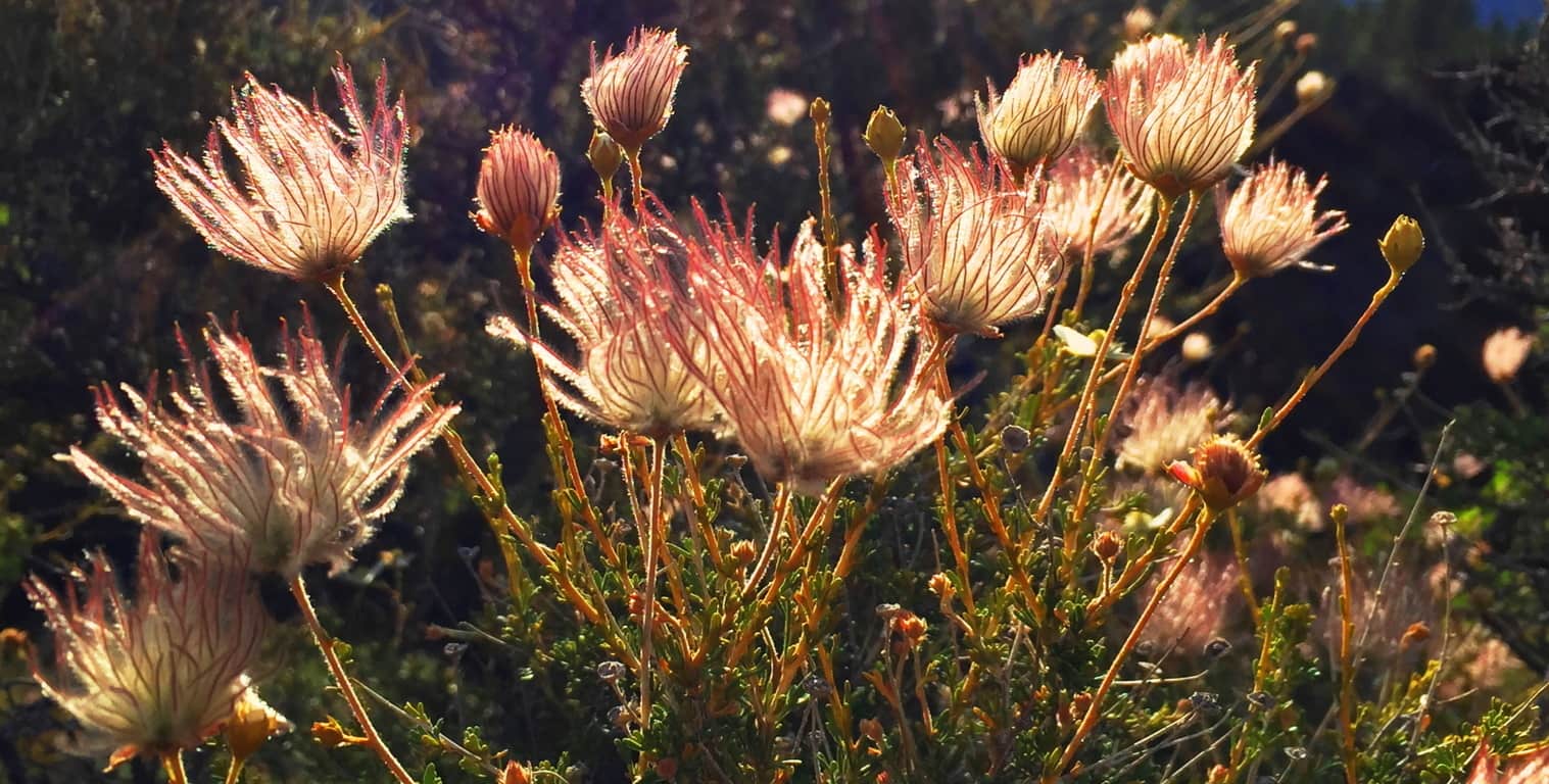 It is truly surreal: What looks like level pavement in the image below, is actually the newest of forests growing straight out of the compiled ashes and magma. The fauna here are tough, resilient, but somehow delicate and soft as well. (Image/Above)
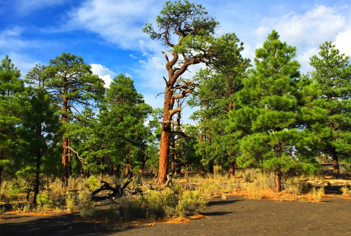 It is forbidden by the Park Service to climb the Crater’, but you can wander into this baby-forest near the western base of the Volcano’. Here you can catch a glimpse of the young glades climbing up the 1000 foot incline. The new growth browns’ the black-rock deep into soil, with the golden brush sprouting-up as a result, pushing the Ponderosa-Pines ever-upward, as if they were climbing The Great Pyramid.
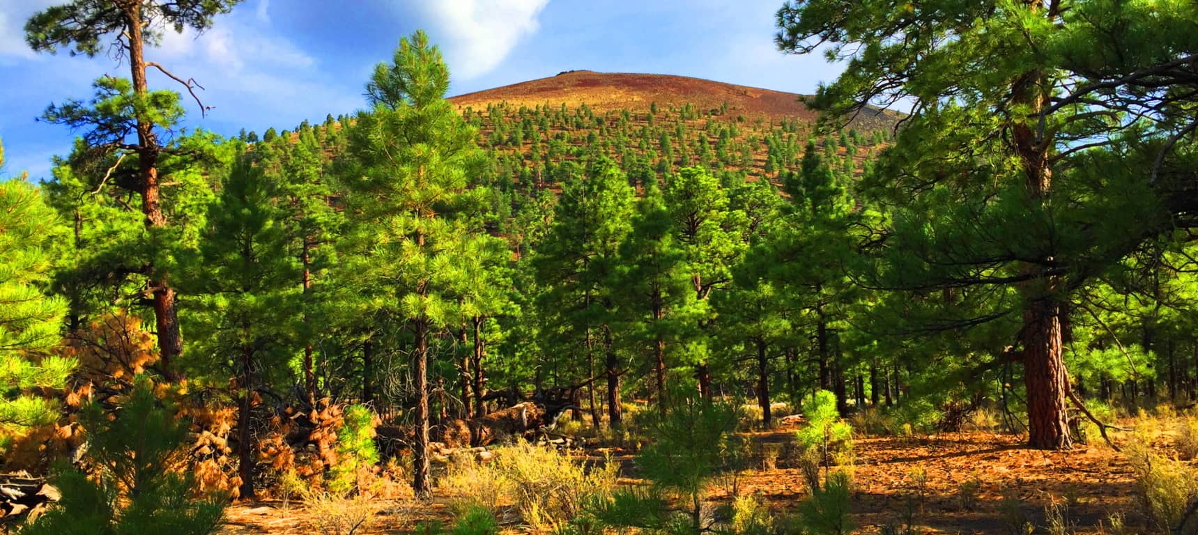
The indigenous Natives of this region, the Wupakti, would’ve seen the dramatic eruption which took place here just over 1000 years ago, from their stone dwellings only a few thousand yards away. Their dwellings remain in the safety of the Ponderosa Pine filled Cococino glades, where once deer and rabbit would’ve been plentiful, before the modern era invaded their tranquil existence. (Image/Below).
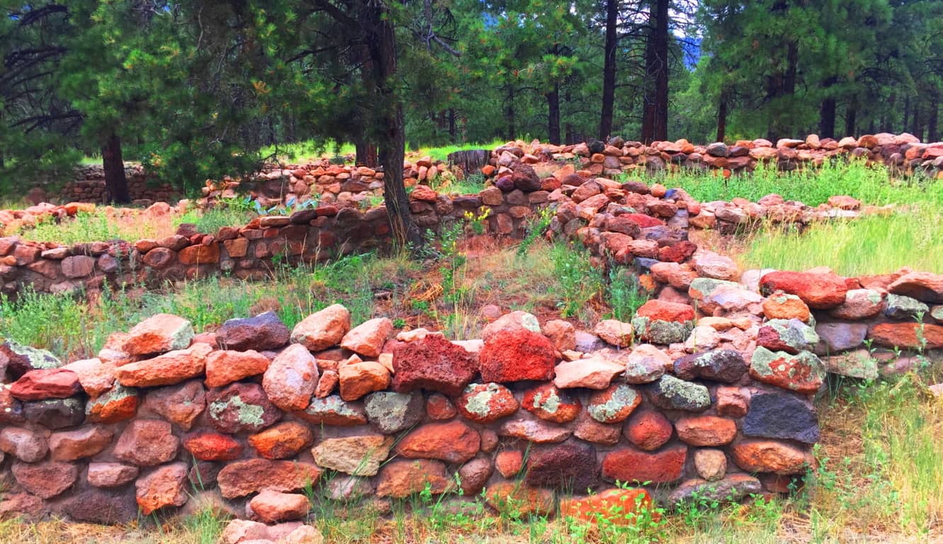 The Wupakti absolutely knew what they were doing when they settled just west of the Volcano. The variety of alternate natural features within a 50-mile radius of Sunset Crater’ is overwhelming. To the north of Flagstaff City, and east of Sunset Crater’, is the striking San Francisco Mountain Range of Arizona, inclusive of four beautiful peaks, with trails, all climbing no less than 12,000 feet. (Image/Below)
 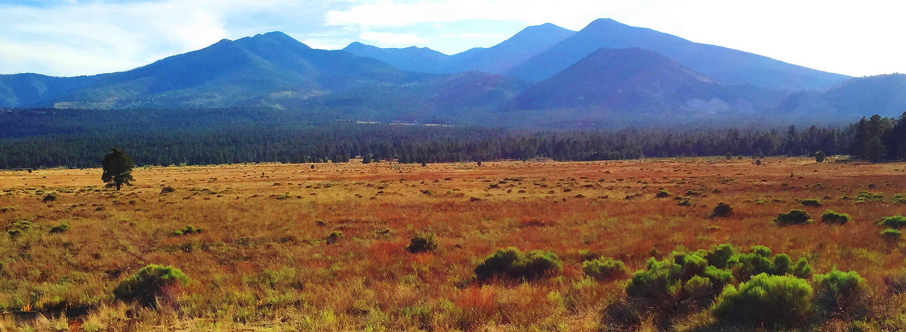 The native cultures here are beautiful and varied. The Wupakti chose to live at the base of these Mountains, within the Forest. The legendary Apache dwelled to the southeast; while the mystical Hopi chose the north, way-out in the desert Canyons, such as the Grand Canyon (Image/Left) and
 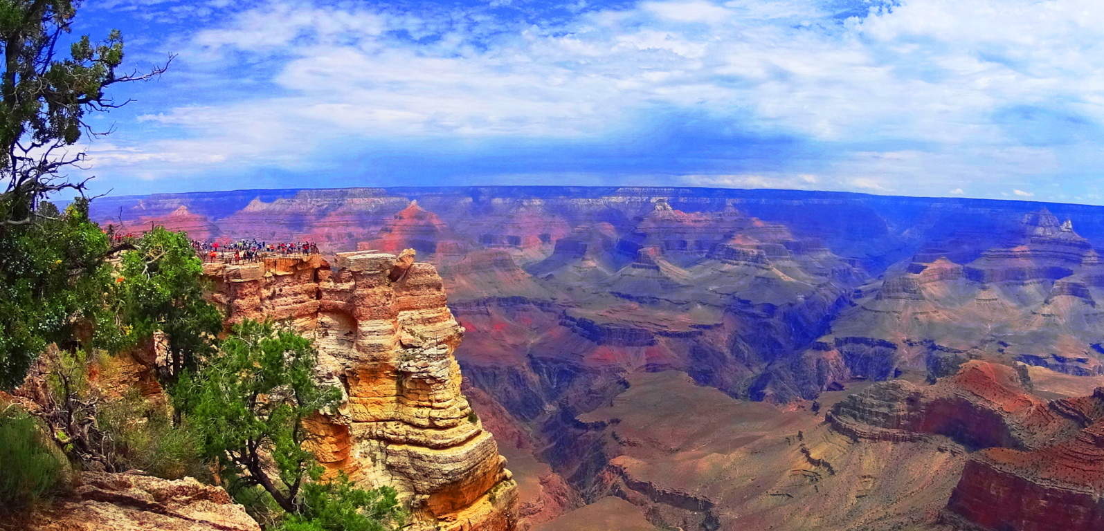 the lessor known, but no less beautiful, ‘Little Colorado Canyon’. All of this is out there in the northern arid abyss that seems to go on forever…(Image/Below)
 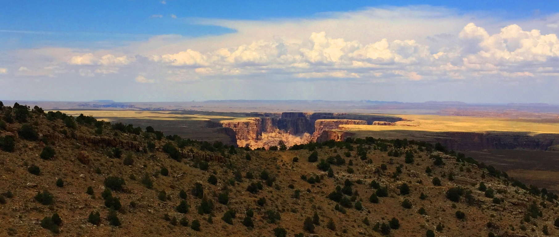 The signs of the Neolithic Culture that existed before the Natives of the region are certainly here, spread across an intensely vast amount of space. Multiple canyons, forests, mountain ranges, and deserts exist here, all with features that show signs of Neolithic culture. If you come to Flagstaff Arizona, visit Sunset Crater’. Experience raw elements of trails containing the Past, Present, and Future in one stellar region. The regenerative force of Nature persists in even the harshest of places. Amazingly, if you investigate the stories of the Wupakti, Hopi, and Apache, you will find myths so similar to Celtic legends, it will astonish you. A hike through Sunset Crater’ makes it all as real as it gets, and in a stunningly beautiful way. Don’t touch the lava if it starts to flow, but definitely enjoy the show.