Medicine Bow National Park
Location: Clark Peak/Rocky Mountains/Colorado
Elevation: 12,953
Prominence: 2,753
Note: If the mountain ranges of Ireland, Wales, and England could be said to be like rolling waves of infinite green… …then the Colorado Rockies of the northwest United States could be said to be nothing less than a rock-solid “tsunami of blue stone”, frozen forever along the landscape, above the western world.
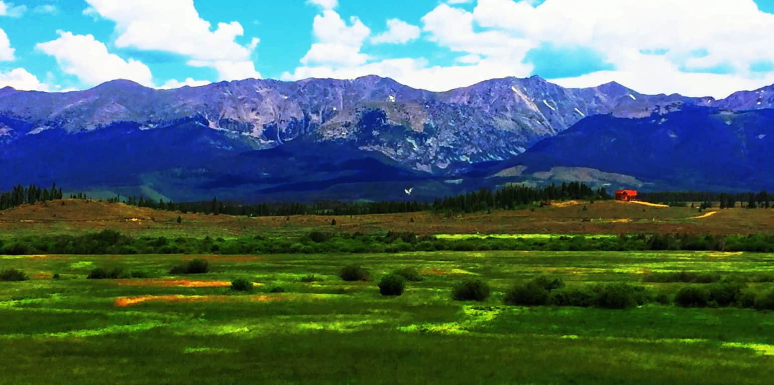
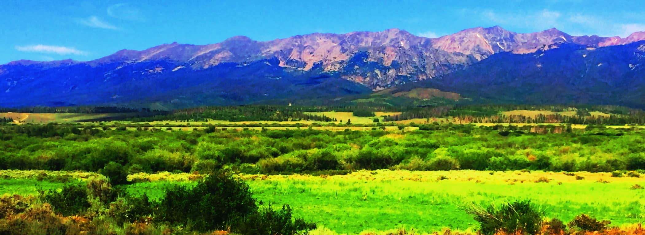 There is no other possible introduction to this juggernaut of a mountain range. Clark Peak, our destination for this article, sits in the southern Medicine Bow National Park. The northern Medicine Bow National Park, across the state line in Wyoming, is an auspicious type of “warm-up” for the grandeur of The Rockies. Southern Wyoming’s Medicine Bow’ features a unique lessor-known range, with ‘chocolate-milk’ looking soil, seemingly poured all over the ledges, standing at what looks to be about 2000 inviting feet of prominence with the highway running right through them. (Image/Below)
 These are surprisingly dramatic yet relatively anonymous mountains, a mere preview to what looms just across the State line. They are absolutely worthy of many an expedition for certain, but remain in the reputational shadow of what awaits in Colorado. To its credit, a mere glimpse of these small peaks reveals a warm and distinct beauty, truly inviting. Everything about this small range says “jump up here for a day!” Like so many people just passing through, this place was passed by in order to reach the Rocky Mountains of Colorado.
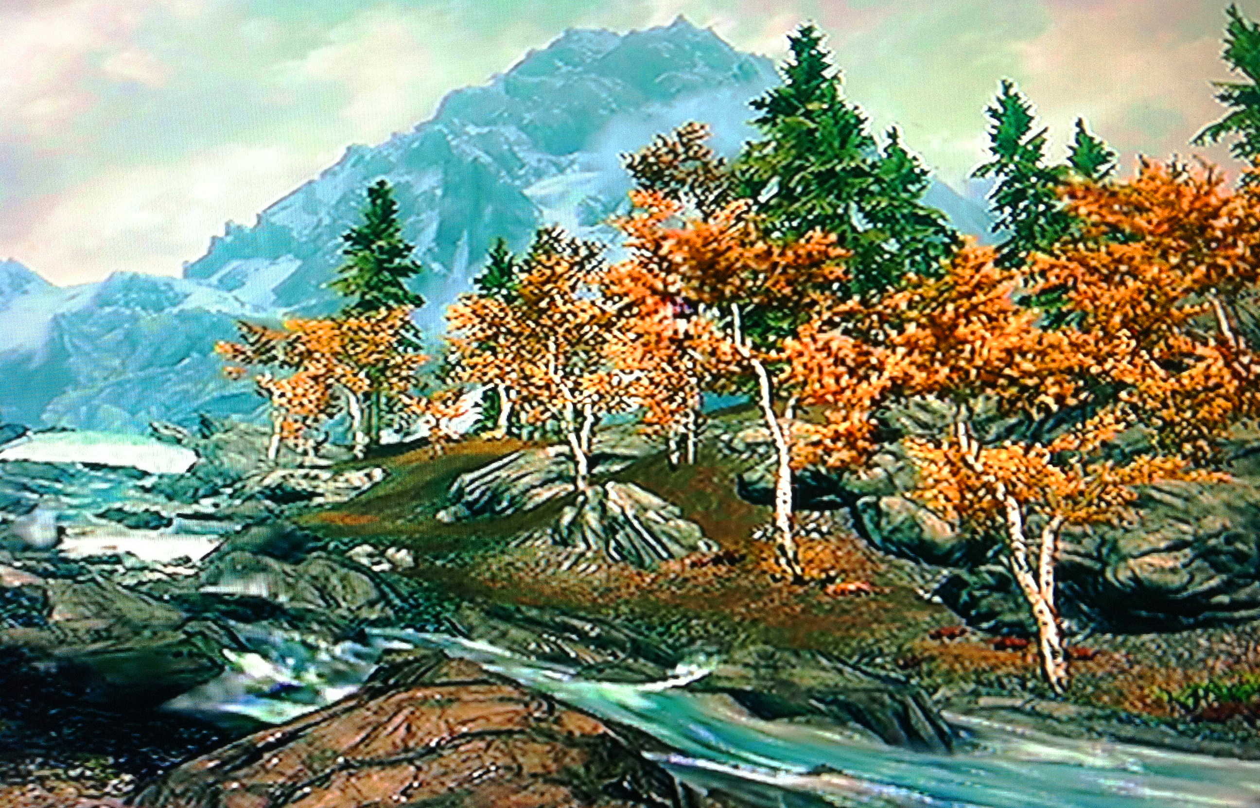
Clark Peak Trail: The feel of Colorado is vast and rustic, and yet it leaves natural space for significant delicate statements also. Trails are thickly bedded with wildflowers of every possible color, like the approach to the mythical city of Oz. Brown Bears and Moose roam the mountains and forests, but for the most part steer clear of the trails. The high plain sits about 9000 feet above sea-level, supporting a universe of fauna. 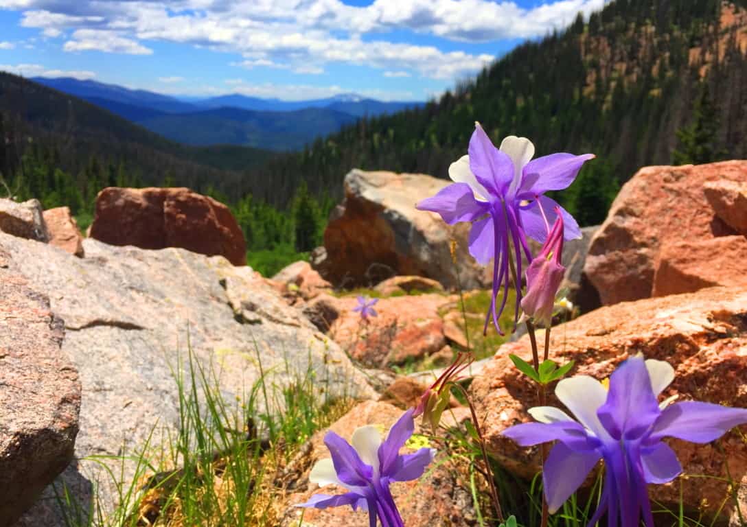 Accessing the elevated trails of Medicine Bow National Park in high country like this requires a 4×4 vehicle, plain and simple. The highest peak of Medicine Bow’, above the northern Rockies, is Clark Peak, looming just shy of 13,000 feet above sea-level. There are basically three levels of trail-heads, each a bit further up the Trail than the next. The first trail-head approaching Clark Peak is at the end of a wide dirt track that passes a small lake on the far edge of the mountains. To start from the first trail-head could basically take more than a day to complete the ascent and return. Most hikers attempting the peak desire an entry that reaches to at least the second trail-head. You should not attempt the second or third trail-head without a 4×4 truck, and prepare to rent a 4×4 for your excursion. Below is an image of the Clark Peak approach. Above the high basin on the left is your destination, where a large still-water pool awaits.
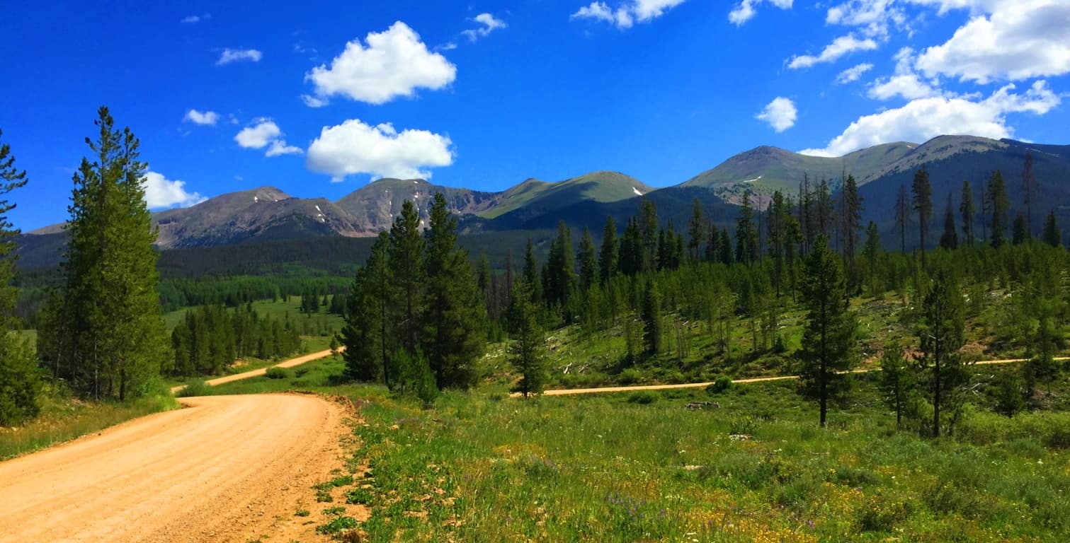 The second trail-head begins about 5 miles into the lower vale, so when you ditch the truck on the side of the track, the forest will already be surrounding you, and perhaps in a way it has never done before (even for seasoned cross trainers.) If this is your first hike in Colorado, you are stepping into a type of hiking phantasy from the moment you get out of the truck.
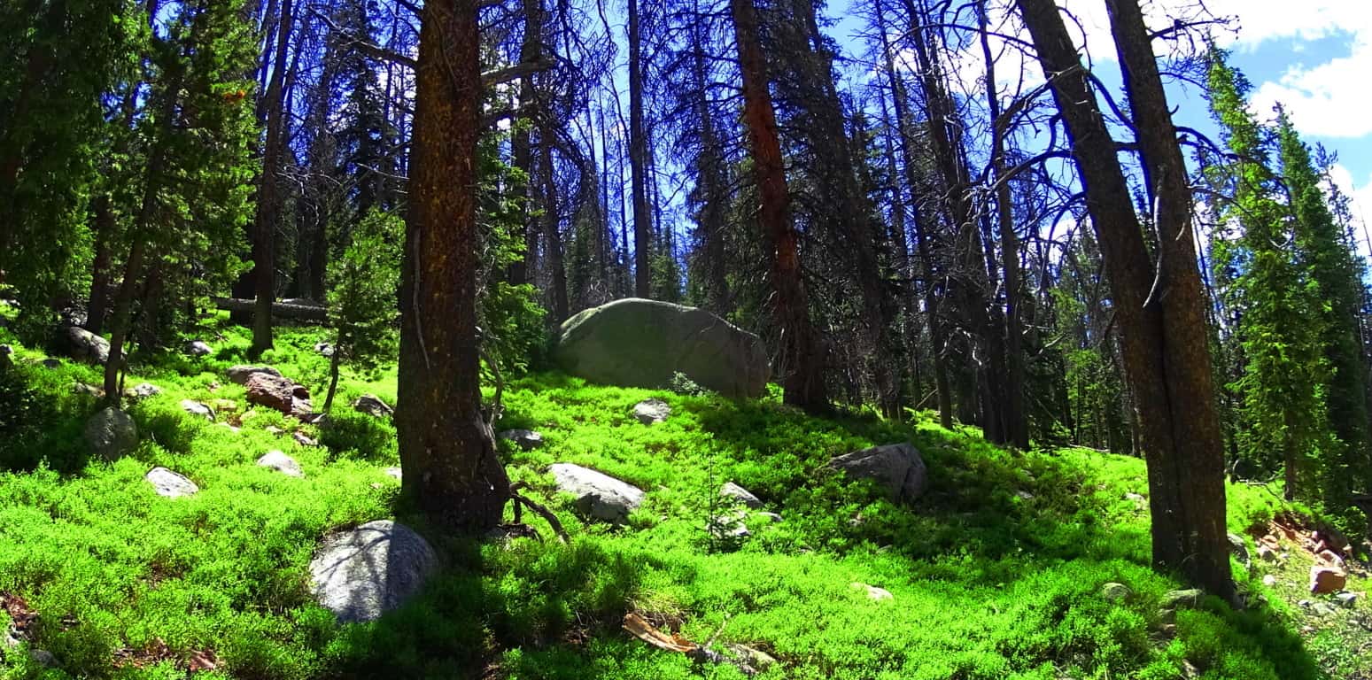 The tallness and fineness of the Aspen trees, Blue Spruces, Douglas Firs, Ponderosa Pines, and Lodgepole Pines, creates a literal euphoric vibe in the forest. From a distance, the woodlands seem to be blending into each other somehow. When the shafts of sunlight hit these trees, it is hard to focus on any single thing; it’s as if the trees are literally vibrating into each other.
 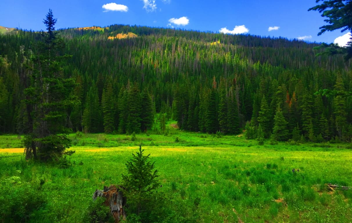 There is a type of enchantment here, a vastness to these glades that gives a very physical impression. The thickets here look as dense and deep as any ocean, and just like the ocean, to go too deep un-prepared could prove fatal. Respect this wilderness, pack properly, study-up, and stay on the trail when inside the forest. The basics here are about being aware of ‘forest-fire warning-levels’ and the restrictions to using flame, the possibility of bringing bear-spray (or even a fire-arm), and never leaving cooked food/food goods unburied or littered in the forest; it will draw the Brown Bears if you are lazy and careless with your goods. Stay sharp and aware, ready to have a great experience.
Very much like in the Mourn Mountains in Ireland, after the lower valley roads begin to elevate, they usually blend into a stone road trail that is almost certainly an ancient pathway. I wondered if I would find such a thing in a wilderness so far removed from Celtic characteristics, and to my delight I did. The look of these rocky tracks are surprising in the initial heights of any mountain range. In many places it seems that these ancient pathways were the very first roads on Earth, navigating the high mountain passes built by the most ancient Culture on Earth, the Neolithic Culture. Here is a look at the ancient stone-road at Mount Bearnagh in Ireland. (Image/Below) 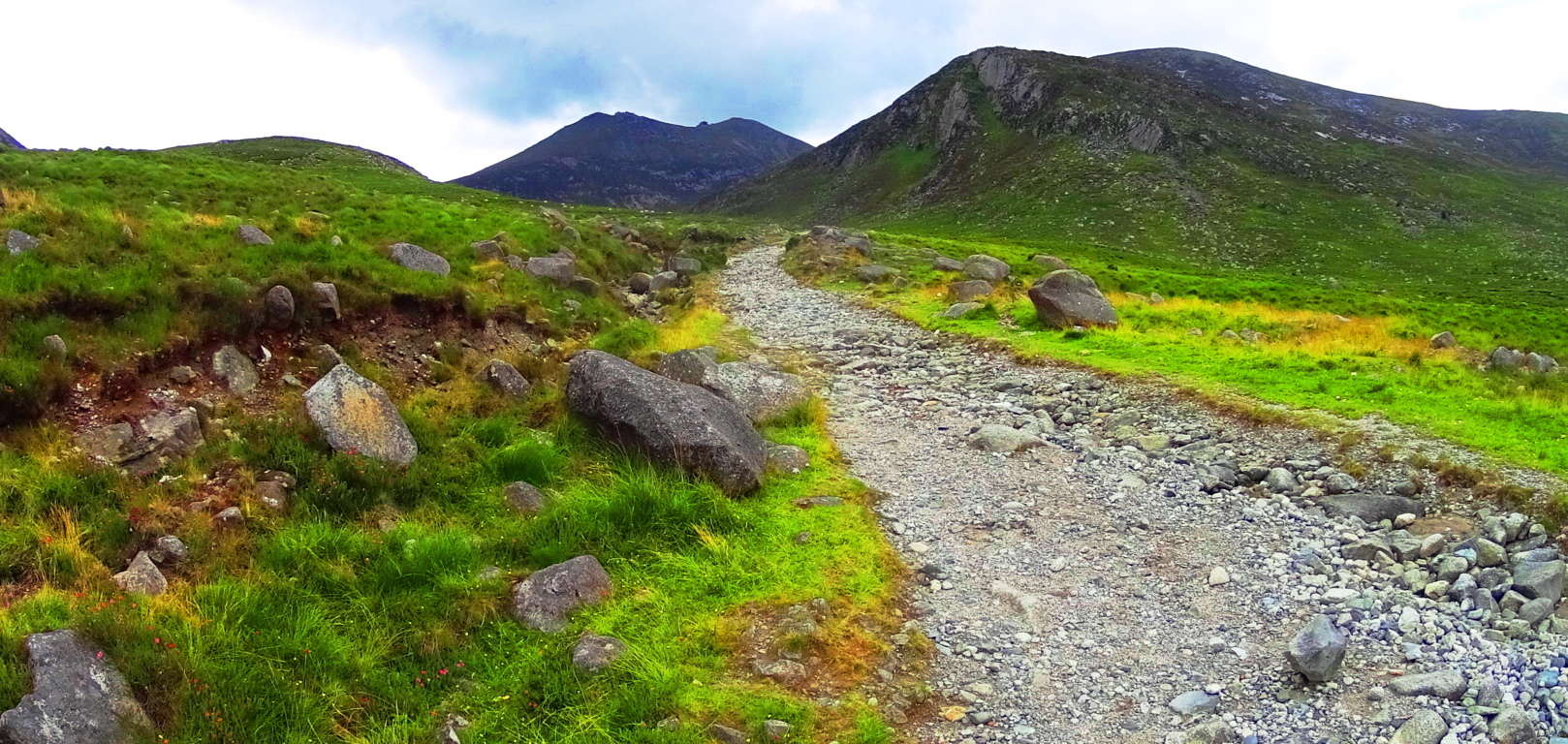 And now here is a look at the nearly identical width grade, and angle of an ancient stone-path in Colorado.(Image/Below) Many of these approaches have been re-worked from a much older original path that has been there (for all intents and purposes) forever. In Ireland it would be the Gaelic/Celtic Culture that identified and revised the ancient paths, while in Colorado, the Native Americans would have been the first to observed and acknowledge these trails as “sacred pathways”, or “pathways of the spirits.” These origin roads had existed long before even their earliest ancestors had arrived. The point is, there is very good reason to believe that an even more ancient culture existed here before the natives, a culture capable of building and engineering with megalithic stones. To my great wonder, some of these signs of “cut stones” and a singular pathways with a specific measurement (roughly 4.5 feet across) in the high mountains appeared here on Clark Peak Trail. A deciphering look at the old pathways alone, however, is not enough evidence to support the idea of a Neolithic existence in this place; it will be in the heights that Wedge Tombs, Cairns, Standing Stones, and Vantage Stones reveal themselves, as we know from Celtic ranges. I admit that this was on my mind as I ascended the beautiful valley with one of my oldest and best friends.
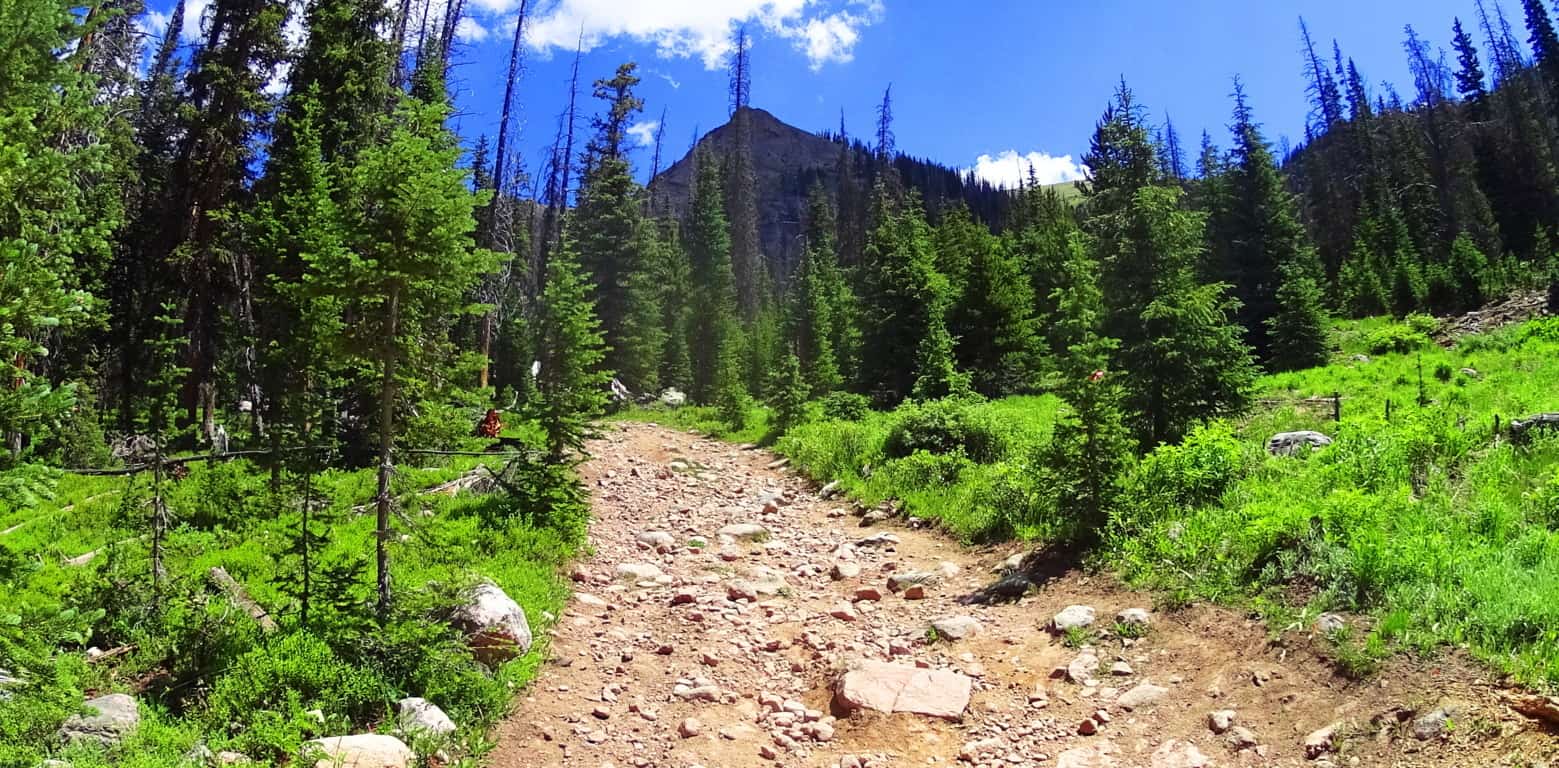
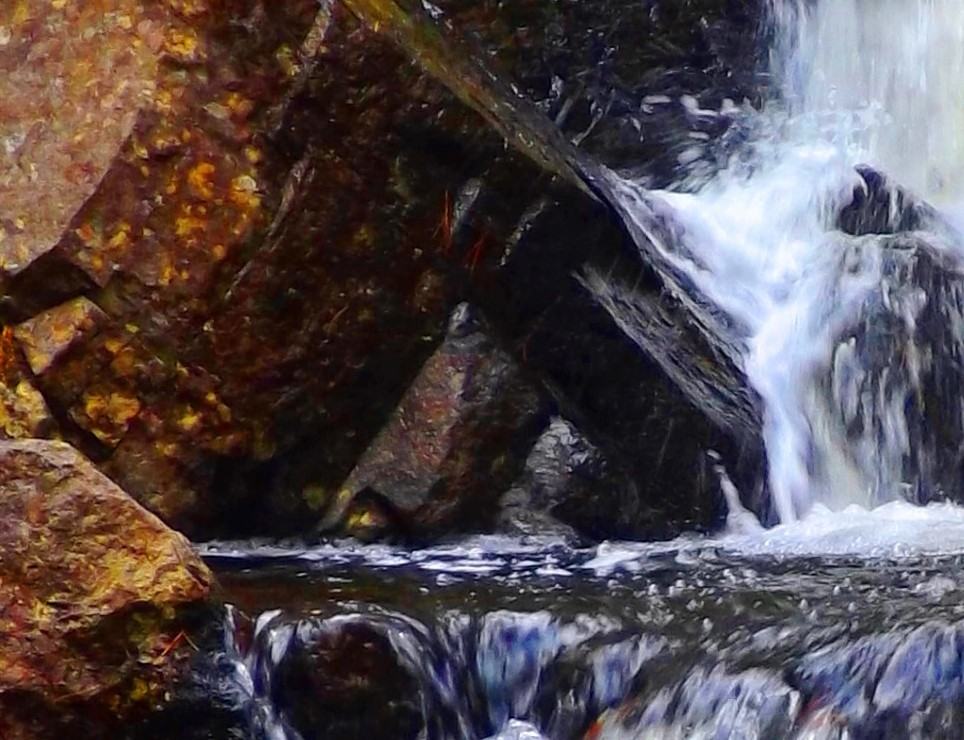
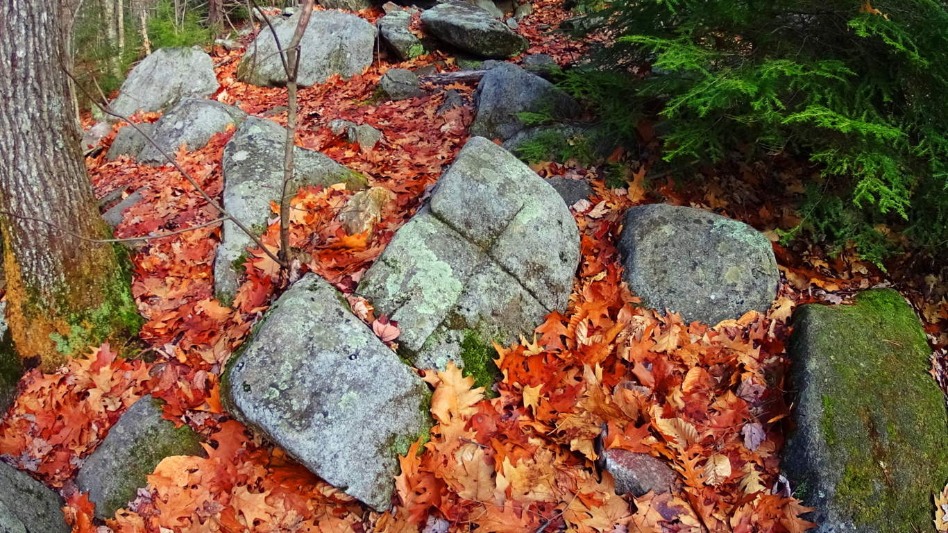
As the old rocky road begins to narrow into a winding path, bustling streams and narrow log bridges emerge. The stream runs almost directly towards Clark Peak, in a line of sight that is classic Colorado; Pines and abundant overgrowth pointing to the peak as if it were a temple corner stone.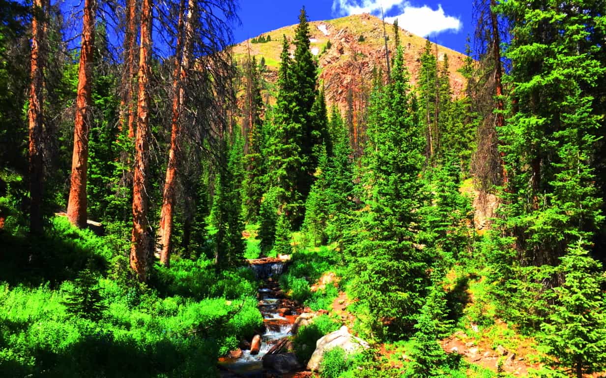 The basin at the upper portion of the trail comes into clear view here, along with a grand clearing in the middle of the vale, about a mile ahead on the trail. A clearing of this scale, where the tree-line abruptly ends, is indicative of a glacial rockslide, which is what we found. The trail continues across the fallen rocks where you catch a first glimpse of the curvature of the glowing moss and speckled glades of the upper basin, which still had somewhat miraculous patches of snow, in July! The absolute dryness of the comfortable cool air preserves the snow in the heights, giving subtle surreal contrast against the hillsides.
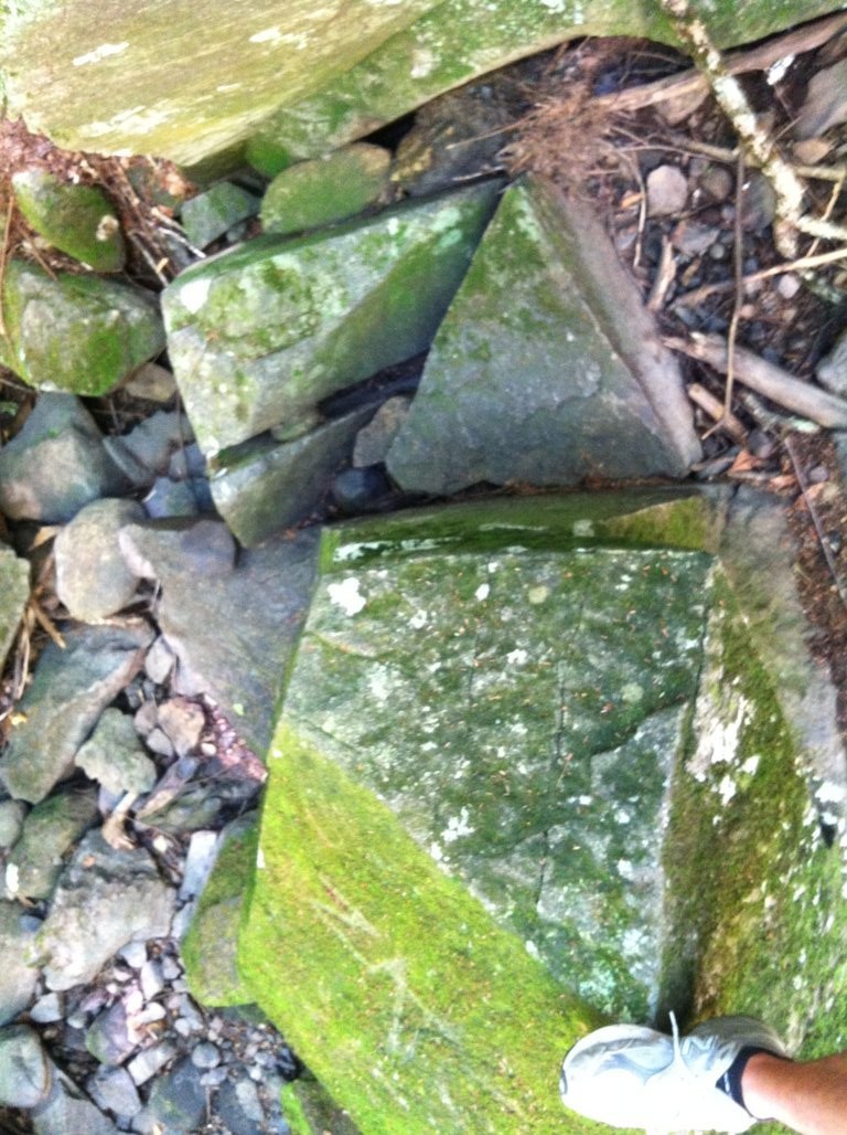
 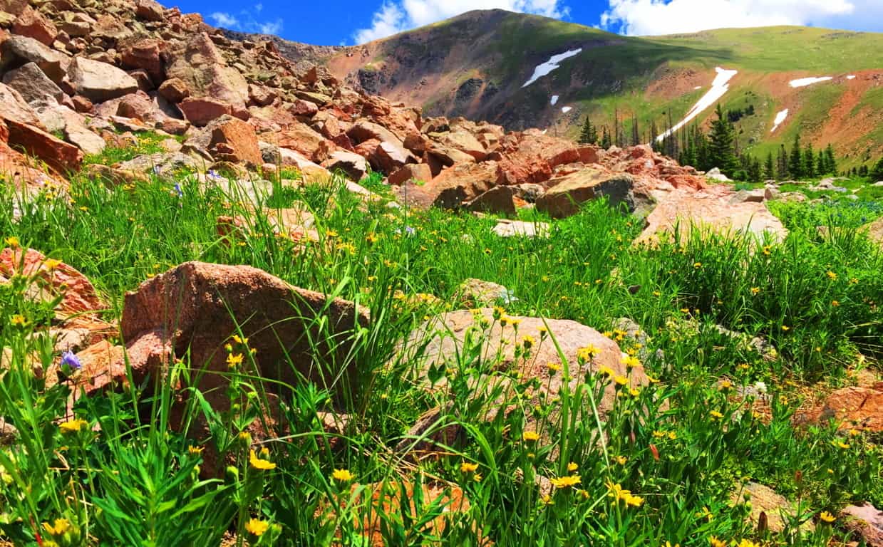 While trekking through a massive rockslide a chronology of the natural events of the mountain comes into perspective. The receding of the last Ice Age left entire mountainsides inundated with random boulders in spastic shambles. Intriguingly, some of the boulders seem to have broken away from the riotously random placement-pattern. One massive ‘squared’ boulder, at the base of the rockslide, seems to be sitting perfectly centered on the incredible scene of the mountains below and beyond. In the upper valley at Mount Bearnagh, of the Mourn Mountain Range of Ireland, not only are there boulders that seem cinematically placed, but they also seem to have been, somehow, hewn to match the shape of the valley beyond. (Image/Below)
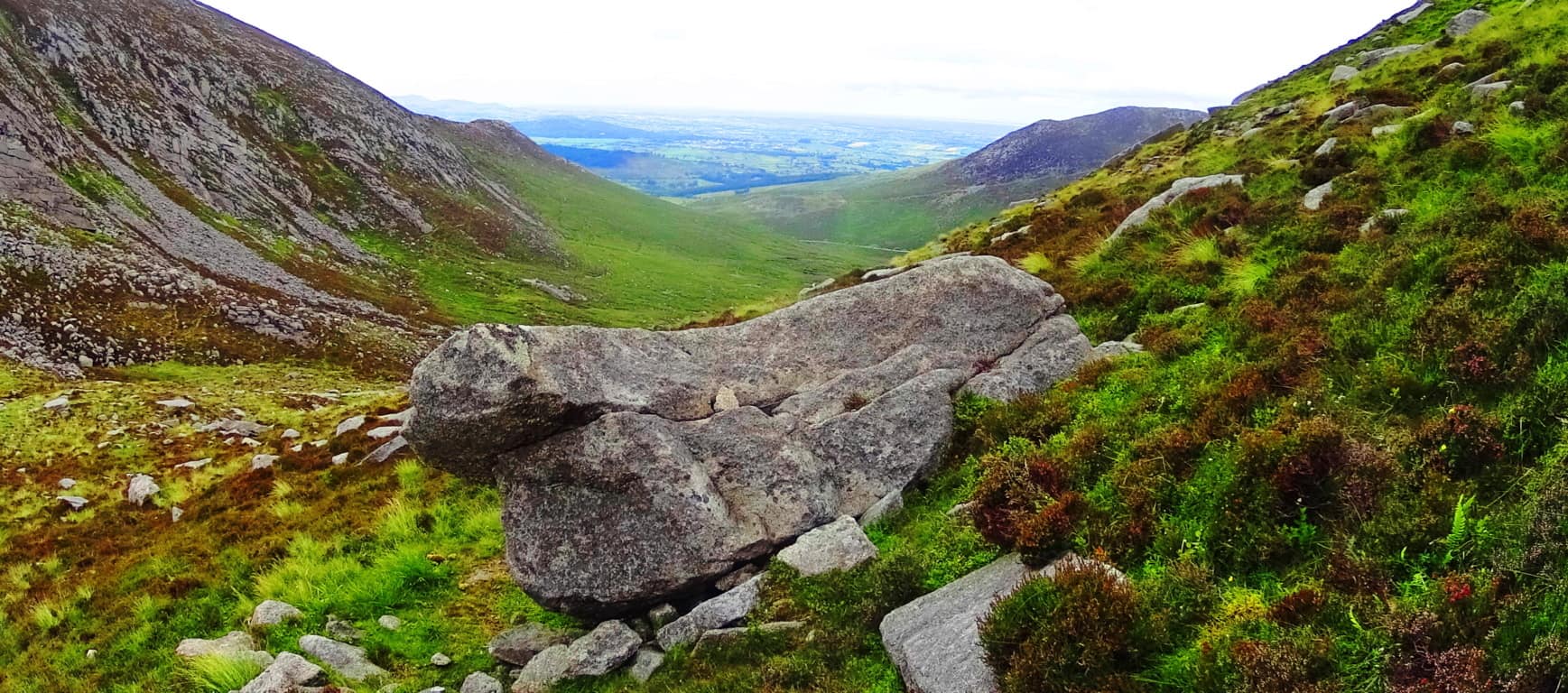
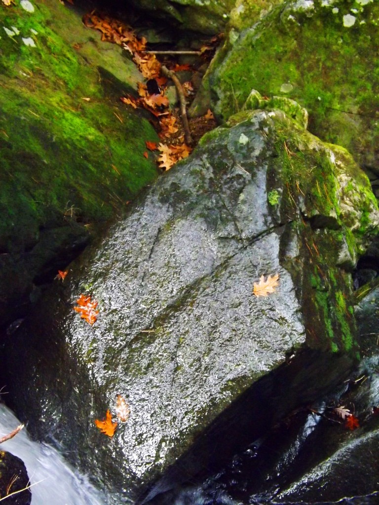
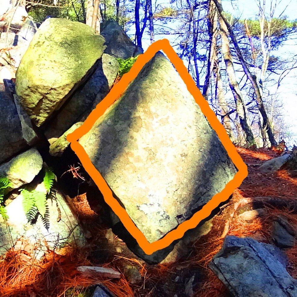
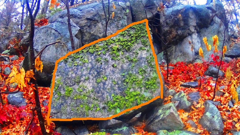
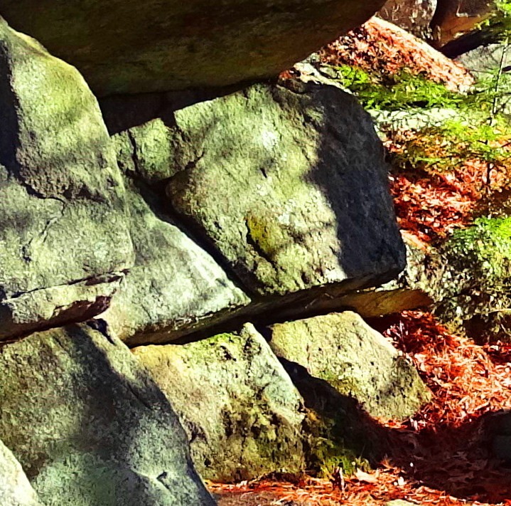
There are also “seat boulders” at the pass at Bearnagh, which absolutely look to have been placed at a cinematic point on the valley, as a place where you could sit and watch anyone approaching slowly from below.(Image/Below)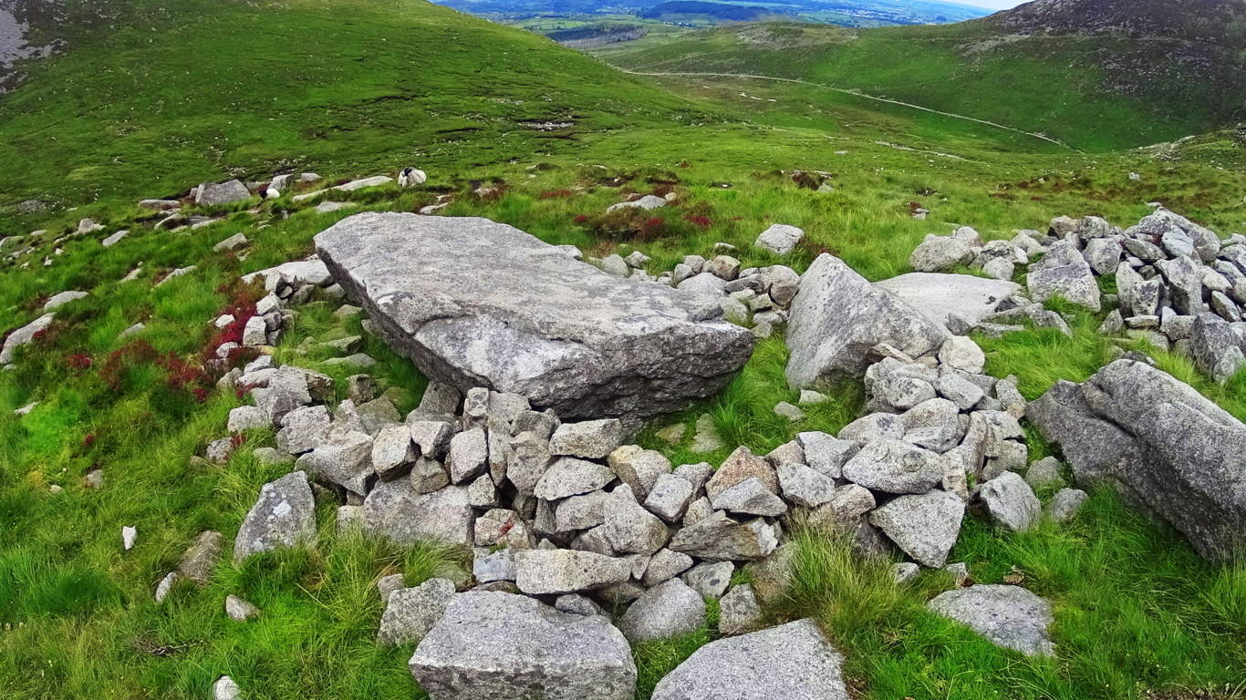 Here at Clark Peak Trail there sits an auspiciously placed boulder which looks more like a “seat” then a random resting place from a rockslide. This ‘squared’ boulder is perfectly centered on the vision that is the brilliant view of The Rockies beyond.(Image/Below) The other stones of this scene are compiled in stacks, tightly packed together, way off to the side of this beautiful seat; and the possibility that it was intentionally placed there becomes very real after considering its perfect symmetrical placement at the dead center of the valley. Only the Neolithic culture, the culture that had the strength and skills to build New Grange, or arrange massive stones in The Mourn Mountains; or masterfully craft the Sarsons at Stonehenge, has the capability to do something of this scale in antiquity. Clark Peak Trail, as you progress, begins to show signs of Neolthic Culture. Clark Peak Trail may very well have been home to the very same Neolithic Culture that marked and roamed the peaks of ancient Europe.
  From this gorgeous spot the Trail runs over the landslide stones and into the curvature of the upper basin, where the scene becomes truly surreal. Beautiful fields of wildflowers decorate the mouth of the basin. Campers pitch their tents here on soft glowing beds of grass and singular Pines. The view is like trekking the natural porch taking you straight to Valhalla.
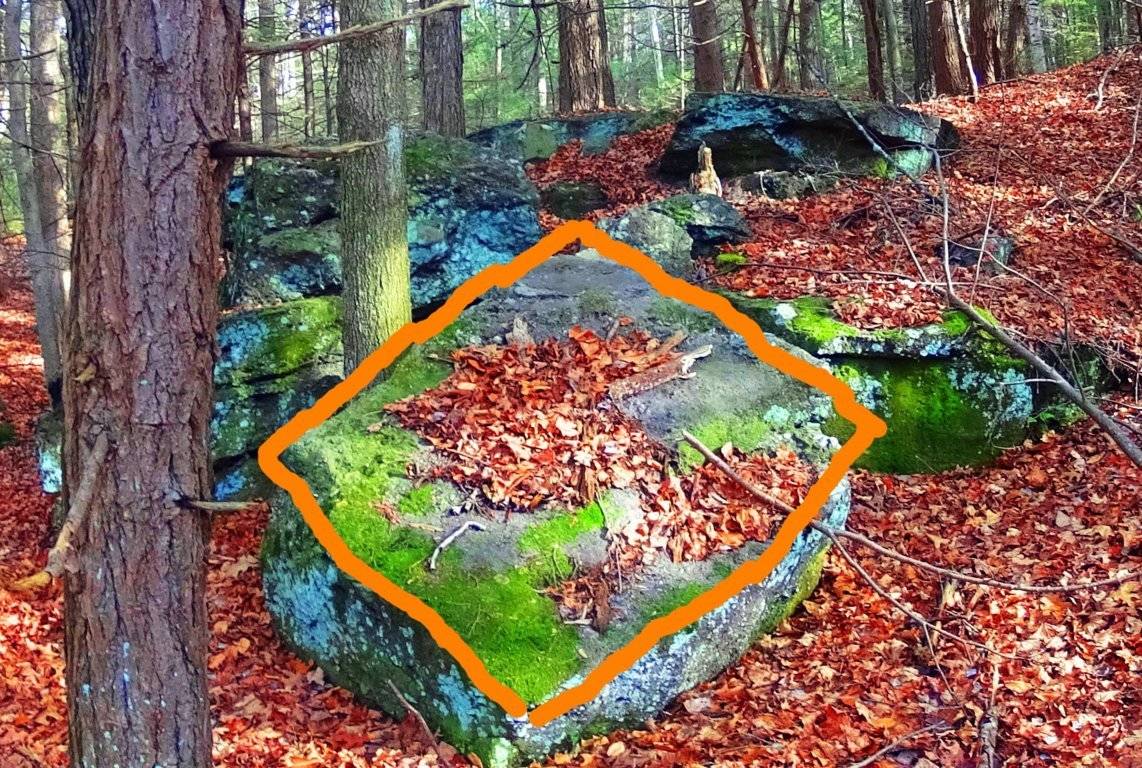
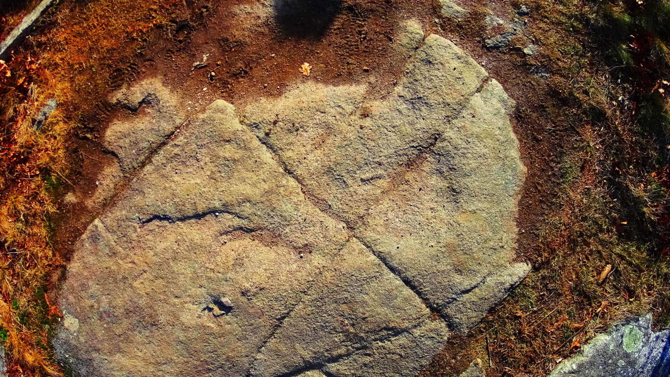
Neolithic Cultures seem to have had the capacity to recognize sites of great beauty. In many places, for example, Standing Stones and Dolmens are found facing the most gorgeous scenes of the heights they occupy. The Standing Stone of the Conwy Valley in Wales overlooks the sacred valley just north of the most revered mountain of the entire Celtic World, Mount Snowdon. (Image/Below) That’s pretty significant placement…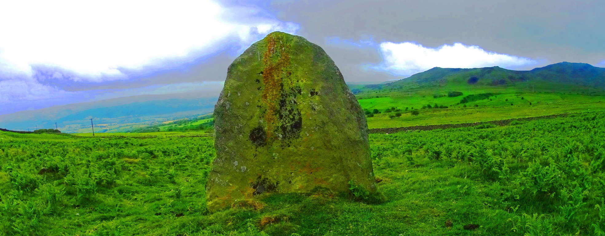 Here at Clark Peak Trail, standing distinctly above the glacial rubble is an equally significant statement, a Standing Stone that was almost certainly placed to acknowledge the incredible beauty of the valley beyond, along with the elevated basin on which it sits. This is an incredible statement of epic proportion that signals an anthropological link to the cultural practices of a Neolithic Culture a Continent, and Ocean away. To find this here was one of the most exciting moments of my life. It vindicates the idea that the heights of the world, mountain ranges in Celtic, Semitic, and Native American places, were once occupied by a Neolithic Culture that had significantly similar practices in marking-out sacred territories with megaliths. Those who dismiss America as a place void of Celtic-esque culture are slowy being dismissed as academic charlatans, theorizing from afar, never to be found in the heights where the answers are, only in the cities where the money is. This may be the worlds first international glimpse at an absolutely gorgeous American Standing Stone in the heights of the Colorado Rockies, on Clark Peak Trail, of Medicine Bow National Park. (Image/Below)
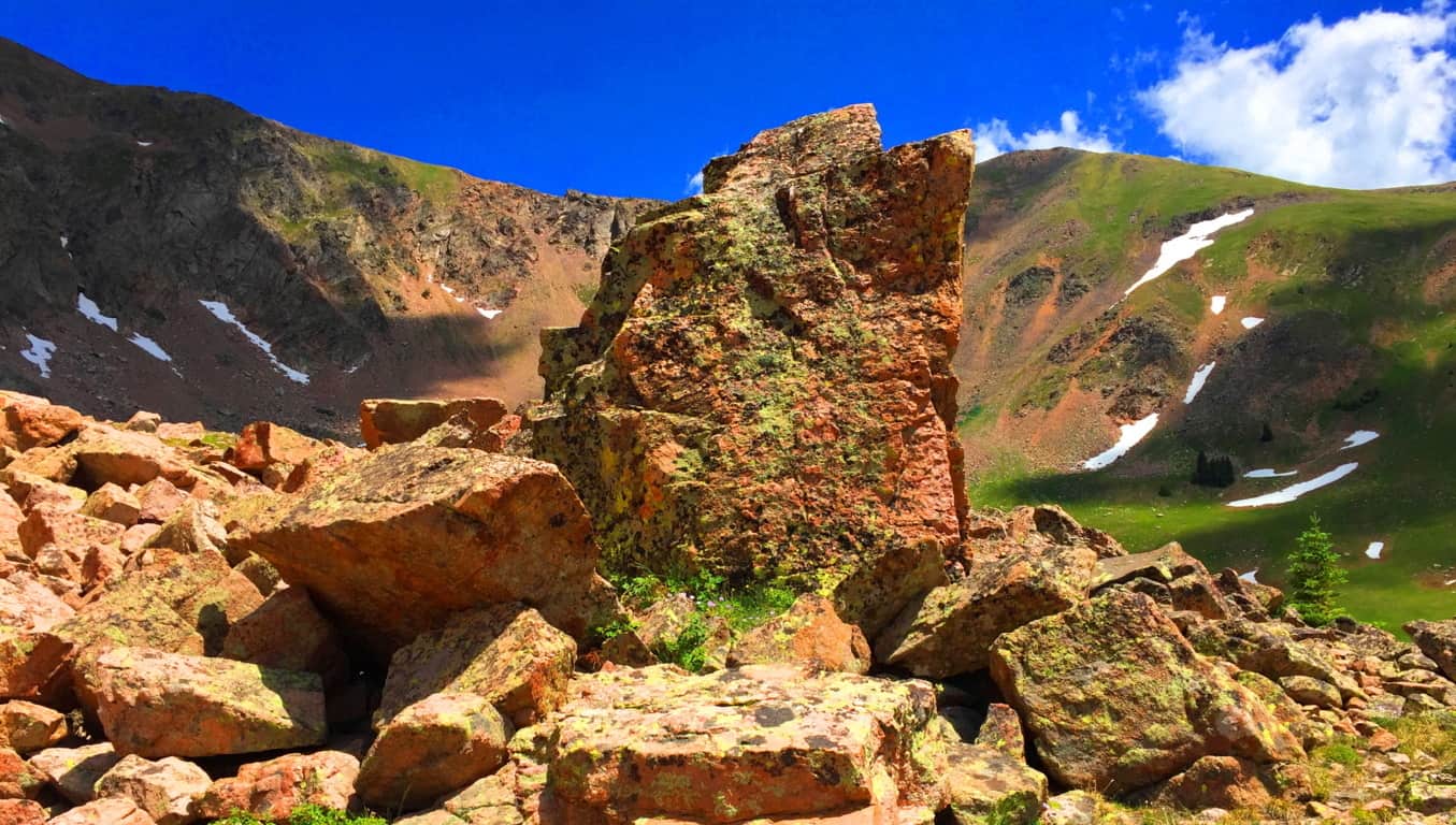
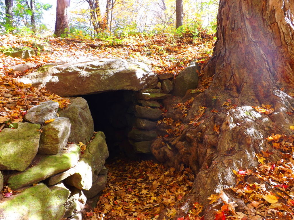
This Standing Stone is 6 feet high and 4 feet thick, looming on the left ridge just above the main Trail along the upper basin fields. The most distinct crafted cut of this Stone’ is along the entirety of Its right side. At the top of the Stone’ there is a distinctly straight top ‘cut’, with an indented ‘top’ slant above it. The left side contains two smaller ‘levelly’ crafted indents. It is so distinctly different than any of the other stones in the basin that I was left to wonder how it was possible that not one person had acknowledged it before?! Additionally, like so many Standing Stones, there is a distinctly marked Cairn on the ledge below, a fairly large crafted cavern where the designers of this Stone would’ve kept objects of value tucked-away. A set of large parallel streaks marks the stone above the trademark opening at the bottom right of the boulder. Do you see any streaks in any of the stones around the area? No, you don’t. The stone is marked for a reason, it was obviously a valued setting in the basin for whoever claimed it. This Cairn Colorado was one of the largest I had ever seen. Other Cairns of this nature could be found in Ireland, New England and practically ever other Celtic peak. Take a look at these very similar Cairns to be found in Ireland and New England: It is true that they look very natural, but their attributes are almost always the same, containg an emblematic “side” which covers a specific gap on the right side, and are in areas where other amazing stones have been blatantly crafted. These Cairns are almost always found near sacred stone statements in the landscape, meaning they are indicative of a specific area that was inhabited by craftsman of the Neolithic Era.
 From the Standing Stone here in Colorado, the last portion of the Trail runs up the Basin. Tucked into the Basin is a lovely hidden lake, which at one time would’ve been a perfect source of drinking water for anyone trying to occupy these heights. All the elements for survival are there. Make your way up the final narrow pathway, where beneath a ledge of millions of stones, none of which look anything like the ones that we have identified as ‘crafted’, sits the stellar pool. Here is the final elevated path into the high basin the image below:
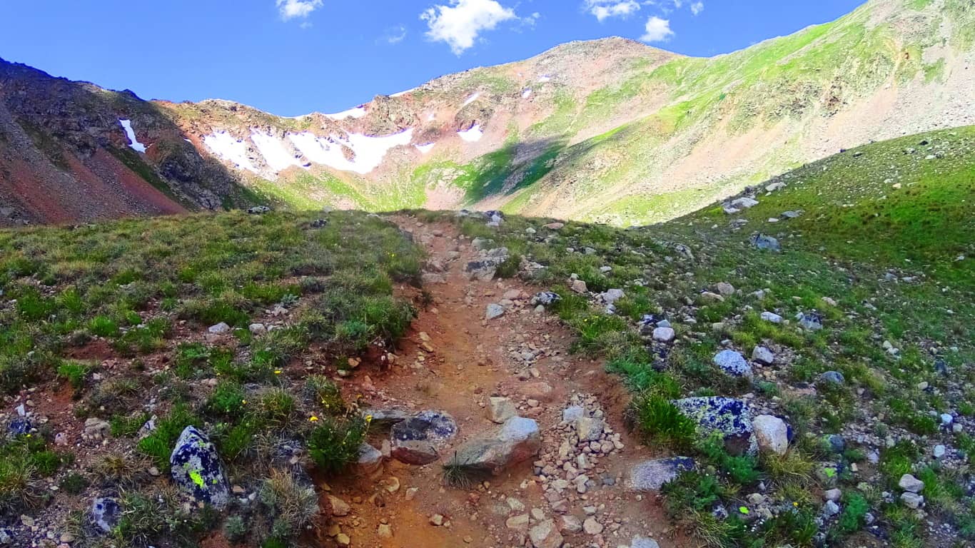 And here is the reflective pool. Imagine looking down on this pool on a clear night to look at the stars! It may very well be that the Standing Stone is pointing to a specific constellation in the night sky, or some meaningful designation of that nature. It would require more time than I had on this fine day to discover such things. But it is truly safe to say that most Standing Stones have a multi-contextual meaning, and here in Colorado, with a crystalline clear sky in July, that possibility is very real.
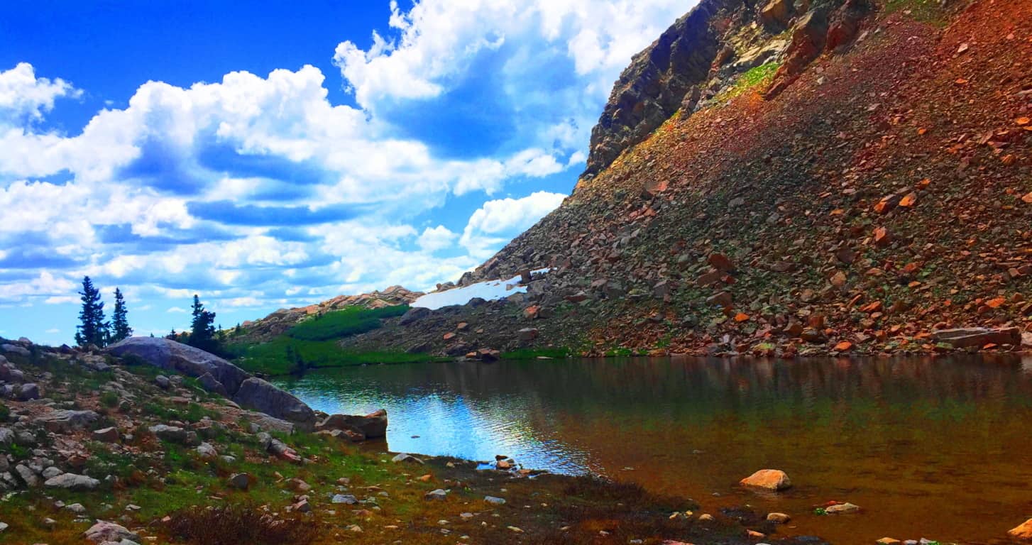
This is one of the highest basins in Colorado, and the country. Like so many beautiful Celtic trails, things here slowly blend into child-like wonder. You are humbled. A look back from the Lake displays a gorgeous jade animation of the entire basin, with the High Plain of the Rocky Mountains beyond, along with drifting clouds that practically touch the upper crags. There is a very real temptation to break all convention and remain in this place, however reclusive it may sound. If a Neolithic individual did decide to live here, the set up for a fantastic existence seems perfectly clear; you could keep a flock in the lower basin, keep a fire by the upper lake, drink a never ending supply of water, and monitor the entire scene from the Standing Stone vantage. Logically it makes sense here.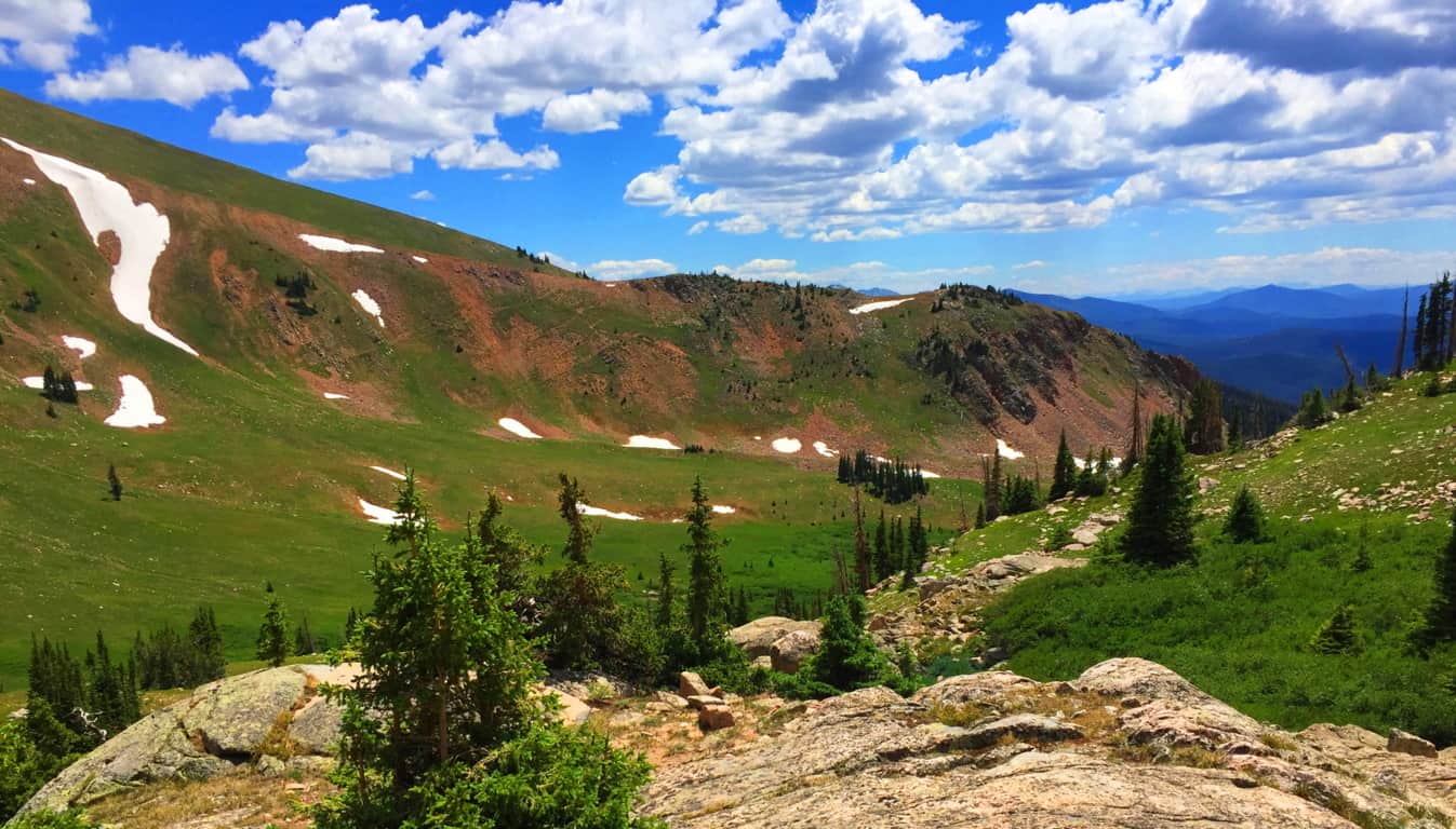 As someone who was trying to scale the heights of Glen Coe Scotland while caught in a rain storm exactly one year earlier, I could not help but feel that Clark Peak Colorado is one of the most comfortable challenges you will ever engage in the month of July. The air temperature and quality in near perfect, pristine, and so delightful. The wildflowers exude an overwhelming spectrum of statements, where entire mountain glens are covered in violet, steel-blue, glowing wild yellow, and subtle bits of auburn.(Image/Below)
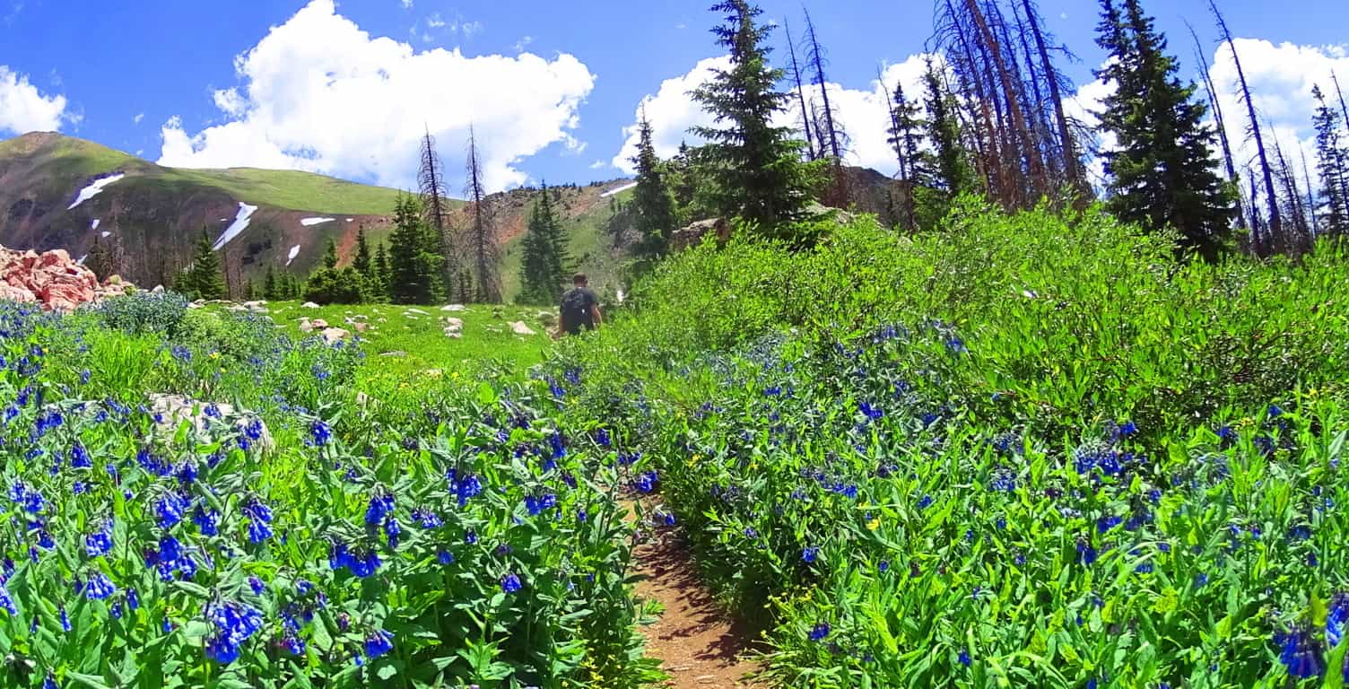 It is understandable if readers are still not sold on the idea of a Neolithic Culture in the heights of these mountains. To some people they might see a mere stone where there is an actual cultural statement. It has taken six years of challenging research in some of the most off-the-grid locations on earth to finally begin to see the patterns of a very real Neolithic Culture. Only after dozens of expeditions have the specific memes begun to reveal themselves. It is not just the evidence itself, but the context of the evidence: the position of a stone in a particular way in a valley; the paring of stone statements in not just one valley, but dozens. There is a very real consistency. It is hard to tell if the Standing Stone here at Clark Peak was there before the rockslide, and was later engulfed by the rush of stone, or if it was placed squarely into the stones after the fact? But the most important, and truly obvious thing, is that there is no other stone even remotely like it in the entire basin, which is what I mean by context. And moreover, the place where it stands, like so many other Standing Stones across the world, is most likely the most advantageous, as well as beautiful, vantage on the entire valley; it’s as if someone wanted to claim the best of what the valley had to offer. I’ve seen this in literally dozens of mountain ranges. The overall point is that hiking and ‘striding’ will take YOU there. You can go and size up the strangeness of these megaliths for YOURSELF. You don’t need my opinion, you can get there and judge on your own! When you do I believe the realness of these statement will hit you….will make it real.
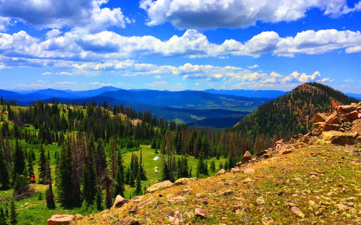 Clark Peak, from the second level trail-head, is one of the single most relaxing and cool hikes in the entire world.The reward in this place far outweighs the work, which is not usually the case for international hiking. Aside from the evidence, there is also that feeling of total tranquility in the Colorado heights, a feeling in all honesty, I have only felt once before in my life, ironically, by the Standing Stone in Wales, at the top of the gorgeous Conwy Valley. At Conwy, a Standing Stone and a Cairn both sit atop the heights, just like in this gorgeous basin in Colorado, paired together like a chair and table, but in an ancient-stone kind of way. So… plan a week or so at the cottages of the tiny American hamlet of Walden Colorado. Take the time to do what it takes to get to the trailheads for Clark Peak, which sits at the eastern edge of Medicine Bow National Park, one of the most scintillated and stellar National Parks on Earth. Find your way, and the way, amazingly, will find you. Go strong. A special thanks to my great friend and confidant Christopher Frohlich for providing his style, skill, and understanding of the grand Colorado landscape. Couldn’t have done this without you Fro’, thank you.
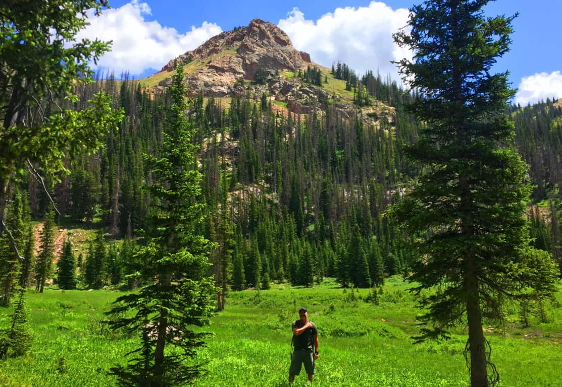
New Grange
Location: County Meath, Ireland
Note: Every so often, with a little luck and determination, you come across things that give cosmic pause. This article is dedicated to those rare moments rather than the beautiful trails to be found in Ireland that are usually reviewed. Hiking starts to take on a next-level significance when you stumble upon practically impossible things. Sometimes they are small things, like perfectly circular concentric rings imprinted on a stone, high above the Black Valley in Killarney.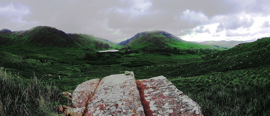 (Image/Below) Sometimes they are jaw-dropping big things, like the balancing Capstone on a giant-sized ‘Proleek Dolmen’ on the boarders of the Mourne Mountains, north of Dublin. (Image/Below) This Dolmen is one of the most massive and well hidden miraculous secrets in all of Ireland, with a 40 ton capstone standing at roughly 15 feet high! Incredible. And yet this pales in comparison to the temple at New Grange.
 The more you look at that specific area north of Dublin, the more amazing mystery you will find. Just as Egypt’s mystical culture was birthed out of the Nile river, and Babylon’s from the Tigris and Euphrates, Ireland’s incredible spiritual origins were born along the Boyne-River-Valley. Although the Boyne-River-Valley culture was most likely not featured in your mandatory History 2.0 undergraduate course requirements, it definitely should’ve been. Egypt has the Great Pyramid; Babylon had it’s great Tower, and Ireland has the incomprehensible, magical, mystical, temple of New Grange, literally tucked into a curvature above the Boyne River.(Image/Below) New Grange also sponsors other megalithic masterpieces like Knowth, which is an incredible megalithic chamber also located on these grounds.
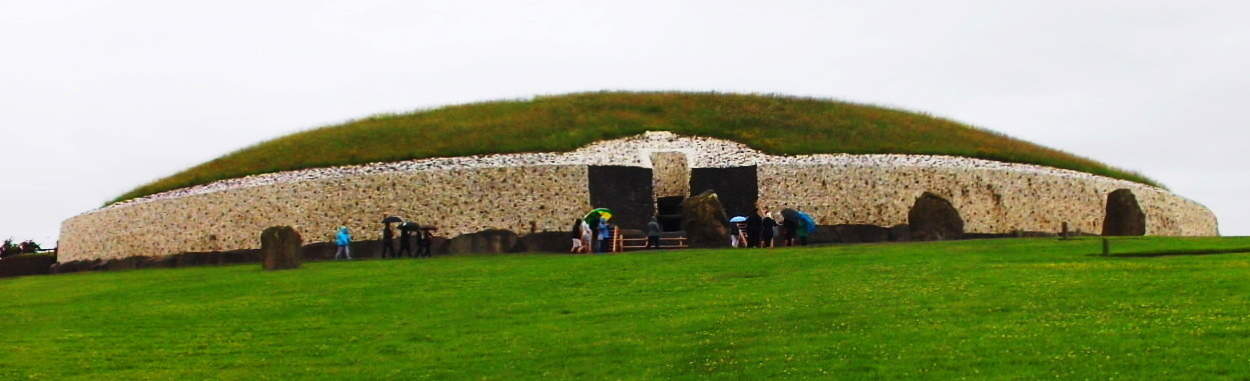
The hedgy river-road that runs along the Boyne River from the hamlet of Rosnaree, just a mile south of New Grange, is the best, and only way to get there. New Grange sits on the highest elevation above the solitary hedge rows and roads without names. You can walk these practically fictional looking hedge-row-paths for days if you are looking to get some trekking in before seeing the Temple, but beware, it would be easy to get lost in this green labyrinth of fields and cart-roads with no names, so make sure you have your device on you to at least navigate at all times. 
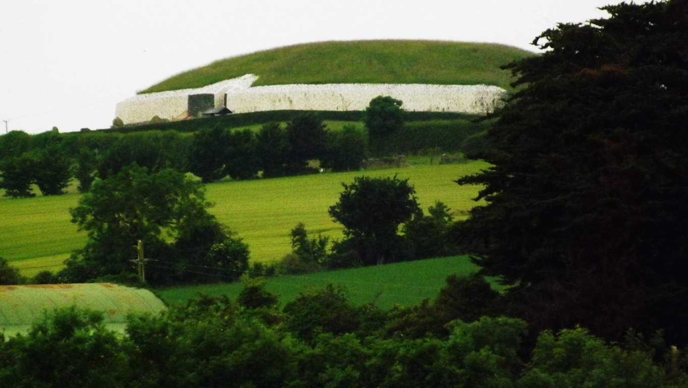
If you are ready to go directly to the Monument go to the Bru-na-Boinne Vistors Center along Staleen Road. Here you will find a ticketed bus line which will take you there. The ride is only 10 minutes, through the hedgy maze. When you arrive at the top of the hill you will be looking at nothing less than a Temple which has stood 2000 years before Moses climbed Mount Sinai. New Grange is older than Stonehenge, The Great Pyramid, and The Parthenon, which puts it in the running for the the oldest Temple on Earth. 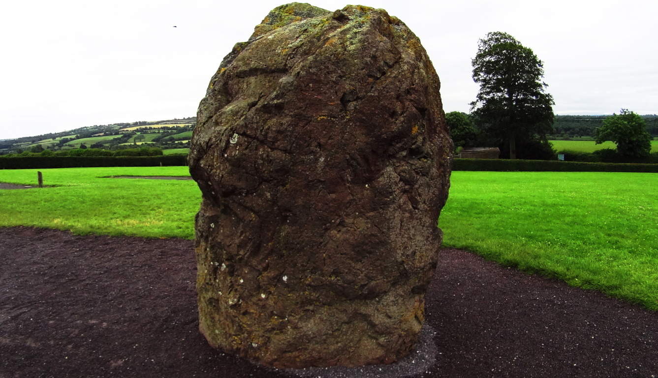 That’s quite a title. The way history has been explained in recent years, you might think that the oldest temple on Earth would look fairly primitive, as human history is generally thought to have gone from basic abilities to very complex ones, but the actual fact appears to be the utter opposite. The construction of New Grange is a study of the highest levels of engineering and accomplishment, bordering on the impossible for a culture not yet capable of using metal tools!? This is a circular mound centered on a main-chamber pathway constructed of roughly 34 level megalithic slabs, each weighing roughly 10 tons (20,000 pounds). Imagine 30 Proleek Dolmens lined perfectly together! Some of the slabs came all the way from the Mourne Mountains to the north, as well as other far off sacred zones. These facts alone start the mind reeling on the impossible story of the stones, which were moved from afar, and finally fit in dry-laid corbel fashion with such perfection that the light of the Solstices shines straight to the heart of the chamber two times a year. This Temple is a celestially connected megalithic miracle. It is surrounded by several massive Standing Stones which are roughly 15-20 tons, and most of them are over 8 feet in height. Moving these stones alone, to what is the highest elevation in this small River Valley, is hard to imagine.
 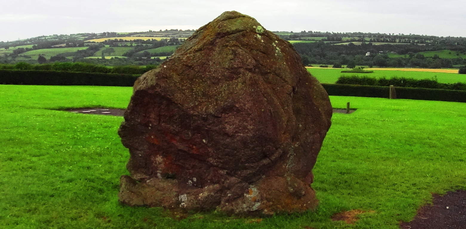 These Standing Stones are territorial markers, and once upon a time, if you passed by these Standing Stones without permission it would certainly have cost you your life. The larger the Standing Stone, the more serious the warning, and sacred the place. In this regard, you will realize that you are standing on truly holy ground.
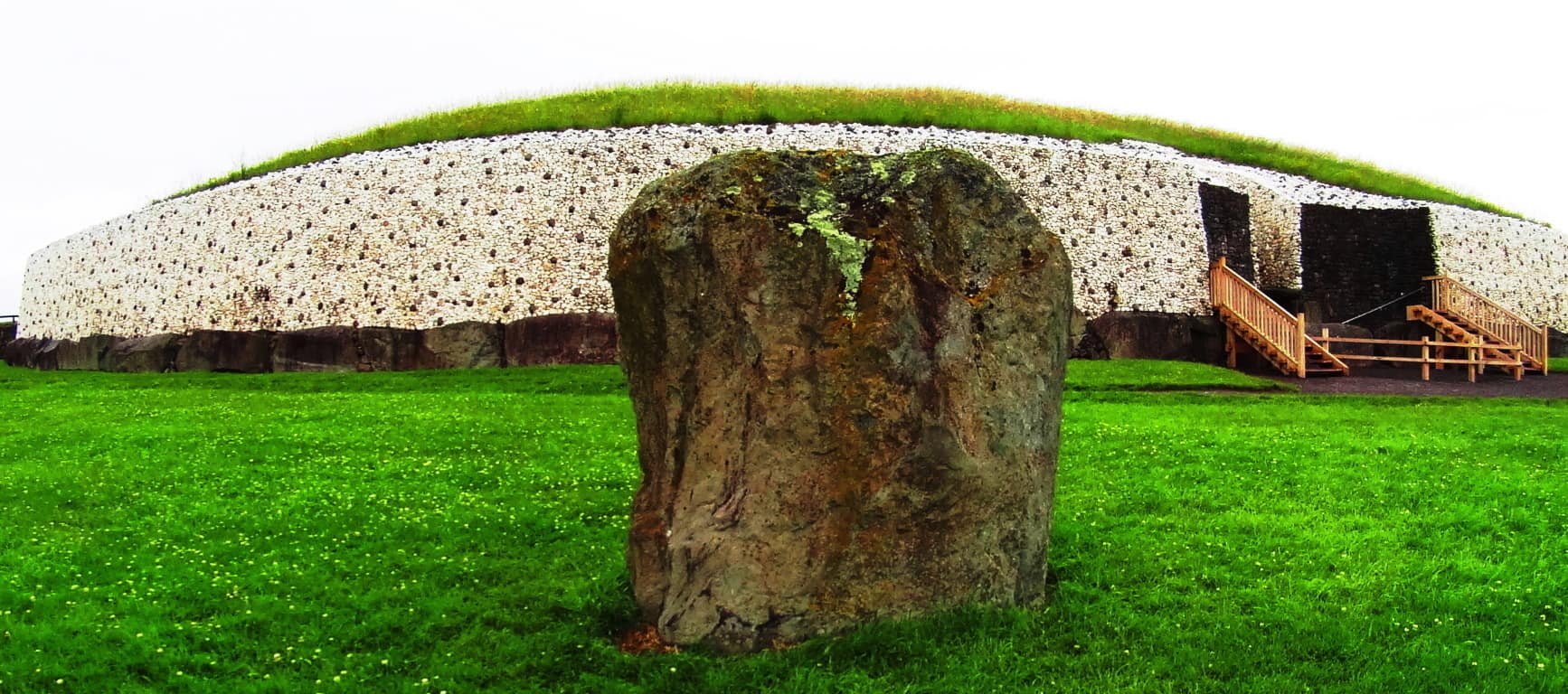 The exterior of the Temple is now lined in a modern white-quartz stone ring. The original Temple was much more concealed and blended into the hill for strategic reasons. It was literally part of the valley. The monumental stone slab at the entrance is one of the most important Celtic relics in the world, with gorgeous iconic Celtic rings imprinted into the megalith. This iconic stone is laid-out in a protective fashion, guarding the entrance, but is also clearly a display. It is a truly magical statement from the beginning of time. Imagine a solitary bean of light on the solstice day shining for only half a minute above this beautiful stone, making it glow, and continuing into the heart of the chamber! It just doesn’t get any better than this. And what’s more, the chambers in New England frequently have the same precise solstice feature. The connections between Celtic and New England antiquity cultures just grows from here, literally.
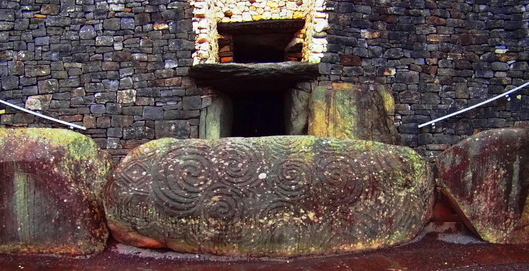
There are several other monumental stones with designs on them around the exterior of the Temple. with specific geometric features to observe on these stones, aside from the spirals. 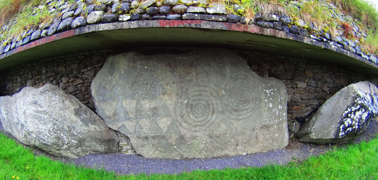 A closer look at this slab opposite the entrance reveals several iconic shapes, and more specifically, interconnected equilateral triangles, as well as mesmerizing Celtic spirals. These are not the only triangles to be found on the megaliths at New Grange. To see the others, we will need to step inside.
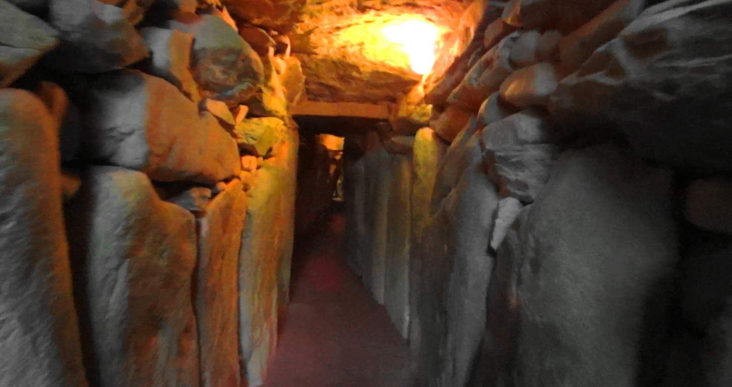 Welcome to the impossible. Here you are entering a chamber of what is the equivalent of 40 Dolmens in one corridor, all fit to perfection leading into a central chamber perfectly aligned to the stars, with a roughly 20 ft high corbel ceiling.
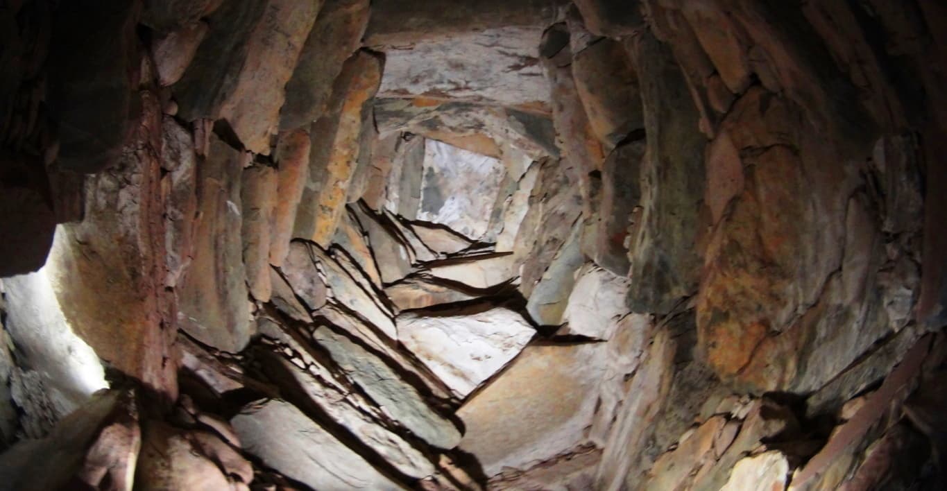 Imagine ancient Ireland, a land where giants roamed across the hills, and dangers unknown lurked beyond the next valley; and then imagine the absolute strength and safety you would feel walking through these impossible stone pillars. Here at least, in the ancient times, you were as safe as any Celt could be. The holistic benefits of living in a synergetic stone temple would most likely be wonderful, in comparison to the huts and wood fortresses of less fortunate clans. At the end of the long singular corridor from the entrance you will encounter stones with imprinted triangles and diamonds before entering the central chamber.
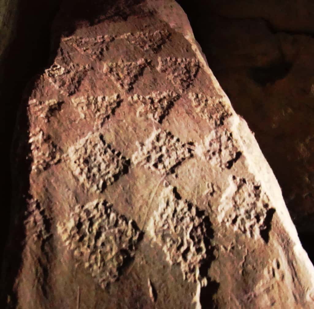
Imprinted on this entryway stone at the main-chamber are distinct equilateral triangles that are seemingly transitioning into diamond shapes. There is profound connection here to the megalithic sites in New England, which utilizes this exact same meme at practically all the megalithic sites. Specifically in New England, you will find equilateral triangles etched into granite by waterfalls, and massive diamond cut stones along ancient trail ways. This is the central megalithic meme in New England, and here are those very same shapes in the heart of the oldest megalithic chamber in the world. Here are some examples of New England megaliths cut exactly into triangles and diamonds.

The evidence is too strong to dismiss. It seems highly likely that the megalithic culture that existed in Ireland had a relative culture across the Atlantic in New England. The question will arise: what is so important about triangles and diamond shapes? It might be that the Triangle is the first shape to develop from any linear set of points, and this culture was the first to develop in linear history, and so they claimed the Triangle as their calling card symbol. The ‘diamond’ is the result of the functionary crafting of cross-sections and equilaterals. If you cut a proper X into a stone, the result is four diamond shapes that are consistent with each other, and these utility cross-sections that create diamonds are found all over New England mountain trails. It as if the Neolithic culture were marking zones and territories as a warning to those passing through, and letting us know that the original culture once claimed this area.
Anther stone in the interior of the chamber at New Grange displays dozens of whimsical triangles and diamonds cascading all over the stone. This just can’t be a coincidence; there must be some relation between New England’s and Ireland’s oldest cultures. 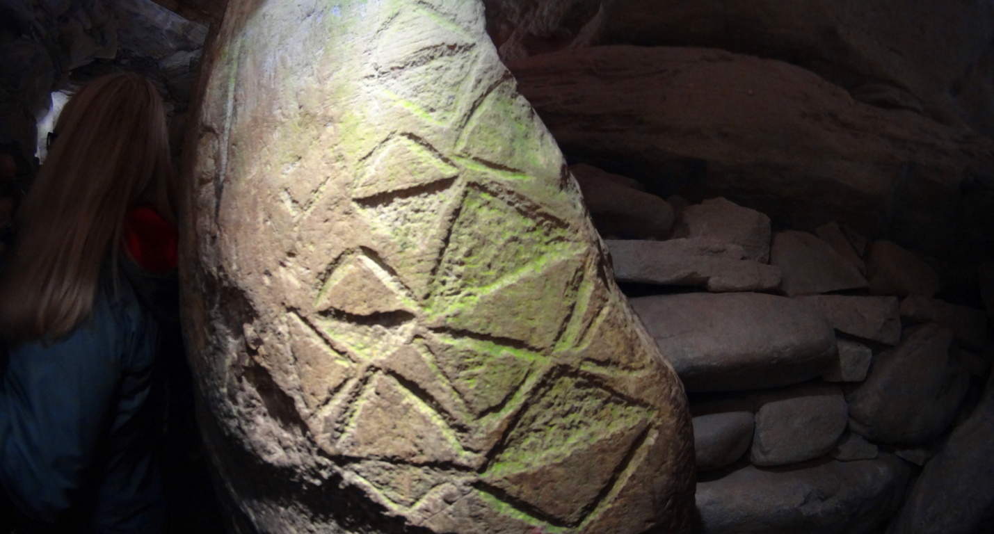 Neolithic Culture: Here is the part of the article that gets surreal and a bit ‘heady’. The history and chronology of how neolithic cultures relate, if they relate, must be found in their works. The works are obviously similar in structure, and also in symbolism. As New Grange is considered the oldest temple in the world, it seems logical that these geometric themes originated here, and spanned-out to the rest of the world. If this is true, then the pre-Celtic neolithic culture in Europe is the original ancestor of the neolithic culture that somehow crossed the Atlantic and ultimately made it’s way to New England. Their works are massive, beyond human in scale, like the Standing Stones outside New Grange.There is also the philosophical aspect of the Triangle, which is a shape specifically relevant to consciousness and divine comprehension. Is the neolithic culture referencing a direct connection to God Itself, like the neolithic tribes of Genesis? This is an intense reference, but according to the Bible the first generation on earth was the ‘Nephilim, meaning: “those who fell from heaven”. The offspring of these angels came from their copulating with human women, and that offspring was said to be Giants. (Genesis: 6) It sounds like extreme science fiction, and yet that’s exactly what the biblical accounts say. Moreover, when the Israelites went into the Promise Land and Joshua scouted out the territory, he found tribes of Giants. Joshua says the tribes he encountered made him feel he was ‘the size of a grasshopper’. What is going there?
With that in mind, you might eventually ask yourself: are these works the productions of these Giants in both Ireland and New England? Why are so many myths based upon Giants? The relations are there, and the relevant meaning of the chosen memes and symbols are there too.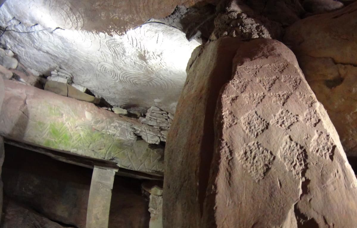 The hard part is, it utterly changes the current story of history, which is evolution based. New Grange is truly an otherworldly ancient temple that evokes wonder and humbling respect for the course of hallowed Time. Our particular modern era looks increasingly like ‘life in a controlled bubble’ when we look at the grand scheme of History. Almost all of our information is pre-packaged and funneled into specific themes, and if you disagree with them, you will be found to be disagreeable and ultimately failed in your assigned studies. The revised history that is given to our children is a set of theories sponsored by commercial academic institutions. The ‘technological era’ is a mere blip of 100 small years at the tail end of 40,000 years of human culture. When we look closely at what the antiquity suggest, it increasingly looks as if our culture is intentionally turning its back on the evidence in order to passively inject a more “convenient” theory of culture, based on erroneous assumptions. New Grange is one of the holiest places in the world, as a temple that has been here since the beginning of anthropological history, it is exquisitely rare. If we are truly sincere about going where the evidence leads us, then we must be prepared to challenge memes that don’t add up. Stonestrider.com isn’t a religious website; it’s about finding the best trails and photos you can, but it is impossible to deny that places like New Grange challenge so many things we assume about human progress. So, even if you are in Dublin just for a few days, plan a morning to visit New Grange. It is something, even with all our modern answers, we still don’t completely understand.
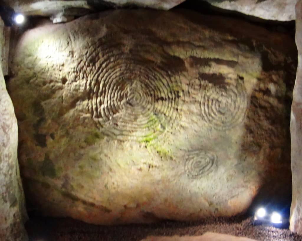 Something incredible, almost otherworldly, took place in antiquity in order to build this temple. Walking into it’s main chamber is like walking into a miracle. It just doesn’t get more sacred than this, and a hillside is sometimes so much more than a hillside, so keep hiking.
Hulapai Mountain
Location: Aspen Peak/Kingman, Arizona/USA
Elevation: 8,417 ft
Prominence: 1700 ft
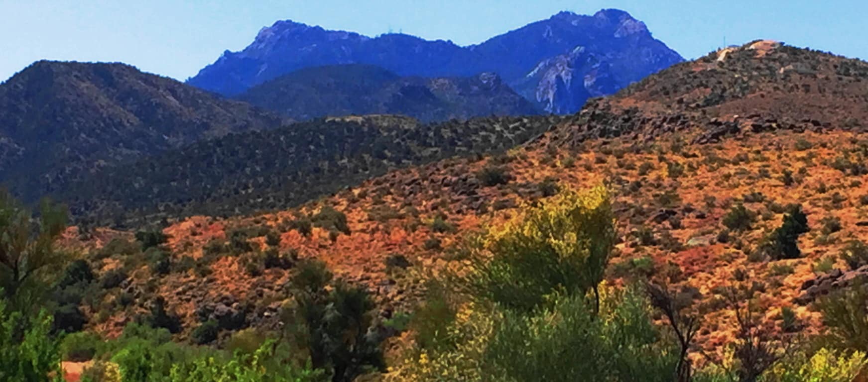
Note: Half a world away from the ancient Celtic Ranges, where Standing Stones guard the mythical heights of Wales, Ireland, Scotland, and England, are the epic mountains of the American West. Among the vast options of the grand natural spaces that dominate northern California, Montana, Oregon, and Colorado, are the mysterious high Ranges of Arizona. The Hulapai Range is a few miles south-east of Kingman Arizona. From Kingman you will take the ‘Hulapai Mountain Road’ straight into the heart of the Range, climbing slowly upward into a set of elevations that look like an American Mount Sinai. The comparison is a good one. The air here is absolutely void of humidity. With temperatures that climb up to 116 degrees in July, the trees, some half burnt, radiate a charcoal scent which carries on the wind; and you can taste that scent on the back of your tongue. 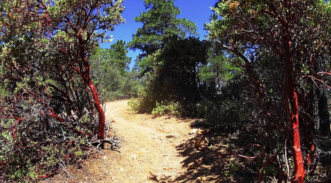 Amazingly, there are some similarities to Celtic mountain ranges here, if you have the right perspective. There are other-worldly rock fixtures, free standing boulders that stack the mountainside, and an amazing magical stone near the peak, which you will see in this article.
 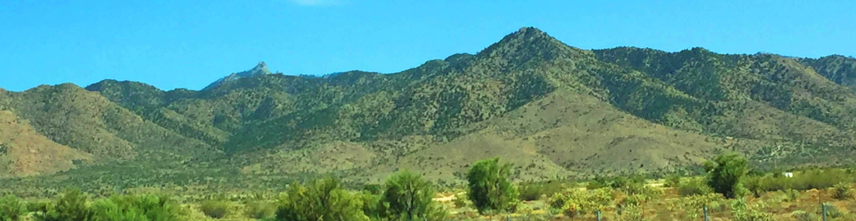 Aspen Peak Trail at Hulapai: As you approach the Range you will notice golden glades, not purely green zones. The bright Ponderosa forest at the belt of these mountains is spacious and inviting . In Celtic Ranges, the signs of the Neolithic Culture usually increase the further up you go. By this logic, if there is Neolithic cultural evidence at Hulapai, the highest peak would most likely yield the most evidence. Aspen Peak is the highest vista in this range, and the focus of this hike. Make sure to bring at least 1.5 gallons of water along with a sports drink for necessary electrolyte/sugar replenishment. Ration your intake. Also bring an extra shirt due to perspiration, several granola bars/ carb eating options, including jellybeans for when you reach the peak.
 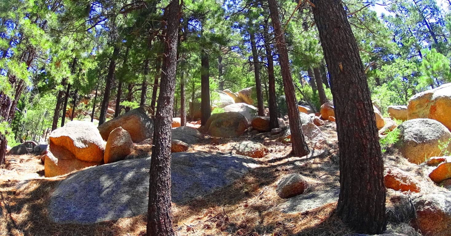 There are options for approaching Aspen Trail. There is a lower entry through the hills and woods off the Hulapai Mountain Road marked by a sign on the left, which is more of a challenge with an extra 1000 ft below the campground trailhead (and about 1.5 miles of extra trail through rocky glades and curiously rounded stones).
  If you want to cut that part of the approach off, you can make your way, by car, passing the Hulapai Ranger Station on the road, and then take the right onto the main campground, which is the more popular entry. After passing the numbered cottages and the RV’s in their designated areas, and you will see the marker for the ‘Aspen Trail’; here you will begin your challenge. Aspen Peak Trail’ is marked with signs on the way up, but remember on the way down to follow the signs that say “Campground” to get back.
The first portion of Aspen Trail is a bold introduction to the Ponderosa Pine “vibe”. Dragonflies with a shiny blue armor orbit dazzling red cactus flowers beneath the forest. (Image/Left) This initial 1000 feet of incline is a winding set of switchbacks and vistas. The boulders here are rounded like leavened bread, adding a unique surreality to the openings in the glades, and there are hundreds of thousands of these rounded fixtures. 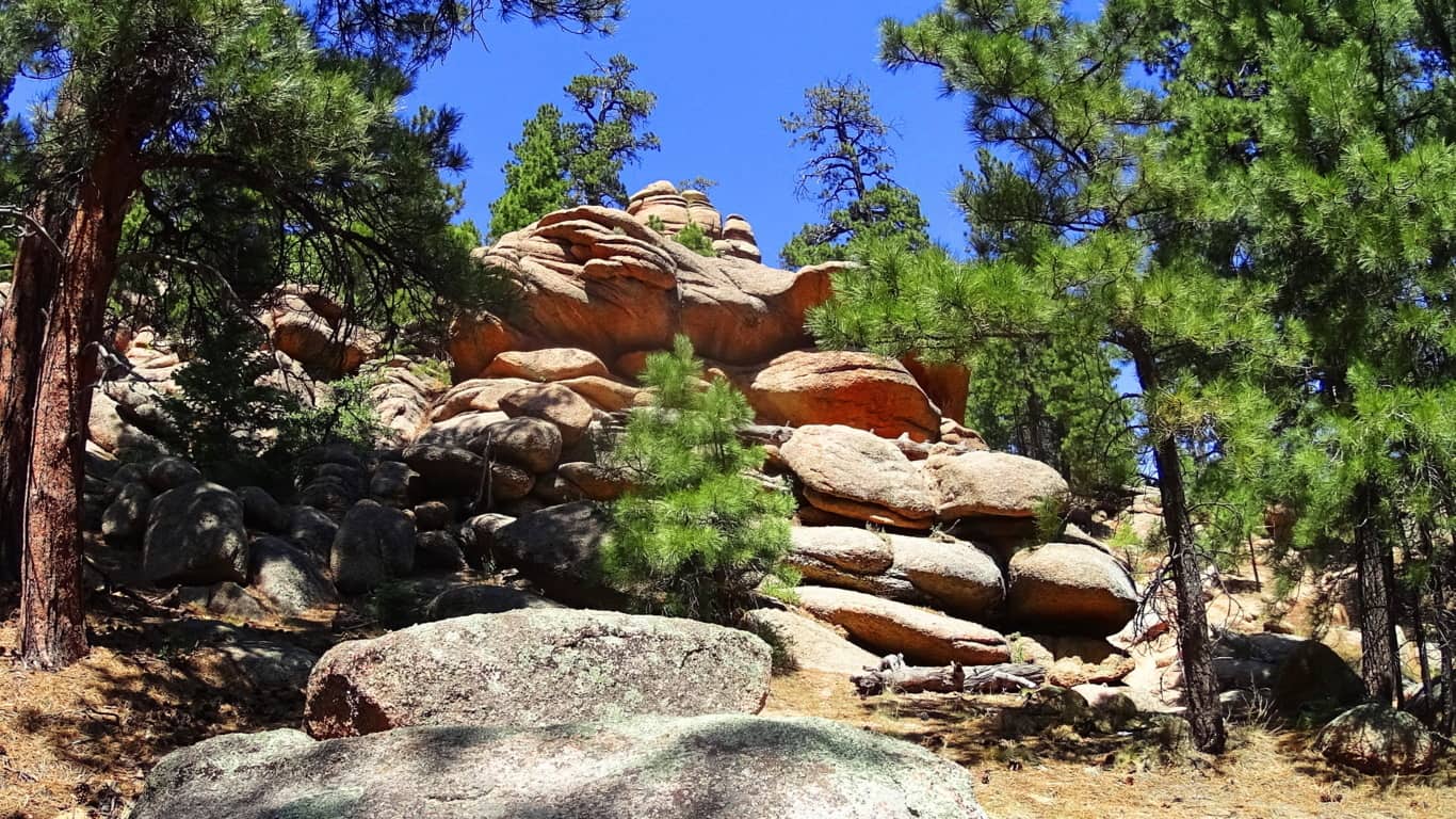
How it is that these boulders came came to be rounded and stacked individually is hard to imagine. As you continue into the 1500 foot level of prominence you will come to the ridge which opens up on the northern view of Kingman and the overall desert plateau.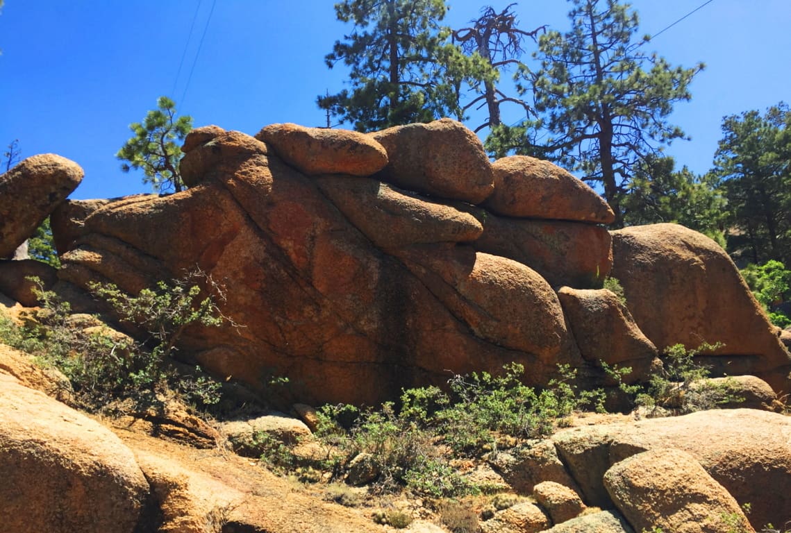 It isn’t just the vastness of this view over the northern ridge, but the stillness that presides over the radiating gold that takes your breath away. Arizona is like “spirituality that happens at a glance”; there’s truly an underlying force that imposes an evolved slowness over everything; it’s the ‘un-rushed’ spirit that survives among the high desert winds. If you move too fast, you just won’t make it. Everything you see is whispering “Pace yourself, and take your time.” The land feels like natures assigned setting for prophecy, which is one hell of a calling card.
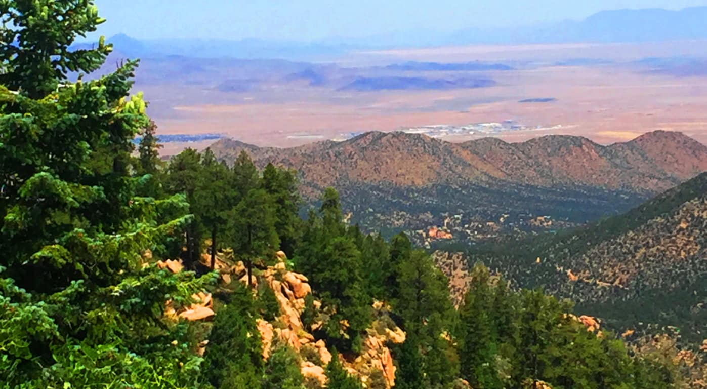
After taking in the northern vista on Aspen Trail’ you will begin to see the peak as you curve slowly around the mountain face, eventually making your way to the southern side. There is a view of the southern ridges beyond as the path first crosses a rickety wooden bridge that is your ‘gateway’ to the uppermost vale.(Image/Below)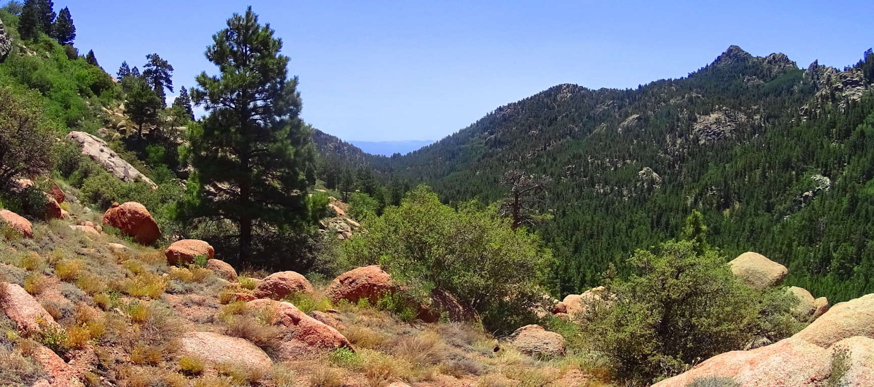
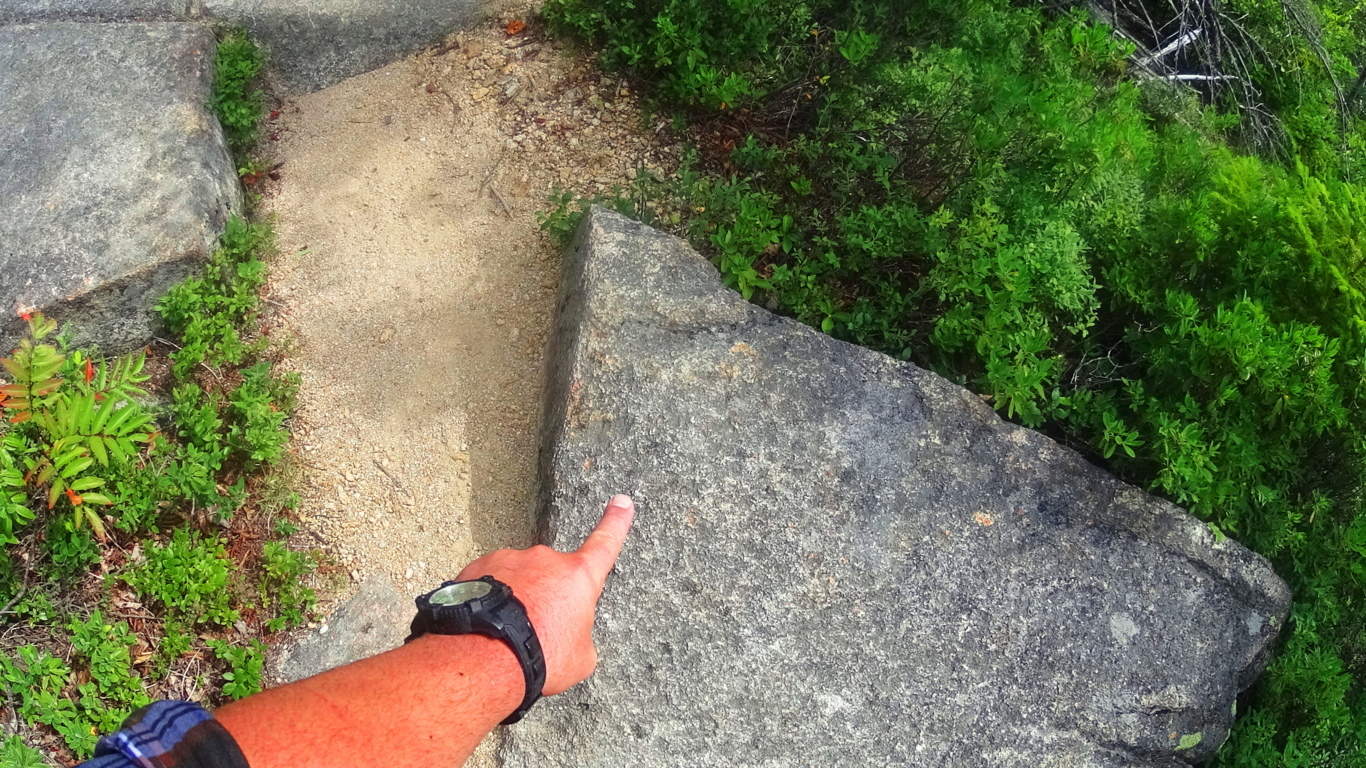
From here something otherworldly happens. Just like in the Celtic heights of enchanted places like the Rowan Valley in Wales, where massive ‘cut’ stones just start to appear out of nowhere, Hulapai seems to support similar ancient stoneworks specifically in the advantageous heights, where anyone approaching would be seen for miles before arrival. There are several stone-linings along the upper path. It is a good possibility that these stones were placed by the Neolithic culture, then supported by the Hulapai tribe, and reinforced in modern times. Clearly the area was sacred for someone if they were taking the time to create stones-works at 8000 feet, which is what we see here.  In Celtic elevations, often times when you find stone-linings that begins to announce a sacred zone, there is a singular solitary statement monumentalizing that sacredness. It is beyond astonishing that as you travel a little further along this last 200 yards of trail you will find a single Standing Stone unlike any of the other hundreds-of-thousands of rounded stones you’ve passed. The Standing Stone is cut abruptly on the top, with a a right angle cut into its right side. It stands about 6 feet high, with an absolutely flat-cut face, like a table standing up at about 4 inches in width. It is totally opposite the rounded features of the common boulders here, in every possible way; and it faces the peak.
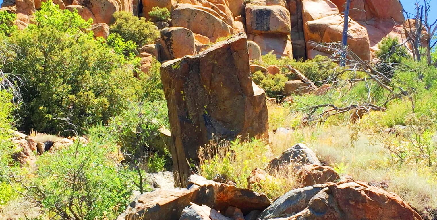
This Standing Stone is most likely one of the oldest sociological statements in all of Arizona, among hundreds of such statements. If it is related to the Neolithic culture of ancient Celtic places, then this stone is no less than 4000 to 6000 years old. It is truly priceless. It might very well be that this is what is known as a ‘Solar Stone’, marking mid-day on this mountain for eternity. ‘Solar Stones’ appear in Celtic highlands, as well as the New England mountains. It is no mistake that from here you can follow the last portion of Aspen Trail towards a grand monolithic peak laid out dramatically before you. 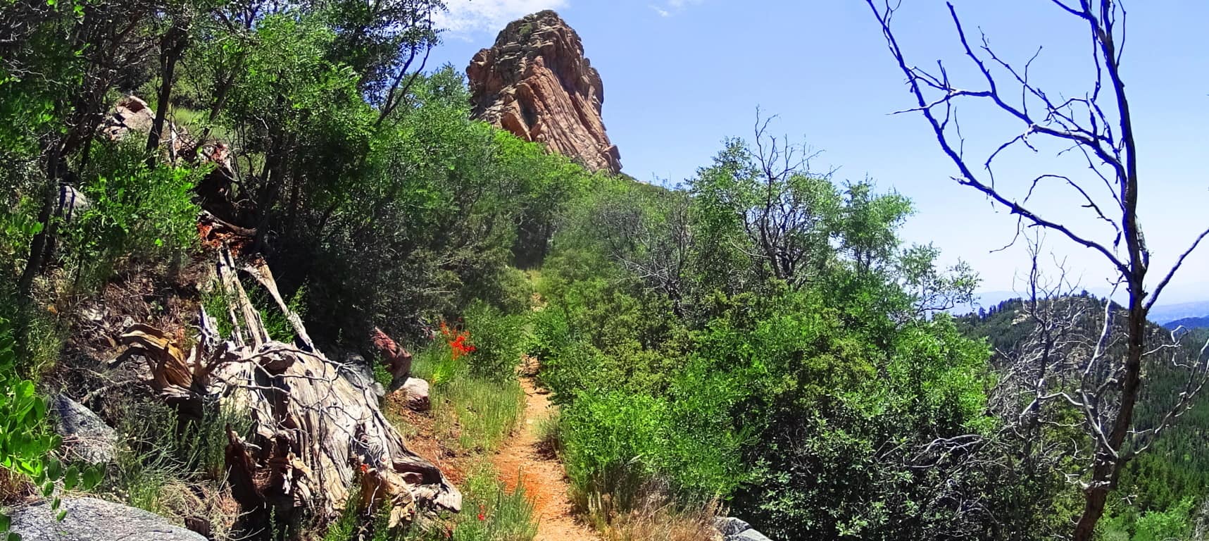 Continue towards this massive pinnacle to make the dramatic Aspen Peak. Even looking at the rock features in this uppermost area, you will see that there is not a single stone cut with right angles at the top and sides, like the Standing Stone that marks the upper trail.
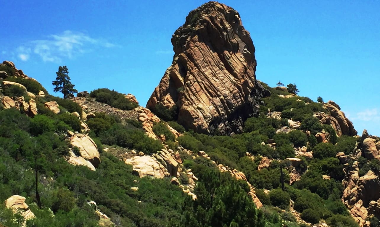
At the peak you are able to see a beautiful northern desert plateau. At this point you are 8,417 feet above Sea-level. 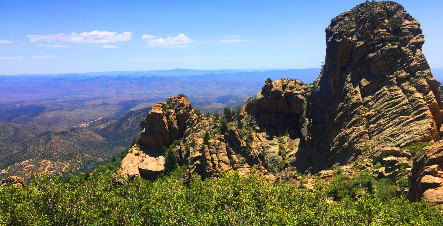
Aspen Trail at Hulapai is a spiritual challenge. You will have to put aside your usual hiking tendencies and regular comforts. Plan carefully. This is a stellar place. There are deer running through the forest below, and a high wind rushing over the desert; it may carry all the way to the Pacific Ocean in California! The Peak here is like an epic guard tower for the entirety of the ‘American West’; Hulapai being on the western edge of the mountain ranges of Arizona, which continue all the way up to the Rockies of Colorado at its eastern edge. The wonders that exist deeper into the Arizona interior are astoundingly worthy of such a “tower”, where the ancients once dwelled, high above the world. Just let it all sink in.
Skyrim
 Location: Skyrim
Note: During the winter of 2014 in New England, 107.6 inches of snow fell around Boston. An Arctic weather system blasted the entire east coast of the United States for six months straight. Temperatures dropped to an average of 30 degrees, and many times as low as -14. Massachusetts declared a state of emergency. Public transportation and public schools were closed. Piles of snow reached 15 feet high on every street corner, and the snow was level with the windows. It was grey and dark everyday. 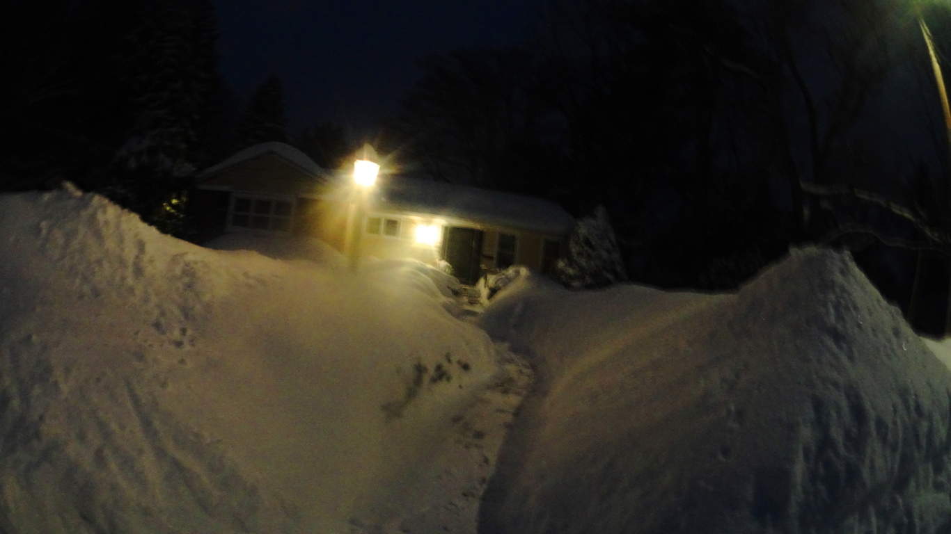 It was a full Arctic winter. Take a look at my home in this picture. Finding things to do inside became a real challenge. Reading is healthy but can get boring after a few hours each evening. Going on-line is fun, but it can give you a headache after extended periods as well. As the winter reached it’s peak in late January, I was going snow-blind, and stir crazy. I had become so accustomed to seeing bright-white literally everywhere, that my depth perception was completely blurry. I realized I needed to find something fun to do inside, something that involved bright colors, as crazy as that sounds. I went to Best Buy to find something playful to do. At the entrance, as if literally waiting for me, was a large poster of what I felt, at that particularly color-starved moment, was the most beautiful landscape I had ever seen. I was completely blown away. I asked the attendant about the poster. He told me that the landscape was from an Xbox ‘quest game’ called Skyrim. He told me the game was a ‘universe of landscapes’ to explore. I spent $550 as if it was 50 cents, and walked out of the store in less than three minutes with a new Xbox, and a single game, Skyrim.
The Birth of Stonestrider: I went home and played the game. It was a Celtic fantasy ‘quest game’, with an epic interactive landscape. At this point in my life I had yet to even think of going to Celtic places, but as I played the game I began to wonder what it would be like. I am a college educated person. I have a Degree in Western Literature. I had read the essential Celtic myths, inclusive of Beowulf, Mallory’s Le Morte d’Artur, Gawain and The Green Knight, and Tolkien’s masterpiece novel The Lord of The Rings, and yet for some reason I had never galvanized my thoughts about the myths of Celtic places, and how much of it might be true. The range of subject matter in Skyrim is awe inspiring. It was obvious to me that the writers of this game did an incredible amount of research regarding Celtic myths. But the Skyrim writers went one step further and made cultural connections about mythical subjects that historians and anthropologists were embarrassed to talk about. For instance, standing stones and free-sitting boulders in Skyrim were not placed at random, presumably from glacial displacement, but were found in places specifically designated by a culture. Those designated spaces were inhabited by giants. Where did Skyrim get that idea from? Certainly not from academic history, although religious history texts have an abundance of content about giants. In Skyrim there are Dolmens, Standing Stones, Cairns, Free-Sitting Boulders, and Stone-Circles, all inhabited by giants, most of which also contain astrological significance. Suddenly Astrology, History, and Anthropology were ignited in my thoughts. It seemed to me that the designers of this game were signaling something to us, saying “wake up people, something amazing happened in the world once”. They had made a seamlessly logical scenario out of the Celtic universe, the ancient and half-forgotten world that we have only guessed at in this late phase of history. I began to wonder if these themes were really out there, in the actual world. If the Megaliths were cultural, then nobody could’ve moved them. I would just have to find them if I could. And that was my epiphany. I decided that when the snow melted, and the Spring finally came, I would go on my own real-time quest to find the Megalithic culture. Stonestrider.com would be born. My life has never been the same. I would like to use this post to just express some of the similarities between the game, and what I found in real time.
Waterfalls: Take a look at this waterfall I came across in the town of Mullaghduff, in Donegal, Ireland. It was totally untouched. No trails, signs, or markers of any kind. As far as I could tell, this Celtic waterfall was in its original state. More fantastic for me were the stones around the main Fall, which seemed curved, and cut, specifically into place, with smoothed arches and right angles actually hanging over the water. I couldn’t see how this configuration of stones would occur naturally. Look also to the left of the main Fall, there is a completely separate stone-cut path with beautifully crafted steps funneling the water. The level elevated bedrock of the main flow of water, combined with the crafted stones which are clearly curved and fitted above it, along with the separate funnel on the left, makes this seem like an engineered area, not a glacial miracle. That’s what I believe this is, an engineered waterway. There are also free-standing boulders that look more like markers heading progressively up the mountain directly beyond this waterway, which makes the area a prime candidate for an ancient Celtic, megalithically cultural center, just like what Skyrim depicts in the game.
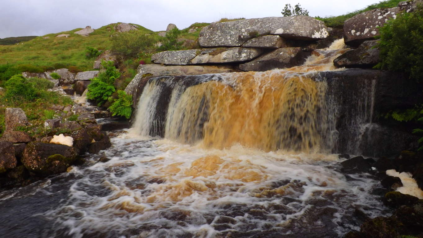 What’s even more interesting, is that this very real waterfall in Mullaghduff has more mysterious components to it than this very fictional waterfall in Skyrim. The main similarity between the two waterfalls is that they both focus on the idea that the water is centered and flowing through a specific, and elevated, rocky precipice, while otherwise surrounded by gorgeous grassy brush and hilly topography beyond. It’s as if both scenes are trying to tell us that something special happens at the rocky points of water-flow.
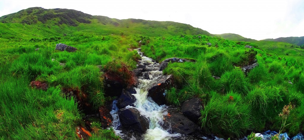
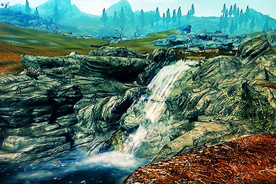 Mountain Streams: Here is a look at a mountain stream headed towards a Celtic alter in the heights of the Black Valley in the southern portion of Killarney National Park, Ireland. Take a look at the stones on the outer edge of the run of the water. The stones are not rounded, but they’re cut distinctly, seemingly directing the water in a funnel towards the center. The most obvious example is the largest stone in the center of this image; it is clearly cut, and with the directional purpose of funneling the water inward. I would also like to point out, that if you were to follow this stream up the mountain, you will come to a massive cut alter, with Celtic rings etched in its side.
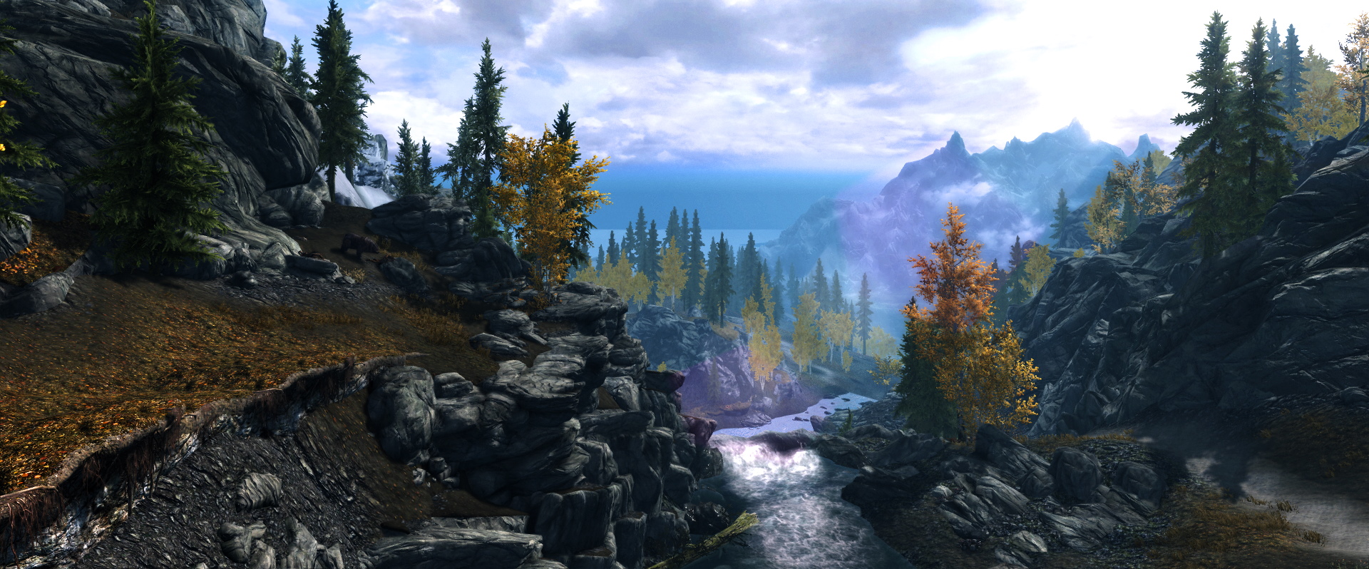
 In Skyrim there are waterways that appear in the elevations, and they follow the flow of specifically dotted stone paths. I really feel that the game’s engineers noticed the stony designation of Celtic waterways. Whether or not they knew that the real life waterways were in many instances engineered, is for us to decide.
Celtic Rings in Stone: Here is a look at the alter to be found at the top of the mountain stream in the Black Valley in Killarney. The rings cut into it are smooth and perfectly concentric, and hardly look like the work of a chisel at all. The rings are thousands of years old and hard to see now, shown just below center of the right slab, if you look close. It is clear that this slab was carved into linear sections, and ‘squared’. Even more incredible is that its location is near the top of a mountain. None of the other stones near by look even remotely like this. One last thing to take note of in this scene is that these slabs seem to be facing directly towards the central feature of the valley beyond, which is the beautiful lake Brinn, splitting the two mountains. There is just so much to consider when looking at Celtic ruins. It seems to me that they are far more than primitive markings. There is meaning in the direction in which stones face, what they depict, and where they are found. All of this is far from primitive, it’s actually elegant.
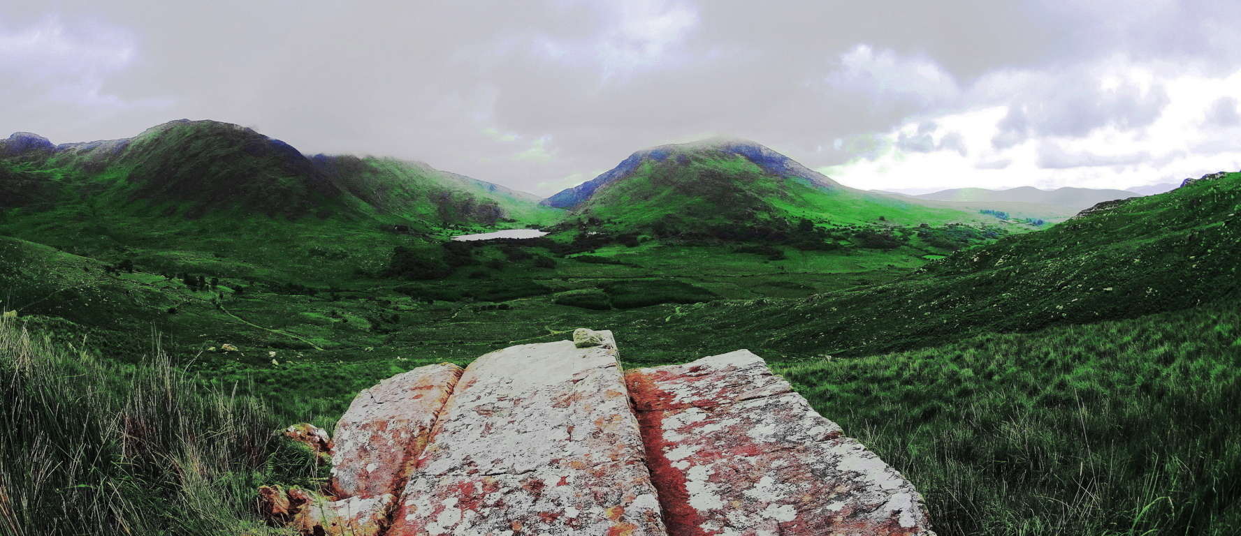 Now here is a view of a squared stone slab with semi-concentric rings on its face in Skyrim. Yet again, the more amazing and mysterious stone, is actually the real one.
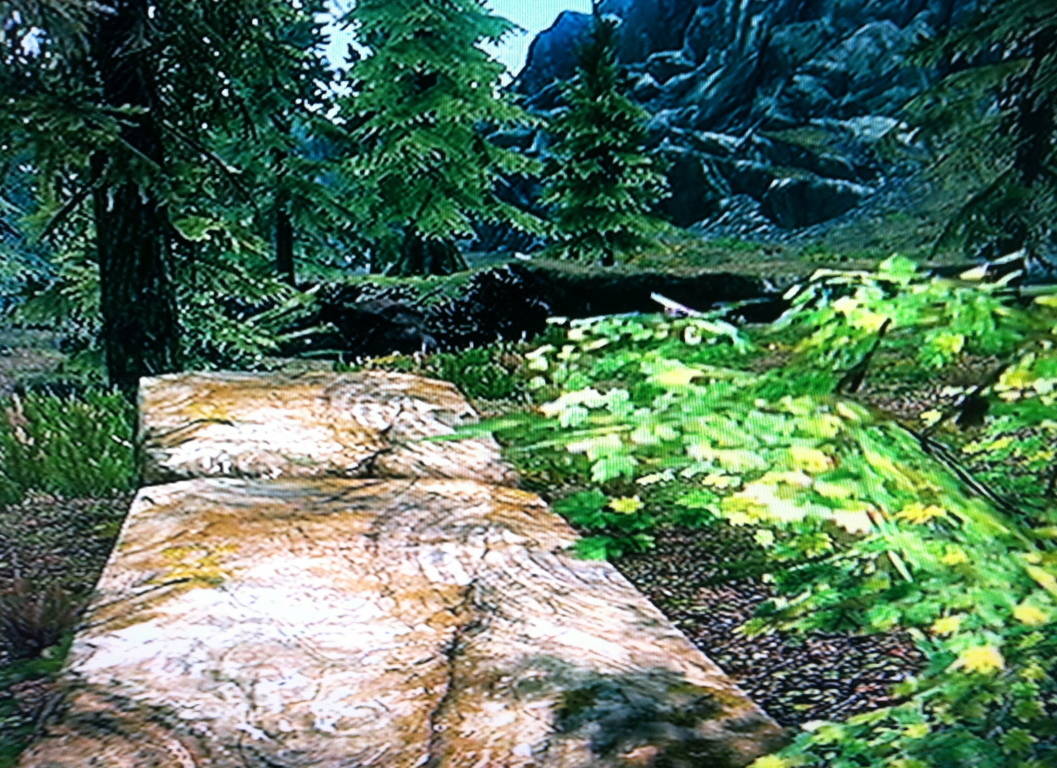 Free Sitting Boulders: I am sure that there are boulders that have been moved by glaciers. But I am equally sure that there are boulders that have not been moved by glaciers.
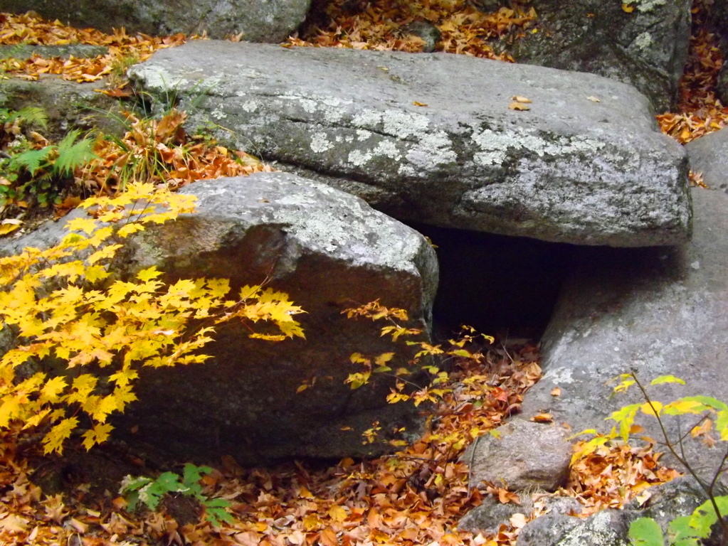
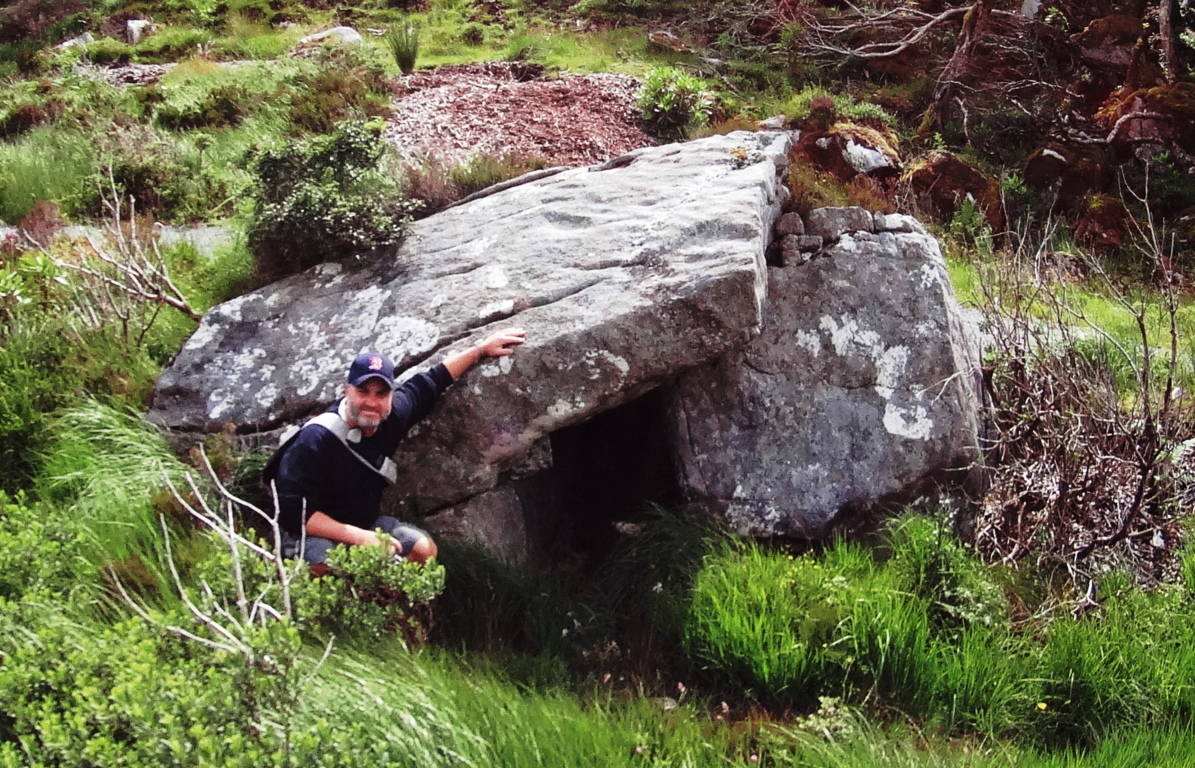
 Free-sitting-boulders can most often be found guarding areas where sacred Dolmens or Wedge Tombs are directly near by. Here is an example of a free-sitting-boulder that I came across placed 30 yards from the incredible Wedge Tomb at Cavan Burren National Park in Ireland (Image on Right, click on it to look closer/Additionally, at this Wedge Tomb, are three stone-linings all converging directly on it/the linings are energy transfers, not walls). I am absolutely certain that this boulder was placed here as a marker to display the area as ‘occupied’. I imagine that this was a fair warning, a way of saying, “if you cross this massive marker, you will have to deal with the individual who is strong enough to put this here”. Notice how the boulder is placed exactly over another granite face below it. Scientists want us to believe that this boulder came to rest exactly on top of this other rock face beneath it, moved at random by glacial displacement? The odds are beyond gastronomical. I’m sorry, but no. This is a megalithic cultural statement, a boundary, near a Wedge Tomb.
 Here is the equivalent in Skyrim. This free sitting boulder is directly on the edge of a Cairn inhabited by giants in the game. It becomes increasingly clear that the Skyrim writers know something the general population has yet to imagine possible, or has perhaps forgotten.
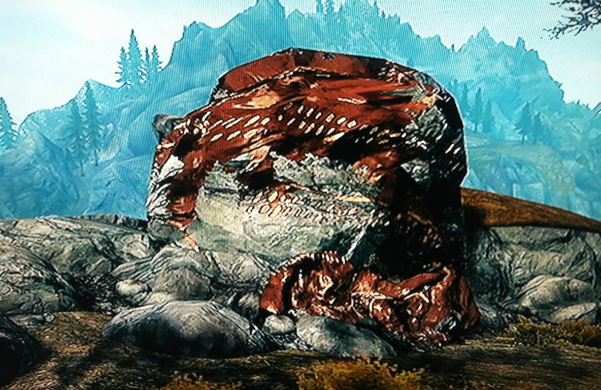 Standing Stones: The simple wonder of standing stones can move you. Here is an 8 foot standing stone in the heights of the Conwy Valley, Wales. Again, this stone weighs at least two tons. Moving this, and to such an elevation from the valley below, would seem crazy by human standards. I believe this standing stone is another type of marker, placed by the individual(s) who wanted to live away from the common collectives of people down below, and it served as a warning to them. More compelling is the fact that this stone is 100 yards from beautiful Dolmen just down the Roman pathway.
 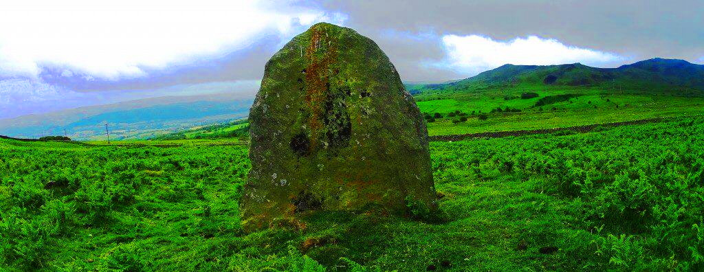 Here is an image of a nice standing stone in Skyrim with what looks like similar dynamics.
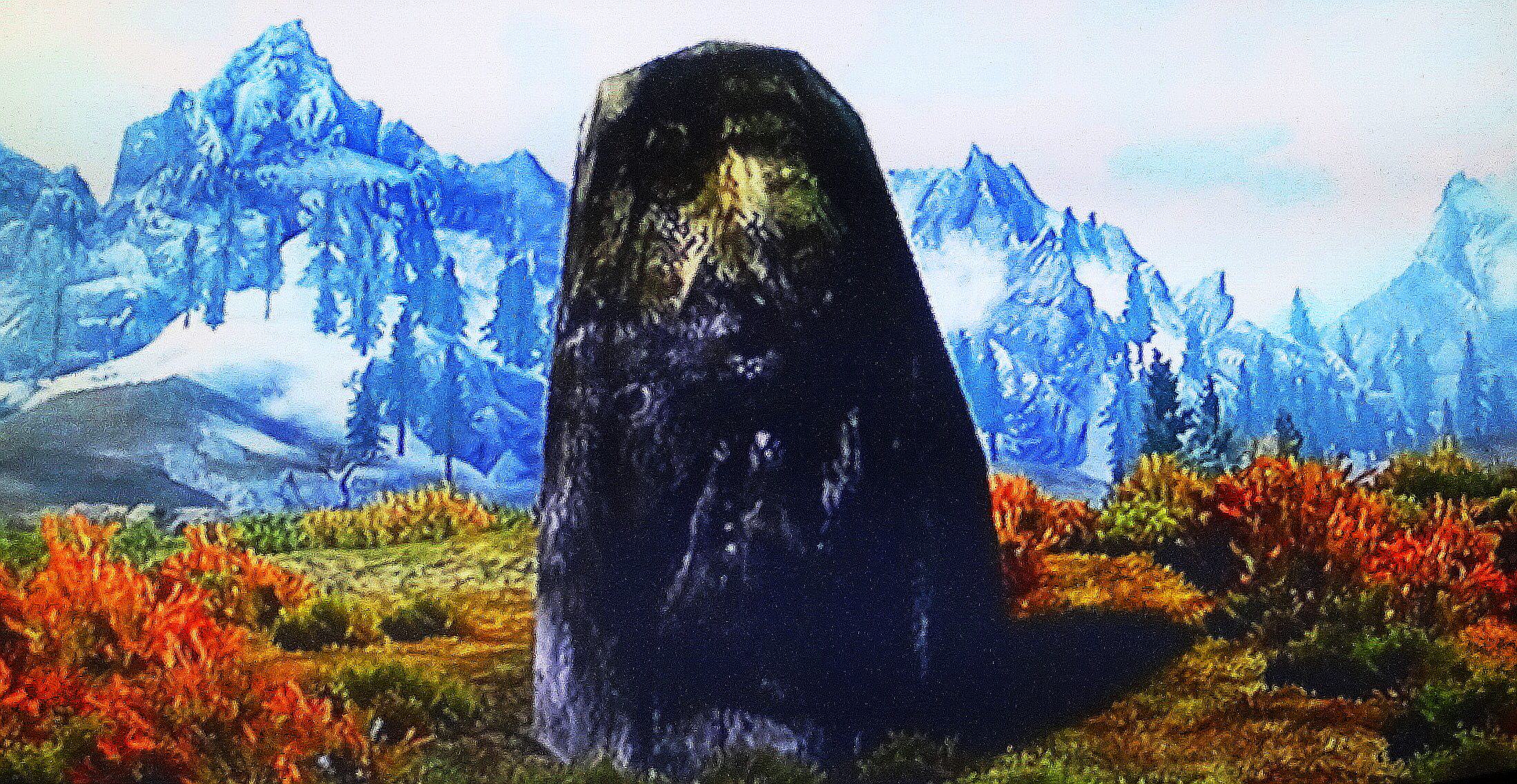 Stacked and level megaliths: The most obvious and famous example of stacked and level megaliths is Stonehenge. The mystery of Stonehenge is one of the most important and fascinating in the world. There is so much that goes into creating sections like these, including grand notches that are cut and fit to be fixed into place like Jurassic Legos. To do this with sarsen stone, the hardest stone in the world, is almost inconceivable for a primitive culture at the start of history. Here is a look at just one section of Stonehenge.
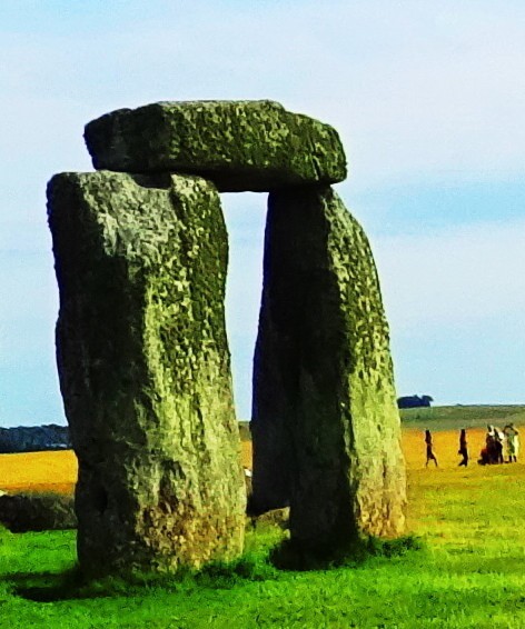 And here is a look at one section of an entrance to a cairn in Skyrim. Same proportions. Same idea.
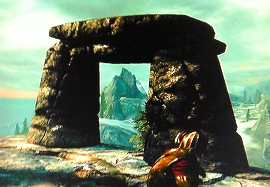 Amazing Natural Beauty: It is so important not to forget the natural beauty surrounding the mystery of Celtic culture. Mountains and valleys are simple and worthy reasons for celebration. I just want to mix and match some actual scenes that I was lucky enough to come across, with scenes from Skyrim below.
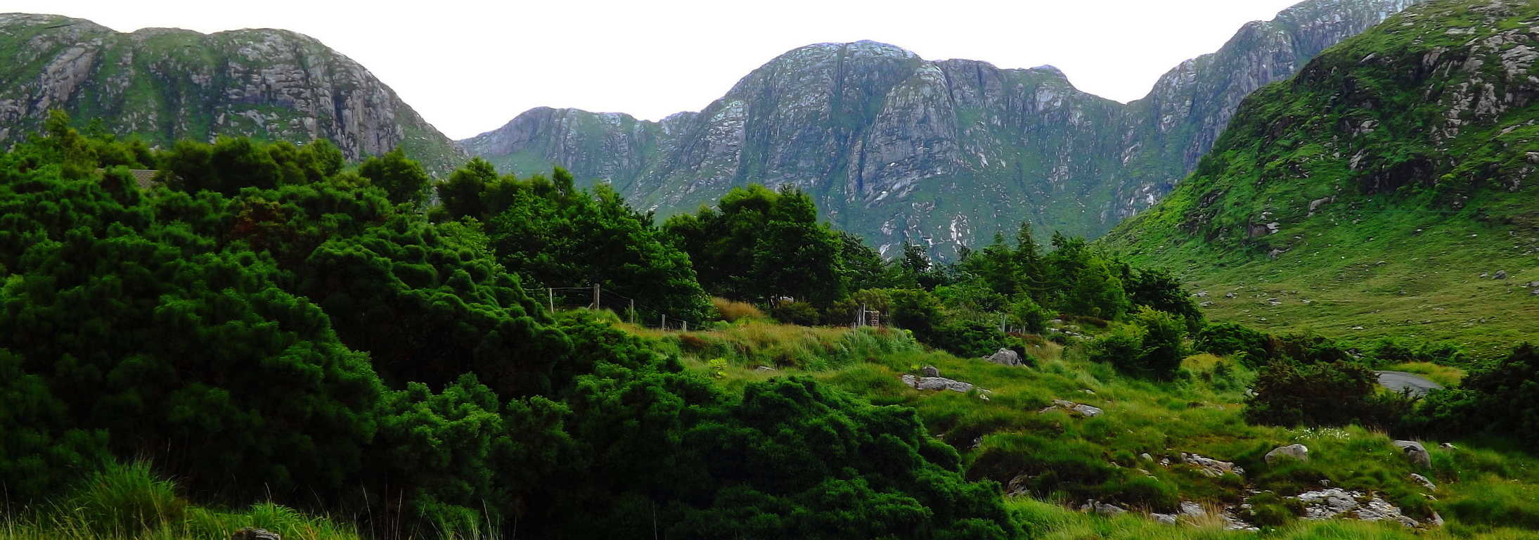 The fantastic images in Skyrim should inspire you to try to climb mountains and explore valleys, however distant from you.
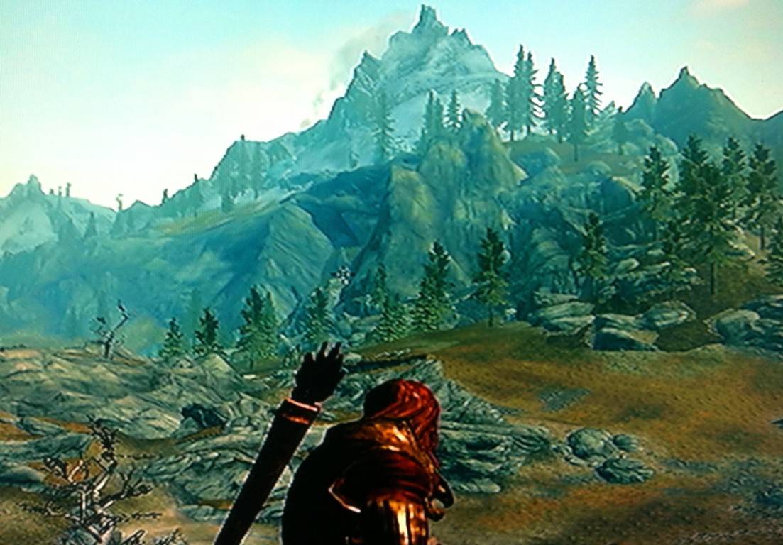 You can do it! Something tremendous is revealed when you get out and take a close look at wild natural spaces. There is a hidden megalithic culture beneath us, and in some preserved places, totally visible.
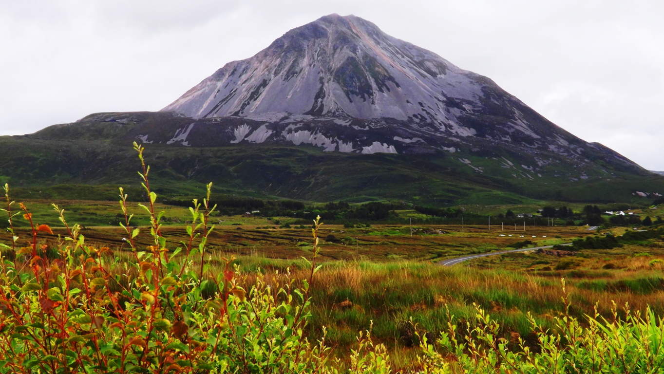 The Skyrim engineers have somehow put together a vision in their game that taps into the myths in a way that is almost signaling us, warning us, that there is more going on in this world than we are being told by commercial banks, governments, and people.
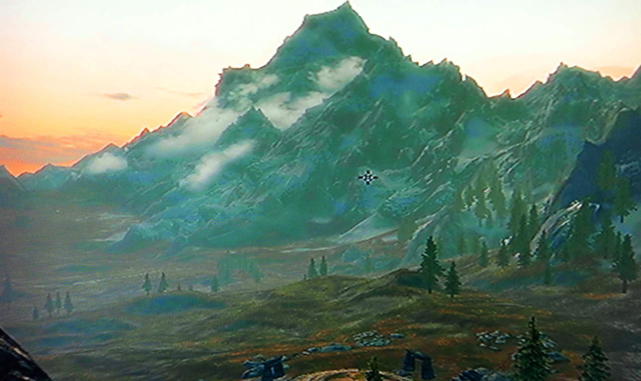 I would like to thank the makers of Skyrim for inspiring me to think and wonder for myself just how much of what they are proposing might be true…
 ..which is far more than I would’ve known, had I not gone in search after the miserable winter of 2014. I will end this post with this statement: Biblical scriptures and the Dead Sea Scrolls speak of giants in the land, before, and after Noah. There are entire narratives dedicated to this premise about giants. “Seek and Find the Sacred” is not just a nifty cliche, its your personal invitation to understand the most mysterious and amazing things first hand, not relying on some other persons opinion, but developing your own. The megaliths are there, in dynamic positions, with symbols and angles, waiting to be understood. All of this takes place in a naturally beautiful, and often romantically distant places, far from the manic urban centers. You have nothing to lose by letting go, and going for it. I hope to see you out there. And however far out “out there” might be, the better.
Avebury Stone Circle
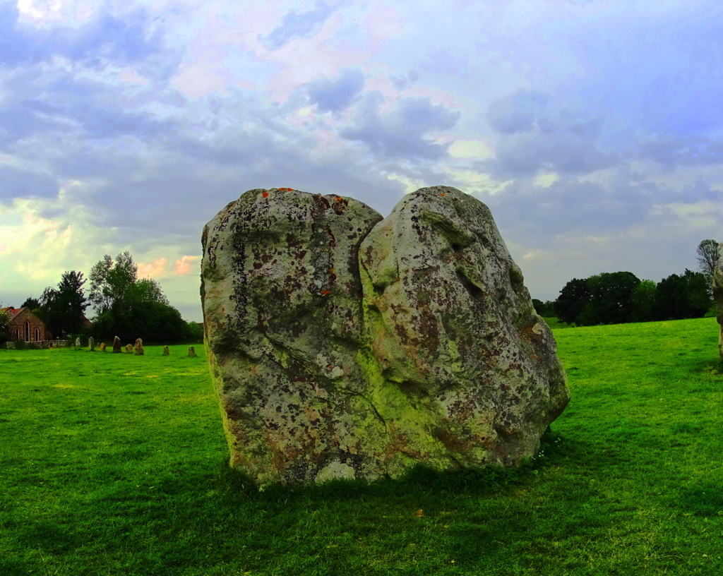 Location: Avebury, England.
Note: The broad and beautiful rolling hills southwest of London is home to some of the most mysterious wonders in the world. This designated area has a rather unassuming name, considering the undeniable mysteries it contains, known simply as ‘Wiltshire’. It could be called something more relevant, like “Temple-haven”, or “God-stone-shire”, but the humble title remains.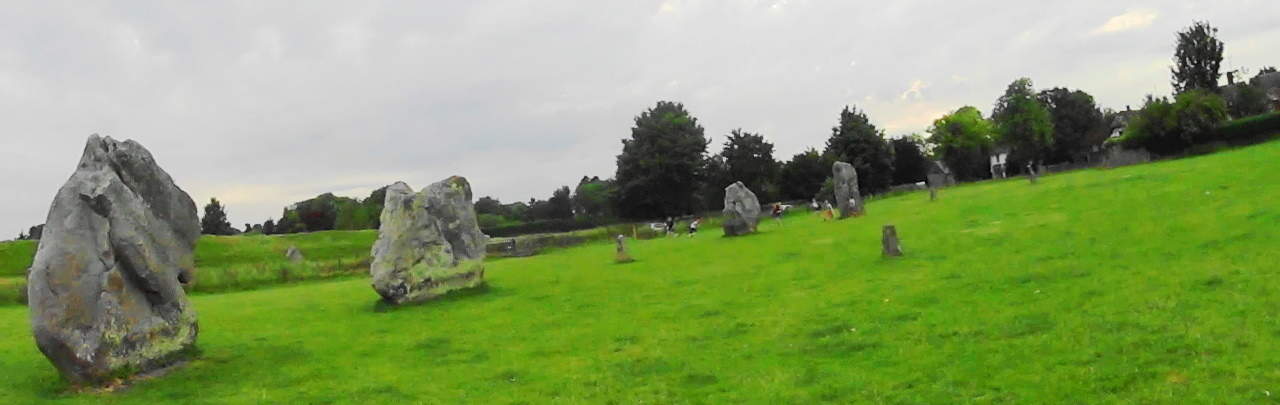 The district of Wiltshire is basically a 50-by-50-mile zone extending from the cities of Ashton Keynes at the northern edge, down to Salisbury in the south, not far from England’s gorgeous southern coast. During the dry season in England, which is late summer, this area is host to campers, hikers, bikers, and anthropologists. Teams of hikers can be found attempting expeditions from the southern tip of nearby Cornwall, north to Snowdon Range in Wales, all the way up to Glencoe Scotland. Many of these outdoor enthusiasts begin here, in Wiltshire. The Wiltshire hills and fields feel at least four to five times more broad then in Ireland, Scotland, or New England. In antiquity England was known as Albion, which means: “Land of Giants”, and on this wide open Celtic plain, the title seems appropriate. It becomes easy to imagine giants roaming across these fields, tending flocks, roasting lamb over great bonfires, and watching the stars in the fair season, very much like they are depicted in the Celtic Xbox game, Skyrim.
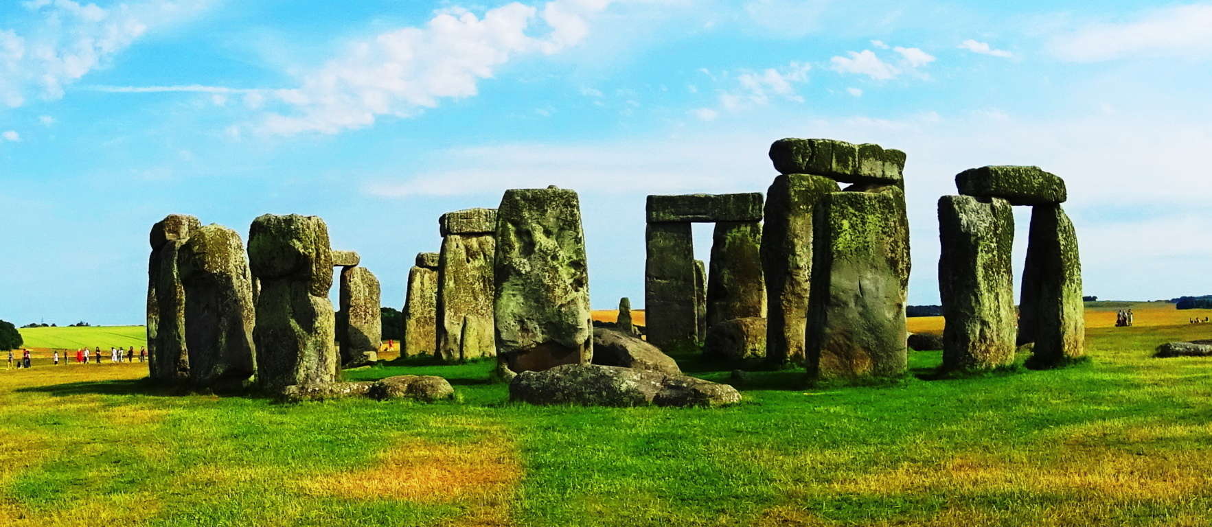 This is an extremely picturesque open space, with hedges, crops, and surviving ancient old-growth trees standing stoically against a universe of looming green fields. The fascinating, and world renown Stonehenge, is within the boarders of Wiltshire, receiving international visitors numbering into the thousands every year. However, an equally incredible and mysterious megalithic place exists just 20 miles south of Stonehenge, a place which most people don’t seem to know about, that place being Avebury Stone Circle. Avebury is nothing less than the largest stone circle on earth.
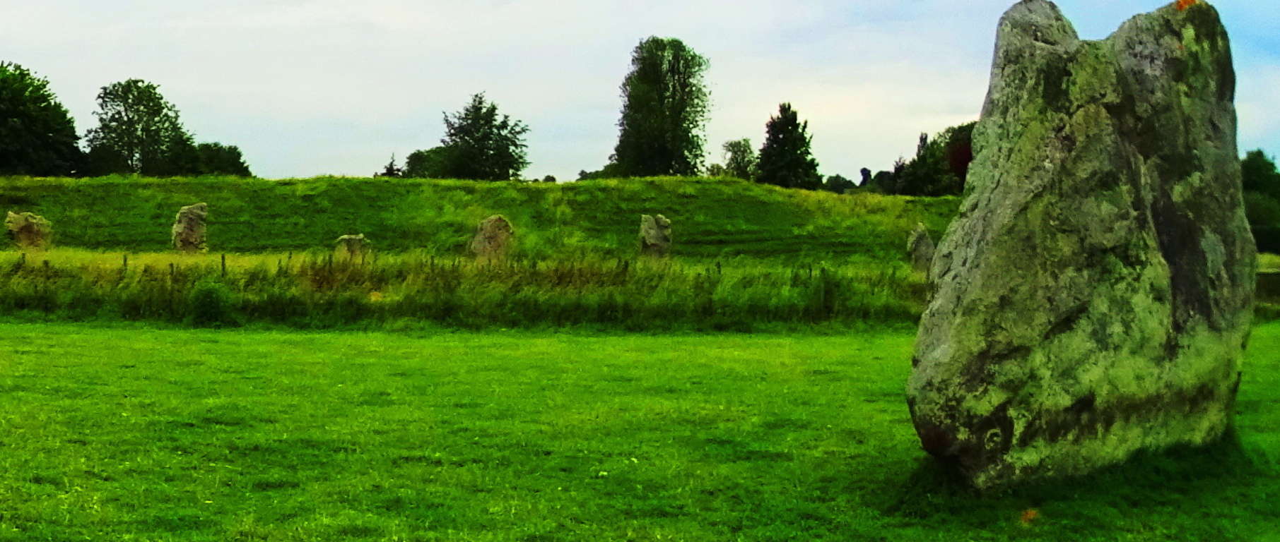 Not only is the radius of the outer circle about a mile long, but the 98 Sarsen stones that make this circle are without a doubt the largest possible standing stones that could’ve been placed here.
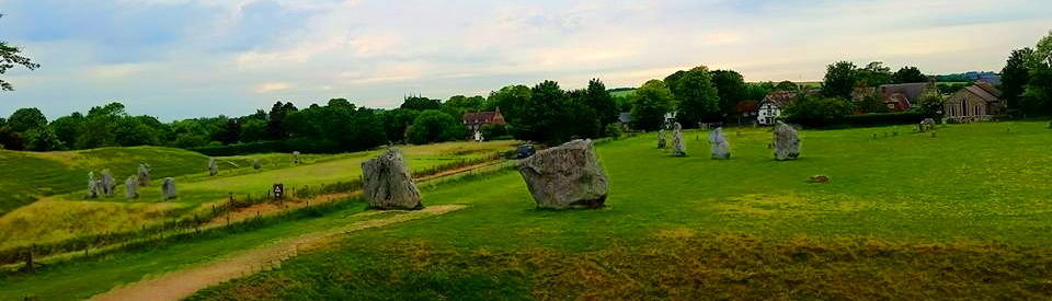 Each stone is, at a minimum, 12 feet tall, by 3 feet in width, and some are larger. These standing stones range from 50 to 60 tons each. It’s boarding on impossible. That’s roughly 12 MILLION pounds of stone in one place. Here are some examples of perhaps the largest standing stones on earth below…
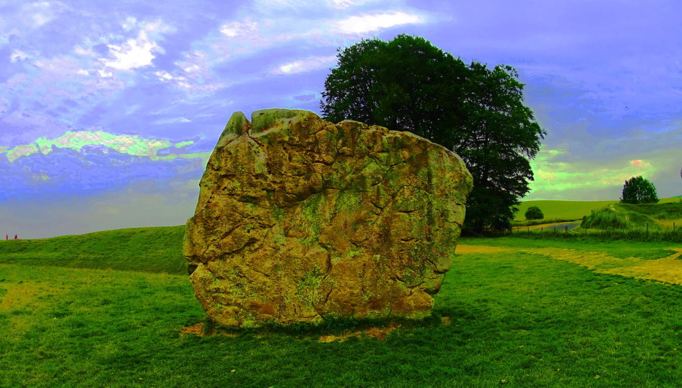 There are also two smaller inner stone circles within the overall ring, with more customary stones that are about 6 feet high and 2 foot in width, but several of those stones are now missing. Altogether, this is a grandly concentric scene, with circles within circles of impossibly placed stones, like interwoven gears in a Jurassic size clock.
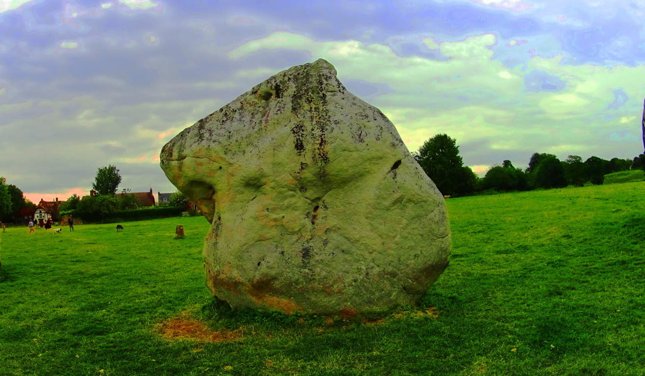 A hike within these rings is a dreamlike experience. Each stone has an absolutely distinct character and individuality, unlike the sarsens at Stonehenge, which are uniform in character, most likely indicating a different meaning. Each standing stone is a type of unique masterpiece, an essay on individuality. If you study standing stones enough, it is hard not to look at people the same way, with subtle nuances and individual markings that make them unique and amazing. Incredibly, standing stones convey many such meanings like this, without a single etched word anywhere. It is simply the nature of the statement itself, the stone as an expression, that draws out our faculties to find the meaning. It would indicate that whoever put these standing stones here was, at minimum, aware of the meanings they would convey forever after. And yet there is so much mystery.
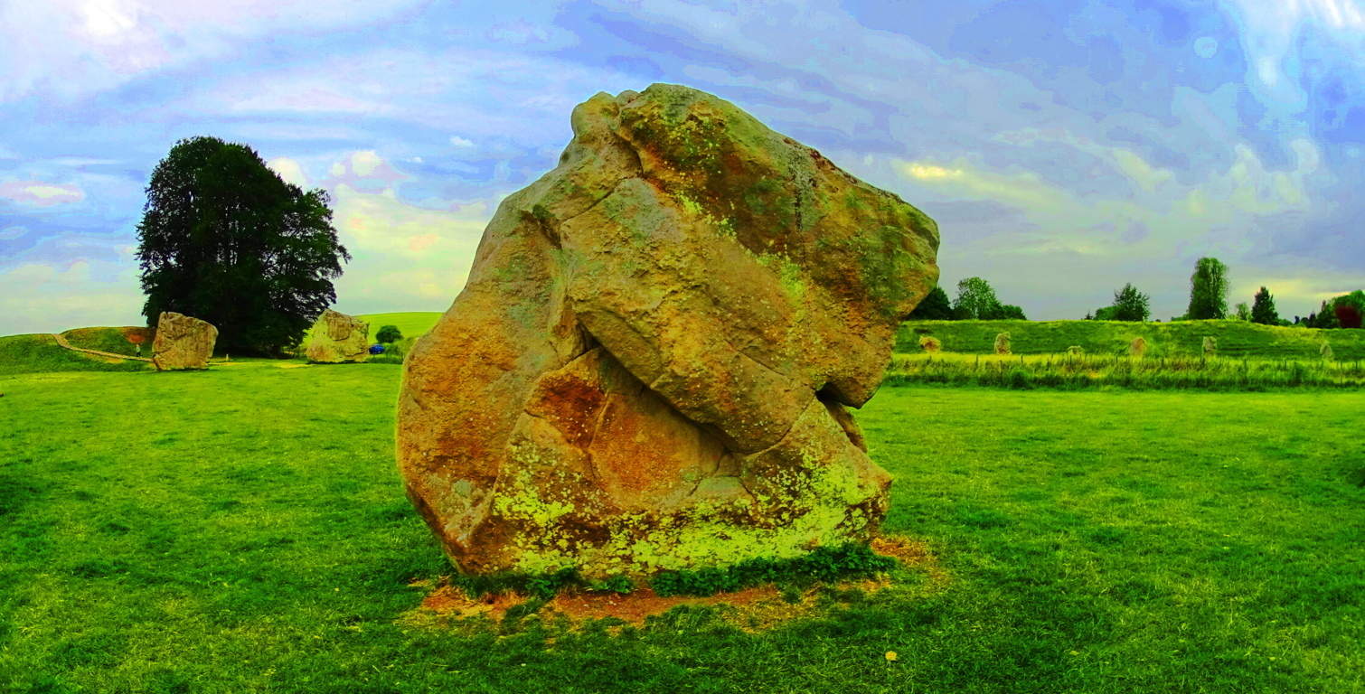 It would seem clear that each stone was chosen specifically for its attributes at Avebury. It becomes impossible not to wonder how these stones came to be here, and why each was chosen.
The amount of work that it would’ve required to move 12 million pounds of stone in the Neolithic period is incomprehensible. The undertaking would’ve cost hundreds, perhaps thousands of lives, and for several reasons. Neolithic England was a place of Celtic tribal hunter-gatherers, and these tribes would’ve guarded their territories against any trespassers or invaders with deadly force. Moving 98, sixty-ton stones, slowly across a hostilely protected landscape (perhaps with wooden rolling logs and ropes) seems totally illogical.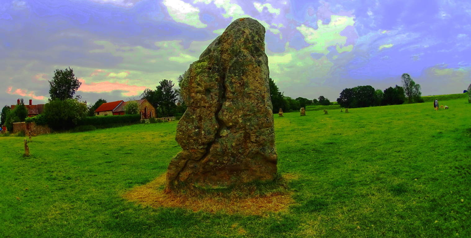 And how many miles have the stones been moved from wherever they came from? This is 12 million pounds of stone we’re taking about, so it presumably makes sense that this effort took several generations, and all of this effort just to create something for which the function is not entirely known? Pretty crazy.
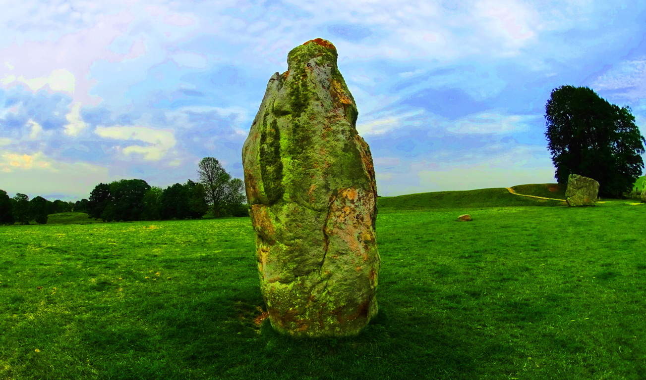 Interestingly enough, if you place your hand on these stones for more than a minute, you can literally feel some kind of charge moving through them. With all the mystery surrounding this place, you could hardly be surprised.
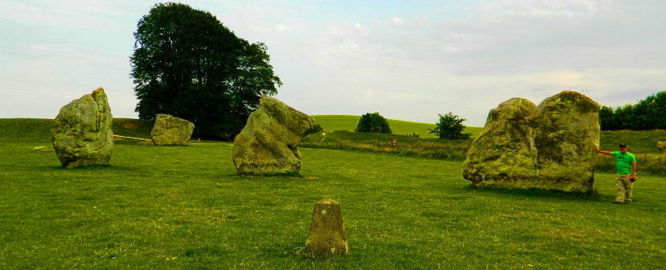 Avebury is obviously a Celtic spiritual center, and one of the most important in the world. The history here goes back to the very beginning of recorded time.
 Druids and Celtic peoples would’ve come here to perform their sacred rites. The classic medieval Tudors in the backdrop behind these ancient stones display a middle age period alive and well in the present day. It is understandable that an author like J.R.R Tolkien so adeptly created his amazing novel not far from here in Oxford, weaving very human themes into mysterious magical memes so seamlessly, influenced by places like this for certain. Avebury is a living crossroads for all of these themes. The exact significance of the placement of these stones is not known. Like so many megalithic sites, it may well be that there are astrological/historical connections that we have yet to understand. I believe that the actual truth about who built this place, and why, is still unknown, and suppressed. If you ever get to Avebury, put your hand on one of the megaliths for two minutes, you will understand, from the subtle but significant charge that runs up your arm, that something more is going on at megalithic sites than just “big rocks in the grass”. I hope you make it there soon. Find your way.
Monument Mountain
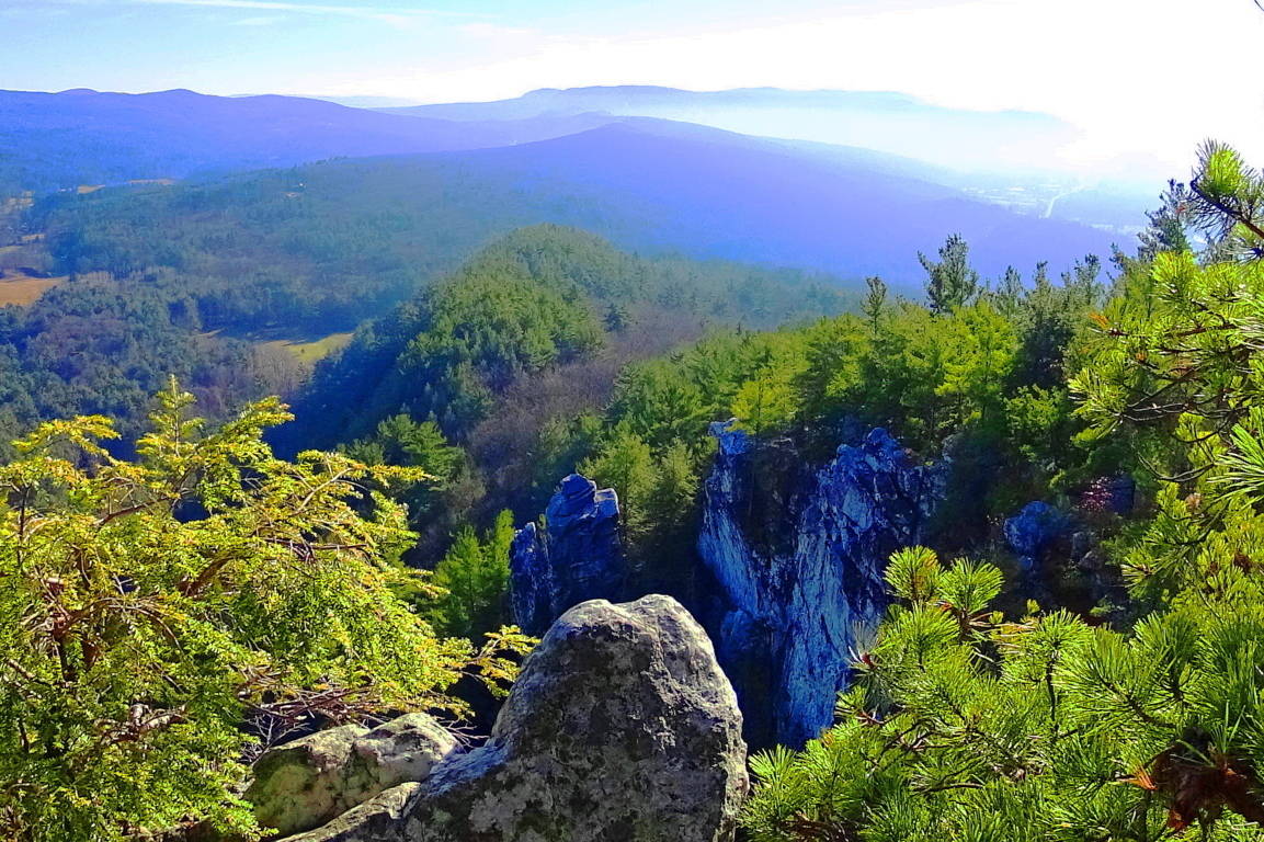 Location: Great Barrington, Massachusetts/USA
Elevation: 1,642 ft
Note: Monument Mountain is a rare natural gem for Massachusetts. It is not connected to the rolling hills of eastern New England, but rather the beautiful Berkshire Mountain range, which runs through the southwest corner of Massachusetts, before continuing northwest into New York State. In early November the hillsides around Monument Mountain practically glow from the morning frost in the Sunrise, giving it a unique New England appeal…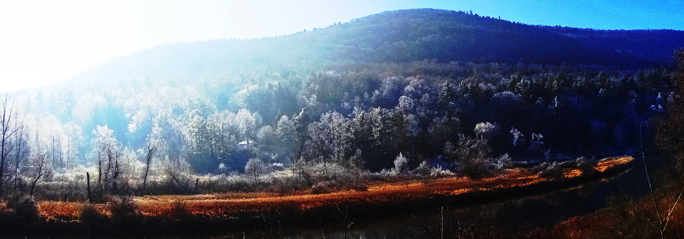 From top to bottom, massive shelves of white-quartzite line the mountainside, with jagged cliffs looming hundreds of feet above the trails, leading to what is known as ‘Squaw-Peak’. Alternative trails are known as “Indian Monument, and”Hickey Trail”, but are both essentially part of the same loop leading to Squaw Peak. As hard as it might be to believe, this is the Macchu Piccu of Massachusetts.
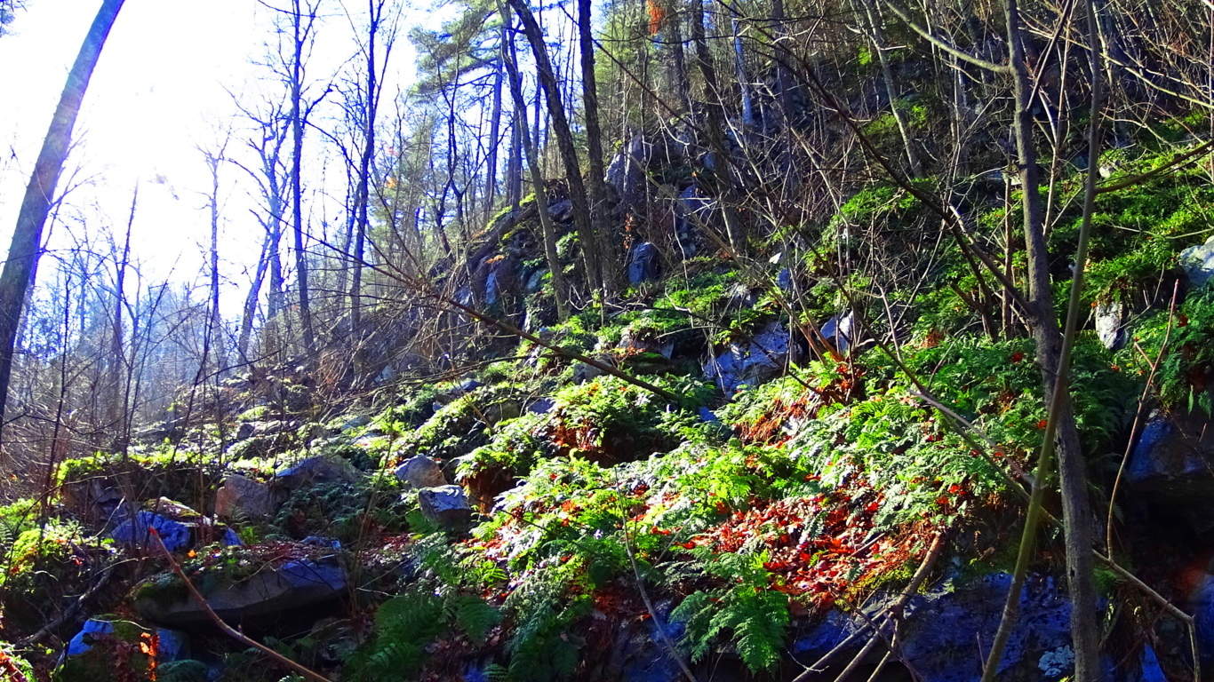 The trails here lead through glades of old growth forest and quartzite glens. There are White Pines, Hemlocks, Maples, and Birches in the elevated areas, that change the feeling of the trail as you go. The forest is a barrage of overgrowth and ledges, with craggy shelves at every turn.
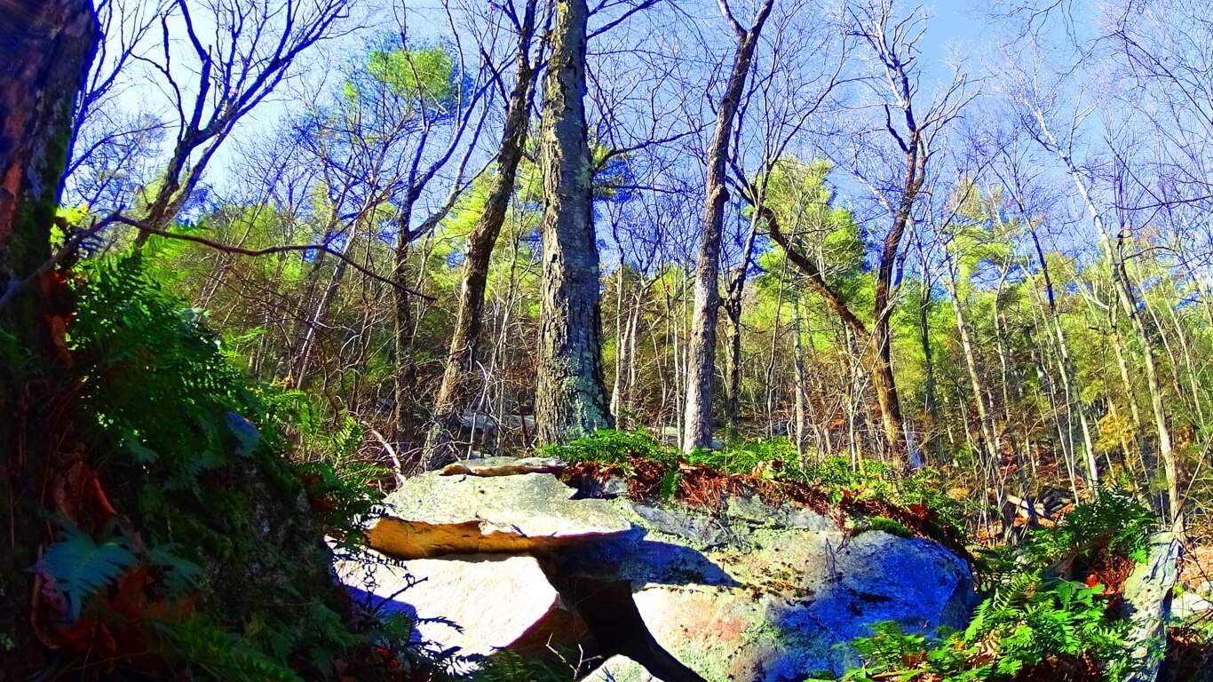 Some fixtures were obviously toppled by a glacial game that was played over 10,500 years ago, while other stones do not seem random at all.
The Solar Stones: The initial trail runs through a glade of towering Pines for about a half mile. Soon you will encounter an incline in the path that will lead you into Birch groves, baby Pines, and stony footing. As the trail to Squaw Peak begins to elevate, there are stairs that are clearly cut out of the mountain, leading up to smooth rounded porches.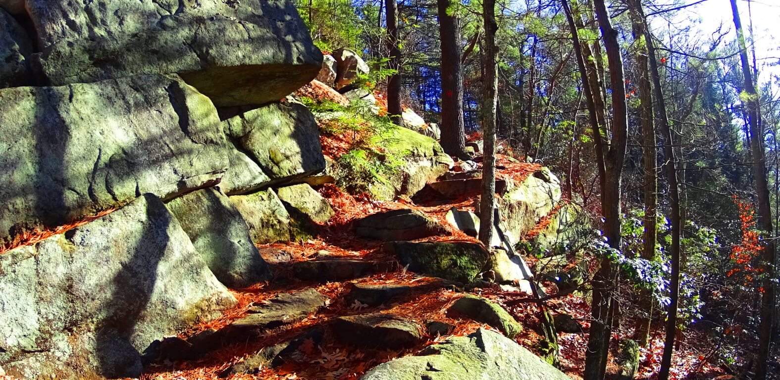 On these porches are stones that have specific angular cuts that are pointing directly at the Sun at mid-day. These stones appear at other sites in New England too. The image below is a prime example of the Solar Stone type at Monument Mountain, approaching Squaw Peak. Before coming to Monument” I had found several stones that were cut exactly like this, shown below. I felt that if stones were cut specifically to be “pointing” at something significant, it would most likely be the Sun. So on this day at Monument Mountain I tested my theory. I climbed to reach Squaw Peak just before Noon, and using this method I came across this exact stone, which points directly at the Sun at Noon. These are the moments that hikers live for. Trail features become both an exploration into natural beauty, and anthropological. Standing there, as the Sun was directly above this stone, I felt as if I was momentarily peeking through a keyhole connected to a culture from the beginning of Time. The “Solar Stones” geometry is essentially: a single long-side leading up to a 45 degree angle, which is then cut, creating an arrow head, or apex, pointing straight up; Then the cut goes back down 45 degrees, to a shorter side, which runs parallel to the long side. These cuts are made in solid granite. Take a look below…
 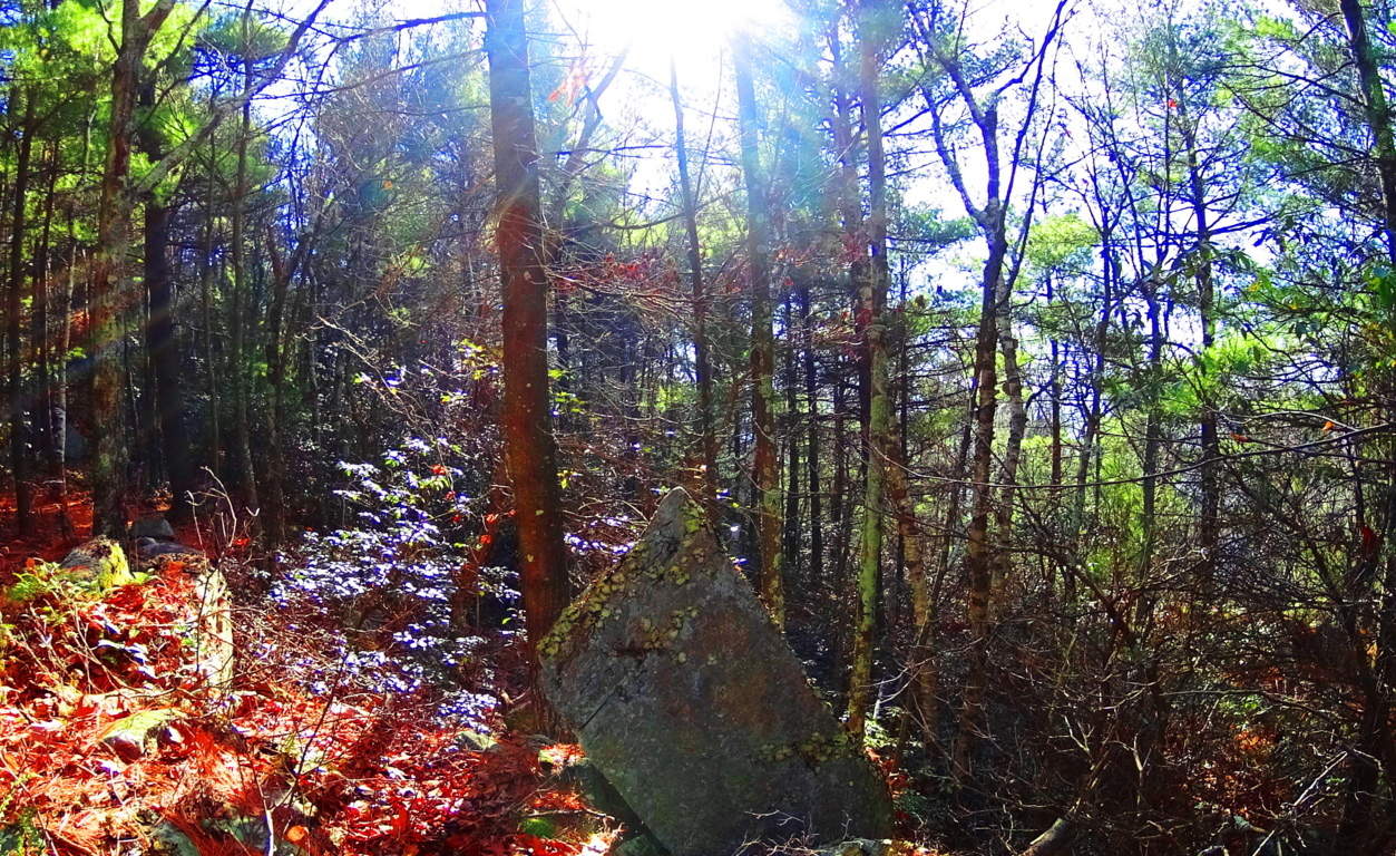 If this were the only stone that I had seen like this, then I would hesitate to publish it here, but I offer some other examples of beautifully cut Solar Stones with the exact same angles and features.
 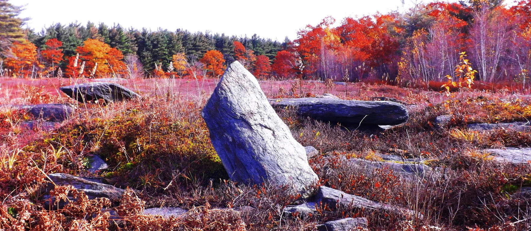 This Solar Stone pictured above is located near one of the most significant “Celtic style” alter’s in New England: the Heath Alter, of Massachusetts. Notice the identical angles.
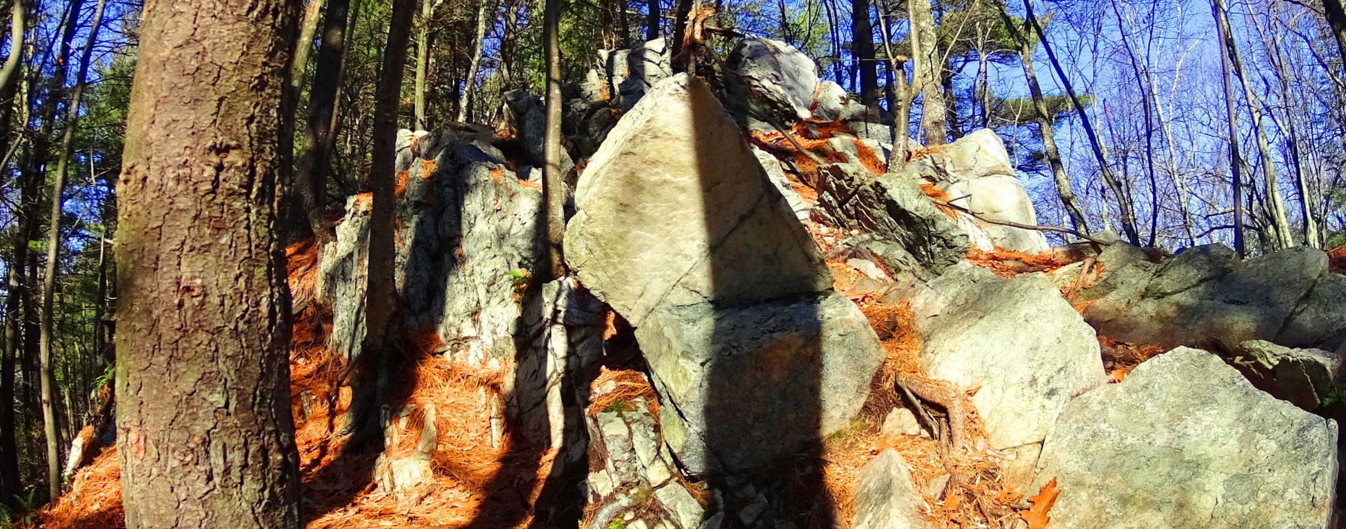 Here again is a Solar Stone with the exact same measurements at a different location.
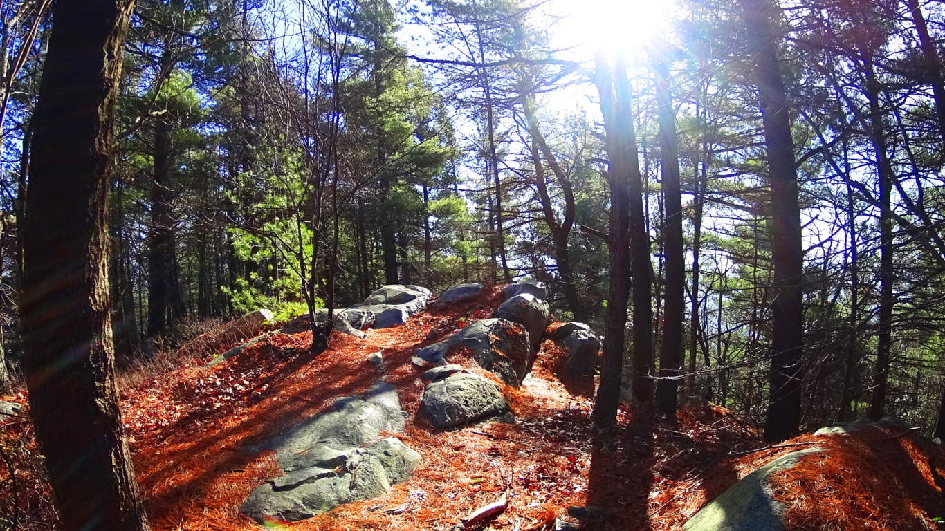 We can at least conclude that whoever created these stones had a sense of ‘symbolism’, which in this case, was to convey how important they felt the Sun was, and that they were very much in tune with its properties.
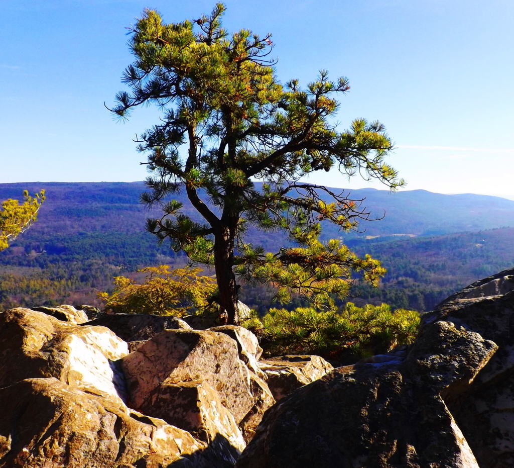 As you continue hiking along, the elevated stone porches emerge (image above) which head directly towards Squaw Peak. Your first clearing will arrive facing north-east, and its phenomenal.
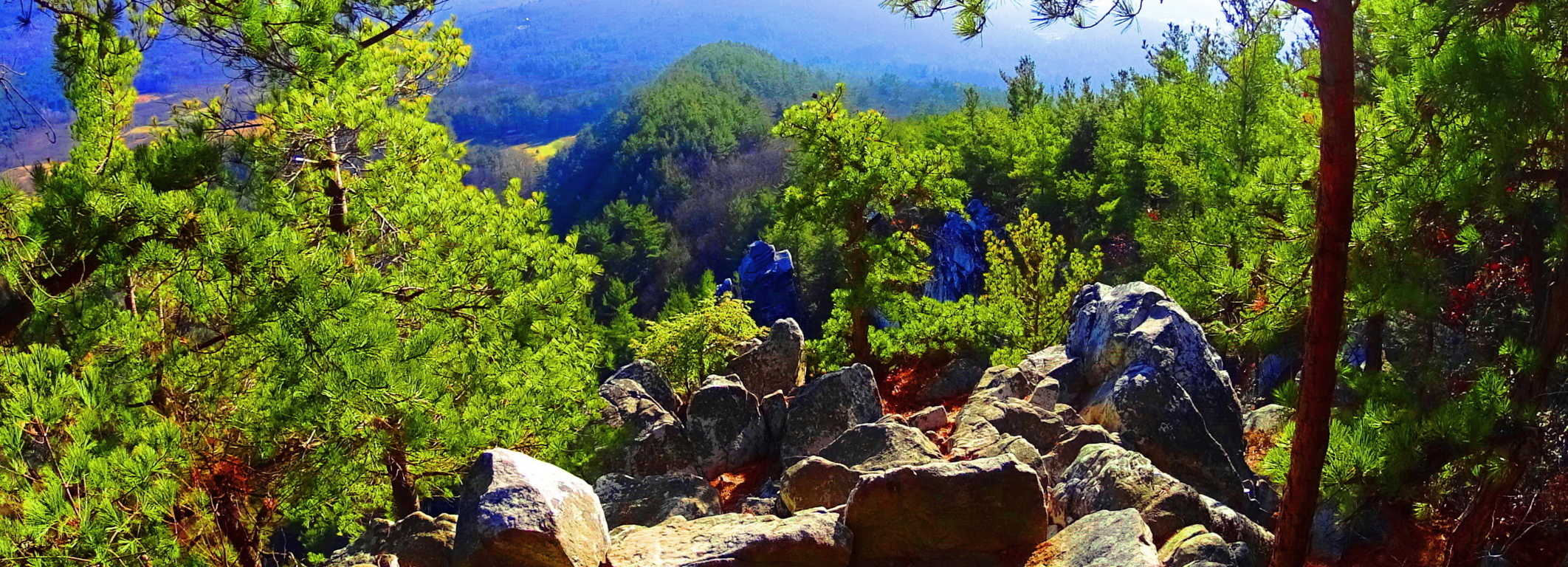
Aligned Stones: The edge of this porch has several stones that are centered and aligned with the massive square tower that stands almost 1000 feet high in the distance. This ledge also seems to be aligned to the peak of the mountain just beyond.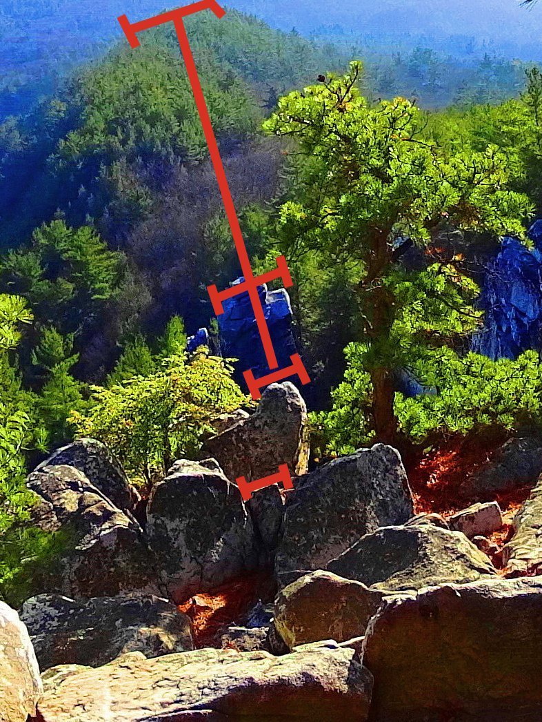 If it weren’t for places like Macchu Piccu, where stones are aligned in amazing ways at high elevations to mountains and peaks, something like this would certainly seem impossible. But notice the stones running in a straight line directly down the center of this porch, with tops that are squared perfectly with each other, as if leveled intentionally. Makes you wonder. What could possibly have done this? (left image) This is the magic of Monument Mountain’s porches.
Pattern Stones: Along the trail at Monument” you will also see a type of stonework that fits a specific pattern. This can also be found at other sites in New England. Here is an image of a long singular megalithic slab specifically placed above three smaller supporting stones. Below this are other spots at Monument”, and other places in New England, with the same dimensions of: the long slab on top, with the three smaller below.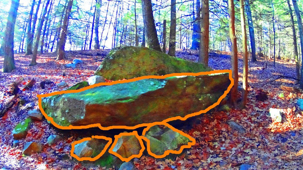 This is easily something you might pass by, believing it to be simple glacial displacement, but have a look at some other patterned stones in New England that fit this exact design.
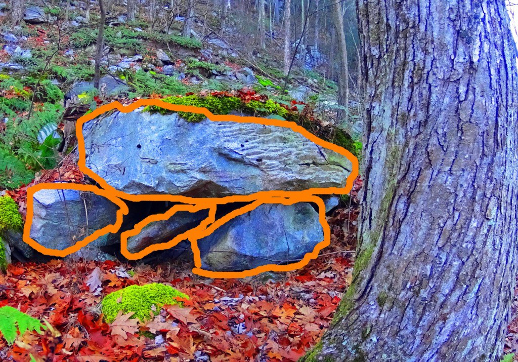
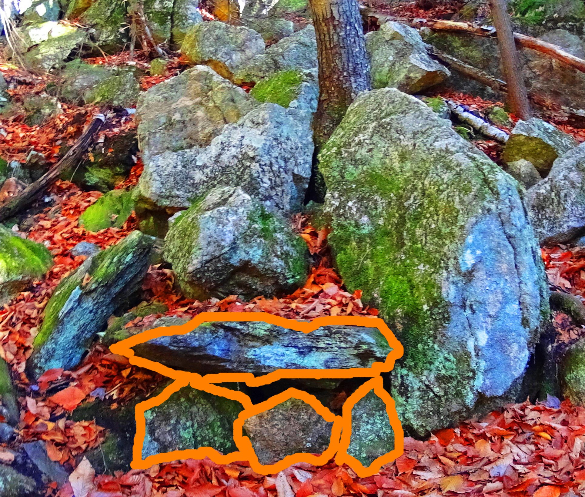
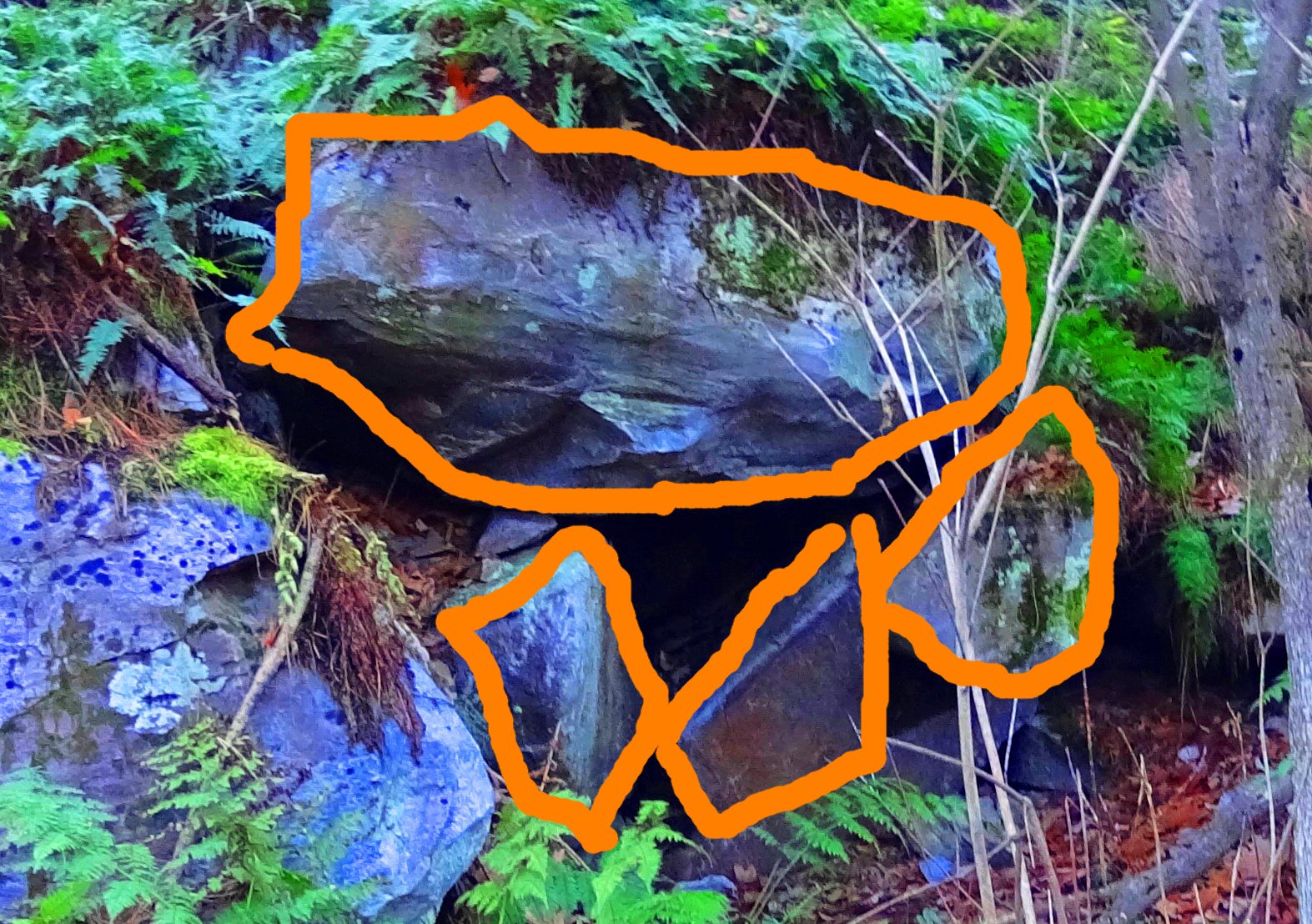
Interestingly, over 2000 miles away, there are Dolmens in Ireland that, in profile, fit this is exact numeric design: one long slab over three lesser stones This example is significantly larger, which is the Gaulstown Dolmen, with a capstone weighing 6 tons, suspended roughly 6 feet in the air. 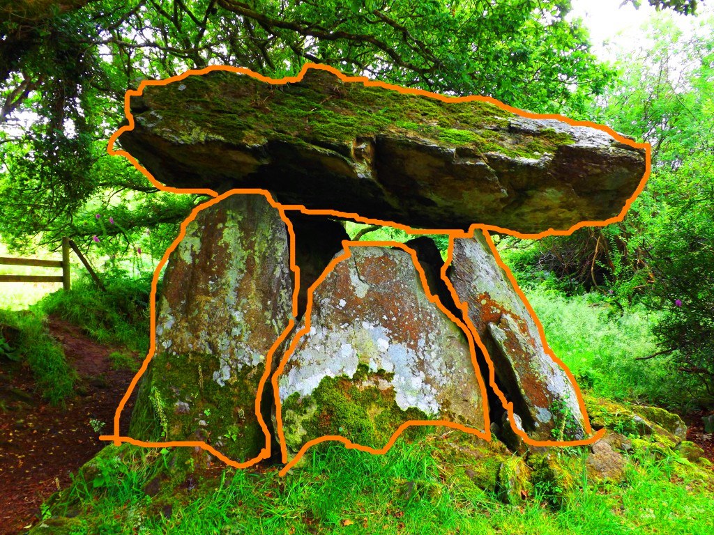 This relationship of 1 over 3 seems to be significant for these fixtures, and for the moment we can only guess at the significance of this.
After continuing along the porch away from the north-east alignment you will find Squaw Peak, which has a wonderful 360 view of the river valley. On a clear day distant peaks cut the clouds at a distance. 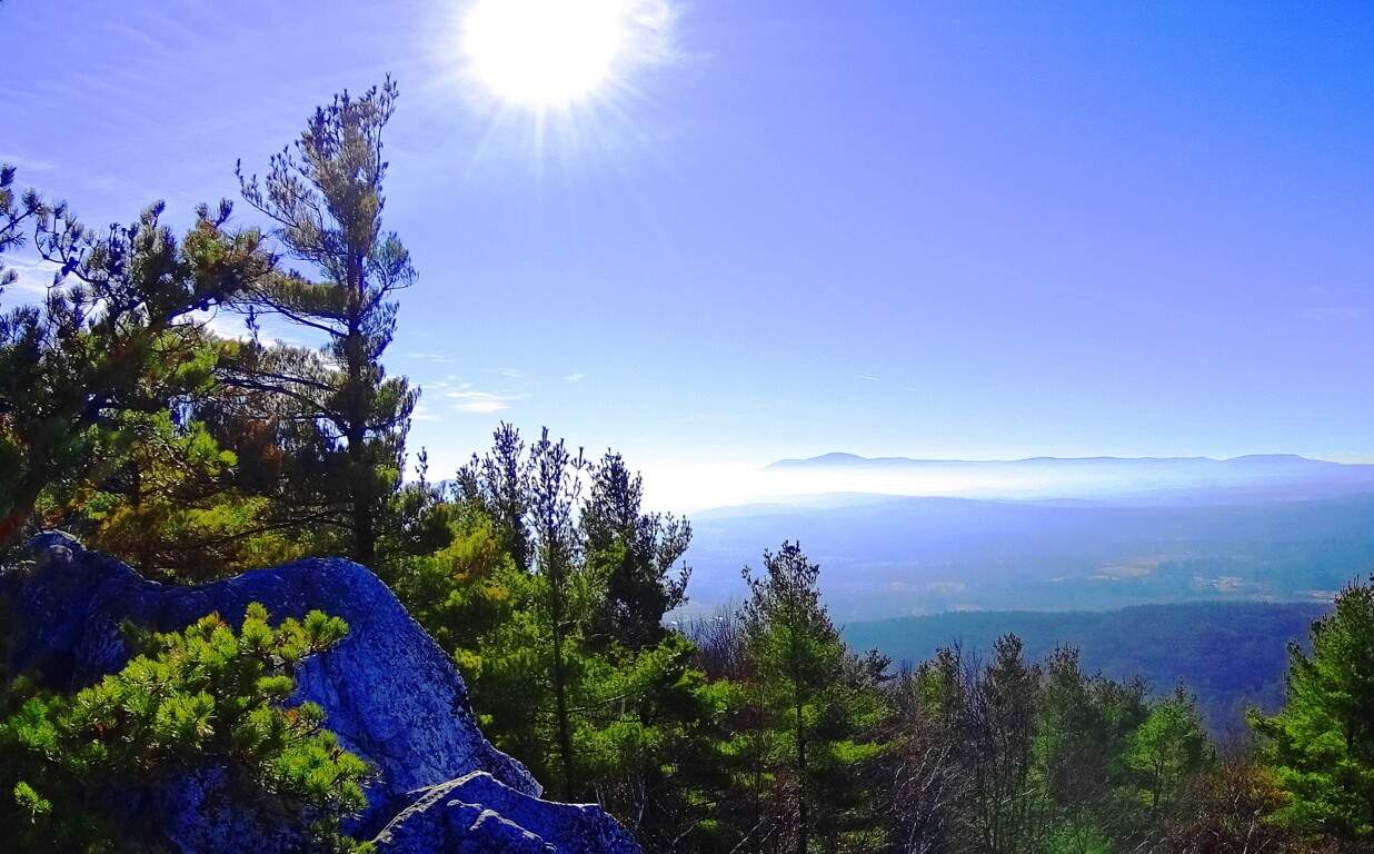 Monument” trails also sponsor some of the more common megalithic features found at places like Mount Monadnock and Mount Watatic. There are classic stone-linings that run straight up the mountain…
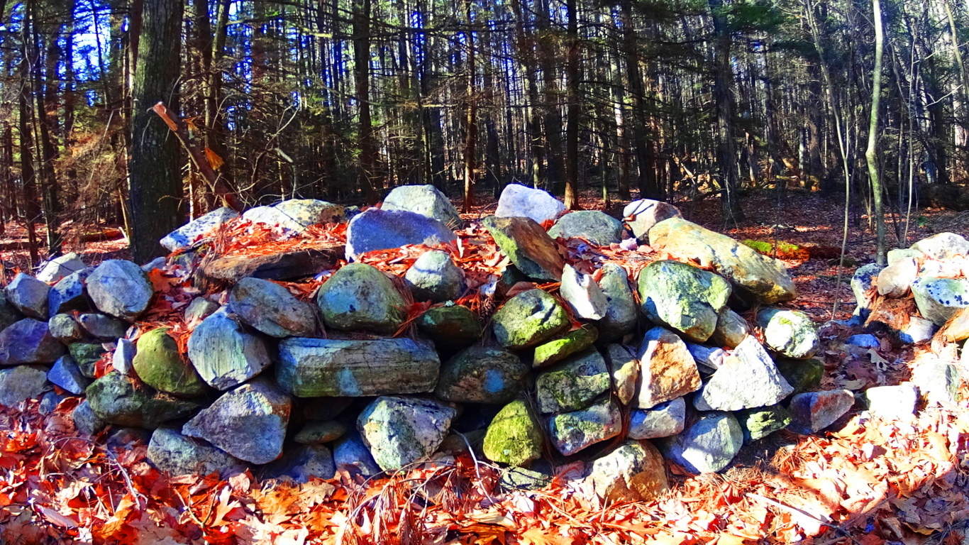 and the mysteriously cut “X” sections, that produces the diamond shape stones that appear all the way into Maine and New Hampshire. All of these are found here at Mounument”. Give yourself an entire day to search out the pathways that lead through this wonderland in south western Massachusetts. Feel the texture and absolute smoothness of the creases in these megaliths as you go. This is an absolutely wonderful hike that stretches for about 4 miles along the larger picturesque loop. Someone loved and appreciated this place in ways we are only just beginning to understand. See it for yourself, the sooner the better.
Upton Massachusetts/USA
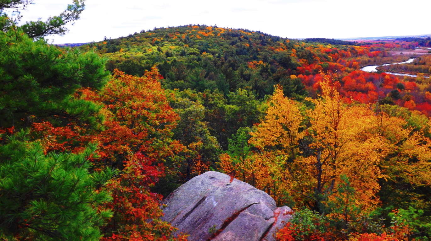 Location: Town of Upton, Massachusetts
Note: In Upton Massachusetts The Blackstone Valley sponsors a full-spectrum ocean of foliage in the Autumn season.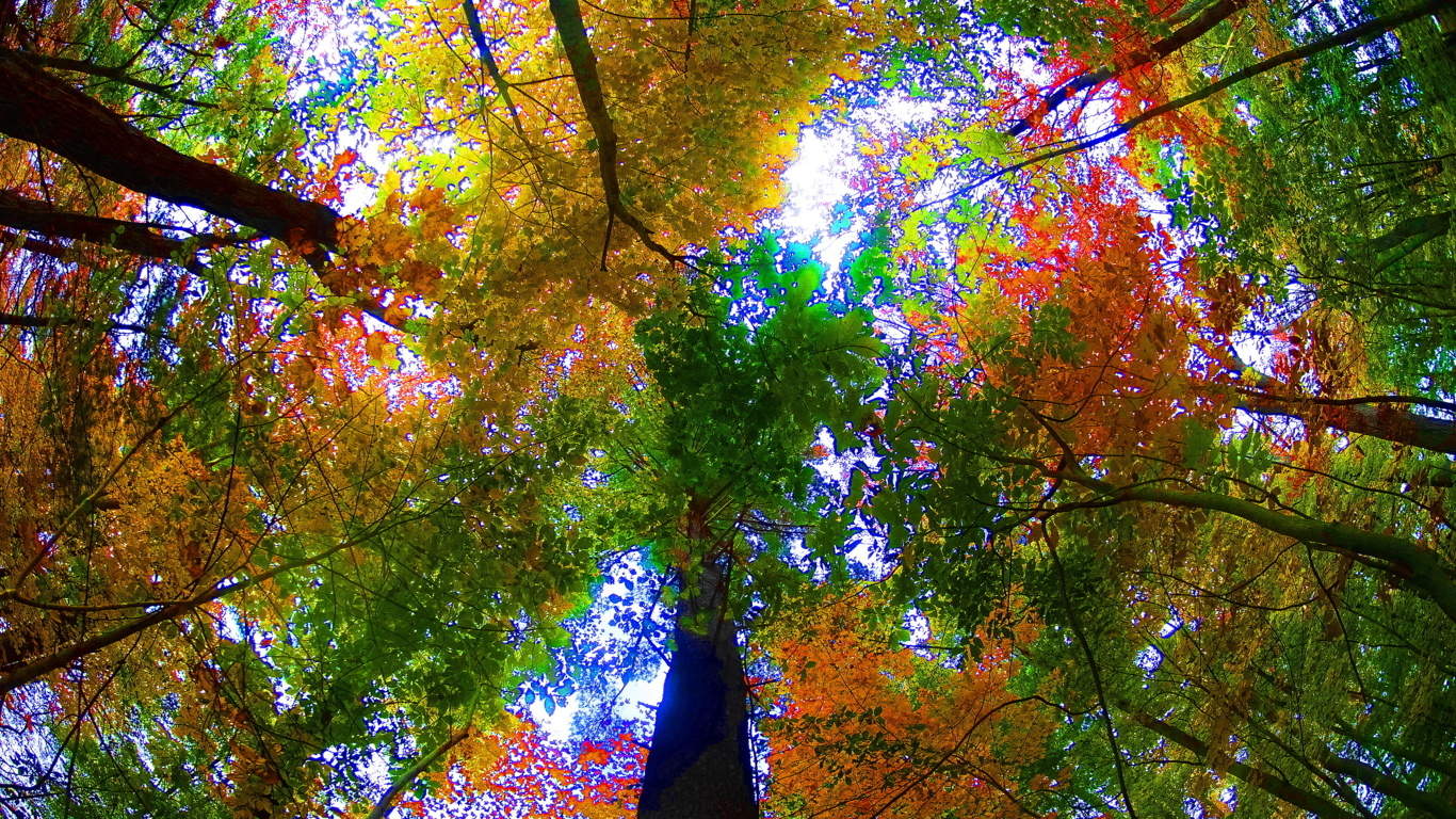 This is a classic New England hamlet that feels more like a rural village sitting just off the Ring of Kerry, rather than central Massachusetts.
 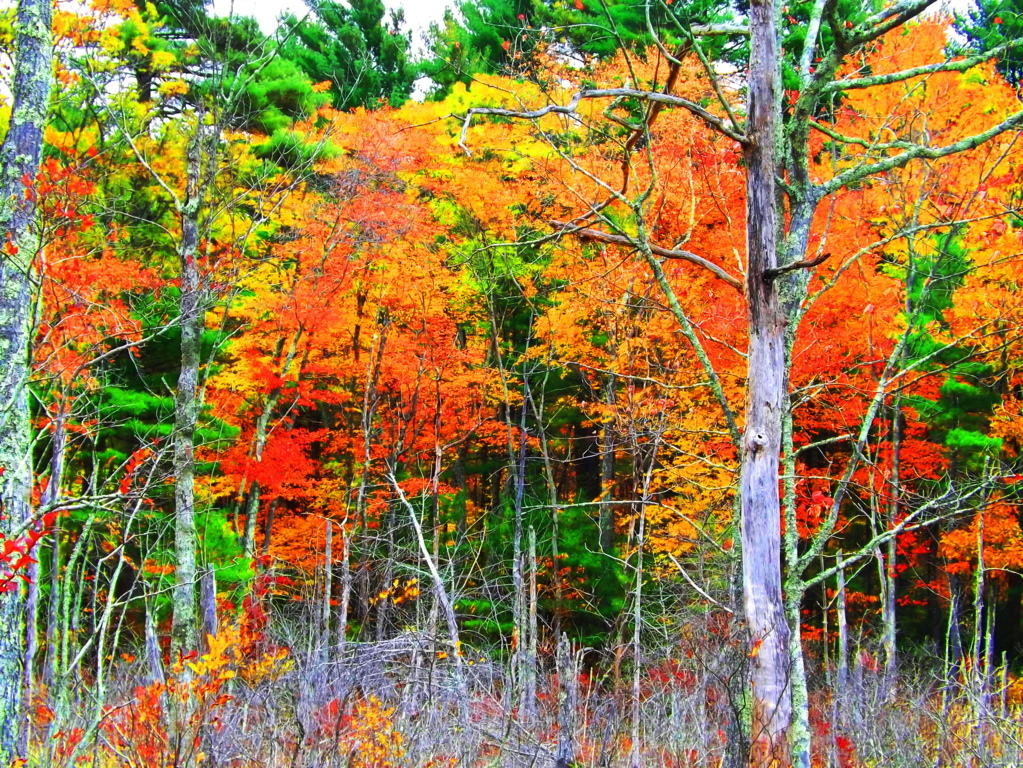 Natural features of the town include a State Forest with roughly 7 miles of trails, with other minor trails leading to stellar places like Look Out Rock (top image). Upton offers-up an “Old World” aesthetic with some very real historical substance, containing one of the finest Wedge Tomb’s in the world, known as the Upton Stone Chamber (image below).
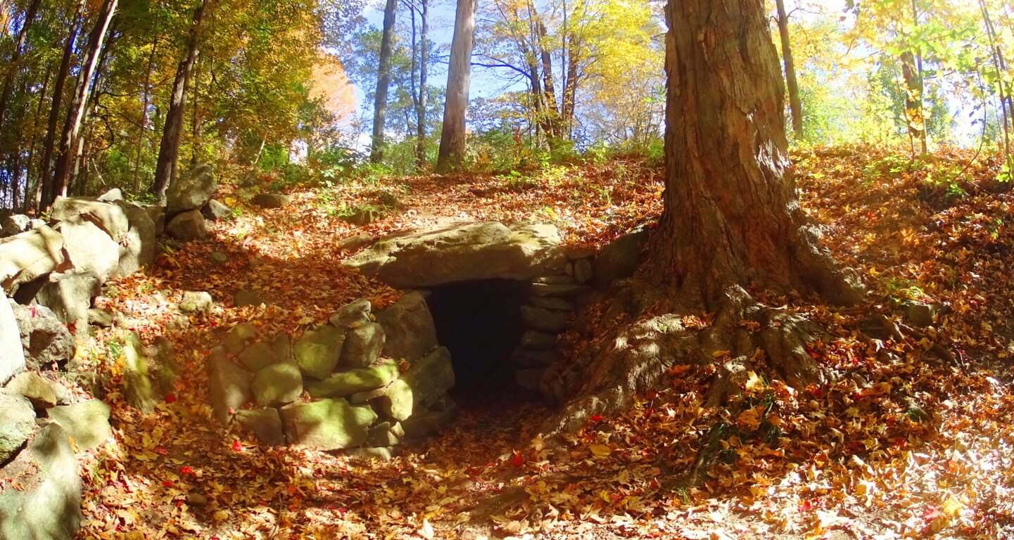 The scale of the Upton Stone Chamber is very similar to the Stone Chamber at the top of the sacred Hill of Tara in Ireland.
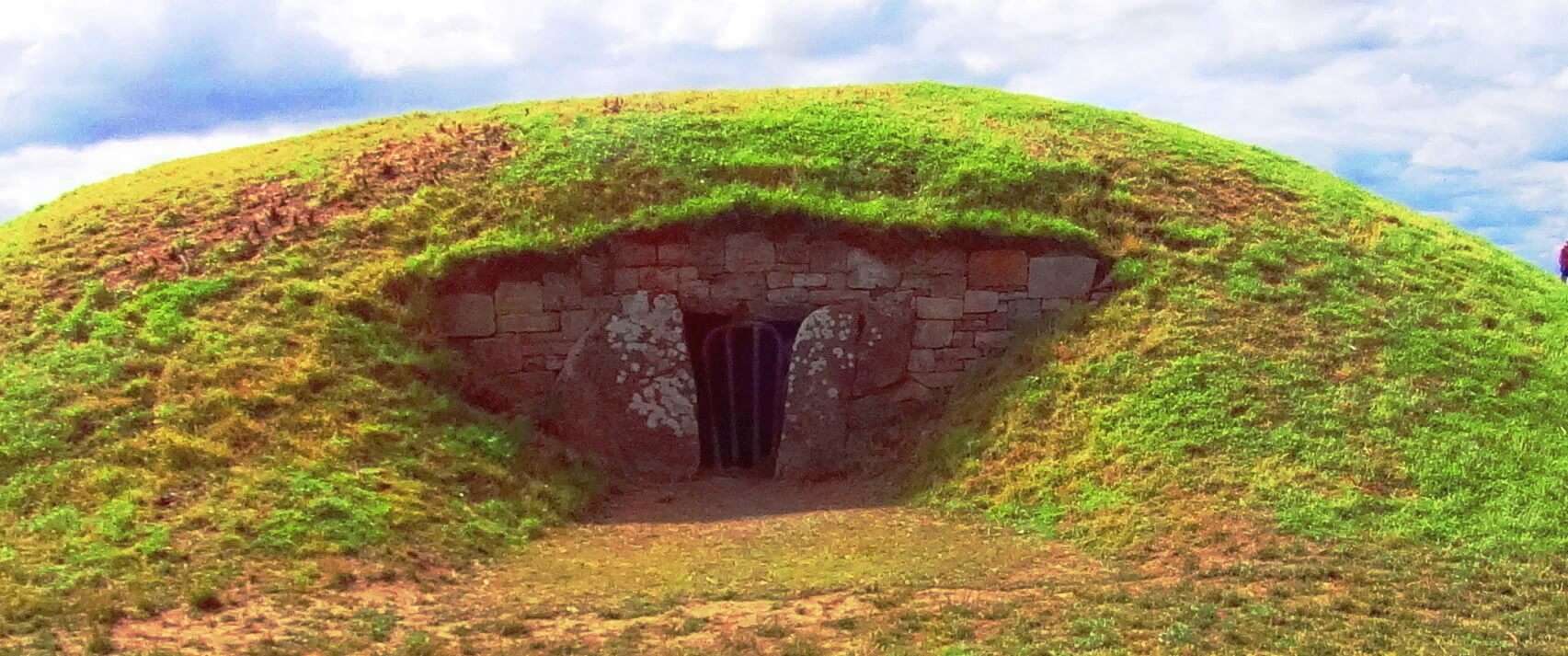 The stonework of the Upton Chamber is exquisite, with dry-laid corbel roofing that opens up from an entry passage into a 15foot dome, crafted into the Earth! The roof has four 5 ton slabs holding up the passage leading to the mini-dome.
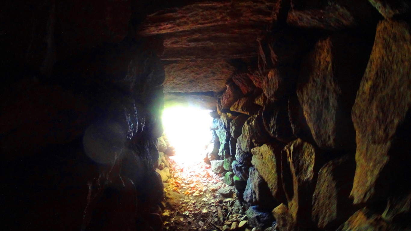 This is of the same style of roofing that was used, on a more massive scale, at New Grange, Ireland, the oldest megalithic site in the World (right image).
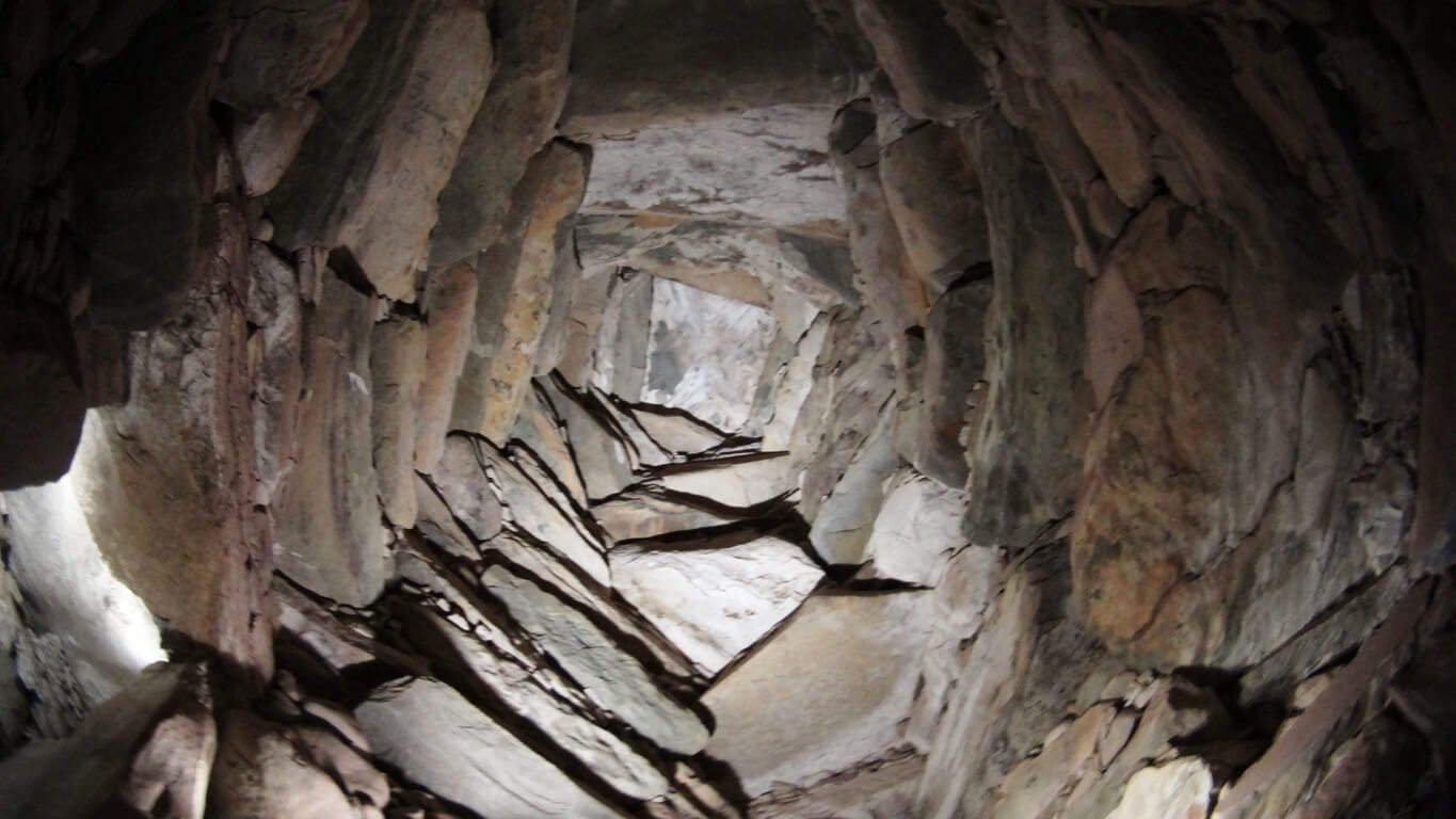 When I entered the Upton Chamber and turned to take pictures, orbs started floating around.(left image) (Click it to look closer). There is energy in these chambers. In general, these are some pretty strong stylistic connections to some very significant places, for just a simple small town in New England.
  Just like in Glenveagh National Park, Ireland (left image), Upton has unique and complex megalithic stones that are beautifully mingled into various features of the landscape, with stone-linings that are much larger than Celtic linings (2nd and 3rd/left images/Upton).
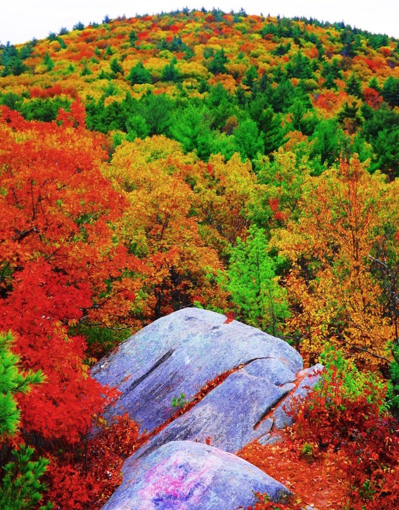 Massive granite boulders are stacked near peaks in the area, and all throughout the elevated trails. Some boulders, however hard it is to believe, seem to have been molded to imitate, and align, to the center of significant peaks in the distance.
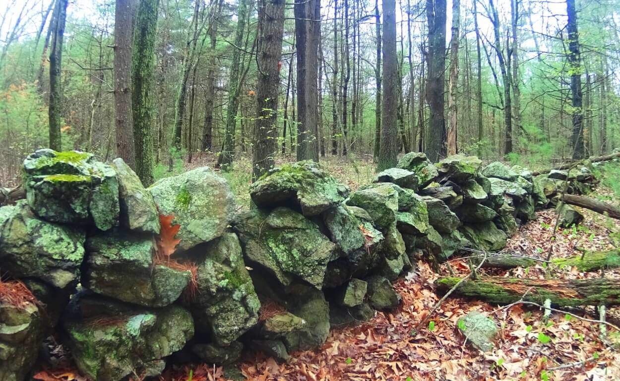 Look Out Rock is an amazing example this, with three parallel grooves carved into its face, seemingly calling attention to the boulder. It points, like an arrow, directly to the top-center of the mountain in the foreground, creating a kind of prismatic display (right image).
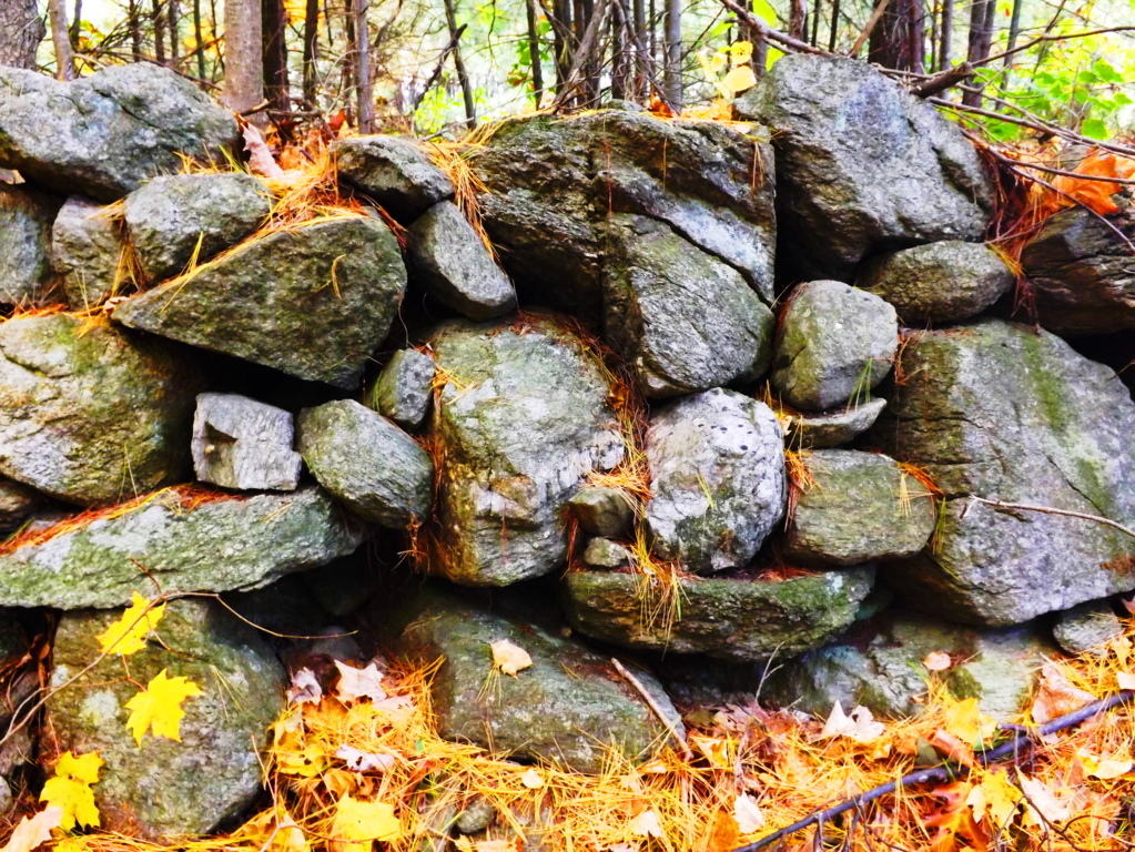 From an anthropological standpoint this is significant information, indicating that this culture was clearly “symmetry conscious”, and not only that, but symmetry capable. They could make it happen. Scope and scale of megalithic work by a culture that is capable of these statements should be reconsidered entirely to understand what is actually taking place. The neolithic culture in Upton, and all over New England, could craft granite boulders like a modern carpenter crafts wood. Forest floors in Ireland and New England look to be made up entirely of granite scraps that are cut from the larger boulders, eventually placed as statements further up the various mountains. This is the reason we find so many stones on elevated trails that have obvious cuts, right angles, and squares. The Blue Hills in Massachusetts (below left), and Mount Bearnagh in Ireland (below right), are prime examples of this. The trails in these sacred places are lined with the scraps of “megalithic carpentry”. If we were to look at the angles of the scraps on the floor of a carpenters cutting-table, the pieces, on their own, are a disheveled mess which doesn’t make any orderly sense, but the significance of each little piece is that they stem from the cutting of a ‘larger block’ on the table.
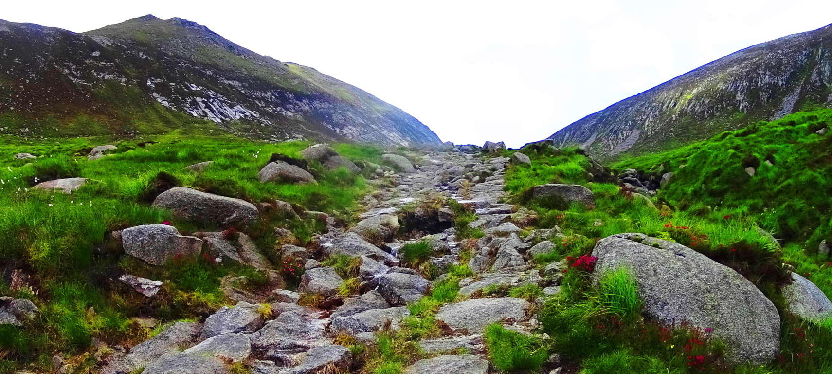
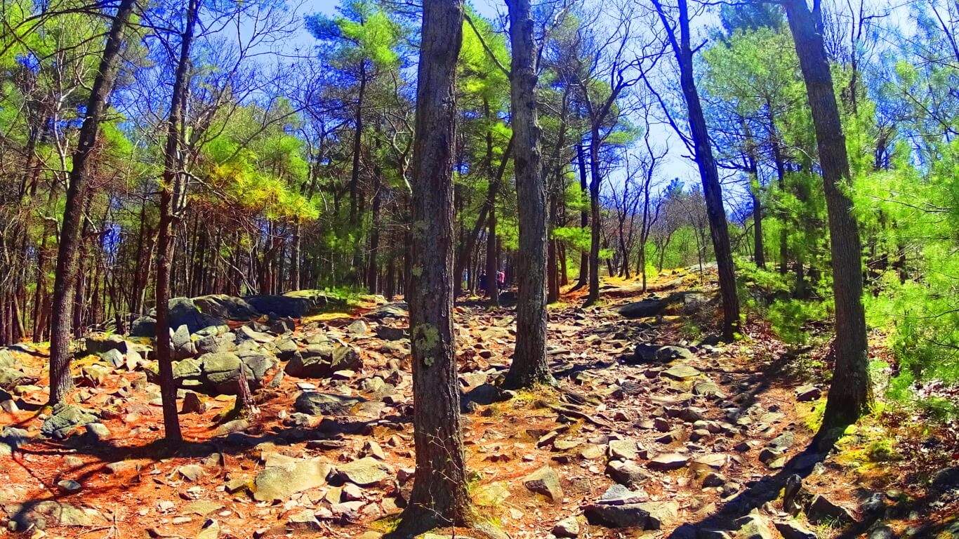 The angled granite scraps are the overall proof that craftsmanship took place. Entire trails are lined with scraps of angular granite cuts throughout Ireland, Wales, England, and New England. Returning to Upton, a New-England style Dolmen sits just thirty yards from the peak at Look Out Rock. This is also a trait of sacred neolithic places. Wedge Tombs and Dolmens are often just out of view from the most advantageous spots of their specific site, very much like hikers and campers keep a tent out of the wind fairly close to the beautiful spots they want to photograph and camp near.
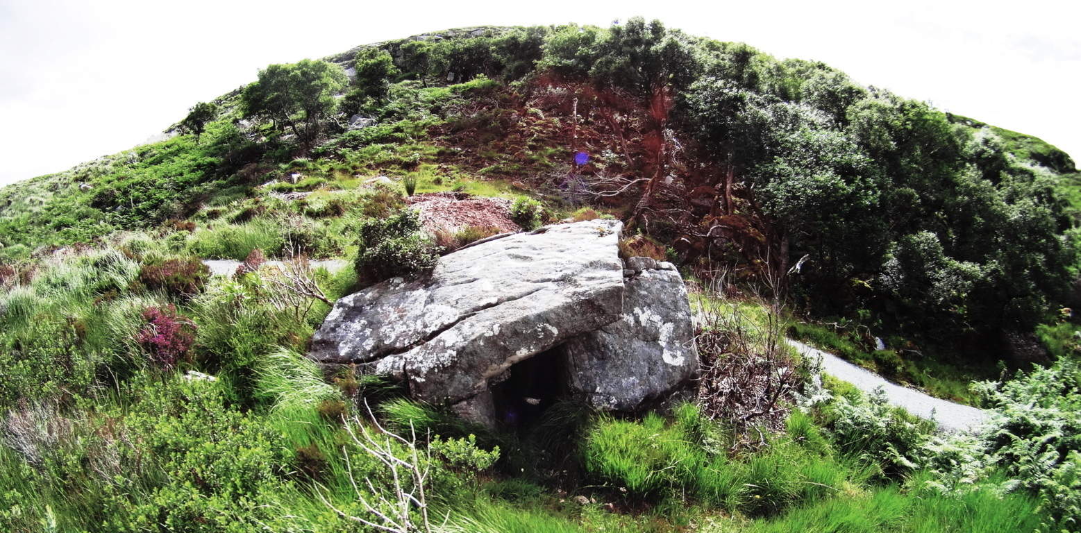 The Wedge Tomb in the heights of Glenveagh Forest, just like Look Out Rock, is centrally aligned to the mountain in front of it, with a Dolmen tucked just 30 yards from the best vantage in Glenveagh National Park. (image on right/Glenveagh Wedge Tomb). Something’s going on here. The boulders on this unique Dolmen (Image below) are cut utilizing massive and graceful lines, with long square boulders fit into each other, balancing perfectly into what looks like a primitive pyramid. The Stones are obviously cut. This Dolmen utilizes a ‘scale-scheme’ with the larger lower boulders, leading up to the smaller capstone at the top (image left).
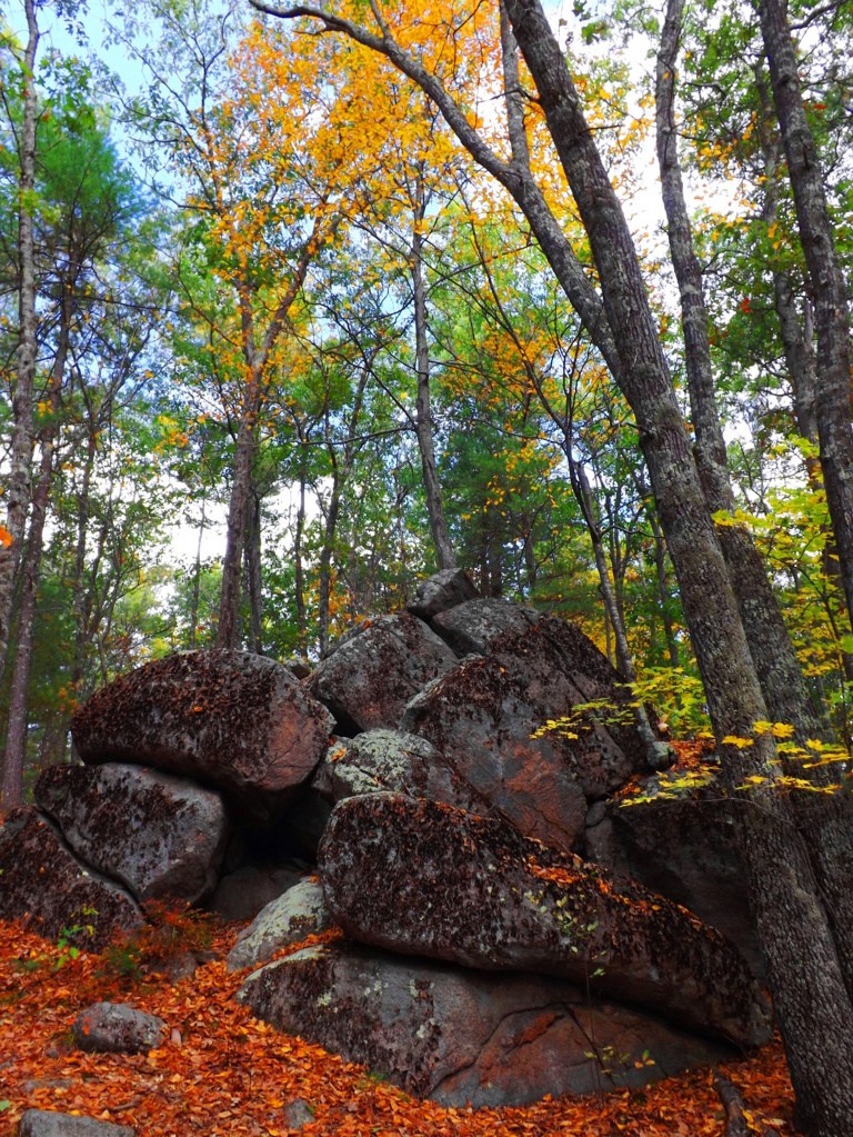 It is an incredibly thoughtful looking structure. In scale (not style) it is very much like the massive Proleek Dolmen in Ireland, which also shows nearly miraculous scale, and balance.
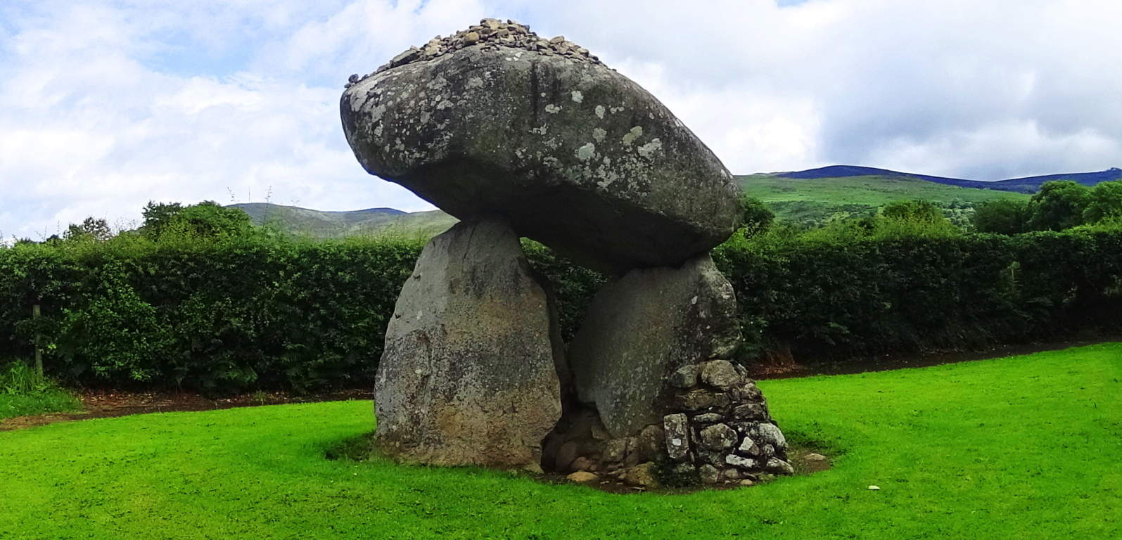 (right image). Interwoven into the old colonial town of Upton, there are ledges with massive megalithic fixtures, huge quartz streaks and balanced boulders. The geological explanation for these features just doesn’t make sense. Scientists usually impose some theory of how glacial ice exploded, or slid, in a certain way to make events like this happen, but it just doesn’t hold up logically. Take a look at these massive quartz parallel shafts, with a free sitting boulder cut and inserted into the underside of the ledge. The boulders may have been cut with the intention of having the quartz grow into the parallel gaps, which reveals an amazing comprehension of how quartz responds to granite in certain positions and places. I wouldn’t put this capability past the megalith builders. It seems that they had total understanding of how to use the landscape, and had the power to mold it as they saw fit. Conceptually, it breaks our reality wide open.
 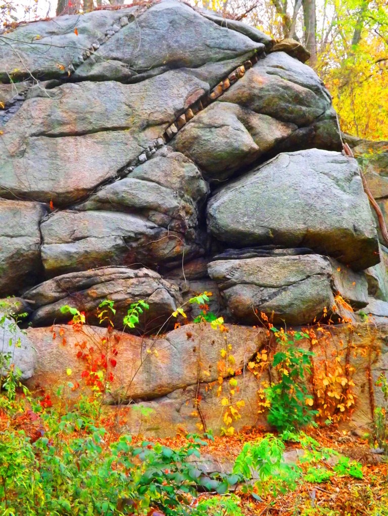 There are stone-linings so massive in Upton, that they look like they were intended to be walked on
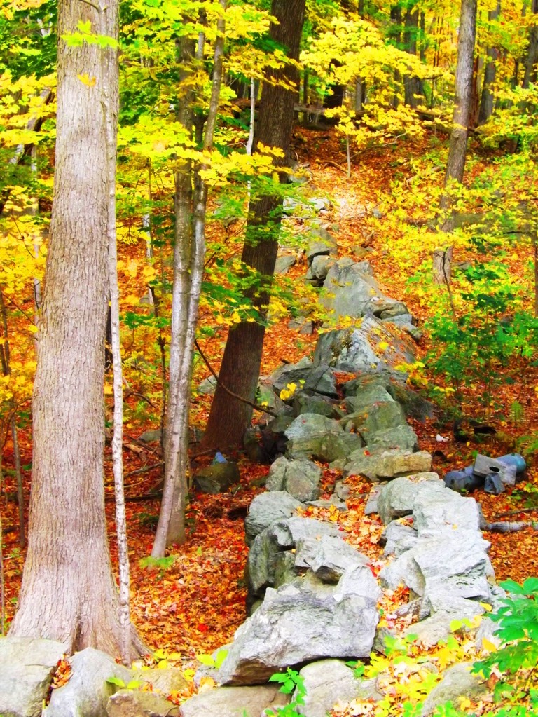 (image left below). Stone-linings literally converge on a Wedge Tomb at Glenveagh National Park from three directions (bottom image) (Click to look closer). These are all indicators that these stones were being used as energy harnesses, connecting features in the landscape, transferring energy from the Sun, to the stones, into the chambers. The entire town of Upton is sitting on a geologically engineered landscape. Take the trails through Upton Forest in October for a ‘fantastic full spectrum’ experience, and hike up to Look Out Rock to see for yourself the aligned ledges and Dolmen. This is truly a sacred and enchanted place in the heart of New England, comparable to any Celtic site. Seek it out.
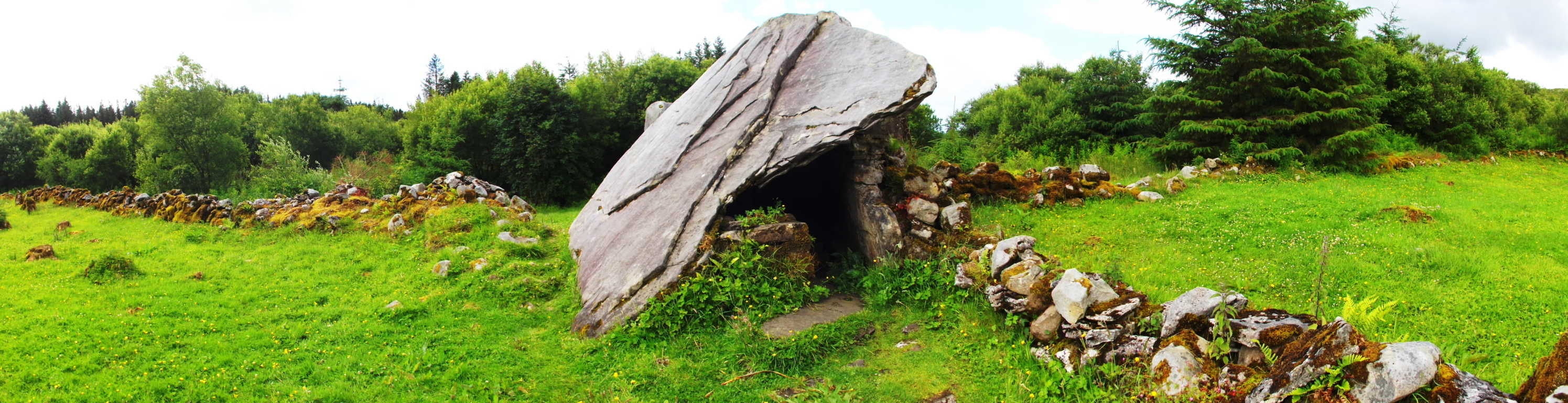
Tintagel
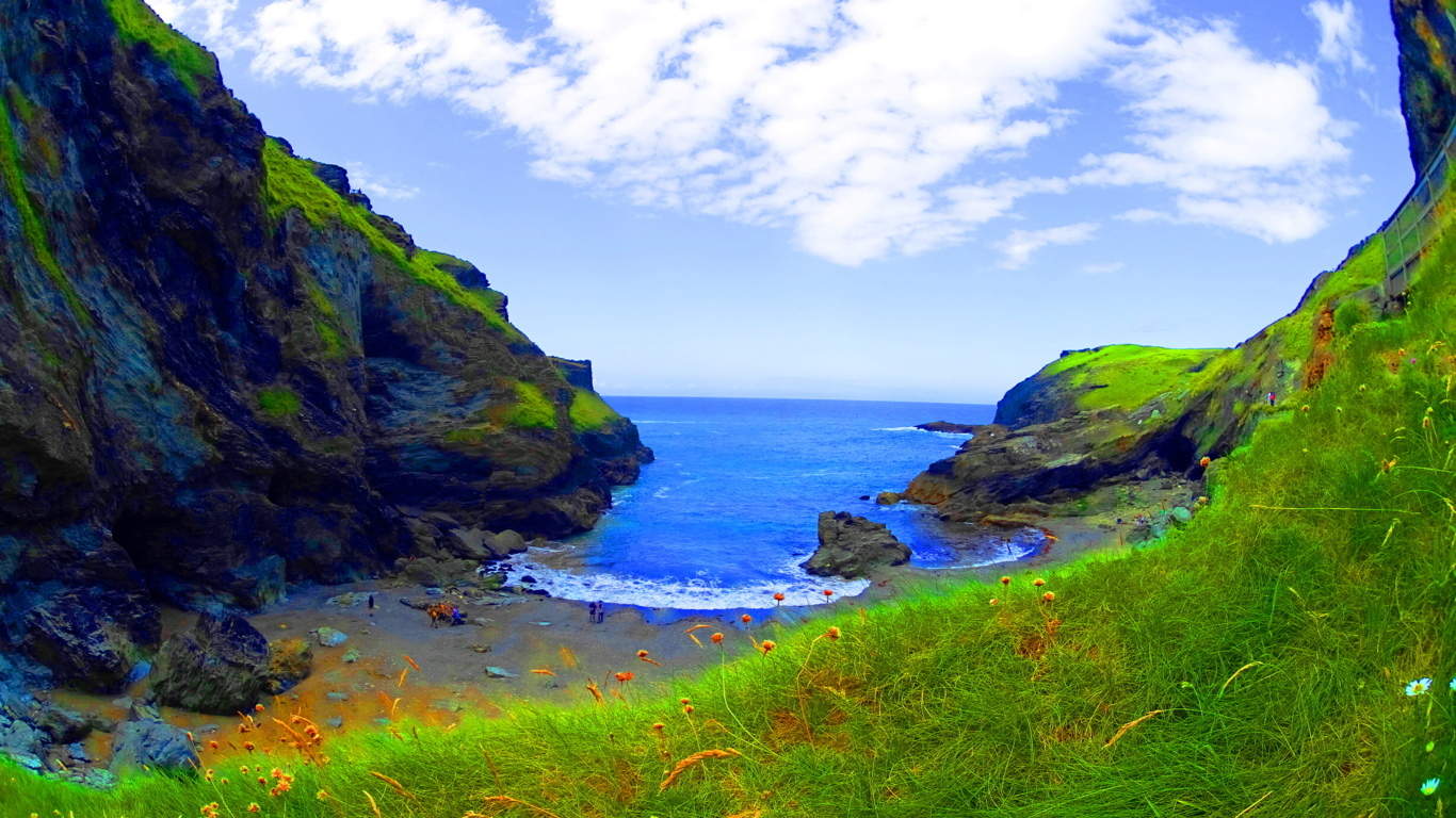 Location: Cornwall Coast, England
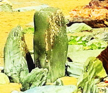
Interlocked Standing Stones at Tintagel
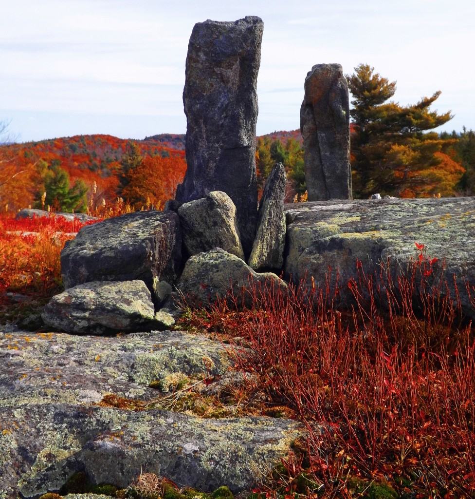
Interlocking Standing Stones in New England
Note: There are trails that can take you to Standing-Stones sitting on the tops of distant valleys in places like Wales Scotland, and Ireland. There are Dolmens and Wedge Tombs in secret hedges along river paths, hard to find, on misty rocky plateaus in regions where roads have no names. Eventually pathfinders need to make their way back from the heights to tell the tale of where they’ve been, preferably to some simple comforts, good food, warm fire, and some cheer. This is Tintagel. The countryside before reaching Tintagel is timeless, with rolling fields contrasted by the sea, and horses grazing on the heights.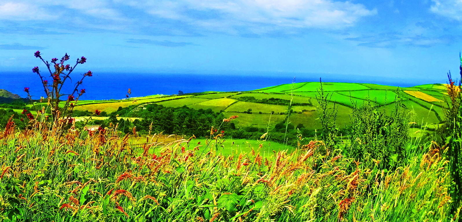 Tintagel is the epitome of the magical safe-haven travelers hope for, complete with an ancient Celtic castle built on a small but lofty island that looms along a 300 ft cliff reaching down to a sandy beach-bay, embraced by rocky cliffs, caves, and waterfalls. Seldom do hiking trails include so many major features in one place.
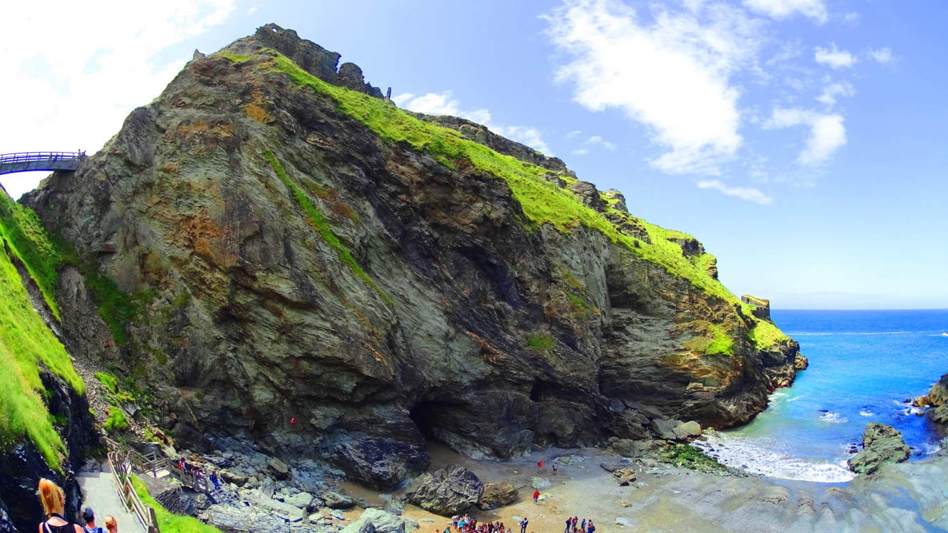 The trail for Tintagel Castle actually begins a mile before reaching the coastal scene, back in the center of the medieval town of Tintagel, which is now a beautiful bustling modern hamlet with every manor of comfort to offer. The trail literally begins from the main road in the center of town, extending down to a flowing freshwater stream with a path that leads straight to the Castle/Bay. Pass through a hilly cascade of tall grass and stony ledges that leads down to the coastal scene and gate.
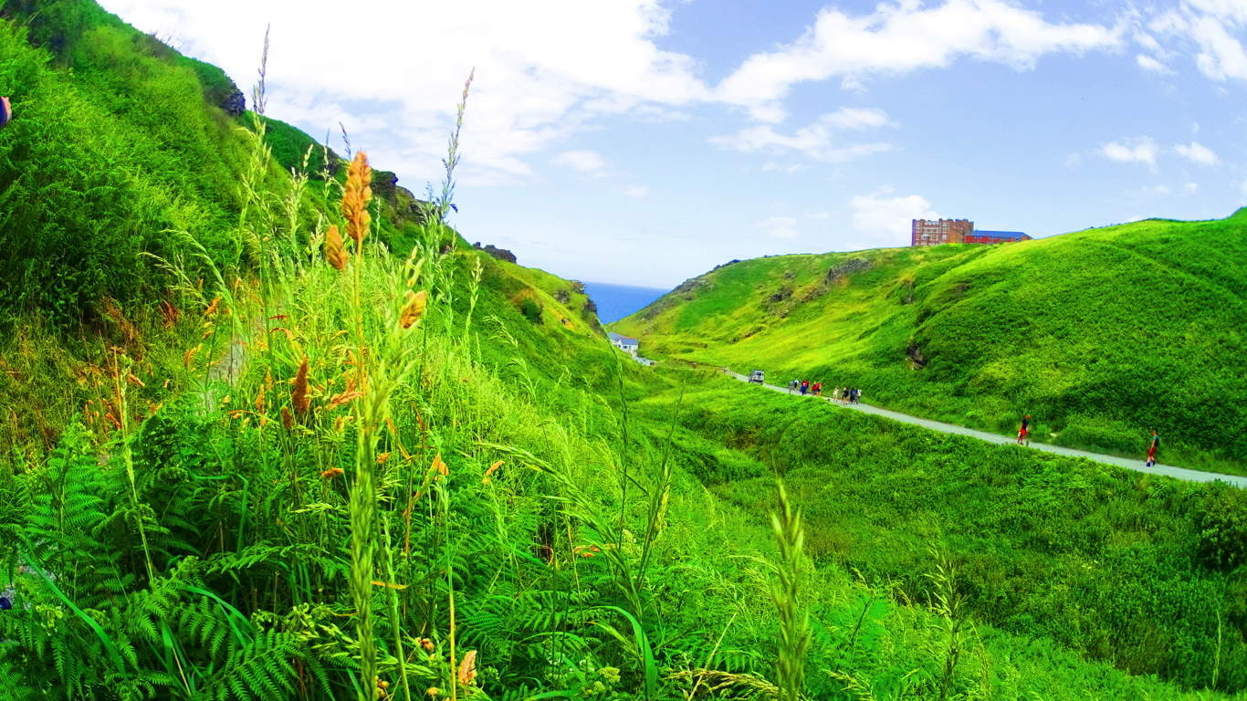 There is a small fee to pass the modern gate, where you are then free to make a choice of walking the elevated wood-board trail that leads over a high bridge onto the island, on which the ruins of Tintagel Castle sits, or down a winding sandy loop to the beautiful beach, megaliths, and massive rock caverns. A portion of the main gate of the castle still stands today. This is is the original Celtic entrance-way to the paths leading to the inner grounds, and around the Island.
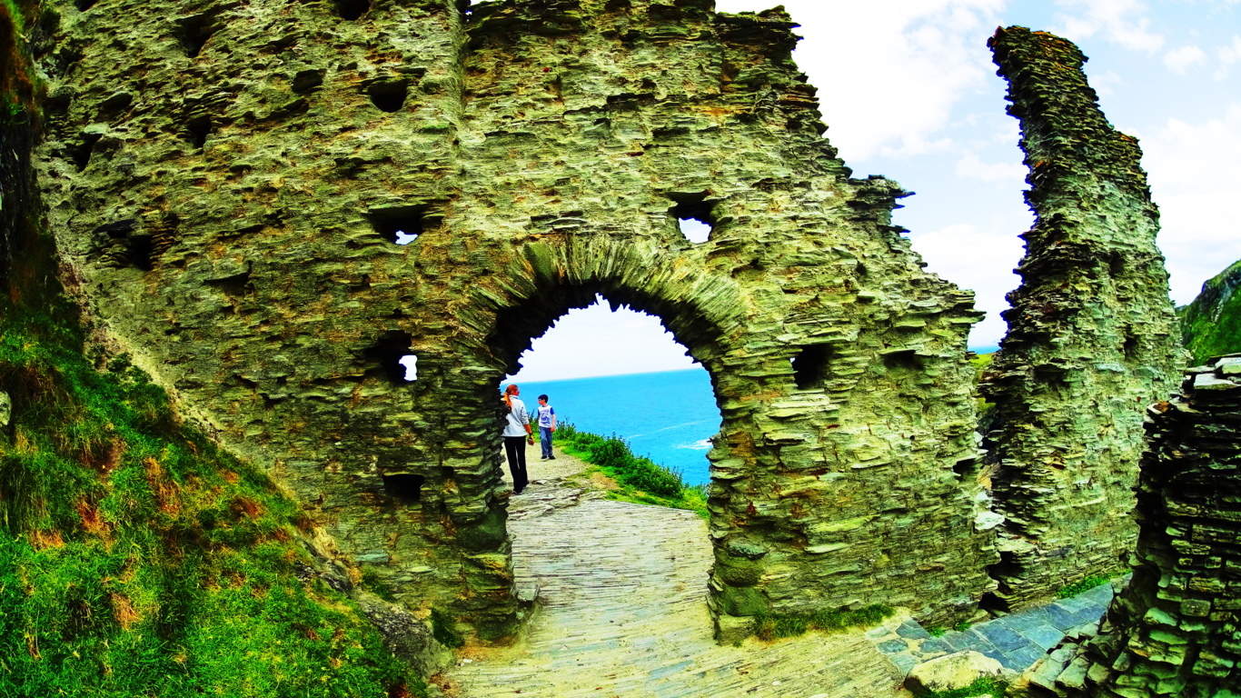 This rare archaeological site contains priceless remains of a Celtic Castle, one of the earliest Christian monastery’s in history, and Medieval period stonework. Almost every Celtic myth has origins here, including perhaps the most epic of all, The Arthur Legend. The story goes that Sir Gorlois, the Duke of ancient Cornwall, locked his wife Igrain in Tintagel while away battling for the Kingship of all England. Sir Uther Pendragon then disguised himself to look like the Duke by the magic of the legendary Druid Merlin, who lived below in the caves. Uther crossed the deep chasm of the bay on a magical mist created by Merlin. and entered the castle to conceive a child with Igrain. The child born of this intense mystical situation would be the legendary King Arthur. The myth of Sir Gawain and The Green Knight also began here. It is from this castle that Gawain sets off to find the ethereal crystal castle of the Green Knight, somewhere to the north, perhaps in Wales.
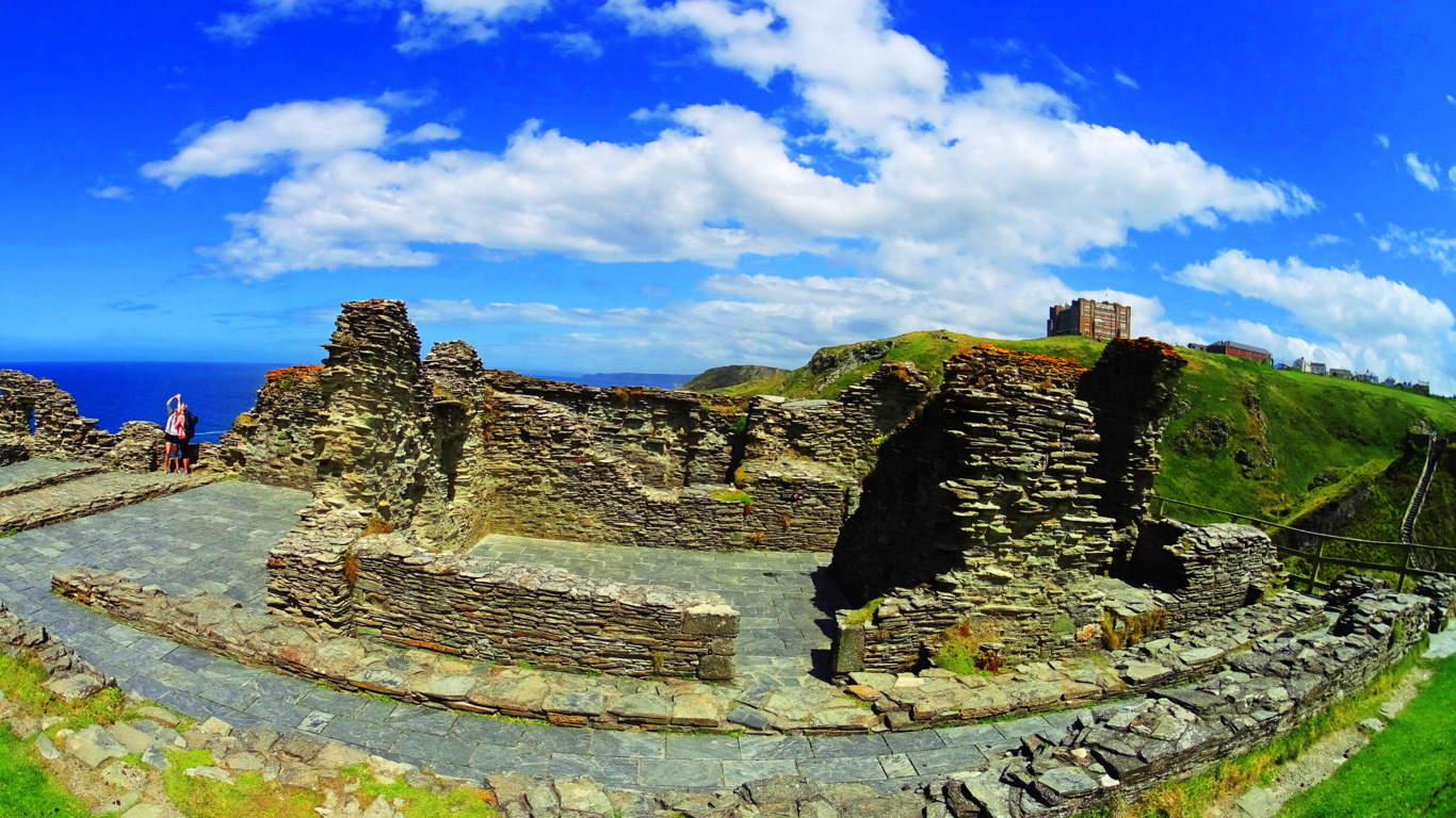 In recent years archaeologists unearthed a piece of Cornish slate with a version of the name ‘Arthur’ written on it, as well as items from France, Spain, and Ireland, indicating that this was an extremely busy and successful international seaport. These upper paths run for about a mile-and-a-half around the south-east edge of the island, with wild goats grazing, and gorgeous views of the blue-green Irish Sea.
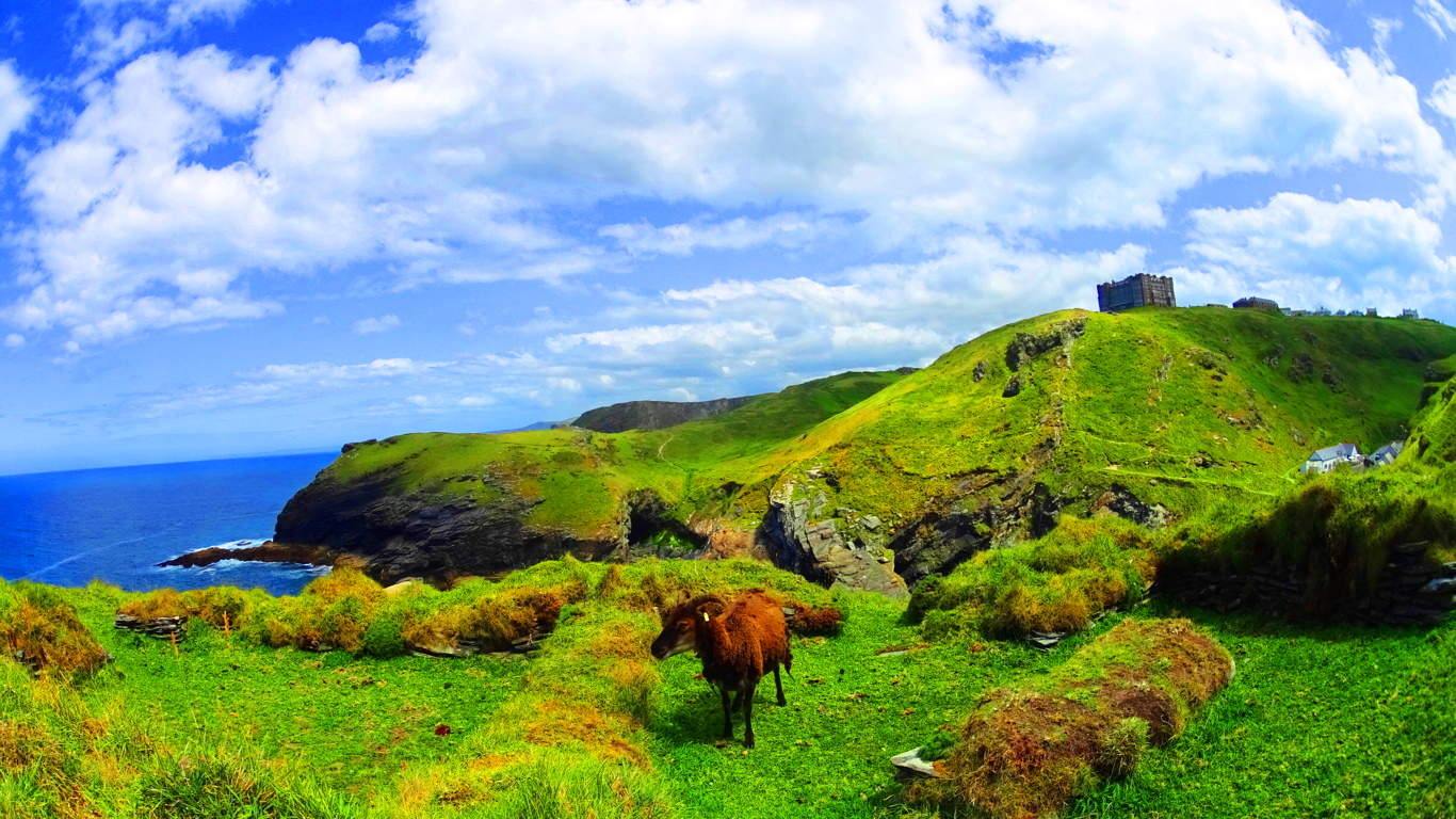 Once you’ve made your way around the Castle island, work your way down one of the most picturesque bays in England. With the Castle ruins looming over the entire scene, it is easy to see why the ancients chose this place to live.
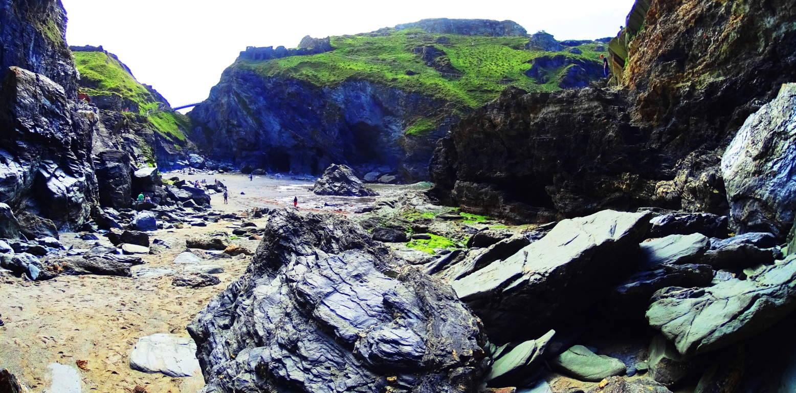 Freshwater streams roll down to the beach. Massive free-sitting boulders guard the cave entrances, along with mysterious standing-stones interlocked along the beach and rocks (top images). This interlocking style is very similar to the standing stones at the sacred alter in Heath Massachusetts, across the Atlantic. The boulders are sitting above other rock faces (pictured below), and centrally to the entire scene, as if they were placed. This is, again, very similar to boulders at other megalithic sites. These are specifically placed stones that date back to pre-Celtic times, associated with giants, when England was known as Albion, meaning, “Land of Giants.”
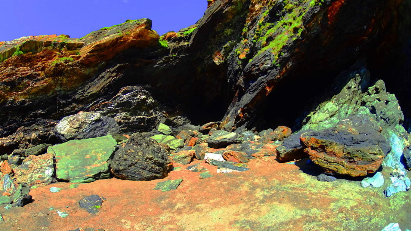 This beach is filled with white sand and mesmerizing tidal flow from the Celtic Sea, which paces everything like a hypnotic dream. You may very well find people reciting poetry about the birth of King Arthur on the beach, or getting some sun.
 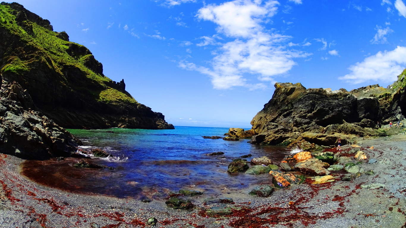 This is a place to take your time and revel in the history and scenery. The entire excursion is about 4.5 miles worth of hiking, after making your way back to town. The energy at Tintagel is palpable. Here you don’t just get an epic glimpse of how things once were in simpler times before the modern world had its way, you feel it.
Watatic Mountain
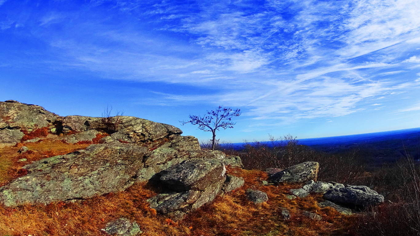 Location: Ashburnham Massachusetts, U.S.A
Elevation: !,831 feet.
Note: Massachusetts is a haven for the ‘small mountain’ experience, with most trails peaking under 2,000 feet. For hikers with the right vision, the experience on the trails is by no means small, however. A mysterious megalithic culture existed once on the rocky peaks, pine forests, and hilly river-valleys of this area. Strongest similarities show up across the Atlantic in the ancient Celtic elevations. The climb to the top of Watatic Mountain will grant you a great view of the State of Vermont to the north. In Autumn it is a visual miasma of colors, increasing the value of the trail exponentially. The main trail is called Nutting Hill, which is just over three miles long, half of which is just about straight up, so be prepared. The megaliths are here too, making this an anthropological experience. To begin, at ground level a set of small ponds accept the run-off from the mountain. The rocky mountainside deflects the wind coming from the north, stilling the ponds surface like glass as you pass by.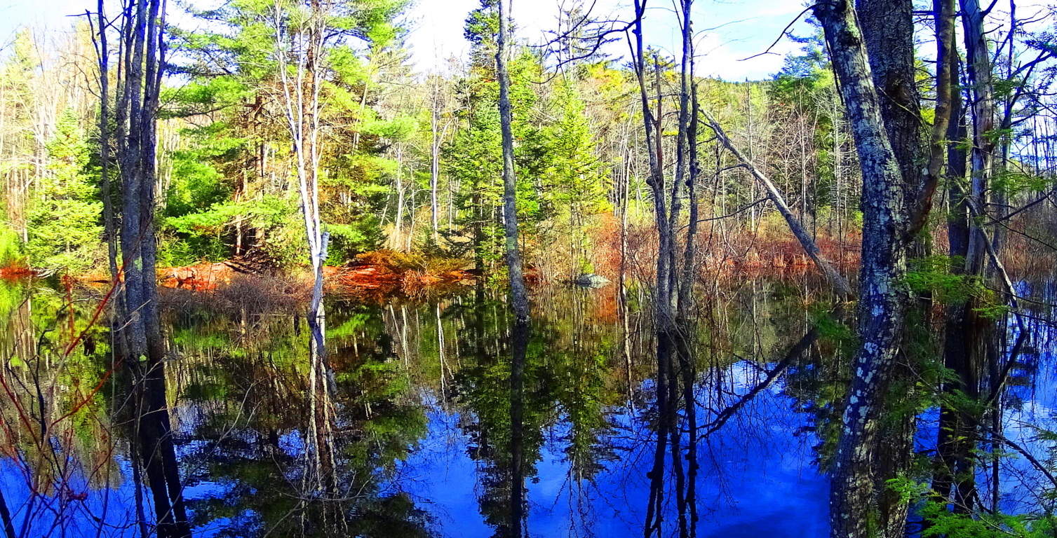 The level portion of the trail, just past the water, is only about 150 yards. Immediately strange stone fixtures protrude through the leaves all around. Among these fixtures are more significant signs of “signatures”, or specifically stylized workings in the stone. The ‘X’, or “diamond cross-section” is one of the most popular types.
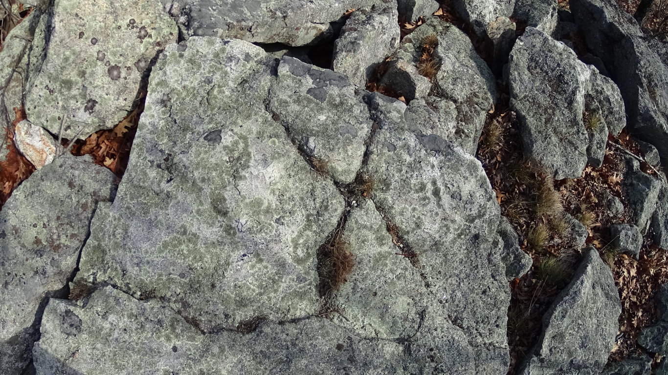
To look at these “X” sections it is nearly impossible to believe that they were created by ‘glacial displacement’. They create symmetries not only on the stones that they are carved into, but also in the stones within the vicinity of that particular signature. They are found on almost every Massachusetts trail where there is significant rock formations, both in the heights, and valleys. They are also found in the Celtic heights of Ireland.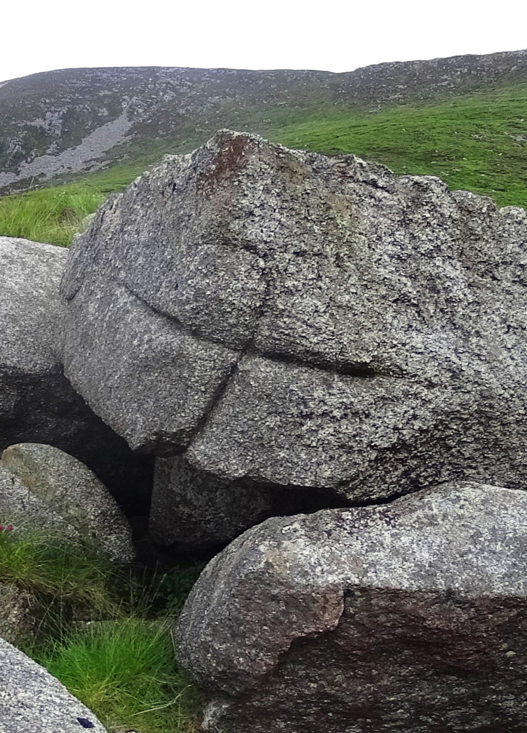 One possibility about the meaning of the “cross section” is that it is a type of utility that insures that if the section is cut, regardless of size, the remaining pieces will fit together if used to build other structures, such as stone-linings (“walls”), dwellings, or irrigation stones. Several examples of this “X” cross section from Watatic are shown here above, as well as one from the heights in the Mourn Mountains in Ireland (right). Before ascension on the trail begins, a classic megalith in the form of a smoothly split boulder, roughly 10 to 15 tons in weight, sits at the base of the mountain, like a gateway. The stone path literally passes straight through this massive cut boulder.
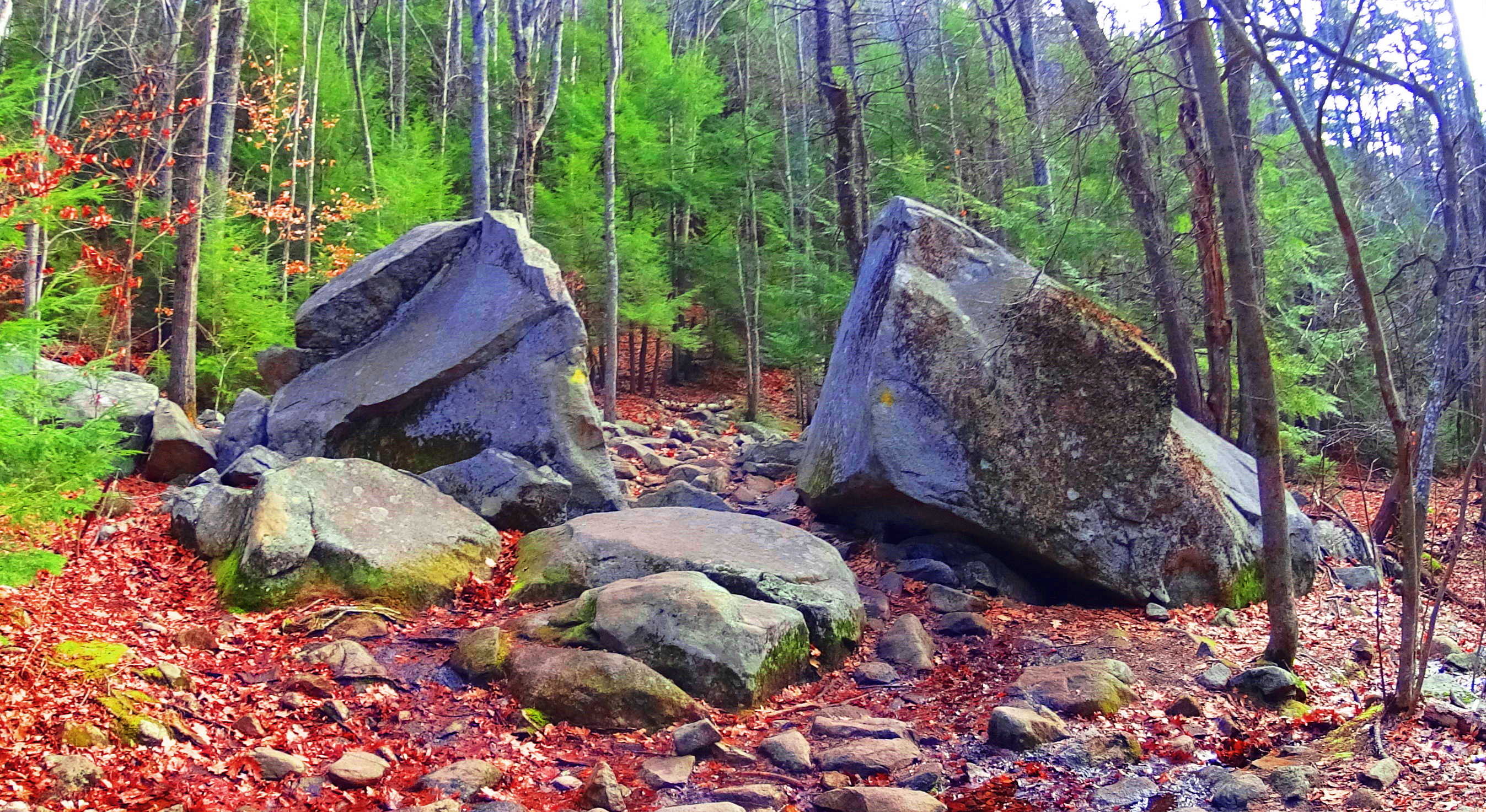 If you stop to examine the area around this megalith, you will find several “cross-sections” waiting to be observed. Continuing, as you begin to climb, a beautiful old-forest glade of pines emerges, and the path becomes wider and rockier. For roughly a mile you will work your way through these pines. Interestingly enough, it is not until you reach about 1,400 feet in elevation, that a “stone-lining” emerges.
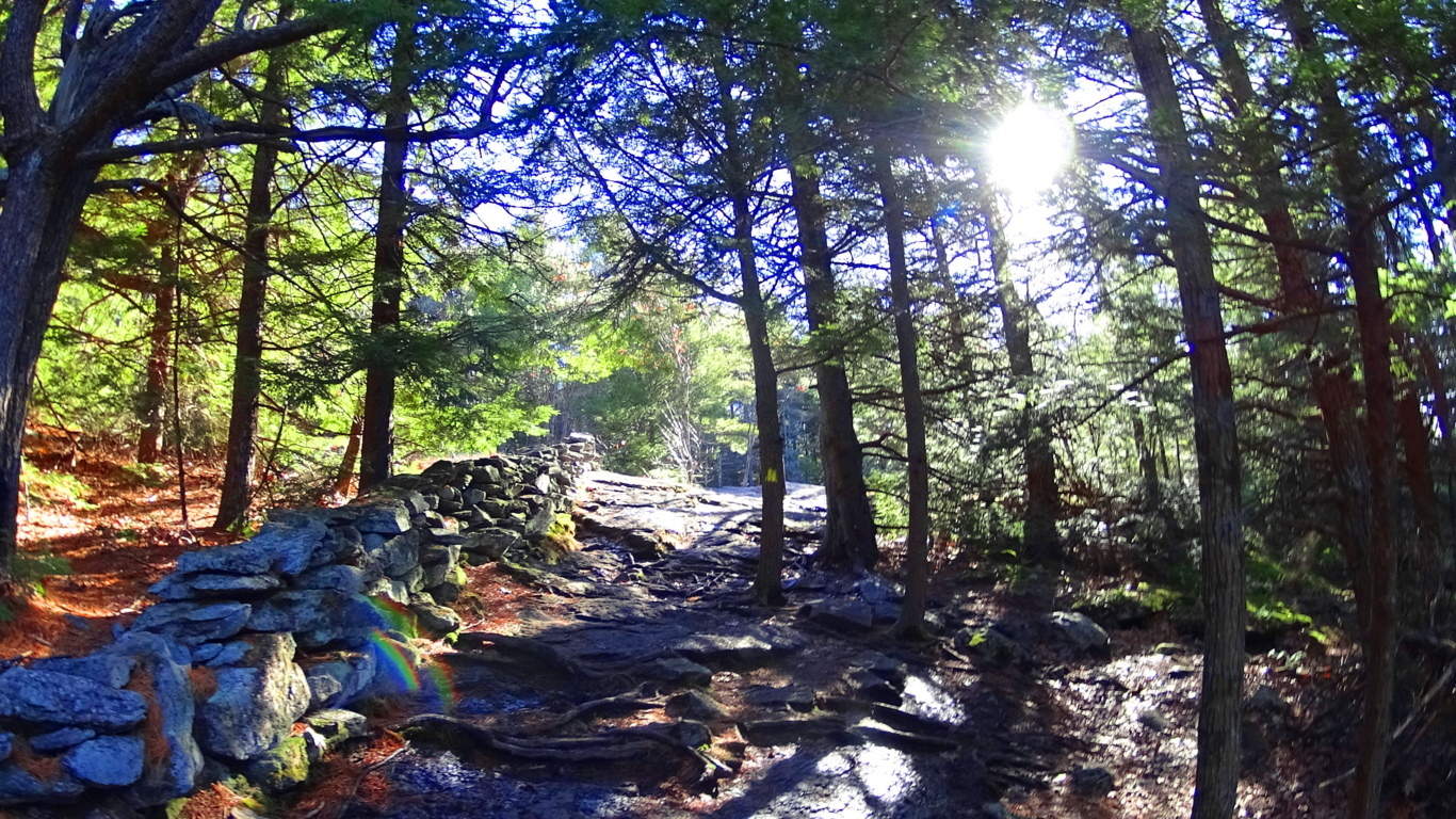 This particular “stone-lining” is another strong piece of evidence against the idea that this type of feature is not a “wall” by any means. It became clear that this feature ran circularly around the dome of the mountain, like a crown on a head. No colonial farm has ever existed at the top of this fairly narrow set of circular porches at Watatic Mountain, where there is no elevated water reserve or pasturing possibility. The case for this being the work of a colonial farmer marking off his territory is illogical. It would be a triply arduous task for any laborer to first gather enough semi-megalithic size stones to lay a three foot high, two foot thick, pile of massive cut rocks around the full circumference of the mountain, at an elevation of about 1,400 feet.
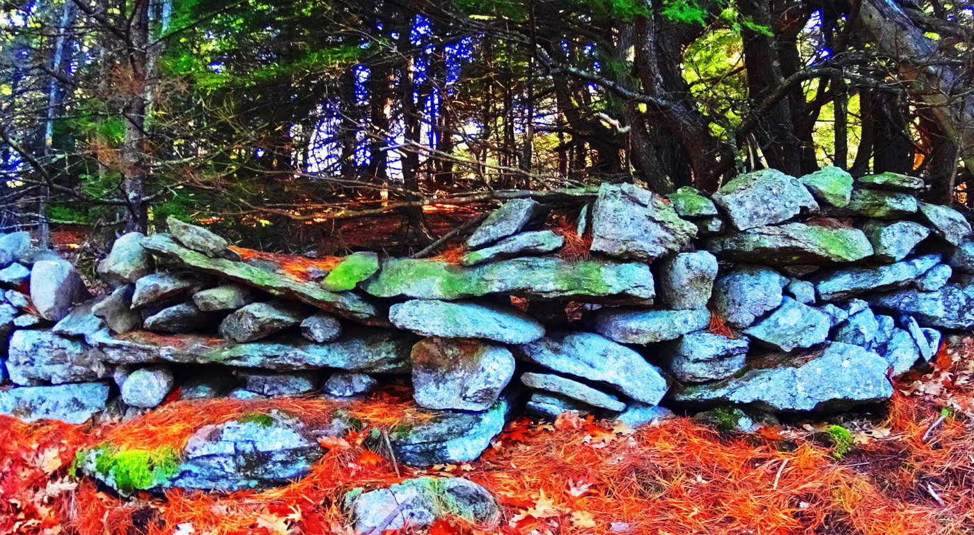 There are no signs that these stones were quarried at the top of Watatic, so they must have come from below. From below, after being crafted, piled, and gathered, the stones would have to be CARRIED UP, AND ALL THE WAY AROUND THE PEAK at an incline of roughly 60 degrees. If a laborer did manage to achieve this impossible feat, actually laying the stones, which weigh anywhere from 50 to 700 pounds each, it would take them a lifetime. Colonial living is an essay in practicality. Labors in Colonial times were conserved to efforts that yielded real sustenance, like digging wells for water, building barns for dairy and protein conservation, and clearing fields for crops. Building a stone wall for no reason around a mountain-side at 1400 feet, where there is no pasture, but only rock, would have been illogical, wasteful, and impractical to the point of preposterous. Something else is going on with these megalithic stone-linings. In places like Cavan Burren National Park in Ireland (Shown in green/right),
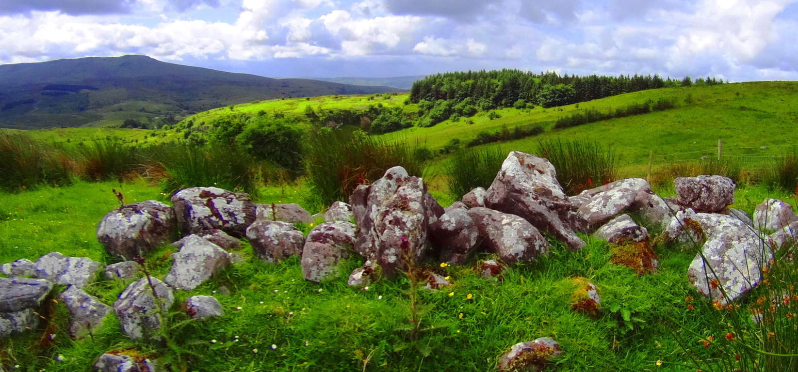 as well as the Blue Hills in south-east Massachusetts (Shown in red and orange, below/left), and the Mourn Mountains in Northern Ireland (Shown in green/left)
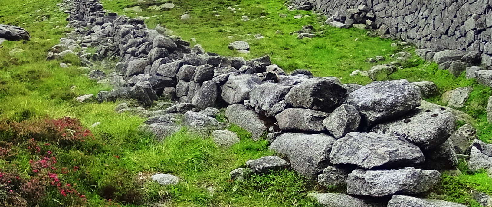 , stone lining seem to be energy connectors, or containers of energy in certain spaces.
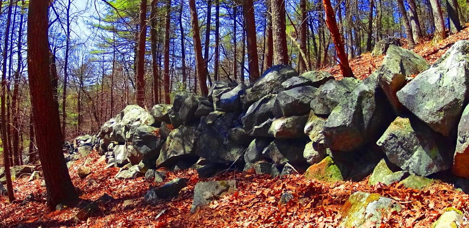 All of these linings are at significant elevations, and are not capable of containing any kind of herds; And this is what is happening at 1,400 feet on Watatic Mountain. Whoever set the stones in place wanted us to understand that the space created within the circle is a sacred energy center, charging the elevated dome of the Mountain with subtle energies. Continuing on again, after passing this 1,400 feet mark, your path will follow the stone-lining for about 100 yards until you cross-over into this special zone. At 1,650 feet there is beautiful Celtic style standing-stone just off to left of the path.
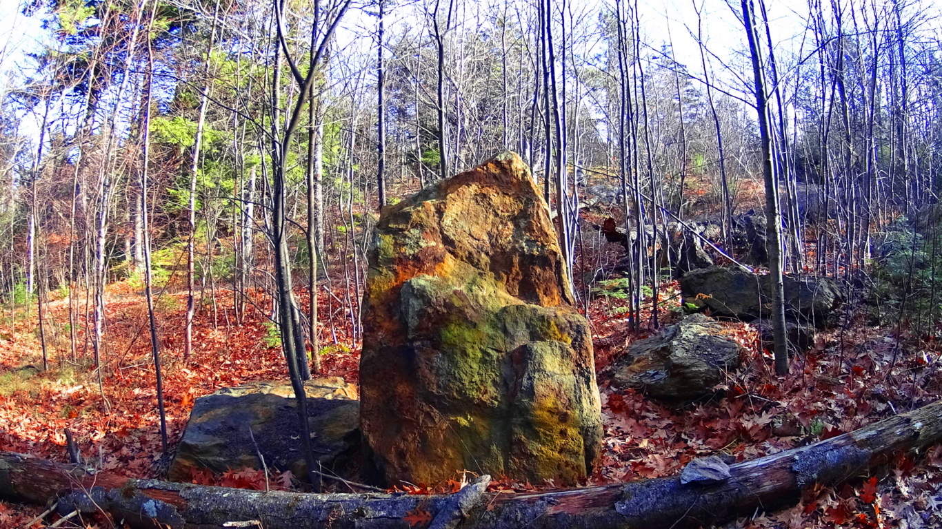 It stands 6 feet tall, and perhaps 7 feet in width, with a distinctly cut ‘face’ supported by a rotund rear side.
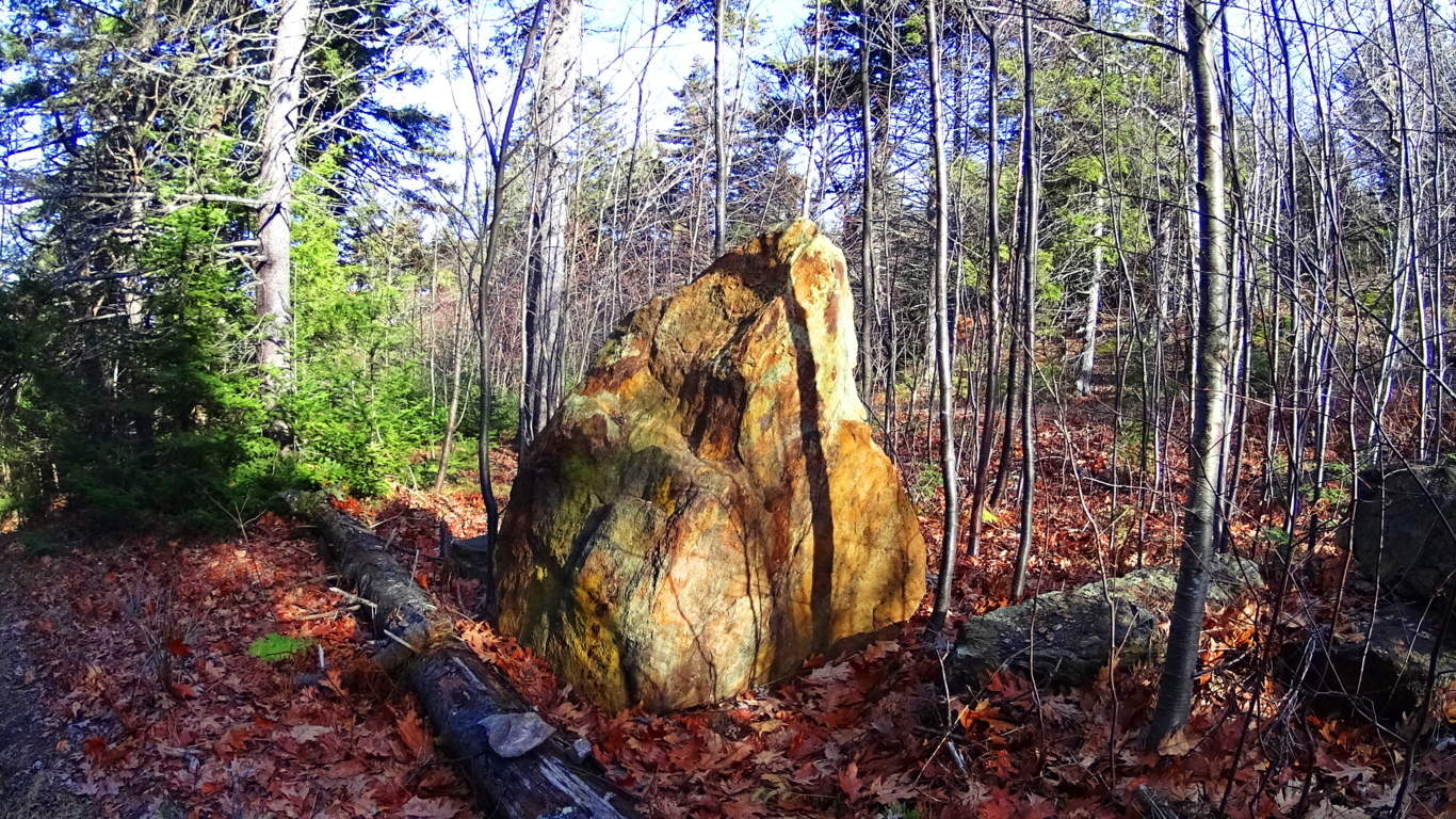 This exact style of “cut-facing with “rotund-rearing” can be found in a gorgeous diamond shaped, white standing-stone, along the castle trail at Glenveagh National Park in Ireland, (shown here in the next two images below).
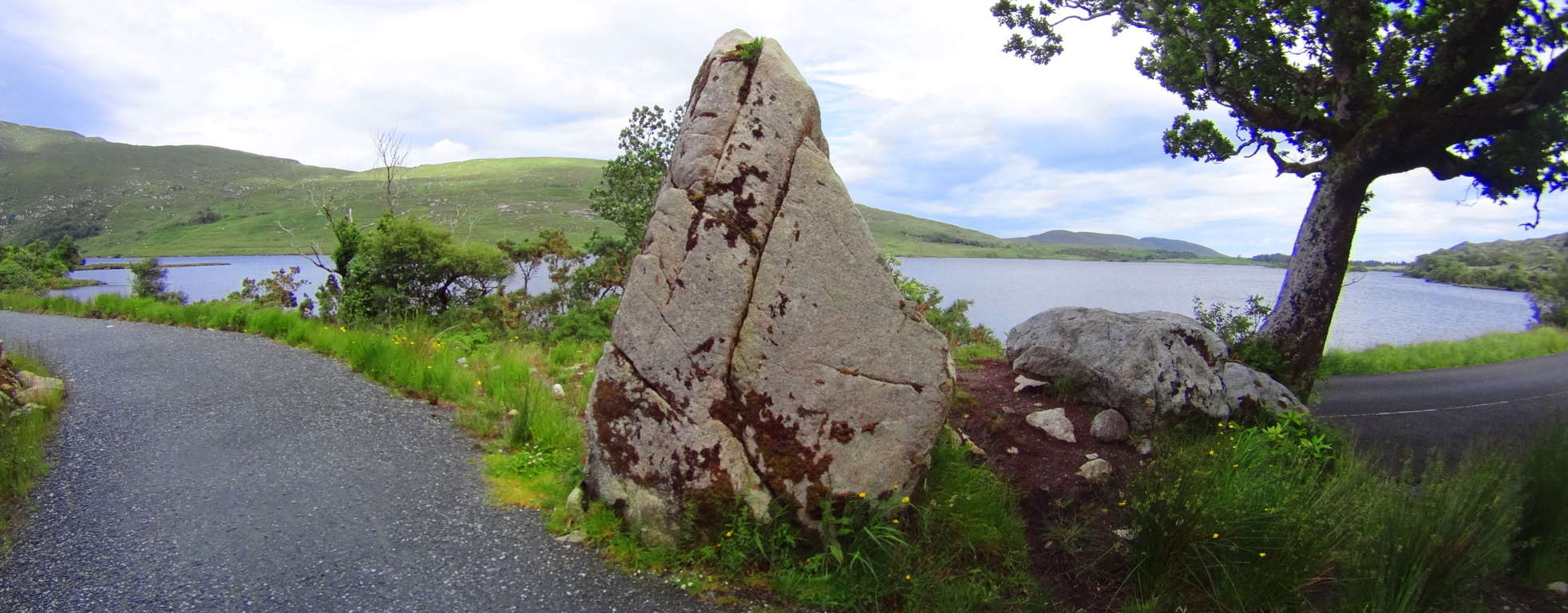
It is impossible to miss the distinctness of the “face” side with the “supporting rounded-rear side” in both stones, and therefor the similarity in craftsmanship. This is pretty solid evidence that the designers of these standing-stones had almost exactly the same knowledge about crafting them, as if they were from the same culture, although separated by an ocean. This is where the story of the Nephilim, as the first anthropological society on Earth, becomes relevant. Obviously the standing-stone at Watatic is so weathered by thousands of years of foliage layered on its distinct face, that it is practically camouflaged into the overgrowth, covering what looks to be pink granite beneath the grime, as opposed to the marble clarity of the Celtic stone, that has not experienced New England foliage. 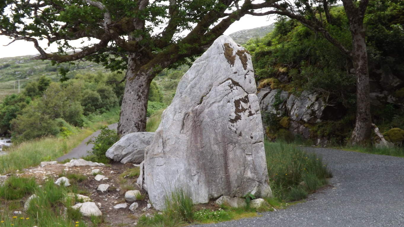 The standing-stone indicates, especailly at such an elevation, that this was once an incredibly endeared and valued space to whoever inhabited it. Finally, a quaintly cut-stone staircase climbs up to the last portion of the heights.
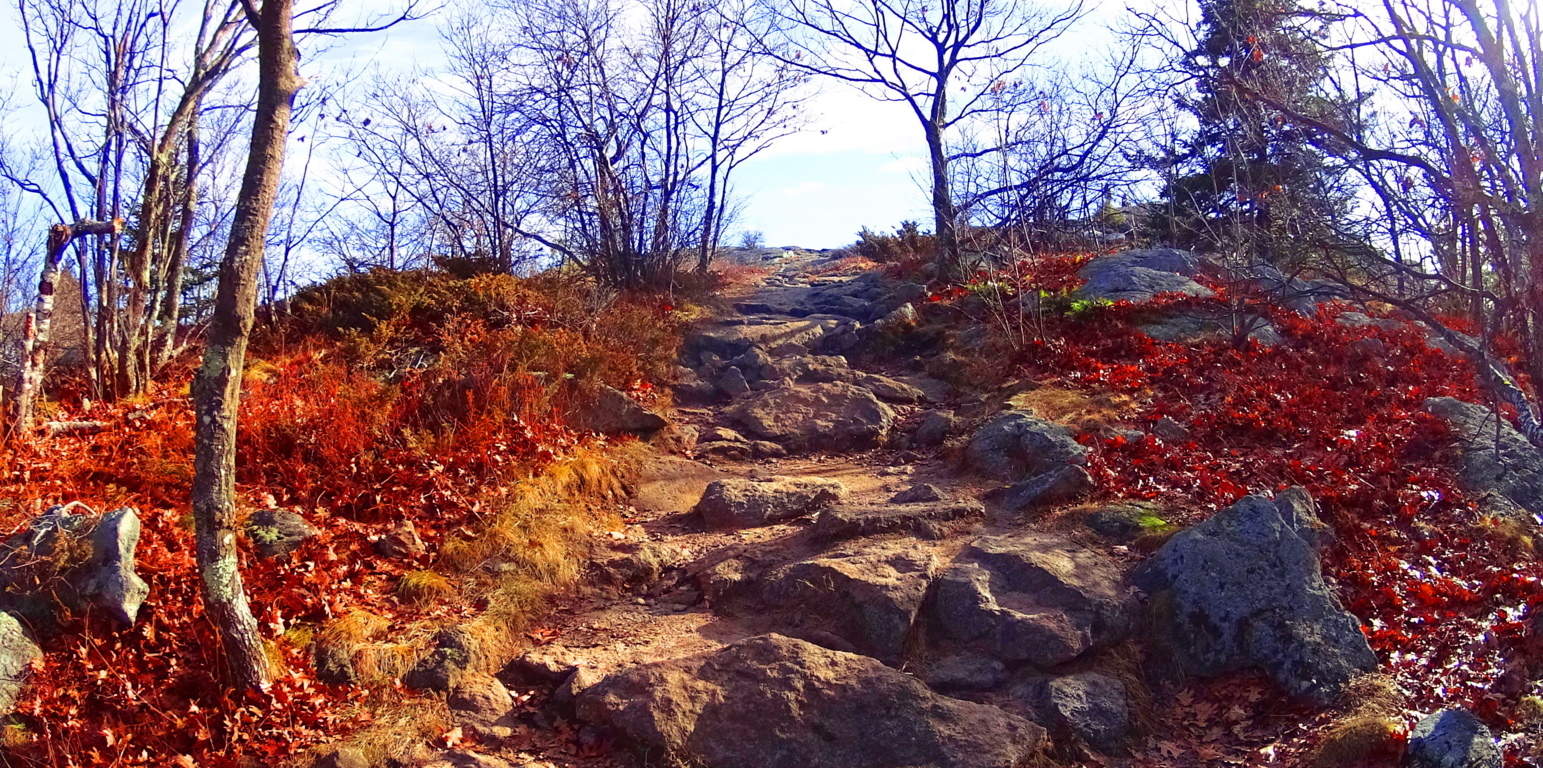 Here you will arrive at a grand porch with a 360 degree view. The rocky trail continues to a larger secondary porch, 50 yards south, lined with pines and rounded granite floors.
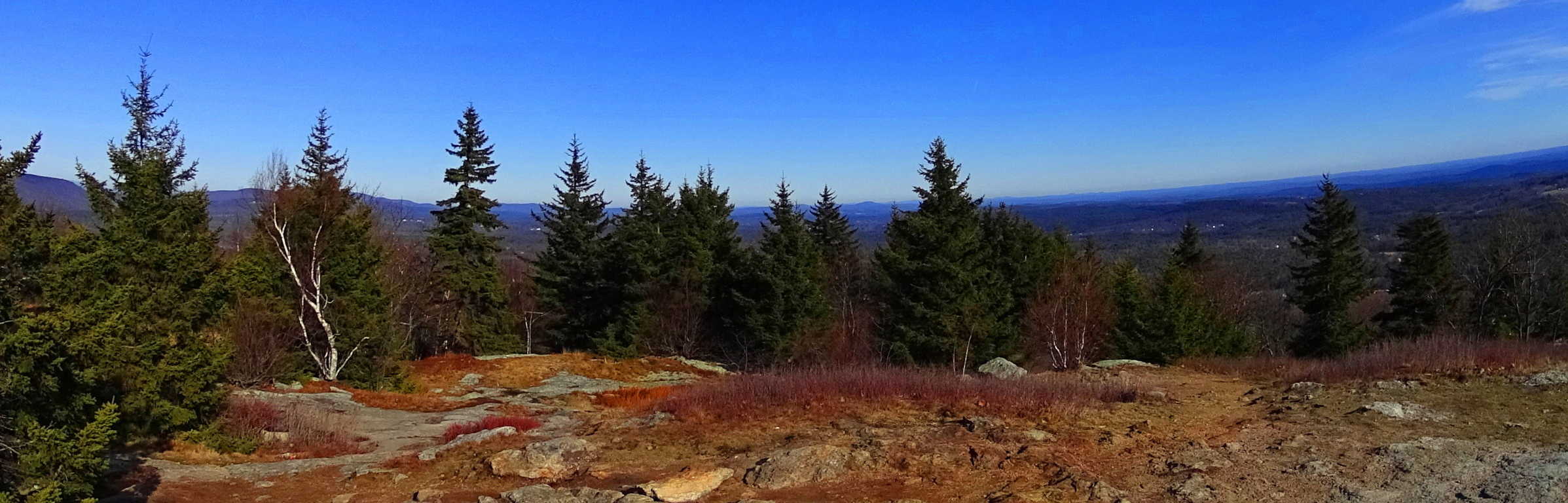 It is well worth the effort to reach the top. Watatic is an essential “small mountain” experience in Massachusetts, literally crowned by ancient megalithic stones. Take a day and see for yourself, you won’t be disappointed.
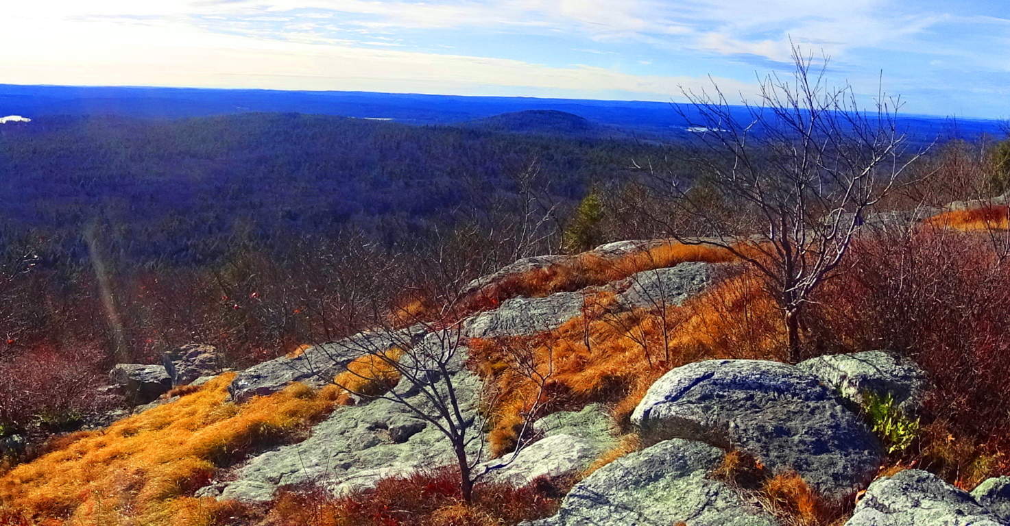
Stonehenge
Location: Wiltshire, England
Note: Imagine yourself walking on a broad plateau surrounded by miles of grass and swaying brush. Continue to imagine that you are curious enough to seek out the best elevation among these vast fields, following the slight incline, continually heading upward. You begin to see something distinct just above the landscape, off in the distance. At about 400 feet away you glimpse something entirely impossible. There before you are several circular stone enclosures towering above you. The hallowed presentation of the area is hard to comprehend, even in broad daylight. It is not a disheveled scene, but rather, a highly organized, dynamic and symmetric presentation, like a temple. You then realize, all at once, that you may be looking at the first temple on earth. If you don’t turn away in fear, your mind, whether it is that of a passing farmer, saint, knight, Celtic king, or simple serf of times past, will inevitably reach for that first logical question asked for thousands of years before: how? How did this happen? Let’s fast forward and look at some of the modern observations. The external ring is made up of Sarsen stone, each standing 30 feet high, at 25 tons each.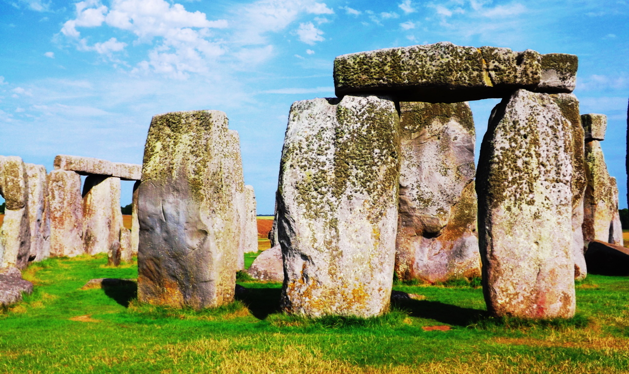 This exterior ring looks to be incomplete, as only 16 of the original Sarsen stones are in place, while there is a significant gap on the opposite end. Was the ring ever fully completed? If it was finished, how could some stones then disappear? A secondary ring of 43 Blue Stones are distinct but also obviously incomplete, within the larger Sarsens. Some believe that there were as many as 80 Blue Stones originally. They weigh roughly 2 to 4 tons each, and were believed to be inserted thousands of years after the Sarsens. A third set of Lintel Stones are laid across the top of the Sarsens in different areas, revealing the intended circularity of the enclosure. The Lintels are not free-sitting, but are placed into grand notches that are carved into the top of the Sarsens, revealing yet another miraculous feat of engineering, besides the placement of the stones themselves. Lastly, at the innermost section of the rings of stone, are the five domineering Trilithons, set in a “horshoe” style configuration, including the lintels above them, weighing 50 colossal tons each. I was lucky enough to walk the grounds of Stonehenge on a sunny day, and got the best images I could, shown here. It was just as moving to step away and see others sizing up the scene, perhaps realizing, as I did, their own humanity; Perceiving that these stones have been here long before they were born, and will be there long after they are gone.
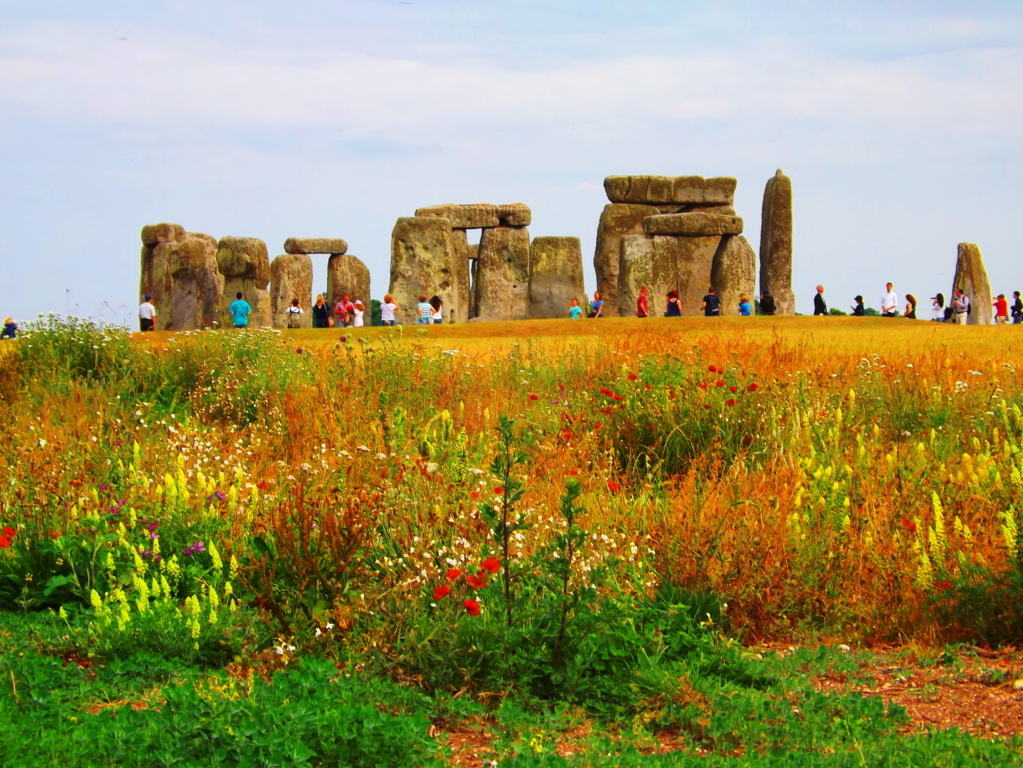 Research continues regarding the meaning of this mystical place. Recent discoveries have revealed that Stonehenge is part of a grander overall context of ‘spiritual monuments’ once built into the land. Remnants of what is now being called “Woodhenge” has been found a few miles away, built in similar fashion to Stonehenge, near to the river Avon. Compelling theories about the ancient Britons utilizing Woodhenge as a temple to the living (cultural association with wood), which moves up along the River Avon in a procession towards Stonehenge (stone being culturally associated with the dead) in a ceremonial celebration of existence, have been put forward. Many researchers also believe Stonehenge was built as a type of ‘celestial clock’, marking the Summer and Winter Solstices for eternity. Another feature of the area is a beautiful ten foot high Standing Stone perched roughly 70 yards away from the Sarson circle. This stone, with its nodules and indented creases, looks somehow older than the Sarsons in the distance. It clearly looks as if it were standing guard over the area, warning passers by that the area is flat-out sacred, and to act accordingly.
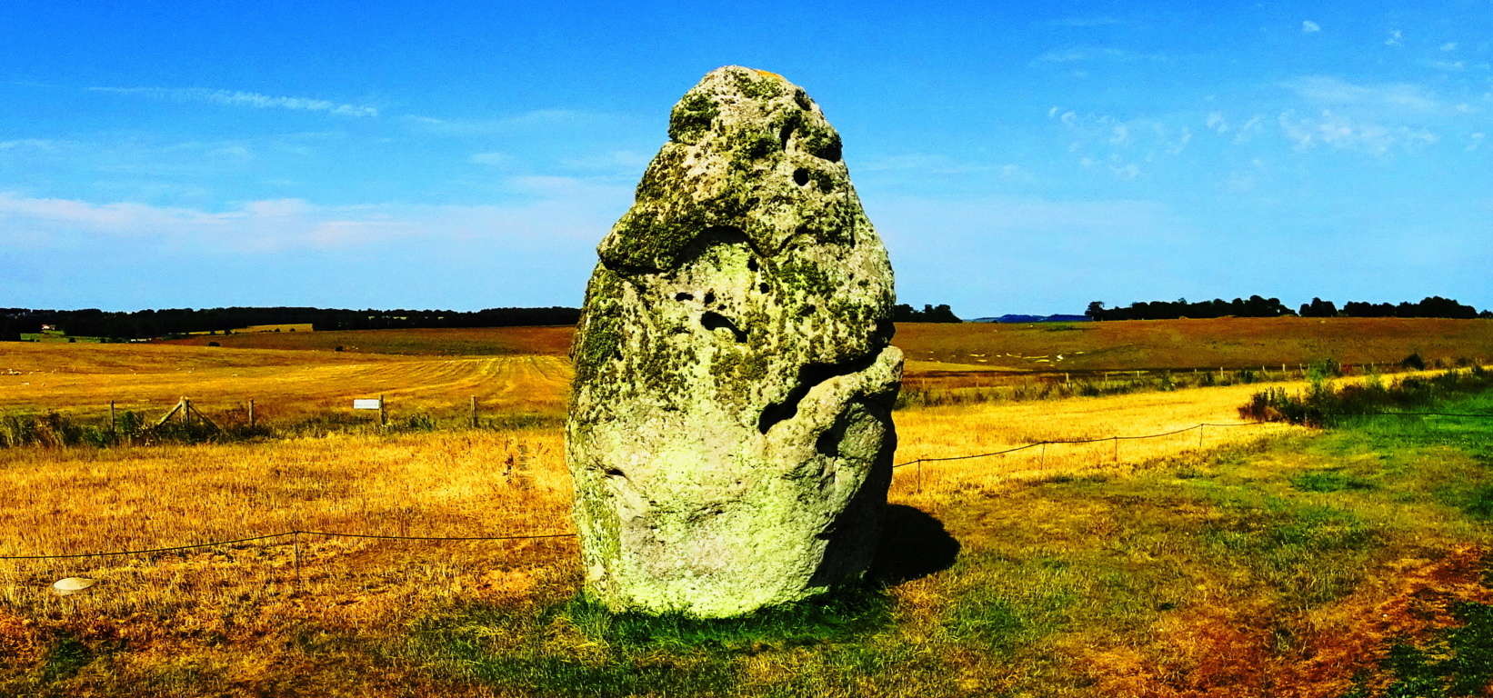 These “guardian stones” can be found near Dolmens and Wedge Tombs all across the Celtic world, standing at the periphery of sacred areas as warnings that visitors are entering a sacred space. This phenomenon exists also in New England, but in the form of free-sitting boulders. Boulders will be placed peripherally, strategically, to corner off a section of forest, cliff, or mountain plateau, in order to make passers-by aware that the area they enter contains sacred features. All of this could have originated at Stonehenge. The original myths and stories of the English country-folk say that giants are the builders of Stonehenge. Ceremonies of Celtic Kings and tribal leaders have taken place within this sacred circle for as long as recorded time has existed, including fantastic tales of Merlin and King Arthur intertwined with the history. Today it is an internationally protected historical site, with a museum and bus that runs along the hills up to the site for a ticket price. You also have the option to walk if you so choose. Stonehenge is the epitome and origin of everything magical about megaliths, once you see it, you cannot help but realize that so many wonderful things are still left to be understood. If you can, I hope you will give yourself that chance.