Hill of Tara
Location: County Meath/Ireland
Elevation: 508 ft
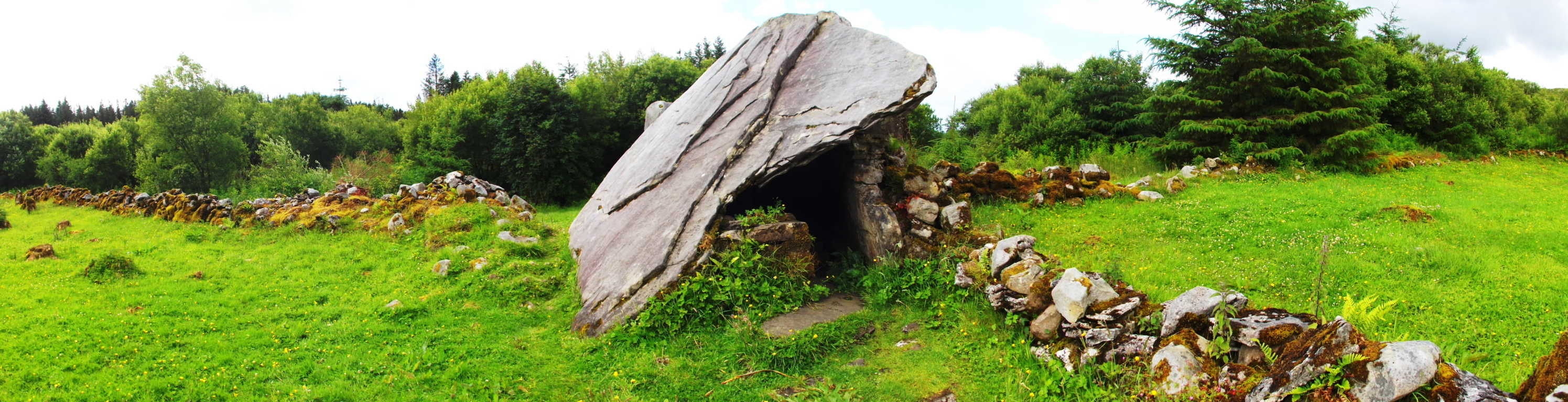
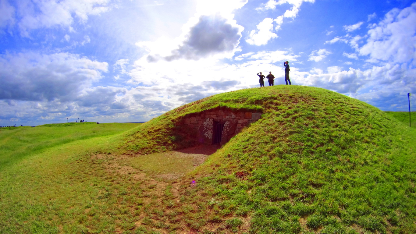
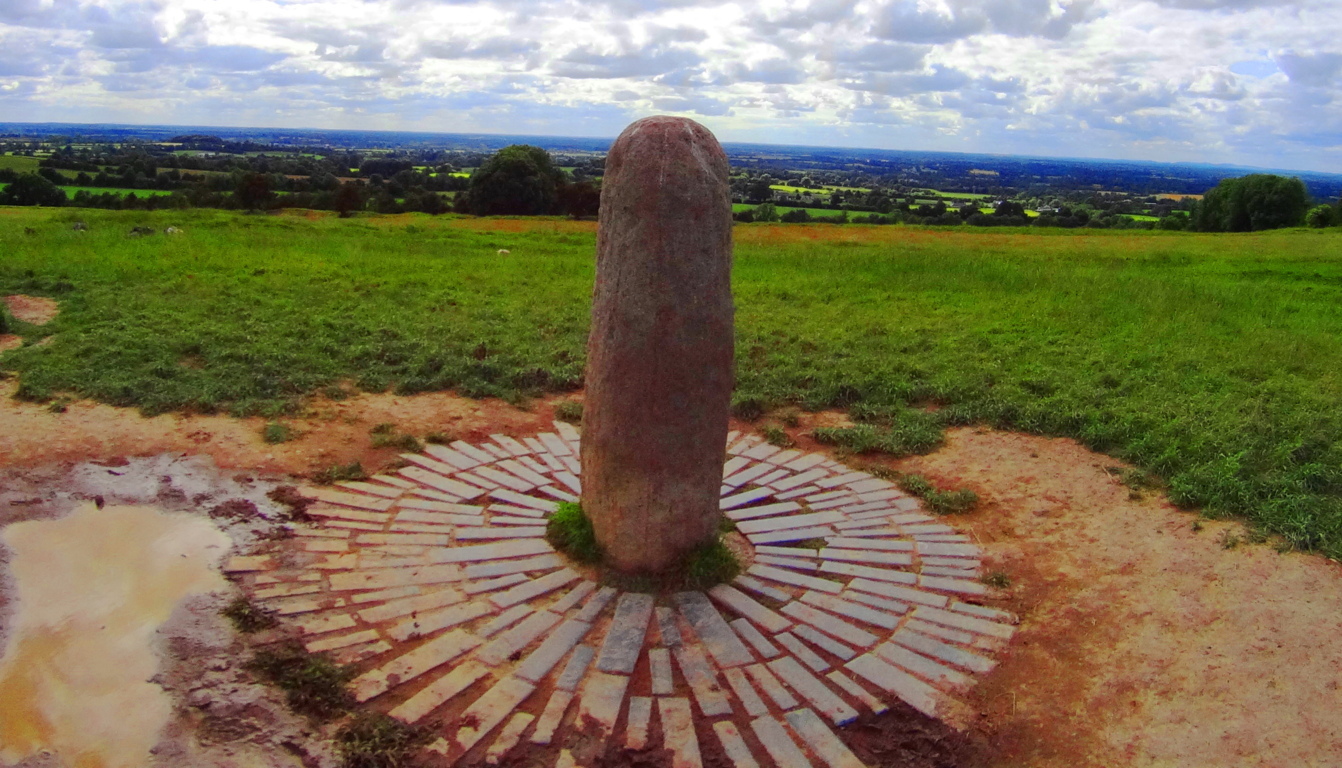
Note: It is fitting that the Hill of Tara, the historic site where it is said the High Kings of Ireland were once crowned, is on a road with no name. This sets the tone for the experience of County Meath, and within it, the enchanting hamlet of Castletown, a place deeply dedicated to preserving the beauty of Celtic life in all its aspects. Castletown is wonderfully lacking in the exacted labels of modernity, with lanes and lands that have names known only by the local farmers and families. It is here that The Hill of Tara is embedded, and without a GPS, or mapping system on your phone, you simply will not find it. Be prepared. The deeply rural aspect of Tara’s location has been challenged by organizations wishing to modernize this area with more expansive highways, and this effort has been met with overwhelming resistance. The people here clearly value a connection to the sacred land over monetary expansion, and this gives us yet another connection between Celtic and Native American culture. The Hill of Tara is the central natural monument for the earliest Celtic identity of the Irish people, while Newgrange is the Megalithic complex with equal stature. It is understood that the High Kings of Ireland were crowned, and kept their High Seat, here. There is a standing stone and stone chamber at the top of the Hill, marking the very spot where the High King was crowned in ancient times. There is a main trail from the car park, and several minor trails that encircle the hill. A full hike of the area is about 4 miles long, if you so choose, rounding the Hill. Perhaps more importantly is the option to sit down and understand the depth of what this place represents, and feel what it exudes. It is not a cliche taking place at Tara’, it is in fact one of the realest connections you can feel to the landscape in all of Ireland.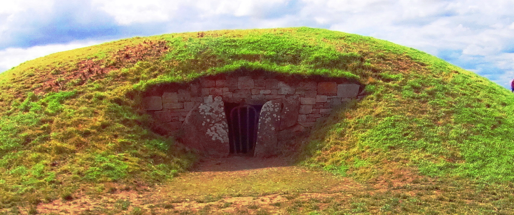 There are several specific monuments that should not be missed here. The stone chamber is a beautiful example of corbel layering in the Celtic style. It is placed specifically at the zenith of the Hill, and built into the ground in order to connect with the earth below. This exact style of stone chamber exists mysteriously in the forests of New England. Below are examples of the stone chambers at Upton and Nashoba Brook, Massachusetts/USA. They are very similar in construction to The Hill of Tara stone chamber, but lack the pinnacle context of the Irish chamber, so obvious with a single glance.
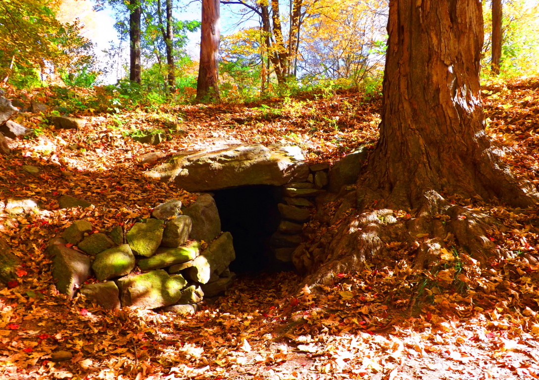
 The question arises: What are identically constructed stone chambers doing an ocean apart from each other? A full analysis of the stone chambers, both in Ireland and New England, may reveal astrological, as well as geomorphic significance. While standing inside the Upton Stone Chamber when I took the image below, over two years ago, several small glowing orbs began floating around my camera lens. (image below/left of center, 2 orbs connected) This is a strong indicator for the purpose of harnessing energy in these chambers.
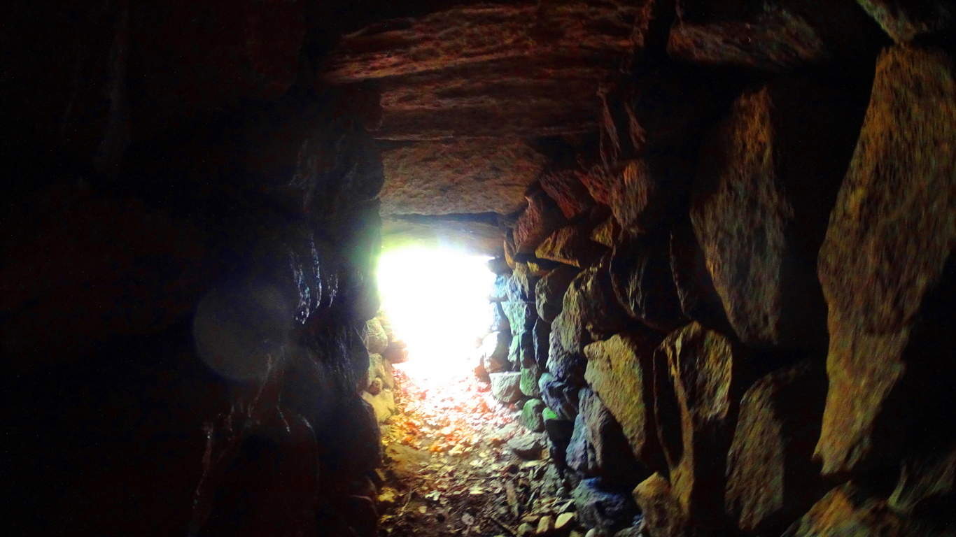 I had never before seen an orb up until that particular moment, or even believed that they existed. It became clear to me that what takes place in the stone chambers is most likely a harnessing of energy. This is very similar to what is done with electrical current and quartzite utilities in today’s era. The stone chamber at Tara’ would very likely have the same energetic benefits, and therefor be a good place for the High King of Ireland to be. After spending some time upon The Hill of Tara, I began to feel that the entire Hill was harnessing energy somehow, and I certainly wasn’t the only one. (Image below/Kings Stone/site of the crowning of the High King)
 Within the Stone Chamber at Tara’ is a type of “keystone” (image below) which maps out the megalithic works of the entire area. On this day I didn’t see any orbs in the Chamber, but it was abundantly clear that Tara’ is a spiritual center that was designed in a very specific way. This would’ve taken an enormous amount of effort.
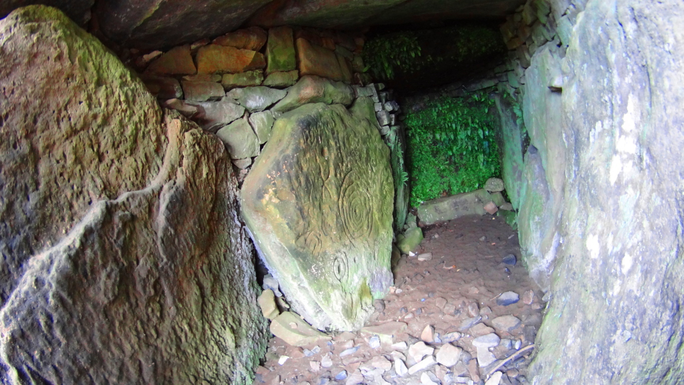 These megalithic monuments date back at least 5000 years. It is very likely that the High Kings chose this place specifically because they knew of an even older megalithic culture that once dwelt upon this Hill, which was a culture capable of harnessing energies through the positioning and aligning of stones with the Sun, Moon, and Stars. The Hill of Tara is a type of energy center, with several large concentric earthworks built into the hillsides. The exact meaning of concentric earthworks is not known, but science is beginning to understand fractal and concentric patterns as extremely useful in the reverberation and harnessing of electric currents.
The feeling at The Hill of Tara: In J.R.R Tolkien’s masterpiece The Lord of The Rings there are two chapters that take place in an enchanted forest called Lothlorien. Deep within Lothlorien there is a hill named Cerin Amroth, and the description of what happens when the company of travelers from this epic tale first glimpse this ancient Hill is poetically relevant to the Hill of Tara. The passage reads:
“Behold! You are come to Cerin Amroth,” Said Haldir. “For this is the heart of the ancient realm as it was long ago, and here is the mound of Amroth, where in happier days Amroth’s high house was built. Here ever bloom the winter flowers in the unfading grass: the yellow elanor, and the pale niphredil.” The others cast themselves down upon the fragrant grass, but Frodo stood a while still, lost in wonder. It seemed to him that he had stepped through a high window that looked on a vanished world. A light was upon it for which his language had no name…”(pg 350;LOTR)
Here is a picture of high plateau of Tara’s wildflowers from up close. They are delicate and beautiful, colorfully vibrant, rich, and unfading, very much like the description of Cerin Amroth in Tolkien’s Lotlorien.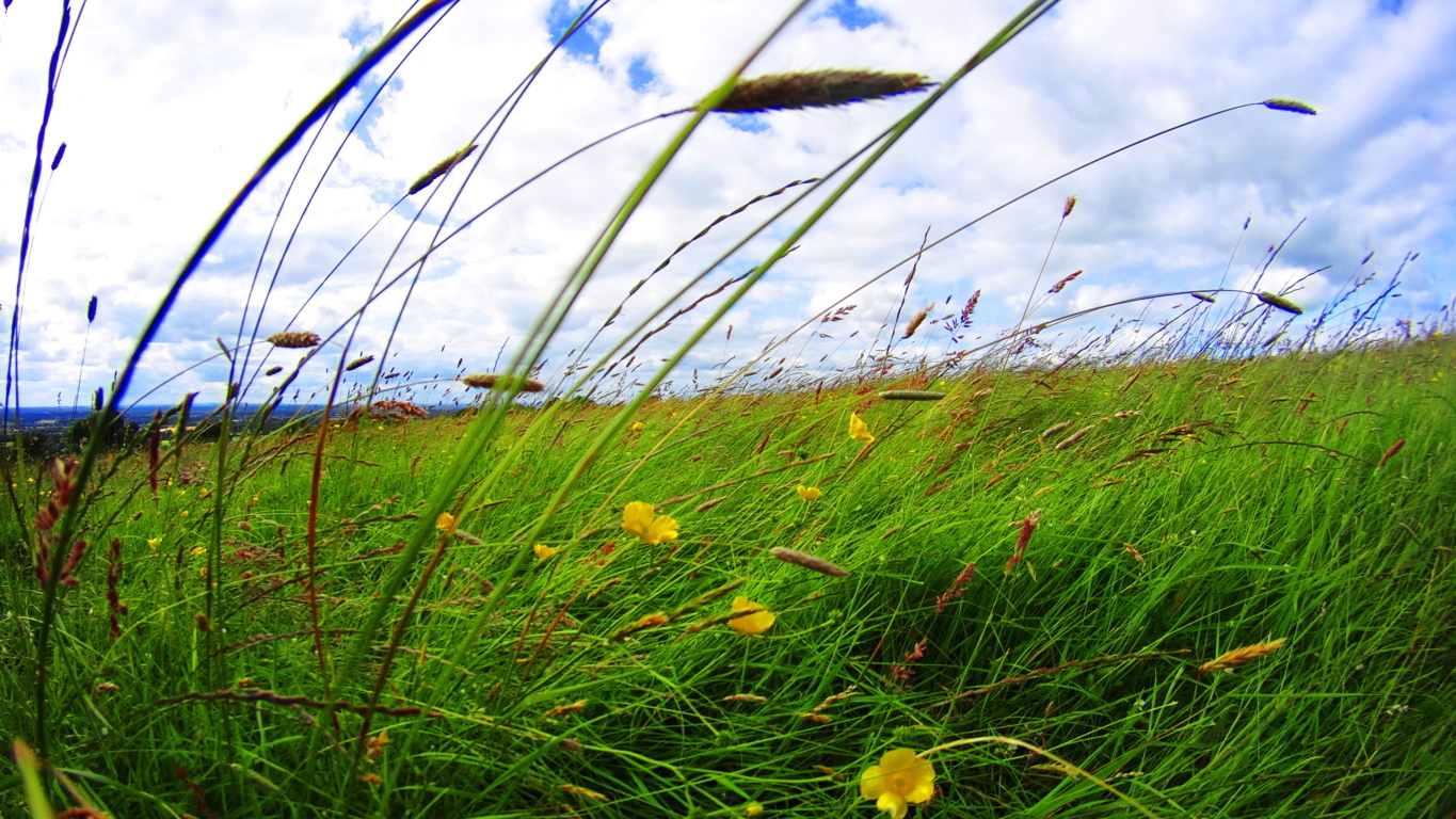 Perhaps it was because the angle of the light on the field was personally different for me; just as the Irish angle on the Sun is different than that of the angle of the Sun in the American northeast where I’m from; but from my foreign perspective the Hill seemed to literally glow in the late-day Sun. It glowed in a way I had never seen before. I could feel a type of electricity all around me, and yet it was a simple landscape on the surface. I truly had to sit down and collect myself for a moment as my head was nearly spinning. I know it sounds strange, but it’s true.
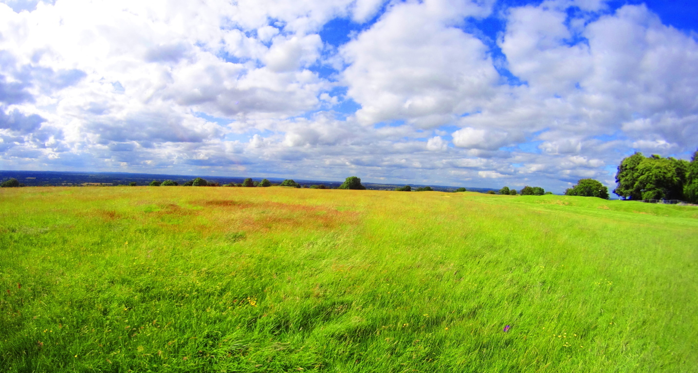 It is very hard to explain, but as I came up the Hill, I began to see that the Irish understood this feeling, completely.
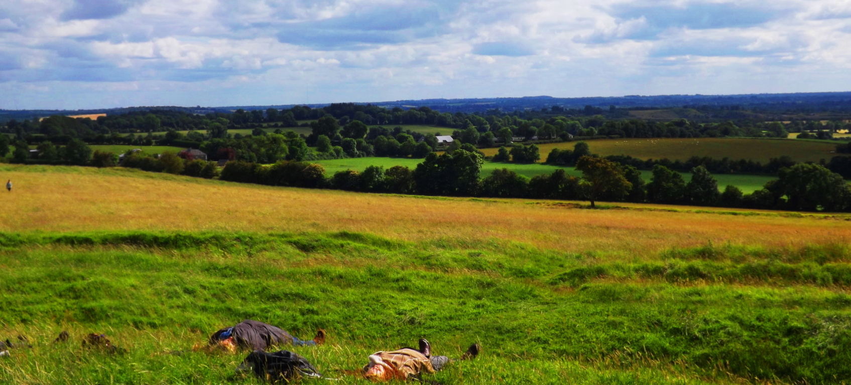
I included the fictional description of The Hill of Cerin Amroth experienced by the characters of The Lord of The Rings above because it was the most relevant passage I could find in all of literature to describe my very real personal experience with The Hill of Tara. When I arrived people were literally sprawled out in the grass, attempting to harness the energy of the Hill. (image/below) I found myself blinking hard at what I was seeing.
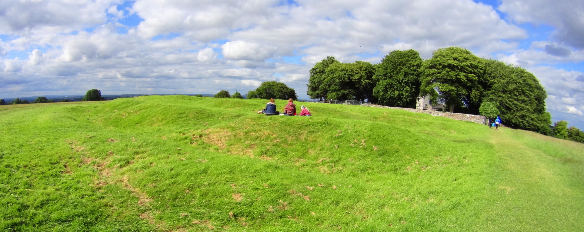
I walked above the stone chamber to get a glimpse from the highest point of the area. Two Irish kids jumped up in front of me and began posing for a picture in the most hilarious way. They were absolutely carefree. With all of Ireland in the backdrop, I suddenly felt as if all my concerns were, at best, ridiculous. 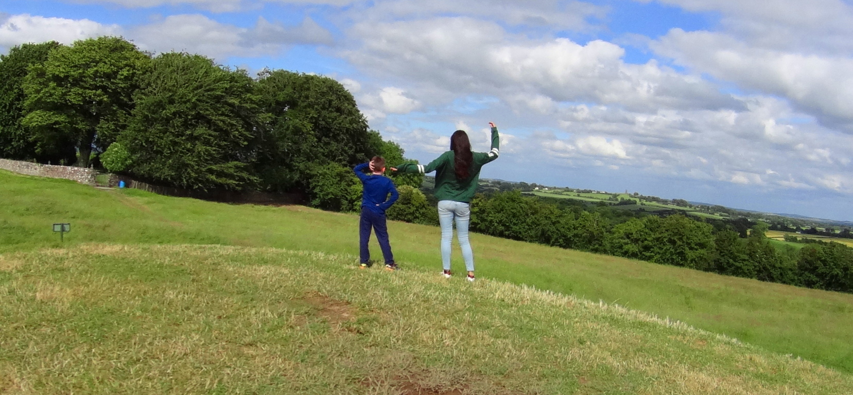 Off in the distance I marked a couple kissing, and then not far from them were college kids sitting and talking softly above the ancient circular rings now covered with earth.
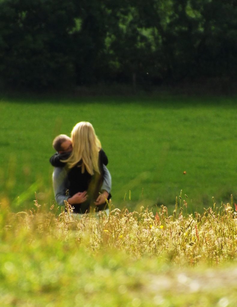 Coming from the America of the last 15 years, I just wasn’t accustomed to this type of uninhibited joy and calm. There was no stress, no observational angst, no fear whatsoever. And you could feel it.
Whatever the original function of Tara’ once was, there is a remnant of it still today. On a sunny day Tara’ feels like the safest place on earth, and this is no exaggeration. In the hills beyond are ruined bell-towers of abbeys long since diminished. It should be appreciated by the readers that these towers, although they look extremely old in their picturesque way, are practically young, comparatively, to the stone chamber and standing stone at Tara’s peak, as well as the stone chambers in New England, for that matter. 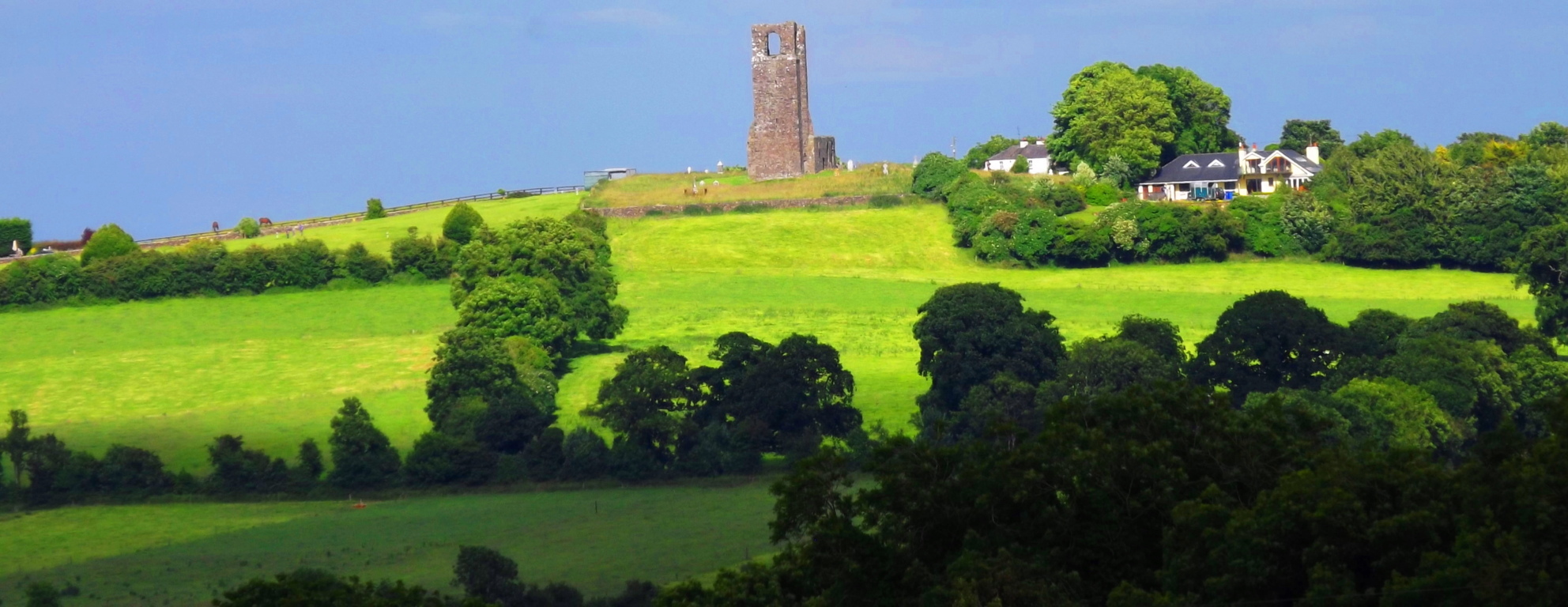 Bective Abbey, a classic Medieval complex, is only 1.5 miles from Tara’, and it is a wonderfully tranquil place. (image below) You can walk the ground and see some beautiful architecture from inside the cells.
 The monks must have known how spiritually potent this area was, with its proximity to Tara’. They would’ve gladly choose to live-out their days in the presence of The Hill, knowing they could certainly do a lot worse. Adding to this energetic feeling of the land and stone-works from the earliest Neolithic period, to Celtic and Medieval, is the oldest element of all, the Boyne River, which cuts North to South through the area.
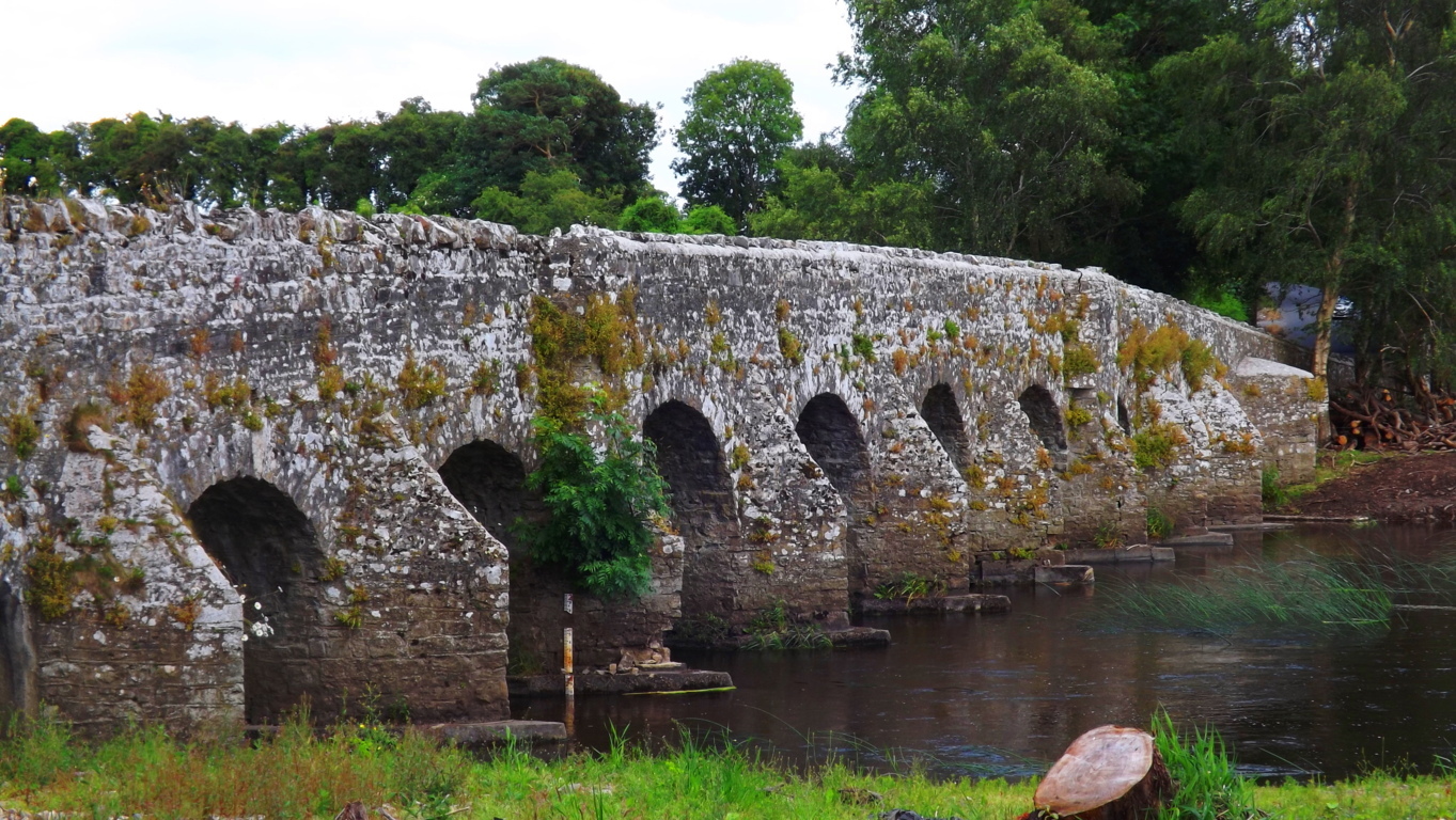 This is the Boyne River Valley, an ancient and sacred landscape filled with stone engineering. “The High Man”, a Celtic complex of astrologically-aligned hill-forts, wedge tombs, and standing stones, is not far from this area. Its monuments are built in precise fashion along the Boyne river in order to be a reflection of the Belt of Orion astrological system actually built into the Irish hills. The entire area is absolutely sacred.
The Hill of Tara has been preserved by the efforts of Irish citizens who have resisted the modern world’s “advances”. They have openly protested any modernization of the area. If you are lucky enough to find the Hill of Tara and walk the grounds; if you come to Castletown and cross the river Boyne; realize it is anything but a simple hike through rustic terrestrial trails that you are taking, but rather, it is a hike into the way things were in the beginning of Time.
Upton Massachusetts/USA
 Location: Town of Upton, Massachusetts
Note: In Upton Massachusetts The Blackstone Valley sponsors a full-spectrum ocean of foliage in the Autumn season.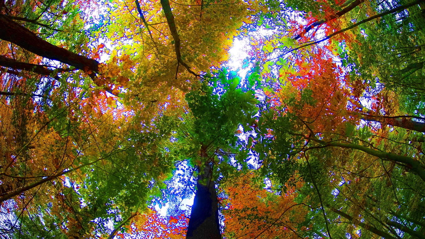 This is a classic New England hamlet that feels more like a rural village sitting just off the Ring of Kerry, rather than central Massachusetts.
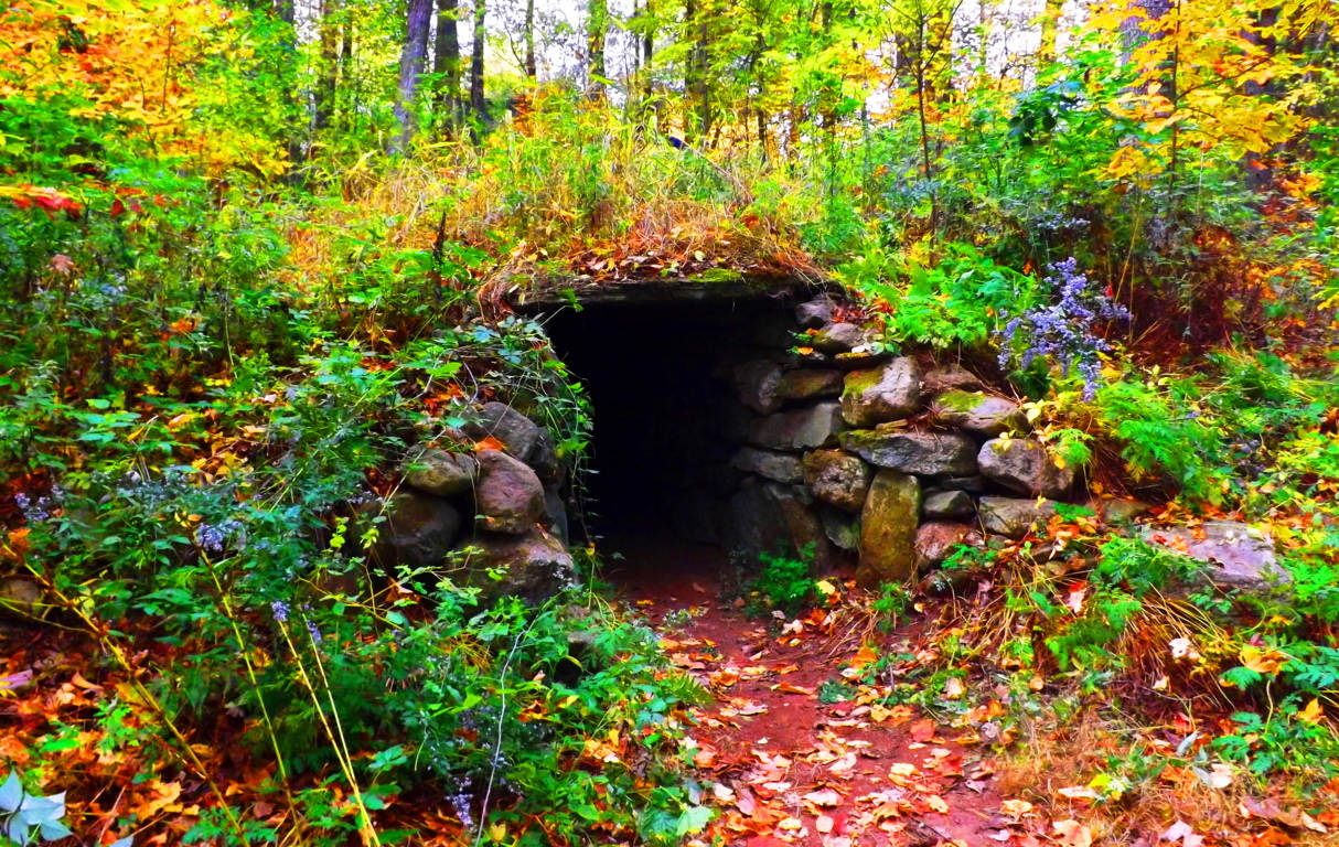
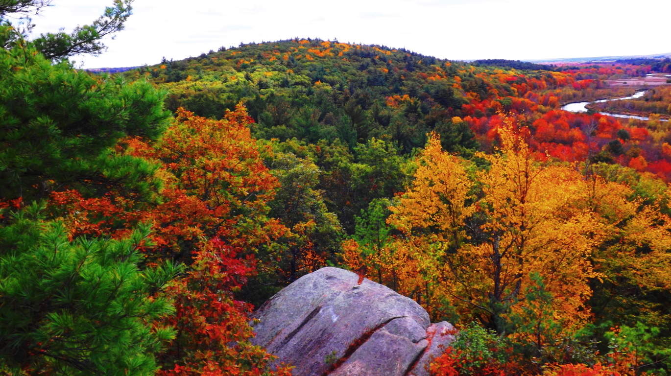
 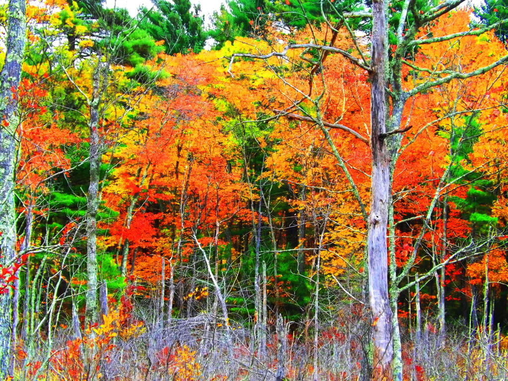 Natural features of the town include a State Forest with roughly 7 miles of trails, with other minor trails leading to stellar places like Look Out Rock (top image). Upton offers-up an “Old World” aesthetic with some very real historical substance, containing one of the finest Wedge Tomb’s in the world, known as the Upton Stone Chamber (image below).
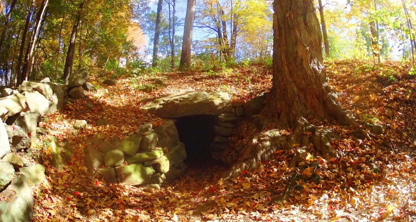 The scale of the Upton Stone Chamber is very similar to the Stone Chamber at the top of the sacred Hill of Tara in Ireland.
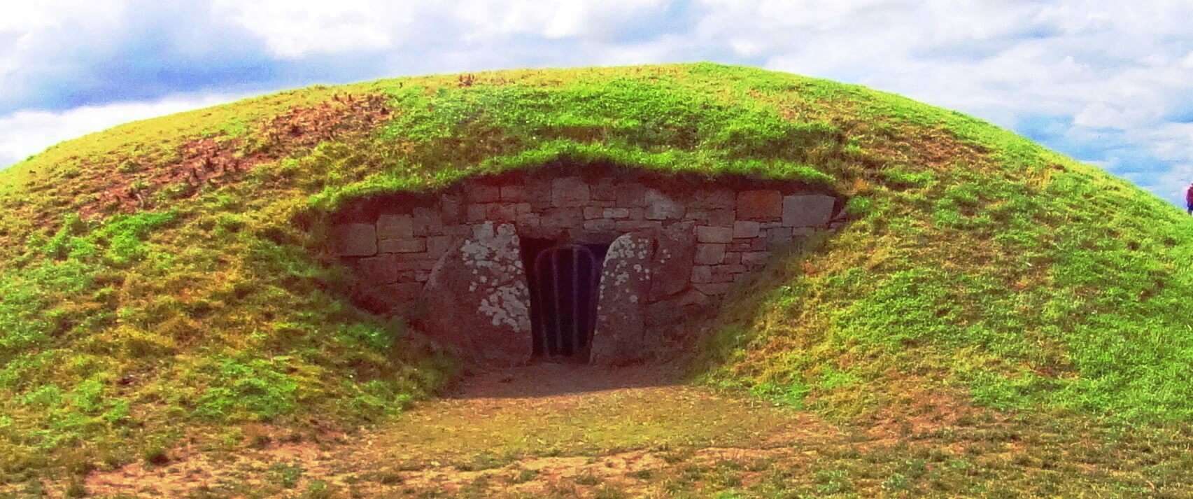 The stonework of the Upton Chamber is exquisite, with dry-laid corbel roofing that opens up from an entry passage into a 15foot dome, crafted into the Earth! The roof has four 5 ton slabs holding up the passage leading to the mini-dome. This is of the same style of roofing that was used, on a more massive scale, at New Grange, Ireland, the oldest megalithic site in the World (right image).
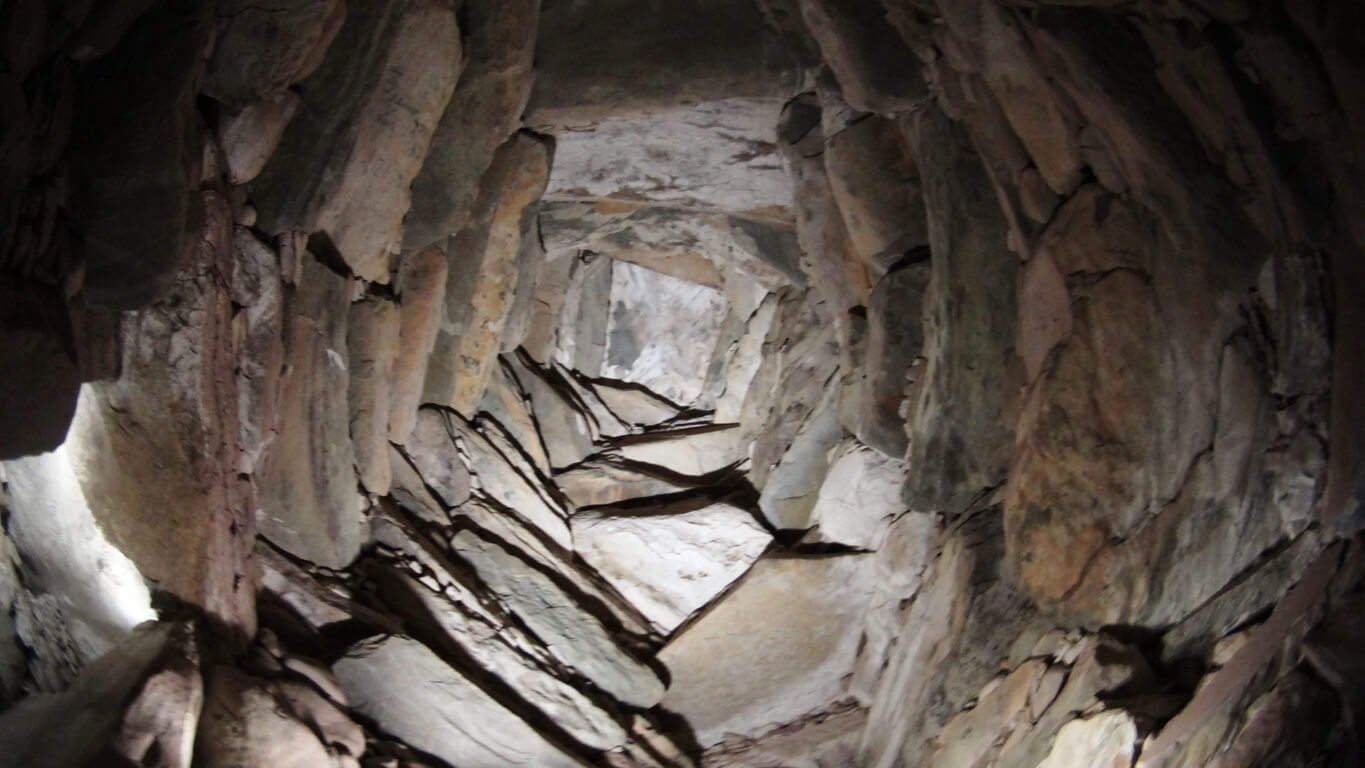 When I entered the Upton Chamber and turned to take pictures, orbs started floating around.(left image) (Click it to look closer). There is energy in these chambers. In general, these are some pretty strong stylistic connections to some very significant places, for just a simple small town in New England.
 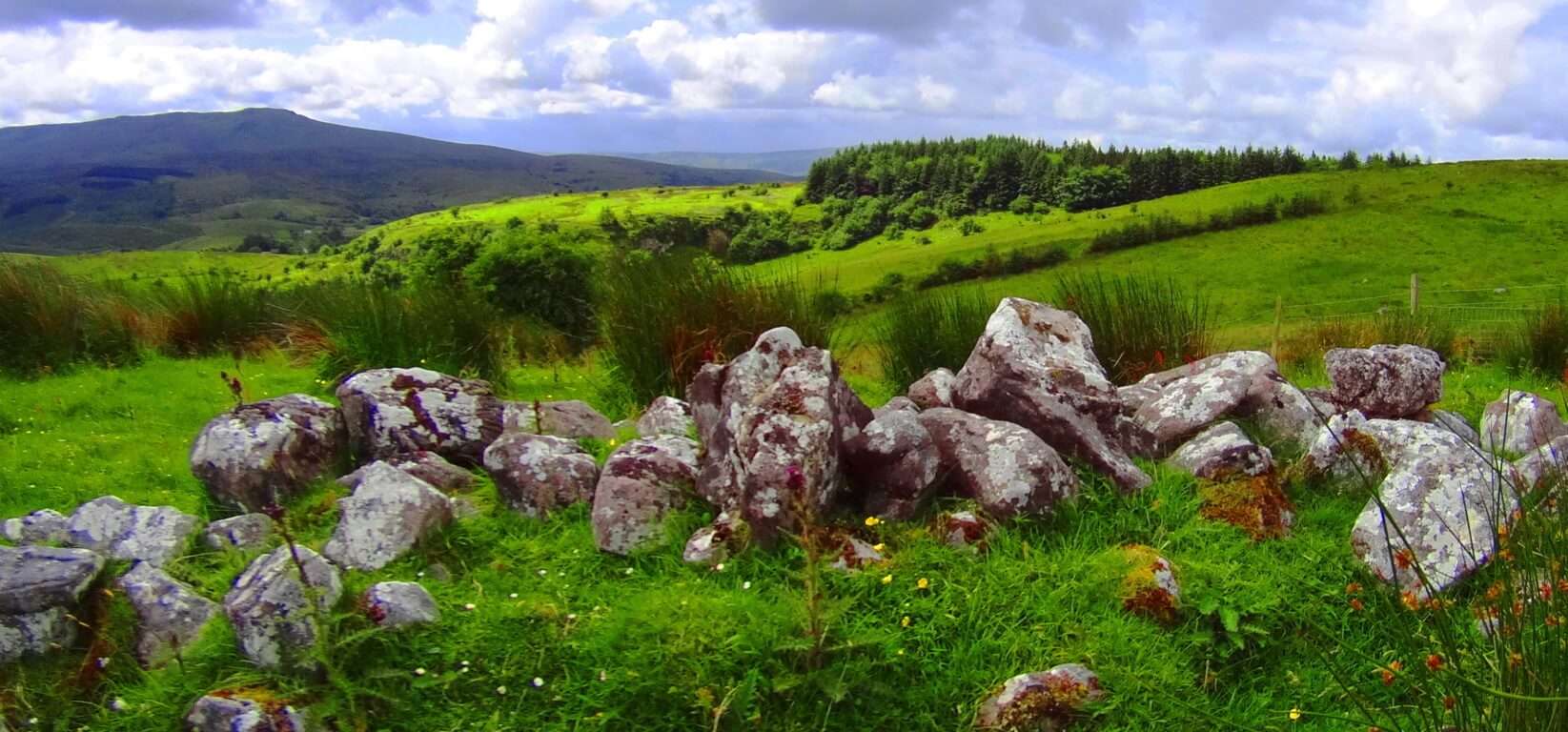 Just like in Glenveagh National Park, Ireland (left image), Upton has unique and complex megalithic stones that are beautifully mingled into various features of the landscape, with stone-linings that are much larger than Celtic linings (2nd and 3rd/left images/Upton).
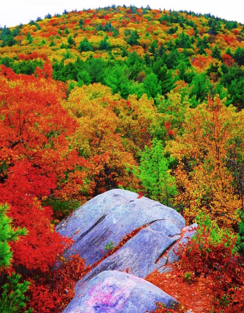 Massive granite boulders are stacked near peaks in the area, and all throughout the elevated trails. Some boulders, however hard it is to believe, seem to have been molded to imitate, and align, to the center of significant peaks in the distance.
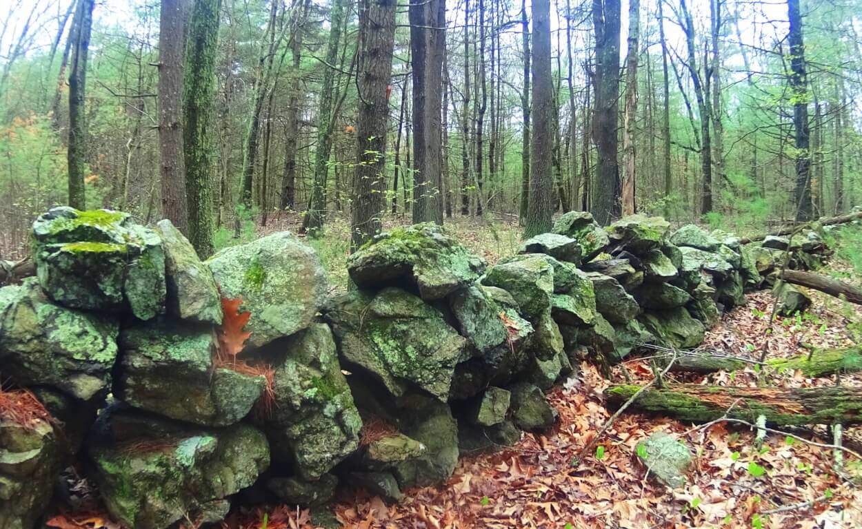 Look Out Rock is an amazing example this, with three parallel grooves carved into its face, seemingly calling attention to the boulder. It points, like an arrow, directly to the top-center of the mountain in the foreground, creating a kind of prismatic display (right image).
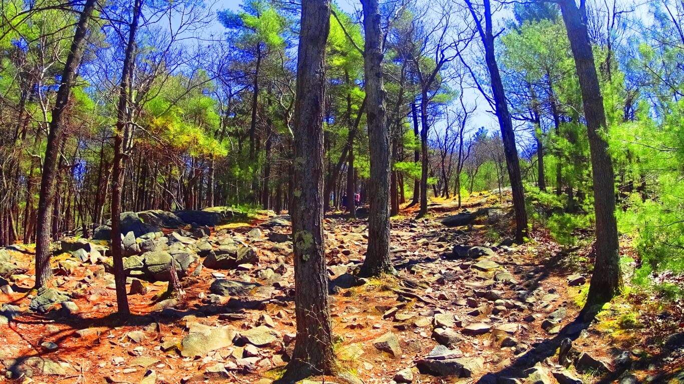
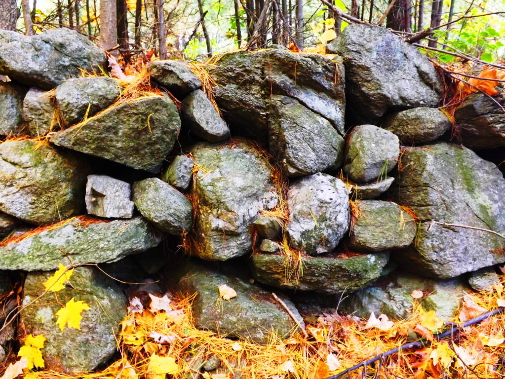 From an anthropological standpoint this is significant information, indicating that this culture was clearly “symmetry conscious”, and not only that, but symmetry capable. They could make it happen. Scope and scale of megalithic work by a culture that is capable of these statements should be reconsidered entirely to understand what is actually taking place. The neolithic culture in Upton, and all over New England, could craft granite boulders like a modern carpenter crafts wood. Forest floors in Ireland and New England look to be made up entirely of granite scraps that are cut from the larger boulders, eventually placed as statements further up the various mountains. This is the reason we find so many stones on elevated trails that have obvious cuts, right angles, and squares. The Blue Hills in Massachusetts (below left), and Mount Bearnagh in Ireland (below right), are prime examples of this. The trails in these sacred places are lined with the scraps of “megalithic carpentry”. If we were to look at the angles of the scraps on the floor of a carpenters cutting-table, the pieces, on their own, are a disheveled mess which doesn’t make any orderly sense, but the significance of each little piece is that they stem from the cutting of a ‘larger block’ on the table.
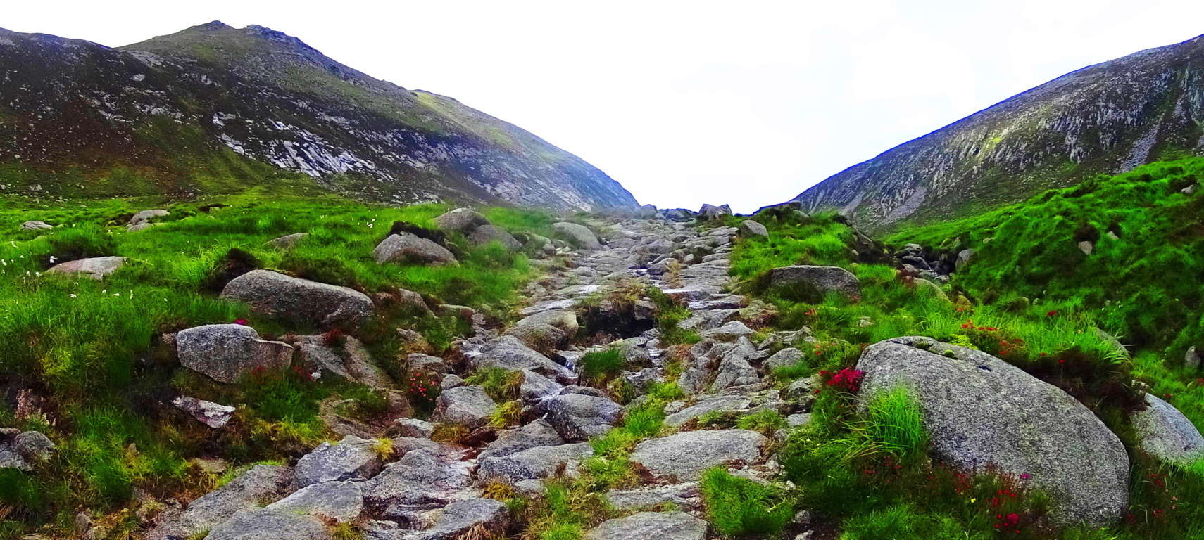
 The angled granite scraps are the overall proof that craftsmanship took place. Entire trails are lined with scraps of angular granite cuts throughout Ireland, Wales, England, and New England. Returning to Upton, a New-England style Dolmen sits just thirty yards from the peak at Look Out Rock. This is also a trait of sacred neolithic places. Wedge Tombs and Dolmens are often just out of view from the most advantageous spots of their specific site, very much like hikers and campers keep a tent out of the wind fairly close to the beautiful spots they want to photograph and camp near.
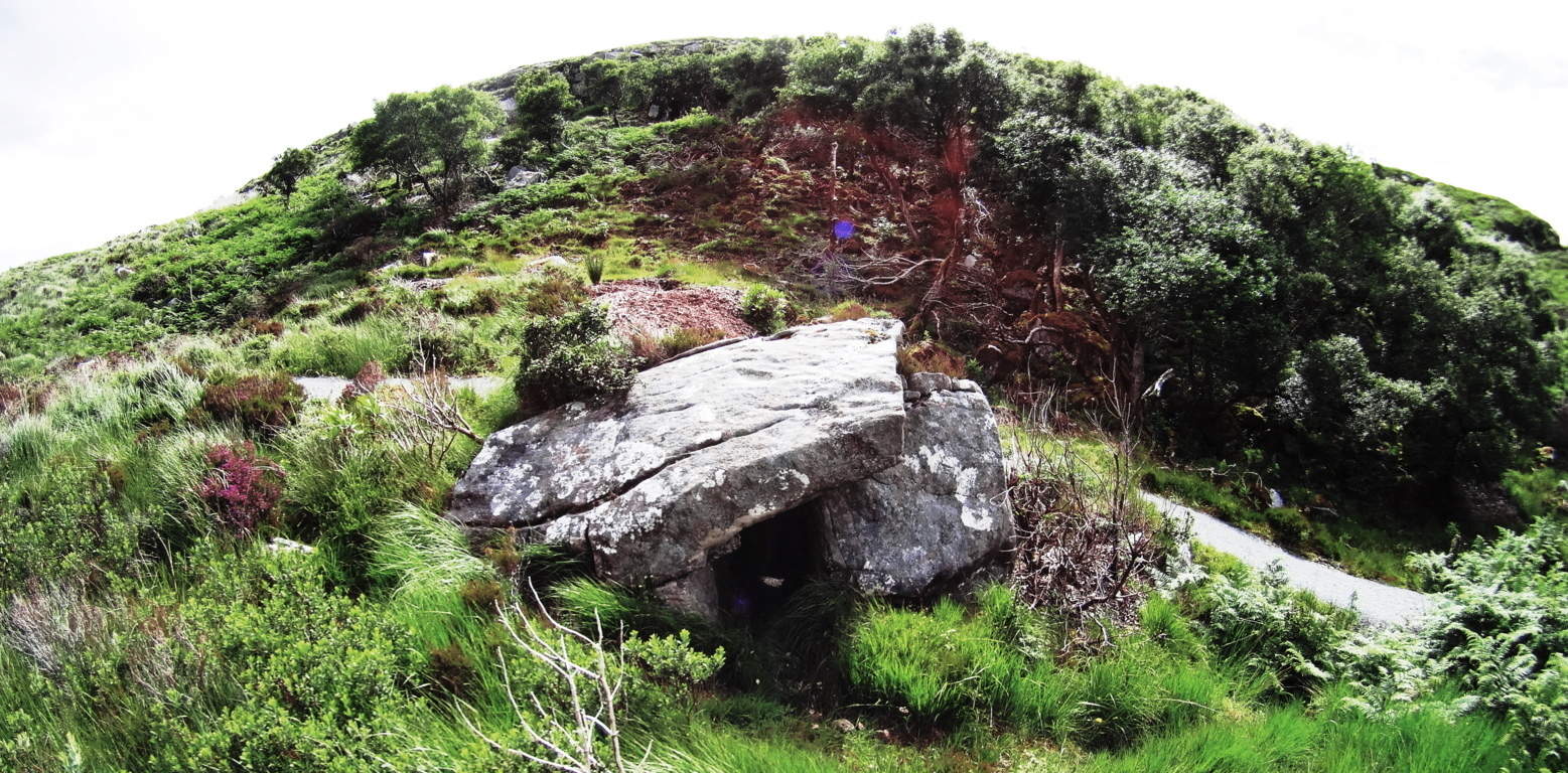 The Wedge Tomb in the heights of Glenveagh Forest, just like Look Out Rock, is centrally aligned to the mountain in front of it, with a Dolmen tucked just 30 yards from the best vantage in Glenveagh National Park. (image on right/Glenveagh Wedge Tomb). Something’s going on here. The boulders on this unique Dolmen (Image below) are cut utilizing massive and graceful lines, with long square boulders fit into each other, balancing perfectly into what looks like a primitive pyramid. The Stones are obviously cut. This Dolmen utilizes a ‘scale-scheme’ with the larger lower boulders, leading up to the smaller capstone at the top (image left).
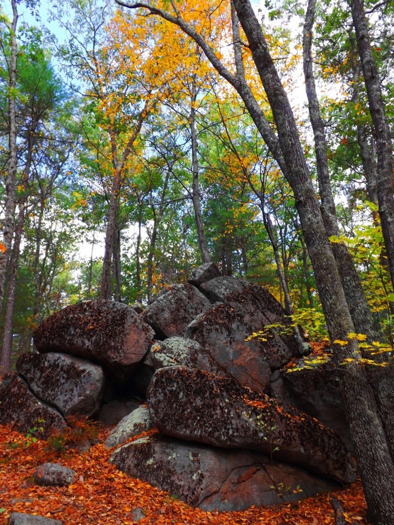 It is an incredibly thoughtful looking structure. In scale (not style) it is very much like the massive Proleek Dolmen in Ireland, which also shows nearly miraculous scale, and balance.
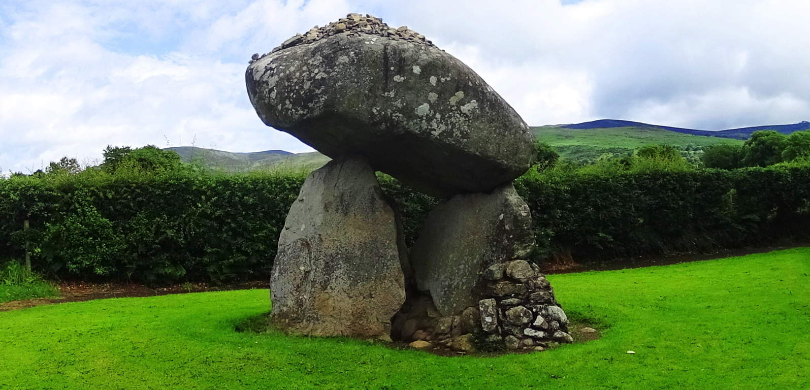 (right image). Interwoven into the old colonial town of Upton, there are ledges with massive megalithic fixtures, huge quartz streaks and balanced boulders. The geological explanation for these features just doesn’t make sense. Scientists usually impose some theory of how glacial ice exploded, or slid, in a certain way to make events like this happen, but it just doesn’t hold up logically. Take a look at these massive quartz parallel shafts, with a free sitting boulder cut and inserted into the underside of the ledge. The boulders may have been cut with the intention of having the quartz grow into the parallel gaps, which reveals an amazing comprehension of how quartz responds to granite in certain positions and places. I wouldn’t put this capability past the megalith builders. It seems that they had total understanding of how to use the landscape, and had the power to mold it as they saw fit. Conceptually, it breaks our reality wide open.
 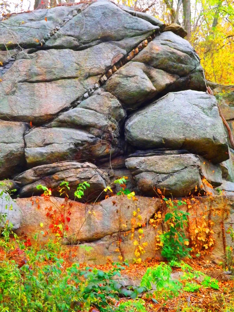 There are stone-linings so massive in Upton, that they look like they were intended to be walked on
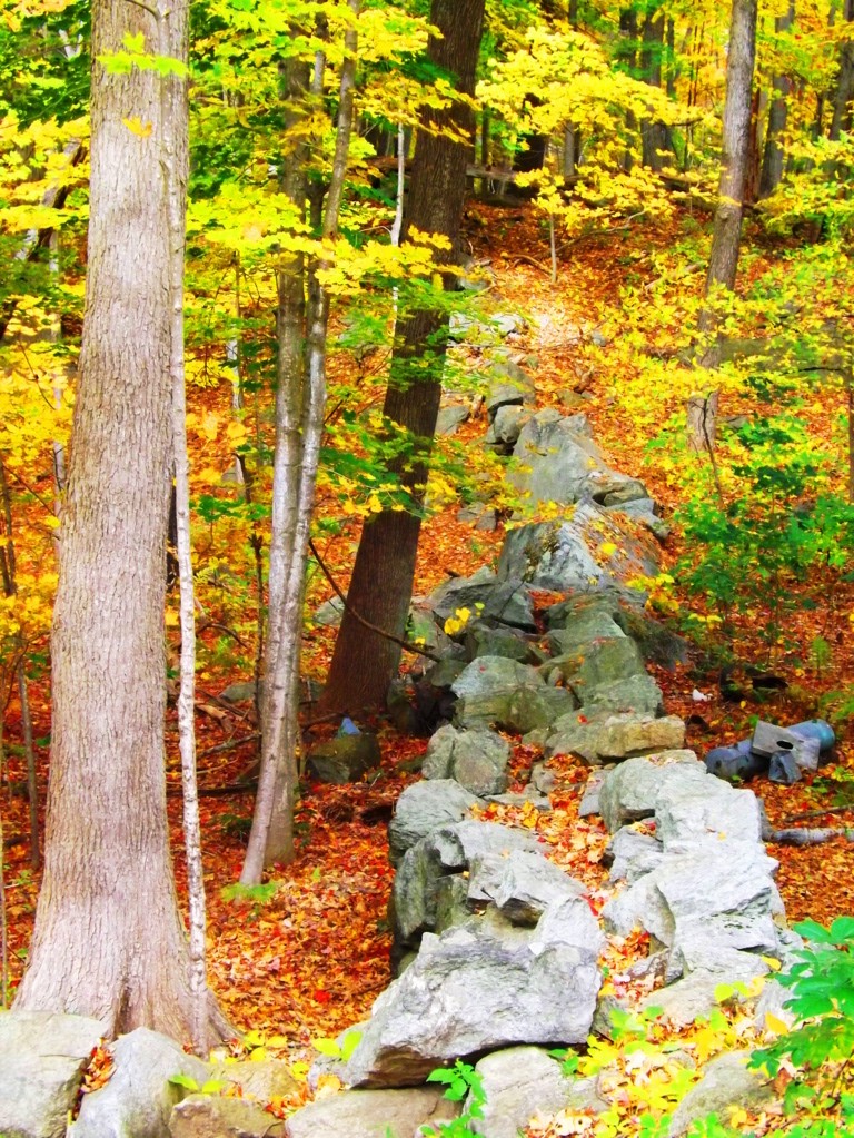 (image left below). Stone-linings literally converge on a Wedge Tomb at Glenveagh National Park from three directions (bottom image) (Click to look closer). These are all indicators that these stones were being used as energy harnesses, connecting features in the landscape, transferring energy from the Sun, to the stones, into the chambers. The entire town of Upton is sitting on a geologically engineered landscape. Take the trails through Upton Forest in October for a ‘fantastic full spectrum’ experience, and hike up to Look Out Rock to see for yourself the aligned ledges and Dolmen. This is truly a sacred and enchanted place in the heart of New England, comparable to any Celtic site. Seek it out.