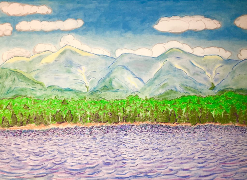
Lonesome Lake
Elevation: 2,730ft
Location: Franconia Notch Range/White Mountains/New Hampshire/USA
Note: Tucked deep into the heart of the White Mountains of New Hampshire, facing the stellar Franconia Notch Range, sits an elevated Lake that is forever embraced by thick Forests, and glowing Mountains. This is Lonesome Lake, a secret shining pendant-piece hanging high upon the neck of the Franconia Notch Forests, 2,730 feet above the valley. This hike is the best overall trek in the White Mountains., and that’s saying a lot!
The view of Franconia Notch from the valley is straight-forward enough. The Mountains are so broad, that it is a real challenge to get a full view of the Range, before finding the Trailhead for Lonesome Lake. 
Lonesome Lake Trailhead is easy to find. Located just 10 minutes, by car, from the Franconia Notch State Park’s main facility. Continue along 93-North for ten minutes, extending from Franconia’s Main Entrance Park. You will actually pass the Trailhead, on the other side of the highway. You will need to take a left at Exit 34 B, and drive 93 South, back in the other direction, for about 4 minutes. You will see signs for the Lonesome Lake Trailhead on the Right, with provided parking. Your Iphone will have no problem identifying the Trailhead, as Route 93 is the major highway running directly through these Mountains ( just like the A82 in Scotland, which splits The incredible Three-Sisters-Mountain Range at Glen Coe. (Image/Below) 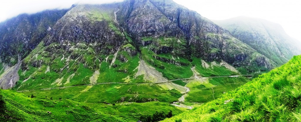
The White Mountains have a very similar feel to Scotland’s gateway Range at Glen Coe. Similar in scale, these are both incredibly massive Mountain Ranges, that somehow depict a rare ‘cozy closeness’ between cleaved peaks, protecting the valleys below, in both locations. The White Mountains in Fall, however, have something that Scotland does not, glowing gold and booming orange-brown colors for just a month out of the year. (Image/Below)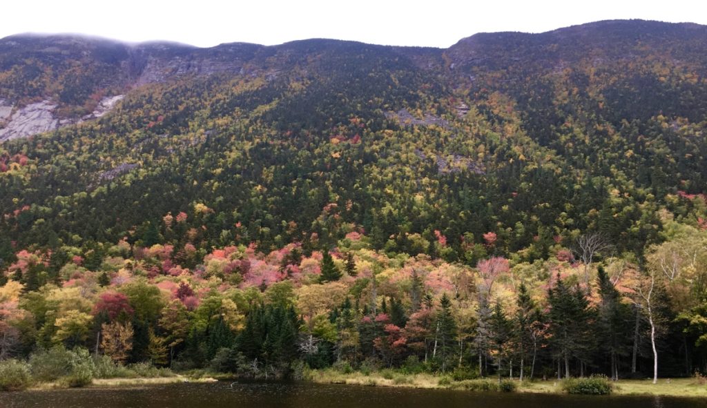
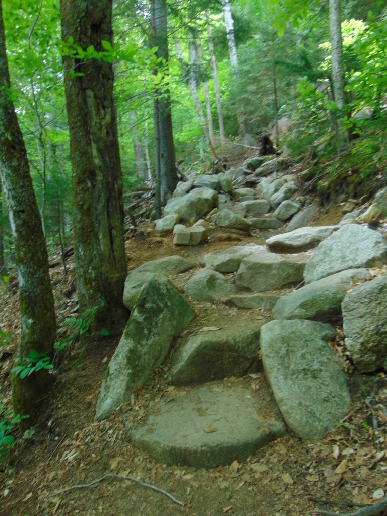
Lonesome Lake Trail: At the opening of the Trailhead you will find a path of collected boulders that climbs straight up, like a winding discheveled stair. As it is with almost every trail in the New England Region, it seems that these boulders were collected, cut, and placed in this specific way (As hard as that might be to believe).
If, for example, people believe that the National Park Service placed these boulders, they are seriously mistaken. It would take millions of dollars, Bobcat-machines, and perhaps 50 to 100 men to align these boulders, straight up a mountain. (Image/Below/Lonesome Lake Trail)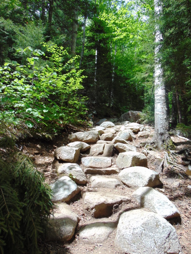 Native Americans did not move these boulders either. The reality is that these trails were created by megalithic builders, just like New Grange in Ireland, Macchu Picchu in Peru, and Stonehenge in England. These trails are monuments. I realize this changes the modern Western conceptualization of what a sacred space, or temple, truly is. These megalithic statements are sprawled and connected all over the landscape. The constructs make the landscape itself a monument. It is not confined to a singular space, like the Parthenon in Greece, or, Notre Dame in France. This has been incredibly difficult to explain. The conceptualization of megalithic building for todays “Anthropologists”, who simply cannot fathom megalithic constructs embedded into a landscape, is not confined to the basic idea of a “building”, but rather, a connective grid, capable of synergizing an entire landscape. The megalithic designer responsible for this Trail, may have left us some clues about the constructs here at Lonesome Lake; Let’s take a look…(Image/Below/Lonesome Lake Trail)
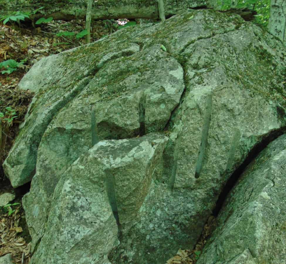
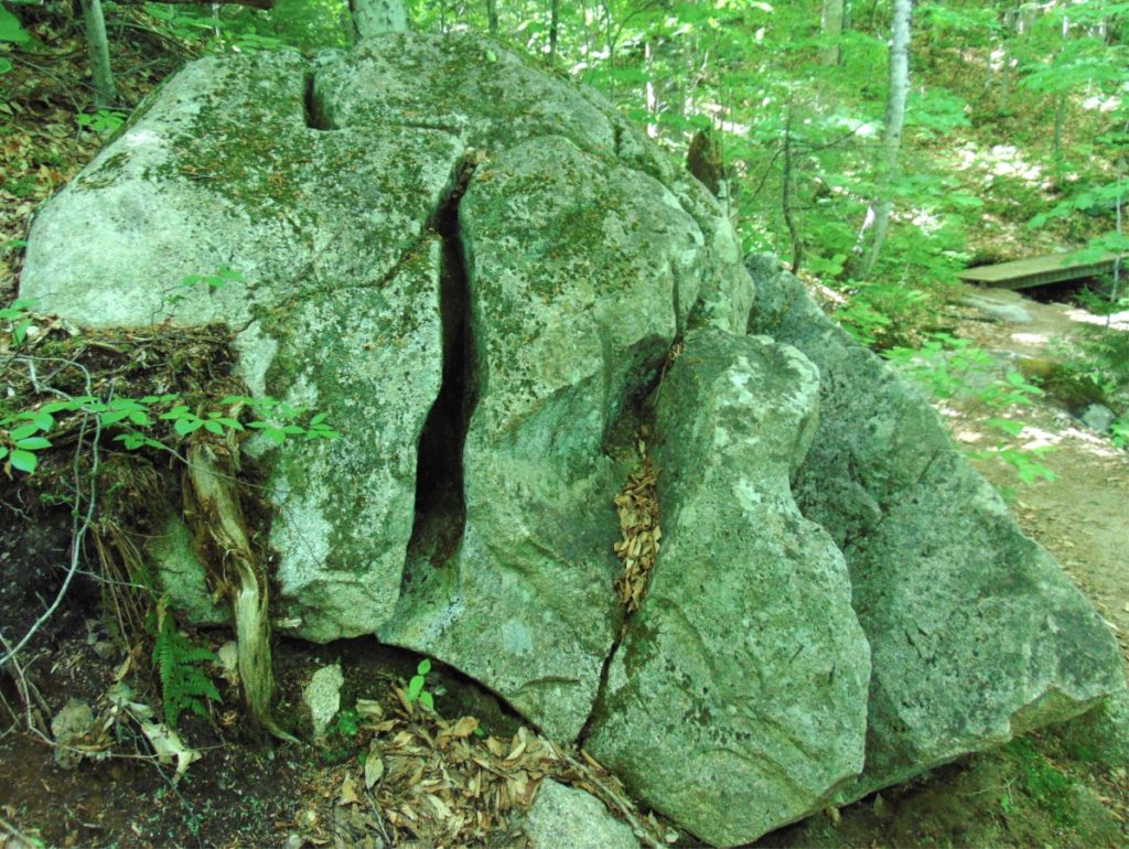
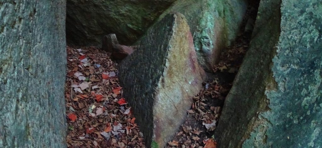
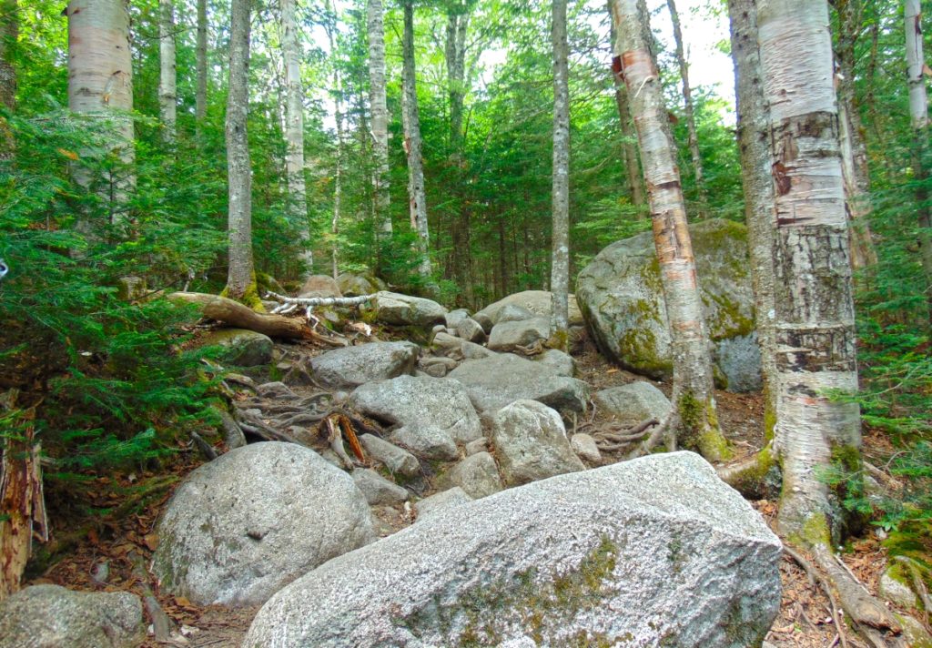 At the base of this Trail sits an extremely unique boulder (Images/Below), with parallel indented markings, and curvy cut sections, like a rounded ‘rubix-cube’. It is clear that this was intended work upon this boulder. There is a dimensional framework to these sections, perhaps indicating some kind of understanding about “perspective”, and vantage. If you look closely at the image (Image/Left/Below) it is crafted into sections: The first frontal section is completely separate, with a symmetrical and penetrating cyndrilical line, seemingly drilled, and at an intense speed, running straight through the rock. The second and third sections, standing behind this first boulder, are cut similarly, and are perhaps aligned in a specific way. There are clearly separate sections to be seen, as if the boulder was once singular, heated, penetrated and then sliced into sections; Like a knife through butter. The side view shows the clear sections; The frontal view show the connectivity. This is a multi-meaningful statement, which deserve mathematical analysis. It is enticing, and adds excitement to this Trail.
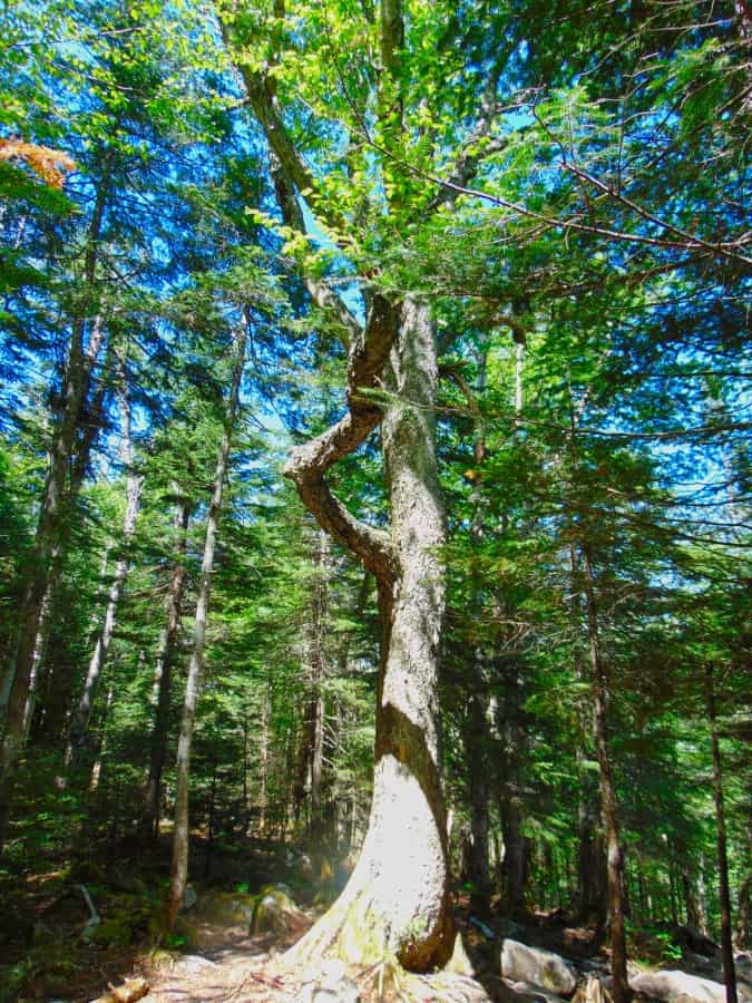
As you progress up the significant climb, there are beautiful settings in the stones, awesome trees, and groves that compliment the experience. One particular tree, near the 2000 ft elevation range, grows right through the middle of the trail, on its own.
 There is a possibility that the stones were left behind in a very specific way, in order that the Forest would grow up in a specific order. This too is very hard for anthropologists and archaeologists to comprehend. But a great deal of megalithic works seem to have multi-layers of meaning. For example, many of the stone-linings (“walls”) that are found winding infinitely through the Forests, directly up mountains, and across streams in the valleys, clearly have nothing to do with the classical usage of “walls”, which is to restrict the movement of cattle and trespassing humans. These ‘Linings’ do not limit movement, at roughly 3 feet high, and three feet thick. If they do not restrict movement, why are they there? And why the monumental effort to create them, if they are not restrictive? It is because there is a megalithic context to these ‘Linings’. These stones are intended to connect the landscape, the way quartz cables connect energy centers on a digital grid within a phone, or computer. It synergizes the landscape; The stones absorb the energy from the Sun, plus subtle electric current from the rolling streams below, sending energy throughout the landscape. The stone-lining pictured below, is found near the peak at Watatic Mountain in Massachusettsm, at around 2400 feet of prominence. It is a good example of the basic width, and depth, of the construct of these ‘Linings’, found at tough elevations. The point of all of this is realizing that these megalithic works are engineered spaces, harnessing the landscape energy, constructing irrigation zones, cairns, standing stones, and much more.
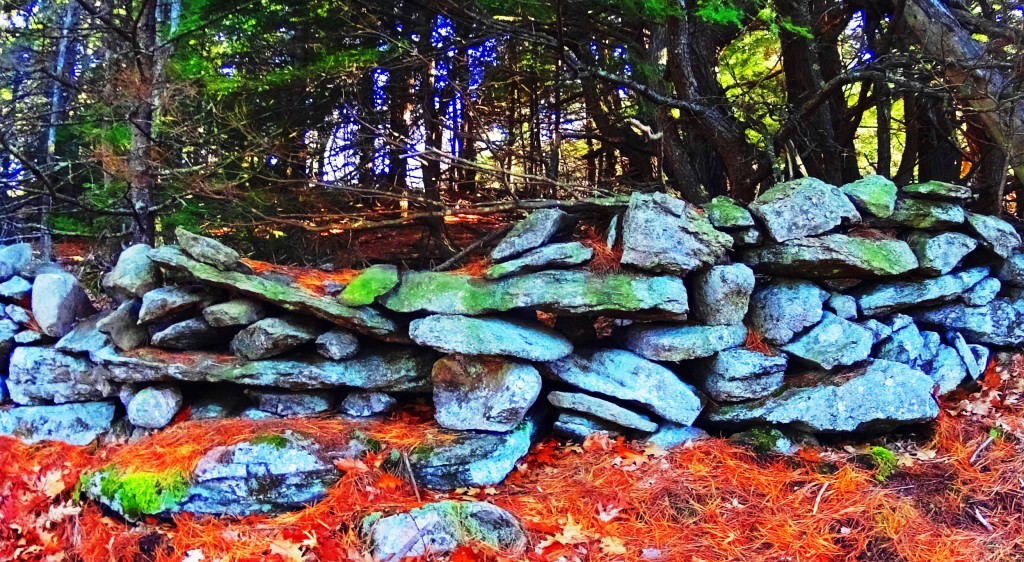
This is megalithic historic view is actually the more logical explanation for these megalithic ‘Linings’ inundating the landscape of New England, and Europe. The megalithic context depicts works of intense utility and scale. To credit the Native American Tribes with these works, would require a massive amount of advanced tools, evidence, and oral-traditional depictions of Native Tribes spending lifetimes building “walls”, with megalithic size stones, directly up mountains. It makes zero sense. There is no such evidence. These works were here before the Native tribes arrived, and at the earliest possible point in Cultural History. The pathway here at Lonesome Lake is an awesome example of megalithic trails. (Image/Below/Left)
To be clear: to say that this path is merely the work of A State Park Service, Native tribes of seasonal and minimal possessions, or “glaciers” . is absolutely absurd. It is a blatant collection of massive boulders, intended as a walkway to the sacred areas above.The work is meant to be seen, just like any work is.
One thing that the builders of these beautiful pathways knew, was that these stones would be here forever. And they were right. What has faded though, is human beings ability to interpret the over-obvious, in plain sight! The evidence embedded in the stonework itself, from all corners of the Western Hemisphere, say something cultural happened, on a megalithic scale.
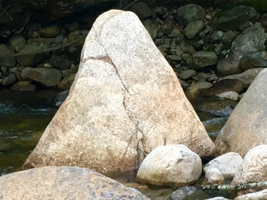
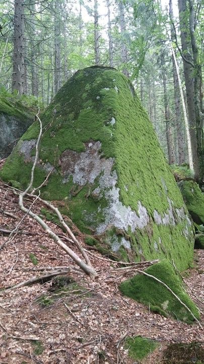
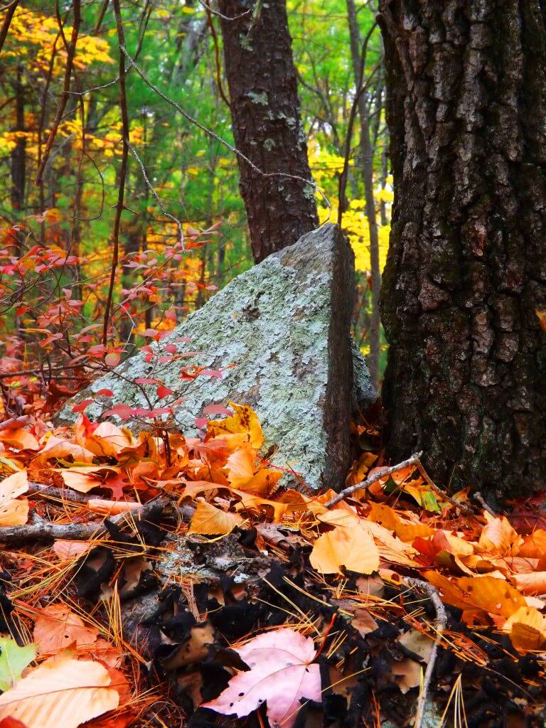
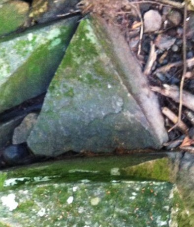
As you make your way to the top of the Trail there is an interesting boulder that marks the point where the ground finally becomes level again. The shape of this boulder (First Image/Below) coincides with the shape of hundreds of boulders that remain unacknowledged by Post-modern ‘anthropologists’ and authors, with agendas, married to their desks, at colleges across New England. Take a look at the examples of these Triangular Megaliths below: 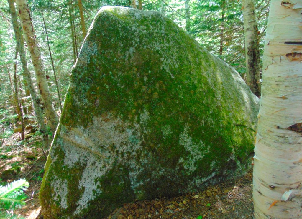
The triangular shape of singular megaliths, as readers of this site well know, is found throughout Forests, from Maine, to Massachusetts, as well as Ireland, Austria, Arizona, and California:

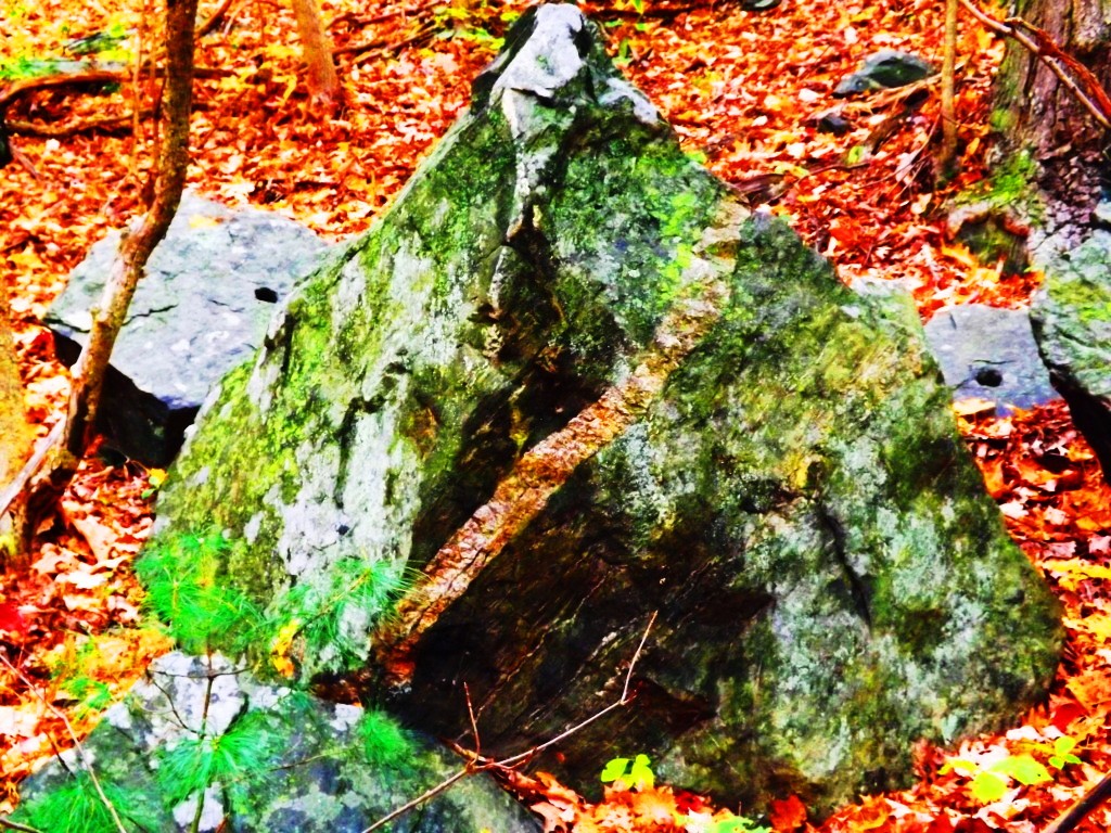
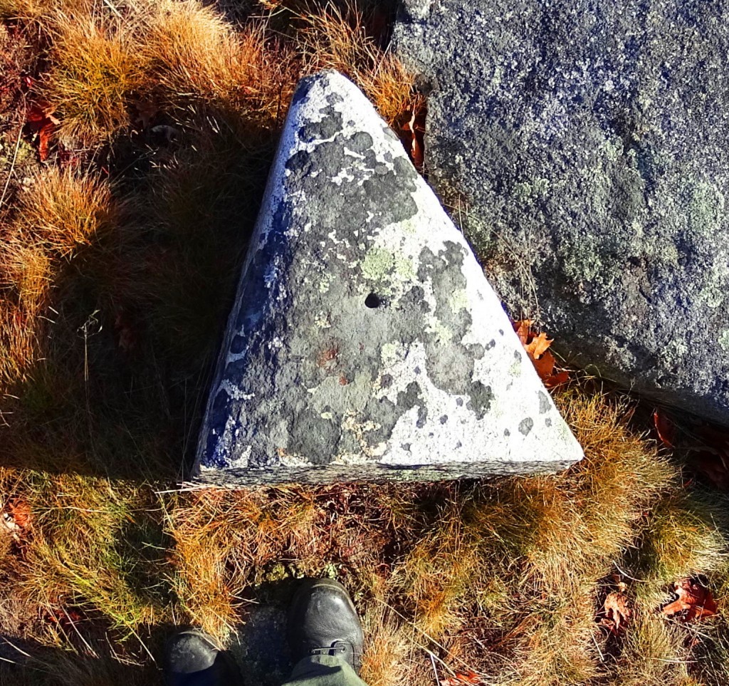
The reason for these triangular megaliths is probably multi-dimensional. It might be a cultural marker for the megalithic culture itself. A ‘calling card’. In mathematics, the first shape to arrive from a linear set of points, is the Triangle. Perhaps this Megalithic Culture is messaging us, via this symbol: Just as the Triangle is the first symbol from any set of given points; The Megalithic Culture is the first Culture, from any set of Cultures. It makes sense. Look at the construct of any set of points reaching a logical triangle shown below:
Ex:
- A
- A to B
- A to B to C
- A to B to C to D…….etc….
- A
- B C
As you can see, the first shape from any set of given linear points possible, is the Triangle. Forever. Its a Law.
Continuing into the level ground of the upper end of the Trail, a beautiful grove emerges, and you actually step down for a few moments, before the second part of this amazing trail unfolds. 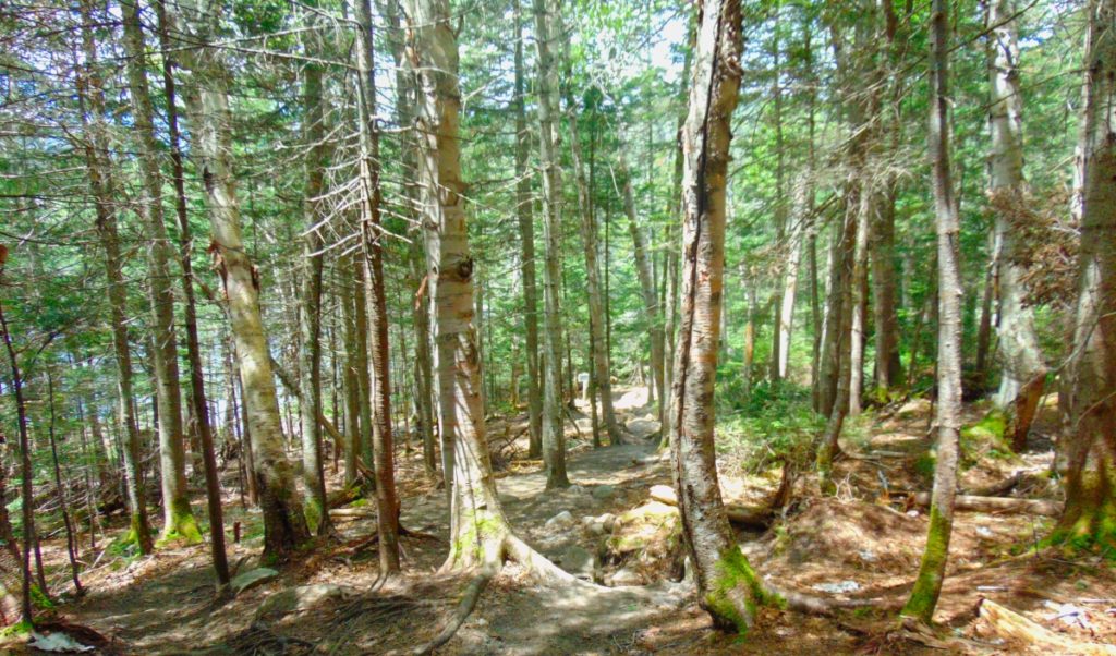
As you step forward towards Lonesome Lake, mountains emerge in the distance beyond, and the Trail reveals an option to go right or left. Take the left side path, clockwise, around the Lake. On the other side is the area which is the main focus of this trek, where everything comes together. This is a scene with multiple mountain vantages, perhaps relating to the mulit-layered rubix-cube-boulder at the beginning of the Trail, indicating something about the vantages and perspectives to be found here.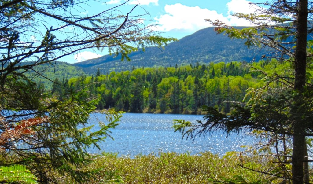
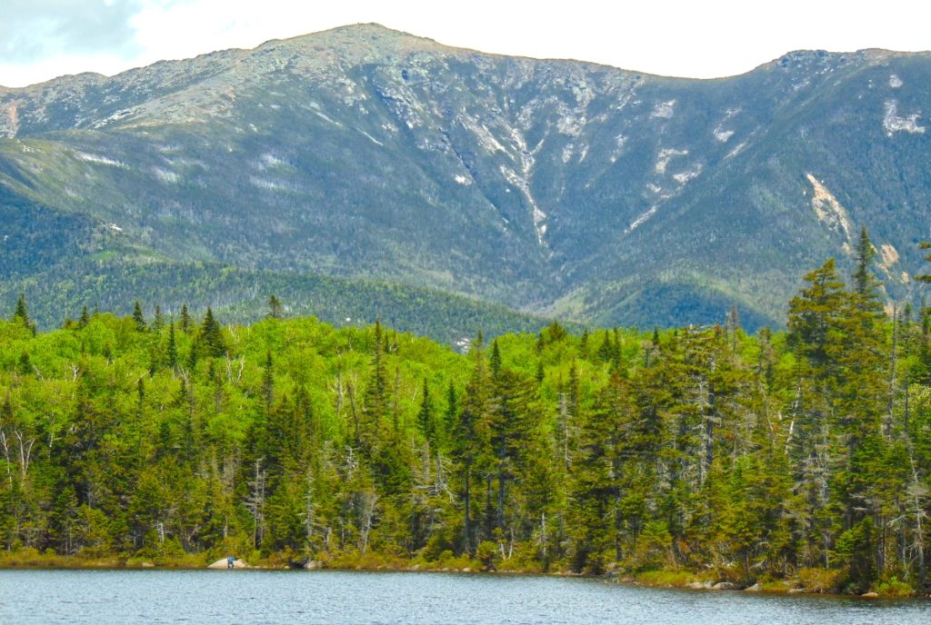
The breezy jaunt around the circular Trail begins to reveal mountains, in every direction. The first view, to the West, is of Kinsman Mountain. (Image/Above) Making your way to the other side of the Lake, Mount Kinsman looms like a Sun-dial; As the Sun makes it way towards its 4,265 ft peak, a shadow slowly cools the hidden Lake below. Reaching the other side, you will turn to look back to the East, and Franconia Notch Range is laid beautifully bare, above the Forest, like a Tigress looms over her cubs. It’s spectacular. This is the place to rest, and eat, and take some pictures. 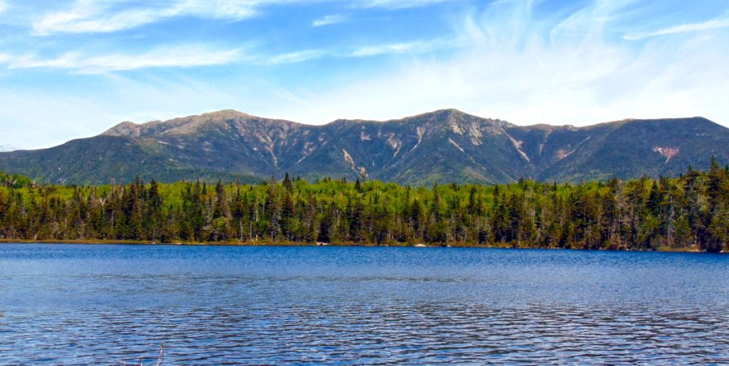
After some time taking in this scene, begin your trek again, continuing clockwise around the Lake. A glowing green Cannon-Ball Mountain radiates brightly to the North. The bright contrast compared to the darker hues of Franconia Notch Range and Mount Kinsman is a super-pleasant shock. A three sided, mountain-sized, protection for this Lonesome Lake. 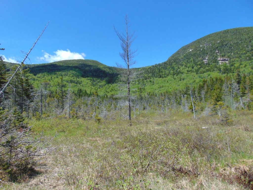
There are platform-pathways that run through the Forest, beside Cannon Ball Mountain, as you make your way. 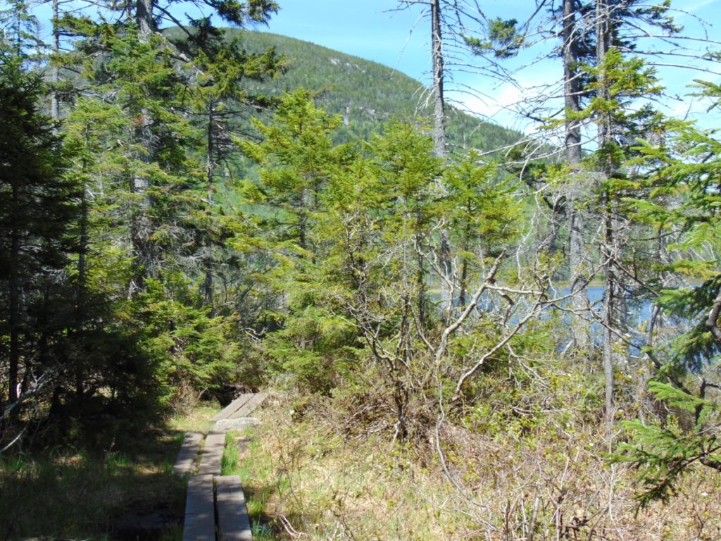 Some of the enclosures give a few different vantages on Franconia Notch Range…
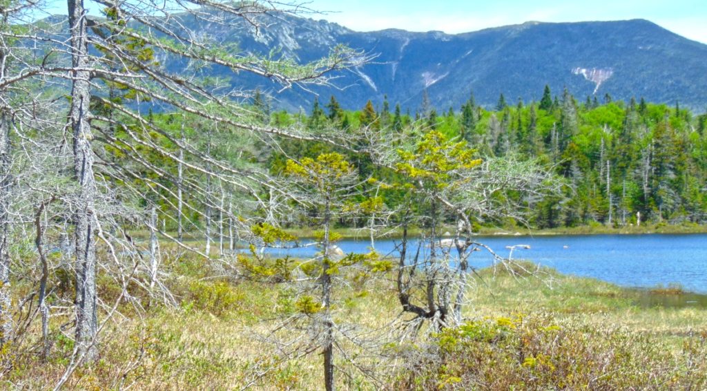
You will come full circle, and head back down the way you came. You took in a brilliant scene.
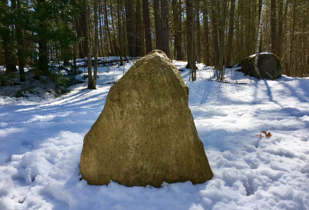
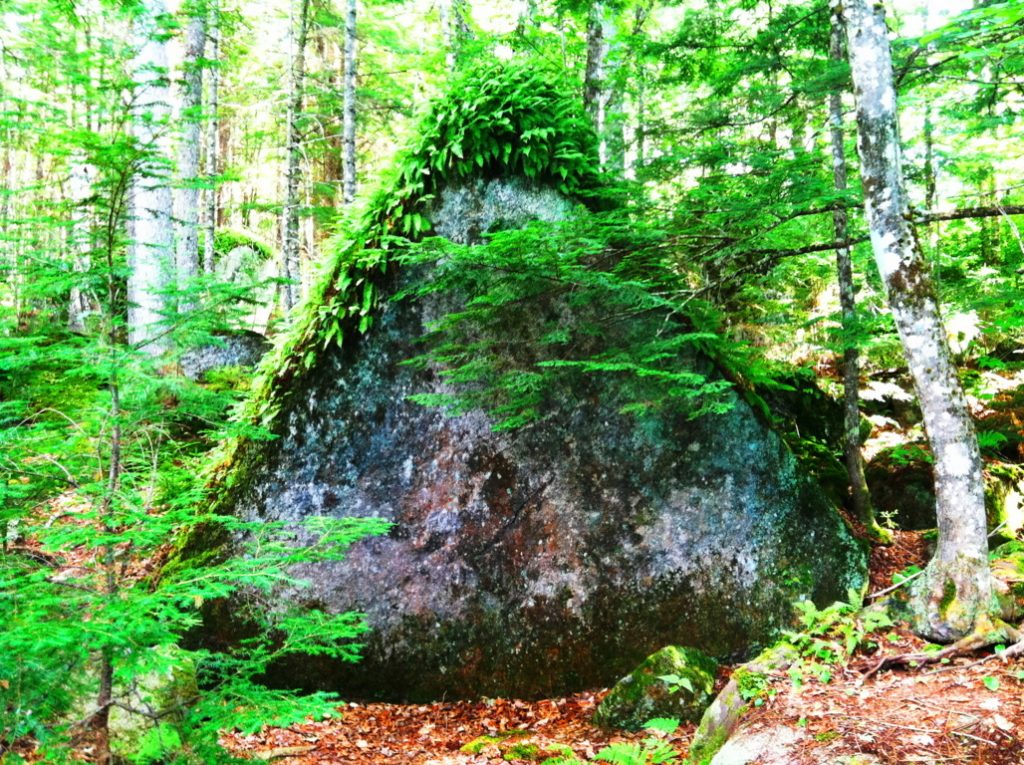
I hope readers will understand that relating these cultural points is not easy, or prideful. There was a time that I myself absolutely did not believe that any of these megalithic indicators were possible. It was a fairy tale, at best. But what I discovered, first hand, in person, as I engaged these trails, is the miasma of academic level evidence pointing towards this earliest anthropological Culture on Earth; This is The Megalithic Culture. You can see it too. The ironic thing, is that this earliest Culture was capable of creating almost anything they decided to build. They were engineers of entire landscapes! We find solid evidence for this Culture in Ireland, England, Wales, Scotland, France, New England, Virginia, Arizona, California, Mexico, Peru, Russia, and many more places. I still remember the first standing-stone I came across randomly, hiking in the dead of Winter in New England, some years ago. I was totally freaked out. It changed my perspective about so many things. (Image/Below)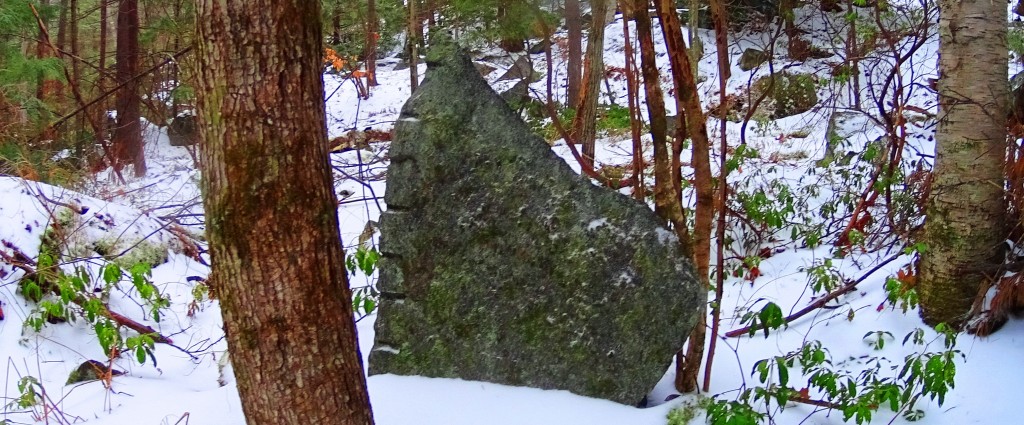
If there was an advanced Culture at the beginning of Time, how could we say that Cultural development is Evolution based? Why is none of this mentioned in our K-12 text books? In other words, why don’t the people funding Public Education not want you to even think about this Megalithic Culture? Are they afraid that it might change your perspective on some things? Your damn right they are! Get free. Open your mind. Look logically. It’s not what “Public Education” told you it is. Lonesome Lake is yet another wonderland, full of natural beauty and cultural mystery. It’s a place I hope you won’t miss. Covid-whatever, or no Covid-whatever. Go strong!