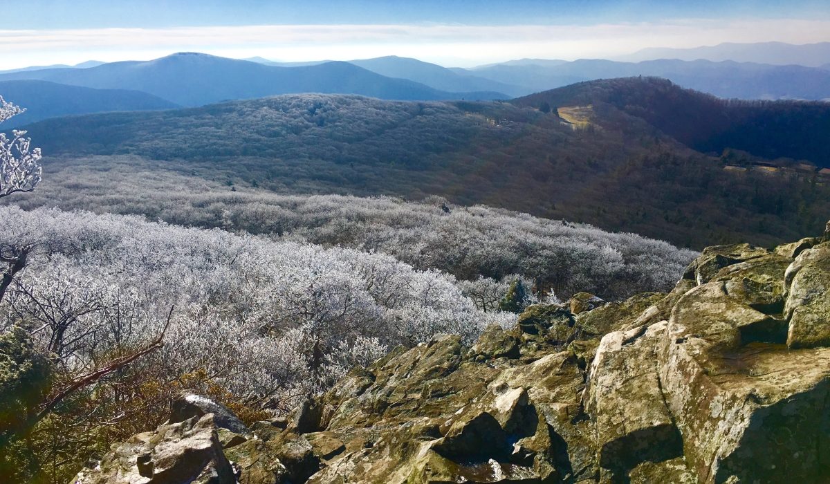
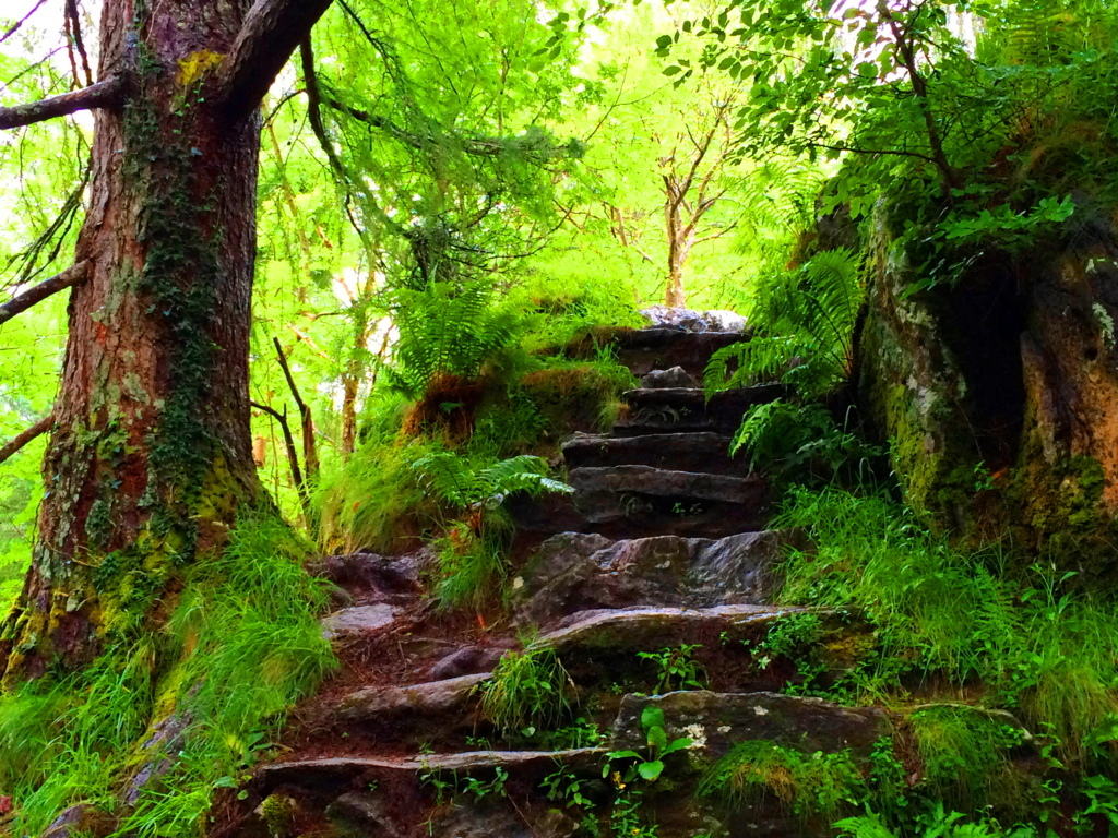
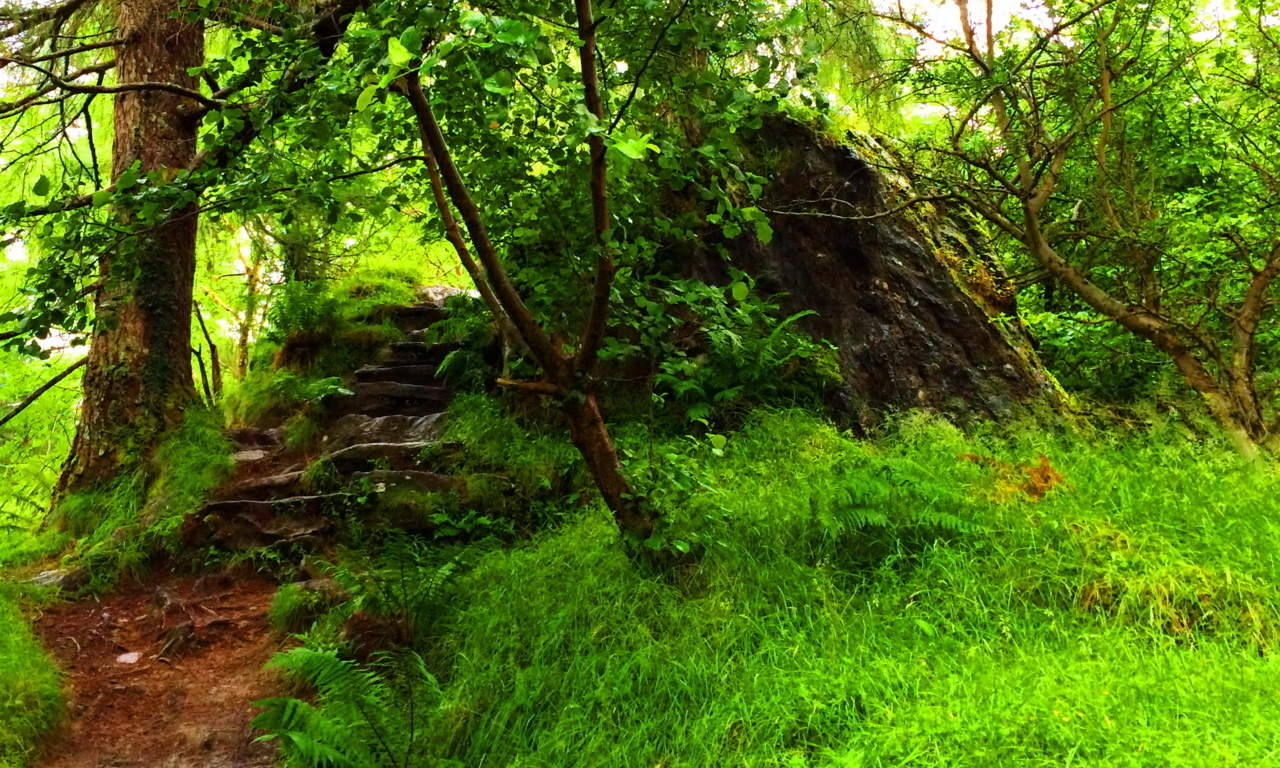
Tully Lake/Forest of Neolithic Engineering
 Location: Athol Massachusetts
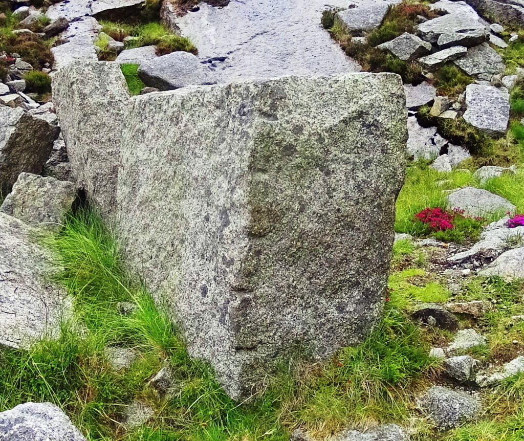
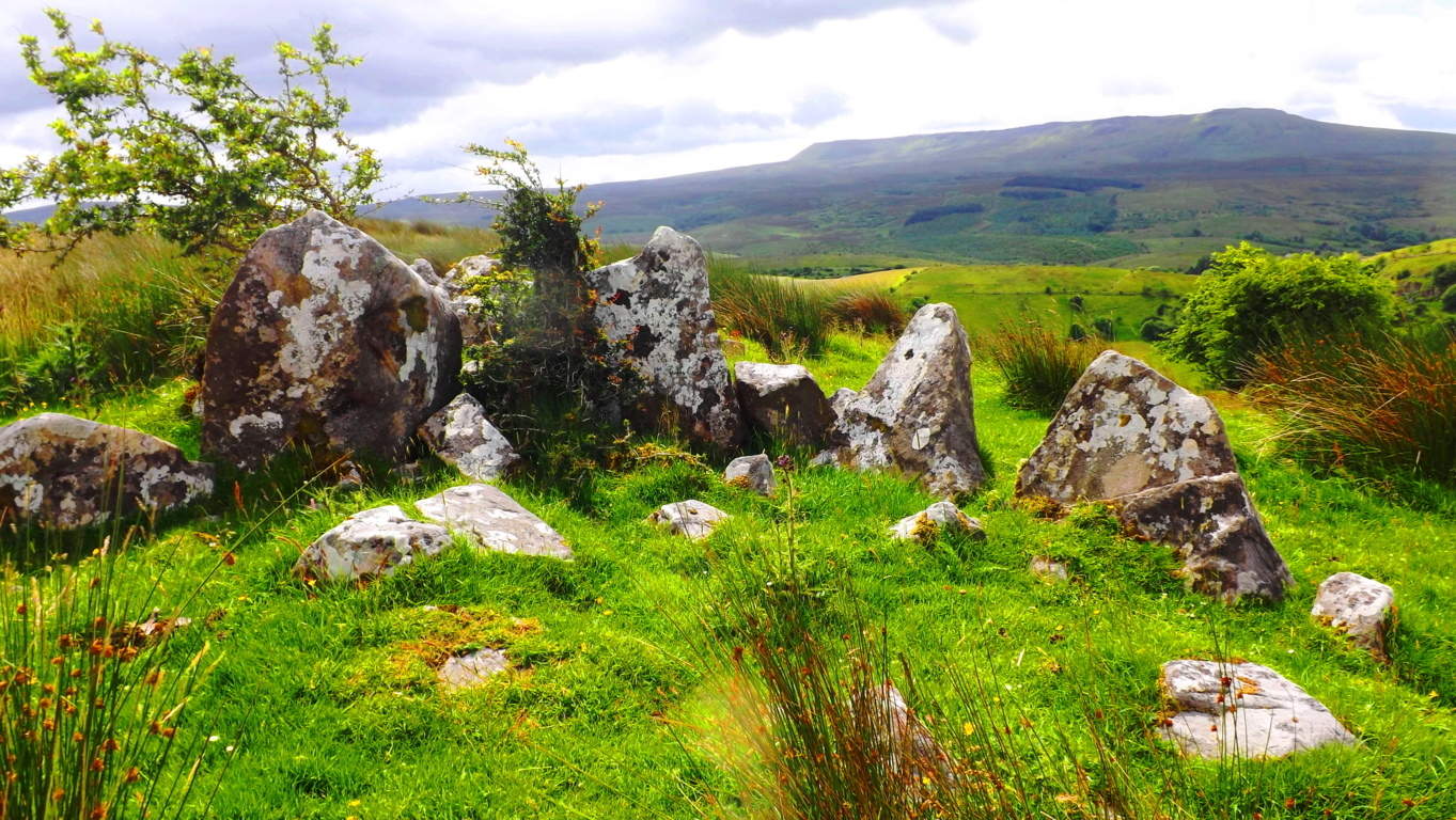
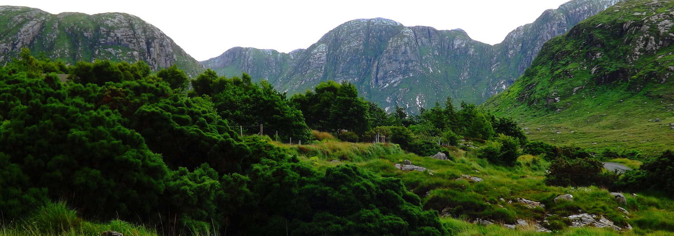
Ireland
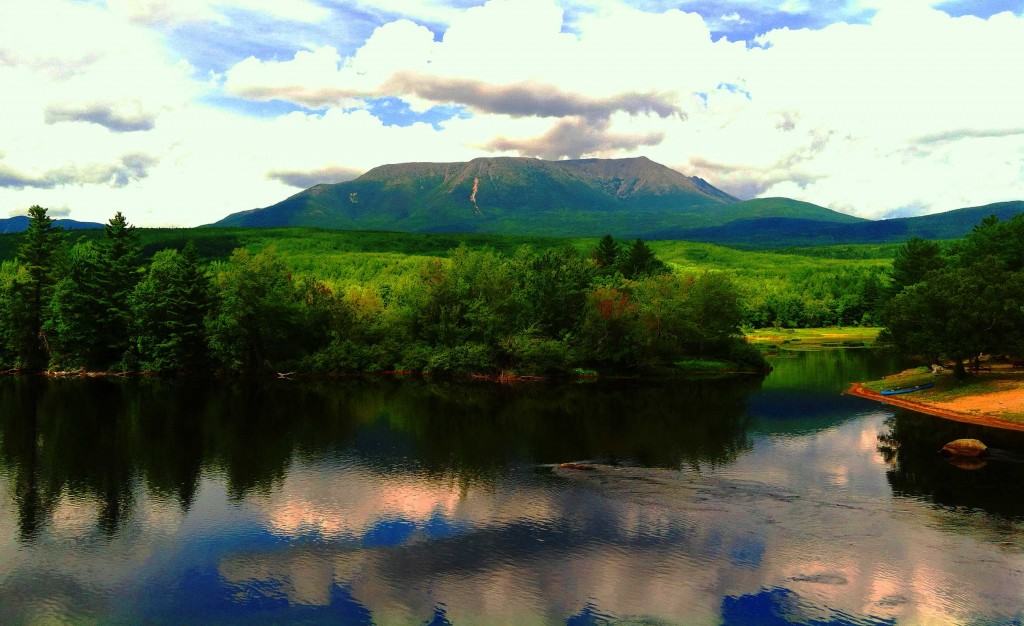
Tully Lake
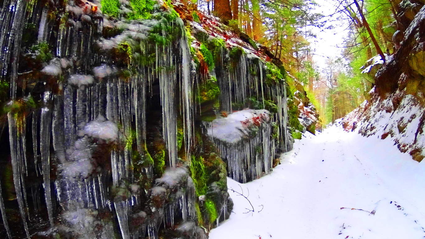
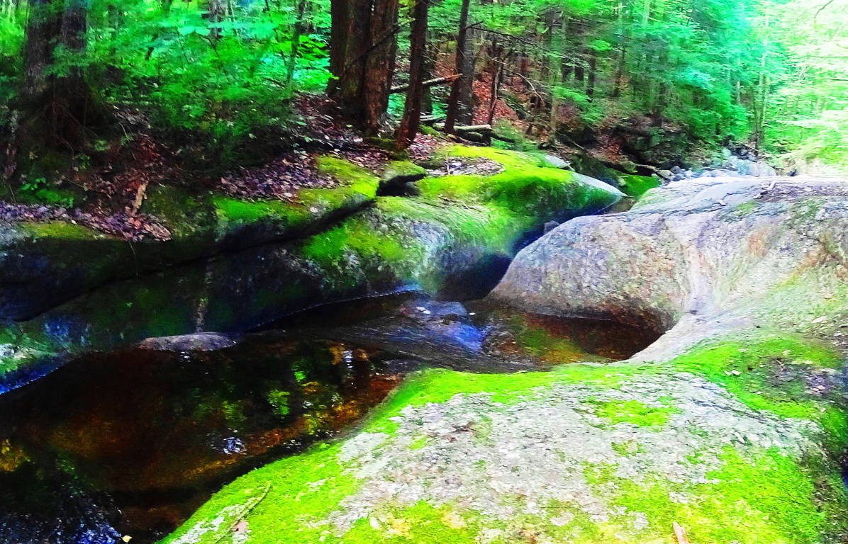
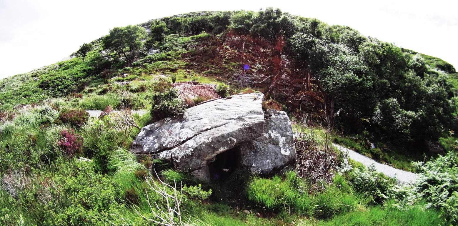
Note: Tully Lake Trail is nothing less than a kingdom of cut stones enveloped by gorgeous old growth forest in the heart of New England. The main trail loops down along the lake for about two miles, and then back into the elevated forest for another five. It is a challenging hike in winter, but enchanting. As you begin to progress into the glades of tall pines, birch, and maple, it becomes impossible to ignore the crafted megaliths lining the hillsides. It becomes abundantly clear that whoever engineered these incredible stones wanted them to be noticed. It is a venerable masonic work area, with standing stones, cut boulders, stone linings, and ancient stone dwellings. Furthermore, the stonework is not arbitrarily placed, but is clearly set in a specific manner, although beneath a blanket of snow it is difficult to decipher on a blustery December day. The clarity of the markings on these stones is astonishing. Similar styles of measurement for the cutting of megaliths exist at Mount Bearnagh in the Mourne Range of Ireland, and also most notably in the Lynn Woods further east of here in Massachusetts. Observing the scale of what are clearly measurement markings for cutting, (which I must add is certainly not inches, but some other grand standard) allows us to consider what the craftsman of the stones considered to be ‘scale’. And that scale is MASSIVE. The stones also reveal incredibly complicated curvatures, extremely hard to create in large granite pieces.
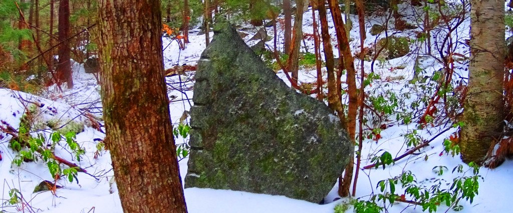 The entire forest is inundated with stone statements that cry out for observation. Consistent with other old-growth trails all over the world, this forest contains the remnants of what I believe is the one time home of the craftsman of this area. Sitting roughly four miles into the loop of the main trail, unlabelled in any way, to the right of the pathway while heading back towards the entrance, I saw an incredible stone foundation of what was once clearly someones home. This site featured a beautifully dry-laid and grand cut-stone looking to weigh at least 2 tons, embedded perfectly into the foundation. The amount of care and effort that went into placing just this one megalithic center-piece must have been challenging. With sites like this, a trail becomes a priceless anthropological zone on the level of Tollymore Forest in Ireland, and Monument Mountain in the southern Berkshires of Massachusetts.
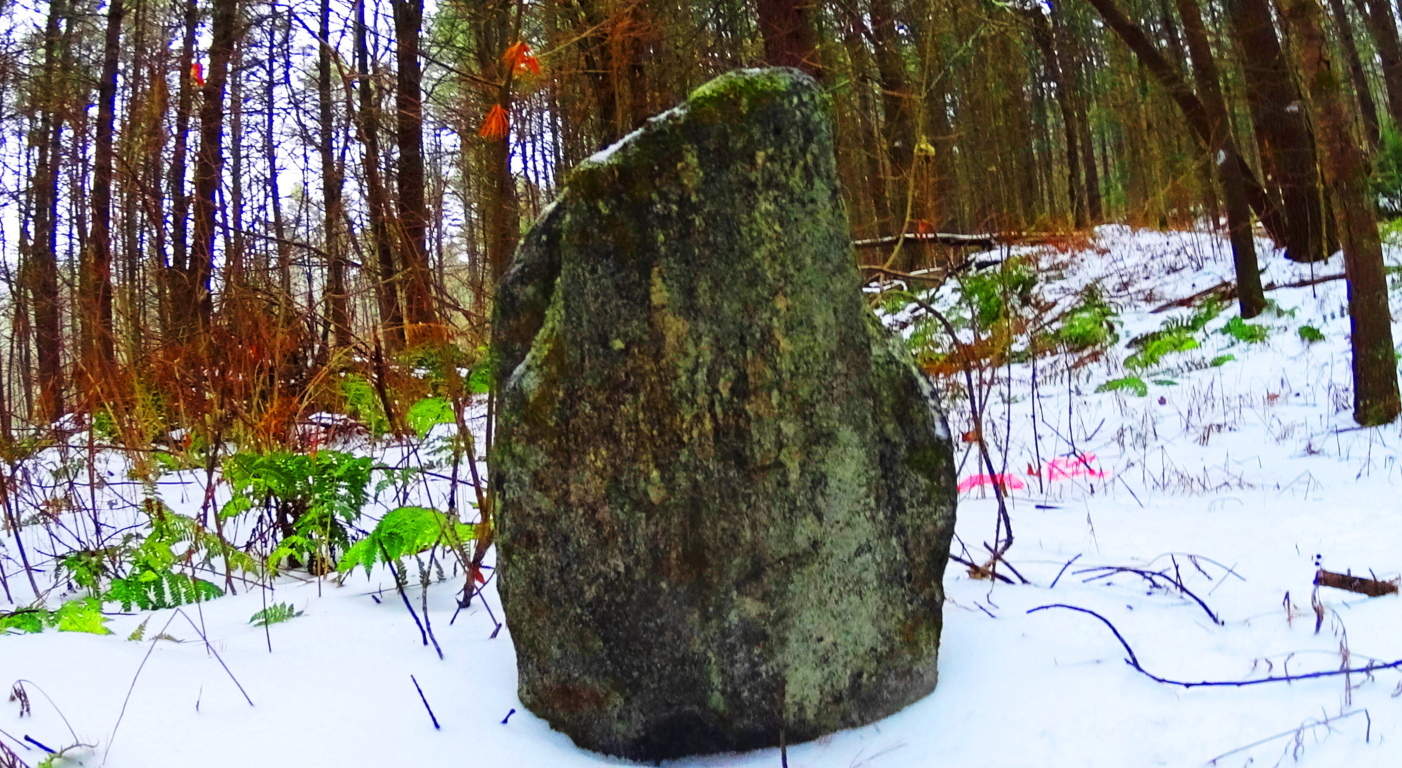 To find an ancient dwelling, or one definitive standing stone in a single New England forest is rare, but to find several is truly exhilarating. Further along the trail there is a stone connected to a stone-lining (‘wall’) looking very much like a Celtic ‘directional stone’, almost identical to types I have seen in England.
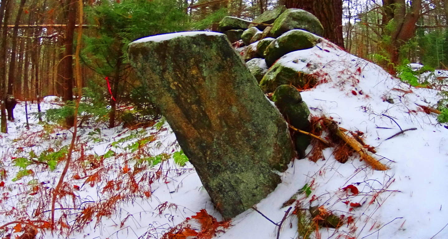 Celtic areas have preserved these stones and properly noted them as important anthropological statements from a culture perhaps 6000 years in the past, but New England has failed to do so here. Ironically, this somehow makes New England’s ancient sites feel a bit more pristine than even Celtic areas that are well known, because the stones have not been touched, or even visited by anyone knowingly seeking the works of a neolithic culture. When considering that almost every massive boulder in the forest contains some form of crafting, whether it be boulders split in half, or simply marked by incisions of some type, the amount of energy that would have been put into this effort is astounding, and so worth noting. And all the time, behind fixture after fixture of colossal craftsmanship, is mile upon mile of zig-zagging stone linings sliding through the trees.
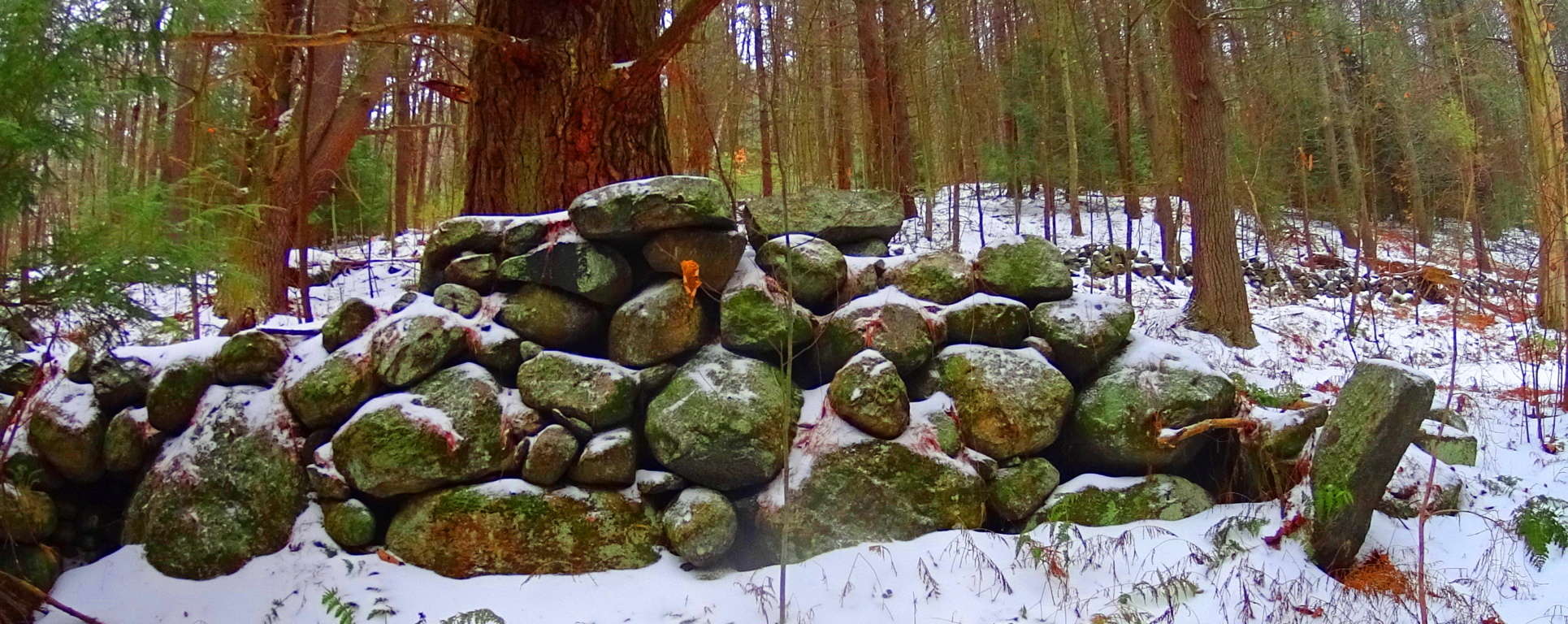 Close consideration of these works reveal that these efforts are not mere random ‘holes’ in the rock, but linearly lined incisions.
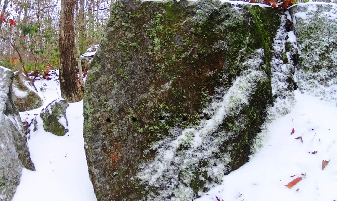 And cuts along the edges of these megaliths are measurements, not random markings. Some of the craft work is truly artistic, revealing a joy in the artistry. Some stones are set in pairs, others are laid out as massive fixtures, seeming to have a functional flare. Hiking through these pathways is a pure wonder that pushes the boundaries of our understanding of what might have taken place clear back to the beginning of Time.
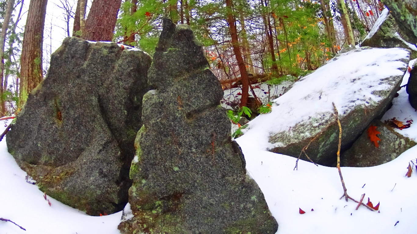 The stones themselves seem to insist that it may not be the linear evolutionary line that postmodern texts have been pushing for the last 100 years. It is clear that technology existed in antiquity, and was utilized in this incredible daydream of a forest. On an international scale of 1 to 10 for sacred forests, Tully Lake is a 15. Seek and find it out for yourself, something truly magical took place here.
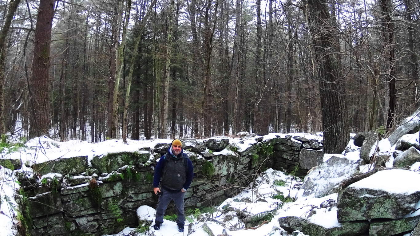
Cavan Burren National Park (Part 1: Celtic Altar)
 Location: Blacklion/County Cavan Ireland/Cavan Burren National Park
Note: If the quintessential Celtic ‘dreamscape’ is what you are hoping to find in a hiking experience, Cavan Burren National Park is the place for you.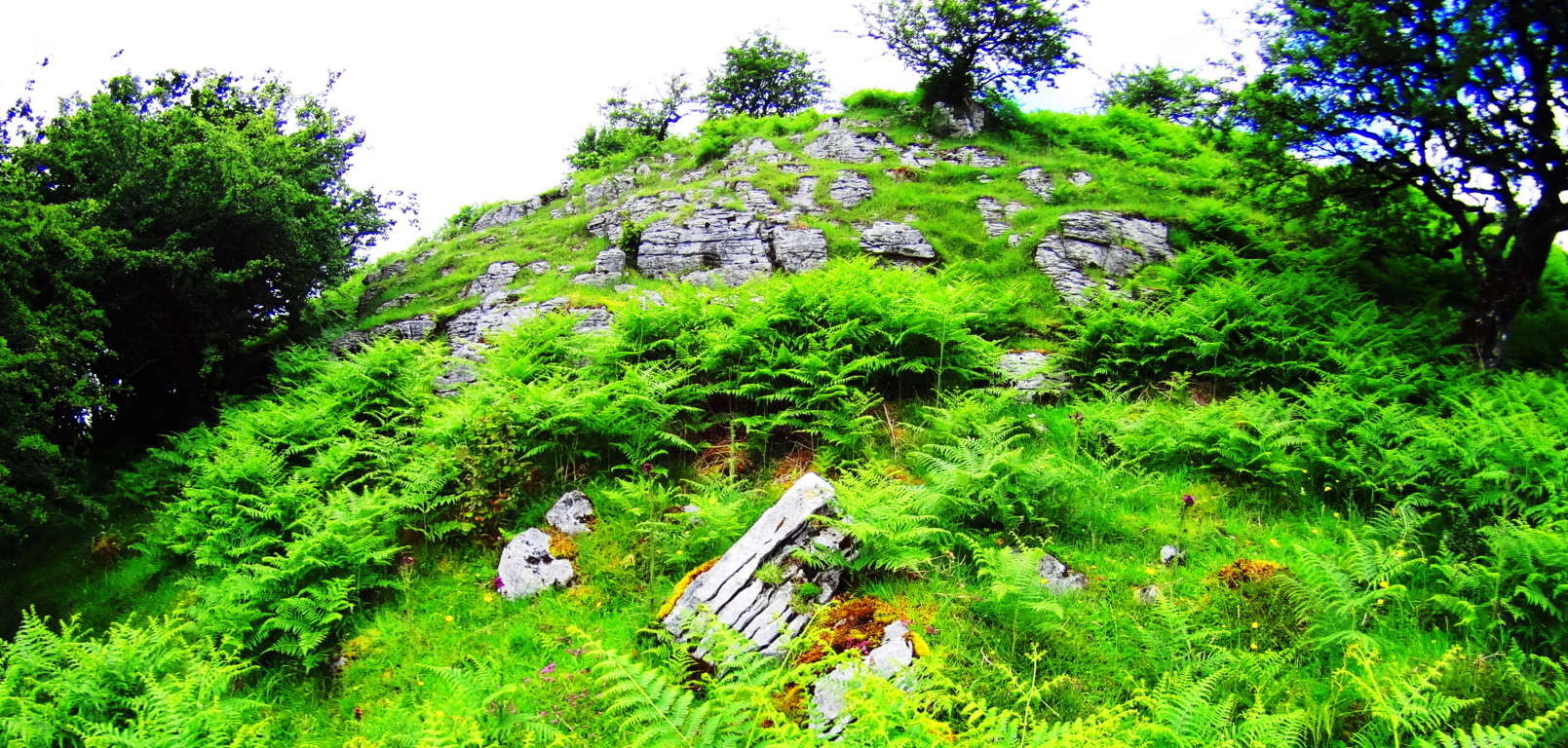 This pristine pre-history landscape is sacred on every possible level, with roughly ten square miles of Celtic wildlife preserve. Embedded in the surreal panoramic vistas surrounding Cuilcagh Mountain, on which the park is mainly canvased, are priceless 5000 year old Wedge Tombs, Alters, Dolmens, and megaliths. A fantastic trail runs from the main entrance/visitors-center of the park to beautiful anthropological sites. The area is absolutely worthy of several specified reviews for each of the sites along this main route, but the real wonder of the region, and perhaps it’s most establishing distinction as a truly Celtic reserve for both exquisitely rare natural fauna and neolithic cultural gems, is that the off trail hiking reveals supremely beautiful works of ancient stone engineering as well. I discovered this incredible alter, featured in the title image above, by interpreting the lay of the engineered stones expressed over the landscape. Postmodern anthropologists have taken a dismissively poor perspective on what they have lazily identified as “farmers walls” looping over the hillsides. These “farmers walls” are not “walls” at all; functionally they do not limit the movements of grazing flocks in any way. Herds can simply walk over these stones if they so choose, so by literal definition, it is not a wall. The function of these special stones that look to our modern eyes as “walling” is actually a type of primitive ‘cable system’ that connects each sacred alter, from one to the next.
 These stone linings are like the wire that runs between a battery’s charge points, to the base-tip of a light bulb, passing energy from one end-point of energy to the next. I found this alter by following the lined stones running north west off the main trail.
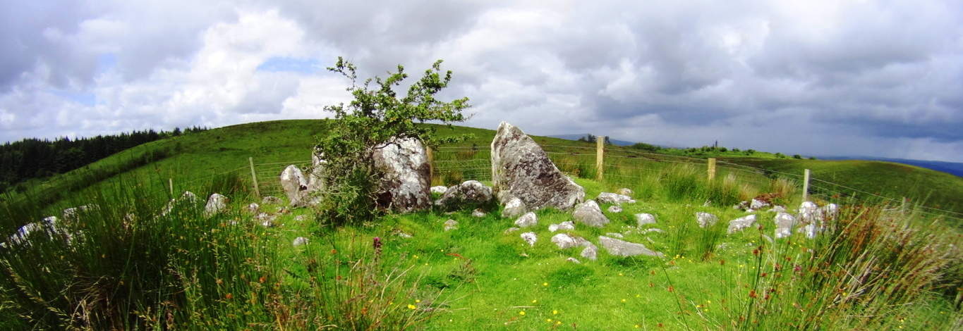 My educated guess was therefore to follow the lined stones I observed to see what special feature it was connected to. I arrived at this incredible Celtic alter wonderfully positioned at the next hilltop, approximately 1.5 miles northwest of the main trails (Top Image).
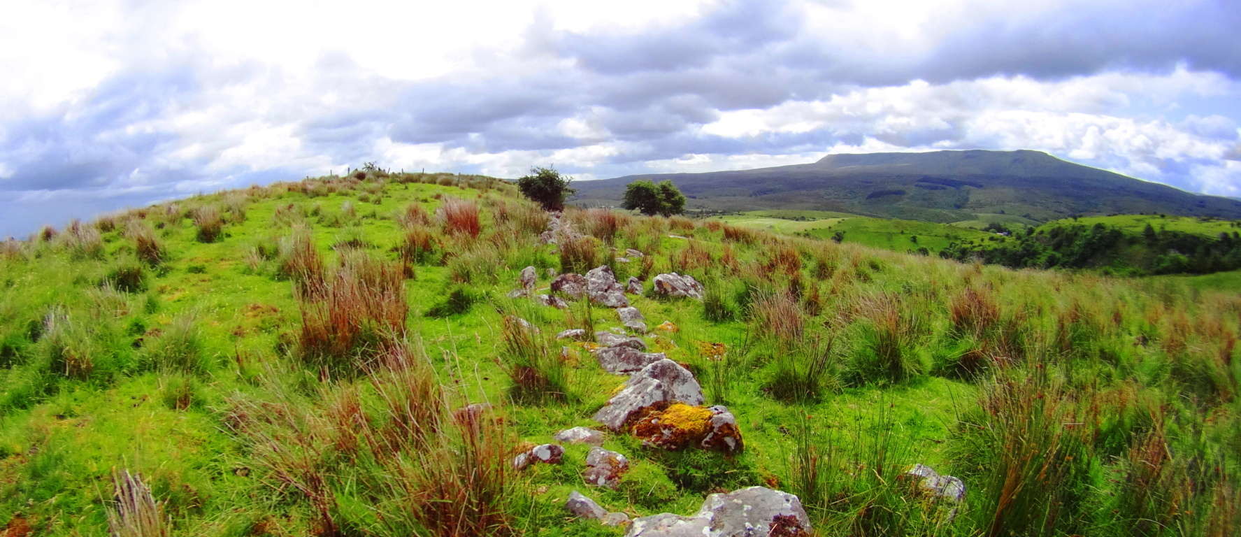 Here again was another moment where my firm belief in the premise of engineered landscapes was vindicated. The earliest Celtic cultures attempted to harness and designate the transfer of energy in the landscape with stones that absorb the energy from the sun and connect the alters sitting strategically at the top the hills. These lined stones funneled energy from peak to peak, alter to alter. Most modern anthropologists fall victim to assuming that a ‘defined sacred space’ requires a specific ‘central temple’ that celebrates the area in a basically singular declaration. What they refuse to consider is that an even higher expression of the sacredness of the landscape is of course to utilize it while celebrating it, making the entire area a type of living, functional temple which connects each elevated corner. This engineering is also present in the mountains and forests of New England. I encourage hikers to prepare appropriate gear for deeply experiencing the landscape, for trekking into wilder corners of the reserves. If you follow the stone-linings of ancient Celtic zones to areas away from the designated trail, you will soon find that the premise of engineered landscapes is absolutely real. Aside form this, the natural beauty of the area is stellar. To deeply experience any ancient landscape equip yourself with cinema-capable cameras and capture your trek.
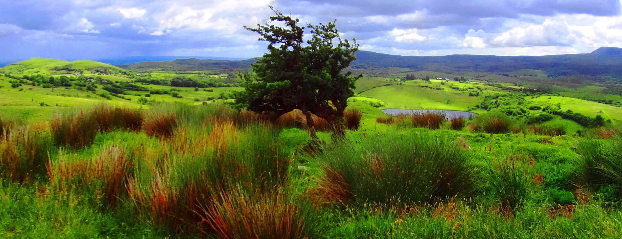 Cavan Burren National Park is a portal into the primordial era of the earths most fantastic expressions, with priceless anthropological expressions of engineering from the first culture on earth. Seek, and find it out for yourself.
Sculptured Rocks Reserve/Groton, New Hampshire/U.S.A
 Location: Cockermouth River, Groton New Hampshire
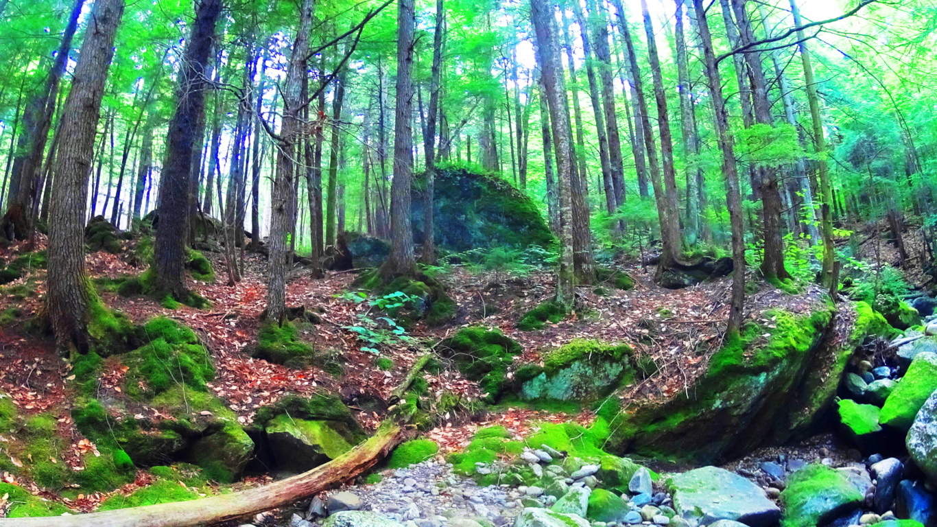
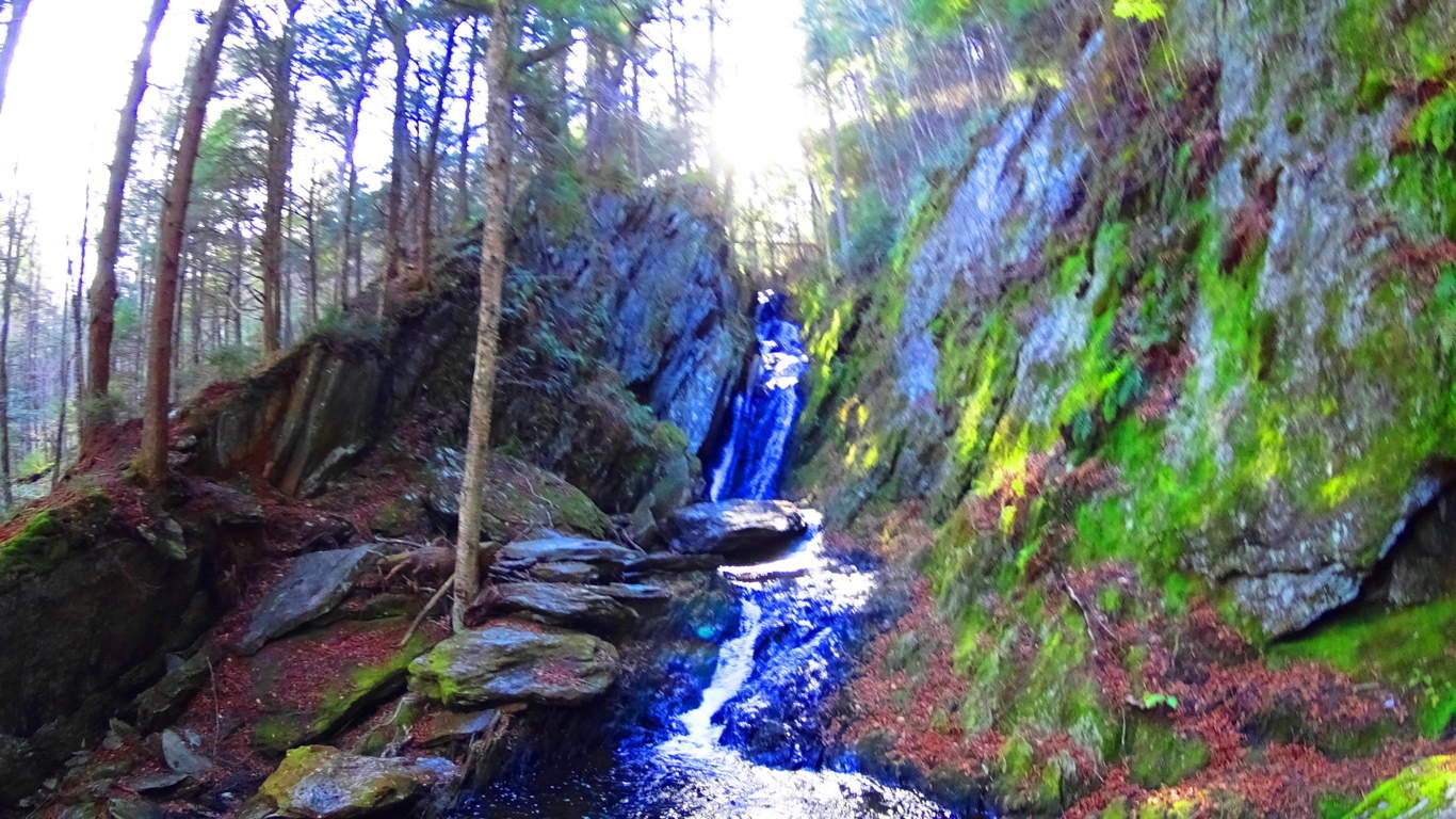
Note: Sculptured Rock Natural Reserve is a watery wonderland of falls rushing within the forests and small mountains of Groton New Hampshire. A hiker has the option of following the falls as far as they wish by hopping from stone to stone, or perhaps stopping to splash around in the amazing still pools created by the rocks.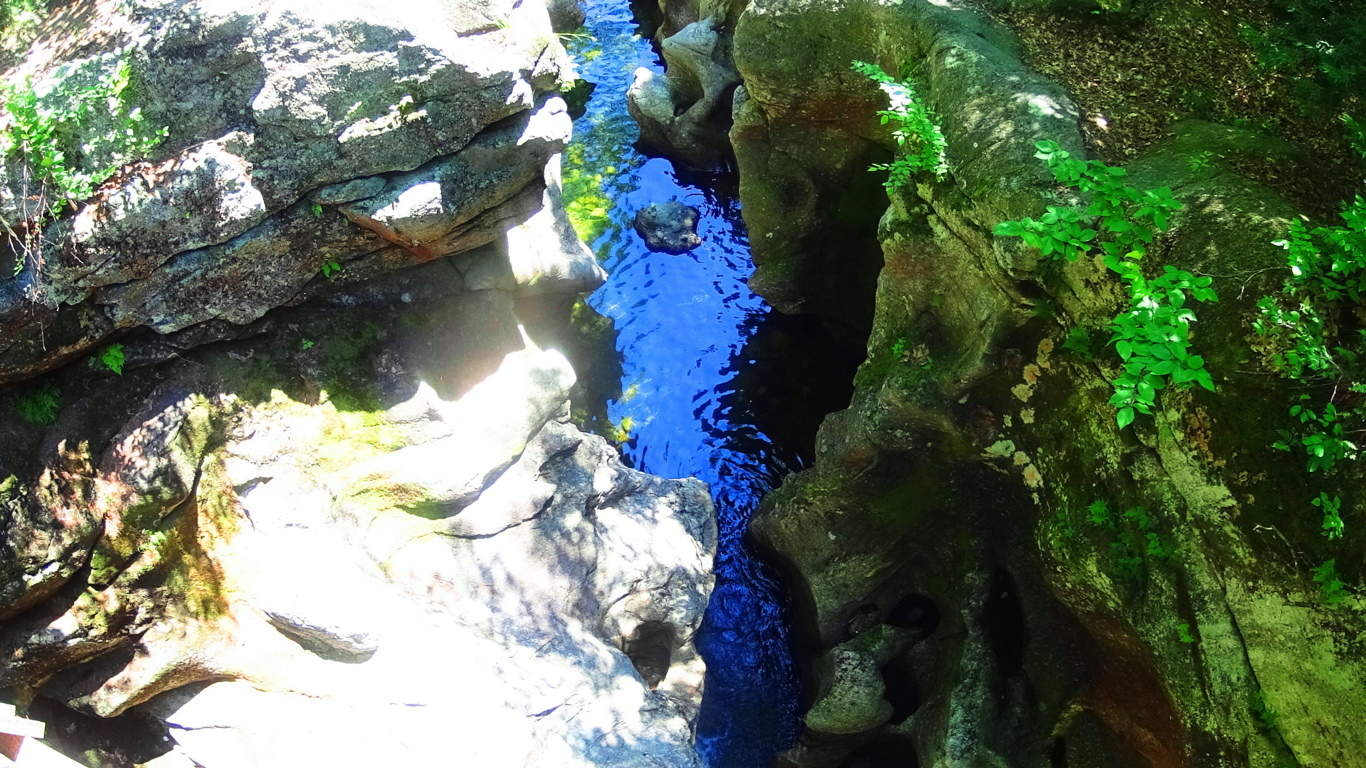 Trails also run away from the fall into the forest, where other works of ancient stone and crafting can be found, such as Cairns, and ‘directional stones’ from another epoch. The area is a notable anthropological site, with an authentic ancient stone dwelling nestled close to the designated forest trail, and several massive stone enclosures of megalithic scale further down the fall to the south.
 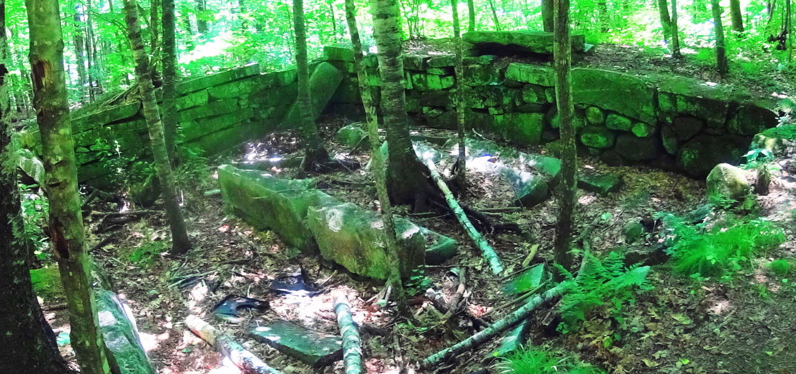 I believe these works, due to their scale and placement, to be PRE Native American, built by a culture yet to be acknowledged by current anthropological historians.
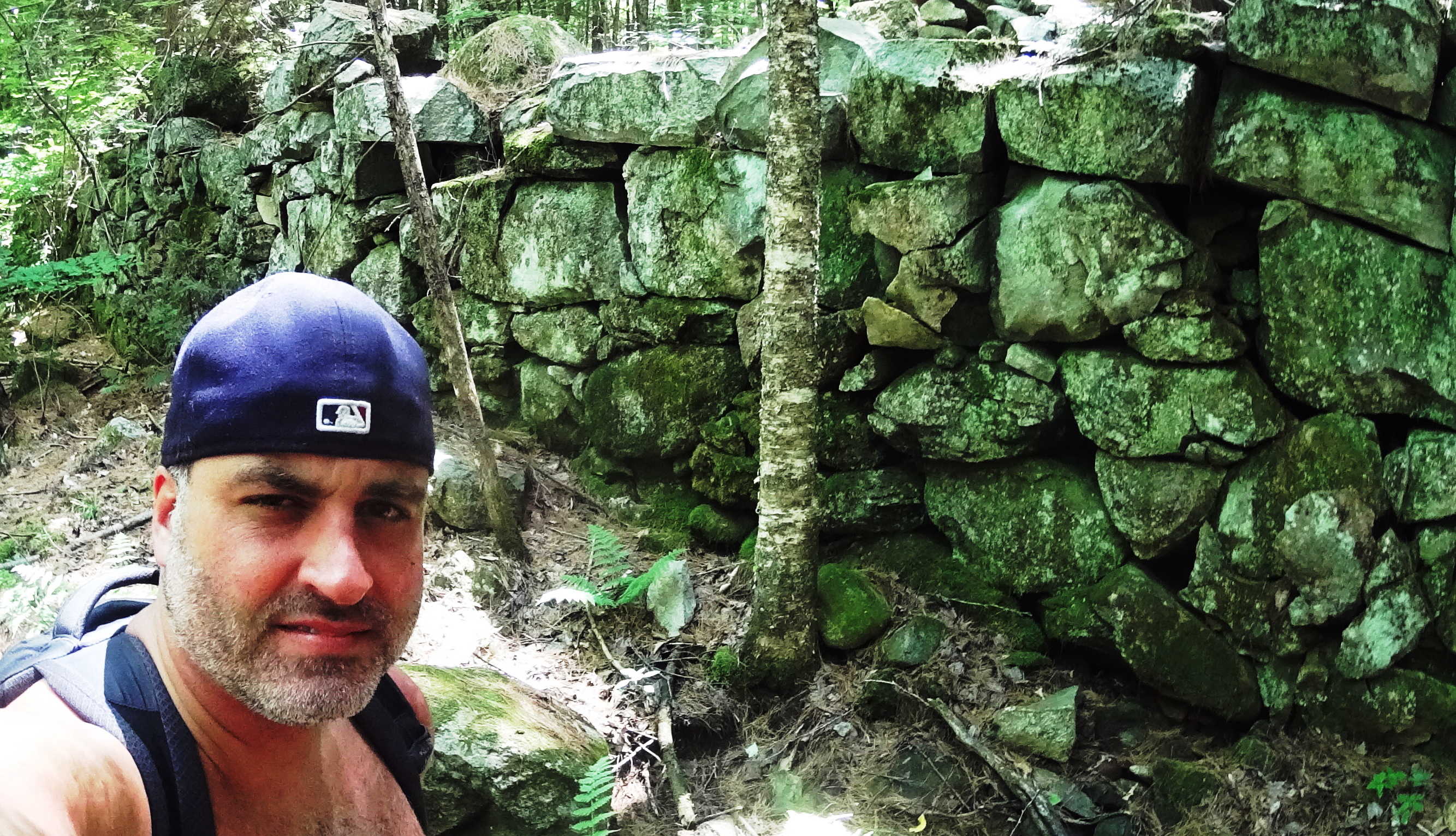 The main water artery, the Cockermouth River, is filled with free standing boulders that sit in an incredibly smooth stone tunnel of what looks to be sculpted rocks. This is very similar to the style of many free standing boulders in Northern Ireland’s rivers, but on a much larger scale. There are literally thousands of these free standing boulders. Away from the Cockermouth River, further north, are several wild rivers without trails running up small mountains enclosing the area.
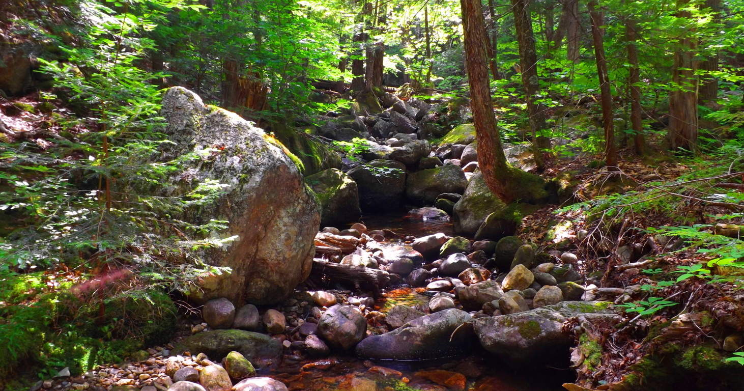 For an experienced and prepared hiker, I recommend the very real adventure of following a waterfall up the mountain by stepping on its stones. Following small mountain falls is an amazing experience due to the fact that the features of the fall become increasingly impressive the higher up you go. Wide stone porches and steps that look to be carved right out of the mountain support fully flowing falls that dance down the stones. Somehow these features leave plenty of dry space along the way, allowing for great footing beside stone porches and pools while ascending the fall.
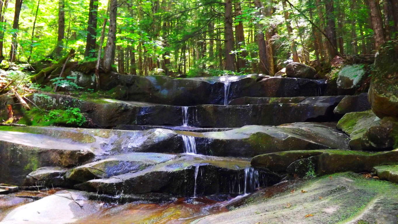 One of the best parts of following a wild fall in New Hampshire is the option to jump in, or plop down in the middle of water-slide like tube of water-flow, and cool down along the way.
 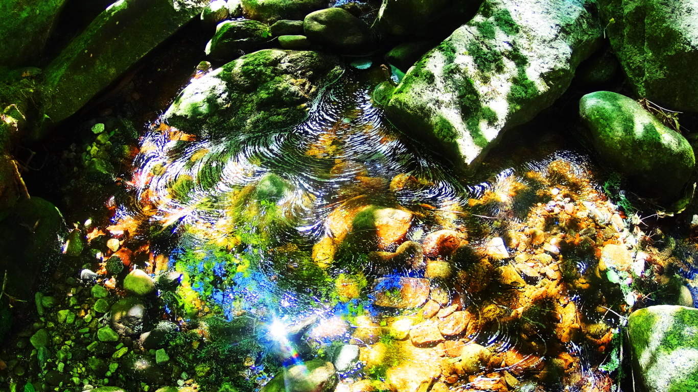 The beautiful combination of sculpted waterways, dynamic waterfalls, ancient forestry/ stonework, literally from the beginning of time, make Sculptured Rock Reserve one of the best kept secrets for outdoor enthusiasts. It is one part water-filled canyon, another part Celtic rock haven, with waterfalls that truly spark the imagination. Sculptured Rock has a sacred feel. Seek it out.
Mount Katahdin
 Location: Baxter State Park/ Millinocket, Maine/USA
Elevation: 5,267 feet
Note: The Penobscot Native-American tribe that once lived in this region referred to this mountain as “Katahdin”, which means: “The Greatest Mountain”. It’s expansive natural reserve is protected by the State of Maine as Baxter State Park, inclusive of incredible rivers, rapids, high mountain streams, and cascading waterfalls cutting through one-hundred miles of Appalachian forest. Hiking Katahdin is a multidimensional experience with marvelous variations in the fauna and stone while ascending.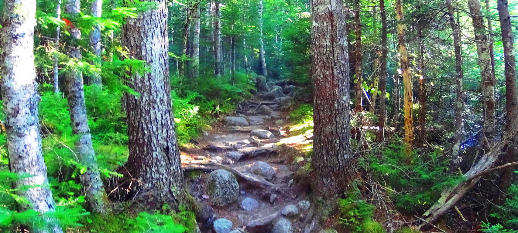 I followed the ‘Katahdin Stream Trail’ on the western face of the mountain, which requires a parking reservation and 7 a.m arrival time, easily made through Baxter State Park Office. The initial portion of ‘Katahdin Stream Trail’ follows a beautiful and wide rocky stream, with grand free-standing boulders guiding the water that rushes down the mountain. Ancient works of masonry appear in unique stone pathways fully enclosed by beautiful Pines and Birches. Some steps are refined and delicately thin, while others are wide and loosely fit, with blatant cuts and incisions, a full half-mile above ground level.
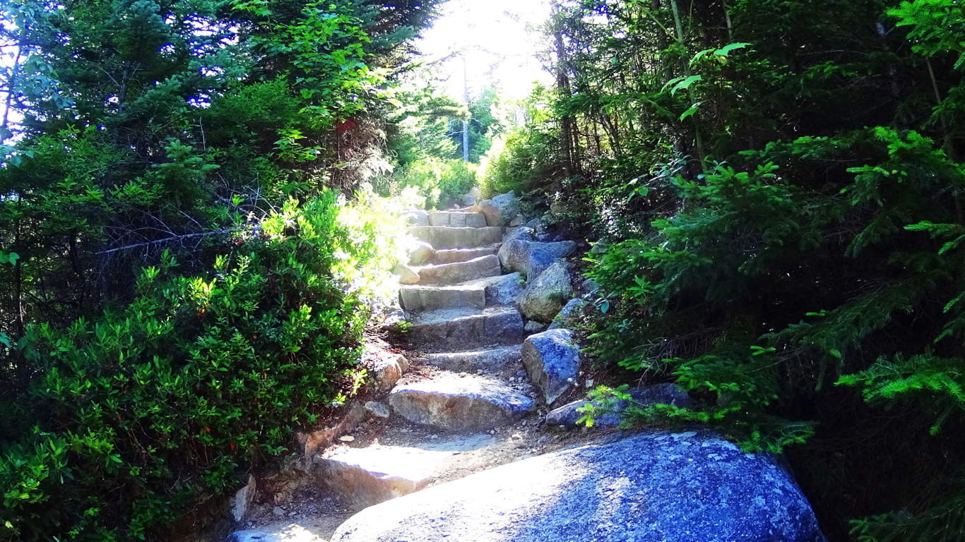 A spectacular waterfall can be found about an hour into the hike. The necessary level of skill increases after the waterfall, where the trail mingles with dried stream-beds and stacked boulders. From here, branches and roots surround the trail increasingly, and it is necessary to begin using climbing techniques. The terrain continues in this way for roughly another hour before breaking the tree-line, and encountering another major challenge. Above and beyond the tree’s is a venerable wonderland of massive rocks and boulders, lining the last ledge to the peak like a giant’s pathway. Free-climbing is required in order to work steadily along the massive ridge, weaving between and over colossal boulders sitting almost a mile above the world. To both the left and right of the boulder-trail the valleys below unfold like a brilliant blanket with peaks to the edge of the skyline.
 The pine trees below undulate and sparkle with a static electricity when the Sun is shinning, and all of New England unfolds before you.
 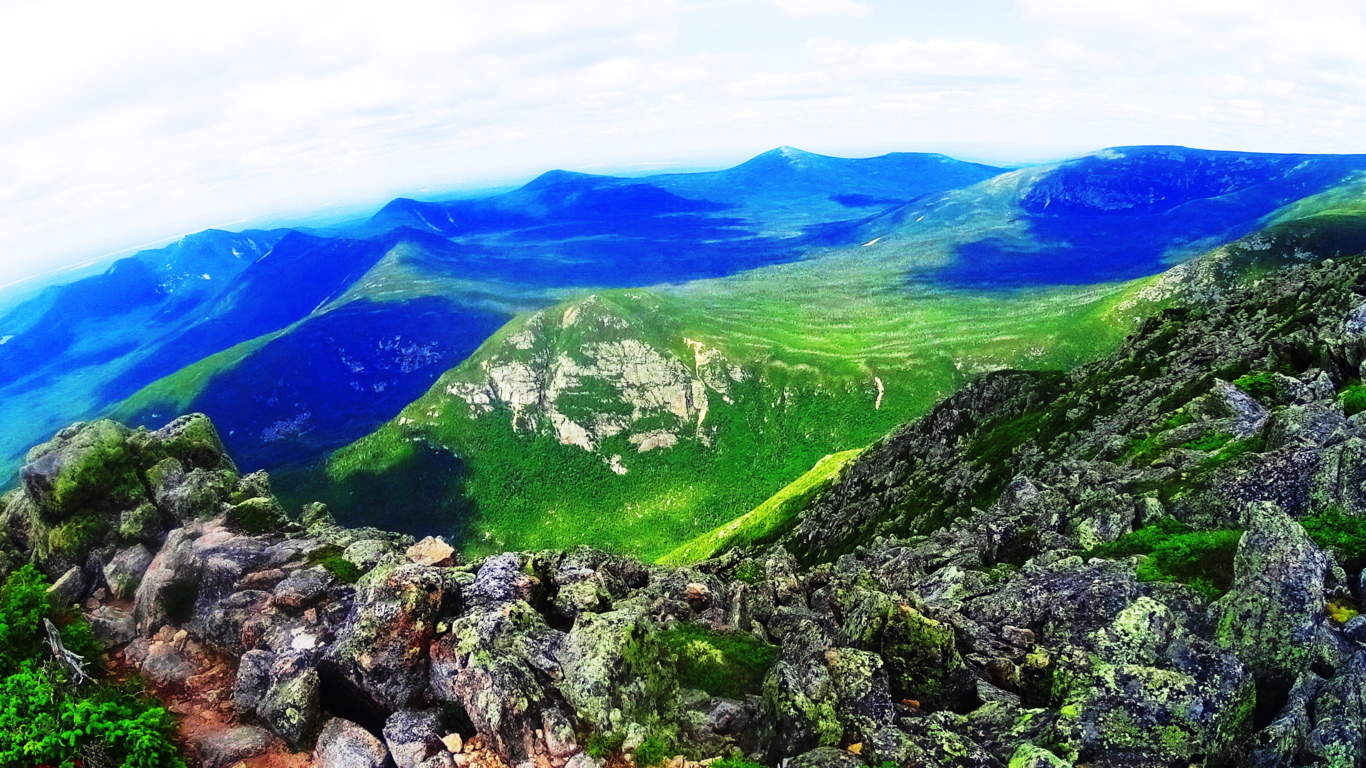 Steadily climb through the boulder-trail following the white-dot markers, and it is roughly 45 minutes to an amazing peak.
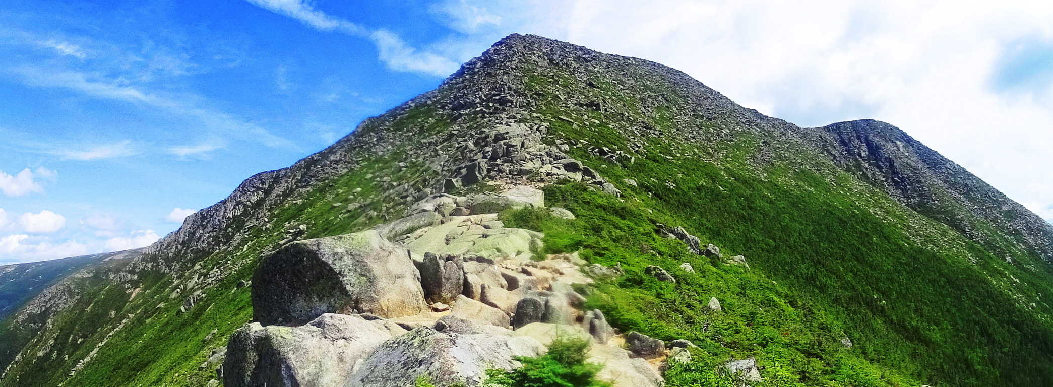 The Katahdin peak is a magical collage of unique dark granite colors combined with Celtic looking green moss, and interlocking stones. There are anthropologically notable standing-stones unlike any I have ever seen on this enchanted plateau, pointing and aligning to peaks to the west and east.
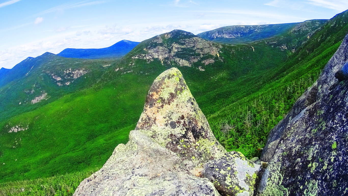 Some standing stones include signature fixtures, such as miniature counterparts supporting the front facade and drawing attention to the work.
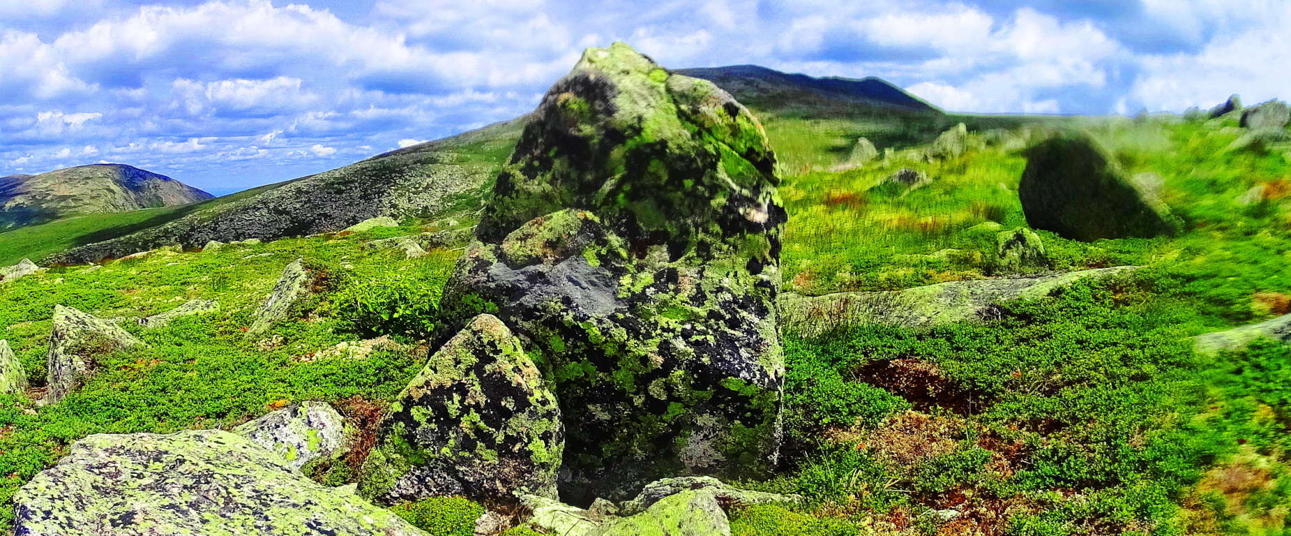 The entire elevation is covered in this unique moss so similar to the heights in the Mourne Mountains of Ireland, the Cornwall coast of England, and gritty heights of Glencoe Scotland. This is one of the best hiking experiences in all of New England, and should be experienced by all sincere nature lovers and ancient culture enthusiasts.
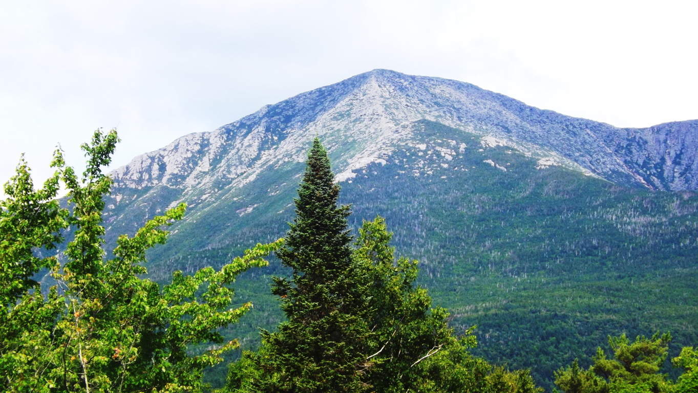
Tollymore Forest/Mourne Mountains
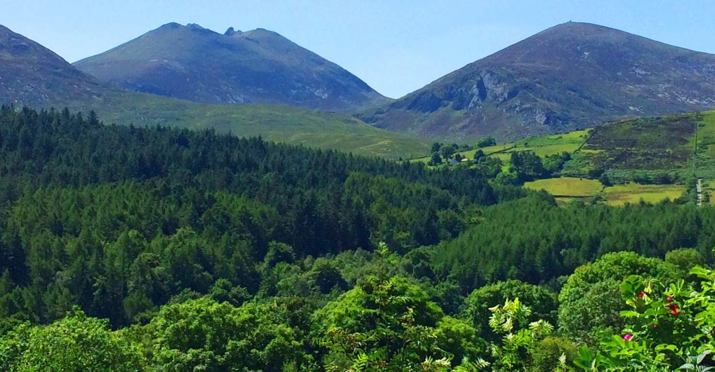 Location: Tollymore Forest/Bryansford Ireland; Newcastle
Note: Here is the now infamous Tollymore forest, the gorgeous setting chosen for much of the first epic season of Game of Thrones. The elevated peak directly behind the vivid pine glades is Croob Mountain, mingled with the greater Mourne Mountain Range. In real-time it is not hard to see why Tollymore was chosen by HBO as the back-drop for its mystical, Celtic/Medieval imaginary masterpiece.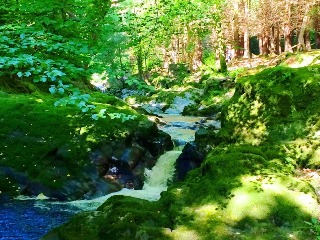 The glowing moss on the stones and tress indicate a pristine, ancient, and untouched aspect to the forest. Older places have this moss, which if touched by human hand, will not grow otherwise. It is everywhere in Tollymore, creating the feeling that one has stepped through a window into the way things once were. Several streams and rivers run through the woods, filled with glades of Oak, Beech, and even ancient Redwood. The stones within the streams reveal signs of equally ancient engineering, with directional layouts to influence the flow of water, or contain it in leveled pools with crafted rock faces.
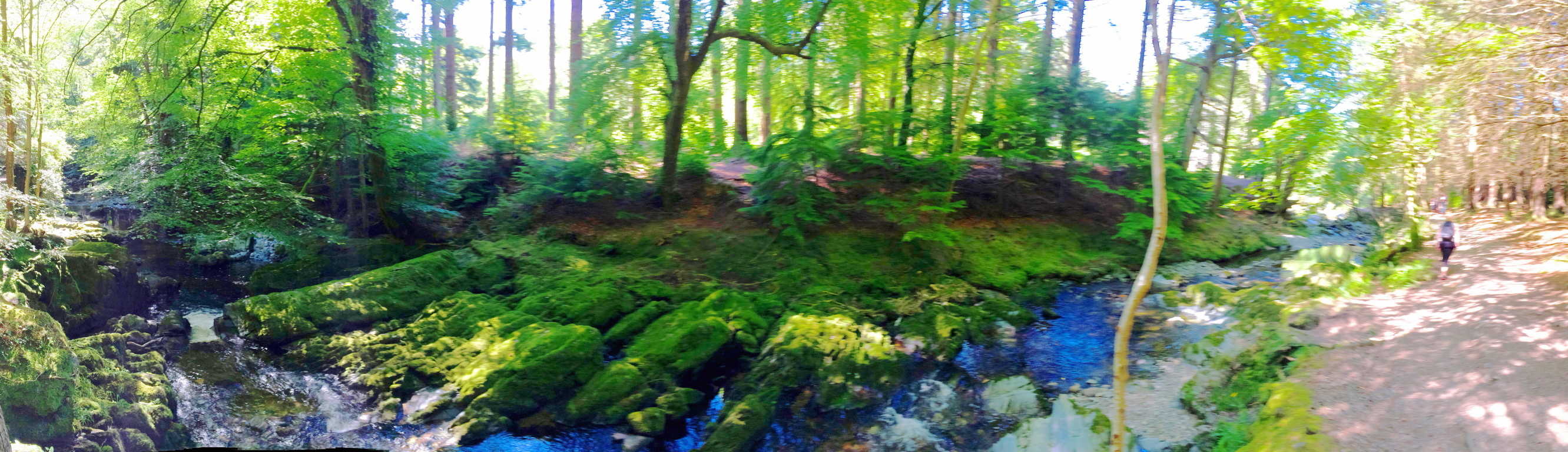 I was able to identify several focal points where the rock had been hewn into a funnel, or spout, which is an amazing feat of controlling/pacing the active elements in the landscape. Again, the moss along the stones of these streams is luminary, especially in the sunlight, like something out of hallowed fairy tales.
 More significant anthropology exists in Tollymore, of classic rock fixtures, also found in the deep woods of New England. To our modern eyes they look like “walls”, but a closer look reveals that they were not built as “walls”. The location of these ‘aligned rocks’ are most often from one peak to the next. Animals are in no way contained by these aligned rocks. They must have had some other purpose, if not just to define the space, but more to connect zones, like a cord of some kind. The stone alignments at Tollymore were inundated with mossy overgrowth, giving it the engaging and magical look that Celtic trails exude.
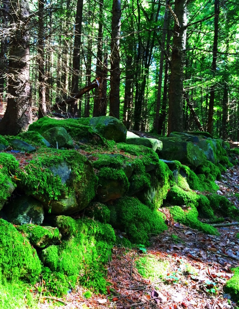 Other glades hosting taller Oaks and dry beds of grass were speckled with the captivating Fairy Foxglove. These violet towers stand guard to some of the most enchanted zones in the forest. Tollymore is absolutely worth a visit. The trails are clear and wide, running along the streams or into the mountain; it’s a Celtic daydream.
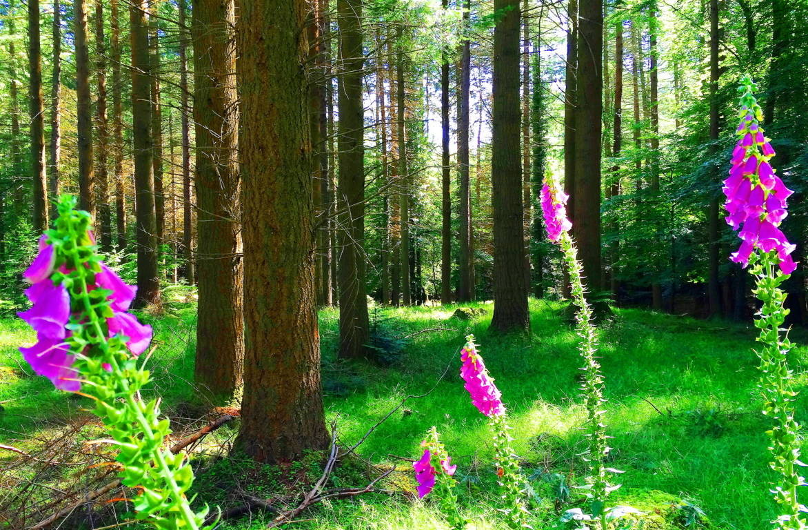
Knoll of The Sun/Glencoe, Scotland
 Location: Glencoe, Scotland
Elevation: 150ft
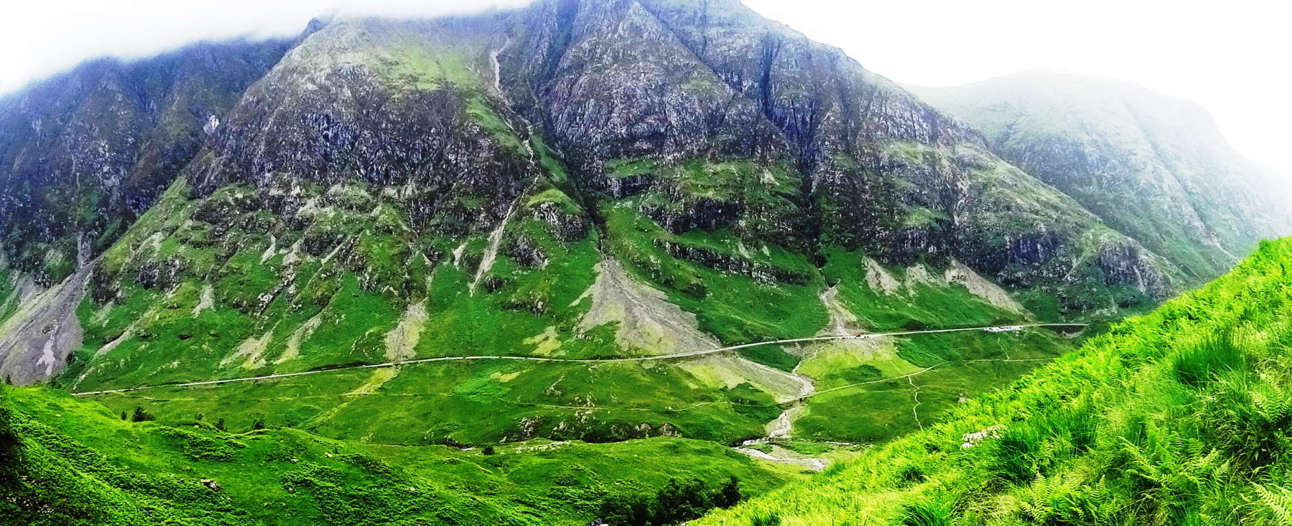
Note: Here is the truly epic gateway to the Highlands of Scotland. Tucked deeply into an ancient forest trail that is dotted with free-standing-boulders and gorgeous Celtic pines, is a rock alter known as The Knoll of The Sun.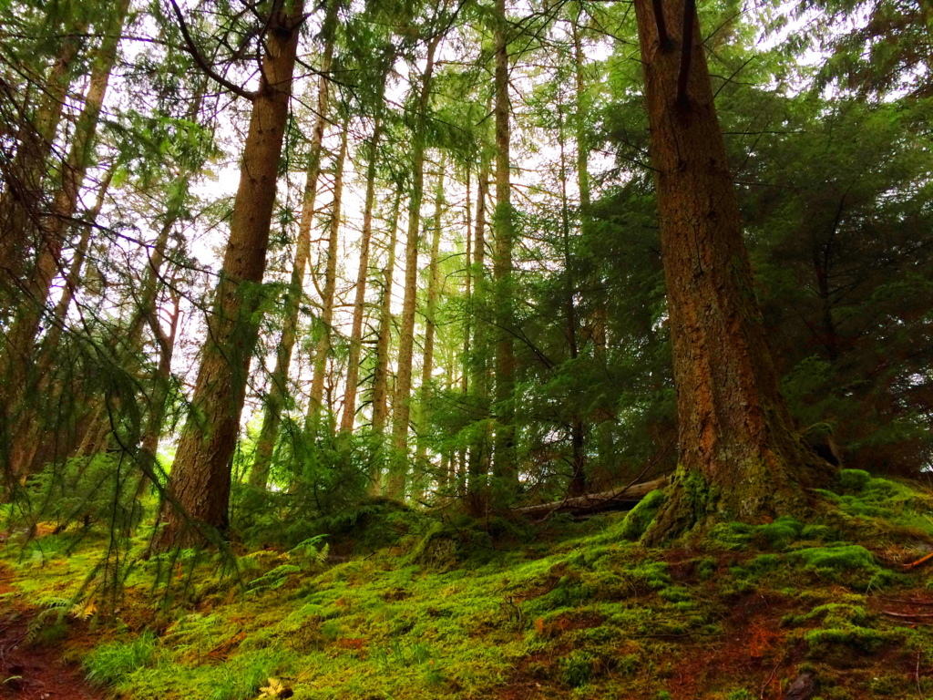 The relatively short trail that winds from the beautiful river into dark mossy glades and root-running pathways, leads to a small but distinct rocky porch in the midst of the forest. This alter is understood to have been used in ancient times by Druids as an observatory of the Sun, or for rituals, although I do not believe the Druids built the alter. The Knoll of The Sun is certainly an engineered area dating back to the beginning of Time, with small boulders lining the mystical forest as directional stones leading to the the Knoll, and potentially marking other significant points.
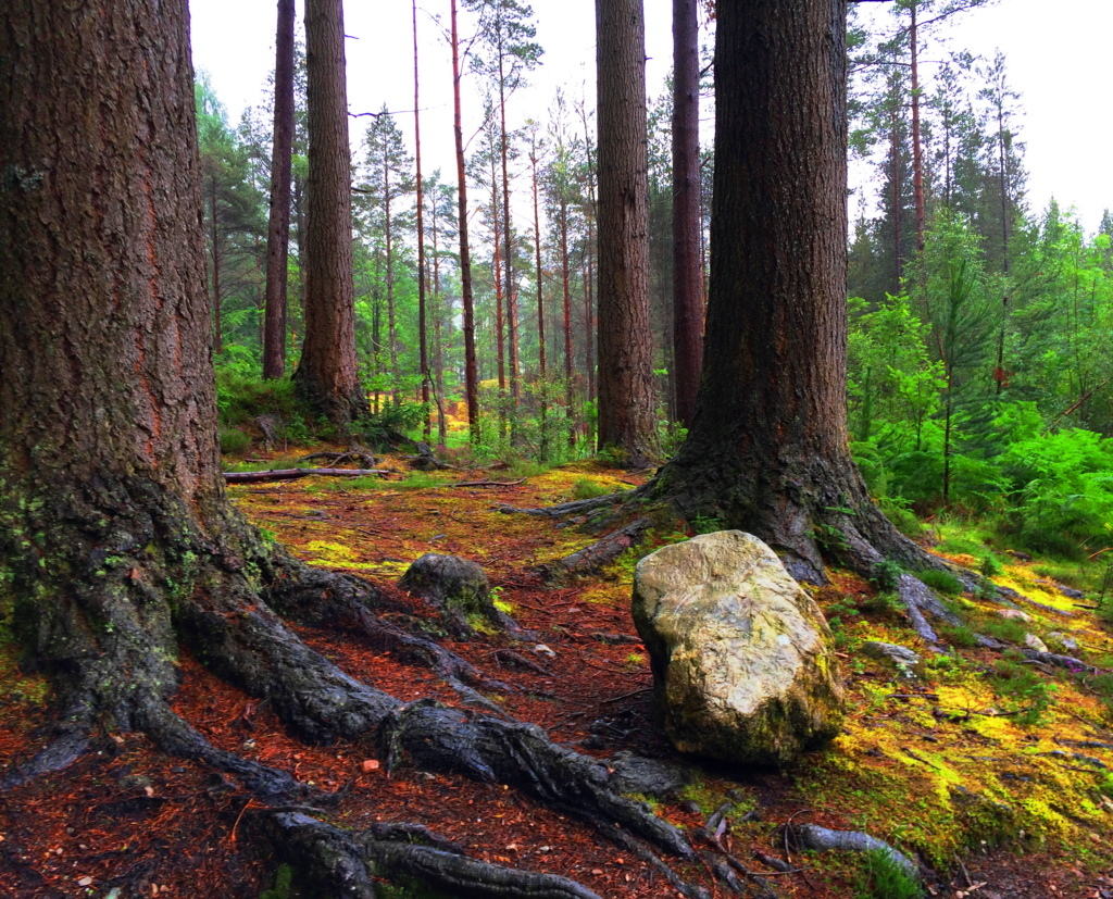 There are incredibly old stone stairs that lead up the alter after a hike of a few miles. The stairs are supported by a siding of massive granite slabs built into the knoll, emphasizing the feature. The top of the knoll is a strange set of long smooth and level granite crevices, distinctly different from the rounded and knobby boulders below. All of these features have a marvelous similarity to sacred stone engineering sites in New England, Ireland, and Wales.
The perimeter of alter marked by a distinct standing stones which is clearly cut, lends serious significance to the sacred spot. Time has tilted the stone and altered it’s original visage, but it remains the small slanted guardian to this Celtic alter.The Scottish elements in July are often a rainy, but even so, the area exudes all the best aspects of the hiking experience, combined with enticing ancient anthropology. The megalithic culture that was present in the southerly Celtic areas was definitely also present here as well. To navigate these particularly drastic mountain passes and trails the ancients would’ve been that much more stout and determined than the average megalithic culture.
 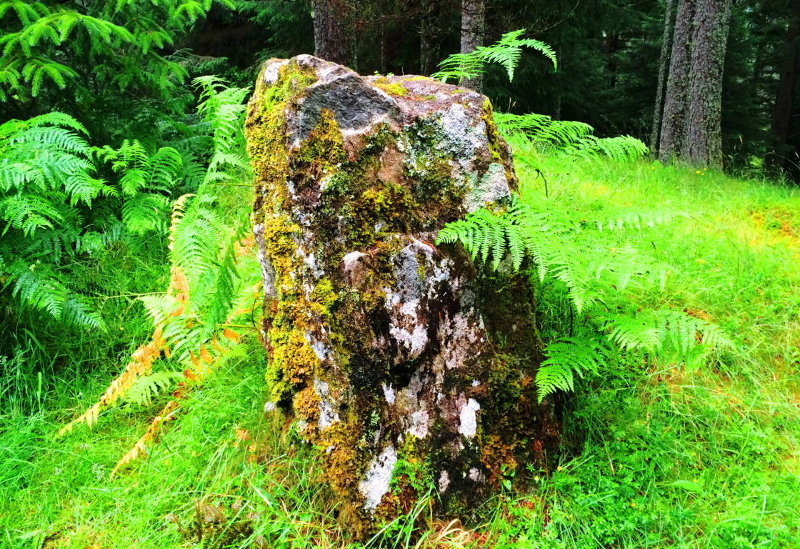 When the Sun comes out in Scotland, it is truly hard to picture wanting to be anywhere else, which is the very idea that this alter, in my opinion, must have been dedicated to. Glencoe is a hikers heaven, go for it.
Savoy Falls Trail/Standing Stone
Location: Savoy, Massachusetts
Scale: Standing Stone weight 1 ton, 5 feet height, 3 feet width: crafted to indicate Solar Noon.
Note: The trail along Savoy Falls in the forests of Massachusetts is as breathtaking as any Celtic scene in Ireland, England, Wales, or Scotland.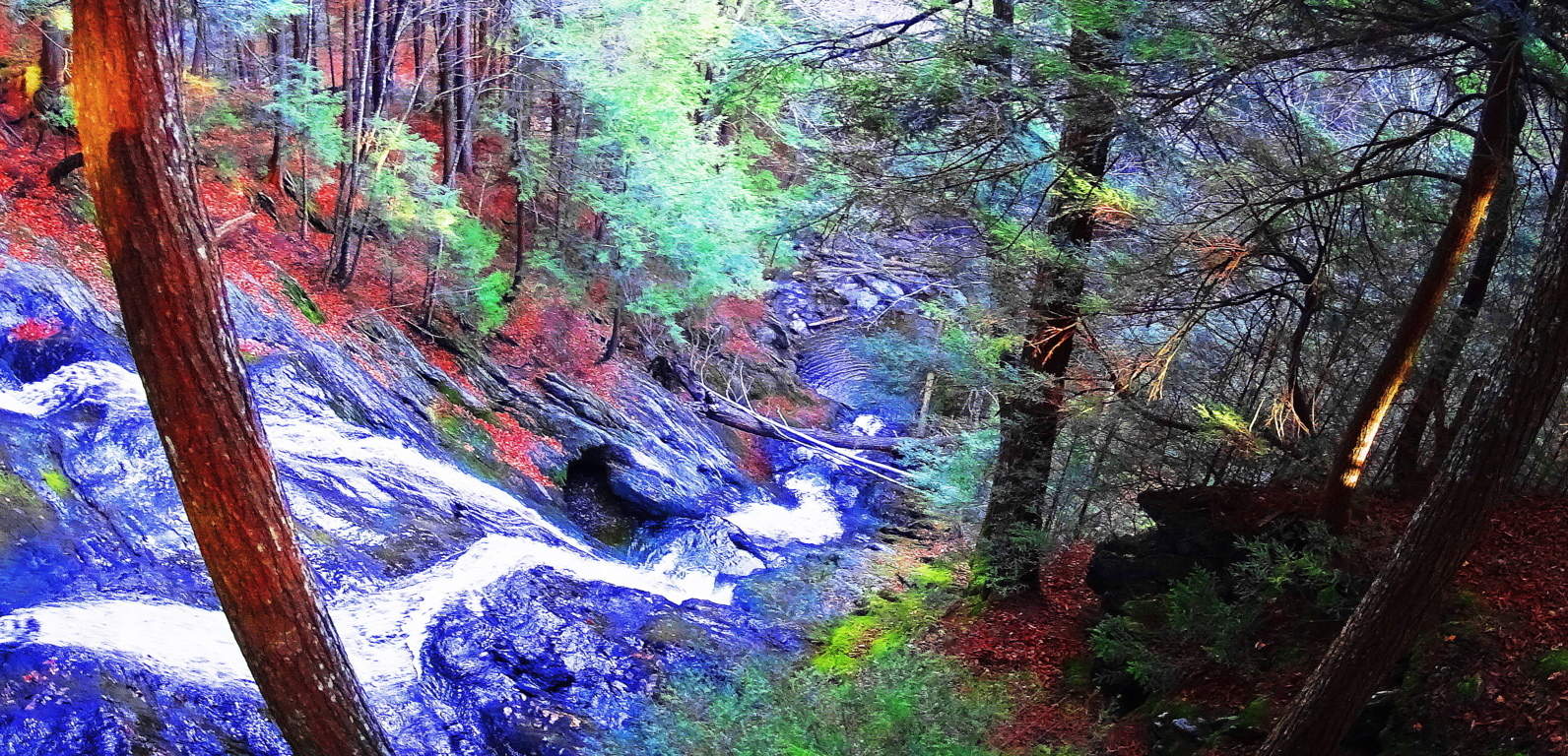 The ancient stonework here is of the exact same style and period one might find in places like Tollymore Forest, or Cavan National Park, both thousands of miles away in Ireland.
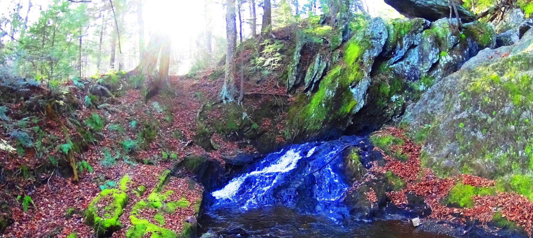 These are not simple “walls”, but they are most certainly engineering efforts put in place to influence the flow of the water in the area. Native Americans did not build these structures, and they did not claim to. They were therefor present in the area before the natives arrived, making them perhaps some of the first engineered works ever, at the beginning of what we know as Time. A more astonishing standing stone is present at the mid-point of the first of two massive waterfalls along the trail. It is my belief that this stone was placed specifically in order to point directly at the Sun at its highest point in the sky.
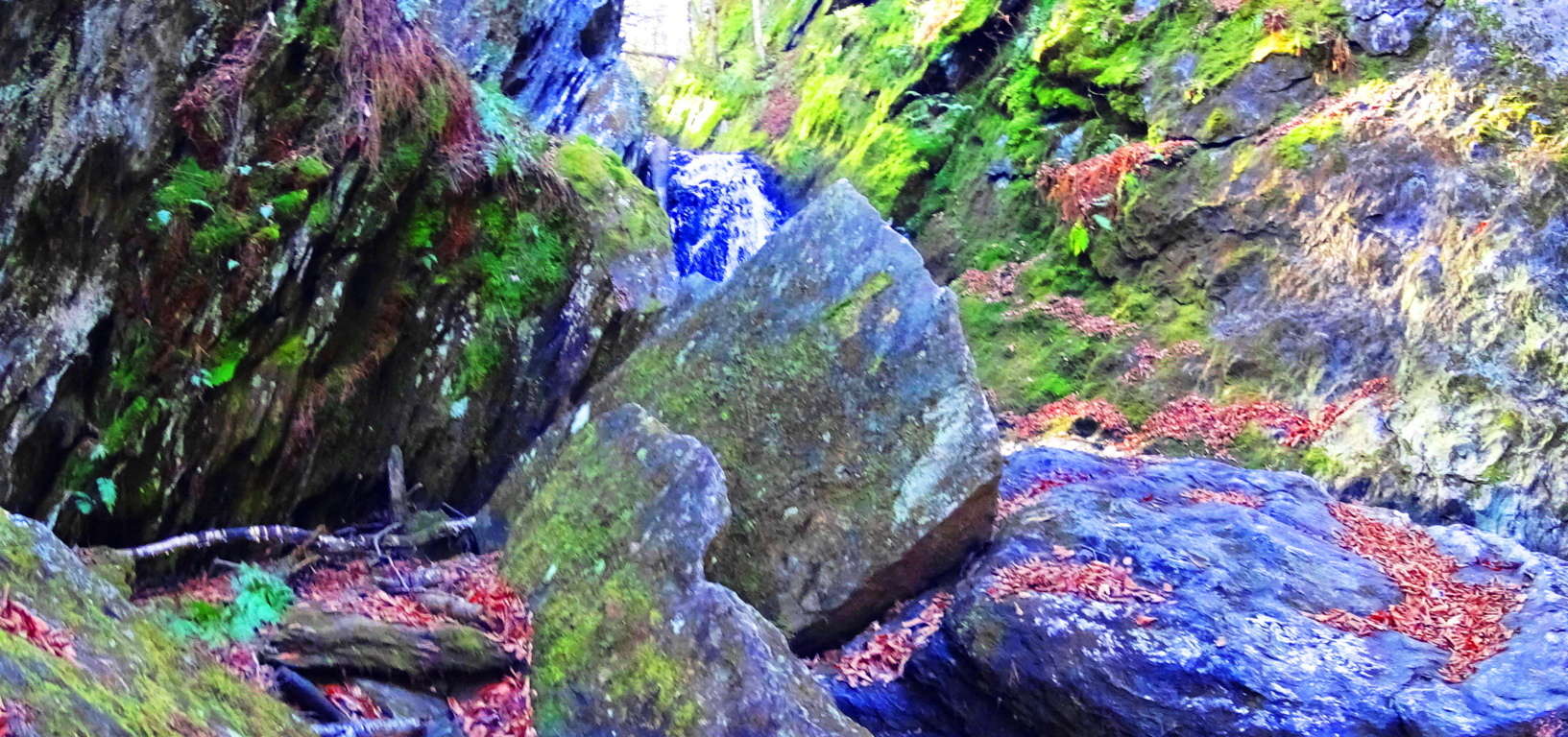 The first image above shows the Sun at mid-day, the waterfall flowing directly along its path, with the stone pointing directly to Noon slightly to the left-center. It is a truly magical and spectacular scene, and I believe the entire waterfall was engineered to create this effect. These are energy centers, not the arbitrary rippings of ice sheets long ago.
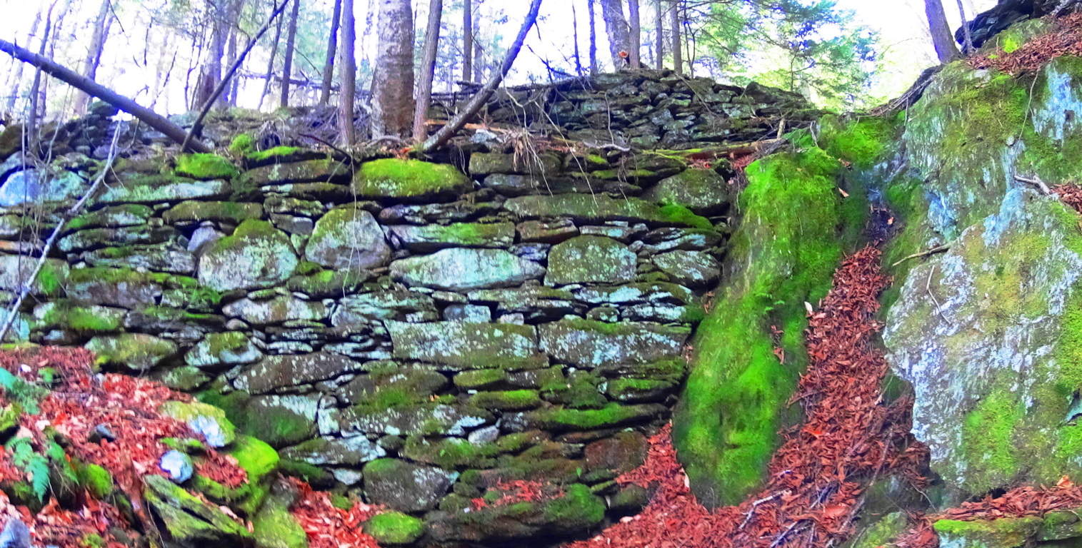
Other areas along the gigantic waterfall trail that runs for miles into the valley reveal wonderful pools and smaller features that are just as mystical as any scene from a Celtic fairy tale. I am convinced that the same culture that crafted the ancient stonework in Celtic places also crafted these sacred sites in New England. There was an era before native cultures, where the original culture existed; The first culture on Earth built these places.
Whats more, not far from this area are sites where standing stones sit in farmers fields just as they do in Europe, again indicating a culture at work in this area ‘once upon a time’. This particular stone below is roughly six feet high and three feet in width, with a beautiful view of the Savoy forestry beyond.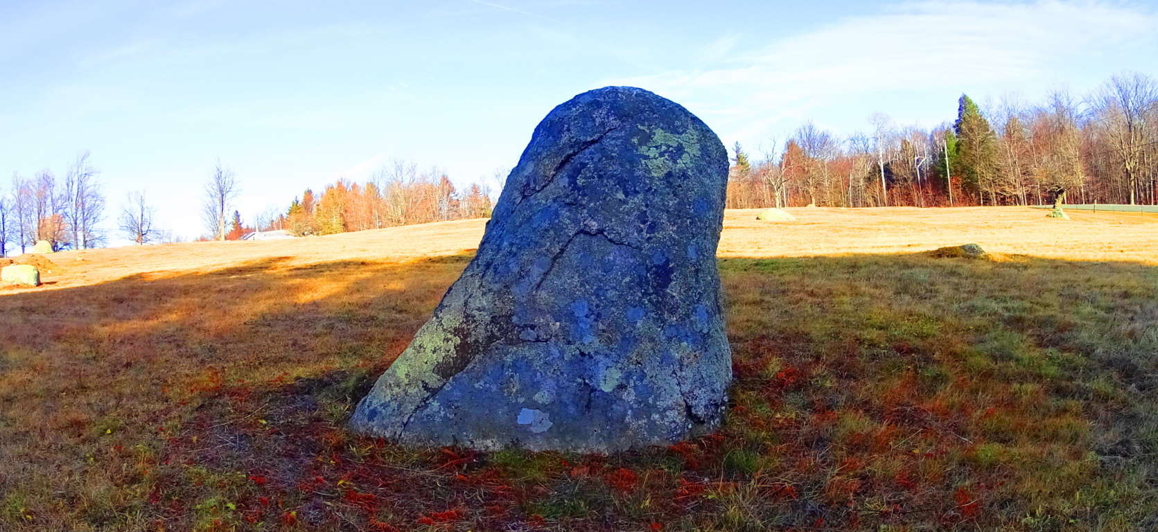 Getting to Savoy Falls is a challenge. GPS will direct you to the extremely rugged dirt road you need to find in the town of Savoy, but drive slowly and carefully or you could damage your exhaust beneath your car. About 3/4 of a mile down the dirt road you can park your car to the right where there is a small designated space. The trail will be just off to the right revealing a waterside path downward. This is one of the most beautiful places in the world, if you come to New England, find Savoy Falls, you’ll never forget it.
Mount Errigal/Donegal, Ireland
 Location: Mount Errigal/Donegal Ireland
Elevation: 2,464 feet
Note: The climbing of Mount Errigal is a truly beautiful and rustic challenge, with as dramatic a peak as any in the world, if not all of Ireland. Although Errigal is a ‘small mountain’ by international standards, it’s presence is absolutely dominant, blasting out of the rocky Glenveagh Mountain range.
 The granite stones of Errigal are so numerous that from a distance the mountain seems snow-covered, in July. The most utilized approach on the eastern face of the mountain has no crafted trail; one must traverse the same elements of watery rushes and mud at the base of the mountain as the ancient Celtic tribes had done for thousands of years. Working your way along the stream that carves its way through the rock, a climber must reach the beginning of the granite trail that winds to the summit. There are a few anthropologically significant stones that are without any doubt engineered, aligning to Mount Muckish to the north, along with other peaks to the north west.
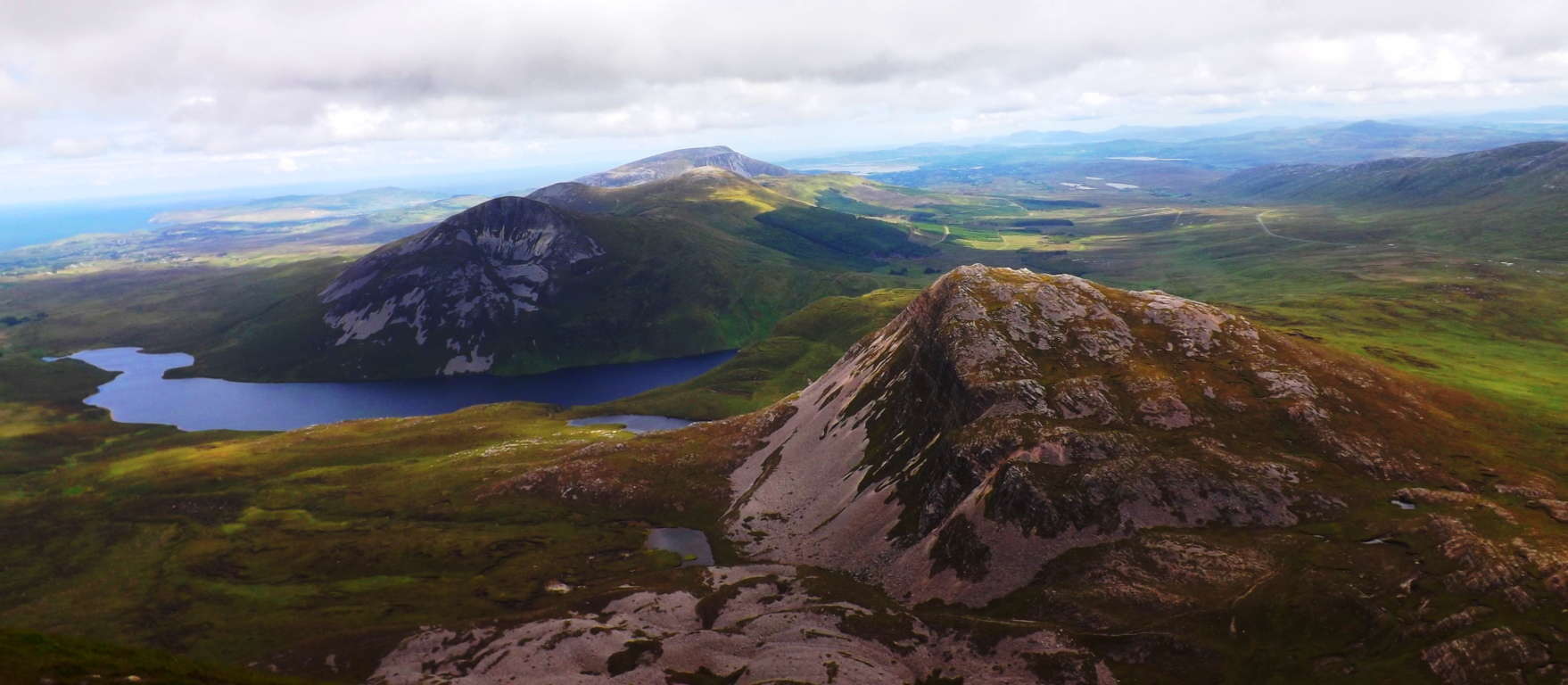 Similar non-arbitrary stones like this one below, cut to align to peaks in the distance, can be found, for example, on Monument Mountain over 2000 miles away on the North American continent in Massachusetts, and is referenced on this site.
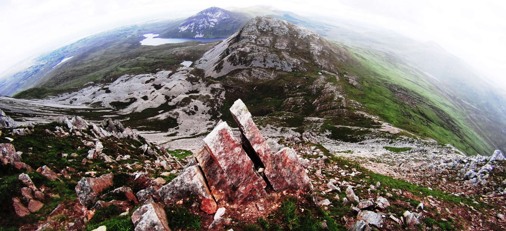
It is clear that in the first era of cultural interaction with the landscape, perhaps 10,000 years ago, or more, a culture existed which was capable of cutting stones to lend significance to certain vantage points on the mountains, connecting the peaks of each range, like the stars of astronomical sets. The Mourne Range, south of Belfast, is a prime example of this peak-to-peak stone alignment and configuring as well. The peak at Errigal is breathtaking; Celtic peaks have a beauty all their own that is distinct due to the lack of tree’s in the landscape, bringing forth an unobstructed vision of the valleys and ranges beyond.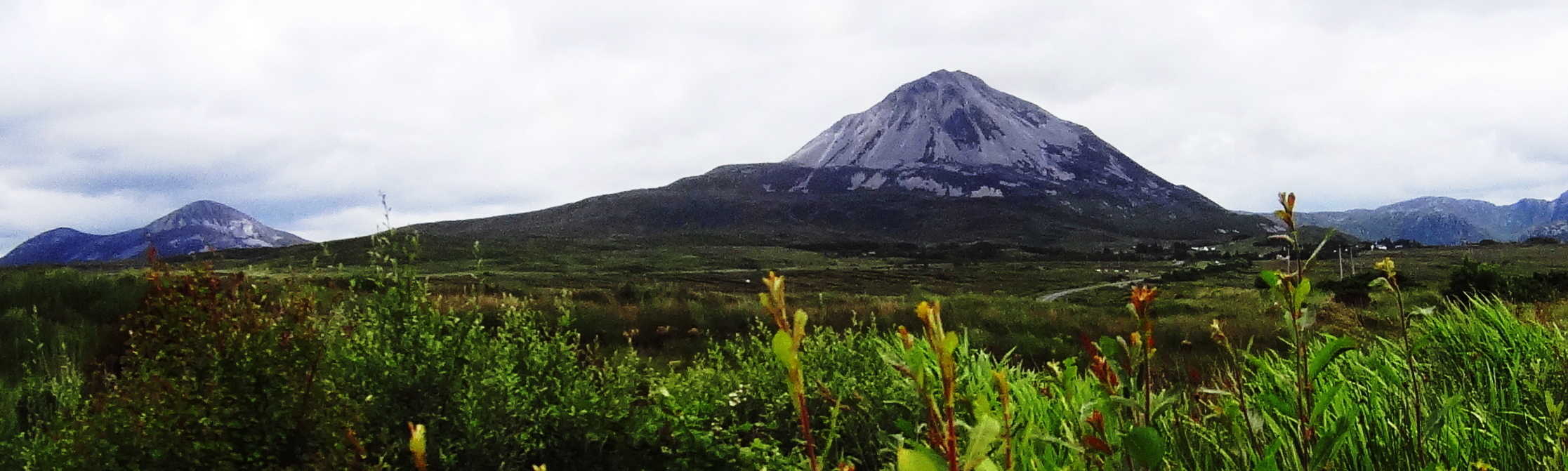 The peak at Errigal is without a doubt one of the single finest examples of the Celtic summit one could hope to find.

Glenveagh National Park
 Location: Glenveagh National Park/Donegal/ Ireland
Elevation: 450 feet/Glenveagh Castle, elevated view trail
Scale: Capstone weight 1.5 tons
Profile of cut Standing Stone

Face of cut Standing Stone
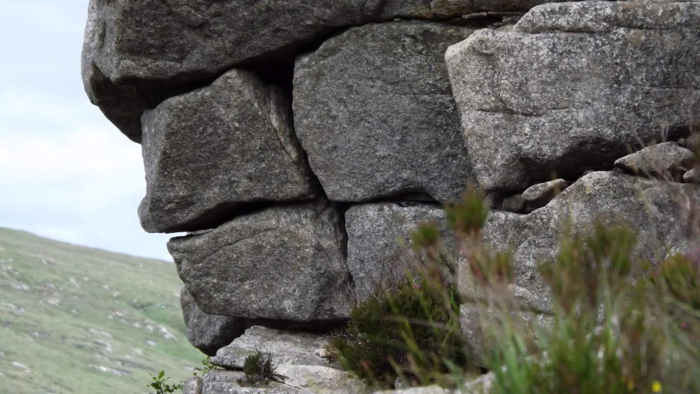
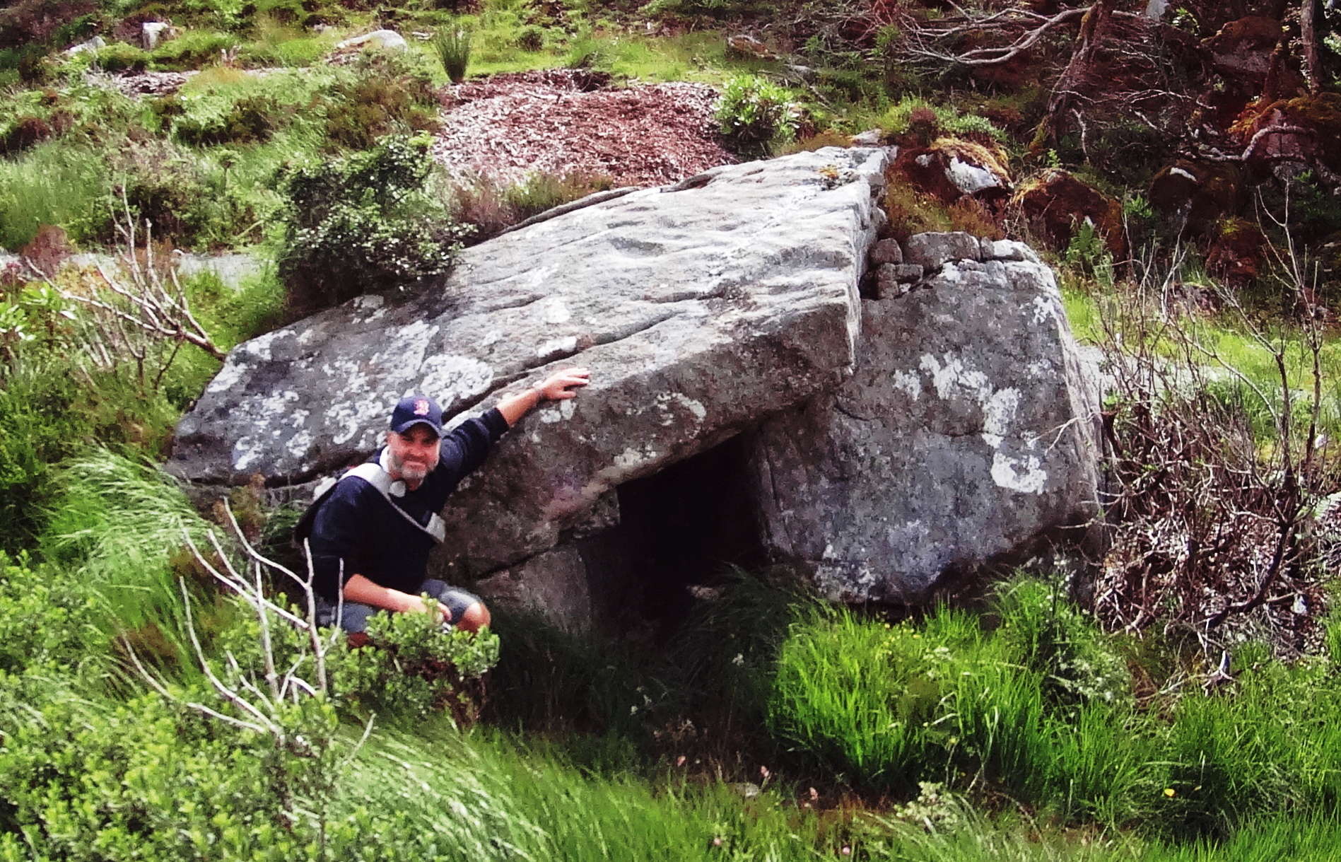
Note: The Glenveagh Mountains are the classic Celtic range for any trailblazer. Glenveagh Castle sits beside the lake below, supporting trails that run both along the water and above the castle grounds. Tucked into the exact center of the elevated gully high above the castle is a small but distinct wedge tomb, complete with a classically slanted capstone and clearly squared entrance way. Many engineered megaliths share the distinct pattern of being located just behind a fantastic peak, out of the wind, most likely where a fire may be concealed from the dangers of the valley beyond; And the valley beyond is truly a site to behold. Another feature that distinguishes arbitrary looking caves from Wedge Tombs is that they are often centrally aligned with the exact mid-line of the mountain facade behind, as you can see from the premier image above. From the top of the mountain looking straight down to the center below is the Wedge Tomb’s location. In terms of the overall space it creates a type of ‘clarity’, rather clutter, to introducing an intrinsic symmetries into the landscape that will comfort those occupy it, and objectify any unaware intruders. Along the Glenveagh Castle Trails there are massive stones that are clearly cut with precision, most likely designating the area as “occupied” by whoever put them there so many thousands of years ago.
 This particular standing stone is cut on one side to create a smooth ‘face’. It stands roughly seven feet high, and 2.5 feet in width, weighing perhaps 3 tons. It is located about a half mile below the Dolmen along a perfectly picturesque waterline. This is also a common theme found in sites from Ireland, England, and America: megaliths placed specifically to call attention to the area as occupied, like corners of a small kingdom. Other clearly engineered works are cut into the cliffs above, complete with right angles and squared free-sitting boulders/slabs. Anthropologists who have taken the time to investigate the patterns of sites where Dolmen are discovered will acknowledge these common themes of strategic location in reference to the Sun, elevated vantages, centrality, and clear ‘signature works’ of stone designating and possessing the area. Those who dismiss the accumulated logic of consistent dynamic evidence with the increasingly crude idea of ‘glacial displacement’ as being responsible for these sacred zones are defending an agenda that limits our understanding of History in general.
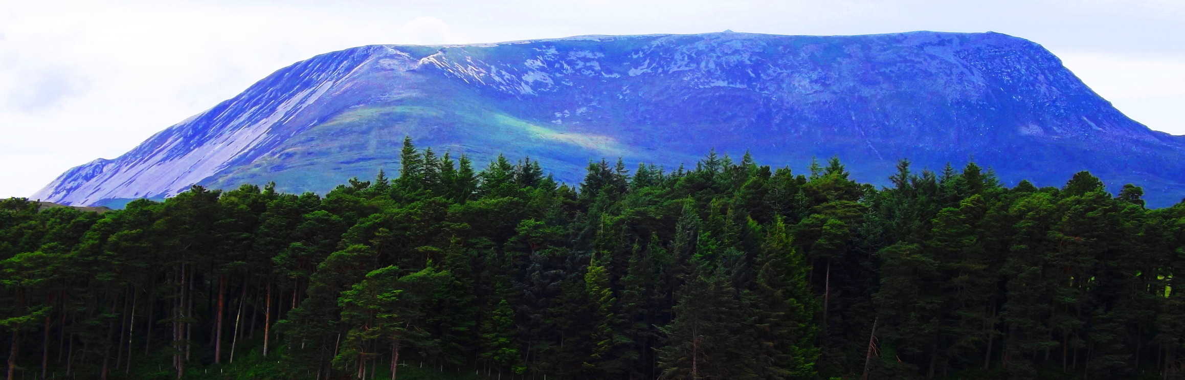 Why is it so hard to even discuss the possibility of a Pre-Native/Pre-Celtic civilization that precedes tribal-human communities? In the Book of Samuel of The Old Testament King David was ordained by God to lead his tribe in battle against the Philistines, who were described as a tribe of giants. The Philistines claimed to be descended from an even more ancient tribe of giants called the Nephilim, referenced in Genesis 6, who were semi-divine, related to angels that fell to Earth and copulated with the first humans in the earliest period of cultural History.
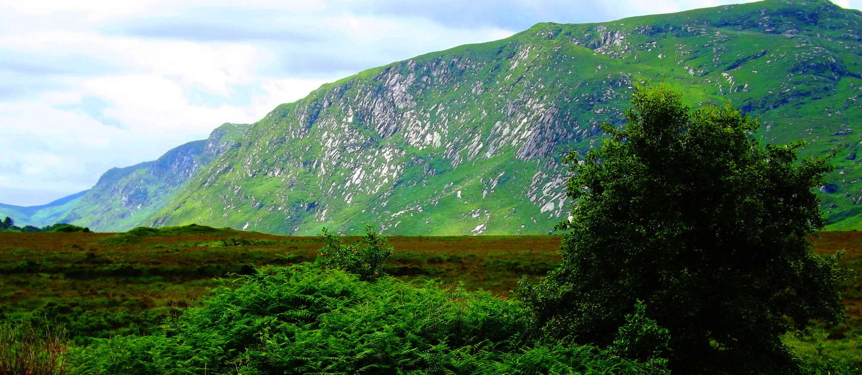 The Mayans did not claim to have built the oldest megalithic sites in South America, but said angels came from the sky and did it before they arrived, and Dolmens can be found outside of Israel to this day. Why is Postmodern culture pushing commercialized popular science as fact when the anthropology tells a very different story? Walk the trails and see for yourself.
Mount Monadnock, New Hampshire, USA
 Location: Mt. Monadnock/Jaffrey New Hampshire/USA
Elevation: 3,165 ft.
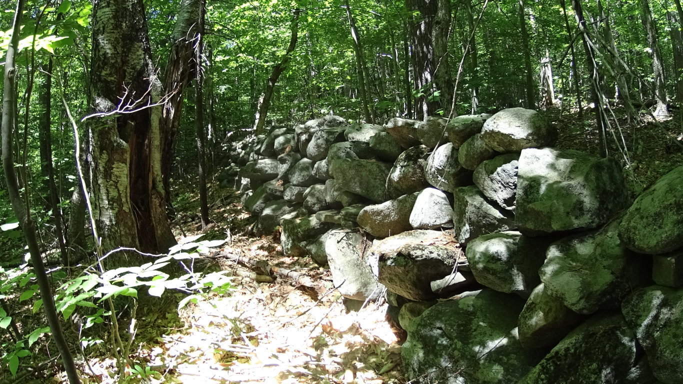
Massive stone work running straight UP the mountain side, defying logic. No farms or crops were ever planted here, it would be impossible. What are these stoneworks?
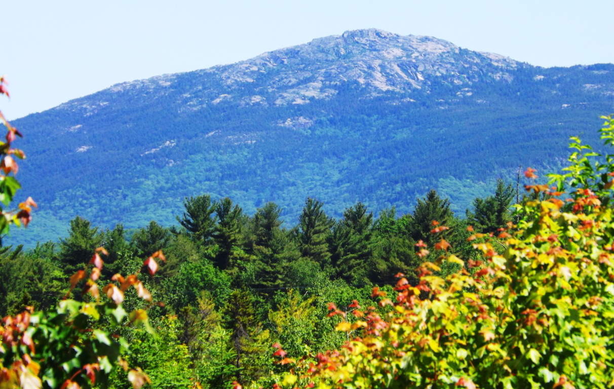
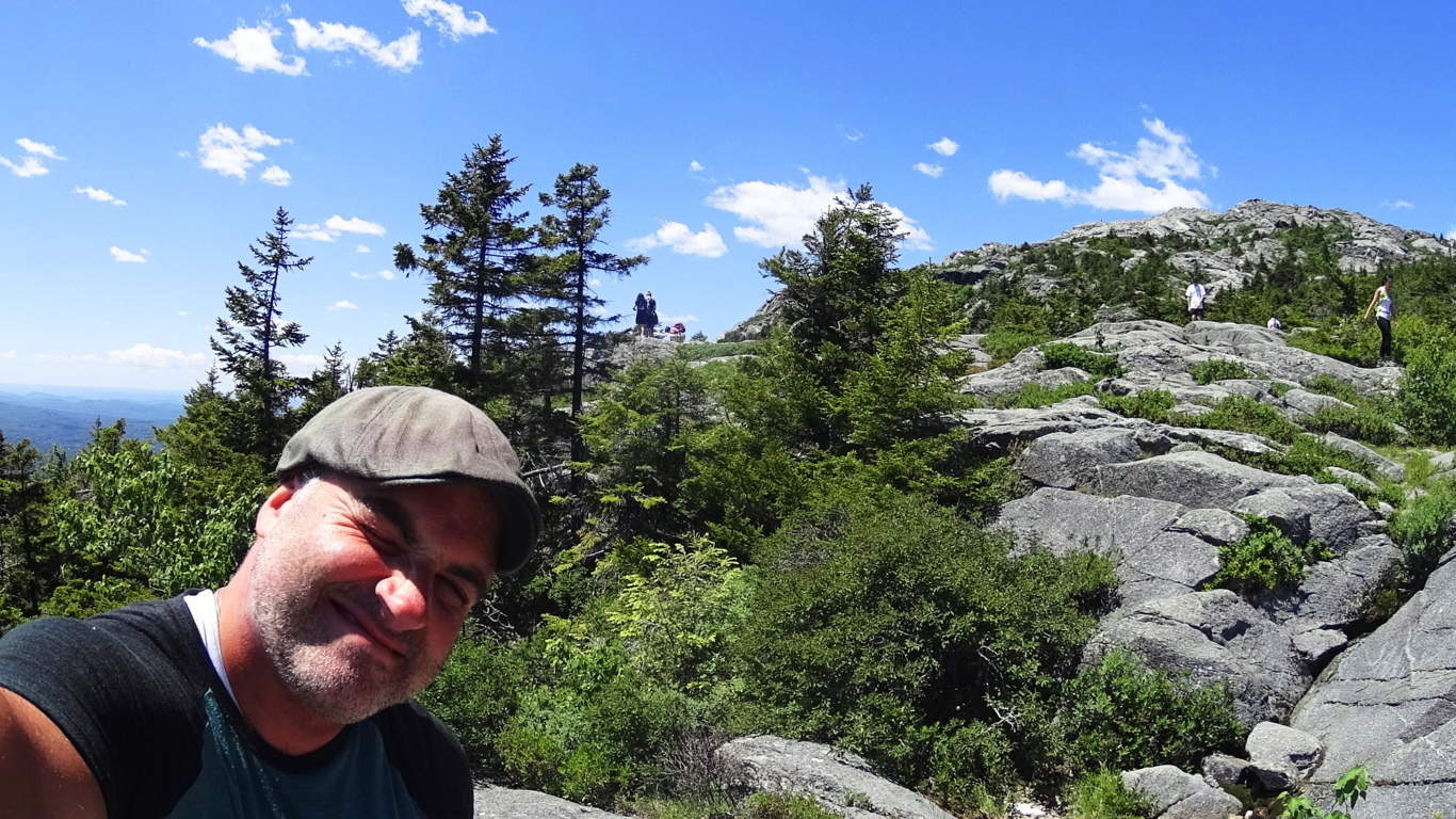
Note:Mt.Monadnock has an autonomous majesty that is impossible to ignore. Very much like Mt.Errigal in Ireland, Monadnock stands alone, part of no particular chain. It’s singular cinematic contrast over the New Hampshire landscape is stellar, although it is a relatively small mountain by global standards. The ‘White Dot Trail’ from the Monadnock State Reserve Station on Dublin Road winds directly to the rocky peak. Anthropological stone work inundates the mountain side, featuring massive signature stone-walling and engineering that runs straight up the mountain, of which no farmer has laid claim. Here there are indicative New England pre-native era stone-works, where 100 to 400 pound stones are crafted, and then laid one atop the other at impossible elevations, where no cart or mule, or sane individual, would build a “wall”. The pattern fits with absolute consistency to every elevated trail site in New England; massive megalithic stone works that no colonial farmer claims, taking place at dizzying elevations. Native Americans would have witnessed these stone structures with equal amazement and wonder, and they take no credit for their building either. The trail requires some hands on work to get above the tree-line, where wildflowers and stone porches emerge to overlook all New England.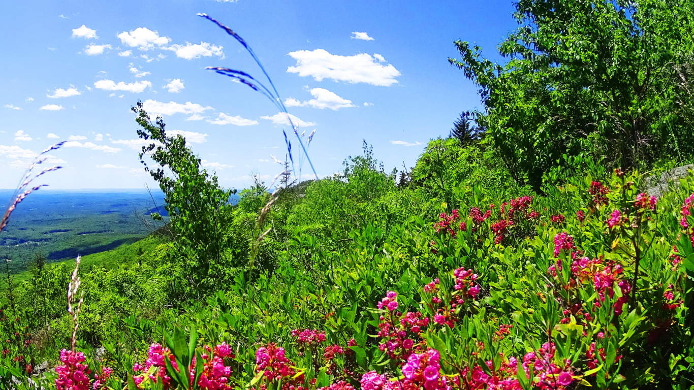 At the peak there is an incredible stone, cut and pulled away from the mountain like a giant puzzle piece, pointing straight to the Sun at Noon. This megalithic scale is similar to works found at Monument Mountain in Great Barrington Massachusetts. It seems that this first culture on Earth took control of these majestic elevations all over the world. Connections can be found between Celtic. Mayan, Native American, and Israeli megalithic sites and trails if we choose to observe them. The next question becomes, what culture is capable of creating these megalithic wonders at the beginning of Time? Monadnock is a beautiful glimpse into this mystery.
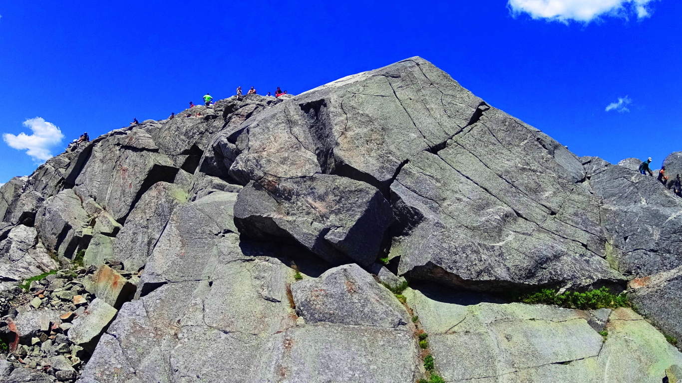
Cut block at the peak of Monadnock, pointing like an arrow to the Sun at Mid-day. The scale is surreal. Look at the smallness of the people above! Megaliths!
The high porch above the tree-line to the peak.