Lonesome Lake
Elevation: 2,730ft
Location: Franconia Notch Range/White Mountains/New Hampshire/USA
Note: Tucked deep into the heart of the White Mountains of New Hampshire, facing the stellar Franconia Notch Range, sits an elevated Lake that is forever embraced by thick Forests, and glowing Mountains. This is Lonesome Lake, a secret shining pendant-piece hanging high upon the neck of the Franconia Notch Forests, 2,730 feet above the valley. This hike is the best overall trek in the White Mountains., and that’s saying a lot!
The view of Franconia Notch from the valley is straight-forward enough. The Mountains are so broad, that it is a real challenge to get a full view of the Range, before finding the Trailhead for Lonesome Lake. 
Lonesome Lake Trailhead is easy to find. Located just 10 minutes, by car, from the Franconia Notch State Park’s main facility. Continue along 93-North for ten minutes, extending from Franconia’s Main Entrance Park. You will actually pass the Trailhead, on the other side of the highway. You will need to take a left at Exit 34 B, and drive 93 South, back in the other direction, for about 4 minutes. You will see signs for the Lonesome Lake Trailhead on the Right, with provided parking. Your Iphone will have no problem identifying the Trailhead, as Route 93 is the major highway running directly through these Mountains ( just like the A82 in Scotland, which splits The incredible Three-Sisters-Mountain Range at Glen Coe. (Image/Below) 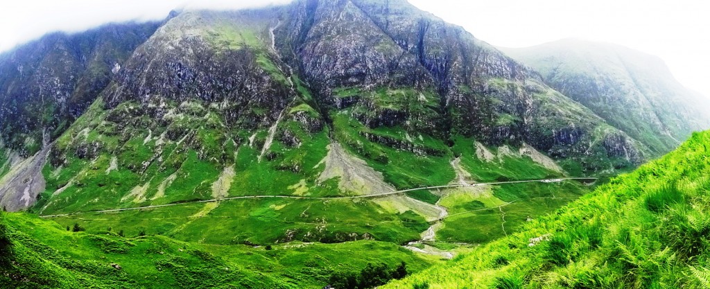
The White Mountains have a very similar feel to Scotland’s gateway Range at Glen Coe. Similar in scale, these are both incredibly massive Mountain Ranges, that somehow depict a rare ‘cozy closeness’ between cleaved peaks, protecting the valleys below, in both locations. The White Mountains in Fall, however, have something that Scotland does not, glowing gold and booming orange-brown colors for just a month out of the year. (Image/Below)
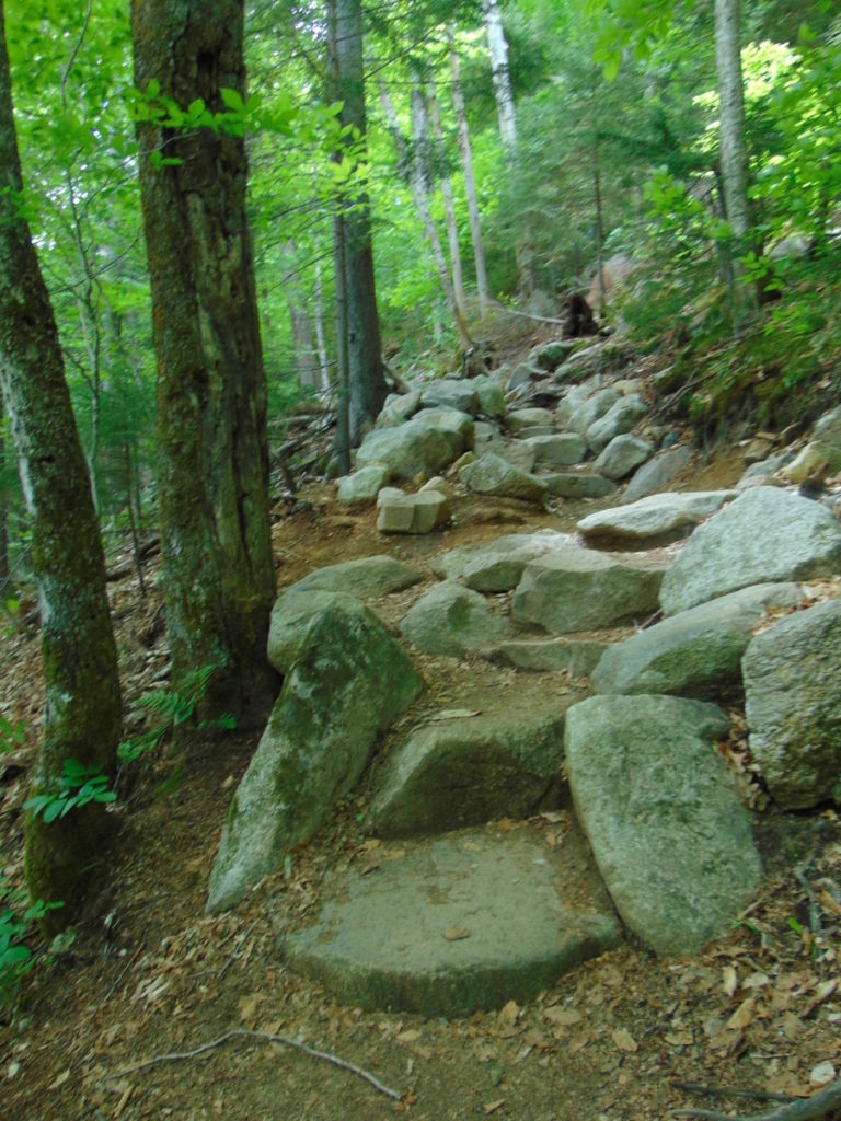
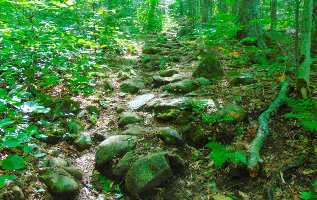
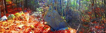
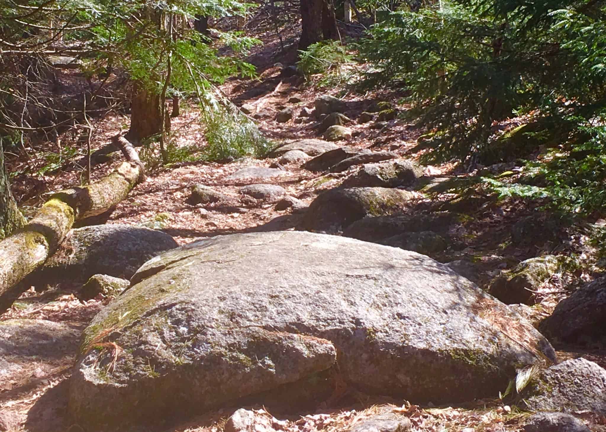
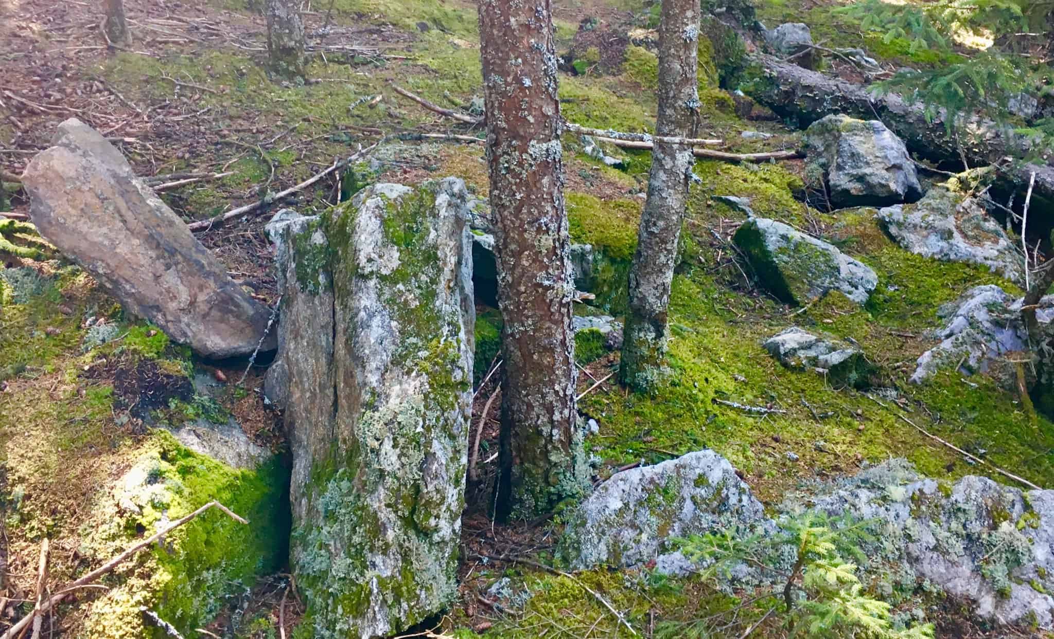
Lonesome Lake Trail: At the opening of the Trailhead you will find a path of collected boulders that climbs straight up, like a winding discheveled stair. As it is with almost every trail in the New England Region, it seems that these boulders were collected, cut, and placed in this specific way (As hard as that might be to believe).
If, for example, people believe that the National Park Service placed these boulders, they are seriously mistaken. It would take millions of dollars, Bobcat-machines, and perhaps 50 to 100 men to align these boulders, straight up a mountain. (Image/Below/Lonesome Lake Trail)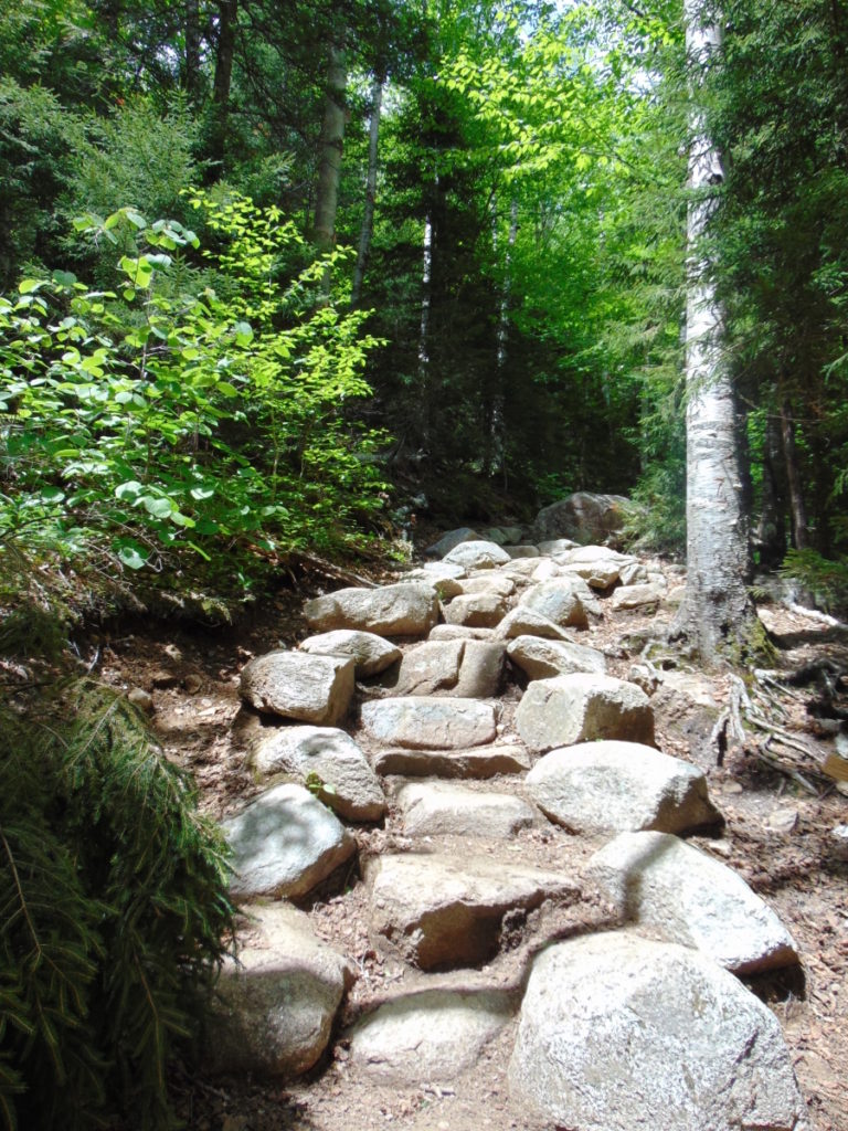 Native Americans did not move these boulders either. The reality is that these trails were created by megalithic builders, just like New Grange in Ireland, Macchu Picchu in Peru, and Stonehenge in England. These trails are monuments. I realize this changes the modern Western conceptualization of what a sacred space, or temple, truly is. These megalithic statements are sprawled and connected all over the landscape. The constructs make the landscape itself a monument. It is not confined to a singular space, like the Parthenon in Greece, or, Notre Dame in France. This has been incredibly difficult to explain. The conceptualization of megalithic building for todays “Anthropologists”, who simply cannot fathom megalithic constructs embedded into a landscape, is not confined to the basic idea of a “building”, but rather, a connective grid, capable of synergizing an entire landscape. The megalithic designer responsible for this Trail, may have left us some clues about the constructs here at Lonesome Lake; Let’s take a look…(Image/Below/Lonesome Lake Trail)
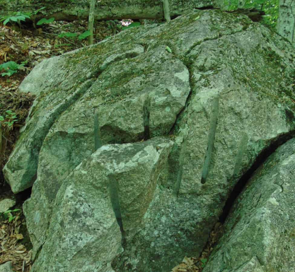
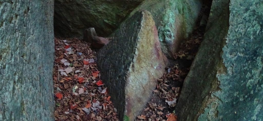
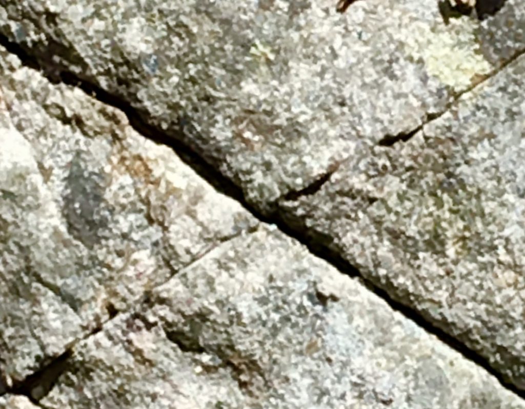
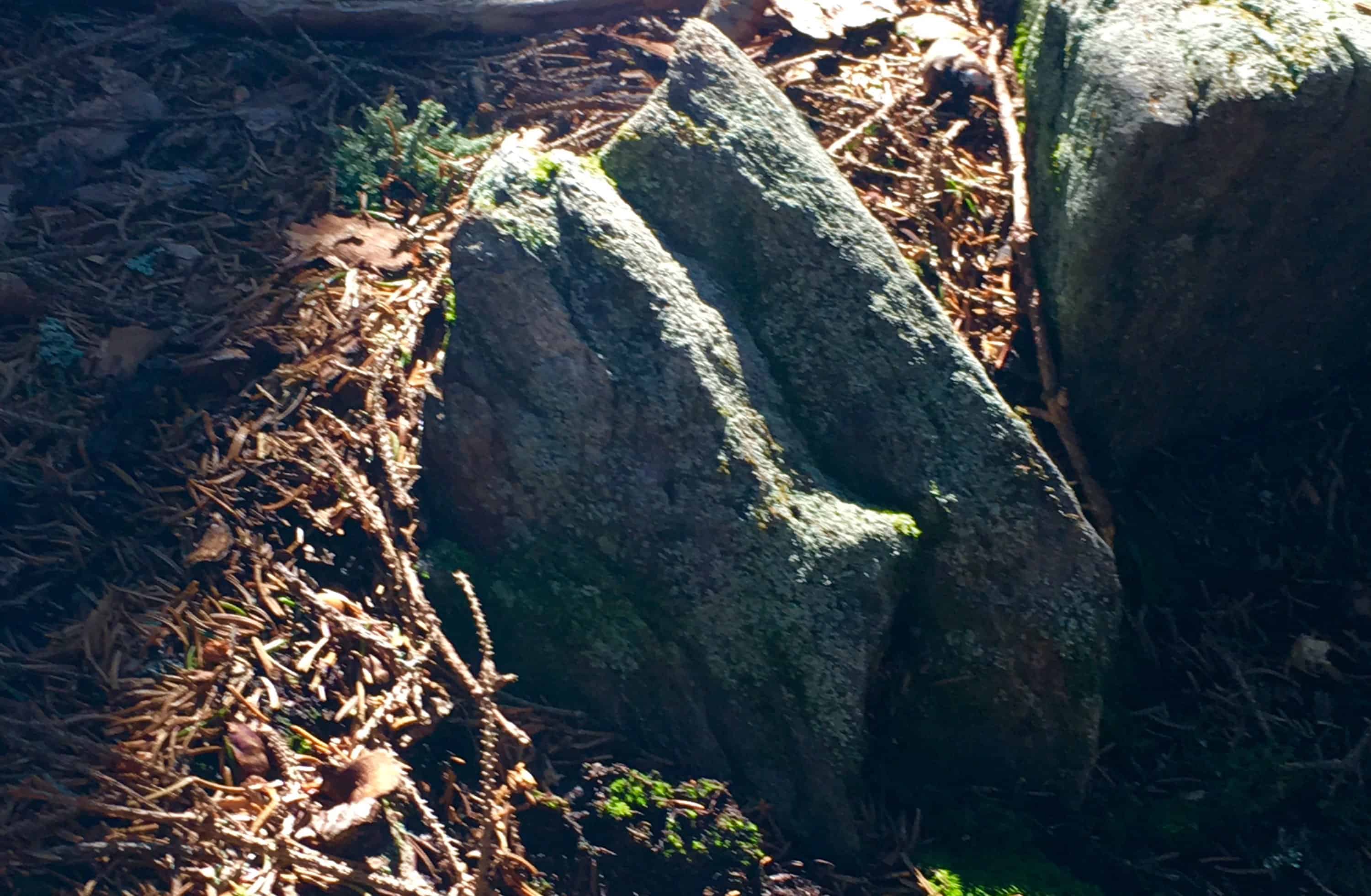
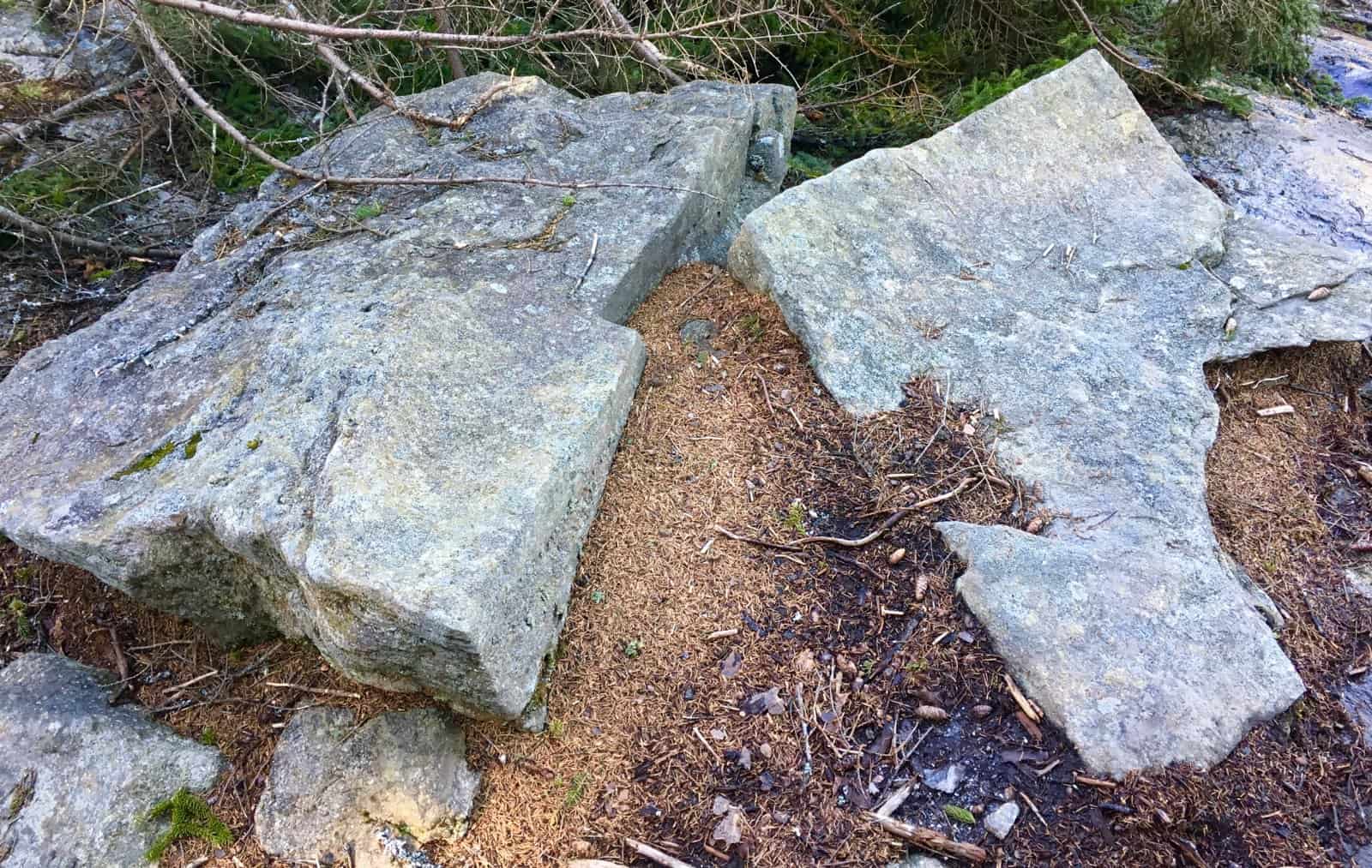
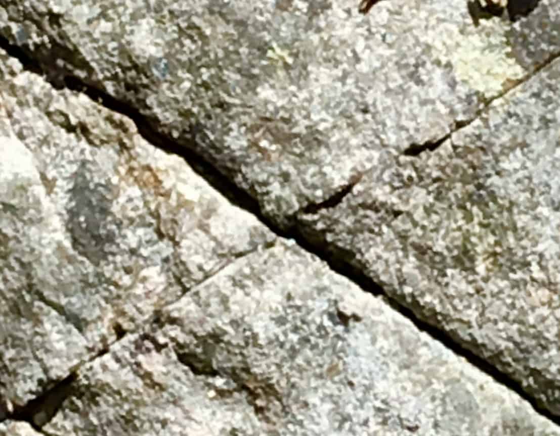
 At the base of this Trail sits an extremely unique boulder (Images/Below), with parallel indented markings, and curvy cut sections, like a rounded ‘rubix-cube’. It is clear that this was intended work upon this boulder. There is a dimensional framework to these sections, perhaps indicating some kind of understanding about “perspective”, and vantage. If you look closely at the image (Image/Left/Below) it is crafted into sections: The first frontal section is completely separate, with a symmetrical and penetrating cyndrilical line, seemingly drilled, and at an intense speed, running straight through the rock. The second and third sections, standing behind this first boulder, are cut similarly, and are perhaps aligned in a specific way. There are clearly separate sections to be seen, as if the boulder was once singular, heated, penetrated and then sliced into sections; Like a knife through butter. The side view shows the clear sections; The frontal view show the connectivity. This is a multi-meaningful statement, which deserve mathematical analysis. It is enticing, and adds excitement to this Trail.
As you progress up the significant climb, there are beautiful settings in the stones, awesome trees, and groves that compliment the experience. One particular tree, near the 2000 ft elevation range, grows right through the middle of the trail, on its own.
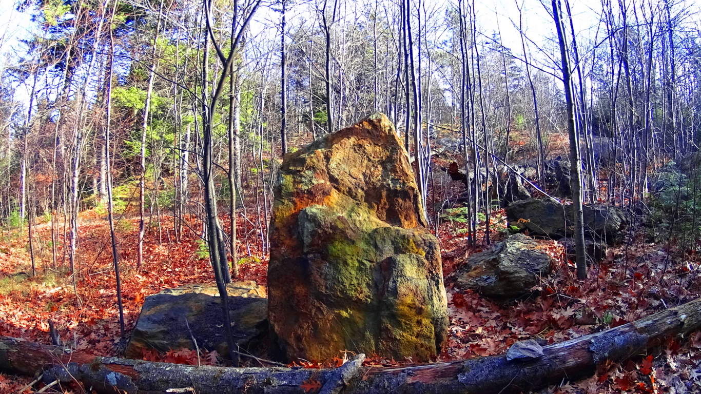
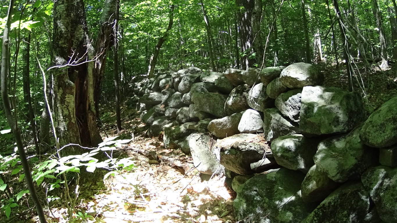
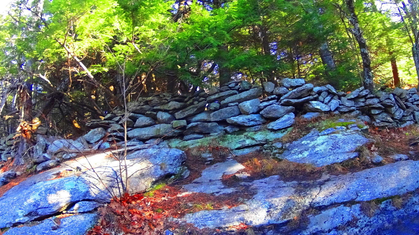
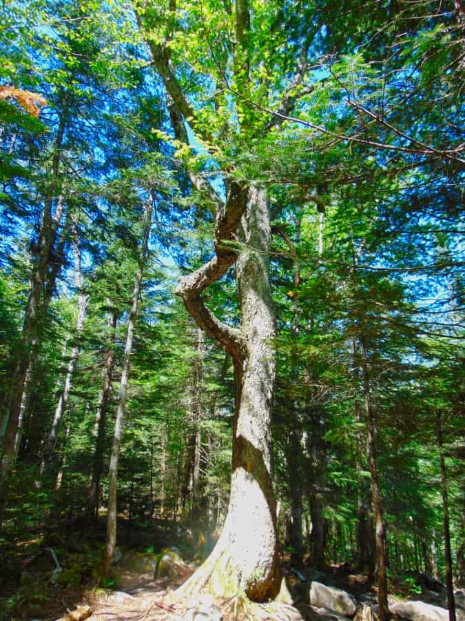 There is a possibility that the stones were left behind in a very specific way, in order that the Forest would grow up in a specific order. This too is very hard for anthropologists and archaeologists to comprehend. But a great deal of megalithic works seem to have multi-layers of meaning. For example, many of the stone-linings (“walls”) that are found winding infinitely through the Forests, directly up mountains, and across streams in the valleys, clearly have nothing to do with the classical usage of “walls”, which is to restrict the movement of cattle and trespassing humans. These ‘Linings’ do not limit movement, at roughly 3 feet high, and three feet thick. If they do not restrict movement, why are they there? And why the monumental effort to create them, if they are not restrictive? It is because there is a megalithic context to these ‘Linings’. These stones are intended to connect the landscape, the way quartz cables connect energy centers on a digital grid within a phone, or computer. It synergizes the landscape; The stones absorb the energy from the Sun, plus subtle electric current from the rolling streams below, sending energy throughout the landscape. The stone-lining pictured below, is found near the peak at Watatic Mountain in Massachusettsm, at around 2400 feet of prominence. It is a good example of the basic width, and depth, of the construct of these ‘Linings’, found at tough elevations. The point of all of this is realizing that these megalithic works are engineered spaces, harnessing the landscape energy, constructing irrigation zones, cairns, standing stones, and much more.
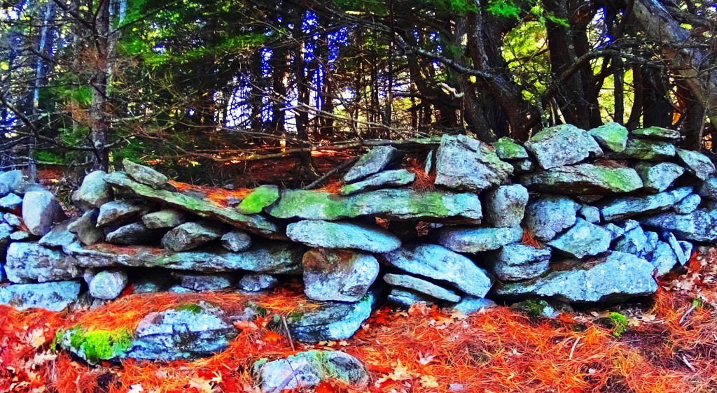
This is megalithic historic view is actually the more logical explanation for these megalithic ‘Linings’ inundating the landscape of New England, and Europe. The megalithic context depicts works of intense utility and scale. To credit the Native American Tribes with these works, would require a massive amount of advanced tools, evidence, and oral-traditional depictions of Native Tribes spending lifetimes building “walls”, with megalithic size stones, directly up mountains. It makes zero sense. There is no such evidence. These works were here before the Native tribes arrived, and at the earliest possible point in Cultural History. The pathway here at Lonesome Lake is an awesome example of megalithic trails. (Image/Below/Left)
To be clear: to say that this path is merely the work of A State Park Service, Native tribes of seasonal and minimal possessions, or “glaciers” . is absolutely absurd. It is a blatant collection of massive boulders, intended as a walkway to the sacred areas above.The work is meant to be seen, just like any work is.
One thing that the builders of these beautiful pathways knew, was that these stones would be here forever. And they were right. What has faded though, is human beings ability to interpret the over-obvious, in plain sight! The evidence embedded in the stonework itself, from all corners of the Western Hemisphere, say something cultural happened, on a megalithic scale.
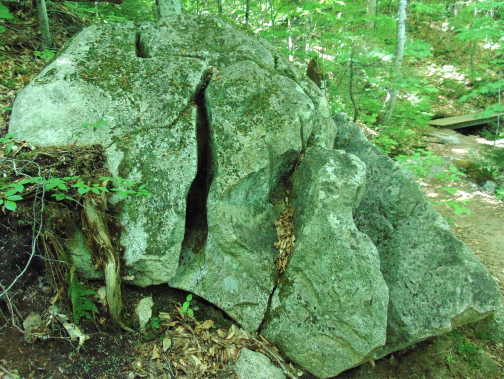
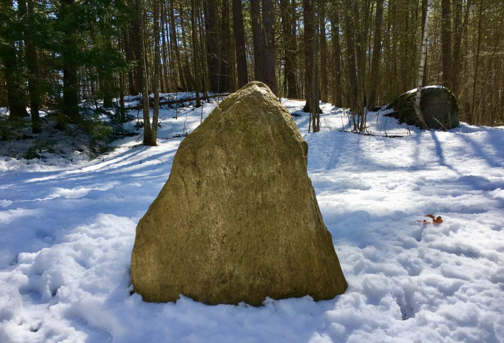
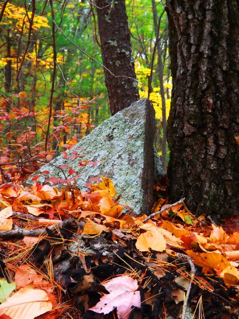
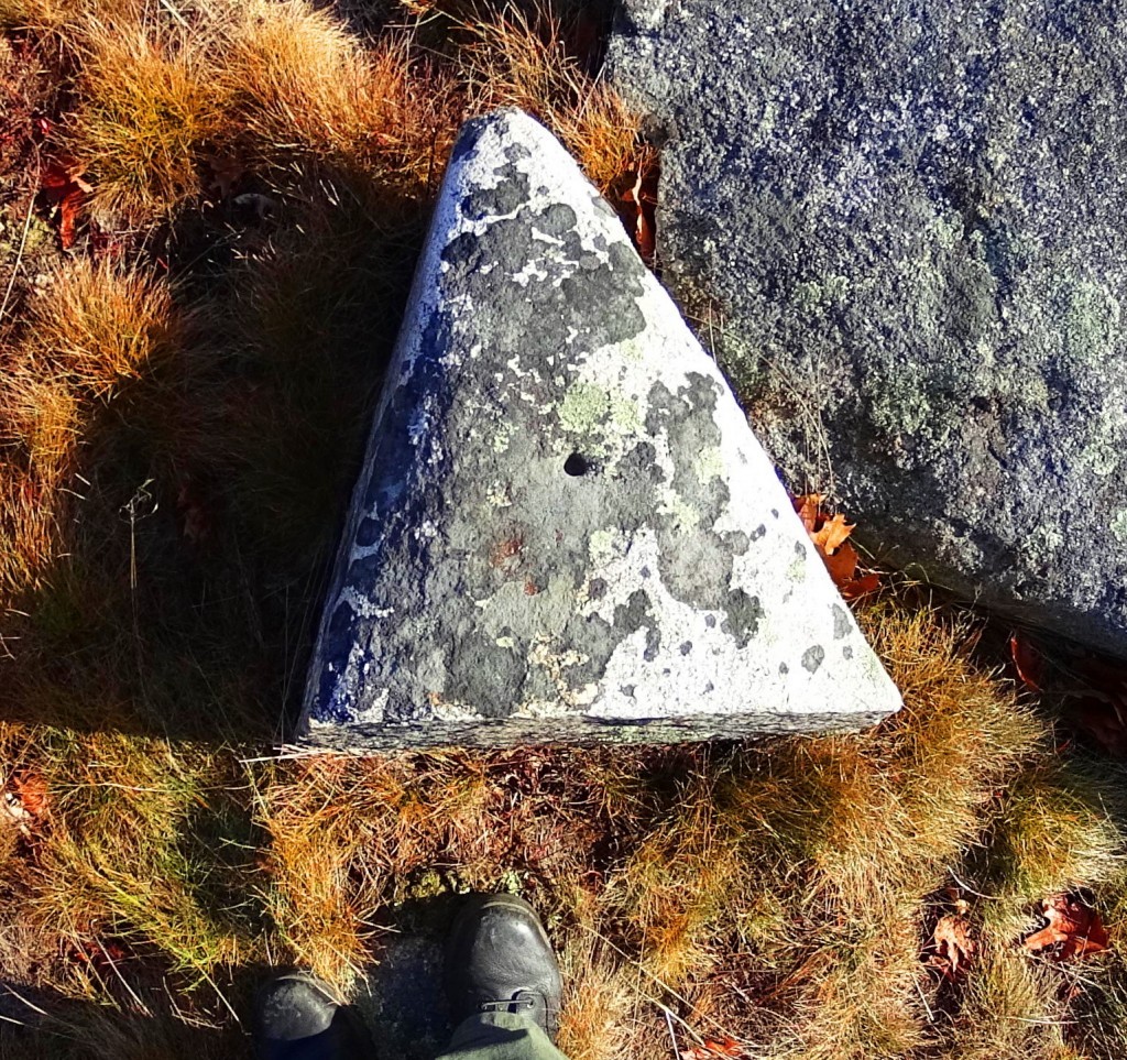
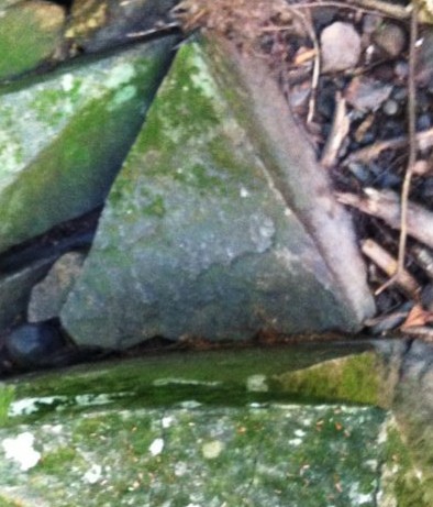
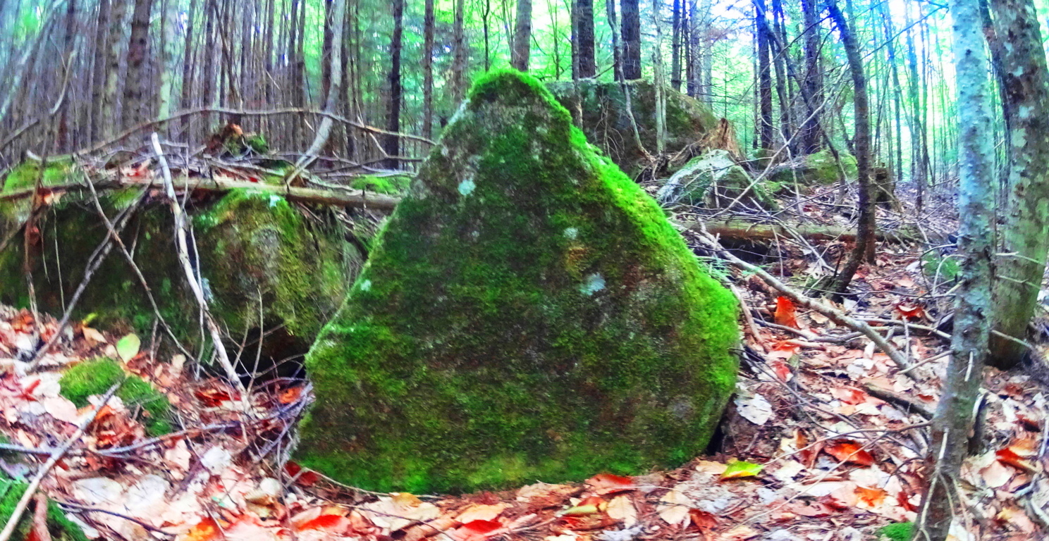
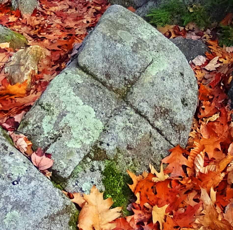
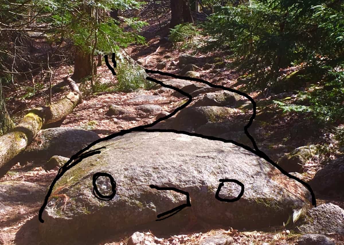
As you make your way to the top of the Trail there is an interesting boulder that marks the point where the ground finally becomes level again. The shape of this boulder (First Image/Below) coincides with the shape of hundreds of boulders that remain unacknowledged by Post-modern ‘anthropologists’ and authors, with agendas, married to their desks, at colleges across New England. Take a look at the examples of these Triangular Megaliths below: 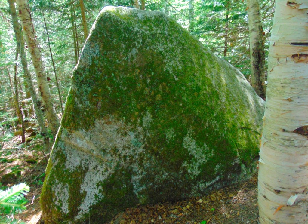
The triangular shape of singular megaliths, as readers of this site well know, is found throughout Forests, from Maine, to Massachusetts, as well as Ireland, Austria, Arizona, and California:


The reason for these triangular megaliths is probably multi-dimensional. It might be a cultural marker for the megalithic culture itself. A ‘calling card’. In mathematics, the first shape to arrive from a linear set of points, is the Triangle. Perhaps this Megalithic Culture is messaging us, via this symbol: Just as the Triangle is the first symbol from any set of given points; The Megalithic Culture is the first Culture, from any set of Cultures. It makes sense. Look at the construct of any set of points reaching a logical triangle shown below:
Ex:
- A
- A to B
- A to B to C
- A to B to C to D…….etc….
- A
- B C
As you can see, the first shape from any set of given linear points possible, is the Triangle. Forever. Its a Law.
Continuing into the level ground of the upper end of the Trail, a beautiful grove emerges, and you actually step down for a few moments, before the second part of this amazing trail unfolds. 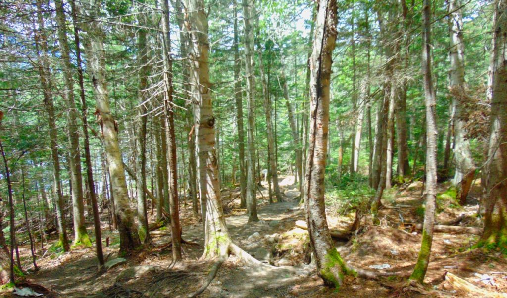
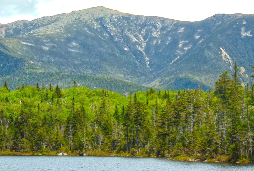
As you step forward towards Lonesome Lake, mountains emerge in the distance beyond, and the Trail reveals an option to go right or left. Take the left side path, clockwise, around the Lake. On the other side is the area which is the main focus of this trek, where everything comes together. This is a scene with multiple mountain vantages, perhaps relating to the mulit-layered rubix-cube-boulder at the beginning of the Trail, indicating something about the vantages and perspectives to be found here.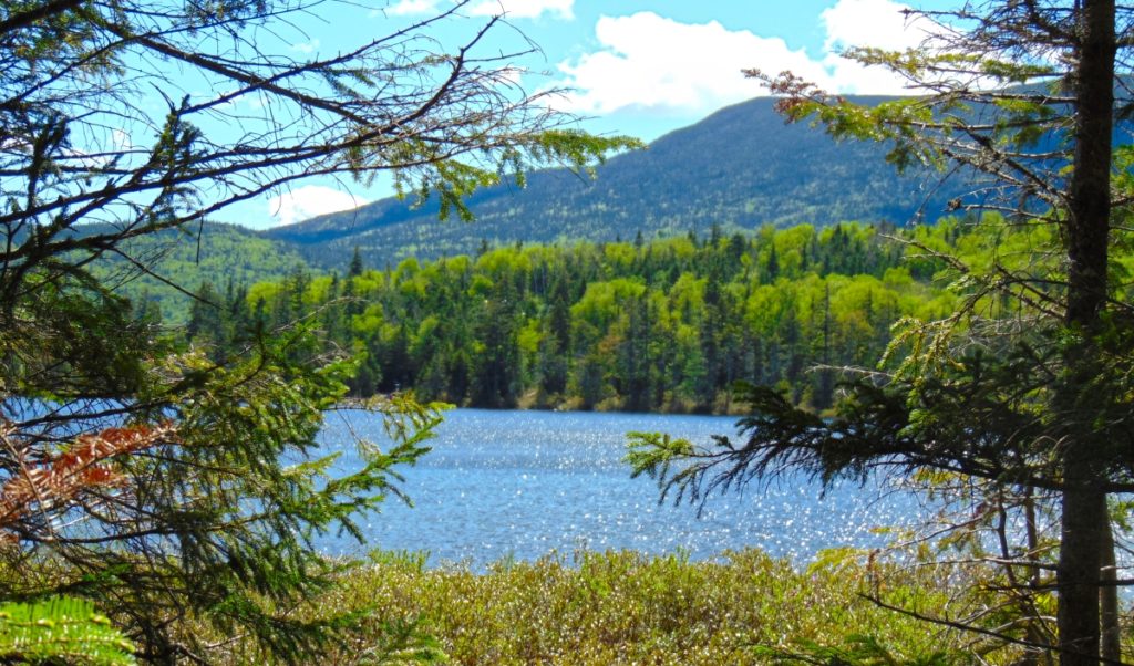
The breezy jaunt around the circular Trail begins to reveal mountains, in every direction. The first view, to the West, is of Kinsman Mountain. (Image/Above) Making your way to the other side of the Lake, Mount Kinsman looms like a Sun-dial; As the Sun makes it way towards its 4,265 ft peak, a shadow slowly cools the hidden Lake below. Reaching the other side, you will turn to look back to the East, and Franconia Notch Range is laid beautifully bare, above the Forest, like a Tigress looms over her cubs. It’s spectacular. This is the place to rest, and eat, and take some pictures. 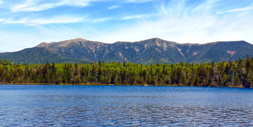
After some time taking in this scene, begin your trek again, continuing clockwise around the Lake. A glowing green Cannon-Ball Mountain radiates brightly to the North. The bright contrast compared to the darker hues of Franconia Notch Range and Mount Kinsman is a super-pleasant shock. A three sided, mountain-sized, protection for this Lonesome Lake. 
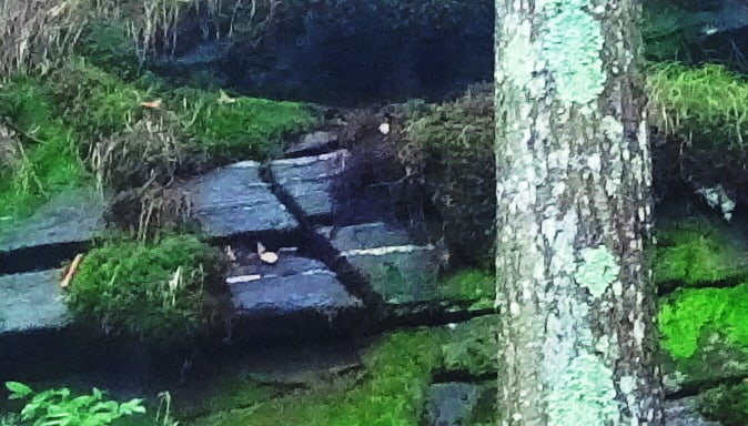
There are platform-pathways that run through the Forest, beside Cannon Ball Mountain, as you make your way. 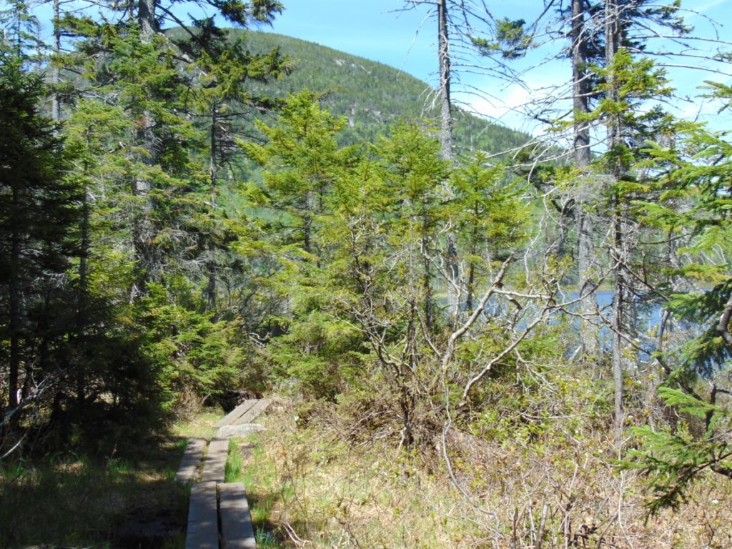 Some of the enclosures give a few different vantages on Franconia Notch Range…
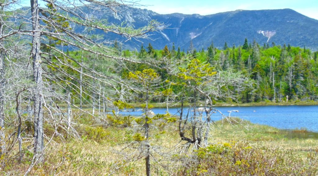
You will come full circle, and head back down the way you came. You took in a brilliant scene.
I hope readers will understand that relating these cultural points is not easy, or prideful. There was a time that I myself absolutely did not believe that any of these megalithic indicators were possible. It was a fairy tale, at best. But what I discovered, first hand, in person, as I engaged these trails, is the miasma of academic level evidence pointing towards this earliest anthropological Culture on Earth; This is The Megalithic Culture. You can see it too. The ironic thing, is that this earliest Culture was capable of creating almost anything they decided to build. They were engineers of entire landscapes! We find solid evidence for this Culture in Ireland, England, Wales, Scotland, France, New England, Virginia, Arizona, California, Mexico, Peru, Russia, and many more places. I still remember the first standing-stone I came across randomly, hiking in the dead of Winter in New England, some years ago. I was totally freaked out. It changed my perspective about so many things. (Image/Below)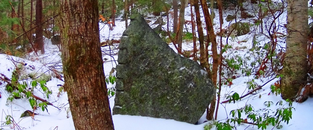
If there was an advanced Culture at the beginning of Time, how could we say that Cultural development is Evolution based? Why is none of this mentioned in our K-12 text books? In other words, why don’t the people funding Public Education not want you to even think about this Megalithic Culture? Are they afraid that it might change your perspective on some things? Your damn right they are! Get free. Open your mind. Look logically. It’s not what “Public Education” told you it is. Lonesome Lake is yet another wonderland, full of natural beauty and cultural mystery. It’s a place I hope you won’t miss. Covid-whatever, or no Covid-whatever. Go strong!
Mount Moosilauke
Elevation: 4,805 ft.
Location: The White Mountains/Benton, New Hampshire/USA
Introduction: Welcome to the dramatic western edge of The White Mountain Range, in New Hampshire/USA!
Mount Moosilauke (Moos-ih-lahk-ee) retains a title given by the Abenaki Native American Tribe; It means: “Rocky face above the trees”. As we will see, the high place at the top of this Mountain, is a definitive and distinct megalithic spiritual zone, where the enchanted stones of the peak mingle intimately with the clouds.
This unique title given by the Abenaki, also indicates a deeper meaning, beyond the name itself. Almost every one of the many White Mountain Peaks has a ‘rocky face above the trees’. Mount Washington, Mount Chocorua, Mount Adams, and Mount Jefferson, all have a ‘rocky face above the trees’. Why single out Mount Moosilauke? There is something special going on here.
I believe that The Abenaki were acknowledging this particular ‘rocky-face’ due to the many unique features that they encountered, and considered spiritually significant when they first saw it. In our time, we see them as Neolithic anthropological features, so ancient, that it seems clear to me that they were there before the Abenaki people had arrived. I can support this with evidence. Let’s take a look at the multi-layered experience of megalithic evidence during this phenomenal climb at Mount Moosilauke.
A Note About ‘Culture’: The ancient stone works found at Mount Moosilauke pre-date the Native American Tribes of New England. The Neolithic Culture you are about to experience on Mount Moosilauke, through this article, created monumental works of stone, in extremely difficult locations, and ways, all of which existed long before any Native American tribes had arrived.
This Megalithic Culture has specific memes (symbols), fixtures (arrangements of stone), and structures (functional centers, small temples,) in the highest elevations all over the world, that mirror, and mimic directly with European Megalithic memes, fixtures, and structures, entire continents away. This would support the idea of a single Megalithic Culture, with a single, common, source of systems. Not hundreds of individual, nomadic, Native America Tribes; Each with its own traditions, with basic tools, and migrations that moved seasonally in the valleys, planting crops, hunting, and fishing game.
I understand that this is very hard for many local researchers to accept, defending the idea that Native Americans created these Neolithic statements; but the evidence and cultural history clearly, and definitively, indicate otherwise. Of course, that statement must be supported with the evidence. So here is yet more evidence, and common Megalithic memes, and structures, from Mount Moosilauke, in New Hampshire, that relate directly to Mountains in Ireland, Arizona, Maine, and other sacred locations and high elevations, thousands of miles away; All these locations crafted in challenging, sophisticated, Megalithic stone.
Ancient Megalithic Memes in New England: Walking along the forest streams of the Franconia Notch Range, some 6 miles west of Mount Moosliauke, just a day before my intense climb, I came upon a six foot tall, equilateral-triangular standing stone, set perfectly in the midst of a quiet stream near Route 3. 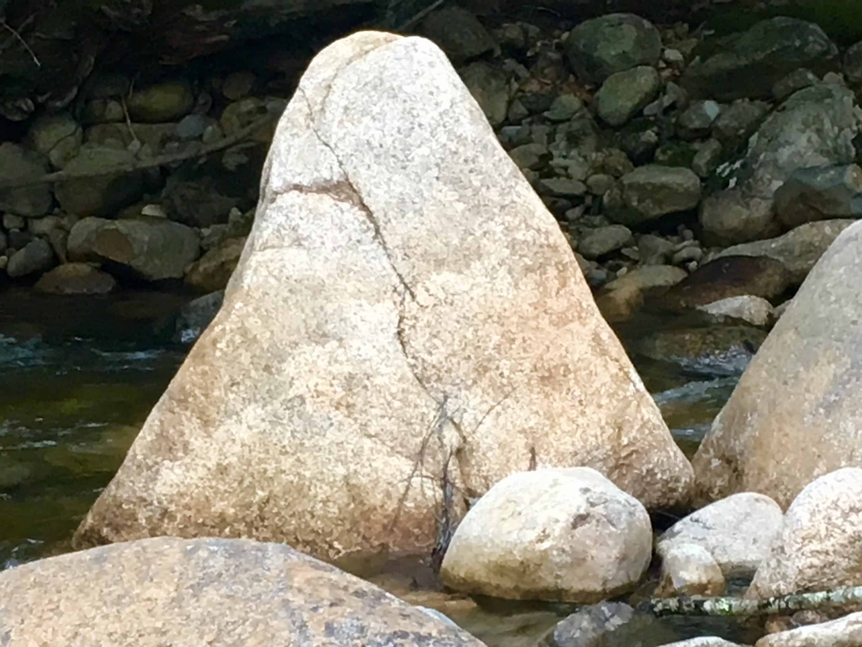
The meme of Megalithic-stone-equilateral-triangles in the Forests of New England, from Massachusetts to Maine, and everywhere in between, is one of the most prevalent and abundant symbols/memes that can be found. On this website alone, there are compiled, and permanently documented, several dozen equilateral triangle memes cut in massive stone in the wilderness.
These stones have significant ‘directionality’, and meaning, yet to be fully understood, or even acknowledge by current anthropology. Academics want us to believe a glacier created these statements? I’m sorry to be blunt here, but how intensely-stupid do these current Post-modern anthropologists think we are? Not to mention the fact that I have NEVER ONCE encountered, in any of the mountain ranges I have climbed, in the entire Western Hemisphere, a single real-time Anthropologist, or Professor, in a DECADE.
Very soon, these arm-chair-anthropologists, that dispute the Megalithic memes, are going to be absolutely disproven, and in the most blatant scientific way possible. With EVIDENCE. The evidence is mounting, and couldn’t be any clearer, that these are intentionally crafted, Megalithic, Neolithic-Period works. So, lets take a look at some examples: 
The green equilateral triangle stone pictured in the above image, has a perfectly cut, flat face, standing ten feet high. It might weigh 100 tons. I said 100 tons! It LOOKS LIKE AN ANNOUNCEMENT! BEGGING TO BE NOTICED! THEY ALL DO! It is located in the immense Forest surrounding the sacred Mount Katahdin, in Maine.
The perfectly equilateral stone pictured to the right, is located in a beautiful Forest in Upton Massachusetts. This example is relatively small compared to many of the other statements, at about 3 feet, on each side. It is absolutely set to a stone below it. You could not budge this stone with all your strength. The point is, someone crafted it, fixed into the rock-face below, perfectly, with a tool capable of doing so, cut directly out of the rock. Look at it. It’s perfect.
To add to this Neolithic context, not far from this very spot, is a megalithic chamber, designed in the the exact same internal, structural-fashion, as the Megalithic Chamber at New Grange. An inside (and outside) that most sacred Megalithic chamber at New Grange is….yes, you guessed it, dancing equilateral triangles, cut into the stones.
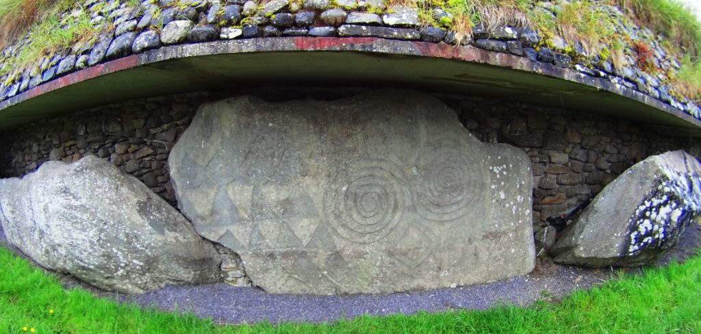
(Images of triangles: Above/Right/Left: New Grange Megalithic Temple, Ireland. One of the oldest in the world.)
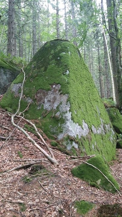
The image below is yet another massive crafted equilateral triangular-stone, found in the Forests of Maine, near Katahdin. Notice the moss covering this stone. For this stone to be cut, and then so covered with moss in this way, means it has been like this for an extremely long period of time; most likely, the very beginning of time, not crafted in the last 500, or even 1000 years. More like 6000 years…
Pictured here, to the right, is another cut, equilateral triangular stone, that is not located in the forest of Maine, but rather, in the forests of Austria. Again, notice the similarity to the stone in Maine, 2500 miles away. And also, notice the indicator of construction in antiquity, alpine moss.
This stunning image to the right, was sent to me by my friend, and researcher, Gunnar Hiptmair, who continues to discover dozens of Neolithic anthropological statements and zones in the Austria and the Alps today. His Facebook profile can be reached directly, here: https://www.facebook.com/profile.php?id=100010469927936
Stemming from this, are countless other examples of equilateral triangles fixed into stone, in New England, and elsewhere. They are so abundant that it suffices to leave these examples to get the point across, and continue forward with the experience at Mount Moosilauke.
Logic About Constructing Megaliths: The ashlar-cut technology in creating these perfectly cut, flattened frontal faces of stone, does not indicate a technologically primitive Native American or Celtic culture(s). These stones were cut, and placed, in specific ways, weighing up to 50 to 100 tons. For Native tribes to move each one, would take a set of completely illogical circumstances, requiring human labor, a time frame, resources, and out-and-out permanence and dedication, that Native American or Celtic tribes would have found absolutely repugnant, annoying, and even ridiculous.
The Winter season in New England is long, deep, and hard. When Spring arrived for the Native tribes, after surviving the deadly Winters, do anthropologists actually think and defend the idea that the very first thing Native Tribes would do after migrating back to the newly warm northern temperatures is, first: go straight back to those impossibly massive stones that they were supposedly moving, before the previous Winter began, (utilizing every ounce of energy, and voluntarily-primitive ingenuity they had) They would immediately abandon their villages, loved ones, and their potential planting/fishing season, and crops, all to move giant rocks?
No. This never happened. It is absurd.
Something else is going on.
This is where things become extremely difficult for local researchers. They are limited to local narratives, local evidence, and local History. They simply cannot comprehend any possibilities outside of the Native American presence. They are forcing a narrative to credit Native American Cultures with the crafting of these megalithic statements, because it is the limit, contextually, historically, and logically, to what these local researchers can understand.
The fact is, there was an earlier Culture, in the Americas, as well as Europe and Israel, as described in every ancient account, and mythic history, which was dominant in these regions of the world. They were Megalithic builders, capable of incredible works of strength and design, that are so permanent, they are still around for us to see today. Let’s turn to the hiking experience for the moment, and move forward with the evidence at this beautiful Mountain.
Hiking Experience And Evidence at Moosliauke: As it is with every serious climb, you need to make sure you are prepared. This is a 4,805 foot climb. Please make sure you are being honest with yourself about how healthy you have been in the last year. Have you been eating right? Are you rested and calm? Have you been training for a tough incline for a few months previous? Do you have a portable water strainer to use in the flowing streams along the trail? And will you be ready to carry your portion of bottled water up the Mountain, on your back? Remember, you need to be hydrating, little by little, the whole way, up, and back. Like myself, you can bring a fully charged iPhone for safety purposes, and music. Bring some kick-ass headphones, and deepen your experience in portions of your climb. Choose a day with good weather, starting as early as possible, with the cool temperatures in the morning, and off you go.
Glencliff Trailhead: Glencliff Traihead, in Glencliff New Hampshire, is located on the ‘Benton State Forest’ side of the Mountain, known as the westerly approach to the peak. From Highway 25 in Glencliff , you will connect and turn right onto High St. You will see Mount Moosilauke to the right. The small trailhead sign, and sandy-square parking lot, about 1.5 miles down the country road on the right. If you reach Glencliff Elderly Home beyond the Trailhead, you’ve gone to far. Turn back, you’ll see it.
Making your way into Glencliff Trailhead, this lower 3rd of the Mountain takes you across a stream, a wide, open wild-field, and into a steady incline of a fairly wide, softened dirt trail in Benton State Forest.
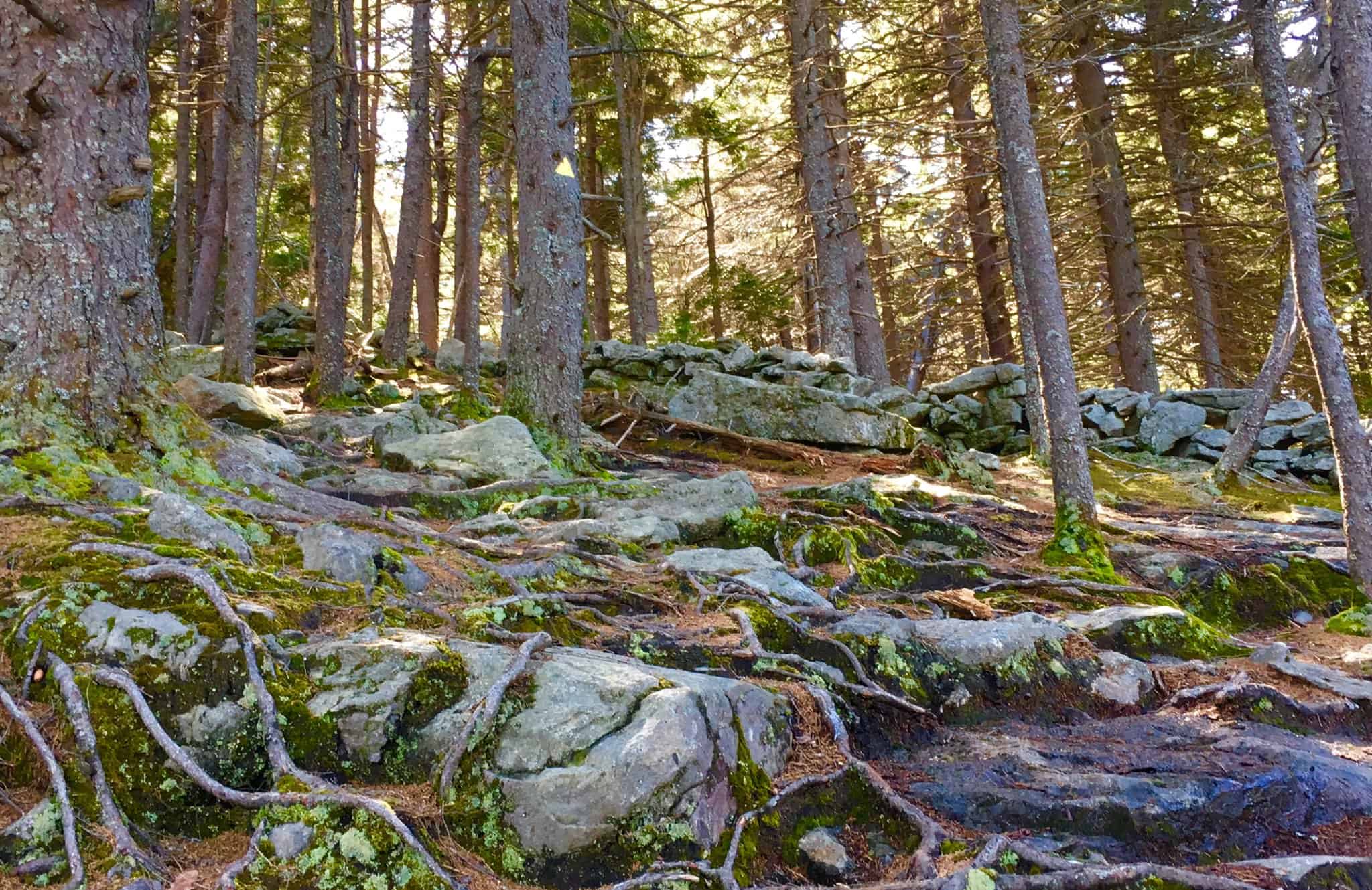
There is a distinct rocky trail that emerges as you steadily make your way up the path. Curiously, the stones seem funneled, collected specifically, in one distinct lining. It is clear that the stones are not sprawled out, as if by a rolling glacier. Stones are collected in one distinct line, straight through the Forest. Although it may be hard to consider for some, this is not random, or the work of The Park Service. As we continue up the Trail, evidence to this effect will emerge.
As the elevation increases the alpine aspects of the Trail emerge, with glowing mossy enclosures and tightening thickets of trees, growing right over the stones, in the cooler temperatures.
Here is strong natural evidence for the chronology of the ecological process in this area, dating all the way back to the beginning of time, if you know how to look, ecologically. It is abundantly clear, as you can see in the image above, that the geology, the rocks, were in the initial layer of the landscape, first. The forest clearly came long after. 
It is a challenge to established how many thousands of years the stones here sat without overgrowth on the open face of the Mountain (like they do in most Celtic Ranges). But it is clear that the Forest, in most areas, has grown up directly over the stones, as we see in the image above.
Please pay attention to the following ecological and anthropological points:
As you can see from the clear grey color of the stones on the pathway, there is no moss at all. This is because alpine moss is extremely sensitive to the touch, and will dissipate growth when contacted externally. The grey stones along the path look to have been ashlar-cut, and worked, distinct from the mossy stones that literally surrounding them. Notice how the pathway stones, the cut stones, have zero amounts of trees, or moss, on top of them? How is that possible? It is because from the earliest possible time, before the Forest had even grown over the rocks here, these stones were touched, and cut specifically as an approach to the peak? Yes. This is an intended pathway of Megalithic construct. It has remained as such, in use by the Native Culture that came long after, as sacred trails, continuing into modern use today.
Just think for a moment. Did the Native Americans cut the pathway stones on these mountains?
They didn’t claim to, so no. Did the Park Service use machines or tools, up to 4,805 ft, to literally cut chronologically related, and level boulders, into flattened halves specifically for stepping up the Mountain? And did they cut down all the trees along the way too? Or was the path always like this, from the very beginning? Please believe me when I tell you, readers and friends, that it would cost millions of dollars in this little country Town, to do such a thing. That never happened. This path, and the hundreds of stony mountain ashlar-cut paths in the Western hemisphere, are specifically crafted, by a Megalithic Culture; a Culture that was gifted technologically, and intent on possessing the Mountain, leaving codes of craftsmanship, from the beginning of Time.
I know this is intensely hard for laymen, and local researchrs to consider, with a locally controlled, “post-modern”-emphasized, public education system, that literally is designed to keep your mental framework historically revised, disconnected from any terrestrial evidence, and ignorant of what actual elite scientists, ecologists, antrhopologists in the government, and Universities, are well aware of. The evidence, scientific, chronological, and logical, indicates a highly advanced Megalithic Culture at the beginning of Time. The Native Americans, and Celts in Europe, knew these constructed paths and stoneworks were present long before they arrived. Just like Peruvian Inca Natives at Machu Piccu, the Megalithic works were there when they arrived. Natives had nothing to do with constructing them.
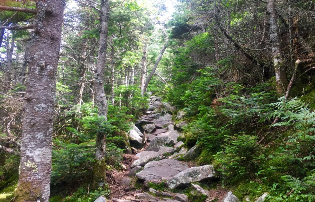
Hiking The Trail: Continuing up theTrail, you should take your time. You will pass two streams running across the path. Pause and take water here, cool off. Jump in! Fill your water bottles. From here, there is no more running water, and you will be on your own. The pathway in the upper 3rd of the Mountain begins to narrow intensely (Image/Above).
Alpine Pine Trees will begin to enclose the stone-steps before you. Here is a chance to pause, speak to the endearingly cool people that are coming and going along this path. While making big climbs, hikers often think and say things that are not common to their lives down below. It may be cathartic for you. Hikers might be needing to get a feeling, or statement out, especially during covid19’s quixotic grip on our society at the moment. Listen to what people are saying. Be kind. These moments could be profound. Singular elevated pathways like this are rare moments in your life. Pay attention.
As you breach the narrow path of the Pines, looking to your left. You begin to realize just how high you’ve climbed. (Image/Below) This is just a preview before completely breaking the tree-line. On a good day, visual potential could be up to 70 miles away, maybe further. Pause and realize, you’re doing a great job. 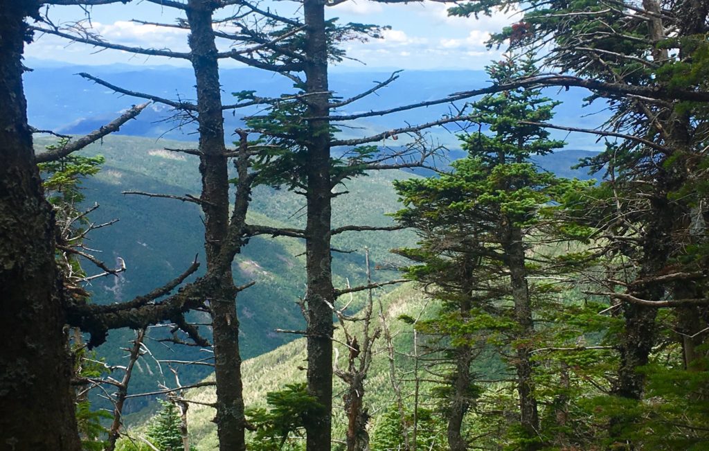
Things start to become pretty special as you continue the quest to break the alpine tree-line. The singular stony path ultimately ends, and you reach a stellar area of level ground with a crossroad of signs. There is the choice to head towards the South Peak, which is 20 minute interlude path to making the actual peak. Make sure you have the energy to take this 20 minute diversion to the view at The South Peak. I did not. I followed the sign pointing to the left, towards Moosilauke Peak.
The pathway here is magical. The relief and surprise of level ground after so much climbing is almost hilarious. It feels easy. This is a high porch, a singular pathway, like a rolled-out soily-soft-carpet, just for you to now come into this upper kingdom in the clouds that you’ve worked so hard to see. You can speedily make your way along the last 1.5 miles of your trek. 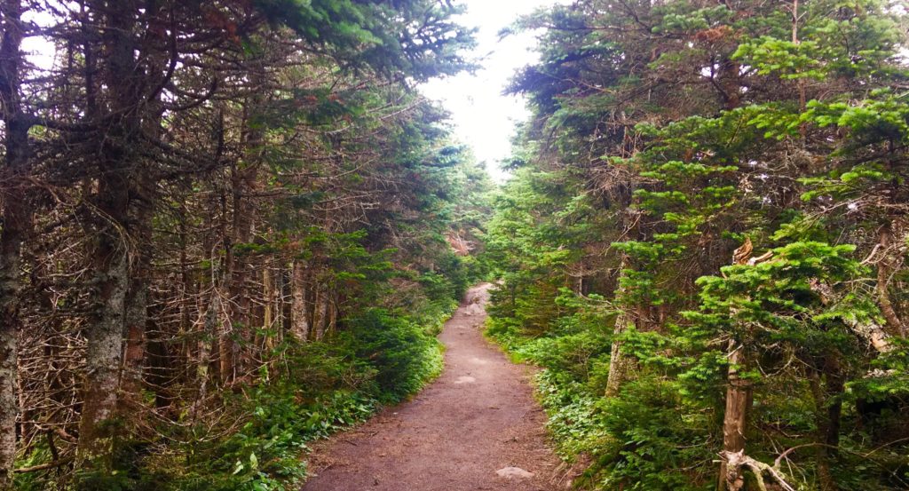
Along this rare level path, you can try to gather your strength. Take your time and enjoy what you’ve earned. It’s the same in life. Don’t go passing by quickly, what took a hard fight to find.
Along this regal and rare path, small stones begin to emerge. The stones are intricate, enchanted, and strange. They seem to be cut in a refined fashion. I have seen this manner of cut before. Take a good look at these stones.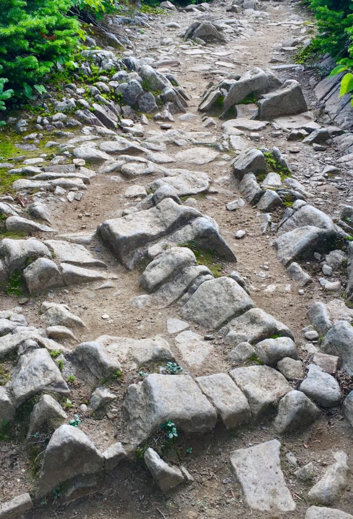 I am willing to bet, that digital analysis of these stone would reveal linearity, symmetry, modeling, and meaning. I am currently working on an ecological analysis system of these rare fixtures. The possibility that this is a miniature map, or modeled version of the overall area, is very real. As we will see, modeling the Mountain Range of the area was an essential practice for the Megalithic builders, in New England, and Europe.
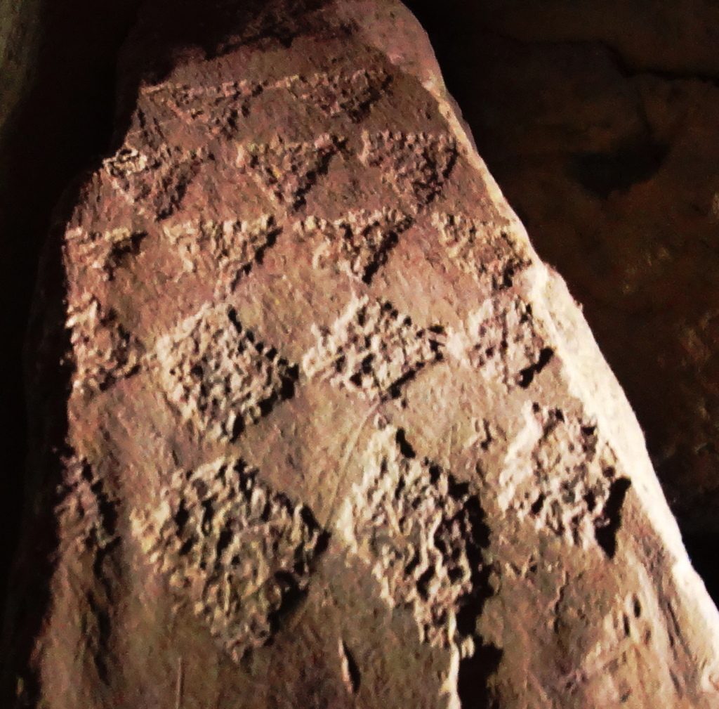
Aside from these theoretic connections, there is a location in Massachusetts that is one of the most sacred groves in the entire world. it is called ‘Bears Den’. At this location there is a hidden waterfall, with a dwelling near by. The entire area seems to have been engineered by a Megalithic builder. There are cut stones, leveled platforms, and the waterfall itself, which is engineered and dedicated, in stone, to (you guessed it) the equilateral triangle.
Images of the rear-side of the waterfall reveal some pretty incredible markings. They will look familiar to you now. Lets have a look at the markings in the rear of that altar. Look at the similarity of these small cut fixtures.
As I mentioned, on the frontal side of this waterfall, there are, etched in permanent stone, undeniable anthropological evidence of the equilateral triangle meme of the Megalithic Culture. 
There it is, again. Perfectly etched in stone. The Equilateral Triangle. Do you think a glacier did that? If you do, then you need to think about how much of your thinking, is someone elses influence.
When are local researchers going to understand that the implications for this clear, and sometimes multi-layered Megalithic evidence, is far beyond the potential of any local nomadically oriented tribes, that have long since vanished? There would be literally millions complicated tools, and an emphasized ‘stone orientation to’ Native-American Culture, beyond anything that we know of them, if infact they constructed these works. They simply could not have done it.
Continuing passed many of these wonderful markings, the path unfolds into a miniature valley, leading up into what looks like a distinctly separate, miniature alpine-mountain. You’ve broken the tree-line. Here before you is what looks like a version the Sacred Mount of Arunachula in Southern India. The majesty of this 4,500 foot piece of elevated earth, is stellar, supreme, and absolutely sacred. 
This zone is protected by the State for its ecological rarity, but in truth, I believe that at the elite level, there are individuals who know that this area is a sacred anthropological zone. The stones here are doubly significant in meaning, compared to the moss.
The approach to the peak is pristine. In every direction, mountains and clouds.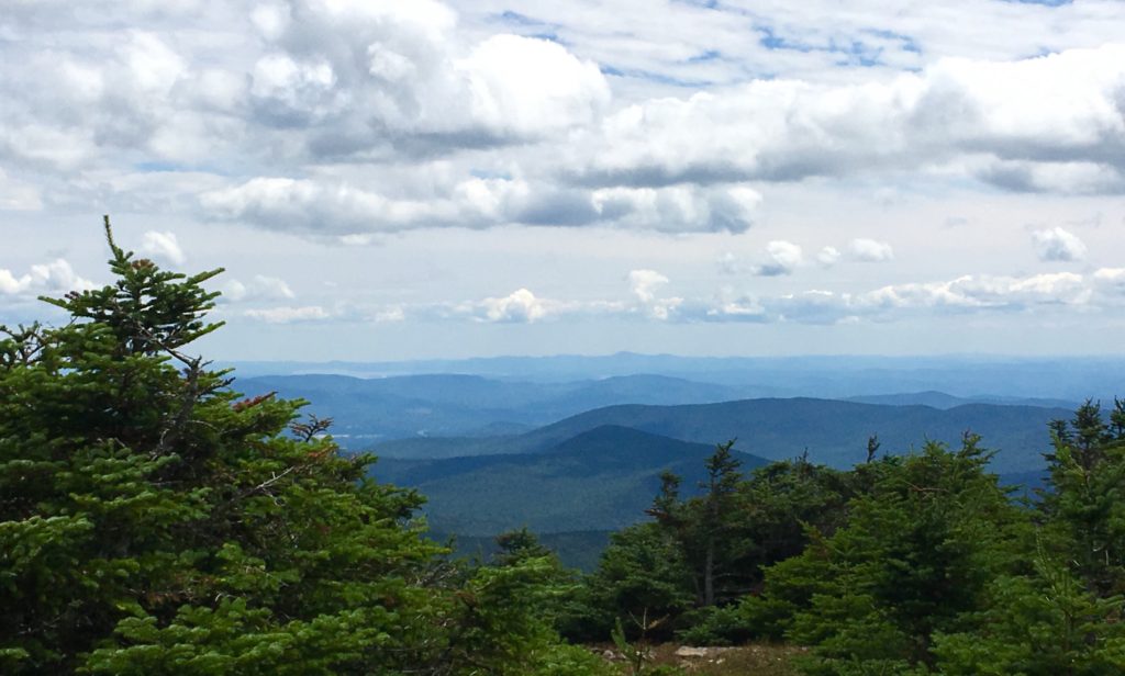
The trees fade out, while stone Cairns line the path. I believe these Cairns are Megalithic statements, perhaps refined by hikers in the last Century, but more likely crafted in antiquity. These Cairns are found even at minor peaks in the hill country. 
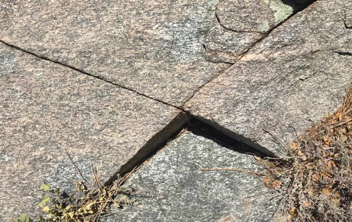
Certain stones along the final approaches at sacred mountains are cut with directionality, pointing directly to the peak. Here is a centrally placed directional stone, directly along the path, just before the peak. Perhaps it will help if readers can see some examples of this Megalithic meme on other locations.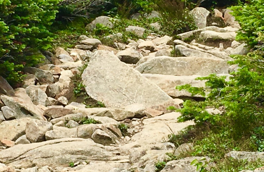 Directional stones have specific parallel sides, leading up to a right-angle-apex of exactly45 degrees.
Sample 1: The image above, as you know, is located near the peak at Mount Moosilauke, New Hampshire. 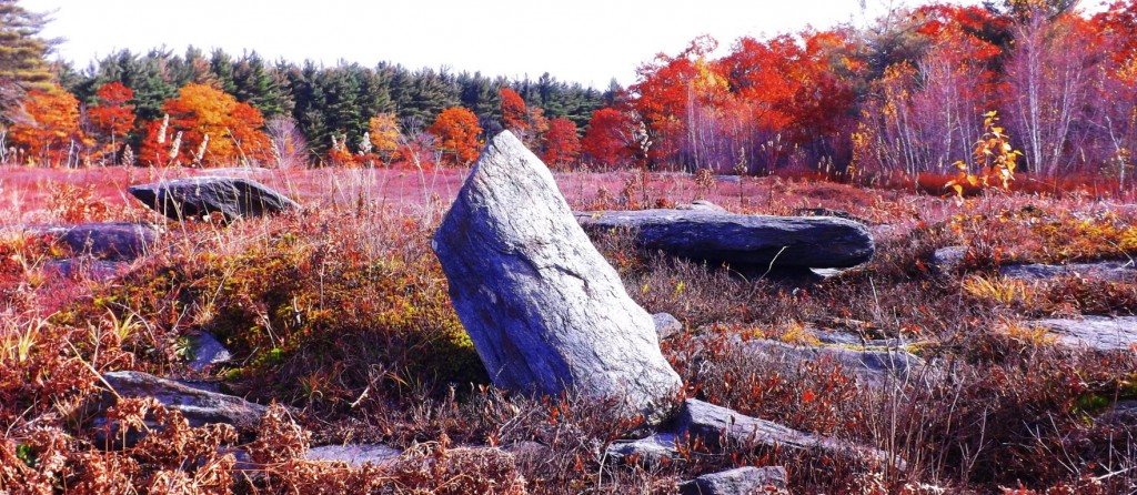 Sample 2: Directional stone located near The Altar at Heath Mass.
 Sample 3: Located near the peak at Watatic Mountain, Massachusetts.
 Sample 4: Located near the peak at Monument Mountain in the Berkshire Range.
Finally arriving at the peak, people are resting and taking in the scene. A large square stone sitting at the very peak is marked with a perfect equilateral cross-section, supported by a triangle in the lower corner. (Image/Below) These particular meme can also be found at dozens of peaks throughout New England, the American West, and Europe. Here are just a few examples below the one here at Mount Moosilauke. 

After this stone, the entire White Mountain Range comes into view. In the image below, Mount Washington can be seen in the distance, the highest point in the center. Mount Chocorua can also be seen to the right, below. Stunning. 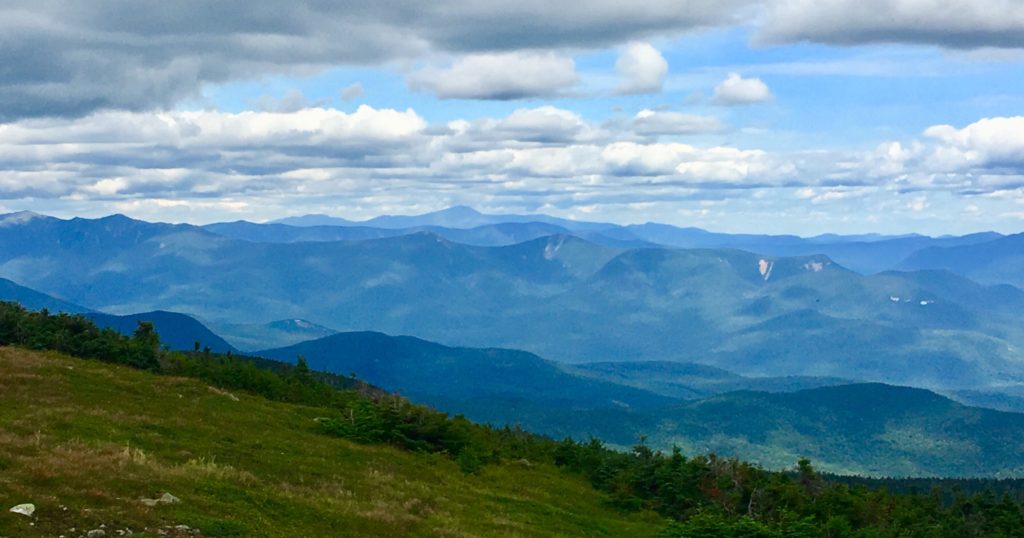
The view to the south, as seen below, is a rolling and rotund descent, with Massachusetts off in the descending peripheral distance.
Another interesting fixture here at the peak is a very special arrangement of stones, with a leveled rock layer at the base of these specially stacked rocks, seemingly made specifically to imitate the cut of the mountain-tops, in the secondary background, of the peaks in the greater distance. Although dozens of people sat here at the peak, not one of them noticed this incredible fixture. Notice in the image below, the leveled work in the bottom portion of the rock, with what looks like distance markings of measure along it’s side. What is this doing at the top pf 4,805 foot mountain? This is no accident. These massive stones are placed to mimic the peaks in the secondary distance. 
Let’s show another location that displays this type of fixture in Europe. At the peak at Mount Bearnagh, in The Mourn Range of Ireland, the peak contains a set of megalithic fixtures that absolutely imitate the peak of the mountains beyond. The stones are clearly cut, and fixed, into positions to imitate the angles of the ledges beyond. Again, this is clearly no accident, it’s incredible engineering, in stone. 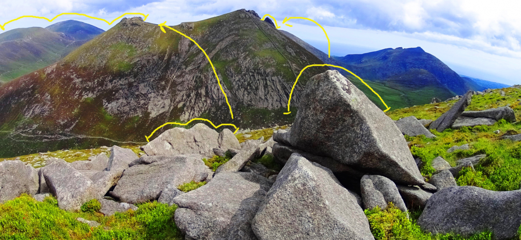 Here is a megalith also located at Mount Bearnagh in Ireland, absolutely crafted to imitate the curvature of the lower valley. At the peak, just one mile from this spot, the boulders are arranged to mimic the mountains of the Range beyond. There is no way that this is random! It’ s intentional, and cultural. How could we not see this!?
 Other examples of stones-marking of peaks, at other mountains, can be found at Mount Katahdin, near the Knifes Edge approach. Look at this exquisite marker, roughly 5 feet tall, pointing directly to the peak in the distance.
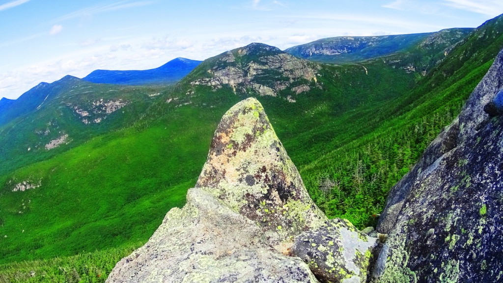
Here is a specifically crafted and placed-megalithic boulder, on the edge of the Sierra Nevada Mountains, in a lake, and shaped to look exactly like the mountains behind. Notice the 3 distinct indents in the boulder as well…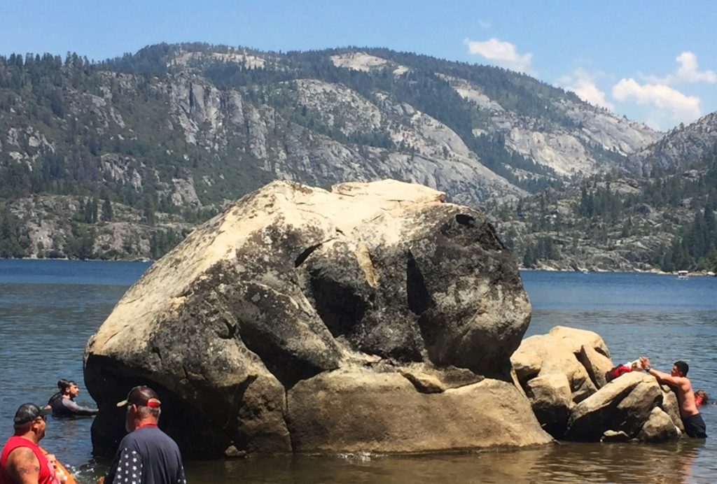
And here is a megalithic boulder at small peak at Upton Massachusetts. It is imitating the small mountain beyond, pointed perfectly to its center. Notice again, 3 distinct indents on the boulder. 
Not two miles from this very beautiful spot in Upton, is one of the finest megalithic chambers in all of New England. To think that these megalithic works are not related would be a serious mistake. They are absolutely related. The Culture that created these works was obviously capable of megalithic design, and large scale. 
The accumulating Megalithic evidence here at Mount Moosilauke, with multiple supported examples from other locations, of memes and fixtures of the exact same stylization, should begin to give serious academic pause for those who have not had the capability to see this evidence, but are now clearly seeing it collected here. Site after site, peak after peak, from Glenn Coe Scotland, to the Sierra Nevada, (and everything in between) are consistent similarities of a single Megalithic Culture, not variations of statements from hundreds of Native Tribes, both Celtic, and American. The evidence point to a Culture that had a singular source of related concepts.
The final Megalithic constructs statements here at the peak of Mount Moosilauke, are perhaps the most important. We find nothing less than an entire complex of leveled stones, stacked into defined sections, spanning perhaps 70 by 30 yards. In its current state it is dilapidated, but a closer look reveals definite distinction, and intended design.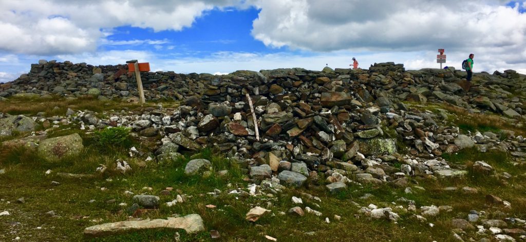
There a several divided square sections of cut, stacked, and leveled stones, which appear to define a particular function within. The section in the image below is absolutely level with the dramatic skyline to the north. There are clearly long and level cut stones worked into this construct, as can be seen, and were most likely crafted specifically for this purpose. 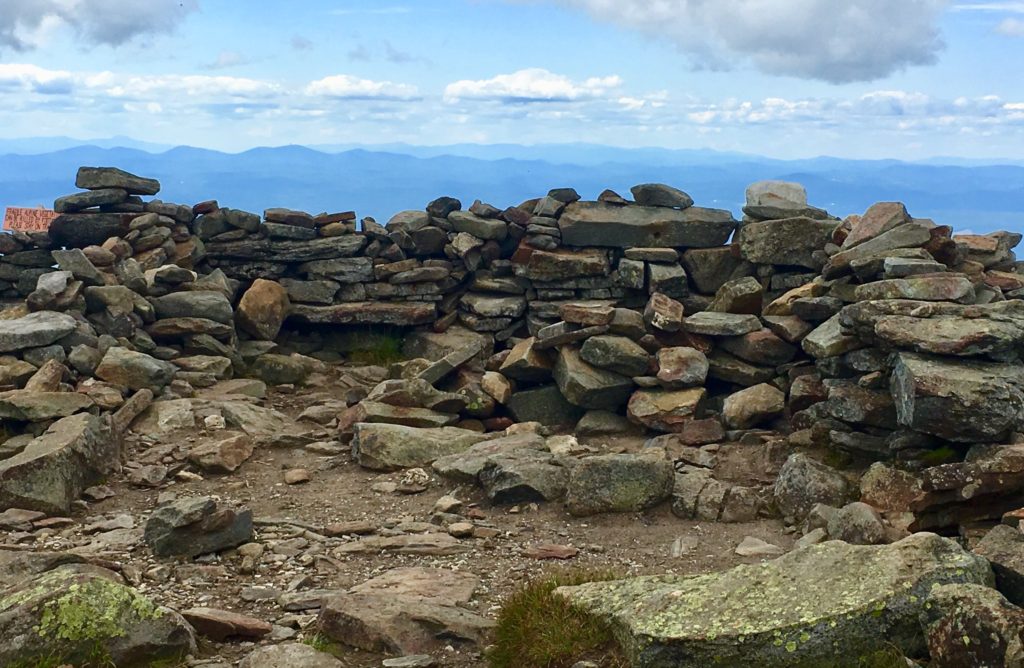
A frontal view of this square space reveals a significant 7 foot high lining of stone, which has clearly been tampered with over time, without any real protections. This particular view shows the significant amount of substance that this Megalithic Chamber once contained. 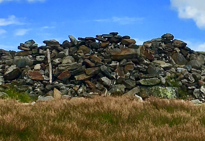
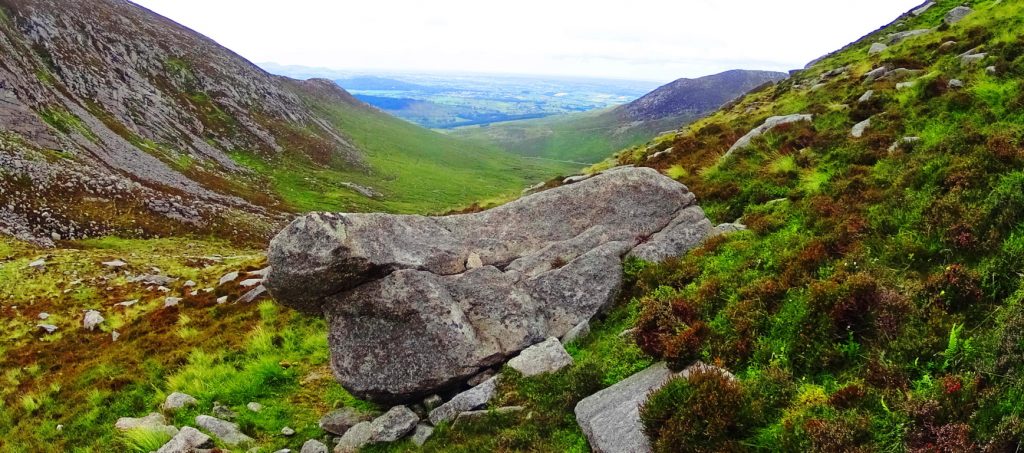
In stark contrast to the square spaces, there is a rounded space, separate from the main constructs, that may have had an alternate purpose, with its alternate shape. 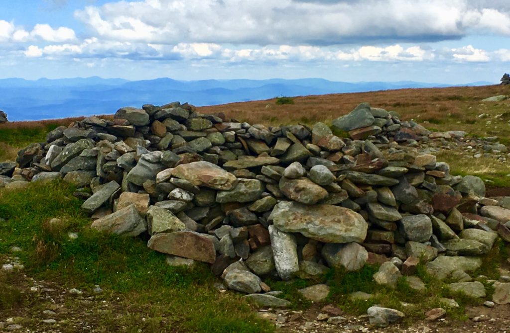 This rounded setting immediately reminded me of another set of rounded Megalithic stones, found in a highly megalithic area, and at a significant elevationm in the Mourn Mountains of Ireland. (Image/Below)
 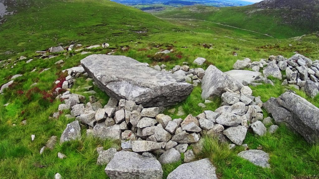 These areas should absolutely be considered National Heritage Sites and archaeological zones, fully acknowledged as a Megalithic Cultural spaces. And yet most passersby simply believe them to be random piles of rocks. How this is being allowed to remain the case is beyond me. There is meaning and intent attached to every one of these works, yet to be understood by so many.
For day hikers, the journey is only halfway done at the peak.
After resting, you need to steadily make your way back down the Mountain. When you make it to the first bubbling stream of water, about 1/3rd the way down, to refill your bottles with your strainer, you will be safe for the rest of the journey. During a trek along a decline, be careful to set your feet squarely, to choose your steps, in order not to turn your ankle. As you make your way, the path will widen, and inevitably drift with the gravity back to the Valley below. I hope hiking sojourners decide to try this climb for themselves, and experience what has been described here. Don’t let anything stop you from continuing to seek out sacred landscapes; Not others, not yourself, and not Covid19, in all its bizarre quixotic strangeness. So many people are waking-up, and truly realizing, that time in the Sun, and in the sacred landscape, is the answer. Thanks for reading. 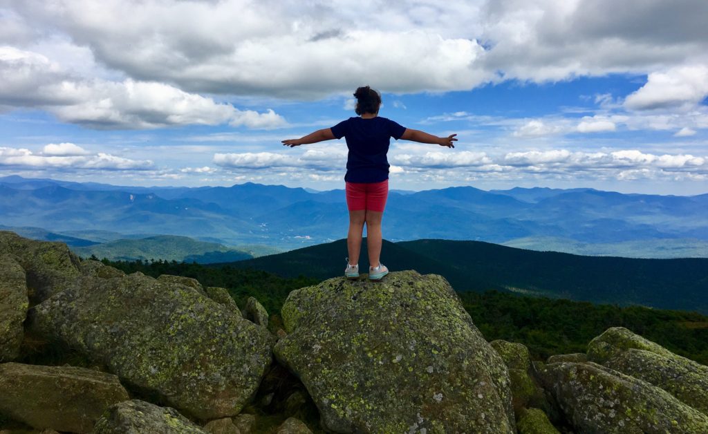
North-Pack Monadnock Mountain
Elevation: 2,300ft
Location: Greenfield New Hampshire/USA
Note1: It is hard to write lately. Spring is here, but its pretty hard to feel.
This is usually the time of year that I’m pretty psyched, where I’m making plans, studying maps, getting strong. The lull and strangeness of life under quarantine, and social distancing, has thrown everybody off. Most importantly, there are people who are sick, and some who have passed away, and it is sharply disheartening. I think to myself: “How can I write of my love of newly explored mountain ranges, without seeming somewhat tone-deaf…”
And then I realize…
This is absolutely the most important time to write of my deep love for mountain ranges, and all the mysteries therein. I want to charge-up people to get out there. So I keep writing. Plus, I have something new to share, something special, rugged, and beatific. New Hampshire, USA.
New Hampshire is truly special, for more reasons than I had previously known. The stones here, are incredible. The forests, intimidatingly dense, even by Colorado Rockies, or Sierra Nevada standards. 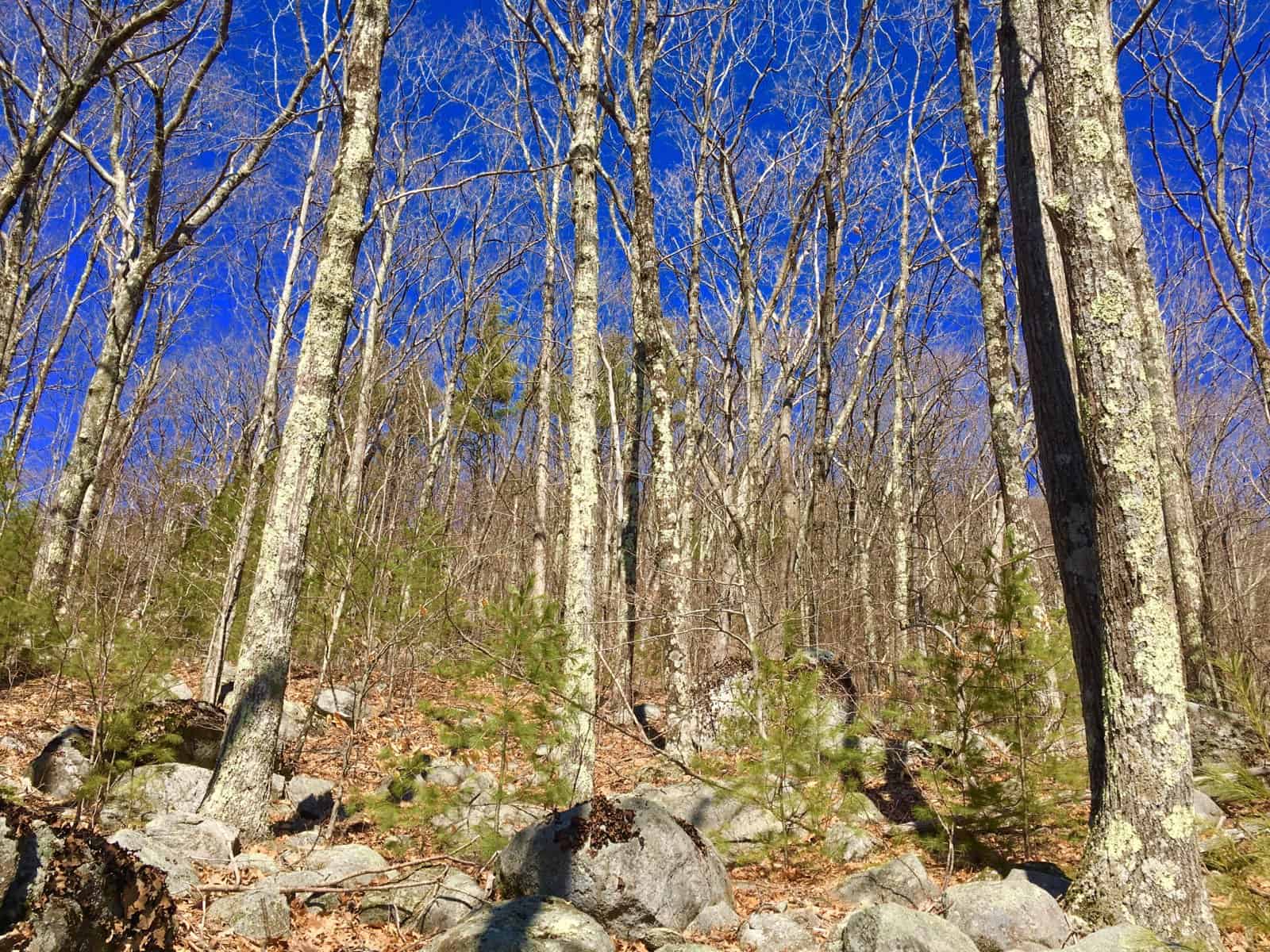
Now, more than ever, people need to experience rolling hills, and rocky heights!
Note2: Aware of the seriousness of the conflicts looming in the valleys of the world down below, I’ve wandered into the hills of New Hampshire merely to cope with what my heart is telling me. And right on time, I’ve discovered the Hillsborough-Small-Mountain Range, here in southern New Hampshire. This is a place of magical beauty, strong signs of profound Neolithic history, and scenes with so much old stone, and alpine moss, that at times I feel I am back in the forests of Blacklion, Ireland, drifting along the glowing, moss-engrossed forest glades. (Image/Below)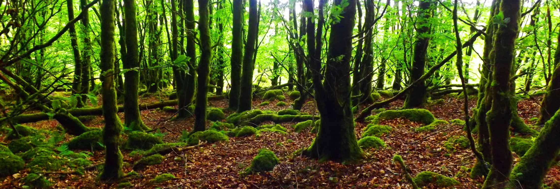
A symmetry-conscious look at this very image below, ‘flips a switch’ in my thinking; the same switch that has sent me packing out to the Highlands of Scotland, the Sierra Nevada’s of California, and Irelands incredible Ranges; searching for the incredible angular-codes in the stones. There are parallels, directional indicators, centricity, apex’s, alignments, magnetic orientations, massive irrigated engineering zones, interlocking-fixtures, and statements that are cut literally into the faces of full Standing Stones, in specific locations across the world.(Mt.Watatic/Massachusetts Standing Stone/Images/Right).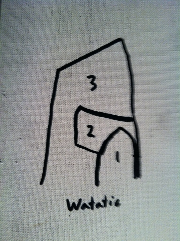
New Hampshire is absolutely part of this epic story, and it is on full display, from mountain to forest to stream. (Megalith found along the stone-lining at Wapack’/Image/Below). It is a cut megalith on its surface, on an exact a parallel plane, in direct accordance with the nearest, flatly-cut surface, of the foreground boulder)
Note3/Trail: The Trail to climb North-Pack-Monadnock-Mountain is found by drifting into the Wapack National Wildlife Refuge pathway, in Greenfield New Hampshire. You can find the trail on the edge of the Forest, cascading down onto ‘Mountain Road’. There is so much stone in this region, from the lower valleys, to the stone-linings running all the way up to the peaks, that I was utterly stunned. The forest here is an abyss of verdant tops, layers of green-upon-green, where from above, nothing might be seen of the stones, and their presence, but from beneath, a Neolithic world is abundant. (Image/ New Hampshire Forest/Below)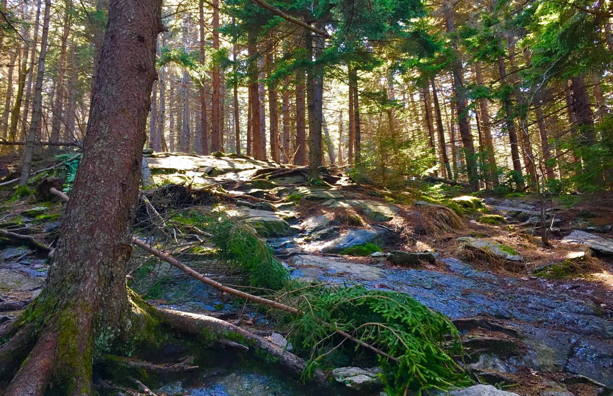 Beneath the rolling massive canvas of leaves, each and every peak in New Hampshire (Image/Below/Right) is inundated with anthropologically-geological statements, cut stones, aligned with the rocky trails, very similar to the Mourn Mountains of Ireland, (Image/Below/Left).
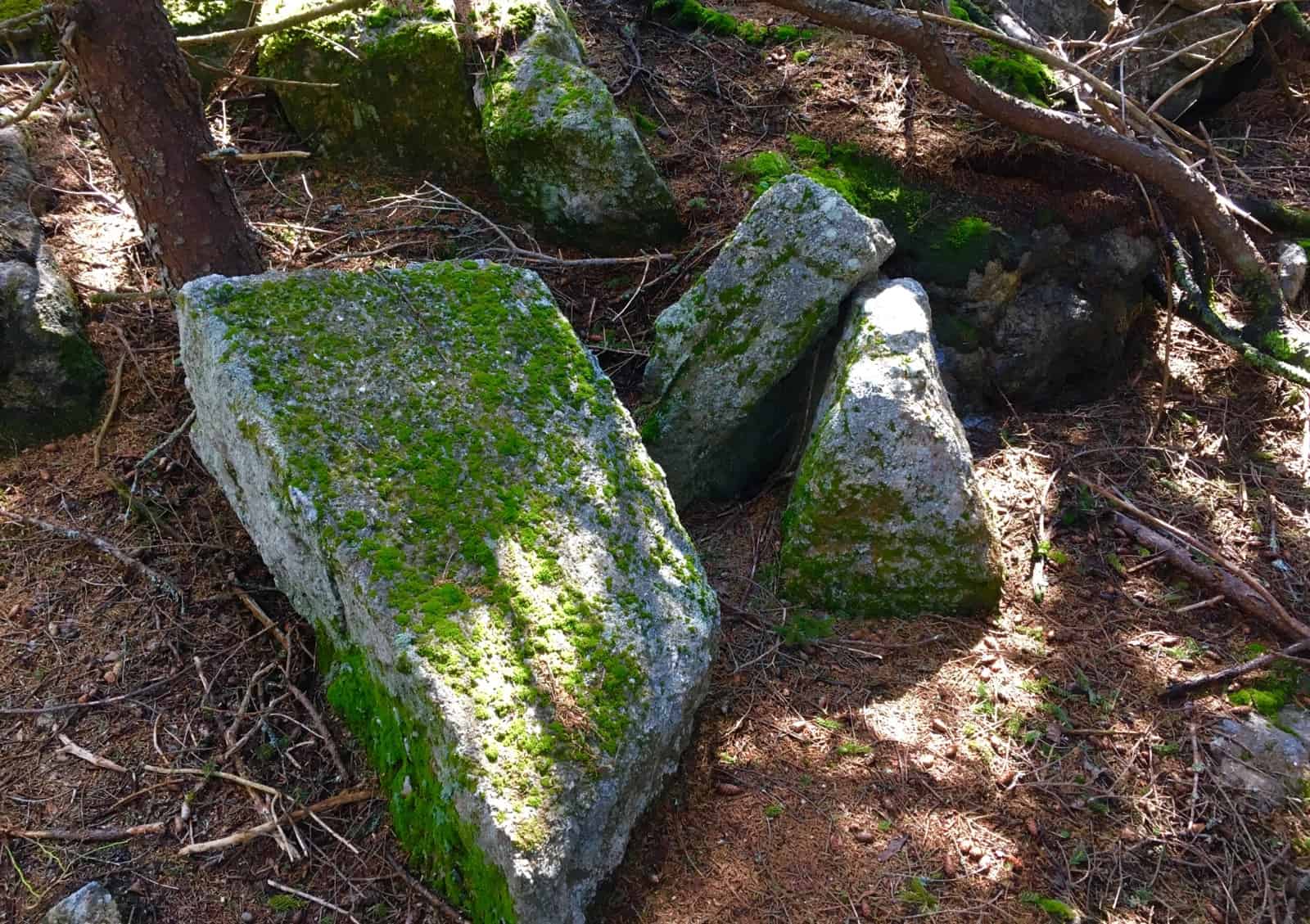
 -Lets take a moment to define what “anthropologically-geological” means, and specifically why we do not attribute these stone-works to Native American, or Celtic Tribes.
I realize it’s a mouthful; the term: “anthropological geology”. But all that means, is that these stones were intentionally crafted by someone at the earliest point in history; someone capable of incredible strength, judging from the statement they left behind, but also capable of incredible engineering and intellect, represented in stone.
 CULTURAL NOTE:
Identifying Fixtures And Cultures: There is a scientific process for identifying anthropological-geological fixtures in the landscape. We are most likely identifying the first culture on Earth, as hard as that is to swallow. This can be a raw challenge for so many people to accept, but accrued evidence points to this conclusion. To give you some historic context, These global stone statements are pre-Mycenaean, pre-Egytian, pre-Native American, and pre-Celtic. If you are lucky enough to encounter South American Native-wisdom-keepers, in Peru; the Mashco-Piro or Nanti Tribes clearly express that the earliest megalithic stones, at the base of various structures at Macchu Picchu, Indigenous tribes will tell you, in no-certain terms, that the ancestors did not build them. The megaliths were already there when the earliest natives arrived. Other cultures, likeThe Mayans of Mexico, attribute the earliest megaliths, to the gods.
It is also the same for North-Eastern Native-American tribes. Not only are the massive amount of tools required to construct ashlar-cut megaliths, nowhere to be found, but there is absolutely no record, even within the oral tradtion of these seasonally nomadic tribes, of any massive megalithic building-teams. The effort would have to be significant enough to circle the Earth 6 to 7 times! REALLY!? Would’t this effort be the absolute hallmark of the Native Americans in the Northeast? Sorry, but it simply doesn’t exist. Someone else built the stones, before the natives.
To support this premise historically and logically, not one of the Northeastern Native Tribes is called: “The Stone Builders” or “Mountain Lining Buillders”. Not one!?
Instead, northeastern Native American tribes called the original stony trails “the pathways of the gods”. It’s not hard to see why. The Natives understood, and honored, the obvious solar and lunar acclamations of these massive stone-linings, which literally run straight-up the sides of mountains, kinetically-connecting rolling valleys and streams, directly up to the sun-kissed peaks. Countless mountains display this. Just a few blatant examples include: Mt.Monadnock, in Massachusetts where there are Massive Stone Linings to the Peak (Image/Left), +Mt. Bearnagh, Ireland (Image/Right), Mt. Watatic in Massachusetts (Image/2nd Below/Left), Mt Katahdin in Maine (Image/2nd Below/Right) as well as thousands of other examples in the world.
Look at the angle of these stone-lingings, running straight up to the peaks, like connecting cables. It’s so obvious that they are intended to connect and synergize the landscape, like power chords. They are not, and have never been, “walls.” 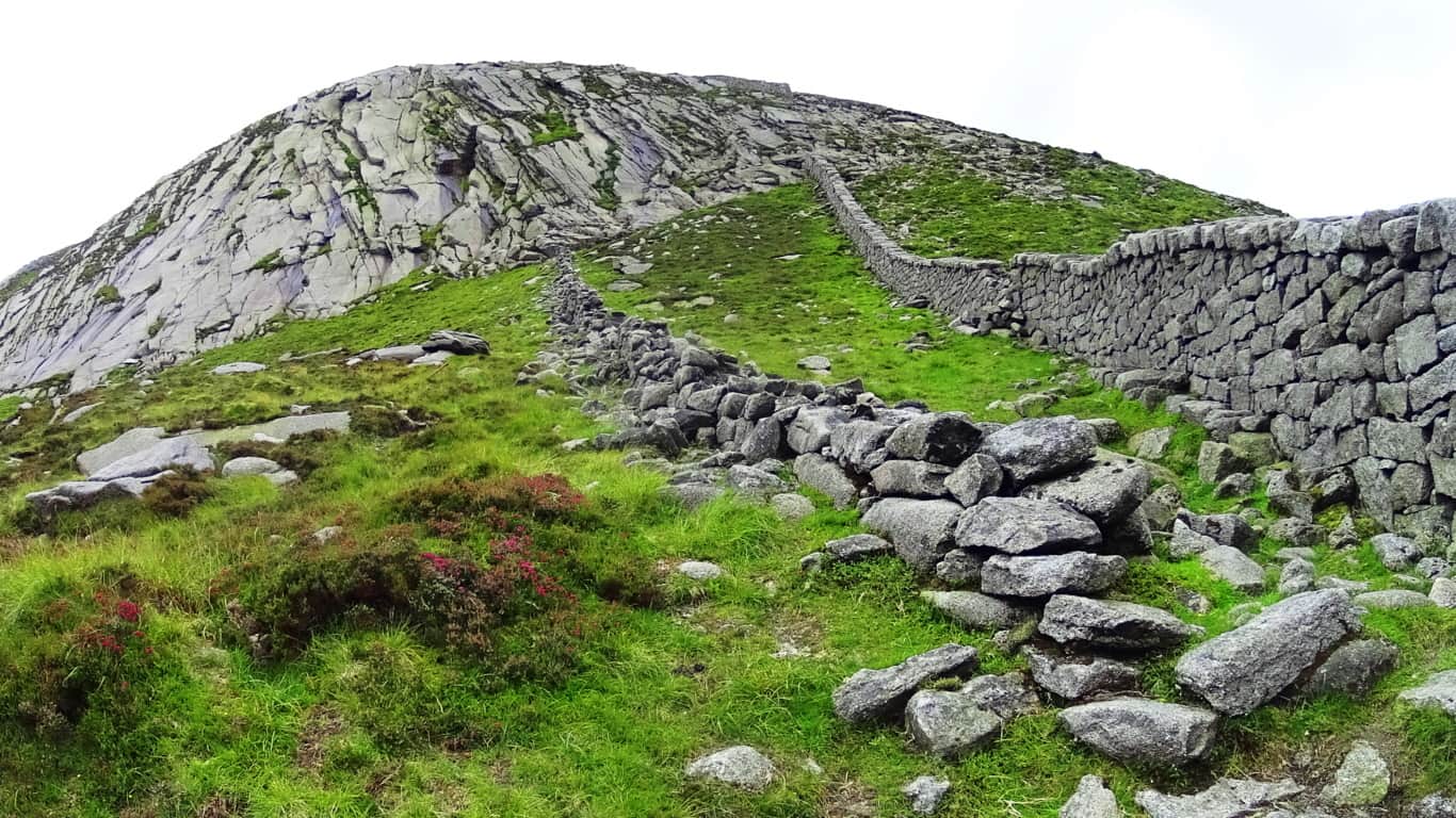
These are statements so massive, even with all our modern equipment and digital ability today, we would not be able to do it. To build this amount of intentionally et stones would take Billions, perhaps Trillions of dollars. Imagine the effort?! Are we actually saying that seasonally nomadic North-Eastern Native American tribes, with simple stone pics, spent literally all of their leisure time, when Spring finally came, after long, challenging, and sometimes brutal winters, working against gravity and logic, building “walls”, which literally impede nothing, and exhaust the warriors of the tribe with this work? No. It’s is a fantasy. It simply did not happen. And theorists espousing mis-information that Native Americans did do this, are dead wrong. 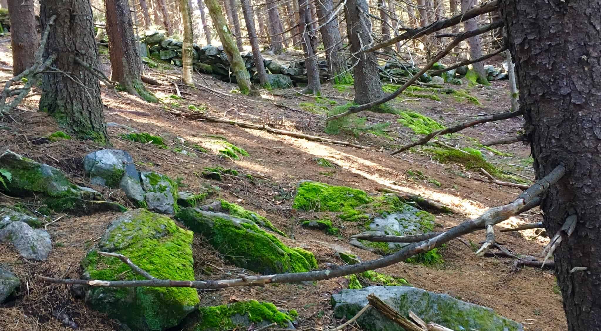
Peer-reviewed study after peer-reviewed study, identifies the seasonal and nomadic nature of Native American tribes in the Northeast. Building massive stone monuments would have been absolutely repugnant to them, and positively the best way for any harshly mandating chief, to get himself beheaded, or banished at best. Ordering the making of “stone walls” which impedes nothing, “walls” nothing, constructing straight up the sides of as many mountains as possible, is absurd in light of North East Native American Culture. It never happened. 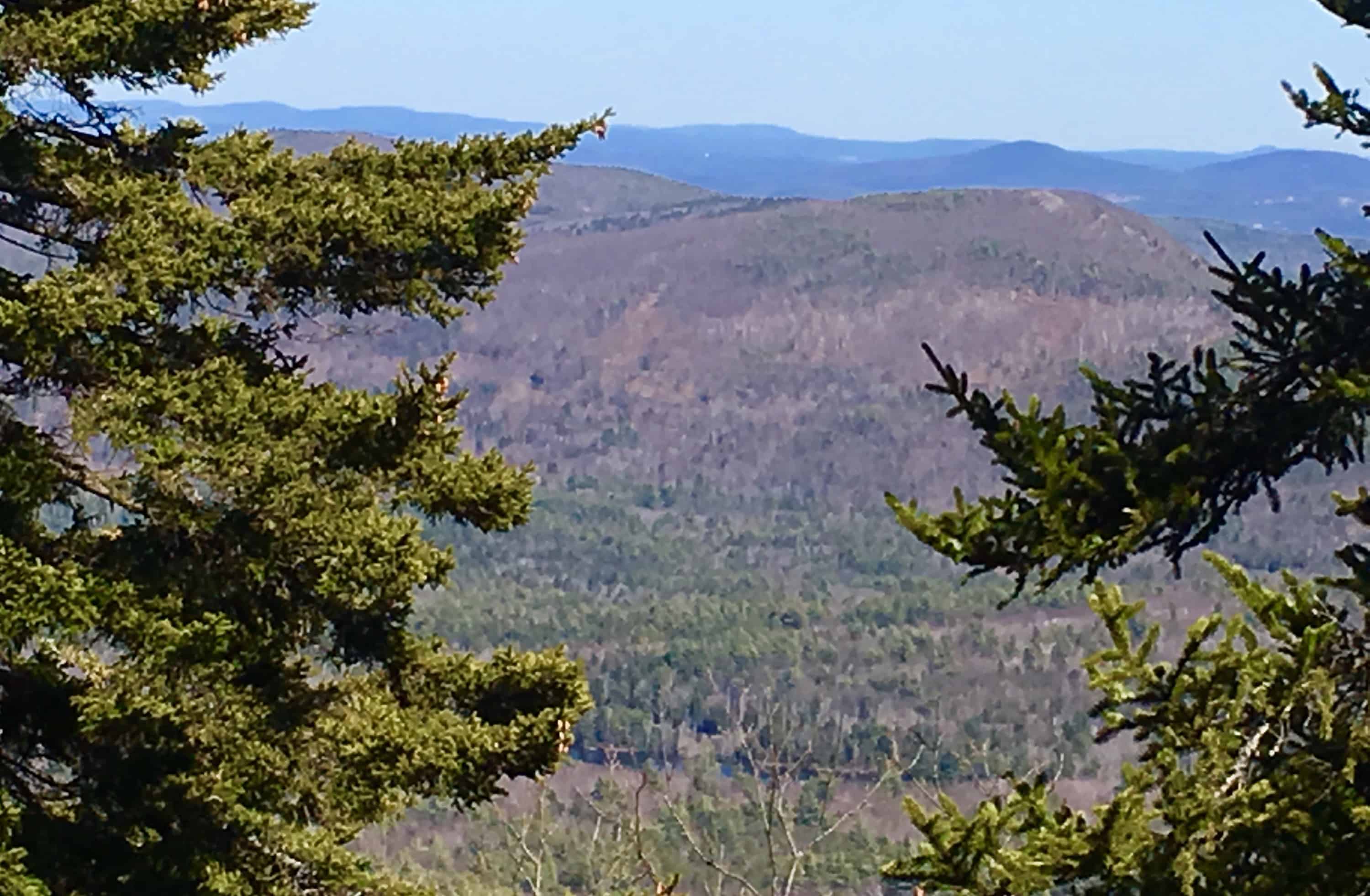
Native American Tribes were, and are, distinctly autonomous, proud, and often at odds with other tribes. If they were out in the forest, completely aloof, voluntarily slaving away, building these stone-“walls”, how could they plant crops, hunt, or be ready to defend themselves from invasive groups in the planting season? Please understand; this does not in any way disrespect the incredibly spiritual beauty, and accomplishments, of the Native American people.
Part of the reason we see them as beautiful, is due to their incredibly minimal, ecologically responsible, imprint upon the landscape. Their attitude was to be part of the landscape, and changing with the seasons; not to build stone-centers, which they would constantly need to defend, in all that permanence. Again, this simply did not happen.
Note4 Trail: Along the initial lower trail at Wapack’, a minor incline weaves into a pristine pathway that leads to a playful set of cascading streams, rolling down the hillsides. (Image/Below) 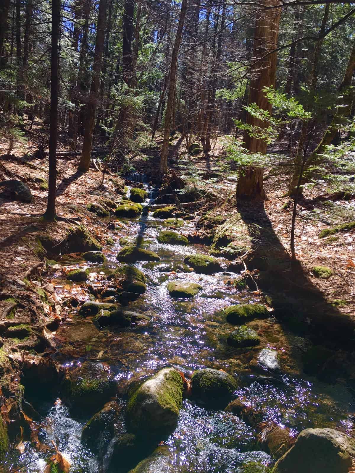
There are some really interesting patterns to the note about the pathway itself, as you begin your trek towards the peak. First, it becomes abundantly clear that the higher up in elevation you climb, the more stones you will find embedded into the trail. Secondly, those stones do not look randomly embedded at all. If you observe many of the stones at your feet, it is clear that they have been cut, like scraps from a carpenters table, and dropped into the ground. Thirdly, the trail itself, where the stones are laid, is wound into a specific ‘S’ shape. Why is the distinct area where the stones are found wound into a distinct ‘S’? Why not a straight line to the peak? If the trail was designed by the State, why not the fastest route to the peak. The trail was there before the state ever existed.
 Also, there are massive flat, distinctly oblong, rounded boulder, sitting centrally along the initial trail, radiating the effigy of a snake, winding its way through the woods.(Image/Right+Below) ‘Snake effigy’s’as studied by the excellent research of Matt Adams at New England’s Stones Sites , are currently being researched to be discovered, as an abundant Neolithic meme, found in the patterns of the stones.
Note4: It is impossible to lose the trail, due to the stones. It’s that clear. After passing the streams, you will come to a small ledge. You will need to climb for a moment. (Image/Below)
After working your way above the ledge, you have reached the upper shelf of the mountain. There is another half mile of steady, low-incline hiking, before reaching the real pearl of the experience, a plateau of semi-alpine Pine Forest. 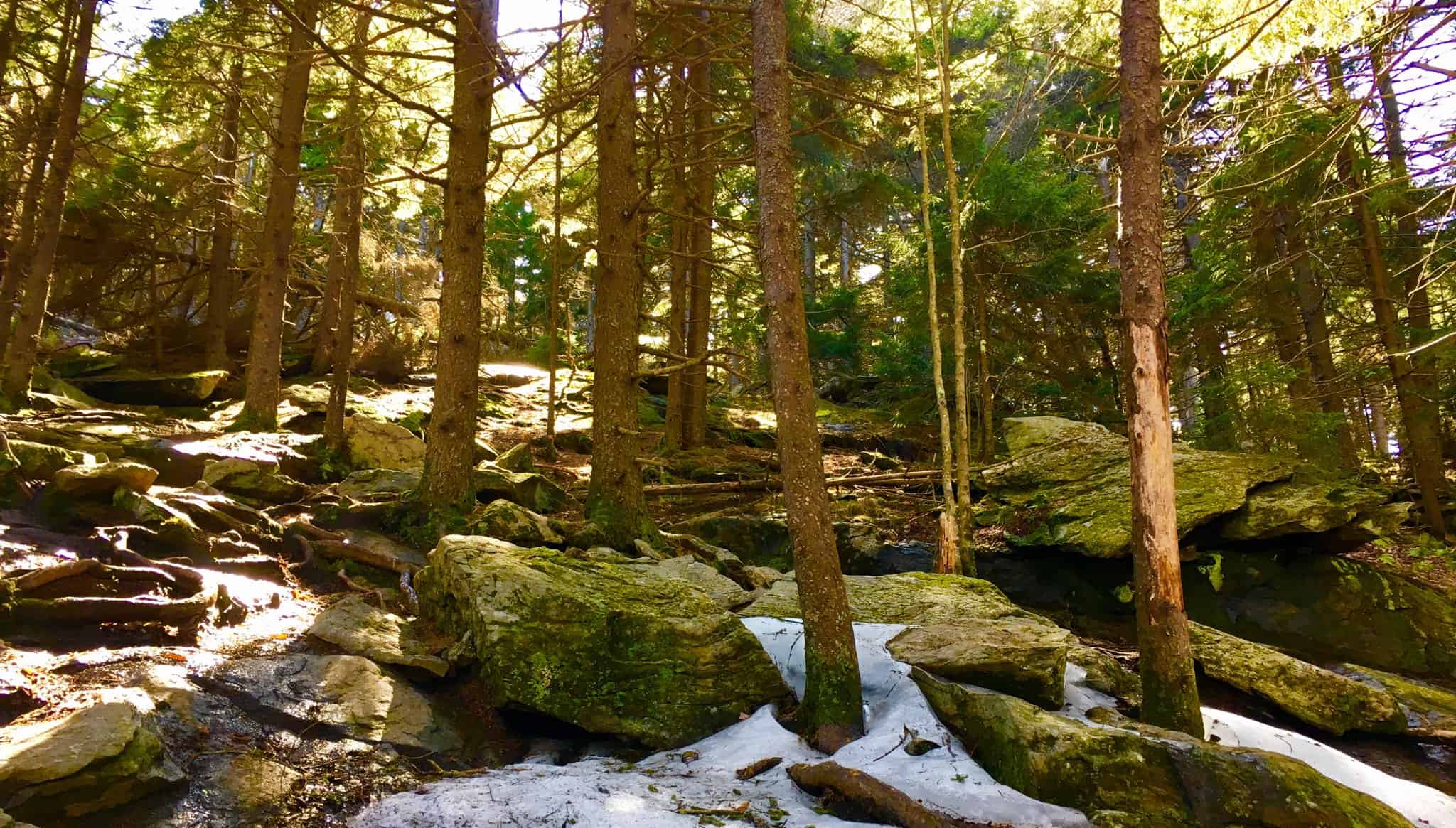
The natural late-afternoon light is tossed through the trees, like slanted pillars, made of light. The stones here tell some sort of story, like peices of a jigsaw puzzle, layed-out sporadically. (4 Images/Below) 
 There are cut-squared slabs, laid side by side, as if to hint at a relationship between the two. There is a full cross-section at the center of the trail, displayed at the rocky edge of the forest above. There are smaller fixtures, fixed perfectly against each other, and cut into apex’s which are also parallel. This is craftsmanship, not mere chance. In addition, the apex’s, or top corners, point directionally to the summit, along the line of the continued trail. That is directionality, and symmetry, as a function of the work of the stones. Another interesting statement of a clearly cut ‘apex-stone’ is found sitting along the trail of the upper forest’s edge (Image/Left) At the moment I found this stone, in mid early April, the Sun was at its highest point in the sky around 1:45. The apex was pointing straight at it. The connection of light to this very spot where I took the photo, created an issue for my camera; but clearly you can see the Sun’s rays, directly above this 4 foot stone, with a 45 degree angle, running parallel, up to an apex section. Perhaps I would not have noticed this if I were a common sojourner, but I have seen this phenomenon many times before, particularly at ancient sites in Western Massachusetts. The comparison to that site is lock-fit. Please compare the two. (Apex-stone at Health Altar Stones/Image/Below)
 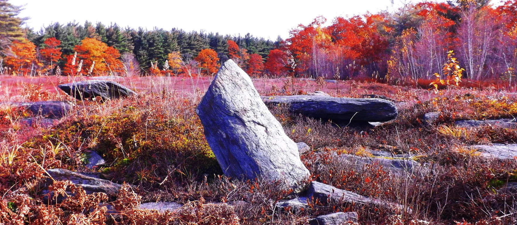 Other statements, such as directly cut cross-sections, are also found along the upper trail at Wapack’. The first two cross-sections below, the first located on Wapack trail, colored grey; and the second section, colored white, (pictured in a row on the left side below) are both from this Hillsborough Region of New Hampshire. The other sections are from Arizona, Killarney/ Ireland, and western Massachusetts.
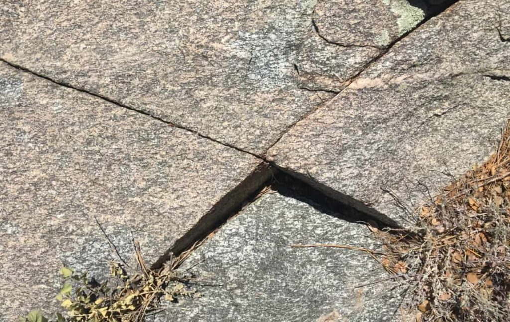
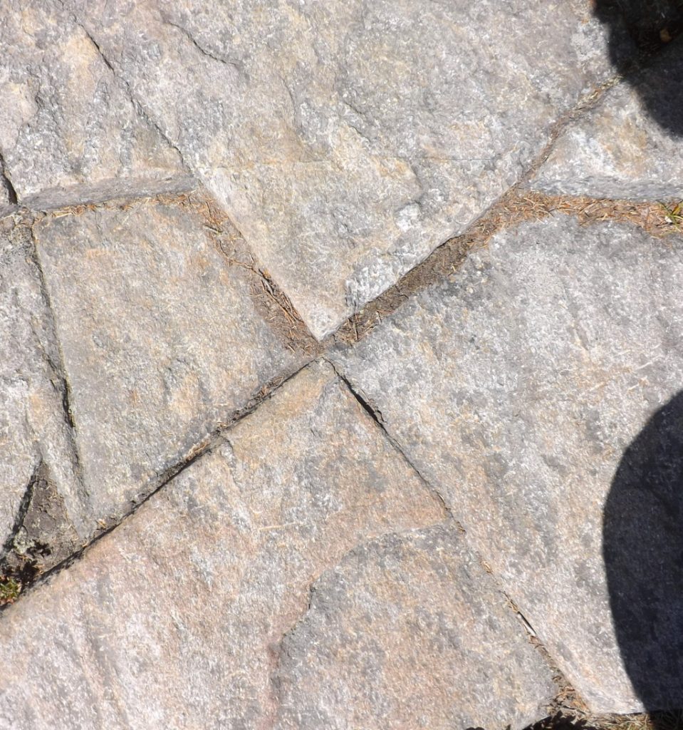
As consistent and mounting evidence continues to build for these X sections, it is becoming hard to dismiss as mere “geological phenomena“. The fact that all of these X sections are found specifically along mountain peak trails is a strong indicator for the idea of engineered landscapes, with distinct memes that identify a single Culture. The meaning of the cross-section is a philosophically mathematical principle, that can be written out, a little dynamic process.
Attributes of the Cross-Section: A cross-section is a centricator.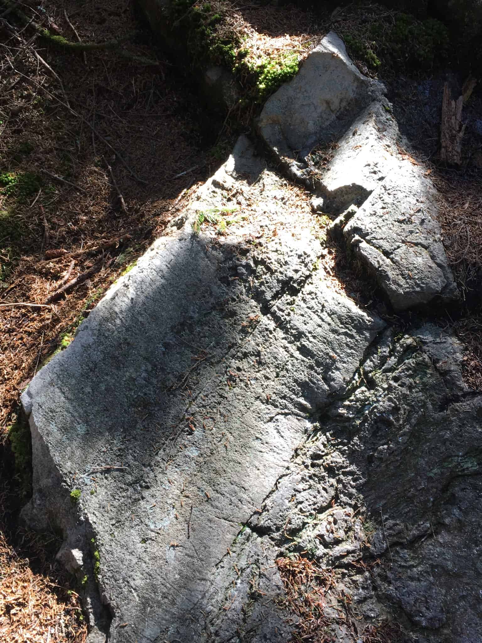 That means it creates a center, symmetry, and distinction, all at once. (Centricated Stone found in Wapack’ Forest/Image/Left)
The logic is: In order to make any starting mark, the mechanism that person’s mind must use, like a primordial computer program, is the function of centrication. You “find your center’, then make your mark”, so to speak. It is the precursor to all marked expression, just as the Culture that utilized it, and made this symbol their ‘calling card’, is the precursor to all Cultures; the First Culture. I believe that this is the exact reason why we find this particular meme, cut in stone, sometimes in nearly perfect precision, as you can see from the images.
Notes5: The upper forest is the last challenge before making the peak. There is a breeze that comes from the West, through the trees, that can be felt in early April, scented with Pine. Watching a multitude of pines bend in unison to the wind creates a sound impossible to imitate. The green universe literally activates a part of your brain associated with calm, just as blue is associated with cold, or cool.  The last path before the peak is a beautiful and distinct little rocky road, with the Sun within view. there are several stone patches with distinctions that again, have that jigsaw feeling. Some with distinctly cut right angles, (like a literal ‘Right-Angle tool’ of a mason), as well as standing-square blocks, with four clear-cut sides, with giant level-cut boulders in the background, along with the earlier mentioned, apex stone.
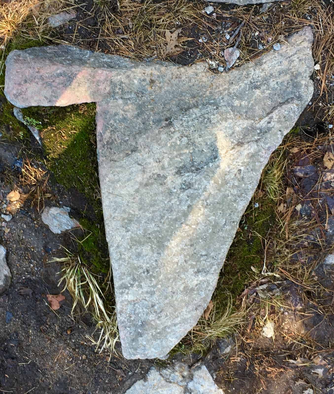
After a long winter of bad news, and now a stressful quarantine debate , all keeping us indoors too much this season, I may have been a bit more sensitive to the light, than usual for this climb. I was particularly struck by the force of the light of the Sun on this day; the silver and bluish hue pervading the subtle jade needles in the trees. The Sun seemed more like a small silver star looming just above my head. And of course, there it was, lined up centrally, with the small ‘rocky road’, directly above the peak. Only if the path were made of chocolate and pistachio would I have been more delighted by the possible meaning here.
 After about 100 yards, the peak appears like a doorway through the hedge. As you breach the trees there is a small cairn which looks to have been placed as an obvious marker of the peak. The odds are that it is neolithic in origin, and modern in additions.
  To the West is a view of Mt. Monadnock, the Senior-sister-Mountain to Wapack’. The distinct straightness of its sides can be distinguished, even from about 2o miles away. It is also inundated with neolithic statements, and reviewed here at Stonestrider.com. Connectivity.
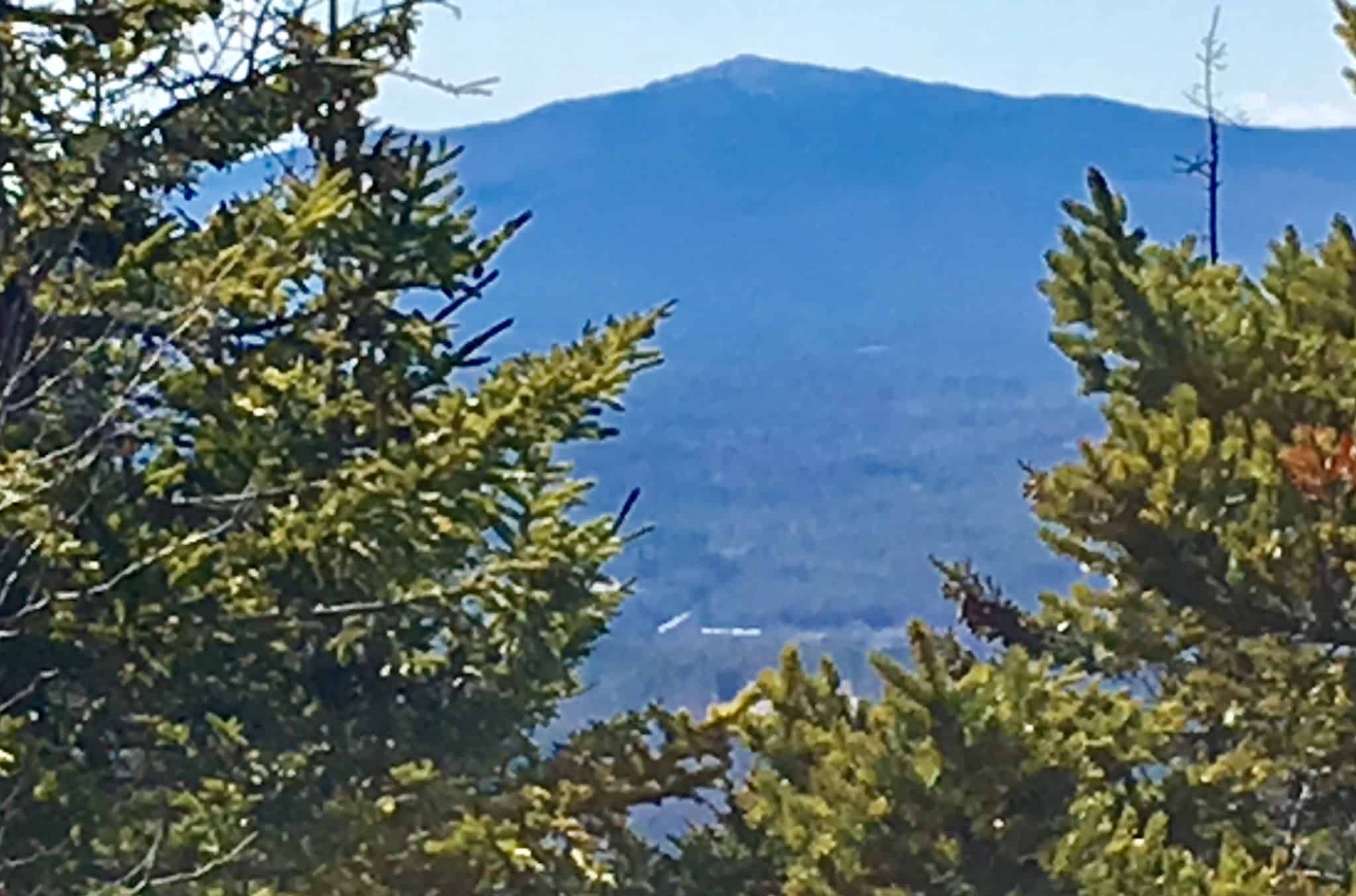 Wapack is a sacred trail, by all of the standards of this mountaineer. It as a 2,200 foot climb, and fun. There is so much to discover in New Hampshire Hills, and New England. On the way back down I sat and watched the valley below, undulating subtly. I tried to remind myself that what is going on down there, is not of my doing, and never could be.
 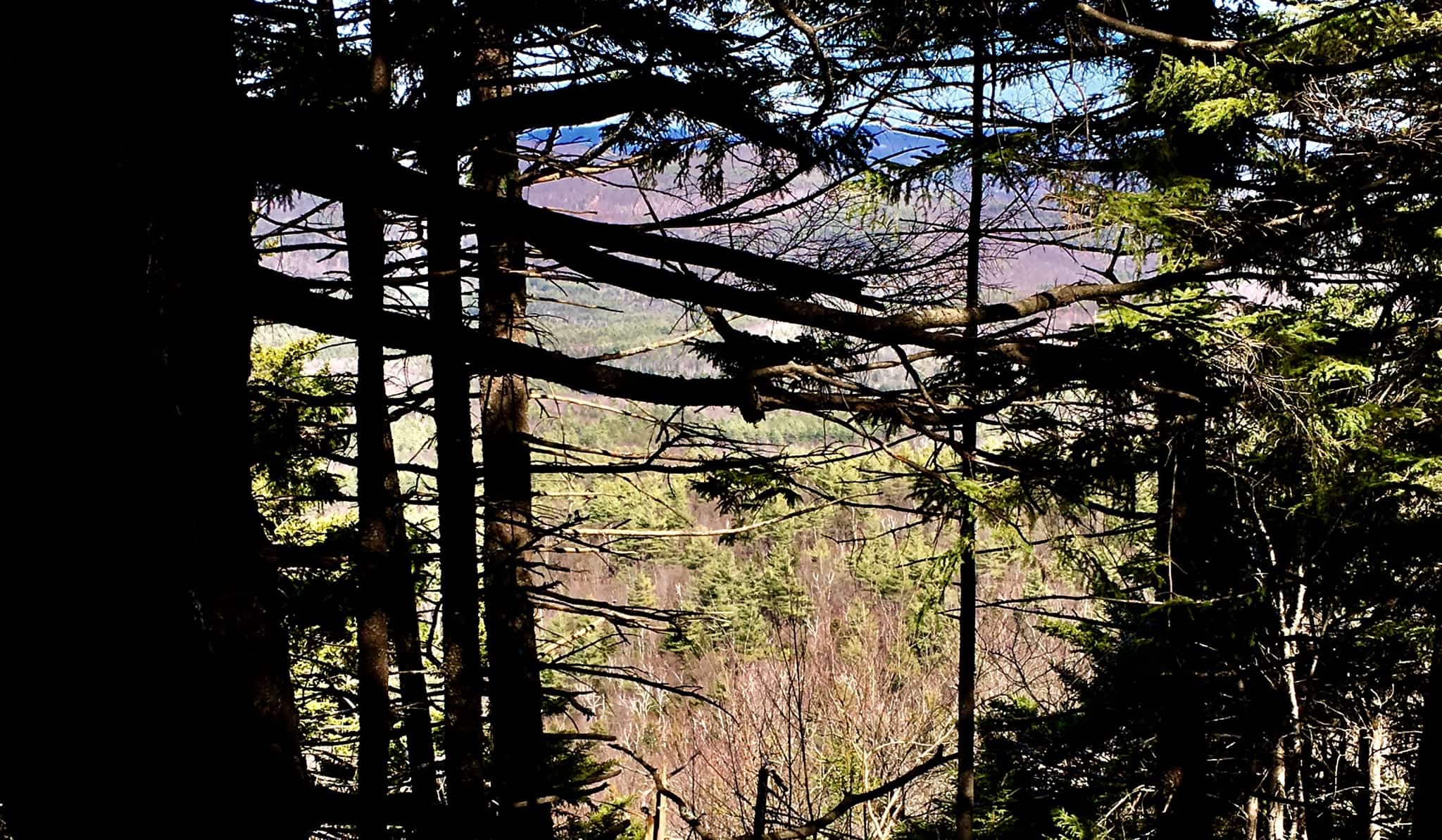 To readers across the globe, may you find health, wellness, and plenty of sunlight, in the days ahead. Thanks for reading.
The White Mountains
 Location: New Hampshire/USA
Elevation: 2000-5000 feet
Note: I have wandered into countless forests, to find mysteries that date back to the beginning of time. I never expected to find anything of the sort, just trees and hedge, mingling with the moonrise. At certain times in my life, that would’ve been reason enough to dissipate into the hills with my cameras. I have been that individual, in the far away distance, in one moment, an acknowledging speck in the distant glances of happy travelers from the valley down below, and in the next moment, vanished.
Once I began to see the legitimacy of what is clearly an oppressed anthropological Culture in the woodsy places of the world, I simply couldn’t tell people fast enough. But as I began to inform people, friends and family, I realized that I was actually performing a new type of vanishing. This vanishing was related to the idea of who I used to be, what I used to say and think. I have one friend, in particular, who, when I would point out some fixture in the stones, would say to me: “It can’t just be beautiful can it? It has to be something… more?” Well, I‘m here today, to say to the entire world, in my least vanished state, that yes, sometimes, if you are truly lucky, it can just be beautiful.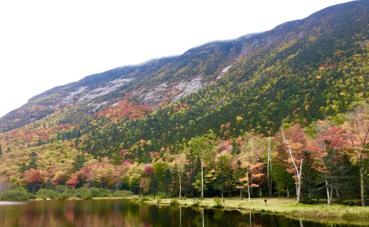
Just look at The White Mountains.
I have travelled many times to the White Mountains intent on the discovery of The Megalithic Culture. In truth, Mount Chocorua, Mount Washington, and more than a half-dozen more of the mingling granite peaks here, in the heart of New Hampshire, hold world-class evidence. But on this excursion, in the Autumn of 2019, although I knew they were certainly there, I would not allow myself to see a single rolling stone. This is the time for trees.
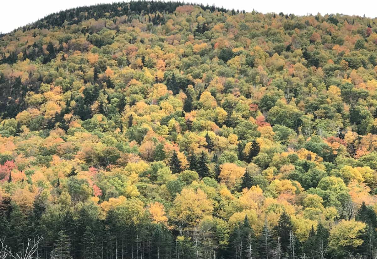
Autumn in New England is a rolling tapestry of trees, an impressionism in real-time, an ocean of foliage. The Mountains roll like stilled tsunamis, continual colors into continual colors, until the sky contrasts the distance. The backdrop of blue, when the Sun is in the sky, fills the scene with brightened colors, deeper shadows, and depth. When a grey mist rolls over the peaks, the shadows seem to vanish, and the colors become slightly more miraculous, against the grey. Ingesting scenes like this somehow creates a mechanism in the heart for turning natural miasmas into rather simple suggestions; like the idea that there is an infinity of everything, spanning in all directions, over the one majestic scene. A true understanding of Nature, that humans are created with a literal connectivity to the lessons of the landscape, becomes clearer in scenes like this. The beauty of the moment is enhanced by the knowledge that it is soon to pass. It underscores the very nature of our lives. To spend time in a space like this is in fact to come many steps closer to what it would be like to wander freely among the stars, blazing against the backdrop of an infinite blackness by the starry billions, and long after you are gone.
Note 2: Mount Pemigewasset Trail/Franconia Notch State Park/NH
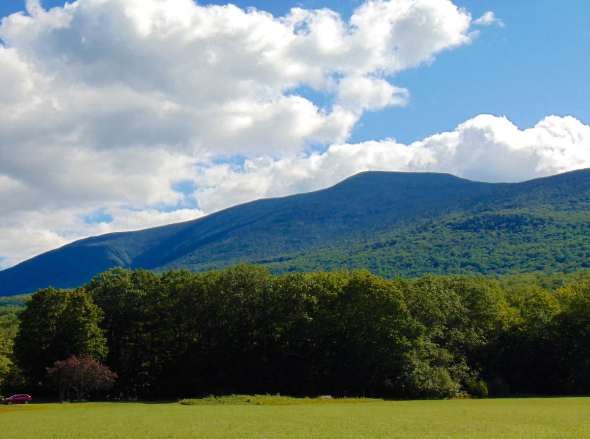
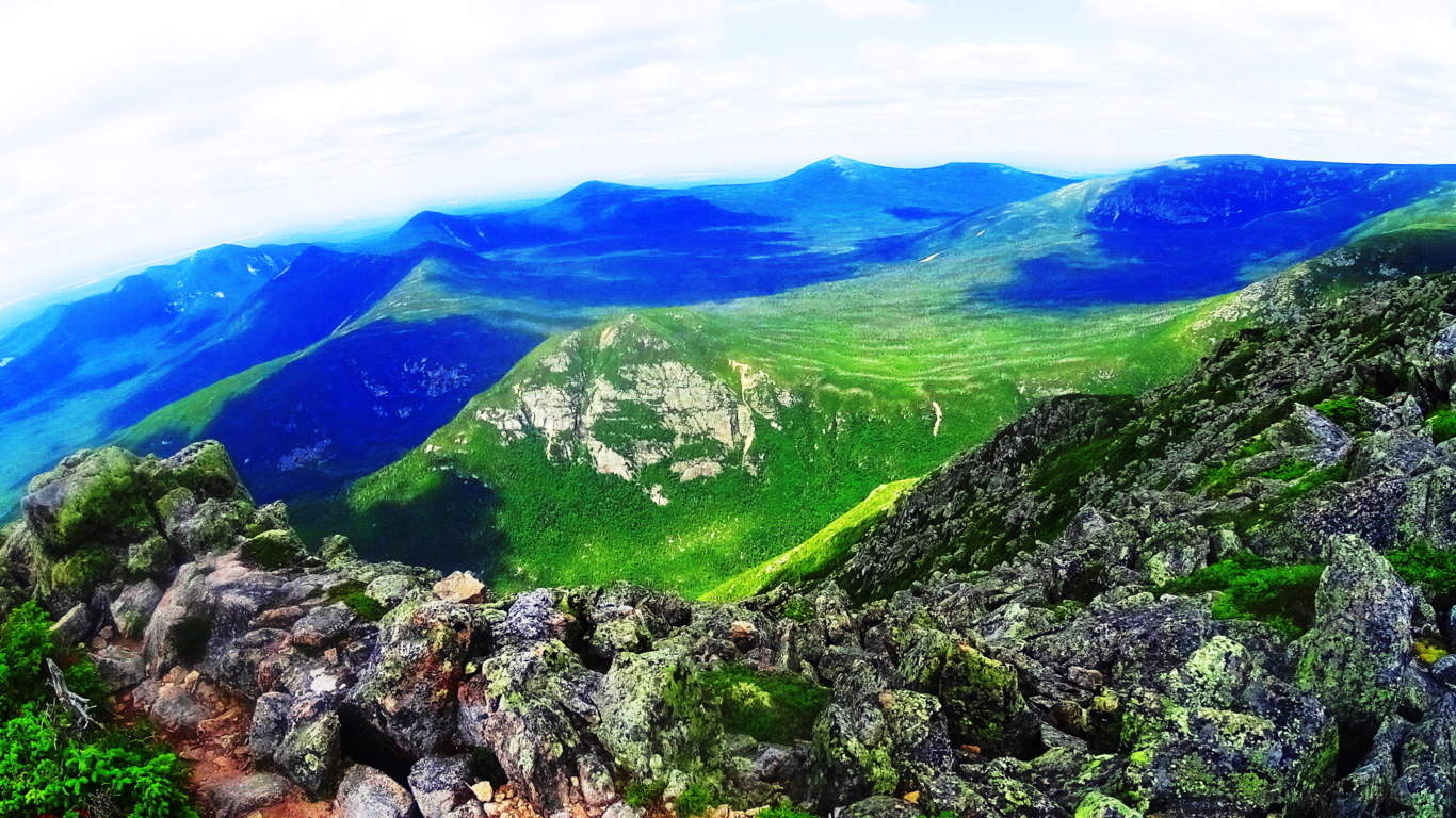
The White Mountains sit at the central heart of the State of New Hampshire. It would be a good guess that the State itself established its original boarders in order to encapsulate this Mountain Range gem. To the West is Vermont, and the beauty of the Green Mountain Range, running throughout. To the Northeast is the massive State of Maine, where Mount Katahdin looms in awe inspiring autonomy, like a section of the Rocky Mountains of Colorado. (Image/Below)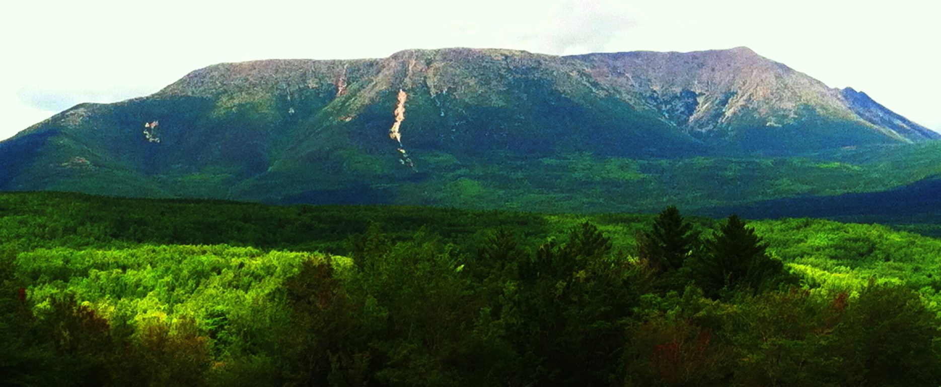
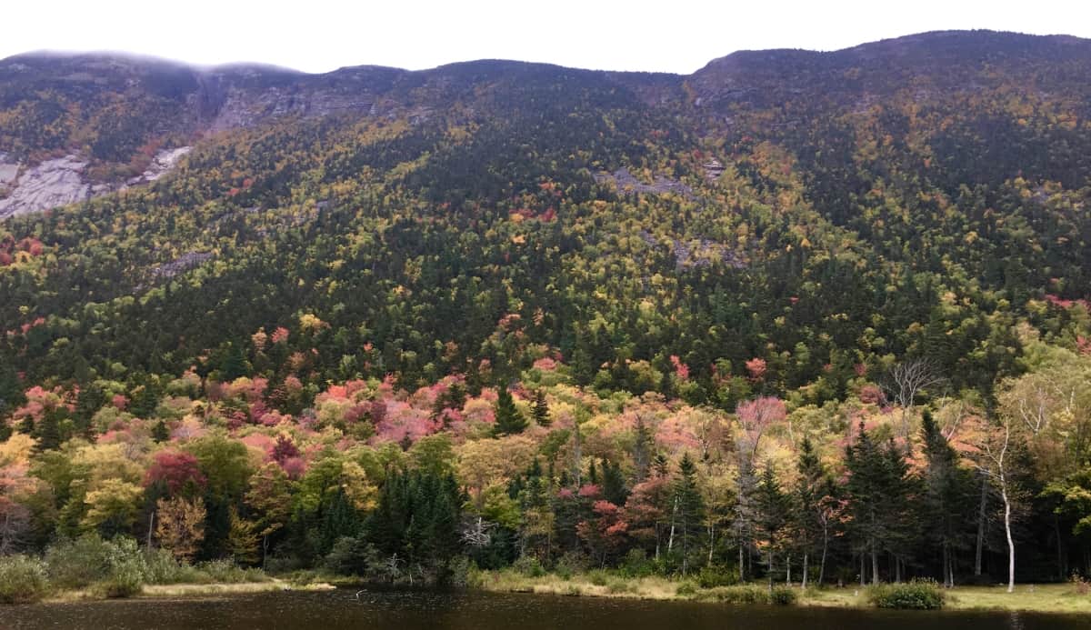
The main highway that runs straight into the White Mountains is Route 93. One of the most popular and beautiful stretches of road in all of New England in Autumn. Make the choice to drive route 93 through the southern portion of the White Mountain Range, and connect to Route 302, which makes an incredibly visceral swing to the East, through the gorgeous White Mountain passes. Just like any of the Celtic Ranges abroad, this region offers excursions into National Parks, Waterfalls, Lakes, and photogenic stretches of valley, all along the main highways. Due to the amount of incredible choices for hiking, as well as its proximity as a gateway to the central Range along Route 93, Franconia Notch State Park was chosen for this Review. Trail choices here include Flume Gorge (easy), Mount Pemigewasset (medium), Little Haystack Falls (hard), and many more. A Ranger on site recommended the stellar view of Mount Pemigewasset Trail (Image/Below), which is achieved by a moderate hiking experience through absolutely classic New England forestry, with very few rocky formations along the way, for a change.
The trail begins on the north side of the Franconia Notch Parking lot. This is an active scene in Autumn, with cars piled along the side of the highway due to the amount of hikers intent on capturing the views of the region. There is a central lodge with a cafeteria, and information center for guided tours into the Mountains. A sign marks the trail for Mount Pemigewasset, along with a distance description of 1.5 miles to the peak. This measure is significantly off. Understand that it is about 2.1miles to the gorgeous peak at Mount Pemigewasset, obviously making the total hiking experience about 4.2 miles. This hike begins beneath a small picturesque bridge which passes beneath a bustling Route 93. 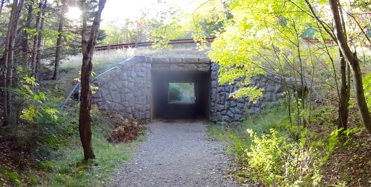 If anything, this bustling is an indicator of exactly what it is you are hoping to get some distance from. Drifting into these Woods is a sonorous escape, where the sound of sifting leaves slowly overcomes the constant murmur of automotive assertion taking place down below. As you slowly climb, the woods whisper over a wide clear path, with roots, rocks, and golden-red leaves. This is a gorgeous forest, on par with the Black Forest of Germany, and beauty of the Scottish Pines in Glen Coe.
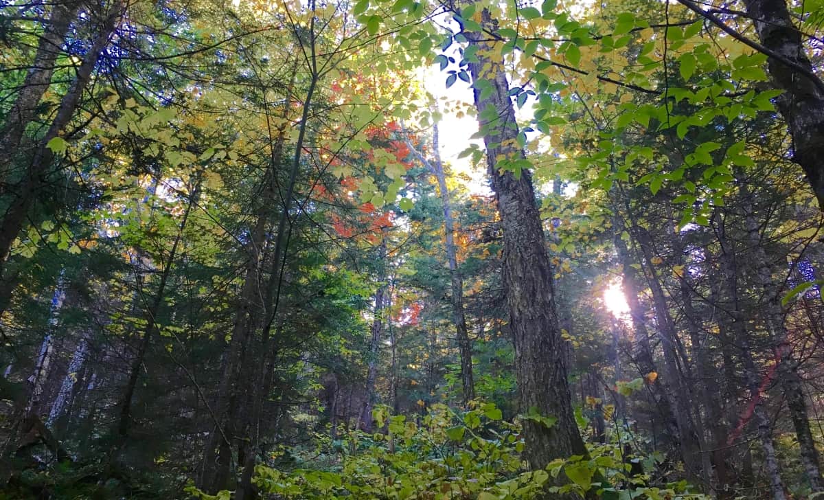
There are no variations on Pemigewasset Trail. You follow the clear rocky path, inundated with gold and rouge. The stones do seem deliberate, but this is not that type of Trail. This is a place to admire the raw and massive force that a New England forest can be, a venerable wonderland of the greatest depth, and degree of beauty. 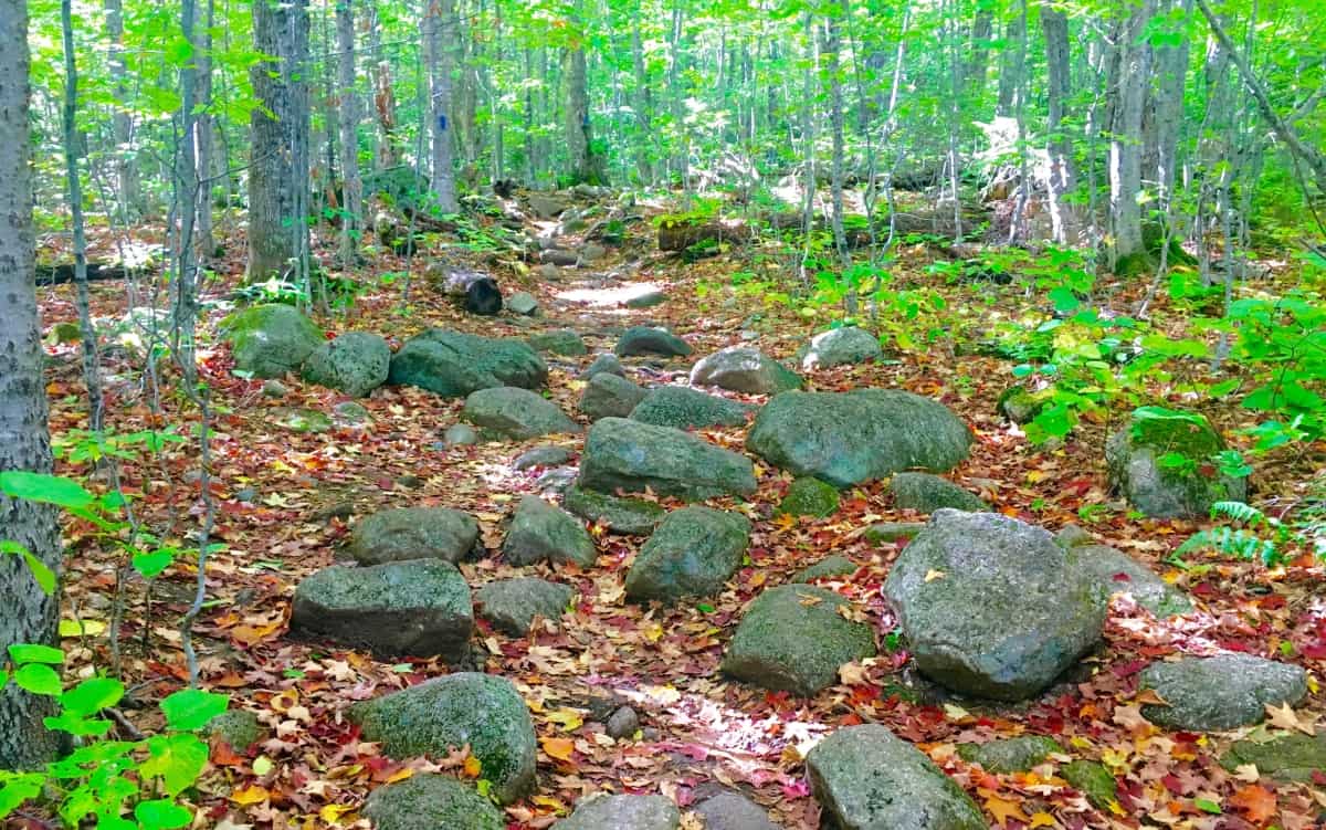 As the incline of the Trail continues the glades begin to change. Families of Birches emerge to greet you at about 2000 feet. Even while hiking in the elevated forests of Wyoming, for example, you might unexpectedly wander into a vast family of Birch trees. They simply pop-up wherever they wish, offering a gorgeous glimpse at the often whimsical mentality of trees; something that many of us just don’t consider in our constant ‘problem-solving state’ of ‘corporate function’, and bullshit. The beauty of where glades decide to grow is a marvel made specifically for hikers to ponder, and has a magic all its own, especially when walking through the miniature white pillars of a plentiful Birch boardwalk, closer to the clouds than the clamoring cars below.
  If you reach these Birches you know you are close to one the prettiest small-Mountain views in all of New Hampshire. As you pass through a narrow corridor of small trees, the vista emerges before you. Take your time breaking through, and prepare to receive your reward.
  This is a once in a lifetime scene. For those just visiting New England, it may be the only time they see such a vision. This is vista that offers a glimpse of the southerly course leading across New Hampshire back into Massachusetts. The multiplicity of the colors can be disorienting, so do not stand too close to the edge at first, and don’t take selfies near the ledge as well. At the Grand Canyon last year, many people died due to this tendency to ignore the significance of the ledge while leaning-back for their photos. Sit down with your friends, and loved ones, then take the pictures. There is a little bit of forever in the foliage here, sitting down is a small price to ask.
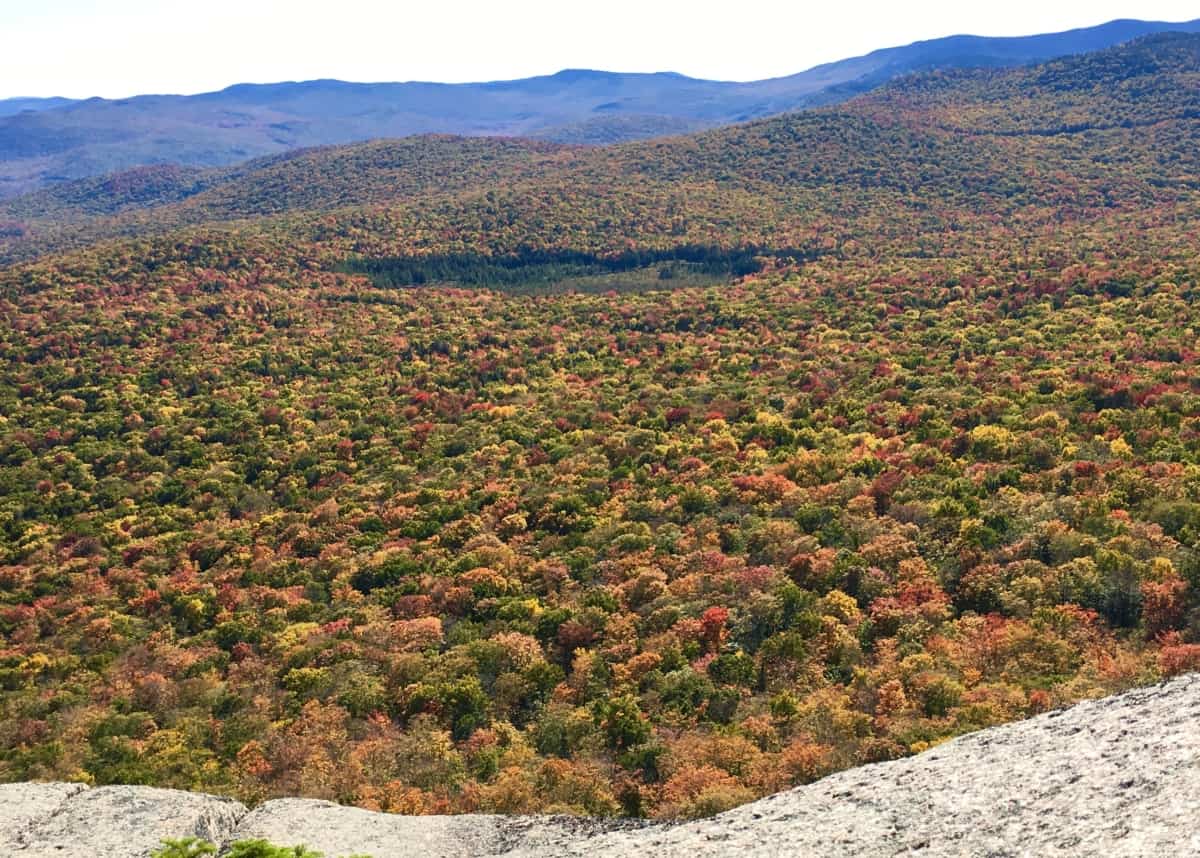 To the West is a view along the edge of the Forest, revealing the edge of the immediate Valley. Somehow, it feels as if you could leap down into the softness of the tree-tops, and bounce out of view in just a few bounds. The scene is that surreal. The stony top-platform feels like a fortress beneath your feet, as the contrast of the soft foliage drifts off over the Valley, and through the woods.
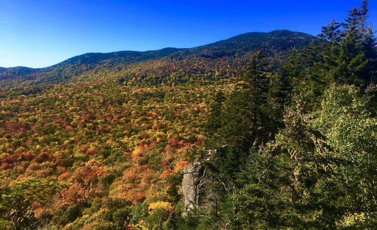 The way back down is doubly easy, as it always is. When you finally arrive back to your car, having seen the foliage, continue onward to the North, up Route 93 to Rt 302, and follow. This is one of the most wonderful drives in all of North America, winding through the Passes of the White Mountains, where hundreds of Waterfalls lay hidden, while some roll down completely open to the road. Silver Cascade Falls is just such an open view along Route 302. (Image/Below)
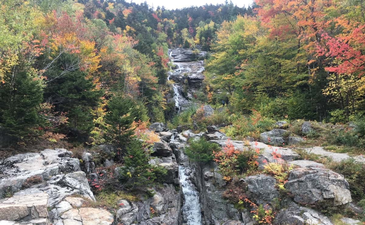 The White Mountains have a blessed status among Ranges; They blush before sleeping, as the Winter sets in and the trees let go. Let it be a lesson to all of us, that all of our growth, and gain, and loss, will one day hang loose, and simply let go. For those who become sad at the notion of this, just remember that the universe of colors for the following year to come, has already been coded. This code, of course, is unable to be seen, but you better believe is more permanent, than even the White Mountain stone. Get into it, and good luck as you go.
Mount Wachusett State Reservation
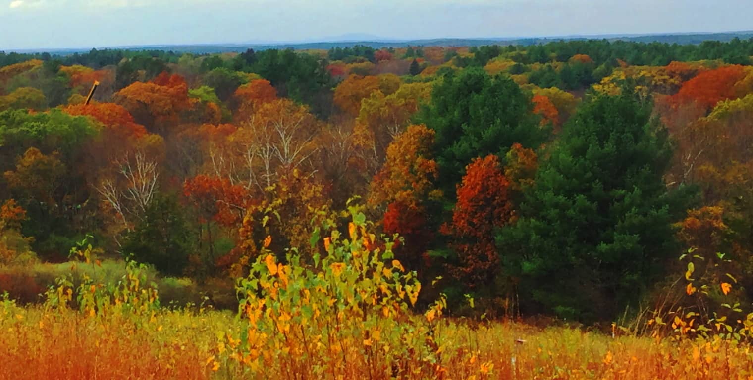
Location: Princeton/ Massachusetts/USA
Elevation: 2006ft
Prominence: 998ft
Note: The small mountains of Massachusetts are a cozy set of elevations that generally rise to about 1700 feet. This description isn’t exactly awe inspiring. One thing that is awe inspiring and of the most pinnacle quality, among these small ranges, are the ecosystems, the fauna, the rivers, the trees, and the soil. This is similar to the reputation of the ancient British heartland, Wessex, where Danes and Saxons carried out brutal campaigns to possess the nutrient rich soil. The Viking homelands of Denmark and Norway were at an extreme agricultural disadvantage, with a majority of un-plantable mountain faces and temperatures too cool and damp to create any consistent crop. Also take a look, for example, at Irish grounds; the grass is often brackish, and inundated with stone. In less modern periods, you could spend your entire life trying to clear a set of Irish fields to produce a crop, and still lack success. Imagine an Irish farmer’s response to the soil in the ‘New World’. In most of New England the soil runs consistent and deep, soft and rich, producing beautiful crops. The image above is a long glance at the beautiful Wachusett Valley, in Massachusetts, in Fall. This multicolored Valley runs from Concord all the way to Princeton Massachusetts, to Wachusett Mountain itself, with many towns between. The Mountain is just barely to be seen in the image above, at the back-center, a shadowy statement against the horizon. It’s just an amazingly beautiful place in Autumn. And just like in Old Europe, any tribe passing through this region would want to stay.  Some History: For this land, Natives fought other Natives. Then Natives fought the Colonials for this land. Then Colonials fought the British for this land. Seems like everyone agrees, this land is a good place to be. A hike up Wachusett Mountain (Image/Above) is an opportunity to feel this regions beauty and value. After recognizing all this, there is yet one more culture that seems to have been here, before anyone else. There are mysterious megalithic signs in the landscape, and yet this earliest Era is never discussed in New England. This is an Era most of us just don’t really consider. Our undergraduate textbooks usually begin with the Greeks, progressing to the Romans, to the Medieval, the Renaissance, Colonialism, and finally the Industrial Revolution; but our classes really never offered information about pre-Grecian cultures, and more importantly, the implications of these unresolved mysteries. The Egyptians had roughly 30 Dynasties over the course of a thousand years, and built the most perfect megaliths the world has ever known (to-date engineers still cannot replicate them) yet the implications of Egyptian mysteries were never discussed in our western classrooms. Why? To keep them obscure; to relegate that portion of history into “conspiracy theory”, rather than part of our overall discussion. The one thing that Western academia couldn’t do is hide the megaliths and the dramatic statements that remain in the granite. The woods at Wachusett State Forest are not unassuming at all; the megaliths here, in several different ways, are trying to tell us something. But first, lets wander in.
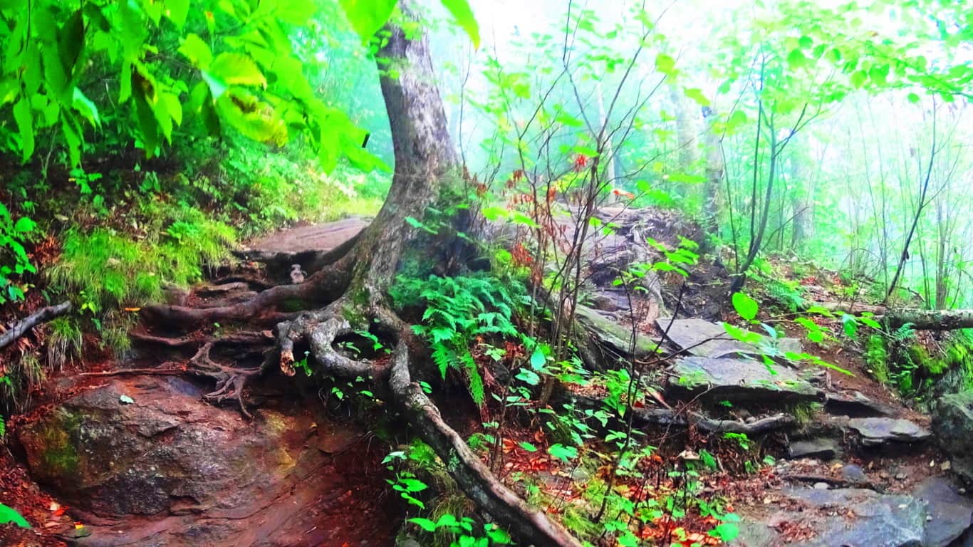
Trails: To arrive at Wachusett Mountain State Reservation in central Massachusetts simply take Route 2 West, which runs across the entire State. Connect to Route 140 South, and drive just for a few minutes. Turn onto Mountain Road into the Reserve, where you will see the sign for the Trailhead parking. There are essentially 8 trails here. Most popular are the “Mountain Loop”, which almost circumambulates the Mountain in an 5.8 mile hike with solid views; “West Side Trail”, a moderate 2.8 mile loop featuring paths strewn with wildflowers, and classic 400 year old forest groves; and “Summit Loop”, a 4.9 mile stretch that includes a serious effort to the peak gaining roughly 1000 feet for the best view of the region. After achieving the peak, the trail will take you down to a full New England Dolmen which sits in the forest (quixotically named: “Balance Rock”)
Featured Trail: “Summit Loop Trail”/Upper trail: This is the most popular trail at Wachusett. The lower trail is a stony path with curious patterns in the rock. It legitimately looks as if the stones here have been hewn into a criss-cross pattern, like a quilt. The stones are distinct, separate, pieces laid in parallel sections. (Image/Below) I just can’t understand how an of this could be considered natural. In one swift diagnostic you can see the math in the stones.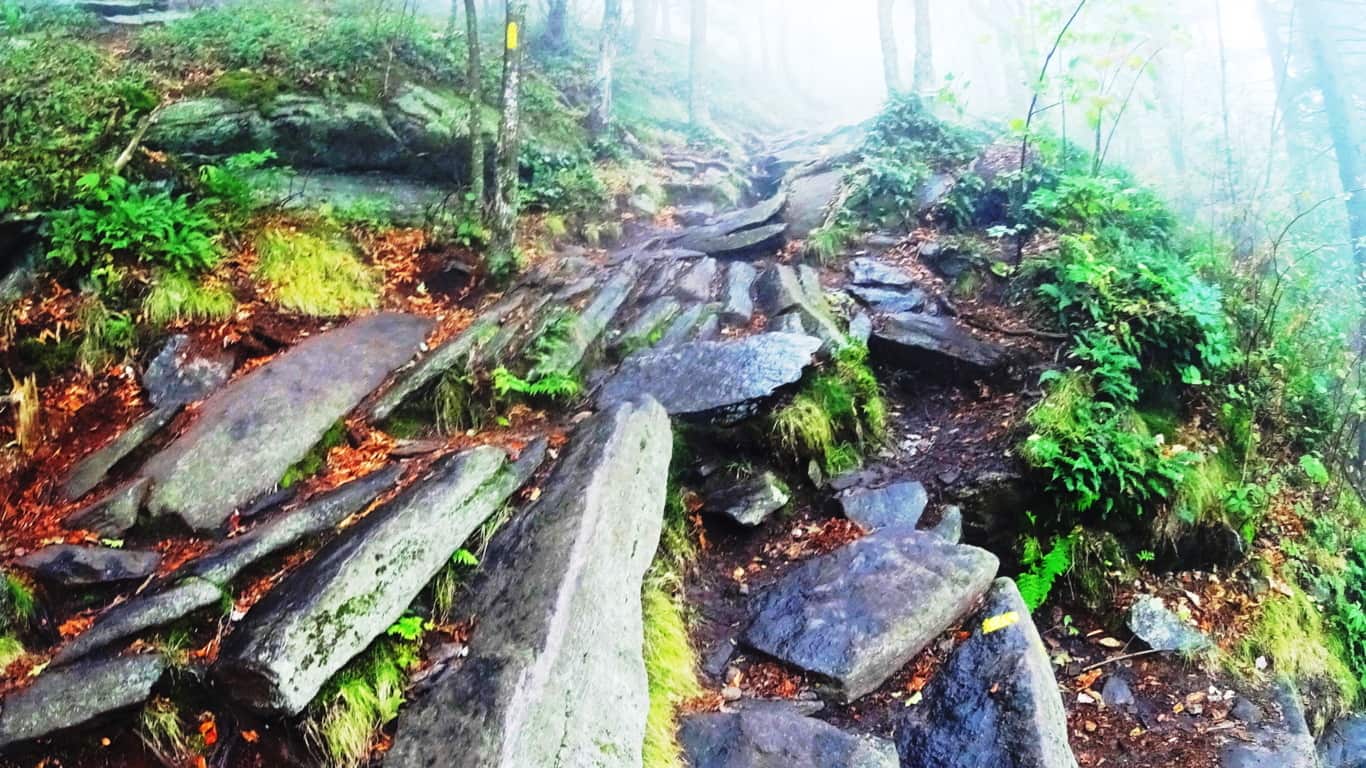 As the path rises, it then changes. A different set of large, individuated, flat plates of rock emerge in a spotty but specifically patterned line up the trail. How could the lower path set be so distinctly different from the one just 100 feet further up? And look at the distribution of the stones; each plate is essentially equal in size and spacing on this second path. Very strange. (Image/Below) Native Americans of this region considered these trails sacred, serving as miniature highways through the mountains. They must have seen the strange distinctions in these stones and considered the place enchanted in some way. Wachusett indeed was considered a holy place by the ancient tribes of the area.
 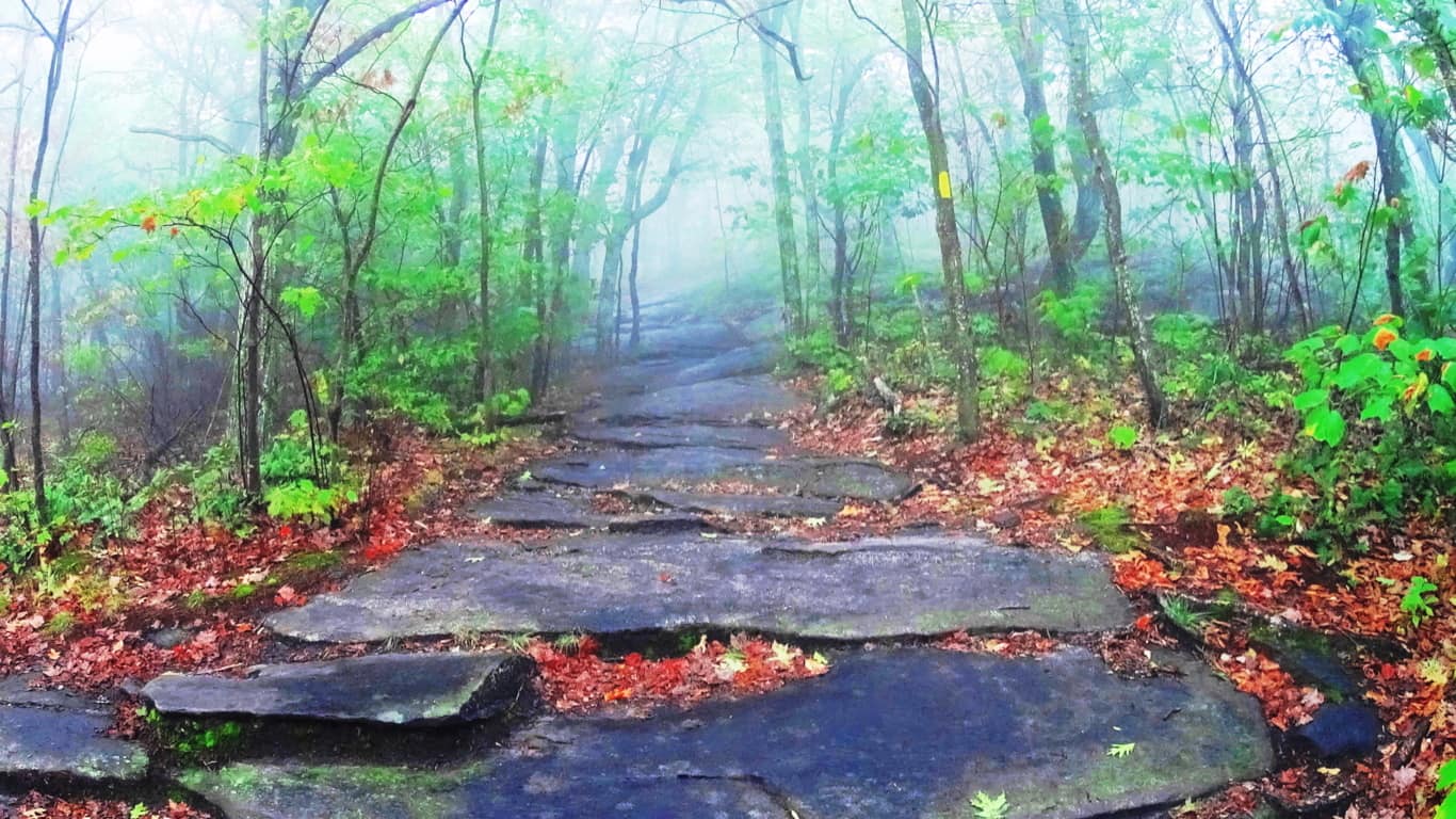 On a misty day such as this, these pathways are like woodsy tunnels. There is a strange comfort in the distinctness of the path that rises before you through the fog. Here is yet a third trail with a unique style of a singular layer of stone spread like butter, evenly, just before the upper clearing. (Image/Below) This a third style of stone along the same path within a thousand feet.How can we not notice this?
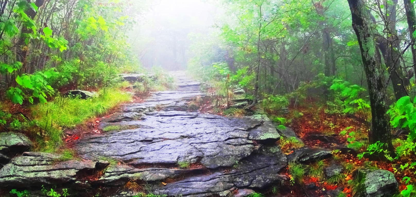 No one is expected to concede to the idea of an ancient culture that could hew massive mountain stones into patterns and structures, and yet, ancient cultures are seemingly beckoning us to accept that very thing. Although it is not written in our textbooks, megalithic craftsmanship is in the antiquity of literally every nation. Russia, Peru, France, Italy, Ireland, China, America, England, Scotland, Greece, Turkey, Korea, Indonesia, Australia, Mexico, and many, many, more. Just google any of these nations, along with the term ‘megaliths’, and hundreds of variations of examples from forests and mountains worldwide will appear, most of them very hard to explain. You will begin to realize that the trail you are on is most likely a sacred one, one that sponsored megalithic culture, with several incredible supporting statements. And if you visit several sacred trails over time, you will see the pattern of those trademarks. One such trademark appeared embedded in the lower rock face of the mountain here, an “X” section. (Image/Below) Now, taken on its own, this could be dismissed as a singular fracture in the granite. But these “X” sections have a way of popping up all over New England. Here is another one at “Monument Mountain”, a sacred mountain to the west of here…(Image/Below/Left) This colossal “X” section is also located about 100 yards from a beautifully cut Standing Stone. (image/right) This is no accident.
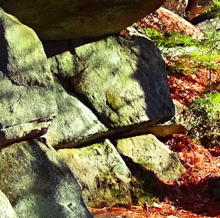
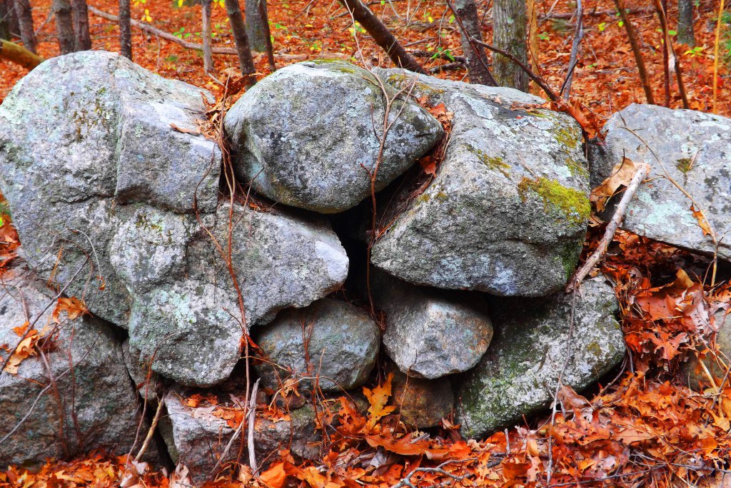
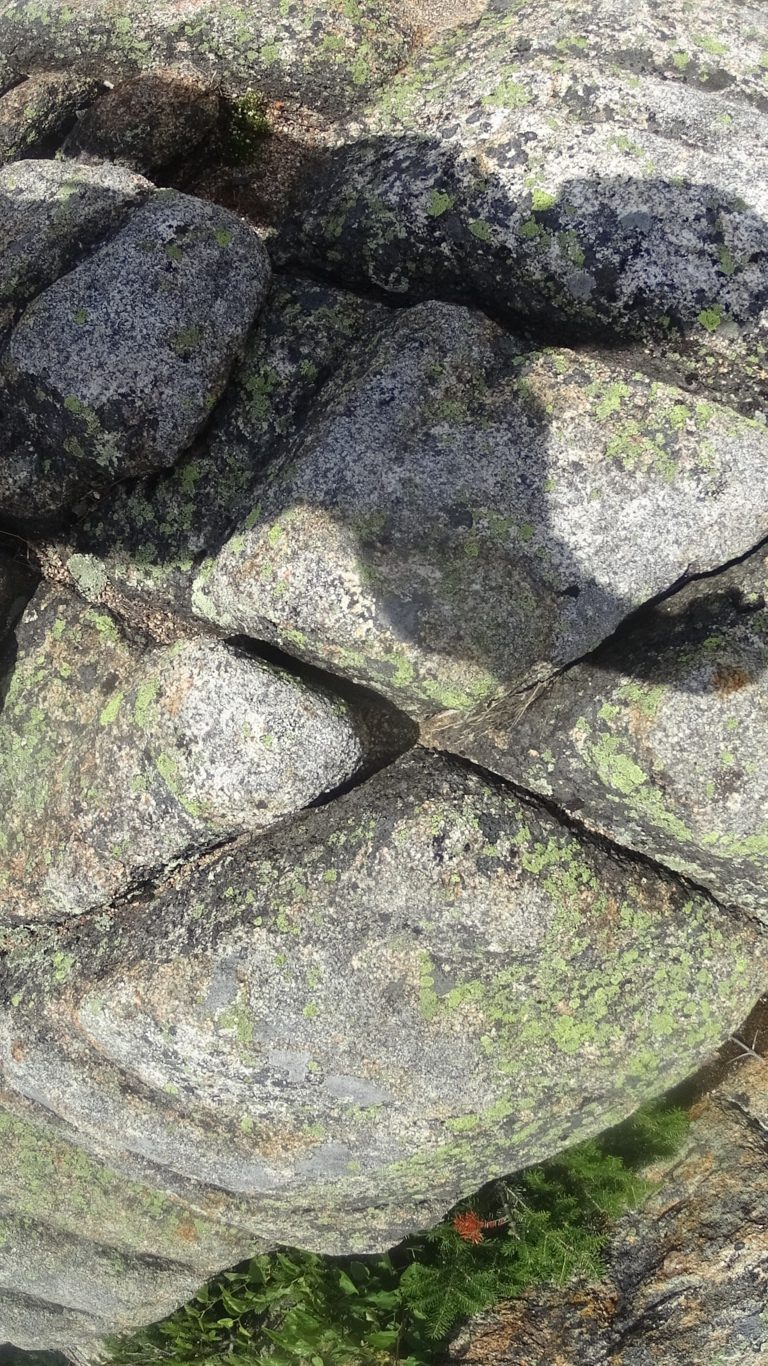
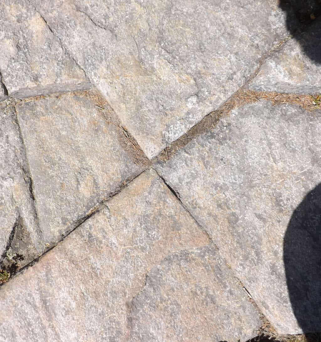
The two “X: sections just above, one located at the sacred Mountain of Monadnock/New Hampshire/USA (Left), and the other literally hewed into one of the the stone linings at Monument Mountain/Massachusetts/USA (Image/Above/Right), reveal varying levels of intensity, but are clearly crafted. It is as if the tool used to create these markings was of intense and focused heat that hewed the rock in exact ways. It clearly was not chiseled into the stone.
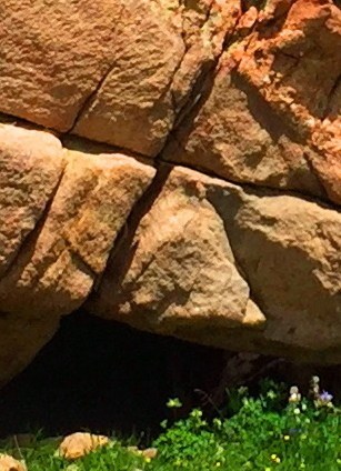 Take a look a this massive “X” section on the left; it is located near the peak of Mount Clark in Colorado/USA. This “X” section is located on a 40 ton boulder sitting just 30 yards from a large Standing Stone (Image/Below), legitimizing the anthropology of the entire scene.
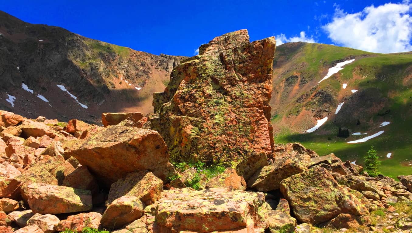
As I have written many times over the years, it seems that the “X” sections are type of logo that signifies a sacred zone. It is no accident that they are most often found near the peaks of mountains that were considered sacred to the Native Americans and Celts. The “X” is a “calling card” of the ancient megalithic culture.  On the left is an image of an “X” section near the peak at Hulapai Mountain /Arizona/USA. Look at the precision of this section! It’s on an isolated trail 7,300 feet above sea level, incised into a mountain side! It looks like modern water-cut stone. This “X” section is also located roughly 30 yards away from a Standing Stone, of equally unique precision. (Image/Below)
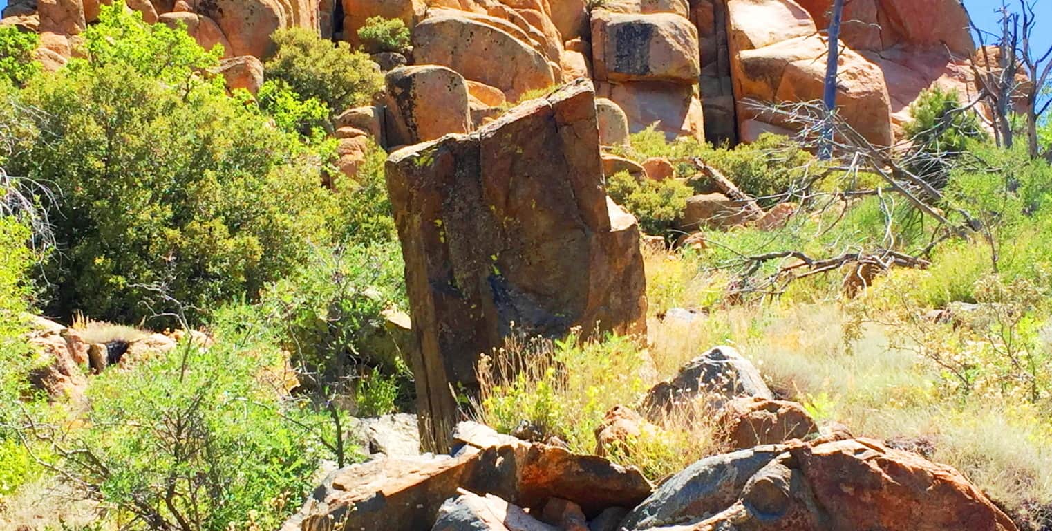
At Watatic Mountain in Massachusetts/USA there are several “X” sections of less intensity, but exact precision sliced into the stones, and yes, they are located near a Standing Stone close to the peak. (Images/Below) These sections are obviously cut to be noticed. We may very well be looking at the first axiomatic and intrinsic symbolism of all language. Whoever created these sections absolutely wanted us to see them, that much is clear. And below/right, again, is the Standing Stone that the two Watatic Mountain “X” sections are near to.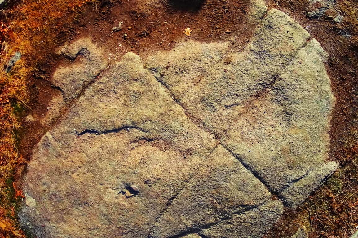
Are you seeing the pattern here? How is it that in a 100 years of modern anthropology, not a single anthropologist, geologist, or even social scientist, has now marked the obvious patterns and trends found in the heights of megalithic spaces of New England? How can Harvard or M.I.T professors, continue to belittle the most blatant and obvious patterns of evidence in these distinct spaces, from their desks? They will refuse to acknowledge, even with the related patterns of evidence, which literally point to a megalithically capable culture existing in the beginning of Time. The academics bully their narrative against the evidence because they can’t handle being dynamically refuted with evidence from people in the field. I hope that the readers will consider the evidence, not the theories of desk-chained theorists.
Returning to Wachusett Peak, at the top of the Summit Loop Trail, there is a solid rock dome over the uppermost mountain face. Carved into that ‘rock-dome’ are geometric patterns with distinct right-angles which could never occur in Nature; entire sections of rock cut with parallels, triangles, and right angles. (Image/Below) This is at the top of a mountain, not near a street corner! It almost looks modern! If people do not see this, it is because they have been programed not to. This is what you will find at the peak of Wachusett Mountain.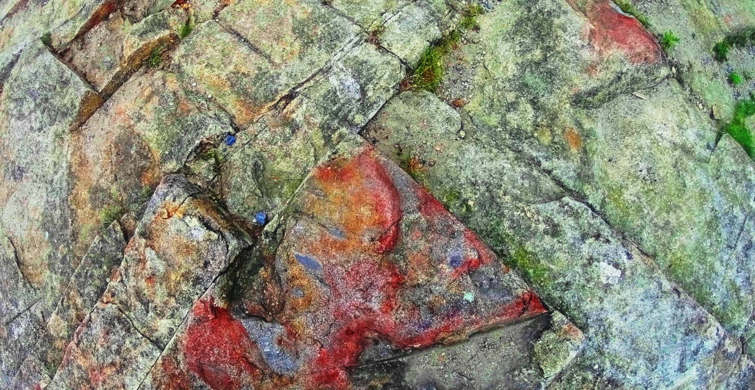
“Summit Loop Trail” Lower trail: Heading back down the trail there are the classic stone-linings running through the lower vale. These are beautiful stone-fixtures that run like cables from one peak to the next in the hills, literally connecting, and synergizing the landscape. 
Continuing down the ‘Lower Loop Trail’ you will find autonomous boulders near the Linings, very similar to Cavan Burren national Park’s megalithic statements in Ireland. These are the literal signs of megalithic culture all over the world.
Above is an image of a unique boulder at Wachusett. Below is an image of the Boulder at Cavan Burren National Park/Ireland, which is near many megalithic altars. The Wachusett boulder, which is subject to the same pattern, is guarding by a sacred area where a full New England Dolmen sits at the bottom of the Loop-Trail path.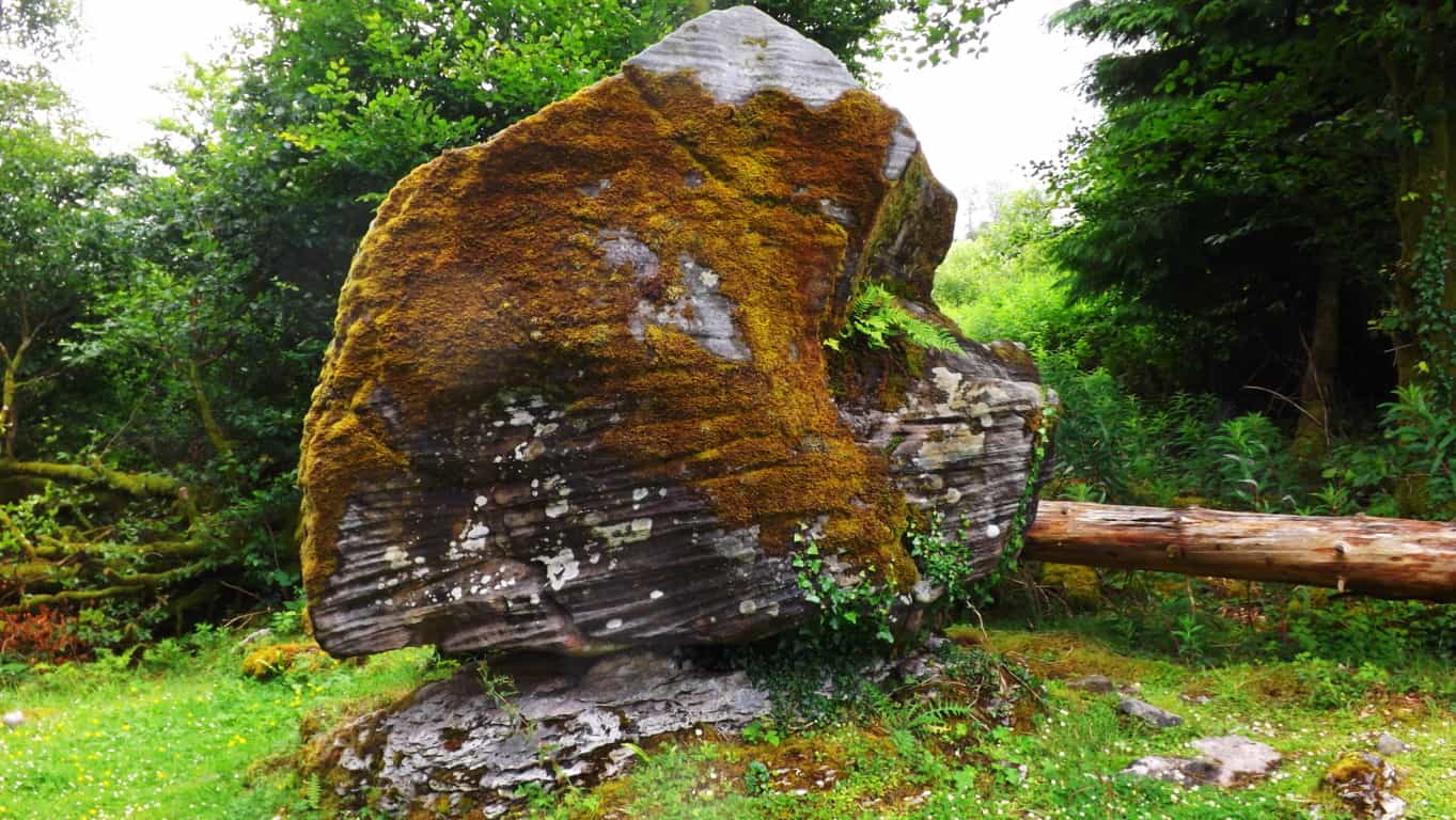
Here is a look at A Dolmen that has been ridiculously labelled “Balance rock” at Wachusett Mountain (Image/Below). This Dolmen is not simply two boulders sitting on top of each other, they are two colossal stones, fixed and set, in a observably crafted style. Each stone looks to be a bout 30 tons! The lower boulder was clearly angled, and cut, to support the upper. It is set before an altar of smaller boulders, which are set in a pattern in the foreground. This entire scene is a magnificent and extremely powerful statement about how important Wachusett was to someone, in the beginning of Time. This is a good place to stop and consider what it must have taken to create this Dolmen! 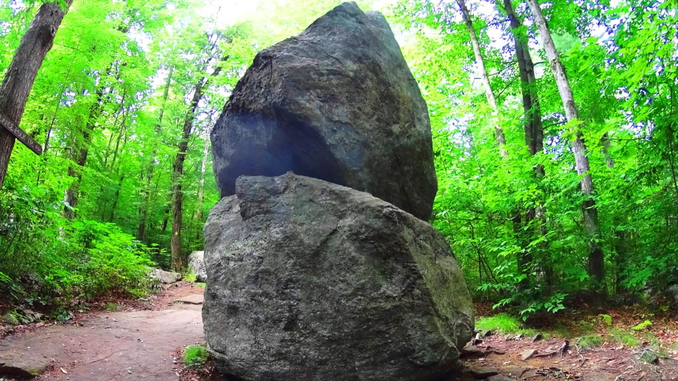
In other parts of the woods, off trail, there are small Cairns that have been toppled. Look at the similarity of the toppled Cairn at Wachusett (Image/Left)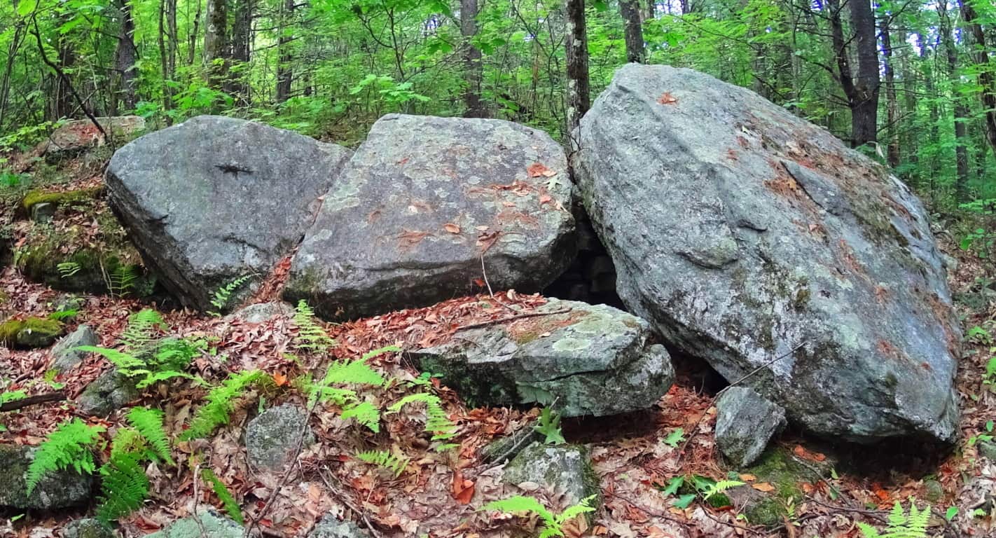 and the toppled Cairn at the Dolmen of Kilclooney Ireland (Image/Right)
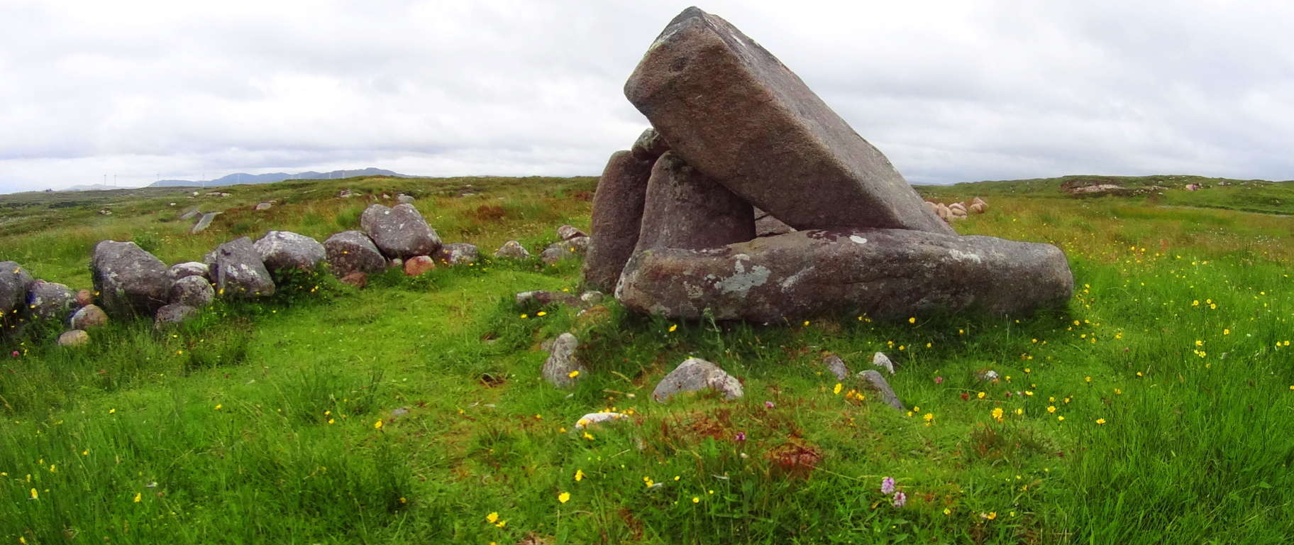
Mount Wachusett State Reservation is yet another sacred megalithic zone full of natural beauty and wonder, on par with any Celtic or American Western zone. The best time to experience this place is in early Autumn, as it is with all New England sites. Although I was unlucky in my excursion to see Wachusett in a veil of incredibly thick fog, the statements here are still overwhelming and inspiring. Yet again, you are being introduced to a trail that, through several subtle, and not so subtle signs, is trying to get your attention. Aside from that, the Forest here is gorgeous. Open your eyes and heart to see which way the evidence here truly leads; touch the markings and stones for yourself. Hike, climb, and meditate on the energy of this synergized landscape. Wachusett is a miniature-wonderland that has been endeared by every single group that passes through, since the very beginning. There must be something much more than typical about this place; the megaliths are indicating that very thing! I hope you will take your turn as well. May the road rise to meet you! And thanks for reading.
Mount Spruce/Monroe State Forest
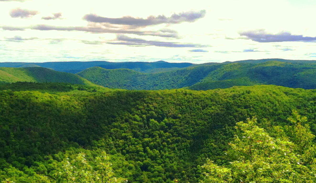
Location: Monroe, Massachusetts/USA
Elevation: 2,730 feet
Note: It’s good to know that every so often you can come across a simple trail. Depending on where you are, you can encounter a host of obstacles and unanticipated factors, especially in New England, which might hinder your way. For example, in early Spring, tree’s may have fallen during the previous Winter before rangers can re-designate the trails with new markers. This can have you miles into a trail expecting a rewarding view, only to be completely off-trail and configuring a way back. For the dedicated hiker in Winter, snow may cover an entire route. Just last week on a trail in New Hampshire a man had the bright idea to bring an M16 rifle several miles into Purgatory Falls Trail; he opened-fire along the river, all while people were hiking, which mind you, is totally LEGAL in New Hampshire. These things should not hinder your dedication to seeking the beautiful and meaningful high points in the landscape, but it should teach you to increase your awareness that the rules do change in different environments/countries/states. This is why it is a relief to arrive at a place like Monroe State Forest, set in a very special region of Massachusetts, on the beautiful boarder of southern Vermont.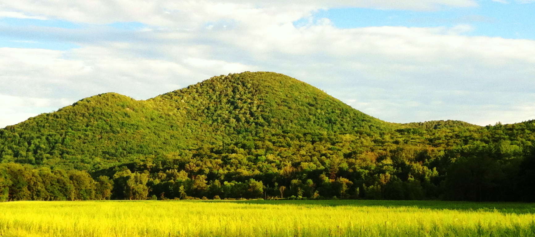 Here you will find a clear and straight trail heading directly to the best view in the entire region. This place is a rolling set of small mountains that vividly encapsulates the medium-scale hiking elevations of central New England. My friend Jon Bent, who is a local, and expert on these hills, has told me that the growth here is not ‘old’ at all, but rather, it is recent (150 years old), which contradicts several sources about these woods. Whatever the case may be with these massive trees, they are a batch of somewhat rare trees for Massachusetts; such as the Yellow Birch, American Basswood, Beech, Red Spruce, and towering White Pine. It is my belief that the crafted stones were here LONG BEFORE any trees, as they were present on the landscapes in Celtic ranges.
  Navigating to the best entry point for this trail requires locating Tilda Hill road in the town of Florida, Massachusetts, which eventually becomes the indistinctly named “Main Road”. There is a sign for Monroe State Forest at the intersection of “Main Road” and Raycroft Road. Raycroft Road is actually a rugged dirt path and the trail for this hike, which elevates gradually into Monroe Forest. You can park your car just passed the Monroe State Forest sign at the turn-off towards Raycroft Road, beside the flowing Dunbar Brook on your left. Simply park your vehicle and head straight up the wide dirt path, without veering in either direction, all the way to Hunt Hill porch. It’s about 2.5 miles to reach the vista. You will actually come to the top of the hike and re-enter a short path directly in front of you leading a bit downward again for 2 minutes before opening up to Hunt Hill Porch. It’s a striking view. On this day someone wrote on one of the porch stones “All good things in all good time.” Perfect spot to contemplate this.
 Mount Spruce is actually a secondary priority compared to the view at Hunt Hill, here at Monroe. Hunt Hill should be your goal. After discovering the Hunt Hill vista you can turn back towards the main trail and follow the westerly paths, to the left, heading towards Mount Spruce. The pathways heading away from the main trail are narrower, with towering trees and hedges.
 These trails continue along hilly glades and knolls that display shafts of cinematic sunlight, and scenes where a stop for water and rest in the Forest is a great idea. Looping down to the main trail again you will be heading generally back towards Dunbar Brook. At about the mid-point of the Raycroft Road main trail, there is an easterly path of forest with those beautiful White Pines, all continuing down to Dunbar Brook and beyond into the lower valley lakes.
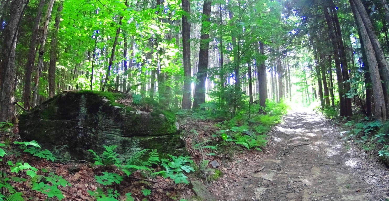
Within this glade of White Pines are some compelling free-standing boulders, with sliced faces and rounded rears, like many Celtic territorial markers. Look at the face of this 10 ton boulder on the left. It is blatantly flat, looking at it head-on.
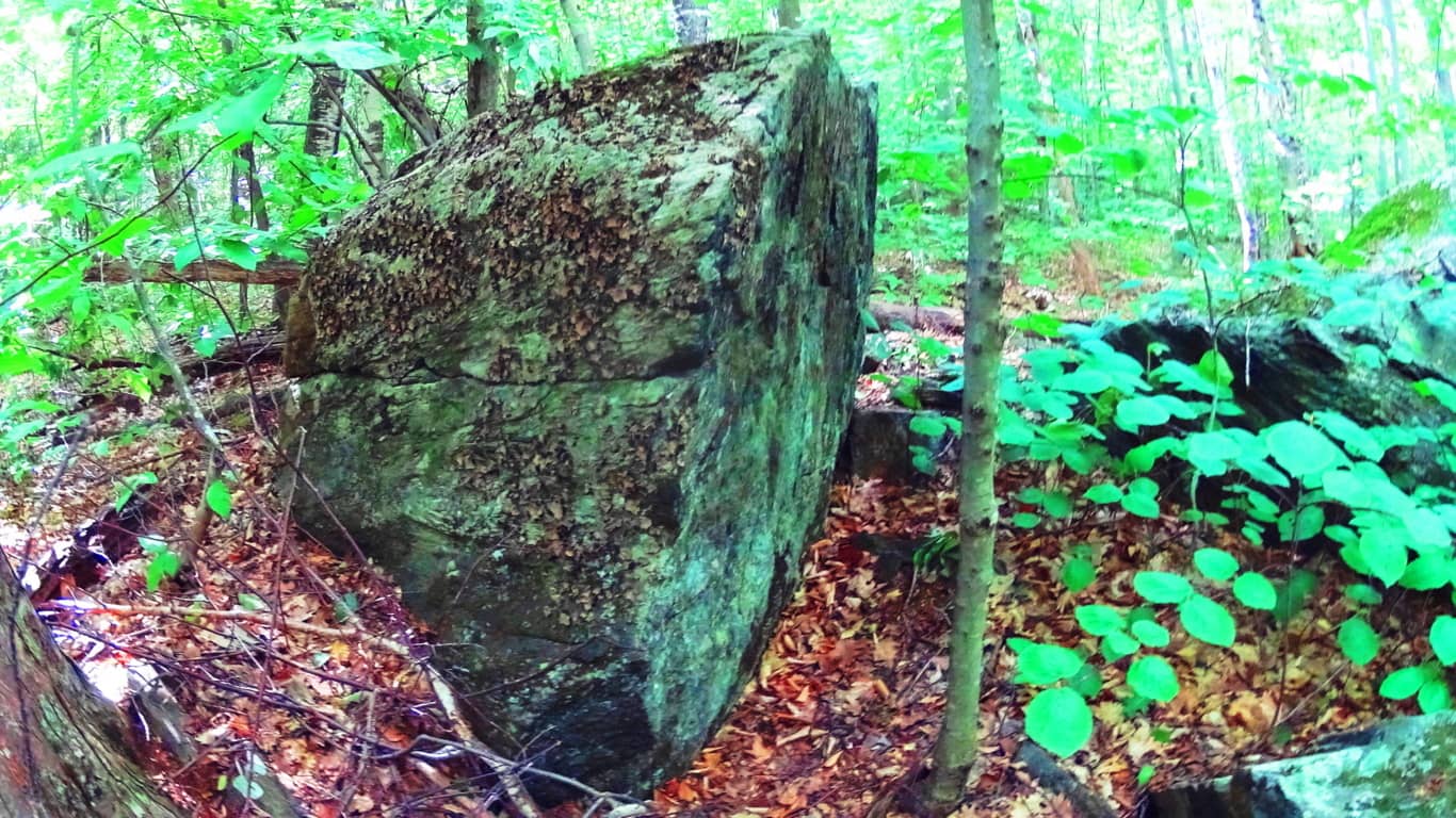 The view from the side reveals that the boulder looks to have been split, like a knife through butter, with a rounded base at the rear, as shown on the right. What could’ve possible done this? Look at these standing stones with rounded rears at Glenveagh National Park/Ireland (White Diamond Face), and Mount Watatic Mass (Red and Gold Leaf coloring on stone). It’s the same exact principle.
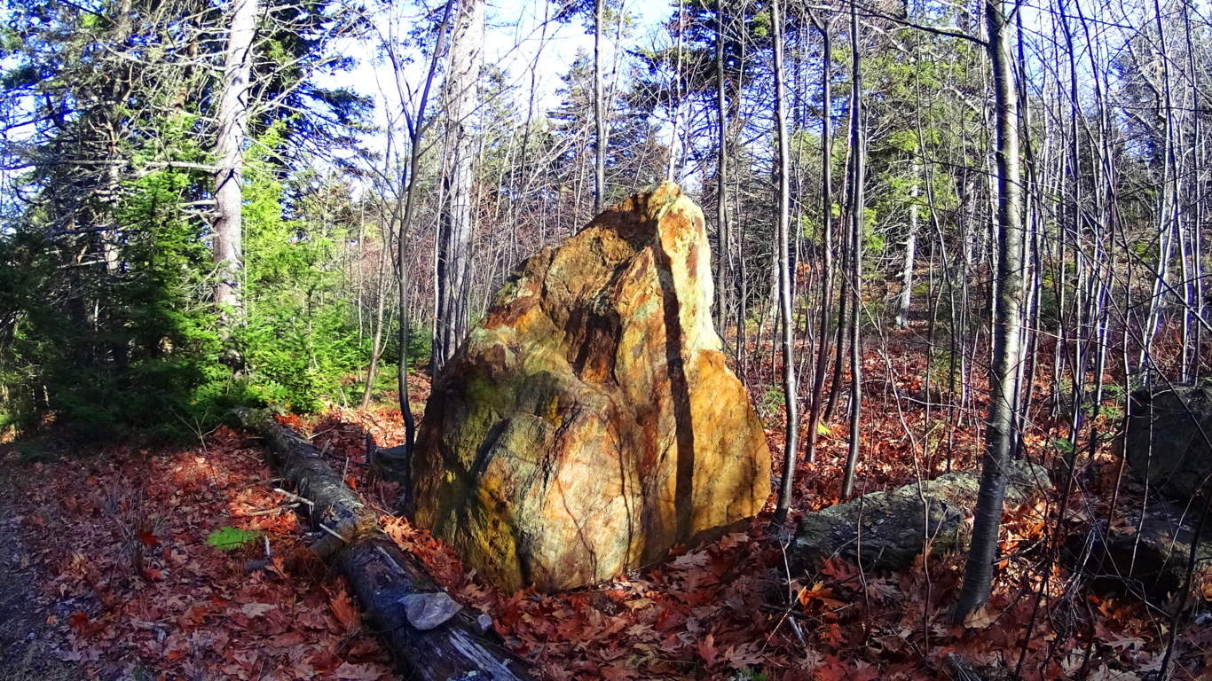
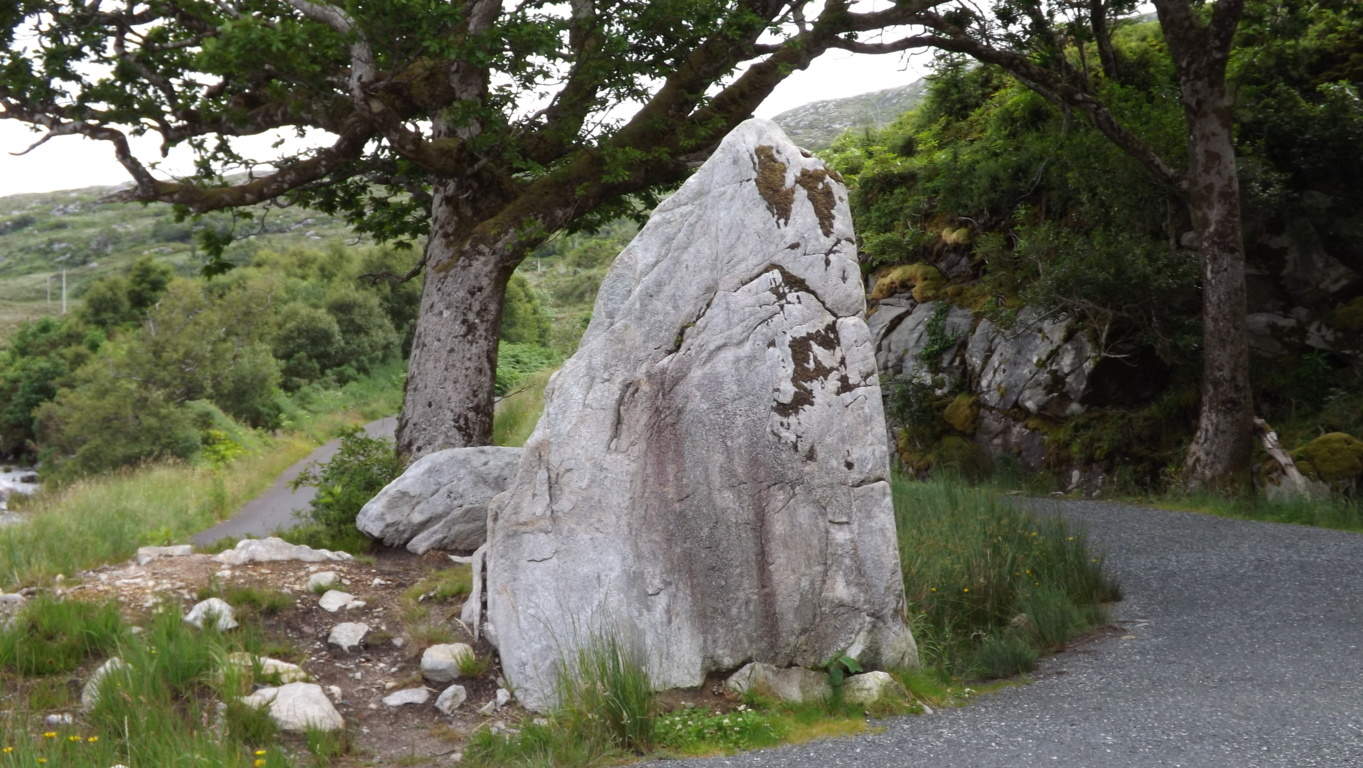
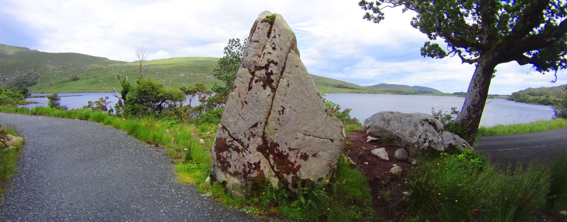
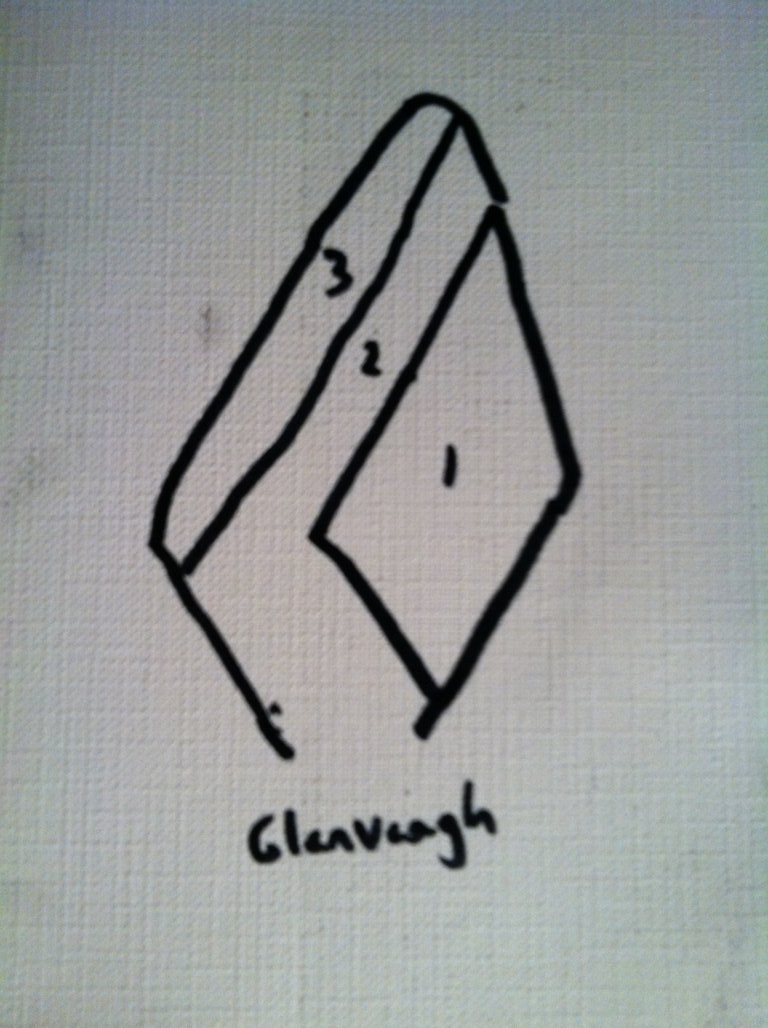
Dunbar Brook becomes a beautiful set of small waterfalls dancing through the rocks and boulders. You can follow this stream with confidence if you so choose, navigating both down and back, with small pathways along the side to help, only be prepared to climb a bit along the boulders.
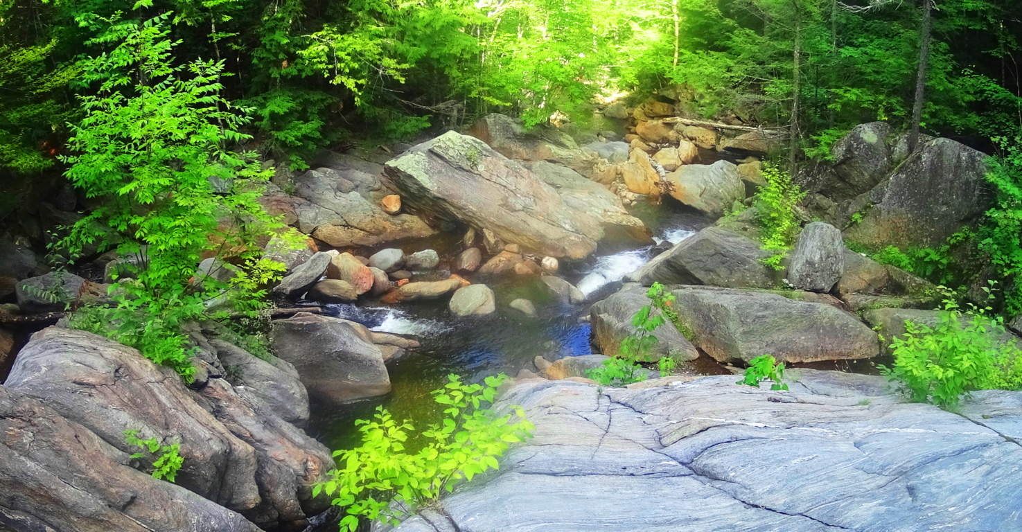 From the vista at Hunt Hill down to the Car Park at the head of Dunbar Brook are Neolithic stones all throughout the forest. Hundreds of zigzagging stone-linings, and squared-out spaces with areas that look like hearth-centers in ancient living centers. Below is an image of what looks like the symmetrical foundation to what was once an ancient living space, with the hearth-stones in the center; presumably for a fire. Look at the leveling of this stonework, which is identical to corbel layering in Celtic ancient spaces.
 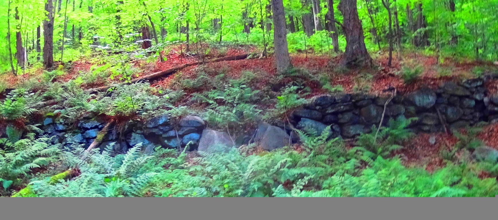 Here’s closer look at the scale of these stones against the landscape, which stands about 4 feet tall. It raises serious questions about the idea that Colonial farmers just randomly decided to waste their Summer seasons utilizing all their resources to build structures like this, and without even an ounce of explanation or claim. Something much more complicated is taking place in these Forests and Mountains.
 For certain so many people will look and say in a most bored fashion, “Yeah o.k, big deal, it’s just a stonewall…” But the point is where it is, and the style and size of it. These stones are in the middle of a Forest and run literally everywhere. They are part of a grander network of connecting stones that do not mark, say, quartered fields, or farmhouses from the colonial period; they zigzag, and often times connect to rivers, like cords connecting to a power source. If a reader doesn’t see that it is riveting to possibly piece together the idea that someone was engineering the entire landscape for the purpose of harnessing energy in antiquity, than just stop reading now.
 These discoveries are changing the way we conceive of “monuments”. The culture that did this monumentalized the entire landscape. The whole thing was once synergized by a connecting system of natural energy producers, like flowing water and Sun. Most people just don’t understand. The same concept of energy connectors and crystalized power sources within your phone, is the same exact principal being discovered on the New England landscape. Above is yet another image of stone-linings zigzagging through the woods. In the forefront of the image, and the back, are stones beyond counting. The odds that these linings connect to the flowing water of Dunbar Brook, just beyond, are 99 to 1. That’s what it is starting to look like; that’s where the physical evidence takes us. All of this happens under beautiful White Pines, tall and fair, on this eastern extension from the main trail here at Monroe State Forest.
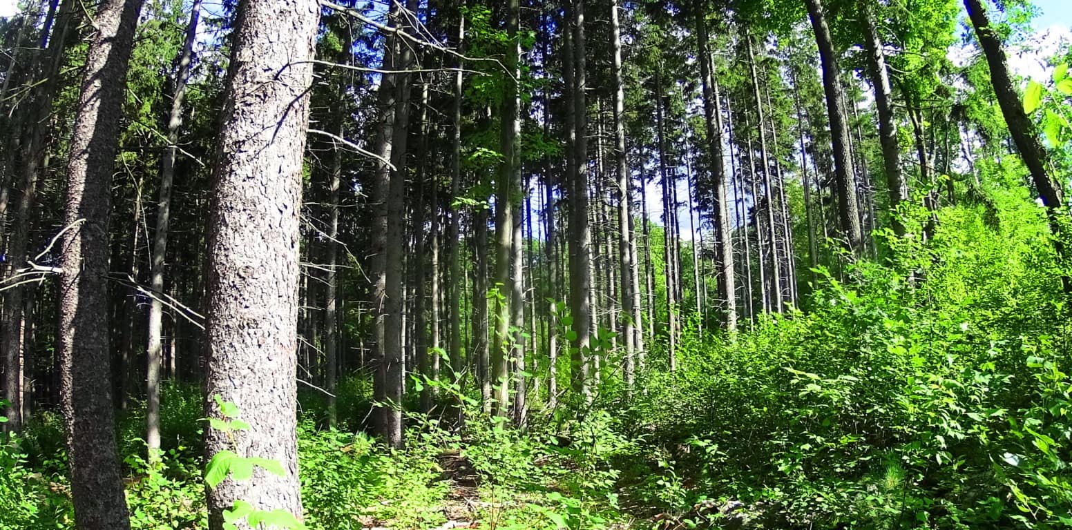 Heading back to the beginning of the trail where your car is parked, you can spend some time at a focal point of Dunbar Brook. There is a hollowed-out section of stream with a small waterfall coming around the side of this central pool, and it is serene. In the image below, the stream looks to have been redirected around the pool, to the left, then continuing to flow down the valley.
 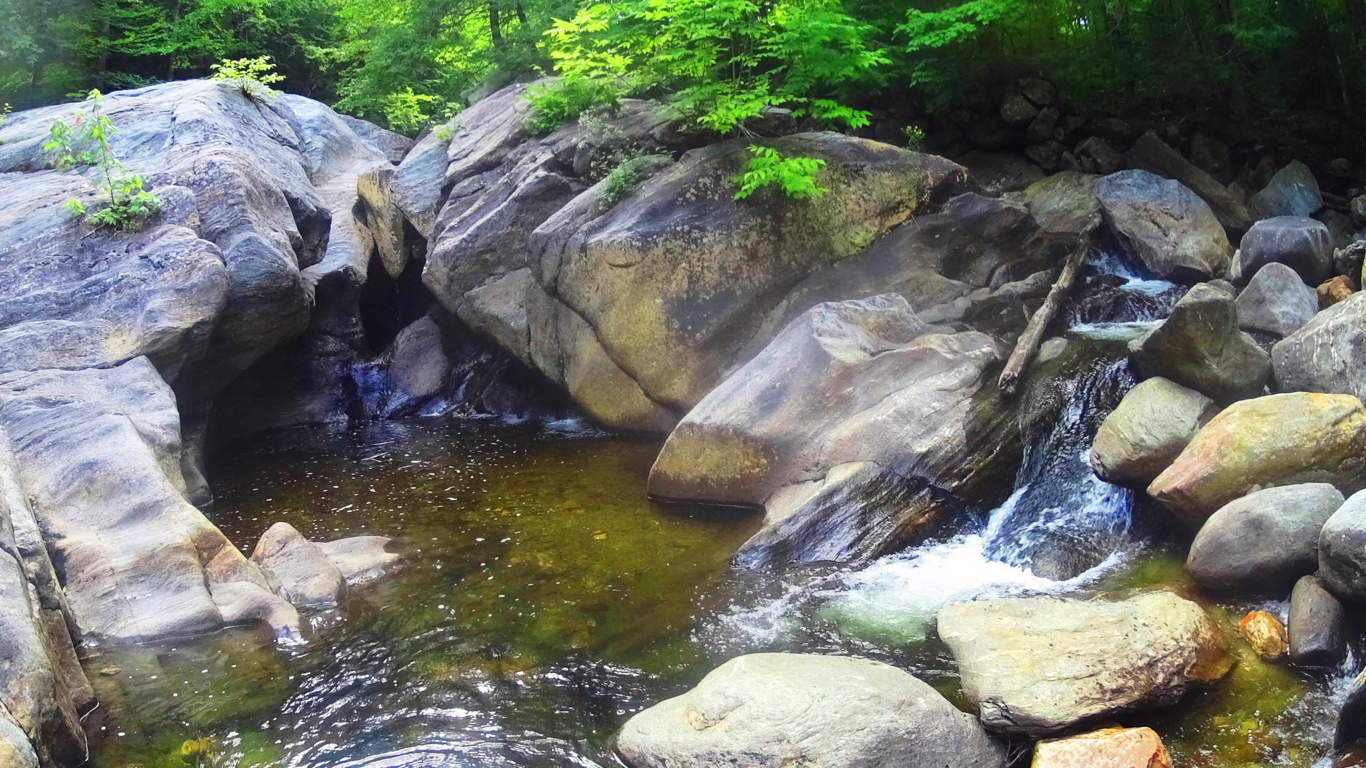 So now you’re thinking that “redirecting” the flow of water at a rocky stream seems impossible right? Take a look at this beautiful waterfall in Donegal, northern Ireland. Aside from the incredibly crafted stones above the fall, which practically look like a faucet fixture funneling the water to an exact point, is an absolutely crafted side-stream to the left. The stones of this side-stream are like a perfect staircase, in width and leveling, allowing the water to mingle with the main flow in front of it in a perfectly sectioned process. This waterfall in Donegal is wild, completely indigenous, without even a path connecting it to the road; the work that was done to it, was done in antiquity, and with great skill. And there are many other places like this, with skilled crafting, alignments, and fitted stones. (See ‘Bears Den’ in the New England Section of Stonestrider.com if you are interested in more water engineering in antiquity.)
 Monroe State Forest is a simple hike to the vista at Hunt Hill, surrounded by enchanted forestry and networks of Neolithic stones. The awareness of this beautiful factor can change the way we read landscapes. Improve your landscape literacy and hike Monroe State Forest. Pictures and images are o.k, but the point of these articles is to get people there for themselves. Spring is here, so go for it! Seeing is believing. Thanks for reading.
Ashburnham State Forest Reserve
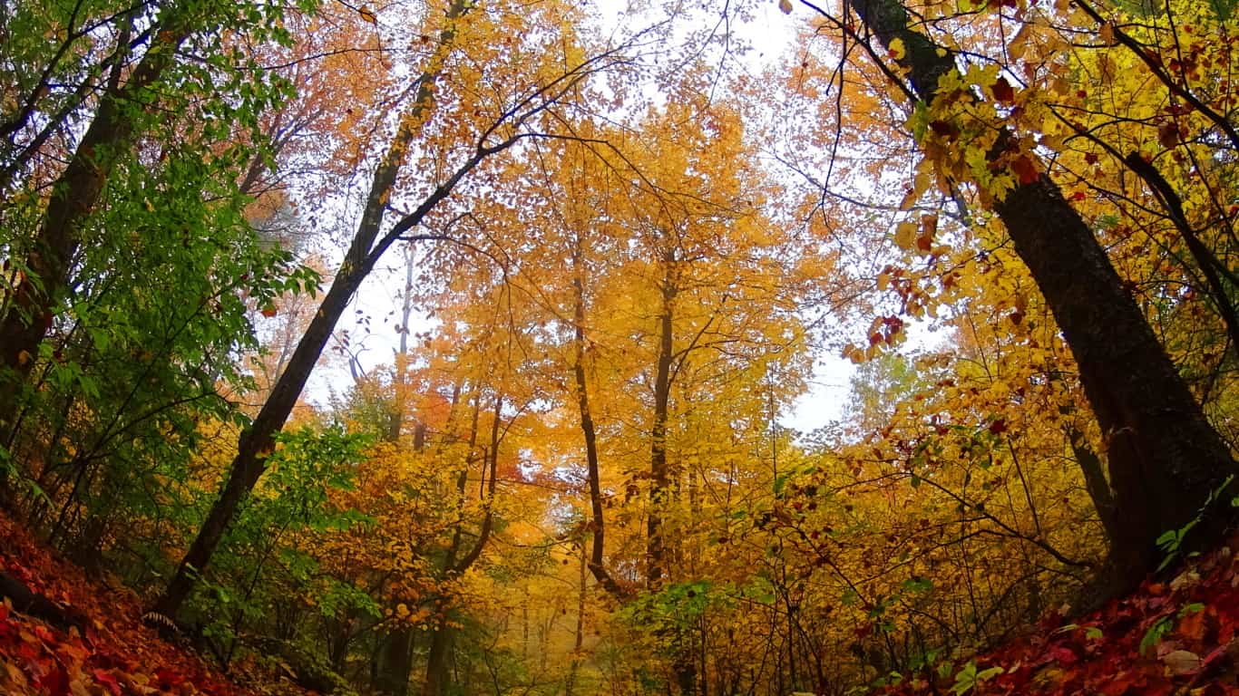
Location: Ashburnham, Massachusetts/USA
Note: The natural beauty of trails in New England, particularly in Fall, is such a blessing for those seeking a break from the suburban inundation that is the trademark of world wide modernism. That’s a mouthful of fancy words for those just seeking a peaceful, compelling, and pleasant space to hike, which Ashuburnham’ definitely is. The paths here are wide and welcoming, with golden leaves literally lining the forest floor. Mingled into these golden pathways are collages of foliage, rusty-red and green with pillar size Pines, Ash, Elms, Birches, Oaks, and Maples arching over the pathways. There are several trails in Ashburnham’, most of them running north to south towards Mount Watatic Reserve about 7 miles away. The Lincoln Pond Trail is the main route through Ashburnham’ which is gladly featured in this article. This is the ideal place to keep in mind that in so many stories forests are places of enchantment. From Grimm’s fairytales to Shakespeare’s magical midsummer backdrops, historically in literary works forests have been places where extraordinary things have occurred. Places like Ashburnham’ are a superfine example of how the most delightful and unassuming woods can hold subtle secrets within, secrets that are somewhat hard to explain and bordering on the magical dimensions so many stories try to relate. Native American stories are also part of this landscape, which have unfortunately been lost to history. It should be recognized that Native stories were deeply connected to specific spots. Elevations were considered “places of power”, and various landmarks had histories behind them that often imparted a moral memory for future generations. All these things are literally stirring in a place like Ashburnham’. Simply put, there’s a lot more going on in the forests of the world than just wood, water, soil and stone; if you go deep enough, often enough, you will see.
The southern entrance of Lincoln Pond Trail is a quiet country road with no visible street sign. It is just off the intersection of Hastings and Stowell roads, and is a bit hard to find, so bring your navigation device. This short country-road leads to the small car-park area, just beyond a farmhouse and picturesque barn at the end of the lane. 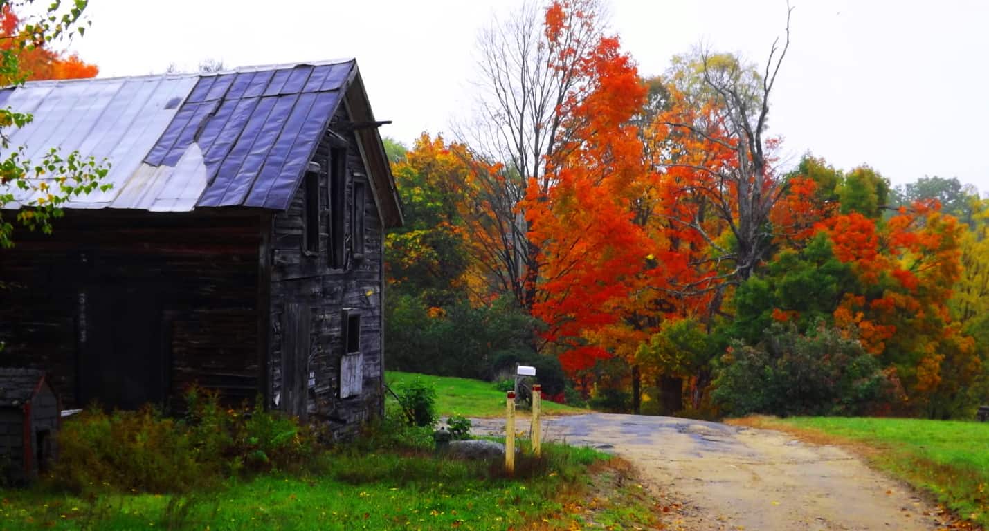 As soon as you begin striding into the entry path there is a feeling of watchfulness. This feeling is far from fictional; ‘watchfulness’ is the unforced moment when you realize that you are not necessarily observing the forest, but rather, the forest is actually observing you. It can take years for some people to pinpoint this moment, while others acknowledge it within a few short hikes. It is a lucky feeling to achieve if you can. The misty entrance at Lincoln Pond Trail is the embodiment of “the old-growth ‘gateway'”, where the possibility of this feeling emerges in each bending branch and whistling breeze. With a swift mist moving through the deep multicolored forest, you might begin to grasp that hiking is anything but primitive “walking”, it is a Godsend treatment for your sensory.
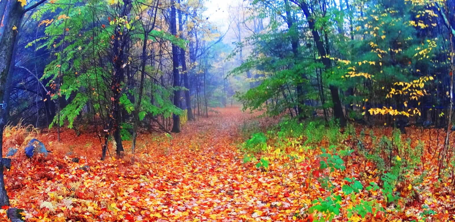
Entering Ashburnham’ in late Fall of 2016 I realized that this would be my last real hike of the year. I had now seen roughly 30 state park nature Reserves in the last 4 years, inclusive of 5 countries and 6 States, (among those various countries). Since walking into Kinnitty Forest for the first time, in the heart of Ireland 4 years ago, where my girlfriend stumbled on a seashell at the top of a mountain, my life has never been the same. I discovered that if you stroll into even the most unassuming looking woods (even in the middle if Ireland), if you look deep enough, or climb high enough, you may very well find something truly wonderful that could change your outlook on the world. 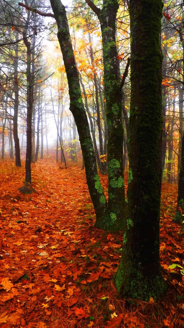 This was subject matter they didn’t teach us in schools, even at universities, which made it all the more stunning for me. Eventually, if thing s like this happen you have to ask why? Why does every region that has yet to be suburbanized, including most of the surviving forests and mountain elevations, contain megalithic stones, ‘linings’ and cairns that are practically hidden in the landscape? why is it not brought up in our text books? It has finally become clear to me. The first culture on Earth, the first layer of culture, is a Megalithic Culture; This was an ‘engineering capable’, technologically proficient, culture. The second layer is the Native period. The third layer is the Colonial period; then the fourth layer is the Industrial movement, and the fifth Postmodern. If this is correct, than in places like Ashburnham’, where there are no layers to cover up and interfere with this first layer of Megalithic Culture, the cultural stones will be discernible. The trails here should reveal stonework just beneath an ocean of golden leaves, like a visibly enlightened landscape that guards the greatest stylized historic secret on earth. It’s like hiding a sword in a stone, deep in the forest of some forgotten place, just waiting to be pulled up.
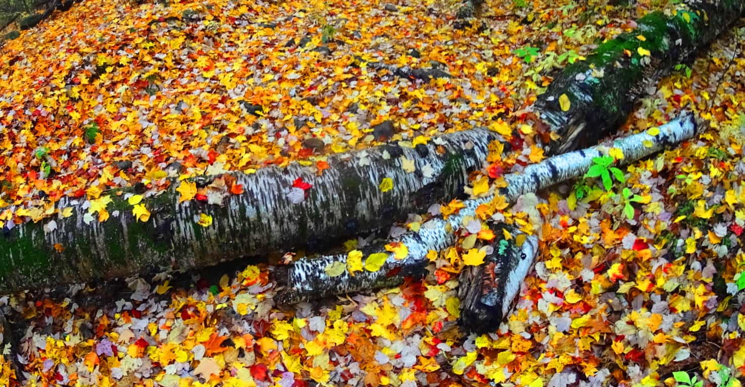
To begin, as you wander in, right away, on both sides of the trail, are beautiful stone-linings that follow the path. This is the sign of a truly ancient Reserve. Following these stones will most often lead you to something even more compelling, a rocky ledge or waterfall, which is a pattern that is also true in the fantastic Celtic Reserves to the east, across the Atlantic Ocean. 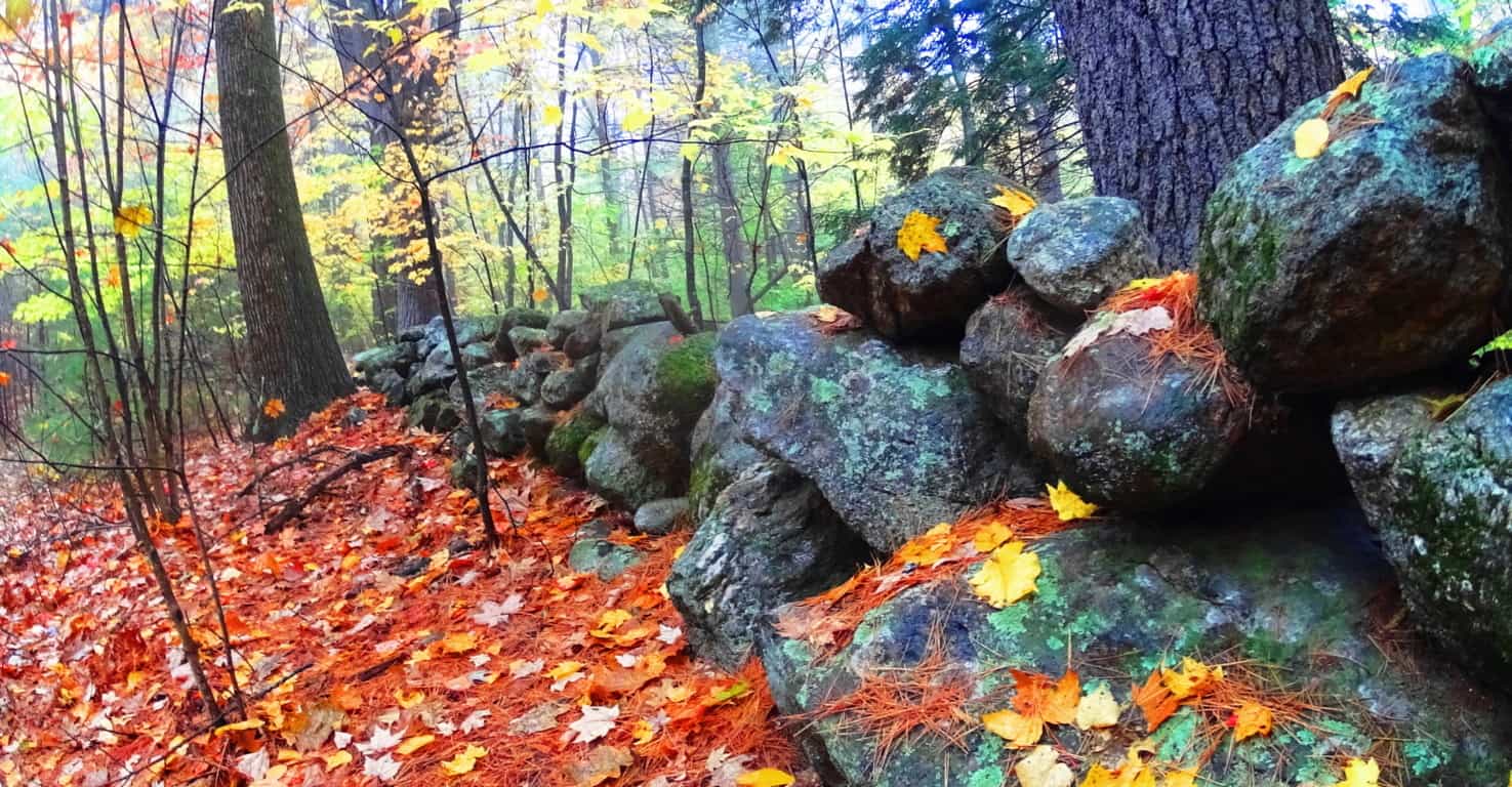 Along this main ‘artery of stone’ is a tour of fantastic expressions, along with what looks like a powerfully regenerative place, a wonderfully healthy old growth forest. Groves of baby Pines flourish here, which can be seen about a quarter mile into this trail, just off the path. It indicates an ecosphere of high quality nutrients in the earth and air. The positive benefits of these energies for people is not dramatic hokum; the effects on human beings are equally reviving, and certainly far more beneficial than say, walking on the pavements of even the “nicest cities”.
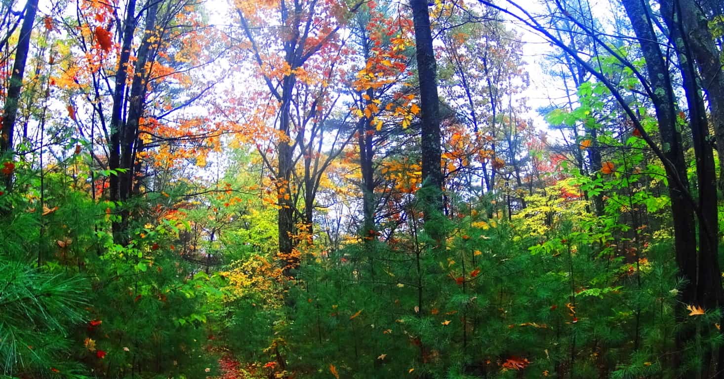
The classic stone-linings in Ashbunrham’ have another quality that makes the case for an increasingly in-depth explanation as to what their purpose(s) may have been. There are places in the ‘linings’ that are clearly and distinctly leading to specific boulders. Just like the head of a large serpent, many of the stones are capitalized with a free-standing boulder that seems to have been placed directly into this construct, intentionally. The idea that stone-linings, which run for dozens of miles through the landscape at Ashburnham’, were simply built along glacially placed boulders sitting at random just doesn’t make sense. The stone-linings create an order in the forest; they are a logical expression of control and directionality. Basing an entire network of megalithic stones on random ‘glacially placed’ boulders seems opposite to the entire point for a culture that actuated meaning int he deep woods by placing lines of massive stones. The boulders were most likely inserted into the stone-linings, just like other lessor stones, however hard that is to believe. And this still doesn’t answer the question, why? Below is an example of just such an expression. This classic stone-lining, which is partially covered by the foliage, runs straight into this massive boulder, like the head of a snake. Even the picture doesn’t do the scene the justice it compels in person.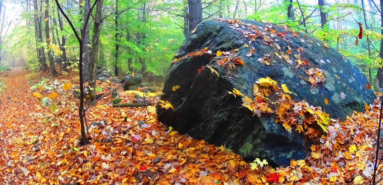
Lincoln Pond Trail is a comfortably gradual incline that twists through glades of differing densities and hues. It is entirely pleasant strolling through. Eventually the golden leaves are left behind for Maple glades, with red burning red leaves rolling at your feet by the thousands. Hiking here is like twisting through a tunnel of colors and variations. The effect of color and variation on the brain is a positively stimulating and beneficial one, refreshing the senses with a refined palate for natural beauty. 
Drifting into this rouge dimension there are other amazing changes to see. A literal matrix of stone pathways begins to emerge; these are stones of a style I had never seen before just beneath the foliage. About 40 yards deeper into the woods, parallel to the trail, is a three-foot wide, by three-foot in height, lane of inserted stones that rolls like a wave through the old-growth woods. This is thousands of stones in an obvious statement which is boldly protruding above the ground, like a tunneled highway for Beavers. It continues for perhaps 400 yards beyond this spot. The meaning of this second style of stone through this gorgeous stretch of Maple groves is an additional mystery, but it is simply an addition to an entire set of mysteries that emerge here. Continuing along the northern line of these stones, the ground slowly elevates the path into a more unique part of the forest at Ashburnham’. This mysterious network blossoms into more obvious statements. It is hard to tell if certain areas are ancient living spaces, or focal points for some kind of work place; or perhaps this is an engineering statement with a functionality yet to be deciphered? The one thing that blatantly stands out here is that there is an entire culture of stonework beneath the leaves.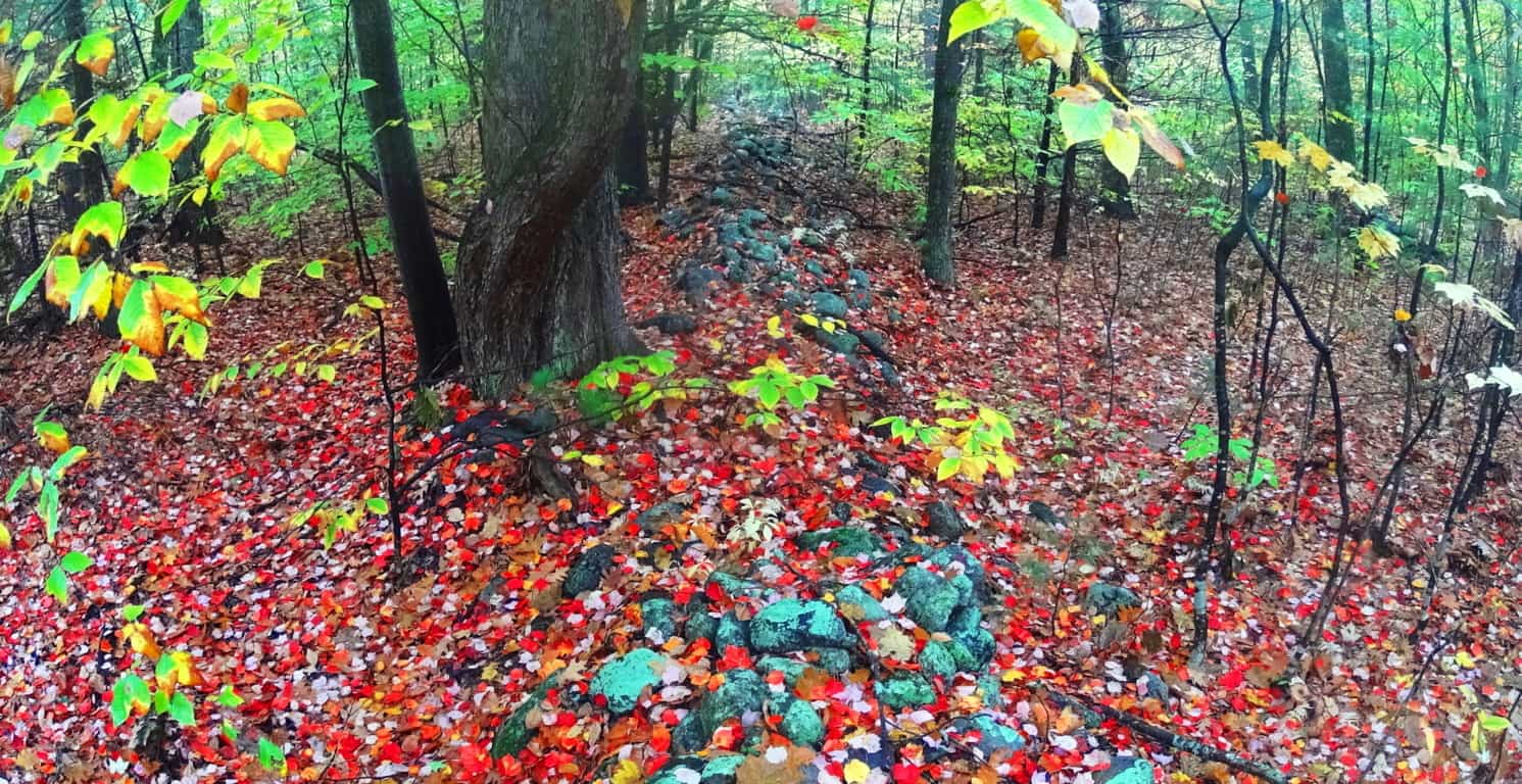 If this were a Celtic area the stones and their layout would be much more visible, as the greenery of indigenous Celtic ranges, and forests, are most often layered with minimal skins of glowing moss, but not much more. Look at the right angles of this stonework below. It is clearly defining the space with stones, but the purpose is hard to decipher. These statements run for miles through the woods. Once upon a time these stones dominated the entire landscape uninterrupted. It is conceivable that the stones were here before the forest even existed.
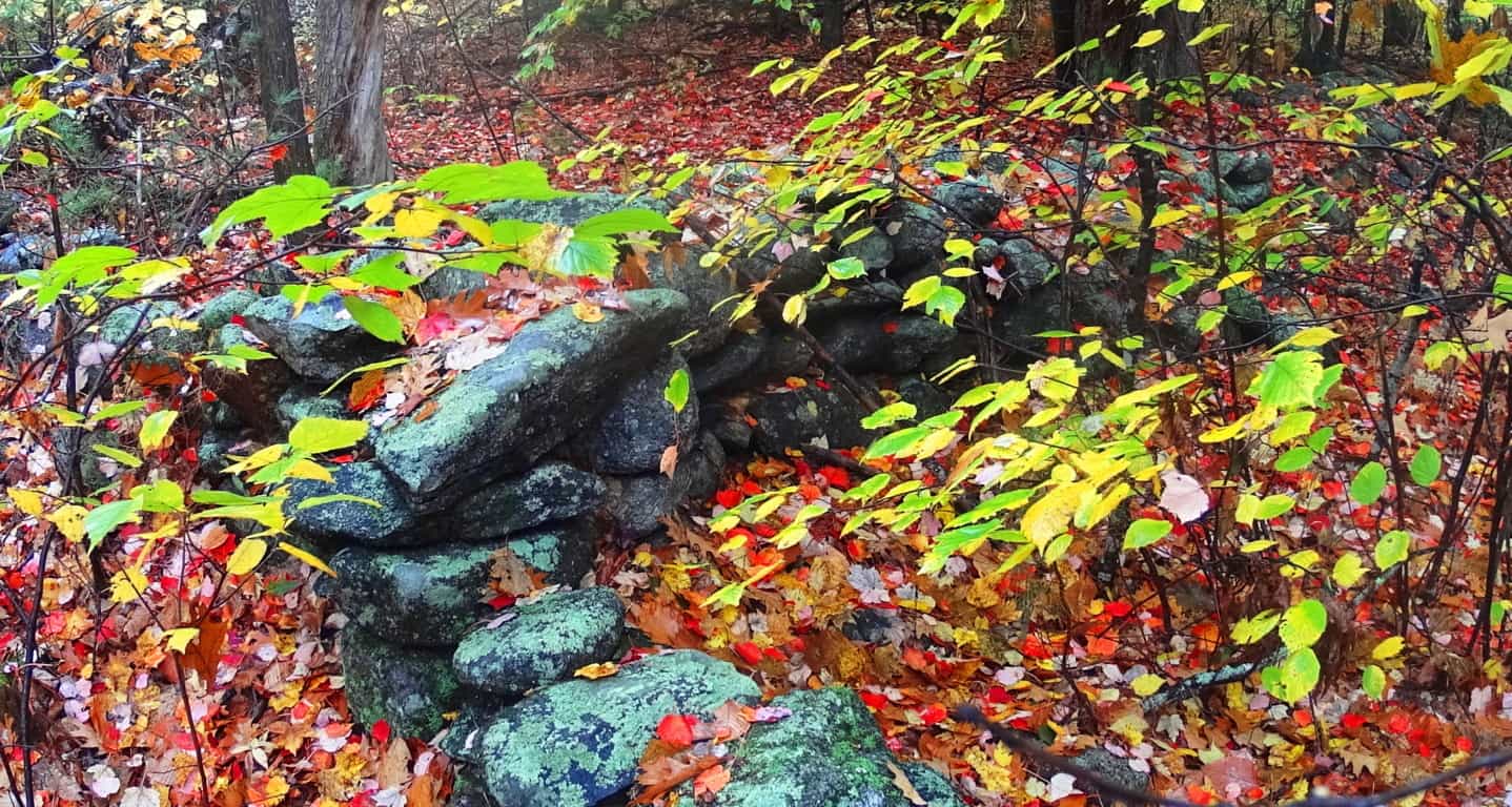
About 150 yards from this spot, off trail, is an entrenched set of stones with the look of a habitable dwelling. These dwellings can be found in crafted spaces much more distinct than here at Ashburnham’, yet to find this indicates that this place was definitely endeared and highly valued as “livable”. The stones below show a corner-section of what was once someones home, most likely in the beginning of history.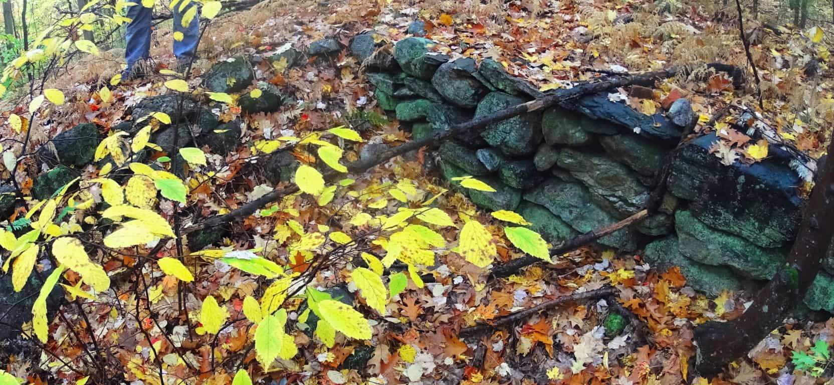
To add to the mystique of this spot, just 10 yards way is an extension of these stones that is symmetrically aligned, with a distinct quartz boulder centering the scene of entirely granite stones. The area is obviously in ruins, but there is an alignment to the overall remaining arrangement. It should be noted at this point, that none of this has anything to do with Colonial farmers.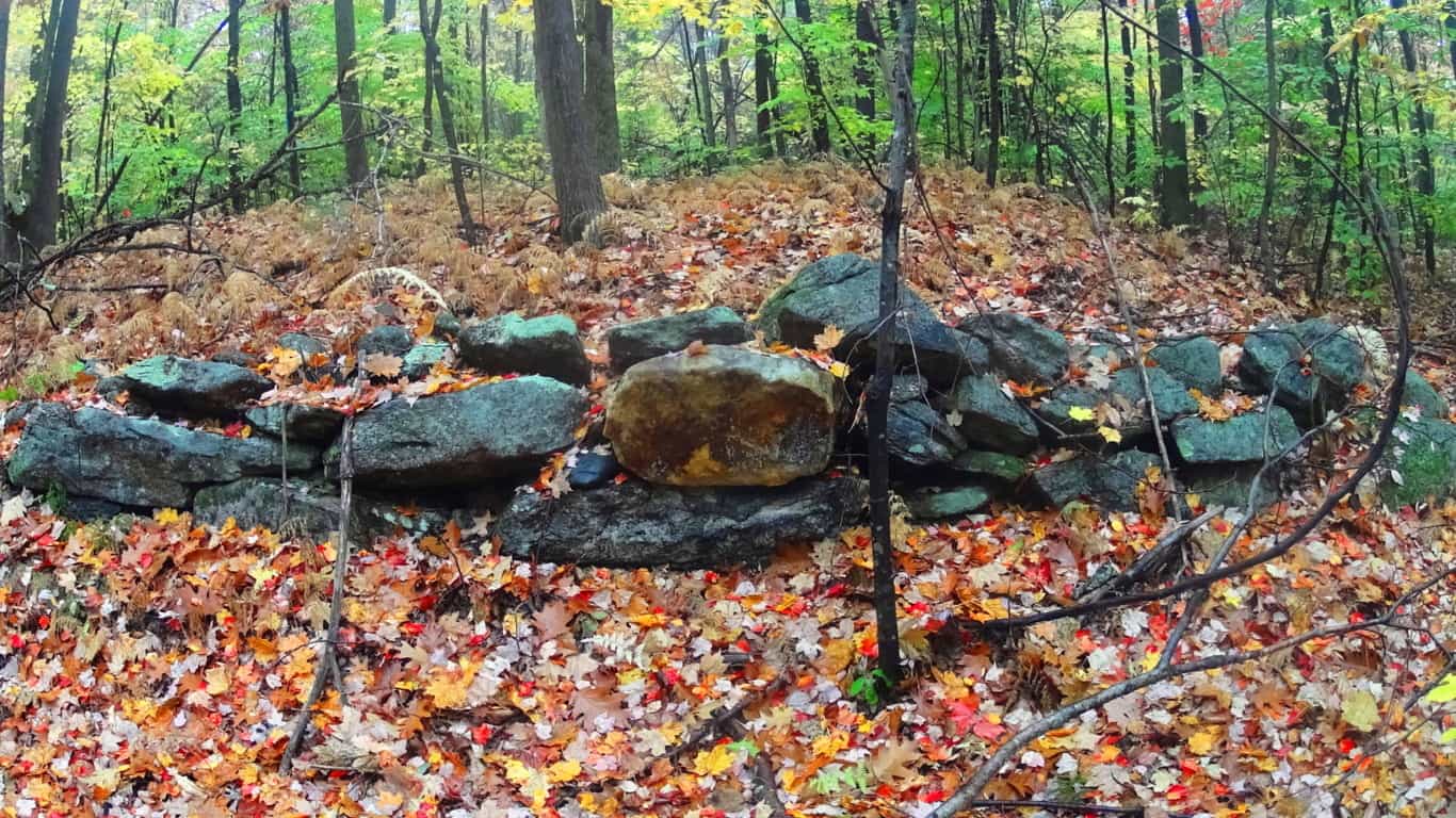 A cartographical recording of this area, a full archaeological review, will reveal a massive stone-network that is the basis of an entirely engineered landscape, harnessing sunlight in certain spaces, creating enclosures for harvested plants, connecting fixtures for navigational purposes, and relegating certain areas for irrigation. This is the case for almost every forest in western Massachusetts. Simply put, there’s a Megalithic Culture under there.
Ashburnham’ is a forest without a mountain in its midst. This makes for a more pleasant stroll over the course of about 3 miles of pathways. It does have slightly a elevated clearing, one 60 foot high ledge that sits like a rocky bald head just above the small valley to the north before reaching Watatic Mountain. as you climb up the forest peals aways and a beautifully rounded rocky ledge emerges, with what looks like molded slabs that feel hollow beneath your feet. The mist culminates here, as if you were walking into a cloud. Seasoned hikers eventually learn that scenes like this are priceless, and relate a side to New England trails that is real and authentic, akin to the dreamy visions that must have prompted stories like ‘The Headless Horseman” which famously took place in the New England forests of Upstate New York, where the woods were an entirely enchanted zone not to be taken lightly for Colonial settlers. This mound feels like another planet as you make for the top.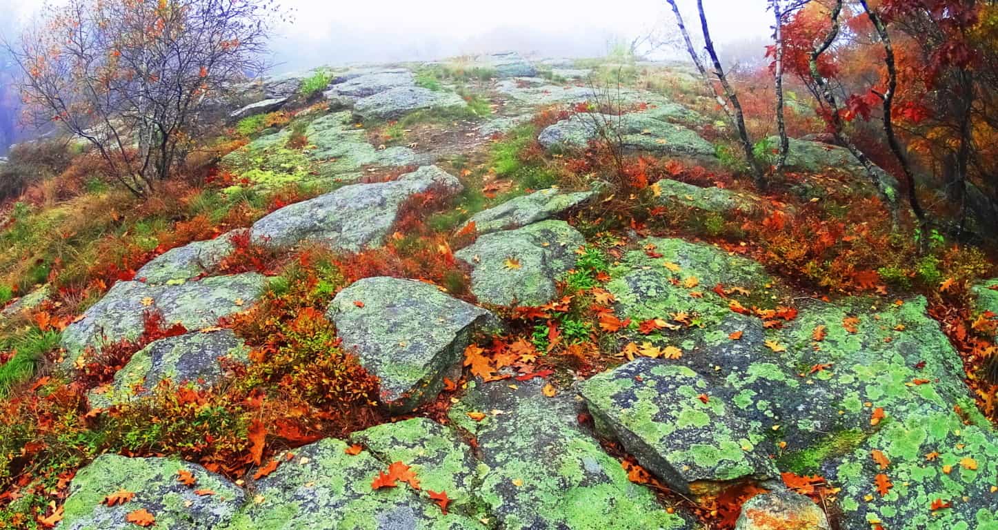
The giant slabs here seemed ‘custom fashioned’ to the hill; they are arched and fit perfectly to the rounded sides of the broad knoll while becoming more flat towards the flattened top. This fits an awesome pattern of higher elevations where ledges are carved-out and specifically rocky, while being surrounded by soil-rich old-growth forest. In short, it’s like a rocky island on an ocean of soil. I will not go so far as to say that these stones were crafted, but the surreality to the scene, the suddenness of these uniquely fitting stones along the rounded path, seems to have some kind of secret to it. To add to the mysterious situation, at the top of the rocky knoll, which is about two miles into the forest, a massive stone-lining of a style and consistency I had yet to see anywhere, even in Ireland, Wales, or Scotland, emerged rolling directly over the mound.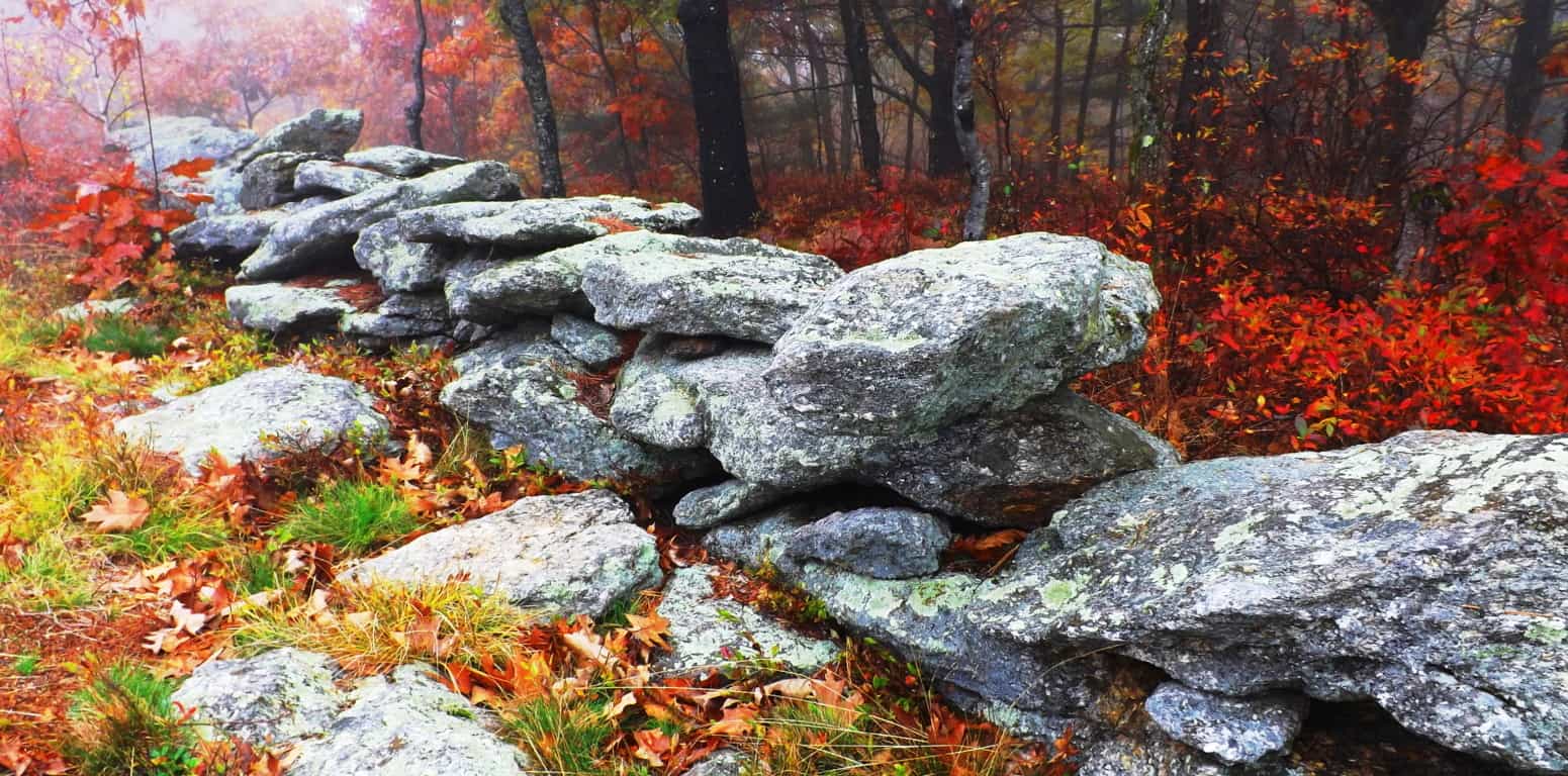 Each stone was proportionally equal, and at least five times bigger than the average stone used in the two types of other stone-linings already tracing the woods below. Each stone looked to be at least 300 to 400 pounds, and not a single alternate stone could be seen in its procession. Whoever engineered this lining had a puritanical streak, a stubborn need for crafted consistency, which is artistic step up from the craftwork of the designers below, literally and figuratively. In the elevated milky mist, with the burning red Maple leaves looming just at the edge of the hill, it looked otherworldly, like a train track running from hell to heaven.
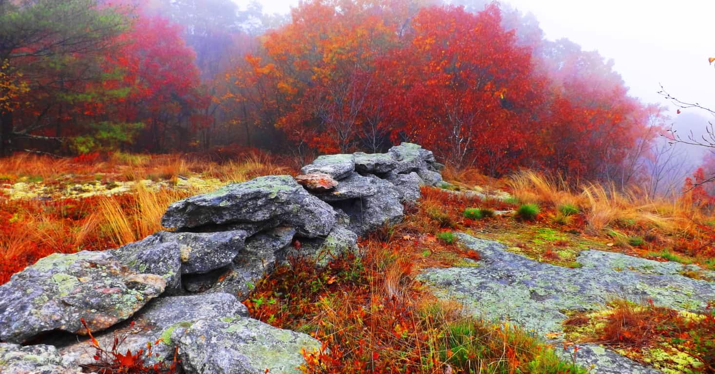 This is an undeniable trend in so many old-growth areas; impressive stone statements placed specifically at the higher elevations of forests. This is exactly what Natives called the “place of power” in their stories. One thing that is obvious about this scene is that on sunnier days the area will obviously absorb unobstructed light for a maximum amount of time, along the with the stone-linings running over them. This set up may very well serve to channel that collected energy from the Sun out into the forest beyond, into the other stone-linings, and the valley below. I have seen a set up just like this at Cavan Burren National Park in Northern Ireland, where the landscape is interconnected by Megaliths, and of course blatantly misunderstood by local “scientists”.
Coming down from this knoll Lincoln Pond Trail continues northwest, where fields and clearing are lined again with stones at the edge various and beautiful glades. These are perfect spots to sit down and appreciate everything you might have seen. The trail extends for several more miles before an optional loop back to the southern entrance, or an exit to the north.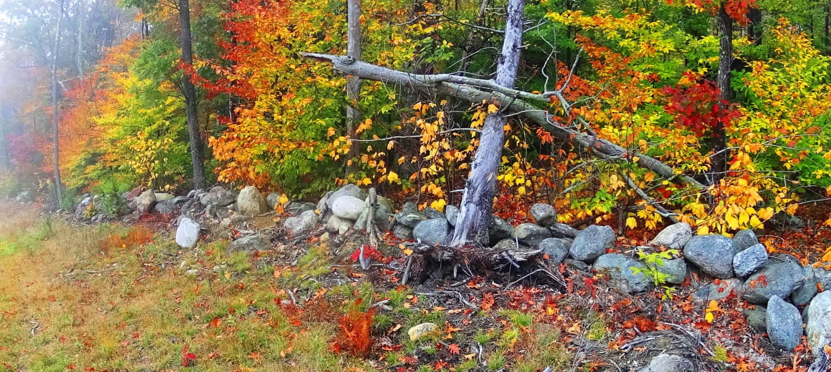 It is important to note that in several other locations in the woods, while exploring this area, there were amazing and mysterious things to see. I came upon a huge lining of stones with a symmetrical tint not far from the southern boarder. It was impressive, with the larger stones towards the top, which is another strange trend to be found in old-growth stoneworks in New England. Any mason putting the larger stones towards the top is making a bold statement, as if to say, “I can do whatever I want, despite the difficulty of crafting the structure this way.” This lining below is not far from the entrance of the trail, roughly 40 yard off to the right of the path. There may very well be something buried beneath this incredible mound. There was a great deal of effort and time put into stacking and leveling these 100 to 500 pound stones, the higher the heavier, which indicates the unique and unlimited mindset of whoever built it.
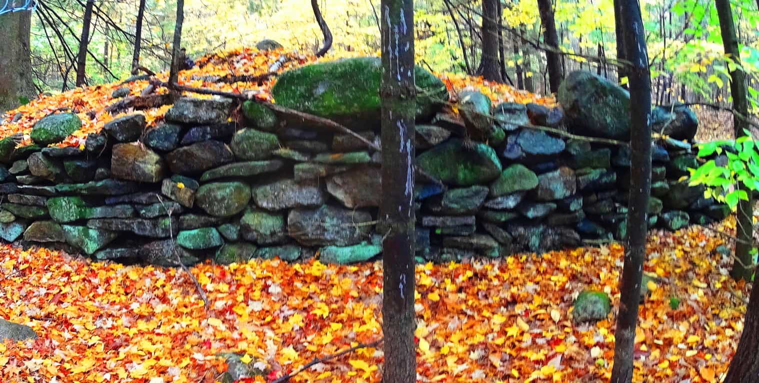
And finally, not far from this ‘lining’, is what I believe to be the remnants of a New England Dolmen, now in a dilapidated state. This rounded boulder was clearly supported and elevated by other stones beneath. It is now only partially supported, which has happened to several Celtic alters abroad. 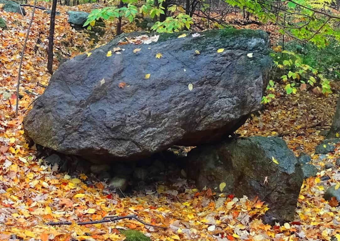 Whatever the truth is about this area, it is obviously an enchanted cultural center that the forest has grown over, and in a beautiful way. It’s time for anthropologists to get their heads around the idea that the stones were probably here first, and the forest, like a grafted grid, grew up around the Megaliths.
Ashburnham State Forest is the epitome of the enchanted New England hike. These woods are in a wonderful state of ‘spooky respiration’, augmented by a universe of color and decor along the trail. This place supports every magical fairytale that has ever been told, but more importantly, it supports a very real Megalithic cultural scene that increasingly emerges with each and every hike taken through these woods. Celtic places have a very similar feel, an it just becomes impossible to ignore the Megalithic foundation of these old-growth regions in New England. If you want to see something sacred, simply find your way to Ashbunrham State Forest; it won’t take long, but be sure to take your time.
Rattlesnake Mountain
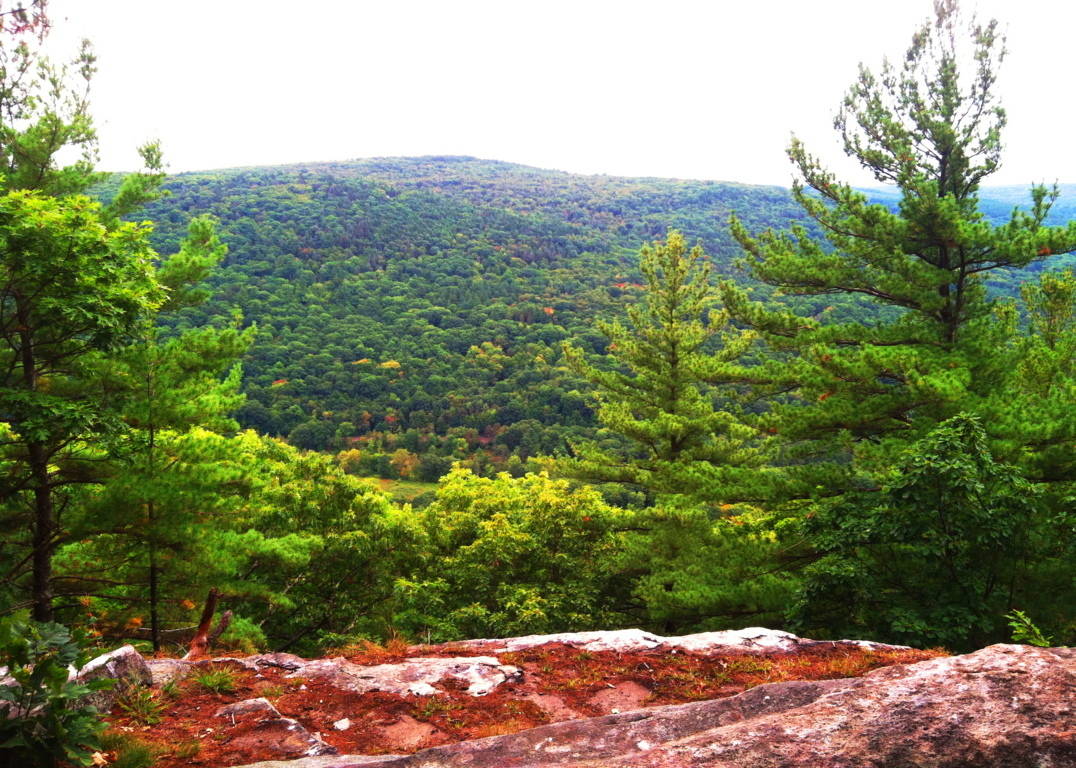
Location: Erving, Massachusetts
Elevation: 1,067 ft
Note: Running along the northern border of Massachusetts is a unique set of rolling “small-mountain” ranges. These elevations are too tall to be called mere hills, but too small to be known as full-fledged mountains. Rattlesnake Mountain sits in the heart of this range in the northwestern portion of the state, surrounded by similar small-mountain peaks in Monroe and Savoy to the west, with Watatic to the east. The woodsy entrance for the car park leading to the main trail at Rattlesnake Mountain is nearly hidden, just off Rt 2A, about 100 yards from Maple Ave, in the picturesque country-town of Erving.
The trail at Rattlesnake’ is essentially a 2.4 mile loop that broadly encircles a massive metamorphic rock ledge. Known as The Farley Ledges, this precipice is enveloped by trees, standing about 220 feet high, and about a mile-and-a-half wide, east to west (image below)…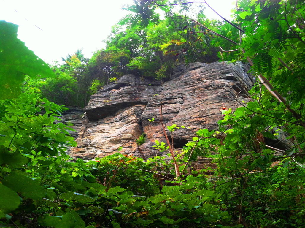 Rock climbers scale this ledge in a world all their own, paying very little attention to the boulders and stones that line the ground below. If they did pay attention, a closer look at these stones reveal something pretty amazing. Here at Rattlesnake’ there is a megalithic mystery that reaches deep into the heart of Massachusetts forests and mountains, a mystery that most often goes unspoken. Simply put, there are hundreds of gigantic cut stones which are measured and marked inundating the forest floor just beneath the ridge. There are pathways that run directly into this “stone playground” where various crafted stones sit (image below)…
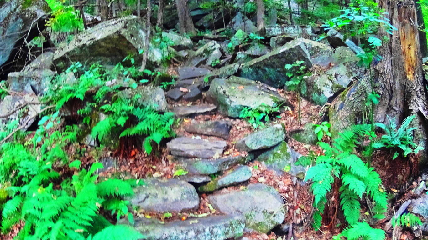 Other megaliths are fixed in some pretty curious positions in arrangements near the trail, winding like a display along the ledge (image below)…
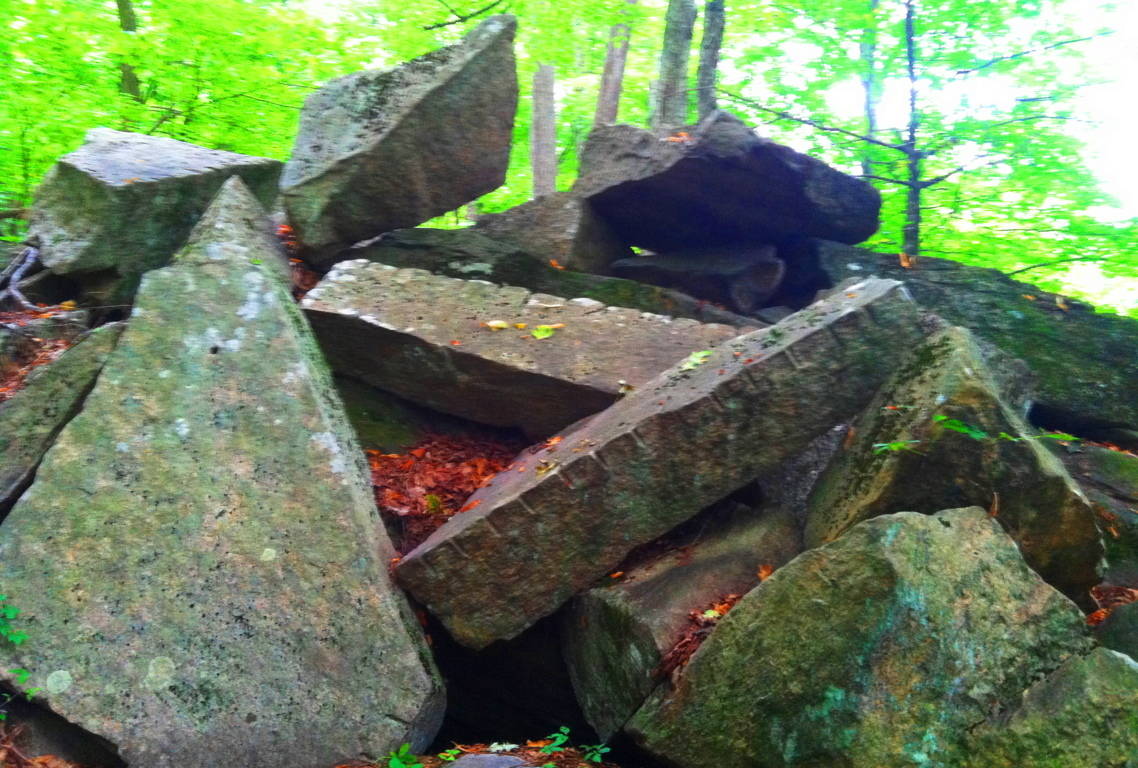 Some of the stones look to be placed in specific places, while others look to have been tossed about like giant toy blocks. The incrementation markings on the huge stones are not in inches or centimeters, they are some other form of measurement entirely. The image above is of two rather long rectangular pieces thrown into a pile at Rattlesnake’. Pieces exactly like this exist at the pass of Mount Bearnagh in Ireland (image below)…
 They also exist at Lynn Woods Reserve in Lynn Massachusetts (image below)…
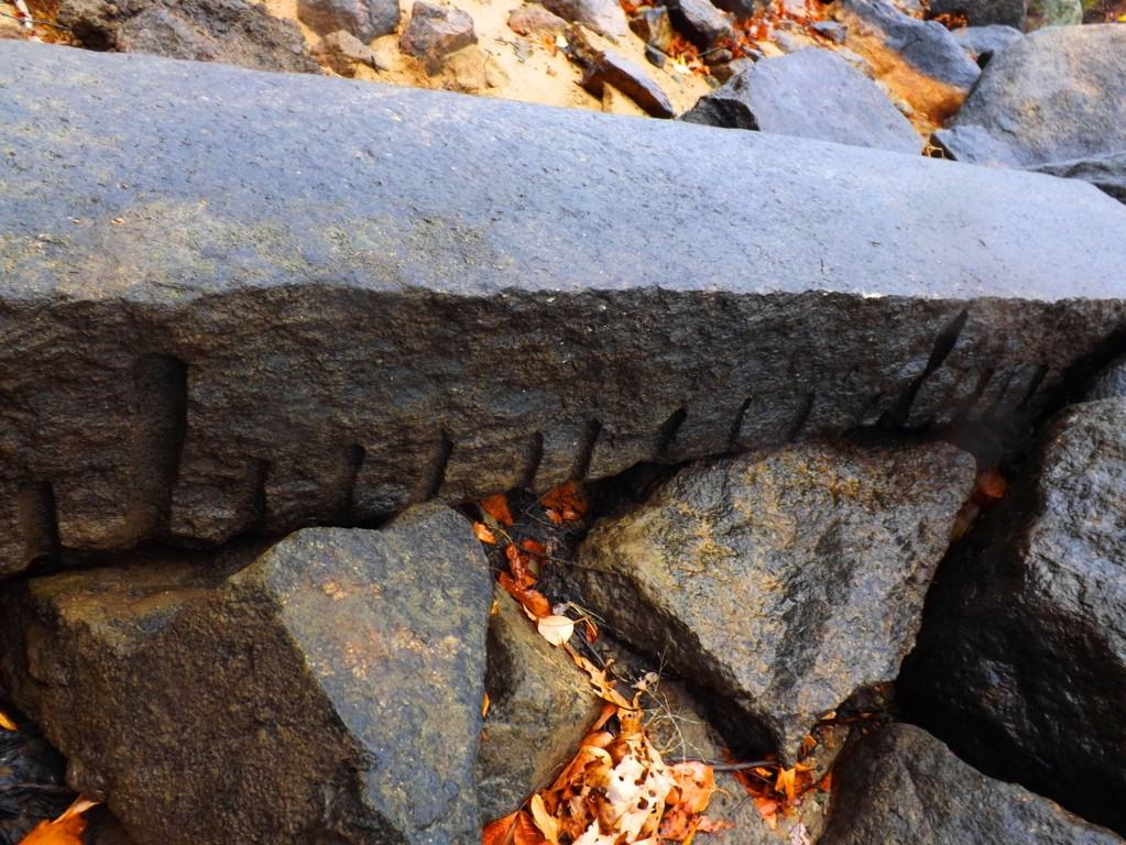 which is 40 miles east of here. Look at the incrementation on the stone in Lynn Woods; between the long marks are 9 short marks. What system of measurement uses increments of 9? And there are countless other places throughout New England where this specific type of rectangular piece can be found. As documented proof of these megalithic stones is slowly compiled, it becomes clear that our modern culture is built directly over what was once a megalithic culture. In old-growth forests and mountain ridges where houses have never been built the evidence for this culture still remains. And please remember, these stones are several tons each, if not more. Whoever cut and placed them, had the ability to do so, and without strain. Other stones beneath the ridge are smaller square pieces (image below)…
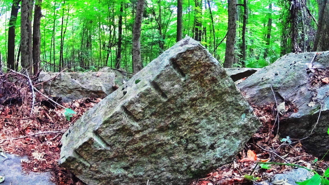
And more stones can be found here, some covered by countless seasons, or are partially entrenched in the earth. It becomes clear that someone literally went to work in this area, and was utilizing megalithic size stones the way a carpenter uses wood blocks (images below)…
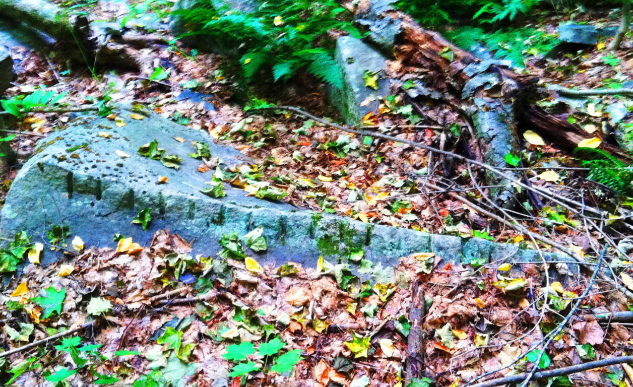
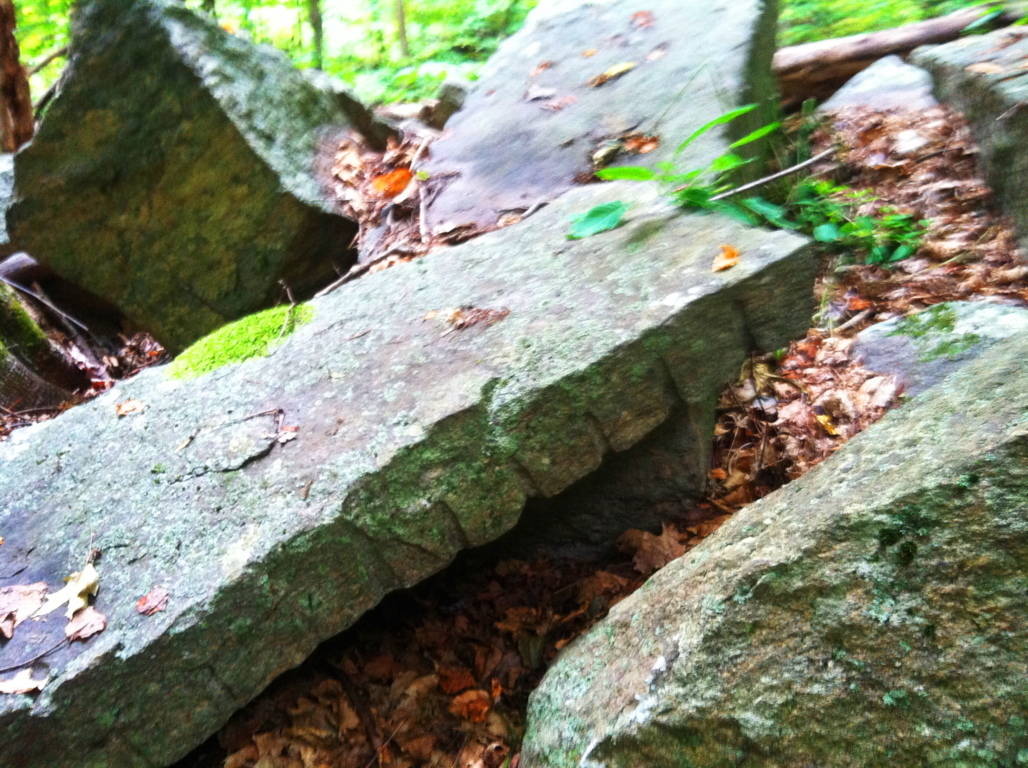
As you head east along the initial trail, passing by these monoliths and huge fixtures, there are other stones that emerge which are relevant to the patterns of megaliths in New England. The equilateral triangle has showed its face in stone in almost every deep woods hiking trail and reserve from northern Maine to western Massachusetts. Here, somehow fixed into a boulder, was a perfect equilateral triangle (image below)…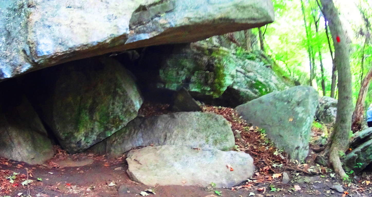 It is at the center of this massive fixture, with a cubicly cut stone to its left, and another perfect equilateral to its right. All of this is under a rock precipice serving as a roof which looks to weigh about 100 tons. The overall symmetrical setting is above (image above), with the central equilateral in the middle, sitting on a perfectly leveled shelf of stone. Please understand, this stone is part of the boulder beneath it; it was carved out to protrude specifically in this fashion. I could not move it. Here’s a closer look (image below)
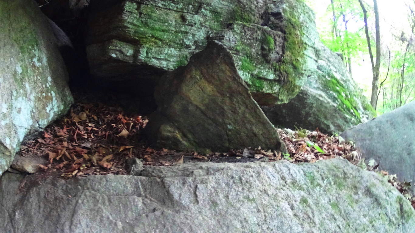 Just a few feet up the trail is another fixture with a equilateral triangle that is guarded by several massive stones. This stone is not only an equilateral, but is a three sided prism that is connected to the boulder beneath it. (image below)
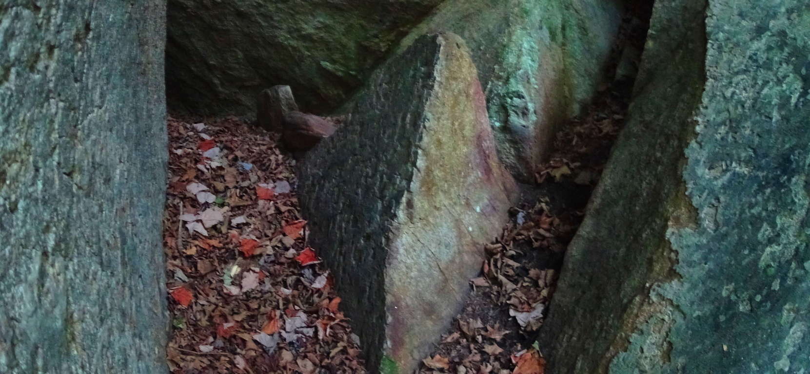 In the woods of Upton Massachusetts there are granite cut equilateral prisms attached to the boulders beneath them (image below), extremely similar to these stones found at Rattlesnake’. I believe the Triangle is the megalithic “calling card” of the ancient culture that once dwelt in the hills of New England, just as the Spiral was the calling card of the megalithic culture that once dwelt once dwelt in Ireland. If you recognize this, then you will realize that New England, in its own way, is a landscape that is just as mythical and beautiful as those traditionally endeared in England, Ireland, Scotland, and Wales. When you hike through these small mountains, you’re hiking through zones of ancient mysteries yet to be solved, but can be seen right before your eyes. The trees of woods are spaced amicably, with small groves of baby pines and birches emerging in various areas. Enjoy these beautiful groves (image below )…
 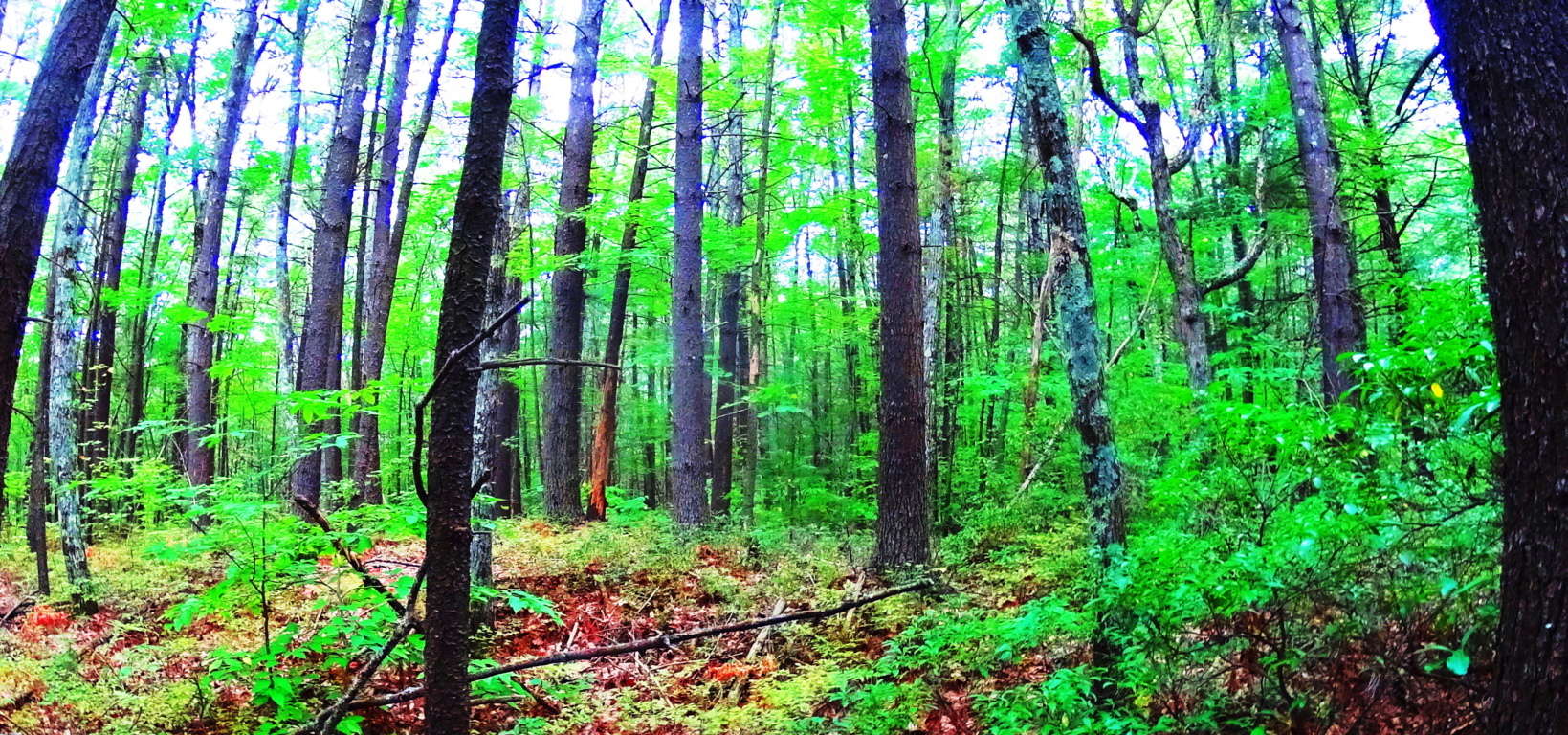 With all of this existing right infornt of you, it can be hard to get back to the natural beauty of the trail ahead, which is another wonderful aspect to hiking the forests of New England and Rattlesnake Mountain. As you step away from these mysterious alters beneath the grand ledge, continue east. After about 1/4 mile you will come to a stream rolling down the mountain from above (image below).
 Turn to follow this stream upward, as you are now on the eastern extremity of the trail (image below).
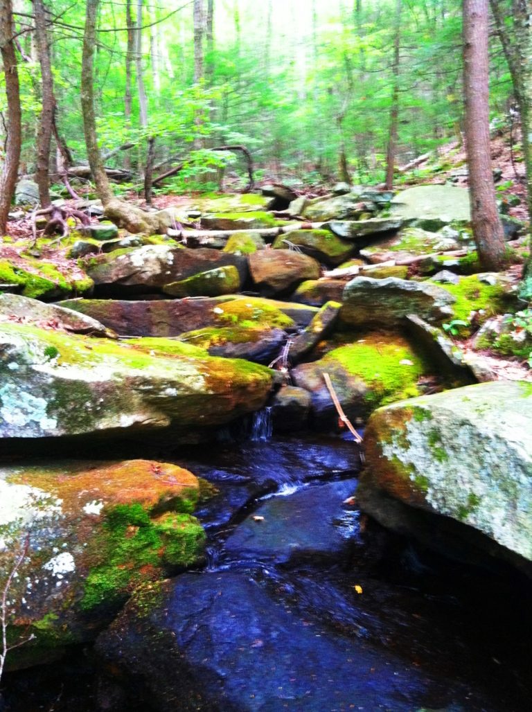
This waterway is so similar to Celtic scenes that you might find at Tollymore Forest in Ireland, or Killarney National Park. The rocks are strewn over the flowing water, with glowing moss beyond. Following the waterways clears the senses and improves your “sound palate” with the soft trickling and smooth rolling of water over stone. This consistency of sound eliminates the sensory overload we experience in our daily lives, which have become controlled blasts of commercial intrusions. One walk along these streams can clear your head for days. Continue up the incline which follows the stream until the trail crosses over the water, to left, at the top of the hillside. The trail continues into an elevated old-growth forest with a classic New England blend of Oak, Maple, Pine, Beech, and Birch trees. Looking northward this forest continues all the way into Vermont.(image below)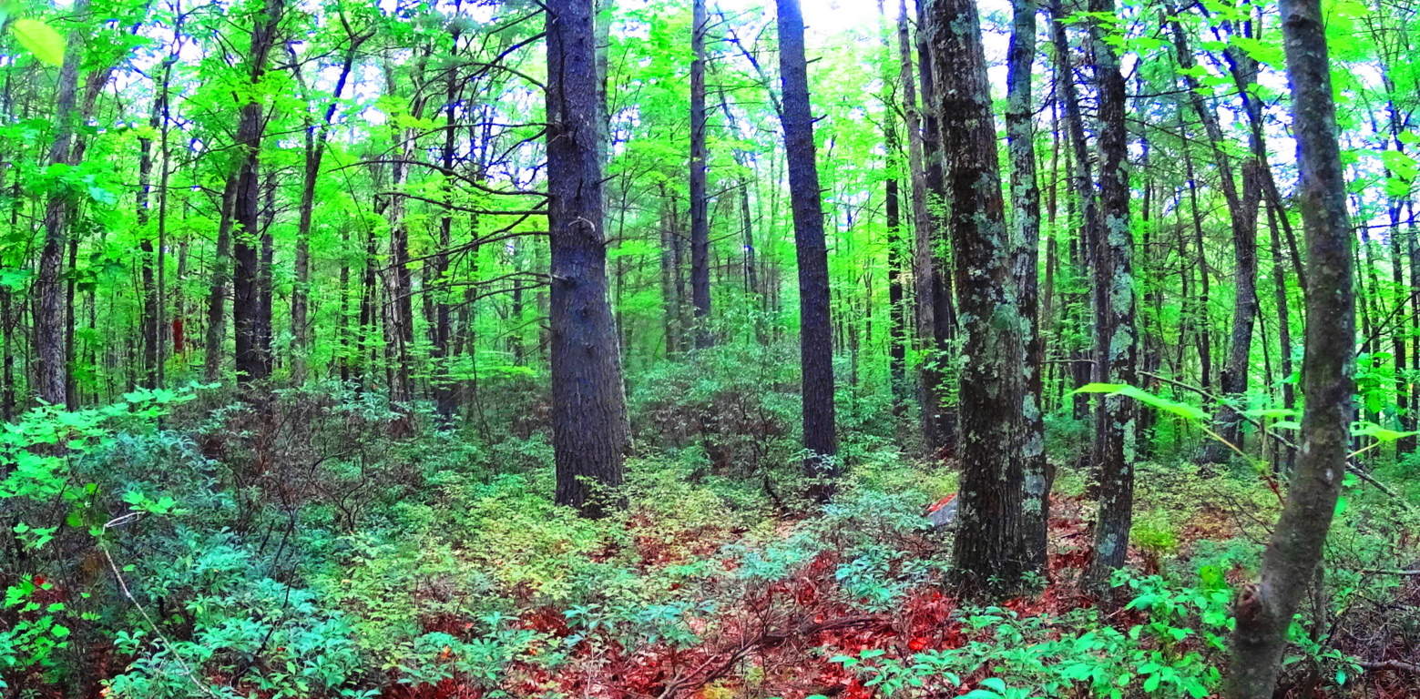 Continuing west on the elevated trail there are minature ledges with tiny pillars creating a tiny cavern on the underside of the precipice (image below)…
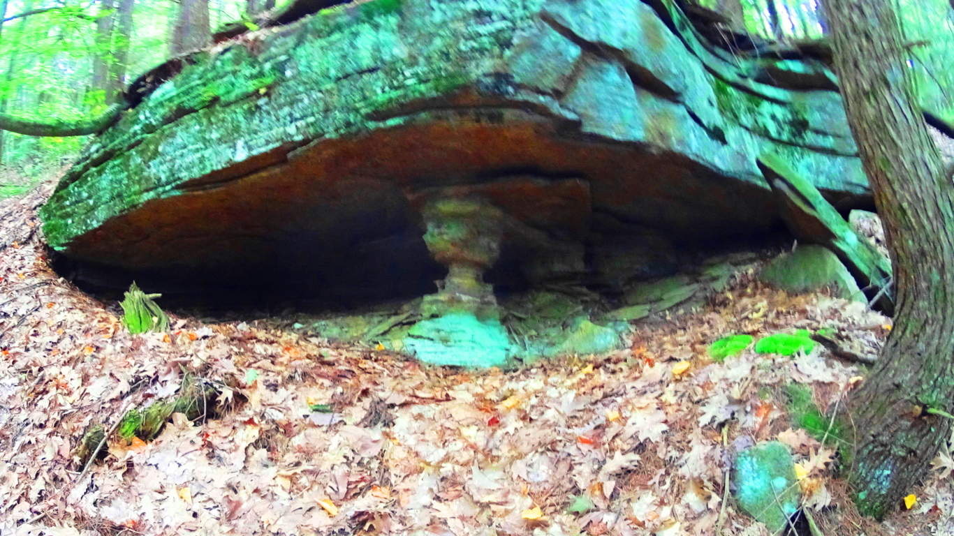 At Cavan Burren National Park in Ireland, where there are some of the most astounding Celtic megalithic monuments in the world, there are also notable stone ledges with the small pillars creating a cavern beneath the tiny granite ridge (image below)…
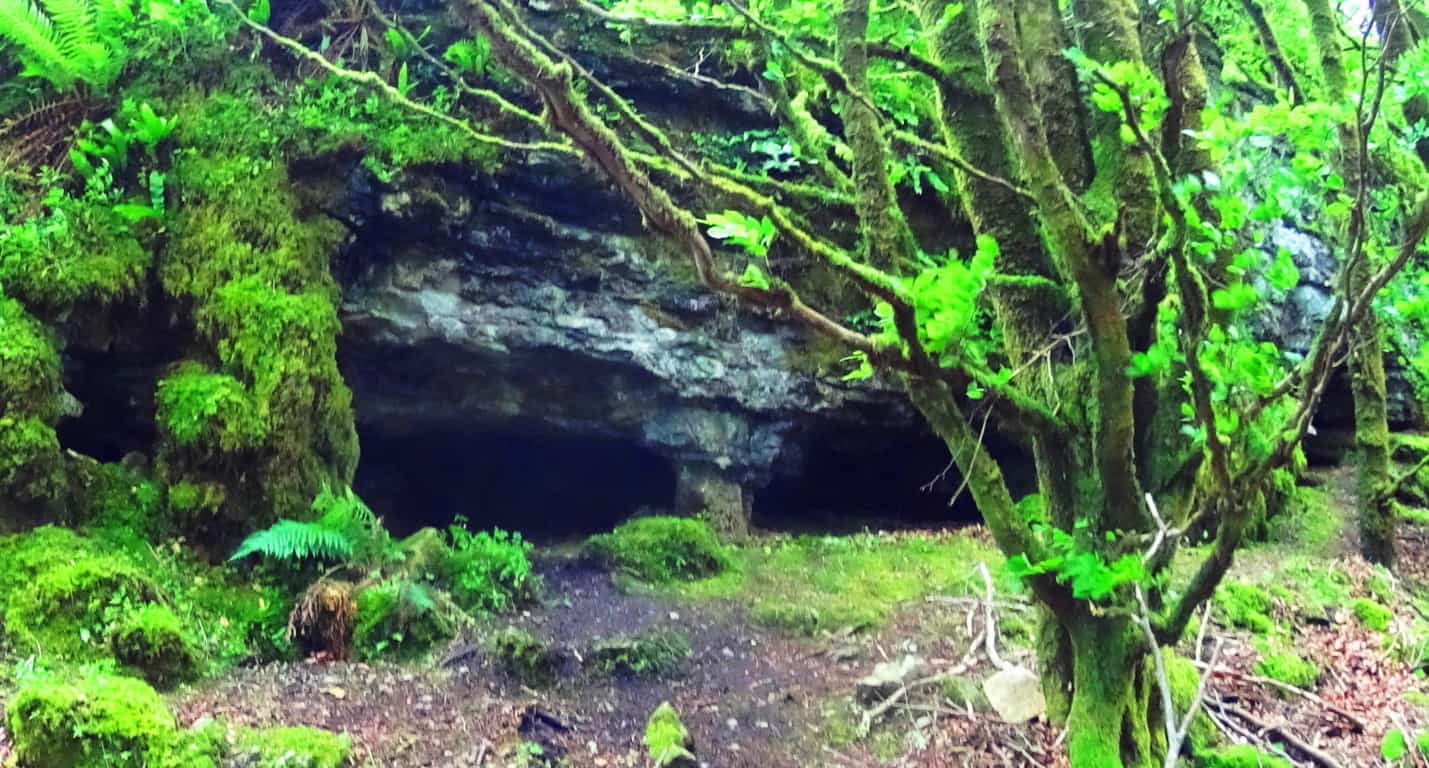 After passing these curious small pillars the trail continues west for about a mile, where other large flat cliffs emerge to the north. These gigantic shelves are layered in loose parallel shafts for 50 to 100 yards each, at about 45 feet in height. (image below)
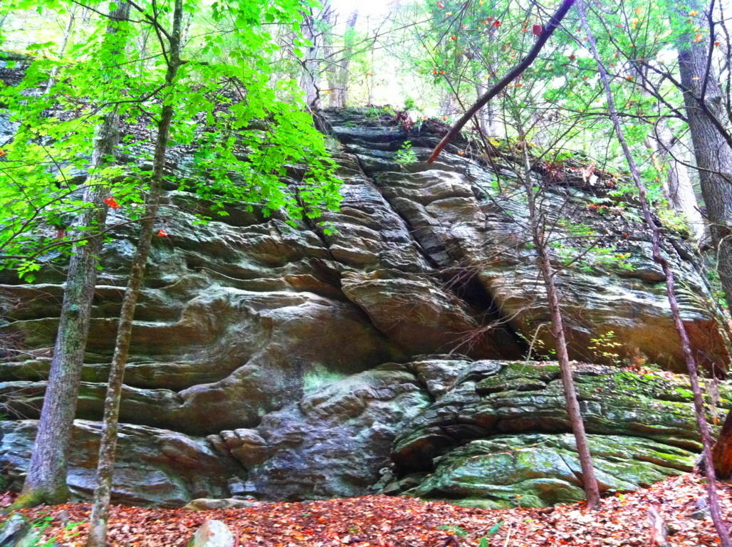
In some places there are small standing stones at the edges of these small cliffs (below)…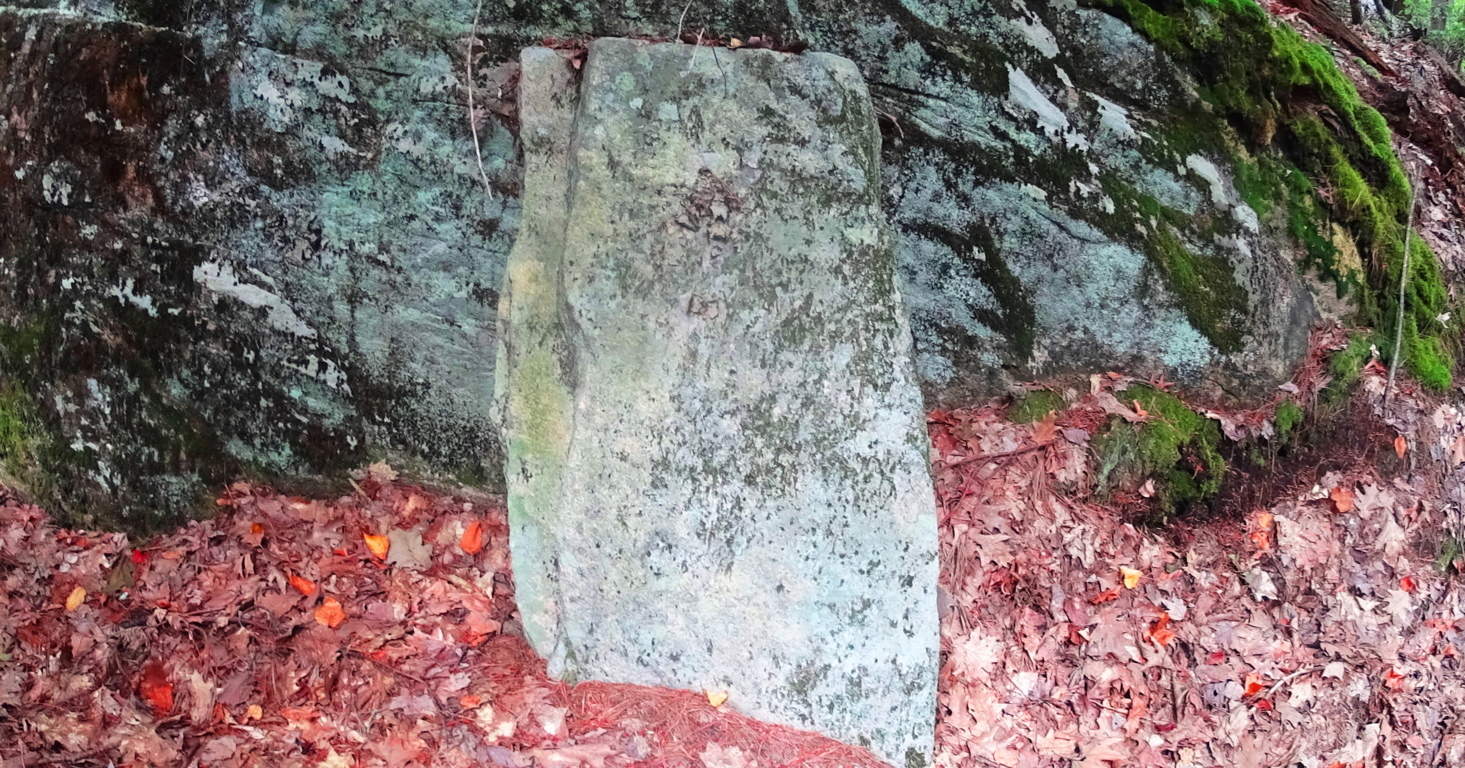
A similar stone in the historically megalithic town of Upton stands, just like this stone in Rattlesnake’, along a large stone-lining near the ancient Upton Chamber (below)…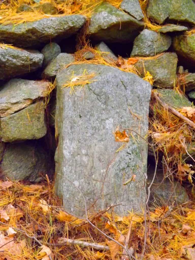
Keep in mind that these are not “small” stones, they are cut and crafted granite pieces that go as far into the ground as they are above; and they are perfectly squared. They are clearly a cultural marker of some kind created in antiquity. You will continue to follow the trail west until it turns left again, towards the western edge of the Farley Ledges, where the best lookout of the trail is found after about another 1/4 mile. The woods on this western edge of the trail are massive shelves and boulders overgrown with classic New England Fauna (image below)… At the western extreme of the trail, over looking Route 2A, is the southerly view of the heart of Massachusetts (image below)…
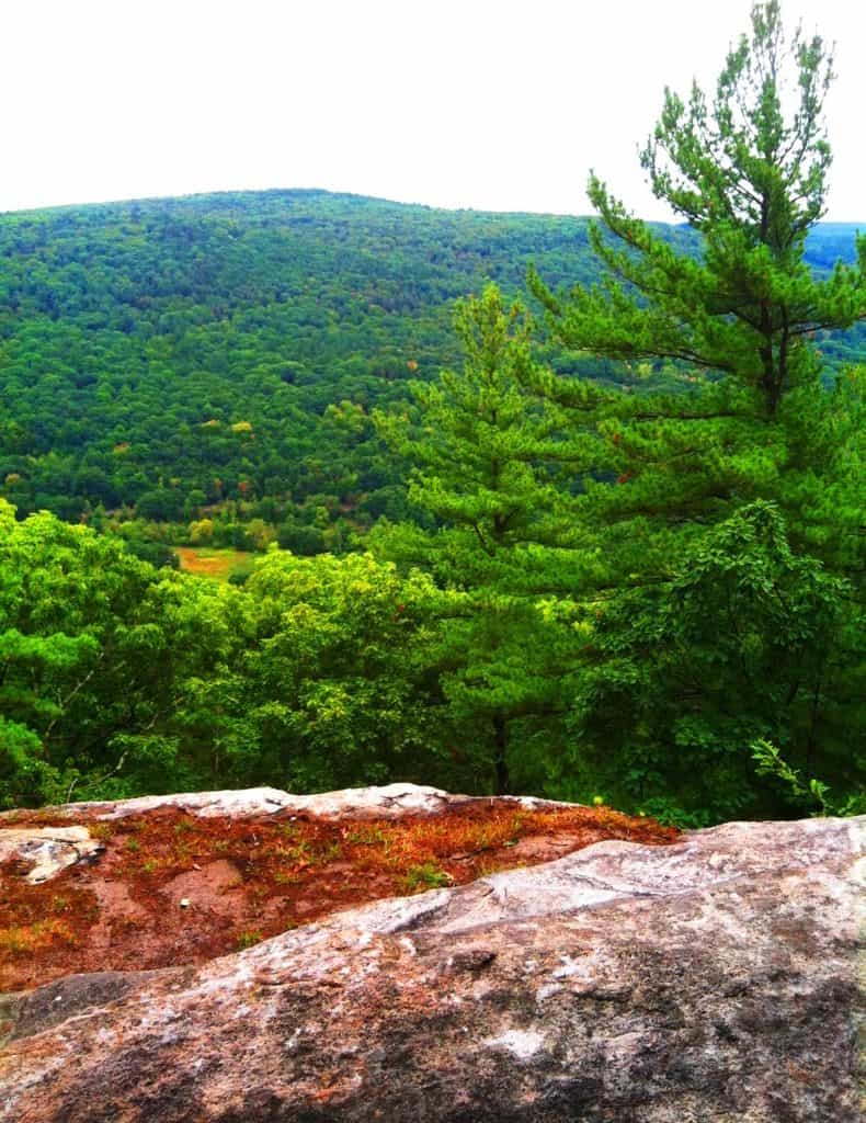
After taking in this view, the last portion of the loop descends back along Farley Ledge to the east. There are miniature canyons below, and gigantic granite walls slicing through the hills (image below)…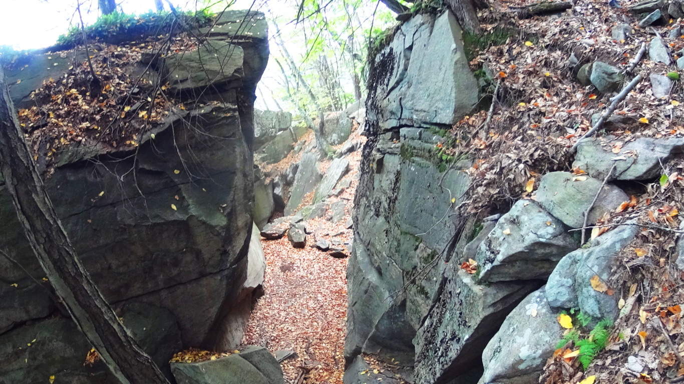 You will eventually come to a lower crossing of the stream at the eastern edge of the trail, then head back down to the megaliths below at Farley Ledge.
Rattlesnake Mountain is yet another example of classic New England hiking that combines practically magical megalithic statements in the forest and mountains with a pristine hiking experience. Time after time, forests and mountains of Celtic and New England places reveal a related megalithic mystery yet to be acknowledged by so many academics. Rattlesnake is clearly one of these sacred places, and it will grant the hiker a vision of something miraculous, something which is calling out to us from a culture that left its mark in a way that will never fade. You can touch these signature stones yourself, see the size and scope of them, walk the trails, and simply wander right into the hallowed wonder of it all.
Baxter State Park
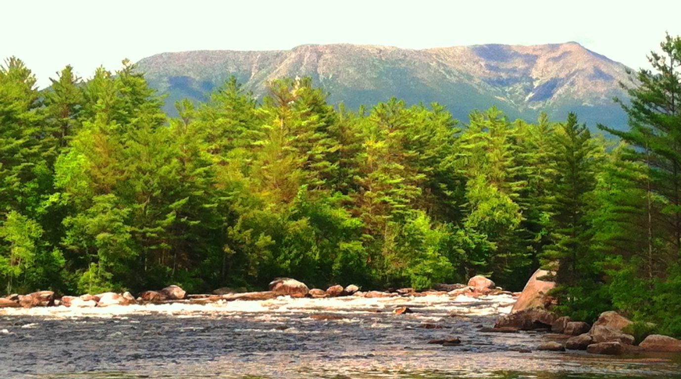
Location: Millinocket Maine/USA
Trail: Hurd’s Pond Trail
Note: Baxter State Park is over 200,000 square acres of protected wilderness, rolling 18 miles northwest of the welcoming country-town of Millinocket, Maine. The crowning feature of this incredible old-growth preserve is Mount Katahdin, a 5,267 foot peak, and final mountain along the American northeast’s 1,500 mile Appalachian Trail. The Piscataquis and Penobscot Rivers cut through the southeasterly portion of the park, creating opportunities for riding rapids and hiking along waterfalls, all with Mount Katahdin looming stoically in the background. Dozens of trails are spread throughout the park. “Hunt Trail” is the official Appalachian pathway to the alpine peak of Katahdin. Other trails that run to the peak, such as “Knives Edge”, “Abol”, “Cathedral”, and several others, require a reservation with the park before arrival, which can be made easily on-line at: http://www.baxterstateparkauthority.com/reservation/ The trails here also offer a good deal of anthropological mystery, with megalithic stones in patterns and shapes that push the envelope of our imaginations. I hope people understand that this is a site about fully appreciating what is discovered on wildlife pathways, and it is not meant to be shocking or offensive in any way. The information and evidence in the forests of New England support a megalithic culture that had specific memes and themes cut into granite, all for the world to discover. These mysterious stones can be found on Hurd’s Pond Trail, and I hope people visit these woods and judge for themselves what is being described here.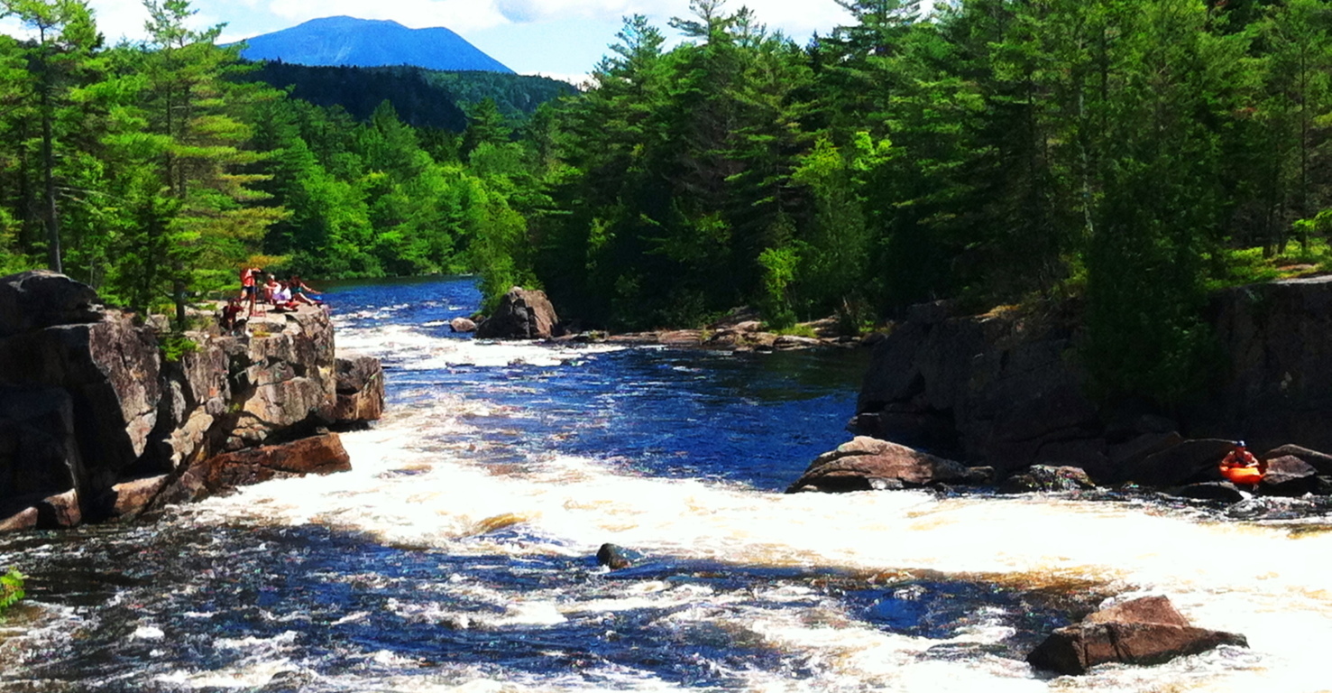 Trails which are not at an immediate proximity to Katahdin will NOT require a reservation, such as trails that run along the rivers, old-growth forests, lakes, rocky ledges, and icy caves, several miles to the south.
Hurd’s Pond Trail: “Hurd’s Pond Trail” will take you through some pretty cool natural features, and picturesque pathways, with several points along the way that give wonderful pause, and appreciation.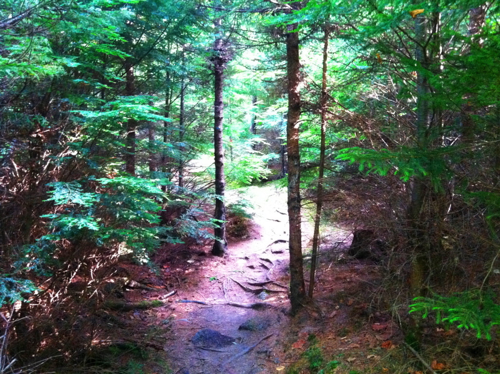 The Abol-Bridge Campground site is the jumping-off point for this trail, which runs the east-to-west course of the main road of the Reserve, Golden Road. The Northeast Piscataquis River runs south from Abol Bridge, with a dirt road running along its edge, eventually veering southwest into the forest trail.
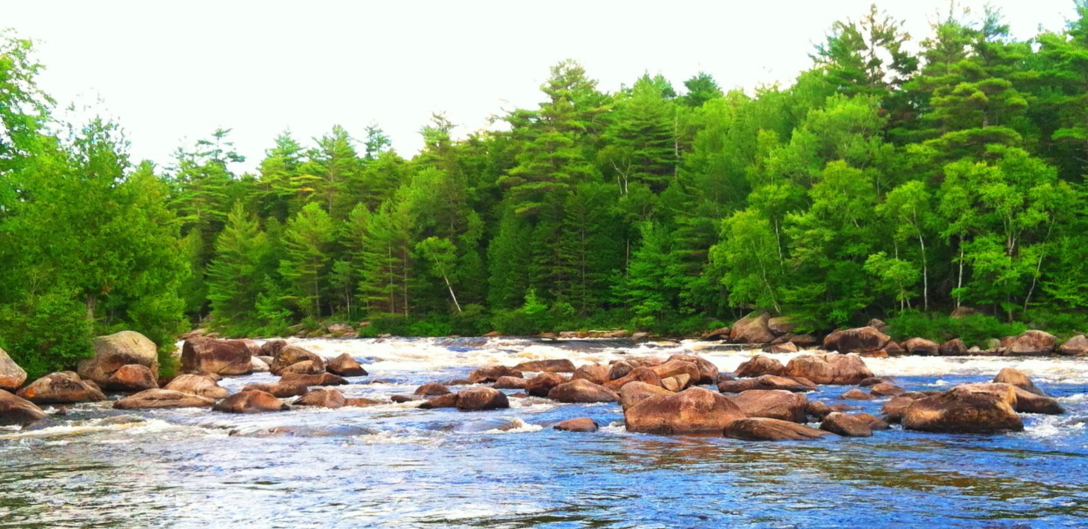 You can choose to walk the 3.5 miles along this stretch of scenic river-road to arrive at the car park of “Hurd’s Pond Trail”, or you can simply drive to the car park, which will be on your right after the 3.5 miles.
Hurd’s Pond Trail is a relatively short hike on it’s own, of about 2.5 miles culminating at the “Ice Caves”, an enticing network of boulders and passages overlooking Debsconeag Lake to the south. Before you get there you pass a set of pathways that feature different types of ledges, hedges, glades, and anthropologically mysterious megaliths.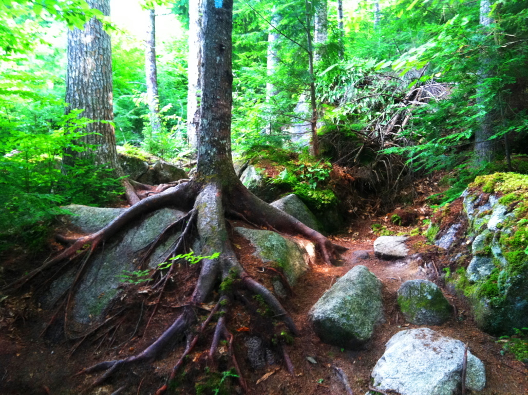 The lower trail runs over thousands of roots, and passes around grand fixtures of boulders that look to have been placed specifically along this particular part of the forest. Take a look at this boulder pictured below; do you notice anything particular about it? To answer the question: there are half-a-dozen massive triangular boulders, cut with a flat face and rounded back, standing at about 10 feet in height, and perhaps 20 tons in weight, along the path to the Ice Caves. It’s astonishing. There is first one triangular boulder to the right, and then one triangular boulder to the left, and then another to the right again, all within the first half mile of the hike. It is hard for me to believe that seasoned hikers and naturalists simply pass by this without taking any note of it whatsoever? Personally, it is impossible for me not to stop and wonder what this might indicate. Take a look at the image below; how could you ignore this? These are teams of similarly crafted boulders, staring you right in the face. Not only are they similarly crafted, but they are facing the exact same direction, north, which is staring directly at Mount Katahdin.
  If it were not for the amount of clearly crafted triangular stones that I have time-and-time-again found in various forests of New England, I would have a hard time writing this portion of the blog. I completely understand that some people may be entirely skeptical of this, but at this point it is utterly obvious to me that the equilateral triangle was worshiped by a megalithic culture in the forests of New England. To support this, just take a look at some of the examples of granite-cut triangles discovered from places all over New England, found in hard to reach places like significant mountain elevations, waterfall facades, and deep woods ridges, miles from modernity in every direction. Please consider, that scientifically speaking, Equilateral Triangles DO NOT OCCUR IN NATURE. These shapes were obviously crafted. Something is going on with the Triangle in antiquity, and anthropologists are simply choosing to totally, and absolutely, ignore it.
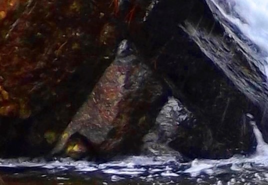

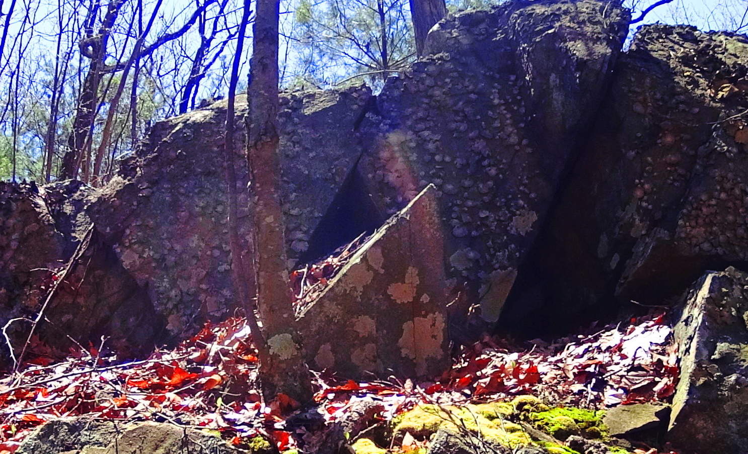
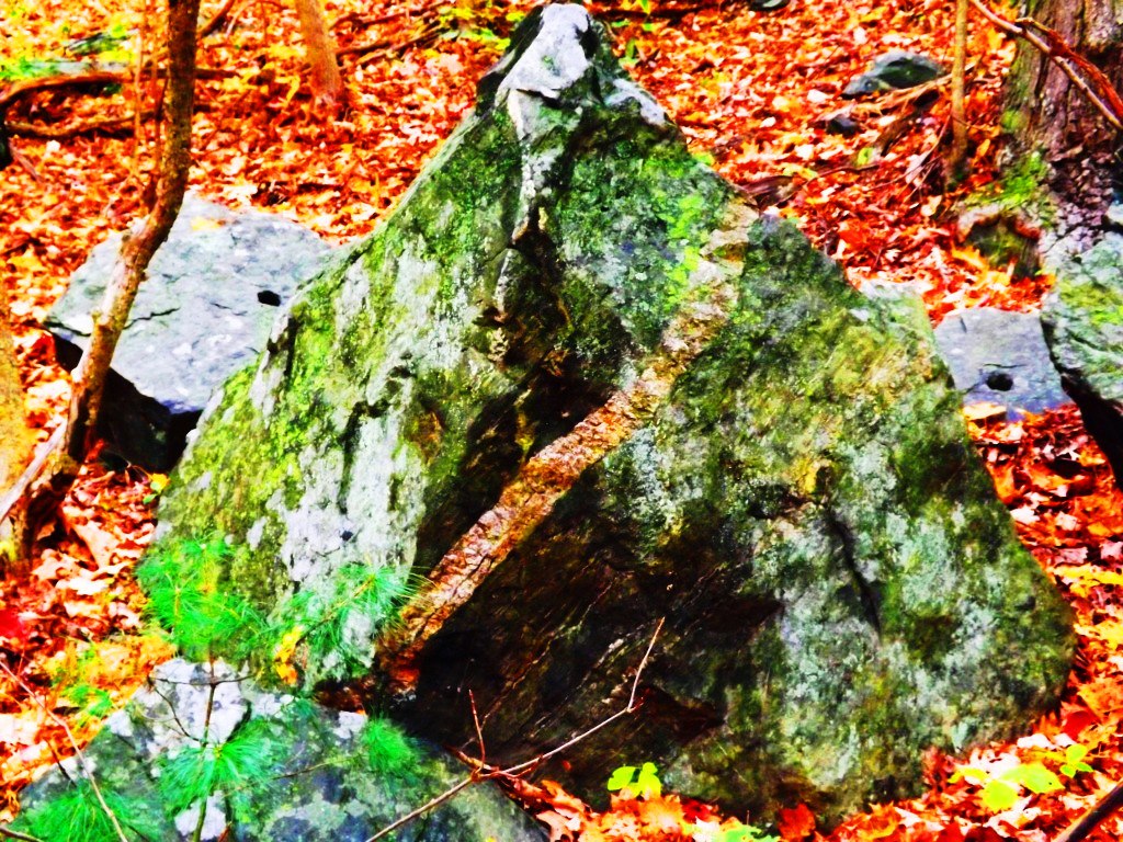
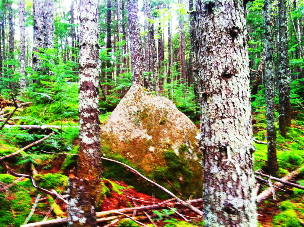
There is more to add to the mysterious elements at Hurd’s Pond Trail. Once you pass the initial triangular megaliths, you will come to groupings of boulders deeper into the woods that have other compelling features. You will first drift through some heavy hedges and narrow lanes, and come out to a beautiful glade of 100 foot tall Pines.
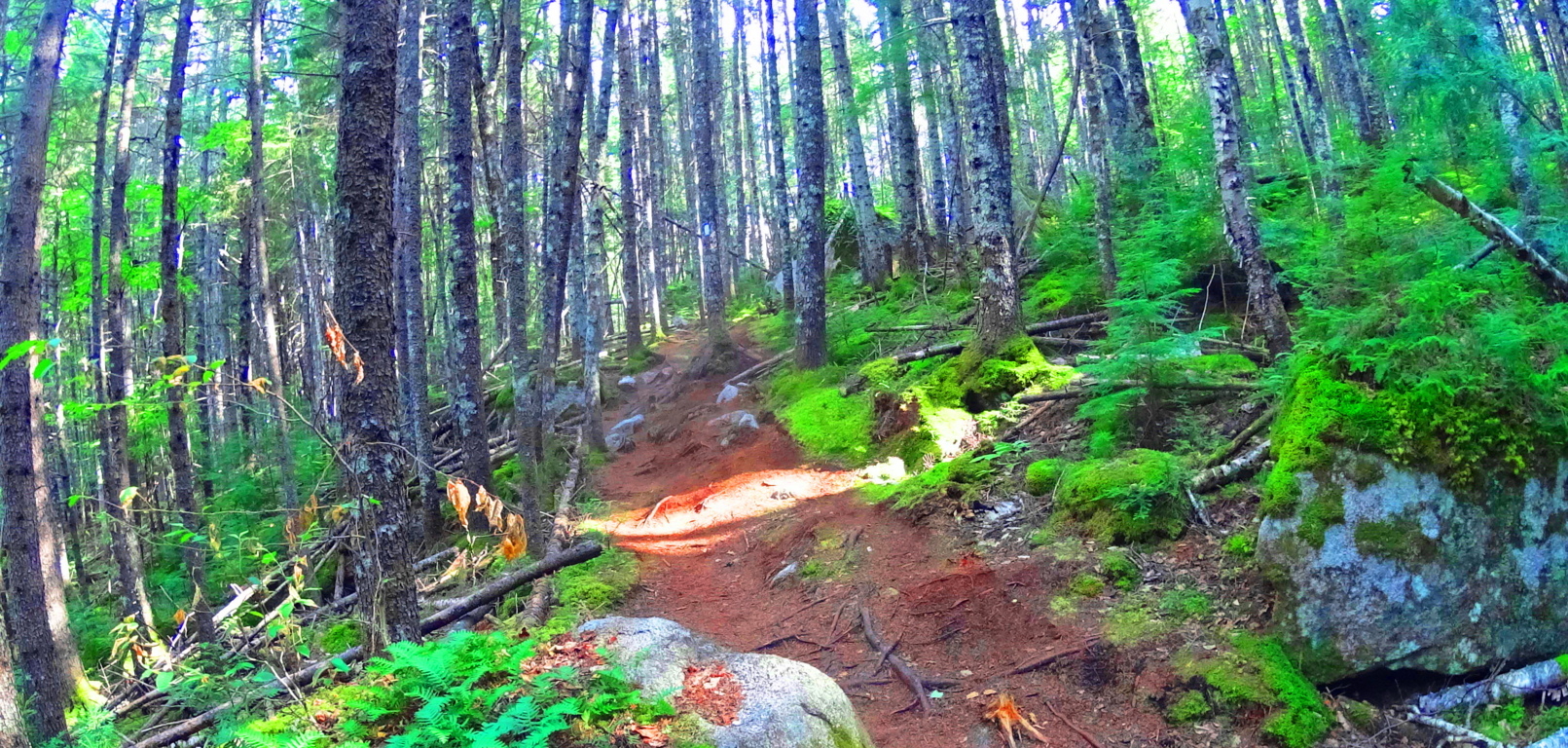 The boulders under these pines have specifically fitted cuts, within the rock faces themselves, which are angled and overlapped to create a triangular feature. In the image below, these two boulders are not sitting at random; the left boulder has a level right-face that is meshed in a perfectly flush fit to the cut-and-leveled left side of the boulder on the right. If you look closely it is absolutely clear. This ‘flush overlapping’ of the stone creates a specifically triangular space beneath.
 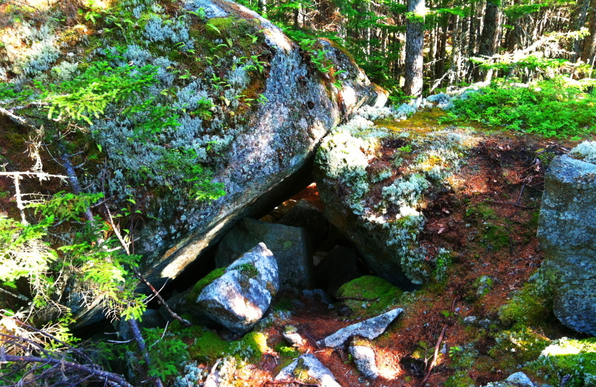 Take a look at some more examples from New England forests where I’ve found flush-fitted overlapping boulders that create triangular spaces. It’s not simply the triangular space beneath the rock, but it is the exact precision of the continued lines which create these angles that amazes me. How this is possible is hard to comprehend, and yet it is there.
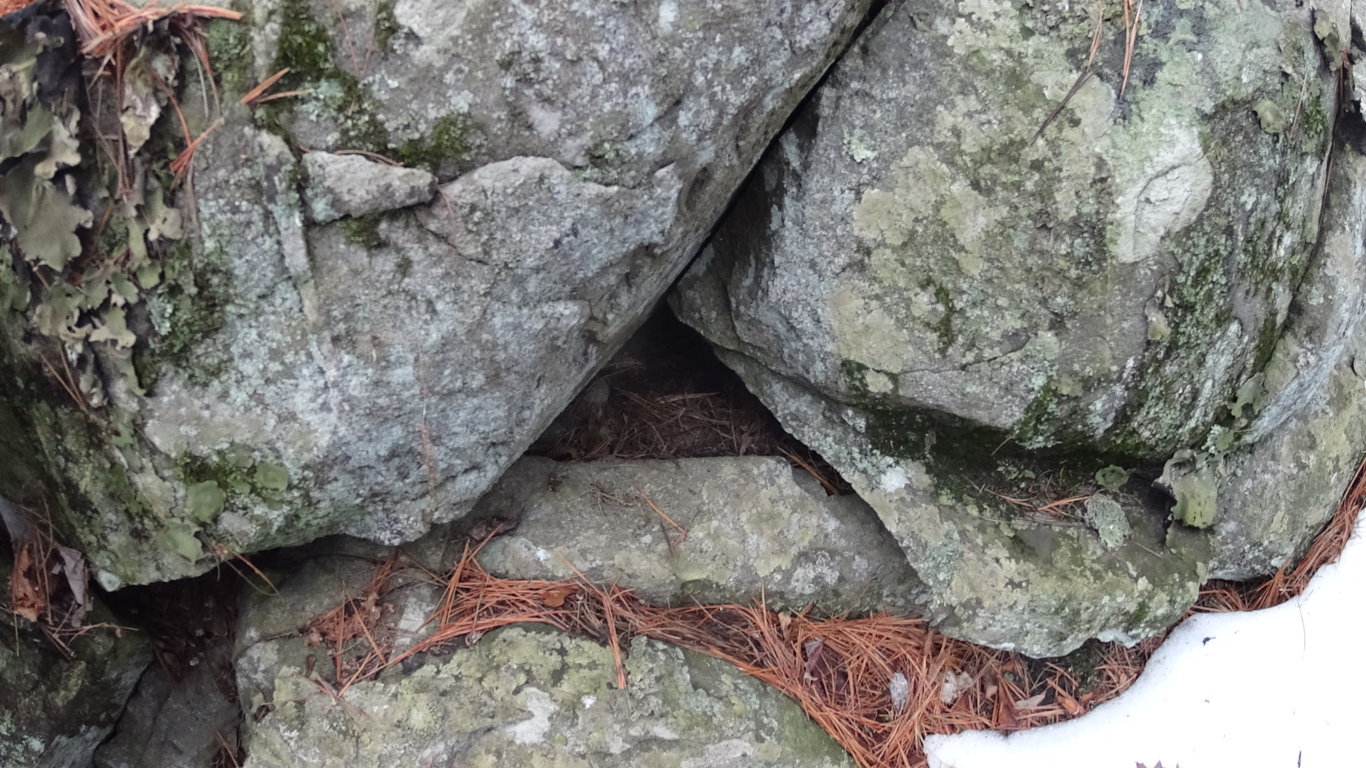
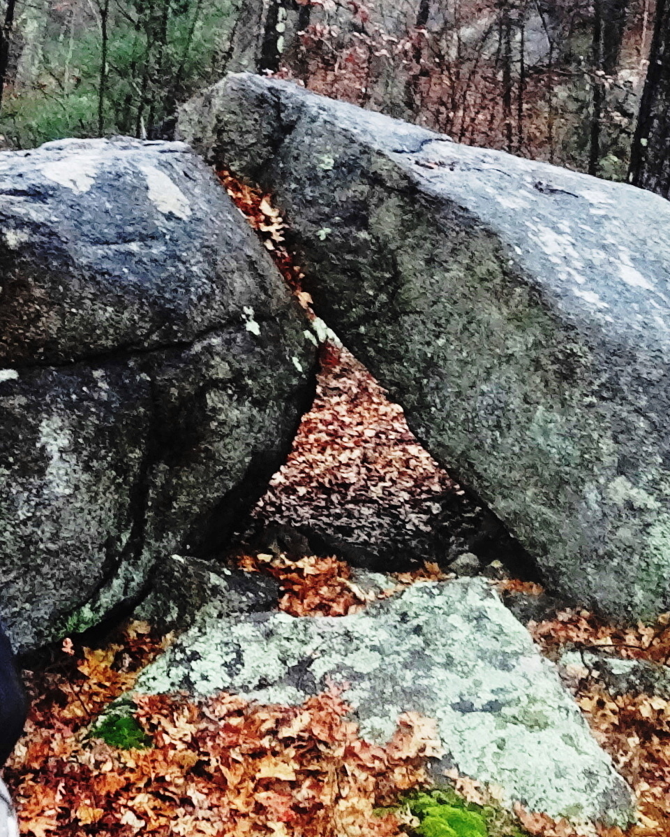
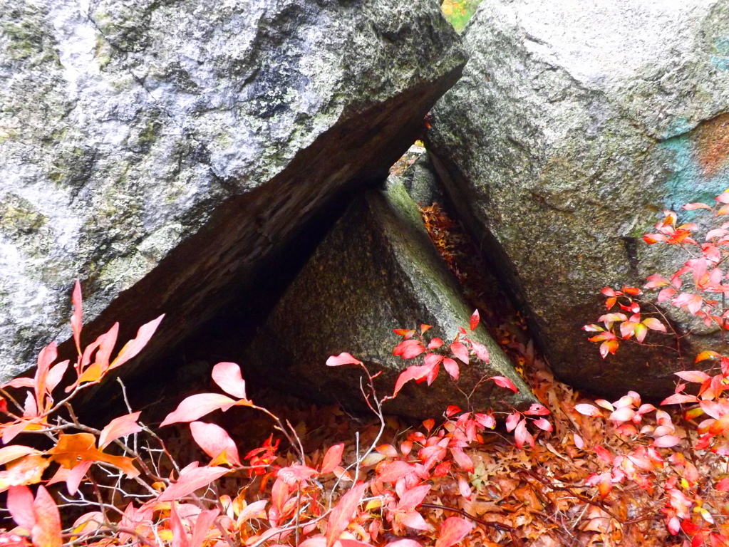
As you continue into the last half mile of Hurd’s Pond Trail you will see granite boulders with rounded-out arches, and the fitted pieces that resulted, sitting within a few small feet of each expression. Look at this section that was cut from this huge boulder below; the piece that was cut is sitting just to the right, like a block waiting to be inserted. It should also be noted that the top of these particular boulders have been cut flat, like a square. This is obviously some type of expression; like some megalithic craftsman saying “Look what I can do!”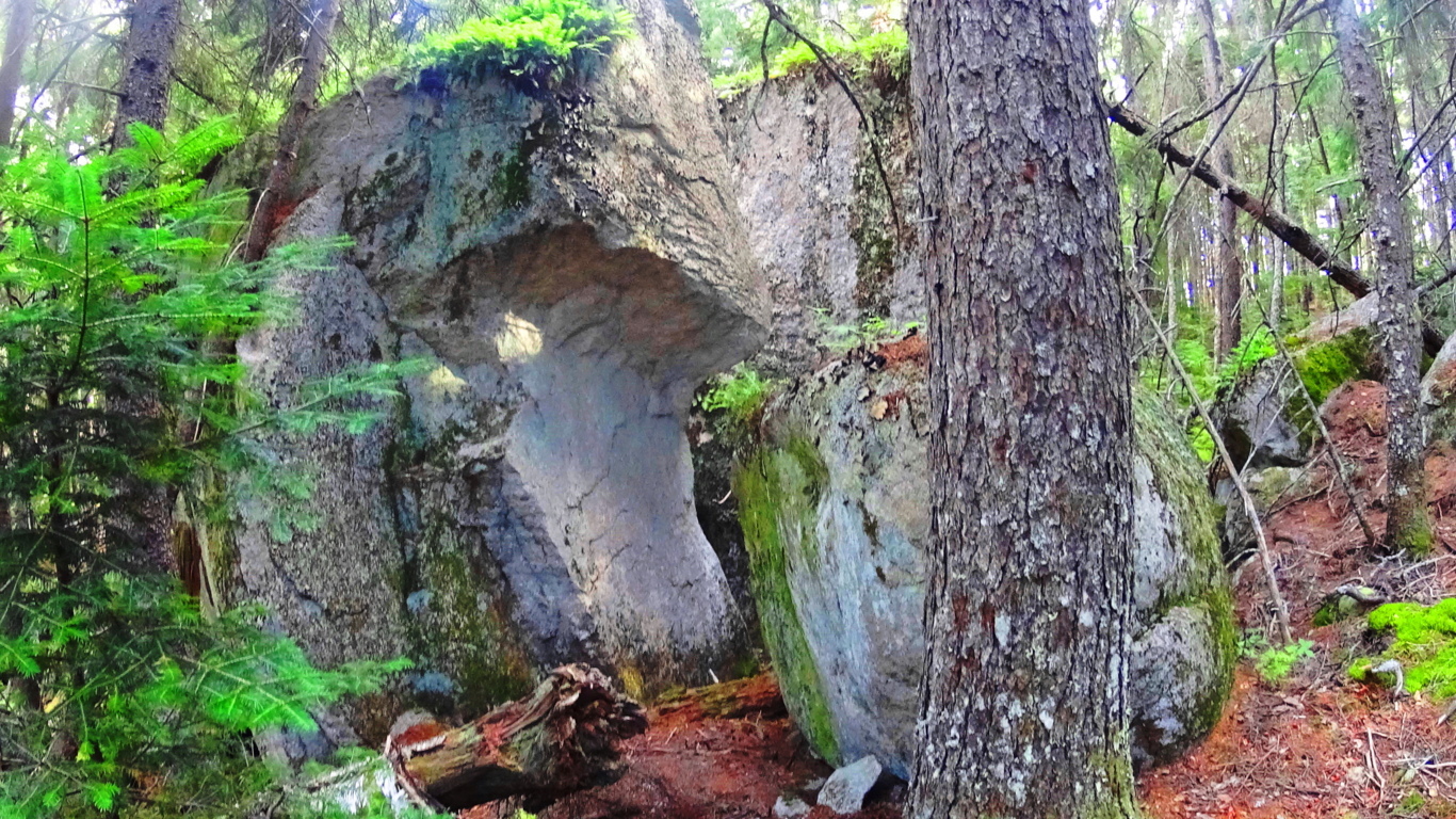
After passing a few hillsides with beautiful trees you will come to the sign that points to the Ice Caves, which do not have ice in late July. There is a railing and ladder that you can climb down into the caves, with its shafts of shadow, wind, and light. Above the Ice Cave boulders is a view of the beautiful Debsconeag Lake to the south.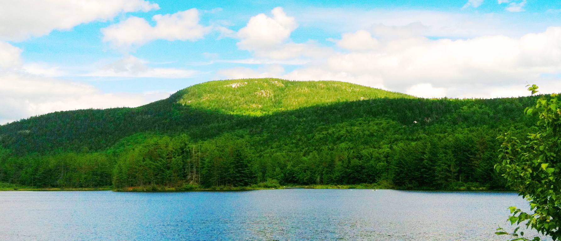 At this point you will have completed one of the better introductory trails to a worthy wildlife preserve in Baxter State Park. Work your way back steadily to the car park, and make sure you give yourself enough time to return before the Sun goes down.
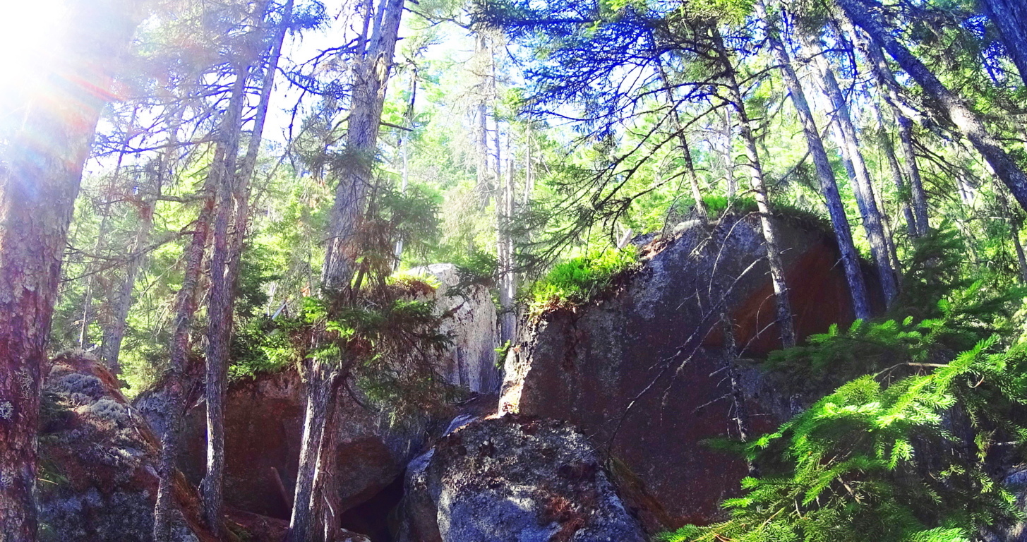
Final Note: New England is home to one of the most mysterious megalithic cultures in the world, which is obviously supported here at Stonestrider.com. This culture is very similar to the Celtic megalithic culture, which of course also has its own beautiful massive stone statements from the earliest era in History. Supported by consistent evidence, the megaliths of New England obviously have their own specific memes; rather than Celtic “spirals”, New England offers us ‘triangles’ cut out of, and into, the stones. I hope people come to understand the anthropological significance of this statement, and that every culture in the world seems to support a megalithic era, with distinct evidence. Baxter State Park is one of these sacred places, with natural beauty in the landscape, epic grandeur in the mountains, and mysterious megalithic statements deep within the forests. It is everything that this website hopes to bring to the foray. Do not to take my word for it, but seek and find these sacred places for yourself.
Mount Chocorua
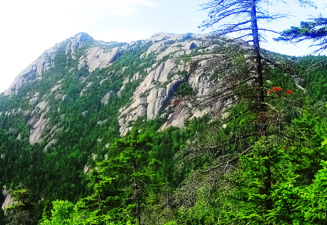
Location: Albany, New Hampshire/USA
Elevation: 3,478ft
Note: At the southern edge of The White Mountain National Forest of New Hampshire, sits the rocky, Pine-covered-peak of Mount Chocorua. The White Mountains are part of the grand Appalachian Trail, which runs 1500 miles south, all the way to Mount Springer in Georgia. About 50 miles directly north of Chocorua is the largest and most famous of the White Mountains, Mount Washington, standing at 6,289 ft. In the 50 miles between Chocorua and Washington are nearly a dozen seemingly animated peaks, all of which can be seen from a stellar vista at the top of Mount Chocorua, some 3,478 ft high.
Trail: Starting out, take Rt 16 to Moulton Drive in New Hampshire, which is a short length dirt road located behind an old antique store. Moulton Drive takes you to the Car Park for ‘Piper Trail’, the best approach at Chocorua Mountain. Start as early as you can, and bring plenty of water, New Hampshire in the Summer can be hot and humid. It is about 3.5 miles to the peak, so be ready for a solid seven mile hike, including a challenging rocky incline to get above the treeline.
At the beginning of Piper Trail you are enveloped by tall White-Pines, rusty colored Red Spruces, Ash, and Balsam trees. Further up the trail, bright Birch groves appear like miniature pillars protesting the hazy green shimmering of millions of leaves. After about a mile, you will cross the Chocorua River, and begin the slight elevation. This slight incline runs along a pristine forest ledge which carries a cool breeze through the shade.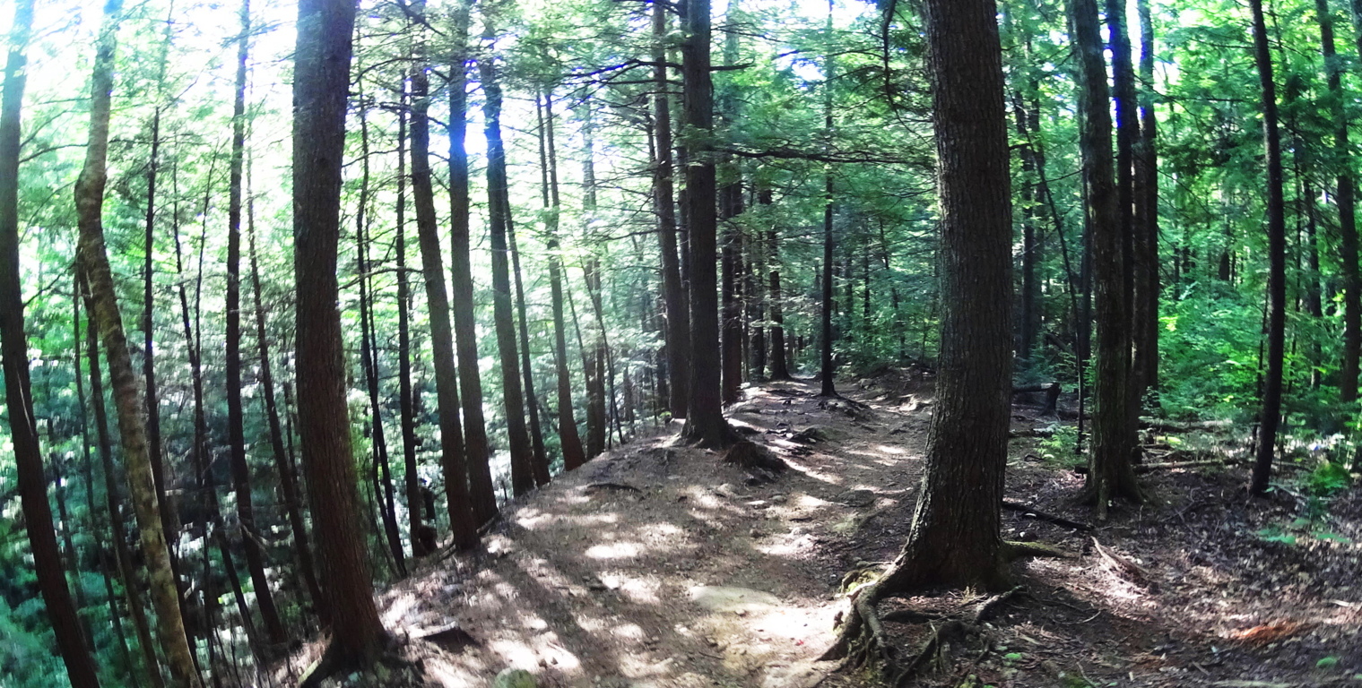 As you continue you will come across free-sitting-boulders beside the trail, which are mingled with the vast hedges running straight up the mountain. These glades continue northeast and west, rolling for 60 protected miles that contains Black Bears, Caribou, and White Tail Deer.
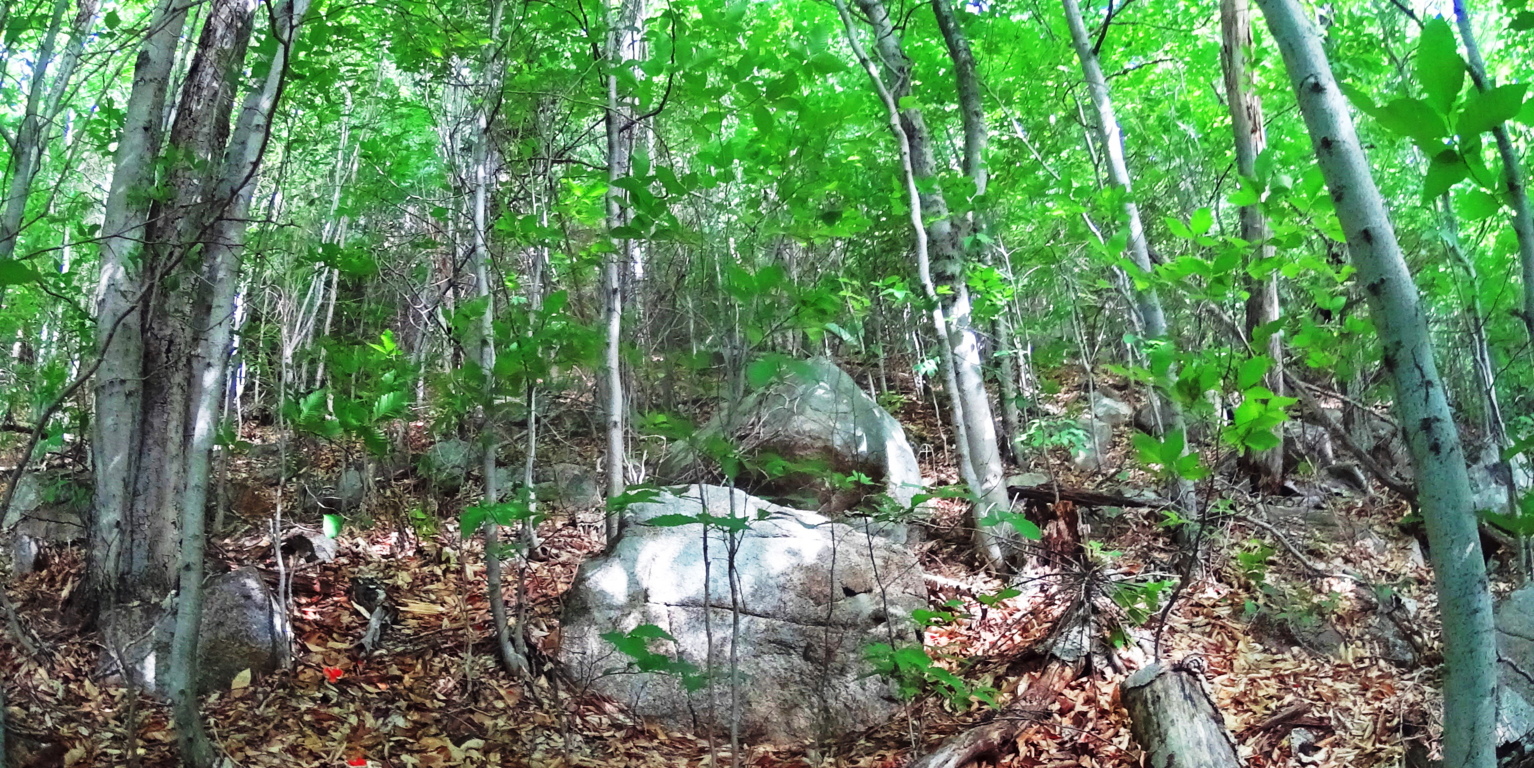 Like so many of the trails in New England, rocky staircases which are cut out of the mountain will begin to appear. At the base of many of these carved stairs there are triangular stones often marking the trail. It is a phenomenon that is found all throughout New England.
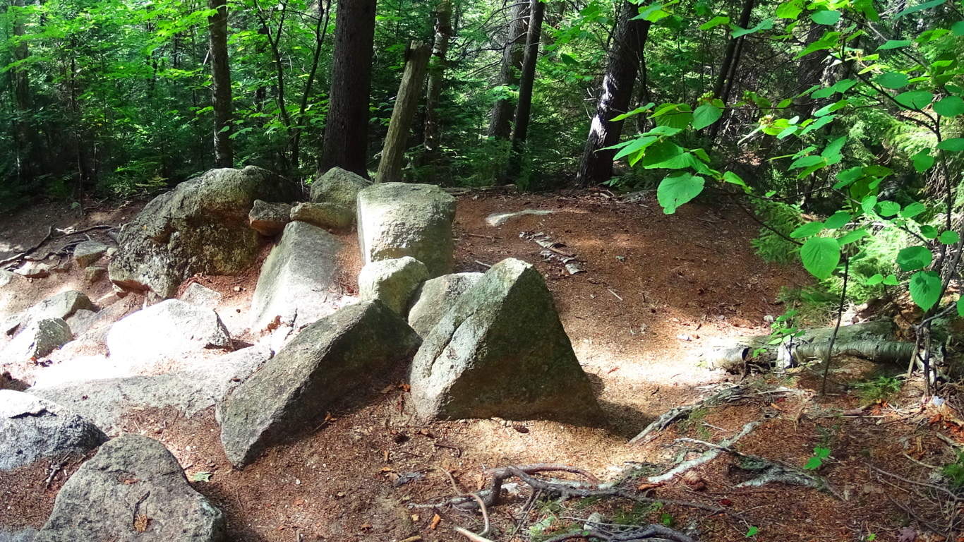 Here are three 8 foot tall equilateral-triangle megaliths at Five Ponds Loop Trail in Baxter State Forest in Maine, in the shadow of Mount Katahdin. It’s as if the overgrowth on the stones knows its not supposed to grow on these flat cut surfaces.
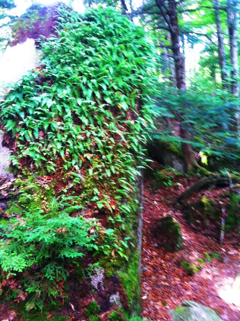 The front side of these stones are absolutely smooth, with a face cut like a knife through cake, while the back sides are arched and rounded. A profile view of the triangle stones is in the far left image. See how the hedge inundates the back, but the face is not touched? And these three stones are identical, lining the pathway like signs on a highway.
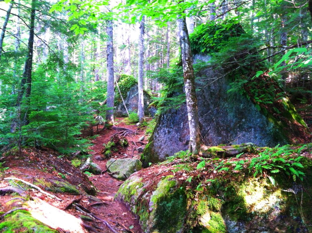 The chances of this are gastronomical. If I had not hiked almost every trail in Massachusetts and seen the triangular phenomenon for myself, I would have a hard time believing it, but time and time again it shows up, and is becoming impossible to deny.
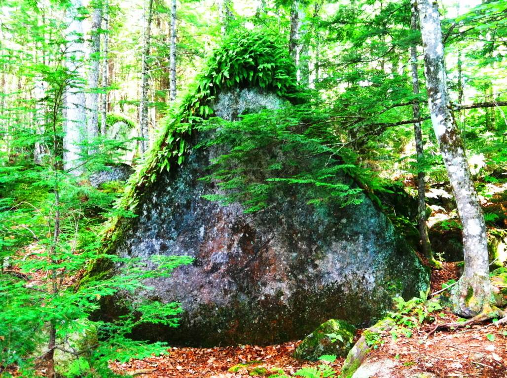 This “cut-face” style is very much like certain types of Celtic standing stones in Glenveagh National Park in Ireland, and Watatic Mountain in Massachusetts, which have stones with smoothly cut faces, supported by large rounded rears. Here is a look at one of the diamond shape “cut-face” stones at Glenveagh, with a profile view, and the frontal view (white stone below). I believe these are anthropological stones, cultural statements, not random. The meaning of the triangle requires more
explanation, and will be explored in a separate post. Continuing on at Mount Chocorua, the small triangle will mark your first stone staircase. As you begin to climb, Chipmunks and Squirrels scatter in every direction, storing acorns under the warm stones.
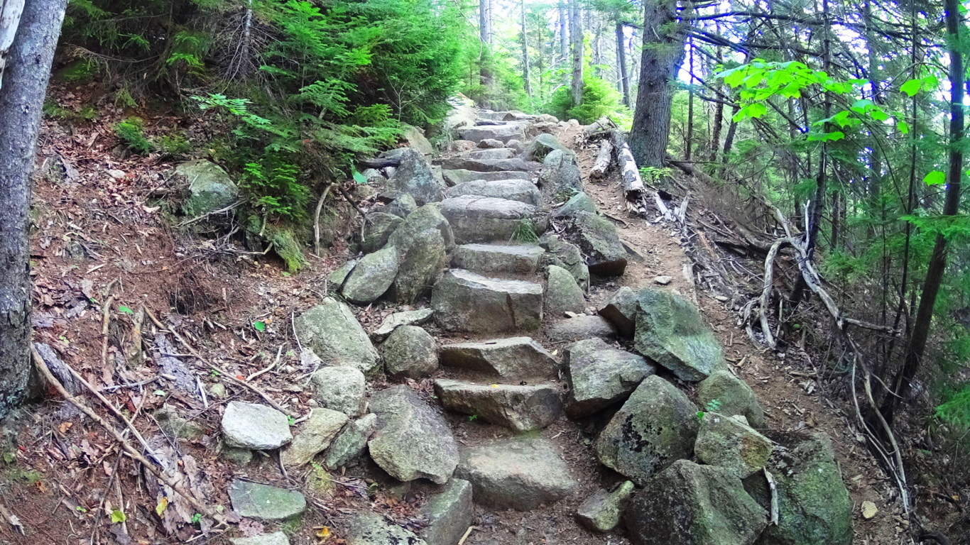
Ascending this stair you will begin to come across ‘signature cross sections’, or ‘X’s’, that also appear mysteriously at trails throughout New England. Here is a cross section along the trail at Chocorua on the left, and a cross section at Mount Watatic on the right.
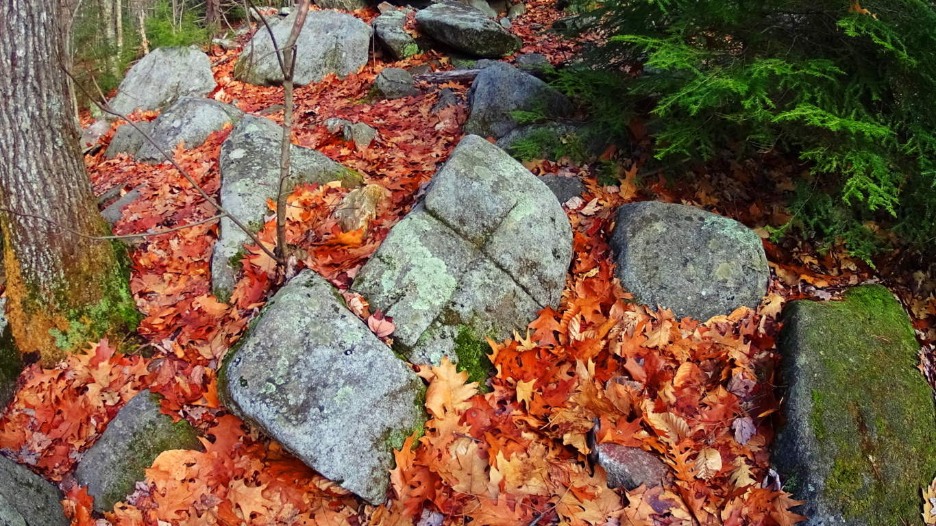
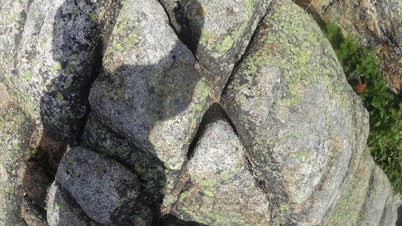
Further up “Piper Trail”, (as if this isn’t strange enough) is another ‘cross section’, but one-quarter portion of its total figure has been cut out, and moved several feet down the trail, like a giant puzzle piece. This is clearly a stylized craftsmanship, like fitted blocks.
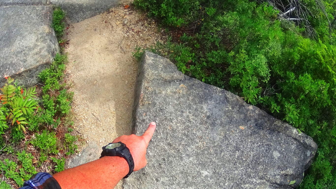
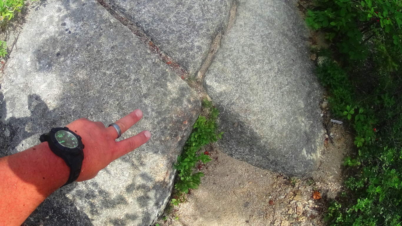
The stairway has many “signature” type stones, indicating that someone is leaving a stylized mark on this pathway. After several stairways you will come to the large boulder-porches that begin to break the treeline.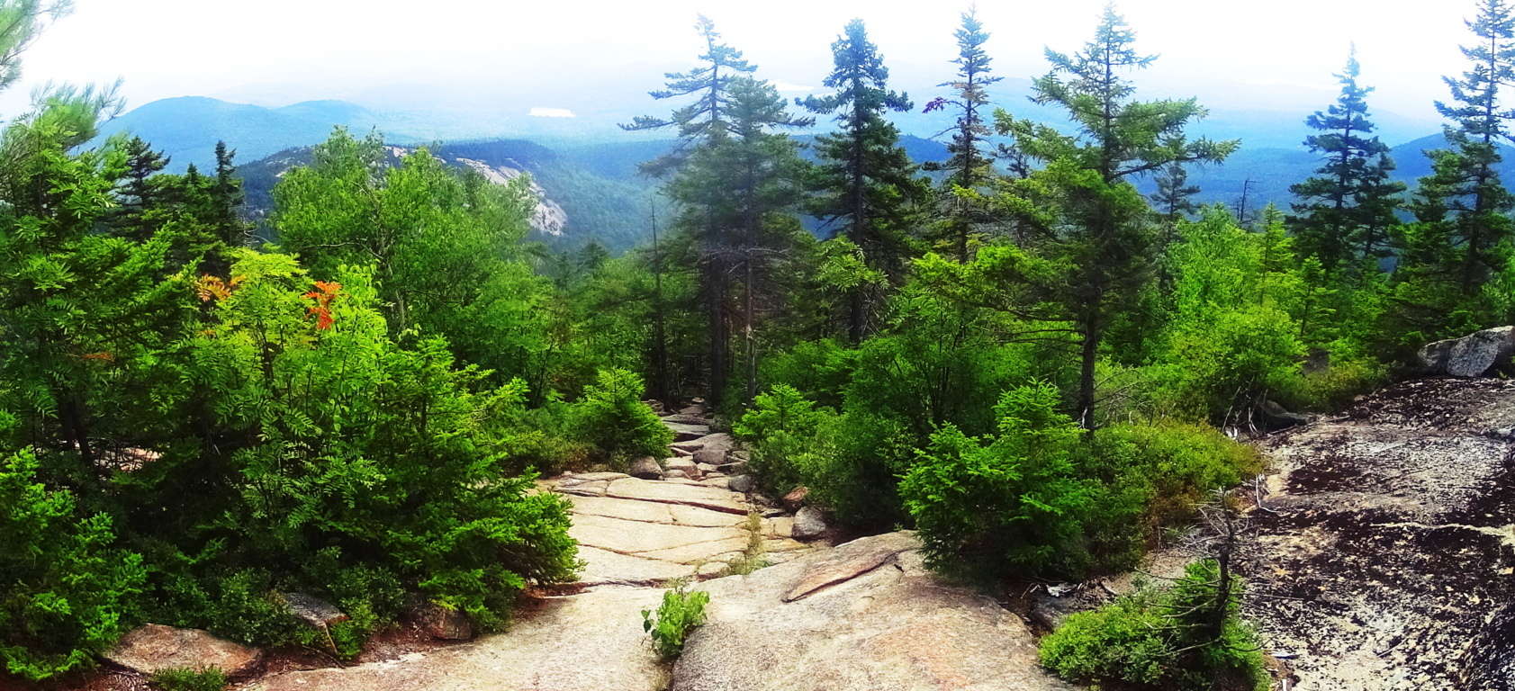 The mid-portion of this hike is a trek on boulder-porches and tight pathways. The view becomes beautiful, looking south into Massachusetts and the river-valley below. The ever rolling aspect of these mountains is more clearly revealed, with a slightly blue hue on the peaks that mingle with the sky in the peripheral distance.
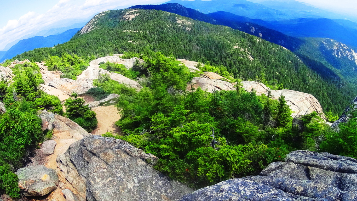 Turning your attention towards the peak, you will reach a ‘crossroad’ of choices in a glade just before the final ascent. There is a wooden sign that points to the pathway leading north, further into the forest, and an arrow pointing left, to the peak. As you follow the Peak Trail sign you will arrive at a stunning boulder-ledge that mingles with White Pines, running roughly 150 steep yards, straight to the peak.
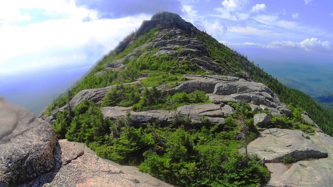 There is a singular massive boulder that is set in place in a distinctly different way from the others, with several incised lines around its sides sitting just before the final ledge. This may very well be a type of Dolmen. Continuing beyond this mysterious stone you will arrive at the top.
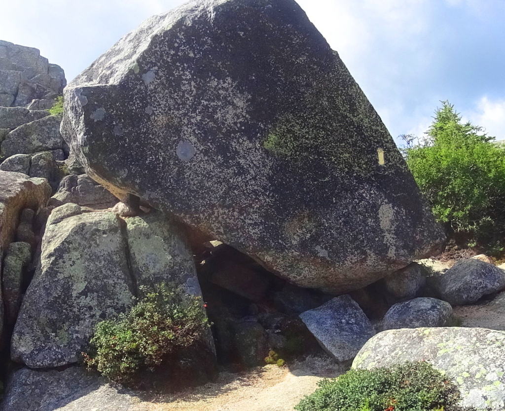 Take your time here, and enjoy the cool crosswind along with a spectacular view. White Mountain National Forest is unveiled.
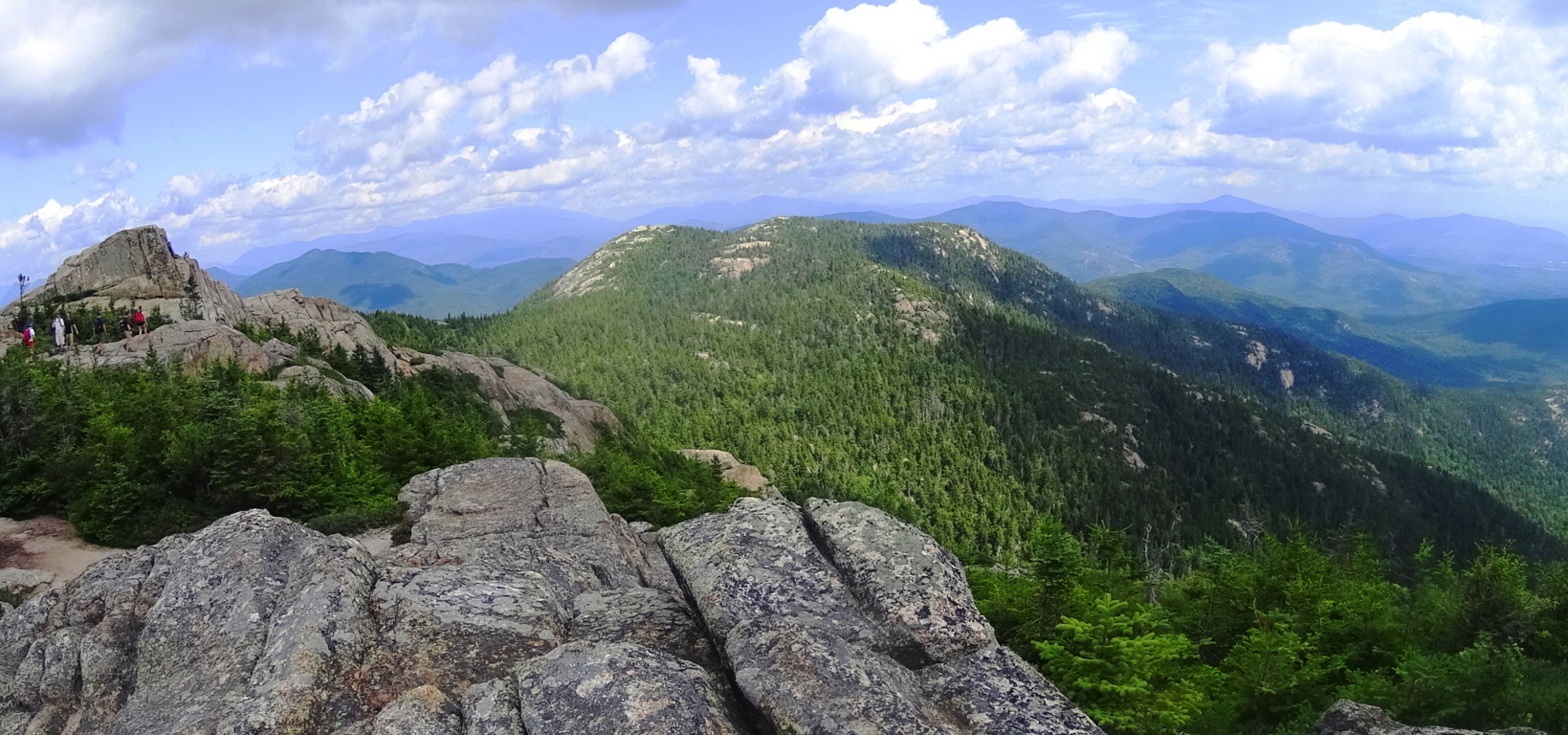 The peak of Chocorua is a 360 degree porch, and it is also a dragonfly haven! There is a standard official mountain-marker at the highest point if you wish to touch it, as many hikers do to complete their hike.
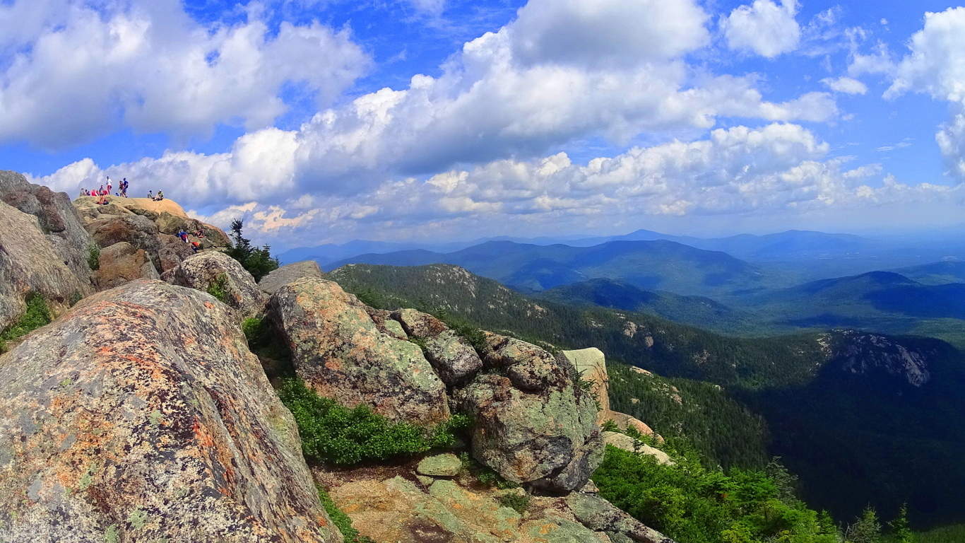 The clouds roll cumulus into the states beyond, and the sun is warm on the boulders of the peak at Mount Chocorua. Climbing this mountain is absolutely a significant accomplishment. I have found many Celtic mountains to be less challenging than this White Mountain gem. New Hampshire is a wonderful place, with a vast natural habitat well worth exploring. It is comparable to places like The Mourn Mountain Range in Ireland, and The Glenveagh Mountains in north Ireland. If you give the White Mountains a chance you could very well fall in love with the classic New Hampshire countryside. Find your way, and go strong.