Donegal
Location: County Donegal/Ireland
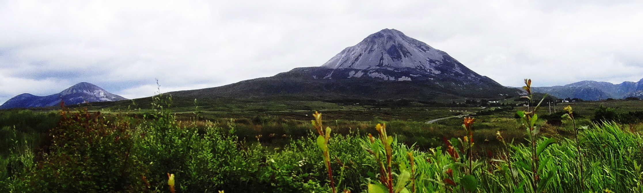
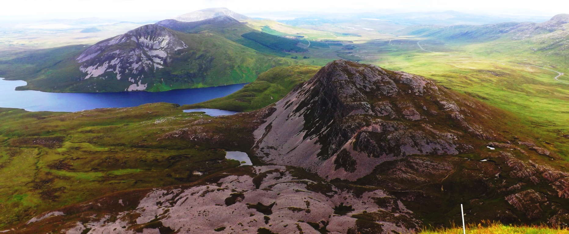
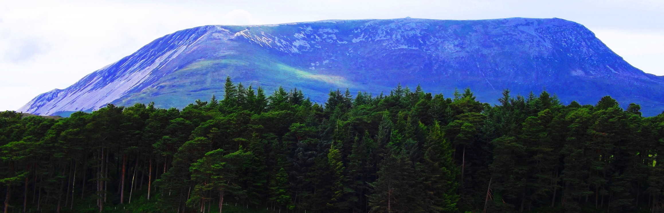
Note 1: There are only so many places in the wide world that offer an approachable scene of mountains along with gorgeous coastline in the same incredible hikes. Some examples include exotic places like Santa Barbara/California, Monaco/France, or Whakatane/New Zealand. These epic places all carry that rare majesty of mountain-range combined with coastal experience. These areas, at minimum, are straight-up wonderlands. It pulls on our imaginations and taps our curiosity to even glimpse images of these places. There is yet another place though, no less profound, further up the northern hemisphere, that is so worthy of your attention. For the lucky trailblazers who have stood at the peak of Mount Errigal in County Donegal, Ireland, and turned their gaze North (Image/Below), it becomes scintillatingly clear that this is one of the most incredible mountainous/coastal regions on Earth. This is Donegal, Ireland. If you haven’t found your way there yet, then this is your chance to get a glimpse of this ancient place. Sometimes just a glimpse is all it takes to get you there, like falling in love at a glance. This is the overall goal of Stonestrider.com; not just to show you how beautiful a given place might be, but to give you enough visual substance to put you over the top, and get you to make the decision to get there… in real-time.
 Donegal is a collection of every possible aspect of ancient Irish culture; from the Celtic tradition espousing tales of Giants and great kings, to the related Medieval Period and its dynamic history. In approaching Donegal, the boarder regions to the South and East will be looked at as well. Ireland is an interwoven tapestry of related Counties, and it becomes necessary to describe the beautiful sites that exist en-route to this beautiful northwest corner of the Emerald Isle, as well as Donegal proper. The history here is pretty much on-par with Game of Thrones. There are epic accounts of Viking-raids all over northern Ireland, mingled with Medieval relations between the great Houses that occupied the ancient castles of the region. Donegal Castle has many engaging stories throughout its haunting and epic history. (below/left). There are hundreds of other gorgeous castles dotting the landscape, contrasting the skyline atop cliffs; along crystalline lakes, and dark Atlantic coast.
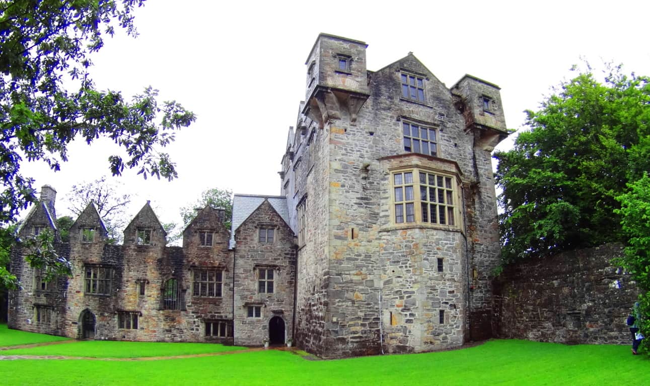 There are Dolmens in the heights and forests; Dolmens which are aged 4000 to 6000 years. Stone Circles exist mystically in the fields of each county as well, and are no less significant. Donegal is a veritable soup of historical substance. There is a historical richness and mystical sustenance that locations like Santa Barbara and Whakatane’ just can’t provide. An adventure in Donegal is rich with tangible in-depth substance, true wonder, and every type of magical potential. O.k. Lets begin, to wander in…
The Region: Before entering the dimension that is Donegal, the logistic mystery that surrounds the area should definitely be addressed. Even describing the cartagraphical affiliations of the area creates a bit of a tongue-twister; colors can be used to describe the political designation of Donegal. Donegal is in the physical region of northern Ireland, and more specifically northwestern Ireland, and remains part of the nation of Ireland, which generally continues geographically South from Donegal. Donegal, however, is not in “the nation” of Northern Ireland, which is part of the U.K. The north-eastern part of the island is the U.K. Be aware of this national distinction if you travel anywhere due-north of Dublin, the proud people of this specified region most certainly are.
Note 2: The history of the northerly destinations of Ireland should definitely be looked at for a moment before thinking of traveling through. Deadly conflict has taken place around the area of Belfast due to the occupation of British forces. This controversial occupation extends far back in Time, even before Colonial times, into the Medieval period. Interaction between the British, Scottish, and Norse cultures, are interwoven into the overall ancient history of the region, with the British prevailing into this Modern period. Towns like Newcastle in the Mourne Mountain Range have a proud tradition of being part of the U.K, with hundreds of British flags often displayed in the old-town center, nestled into its beautiful coastal/mountain scene. (Image/Left)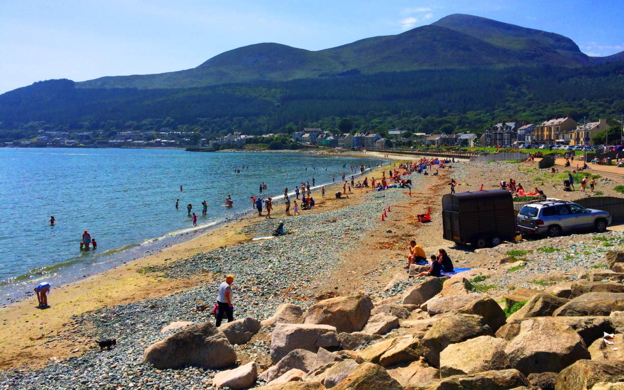 Travelers should know that there is no toll, or wall, separating the northeastern region from the rest of Ireland. The beautiful Irish landscape rolls through the entire Island unhindered, and you can pass from county to county freely, regardless of these modern distinctions.
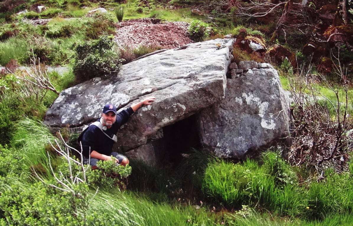
Note 3: A seekers approach to Donegal can definitely start with the Megaliths, among many other beautiful things from era’s past. The ancient monuments of Ireland, its Dolmens, Cairns, Standing Stones, Stone Temples, and Castles, are extremely important for trail-finders. Their initial quality of lending the deepest spiritual significance to the landscape is only the beginning of their impact; they also give hikers something significant to strive for, a goal beyond the typical tourist attractions i.e: places where the locals stare distantly from beyond the parking-lots. Often times, if you set your sights on a sacred site, those beautiful and impossible stones in the illusive distance, wonderful and unpredictable things will appear and happen along the way. An example of this is found on the wonderful trail high above Glenveagh Castle, in Glenveagh National Park. There is a totally unmarked Wedge Tomb in the most dramatic of places, right next to the elevated trail. Finding these relics is not only a natural rush, but it also supports the idea that someone lived in this specific area as far back as the Neolithic Period, and if you explore further, it is likely that you will find more magical anthropological statements, adding to the wonder and mystery of the scene. This Wedge Tomb had that special symmetry that so many Megaliths do (Image/Below)…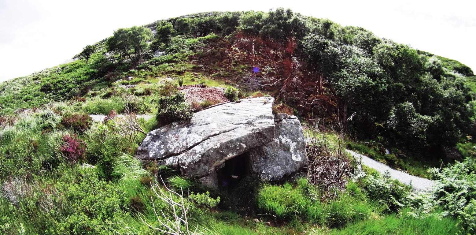 it is placed in the absolute center of the gully, and above an incredibly beautiful Glenveagh Lake. The view just 20 yards away from the Wedge Tomb, is truly spectacular with the Castle in the Frame. It is no wonder that an ancient group/culture found this spot to be a place worth living in, and claimed it with territorial stone statements. Incredible.
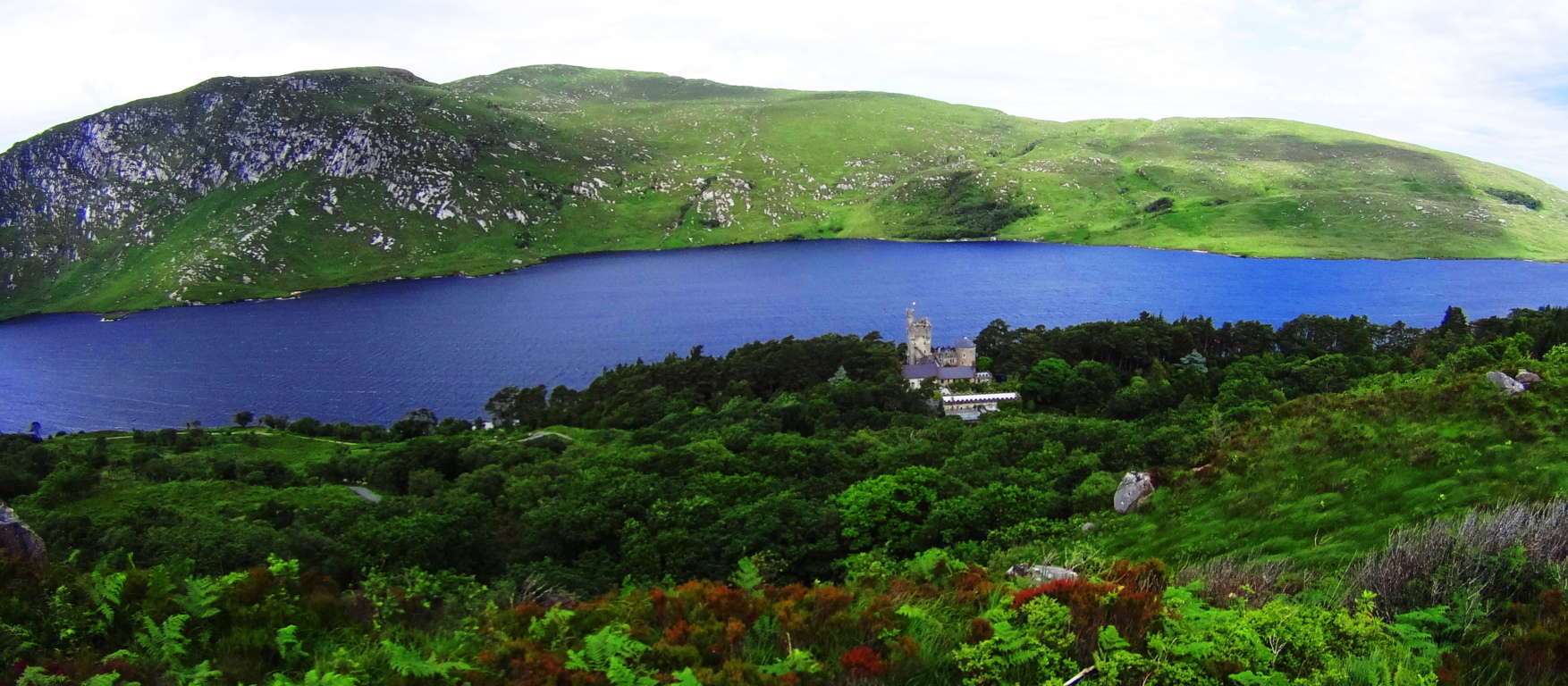 Other times, you can often be hiking and just around the next bend an incredible historic site will just appear practically out of nowhere, as Monea Castle did for me while hiking a roadside in Enniskillen on my way to Donegal.
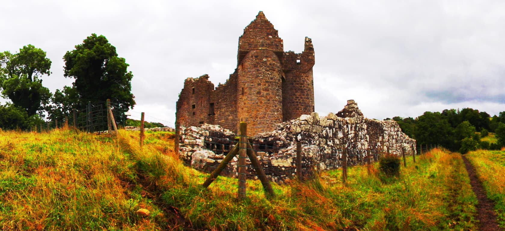 Walking towards a countryside castle like Monea is like wandering into a dream; often without another person for miles, with only the quiet stillness to picture the beautiful life-style that had taken place here hundreds of years ago. (Image/Above) Not far from this very same scene, continuing north on the A35 to enter Donegal from the South, you will discover the approach for Drumskinny Stone Circle. There is countryside for 15 miles in every direction when you arrive. The stillness is shocking. This is the epitome of Stones Circles in Ireland. Drumskinny is in a classic radial form, along with a linear extension of smaller stones, which are certainly worthy of a study beyond the scope of this article. Perhaps there is a celestial connection? Each stone is beautifully unique, like people, and yet the unify into one shape. These places of ancient ceremony have a vibe similar to that of visiting a relative over the landmark age of 100, that is: without words there is an amazing depth to the moment, however still and nearly silent the scene may be.
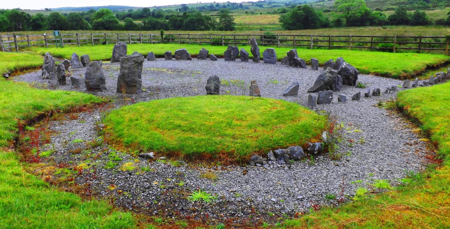 These are the places where the Celts had dwelt for centuries; generations of everyday farmers, householders, and small-business-owners are their descendants. They have survived countless struggles to remain connected to their homesteads. After visiting this beautiful place at the southern edge of Donegal, you will be ready to move North to a region where two Dolmens have stood since the beginning of History. Both the Gortnavern Dolmen, and the Kilclooney Dolmen, are located in County Donegal, and are fantastic options for a multifaceted adventures with a climactic focus.
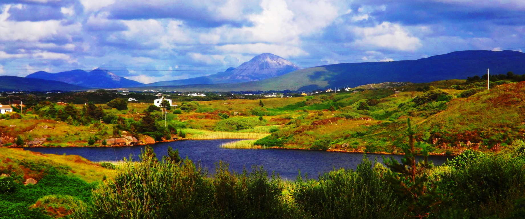
The Gortnavern Dolmen Excursion: The overall approach to reaching the Gortnavern Dolmen is just as significant as actually finding it. Major roads in Donegal are solitary and singular, while contrastingly, smaller roads often have no names, and lead to the farthest corners of enclosed hedges and fields that seem to go on forever. ‘Moneymore Road’ is a good example of the lessor road experience, located at the southern base of Mount Errigal. This little street gives a reclusive valley perspective of the entire enchanting area. An abandoned stone church sits in the shadow of the Mount Errigal beyond, a truly epic vision. The best and most beautiful approach to the Gortnavern Dolmen, is to pass by Mount Errigal, near Moneymore, and continue through Glenveagh National Park (Image/Below) along the incredible R251.
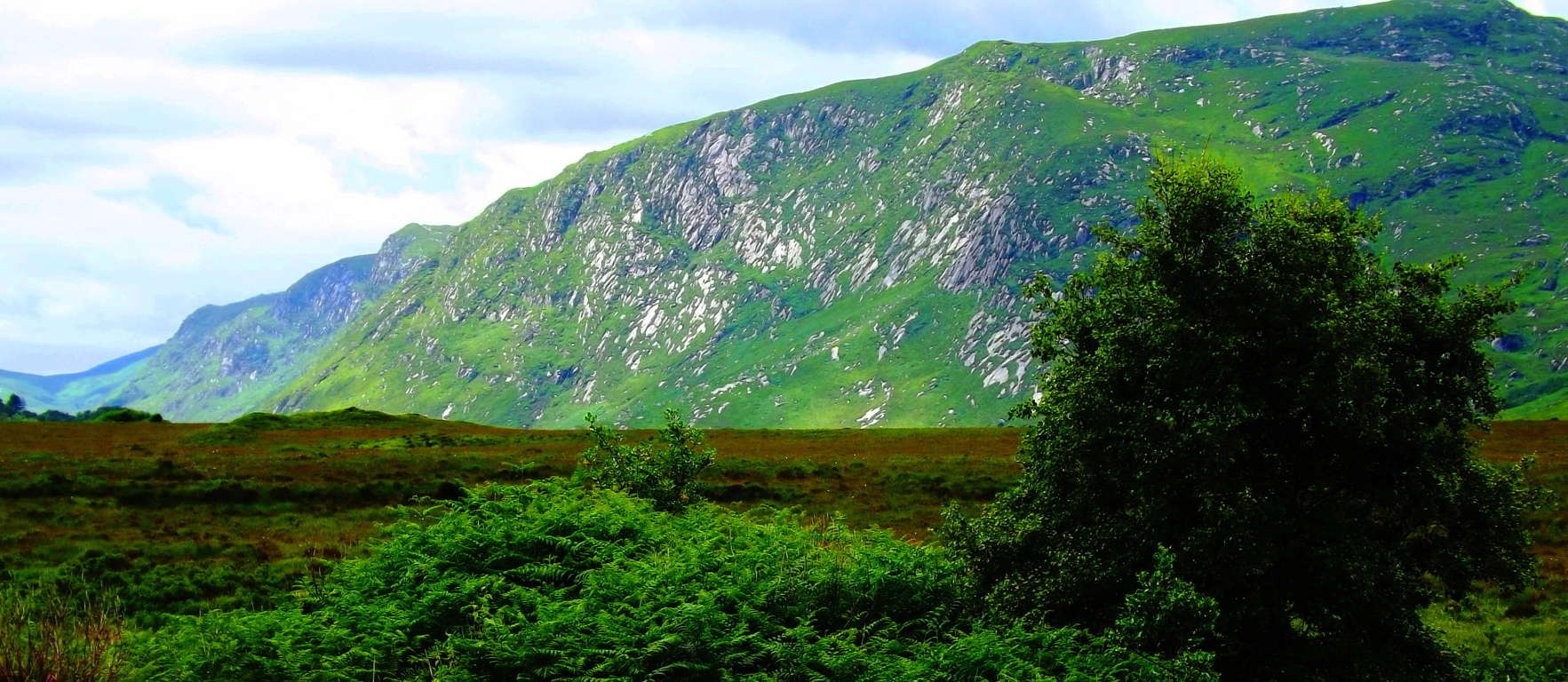 This is a once-in-a-lifetime-drive. From the Hamlet of Mullaghduff the entire R251 scene can be viewed. (Image/Below)
 In hamlet of Mullaghduff there are beautiful free-standing boulders in gorgeous places (Image/Below), and incredible lowland waterfalls that are totally untouched, all in their original state.
 This waterfall (Image/Below), just off the road, doesn’t even have a path or an approach; you simply have to wade through the hedges to get close. I believe that this is a megalithic altar from antiquity, and fully engineered. Look at the fixtures of the interlocked stones; they are clearly “cut-to-fit” and rounded to create a beautiful and massively harnessed release point for the flowing water. Incredible. The entire landscape is enchanted; it truly is.
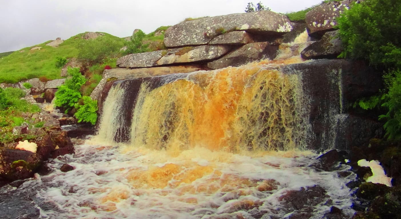 So bring your hiking gear/tall-boots, and be ready to trudge away in order to get close to something beautiful in Donegal. Continuing on, the Gortnavern Dolmen (Image/Below) is only 4 miles from the center of Kerrykeel.
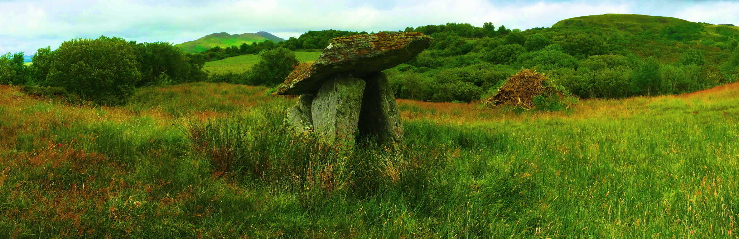 Along the road to Kerrykeel there are local vegetable stands ( 2nd Image/Below/Left) and craft shops. Stop by and converse with these local people! The Irish of Donegal are a people who have lived on the distant northwestern edge of Europe’s continental crossroads for what is now thousands upon thousands of years; take a moment for these unique and amazing souls. Even the small things the Irish country-folk have to do and say, may strike you as rare subtle wisdom, especially when compared to the placative and manic normalities of American and European Post-Modern life. The Gortnavern Dolmen is tucked beautifully into an elevated set of hills, south of the darkly soiled ‘Mount Ranny.’ (You must follow a country road with a small sign for the Dolmen, and then a left onto another country road, above a farm/ i.e: exact instructions to get to the Dolmen are in the “Gortnavern” article of Stonestrider.com, in the ‘Ireland’ section)
This is a 4000 to 6000 year old Portal-Tomb with a massive Capstone which faces the gorgeous Gortnatraw Mountain.(Image/Above) It is a rugged hilltop tapestry; a tangible infinity of farms and hedges amazingly complimented by the intentional angles of these ancient stones; stones that I believe were built to tantalize our perspective.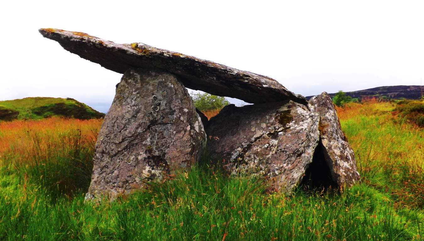 Perhaps 700 generations have passed since the construction of this monument. Dolmens, at this modern point in history, are more rare than any section of amazon forest; at greater risk of extinction than the Orca; and are as rare as a blue diamond. If you see a Dolmen you are truly touching something priceless.
  ( Again, for the more detailed instructions on how to get to the Gorntavern Dolmen please see the “Gortnavern” section in the ‘Ireland’ category of Stonestrider.com, or: https://stonestrider.com/2016/11/07/gortnavern/
Now let’s wander in an entirely different direction.
The Kilclooney Dolmen Excursion: Mount Errigal could be considered the epicenter of County Donegal. It helps to describe the many features of Donegal in reference to its beautiful white peak. The countryside to the East, which heads toward the Gortnavern Dolmen, is an inland scene of enchanted mountains and rolling valleys. The countryside to the South, which leads toward the Kilclooney Dolmen, is a different experience entirely, a coastal scene of cliffs, crescent beaches, rocky caverns, and an amazingly iconographic waterfall. From Errigal head South along the N56 to the R261. The R261 will take you to the Kilclooney Dolmen Centre, where you can take the short hike to the Dolmen. Not far from the Centre, at the farm house just up the road on R261, is an almost hidden, practically forgotten set of stones that was once a beautiful Wedge Tomb. It is unmarked by the side of the road, and clearly, once upon a time, a capstone was balanced above the supporting stones. Amazing. It is just an indicator that there are sacred things, seen, and unseen, all around you here. The entire landscape is a type of natural “temple”, a once synergized region accentuated by stone fixtures that we are still trying to understand in these late Modern times.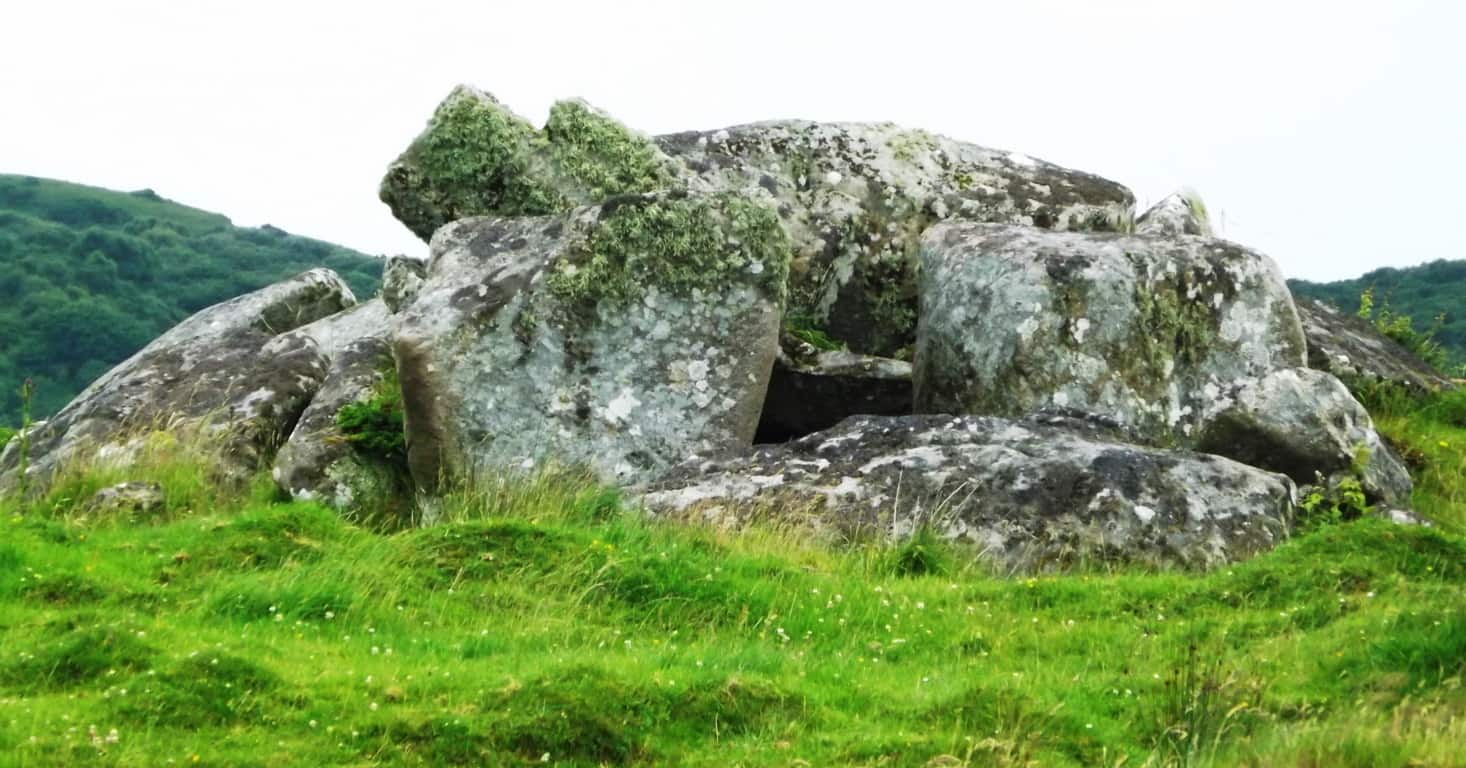 Before you start hiking here, wear ‘tall boots’! Having the right boots is the difference between a challenging experience, or something challengingly wonderful. As is the case with so many indigenous ancient sites, there is not a ‘standard path’ to the Megalith, you simply have to see the Dolmen about 150 yards behind the farmhouse and make your way towards it. For those who understand how wonderful this experience is, the non-commercial experience, the chance to laugh increases and releases with each and every Irish-as-hell step. These are truly special moments in a literally sacred Irish countryside. The terrain here is mossy, with brackish water mixed into tall-brush, and sandy dunes. Your ‘tall boots’ will make an easy walk through the terrain, right up to the ancient stone-lining which runs directly to the Dolmen and Wedge Tomb; they sit atop a small knoll covered with wildflowers and tough moss. Here is a prime example of how stones that look like a “wall” leading up to the Dolmen and Wedge Tomb, are certainly not a wall. These stones are a “Lining”; a veritable cable made of stones, which connects sacred site to sacred site, just like in New England. These stones were never, by definition, a “wall”. The stones of the Lining’ couldn’t stop a single thing passing through this country side, and it was never meant to. The Lining’ is part of an over all scene, all of the same Period, and most likely created by the same individual(s) as an “energy center” for the over-all scene.
 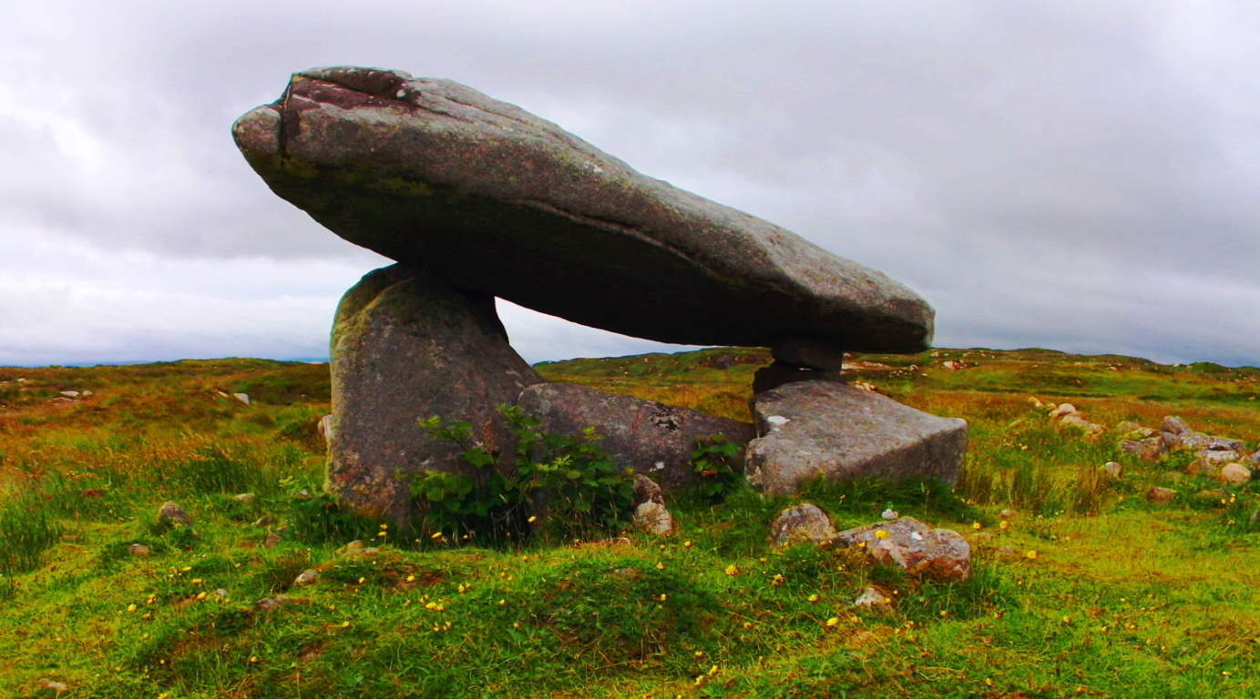 With the Atlantic Ocean only a mile or so beyond, the air here is medicinally salty. This “beach-day breeze” inundates everything, from the moss and grass, to the Dolmen’s very stones. This is an above average size Dolmen, with a massive “satellite-dish-like” 20 ton Capstone. This Capstone is balanced, and set roughly 5 feet above the ground. There is a slightly dilapidated Wedge Tomb with a 5 ton Cap-stone just ten yards away. This Wedge Tomb is no less priceless or significant in an archaeological sense, and certainly beautiful in its own right.
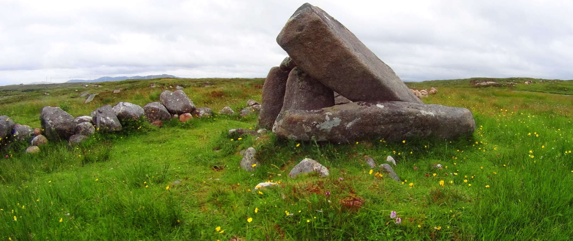 Again, like Gortnavern, Poulnabrone, and the dozen or so remaining in-situ Dolmens in Ireland, Kilclooney is roughly 4000 to 6000 years old, and a unique version of the classic Portal Tomb. This is a place to sit and contemplate the scope of Time, the magical possibilities implied by the Stones, and the luck of being alive to see them.
Assaranca Waterfall: Like so many highways in other countries, certain roads simply become other roads, or have two names. After taking in the experience of the Kilclooney Dolmen site, you should continue driving to see the beautiful Assaranca Waterfall on the R261 South, which simply becomes the N56. Not far passed “Northwest Sea Kayaking” business, along the N56, just passed a beautiful white house with a red door, is a road with no name. It is a right-turn road with signs that point and say: “Tra Strand”/Uaimh Caves/Eas’ Waterfall 6 km/: standing clearly for all to see. Take the Right onto this classic Irish road and enjoy the short drive to the beautiful Assaranca Waterfall.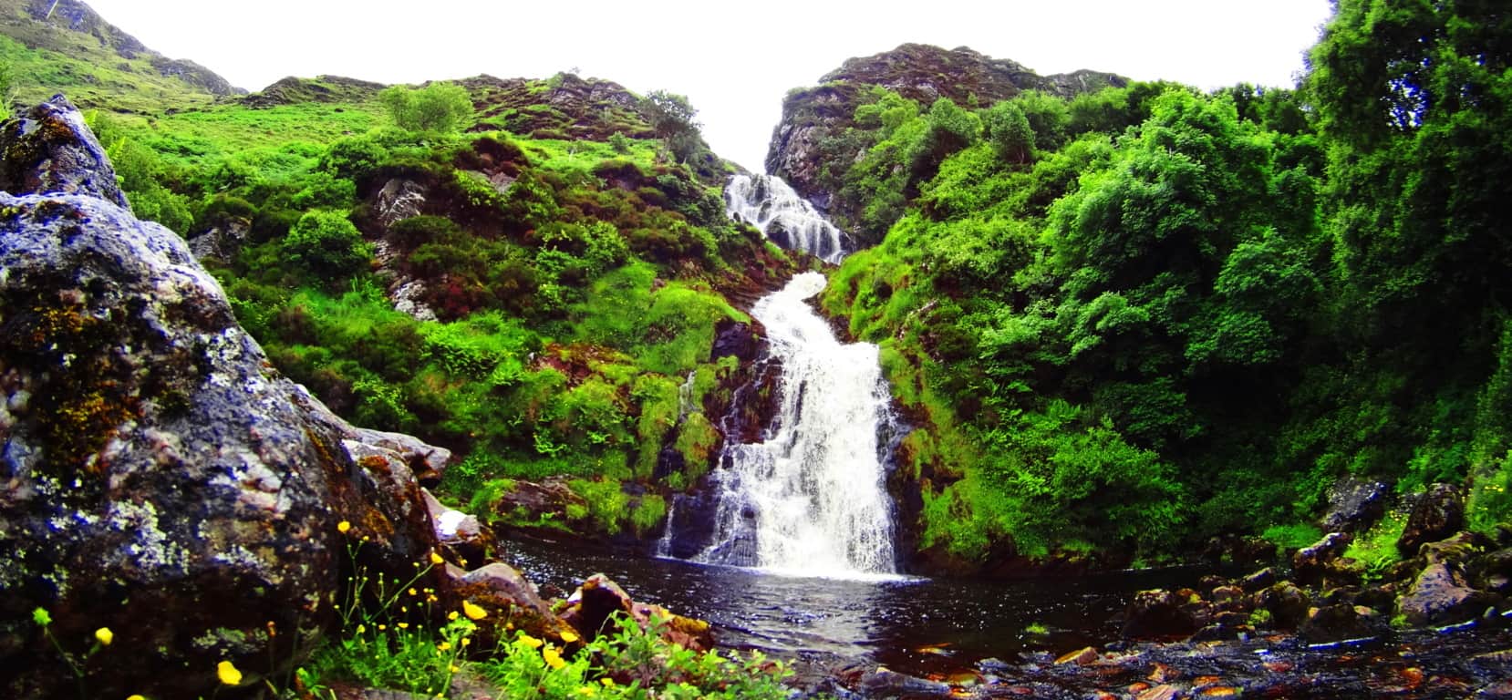 The roads here are the hiking trails. This gorgeous region is known as Lackaduff. You can park your car at the waterfall and begin a beautiful hike towards the massive caves within the beautifully looming cliffs, all about 2 miles further up the lane. Small mountains encompass this rugged bay-route pathway, with adorable homes and fields of wildflowers, along with flocks of sheep.
 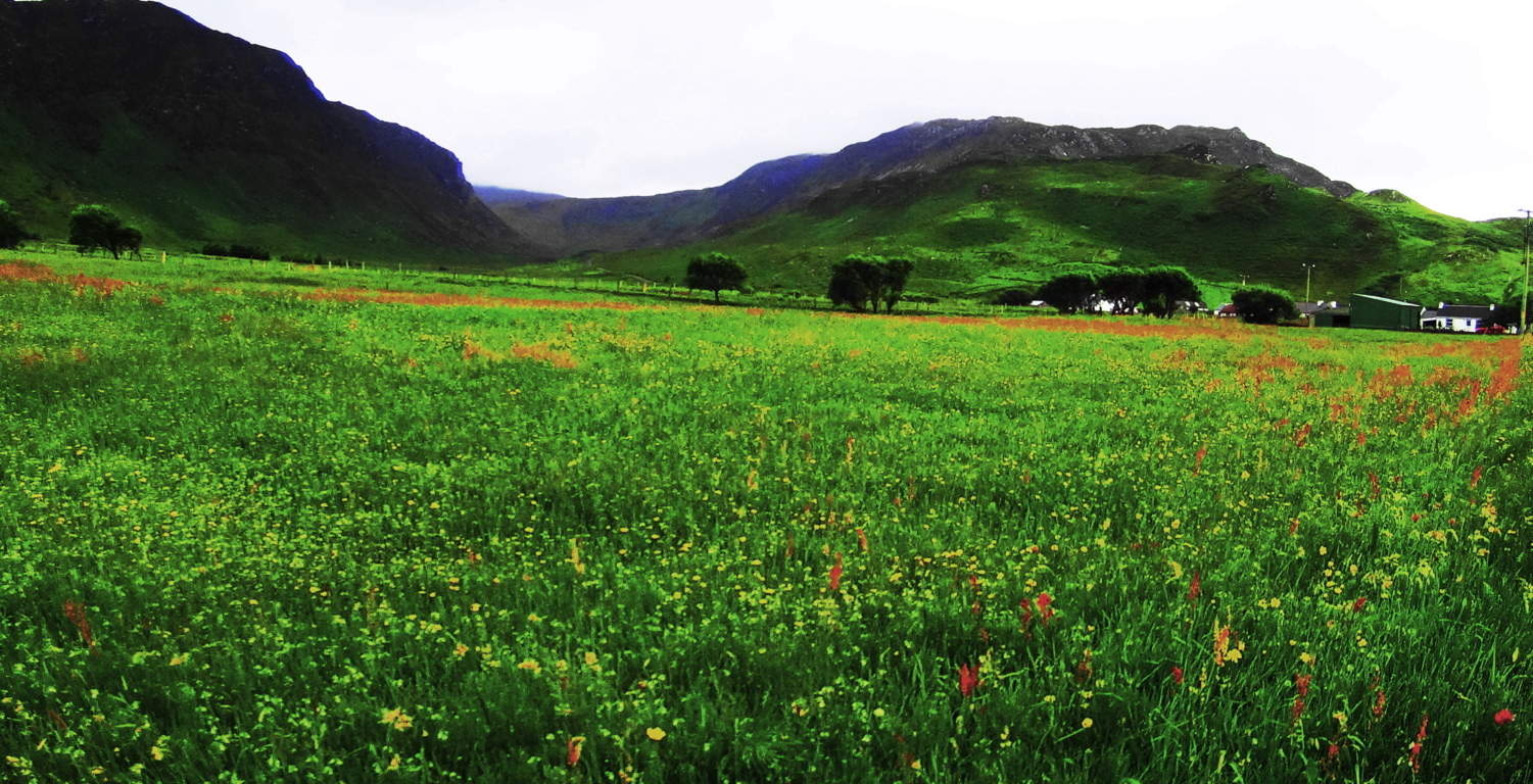 These are working farmers and fisherman in the area; they are not on vacation, so please be kind to those you meet, whoever that may be. Soon you will arrive to the beach…
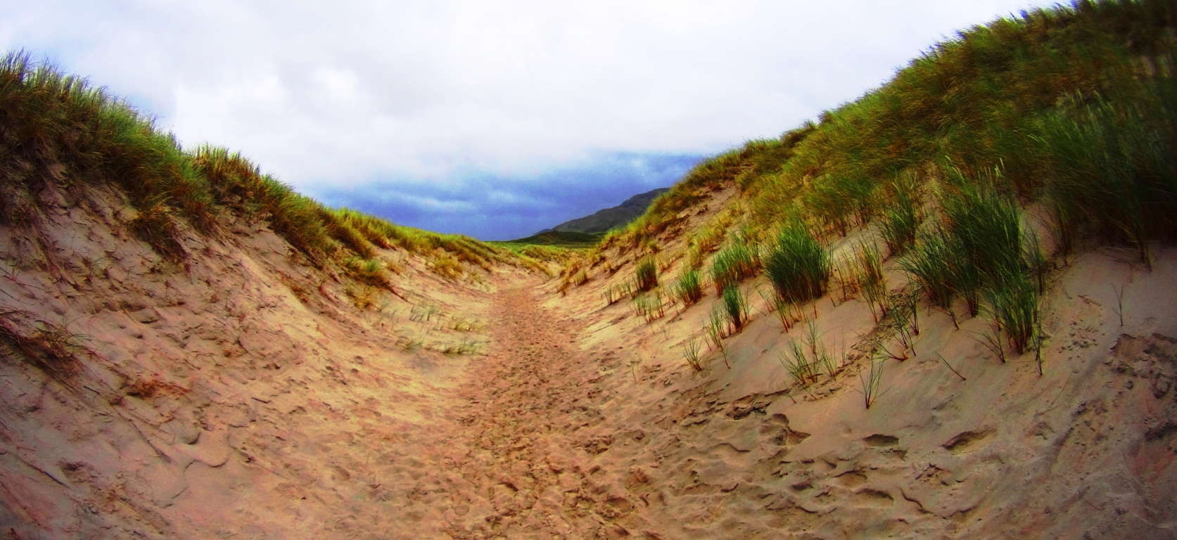 When you arrive take the path into the sand-dunes just at the end of the lane, and head out to the beach toward the caves (on the left.) As other places have been described in Stonestrider.com, this place looks like the perfect Jedi hideaway, perhaps to be found only by the most devout of disciples.
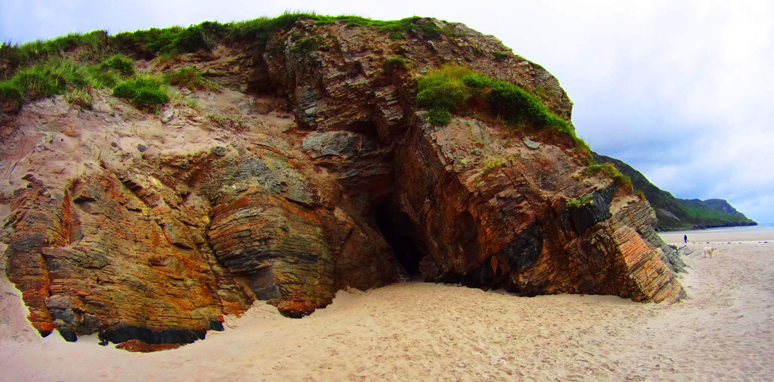 The colors here; the glassy Atlantic Ocean against the super-fine sand; the cliffs and caves under a cloud-sized blanket of green; they create a living canvas that just pours out an absolutely radiating beauty.
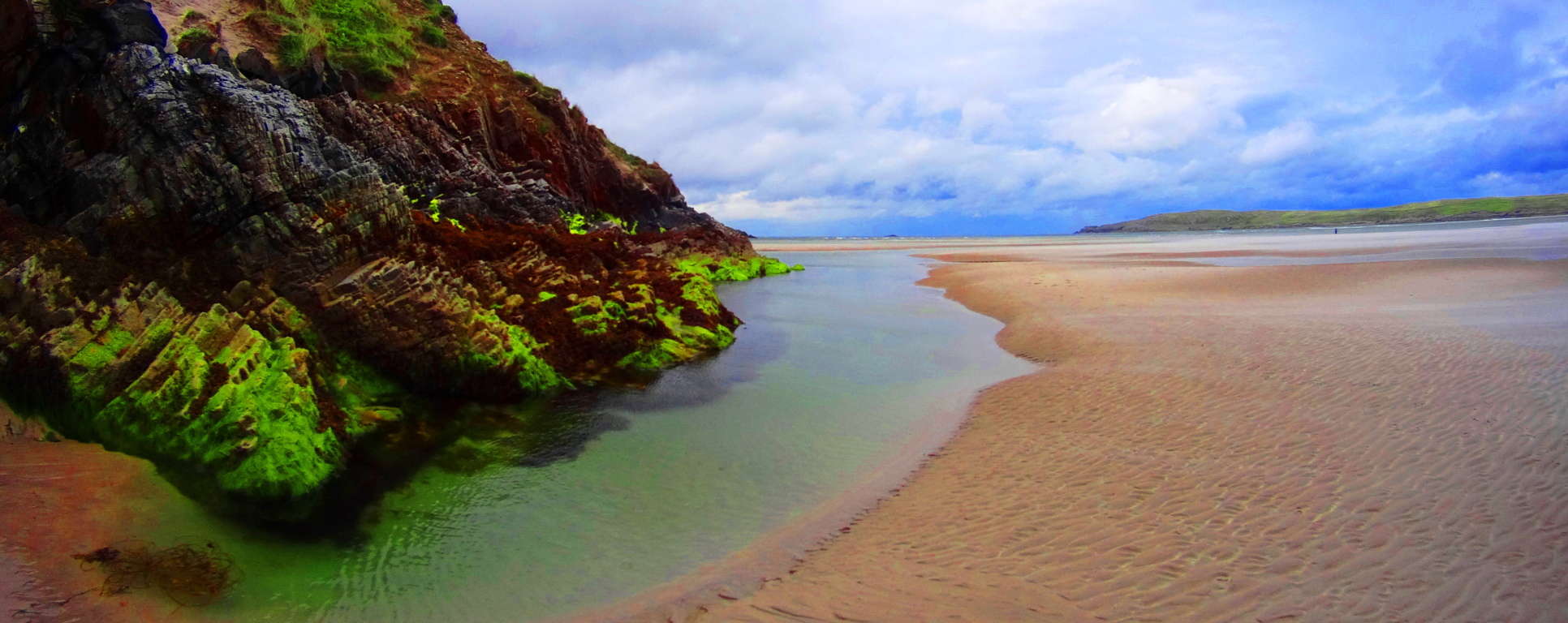
Last Note: Donegal is both rugged and radiant in one. There are striking scenes of mountains that just cut the sky with white stone peaks; there are rolling green ranges of mountain after mountain, after mountain.
 Eventually these mountains slam into a crystalline Atlantic Ocean. The Dolmens in Donegal indicate that the culture of the region is as old as Time itself. Wandering into this County is equivalent to wading into a Celtic Tsunami. The beauty is overwhelming. In every direction there is a pastoral dimension which is vividly painted in every possible variation of green.
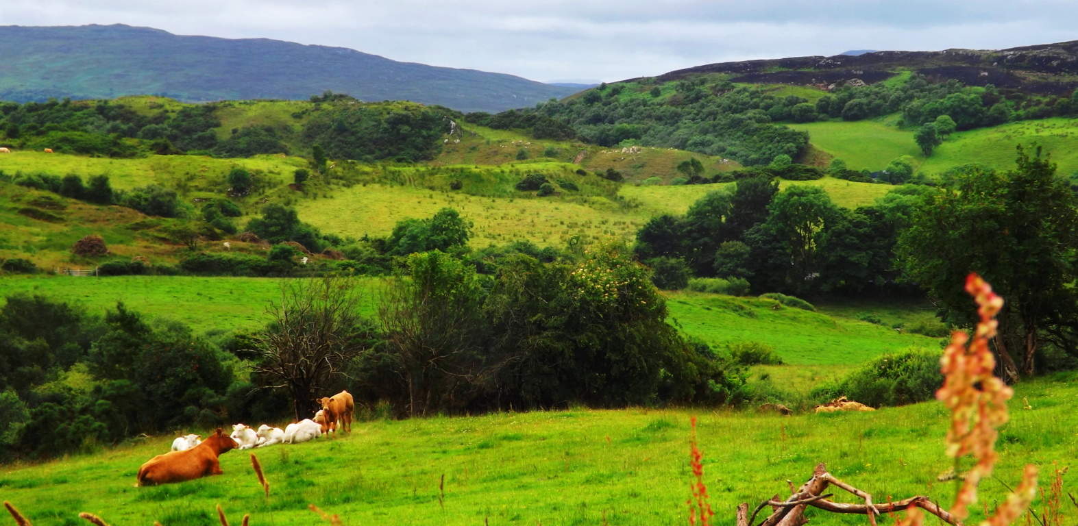
Donegal is so connected to the land, that the entire region is a ‘trail’. You don’t look for “the trail” at ‘Ranny’, the little dark mountain (Image/Below) which sits a valley away from the Gortnavern Dolmen; you simply climb the mountain. The mountain IS THE TRAIL.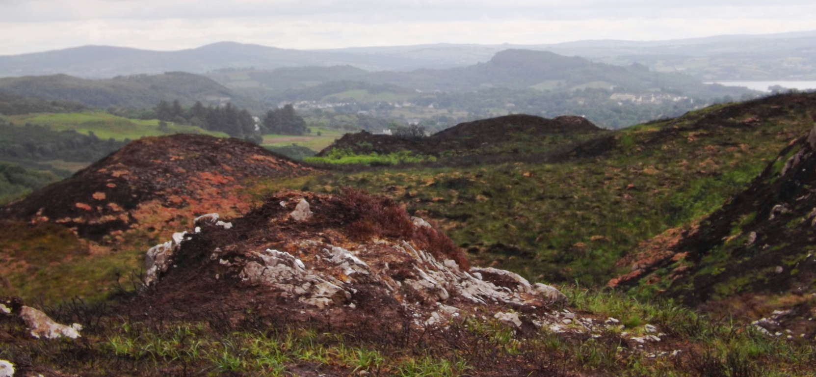 Donegal feels like the landscape that never told a lie. It is the last European coastline upon the vast Atlantic Ocean which cuts jagged jade cliffs into what was for centuries the edge of the known world. Come out and stand on the edge. Seek and Find.
Oak Creek Canyon
Location: Oak Creek Canyon/Arizona/USA
Elevation: 7,200 ft.
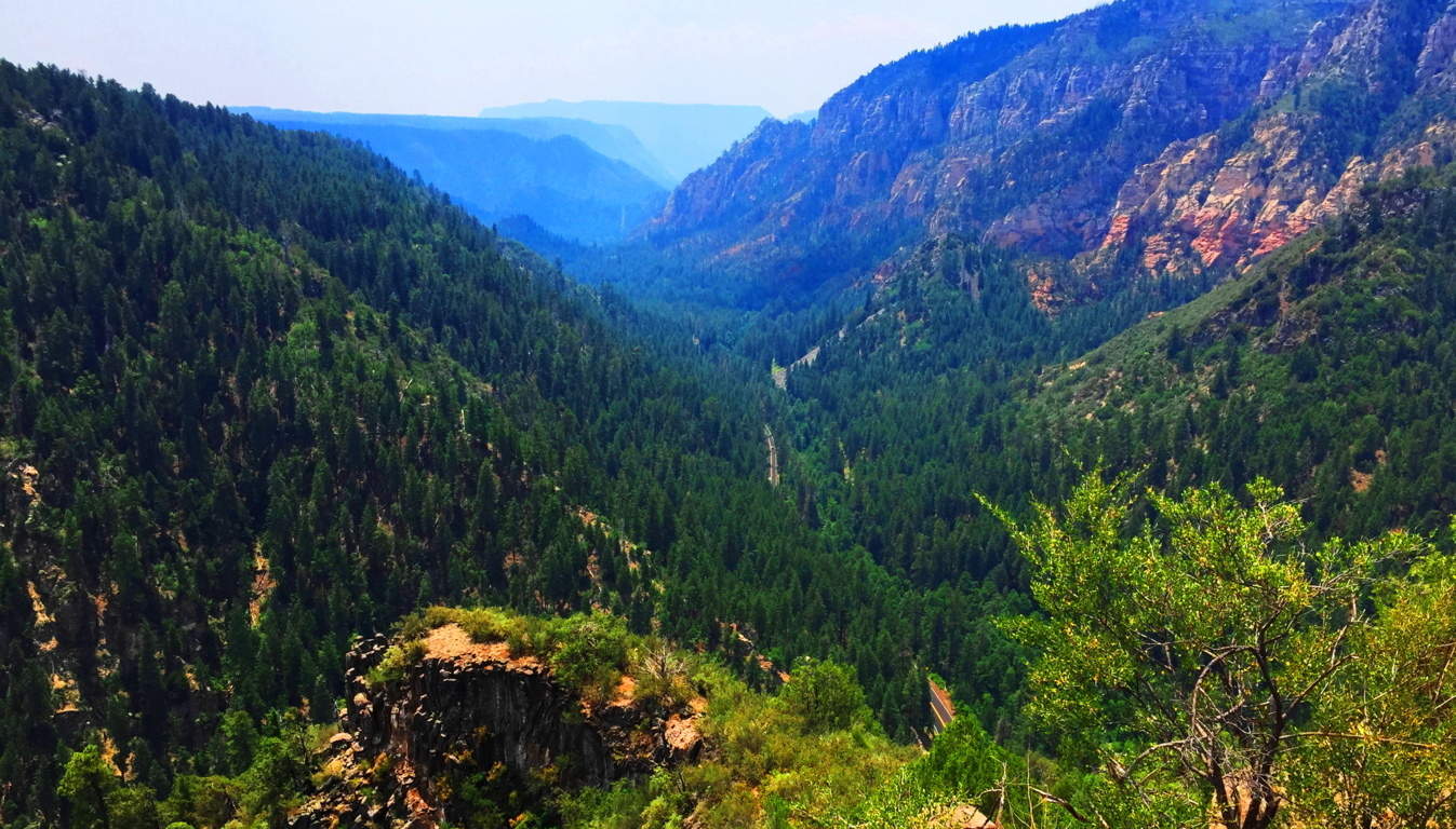
Note: The majestic Oak Creek Canyon is as much an expedition as it is a unique hike, even by international standards. It’s an achievement just to commit to this adventure, which is located in a massive 16 mile crevasse beneath the dramatically elevated Ranges of Sedona and Flagstaff in the great State of Arizona/USA. This may be the most popular hike in all of Arizona, which is less extreme than the Grand Canyon, and more accessible, with beautiful Coconino forestry surrounding the rocky trails running along the surreal stony tributary of the Verde River. This is another photographic paradise, where the curvatures and contrasting colors of the Canyon create the feeling of a rocky oasis; a secret cavernous fortress; a brilliant natural hideaway which has protected the precious stream that has flowed here since the receding of the last ice age, some 21,000 years ago. 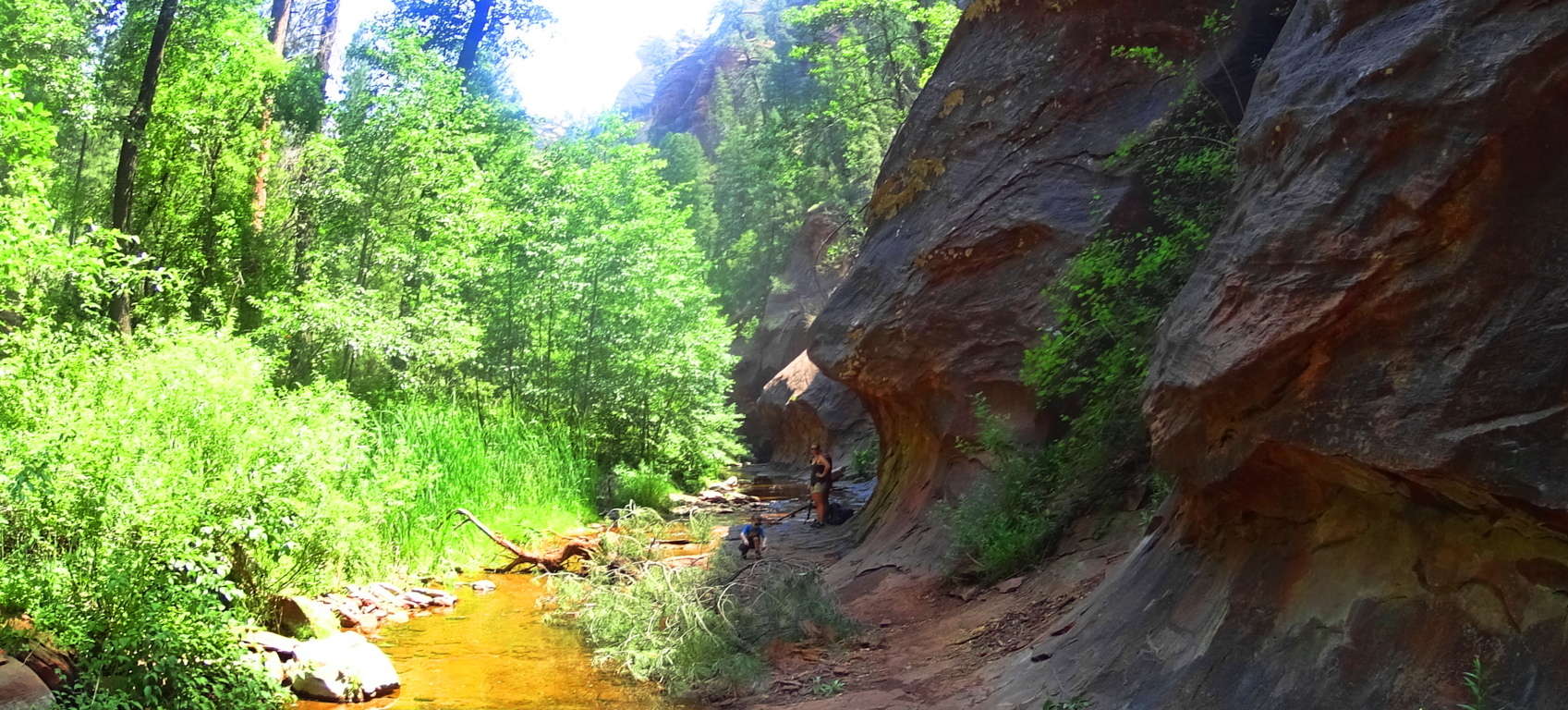
Route 89A runs dramatically into the base of the Canyon, twisting and turning along ledges that will require careful driving. Like the N71 that stretches across Killarney National Park in Ireland, or the A82 that cuts through the natural gateway to the Highlands in Scotland, 89A in Arizona has the potential to be one of the most dramatic drives of your life. Upon reaching the central base of the Canyon there is a toll with a small entry fee, along with an active parking lot. In this part of the world ‘climate conscious’ strategies should be practiced carefully in order to insure an engaging and healthy quest into the Canyon. Most importantly, for a hike in this region, is an early arrival, which insures the coolest possible temperature for your excursion, as well as the best odds for parking inside the reserve. If the parking Lot is full, which could well be the case by 8:30 a.m, most of the remaining gregarious trailblazers will attempt to park along the base of the 89A roadside ledge, which is certainly possible, but dangerous. Start early and increase your odds for a great and seamless experience.
The first vision of Oak Creek Canyon is of a domineering rock-tsunami of glowing golden stone that stretches for miles in each direction. 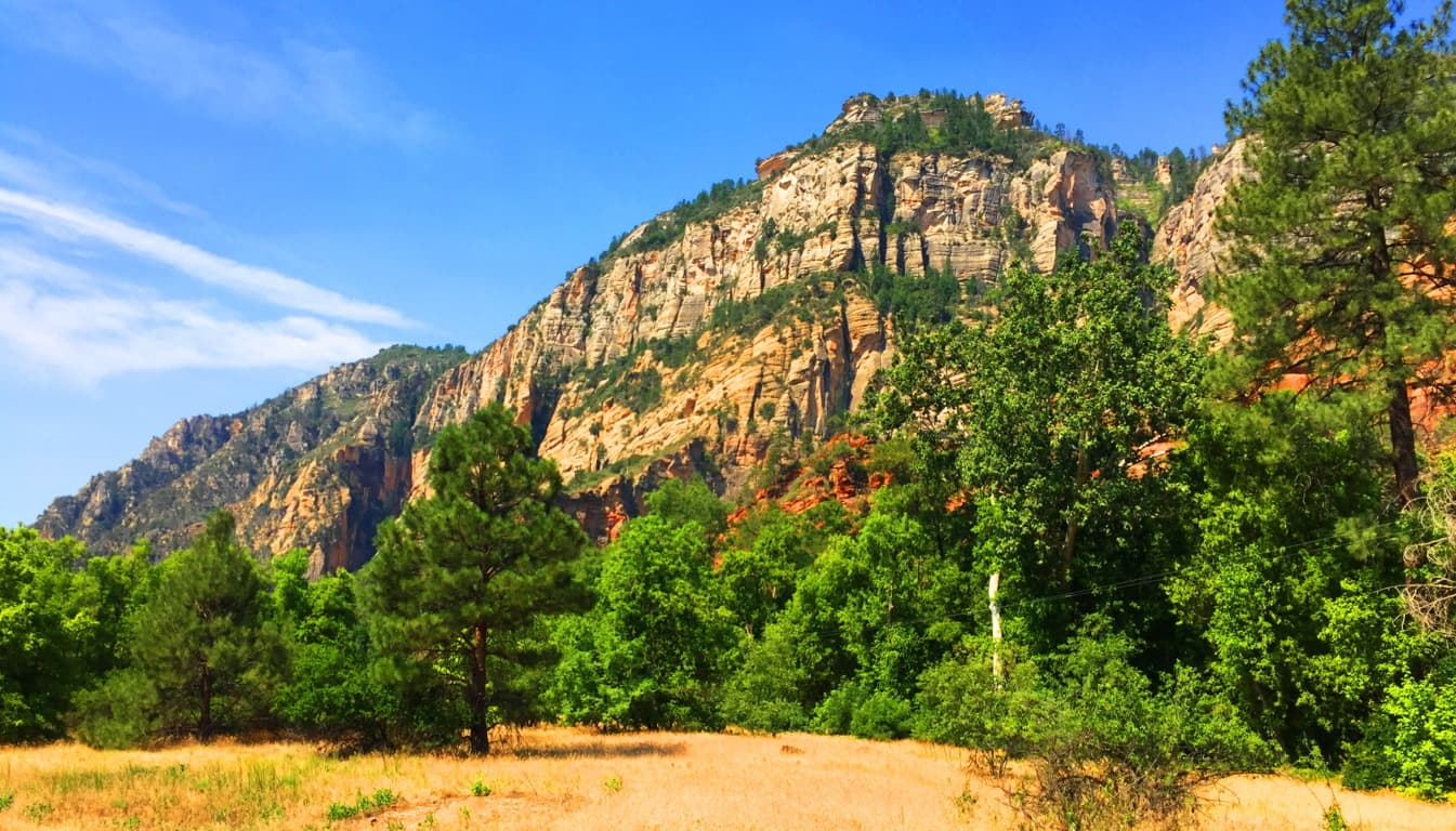
After crossing the main entry bridge, the Oak Creek trail branches off into several alternate options, each with varying ability levels.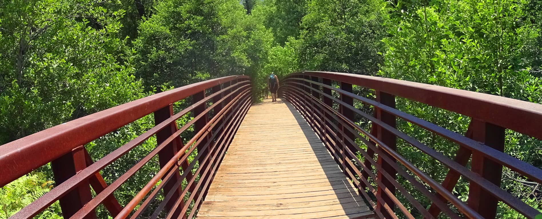 The initial trail follows the flow of the Verde River to the north, where dramatic caverns emerge like tunnels carved out of the rock-face, funneling a seemingly miraculous flow of water. On the right side of the initial trail is a rounded out rock cavern. This cavern is elevated with an entrance that is supported by stone-linings. These are similar to linings which can be found in New England and Ireland, although they are not a major feature throughout the trail here at Oak Creek. Additionally, there are several free standing boulders above the entrance way, and along the trail, which are often an indicator of something more than just natural “random rock” placement.
 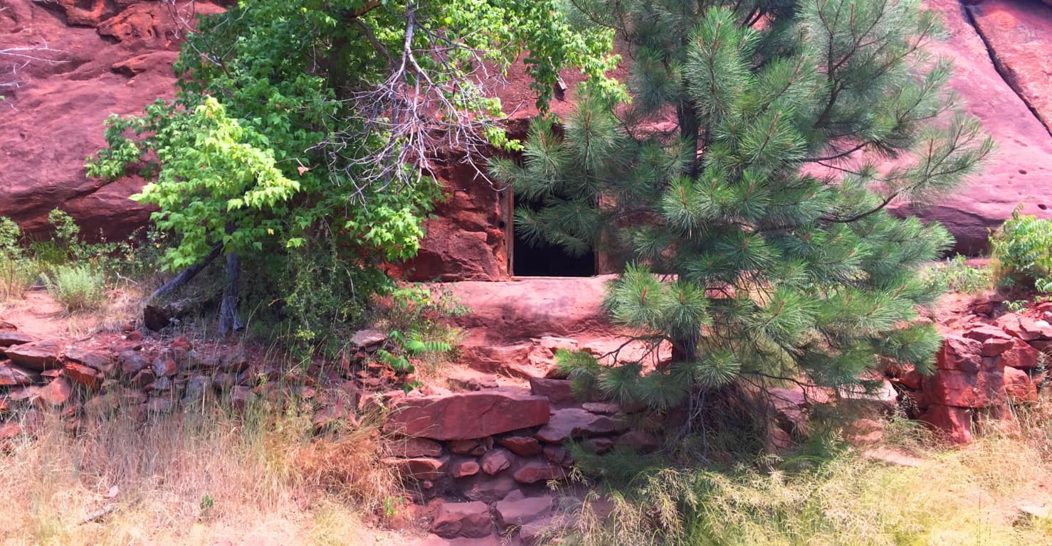 The interior of this cave is perfectly smooth. There are no signs of it being chipped away at with some kind of pick-axe or prehistoric chisel. Even more mysteriously is a perfectly square 4 foot shaft angled straight towards the sky, specifically along the outer canyon wall. This is very similar to the square shafts found in almost all the stone chambers in New England, as well as the Great Pyramid at Giza.
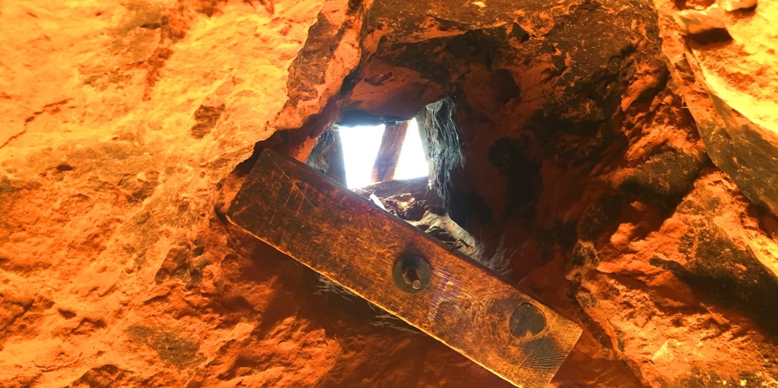 These shafts often point to the Sun at a specific point on the skyline, and more specifically, to the Winter or Summer solstices, which are moments that will flash dramatically through the shaft at that specific moment of the year. This also exists at New Grange in Ireland, the oldest megalithic temple in the world. How could a primitive native culture cut a perfectly square shaft through 4 feet of solid rock? While considering this question, observe the dramatic view from the cavern, which is truly a wonder.
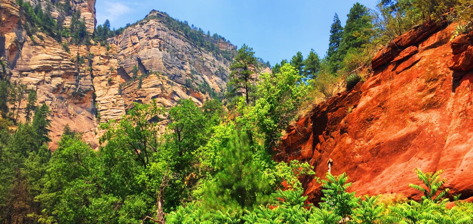 Moving on from this cave, the trail follows a stream into the deeper woods, and becomes an experience unlike any hike you’ve ever taken.
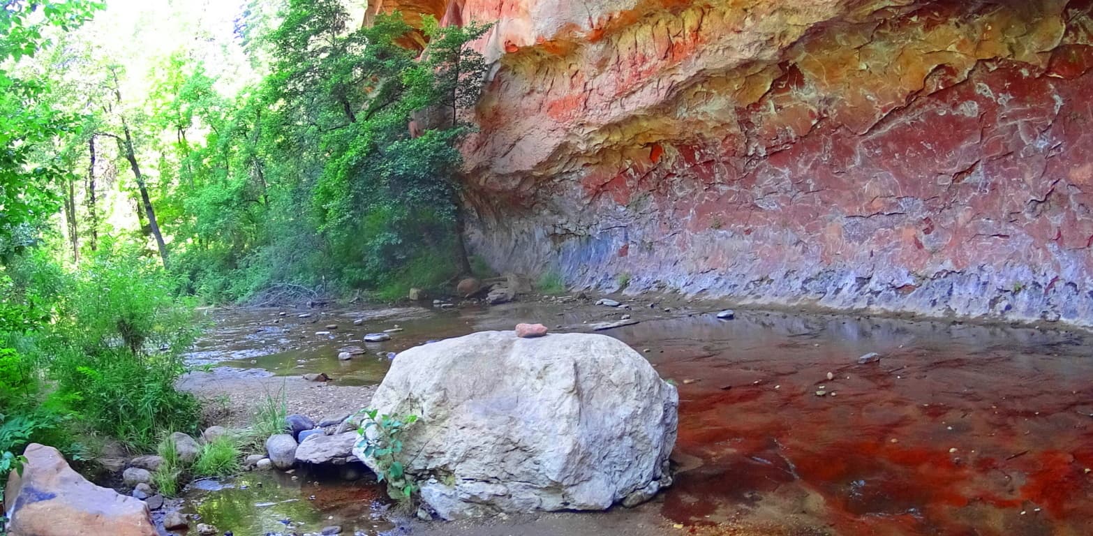 The trail extends back and forth over the rolling stream, leading into the deeper glens of the gorgeous Cococino Forest. There are free sitting boulders at each significant portion of the trail, seemingly and mysteriously assisting the hike. At some points the boulders indicate a scenic place, and at other points they indicate an actual direction on the trail. It is hard to ignore the specific placement of these boulders, and what it might indicate. What culture is capable of moving boulders above caverns and along rivers, and to specific points on the trails?
 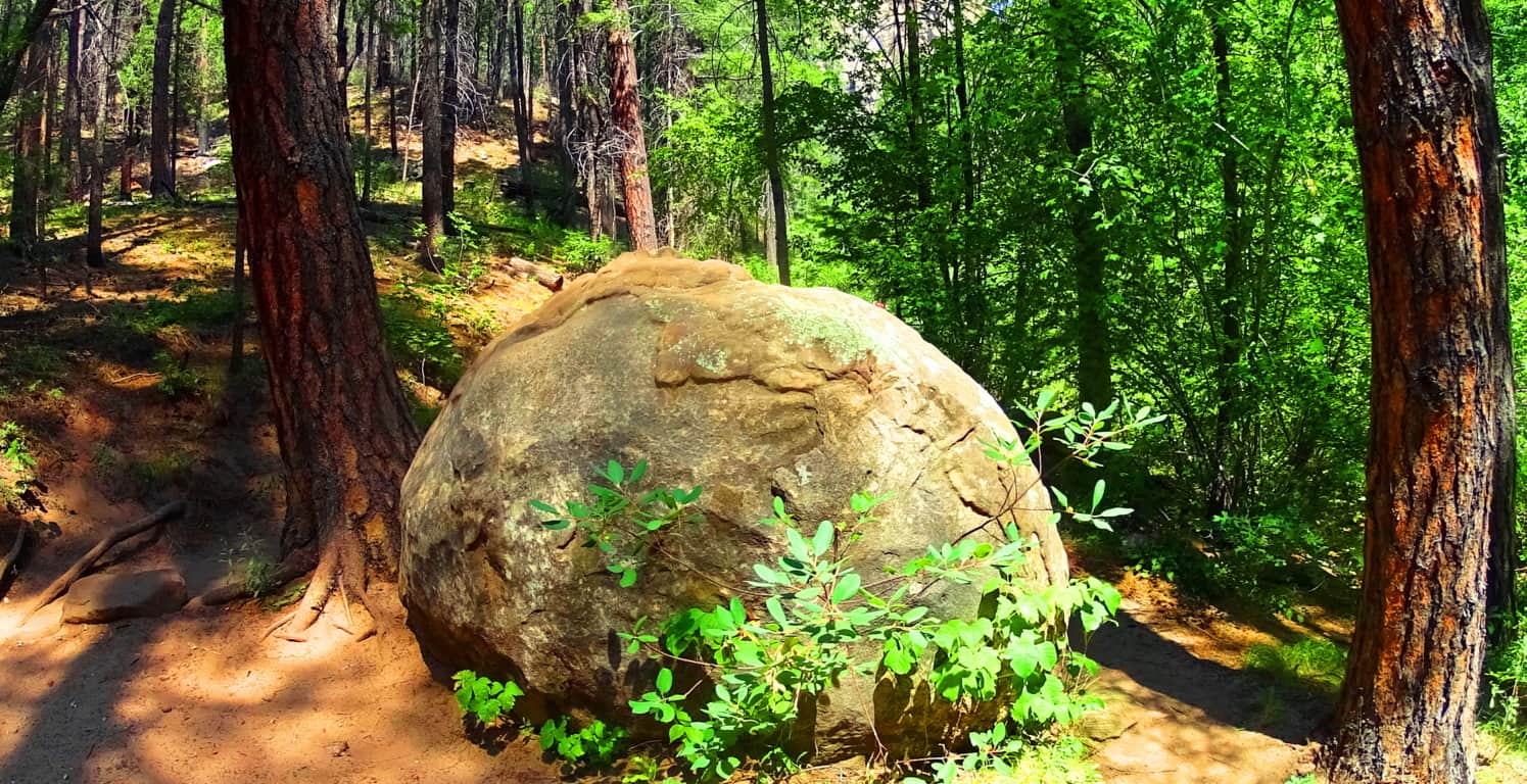 Continuing, this woodsy path quickly escalates into a humbling epiphany of enchanted woods. Oaks, Ash, Willows, Ponderosa Pines, and Cottonwoods burst broadly forth from the landscape, all surrounded by a red-rock coliseum of natural stone.
 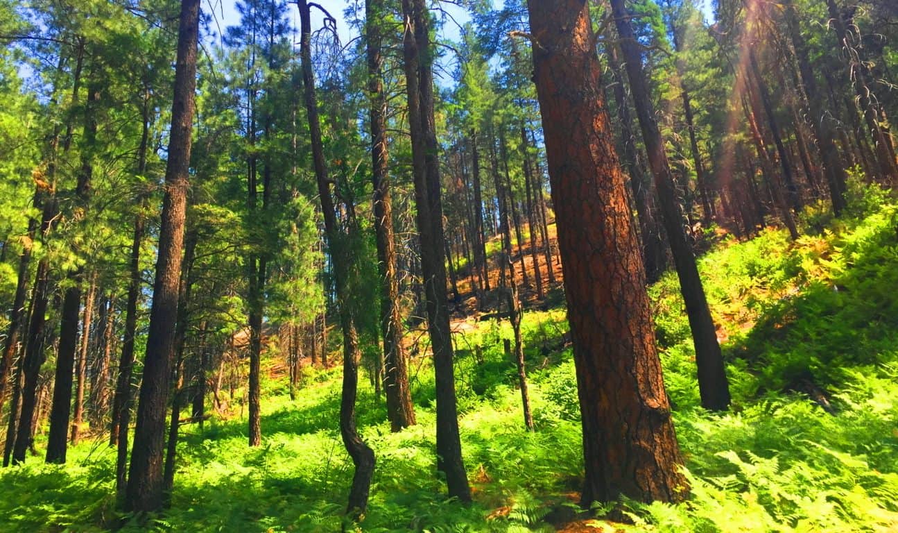 Heading north along this beautifully forested route you will encounter a feature of colossal level granite shelves that lead dramatically up the chasm like a massive set of porticos. The color of these ‘shelves’ is so in tune with the surrounding forest that you might actually mistake these curvy and knotted red-rock exteriors for fallen wood, but it most certainly is not. It is a testament to the original look of this ancient trail, where once upon a Time, the first Time, the rock was barren and uncovered by the forest, revealing it’s incredible original story. Just use your imagination and picture these giant steps climbing up the canyon in an incredibly broad way!
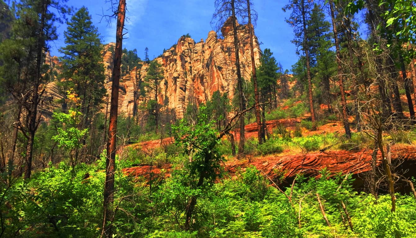
This is a truly magical trail complete with brilliantly bright butterflies, dragonflies, fields of wildflowers, and gigantic trees.  The rolling of the stream along the path creates a wind-tunnel that is invigorating, especially in such a dry climate. Feel free to jump in the water here, or perhaps picnic for the day. There are trailblazers of all ages climbing, hiking, and splashing through the woods. The protective feeling of the massive chasm of rock all around you creates a wonderful experience. The Native Americans considered this canyon absolutely sacred, and it is easy to see why. It’s a magical hideaway with miraculous qualities which could sustain a tribes existence with surprising sustenance, as well as profound beauty. Make the best preparations you can and explore this incredible place. Get a true taste of the southwestern American trail experience! And finally, welcome to the newest season of Stonestrider.com! There are some incredible and mysterious new surprises to be revealed here publically for the first time in the coming articles! Seek and find.
Mount Bearnagh
Location: Newry/Northern Ireland/U.K
Elevation: 2,385 ft
Note: In an almost hidden pocket of Northern Ireland, several hours drive north of Dublin, along the Irish Sea, sits the majestic Mourne Mountain Range. This is a region of beautiful mid-size peaks with approaches that are for everyone, not just the highly trained. The hike here includes a 4000 year old stone pathways which elevates steadily and comfortably into the heights. These ancient trails run beside wide streams and ledges that roll playfully down from the rocky mountain passes, and feel cool and comfortable in this northern latitude. In the heights of the mountains are cinematically continuous stone walls which stretch surreally from peak to peak, like a “Rangers Highway”. There are stunning ancient stone statements here as well. Original stoneworks here date back to the first culture, a culture which left its mark on this hauntingly beautiful place, perhaps 6000 years ago, or more. The southern face of Mount Bearnagh has a distinct ‘top porch’ which is level at the peak, with similarly sloping sides, giving the entire face a symmetrical feel. If you look close at the image below you may think its hard to find me in such a massive space; but redirect your eye to the exact center of the overall mountain, then follow that center line down to the stream, and you will see me standing at that exact center line of the scene. I am leaning a little to my right just enough to put my right eye along that center line; indicating that its possible to see potential symmetries in even the grandest spots.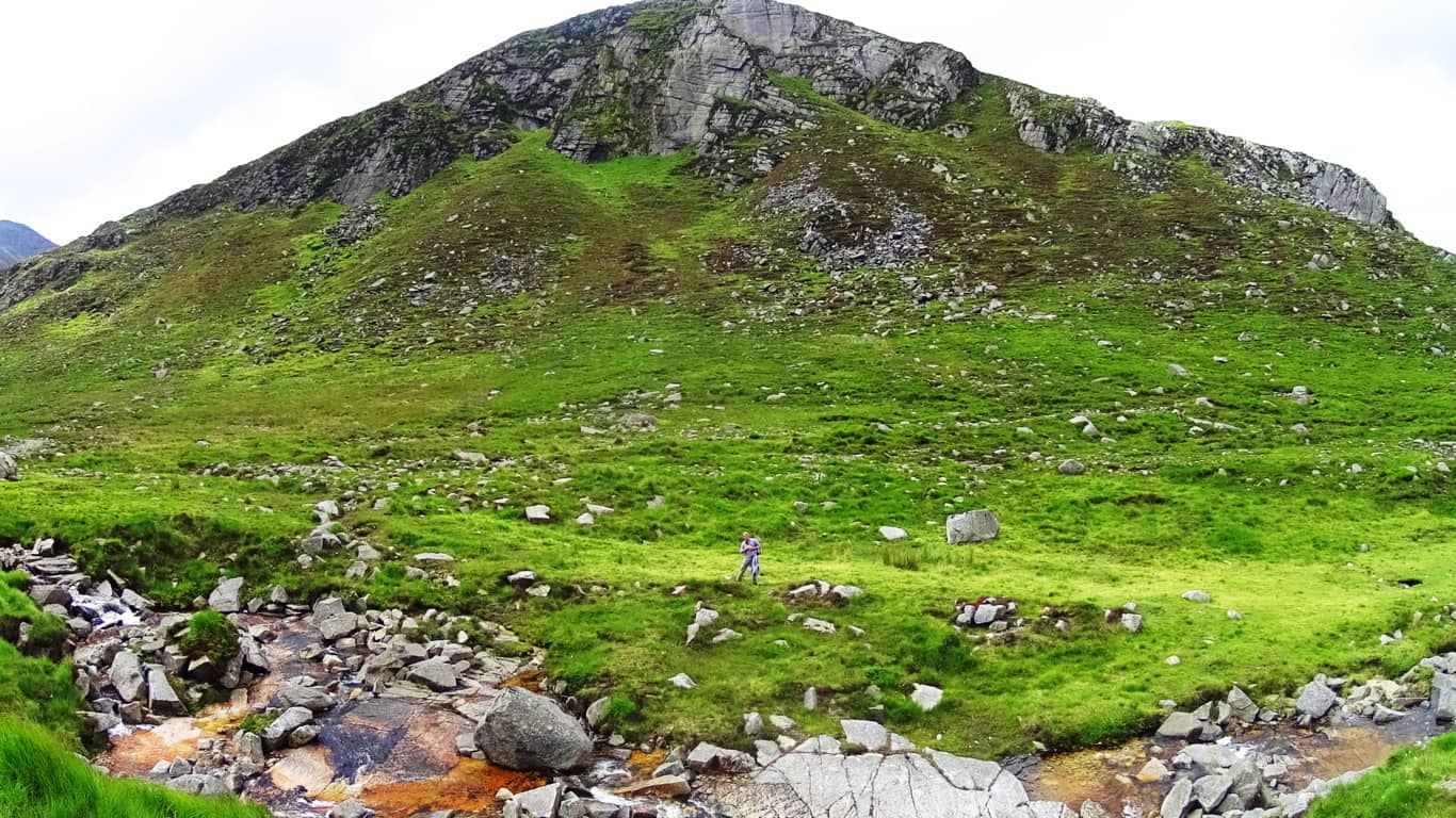
I did the same thing at the ‘center point’ of Bear’s Den Fall’s in Massachusetts (See Bear’s Den/New England/Stonestrider.com), in order to illustrate the central alignment at a specially engineered site, which in this instance is easier to see from close range. The reason for leaning on the ‘center lines’ of potentially symmetrical scenes is to acknowledge the possibility of a mathematical consideration of the overall space, which often leads to real breakthroughs in identifying Neolithic statements. The works of Neolithic craftsman reveal that they were absolutely aware of geometric principles and symmetries. Like Feng Shui, Neolithic symmetries, and spacial statements, create beauty and tranquility in any type of scene. Mount Bearnagh is part of majestically enchanted Range where Neolithic statements continue to increase the further up the valley you go.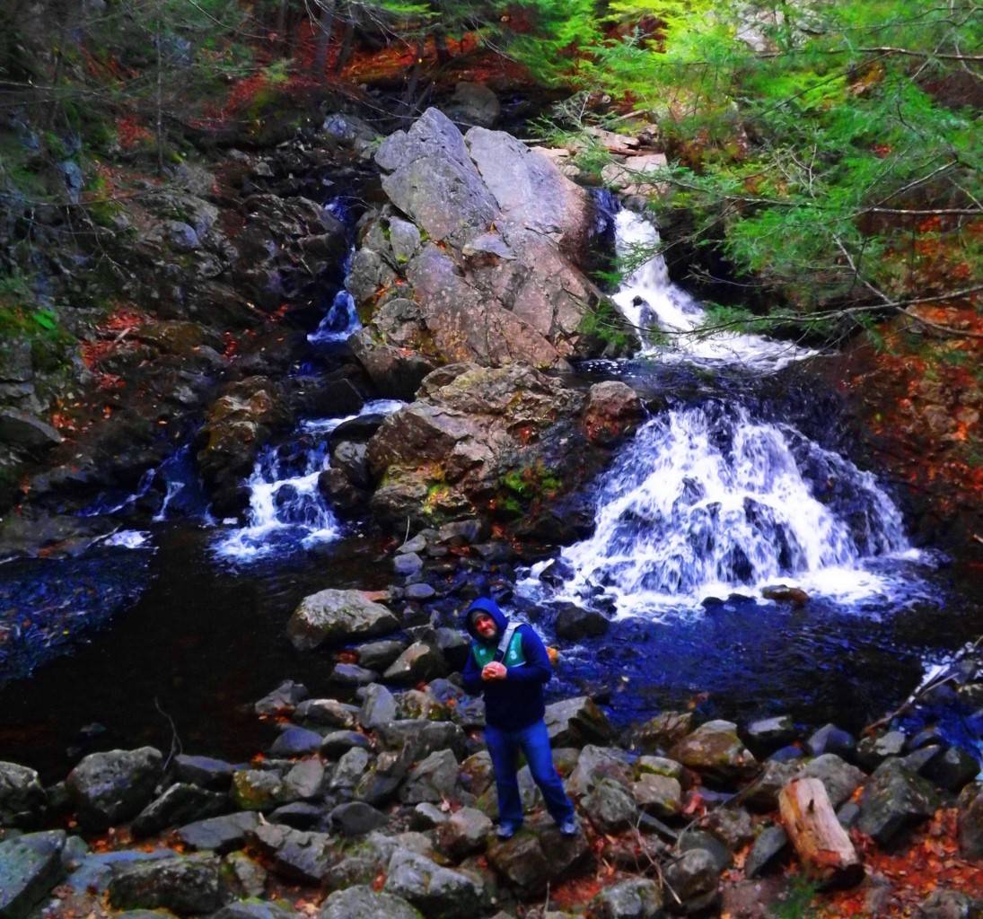
Trail: The approach at Mount Bearnagh is practically flawless. It is everything you could want in a day hike. This is a comfortable set of pathways, trails, ancient roads, and riverside runs that steadily progress, first to the Pass, then to the Peak. To the southwest of Bearnagh is a great hiking station and parking plaza with a cafeteria and campgrounds which can be found on-line. Plan your excursion before arriving for best results. Here Irish school-age children set up tents, along with international hikers, in the shadow of the gorgeous southern Mourne Range. Below is a look at the farmers road headed directly out of the Mourne towards the station. 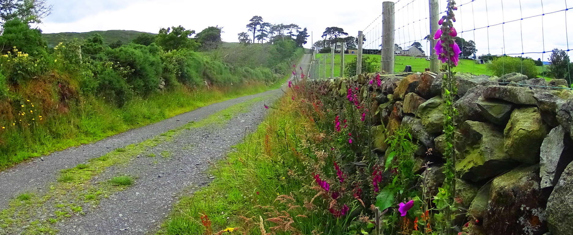
From this simple tractor path you will begin your trek into the Mourne. After about 150 yards you will emerge out of the hedge to find a rocky path. Turn left, heading west along this rocky path for roughly 200 yards. Carefully cross over small streams, fairy pools, and massive stones to eventually come to the main wide valley trail, which is a wide rocky path turning blatantly north. Mount Bearnagh will be directly to your right as you begin to ascend what can only be described as an ancient Celtic road, all the way to the top of the valley 3.5 miles beyond. Roads like these are so ancient that we can only guess as to who built them, and are most often associated with the Celts, although that may not necessarily the case.
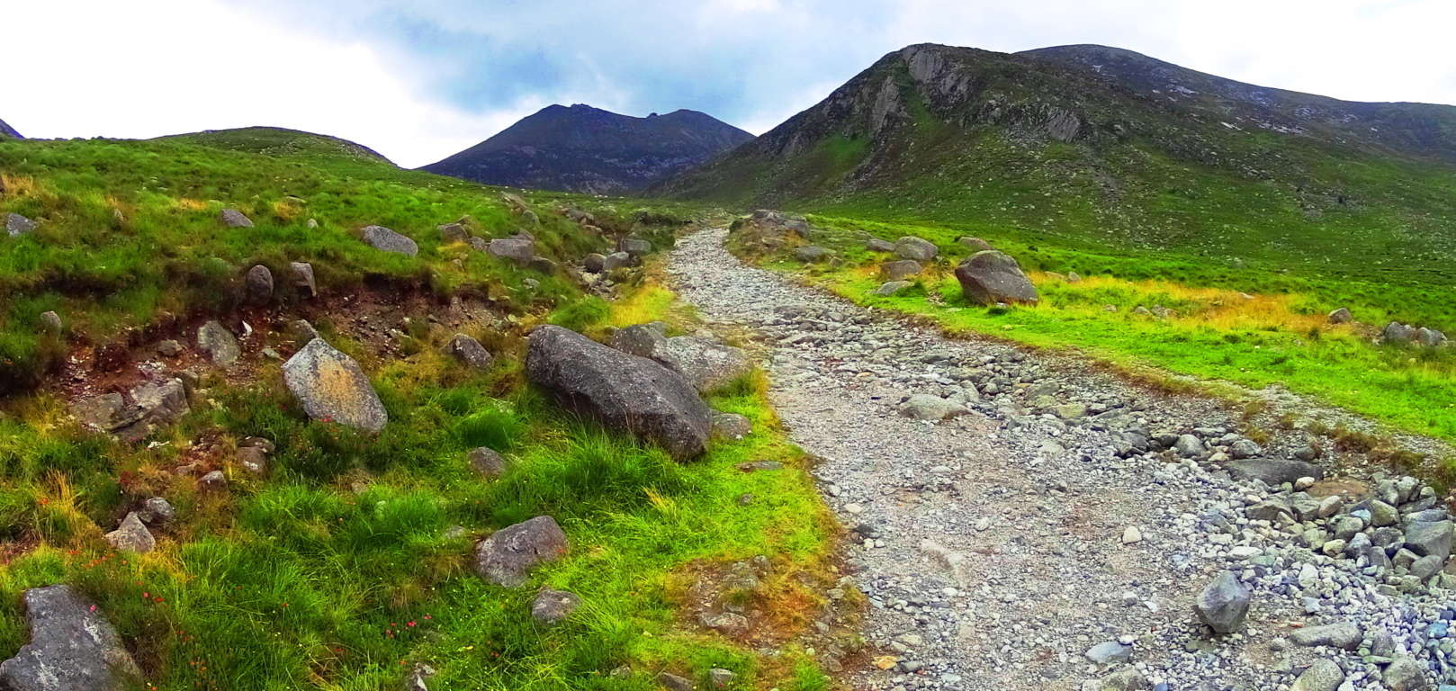
With an entire mountain range before you, and a beautiful rocky stream gushing along to your right, you can steadily make your way up to the Pass. At about 1.5 miles into this part of the trail wildflowers begin to emerge, along with boulders that seem centered on the peaks above. The feeling of rarity and dimensionality sets in; like you’ve stepped into another time. 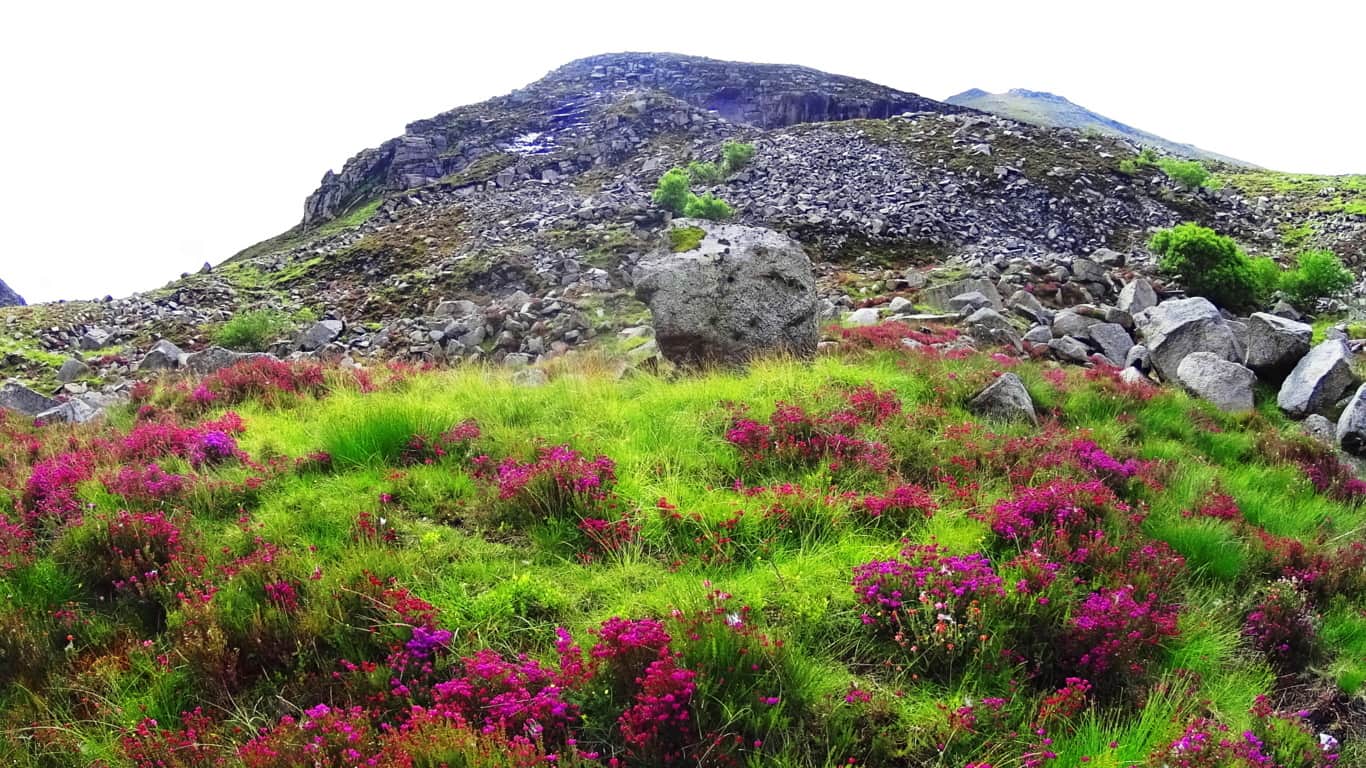 Rising into the area of about 1500 feet above sea level vast amounts of uniquely shaped and colossal crafted stones begin to emerge all around the trail. Often times what looks like arbitrarily placed glacial stones are actually quite the OPPOSITE. A closer look at the inundation of stones all about the valley reveals incredible and strange fixtures of stacked, quarried, and interlocking stones.
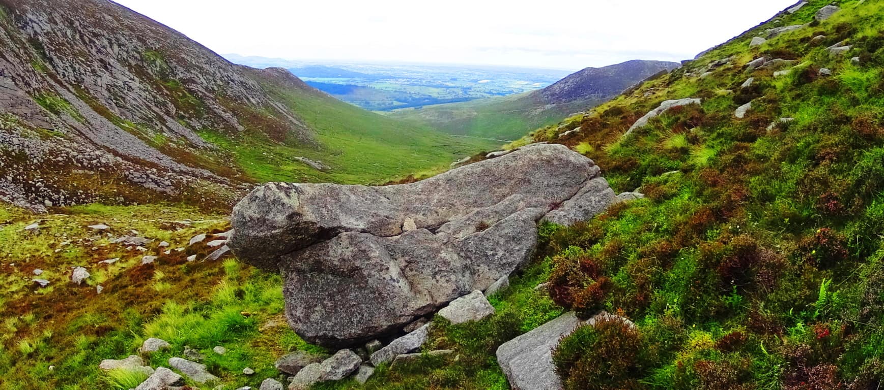
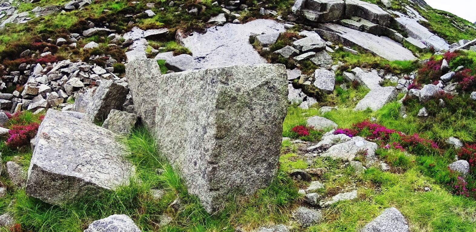 About 3 miles into the trail a beautifully carved and truly amazing megalithic boulder that is encircled by smaller stones. This embracing of smaller stones lends this boulder a certain significance. Looking at this “seat” you cannot help but feel that this stone was created for exactly that purpose, as a “seat” for viewing the valley below. Obviously the amount of work it would take to move this stone is remarkable. Who would do such a thing 1000 feet above the valley?
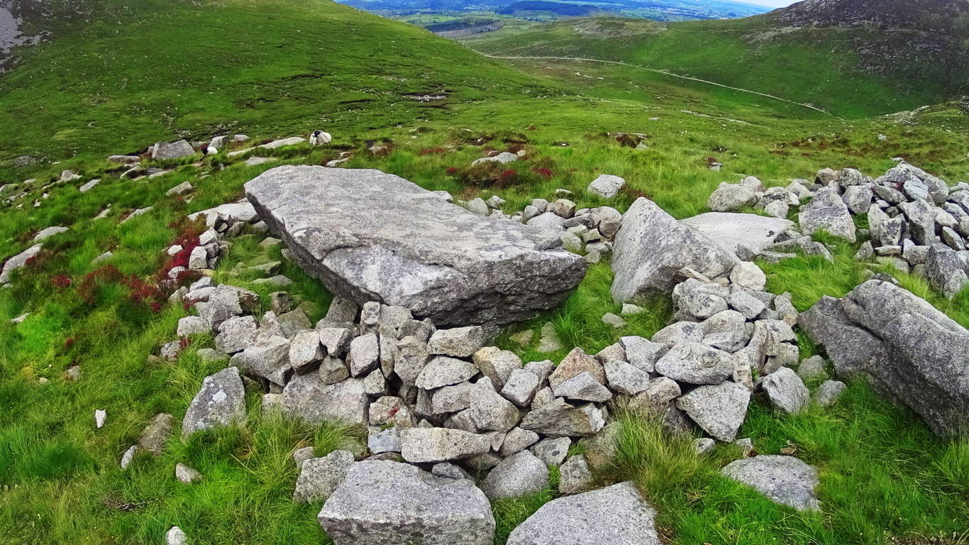
Beyond this amazing “seat” the trail becomes a wonderful stone path veering to the north-east. A heart warming view of the valley below becomes more dramatic with each step. These pathways look like something out of a fairy tale.
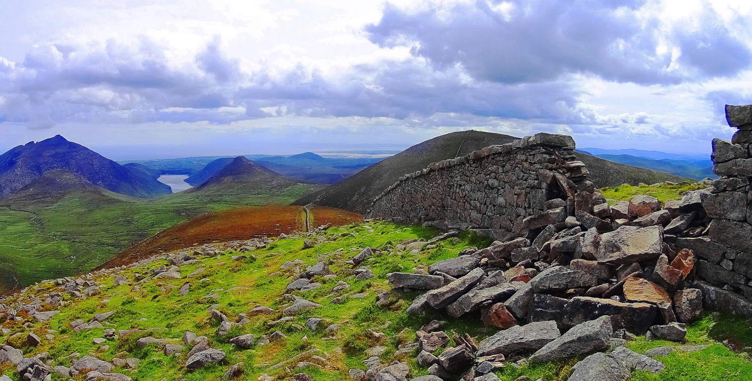
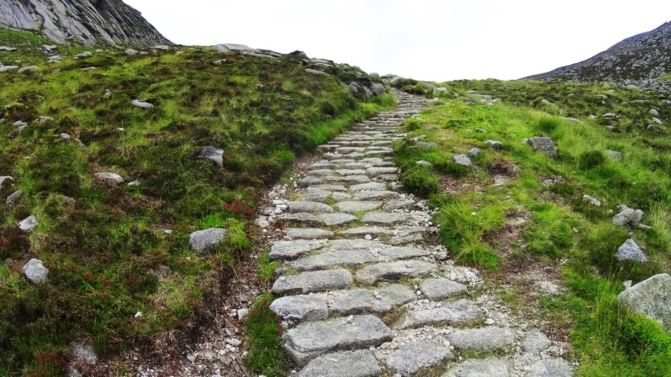 The Pass at Mount Bearnagh will be a short distance ahead from here, with stone walls from two utterly different era’s guarding the top of the valley.
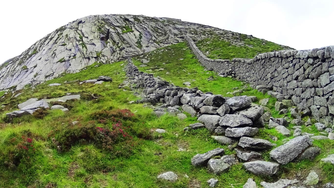
The image above of the Pass at Bearnagh is of two stone structures with a somewhat important historic meaning to convey; we should pause for a moment to consider this. The more modern wall, built in the early 1800’s, can be seen to the right. This is an actual ‘wall’ used to keep farmers flocks from crossing over into the next valley. The structure to the left is not a ‘wall’, but a 4000 to 6000 year old ‘stone-Lining’ that serves an entirely different function. This ‘Lining’ could never restrict the movements of anything in the valley, and was not intended to. Yet it was untouched by the builders of the wall next to it? This Lining could easily have been deconstructed as the most convenient possible supply of stone for the modern wall, some 1800 feet above the valley; why was it untouched? The reason it is preserved is that it is absolutely sacred and has been at this Pass as long as anyone can remember. The Irish have a profound respect for the ancient stones within its borders, and for thousands of years, no one dared touch these stones. So what is the Linings purpose? One hint about its purpose is in the ‘Linings’ positioning. If you will notice, this ‘Lining’ runs straight to the center point of the peak beyond, extending into strange ‘stacks’ running directly up the mountain to the center of the peak. I believe these ‘Linings’ are a type of ‘stone-cable’ that run from peak to peak, cabling subtle energies which run up through the mountain to ultimately culminate at the peak, like a capstone on a pyramid. These same Linings can be found connecting peaks in the small mountains and forests of New England, and is consistent with a pattern of Neolithic engineering found in hundreds of places, and perhaps world wide. In places like this, it feels as if the higher up you go the more strange the stones become. Just 35 yards away from the Lining at the Pass is a type of Cairn, a specific style of which can be found in areas with sacred stones. This type of Cairn has a square ‘roof slab’, with an emblematic looking side stone which stands like a sign in support of the long roof. This creates a kind of temperate storage compartment within the stones, which is what I believe was its use.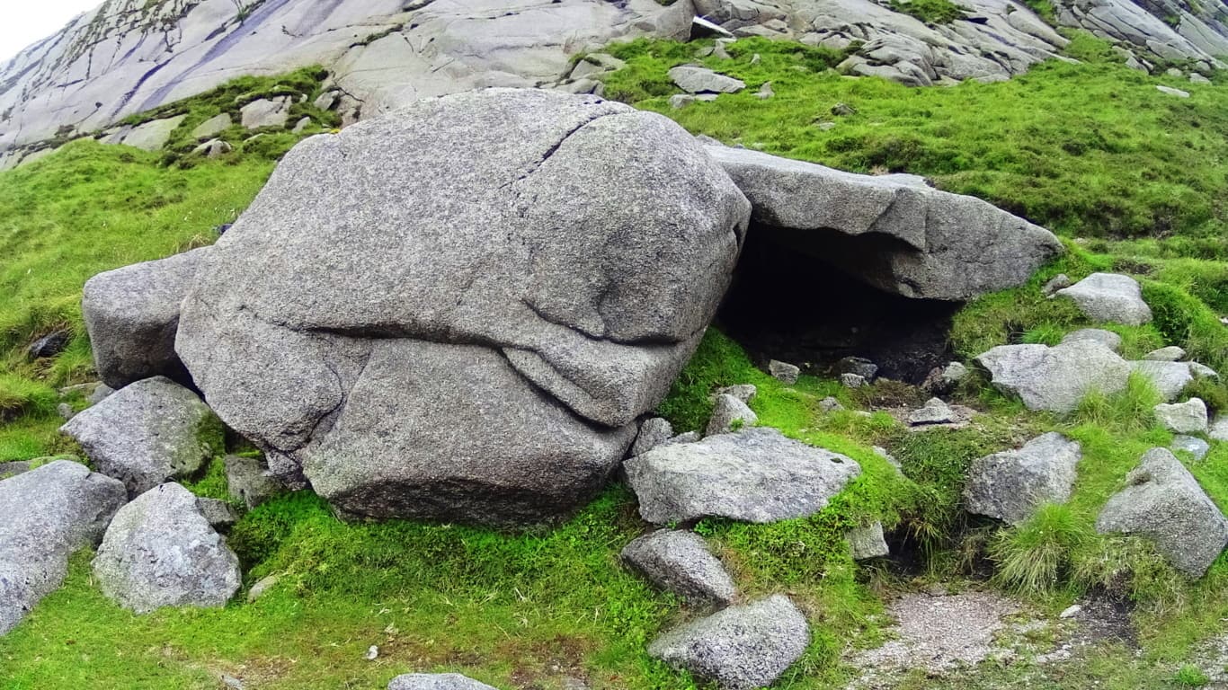 2000 miles away, hidden in the forests of Massachusetts, is a very similar Cairn located in Purgatory Chasm, a rare miniature canyon in the American northeast (featured on Stonestrider.com/Image Below, Left). Another Cairn of this specific style can be found at the highest point of the trail behind Glenveagh Castle in Donegal, Ireland (Image Below, Right).
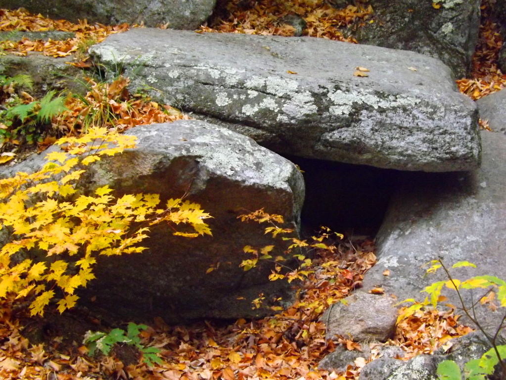
A 20 ton stone about 100 yards down the valley looks to have been somehow sculpted to match the slope of the base of the valley. (Image/Below). This raises all sorts of questions about the earliest culture to inhabit this region. Many of the stones seem to have this reflective quality on the landscape, mimicking features beyond, imitating valleys, building connectors between peaks; who does this? It has an artistic quality, as well as raw ability to build and move massive rock sculptures. Mysterious. And it just gets more mysterious the further up you go.
 The final phase of the ascent at Mount Bearnagh is a solid challenge, but breathtaking.
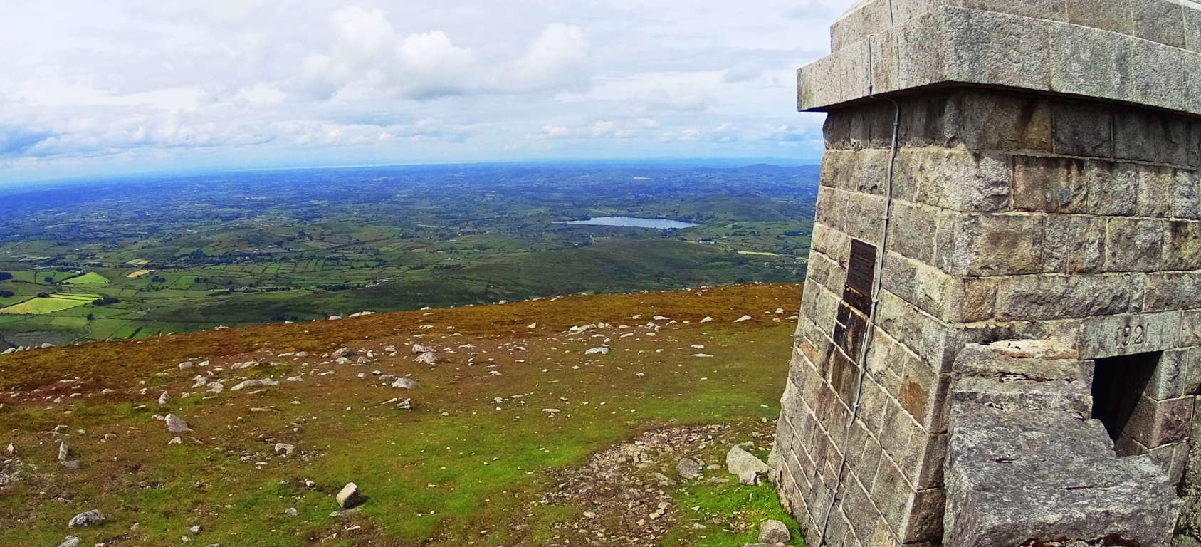 Here you will turn right and follow the modern wall directly up the side of the mountain for about another 3/4 of a mile to the small tower sitting above the Range.
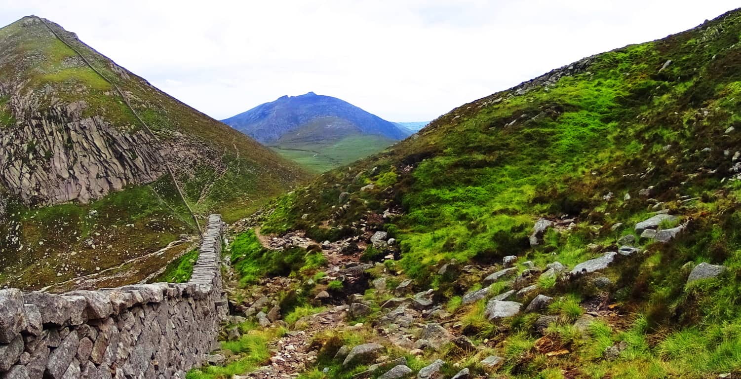 In this most elevated region the mountainside becomes inundated with dramatic sections of stone, much of which has been marked, measured, and cut into curious fixtures. While hiking you can look closely at some of the stone statements that are totally distinct. Below is an example of spirally stacked stones that are mingled with pieces that are clearly marked, measured, and cut. This piece I’m pointing at in the image below contains a stone with three equidistant measured markings for cutting along its side; it was obviously intentional.
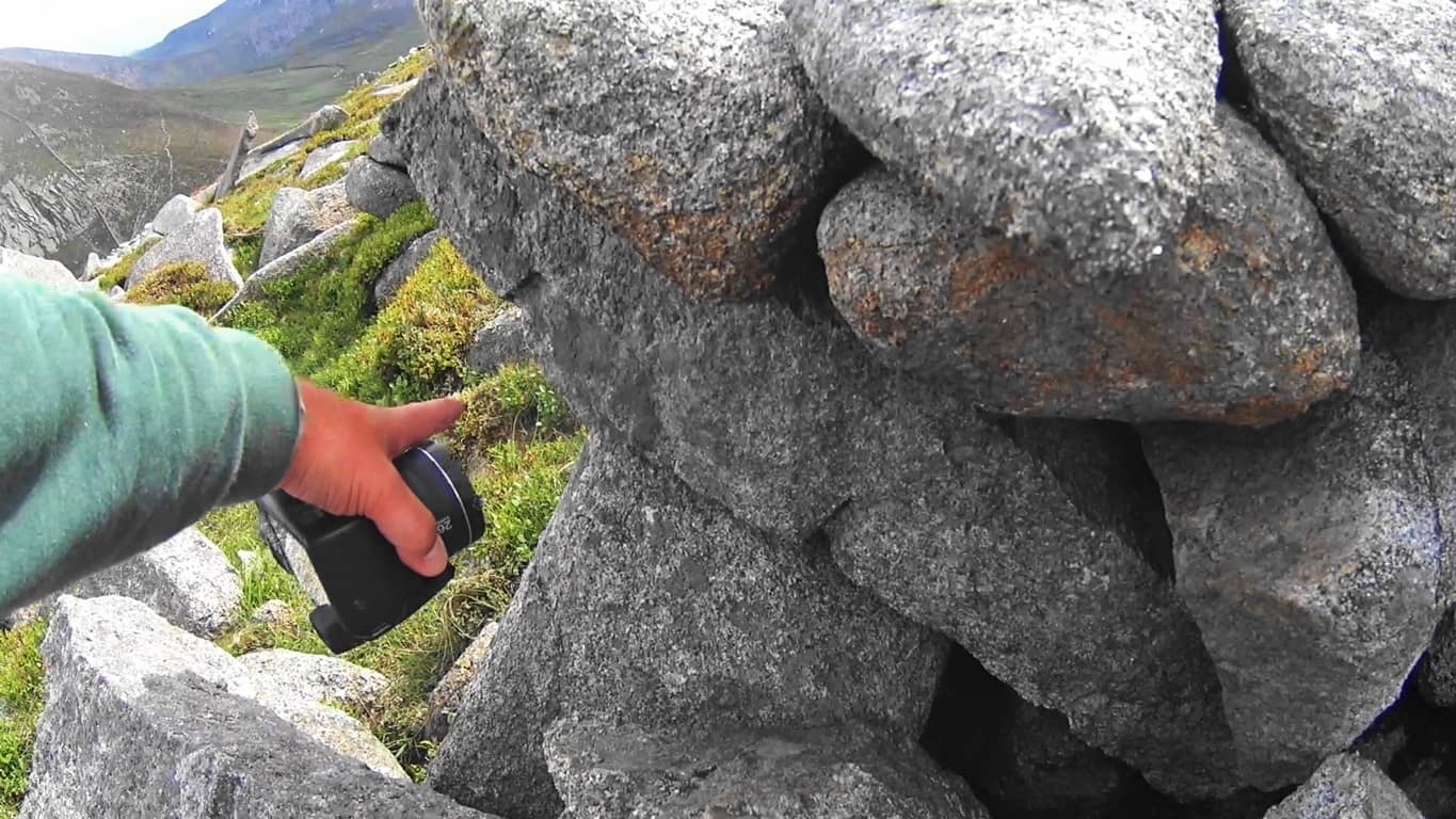
There are hundreds, if not thousands, of crafted stones to be found here, all utterly undocumented artifacts. What are they doing at 2,200 feet above the valley? Here again is another set of stones which look to have been specifically cut in order to mimic the slope of the mountains beyond. (Image Below) I noticed the boulder on the right side of the picture from over 50 yards away. It has been sliced, as you can see, and the angle of that slice imitates the slope of the eastern face of the mountain beyond,

The shape of the stones imitates a rock fixture nearly at the top of the opposite slope beyond. Notice also the thin rounded plate to the left which imitates the exact angle and roundness of the peaks on the left. These stones were absolutely placed this way to specifically mimic the opposite mountains. Unreal.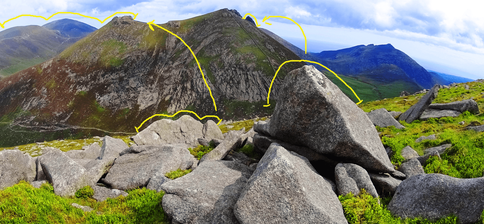 I am aware that this is a challenge for people to accept; I too found it a challenge for years. But time and time again, similar expressions arise in challenging elevations that are begging to be noticed, both in Ireland, and New England (as well as the rest of the world). This is a form of megalithic expression that we are simply not accustom to acknowledging, as it has been mostly ignored by the academic community. The real question you should eventually ask is: “How could they ignore an entire mountainside of marked and positioned stones?” The logical questions that arise would challenge our picture of Neolithic history, and that looks to be what modern academia will not allow. Just beyond this magical fixture is the small tower, where a 360 degree view comes into full focus. On clear days you can see Wales on the other side of the Irish Sea! Below is the simple southern view from which your hike began.
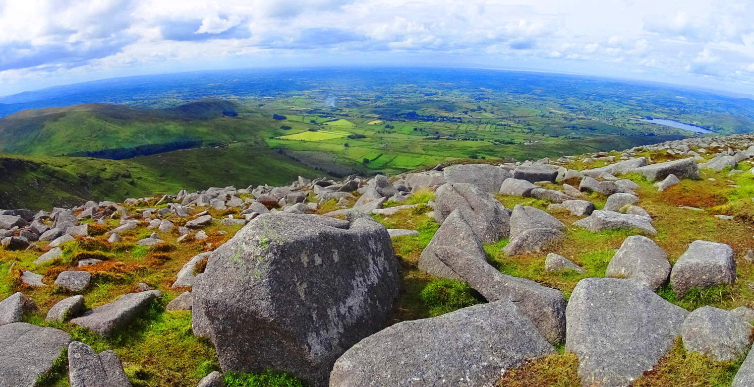 The modern stone wall continues along the elevated porch of the upper mountains, twisting surreally through the Mourne beautifully (Top Image of Article). Many hikers choose to continue hiking from small tower to small tower, while others, like myself, made the return descent back to the Pass and down the Valley.
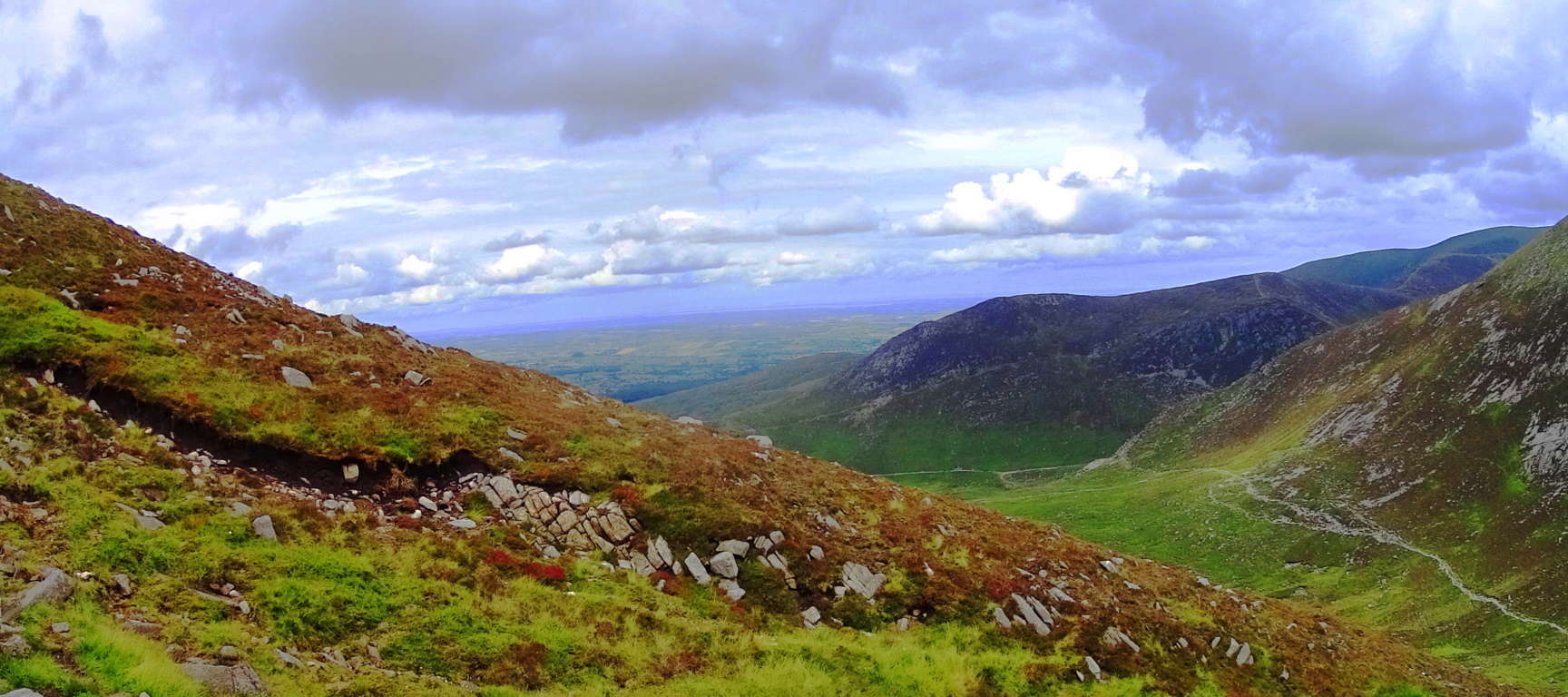
The colors here are a spongy mixture of rugged and rusty oranges mingled with profound jade and deep mossy green. The clouds play a pocketed game, with shafts of light seeping through the fast moving heavens; light arrives, sometimes in flashes over broad portions of the Mourne, while at other times appearing in prolonged beams of revelation. The air is cool and forgiving. If you have a small water purifier you could drink from the wide stream heading down the central portion of the valley back to the bottom. Enjoy the benefits of gravity assisting your 3.5 mile trek back to the station. This place has the potential to be one of the best day hikes you will ever have in your life. What more do I need to say about such a place? Find your way.
Giant’s Causeway
 Location: Hamlet of Bushmills/County Antrim/Northern Ireland/(U.K)
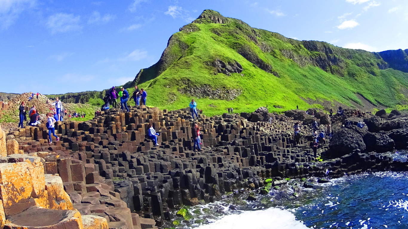
Note: Every so often a place emerges for trailblazers that is so mysterious, so utterly stunning, that a reactionary discussion is unavoidable. The simplest question emerges: “How did this happen?” Welcome to The Giant’s Causeway, the slightly golden, hexagonal stone courtyard on the absolute northernmost coastal point of the Emerald Isle. This is a gorgeous coastal trail, of roughly five amazing miles, that slowly elevates and bends around two gorgeous bays which cinematically ensconce one of the most mysterious sacred sites in the world.
Scientific Theories: The landscape of Ireland is not just a minor variation from the nearby nations of England, Scotland, and France, just across the Irish Sea; it is distinctly different. Take a look at the image above, along the bay of The Giant’s Causeway; the green coastline emerges like a Jurassic jade stone. It’s breathtaking. How does a landscape like this happen? How did Ireland happen? The answers come from all sides, and each is more challenging than the next. The author J.P Mallory in his book ‘The Origins of The Irish’ attributes Ireland’s unique glowing ‘green-colored-universe’ to the primordial history of it’s formation in the earliest periods of geological history. Get ready for this: Once upon a time, believe it or not, just after the breaking-up of the singular Pangaea Continent, Ireland was actually off the coast of… Australia.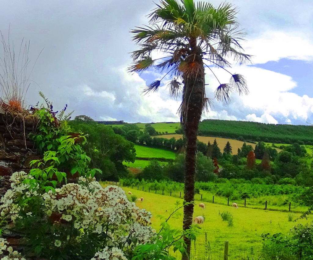 Ireland’s earliest tropical attributes come from this region. In an oversimplified explanation, Ireland slowly made its way (in what is scientifically called the ‘Ordovician Period‘) through extreme Ice Ages, Floods, and drastic Continental shifts, to reside at its preset position. That’s what scientists believe. Adding to that initial tropical origin, Ireland is at the glorious finish-line of the Atlantic Jet Stream, which is the warmest and largest tropical under-water-highway in the world, literally running from Jamaica to Ireland in it’s final phase. As result, Ireland’s southern coast (and England’s) is subtly marinated with Palm trees, something many people just don’t know. While hiking through Ireland you can easily begin to wonder what the actual story of this landscape is?
History and Religious Myth: It is hard to accept a theory that has Ireland’s earliest origin off the coast of Australia, but the uniqueness of Ireland’s semi-tropical south, and ‘thousand shades of green’, indicate something special. As noted before on Stonestrider.com, once, while hiking Kinnitty Mountain in the landlocked heart of Ireland, I found seashells on the mountain trail, about 2200 feet above sea level.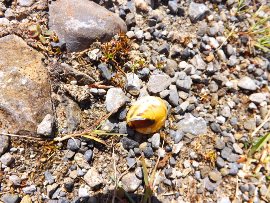 What were seashells doing at the top of a mountain? Ireland must have been covered by the ocean at one point or another, just as other landmasses, for this to happen; and more directly, this evidence would point to the last time it happened, meaning the Biblical Flood. For some people this is also hard to reconcile, and yet it is hardly less realistic than a theory transporting Ireland from the coast of Australia. To this point, in the southwest of Ireland, there is a magical view of the Gap of Dunloe from the N71 Road, that is so spongy, so filled with undulating vegetation, that picturing it at the bottom of the ocean seems uniquely possible. (Image/Below)
 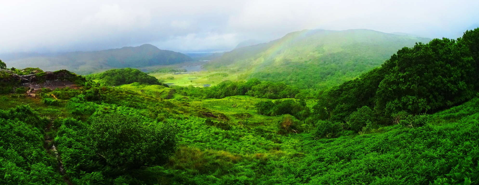 Like shells on mountaintops, or Palm trees growing in a northern European nation, The Causeway’ contains features that are compelling, and require some secondary consideration, to say the least. The first and most obvious of the features here are the small, but dense, golden hexagonal stone pillars lining this brilliant coastal cove.
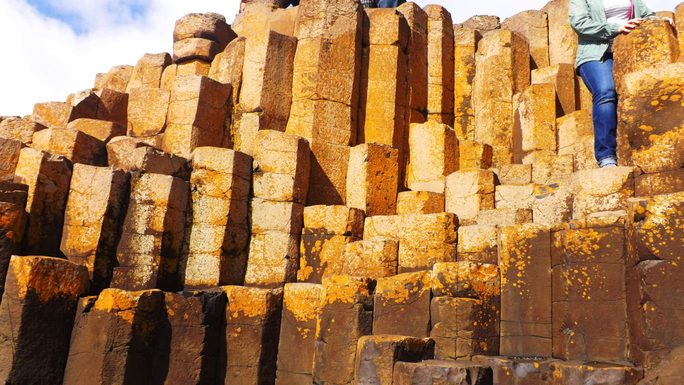 School-Age textbooks attribute the geometry of these stones to a process of volcanic lava being cooled and shaped by the ocean some 40 million years ago. For an impressionable ten year old child reading a fancy textbook this explanation might seem o.k, but for an educated, sentient adult, aware of logic and context, the explanation is almost insulting. Simply put, there are so many problems with the accepted theory. For example, in Hawaii this process of “lava cooling” is still taking place in real-time, and yet there is not a single hexagonal to be found. In fact, the lava-solids in Hawaii looks exactly as you would think; like grand layers of “syrup” slowly solidated into large round bulges of stone. These are strangely different results for two coastlines undergoing the exact same process. (Giant’s Causeway Hexagonals/Image/Below)
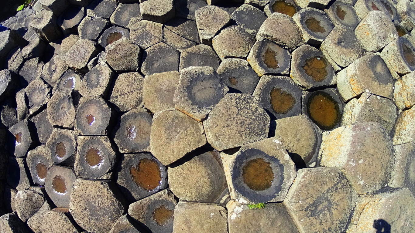 Furthermore, there are no hexagonals to be found anywhere else along the coast of Ireland; not a single one. That just doesn’t make sense for such a small national coast. There is also the apparently miraculous geographic placement of The Causeway’, set like a perfect northern gateway into Ireland from Scotland, which isn’t even 70 miles north across the inner Atlantic bay. It’s as if the area says: “Welcome to our side of the Sea”; a striking entry zone specifically facing the only other international land mass in the vicinity, Scotland/Wales.
View From The Trail: As you might expect from a World Heritage Site, at the beginning of the trail is a busy commercial station and parking lot that requires payment. There is even a small bus line that will take physically challenged people to the The Causeway’. Don’t use the bus-line. Walk the 200 dramatic yards down the small road to the actual trail. From here the first full vantage of the northeasterly coastline pathway appears, and it couldn’t be more inviting. In the Sun, this scene looks like a Celtic northern California.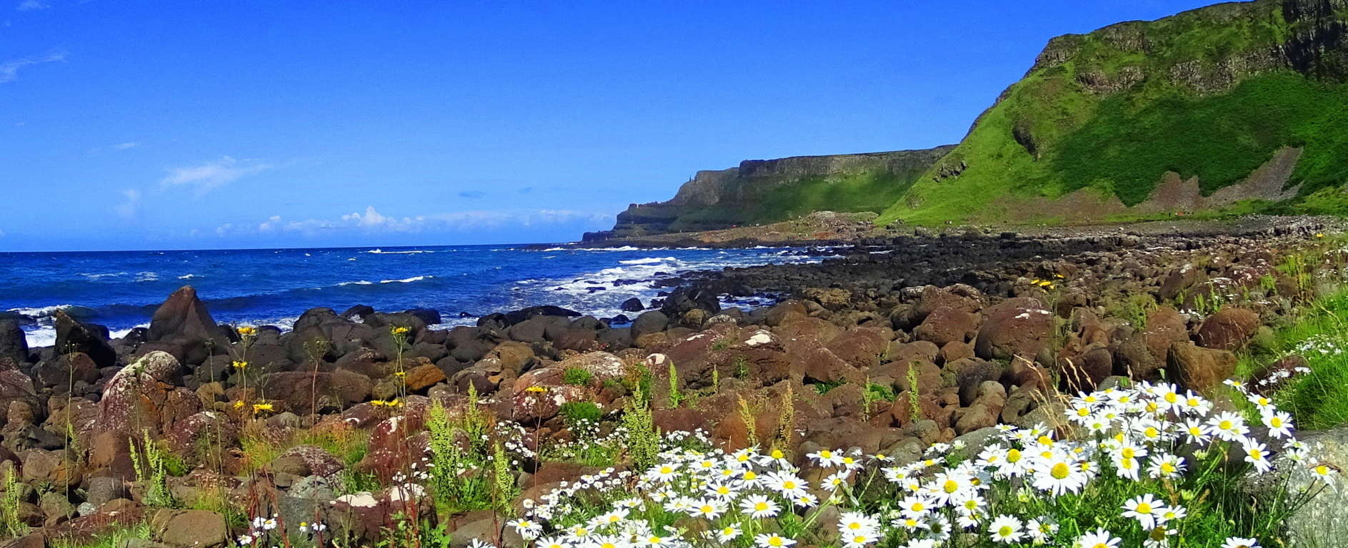
In this initial bay, before even arriving at the mysterious Causeway’, are massive stones and boulders that seem to have some kind of secret. Many of the large shapely boulders have names, and are famous in the area for their form (Image/Below). 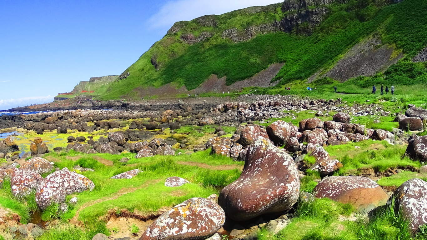 There are stones look to have been placed specifically as seats, with brilliant curvatures and character. Other stones are more stoic and classic in stature, looking like legitimate standing stones (Image/Below), fixed squarely into the rock beneath them. The entirety of this rocky opening scene, before arriving at the Causeway paints a picture of a ‘rock garden’ that reveals a small taste of the striking geomorphic strangeness taking place here.
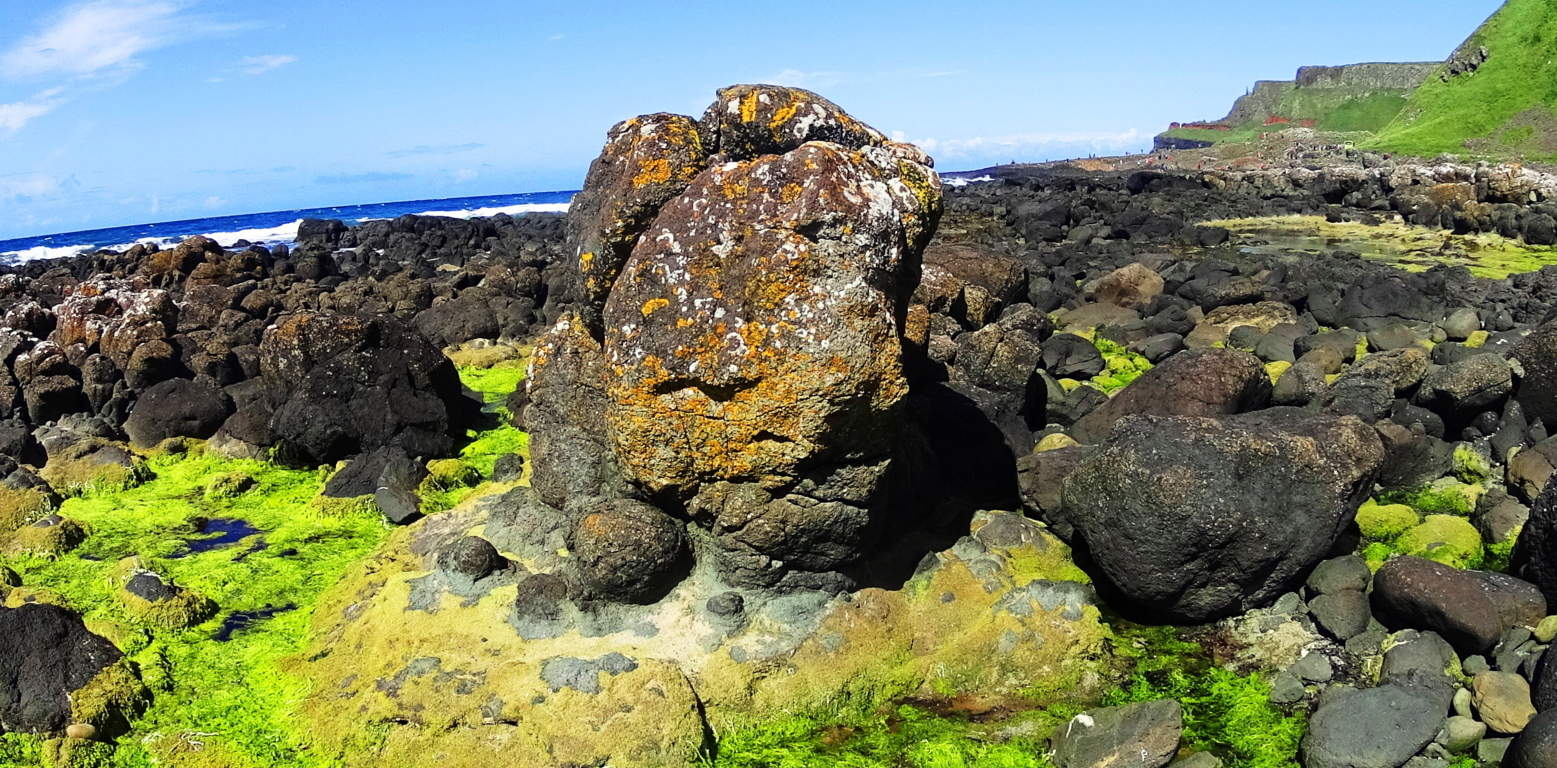 Continuing eastward along the trail the Causeway’ emerges, and not without what looks like playfully designed characteristics. At first glance, the leveling of the hexagonal stones in certain areas, combined with the orientation of this circular stone enclosure, give the impression that it was once perfectly carved-out to face the Sun, all while encapsulating water in a small protected ‘hot tub’ type space (Image/Below).
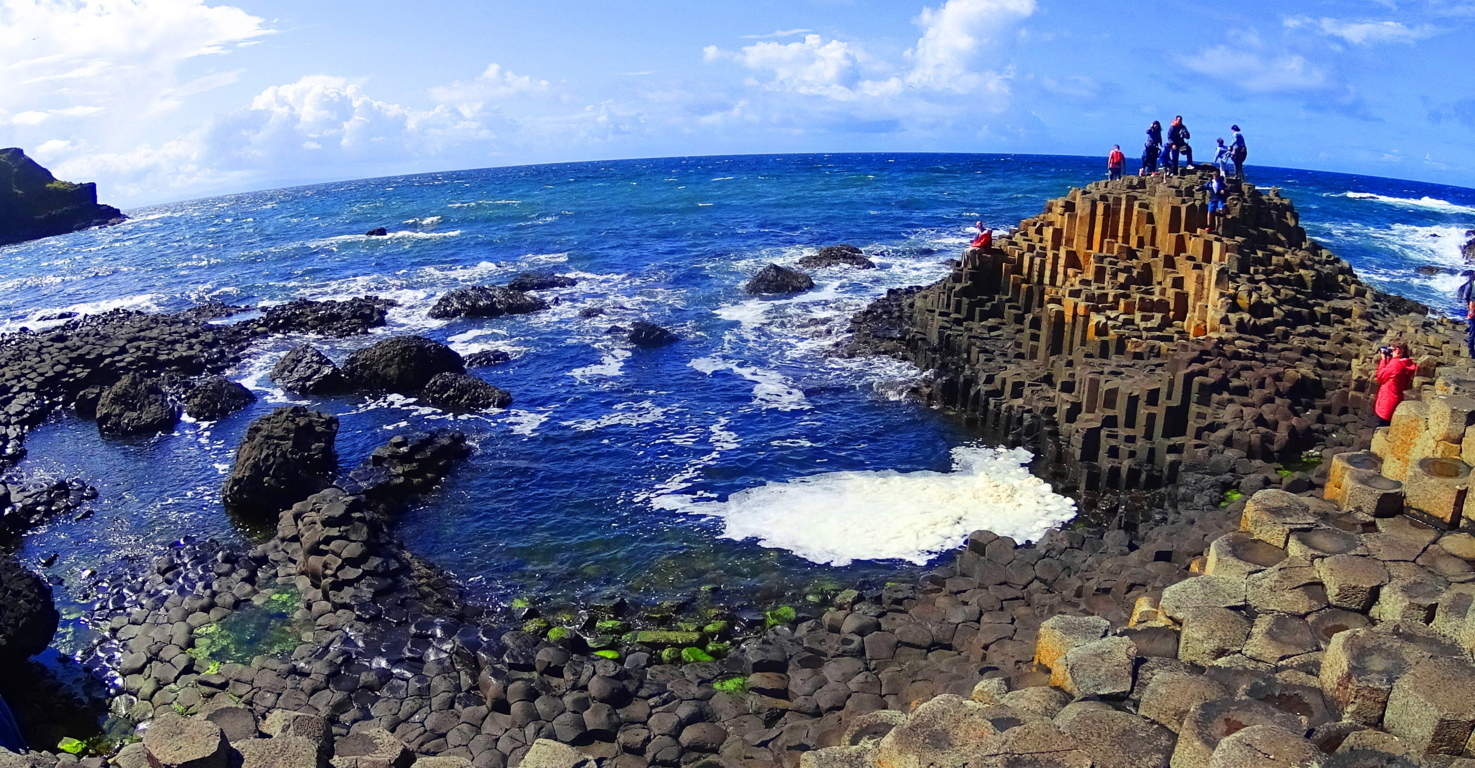 Taking a seat on the stones while the Sun shines overhead absolutely creates the feeling of a Spa. The area feels entirely functional and intentional, like many Neolithic places along waterfalls and mountainsides in New England, Wales, Scotland, and England. Continuing on the trail will bring you through a hexagonal stone gate, over a small hill, and then up the coastal path you go. As you begin the minor incline upward, yet another lessor-written-about feature is embedded perfectly into the coastal mountain face, and in only one specific area. How did lava quarry-out a perfectly squared set of evenly sectioned and leveled hexagonal stones inside the mountain? Why does the stone directly above these towering hexagonal shafts remain regular? Wouldn’t these stones have absolutely been affected by this magical lava flow which seems to pick and choose, even organize, specific sections of the coast for influence? Wouldn’t these shafts be spread at random, all over the scene, for miles perhaps? It just doesn’t make sense. And of course, these shafts are not published and written about in so many text books. Why? Because the logical questions they raise are too free of the authority of those who write the textbooks. Academics know that most of us will never see this place for ourselves. Stonestrider.com exists to inspire hikers, humble or affluent, to break through the paradigm and expectations of the individuals who are re-writing our histories, and see for themselves.
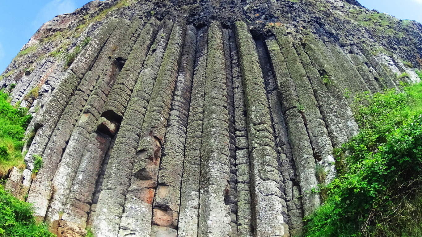
Continuing up this wonderful trail brings an endearing visual of the entire bay. It is no wonder that about 5 miles west, down the coast, sits Dunluce Castle, a gorgeous 13th century fortification built at the edge of a cliff, and practically the northern edge of Ireland. This castle was utilized and enhanced wonderfully in Game of Thrones, a well deserved compliment to the area. In its day, Dunluce must have been one of the most desired residences in all of Ireland. The grounds at Dunluce are open for walking, and it is certainly recommended to any sojourners to visit this incredible stone palace.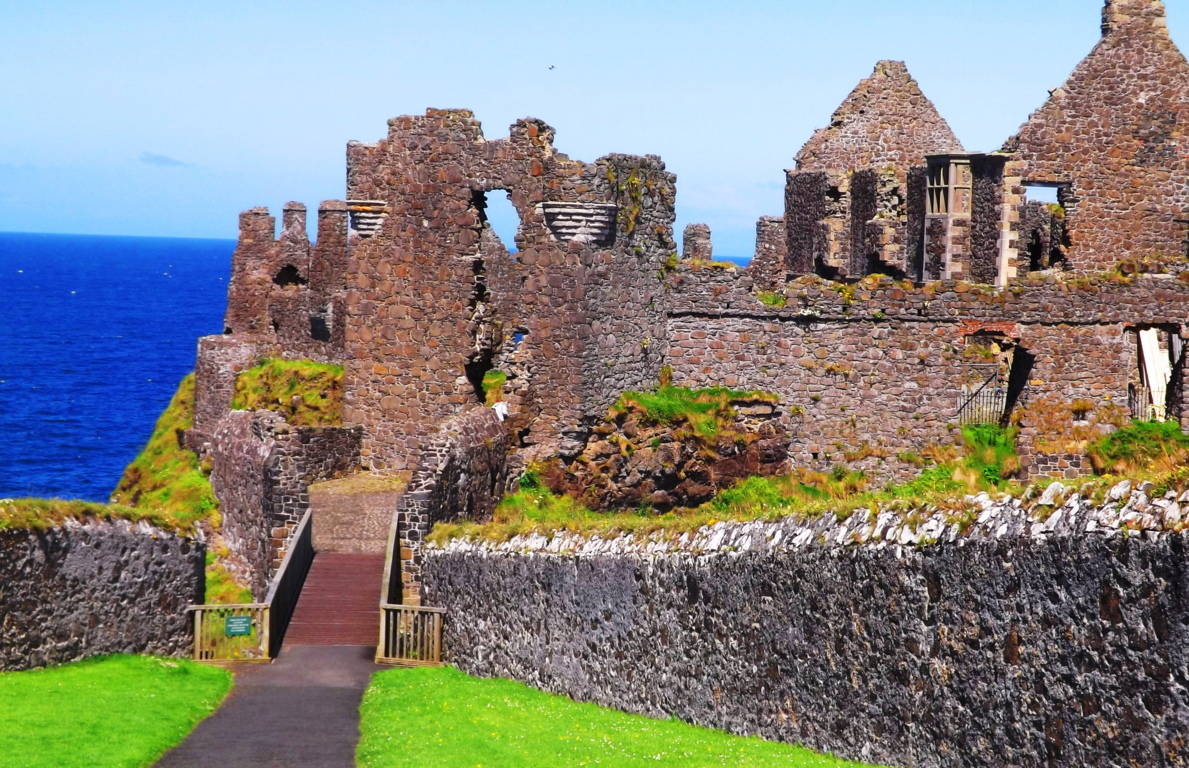 Returning to the easterly trail above the Causeway’, the elevation rises as you approach the edge of the bay. Why don’t the stones below the trail, which are much closer to any theoretical flow of lava which they say came up from the water, have hexagonals? How did the lava pass them over, and then cut into the specific stones above? Logically it just doesn’t hold up.
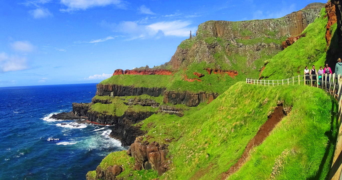 Just beyond, and above the trail, is another set of singular hexagonal stones, and in an even more specific position.
 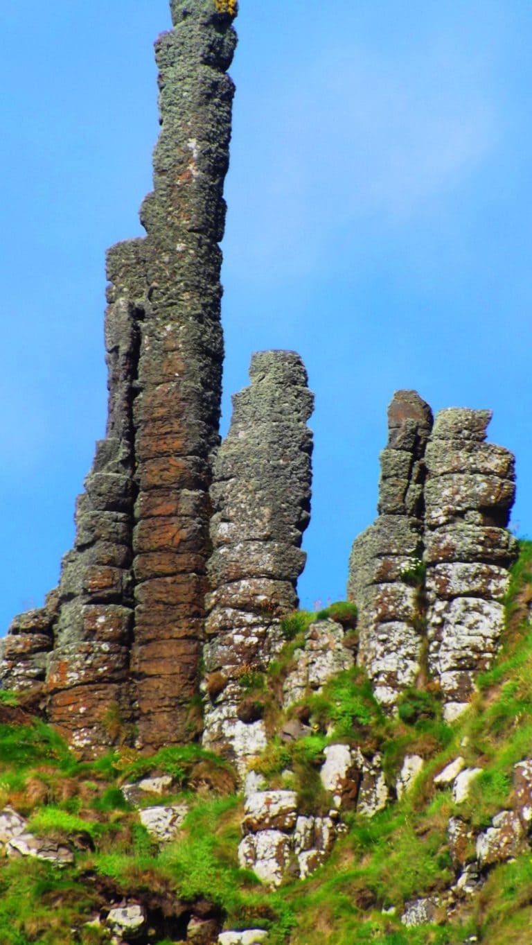 These stones mark the edge of The Giant’s Causeway, like a specific warning sign; it says someone skillful enough to create these picturesque pillars once occupied this place (Below/Left).
This beautiful trail bends around to the next grand cove, and up out of the coastal wall, continuing on the mainland, looping back to its start for another 1.5 miles. But the other coves do not contain the hexagonals; intact, no other coves do anywhere in Ireland, Many people simply walk back down the trail from the direction they came to get a last look at the Causeway’. Who could blame them? Passing through this place a hiker can see that there really is no logical way to explain what has taken place here. The magical aspect of hiking and trailblazing is palpable; stories about its origin have survived for century upon century. Just as the earliest Hebrew scriptures record the presence of Giants in the land, well before the tribes of mankind swept into their valleys, Ireland and England’s earliest tales are of giants. The name “Giant’s Causeway” is not without substance. It is here that Fin McCool, the most famous Giant in both Ireland and England, is said to have exacted tolls upon those wishing to enter Ireland from the north. There are stories of epic battles with other Giants from Scotland and England, and looking around the Causeway’ it is just impossible to ignore the possibility of Fin’s presence. Looking back on the entire scene would justify any fight in order to hold on to this beautiful and epic space.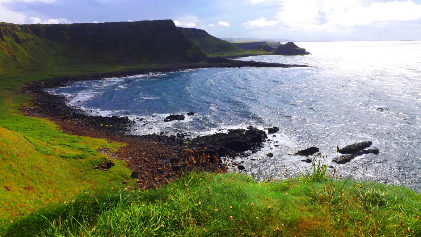 Hikers, anthropologists, story-tellers, and locals, are left to choose between stories or scientific theories, both of which stretch our imaginations, either in one direction or the other. Science seems no less ridiculous than myth, and our personal cognitive abilities are ultimately required to decipher places like this, which is a testament to its magical vibration. It would be a lot easier to dismiss the idea of Giants as ridiculous if they weren’t written about so clearly in ancient scripture, and embedded in literally every cultures deepest mythical roots. Hike the Causeway’ for yourself, it’s the only way to get just a little closer to what actually might be the case here. As a new Spring emerges, give yourself a worthy challenge and head to the beautiful northern Irish coast; it’s a “can’t miss”. And of course, may the road rise to meet you, until the cove of hexagonals greet you.
Mount Spruce/Monroe State Forest
Location: Monroe, Massachusetts/USA
Elevation: 2,730 feet
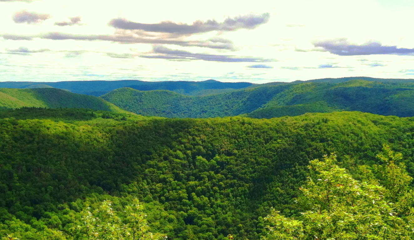
Note: It’s good to know that every so often you can come across a simple trail. Depending on where you are, you can encounter a host of obstacles and unanticipated factors, especially in New England, which might hinder your way. For example, in early Spring, tree’s may have fallen during the previous Winter before rangers can re-designate the trails with new markers. This can have you miles into a trail expecting a rewarding view, only to be completely off-trail and configuring a way back. For the dedicated hiker in Winter, snow may cover an entire route. Just last week on a trail in New Hampshire a man had the bright idea to bring an M16 rifle several miles into Purgatory Falls Trail; he opened-fire along the river, all while people were hiking, which mind you, is totally LEGAL in New Hampshire. These things should not hinder your dedication to seeking the beautiful and meaningful high points in the landscape, but it should teach you to increase your awareness that the rules do change in different environments/countries/states. This is why it is a relief to arrive at a place like Monroe State Forest, set in a very special region of Massachusetts, on the beautiful boarder of southern Vermont.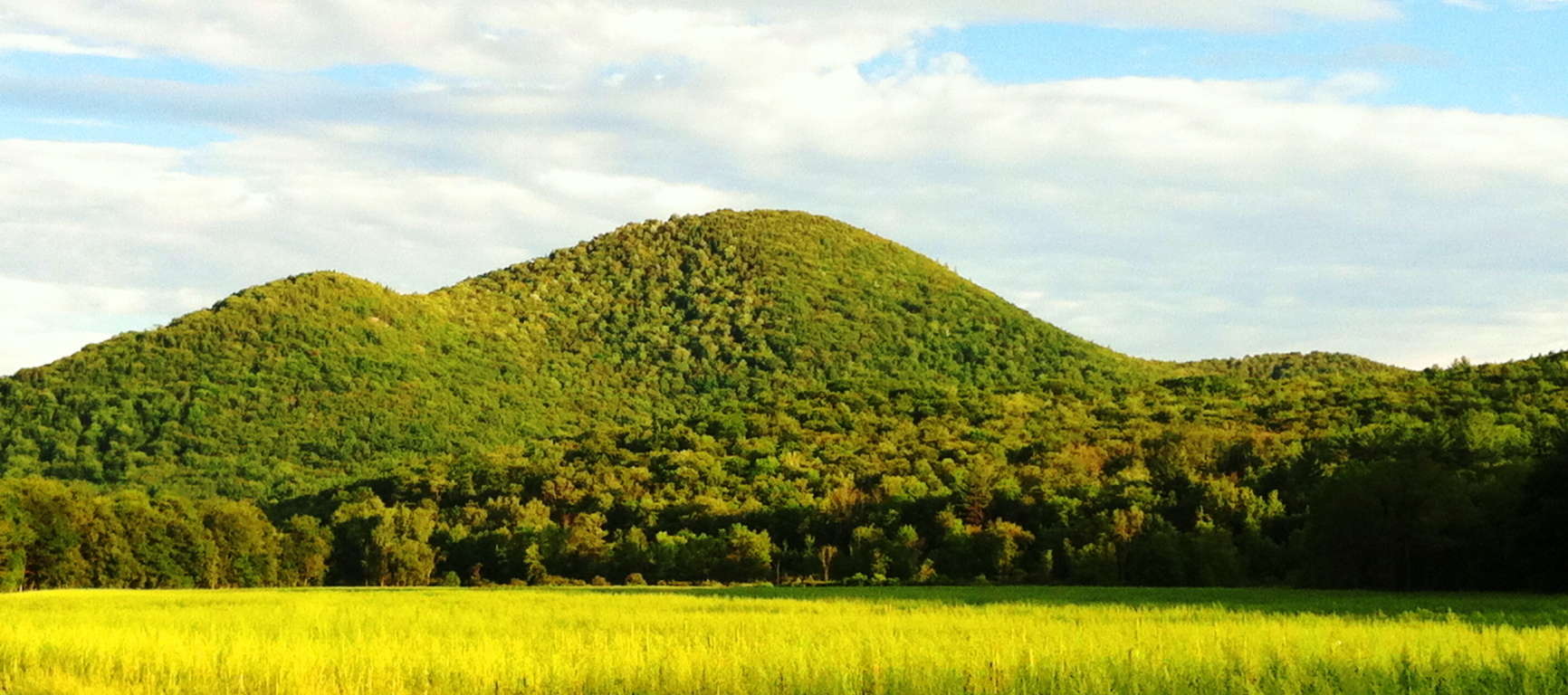 Here you will find a clear and straight trail heading directly to the best view in the entire region. This place is a rolling set of small mountains that vividly encapsulates the medium-scale hiking elevations of central New England. My friend Jon Bent, who is a local, and expert on these hills, has told me that the growth here is not ‘old’ at all, but rather, it is recent (150 years old), which contradicts several sources about these woods. Whatever the case may be with these massive trees, they are a batch of somewhat rare trees for Massachusetts; such as the Yellow Birch, American Basswood, Beech, Red Spruce, and towering White Pine. It is my belief that the crafted stones were here LONG BEFORE any trees, as they were present on the landscapes in Celtic ranges.
 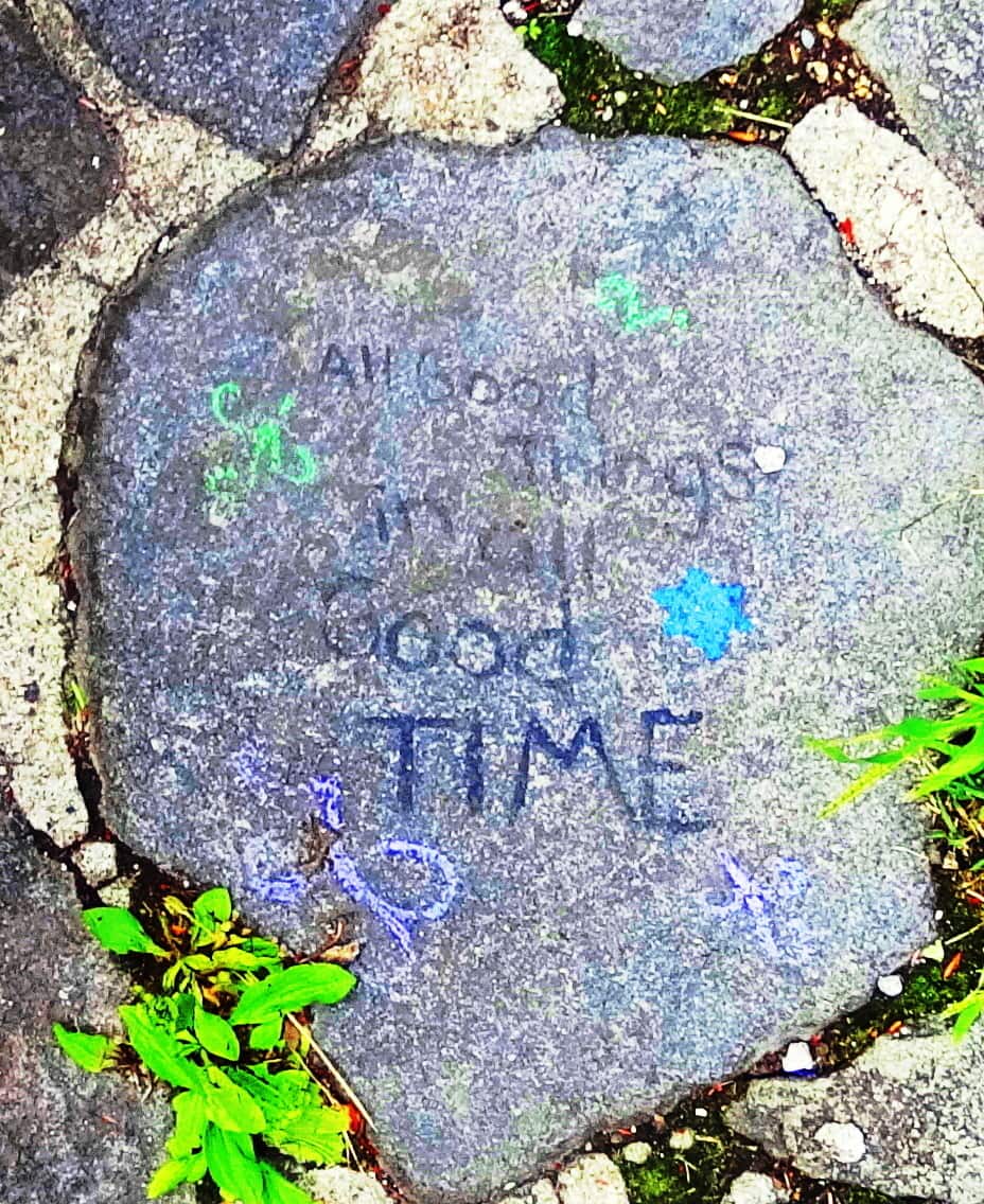 Navigating to the best entry point for this trail requires locating Tilda Hill road in the town of Florida, Massachusetts, which eventually becomes the indistinctly named “Main Road”. There is a sign for Monroe State Forest at the intersection of “Main Road” and Raycroft Road. Raycroft Road is actually a rugged dirt path and the trail for this hike, which elevates gradually into Monroe Forest. You can park your car just passed the Monroe State Forest sign at the turn-off towards Raycroft Road, beside the flowing Dunbar Brook on your left. Simply park your vehicle and head straight up the wide dirt path, without veering in either direction, all the way to Hunt Hill porch. It’s about 2.5 miles to reach the vista. You will actually come to the top of the hike and re-enter a short path directly in front of you leading a bit downward again for 2 minutes before opening up to Hunt Hill Porch. It’s a striking view. On this day someone wrote on one of the porch stones “All good things in all good time.” Perfect spot to contemplate this.
 Mount Spruce is actually a secondary priority compared to the view at Hunt Hill, here at Monroe. Hunt Hill should be your goal. After discovering the Hunt Hill vista you can turn back towards the main trail and follow the westerly paths, to the left, heading towards Mount Spruce. The pathways heading away from the main trail are narrower, with towering trees and hedges.
 These trails continue along hilly glades and knolls that display shafts of cinematic sunlight, and scenes where a stop for water and rest in the Forest is a great idea. Looping down to the main trail again you will be heading generally back towards Dunbar Brook. At about the mid-point of the Raycroft Road main trail, there is an easterly path of forest with those beautiful White Pines, all continuing down to Dunbar Brook and beyond into the lower valley lakes.
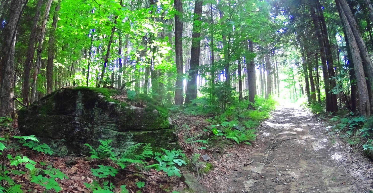
Within this glade of White Pines are some compelling free-standing boulders, with sliced faces and rounded rears, like many Celtic territorial markers. Look at the face of this 10 ton boulder on the left. It is blatantly flat, looking at it head-on.
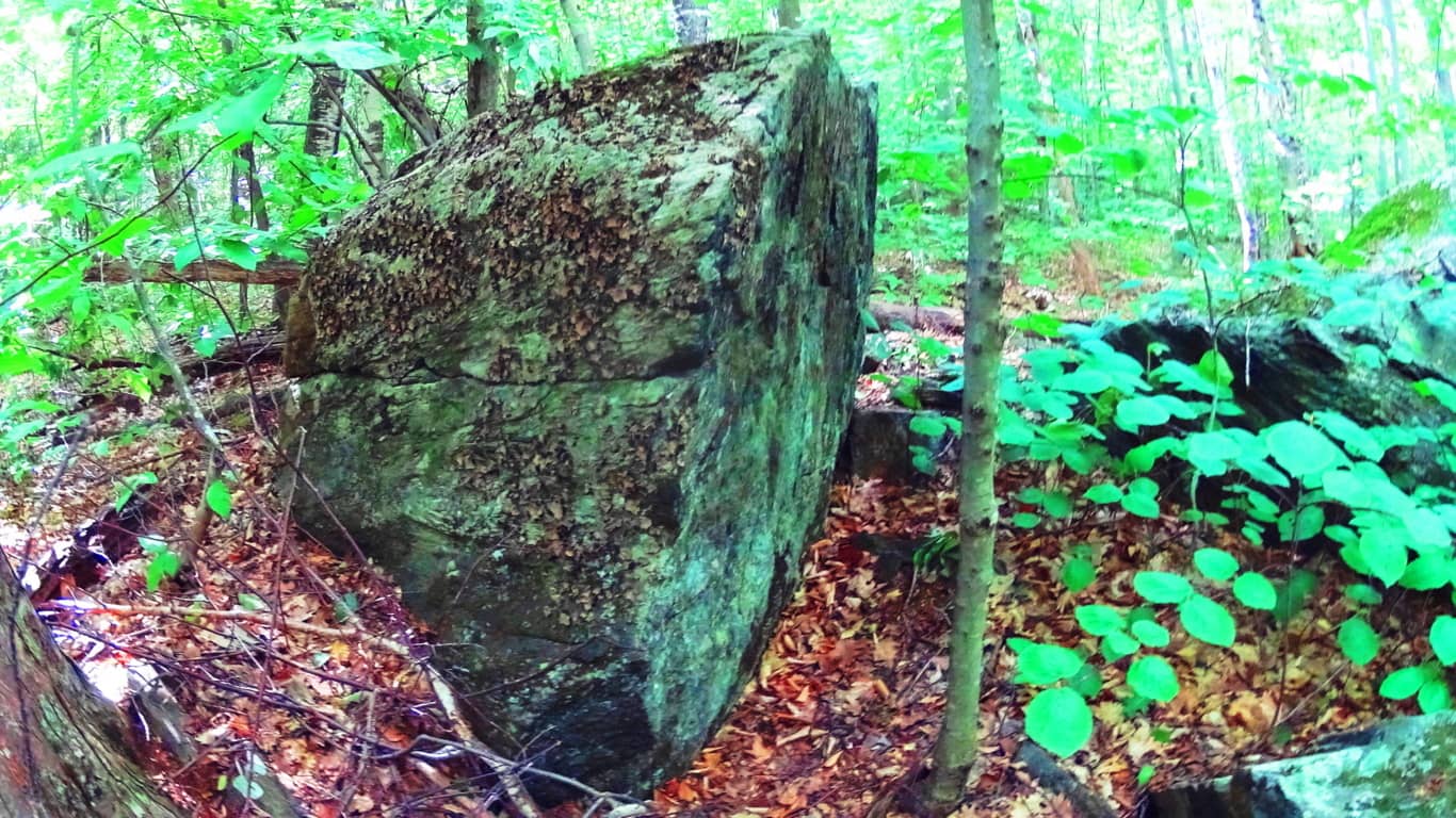 The view from the side reveals that the boulder looks to have been split, like a knife through butter, with a rounded base at the rear, as shown on the right. What could’ve possible done this? Look at these standing stones with rounded rears at Glenveagh National Park/Ireland (White Diamond Face), and Mount Watatic Mass (Red and Gold Leaf coloring on stone). It’s the same exact principle.
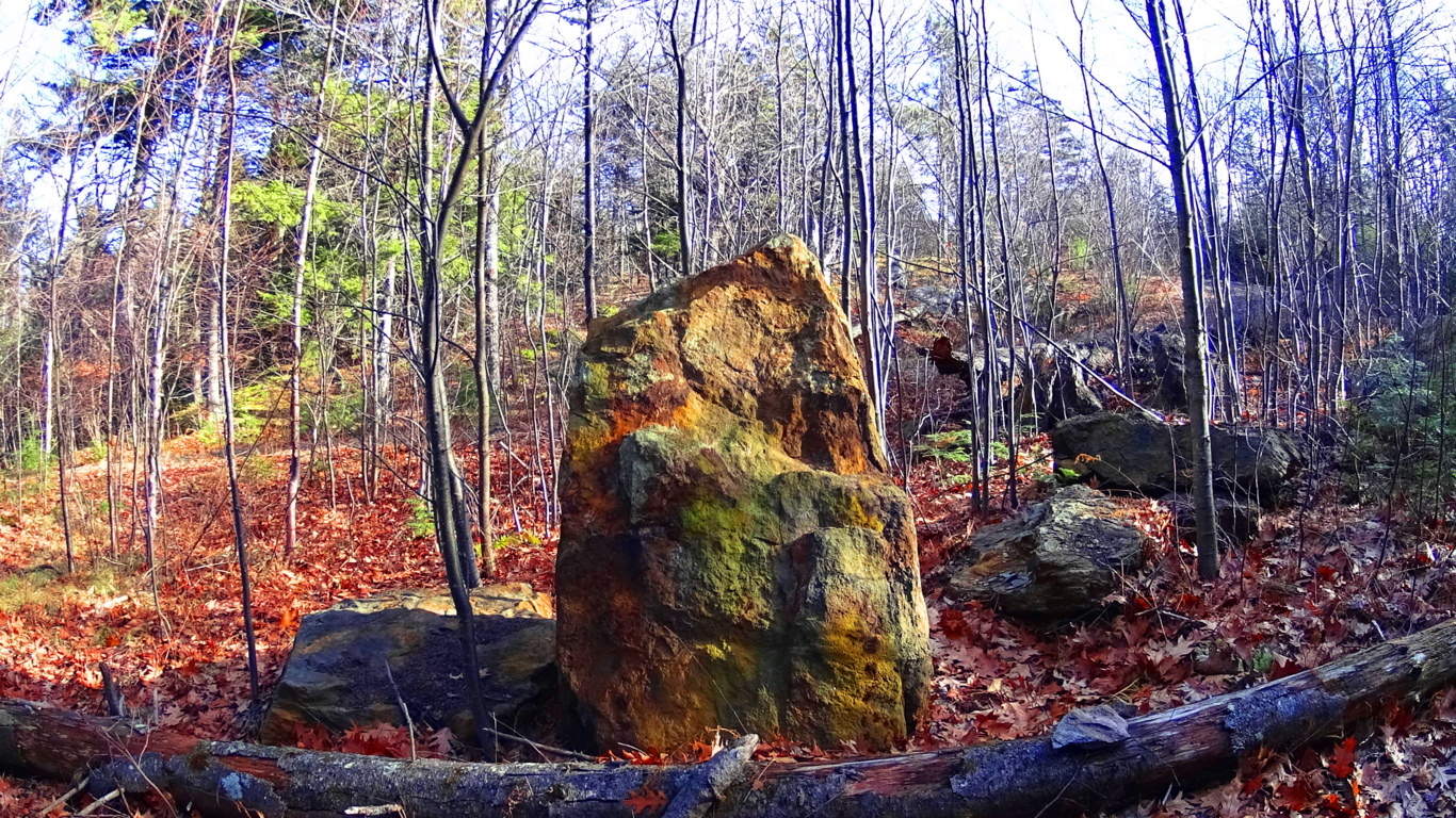
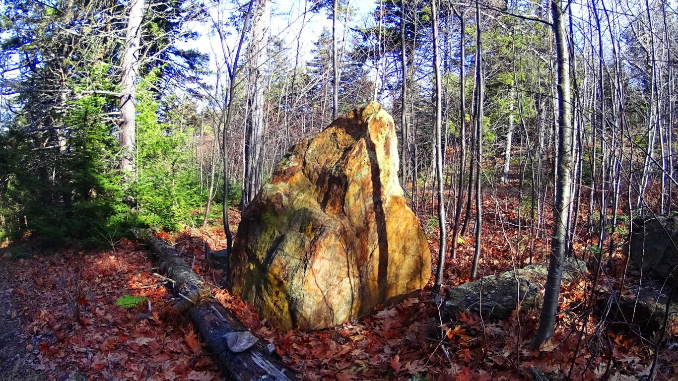
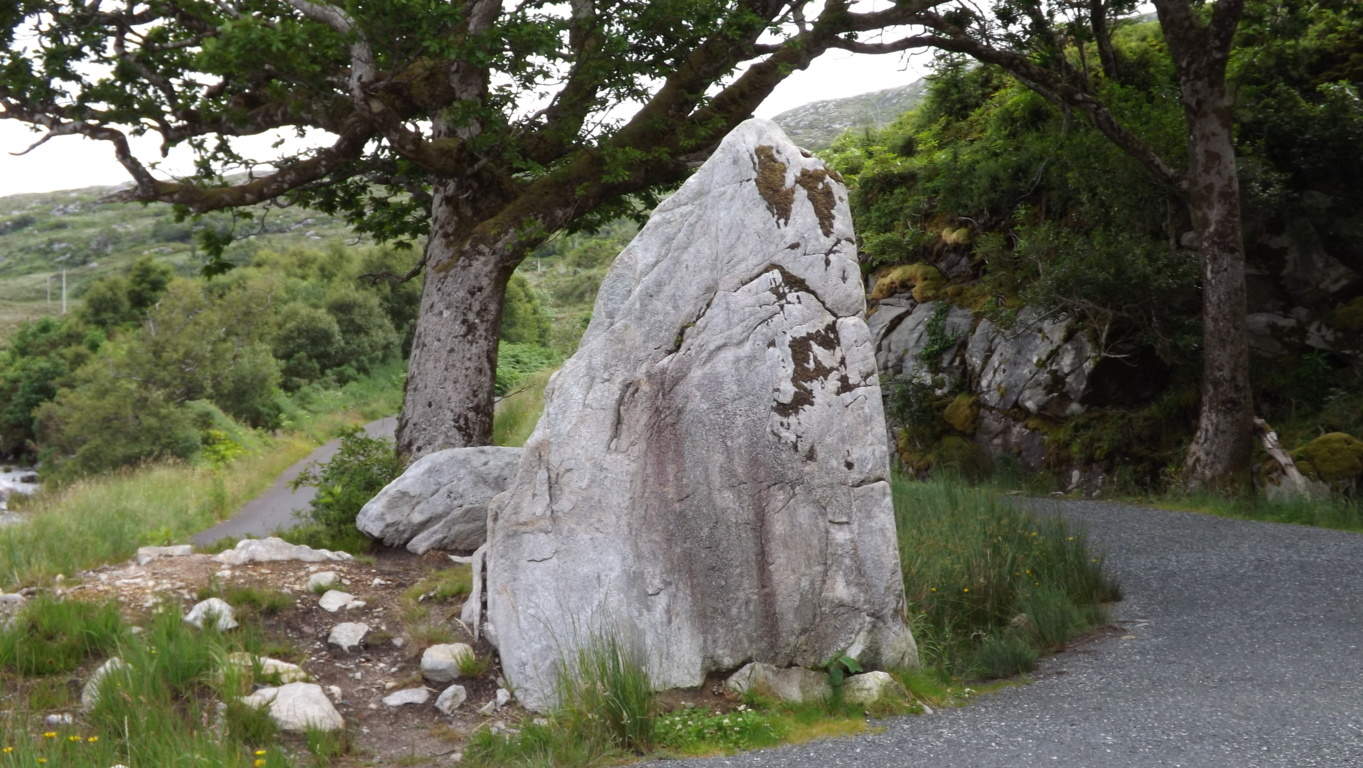
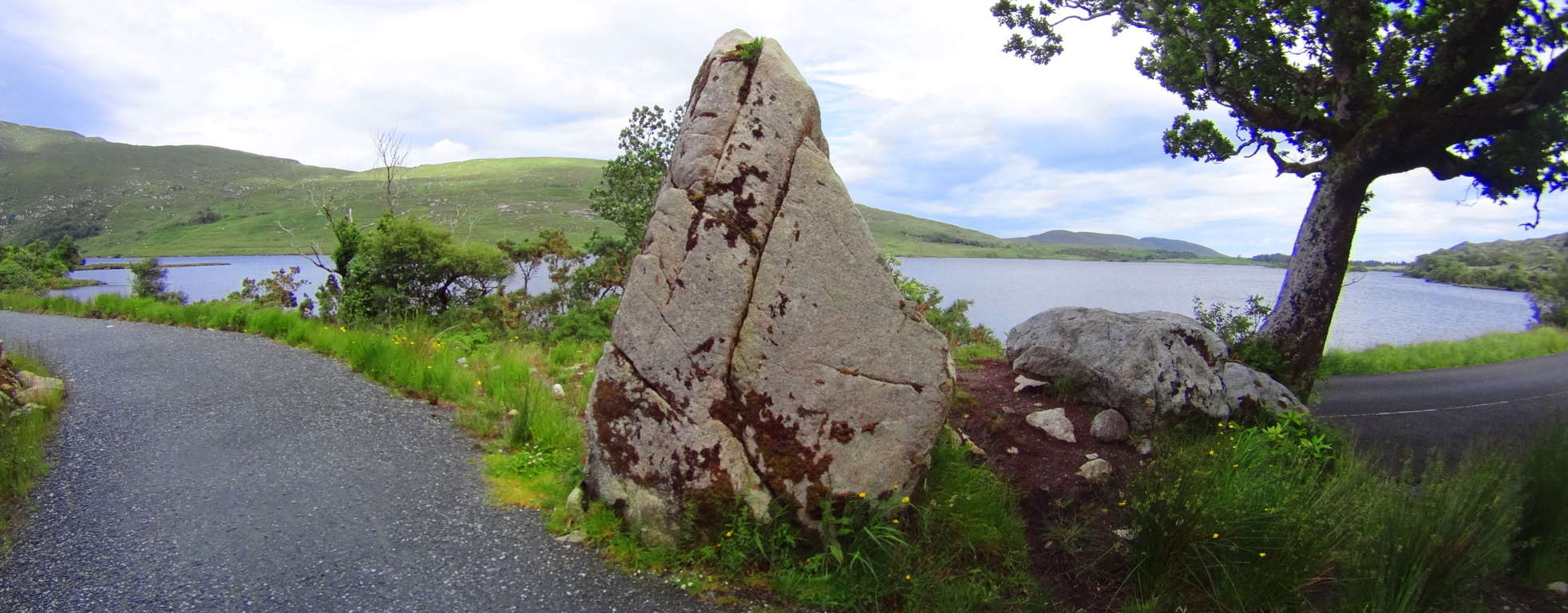
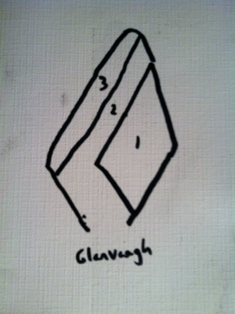
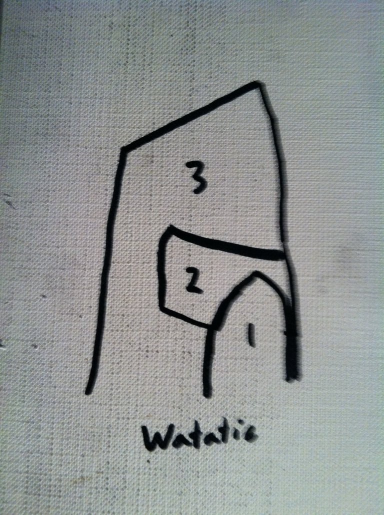 Dunbar Brook becomes a beautiful set of small waterfalls dancing through the rocks and boulders. You can follow this stream with confidence if you so choose, navigating both down and back, with small pathways along the side to help, only be prepared to climb a bit along the boulders.
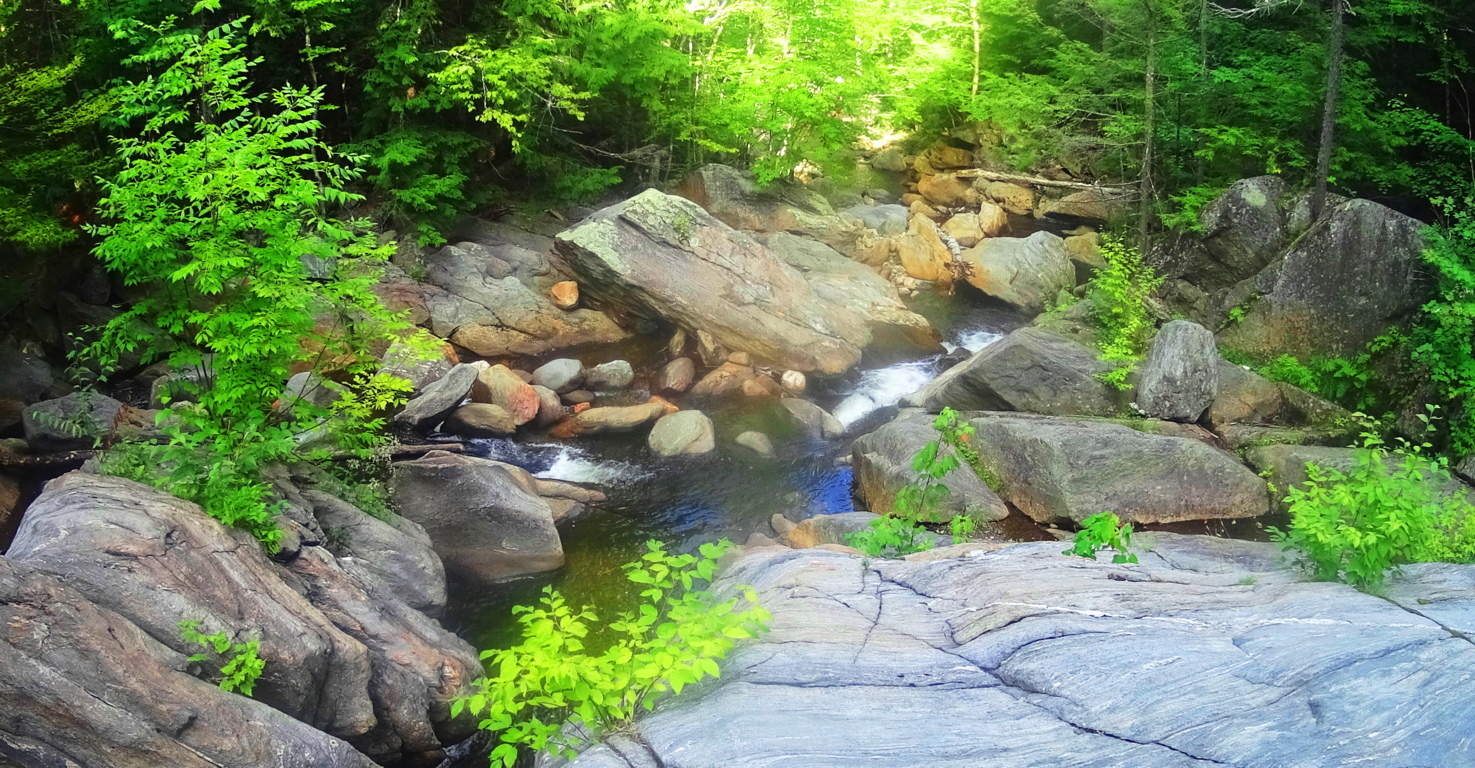 From the vista at Hunt Hill down to the Car Park at the head of Dunbar Brook are Neolithic stones all throughout the forest. Hundreds of zigzagging stone-linings, and squared-out spaces with areas that look like hearth-centers in ancient living centers. Below is an image of what looks like the symmetrical foundation to what was once an ancient living space, with the hearth-stones in the center; presumably for a fire. Look at the leveling of this stonework, which is identical to corbel layering in Celtic ancient spaces.
 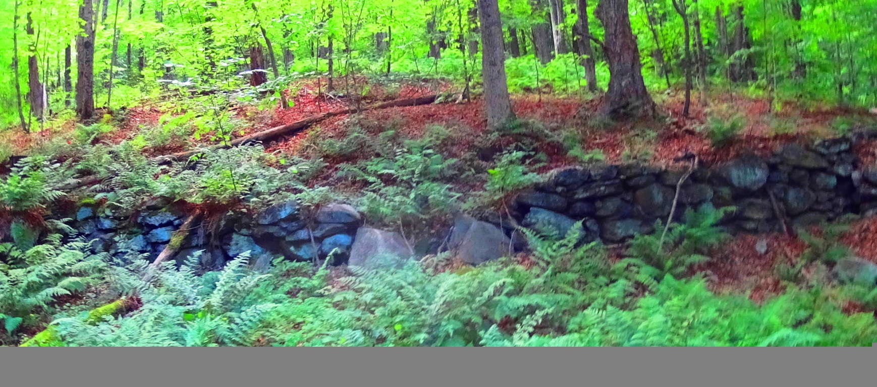 Here’s closer look at the scale of these stones against the landscape, which stands about 4 feet tall. It raises serious questions about the idea that Colonial farmers just randomly decided to waste their Summer seasons utilizing all their resources to build structures like this, and without even an ounce of explanation or claim. Something much more complicated is taking place in these Forests and Mountains.
 For certain so many people will look and say in a most bored fashion, “Yeah o.k, big deal, it’s just a stonewall…” But the point is where it is, and the style and size of it. These stones are in the middle of a Forest and run literally everywhere. They are part of a grander network of connecting stones that do not mark, say, quartered fields, or farmhouses from the colonial period; they zigzag, and often times connect to rivers, like cords connecting to a power source. If a reader doesn’t see that it is riveting to possibly piece together the idea that someone was engineering the entire landscape for the purpose of harnessing energy in antiquity, than just stop reading now.
 These discoveries are changing the way we conceive of “monuments”. The culture that did this monumentalized the entire landscape. The whole thing was once synergized by a connecting system of natural energy producers, like flowing water and Sun. Most people just don’t understand. The same concept of energy connectors and crystalized power sources within your phone, is the same exact principal being discovered on the New England landscape. Above is yet another image of stone-linings zigzagging through the woods. In the forefront of the image, and the back, are stones beyond counting. The odds that these linings connect to the flowing water of Dunbar Brook, just beyond, are 99 to 1. That’s what it is starting to look like; that’s where the physical evidence takes us. All of this happens under beautiful White Pines, tall and fair, on this eastern extension from the main trail here at Monroe State Forest.
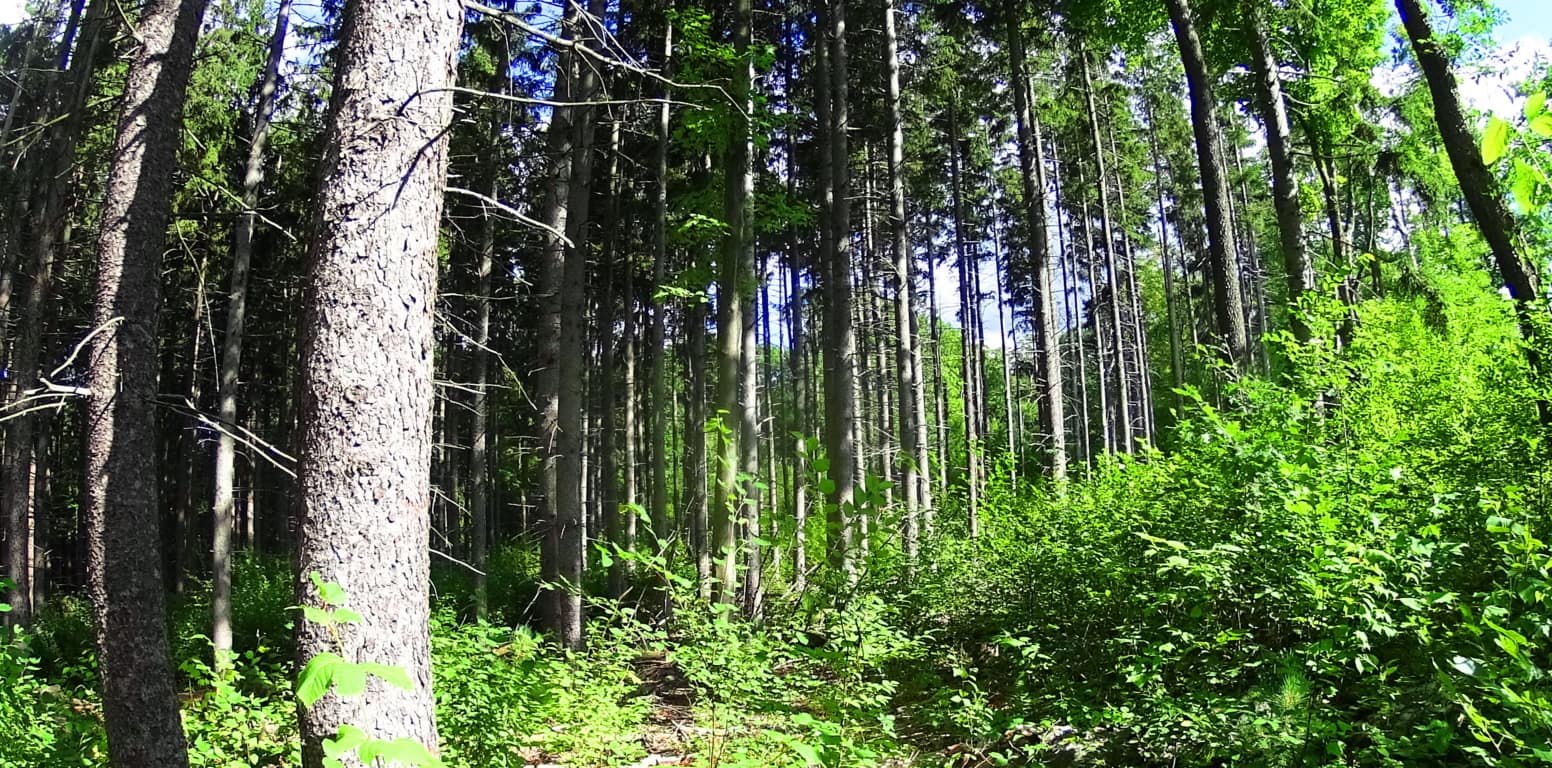 Heading back to the beginning of the trail where your car is parked, you can spend some time at a focal point of Dunbar Brook. There is a hollowed-out section of stream with a small waterfall coming around the side of this central pool, and it is serene. In the image below, the stream looks to have been redirected around the pool, to the left, then continuing to flow down the valley.
 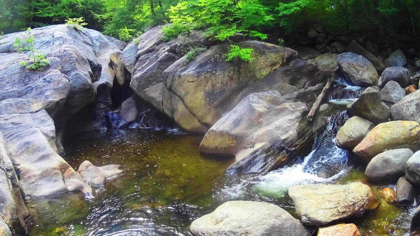 So now you’re thinking that “redirecting” the flow of water at a rocky stream seems impossible right? Take a look at this beautiful waterfall in Donegal, northern Ireland. Aside from the incredibly crafted stones above the fall, which practically look like a faucet fixture funneling the water to an exact point, is an absolutely crafted side-stream to the left. The stones of this side-stream are like a perfect staircase, in width and leveling, allowing the water to mingle with the main flow in front of it in a perfectly sectioned process. This waterfall in Donegal is wild, completely indigenous, without even a path connecting it to the road; the work that was done to it, was done in antiquity, and with great skill. And there are many other places like this, with skilled crafting, alignments, and fitted stones. (See ‘Bears Den’ in the New England Section of Stonestrider.com if you are interested in more water engineering in antiquity.)
 Monroe State Forest is a simple hike to the vista at Hunt Hill, surrounded by enchanted forestry and networks of Neolithic stones. The awareness of this beautiful factor can change the way we read landscapes. Improve your landscape literacy and hike Monroe State Forest. Pictures and images are o.k, but the point of these articles is to get people there for themselves. Spring is here, so go for it! Seeing is believing. Thanks for reading.
The Hen Mountain/Mourne Range/Ireland
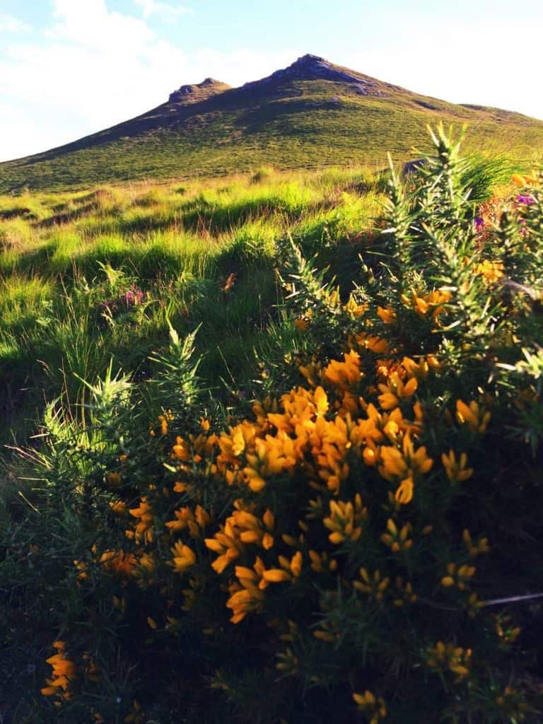 Location: Newry Ireland
Elevation: 1653 ft/5o8m
The Hen Mountain sits at the northeastern extremity of the Mourne Mountain Range. It is the lessor elevated gateway to an area known nationally as a “place of outstanding beauty”, rolling east all the way to the harbor city of Newcastle, and the dreamy Irish Sea. The gorgeous hamlet of Hilltown sits just west of The Hen, which is the practically perfect jumping-off point for this small mountain. The main car park for The Hen Trail is off Sandbank Road, near the beautiful River Bann, which can easily be found. The Hen, with it’s classically Celtic treeless approach, is entirely welcoming. I was so drawn to the view of this small summit from my deck at Hilltown that I literally ran down to the River Bann, hopped the fence, crossed the rocky river bed, and started an ascent from the northwest with my sneakers on. The image on the left was taken while standing in my sneakers at the base of the Mountain. It was just that type of day. When the Sun comes out in Ireland the landscape becomes a vision. The wildflowers in the area glow in variations of gold, green, and velvet.The image below shows Mount Hen, second from the left, taken from my accommodations in Hilltown. This was exactly how I pictured J.R.R Tolkien’s “Shire”.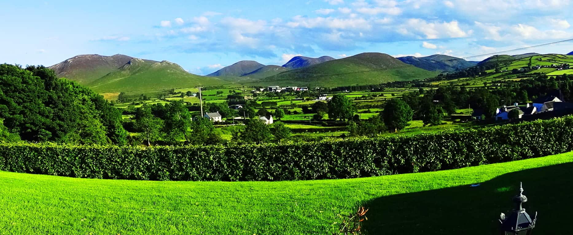
The River Bann reminded me of so many rocky streams in the Massachusetts hills, with several massive free-standing boulders lining the sides of the flowing stream. The scientific explanation for these boulders is, of course, glacial, but several of the larger stones look as if they had been cut and angled specifically, which is often found near sacred mountains in New England, and here in The Mourne. Additionally, coming from New England, where the forests are an overpowering aspect to any landscape, views like this, where not even a single Hawthorn tree can be seen on the horizon, are a constant surprise to the senses. It is truly surreal. The mountains are roughly the same scale as New England’s smaller ranges, but the peaks just look so much more stoic, without one single tree. 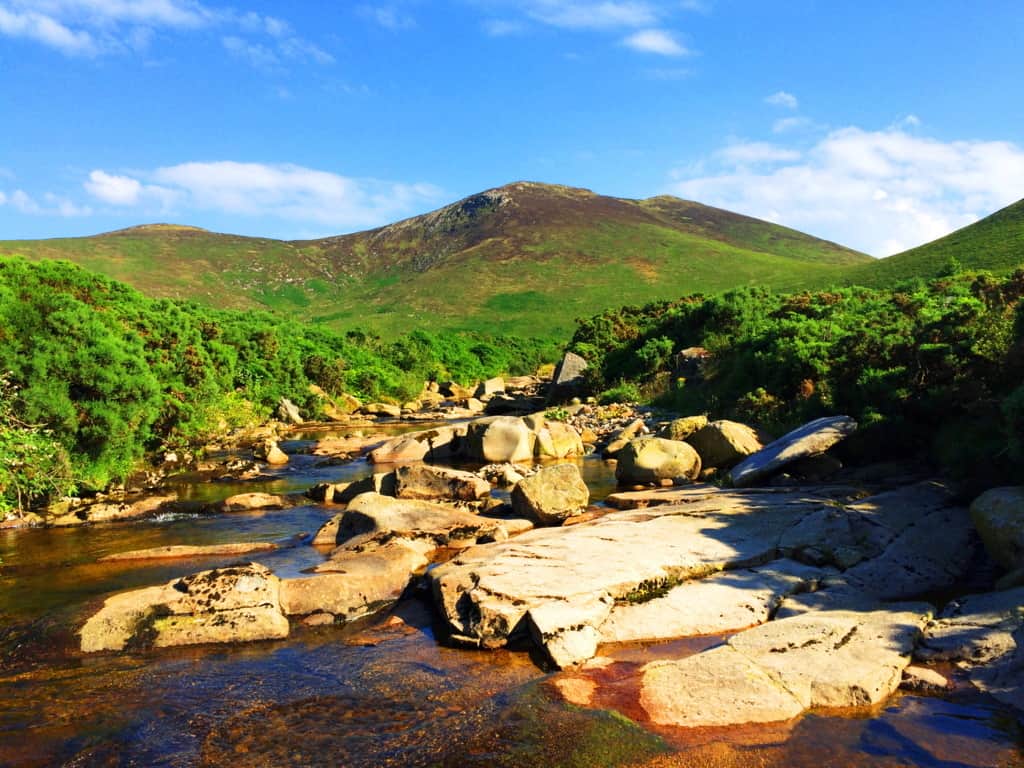 The Sandbank Trail is actually on the other side of the Mountain from this spot on the river, along the eastern face, about 400 yards away. In Celtic places the opportunity to wander should be embraced; there are no animals that could overpower you (like a Bear or Wolf), and the chances of stumbling upon Neolithic expressions are pretty good. And perhaps most importantly, this is one of the best places in the world to take out your camera(s).
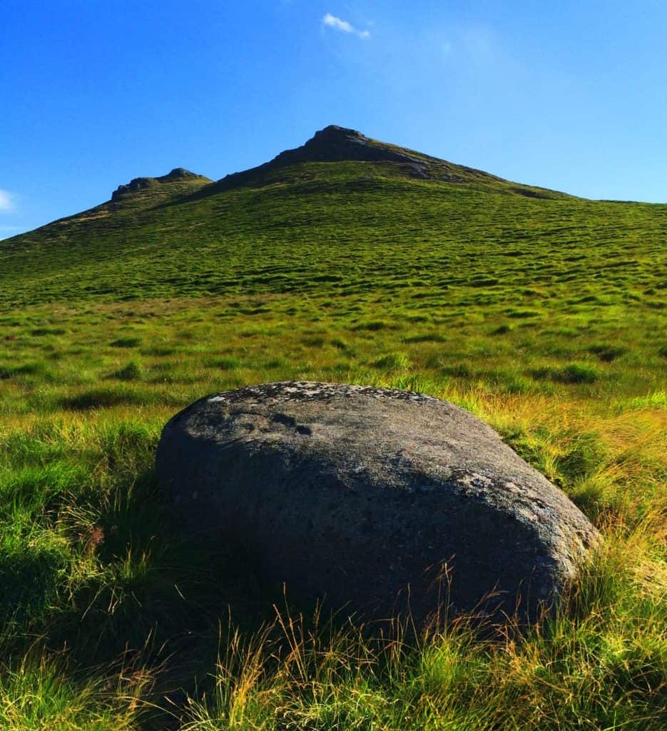
Heading directly up the mountainside from the river, climbing over the farmers fence, I came across this lonely boulder. It was a like seat for watching the lower valley.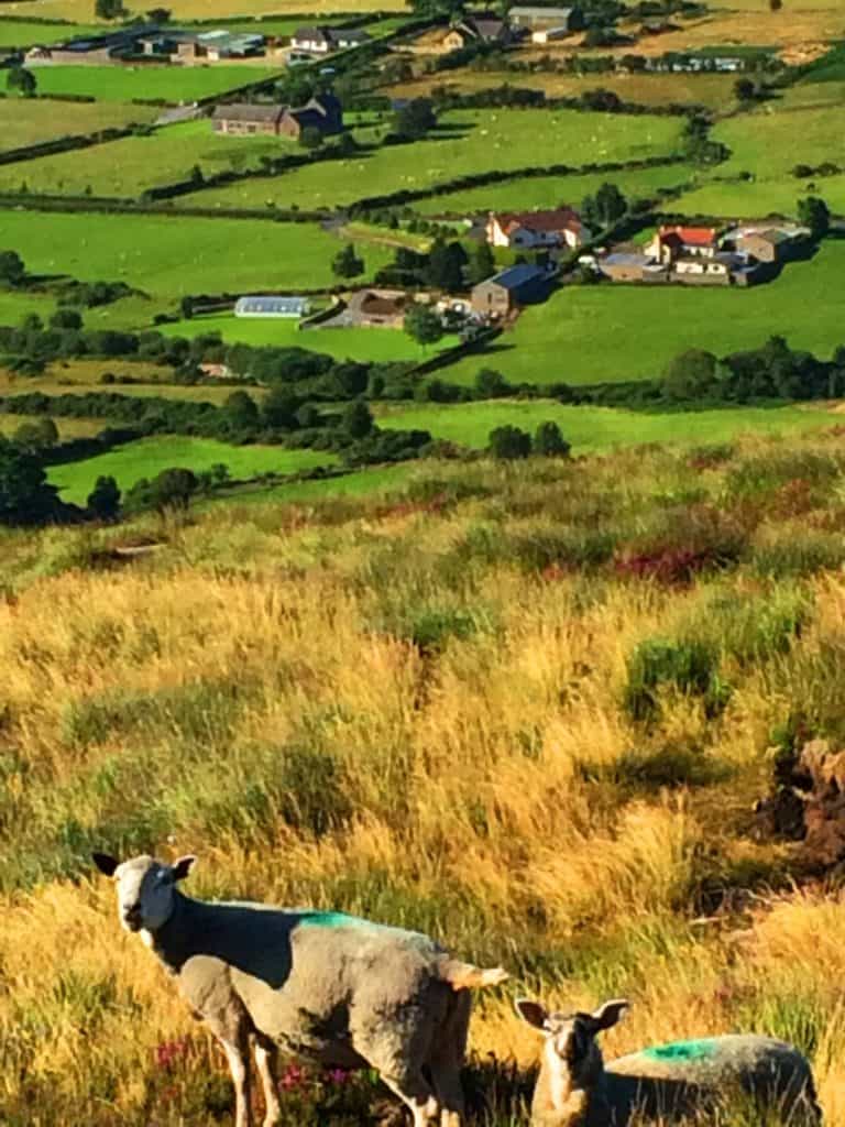 Flocks of sheep rove the hillside with farms in foreground, all bustling and interwoven into a rural tapestry that America has almost forgotten. Ireland remains one of the the most functionally rural European country’s, where men over the age of 70 can be seen in the tractors hauling hay, while the elderly in America linger in nursing homes. Experiencing a nation where the food is fresh, without preservatives and processing, can have your body feeling stronger and more awake, in a relatively short period of time. Here I will venture to share a rare introspective moment that took place from this beautiful scene. Things at times become incredibly clear while hiking, super-clear. I began to think about America, and it was perhaps a thought I had been waiting to have for some time. Americans are confronted with a universe of processed and artificial foods on a daily basis, wars, social movements, and scandals, and while hiking in the safety of a place like this, I simply could not help but wonder what the hell has been going on in the United States for the last 15 years, and how the rest of the world truly sees us. It is borderline embarrassing. Ironically, so many locals in Newcastle expressed their desire to be in Boston, where I was from, having little awareness of the truly challenging social experience America forces upon its citizens today. All of this crossed my mind as I made my climb. Turning and facing the peak the wildflowers ran concentrically in what felt like a spiraling parade of color, radiating down the ledge. These are the places to wade in, like wandering into a dream.
 The brush here is deep, knee high, and strenuous to climb. The Irish Sea is only about 7 miles away, and the hedges have a toughness to them, a saltiness just beneath the surface, perhaps carried on the wind. Complimenting this faint ocean breeze is a strong Sun which can be felt warmly on the skin. Although many people do not picture Ireland’s climate in this way, when the Sun is out, windburn is a real possibility in the heights; in The Mourne the body can be fooled by the wind, seeming cool while outside, but later revealing a burn when out of the breeze.
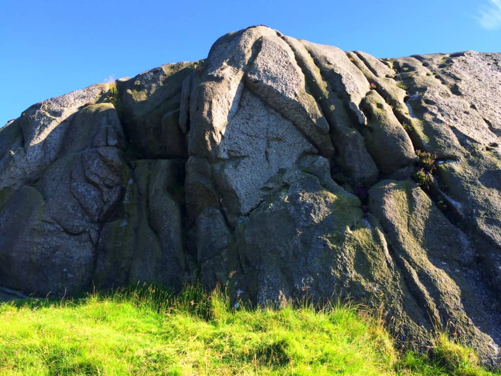
It is said by Hebrew texts, that the fall of 300 angels took place, once upon a time, upon Mount Hermon, in Lebanon. While hiking in the heights of many mountains this is a story that has crossed my mind many times, especially while approaching peaks. If this story were true, than this culture of fallen angels would have claimed the high places first, coming from above, however surreal it sounds. And what we find in so many of the high places, in mountain ranges all across the world, are megalithic statements of impossibly large, but crafted stones. Hen Mountain’s peak is capped in solid rock, with indents and fixtures that are seemingly crafted into it. The anthropological side of hiking takes place as you explore the rocky ledges in the heights, and turn to see the beauty of the valley below.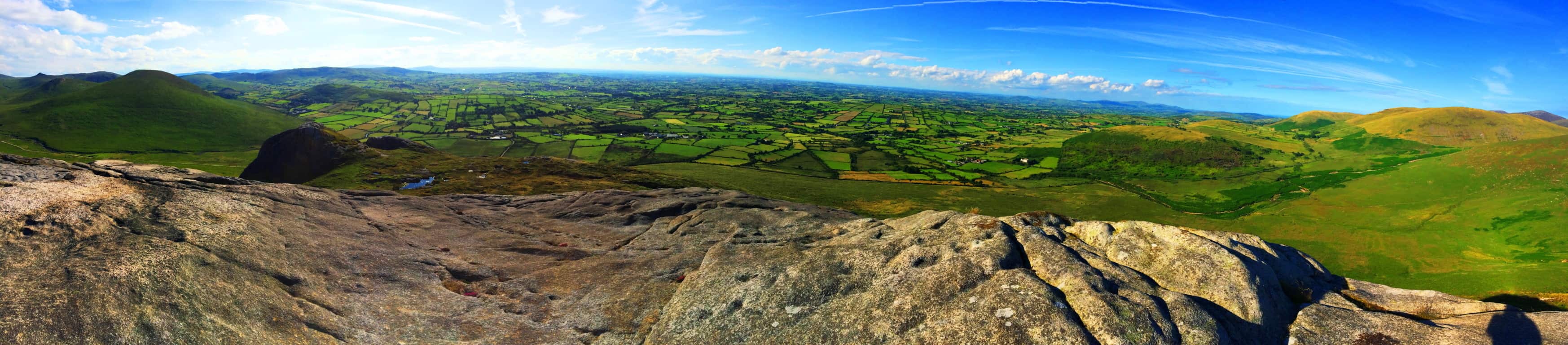 Simply put, the rocks tell a story, and a well trained eye can read that story. There are lineations in the rocky peak that are hard to describe. These parallel streaks look to have been burned, or smelted into the stone. These streaks look eerily like they were made to mimic the rippling landscape beyond, all at the top of the mountain.
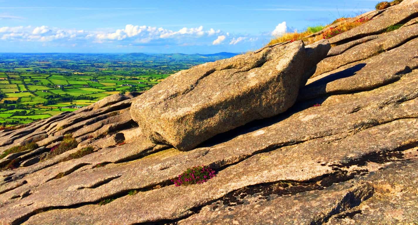 Here at the peak, this single 1 ton stone sat freely and in complete coherence with the parallel streaks beneath it. There were no other stones like it. With the scruffy wildflowers that somehow spurt out of the crags in the rock, and the layers of green beyond, this feels like the precipice of another world, however small the mountain truly is. This is the game that the peaks of mountains play, no matter what part of the world you find yourself in. At only 1,653 feet the feeling on Hen Mountain is still ‘top of the world’, as the Celtic landscape rolls nakedly away into the horizon.
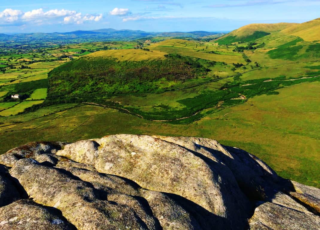
Facing to east at the peak Sandbank Trail can be seen approaching an elevated knoll at about 1200 feet, just below. The view beyond this “porch” is stunning, leading all the way to across the Mourne to Newcastle at the coast. In this spot there are two distinct rocky fixtures that sit like ‘gates’ as the trail passes through, and between these two fixtures is a free standing boulder that I believe was placed here as a kind of ‘marker’. A closer look at this rocky “gateway” and boulder revealed a compelling case for megalithically cultural craftsmanship.
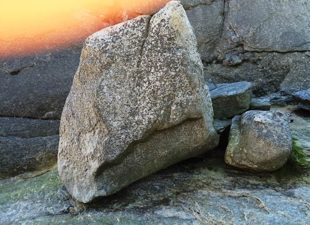 This boulder stood perfectly square at roughly 8 feet high, and 3 feet thick, upon level rock beneath. The indentation of the lower portion of the boulder, again, had the look of ‘smelted’ rock, of a design, like a cherished chair. What is more compelling about this megalith, is the exact spot upon which stands, in a beautiful gateway on the northeastern edge of the entire Mourne range, as if to say “Welcome to The Mourne, enter!” Beyond this very spot is every other mountain in the region, including Bearnagh Mountain, which contains some of the most ancient roads, and cultural stones, in the entire world.
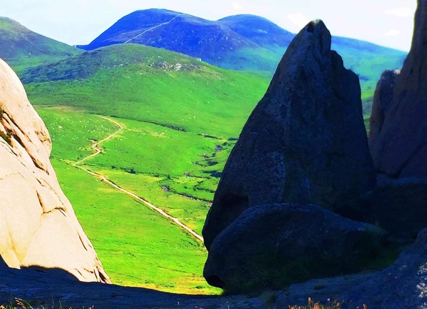 If you ever come to The Mourne Mountains, The Hen’ is a perfect place to either begin, or end your experience, as a ‘gateway’ for the entire range and relatively pleasant climb. As all hikers do, I eventually made my way back down into the valley-village of Hilltown, and simply walked back east along the Sandbank Road. Be careful here, the Irish drive at one speed, fast. On my last day in The Mourne I witnessed a sunset from the eastern edge of Hilltown that sums up the entirety of the potential experience, stunning. Anyone visiting here can experience a waking dream; it is simply a matter of going. And although this particular article was filled with more personal introspection than usual, I would like to reiterate that the soul point of each featured place is to make the hike tangible for you, the reader, so you can picture yourself getting there, above the valleys, to the stone gateways in the clouds. Thanks for reading, and go strong.
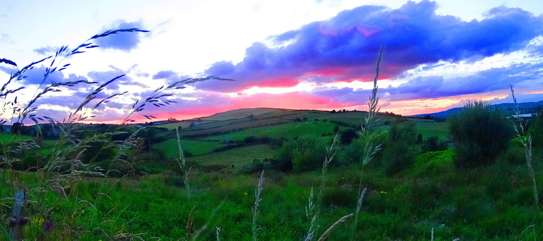
Ashburnham State Forest Reserve
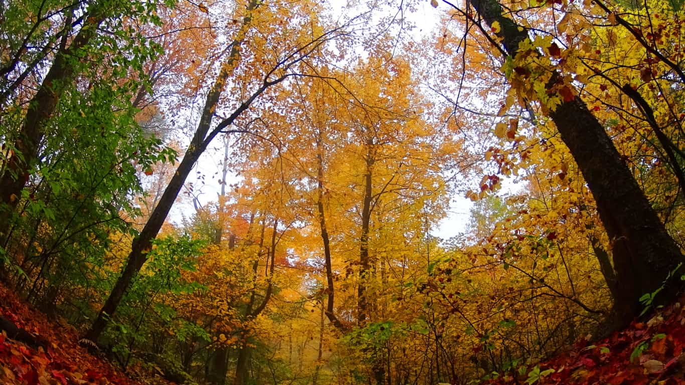
Location: Ashburnham, Massachusetts/USA
Note: The natural beauty of trails in New England, particularly in Fall, is such a blessing for those seeking a break from the suburban inundation that is the trademark of world wide modernism. That’s a mouthful of fancy words for those just seeking a peaceful, compelling, and pleasant space to hike, which Ashuburnham’ definitely is. The paths here are wide and welcoming, with golden leaves literally lining the forest floor. Mingled into these golden pathways are collages of foliage, rusty-red and green with pillar size Pines, Ash, Elms, Birches, Oaks, and Maples arching over the pathways. There are several trails in Ashburnham’, most of them running north to south towards Mount Watatic Reserve about 7 miles away. The Lincoln Pond Trail is the main route through Ashburnham’ which is gladly featured in this article. This is the ideal place to keep in mind that in so many stories forests are places of enchantment. From Grimm’s fairytales to Shakespeare’s magical midsummer backdrops, historically in literary works forests have been places where extraordinary things have occurred. Places like Ashburnham’ are a superfine example of how the most delightful and unassuming woods can hold subtle secrets within, secrets that are somewhat hard to explain and bordering on the magical dimensions so many stories try to relate. Native American stories are also part of this landscape, which have unfortunately been lost to history. It should be recognized that Native stories were deeply connected to specific spots. Elevations were considered “places of power”, and various landmarks had histories behind them that often imparted a moral memory for future generations. All these things are literally stirring in a place like Ashburnham’. Simply put, there’s a lot more going on in the forests of the world than just wood, water, soil and stone; if you go deep enough, often enough, you will see.
The southern entrance of Lincoln Pond Trail is a quiet country road with no visible street sign. It is just off the intersection of Hastings and Stowell roads, and is a bit hard to find, so bring your navigation device. This short country-road leads to the small car-park area, just beyond a farmhouse and picturesque barn at the end of the lane. 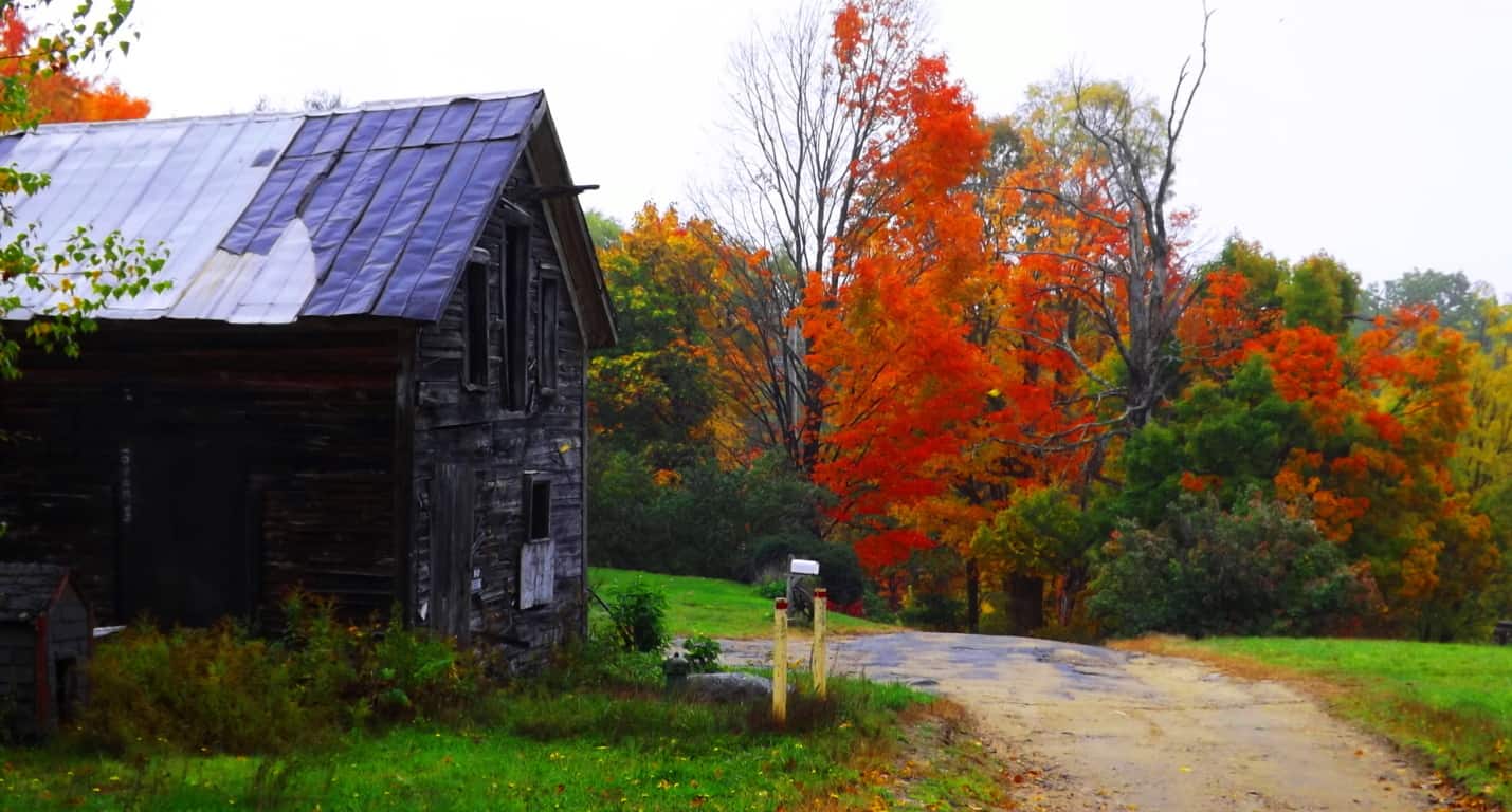 As soon as you begin striding into the entry path there is a feeling of watchfulness. This feeling is far from fictional; ‘watchfulness’ is the unforced moment when you realize that you are not necessarily observing the forest, but rather, the forest is actually observing you. It can take years for some people to pinpoint this moment, while others acknowledge it within a few short hikes. It is a lucky feeling to achieve if you can. The misty entrance at Lincoln Pond Trail is the embodiment of “the old-growth ‘gateway'”, where the possibility of this feeling emerges in each bending branch and whistling breeze. With a swift mist moving through the deep multicolored forest, you might begin to grasp that hiking is anything but primitive “walking”, it is a Godsend treatment for your sensory.
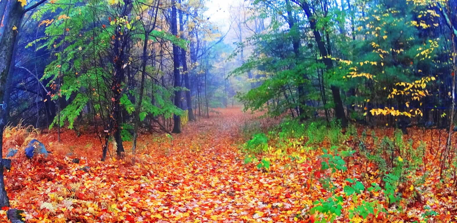
Entering Ashburnham’ in late Fall of 2016 I realized that this would be my last real hike of the year. I had now seen roughly 30 state park nature Reserves in the last 4 years, inclusive of 5 countries and 6 States, (among those various countries). Since walking into Kinnitty Forest for the first time, in the heart of Ireland 4 years ago, where my girlfriend stumbled on a seashell at the top of a mountain, my life has never been the same. I discovered that if you stroll into even the most unassuming looking woods (even in the middle if Ireland), if you look deep enough, or climb high enough, you may very well find something truly wonderful that could change your outlook on the world. 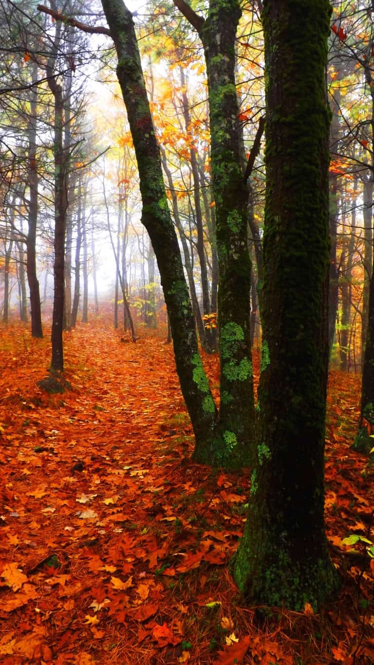 This was subject matter they didn’t teach us in schools, even at universities, which made it all the more stunning for me. Eventually, if thing s like this happen you have to ask why? Why does every region that has yet to be suburbanized, including most of the surviving forests and mountain elevations, contain megalithic stones, ‘linings’ and cairns that are practically hidden in the landscape? why is it not brought up in our text books? It has finally become clear to me. The first culture on Earth, the first layer of culture, is a Megalithic Culture; This was an ‘engineering capable’, technologically proficient, culture. The second layer is the Native period. The third layer is the Colonial period; then the fourth layer is the Industrial movement, and the fifth Postmodern. If this is correct, than in places like Ashburnham’, where there are no layers to cover up and interfere with this first layer of Megalithic Culture, the cultural stones will be discernible. The trails here should reveal stonework just beneath an ocean of golden leaves, like a visibly enlightened landscape that guards the greatest stylized historic secret on earth. It’s like hiding a sword in a stone, deep in the forest of some forgotten place, just waiting to be pulled up.
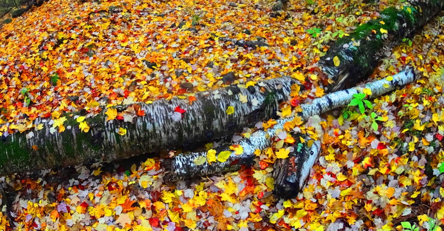
To begin, as you wander in, right away, on both sides of the trail, are beautiful stone-linings that follow the path. This is the sign of a truly ancient Reserve. Following these stones will most often lead you to something even more compelling, a rocky ledge or waterfall, which is a pattern that is also true in the fantastic Celtic Reserves to the east, across the Atlantic Ocean. 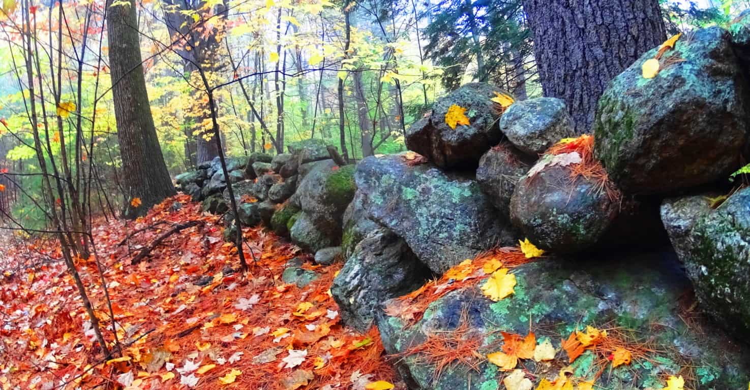 Along this main ‘artery of stone’ is a tour of fantastic expressions, along with what looks like a powerfully regenerative place, a wonderfully healthy old growth forest. Groves of baby Pines flourish here, which can be seen about a quarter mile into this trail, just off the path. It indicates an ecosphere of high quality nutrients in the earth and air. The positive benefits of these energies for people is not dramatic hokum; the effects on human beings are equally reviving, and certainly far more beneficial than say, walking on the pavements of even the “nicest cities”.
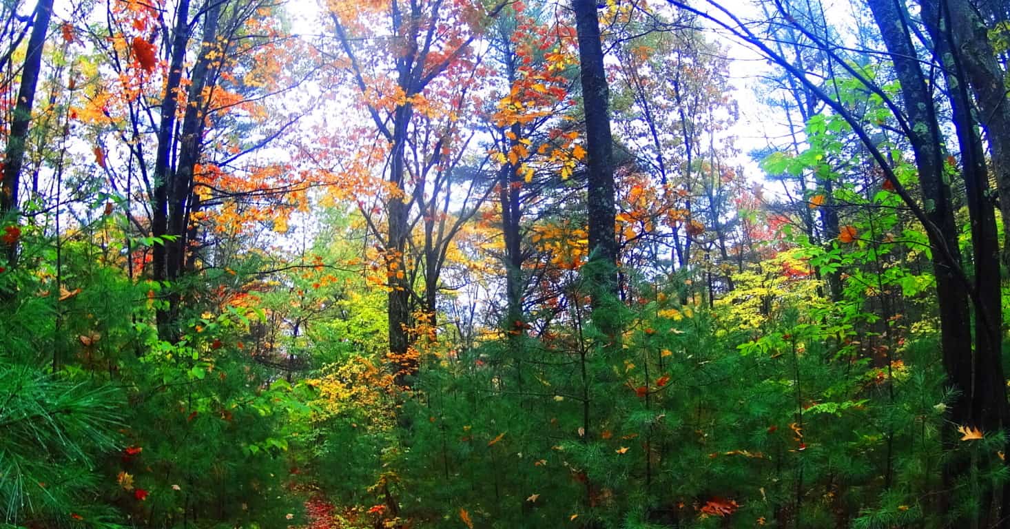
The classic stone-linings in Ashbunrham’ have another quality that makes the case for an increasingly in-depth explanation as to what their purpose(s) may have been. There are places in the ‘linings’ that are clearly and distinctly leading to specific boulders. Just like the head of a large serpent, many of the stones are capitalized with a free-standing boulder that seems to have been placed directly into this construct, intentionally. The idea that stone-linings, which run for dozens of miles through the landscape at Ashburnham’, were simply built along glacially placed boulders sitting at random just doesn’t make sense. The stone-linings create an order in the forest; they are a logical expression of control and directionality. Basing an entire network of megalithic stones on random ‘glacially placed’ boulders seems opposite to the entire point for a culture that actuated meaning int he deep woods by placing lines of massive stones. The boulders were most likely inserted into the stone-linings, just like other lessor stones, however hard that is to believe. And this still doesn’t answer the question, why? Below is an example of just such an expression. This classic stone-lining, which is partially covered by the foliage, runs straight into this massive boulder, like the head of a snake. Even the picture doesn’t do the scene the justice it compels in person.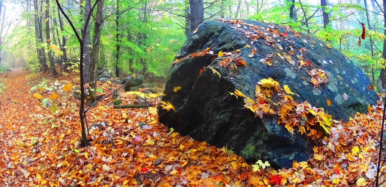
Lincoln Pond Trail is a comfortably gradual incline that twists through glades of differing densities and hues. It is entirely pleasant strolling through. Eventually the golden leaves are left behind for Maple glades, with red burning red leaves rolling at your feet by the thousands. Hiking here is like twisting through a tunnel of colors and variations. The effect of color and variation on the brain is a positively stimulating and beneficial one, refreshing the senses with a refined palate for natural beauty. 
Drifting into this rouge dimension there are other amazing changes to see. A literal matrix of stone pathways begins to emerge; these are stones of a style I had never seen before just beneath the foliage. About 40 yards deeper into the woods, parallel to the trail, is a three-foot wide, by three-foot in height, lane of inserted stones that rolls like a wave through the old-growth woods. This is thousands of stones in an obvious statement which is boldly protruding above the ground, like a tunneled highway for Beavers. It continues for perhaps 400 yards beyond this spot. The meaning of this second style of stone through this gorgeous stretch of Maple groves is an additional mystery, but it is simply an addition to an entire set of mysteries that emerge here. Continuing along the northern line of these stones, the ground slowly elevates the path into a more unique part of the forest at Ashburnham’. This mysterious network blossoms into more obvious statements. It is hard to tell if certain areas are ancient living spaces, or focal points for some kind of work place; or perhaps this is an engineering statement with a functionality yet to be deciphered? The one thing that blatantly stands out here is that there is an entire culture of stonework beneath the leaves.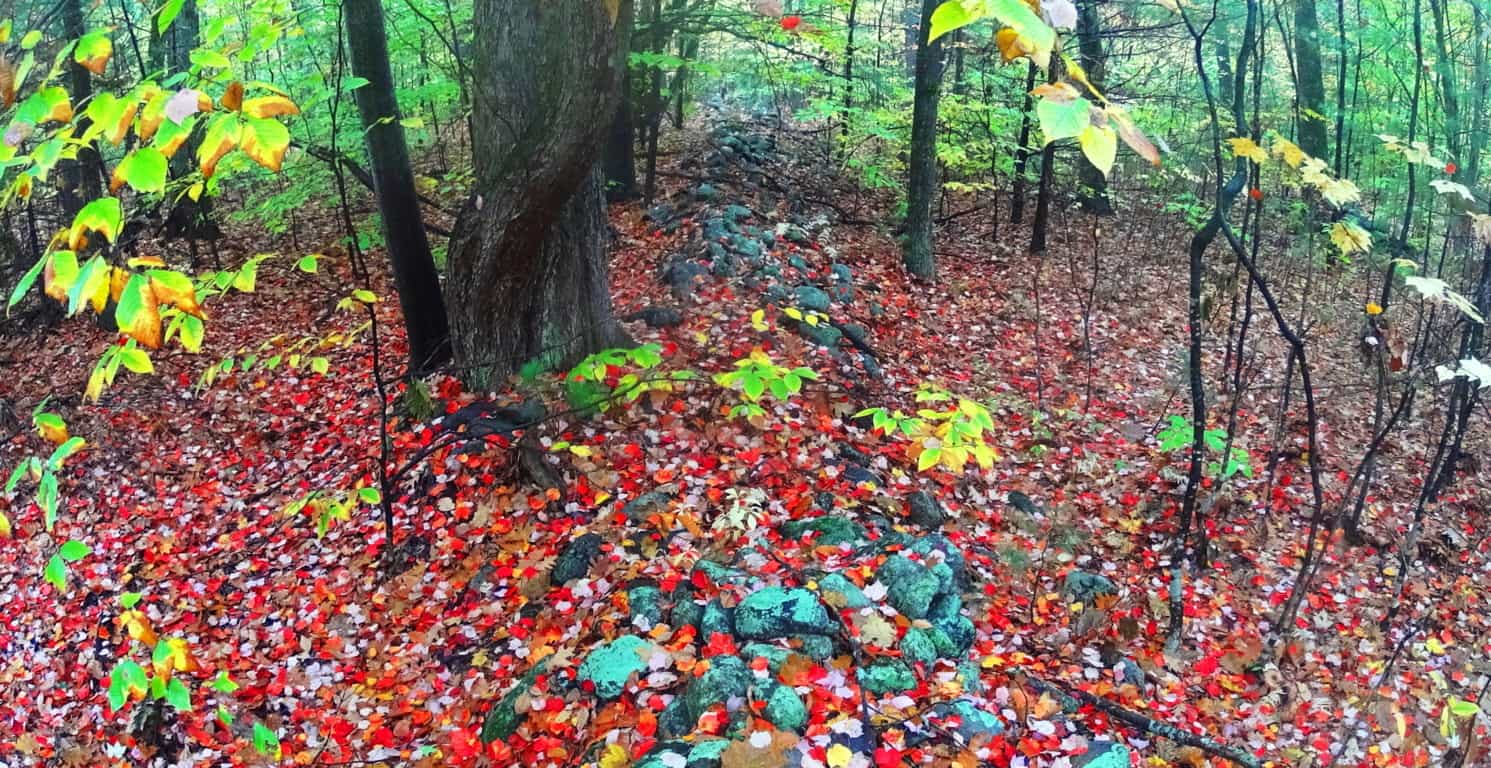 If this were a Celtic area the stones and their layout would be much more visible, as the greenery of indigenous Celtic ranges, and forests, are most often layered with minimal skins of glowing moss, but not much more. Look at the right angles of this stonework below. It is clearly defining the space with stones, but the purpose is hard to decipher. These statements run for miles through the woods. Once upon a time these stones dominated the entire landscape uninterrupted. It is conceivable that the stones were here before the forest even existed.
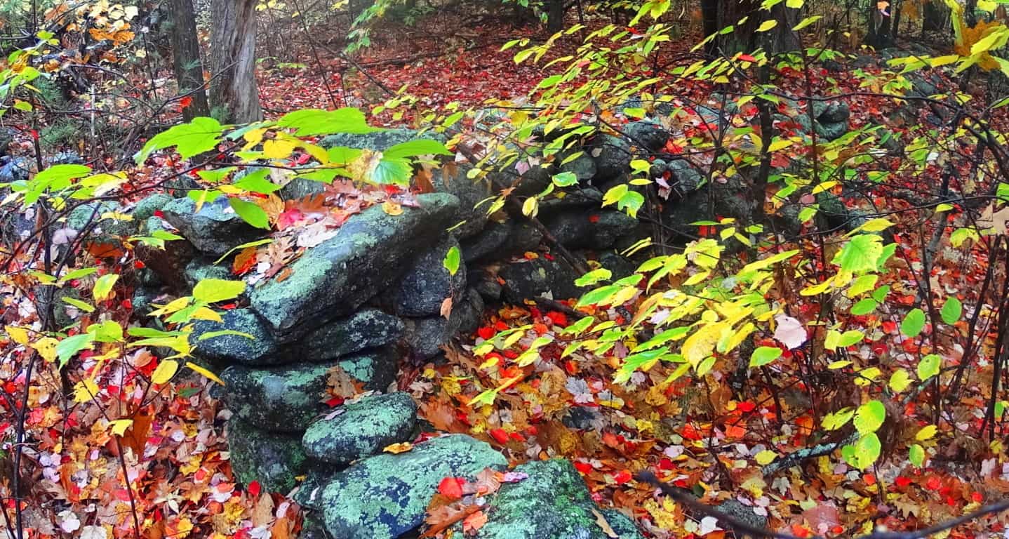
About 150 yards from this spot, off trail, is an entrenched set of stones with the look of a habitable dwelling. These dwellings can be found in crafted spaces much more distinct than here at Ashburnham’, yet to find this indicates that this place was definitely endeared and highly valued as “livable”. The stones below show a corner-section of what was once someones home, most likely in the beginning of history.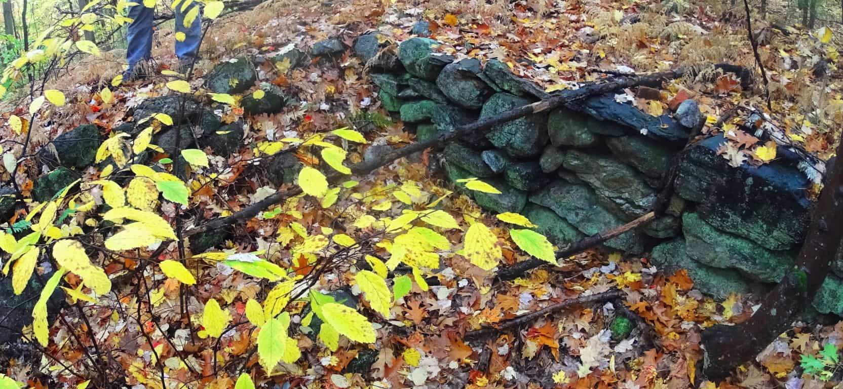
To add to the mystique of this spot, just 10 yards way is an extension of these stones that is symmetrically aligned, with a distinct quartz boulder centering the scene of entirely granite stones. The area is obviously in ruins, but there is an alignment to the overall remaining arrangement. It should be noted at this point, that none of this has anything to do with Colonial farmers.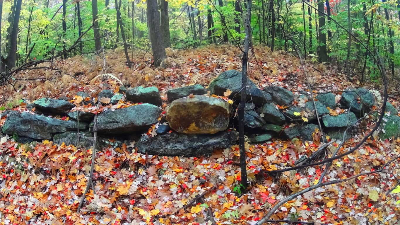 A cartographical recording of this area, a full archaeological review, will reveal a massive stone-network that is the basis of an entirely engineered landscape, harnessing sunlight in certain spaces, creating enclosures for harvested plants, connecting fixtures for navigational purposes, and relegating certain areas for irrigation. This is the case for almost every forest in western Massachusetts. Simply put, there’s a Megalithic Culture under there.
Ashburnham’ is a forest without a mountain in its midst. This makes for a more pleasant stroll over the course of about 3 miles of pathways. It does have slightly a elevated clearing, one 60 foot high ledge that sits like a rocky bald head just above the small valley to the north before reaching Watatic Mountain. as you climb up the forest peals aways and a beautifully rounded rocky ledge emerges, with what looks like molded slabs that feel hollow beneath your feet. The mist culminates here, as if you were walking into a cloud. Seasoned hikers eventually learn that scenes like this are priceless, and relate a side to New England trails that is real and authentic, akin to the dreamy visions that must have prompted stories like ‘The Headless Horseman” which famously took place in the New England forests of Upstate New York, where the woods were an entirely enchanted zone not to be taken lightly for Colonial settlers. This mound feels like another planet as you make for the top.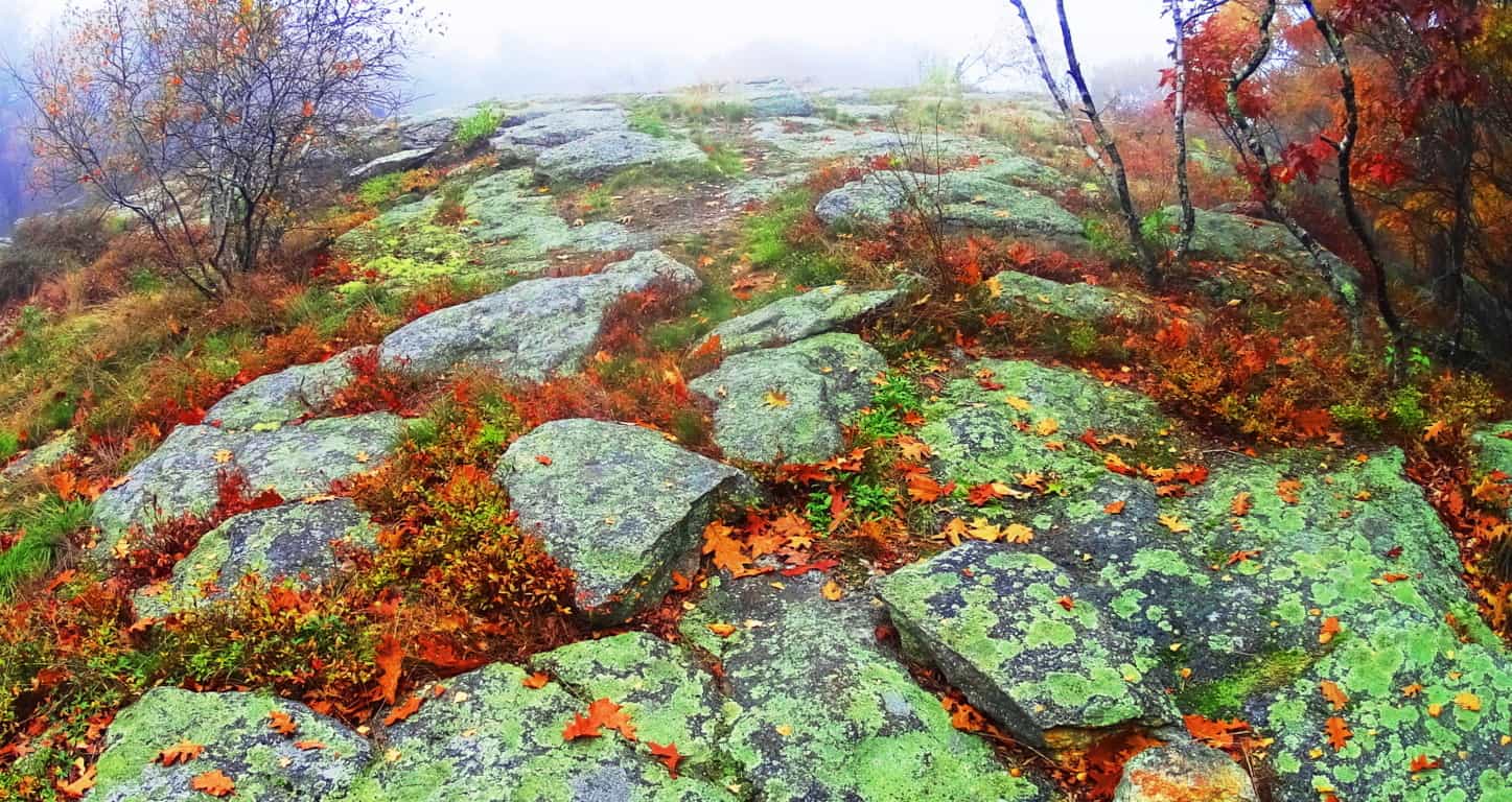
The giant slabs here seemed ‘custom fashioned’ to the hill; they are arched and fit perfectly to the rounded sides of the broad knoll while becoming more flat towards the flattened top. This fits an awesome pattern of higher elevations where ledges are carved-out and specifically rocky, while being surrounded by soil-rich old-growth forest. In short, it’s like a rocky island on an ocean of soil. I will not go so far as to say that these stones were crafted, but the surreality to the scene, the suddenness of these uniquely fitting stones along the rounded path, seems to have some kind of secret to it. To add to the mysterious situation, at the top of the rocky knoll, which is about two miles into the forest, a massive stone-lining of a style and consistency I had yet to see anywhere, even in Ireland, Wales, or Scotland, emerged rolling directly over the mound.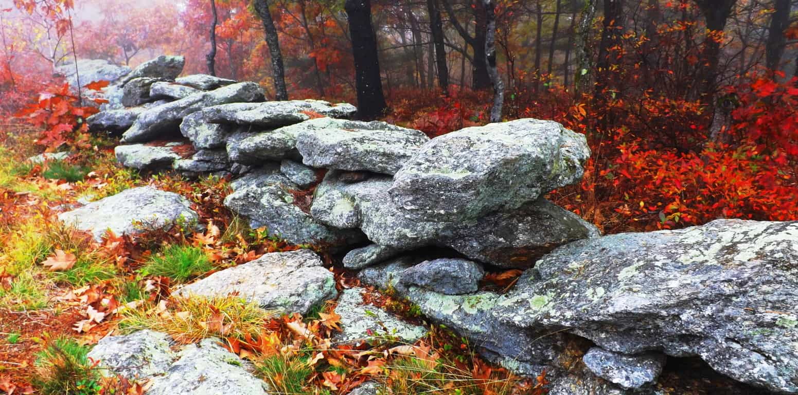 Each stone was proportionally equal, and at least five times bigger than the average stone used in the two types of other stone-linings already tracing the woods below. Each stone looked to be at least 300 to 400 pounds, and not a single alternate stone could be seen in its procession. Whoever engineered this lining had a puritanical streak, a stubborn need for crafted consistency, which is artistic step up from the craftwork of the designers below, literally and figuratively. In the elevated milky mist, with the burning red Maple leaves looming just at the edge of the hill, it looked otherworldly, like a train track running from hell to heaven.
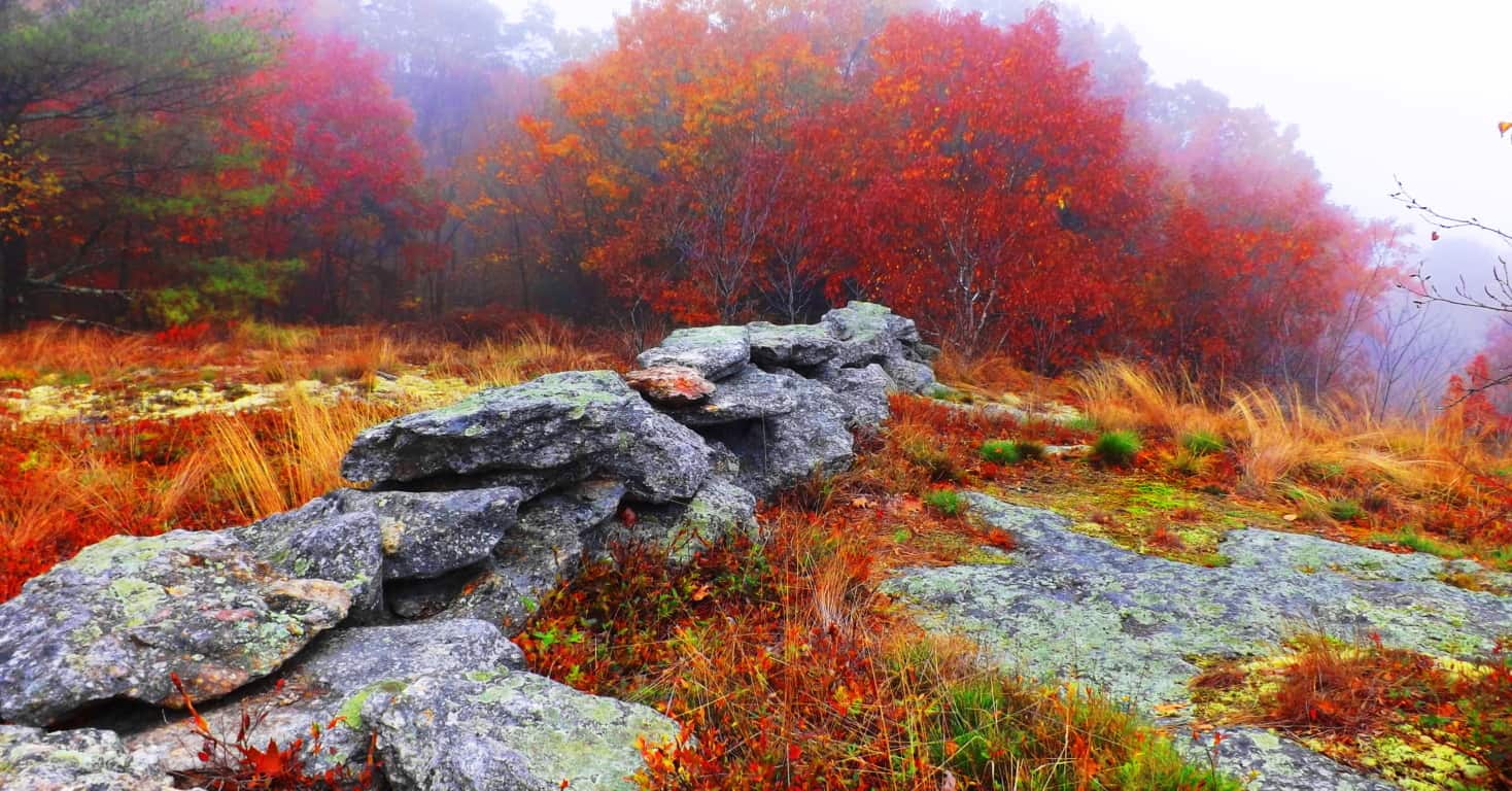 This is an undeniable trend in so many old-growth areas; impressive stone statements placed specifically at the higher elevations of forests. This is exactly what Natives called the “place of power” in their stories. One thing that is obvious about this scene is that on sunnier days the area will obviously absorb unobstructed light for a maximum amount of time, along the with the stone-linings running over them. This set up may very well serve to channel that collected energy from the Sun out into the forest beyond, into the other stone-linings, and the valley below. I have seen a set up just like this at Cavan Burren National Park in Northern Ireland, where the landscape is interconnected by Megaliths, and of course blatantly misunderstood by local “scientists”.
Coming down from this knoll Lincoln Pond Trail continues northwest, where fields and clearing are lined again with stones at the edge various and beautiful glades. These are perfect spots to sit down and appreciate everything you might have seen. The trail extends for several more miles before an optional loop back to the southern entrance, or an exit to the north.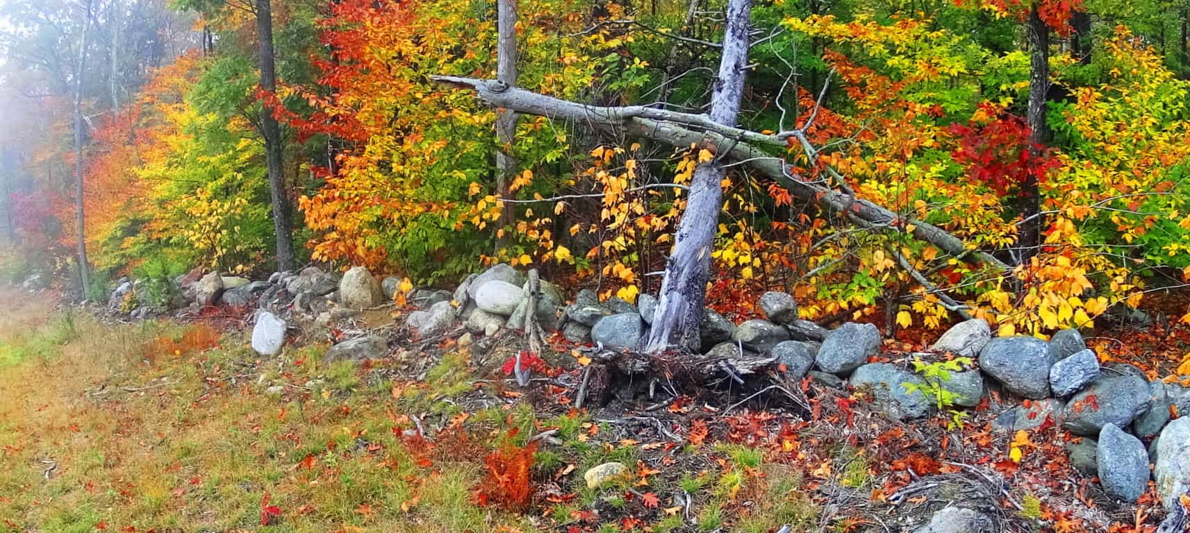 It is important to note that in several other locations in the woods, while exploring this area, there were amazing and mysterious things to see. I came upon a huge lining of stones with a symmetrical tint not far from the southern boarder. It was impressive, with the larger stones towards the top, which is another strange trend to be found in old-growth stoneworks in New England. Any mason putting the larger stones towards the top is making a bold statement, as if to say, “I can do whatever I want, despite the difficulty of crafting the structure this way.” This lining below is not far from the entrance of the trail, roughly 40 yard off to the right of the path. There may very well be something buried beneath this incredible mound. There was a great deal of effort and time put into stacking and leveling these 100 to 500 pound stones, the higher the heavier, which indicates the unique and unlimited mindset of whoever built it.
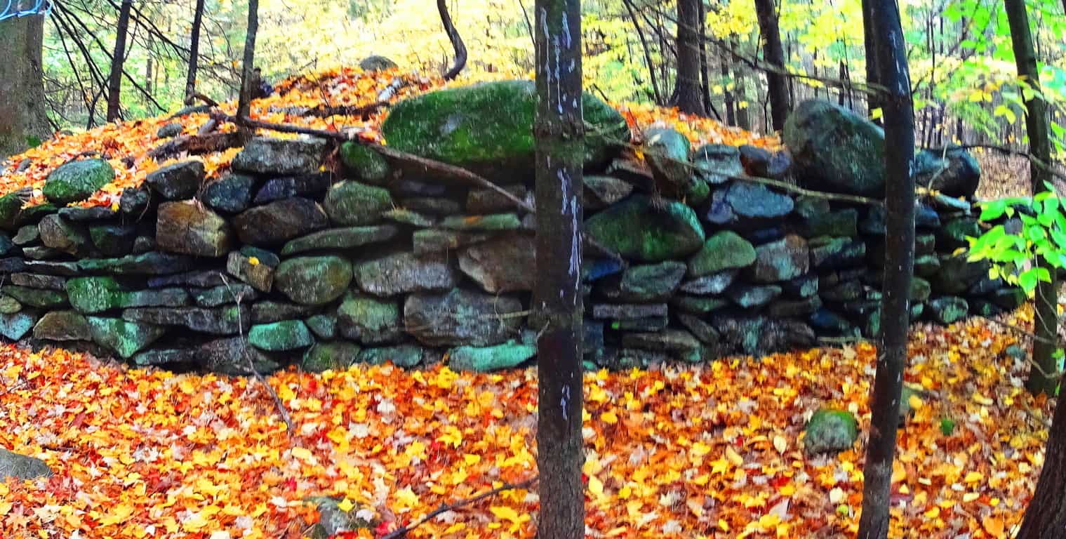
And finally, not far from this ‘lining’, is what I believe to be the remnants of a New England Dolmen, now in a dilapidated state. This rounded boulder was clearly supported and elevated by other stones beneath. It is now only partially supported, which has happened to several Celtic alters abroad. 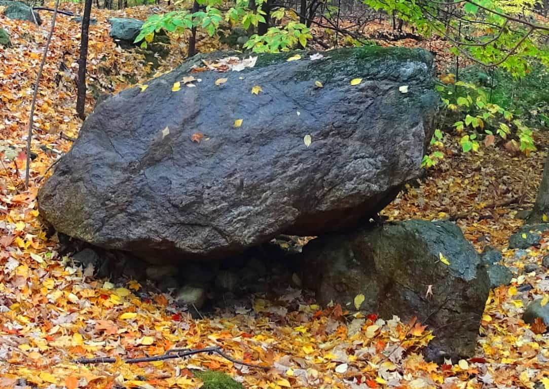 Whatever the truth is about this area, it is obviously an enchanted cultural center that the forest has grown over, and in a beautiful way. It’s time for anthropologists to get their heads around the idea that the stones were probably here first, and the forest, like a grafted grid, grew up around the Megaliths.
Ashburnham State Forest is the epitome of the enchanted New England hike. These woods are in a wonderful state of ‘spooky respiration’, augmented by a universe of color and decor along the trail. This place supports every magical fairytale that has ever been told, but more importantly, it supports a very real Megalithic cultural scene that increasingly emerges with each and every hike taken through these woods. Celtic places have a very similar feel, an it just becomes impossible to ignore the Megalithic foundation of these old-growth regions in New England. If you want to see something sacred, simply find your way to Ashbunrham State Forest; it won’t take long, but be sure to take your time.
Cavan Burren National Park (Part 2: Wedge Tombs)
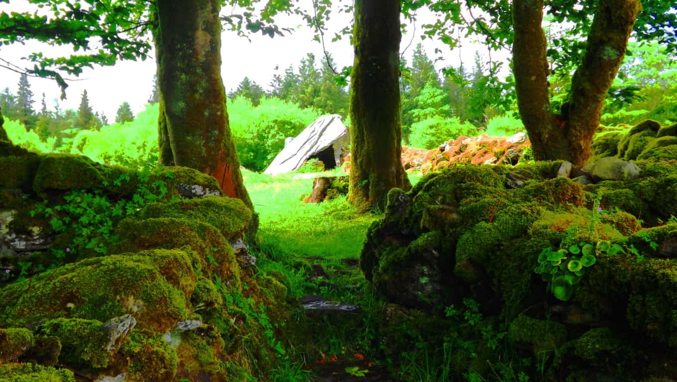 Location: Blacklion/County Cavan Ireland/Cavan Burren National Park
Note: Much like the way the Skellig Islands on the southwest coast of Ireland are represented in the final scene of ‘Star Wars/The Force Awakens’, Cavan Burren National Park feels like the last bastion for recluse Jedi Knights to live out their days in a galaxy, far, far away. 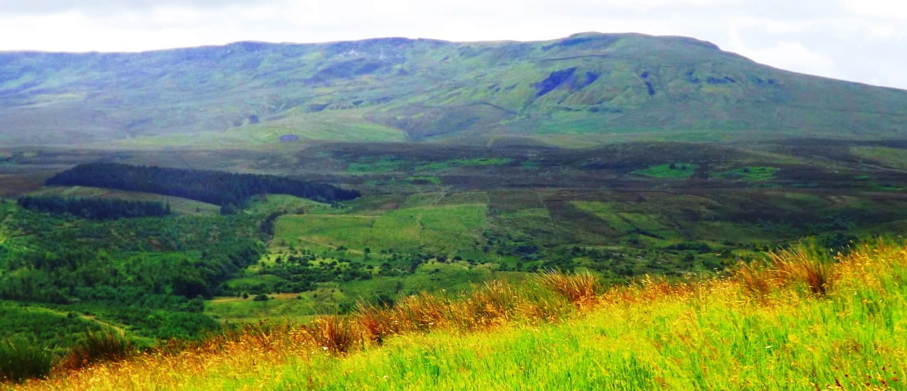 The only way to describe this set of rolling Celtic elevations, the cinematically striking Hawthorn trees vibrating on the horizon,
 the ancient stones strewn across the valley like dominos, is complete scintillation.
The rare and strange megalithic ‘calf house’ in the top image above is at the base of a small mountain. The excellently constructed trails here wind down the elevation and diverge along paths which take you into pristine Celtic forest bedded entirely in clover, with ancient megaliths in mysterious rows running straight through the trees. Known as Killykeen Forest, this significant preserve of rare Celtic trees feels like an original fairytale backdrop. Adding to the universe of rolling clover are huge boulders covered in moss; these are giant green monoliths glowing between the roots and branches along the trail.
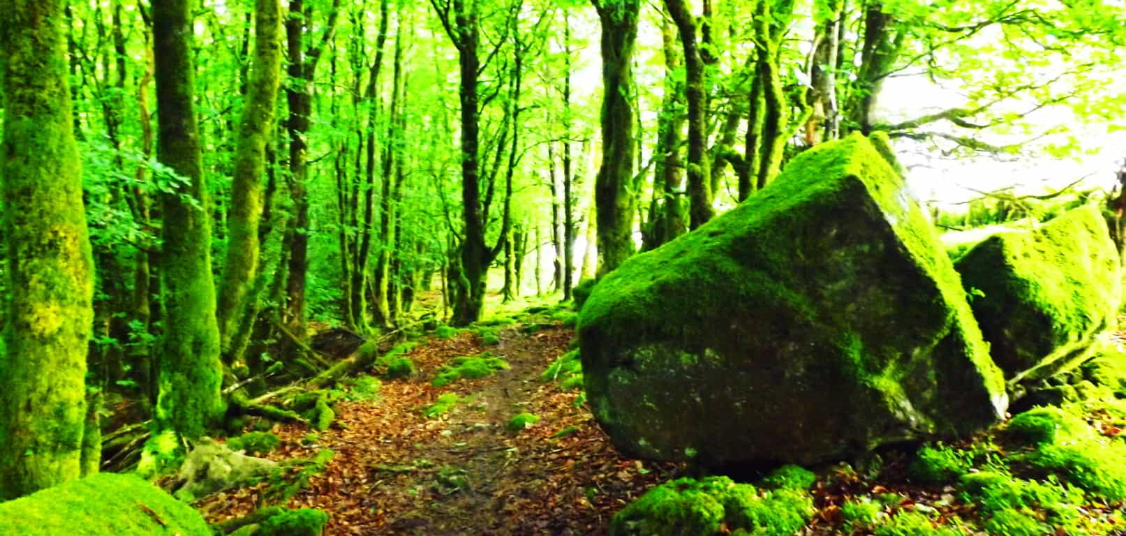
Moving deeper into the woods the sunlight blasts away beyond the hedges, while occasionally unrestricted shafts of light peak through into the inner thickets. When the Sun peaks through the mossy trees and hedges they shimmer with a misty light.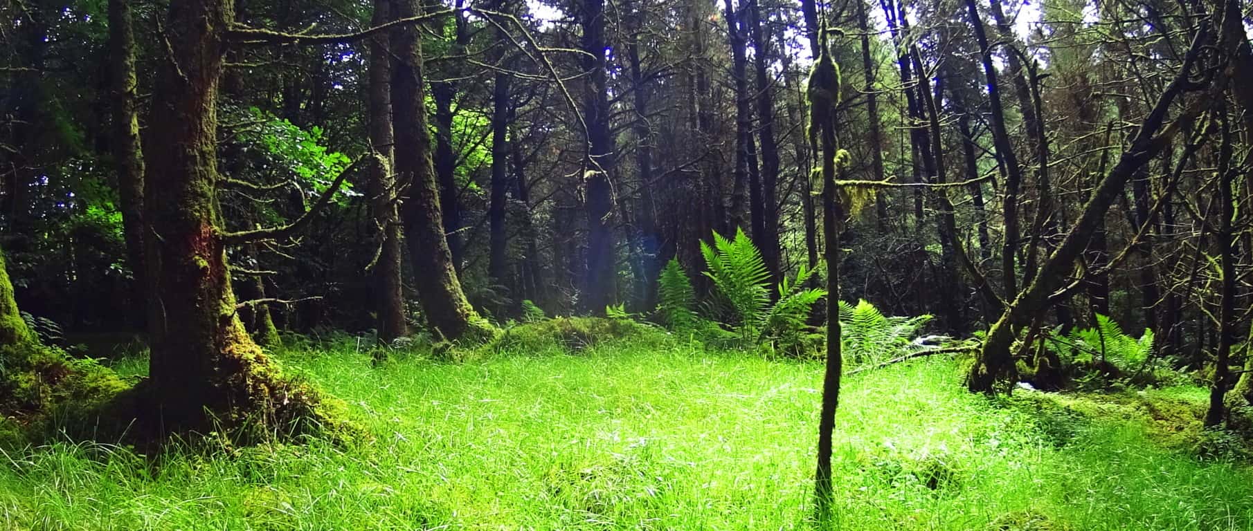 The woods here are like the opening scene for the most classic Celtic myth, at one moment bright and shimmering, and the next, shadowy and dark.
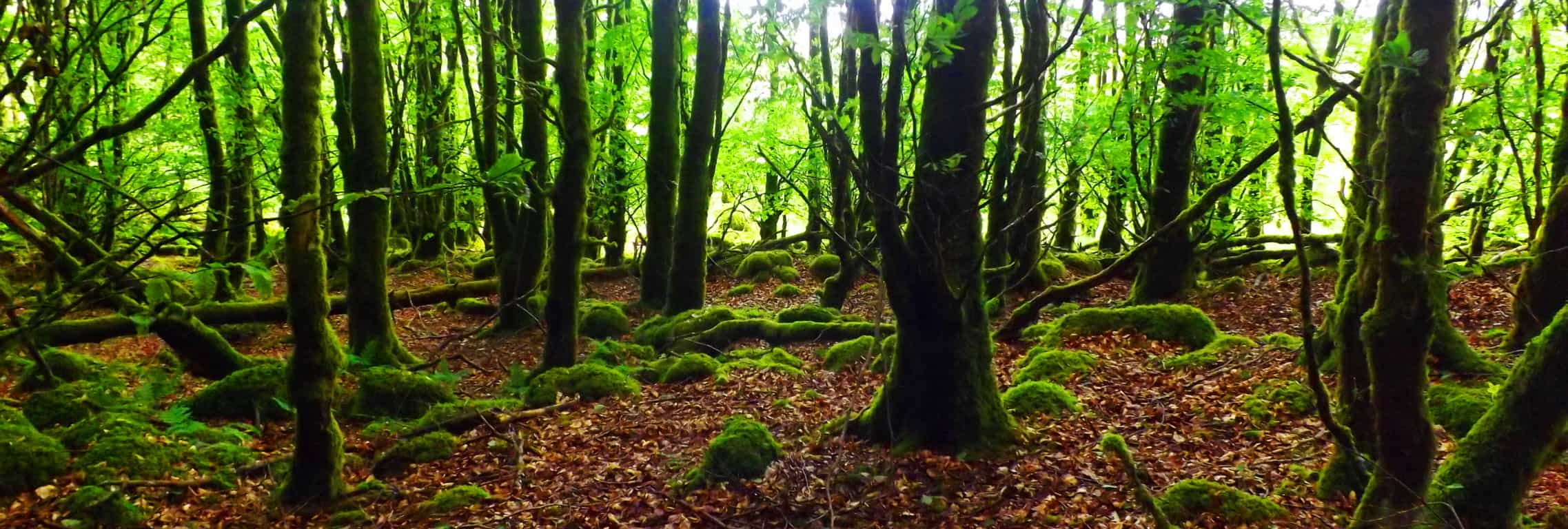 You can take the lower trail away from the forest to caverns and small cliffs where saint Patrick himself may have met with Druid kings. These caves are supported by what look like singular pillars which were carved out of the cliff at some point, either by an ancient culture, or by the wind. It is for you to decide. Before you make your decision about what’s possible and what’s not, consider some of the most amazing megalithic chambers in the world waiting to be viewed nearby…
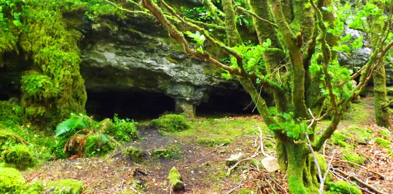 In a grove of ancient mossy stones and trees, set in an otherworldly vision about 1.5 miles into the lower trail, is one of the most amazing and mysterious megalithic chambers in Ireland. In this grove you almost expect a reclusive Jedi Knight to emerge from the mysterious stone chamber, which is clearly the centerpiece of this scene. This of course is an imaginary context, but the actual depth, beauty, and mystery that exists here is not imagined at all.
This is a 4000 to 6000 year old Celtic megalith. It is a mix of a wedge tomb, cairn, and stone chamber all in one. It should first be understood that the limestone slab that has been placed as a type of panel above the small entranceway looks to weighs at least 10 tons, if not more. This is a four inch thick, rock-strip of 7 by 14 foot wide singular slab, of solid limestone. To quarry and craft this chamber would have taken an immense amount of work, yet there are no markings on it. No chips from a chisel at its edges, or Pic-axe cuts of any kind. The dedication and resources of an entire village would’ve been necessary to quarry and move this stone to this specific spot. This seems like an extremely strange amount of effort for a Neolithic village to produce just to build a “house for a calf”, which is what the archaeologists of this area have actually had the nerve to label this chamber. The idea of a community exerting the resources and risk necessary to transfer this specific monolithic stone in a precise placement and location just to “house a cow” is insultingly absurd, and borders on fraud.
A refined consideration of this chamber should first take note of the specific angle of the slab, which, as can be seen by the refractory blast of light glaring off its surface (first image above) is facing directly towards the course of the Sun through the valley. The specific angle of this extremely hard to move megalith indicates that it was intentionally placed in such a fashion in order to absorb as much of the Sun’s energy as possible. Additionally, connected to it, absorbing the Sun’s energy, are three stone-linings. This is a type of energy epicenter. Just as solar panels are angled on rooftops and plugged into an attached house for energy, this slab looks to serve the exact same purpose with the connecting stone-linings. This is a Neolithic solar panel distributing the harnessed energy of the Sun to the stone-linings which act as ‘cables’ transferring energy out to the landscape. Look at the stone-linings (which are a massive megalithic project also) in this image below, they plug-in and diverge in three different directions, which leads us to our next observation about this magical grove where wildflowers bloom like muffins in the grass.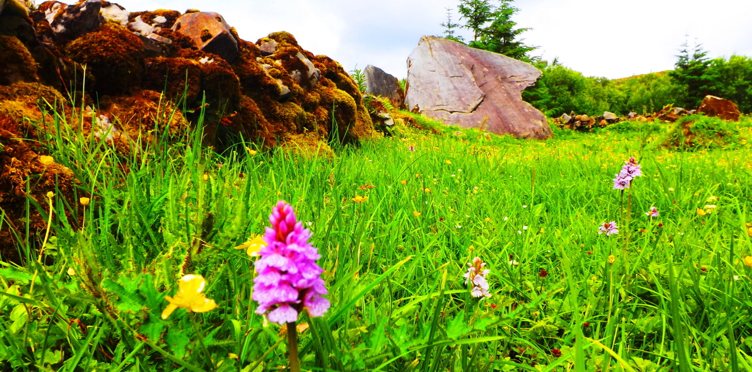 Modern archaeologists have dismissed these stones as primitive objects thrown down without any secondary functional purpose, perhaps other than to restrict the movements of herds. That’s problematic from the start. These stones couldn’t restrict a blind billy goat with three legs. This is a massive amount of effort to build something that doesn’t even perform its assumed functional purpose. This is because it’s not a “wall”. If we truly look at this scene functionally, from an engineering standpoint, it starts to make sense. Stones have energetic properties, transferring and storing energy if harnessed. How do we not acknowledge this in our particular day and age? Distributing harnessed energy is what our modern culture does with miniature ‘microchip landscapes’ every day. How could we not identify this larger model for the exact same concept, which is a landscape with connectors and harnessers of solar power that synergizes the entire area? This is the first engineering culture on earth, fully conscious of the utility properties of the elements in the landscape. Early antiquity was anything but primitive. “Archaeologists” selling people the idea that this priceless monument is a “calf house” are a patronizing disgrace.
Just 10 yards from this beautiful chamber is an amazing isolated boulder that sits specifically above another granite foundation. There are no other level granite tables protruding out of the ground anywhere else in the grove. There are perfectly parallel slashes along the side of the free-sitting boulder, which gives the impression more akin to a sculptural statement, or display of decoration, rather than clumsy cracks from random toppling.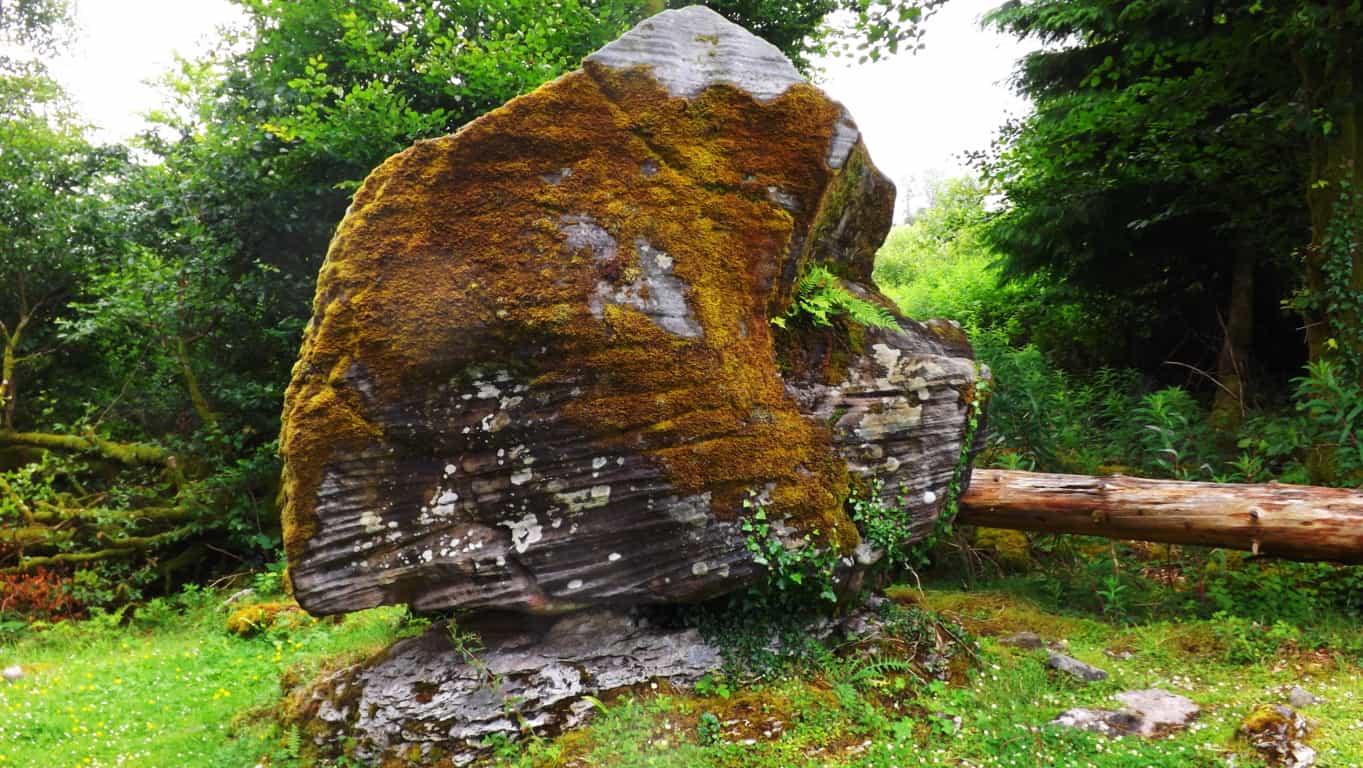 This boulder was specifically place on this exact spot as a marker for anyone approaching the area. It is obviously a statement that displays incredible strength and ingenuity, warning anyone passing through that the region is habituated by an individual(s) capable of this statement. The area is inundated with cultural megalithic statements, and yet, “scientists” somehow have the nerve to isolate this particular statement of megalithic balance and power, as random “glacial activity”. People need to get their heads around the idea of megalithic engineering in antiquity, and the ability to move and utilize massive stones. These engineered stones are in every forest and wildlife reserve from Gortnavern Ireland, to Monument Mountain Massachusetts. We need to stop being afraid of the possibility of a different history that the ‘postmodern era’ has perpetuated. Cultural history, after the last glacial flood period, spans some 12,500 years. In just the last 100 short years of human culture, which is a whopping 8% of the overall Era, ‘modern culture’ has decided to literally theorize everything, just ignoring the other 92% of cultural history along with the various forms of evidence we have inherited but mostly ignored. When defending the the 92% portion of overall history with a “modern scholar” they will dismiss the concrete evidence of engineered megaliths and historical texts with the painful logic that these statements are “just too old to be true”, or ” made-up stories created to manipulate culture”. This makes a practice of dismissing anything outside of the approved of narrative. If cultures just follow narratives and not the scenes themselves, those cultures will forget themselves. These stones are incredible coded puzzles that have been handed down to us from antiquity. They are literally priceless. In all our “modern wisdom” we still have yet to explain the purpose for these wedge tombs. This fact alone is enough to dismiss the assumptions of those who say that todays era is the height of cultural progress and achievement. It simply isn’t true, and the stones prove it. Let’s look closer.
Just 2oo yards further up the trail is yet another priceless megalithic statement. This classic Celtic Wedge Tomb is at the top of a beautiful knoll with a 360 degree view on the Reserve. Placing these stones at this elevation would’ve been a serious endeavor, requiring years of specified labor.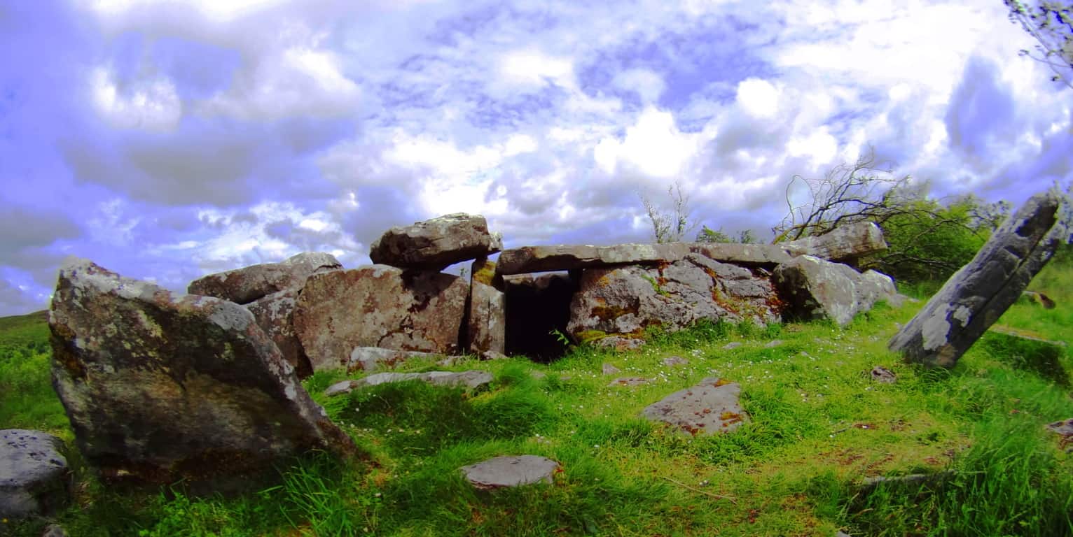
This chamber has several features that are mysterious and fantastic. Roughly measured the chamber reveals a 17 foot long set of fitted and crafted blocks of limestone. There is a captivating symmetry and set-up to these 1000 pound stones, with a centered entranceway. Two ‘pillar stones’ guard the entrance about 7 feet from the immediate left and right of the center entrance. The implementation of symmetry into a grand stone scene indicates dynamic planning and geometric comprehension, even beauty.Their are squarely placed roof and side-stones which are cut and fitted in eloquent styles. Beds of vibrant wildflowers populate the hill all around the chamber. With the clouds rolling swiftly by above the entire scene it truly feels dreamlike and utterly surreal. 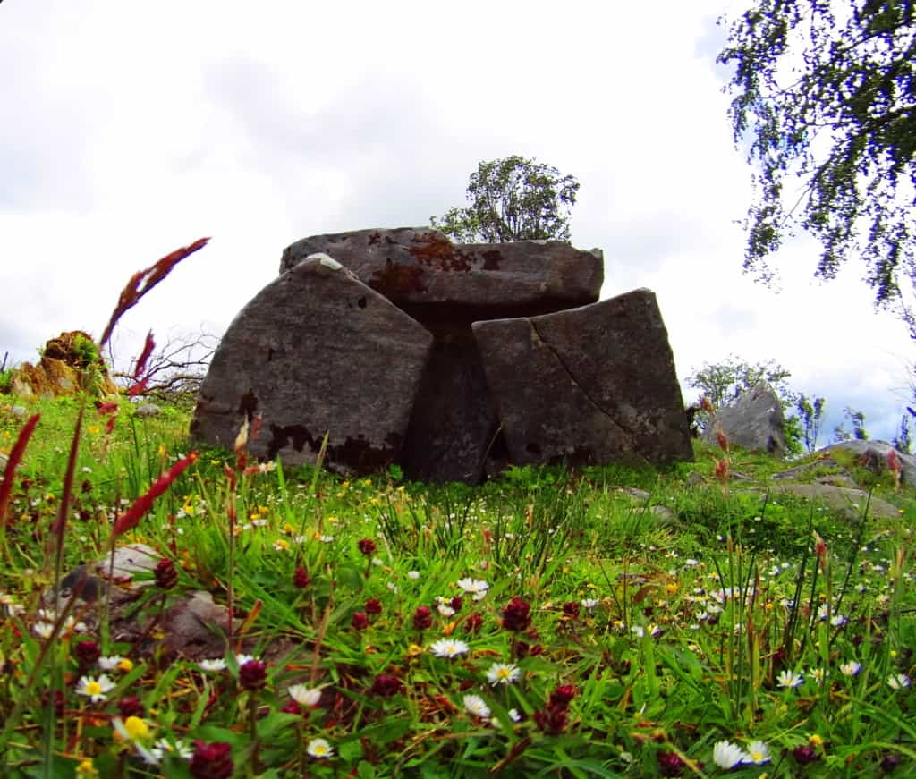 There is another classic wedge tomb on the initial elevation when starting the trail. Unfortunately this chamber is dilapidated, but with the help of the other chambers down the trail, we can make a pretty good guess as to what this scene may have looked like once. There are 1000 pound ceiling stones which have been toppled, while the side stones are no longer standing straight up. It was once a beautiful limestone chamber with an incredible view of the mountain beyond. There’s a good chance that this chamber once mimicked the beautifully distinct Culigagh Mountain in the background, which is a technique found in many of the stones at Mount Bearnagh in the Mourne Mountain Range to the east.
In review, the designated trails here are a short 3 mile loop that take you from megalith to megalith, branching off into the forest as well. The roads and pathways approaching the Reserve run for several miles all their own, and are completely accessible as well. This is a once in a lifetime excursion. The first culture in Ireland once thrived in this region, and found joy in creating impossible engineering spectacles built into the landscape, too grandiose to be removed some 6000 years later. Photography here is an opportunity to capture the beautiful spirit of Ireland’s oldest rural wonderland. These images tell a tale of complete beauty and mystique, of wonder and grandeur. An excursion here can lead you off-trail too, where Celtic stone-linings might be your only guide for miles. If possible, give yourself a chance to discover something away from the path. Wander into the hills to experience the breezy sway of the hillside brushing against your gear. A nearly scriptural level of simplistic beauty can emerge while passing by the flocks in these hills. The realness of witnessing a hallowed ‘rural order’ gives us a primordial reminder that life can hold incredibly simplistic beautiful moments, if we so choose. Cavan Burren National Park is the perfect place to wander into that type of moment. Seek and find.
Hill of Tara
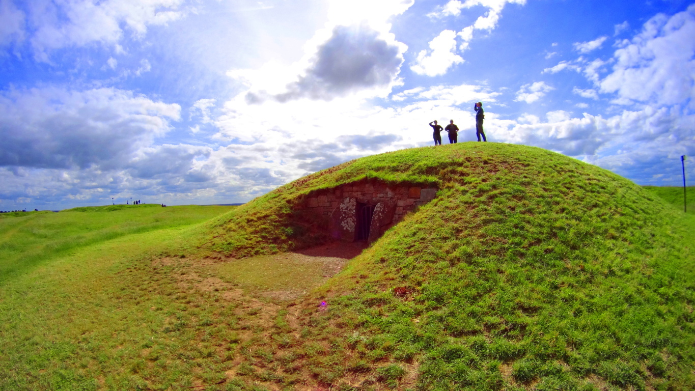
Location: County Meath/Ireland
Elevation: 508 ft
Note: It is fitting that the Hill of Tara, the historic site where it is said the High Kings of Ireland were once crowned, is on a road with no name. This sets the tone for the experience of County Meath, and within it, the enchanting hamlet of Castletown, a place deeply dedicated to preserving the beauty of Celtic life in all its aspects. Castletown is wonderfully lacking in the exacted labels of modernity, with lanes and lands that have names known only by the local farmers and families. It is here that The Hill of Tara is embedded, and without a GPS, or mapping system on your phone, you simply will not find it. Be prepared. The deeply rural aspect of Tara’s location has been challenged by organizations wishing to modernize this area with more expansive highways, and this effort has been met with overwhelming resistance. The people here clearly value a connection to the sacred land over monetary expansion, and this gives us yet another connection between Celtic and Native American culture. The Hill of Tara is the central natural monument for the earliest Celtic identity of the Irish people, while Newgrange is the Megalithic complex with equal stature. It is understood that the High Kings of Ireland were crowned, and kept their High Seat, here. There is a standing stone and stone chamber at the top of the Hill, marking the very spot where the High King was crowned in ancient times. There is a main trail from the car park, and several minor trails that encircle the hill. A full hike of the area is about 4 miles long, if you so choose, rounding the Hill. Perhaps more importantly is the option to sit down and understand the depth of what this place represents, and feel what it exudes. It is not a cliche taking place at Tara’, it is in fact one of the realest connections you can feel to the landscape in all of Ireland.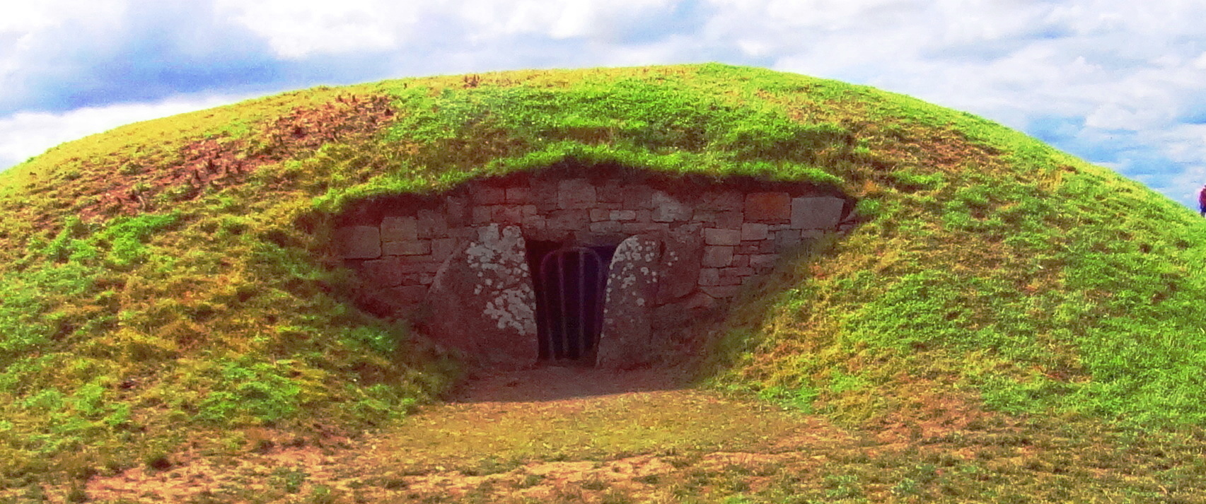 There are several specific monuments that should not be missed here. The stone chamber is a beautiful example of corbel layering in the Celtic style. It is placed specifically at the zenith of the Hill, and built into the ground in order to connect with the earth below. This exact style of stone chamber exists mysteriously in the forests of New England. Below are examples of the stone chambers at Upton and Nashoba Brook, Massachusetts/USA. They are very similar in construction to The Hill of Tara stone chamber, but lack the pinnacle context of the Irish chamber, so obvious with a single glance.
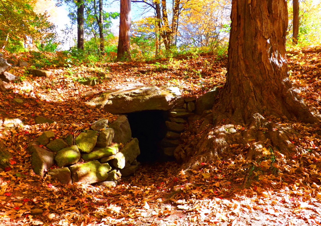
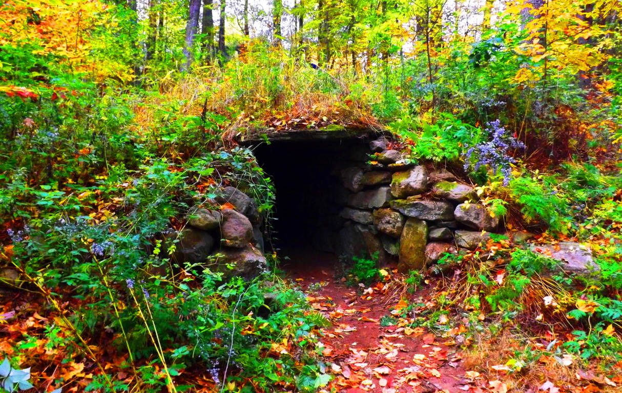 The question arises: What are identically constructed stone chambers doing an ocean apart from each other? A full analysis of the stone chambers, both in Ireland and New England, may reveal astrological, as well as geomorphic significance. While standing inside the Upton Stone Chamber when I took the image below, over two years ago, several small glowing orbs began floating around my camera lens. (image below/left of center, 2 orbs connected) This is a strong indicator for the purpose of harnessing energy in these chambers.
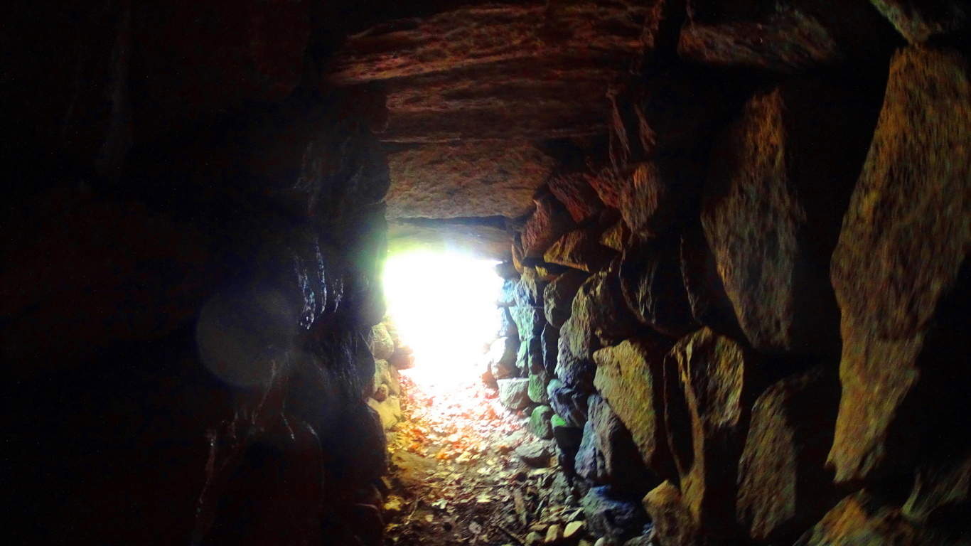 I had never before seen an orb up until that particular moment, or even believed that they existed. It became clear to me that what takes place in the stone chambers is most likely a harnessing of energy. This is very similar to what is done with electrical current and quartzite utilities in today’s era. The stone chamber at Tara’ would very likely have the same energetic benefits, and therefor be a good place for the High King of Ireland to be. After spending some time upon The Hill of Tara, I began to feel that the entire Hill was harnessing energy somehow, and I certainly wasn’t the only one. (Image below/Kings Stone/site of the crowning of the High King)
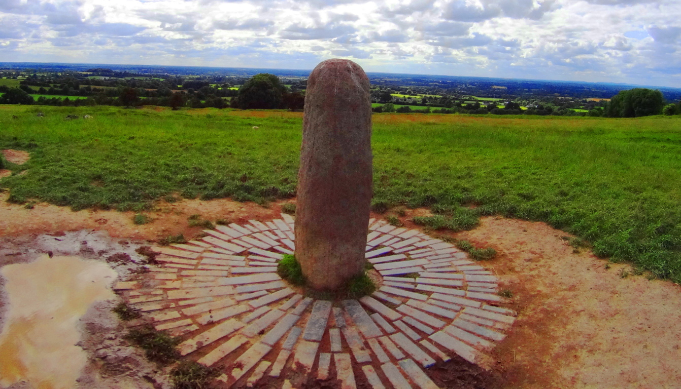 Within the Stone Chamber at Tara’ is a type of “keystone” (image below) which maps out the megalithic works of the entire area. On this day I didn’t see any orbs in the Chamber, but it was abundantly clear that Tara’ is a spiritual center that was designed in a very specific way. This would’ve taken an enormous amount of effort.
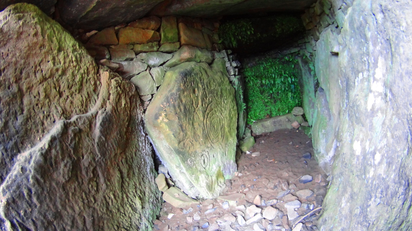 These megalithic monuments date back at least 5000 years. It is very likely that the High Kings chose this place specifically because they knew of an even older megalithic culture that once dwelt upon this Hill, which was a culture capable of harnessing energies through the positioning and aligning of stones with the Sun, Moon, and Stars. The Hill of Tara is a type of energy center, with several large concentric earthworks built into the hillsides. The exact meaning of concentric earthworks is not known, but science is beginning to understand fractal and concentric patterns as extremely useful in the reverberation and harnessing of electric currents.
The feeling at The Hill of Tara: In J.R.R Tolkien’s masterpiece The Lord of The Rings there are two chapters that take place in an enchanted forest called Lothlorien. Deep within Lothlorien there is a hill named Cerin Amroth, and the description of what happens when the company of travelers from this epic tale first glimpse this ancient Hill is poetically relevant to the Hill of Tara. The passage reads:
“Behold! You are come to Cerin Amroth,” Said Haldir. “For this is the heart of the ancient realm as it was long ago, and here is the mound of Amroth, where in happier days Amroth’s high house was built. Here ever bloom the winter flowers in the unfading grass: the yellow elanor, and the pale niphredil.” The others cast themselves down upon the fragrant grass, but Frodo stood a while still, lost in wonder. It seemed to him that he had stepped through a high window that looked on a vanished world. A light was upon it for which his language had no name…”(pg 350;LOTR)
Here is a picture of high plateau of Tara’s wildflowers from up close. They are delicate and beautiful, colorfully vibrant, rich, and unfading, very much like the description of Cerin Amroth in Tolkien’s Lotlorien.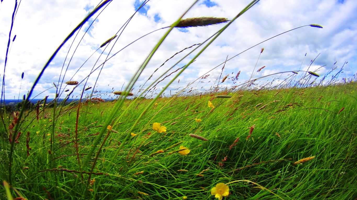 Perhaps it was because the angle of the light on the field was personally different for me; just as the Irish angle on the Sun is different than that of the angle of the Sun in the American northeast where I’m from; but from my foreign perspective the Hill seemed to literally glow in the late-day Sun. It glowed in a way I had never seen before. I could feel a type of electricity all around me, and yet it was a simple landscape on the surface. I truly had to sit down and collect myself for a moment as my head was nearly spinning. I know it sounds strange, but it’s true.
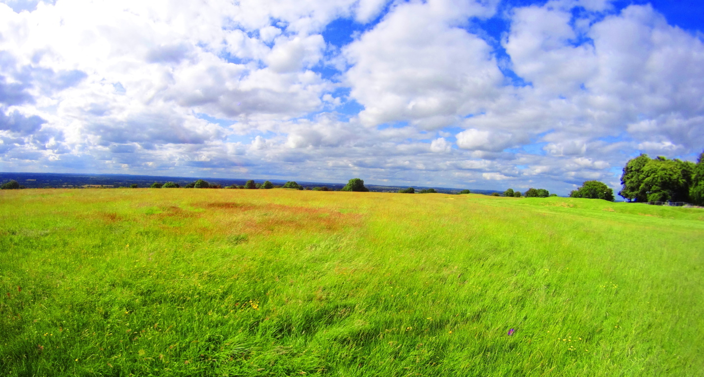 It is very hard to explain, but as I came up the Hill, I began to see that the Irish understood this feeling, completely.
I included the fictional description of The Hill of Cerin Amroth experienced by the characters of The Lord of The Rings above because it was the most relevant passage I could find in all of literature to describe my very real personal experience with The Hill of Tara. When I arrived people were literally sprawled out in the grass, attempting to harness the energy of the Hill. (image/below) I found myself blinking hard at what I was seeing.
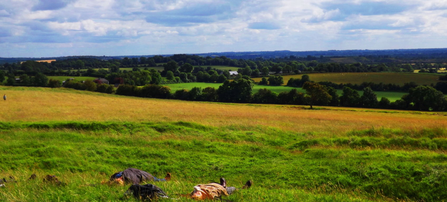
I walked above the stone chamber to get a glimpse from the highest point of the area. Two Irish kids jumped up in front of me and began posing for a picture in the most hilarious way. They were absolutely carefree. With all of Ireland in the backdrop, I suddenly felt as if all my concerns were, at best, ridiculous. 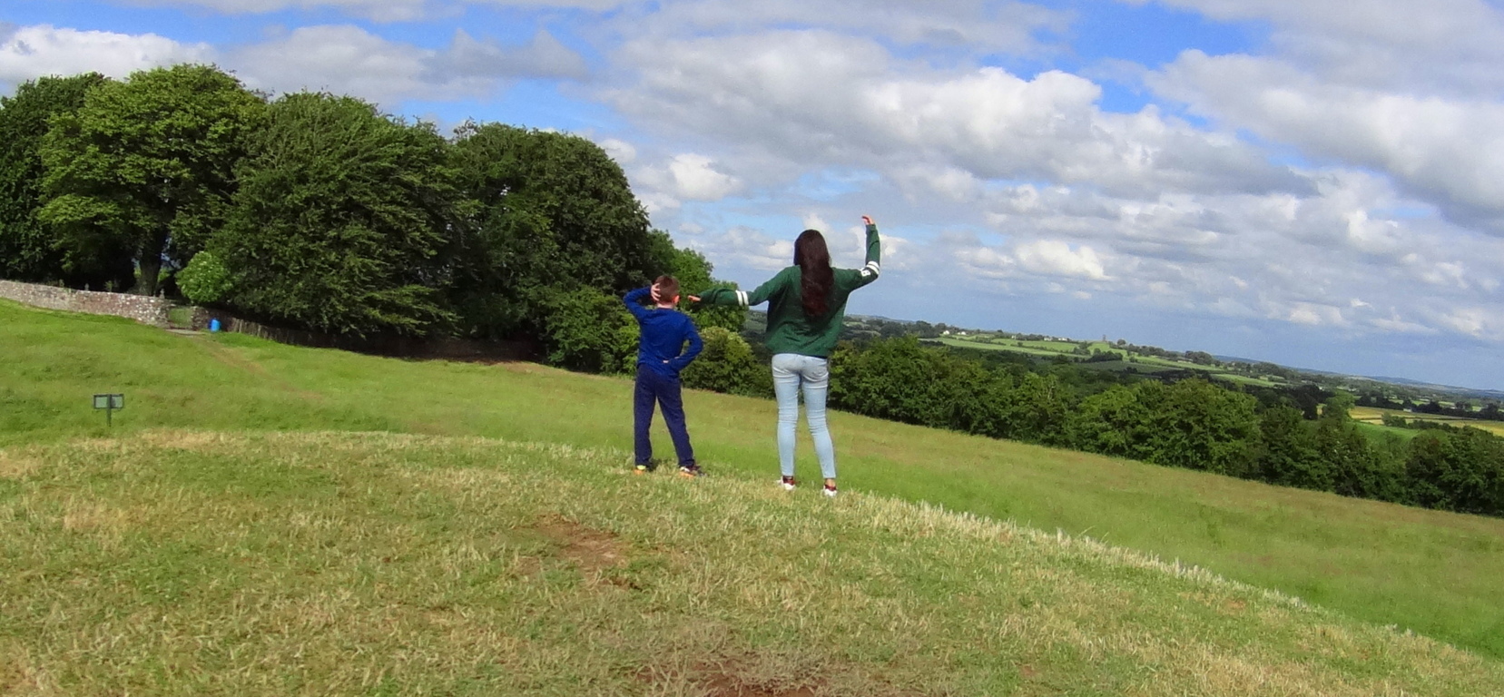 Off in the distance I marked a couple kissing, and then not far from them were college kids sitting and talking softly above the ancient circular rings now covered with earth.
 Coming from the America of the last 15 years, I just wasn’t accustomed to this type of uninhibited joy and calm. There was no stress, no observational angst, no fear whatsoever. And you could feel it.
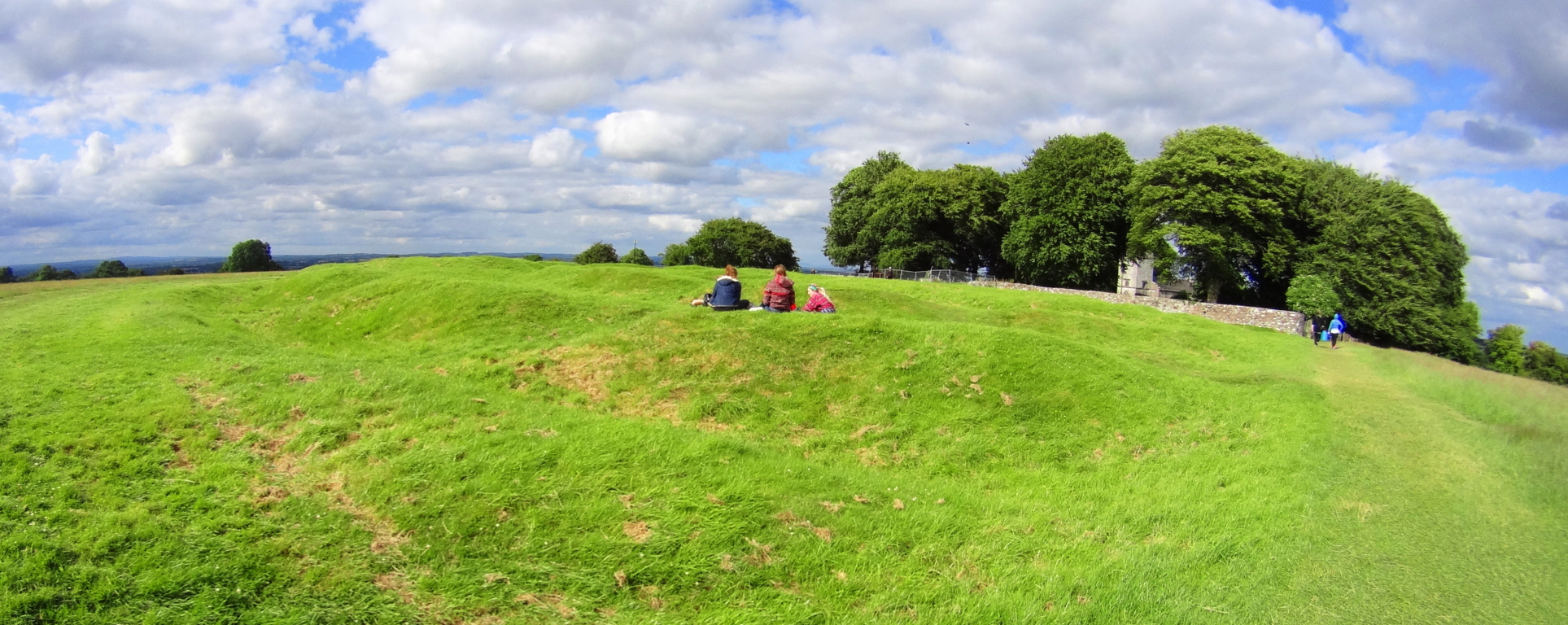
Whatever the original function of Tara’ once was, there is a remnant of it still today. On a sunny day Tara’ feels like the safest place on earth, and this is no exaggeration. In the hills beyond are ruined bell-towers of abbeys long since diminished. It should be appreciated by the readers that these towers, although they look extremely old in their picturesque way, are practically young, comparatively, to the stone chamber and standing stone at Tara’s peak, as well as the stone chambers in New England, for that matter. 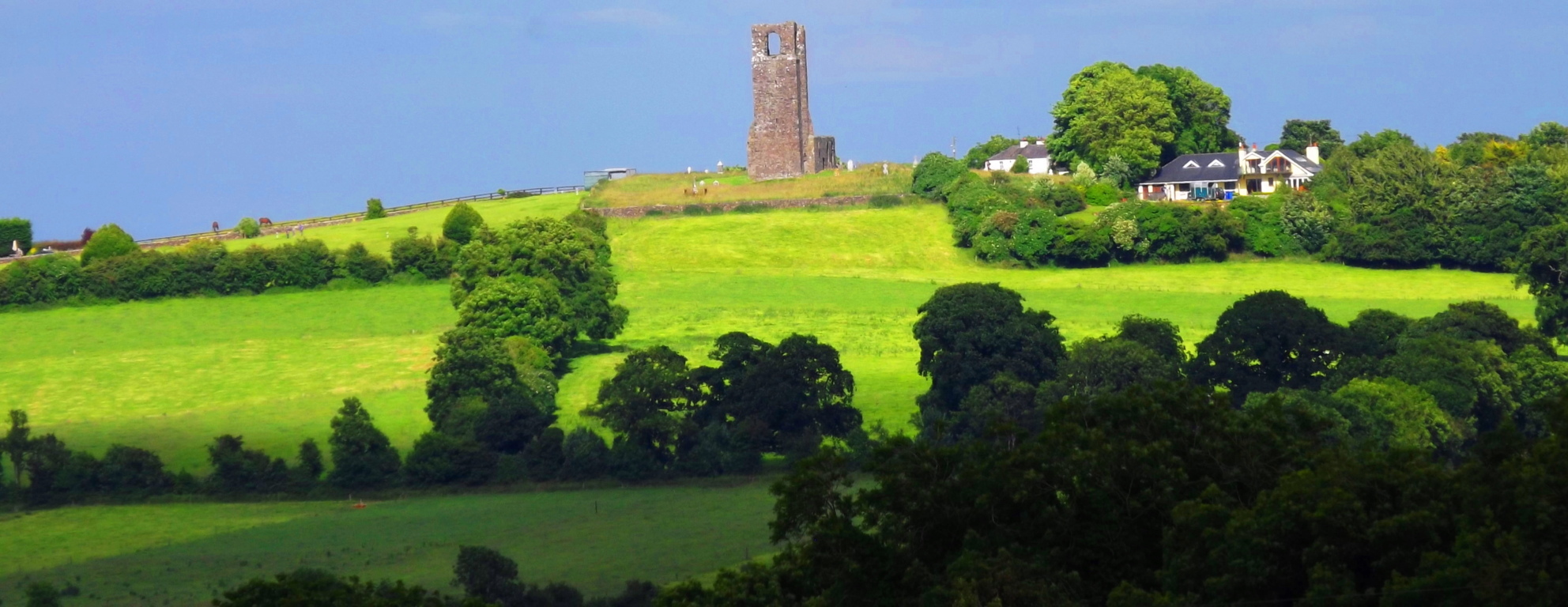 Bective Abbey, a classic Medieval complex, is only 1.5 miles from Tara’, and it is a wonderfully tranquil place. (image below) You can walk the ground and see some beautiful architecture from inside the cells.
 The monks must have known how spiritually potent this area was, with its proximity to Tara’. They would’ve gladly choose to live-out their days in the presence of The Hill, knowing they could certainly do a lot worse. Adding to this energetic feeling of the land and stone-works from the earliest Neolithic period, to Celtic and Medieval, is the oldest element of all, the Boyne River, which cuts North to South through the area.
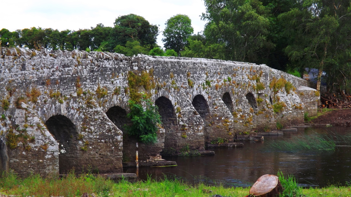 This is the Boyne River Valley, an ancient and sacred landscape filled with stone engineering. “The High Man”, a Celtic complex of astrologically-aligned hill-forts, wedge tombs, and standing stones, is not far from this area. Its monuments are built in precise fashion along the Boyne river in order to be a reflection of the Belt of Orion astrological system actually built into the Irish hills. The entire area is absolutely sacred.
The Hill of Tara has been preserved by the efforts of Irish citizens who have resisted the modern world’s “advances”. They have openly protested any modernization of the area. If you are lucky enough to find the Hill of Tara and walk the grounds; if you come to Castletown and cross the river Boyne; realize it is anything but a simple hike through rustic terrestrial trails that you are taking, but rather, it is a hike into the way things were in the beginning of Time.
Baxter State Park
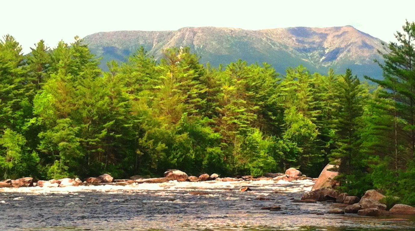
Location: Millinocket Maine/USA
Trail: Hurd’s Pond Trail
Note: Baxter State Park is over 200,000 square acres of protected wilderness, rolling 18 miles northwest of the welcoming country-town of Millinocket, Maine. The crowning feature of this incredible old-growth preserve is Mount Katahdin, a 5,267 foot peak, and final mountain along the American northeast’s 1,500 mile Appalachian Trail. The Piscataquis and Penobscot Rivers cut through the southeasterly portion of the park, creating opportunities for riding rapids and hiking along waterfalls, all with Mount Katahdin looming stoically in the background. Dozens of trails are spread throughout the park. “Hunt Trail” is the official Appalachian pathway to the alpine peak of Katahdin. Other trails that run to the peak, such as “Knives Edge”, “Abol”, “Cathedral”, and several others, require a reservation with the park before arrival, which can be made easily on-line at: http://www.baxterstateparkauthority.com/reservation/ The trails here also offer a good deal of anthropological mystery, with megalithic stones in patterns and shapes that push the envelope of our imaginations. I hope people understand that this is a site about fully appreciating what is discovered on wildlife pathways, and it is not meant to be shocking or offensive in any way. The information and evidence in the forests of New England support a megalithic culture that had specific memes and themes cut into granite, all for the world to discover. These mysterious stones can be found on Hurd’s Pond Trail, and I hope people visit these woods and judge for themselves what is being described here.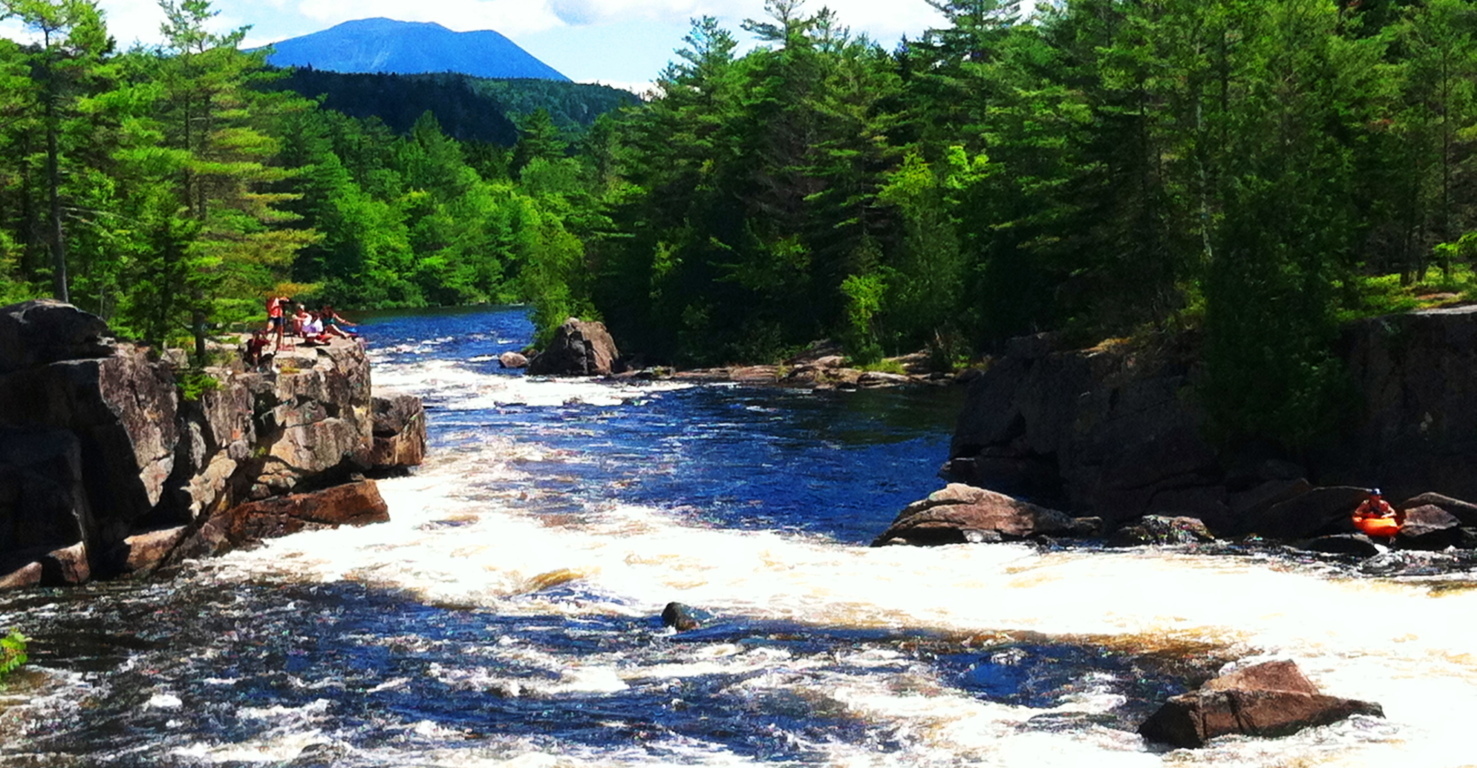 Trails which are not at an immediate proximity to Katahdin will NOT require a reservation, such as trails that run along the rivers, old-growth forests, lakes, rocky ledges, and icy caves, several miles to the south.
Hurd’s Pond Trail: “Hurd’s Pond Trail” will take you through some pretty cool natural features, and picturesque pathways, with several points along the way that give wonderful pause, and appreciation.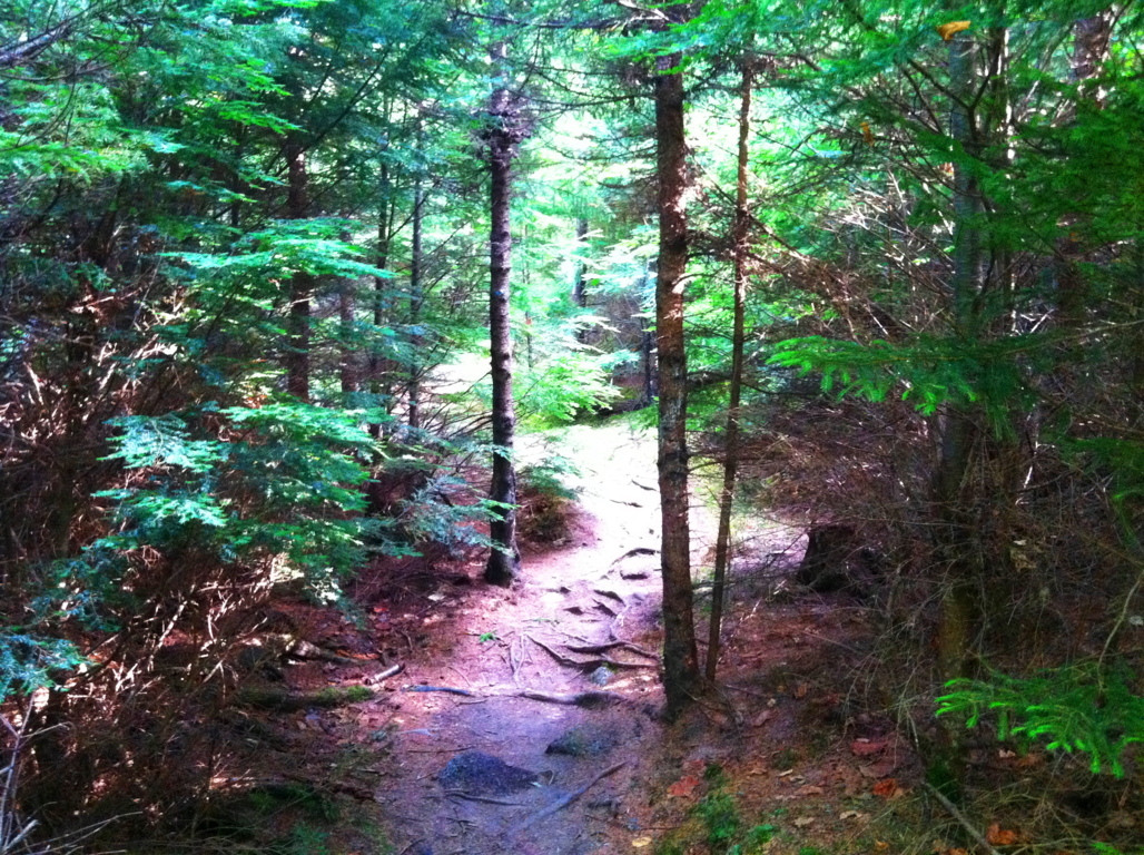 The Abol-Bridge Campground site is the jumping-off point for this trail, which runs the east-to-west course of the main road of the Reserve, Golden Road. The Northeast Piscataquis River runs south from Abol Bridge, with a dirt road running along its edge, eventually veering southwest into the forest trail.
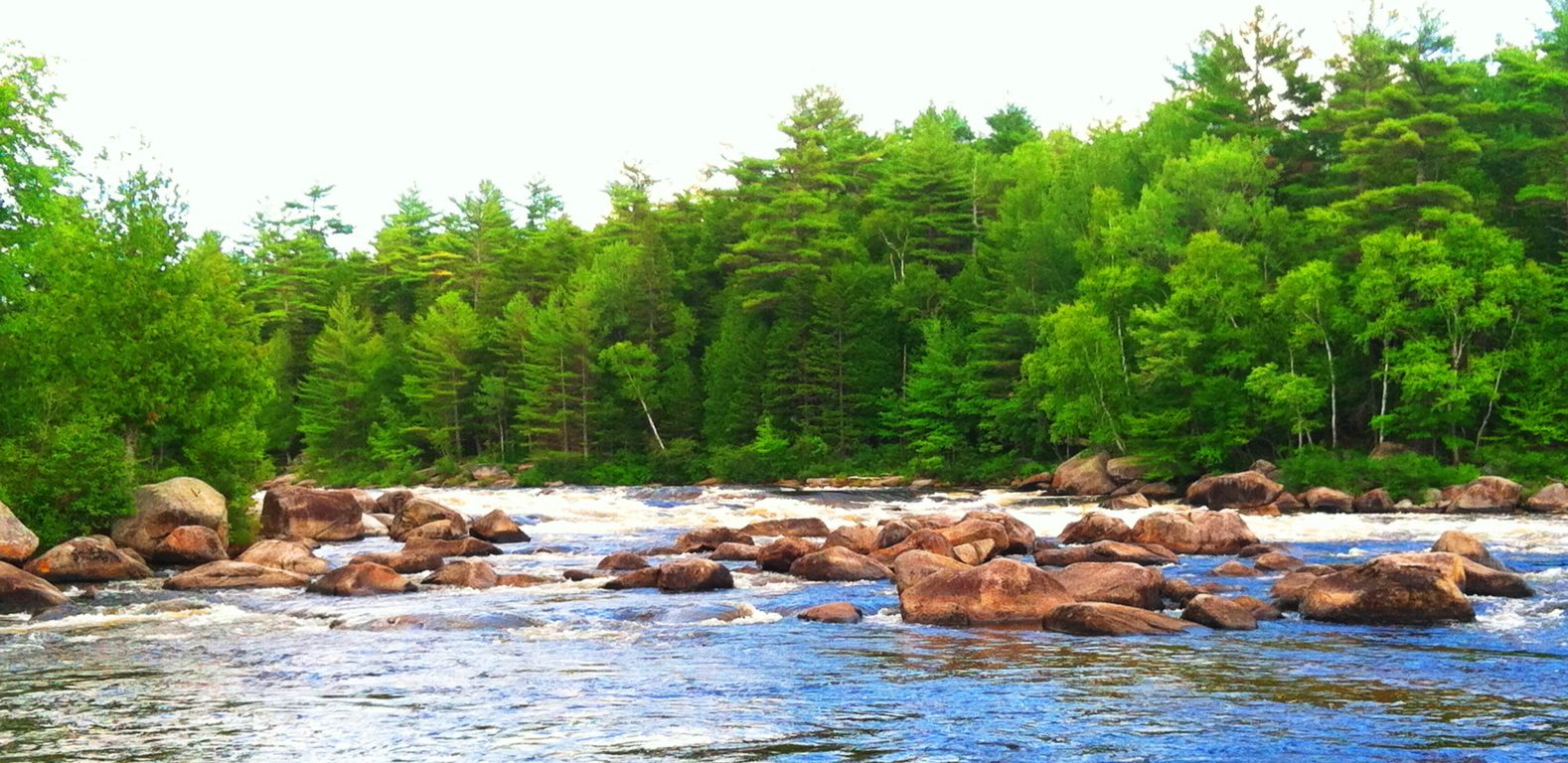 You can choose to walk the 3.5 miles along this stretch of scenic river-road to arrive at the car park of “Hurd’s Pond Trail”, or you can simply drive to the car park, which will be on your right after the 3.5 miles.
Hurd’s Pond Trail is a relatively short hike on it’s own, of about 2.5 miles culminating at the “Ice Caves”, an enticing network of boulders and passages overlooking Debsconeag Lake to the south. Before you get there you pass a set of pathways that feature different types of ledges, hedges, glades, and anthropologically mysterious megaliths.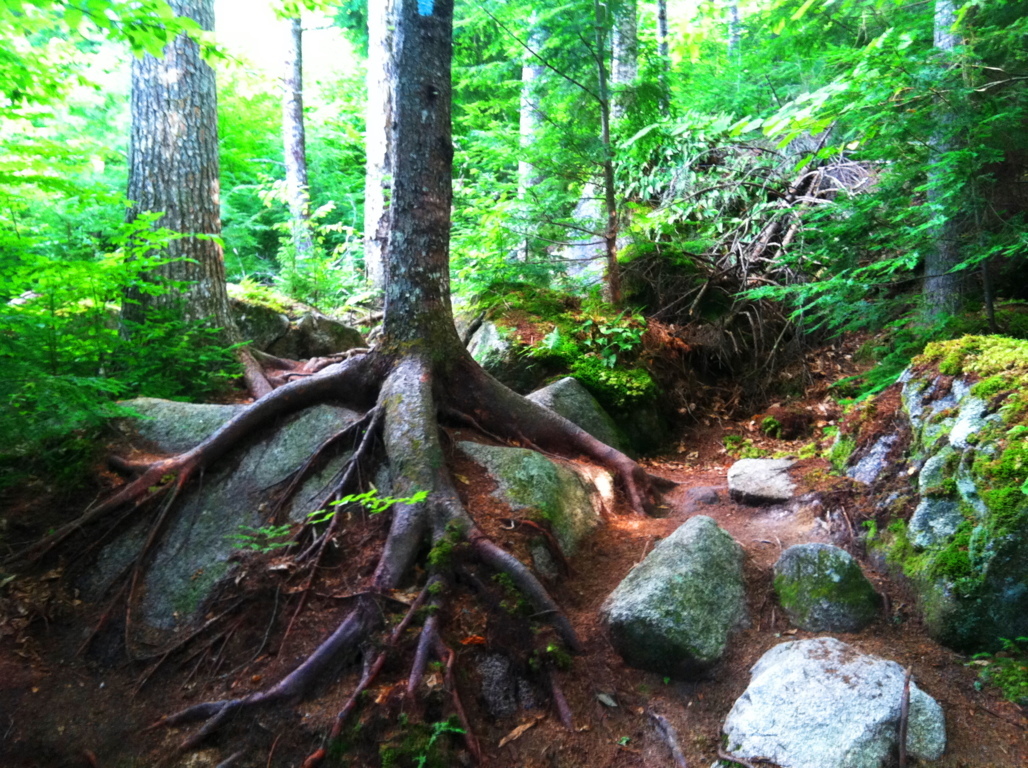 The lower trail runs over thousands of roots, and passes around grand fixtures of boulders that look to have been placed specifically along this particular part of the forest. Take a look at this boulder pictured below; do you notice anything particular about it?
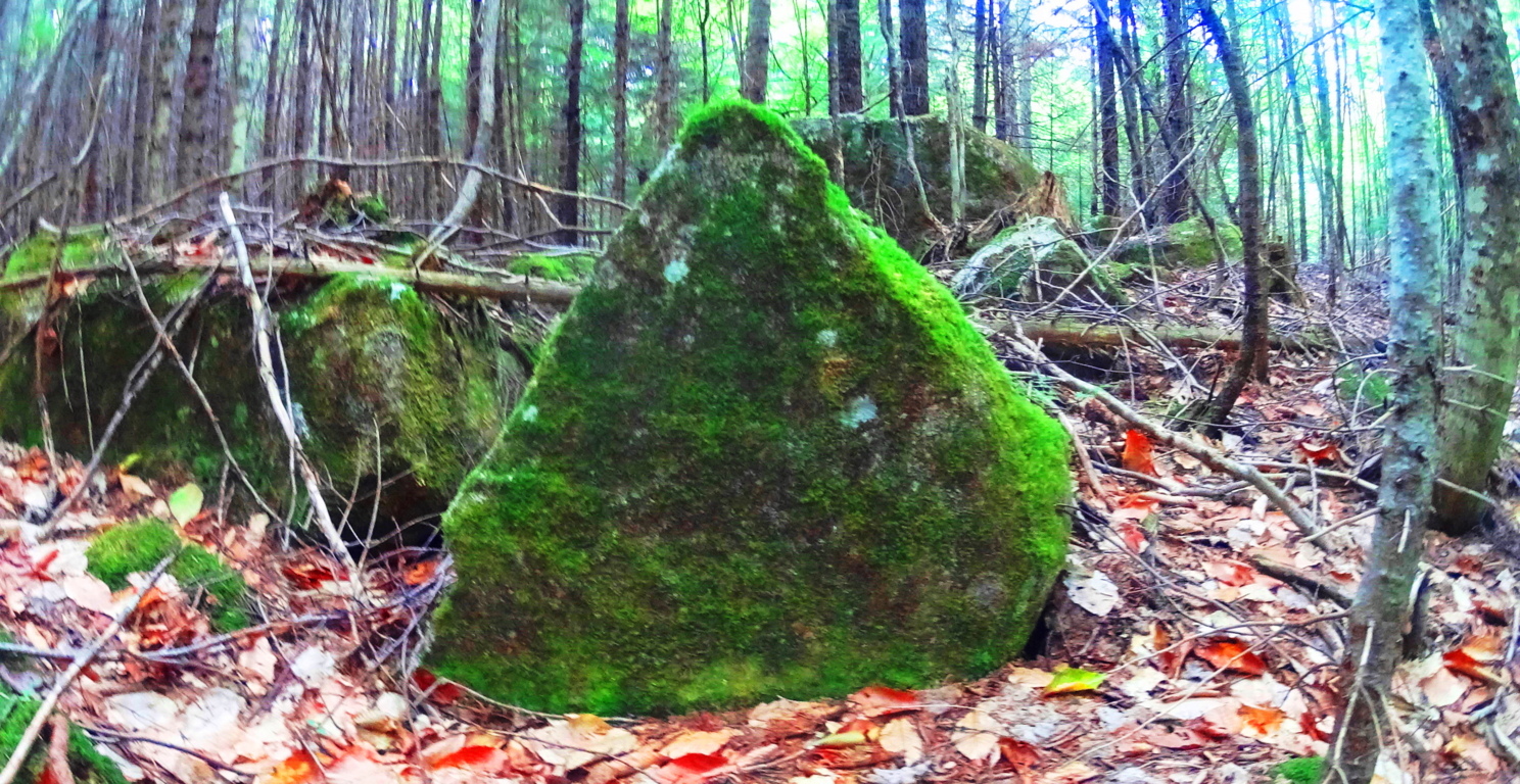 To answer the question: there are half-a-dozen massive triangular boulders, cut with a flat face and rounded back, standing at about 10 feet in height, and perhaps 20 tons in weight, along the path to the Ice Caves. It’s astonishing.
 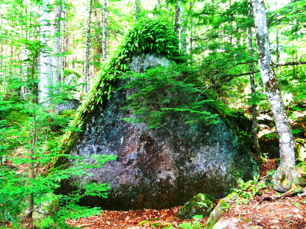 There is first one triangular boulder to the right, and then one triangular boulder to the left, and then another to the right again, all within the first half mile of the hike. It is hard for me to believe that seasoned hikers and naturalists simply pass by this without taking any note of it whatsoever? Personally, it is impossible for me not to stop and wonder what this might indicate. Take a look at the image below; how could you ignore this? These are teams of similarly crafted boulders, staring you right in the face. Not only are they similarly crafted, but they are facing the exact same direction, north, which is staring directly at Mount Katahdin.
 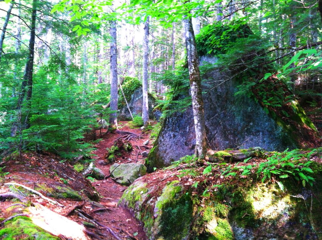 If it were not for the amount of clearly crafted triangular stones that I have time-and-time-again found in various forests of New England, I would have a hard time writing this portion of the blog. I completely understand that some people may be entirely skeptical of this, but at this point it is utterly obvious to me that the equilateral triangle was worshiped by a megalithic culture in the forests of New England. To support this, just take a look at some of the examples of granite-cut triangles discovered from places all over New England, found in hard to reach places like significant mountain elevations, waterfall facades, and deep woods ridges, miles from modernity in every direction. Please consider, that scientifically speaking, Equilateral Triangles DO NOT OCCUR IN NATURE. These shapes were obviously crafted. Something is going on with the Triangle in antiquity, and anthropologists are simply choosing to totally, and absolutely, ignore it.
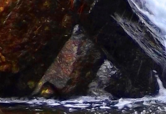
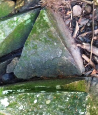
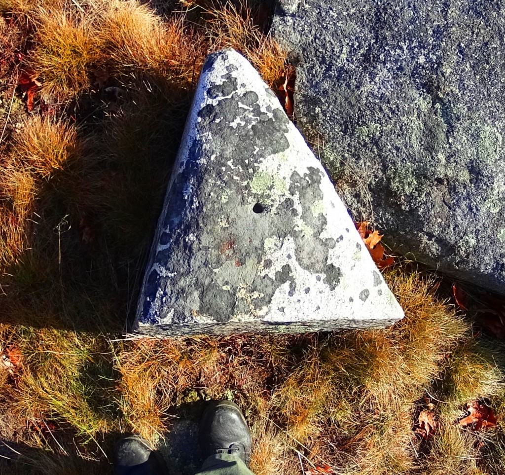
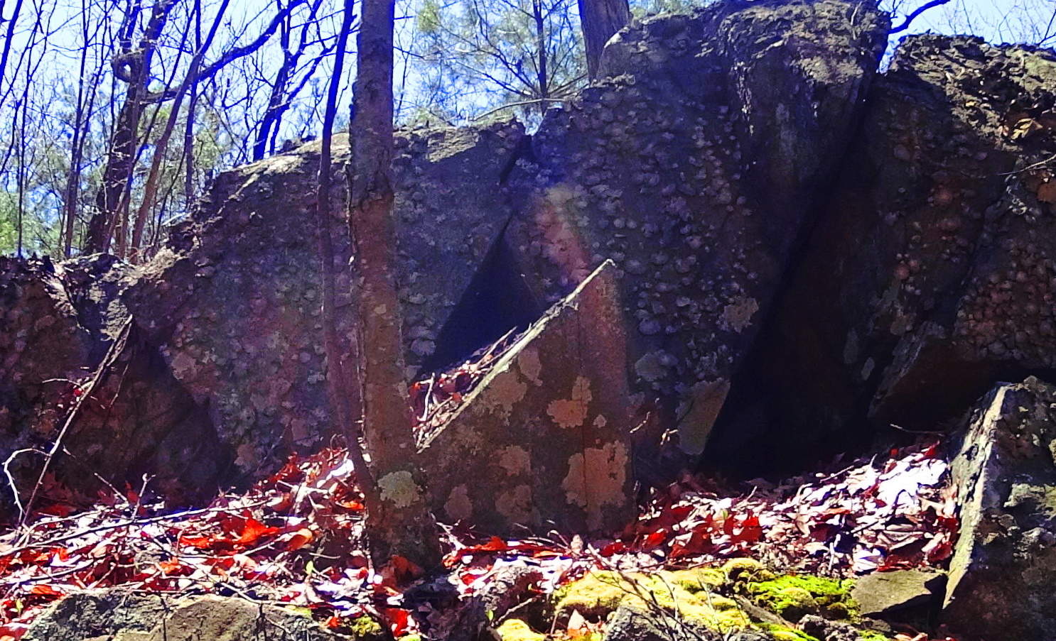

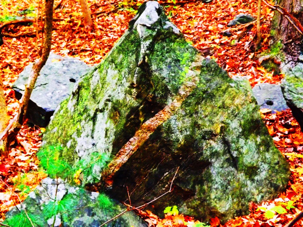
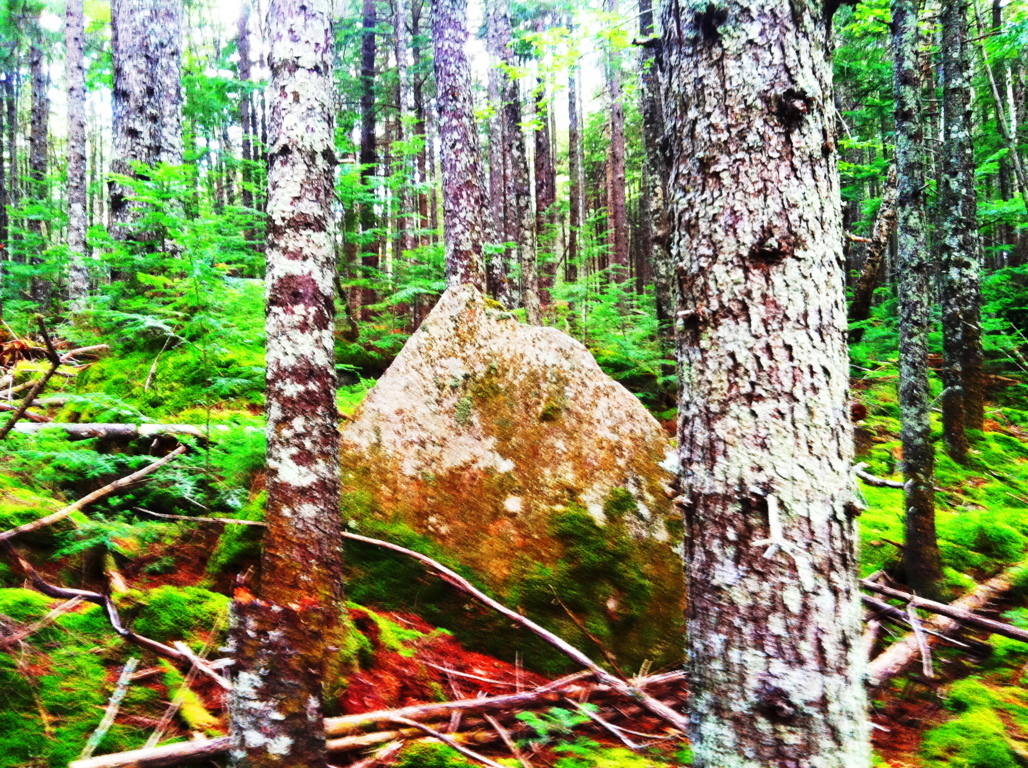
There is more to add to the mysterious elements at Hurd’s Pond Trail. Once you pass the initial triangular megaliths, you will come to groupings of boulders deeper into the woods that have other compelling features.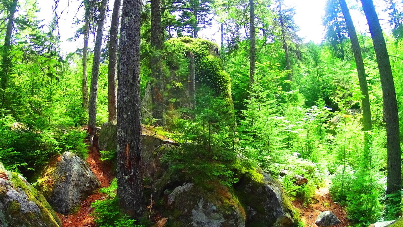 You will first drift through some heavy hedges and narrow lanes, and come out to a beautiful glade of 100 foot tall Pines.
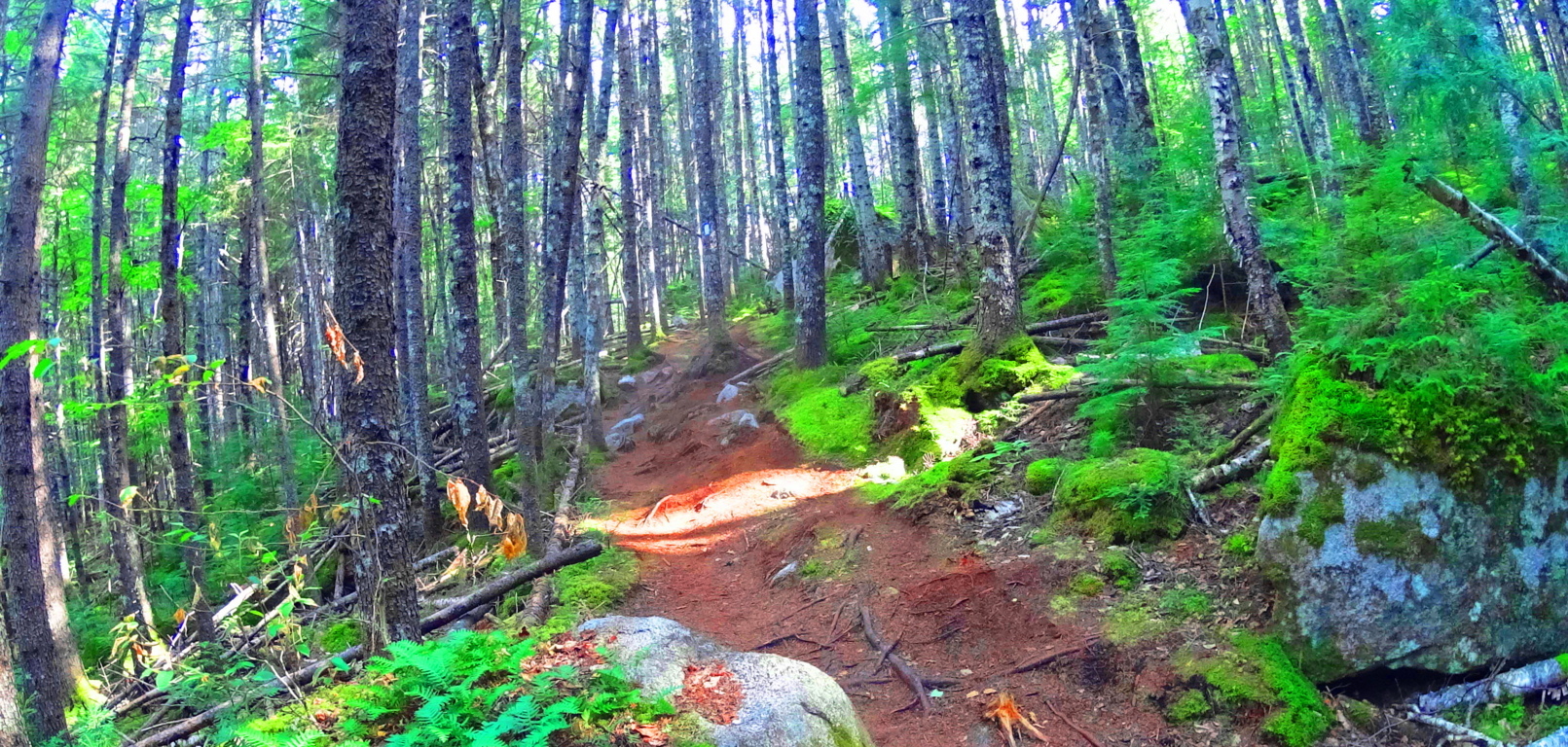 The boulders under these pines have specifically fitted cuts, within the rock faces themselves, which are angled and overlapped to create a triangular feature. In the image below, these two boulders are not sitting at random; the left boulder has a level right-face that is meshed in a perfectly flush fit to the cut-and-leveled left side of the boulder on the right. If you look closely it is absolutely clear. This ‘flush overlapping’ of the stone creates a specifically triangular space beneath.
 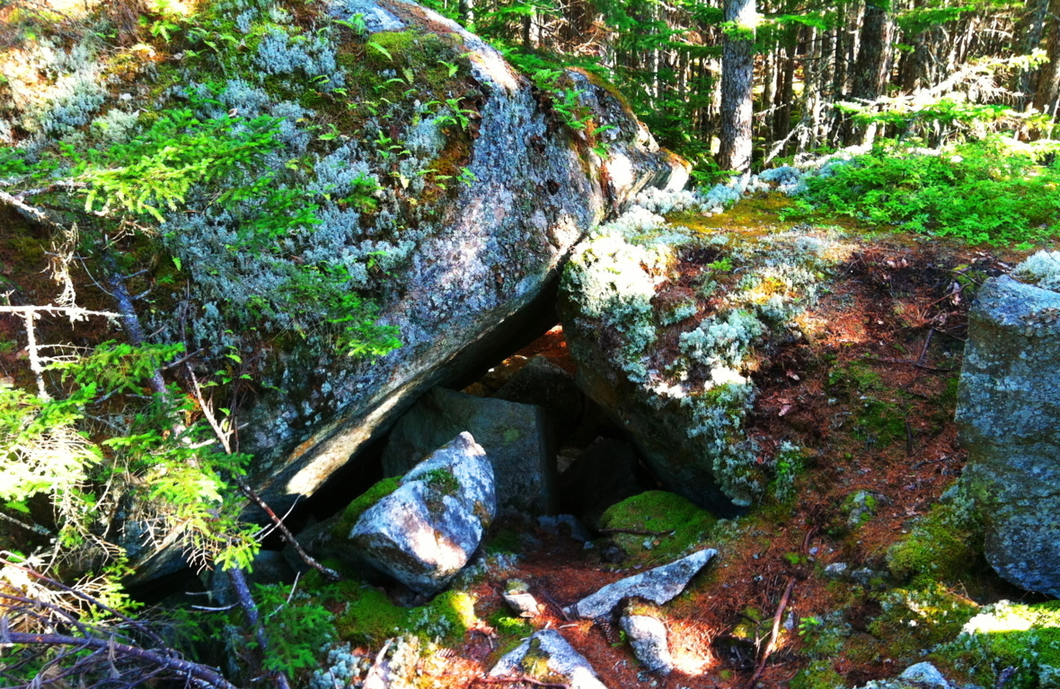 Take a look at some more examples from New England forests where I’ve found flush-fitted overlapping boulders that create triangular spaces. It’s not simply the triangular space beneath the rock, but it is the exact precision of the continued lines which create these angles that amazes me. How this is possible is hard to comprehend, and yet it is there.
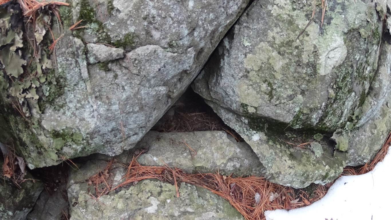
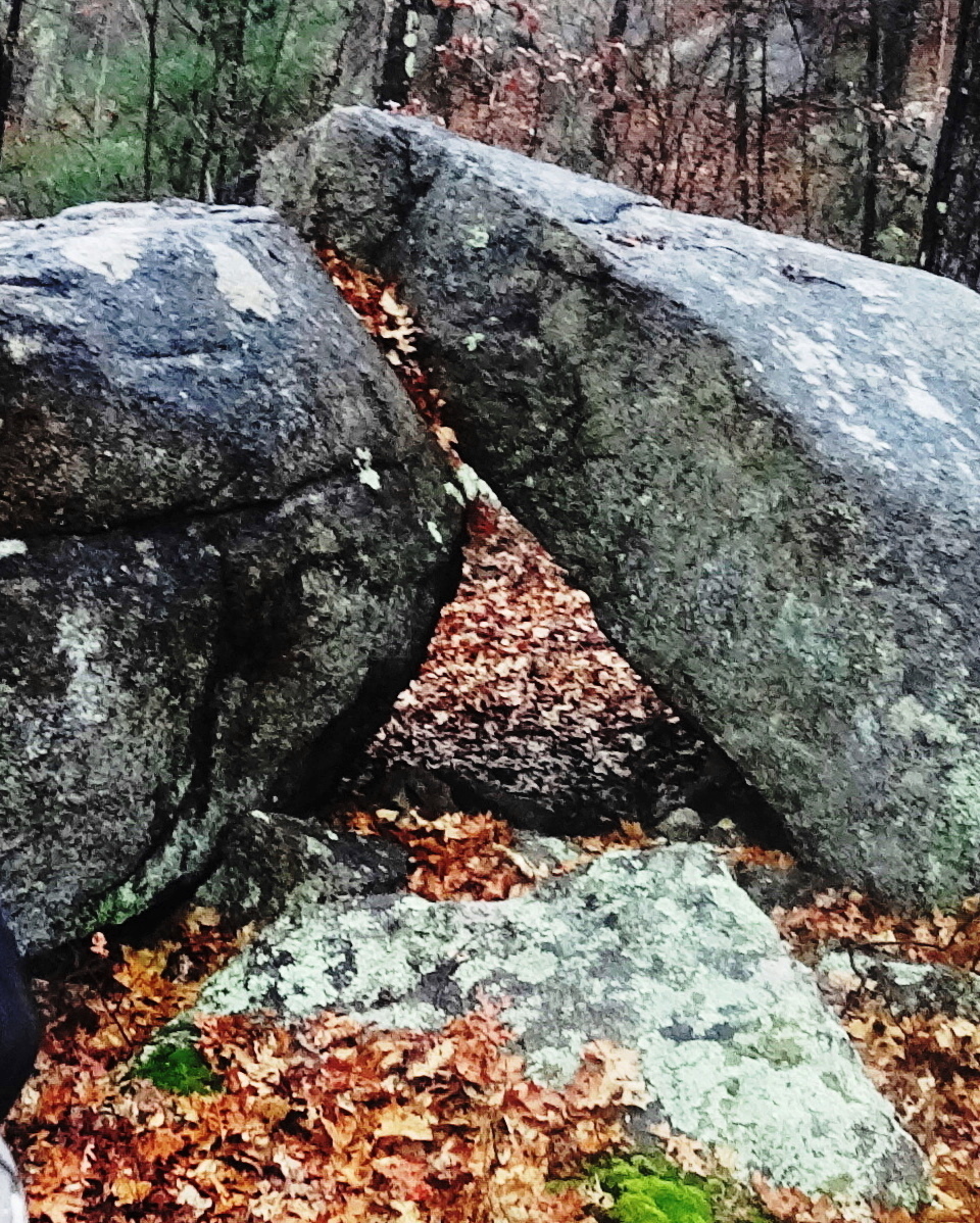
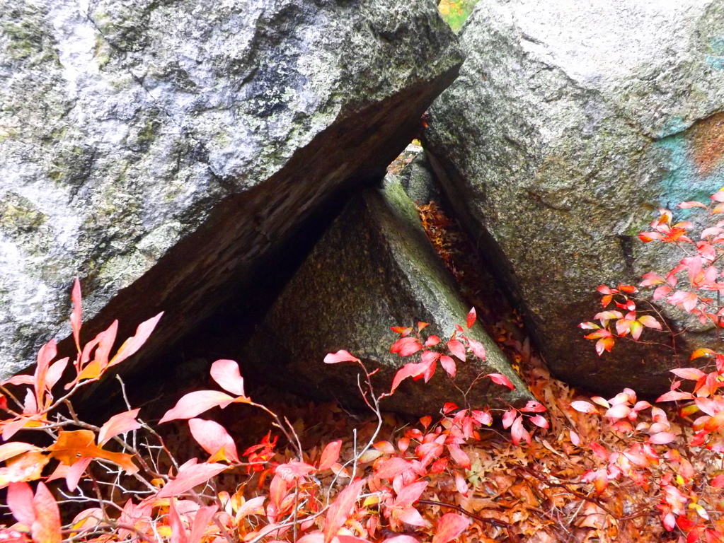
As you continue into the last half mile of Hurd’s Pond Trail you will see granite boulders with rounded-out arches, and the fitted pieces that resulted, sitting within a few small feet of each expression. Look at this section that was cut from this huge boulder below; the piece that was cut is sitting just to the right, like a block waiting to be inserted. It should also be noted that the top of these particular boulders have been cut flat, like a square. This is obviously some type of expression; like some megalithic craftsman saying “Look what I can do!”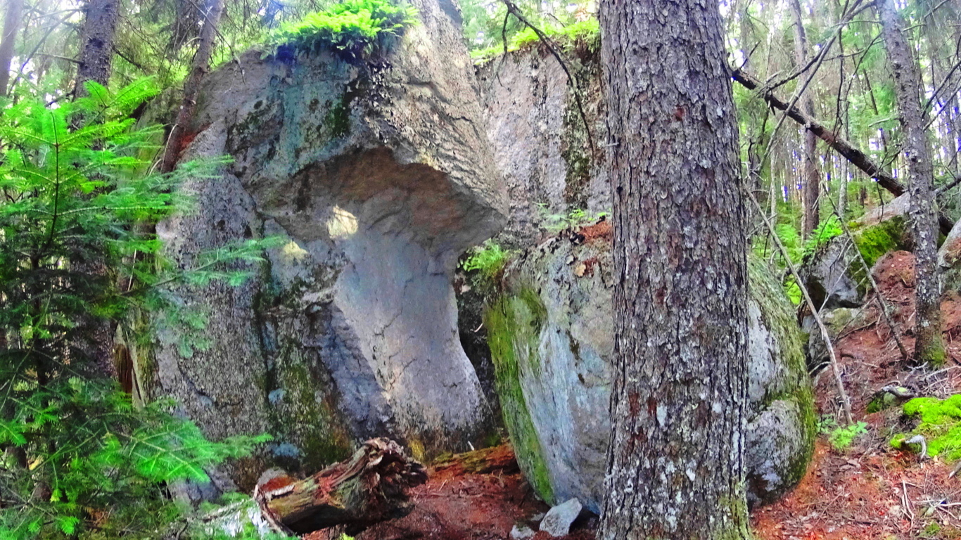
After passing a few hillsides with beautiful trees you will come to the sign that points to the Ice Caves, which do not have ice in late July. There is a railing and ladder that you can climb down into the caves, with its shafts of shadow, wind, and light. Above the Ice Cave boulders is a view of the beautiful Debsconeag Lake to the south.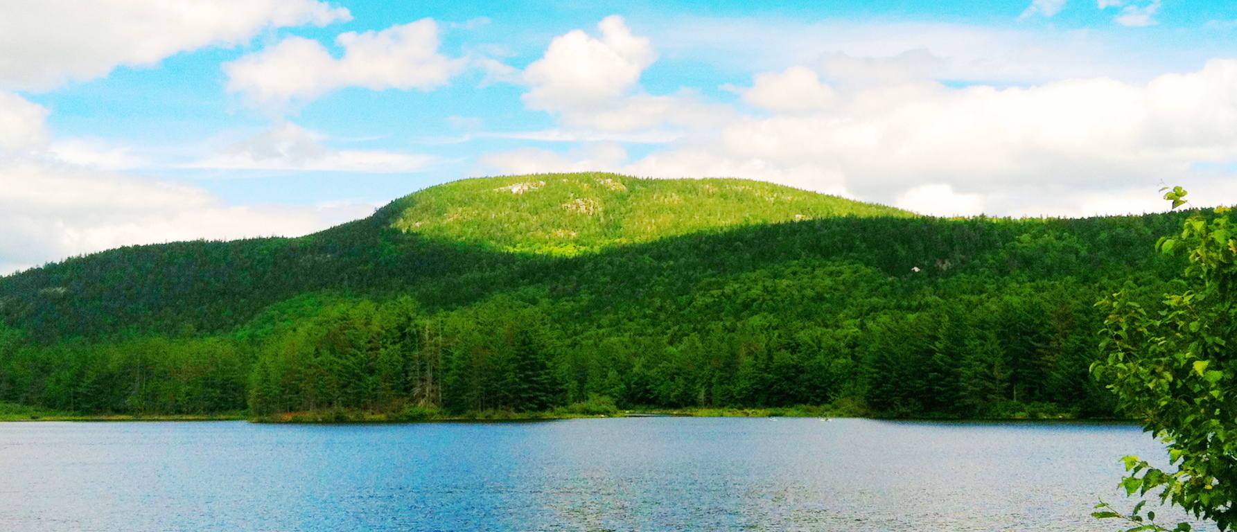 At this point you will have completed one of the better introductory trails to a worthy wildlife preserve in Baxter State Park. Work your way back steadily to the car park, and make sure you give yourself enough time to return before the Sun goes down.
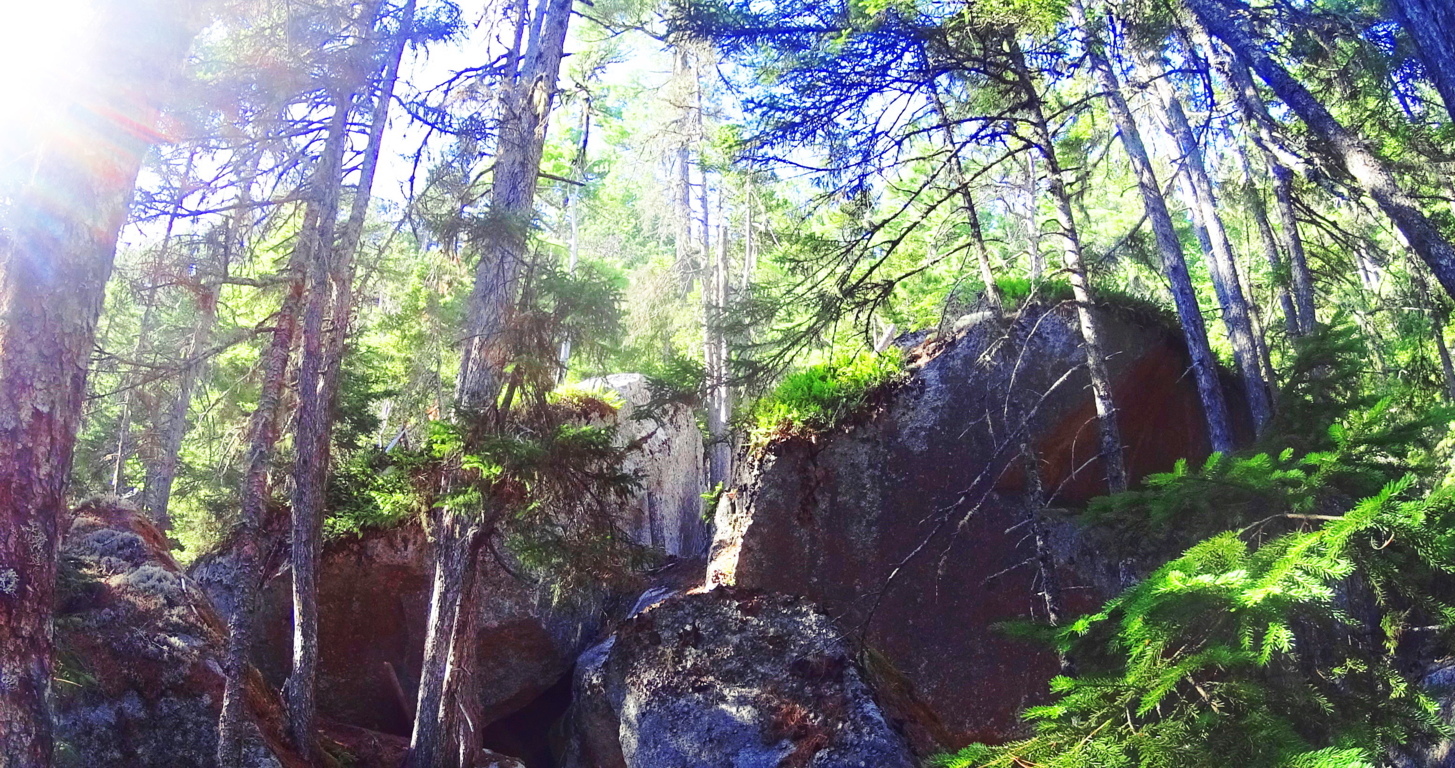
Final Note: New England is home to one of the most mysterious megalithic cultures in the world, which is obviously supported here at Stonestrider.com. This culture is very similar to the Celtic megalithic culture, which of course also has its own beautiful massive stone statements from the earliest era in History. Supported by consistent evidence, the megaliths of New England obviously have their own specific memes; rather than Celtic “spirals”, New England offers us ‘triangles’ cut out of, and into, the stones. I hope people come to understand the anthropological significance of this statement, and that every culture in the world seems to support a megalithic era, with distinct evidence. Baxter State Park is one of these sacred places, with natural beauty in the landscape, epic grandeur in the mountains, and mysterious megalithic statements deep within the forests. It is everything that this website hopes to bring to the foray. Do not to take my word for it, but seek and find these sacred places for yourself.