Mount Bearnagh
Location: Newry/Northern Ireland/U.K
Elevation: 2,385 ft
Note: In an almost hidden pocket of Northern Ireland, several hours drive north of Dublin, along the Irish Sea, sits the majestic Mourne Mountain Range. This is a region of beautiful mid-size peaks with approaches that are for everyone, not just the highly trained. The hike here includes a 4000 year old stone pathways which elevates steadily and comfortably into the heights. These ancient trails run beside wide streams and ledges that roll playfully down from the rocky mountain passes, and feel cool and comfortable in this northern latitude. In the heights of the mountains are cinematically continuous stone walls which stretch surreally from peak to peak, like a “Rangers Highway”. There are stunning ancient stone statements here as well. Original stoneworks here date back to the first culture, a culture which left its mark on this hauntingly beautiful place, perhaps 6000 years ago, or more. The southern face of Mount Bearnagh has a distinct ‘top porch’ which is level at the peak, with similarly sloping sides, giving the entire face a symmetrical feel. If you look close at the image below you may think its hard to find me in such a massive space; but redirect your eye to the exact center of the overall mountain, then follow that center line down to the stream, and you will see me standing at that exact center line of the scene. I am leaning a little to my right just enough to put my right eye along that center line; indicating that its possible to see potential symmetries in even the grandest spots.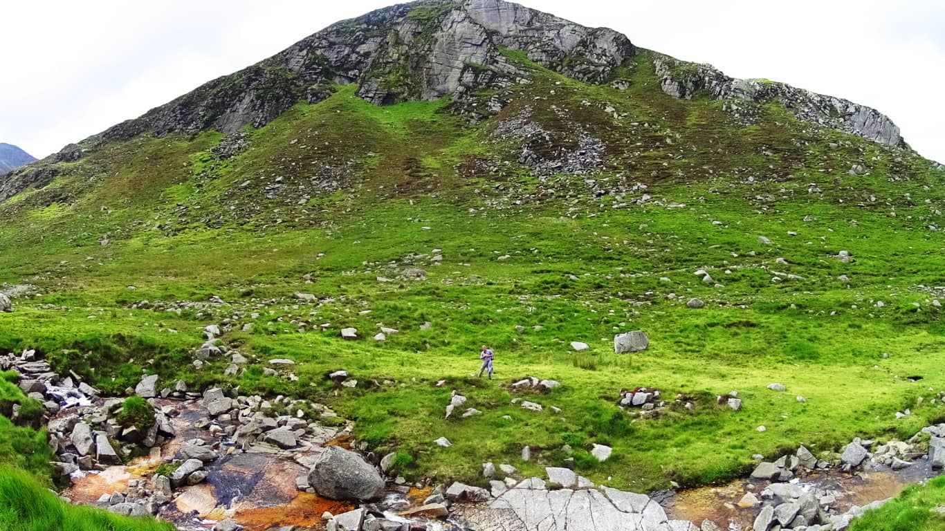
I did the same thing at the ‘center point’ of Bear’s Den Fall’s in Massachusetts (See Bear’s Den/New England/Stonestrider.com), in order to illustrate the central alignment at a specially engineered site, which in this instance is easier to see from close range. The reason for leaning on the ‘center lines’ of potentially symmetrical scenes is to acknowledge the possibility of a mathematical consideration of the overall space, which often leads to real breakthroughs in identifying Neolithic statements. The works of Neolithic craftsman reveal that they were absolutely aware of geometric principles and symmetries. Like Feng Shui, Neolithic symmetries, and spacial statements, create beauty and tranquility in any type of scene. Mount Bearnagh is part of majestically enchanted Range where Neolithic statements continue to increase the further up the valley you go.
Trail: The approach at Mount Bearnagh is practically flawless. It is everything you could want in a day hike. This is a comfortable set of pathways, trails, ancient roads, and riverside runs that steadily progress, first to the Pass, then to the Peak. To the southwest of Bearnagh is a great hiking station and parking plaza with a cafeteria and campgrounds which can be found on-line. Plan your excursion before arriving for best results. Here Irish school-age children set up tents, along with international hikers, in the shadow of the gorgeous southern Mourne Range. Below is a look at the farmers road headed directly out of the Mourne towards the station. 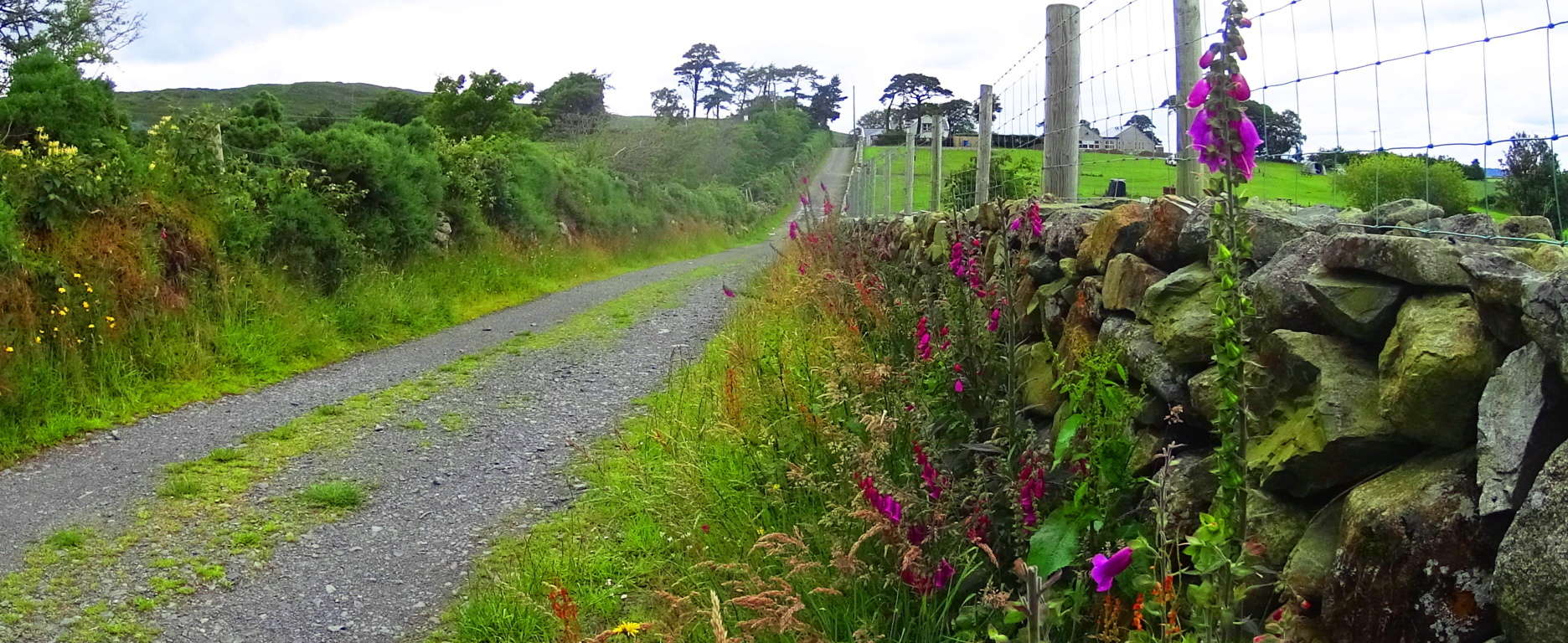
From this simple tractor path you will begin your trek into the Mourne. After about 150 yards you will emerge out of the hedge to find a rocky path. Turn left, heading west along this rocky path for roughly 200 yards. Carefully cross over small streams, fairy pools, and massive stones to eventually come to the main wide valley trail, which is a wide rocky path turning blatantly north. Mount Bearnagh will be directly to your right as you begin to ascend what can only be described as an ancient Celtic road, all the way to the top of the valley 3.5 miles beyond. Roads like these are so ancient that we can only guess as to who built them, and are most often associated with the Celts, although that may not necessarily the case.
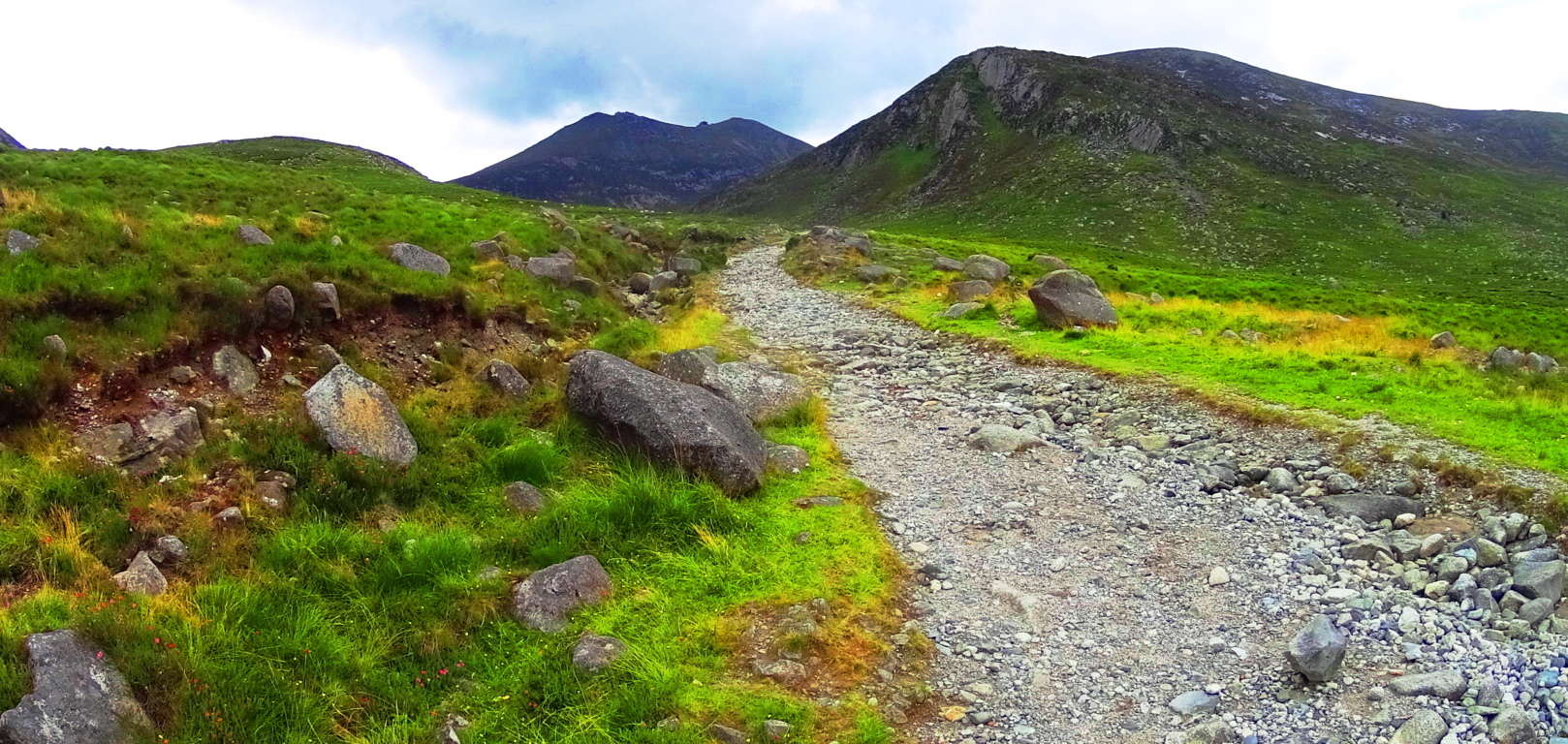
With an entire mountain range before you, and a beautiful rocky stream gushing along to your right, you can steadily make your way up to the Pass. At about 1.5 miles into this part of the trail wildflowers begin to emerge, along with boulders that seem centered on the peaks above. The feeling of rarity and dimensionality sets in; like you’ve stepped into another time. 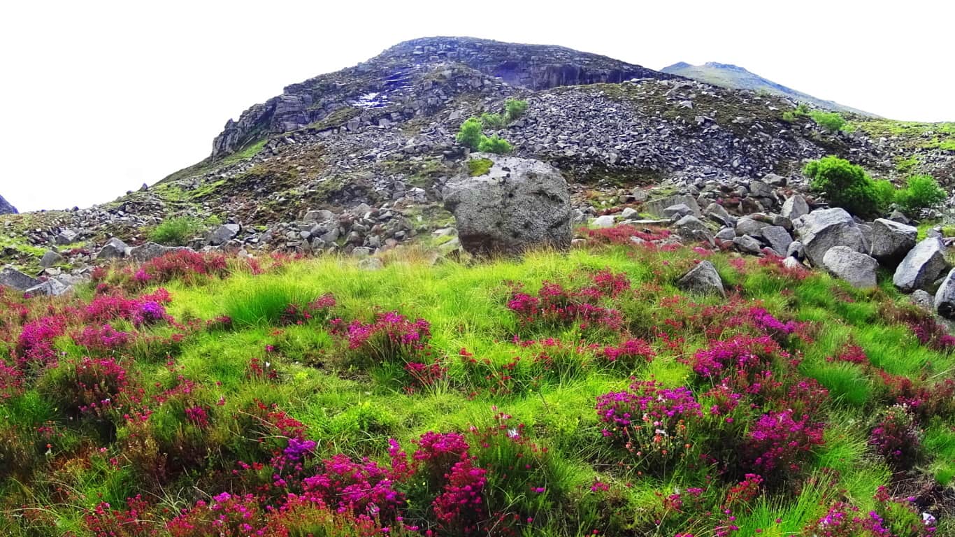 Rising into the area of about 1500 feet above sea level vast amounts of uniquely shaped and colossal crafted stones begin to emerge all around the trail. Often times what looks like arbitrarily placed glacial stones are actually quite the OPPOSITE. A closer look at the inundation of stones all about the valley reveals incredible and strange fixtures of stacked, quarried, and interlocking stones.
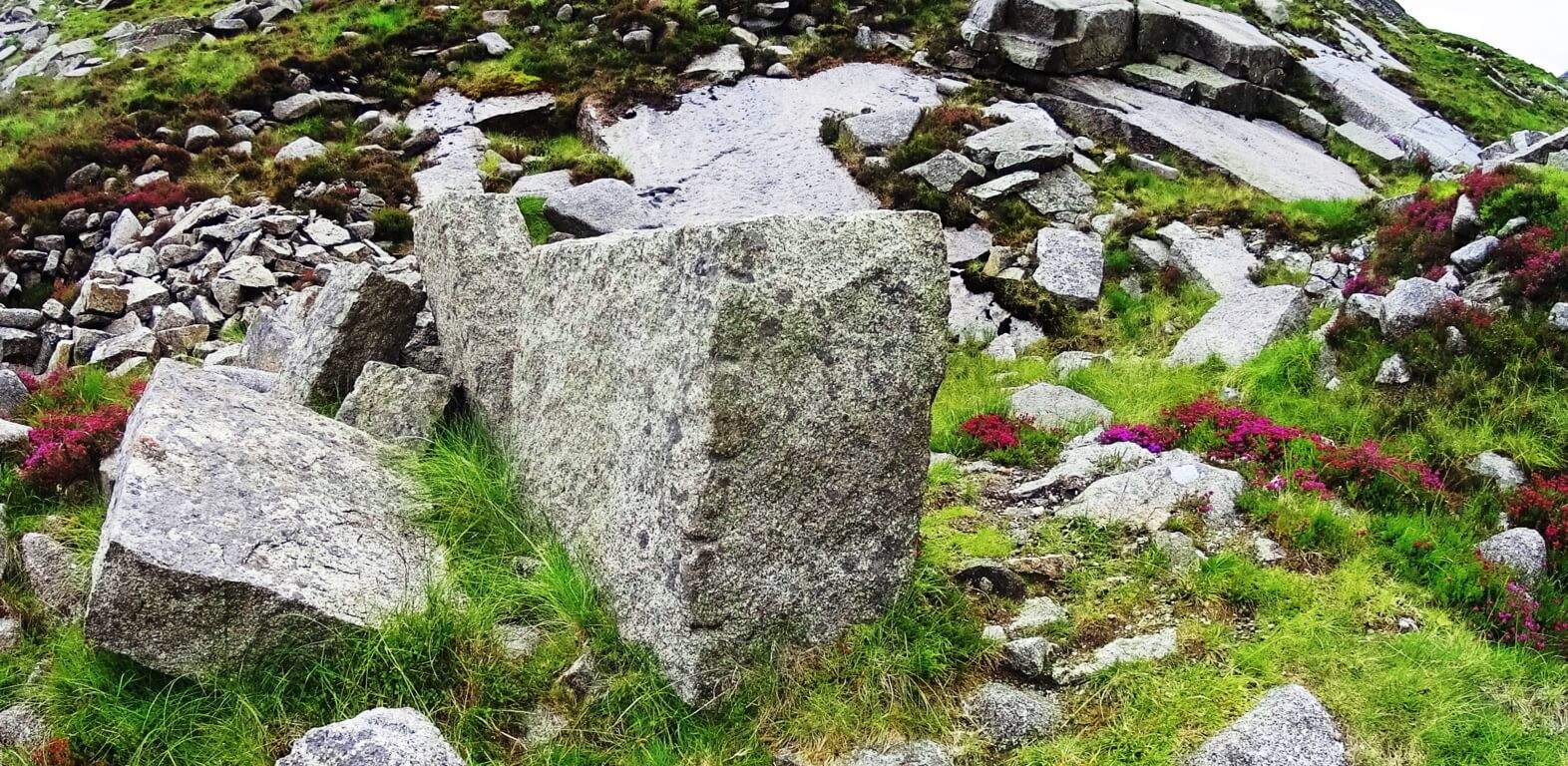 About 3 miles into the trail a beautifully carved and truly amazing megalithic boulder that is encircled by smaller stones. This embracing of smaller stones lends this boulder a certain significance. Looking at this “seat” you cannot help but feel that this stone was created for exactly that purpose, as a “seat” for viewing the valley below. Obviously the amount of work it would take to move this stone is remarkable. Who would do such a thing 1000 feet above the valley?
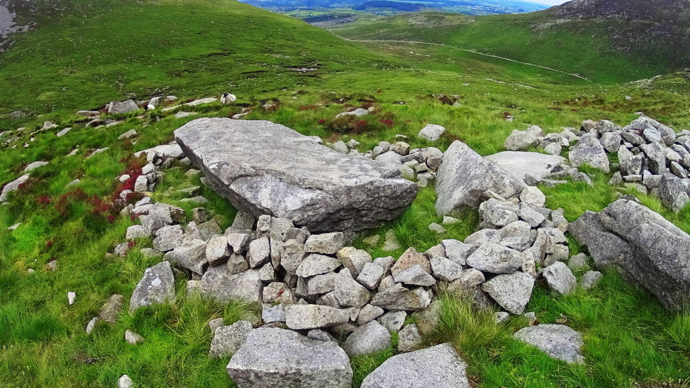
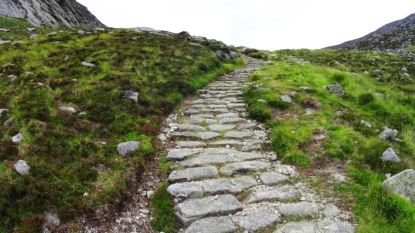
Beyond this amazing “seat” the trail becomes a wonderful stone path veering to the north-east. A heart warming view of the valley below becomes more dramatic with each step. These pathways look like something out of a fairy tale.
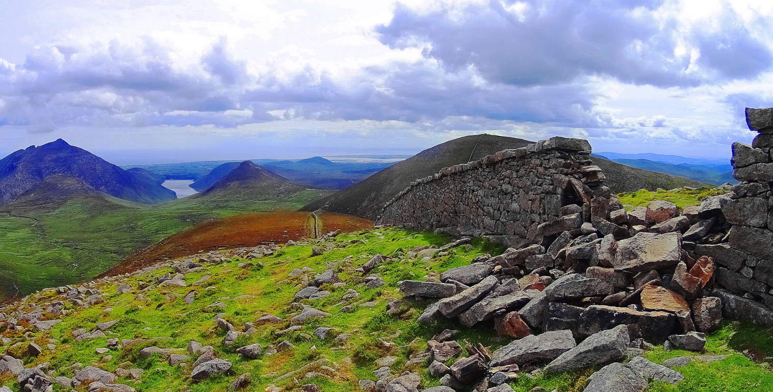
 The Pass at Mount Bearnagh will be a short distance ahead from here, with stone walls from two utterly different era’s guarding the top of the valley.
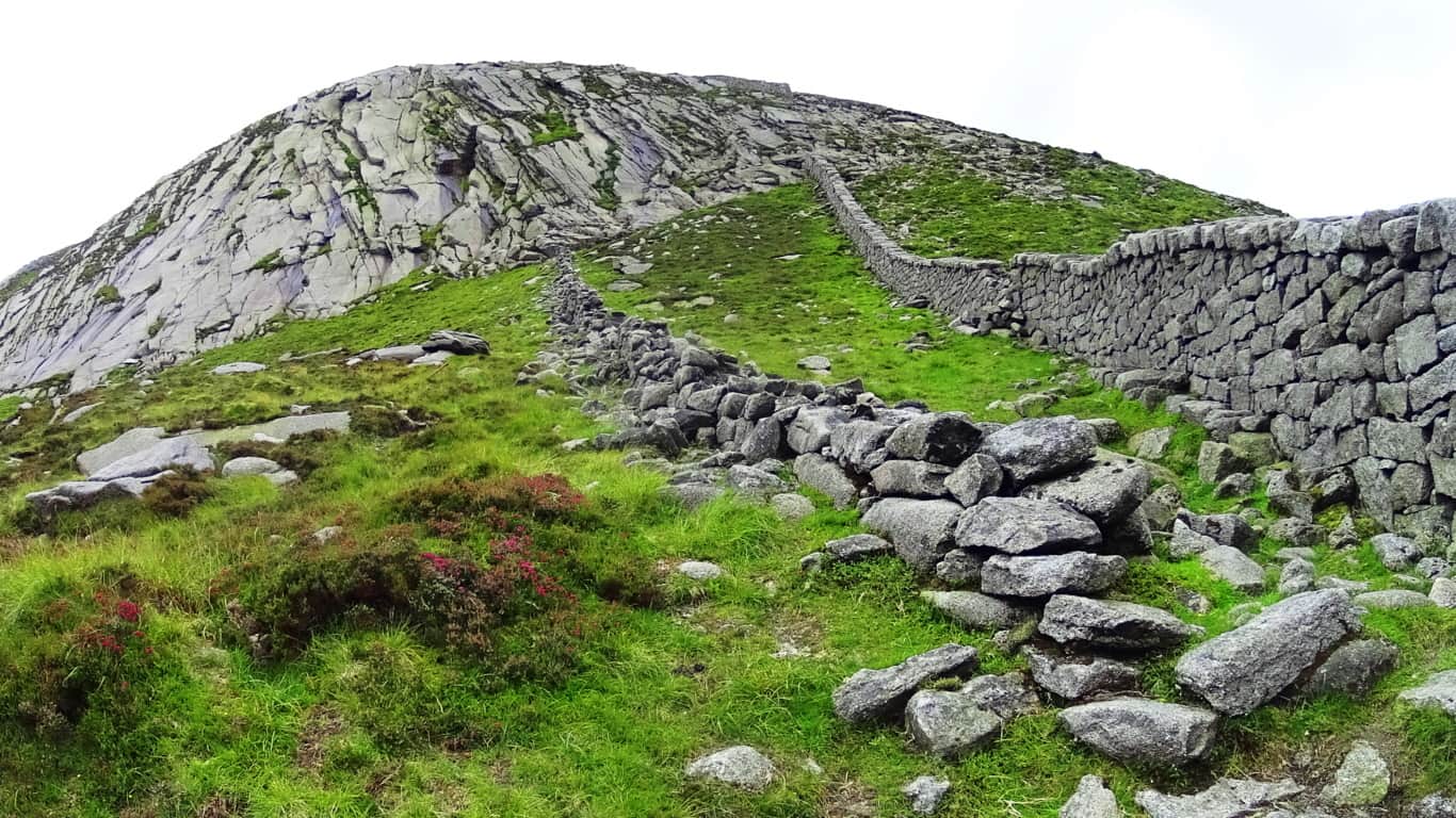
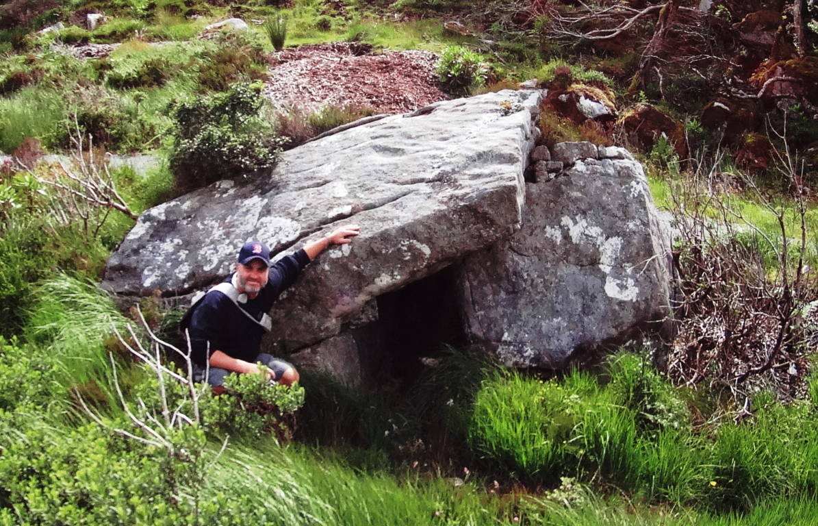
The image above of the Pass at Bearnagh is of two stone structures with a somewhat important historic meaning to convey; we should pause for a moment to consider this. The more modern wall, built in the early 1800’s, can be seen to the right. This is an actual ‘wall’ used to keep farmers flocks from crossing over into the next valley. The structure to the left is not a ‘wall’, but a 4000 to 6000 year old ‘stone-Lining’ that serves an entirely different function. This ‘Lining’ could never restrict the movements of anything in the valley, and was not intended to. Yet it was untouched by the builders of the wall next to it? This Lining could easily have been deconstructed as the most convenient possible supply of stone for the modern wall, some 1800 feet above the valley; why was it untouched? The reason it is preserved is that it is absolutely sacred and has been at this Pass as long as anyone can remember. The Irish have a profound respect for the ancient stones within its borders, and for thousands of years, no one dared touch these stones. So what is the Linings purpose? One hint about its purpose is in the ‘Linings’ positioning. If you will notice, this ‘Lining’ runs straight to the center point of the peak beyond, extending into strange ‘stacks’ running directly up the mountain to the center of the peak. I believe these ‘Linings’ are a type of ‘stone-cable’ that run from peak to peak, cabling subtle energies which run up through the mountain to ultimately culminate at the peak, like a capstone on a pyramid. These same Linings can be found connecting peaks in the small mountains and forests of New England, and is consistent with a pattern of Neolithic engineering found in hundreds of places, and perhaps world wide. In places like this, it feels as if the higher up you go the more strange the stones become. Just 35 yards away from the Lining at the Pass is a type of Cairn, a specific style of which can be found in areas with sacred stones. This type of Cairn has a square ‘roof slab’, with an emblematic looking side stone which stands like a sign in support of the long roof. This creates a kind of temperate storage compartment within the stones, which is what I believe was its use.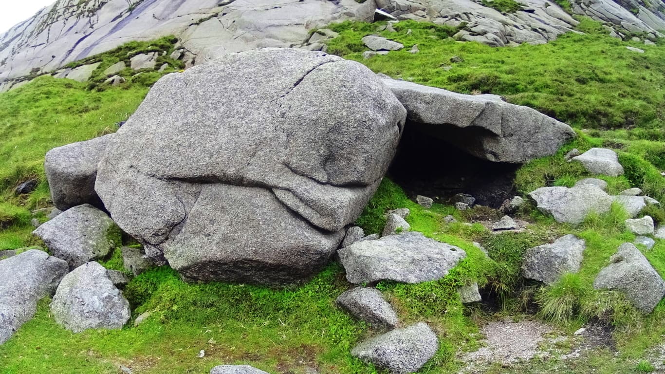 2000 miles away, hidden in the forests of Massachusetts, is a very similar Cairn located in Purgatory Chasm, a rare miniature canyon in the American northeast (featured on Stonestrider.com/Image Below, Left). Another Cairn of this specific style can be found at the highest point of the trail behind Glenveagh Castle in Donegal, Ireland (Image Below, Right).
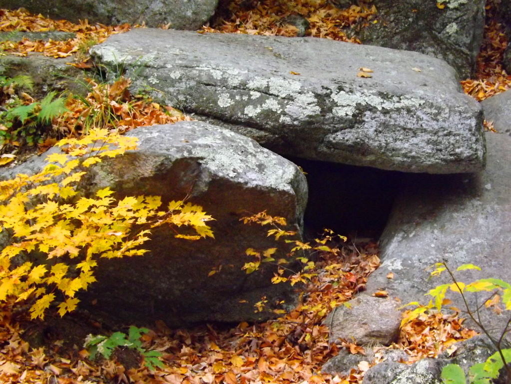
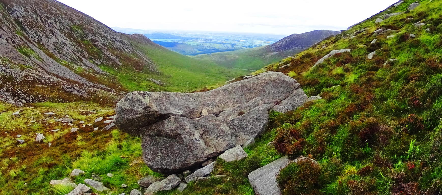
A 20 ton stone about 100 yards down the valley looks to have been somehow sculpted to match the slope of the base of the valley. (Image/Below). This raises all sorts of questions about the earliest culture to inhabit this region. Many of the stones seem to have this reflective quality on the landscape, mimicking features beyond, imitating valleys, building connectors between peaks; who does this? It has an artistic quality, as well as raw ability to build and move massive rock sculptures. Mysterious. And it just gets more mysterious the further up you go.
 The final phase of the ascent at Mount Bearnagh is a solid challenge, but breathtaking.
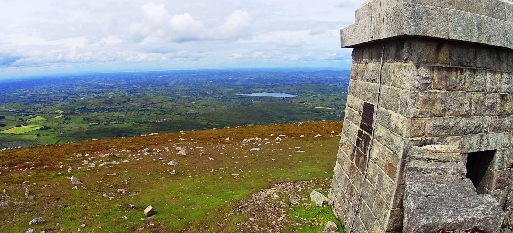 Here you will turn right and follow the modern wall directly up the side of the mountain for about another 3/4 of a mile to the small tower sitting above the Range.
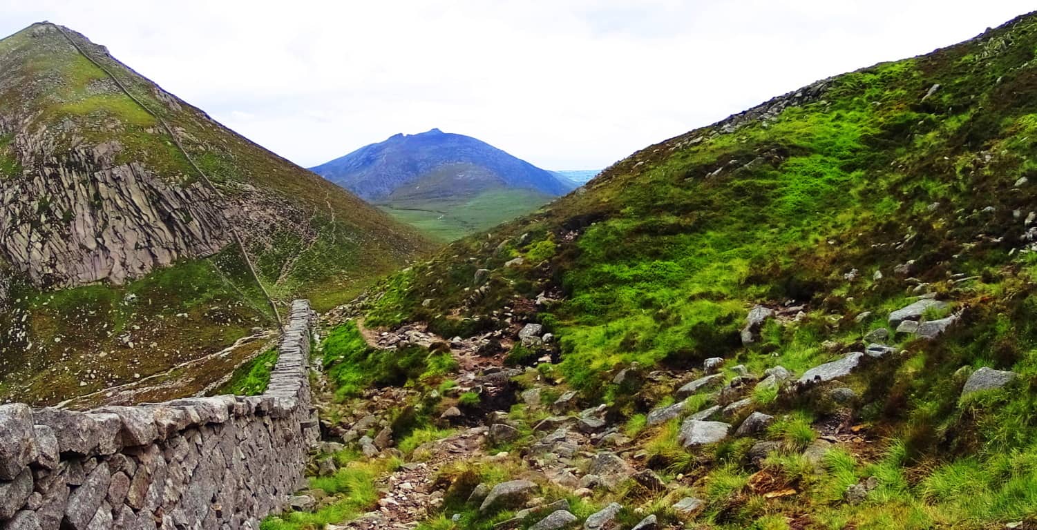 In this most elevated region the mountainside becomes inundated with dramatic sections of stone, much of which has been marked, measured, and cut into curious fixtures. While hiking you can look closely at some of the stone statements that are totally distinct. Below is an example of spirally stacked stones that are mingled with pieces that are clearly marked, measured, and cut. This piece I’m pointing at in the image below contains a stone with three equidistant measured markings for cutting along its side; it was obviously intentional.
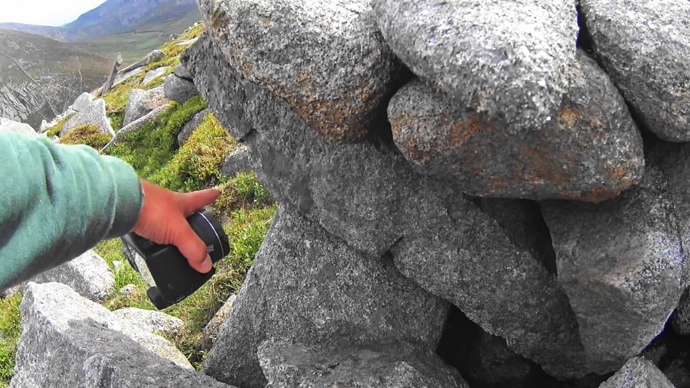
There are hundreds, if not thousands, of crafted stones to be found here, all utterly undocumented artifacts. What are they doing at 2,200 feet above the valley? Here again is another set of stones which look to have been specifically cut in order to mimic the slope of the mountains beyond. (Image Below) I noticed the boulder on the right side of the picture from over 50 yards away. It has been sliced, as you can see, and the angle of that slice imitates the slope of the eastern face of the mountain beyond,

The shape of the stones imitates a rock fixture nearly at the top of the opposite slope beyond. Notice also the thin rounded plate to the left which imitates the exact angle and roundness of the peaks on the left. These stones were absolutely placed this way to specifically mimic the opposite mountains. Unreal.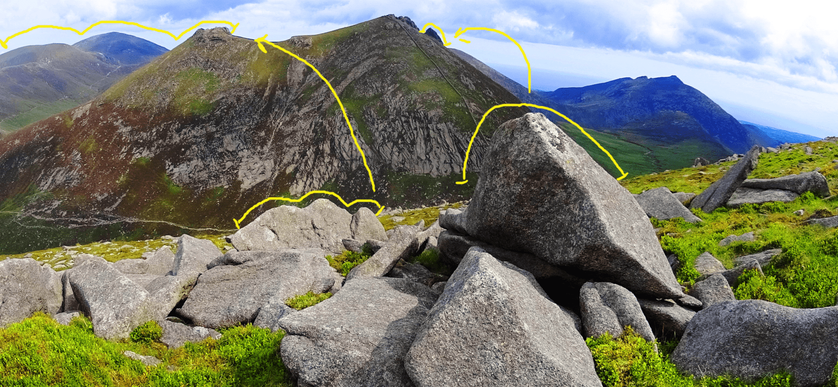 I am aware that this is a challenge for people to accept; I too found it a challenge for years. But time and time again, similar expressions arise in challenging elevations that are begging to be noticed, both in Ireland, and New England (as well as the rest of the world). This is a form of megalithic expression that we are simply not accustom to acknowledging, as it has been mostly ignored by the academic community. The real question you should eventually ask is: “How could they ignore an entire mountainside of marked and positioned stones?” The logical questions that arise would challenge our picture of Neolithic history, and that looks to be what modern academia will not allow. Just beyond this magical fixture is the small tower, where a 360 degree view comes into full focus. On clear days you can see Wales on the other side of the Irish Sea! Below is the simple southern view from which your hike began.
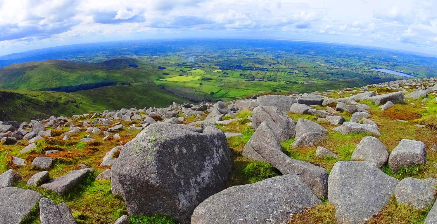 The modern stone wall continues along the elevated porch of the upper mountains, twisting surreally through the Mourne beautifully (Top Image of Article). Many hikers choose to continue hiking from small tower to small tower, while others, like myself, made the return descent back to the Pass and down the Valley.
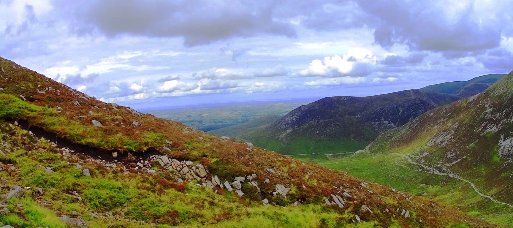
The colors here are a spongy mixture of rugged and rusty oranges mingled with profound jade and deep mossy green. The clouds play a pocketed game, with shafts of light seeping through the fast moving heavens; light arrives, sometimes in flashes over broad portions of the Mourne, while at other times appearing in prolonged beams of revelation. The air is cool and forgiving. If you have a small water purifier you could drink from the wide stream heading down the central portion of the valley back to the bottom. Enjoy the benefits of gravity assisting your 3.5 mile trek back to the station. This place has the potential to be one of the best day hikes you will ever have in your life. What more do I need to say about such a place? Find your way.
The Hen Mountain/Mourne Range/Ireland
 Location: Newry Ireland
Elevation: 1653 ft/5o8m
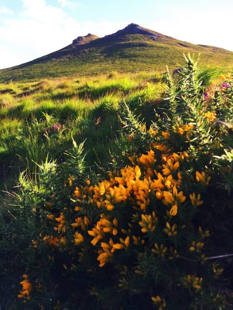
The Hen Mountain sits at the northeastern extremity of the Mourne Mountain Range. It is the lessor elevated gateway to an area known nationally as a “place of outstanding beauty”, rolling east all the way to the harbor city of Newcastle, and the dreamy Irish Sea. The gorgeous hamlet of Hilltown sits just west of The Hen, which is the practically perfect jumping-off point for this small mountain. The main car park for The Hen Trail is off Sandbank Road, near the beautiful River Bann, which can easily be found. The Hen, with it’s classically Celtic treeless approach, is entirely welcoming. I was so drawn to the view of this small summit from my deck at Hilltown that I literally ran down to the River Bann, hopped the fence, crossed the rocky river bed, and started an ascent from the northwest with my sneakers on. The image on the left was taken while standing in my sneakers at the base of the Mountain. It was just that type of day. When the Sun comes out in Ireland the landscape becomes a vision. The wildflowers in the area glow in variations of gold, green, and velvet.The image below shows Mount Hen, second from the left, taken from my accommodations in Hilltown. This was exactly how I pictured J.R.R Tolkien’s “Shire”.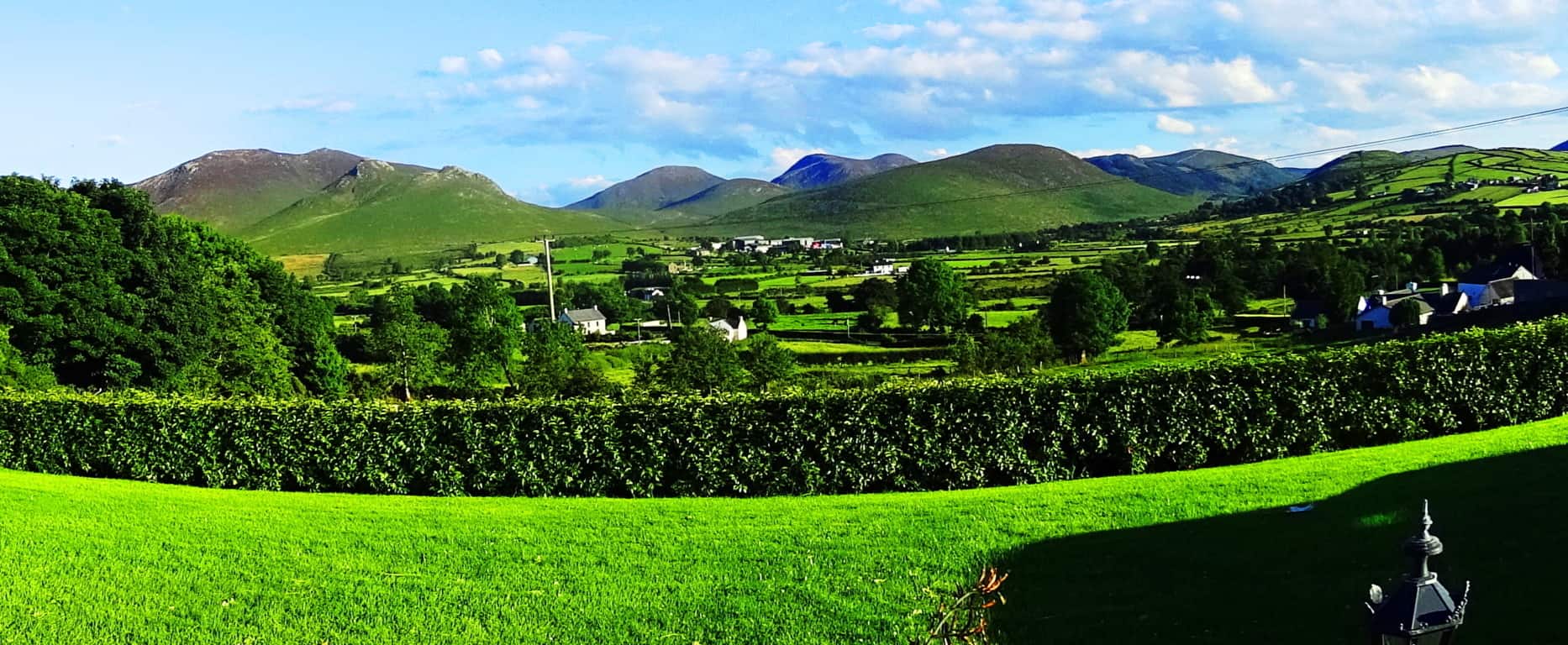
The River Bann reminded me of so many rocky streams in the Massachusetts hills, with several massive free-standing boulders lining the sides of the flowing stream. The scientific explanation for these boulders is, of course, glacial, but several of the larger stones look as if they had been cut and angled specifically, which is often found near sacred mountains in New England, and here in The Mourne. Additionally, coming from New England, where the forests are an overpowering aspect to any landscape, views like this, where not even a single Hawthorn tree can be seen on the horizon, are a constant surprise to the senses. It is truly surreal. The mountains are roughly the same scale as New England’s smaller ranges, but the peaks just look so much more stoic, without one single tree. 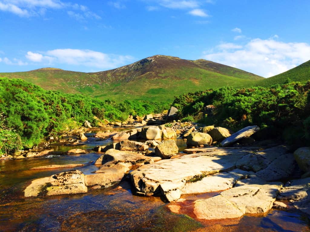 The Sandbank Trail is actually on the other side of the Mountain from this spot on the river, along the eastern face, about 400 yards away. In Celtic places the opportunity to wander should be embraced; there are no animals that could overpower you (like a Bear or Wolf), and the chances of stumbling upon Neolithic expressions are pretty good. And perhaps most importantly, this is one of the best places in the world to take out your camera(s).
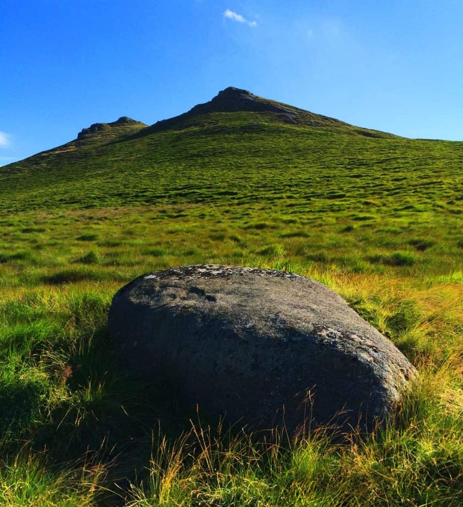
Heading directly up the mountainside from the river, climbing over the farmers fence, I came across this lonely boulder. It was a like seat for watching the lower valley.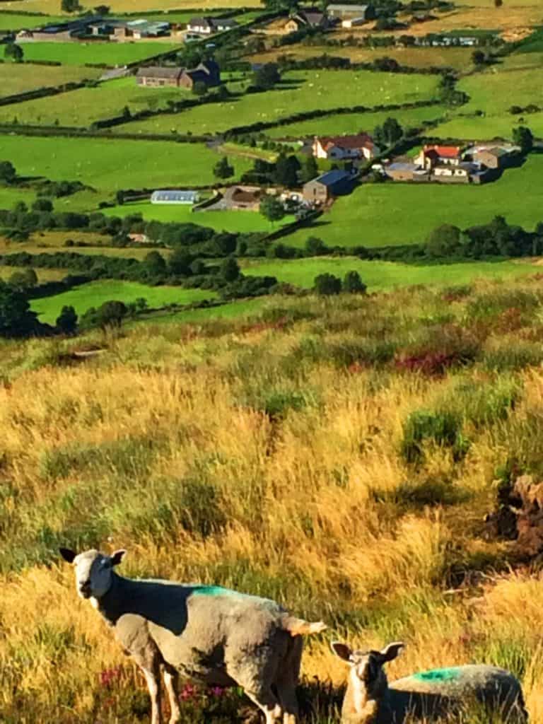 Flocks of sheep rove the hillside with farms in foreground, all bustling and interwoven into a rural tapestry that America has almost forgotten. Ireland remains one of the the most functionally rural European country’s, where men over the age of 70 can be seen in the tractors hauling hay, while the elderly in America linger in nursing homes. Experiencing a nation where the food is fresh, without preservatives and processing, can have your body feeling stronger and more awake, in a relatively short period of time. Here I will venture to share a rare introspective moment that took place from this beautiful scene. Things at times become incredibly clear while hiking, super-clear. I began to think about America, and it was perhaps a thought I had been waiting to have for some time. Americans are confronted with a universe of processed and artificial foods on a daily basis, wars, social movements, and scandals, and while hiking in the safety of a place like this, I simply could not help but wonder what the hell has been going on in the United States for the last 15 years, and how the rest of the world truly sees us. It is borderline embarrassing. Ironically, so many locals in Newcastle expressed their desire to be in Boston, where I was from, having little awareness of the truly challenging social experience America forces upon its citizens today. All of this crossed my mind as I made my climb. Turning and facing the peak the wildflowers ran concentrically in what felt like a spiraling parade of color, radiating down the ledge. These are the places to wade in, like wandering into a dream.
 The brush here is deep, knee high, and strenuous to climb. The Irish Sea is only about 7 miles away, and the hedges have a toughness to them, a saltiness just beneath the surface, perhaps carried on the wind. Complimenting this faint ocean breeze is a strong Sun which can be felt warmly on the skin. Although many people do not picture Ireland’s climate in this way, when the Sun is out, windburn is a real possibility in the heights; in The Mourne the body can be fooled by the wind, seeming cool while outside, but later revealing a burn when out of the breeze.
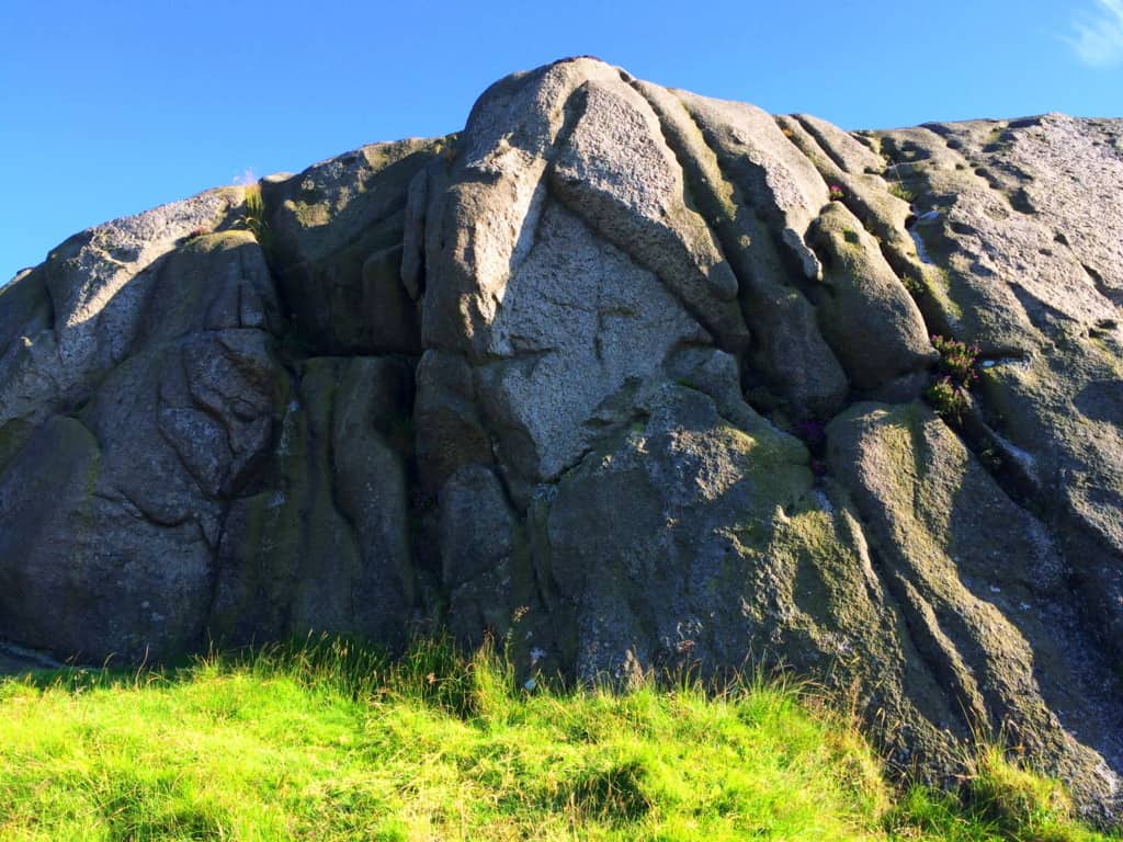
It is said by Hebrew texts, that the fall of 300 angels took place, once upon a time, upon Mount Hermon, in Lebanon. While hiking in the heights of many mountains this is a story that has crossed my mind many times, especially while approaching peaks. If this story were true, than this culture of fallen angels would have claimed the high places first, coming from above, however surreal it sounds. And what we find in so many of the high places, in mountain ranges all across the world, are megalithic statements of impossibly large, but crafted stones. Hen Mountain’s peak is capped in solid rock, with indents and fixtures that are seemingly crafted into it. The anthropological side of hiking takes place as you explore the rocky ledges in the heights, and turn to see the beauty of the valley below.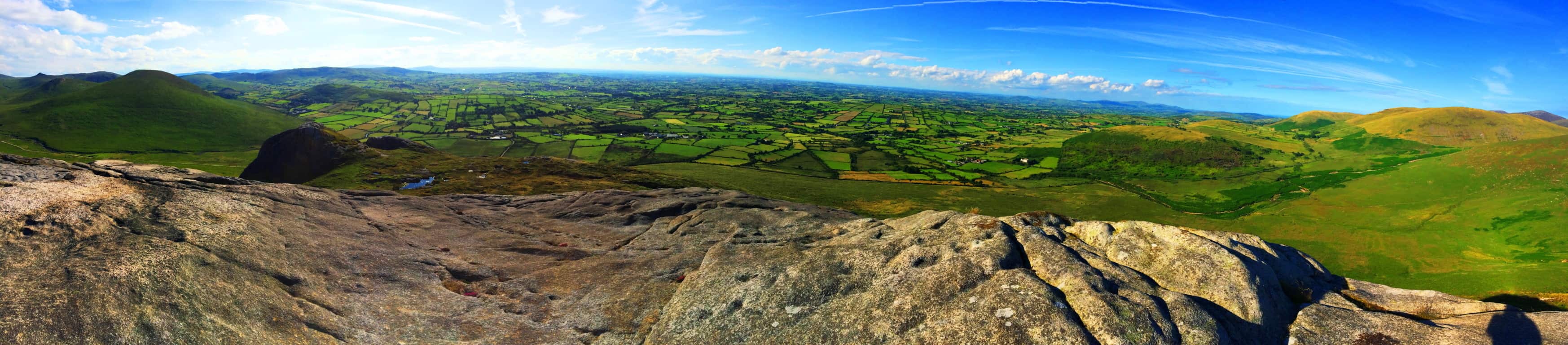 Simply put, the rocks tell a story, and a well trained eye can read that story. There are lineations in the rocky peak that are hard to describe. These parallel streaks look to have been burned, or smelted into the stone. These streaks look eerily like they were made to mimic the rippling landscape beyond, all at the top of the mountain.
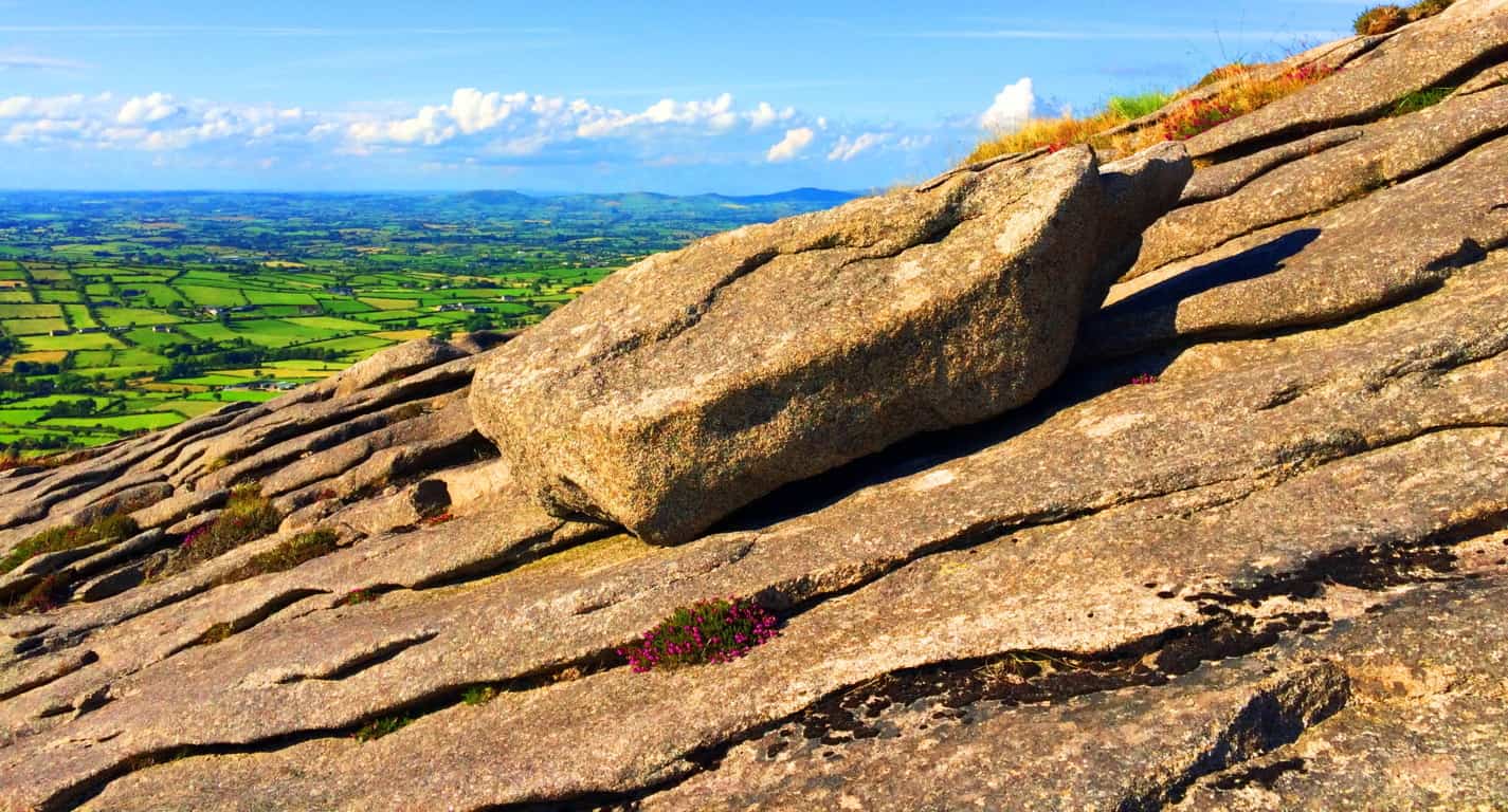 Here at the peak, this single 1 ton stone sat freely and in complete coherence with the parallel streaks beneath it. There were no other stones like it. With the scruffy wildflowers that somehow spurt out of the crags in the rock, and the layers of green beyond, this feels like the precipice of another world, however small the mountain truly is. This is the game that the peaks of mountains play, no matter what part of the world you find yourself in. At only 1,653 feet the feeling on Hen Mountain is still ‘top of the world’, as the Celtic landscape rolls nakedly away into the horizon.
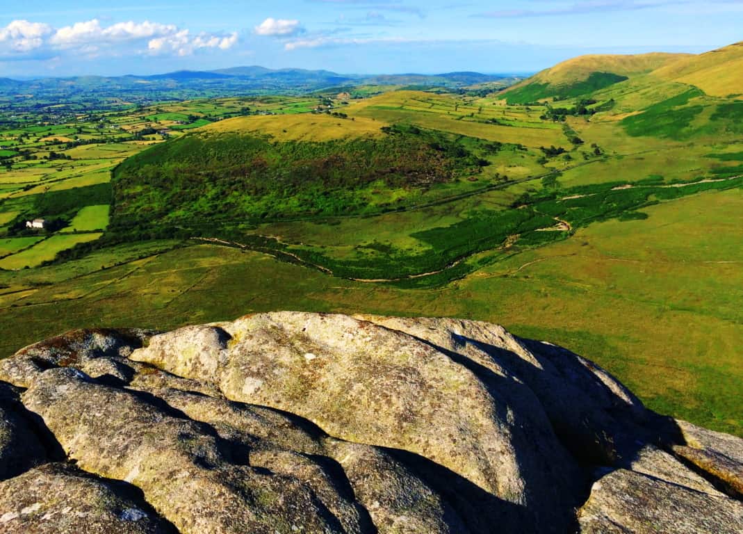
Facing to east at the peak Sandbank Trail can be seen approaching an elevated knoll at about 1200 feet, just below. The view beyond this “porch” is stunning, leading all the way to across the Mourne to Newcastle at the coast. In this spot there are two distinct rocky fixtures that sit like ‘gates’ as the trail passes through, and between these two fixtures is a free standing boulder that I believe was placed here as a kind of ‘marker’. A closer look at this rocky “gateway” and boulder revealed a compelling case for megalithically cultural craftsmanship.
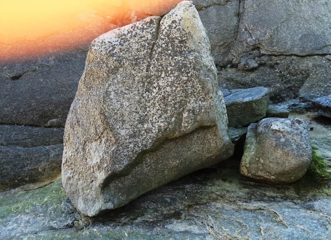 This boulder stood perfectly square at roughly 8 feet high, and 3 feet thick, upon level rock beneath. The indentation of the lower portion of the boulder, again, had the look of ‘smelted’ rock, of a design, like a cherished chair. What is more compelling about this megalith, is the exact spot upon which stands, in a beautiful gateway on the northeastern edge of the entire Mourne range, as if to say “Welcome to The Mourne, enter!” Beyond this very spot is every other mountain in the region, including Bearnagh Mountain, which contains some of the most ancient roads, and cultural stones, in the entire world.
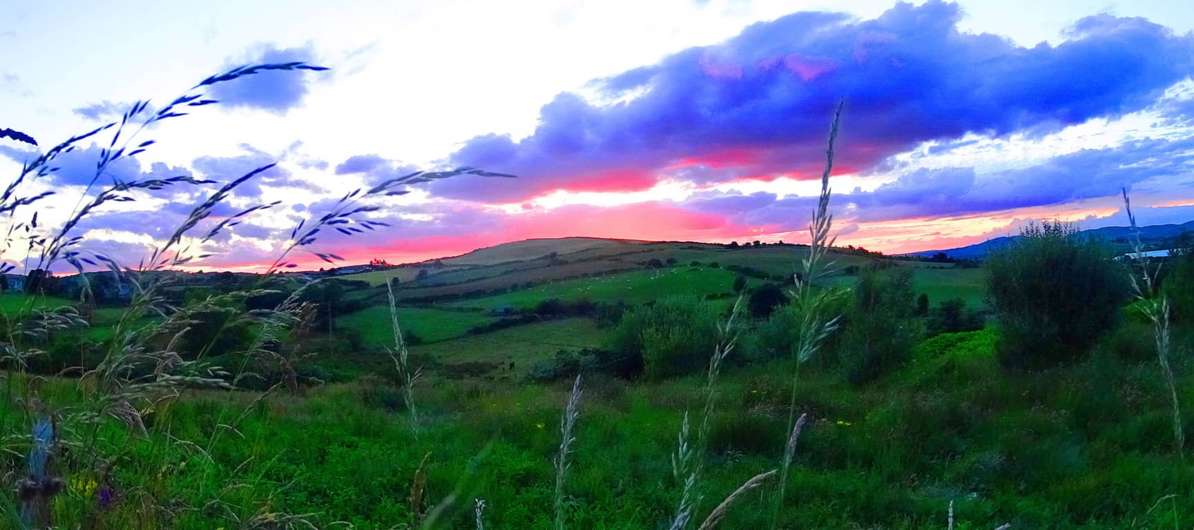
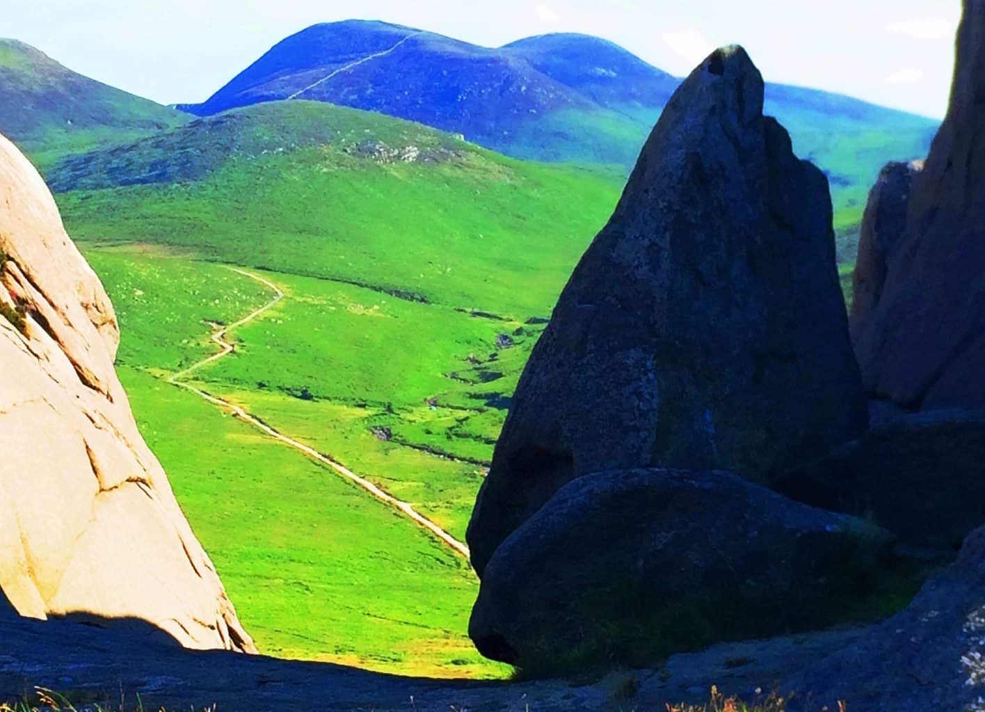 If you ever come to The Mourne Mountains, The Hen’ is a perfect place to either begin, or end your experience, as a ‘gateway’ for the entire range and relatively pleasant climb. As all hikers do, I eventually made my way back down into the valley-village of Hilltown, and simply walked back east along the Sandbank Road. Be careful here, the Irish drive at one speed, fast. On my last day in The Mourne I witnessed a sunset from the eastern edge of Hilltown that sums up the entirety of the potential experience, stunning. Anyone visiting here can experience a waking dream; it is simply a matter of going. And although this particular article was filled with more personal introspection than usual, I would like to reiterate that the soul point of each featured place is to make the hike tangible for you, the reader, so you can picture yourself getting there, above the valleys, to the stone gateways in the clouds. Thanks for reading, and go strong.