Mount Bearnagh
Location: Newry/Northern Ireland/U.K
Elevation: 2,385 ft
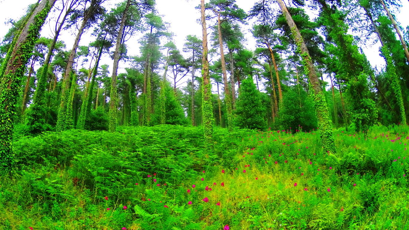
Note: In an almost hidden pocket of Northern Ireland, several hours drive north of Dublin, along the Irish Sea, sits the majestic Mourne Mountain Range. This is a region of beautiful mid-size peaks with approaches that are for everyone, not just the highly trained. The hike here includes a 4000 year old stone pathways which elevates steadily and comfortably into the heights. These ancient trails run beside wide streams and ledges that roll playfully down from the rocky mountain passes, and feel cool and comfortable in this northern latitude. In the heights of the mountains are cinematically continuous stone walls which stretch surreally from peak to peak, like a “Rangers Highway”. There are stunning ancient stone statements here as well. Original stoneworks here date back to the first culture, a culture which left its mark on this hauntingly beautiful place, perhaps 6000 years ago, or more. The southern face of Mount Bearnagh has a distinct ‘top porch’ which is level at the peak, with similarly sloping sides, giving the entire face a symmetrical feel. If you look close at the image below you may think its hard to find me in such a massive space; but redirect your eye to the exact center of the overall mountain, then follow that center line down to the stream, and you will see me standing at that exact center line of the scene. I am leaning a little to my right just enough to put my right eye along that center line; indicating that its possible to see potential symmetries in even the grandest spots.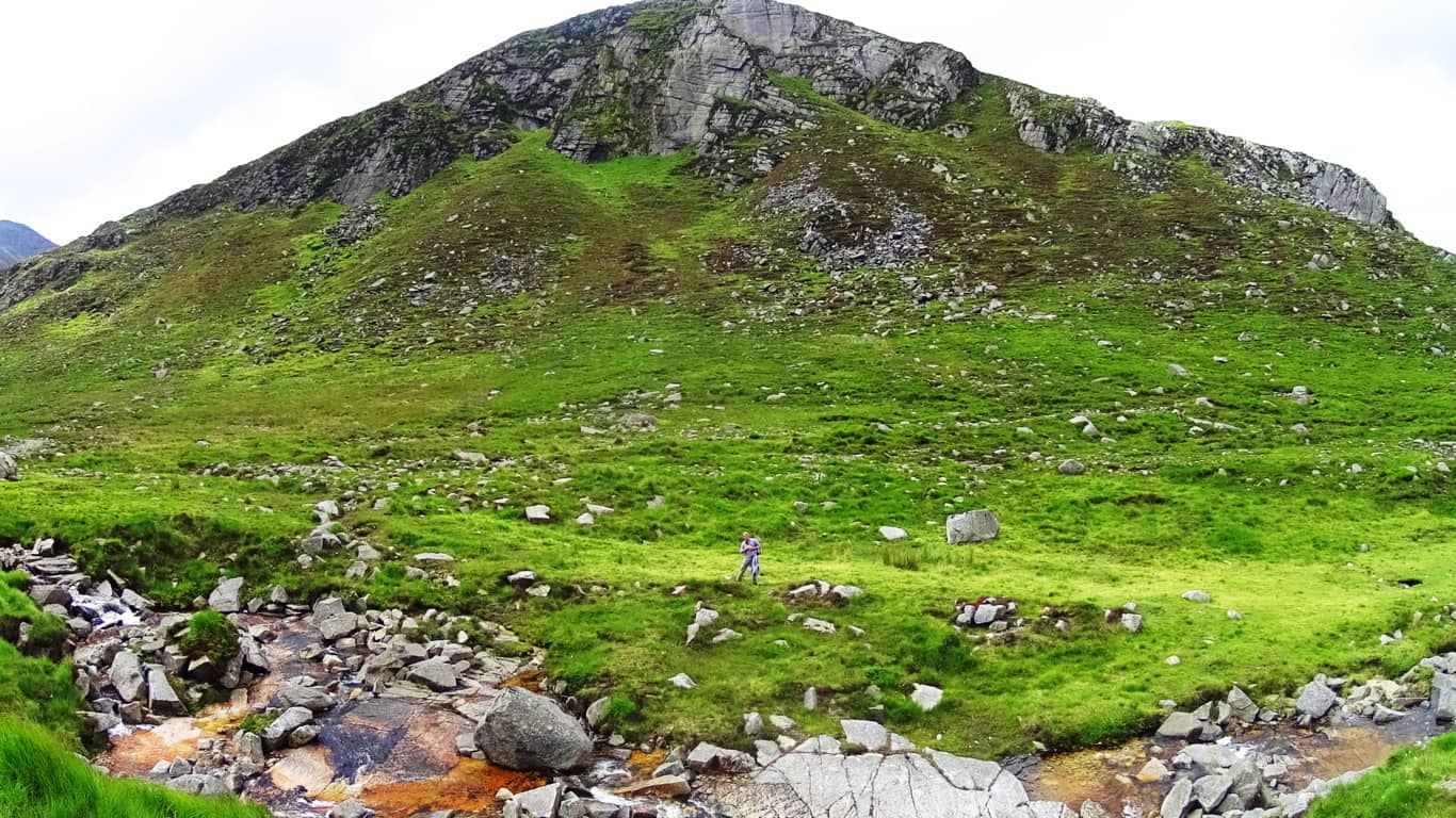
I did the same thing at the ‘center point’ of Bear’s Den Fall’s in Massachusetts (See Bear’s Den/New England/Stonestrider.com), in order to illustrate the central alignment at a specially engineered site, which in this instance is easier to see from close range. The reason for leaning on the ‘center lines’ of potentially symmetrical scenes is to acknowledge the possibility of a mathematical consideration of the overall space, which often leads to real breakthroughs in identifying Neolithic statements. The works of Neolithic craftsman reveal that they were absolutely aware of geometric principles and symmetries. Like Feng Shui, Neolithic symmetries, and spacial statements, create beauty and tranquility in any type of scene. Mount Bearnagh is part of majestically enchanted Range where Neolithic statements continue to increase the further up the valley you go.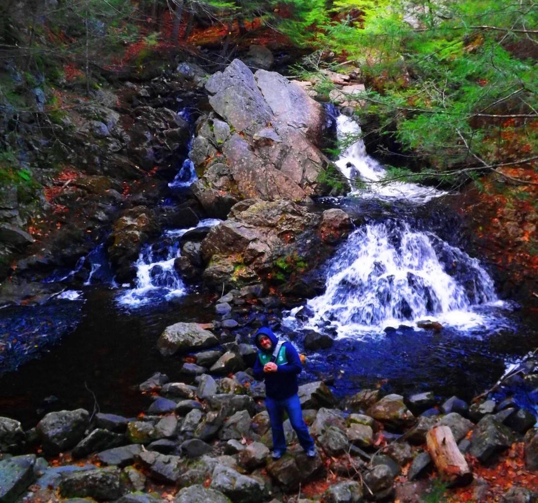
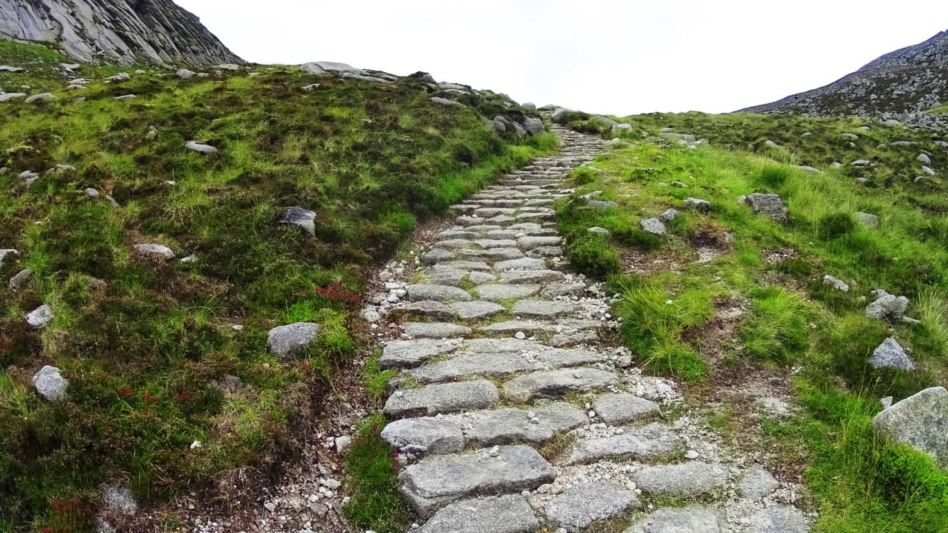
Trail: The approach at Mount Bearnagh is practically flawless. It is everything you could want in a day hike. This is a comfortable set of pathways, trails, ancient roads, and riverside runs that steadily progress, first to the Pass, then to the Peak. To the southwest of Bearnagh is a great hiking station and parking plaza with a cafeteria and campgrounds which can be found on-line. Plan your excursion before arriving for best results. Here Irish school-age children set up tents, along with international hikers, in the shadow of the gorgeous southern Mourne Range. Below is a look at the farmers road headed directly out of the Mourne towards the station. 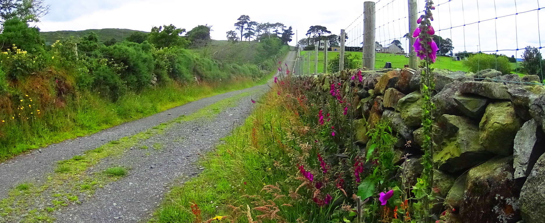
From this simple tractor path you will begin your trek into the Mourne. After about 150 yards you will emerge out of the hedge to find a rocky path. Turn left, heading west along this rocky path for roughly 200 yards. Carefully cross over small streams, fairy pools, and massive stones to eventually come to the main wide valley trail, which is a wide rocky path turning blatantly north. Mount Bearnagh will be directly to your right as you begin to ascend what can only be described as an ancient Celtic road, all the way to the top of the valley 3.5 miles beyond. Roads like these are so ancient that we can only guess as to who built them, and are most often associated with the Celts, although that may not necessarily the case.
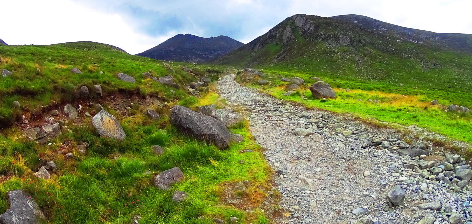
With an entire mountain range before you, and a beautiful rocky stream gushing along to your right, you can steadily make your way up to the Pass. At about 1.5 miles into this part of the trail wildflowers begin to emerge, along with boulders that seem centered on the peaks above. The feeling of rarity and dimensionality sets in; like you’ve stepped into another time. 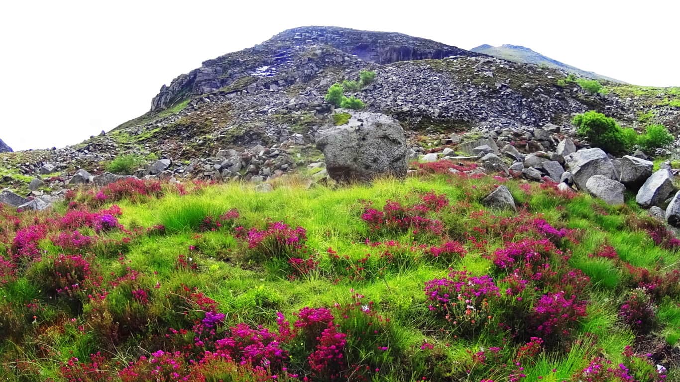 Rising into the area of about 1500 feet above sea level vast amounts of uniquely shaped and colossal crafted stones begin to emerge all around the trail. Often times what looks like arbitrarily placed glacial stones are actually quite the OPPOSITE. A closer look at the inundation of stones all about the valley reveals incredible and strange fixtures of stacked, quarried, and interlocking stones.
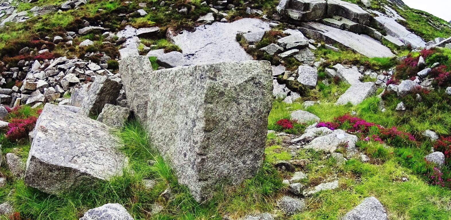 About 3 miles into the trail a beautifully carved and truly amazing megalithic boulder that is encircled by smaller stones. This embracing of smaller stones lends this boulder a certain significance. Looking at this “seat” you cannot help but feel that this stone was created for exactly that purpose, as a “seat” for viewing the valley below. Obviously the amount of work it would take to move this stone is remarkable. Who would do such a thing 1000 feet above the valley?
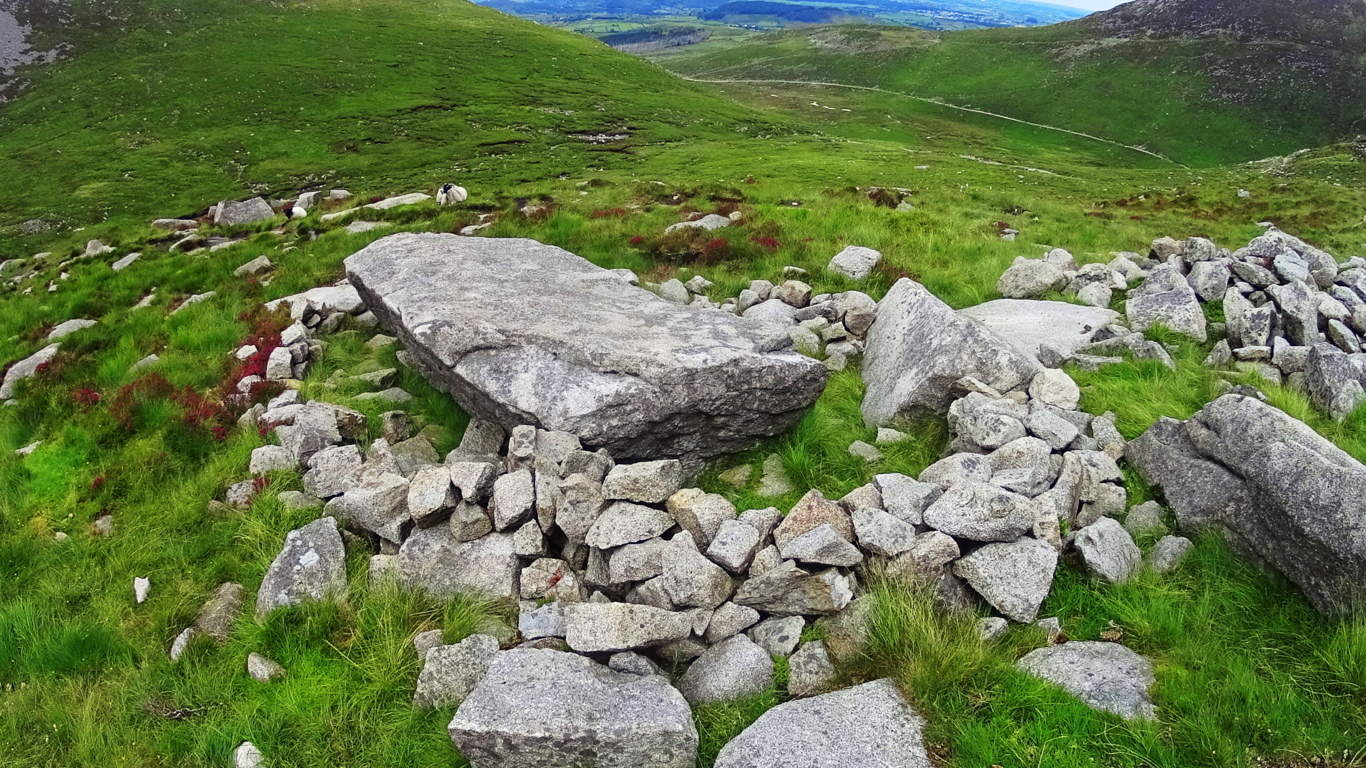
Beyond this amazing “seat” the trail becomes a wonderful stone path veering to the north-east. A heart warming view of the valley below becomes more dramatic with each step. These pathways look like something out of a fairy tale.
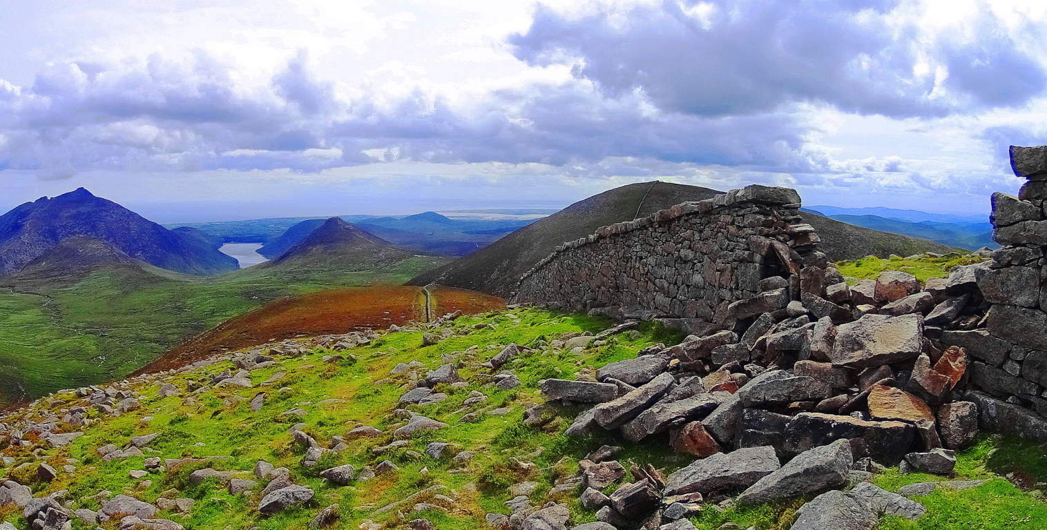
 The Pass at Mount Bearnagh will be a short distance ahead from here, with stone walls from two utterly different era’s guarding the top of the valley.
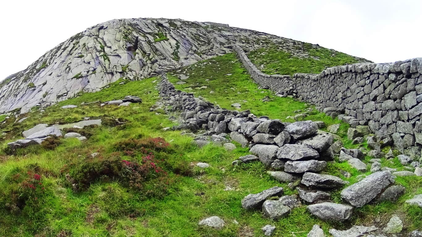
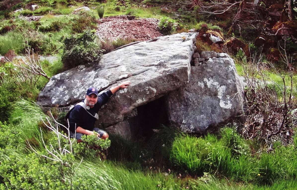
The image above of the Pass at Bearnagh is of two stone structures with a somewhat important historic meaning to convey; we should pause for a moment to consider this. The more modern wall, built in the early 1800’s, can be seen to the right. This is an actual ‘wall’ used to keep farmers flocks from crossing over into the next valley. The structure to the left is not a ‘wall’, but a 4000 to 6000 year old ‘stone-Lining’ that serves an entirely different function. This ‘Lining’ could never restrict the movements of anything in the valley, and was not intended to. Yet it was untouched by the builders of the wall next to it? This Lining could easily have been deconstructed as the most convenient possible supply of stone for the modern wall, some 1800 feet above the valley; why was it untouched? The reason it is preserved is that it is absolutely sacred and has been at this Pass as long as anyone can remember. The Irish have a profound respect for the ancient stones within its borders, and for thousands of years, no one dared touch these stones. So what is the Linings purpose? One hint about its purpose is in the ‘Linings’ positioning. If you will notice, this ‘Lining’ runs straight to the center point of the peak beyond, extending into strange ‘stacks’ running directly up the mountain to the center of the peak. I believe these ‘Linings’ are a type of ‘stone-cable’ that run from peak to peak, cabling subtle energies which run up through the mountain to ultimately culminate at the peak, like a capstone on a pyramid. These same Linings can be found connecting peaks in the small mountains and forests of New England, and is consistent with a pattern of Neolithic engineering found in hundreds of places, and perhaps world wide. In places like this, it feels as if the higher up you go the more strange the stones become. Just 35 yards away from the Lining at the Pass is a type of Cairn, a specific style of which can be found in areas with sacred stones. This type of Cairn has a square ‘roof slab’, with an emblematic looking side stone which stands like a sign in support of the long roof. This creates a kind of temperate storage compartment within the stones, which is what I believe was its use.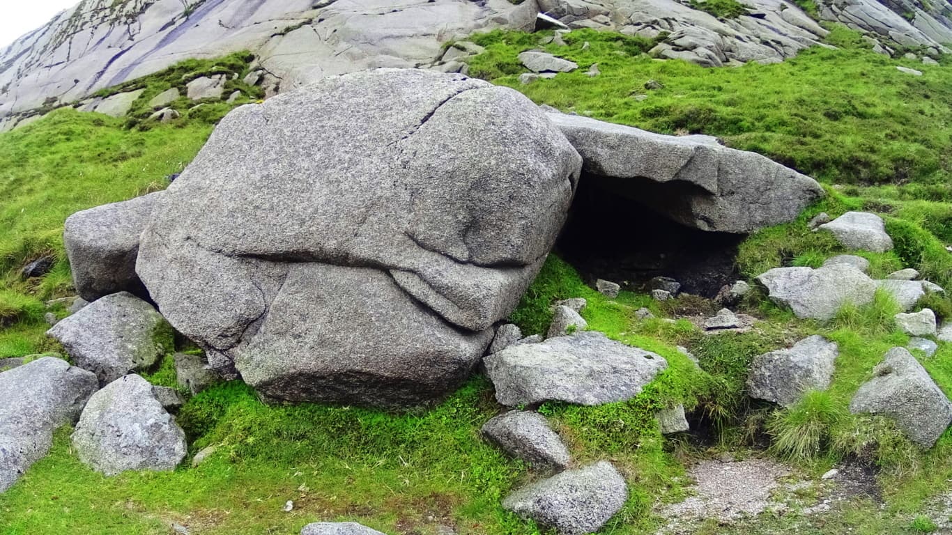 2000 miles away, hidden in the forests of Massachusetts, is a very similar Cairn located in Purgatory Chasm, a rare miniature canyon in the American northeast (featured on Stonestrider.com/Image Below, Left). Another Cairn of this specific style can be found at the highest point of the trail behind Glenveagh Castle in Donegal, Ireland (Image Below, Right).
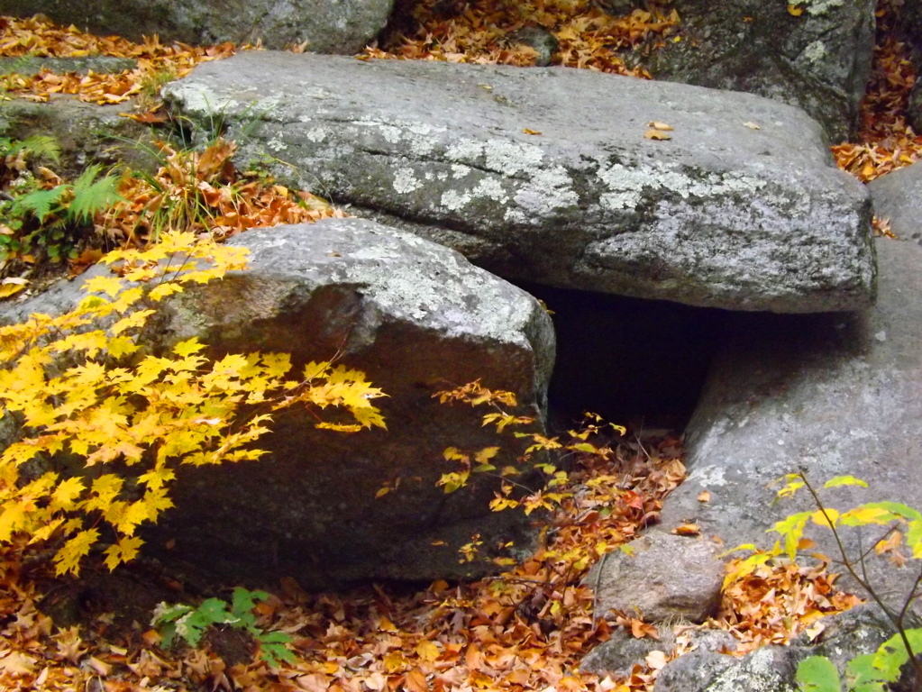
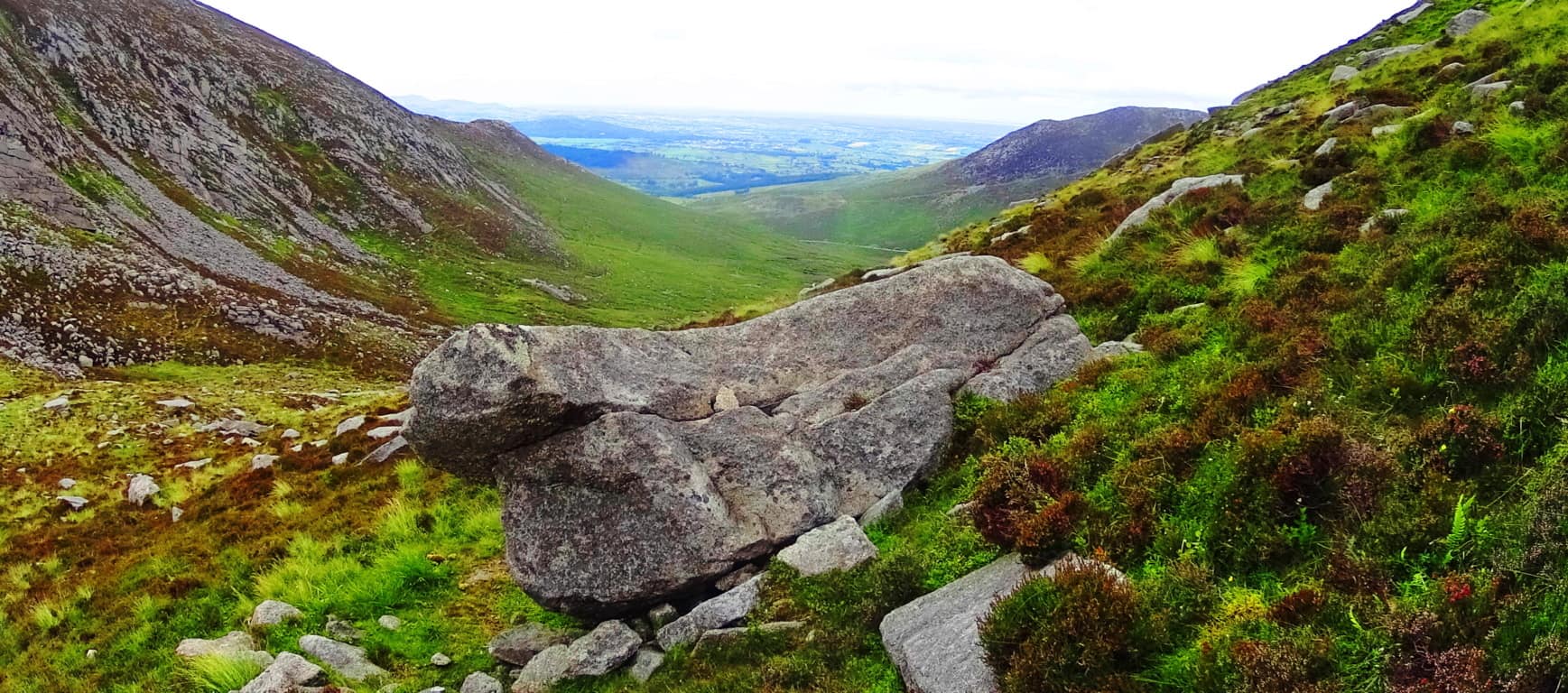
A 20 ton stone about 100 yards down the valley looks to have been somehow sculpted to match the slope of the base of the valley. (Image/Below). This raises all sorts of questions about the earliest culture to inhabit this region. Many of the stones seem to have this reflective quality on the landscape, mimicking features beyond, imitating valleys, building connectors between peaks; who does this? It has an artistic quality, as well as raw ability to build and move massive rock sculptures. Mysterious. And it just gets more mysterious the further up you go.
 The final phase of the ascent at Mount Bearnagh is a solid challenge, but breathtaking.
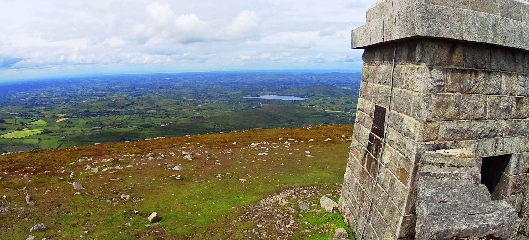 Here you will turn right and follow the modern wall directly up the side of the mountain for about another 3/4 of a mile to the small tower sitting above the Range.
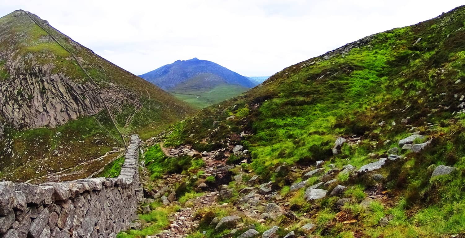 In this most elevated region the mountainside becomes inundated with dramatic sections of stone, much of which has been marked, measured, and cut into curious fixtures. While hiking you can look closely at some of the stone statements that are totally distinct. Below is an example of spirally stacked stones that are mingled with pieces that are clearly marked, measured, and cut. This piece I’m pointing at in the image below contains a stone with three equidistant measured markings for cutting along its side; it was obviously intentional.
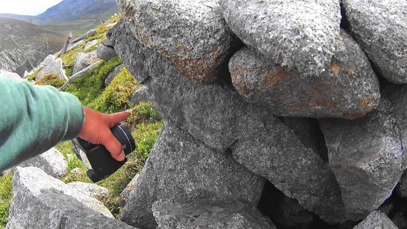
There are hundreds, if not thousands, of crafted stones to be found here, all utterly undocumented artifacts. What are they doing at 2,200 feet above the valley? Here again is another set of stones which look to have been specifically cut in order to mimic the slope of the mountains beyond. (Image Below) I noticed the boulder on the right side of the picture from over 50 yards away. It has been sliced, as you can see, and the angle of that slice imitates the slope of the eastern face of the mountain beyond,

The shape of the stones imitates a rock fixture nearly at the top of the opposite slope beyond. Notice also the thin rounded plate to the left which imitates the exact angle and roundness of the peaks on the left. These stones were absolutely placed this way to specifically mimic the opposite mountains. Unreal.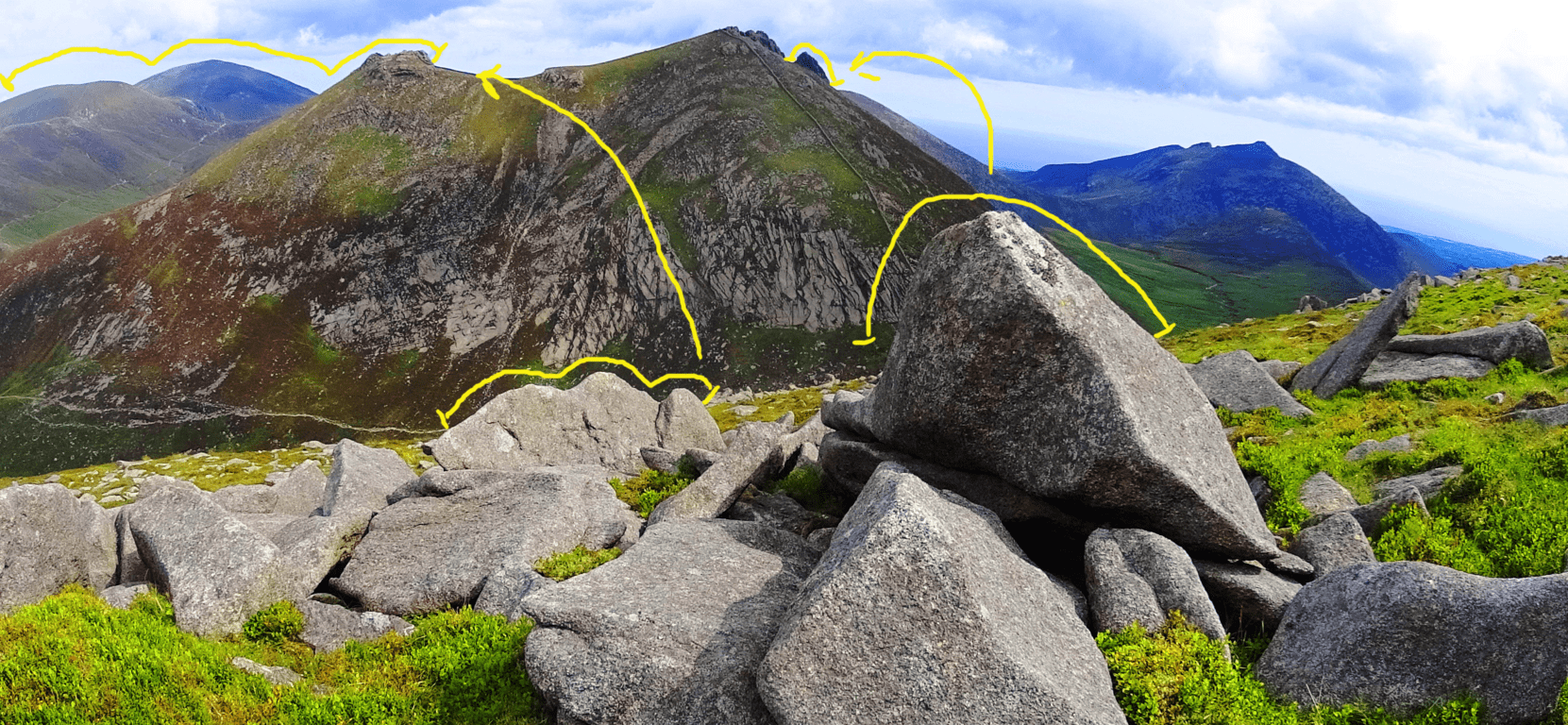 I am aware that this is a challenge for people to accept; I too found it a challenge for years. But time and time again, similar expressions arise in challenging elevations that are begging to be noticed, both in Ireland, and New England (as well as the rest of the world). This is a form of megalithic expression that we are simply not accustom to acknowledging, as it has been mostly ignored by the academic community. The real question you should eventually ask is: “How could they ignore an entire mountainside of marked and positioned stones?” The logical questions that arise would challenge our picture of Neolithic history, and that looks to be what modern academia will not allow. Just beyond this magical fixture is the small tower, where a 360 degree view comes into full focus. On clear days you can see Wales on the other side of the Irish Sea! Below is the simple southern view from which your hike began.
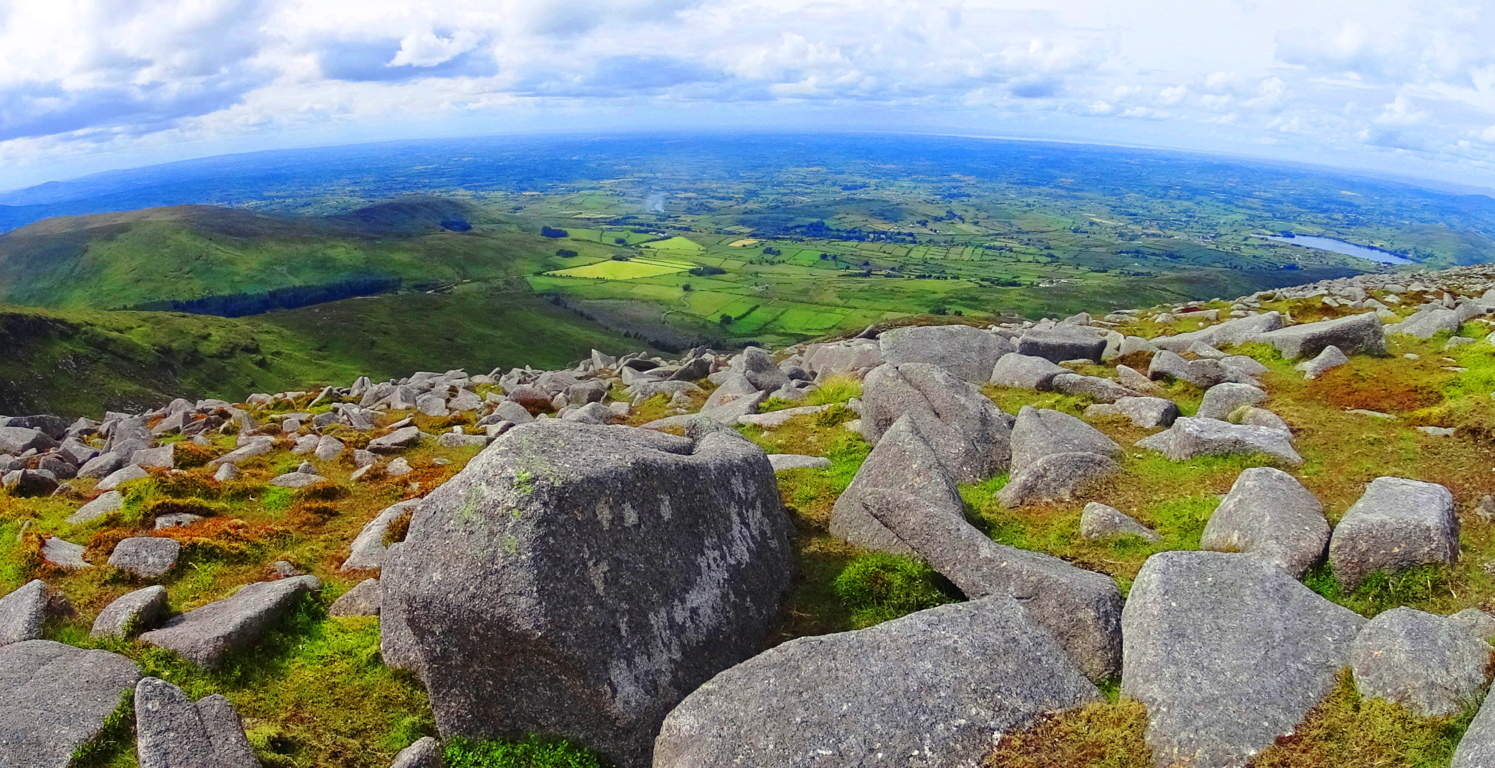 The modern stone wall continues along the elevated porch of the upper mountains, twisting surreally through the Mourne beautifully (Top Image of Article). Many hikers choose to continue hiking from small tower to small tower, while others, like myself, made the return descent back to the Pass and down the Valley.
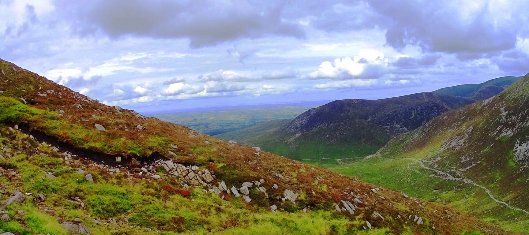
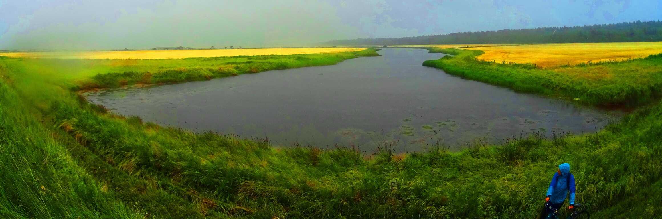
The colors here are a spongy mixture of rugged and rusty oranges mingled with profound jade and deep mossy green. The clouds play a pocketed game, with shafts of light seeping through the fast moving heavens; light arrives, sometimes in flashes over broad portions of the Mourne, while at other times appearing in prolonged beams of revelation. The air is cool and forgiving. If you have a small water purifier you could drink from the wide stream heading down the central portion of the valley back to the bottom. Enjoy the benefits of gravity assisting your 3.5 mile trek back to the station. This place has the potential to be one of the best day hikes you will ever have in your life. What more do I need to say about such a place? Find your way.
Gortnavern
 Location: Kerrykeel/Ranny Mountain/Ireland
Note: It is hard to know how to begin when talking about a place like Gortnavern. It really isn’t a place that you will find in a tourism guidebook. It’s a rugged and cloudy place, with dark oily soil in the heights. Known as ‘Ranny’ to the locals, the small black mountain peak here overlooks Mulroy Bay, an inlet extending out to the stark Atlantic edge of Ireland’s northernmost coastline. There are no trails here, just farmers roads, and fields upon fields. In the distance to the northeast is a rim of mountains that create a saturated basin of nearly picture perfect rolling hills and streams.
 What looks like a simple and approachable climb through these heights is actually a phalanx of thick hedges, stony streams, tall grass, rocky knolls, spongy moss, and tough roots.
 You will need all your gear, tall boots, and rain suit, to hike without fear. At the dark peak of Ranny wild goats graze and look on. It is easy to see that people do not come here often, judging from the looks on their faces.
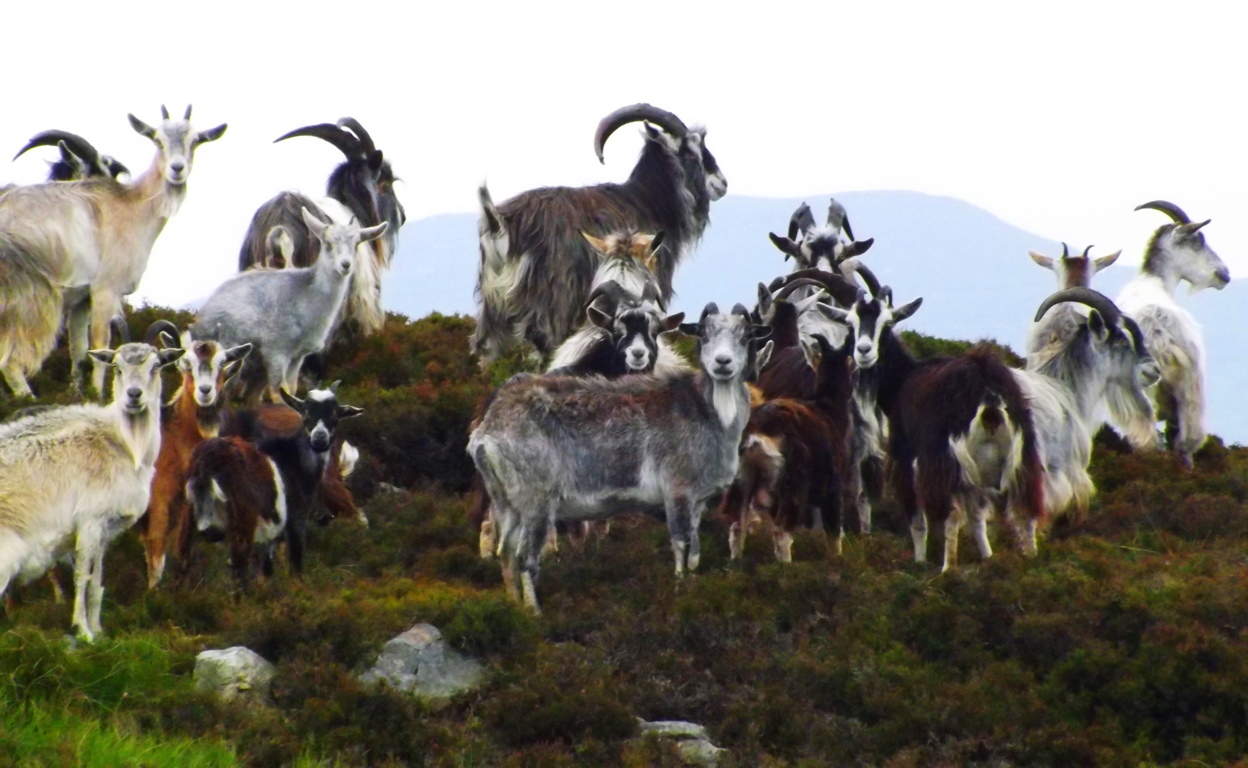 There are plants and fauna here that I have never seen before, with winding undergrowth and tunnels of tough branches. To achieve the peak at Ranny you will have to pass through them.
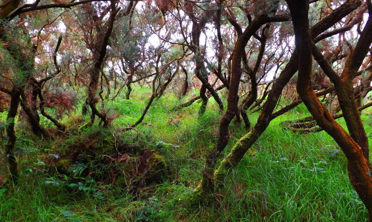 Not only that, but you will have to cross streams, climb fences, and avoid bulls in the fields. At this point you’ll probably want to ask: ” Well then, why the hell would you want to go hiking there?”
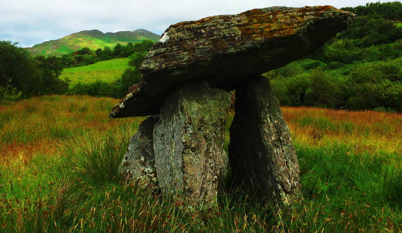
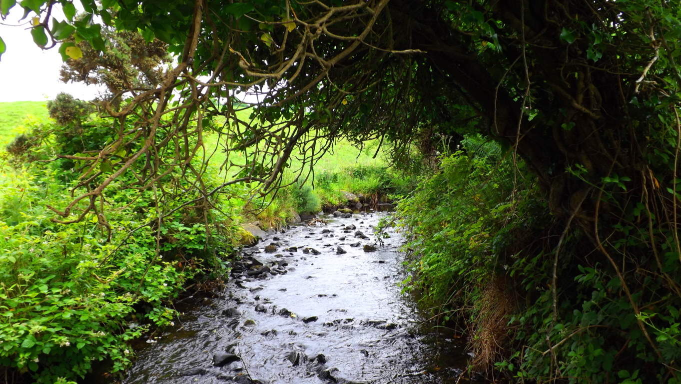 It’s a good question, with a worthy explanation. The Dolmen. The misty heights of Ranny is home to one of the few remaining undisturbed Celtic Dolmens in this part of the world. Other Dolmens remain, but are reinforced, rebuilt, or tampered with, in various ways; But not the Gortnavern Dolmen. It is in situ, in it’s original state; A beyond-priceless expression from an era gone by, built by the first culture that this part of the world had ever seen.
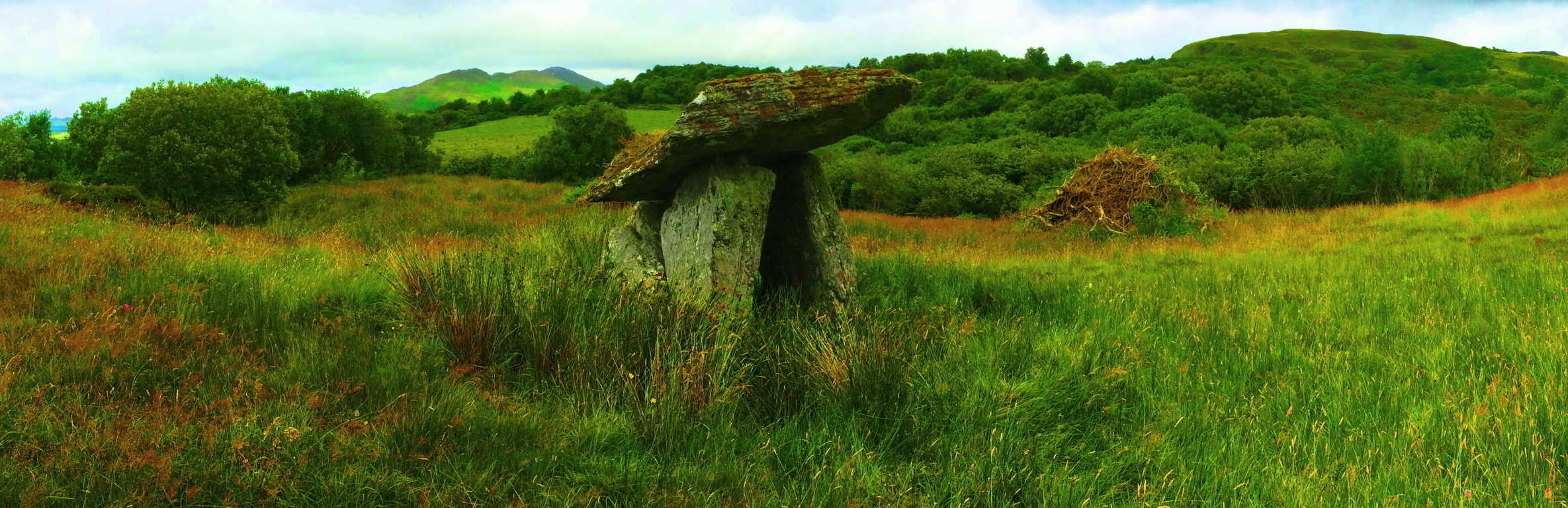 Irish archaeologists date the building of most Dolmens somewhere around 4000 to 6000 B.C.E, but in truth, there is really no way of knowing just how old this megalith is. This is an exquisite example of the Portal Tomb, which is a spiritual statement of a crafted, massive, stone satellite, meant for catapulting souls from this world, to the stars. The 10 ton, elevated capstone, supported by five huge pillar pieces beneath, is forever tipping its brim towards the beautiful Gortnatraw Mountain in the distance. If you can get to this spot, it feels as if whoever created this Dolmen, wanted us to see how beautiful they felt this very scene was, which is why, perhaps, they chose to face the capstone in that specific direction. If that is the case, then as you look, you are sharing a moment with someone who lived 6000 years ago.
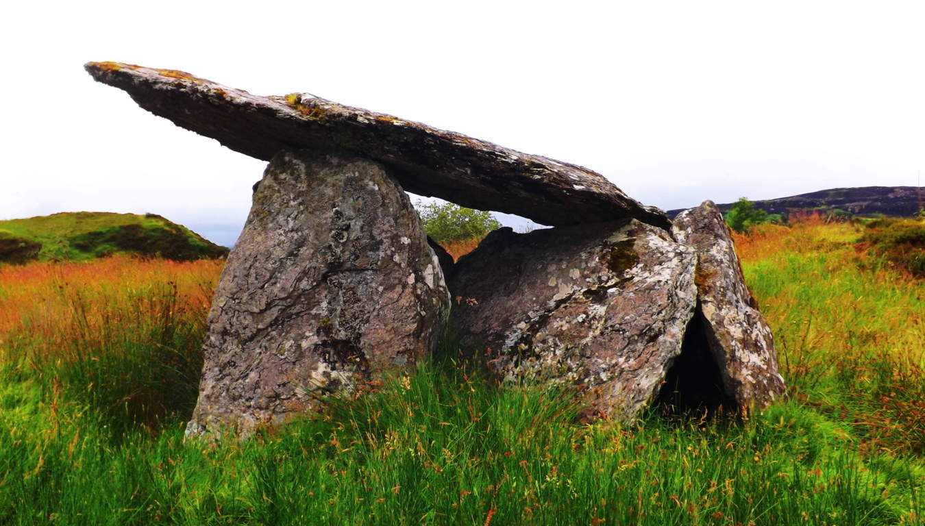 What could be a more worth while hiking goal? Whatever you do, stop to appreciate the the strange darkened peaks, of a style i had never seen before, or since. In the end, you will have to decide what your goals in a rustic scene like this will be.
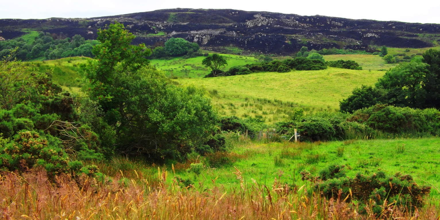 If hiking to the top of Mount Ranny is your goal, be prepared to cross farmers fields, and travail the obstacles, with a tough incline as you go. If finding the Gortnavern Dolmen is your goal, you must find Drumatrumman Road. Pass the farm at the top of Drumatrumman Road, and continue about a half mile further up the hedgy dirt path. You will need to look right; At about 75 yards to the right of the lane, beyond cows in the fields, just to the next gully, beyond the stream, you will see the Dolmen. Beyond the hedges behind the cattle in the image below, the Dolmen is just out of view at this vantage from the road. Keep clear of the bull, follow the hedge to the left.
 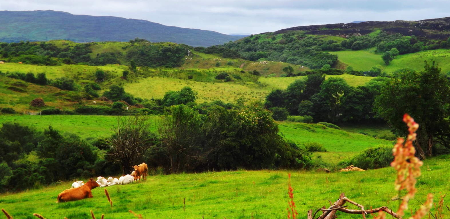 More generally, approaching this scene, there is a sign for the ‘Gortnavern Dolmen’ from the main road just outside Kerrykeel center, but from there you should plan to ask for help, and bring your GPS/Phone, you will need it. Many of the roads do not have names, so approach farmers with humble honesty and respect. You are on their land. If you tell them you would like to see the Dolmen, they will gladly show you the way, but DO NOT JUST WAVE AT THEM AND PASS BY. This is a real rural community, with functional farms and generational families at work, be respectful.
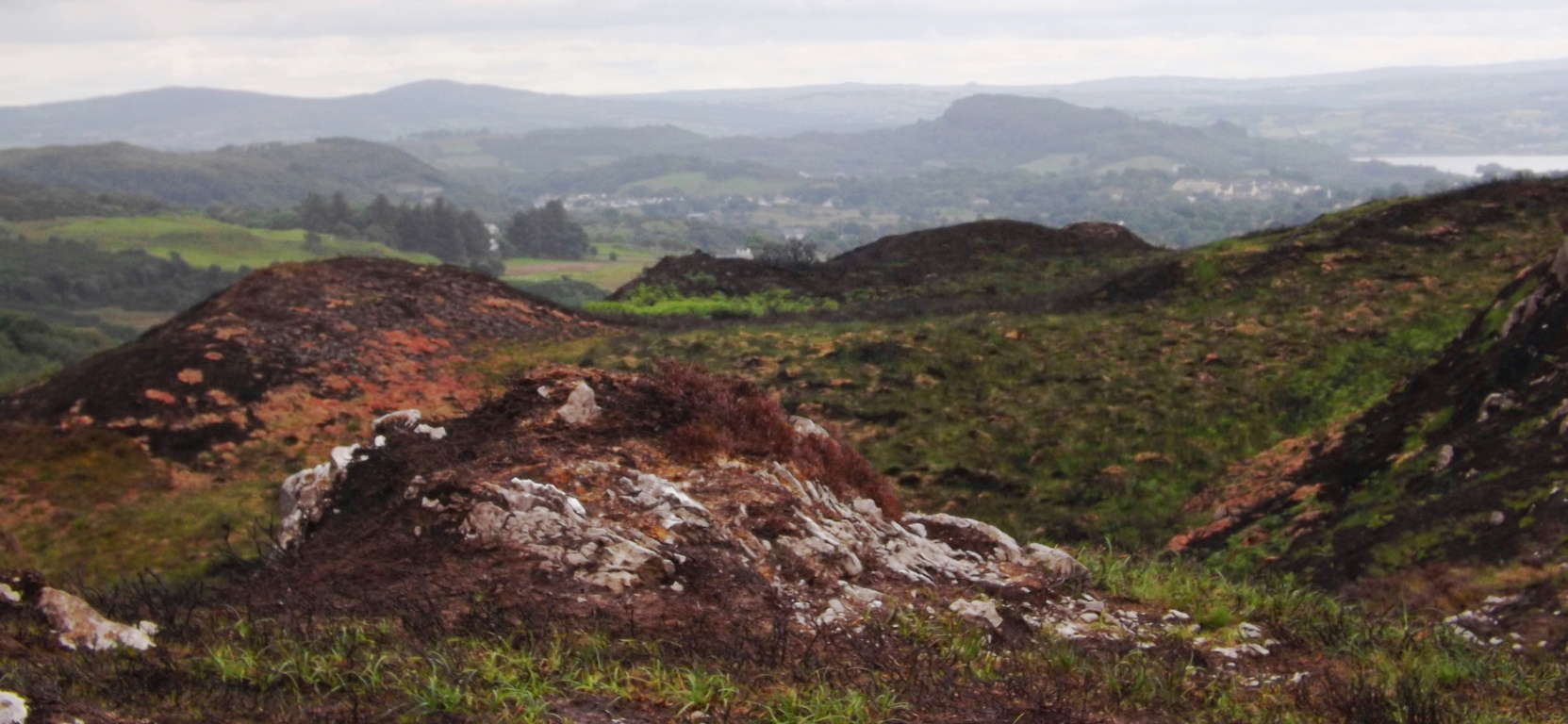 If you can get to Gortnavern, you have already achieved something which most people, even seasoned hikers, will never do. These are the rare places, the wild unmarked terrains, where you will discover more about yourself in the challenge, than any commercially advertised trek can offer. This is the real Celtic experience. Go strong, bring plenty of water, and may the road rise to meet you.
The Raven Wildlife Preserve
 Location: Wexford, Ireland
Note: Along the gorgeous south-west coast of Ireland, which runs all the way down to a baby-blue Irish Sea, sits the rare, old-growth, Celtic forest known as The Raven. There are a few reasons why it’s rare; The first being the British incursion of Ireland, which took place from the early Medieval period into the Colonial. The British occupation made it possible to extort vital resources for England, such as timber for the imperial fleet, starting in the mid 1500’s. 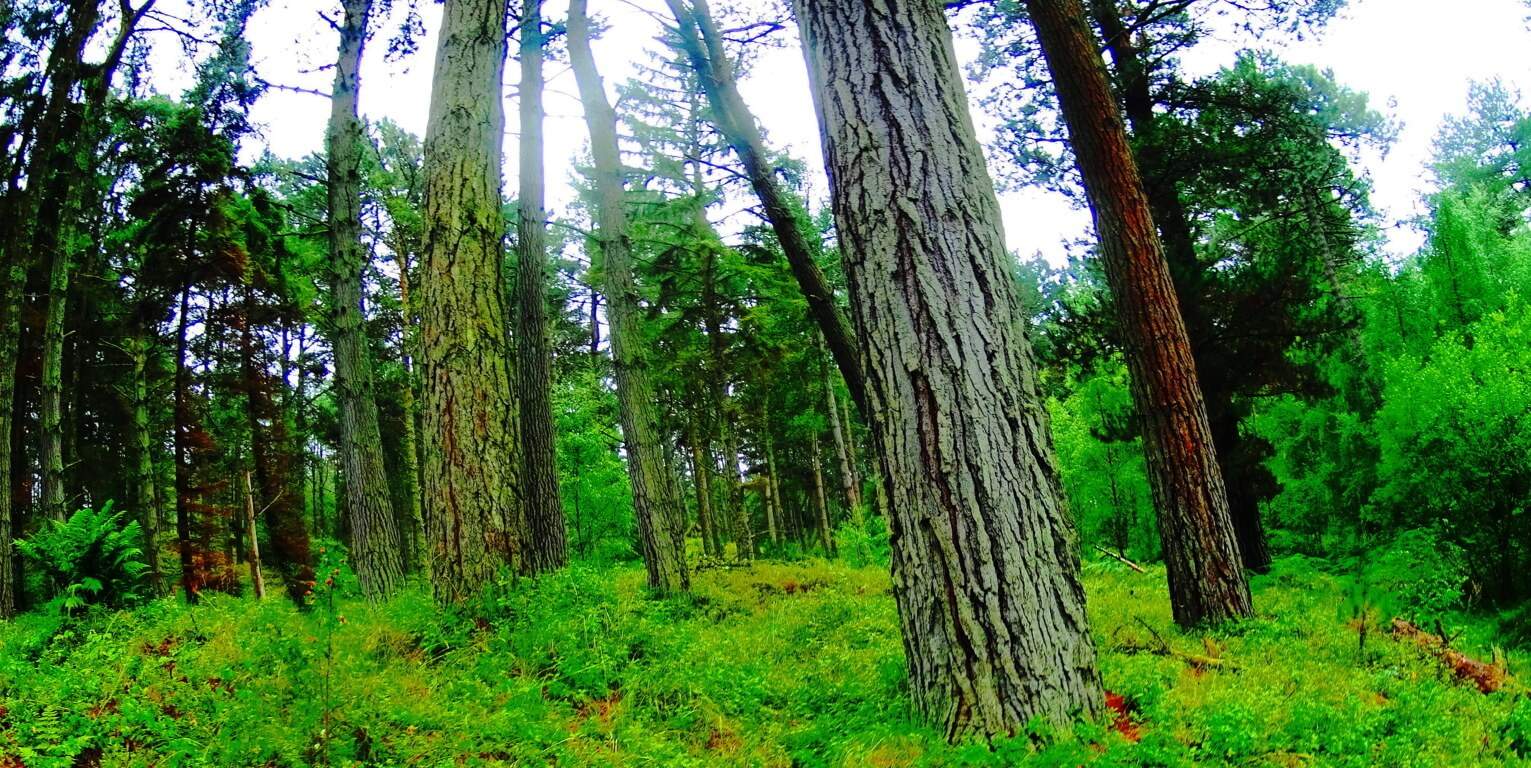 Luckily The Raven survived. The second reason for the rarity of this place is that The Raven has been a protected wildlife Reserve since the 1880’s, making it a priceless time capsule of trees and flowers that have almost vanished. It is the only place left in the country where you can find the wildflower known as Wintergreen, which is mingled among Devil’s-Bits, Foxgloves, and Bluebells in the grassy dunes. This is a place to let your imagination go, and daydream about the feeling of old Celtic regions. It is a natural kingdom of preserved fauna and wildlife that Celtic peoples felt was sacred.
 Beautiful trails extend around, and through this forest of towering Irish Pines and Evergreens. One of the trails is a basic circular loop around the edge of the old glades. S0me tree’s are standing over 150 feet tall, above broad beds of rolling clover, tall grass, and shiny white sand.
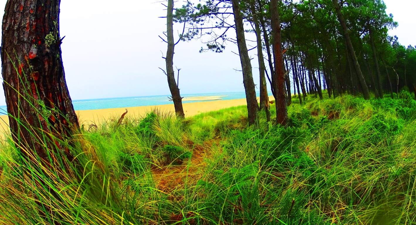 If you add the element of the striking blue-crystaline color of the Irish Sea, the overall scene becomes worthy of wonder. There are fantastic minor trails that branch off into the forest, creating a direct pathway from the beach, about halfway around the larger outer loop.
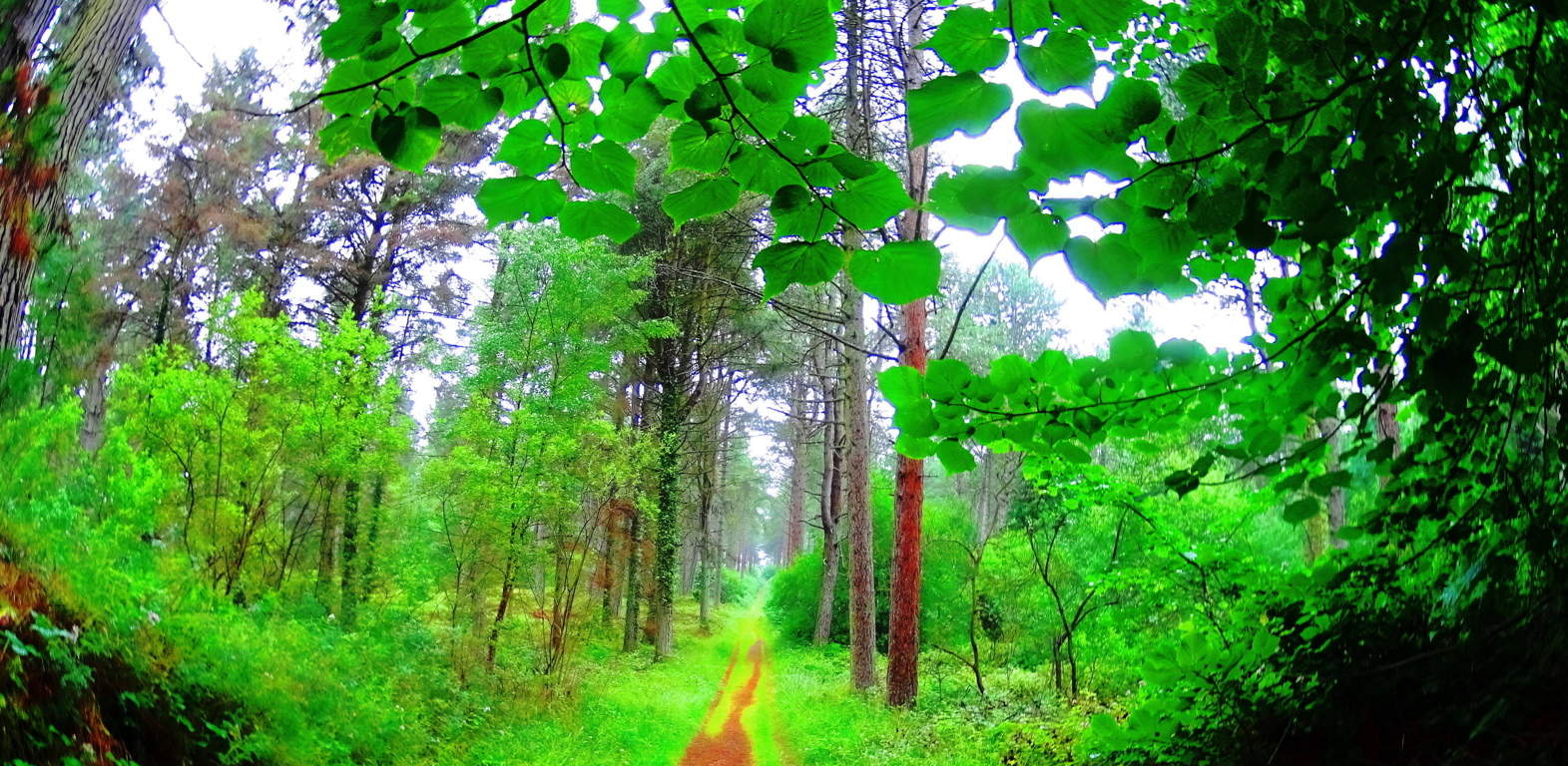 These pathways are nearly perfect for mountain-biking as well. An extended adventure is possible for those who wish to try a more rustic challenge of approaching the Raven from further off. If you park at Adcavan business park, about 3 miles away, you can bike the small dirt road that runs parallel to The Raven in the distance. Riding from the main road, you will need to lift your bike over a simple gate, and ride 2 miles, eventually reaching a dilapidated stone archway. This archway marks the path that runs directly towards the forest.
 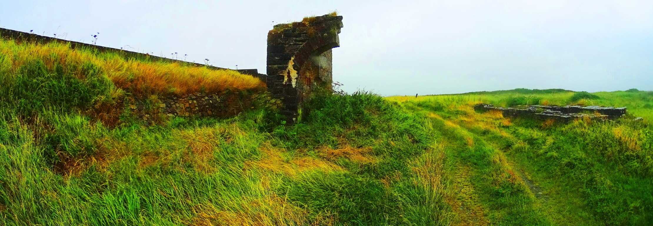 This route is rustic and challenging, with rocky paths that run along a huge ocean channel lined with golden wildflowers while you approach. At times you may need to walk your bike, but it leaves time to get a picture of the channel with The Raven beyond.
 Once you reach the forest you may wish to explore the beach before continuing to ride. Lock your bike around a tree and climb over the dunes to get a glimpse of the Irish Sea. Smaller side paths lead through thickets on the edge of the dunes that are tempting to follow.
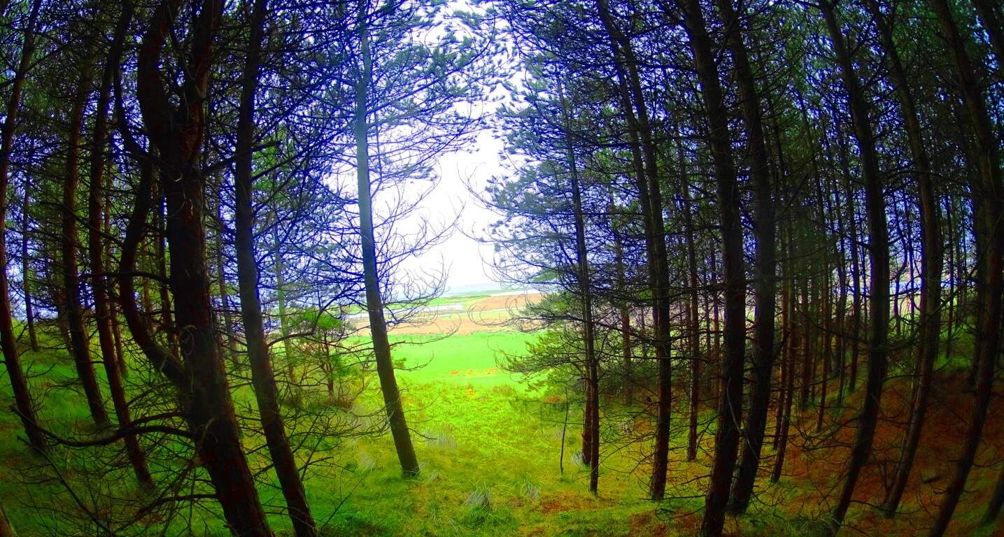 The Pines run to the edge of the dunes, opening up to a spectacular scene, one which the ancient mariners of England, and the Vikings, must have admired while approaching to raid. A view like this is also most likely what a young Saint Patrick must have seen, and had to return to, even after captivity.
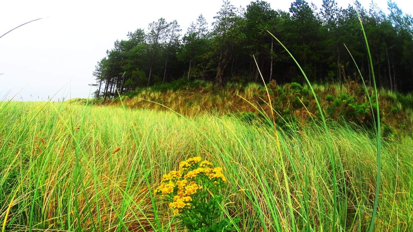 This place is hauntingly beautiful, even on a cloudy day. Enjoy the opportunity to relax and wander in a rare wildlife scene from long ago. All options for exploration are possible at The Raven. Good luck as you go:) Seek and find.