Devil’s Tower National Park
Location: Crook County/Wyoming/USA
Elevation: 5,100 feet above Sea Level
Prominence: 1,267 feet
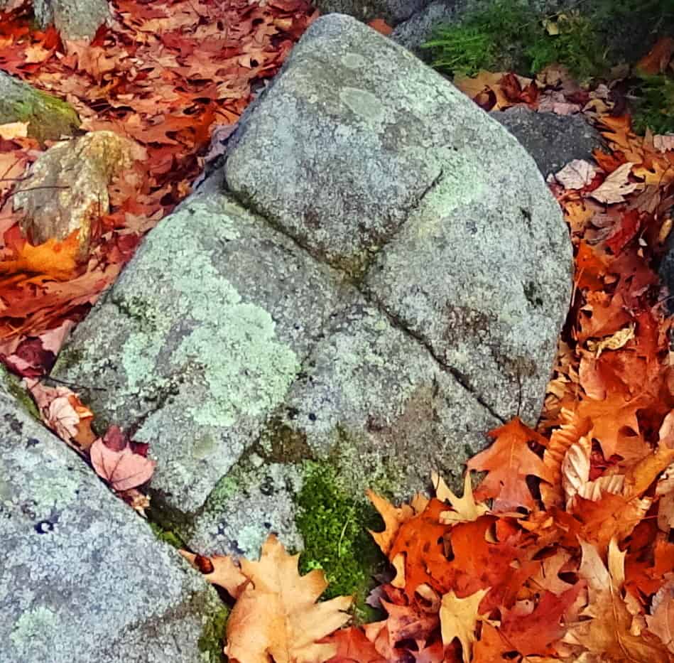
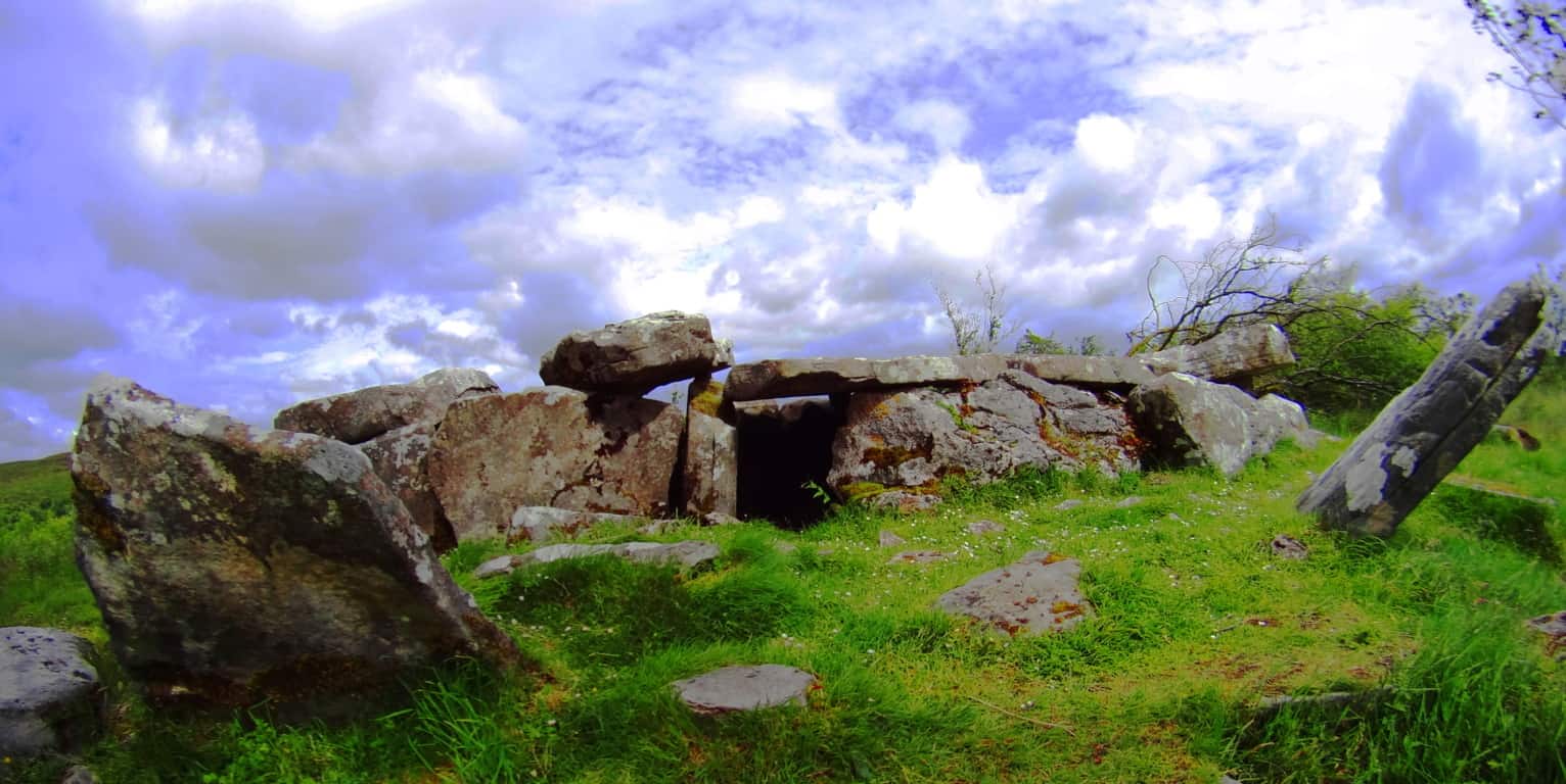
Note: The only way to introduce the most mysterious small Mountain in America, which looms 1000 feet above the Black Hills Forest of Wyoming/USA, is to contextualize it by mentioning other places with very similar megalithic traits. Just to get you in the mood, take a look at these places: A coastline in Northern Ireland made entirely of hexagonal stones (Image/Left); 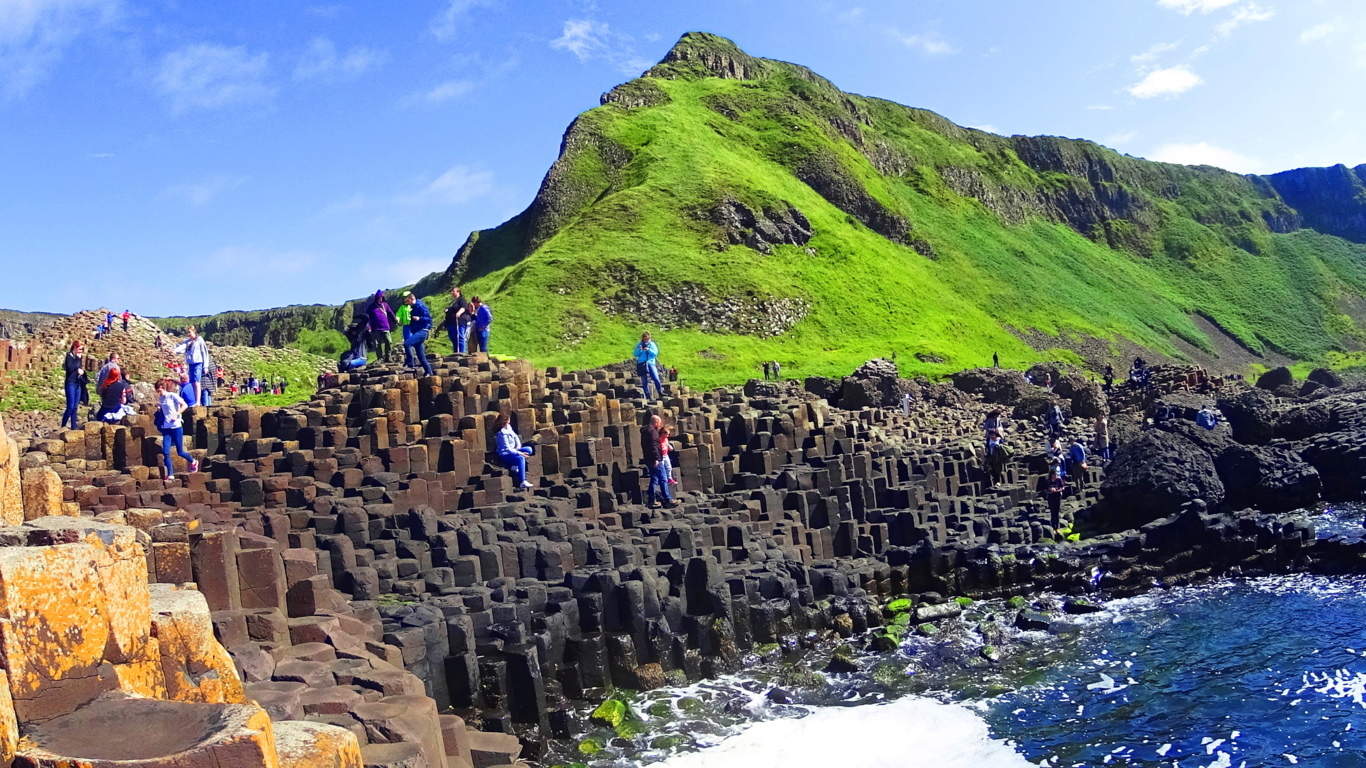 an elegantly scenic mountain ridge where three perfectly square slabs of stone, with absolutely concentric rings imprinted on its face, sits stoically above the beautiful Black Valley of Killarney, Ireland. (Image/Below); or a secret grove where a…
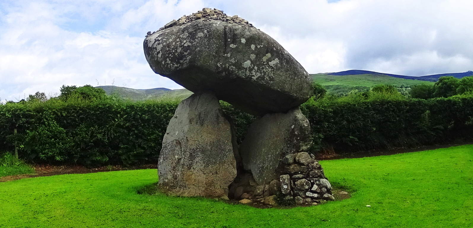
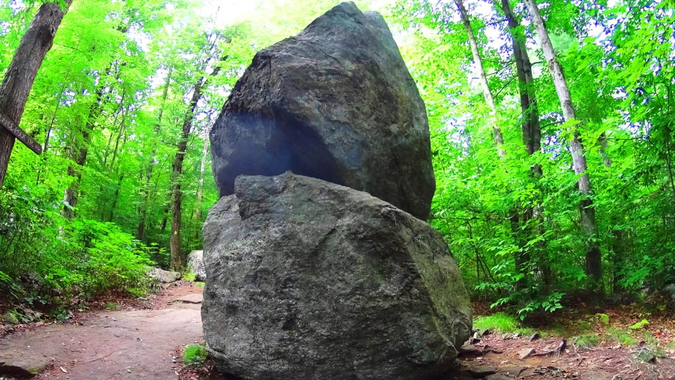
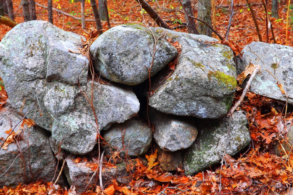
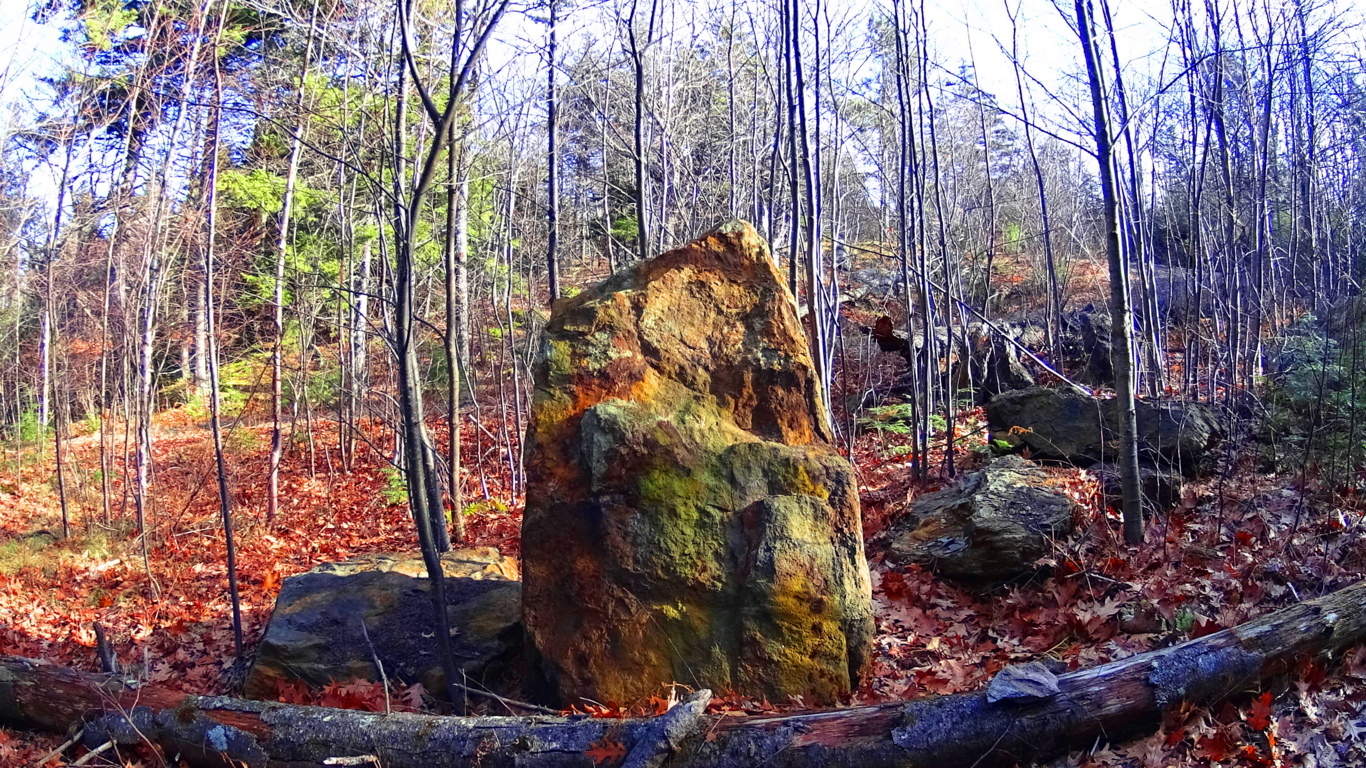
 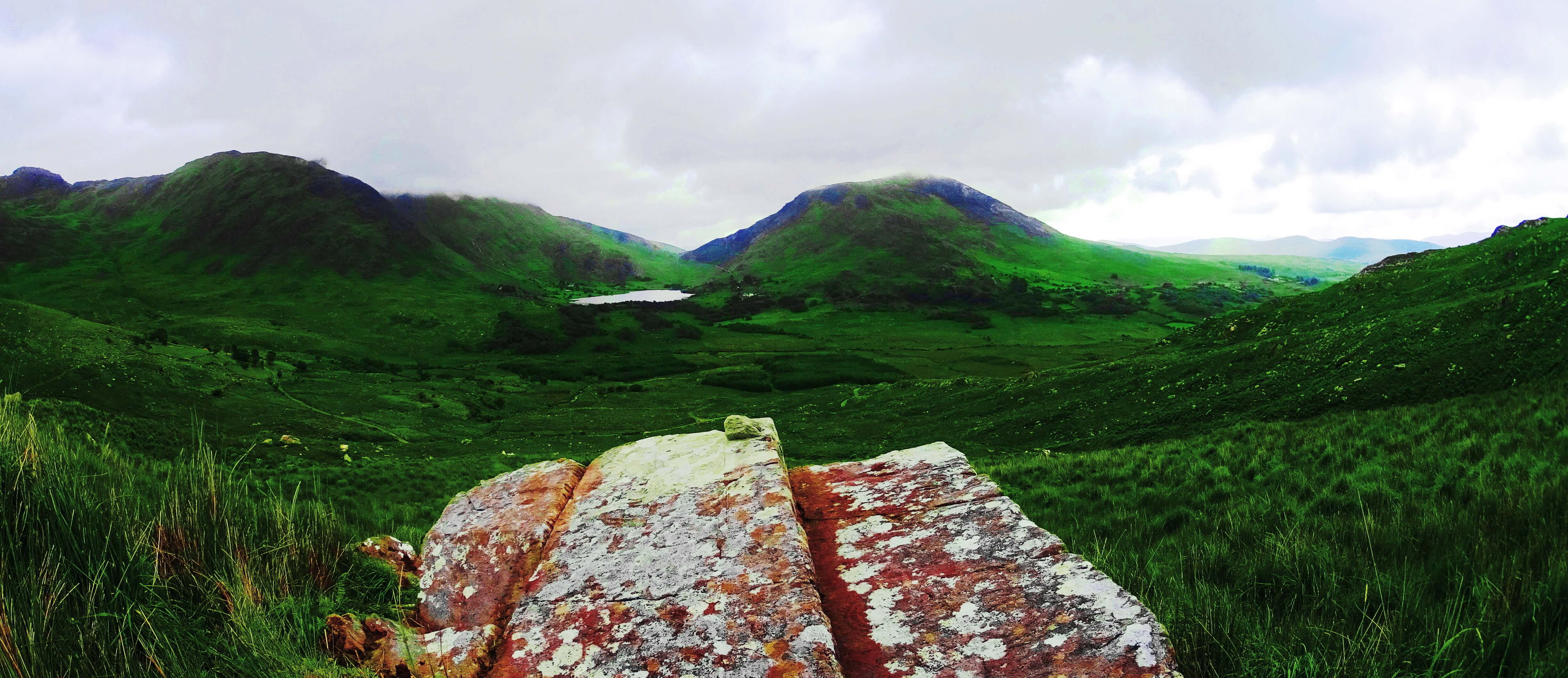 40 ton boulder balancing 15 feet high, supported by three standing stones, in Ravensdale Ireland, looms just south of the Mourn Mountains (Image/Left); or how about two colossally stacked, and perfectly balanced boulders, tucked deep within a Forest in Massachusetts/USA, each weighing about 30 tons, where the top boulder is balanced at about ten feet high. (Image/Right);
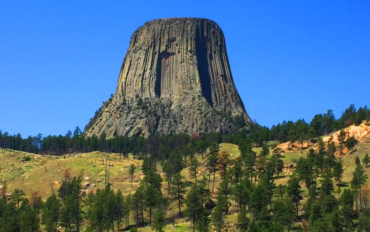
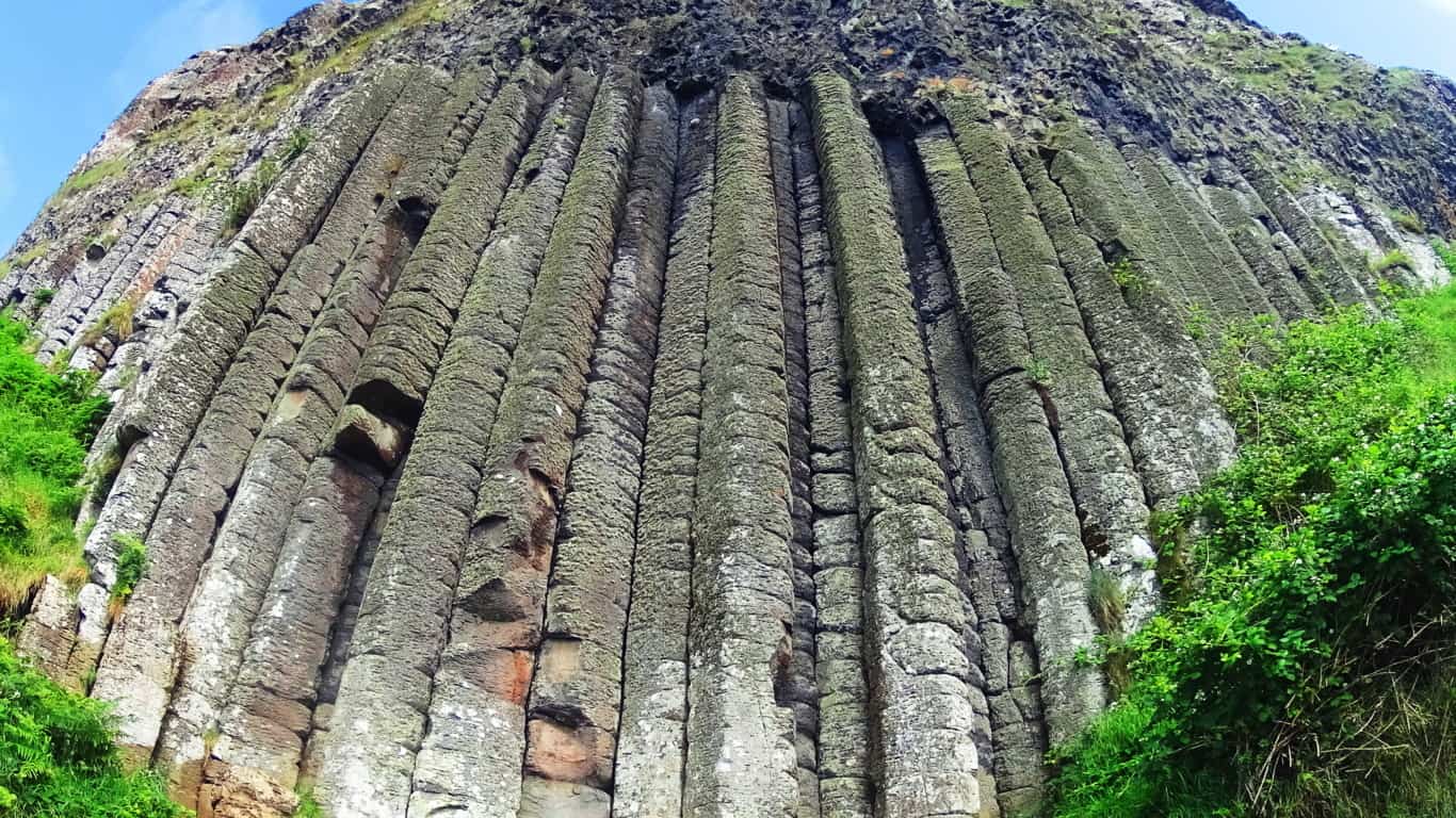
and last, there is an entire Mountain in Wyoming/USA that is completely sculpted into perfectly parallel square shafts reaching 1000 feet high for over a mile in circumference.(Images/Top/and Below) This is The Devil’s Tower National Park.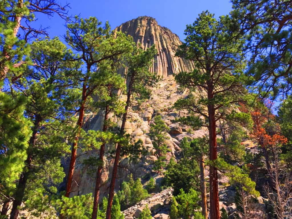 In this era of informational sharing, places that were once thought to be singular anomalies on Earth are now being connected to similar statements across the globe. Not only are these places being connected through physical similarities, but we find that the strange explanations that have been used to justify their unique features are also very similar, (as if it was decided uniformly in some boardroom far from the public, perhaps in the Smithsonian’s basement in the early Century) The bizarre explanations don’t make sense, especially when you see these places first hand, and get a look at the attributes that are not described online; traits like the elevated parallel shafts above the coastline at Giant’s Causeway Ireland, which is the most similar place to the Devil’s Tower in the World. We will look at the problems with the explanations, and the disregarding of certain evidence later in the article; but for the moment lets enjoy the mysterious scene above the grand Plain in Wyoming. The Devil’s Tower is an exceptional place, making it very hard to look away. It is almost guaranteed that you haven’t seen anything like this in your life. The Tower’ sits isolated above the golden-green landscape, an absolute silhouette. Even from far away, it is easy to see the unique exterior of geometric stones. Seniors and children alike will stare wide-eyed as they approach the Trail surrounding the Tower’. Human’s have wondered about this place forever. Lets have a look…
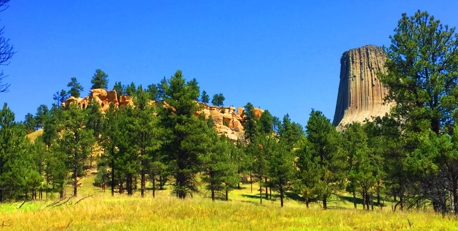 Trails at Devil’s Tower National Park: The main Trail here is straight-forward and interactive; it basically circles the Tower’, winding past massive boulders which can be climbed, all surrounded by Ponderosa Pine Forest. The Forest supports wildlife in abundance; Deer, Hedgehogs, Hawks, and Grey Squirrels wander freely.
 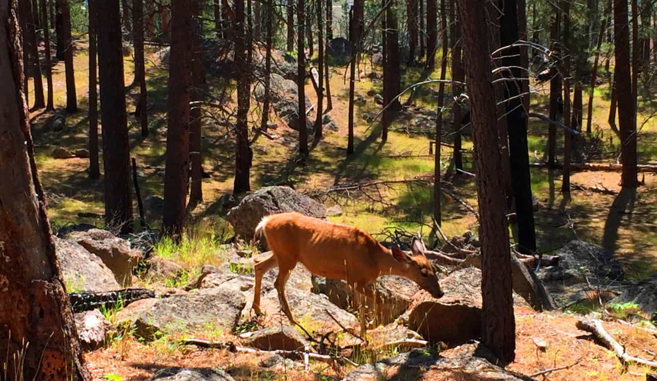 There are other trails that drift away from The Tower’ if you are interested in a longer trek. Everything sort of circumambulates Devil’s Tower, the longer trails being the more distant concentric from the small Mountain.
 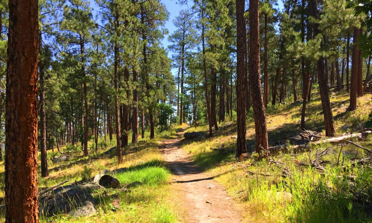 The broad and beautiful landscape of Wyoming is what makes the Devil’s Tower so significant; there is simply nothing else like it on the North American Continent. It is the tranquility of this scene that is striking once you arrive. The Tower’, however, does not look as if it was quietly created, but rather, it seems is as if whatever sculpted it was most likely the loudest sound this valley ever heard. It just looks that way, with huge boulder’s all disheveled at the base, perhaps like giant crumbs from the most massively creased cake of all time.
 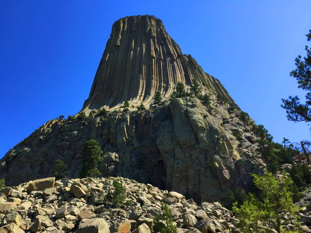 A Confusing Geological Scene: A geologic diversity exists throughout the Park’, with variations in specific stone and coloration. Below is an image of the lower portion of the Park’, where hundreds of hedgehogs have burrowed opposite these bright red ledges. The difference between these ‘red-ledges’ and the upper Tower’s white stone ridge is so distinct, so completely different, that it is hard to accept the current “volcanic explanation” about the birth of the Tower’. “Scientists” have basically stated that The Tower’ was created through a “volcanic event”, and yet the lava dispersion is restricted absolutely to the Tower’, while the lower scene reveals absolutely no similarity, or any other signs relating to this…”volcanic event“. If both areas experienced the same flow of lava, why are they so completely different? How did the lava-flow go upward, or simply stop flowing downward, to build The Tower without affecting the ridge below’?! No other active lava flow that we currently see on earth, like in Hawaii, Italy, or Japan, does anything remotely like this. And where is the active lava here in this landlocked and level landscape? How could the information centers possibly endorse this explanation? There is no sign of any active volcanic source beneath, or around, The Tower’. Amazingly, there is another small Mountain, in another part of the world, with exactly the same logical dilemma concerning the “lava-flow explanation“. Now lets compare both scenes…
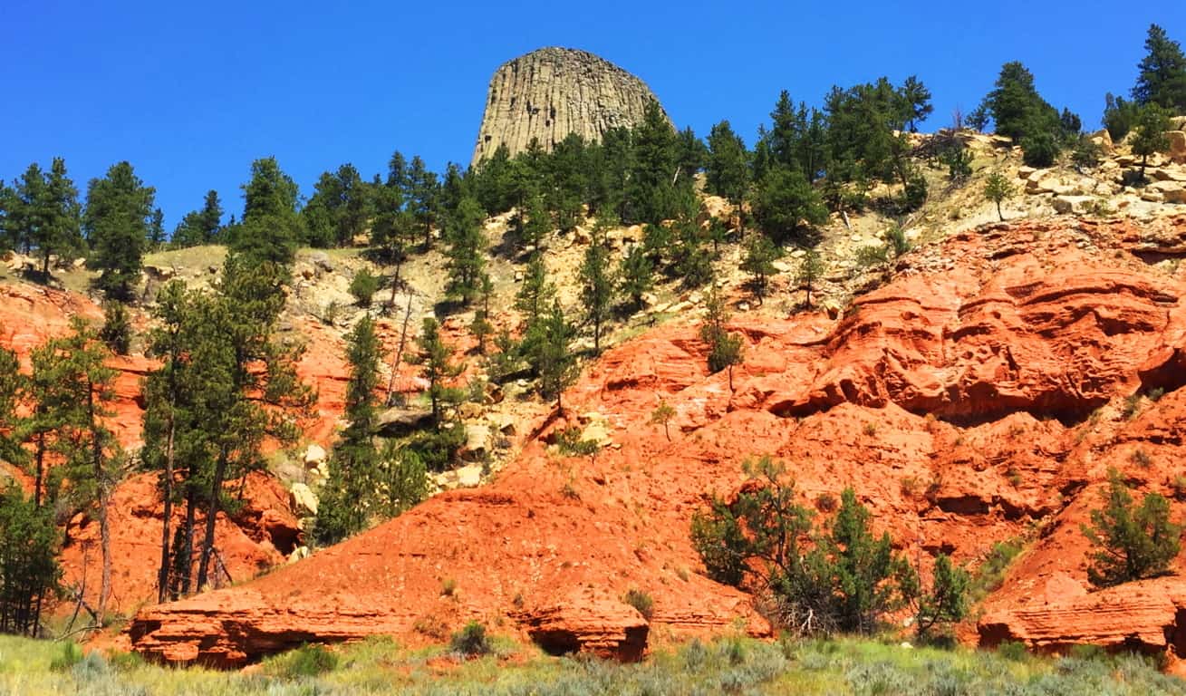 International Connections to Devil’s Tower: Many times, if international hiking and anthropology become part of your life, synchronicity and moments of wonder will happen. It’s one of the reasons hiking becomes a lifestyle. Crazy connections happen. On July 13th 2016, I would first see the inexplicable parallel hexagons carved into the mountainside at Giant’s Causeway, in Northern Ireland. And exactly one year to the very day, July 13th 2017, I would be standing 2,300 miles away, beneath another impossible set of parallel shafts, etched into a Mountainside in Wyoming/USA. The similarities between these sites are astounding, in every possible way
Take a look at the parallel shafts along the side of Devil’s Tower; do they look at all like flowing liquid/lava?(Image/Below/Left) At “The Giant’s Causeway”in Northern Ireland, look at the parallel shafts etched into that small Mountain above the coastline.(Image/Below/Right) Again,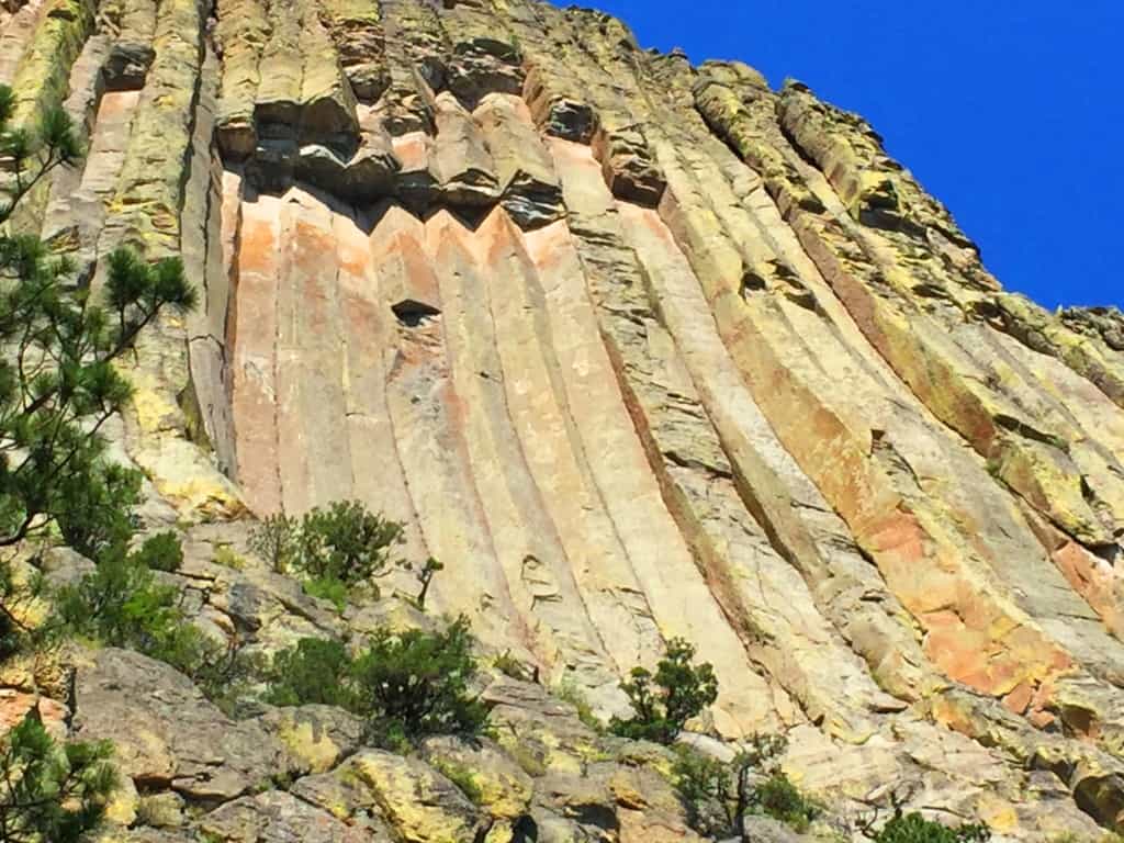
 there is no look of lava-flow whatsoever, but the very same parallel shafts. This is cause for true wonder. It is interesting that the parallel shafts in the small Mountainside at Giant’s Causeway are not advertised. Most people would never know or see anything about them unless they had hiked the trail personally. It is a good bet that the people who control the information about these sites know full-well that most people have a hard time carving out the time to see them for themselves. At Giant’s Causeway only the famous hexagonal stones on the coastline are advertised. Why wouldn’t the shafts in the mountain be advertised? Perhaps because it doesn’t fit the “lava-flow” narrative. The lower portion of the coastline is a patio of hexagonal stones, which is what they say was created by a lava-flow coming out of the Ocean; but how did the lava come out of the water, and then up a small Mountain 200 yards away, without leaving any trail of lava between the Coastline and the Mountain? (Image/Above/Right) Look at the coastline of hexagonals below, this distinct statement simply stops! And then almost 300 yards away, and 200 yards up, a section of parallel hexagonal shafts is carved right into the ledge, as you see above? Totally illogical. There is nothing but consistent green ledge and rounded regular stone between the two places, NOT lava flow.
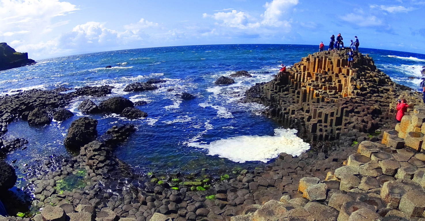 Below is another perspective on the separate statements at Giant’s Causeway. Clearly these are two very separate sections of geometric stones from the coast to the upper ridge. What in God’s name are these scientists talking about? It’s as if they give us explanations that sound….
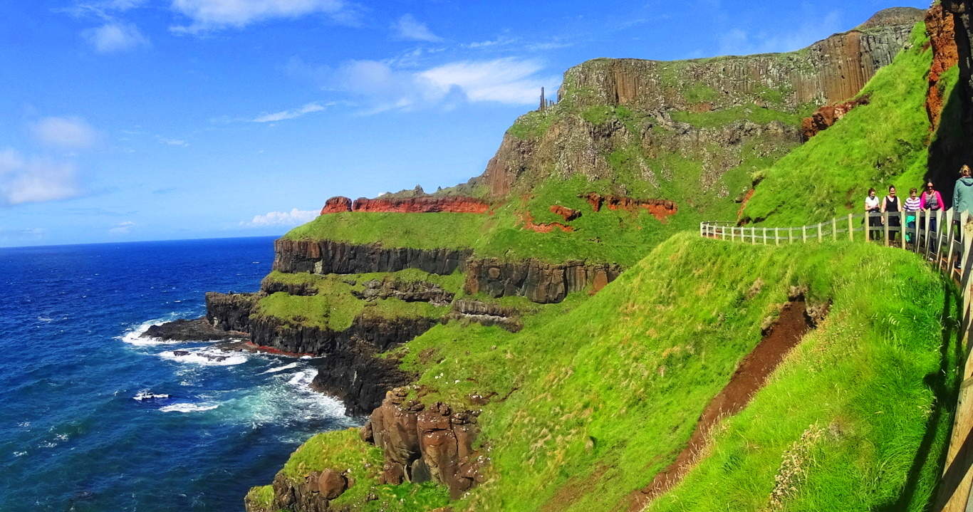 just “scientific” enough to keep less informed people totally bewildered. And there are more places of parallel stone shafts in the world; on the island of Sardinia/Italy, Scotland, and Russia, to name a few. How can these explanations hold up for us? These are the moments that people should start to see that if you just accept the explanations of others, you can pass up your universal human right to know the truth. I hope my readers are starting to understand that connecting the dots in the world for yourself is possible, and places like Devil’s Tower and Giant’s Causeway are literally there to inspire you into galvanizing your own perspective.
Dreamscape Wyoming: Returning to the landscape at Devil’s Tower in Wyoming, the hills and ledges drift away with a steady consistency, making Devil’s Tower that much more incredible, and bizarre.
The vastness of Wyoming is supremely humbling. You can drive, and drive, and drive, and drive, and the land just keeps going. It was only after I experienced this spacious dimension that I had a realization about how the Native Americans must have felt about the land. The Lakota and the Cheyenne must have been so deeply connected that it must have seemed that no one and nothing could ever displace them; they were fully embraced, protected, and immersed in the land.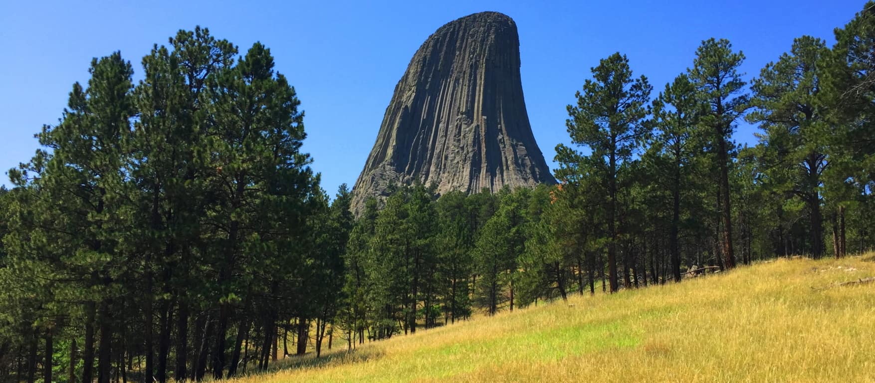 The Union Army arriving on the Prairie would’ve been like an invading army of Aliens emerging, in the hundreds of thousands, from the clouds over the world of today. And the Native Americans say that there were people here before them, tribes of violent Giants that they were forced to hunt, and finally exterminate. If you feel that this ancient story is completely absurd, just understand that the account of the Tribes of Israel upon entering the Promised Land in the Old Testament is exactly the same. Moses sends Joshua with his spies to explore the new land before them, and they return with reports of Giants inhabiting the heights of what is now the Mountains of Israel (Numbers 13:33) Most “educated” people simply choose to ignore this information, and dismiss it as myth. What are these people afraid of? The Devil’s Tower forces us to reconsider the information we accept in our lives; how we accept information. It is a place that challenges you, and pushes you to consider possibilities that are hard to fathom. Whatever the actual case may be, the Devil’s Tower is a magnet for our imaginations, a mysterious refuge that pulls us boldly towards it. This has been a sacred refuge for as long as anyone can possibly remember, and should be shown to the entire world in this unique and wonderful light. There are connections and relations at megalithic sites that make a difference in how we perceive and understand the world. That in itself is enough reason to get out there, and take a look. Thanks for reading, and please share this article with a friend. Stonestrider.com
Mount Wachusett State Reservation
Location: Princeton/ Massachusetts/USA
Elevation: 2006ft
Prominence: 998ft
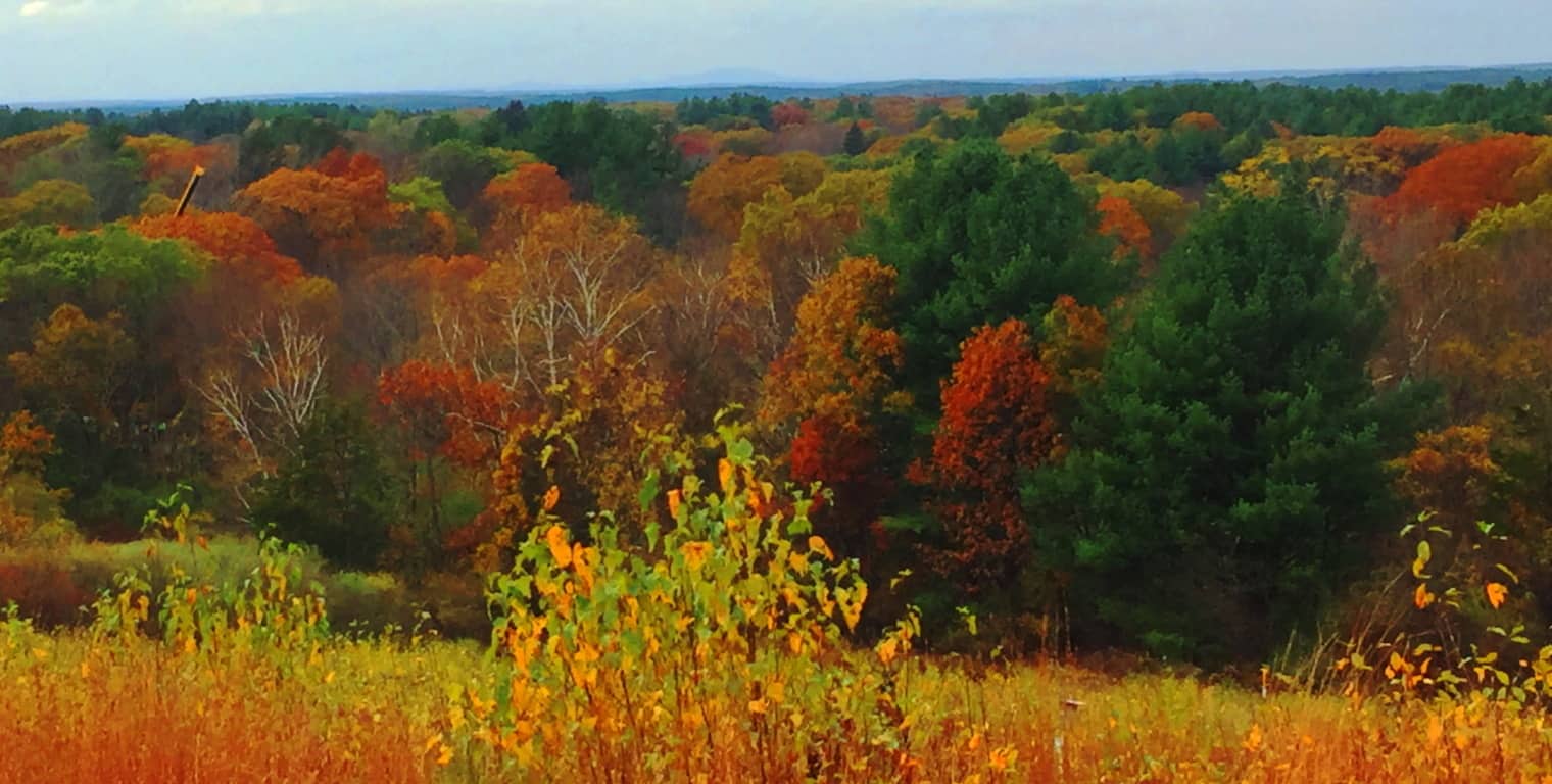
Note: The small mountains of Massachusetts are a cozy set of elevations that generally rise to about 1700 feet. This description isn’t exactly awe inspiring. One thing that is awe inspiring and of the most pinnacle quality, among these small ranges, are the ecosystems, the fauna, the rivers, the trees, and the soil. This is similar to the reputation of the ancient British heartland, Wessex, where Danes and Saxons carried out brutal campaigns to possess the nutrient rich soil. The Viking homelands of Denmark and Norway were at an extreme agricultural disadvantage, with a majority of un-plantable mountain faces and temperatures too cool and damp to create any consistent crop. Also take a look, for example, at Irish grounds; the grass is often brackish, and inundated with stone. In less modern periods, you could spend your entire life trying to clear a set of Irish fields to produce a crop, and still lack success. Imagine an Irish farmer’s response to the soil in the ‘New World’. In most of New England the soil runs consistent and deep, soft and rich, producing beautiful crops. The image above is a long glance at the beautiful Wachusett Valley, in Massachusetts, in Fall. This multicolored Valley runs from Concord all the way to Princeton Massachusetts, to Wachusett Mountain itself, with many towns between. The Mountain is just barely to be seen in the image above, at the back-center, a shadowy statement against the horizon. It’s just an amazingly beautiful place in Autumn. And just like in Old Europe, any tribe passing through this region would want to stay.  Some History: For this land, Natives fought other Natives. Then Natives fought the Colonials for this land. Then Colonials fought the British for this land. Seems like everyone agrees, this land is a good place to be. A hike up Wachusett Mountain (Image/Above) is an opportunity to feel this regions beauty and value. After recognizing all this, there is yet one more culture that seems to have been here, before anyone else. There are mysterious megalithic signs in the landscape, and yet this earliest Era is never discussed in New England. This is an Era most of us just don’t really consider. Our undergraduate textbooks usually begin with the Greeks, progressing to the Romans, to the Medieval, the Renaissance, Colonialism, and finally the Industrial Revolution; but our classes really never offered information about pre-Grecian cultures, and more importantly, the implications of these unresolved mysteries. The Egyptians had roughly 30 Dynasties over the course of a thousand years, and built the most perfect megaliths the world has ever known (to-date engineers still cannot replicate them) yet the implications of Egyptian mysteries were never discussed in our western classrooms. Why? To keep them obscure; to relegate that portion of history into “conspiracy theory”, rather than part of our overall discussion. The one thing that Western academia couldn’t do is hide the megaliths and the dramatic statements that remain in the granite. The woods at Wachusett State Forest are not unassuming at all; the megaliths here, in several different ways, are trying to tell us something. But first, lets wander in.
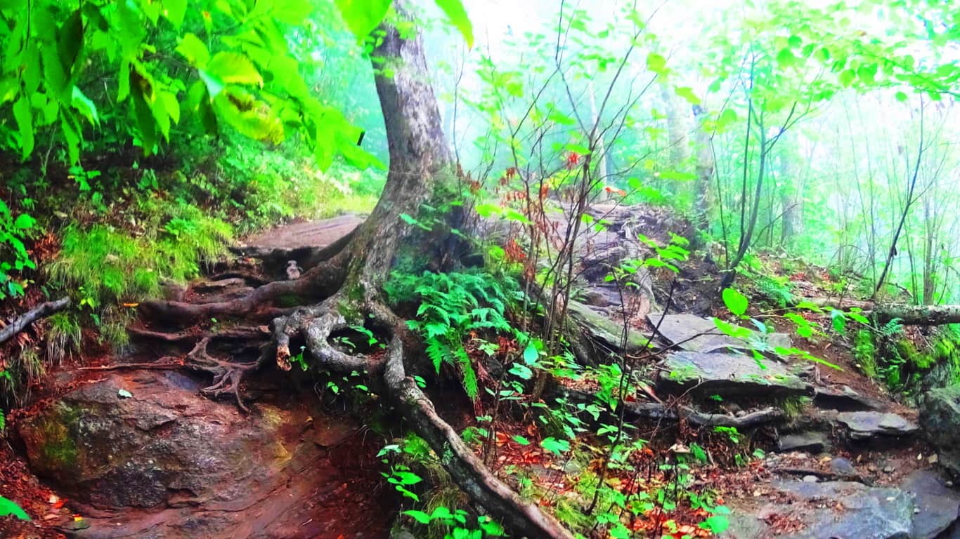
Trails: To arrive at Wachusett Mountain State Reservation in central Massachusetts simply take Route 2 West, which runs across the entire State. Connect to Route 140 South, and drive just for a few minutes. Turn onto Mountain Road into the Reserve, where you will see the sign for the Trailhead parking. There are essentially 8 trails here. Most popular are the “Mountain Loop”, which almost circumambulates the Mountain in an 5.8 mile hike with solid views; “West Side Trail”, a moderate 2.8 mile loop featuring paths strewn with wildflowers, and classic 400 year old forest groves; and “Summit Loop”, a 4.9 mile stretch that includes a serious effort to the peak gaining roughly 1000 feet for the best view of the region. After achieving the peak, the trail will take you down to a full New England Dolmen which sits in the forest (quixotically named: “Balance Rock”)
Featured Trail: “Summit Loop Trail”/Upper trail: This is the most popular trail at Wachusett. The lower trail is a stony path with curious patterns in the rock. It legitimately looks as if the stones here have been hewn into a criss-cross pattern, like a quilt. The stones are distinct, separate, pieces laid in parallel sections. (Image/Below) I just can’t understand how an of this could be considered natural. In one swift diagnostic you can see the math in the stones.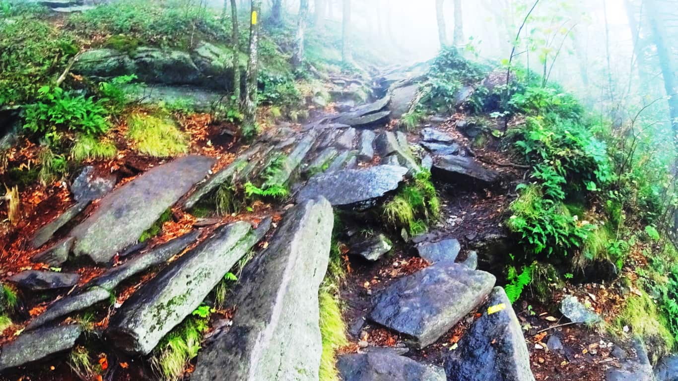 As the path rises, it then changes. A different set of large, individuated, flat plates of rock emerge in a spotty but specifically patterned line up the trail. How could the lower path set be so distinctly different from the one just 100 feet further up? And look at the distribution of the stones; each plate is essentially equal in size and spacing on this second path. Very strange. (Image/Below) Native Americans of this region considered these trails sacred, serving as miniature highways through the mountains. They must have seen the strange distinctions in these stones and considered the place enchanted in some way. Wachusett indeed was considered a holy place by the ancient tribes of the area.
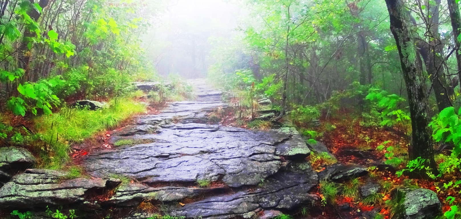
 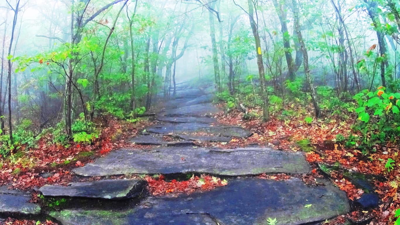 On a misty day such as this, these pathways are like woodsy tunnels. There is a strange comfort in the distinctness of the path that rises before you through the fog. Here is yet a third trail with a unique style of a singular layer of stone spread like butter, evenly, just before the upper clearing. (Image/Below) This a third style of stone along the same path within a thousand feet.How can we not notice this?
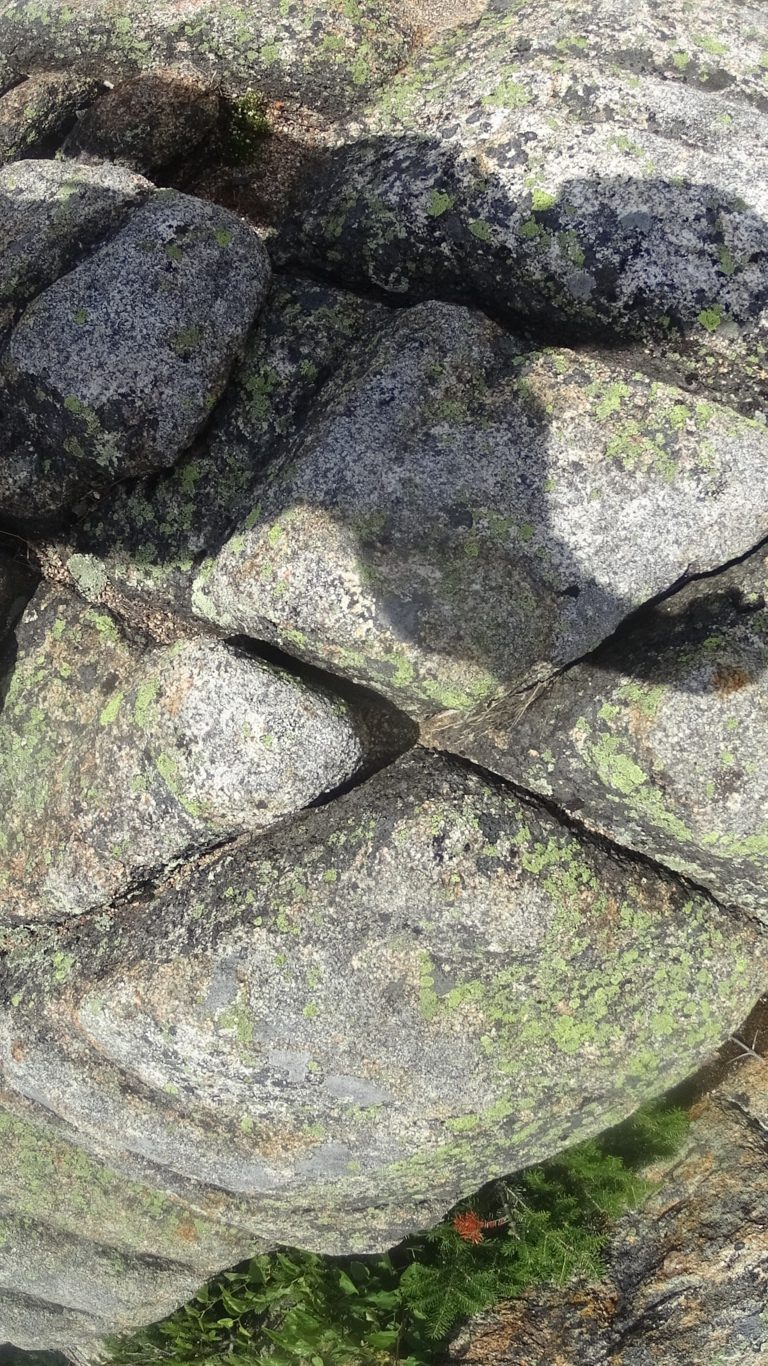
 No one is expected to concede to the idea of an ancient culture that could hew massive mountain stones into patterns and structures, and yet, ancient cultures are seemingly beckoning us to accept that very thing. Although it is not written in our textbooks, megalithic craftsmanship is in the antiquity of literally every nation. Russia, Peru, France, Italy, Ireland, China, America, England, Scotland, Greece, Turkey, Korea, Indonesia, Australia, Mexico, and many, many, more. Just google any of these nations, along with the term ‘megaliths’, and hundreds of variations of examples from forests and mountains worldwide will appear, most of them very hard to explain. You will begin to realize that the trail you are on is most likely a sacred one, one that sponsored megalithic culture, with several incredible supporting statements. And if you visit several sacred trails over time, you will see the pattern of those trademarks. One such trademark appeared embedded in the lower rock face of the mountain here, an “X” section. (Image/Below)
 Now, taken on its own, this could be dismissed as a singular fracture in the granite. But these “X” sections have a way of popping up all over New England. Here is another one at “Monument Mountain”, a sacred mountain to the west of here…(Image/Below/Left) This colossal “X” section is also located about 100 yards from a beautifully cut Standing Stone. (image/right) This is no accident.

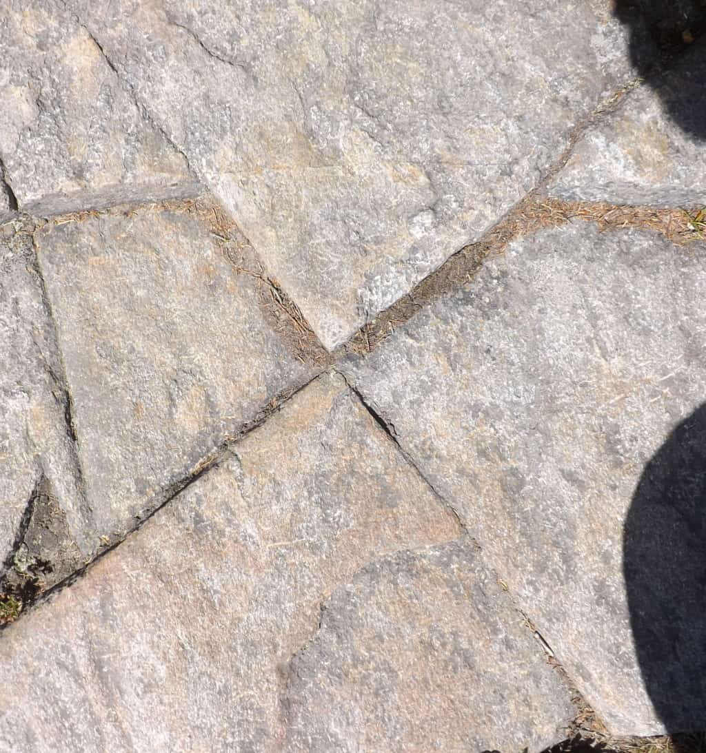
The two “X: sections just above, one located at the sacred Mountain of Monadnock/New Hampshire/USA (Left), and the other literally hewed into one of the the stone linings at Monument Mountain/Massachusetts/USA (Image/Above/Right), reveal varying levels of intensity, but are clearly crafted. It is as if the tool used to create these markings was of intense and focused heat that hewed the rock in exact ways. It clearly was not chiseled into the stone.
 Take a look a this massive “X” section on the left; it is located near the peak of Mount Clark in Colorado/USA. This “X” section is located on a 40 ton boulder sitting just 30 yards from a large Standing Stone (Image/Below), legitimizing the anthropology of the entire scene.
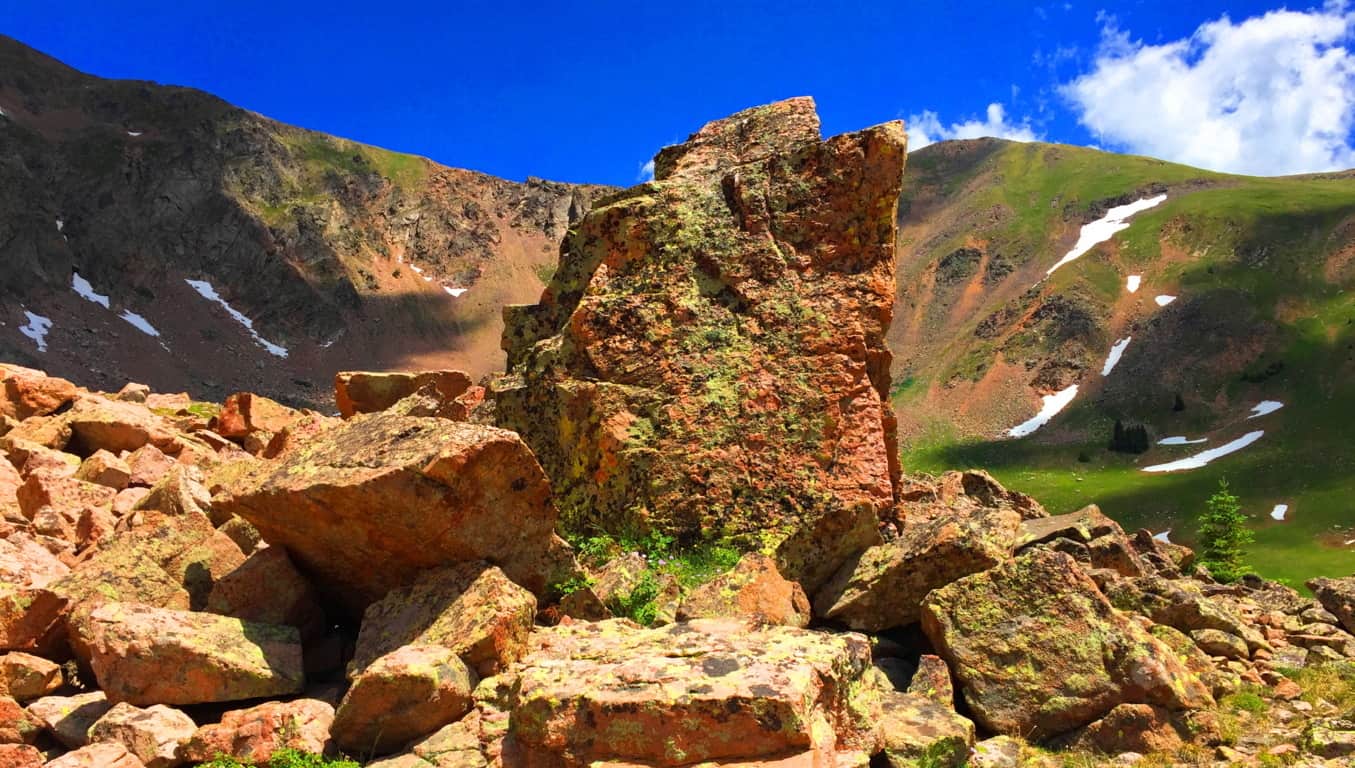
As I have written many times over the years, it seems that the “X” sections are type of logo that signifies a sacred zone. It is no accident that they are most often found near the peaks of mountains that were considered sacred to the Native Americans and Celts. The “X” is a “calling card” of the ancient megalithic culture. 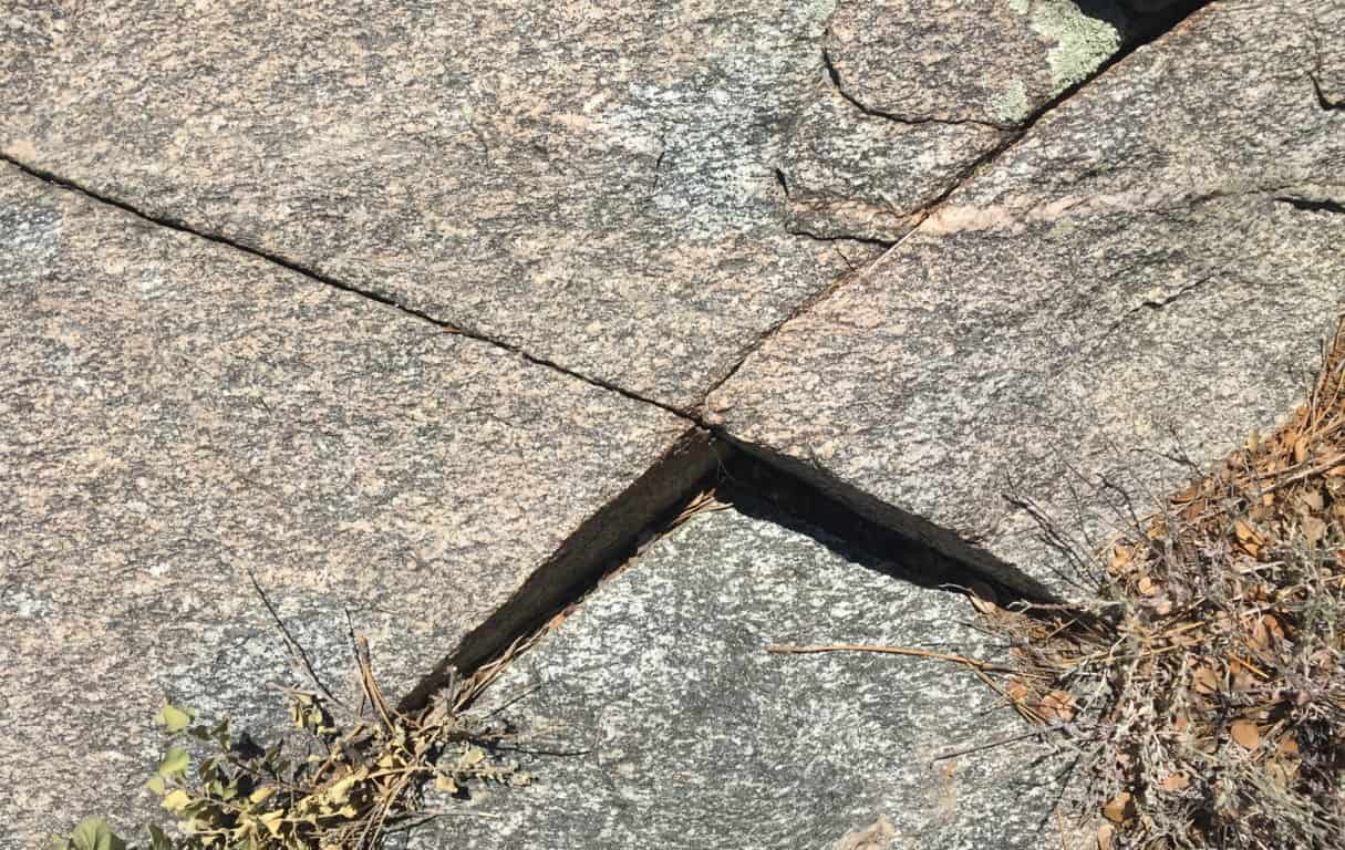 On the left is an image of an “X” section near the peak at Hulapai Mountain /Arizona/USA. Look at the precision of this section! It’s on an isolated trail 7,300 feet above sea level, incised into a mountain side! It looks like modern water-cut stone. This “X” section is also located roughly 30 yards away from a Standing Stone, of equally unique precision. (Image/Below)
At Watatic Mountain in Massachusetts/USA there are several “X” sections of less intensity, but exact precision sliced into the stones, and yes, they are located near a Standing Stone close to the peak. (Images/Below) These sections are obviously cut to be noticed. We may very well be looking at the first axiomatic and intrinsic symbolism of all language. Whoever created these sections absolutely wanted us to see them, that much is clear. And below/right, again, is the Standing Stone that the two Watatic Mountain “X” sections are near to.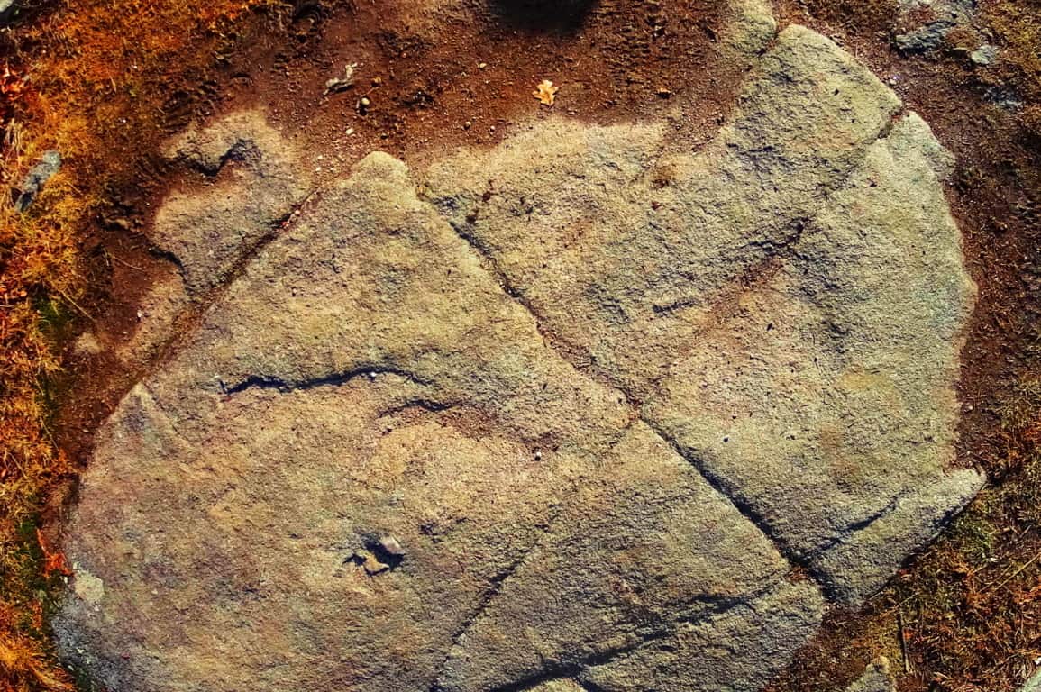
Are you seeing the pattern here? How is it that in a 100 years of modern anthropology, not a single anthropologist, geologist, or even social scientist, has now marked the obvious patterns and trends found in the heights of megalithic spaces of New England? How can Harvard or M.I.T professors, continue to belittle the most blatant and obvious patterns of evidence in these distinct spaces, from their desks? They will refuse to acknowledge, even with the related patterns of evidence, which literally point to a megalithically capable culture existing in the beginning of Time. The academics bully their narrative against the evidence because they can’t handle being dynamically refuted with evidence from people in the field. I hope that the readers will consider the evidence, not the theories of desk-chained theorists.
Returning to Wachusett Peak, at the top of the Summit Loop Trail, there is a solid rock dome over the uppermost mountain face. Carved into that ‘rock-dome’ are geometric patterns with distinct right-angles which could never occur in Nature; entire sections of rock cut with parallels, triangles, and right angles. (Image/Below) This is at the top of a mountain, not near a street corner! It almost looks modern! If people do not see this, it is because they have been programed not to. This is what you will find at the peak of Wachusett Mountain.
“Summit Loop Trail” Lower trail: Heading back down the trail there are the classic stone-linings running through the lower vale. These are beautiful stone-fixtures that run like cables from one peak to the next in the hills, literally connecting, and synergizing the landscape. 
Continuing down the ‘Lower Loop Trail’ you will find autonomous boulders near the Linings, very similar to Cavan Burren national Park’s megalithic statements in Ireland. These are the literal signs of megalithic culture all over the world.
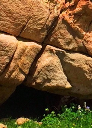
Above is an image of a unique boulder at Wachusett. Below is an image of the Boulder at Cavan Burren National Park/Ireland, which is near many megalithic altars. The Wachusett boulder, which is subject to the same pattern, is guarding by a sacred area where a full New England Dolmen sits at the bottom of the Loop-Trail path.
Here is a look at A Dolmen that has been ridiculously labelled “Balance rock” at Wachusett Mountain (Image/Below). This Dolmen is not simply two boulders sitting on top of each other, they are two colossal stones, fixed and set, in a observably crafted style. Each stone looks to be a bout 30 tons! The lower boulder was clearly angled, and cut, to support the upper. It is set before an altar of smaller boulders, which are set in a pattern in the foreground. This entire scene is a magnificent and extremely powerful statement about how important Wachusett was to someone, in the beginning of Time. This is a good place to stop and consider what it must have taken to create this Dolmen!
In other parts of the woods, off trail, there are small Cairns that have been toppled. Look at the similarity of the toppled Cairn at Wachusett (Image/Left)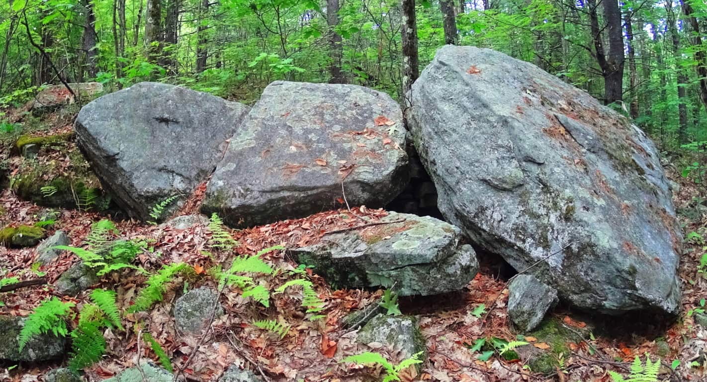 and the toppled Cairn at the Dolmen of Kilclooney Ireland (Image/Right)
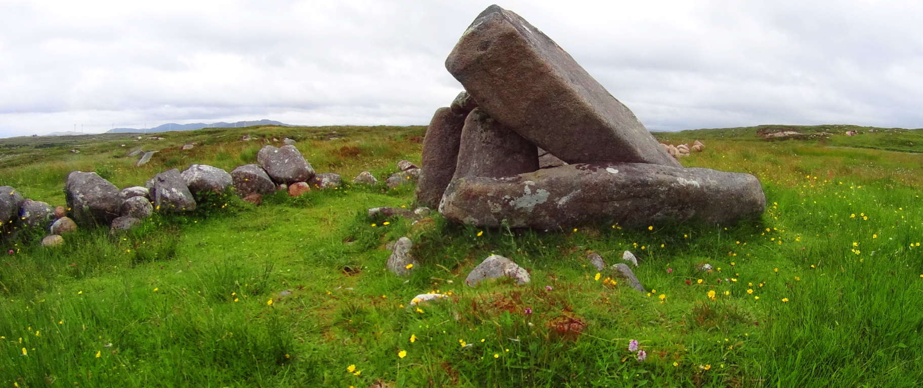
Mount Wachusett State Reservation is yet another sacred megalithic zone full of natural beauty and wonder, on par with any Celtic or American Western zone. The best time to experience this place is in early Autumn, as it is with all New England sites. Although I was unlucky in my excursion to see Wachusett in a veil of incredibly thick fog, the statements here are still overwhelming and inspiring. Yet again, you are being introduced to a trail that, through several subtle, and not so subtle signs, is trying to get your attention. Aside from that, the Forest here is gorgeous. Open your eyes and heart to see which way the evidence here truly leads; touch the markings and stones for yourself. Hike, climb, and meditate on the energy of this synergized landscape. Wachusett is a miniature-wonderland that has been endeared by every single group that passes through, since the very beginning. There must be something much more than typical about this place; the megaliths are indicating that very thing! I hope you will take your turn as well. May the road rise to meet you! And thanks for reading.
Lake Agnes State Forest
Location: Rocky Mountains/Steamboat Springs/Colorado/USA
Elevation: 10,290ft
Prominence: 459ft
Note: Any time the overall goal of your hike is found in a place that looks like a scene out of Avatar, you really can’t lose. “Avatar-type” places are the icing-on-the-cake of a well planned expedition, so absolutely “pencil-in” trips with extraordinary natural features. I penciled-in Lake Agnes State Forest just a few days before I arrived, looking over google maps with a friend, and received the Avatar-type ending we were hoping for, in spades. Just look at this scene! The view from the Trailhead could easily be mistaken for nothing less than the Swiss Alps; but it’s not the Alps, it’s the Colorado Rockies. Make sure you bring the cameras for this one..
To Trailhead: Unlike Mount Clark or Bear Mountain, for Lake Agnes you will not need a 4X4 vehicle to reach the Trailhead, a regular car will do fine. Coming from Walden Colorado (an Americana hamlet and biker haven nestled just south of Wyoming, in the heart of Medicine Bow National Park). You can take Route 14 South almost the entire drive, following Little Muddy Creek the entire way on the right. After about 35 minutes, merge onto Route 40 South, and take it just a few miles before turning Right onto Road 186, the final country lane before reaching the Trailhead, with vehicles parked near the entrance. The low-maintenance aspect of getting to Lake Agnes is one of its draws, along with the comfortable half-day-or-less distance of the beautiful hike.
Lower Trail: The initial trail is a tunnel of tall and pristine Pine trees, regal in strength and height. With the mountain views at the first segment of the hike, it’s a wonder people continue to the next phase at all, with these massive jade colored peaks, and mesmerizing forest, beckoning the cameras. 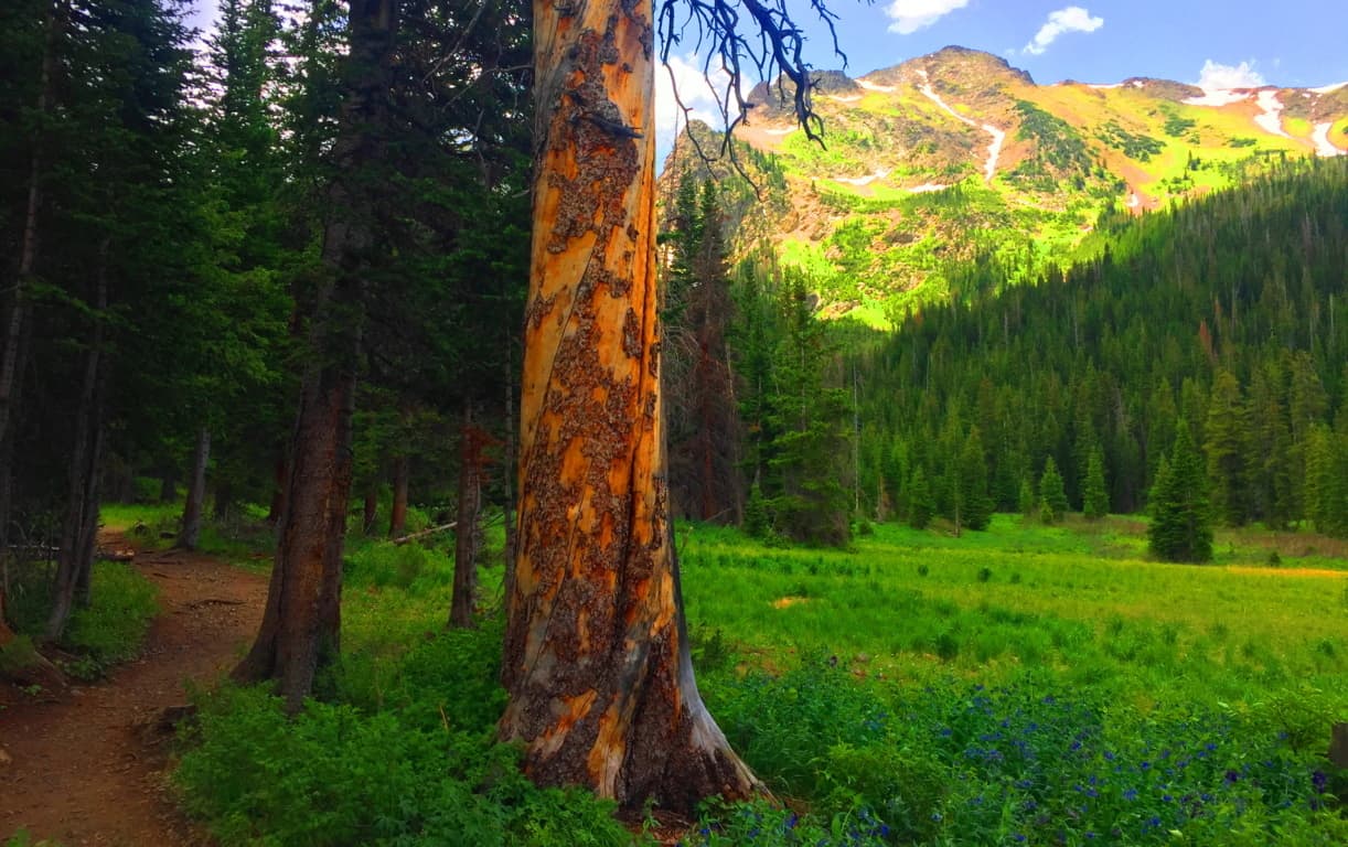 A profound view of Mount Baker, sitting several miles to the north, comes into view as you begin the 45 minute climb required of you. Each switchback-porch gives a slightly better angle on the mountains beyond.
 The trail continues around Lake Agnes, and back again, requiring a short trek through beautiful glades, with a path running directly over a rockslide on the edge of the Lake. The cliffs are streamline and massive. The scale of the mountain ridges are humbling beyond measure.
  The trailhead opening of Lake Agnes is a truly majestic scene, with a 100 yard field of velvet wildflowers pointing straight at Mount Baker to the North, which was glowing like an earthen-colored diamond.
  The image below is a wonderful example of how the Trail looks heading into the forest. The trees are vibrant and sturdy beyond measure, while the mossy forest-floor practically glows on a sunny day. It is quintessential forest, much deeper and more dangerous than any Celtic woods. Brown Bears are out there. Make plenty of noise on a trail; let them know you’re out there. You simply don’t want to startle any creatures of the forest. If you do come across a Brown Bear unexpectedly, do not make eye-contact, stay as calm as you can, and back away slowly and silently. (Studying up on wildlife encounters in the region(s) you are visiting is of course always a good idea)
 The eastern side of the dell at Lake Agnes is a phalanx of cliff-faces and striking rock facades. To the west, the valley rolls down in an ocean of green. (Image/Below)
  The Upper Trail: Welcome to the higher elevations of Colorado in July, where snow remains on the heights of the upper vale, even while the forest is in full-bloom. The water here is so clear that it reflects vividly, like a lens, curious combinations of snow white, forest-green, avalanche-grey, and blue sky. This a virtual stadium of natural perfection, where the upper-deck is hard blue stone, and the lower section a universe of sliding rocks capped with indents of glowing snow along the highest ridges. Lakes Agnes Trail is a cozily short ‘loop-trail’, only bout 3.5 miles in length. The first portion of the trail is a fairly challenging 45 minute climb to the Lake inclosure, sitting 10,290 magical feet above Sea-Level. Up here you can really feel the elevation. If you continue the woodsy loop around the Lake you will see how the small pond actually changes colors from different perspectives. The initial look of the pool looks like a deep, yet radiant blue (Image/Top), but change the angle further up the trail, and it becomes a solid green, as depicted in the image below. This is truly a wonderful place
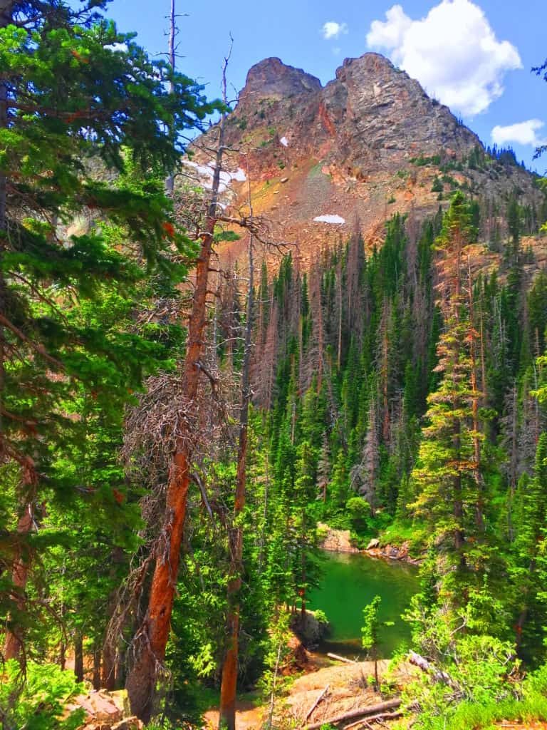
There are many stones with markings that look like linear sections which were cut smoothly, across the rock face. (Image/Below) This section reminded me of a curious solitary stone with strangely marked sections at The Blue Hills Trail in New England, some 2000 miles away. (Image/Below) The sections of the New England stone is not linear, but clearly chiseled, with the small sections that were cut away sitting all around the boulder. How di these markings and results happen?
The phenomenon of stones that seem to be blatantly crafted is no fluke. There are extreme examples of this phenomenon in many other places across the globe, many of which are noted here at Stonestrider.com. But this was the limit to what I saw of signs which seemed related to the Neolithic Culture. For the most part Lake Agnes itself is the jewel of this excursion. If you come to northern Colorado this would be a great trail to begin with as a warm up for the other mountains of The Rockies. When you get to the Lake yo will understand.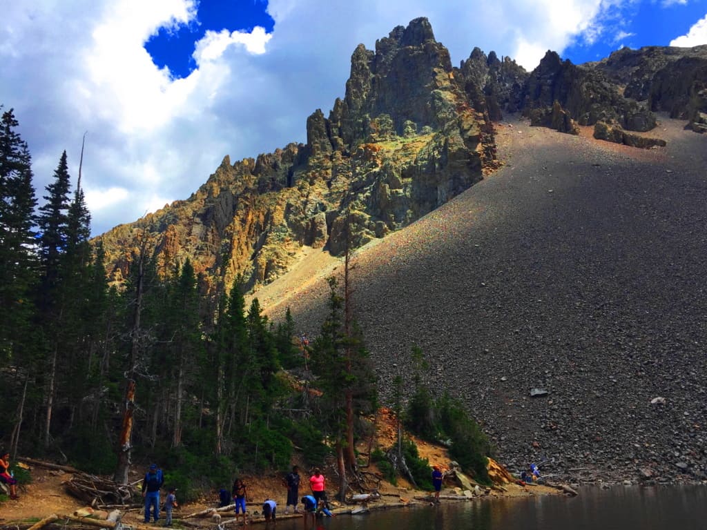 Don’t just seek it out, find it out. You’ll be glad that you did. Thanks for reading, and go strong.
Coconino National Forest
Location: Flagstaff, Arizona.
Elevation: 7000 ft
Note: Coconino National Forest raises some amazing questions and answers about what has really taken place in the beautiful forests of the world. Before wandering into any part of the massive Coconino’, it seems appropriate to have a discussion about the very real enchanted statements that exist in sacred zones. Coconino is certainly one of those sacred zones. Therefore, this article begins with a “Forward” in order to offer logical evidence, rather than tired theories from post-modern science, theories which are quickly being understood as totally ridiculous. Here at Stonestrider is some of the most vanguard and comprehensive work on what is actually revealed by these megalithic stone works, and you will learn something incredible from it. There is an anthropological side of hiking in ancient places, and every so often it is important to review connections, patterns, and evidence. By looking at this material, please understand that you are stepping into something truly magical. I thank everyone who takes the time to consider the evidence in the beautiful places of the world by reading an article like this, and we will wander into Coconino after explaining a few wonderful things about what is taking place here.
Forward: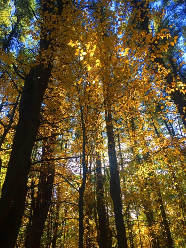 After drifting into roughly 30 forests internationally, and sponsoring this website with many truly challenging expeditions over the course of the last five years, I’m gonna take the chance of going full-on anecdotal for the first time, due to the relevance to The Coconino National Forest featured at the moment, which is one of the largest and most beautiful Pine forests in the entire World (and obviously the continental U.S) Allow me to step back for a moment to set a scene about what Forests mean to me. As a teenager I read, and re–read the works of J.R.R Tolkien, which many students utilized to break the boredom of raw academic classes, ever since the massive novel was first published in the 1950’s. Intrinsic to my photo’s, if you look with a certain eye, are Tolkien’s descriptions; images of mountains, river-glades, and forests which certainly engage all of our imaginations to this day! I realized, while going-over the content for this particular article, that in my mind, before I wander into any forest while out on the trail, that I am always comparing it to one forest in particular from Tolkien’s fictional masterpiece, that forest being Lothlorien. In this regard, I have searched for many years for forests that most closely resembled an enchanted experience, where the deeper you walked in, the more magical and dimensional the experience became. And amazingly enough, from this inspiration I discovered the real-time magic of forests internationally. These are profound discoveries that should be shared, which is the focus of this article.
 Forests often have particular emotional effects on people. Tolkien, in the Lord of The Rings, also creates a polarity about forests. His characters journey through the beautiful, mystical, spacious, ageless, enchanted Forest of Lothlorien; and then later into the dark, rustic, knarly, timeless Forest of Fanghorn. Some are light, and some are dark. And darker still, is Mirkwood Forest in The Hobbit, the epic prequel to L.O.T.R. (There are other forests as well, like the heart-warming Buckland Forest in the opening of LOTR,(#TolkienNerd), plus what you find in Grimm’s Fairy Tales, or Science Fiction stories of today)
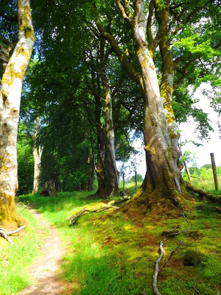
The main point of all this ‘fictional forest referencing’ is to understand that forests have, and promote, specific styles and characteristics all their own, just like people. Some are bright and carefree, with pleasant pathways, and golden Autumn leaves, as in New England (Image/Upper-Left); while Other forests, like Ballachulish in Glen Coe Scotland, are dark and looming, with strong and rustic ancient knolls. Walking through Scottish forest is truly intimidating, with a fear of getting lost in the fog and rain; yet the glens are gorgeous! (Image/Upper-Right). Take a look at another Glen in the Snowdon Forests of Wales, which is as pleasant-a-vale you will ever walk through in your life. This particular glade, which almost looks fictional in real-time, are woods made of an extended family of trees, spacious and airy, with an obvious brightness that nearly forces you to squint just to decipher the full scene. (Image/Lower-Left). There is a small standing stone at the top of the knoll in this image, which can’t be seen from this spot.
And along those lines, how could I exclude a forest which is, in my opinion, one of the most enchanting paths that has ever been, which is the smaller, but incredibly beautiful, Kinnitty Forest, in the absolute heart of Ireland. This is a rare Celtic Wood, that has been vanishing steadily since the Colonial Period. Irish forests are particularly rare due the British need for resources across the Celtic Sea just 100 miles away. Kinnittty is a rare gem.(Image/Lower-Right)
And before finally moving into the deeper meaning of forests, I could not complete this small tour without having a quick glance at the most dense and intimidating forest I’ve ever seen, which is the brilliant Rawah Forest of Medicine Bow National Park in Colorado USA. These are shimmering glades that sway and sift through each other like green-ghosts. In almost all the forests I’ve been I have disappeared into dells that looked to be harboring some kind of clearing or stone-altar; but in Colorado I dared not wander in any away from the old rocky paths. As I have described in other articles, it would be like wondering into the depths of the ocean at night, and like the ocean, it is an overwhelmingly profound statement about the abundance of Nature’s forces, ever blooming in our complicated world. (Image/Below) Forest Mysteries: I hope with this brief set of examples that it’s a little more clear how forests have enchanting and unique personalities. This “enchanting” vibe, if you look even closer, doesn’t come from the glades alone; there is something even more strange and mysterious beneath the tree tops. There are megaliths and impossibly crafted stones. This mysterious trend is an international phenomenon, where specific geometric patterns of stones, along with incredible feats of megalithic engineering, emerge deep within the woods, beneath sacred mountainsides, from Glen Coe, Scotland, all the way to Arizona, USA. After establishing proper anthropological and mathematical similarities in stones from forests nearly 3000 latitudinal miles away from each other (that’s North to South) the obvious question emerges: “How can this “glacial” arguement continue to hold up?
  Free-sitting boulders at advantageous vantage points in the forests of New England (Image/Below/Right) Ireland (Image/Left) England, Scotland, and Wales are technically similar to free-sitting boulders in Wyoming, Colorado, and Arizona.
 How the hell is this possible? Did the most recent Ice-Age glacier of roughly 40,000 years ago reach all the way down to Arizona’s volcanic mountain deserts? It just doesn’t make sense. Technically, the continent-sized ice mass that covered what would be the American West was called the Cordilleran, which looks to have stopped on the border of what would eventually be Canada. So, simply put, how are scientists claiming that free-sitting boulders like this one in the Coconino Forest in central Flagstaff was moved by the same glacier as the boulders in New England and Ireland? (Image/Lower/Left)
 I examined this Arizona boulder, and more importantly, the slope of the ledge it sits on, and the angle is very telling of how unlikely it is that this boulder remained on this ledge from an at-random geologic process. There is 15 degree slope on the ledge-top, as you can see. To counter that, on the boulder’s base, is a cut of about 15 degrees, fitting the boulder to the ledge perfectly. This is a fixture; an intentional fit, in my opinion. Additionally, there are markings all over this boulder, which is a type of “ledge-boulder” found in sacred zones all over the country. The odds that all of these boulders are placed at random at the very edge of vantage-giving ledges is, to put it blatantly: gastronomical multiplied by gastronomical; impossible.
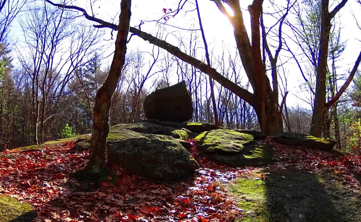
Take a look at yet another free-sitting boulder on a rounded ledge which is ‘vantage-giving’. This boulder is 2500 miles away, in New England. See how rounded this ledge is? For this boulder to remain fixed on top of this rounded precipice it would have to sit in the absolute gravitational center, which it does. Again this an example where if you use logic, and not simply dismiss the statement with brazen theories about ancient ice-sheets, the truth will come out. Someone, or something put this boulder here in order to say: “This is my zone; see how strong I am; beware!”
If this “territorial fixture” still doesn’t seem realistic to you, take a look at this amazing statement at Cavan Burren National Park in Ireland. It should be understood by the reader that Cavan Burren is filled with sacred megaliths; altars with standing stones, small temples, and Neolithic engineering. Someone claimed this space for themselves in antiquity, and in this space what do we find? A free-sitting boulder perfectly placed on a tiny platform of bedrock. Modern “science” is telling us to believe a massive glacier rolled this single boulder hundreds, or even thousands of miles, only to land it perfectly square and set on this minuscule 4 by 3 foot space of embedded rock? No. Impossible. Absurd. Illogical. And to me, insulting. Again, this is clearly an example of a boulder which was placed by an individual(s) in ancient times, as a statement to others that this zone is occupied, and by someone with incredible strength and know-how. Furthermore, here are some of the Neoliths found within just 25 yards of this boulder:
 (Image/Left) and (Image/Below/Right). How can we go on believing the academic narrative of the post-modernists? They are blatantly lying to us in their white-papers, mini-museums, and gift shops. Why? What do they not want us to conclude? Well, regardless, perhaps these academics didn’t expect someone with a Degree in Western Literature, and some perspective, to make the effort to actually study these places in detail. Perhaps they are RELYING on the fact that people don’t make the effort to stride into these sacred zones from one continent to the next. And these free-standing statements can be found in forests all over the world. Here’s a look at some of the very strange and distinct boulders that remain in Cavan Burren Forest, just 100 yards from the Wedge Tombs. Celtic glades in Ireland are rare, and these boulders are strewn into the landscape like an above ground cable system. Covered in glowing green moss, they just looked to have some positional secret yet to be understood…
And now take a look at a similarly stoic boulder in the forest of Cococino, 4000 miles away. It has precise indents on its side, also with a strange glow, which is of course rusty orange, rather than mossy green. These boulders seem plotted, or planted, rather than randomly tossed about by ice. They are both squared and monumental, as opposed to disheveled. Another very real possibility is that the stones were there long before the forests grew. Were the stones there before the glacier came along? In some forests you can easily see that the stones were there first, as the trees grow straight over the rock. The point is, there are a great many questions that are not answered by the one size fits all modern answers of “glacial displacement.”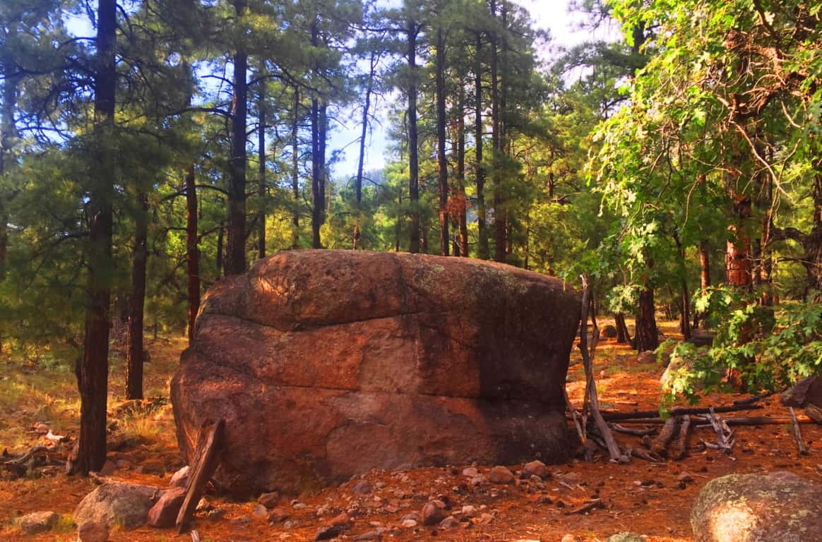 Coconino National Forest: Welcome to a Ponderosa Pine vale that stretches from the northern to southern heart of Arizona. Grand sections of forest emerge all the way from the Grand Canyon down to Sunset Crater Flagstaff, continuing even further down through Oak Creek Canyon, in Sedona. In this environment entire glades of trees are literally on the edge of burning at any given moment. Many trees are already lying prostrate on the ground with limbs seemingly reaching to the heavens, begging to be finally ignited by the Sun. I had just never seen trees like this before.
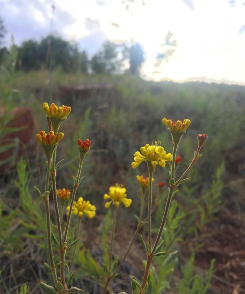
 Even with the challenge of an extremely arid climate, many incredibly delicate and beautiful statements emerge in the dry hedge and shade. These wildflowers just look so resilient against a massive canvas dry-wood in the background.
 You will have to make a decision about where and when you want to wander into the Coconino’. The northern section of the Forest sits at the edge of the Grand Canyon, near the great Southern Rim. This requires traveling through the beautiful desert plain to arrive at the Canyon. The central section of the Forest is roughly 150 miles south of the Grand Canyon, stretching from Sunset Crater National Park to the The San Francisco Peaks, which are the rugged mountains that engulf the city of Flagstaff. Much of the Forest can be found at the base of Mount Humphries, climbing all the way to the peak, which stands at 12,365 feet above Sea Level, and offering 6000 feet of Prominence. That’s a pretty serious climb, and one which I did not make during this particular excursion. The area is truly a wonderland, with possibilities in every direction, and it is nearly impossible to miss a mountain, canyon, or forest trail, in this part of Arizona. Flagstaff is the place where I chose to enter the Coconino first.
 The Coconino Forest at Buffalo Park: There are half a dozen parks and entries for the Forest in Flagstaff. Buffalo Park is a 700 foot elevation hill encompassing about 5 by 15 miles of quiet grassland above, and on the edge of Flagstaff.
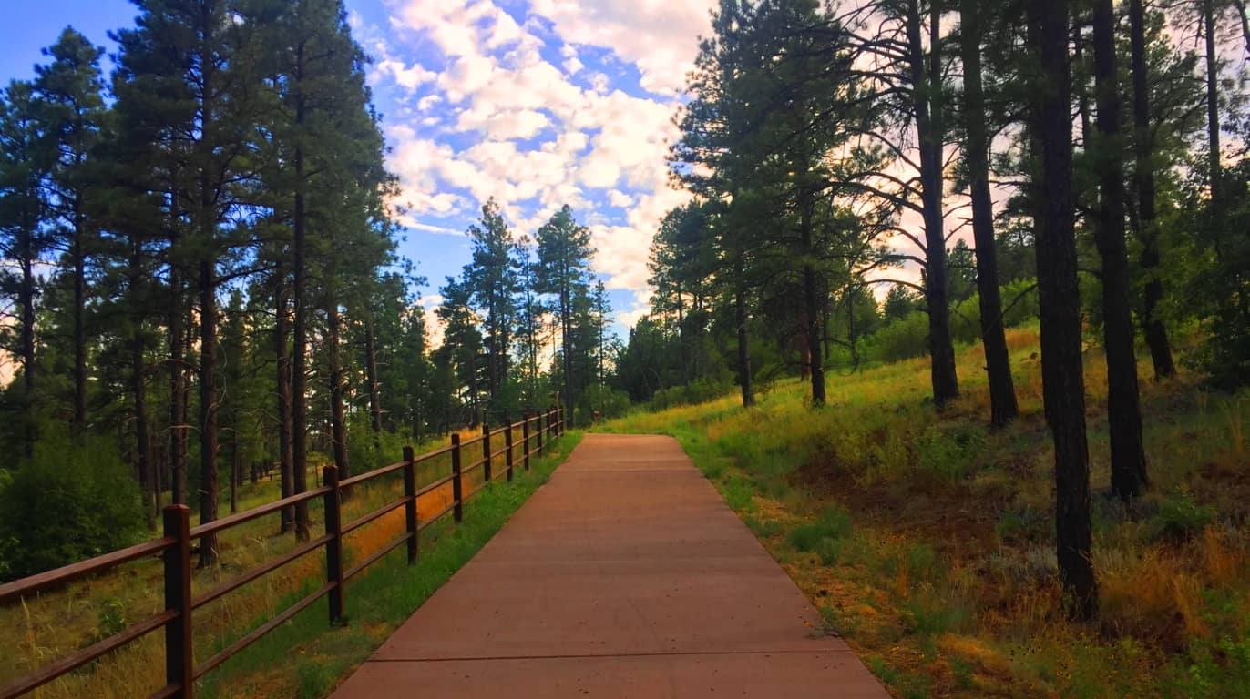 At the top, after sifting through the Forest, the area opens up to a surprisingly vast and peaceful scene. (Image/Below)
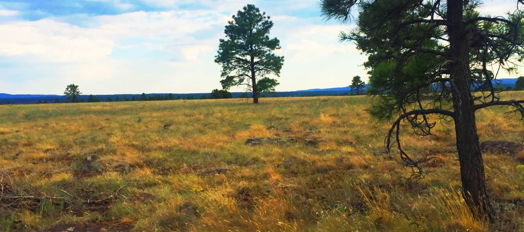 This plateau is like the American West’s rustic version of Ireland’s Hill of Tara (Image/Below/Left) although it was far less lush than the near perfect setting of Tara’. The quiet was very similar though, both hills were places to feel the high winds and absorb the day. It was easy to see that this hill, perhaps 500 years ago, would’ve certainly been a serene place for the Natives, who built stone huts in the deeper forest just a 1000 yards away from here. The size and scale of Coconino and Tara’ is eerily similar.
 The trees and stone-fixtures surrounding the Hill at Buffalo Park seems as enchanted as the megaliths in, say, the Mourne Range in Ireland, or the Berkshire Range in Massachusetts. As explained at the beginning of the article, certain areas felt more like claimed cliff-spaces from the beginning of Time. Buffalo Park is just a teaser to the more dense forest which is closer to Mount Humphries, a beautiful wilderness looming in the immediate distance.
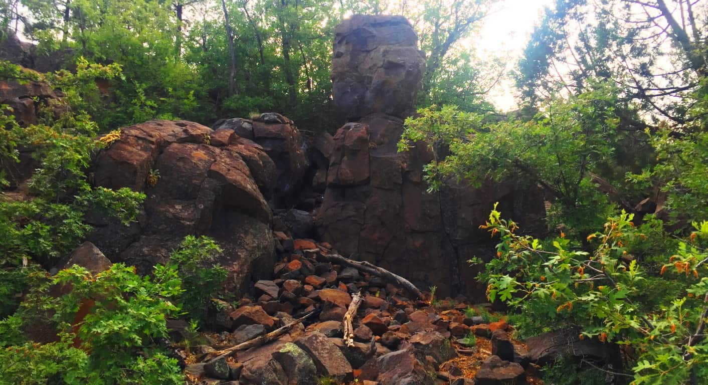
The image above is another look at the small cliff-face with a distinctly placed free-sitting boulder, etched just below the top of the broad hill beyond. I can’t stress it enough, how similar this is to places in New England, where magical things often loom in deep gully’s, which unless you stop and dip down into them, you would simply pass by, gaining no knowledge of the concealed area at all. Here’s another look at the surprising frequency of boulders beneath the trees in this wonderful place. (Image/Below) 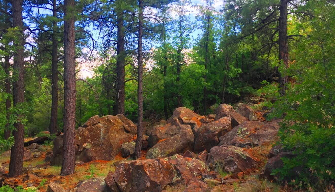
Once you are ready to step into the larger Coconino Forest at the base of Mount Humphries, you can simply drive up to one of the many Trailheads. I used the entrance at Trinity Methodist Church, sitting on the literal edge of the vast woods.  There are dozens of trails winding through this spacious and beautiful set of glades, with massive stones set in incredible positions that give serious pause. This amazing stone was there to greet me as soon as I walked in. (Image/Below) You just can’t make this stuff up.
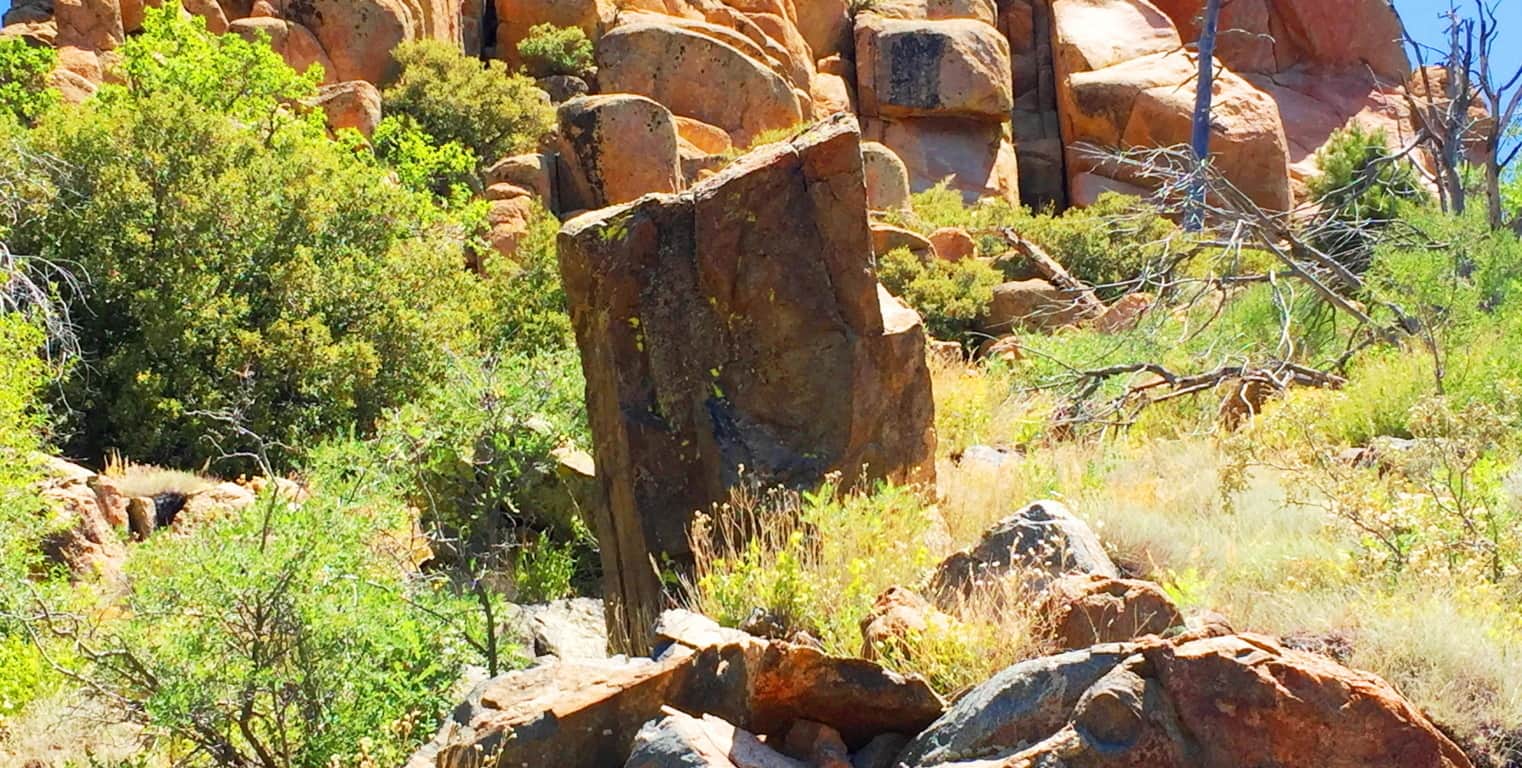
This stone is essentially standing straight up at about 4 feet high, with only a five inch width, which is relatively thin. It is also buried deep within the ground, and make no mistake, this a massive rock. There is a type of streak across the center, with an oblong leaning of the overall shape. I was excited to see a type of “statement stone” as soon as I began my hike. The forest felt strange, mysterious and beautiful. Stones like these in New England are very similar, but this seemed a different style all together! As I progressed further towards the base of the mountain, another stone, more convincing as a Standing Stone, emerged. (image/Below)
Here is another huge stone standing straight up at about 5 feet tall, and about three inches in width. At this point I was having that moment, just like I’ve had at Cavan Burren National Park in Ireland, and Monument Mountain in Massachusetts, when I said to myself: “O.k, what in God’s name is going on in this enchanted place?” And that feeling of ‘Lothlorien’ begins to sink in, all over again…
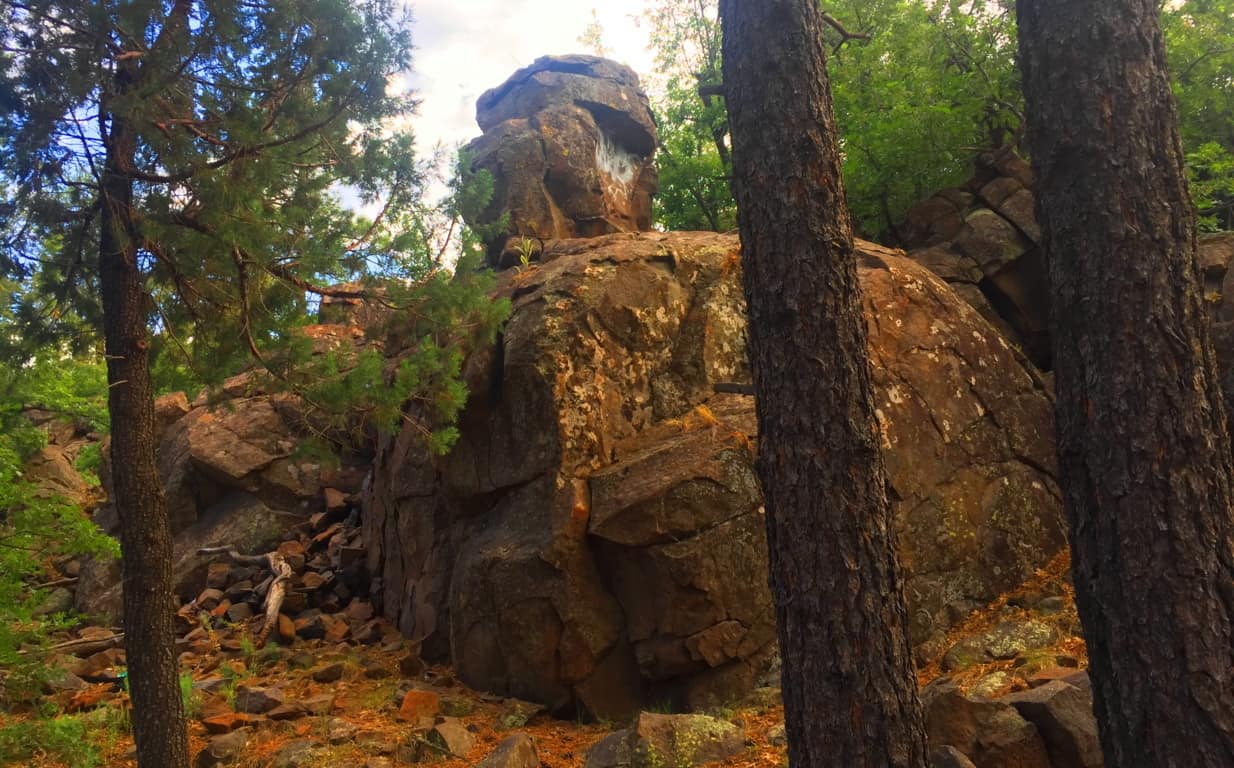
Take a look at this boulder above, which was on the edge of the woods. It was so isolated and stoic, extremely similar to the boulder at Cavan Burren National Park I described above. I could not help but feel that this was another territorial marker, just like at Celtic sites. I even pictured it painted with various markings to increase its distinction, as they are depicted in the mythical xbox game Skyrim, protected by giants living their primordial existence.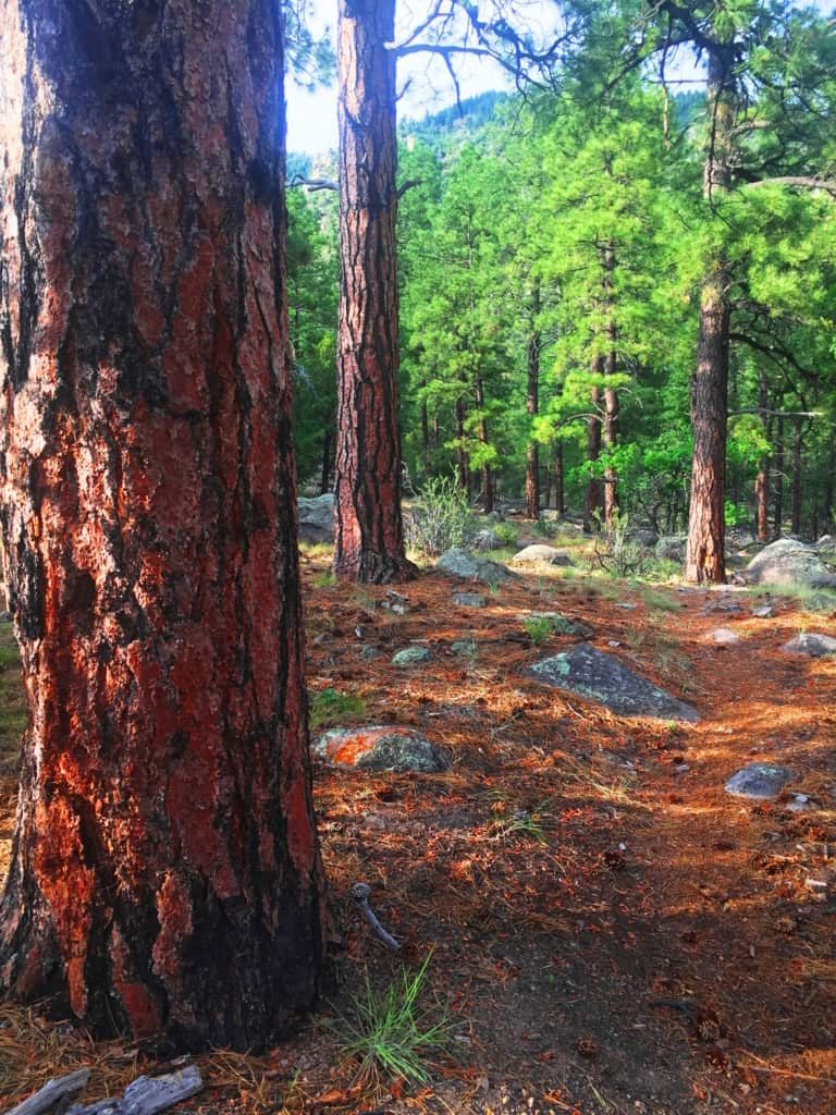 Hundreds of distinct statements like this can be found in the Flagstaff Coconino. Something spectacular is going in this place, so spectacular, that its hard to totally understand. Aside from the threat of fire in July, the place was incredibly peaceful. Against Mount Humphries, the forest seemed ultimately protected from the North, tucked-in enough for the natives to build there homes here, which of-course they did. The trees are spaciously placed with a rusty orange glow along the tough exteriors and the forest floor, very much like New England Pine glades. The air is so dry that you can taste the hovering heat in the pocket of your tongue, like the taste of charcoal in the wind at a barbecue. Any spot is a great spot to sit down, take a nap, take a picture or video, and just fall into the peace and quiet of this massive natural space. It is pure medicine for your mind, against a modern world constantly driving us into the lower aspects of existence, which is the material and monetary contest we experience to survive. The Coconino’ makes you forget, in the best possible way; through the wind in the trees.
Coconino Forest at Oak Creek Canyon/Sedona: After walking out of the Forest at Flagstaff, I had real and tangible reasons to believe that the Neolithic Culture inhabited this place, just like the myths of the Natives speak of. The following day, heading down to the southern extreme of the Coconino’ from Flagstaff, to Oak Creek Canyon, there are two southerly highways. Take the 89A, not Route 17. The 89A is one of the most beautiful back-highways in the country, and scenic Coconino forestry all the way down into the Canyon. The distance from Flagstaff to Oak Creek is only about an hour, the entire trip a wonderful experience. Bring cameras and water, and be ready to freak-out on the beautiful southern extension of the Coconino!
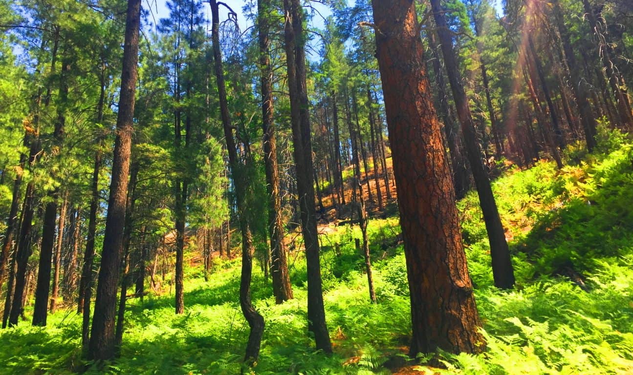
Oak Creek is its own excursion, with magical stones, free-sitting boulders, and habitations well worth several treks. (See “Oak Creek Canyon” at Stonestrider.com for the complete experience.) The most important thing to understand is that the Coconino forest reaches all the way to this southern tip of the central portion of Arizona. This forest is massive and gorgeous, and as mysterious as any Celtic place I’ve ever seen. The trails here are cool and distinct, marked by lonely boulders that seem to be markers, yet again. The Forest grows thickly, with perhaps the tallest of Ponderosa Pines in all Arizona, featured in the very top image of this article. The Coconino Forest is enchanted with a rare Trinity of locations; found in Canyon, Mountain, and Desert. 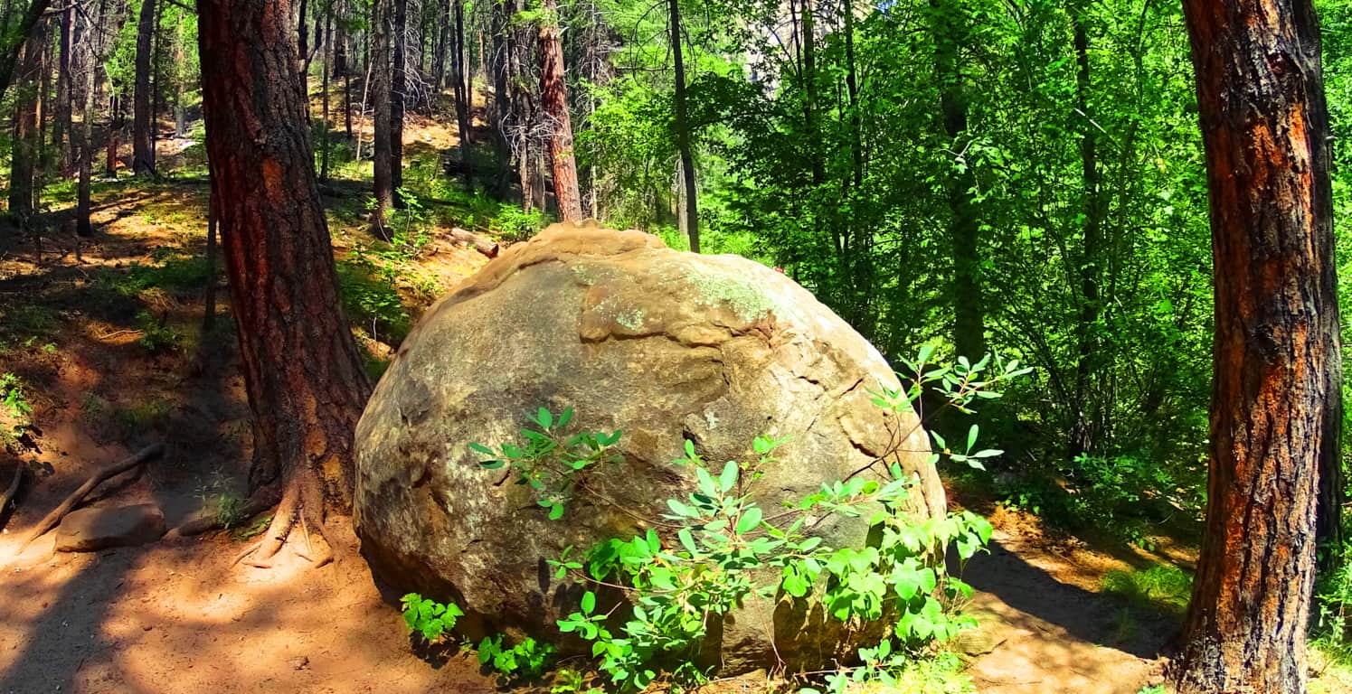
The Coconino Forest of Arizona is another dreamscape with mysterious statements strewn throughout the gigantic woods. It is the majestic wood-belt of Arizona, and in terms of scale, trumping Celtic forests in every possible way. Did the same Neolithic Culture which I believe existed in the forests of Celtic places exist here? I believe they did. Let yourself wander beneath these Pondersa Pines. There are mountains, volcanos, canyons, deserts, and grassy plateaus, where you find this Forest’s trails. It is an all-embracing Forest that pushes through the most arid of environments to ultimately give life and shade to this part of the world. The most important message I can convey at the end of this article is that reading about a forest is all well and good, but entering into one is the overall goal. You can get there and experience this massive life-force for yourself; it’s not a cliche. Seek it out, and find it out. Use your own mind to experience places like this, and don’t let the information-comptrollers and false-history writers deny you your allotted connection and interaction with this amazing primordial source of life in our world. Look and decide for yourself what happened in this gorgeous place. Go strong. Stonestrider.com.
Black Hills National Forest
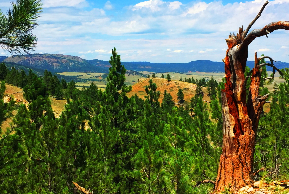
Location: Sundance, Wyoming/USA
Elevation: 3,100 ft
Prominence: 1200 ft
Note: Before you begin reading I already know what you’re thinking: “What could possibly be exciting about Wyoming? (yawn)” It’s a fair question, and something that should be addressed straight-away. The answer might surprise you a little. The truth is, the answer is totally related to what kind of hiker you are, and somewhat philosophical. You have to ask yourself: “Am I a trailblazing, stone-kicking, seeker of sacred zones in the misty heights?” “A geared-up ‘earthbound-astronaut-in-boots’ made for 10,000 feet above sea-level?” “Am I wading waist-deep in the Irish-muck to get to the distant hill where the Dolmen sits?” “Am I willing to go to that way-out-there place which others dismiss as too inconvenient?” In other words, are you passionate about breaking the domesticated spell of post-modern life? Or…are you the needy type? Do you need attention and noise? Are you in the habit of speaking constantly, needing to hear about this, that, and the other thing from the social-media feed? Do you need lots of stuff at your disposal? Do you need to be close to a metropolis and all its accoutrements? Do you need a constant phone/computer signal? If so, you’re not alone; but let’s put distant, hard to reach, places into perspective;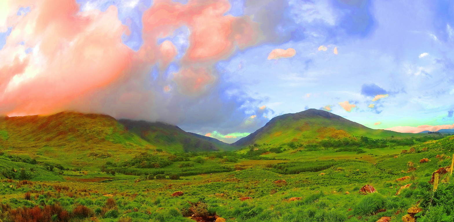 If, for example, you were to show up in a place like Killarney Ireland (Image/Left) with this needy attitude, a Killarney which is a darkly magical, mostly wet, Celtic wilderness of eternal greenery, you could perhaps say the same needy things you say of Wyoming, like: “Oh man, it’s just farms and mountains without a soul in sight”… etc etc etc. And with this needy attitude you will have already failed. You might as well go on a cruise and do the thing where you get off the boat, and then back on, after looking at a mountain from the beach, for about ten minutes. Awful. The point is this: the only real difference between the stellar beauty of a romantic wilderness like Killarney, and the lessor known wilderness of The Black Hills (Image/Below), is only the basics of fauna of the landscapes, and that’s it.
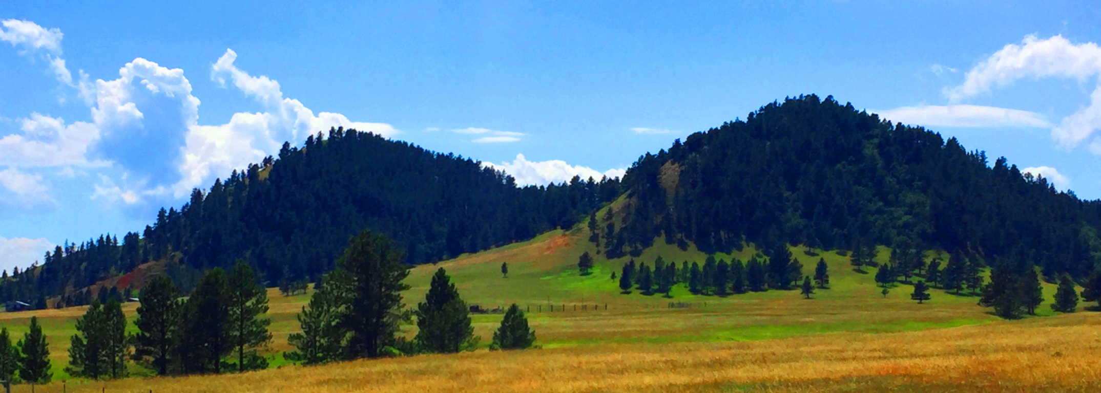 That’s all. The potential for wonder and exploration is just as possible in Wyoming as it is anywhere else on Earth. Both are haunting and spacious, eccentrically-far from any city, and soooo quiet that they are equally capable of making you face that illusive, money-bound, noise factory, you currently know as…. yourself. The Black Hills in Wyoming is yet another dream-scape that can heal your senses and sooth your thoughts. There are romantic signs in the mountains of a history that goes right back to the primordial beginning of Time, just like Celtic sites. If you open your eyes in this way, Black Hills Wyoming is a vast mystical zone, just waiting to embrace you.
 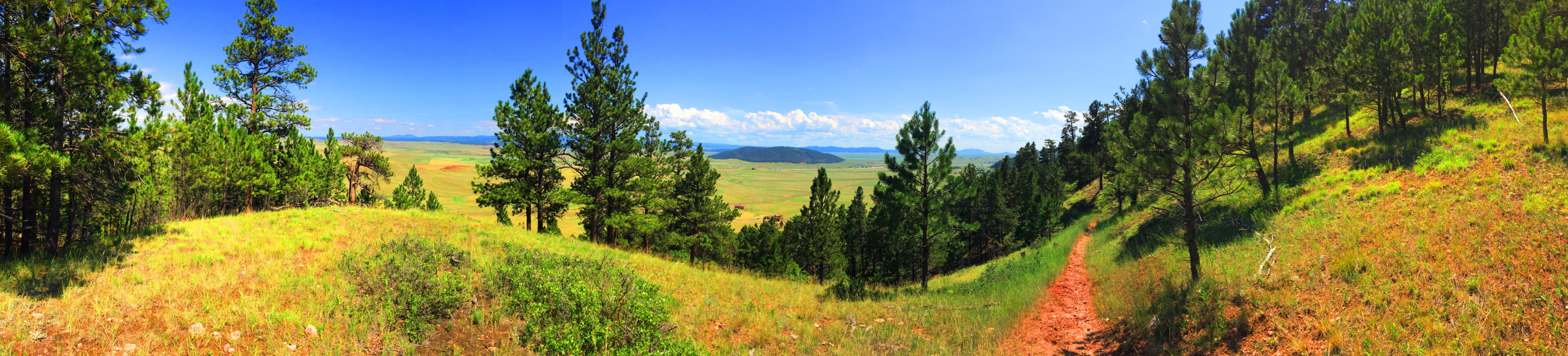 In American modern cinema, in films such as ‘Dances With Wolves’, ‘The Last of The Mohicans”, or “The Revanent”, there is an image of the “spiritually in-tune” Native American. This image of the stoic, quiet minded, spiritually animated native, is not easily grasped by the domesticated culture we now find ourselves in, where almost 65% of the population has now been forced to inhabit cities. It is hard to comprehend the once spiritual state of the Native American in such a postmodern situation. But, if cities are the mechanism for our domestication, than places like Black Hills National Forest in Wyoming, are the mechanism for cosmic-quiet, and a confident solitude that the Native Americans once knew. When you enter them, the quiet is practically a persona to be interacted with, not just a lack of meaningless bustle and monotonous motion. You can truly realize this in this absolutely vast space, and slightly hypnotizing slopes of the Black Hills.
Even the image of this wide-open landscape can’t do the actual scale justice. South of this place, the Wyoming Plain rolls like an intermediary dimension between Heaven and Hell, neither rising nor falling, just continuing into an ever distant blue horizon. Some History: Obviously no Roman Army ever traversed this place, like in England or France, although, I have to think that the Caesars would have been tempted by the idea of crossing such a vast stretch of accessible land, like when they penetrated the high Plains of Scotland, where they were eventually turned back by the Picti (Scottish Natives). So, who did walk in this place in Wyoming? The Arapaho, Cheyenne, Ute, and Shoshone all inhabited this vast space as warrior-hunters of the Plains. We now know that most of their ancestors wandered over the land-bridge while hunting animals from the East-Eurasian Continent to what is now Alaska, created by the receding Ice-Age some 40,000 years ago. Once upon a time, this Plain was inundated with Buffalo, an animal by which nearly every human need can be resourced. The native tribes, amazingly, say that they were NOT the first to inhabit this place, but rather, the ancient myths tell of a race of “Celtic looking (caucasion) red-haired giants” who were already here when the natives arrived. Strangely enough, the Native Israelite tribes encountered the exact same thing when they entered Israel from Arabia, discovering giants in the hills, which is recorded in Semetic Scripture: ‘Numbers 13:32’. The Mayan and Inca say the very same thing. The megaliths of South America were there BEFORE THEY ARRIVED. In fact, nearly every Native American tribe has stories of giants controlling the heights of the mountains and hills. And these are the oldest stories that the tribes have to offer, which are now faded into inaccuracy and mere myth, due to the genocide that came for the natives in the modern Era. Like the native Scottish Picti tribes, these Native Americans were at-one with the landscape, and also like the Picti, when a foreign army came marching through, they decided to paint themselves for battle, and fight. Of-course it wasn’t the Roman Army which wandered into the heights of Wyoming, but The Union Army, a far more advanced and devastating force, and we know how that story ends. Don’t let this wide-open space and silence fool you; although it is profoundly peaceful there are mysteries and epic events which took place here, making it that much more haunting in the heights of the trail. The natives called this place “The Black Hills”, although I am not entirely sure how they could have…
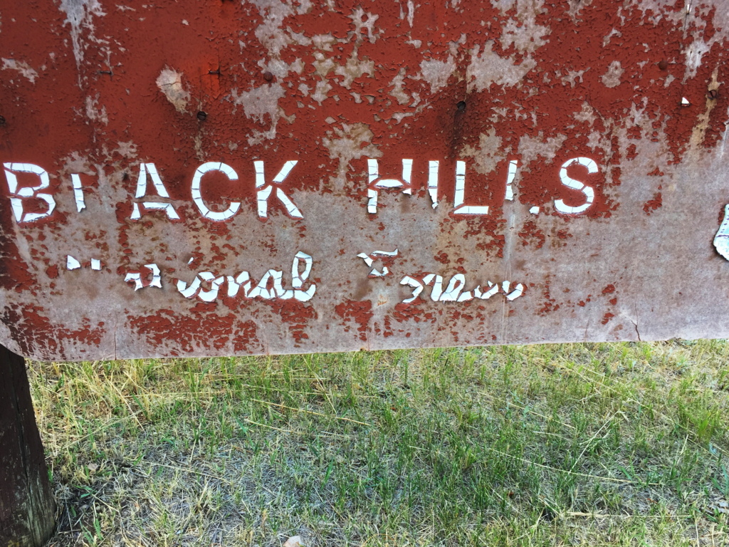 The scene is a dry green and golden haze that embeds striking patches of massive trees and knolls. It all booms-out over the region as if it never ends. The trails are not what you would call ‘a going concern’, but are still marked by the classic cursive lettering and soil-brown signs that were erected at the turn of the century. I’ve waited my entire life to see one of these particular types of signs; seeing one means you’re in the Great North West of America; a rock-star zone for hikers. This is the listed trail-head for the Black Hills, down a lulling farm-road, about 7 miles from the classically Americana town of Sundance Wyoming, population 1,182. Sundance has veterans who died for the United States memorialized in the center of Town, along with home-like breakfast parlors and ice-cream shops straight out of a Norman Rockwell painting. But these people aren’t lost to the Times, as you might ignorantly assume; they are a deeply rustic, tough, and caring people who look you straight in the eye, and extend a helping hand in a moments notice.
 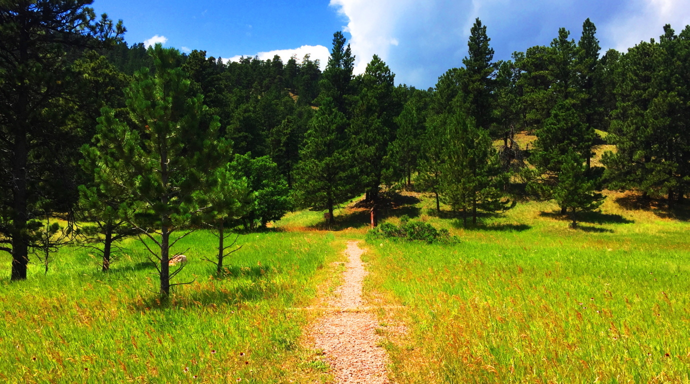 Black Hills Trail: Entering this trail is as pleasant as it gets. There are distinct and clear heights in front of you, with a breeze and swaying grass beneath spaciously assorted Pines.
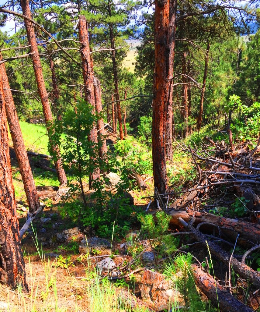 The path appears to be a modern work of Cub Scouts and campers from the last 100 years. There are no signs of the ancient stony paths found in Celtic heights, New England, or northern Colorado. The one factor that is entirely unique to this space is the level of quiet, if that is possible to measure. It is simply a denser quiet. Even the regular sounds of hawks or wild goats are not heard in these hills. It will make you more aware of yourself in return. Often times it’s a moment to say to yourself: “Well, at least I’m not in my office/in traffic/on-line/ etc etc etc. The Trail switches back a few times as you ascend a solid soil pathway through the Ponderosa treeline (Image/Left). As the hillside reveals itself, there are stones that begin to pop up, of a type I had never seen before. As the trail levels off near the top of the initial knoll, it begins to veer into the deeper woods, and boulders akin to what is found on the ledges of New England, begin appear. I have to admit that the ledges and boulders here were so ancient looking, so old, that I realized I had never seen this specific type before. Ancient Wyoming boulders are practically rust colored with orange and brown spots. (Image/Below/Right) This is very similar to the pattern on Alpine stones found in the heights of Mount Katahdin (Below/Left). Look at the Same rare spotted pattern, although they are very different colors.
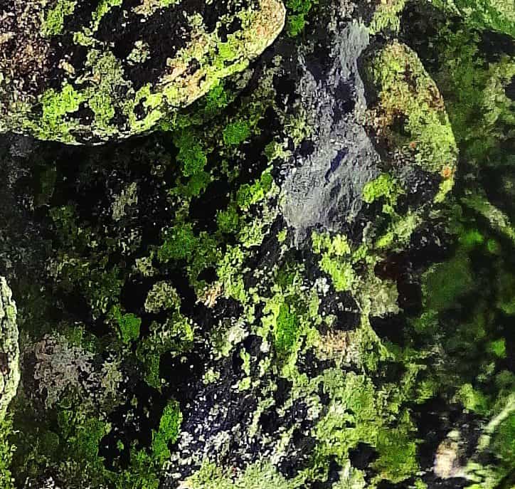
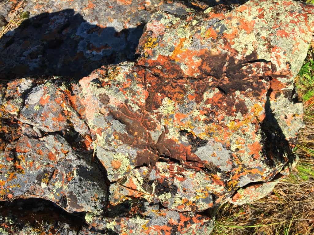 There are also boulders in auspicious vantage points throughout the early portion of the upper trail.(Image/Below) You can see cut-sections of ancient hillside stone, with a free standing boulder on the upper left corner in the image, in an advantageous vantage-point above, just like on New England ledges. Whoever put these boulders there are the first occupants of this land, before the Native Americans arrived.
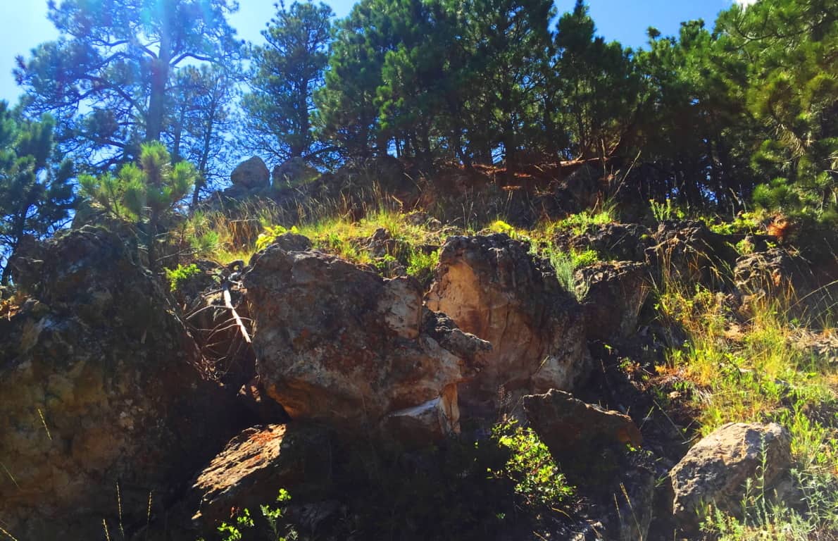 The places where the stones are cut, and stacked, on top of each other are most often the most beautiful views facing outward, not hidden in the forest. Again, this is so similar to Ireland and New England that it is nearly impossible to ignore. Look how distinctly the stone is cut and set in a fixture in the image below.
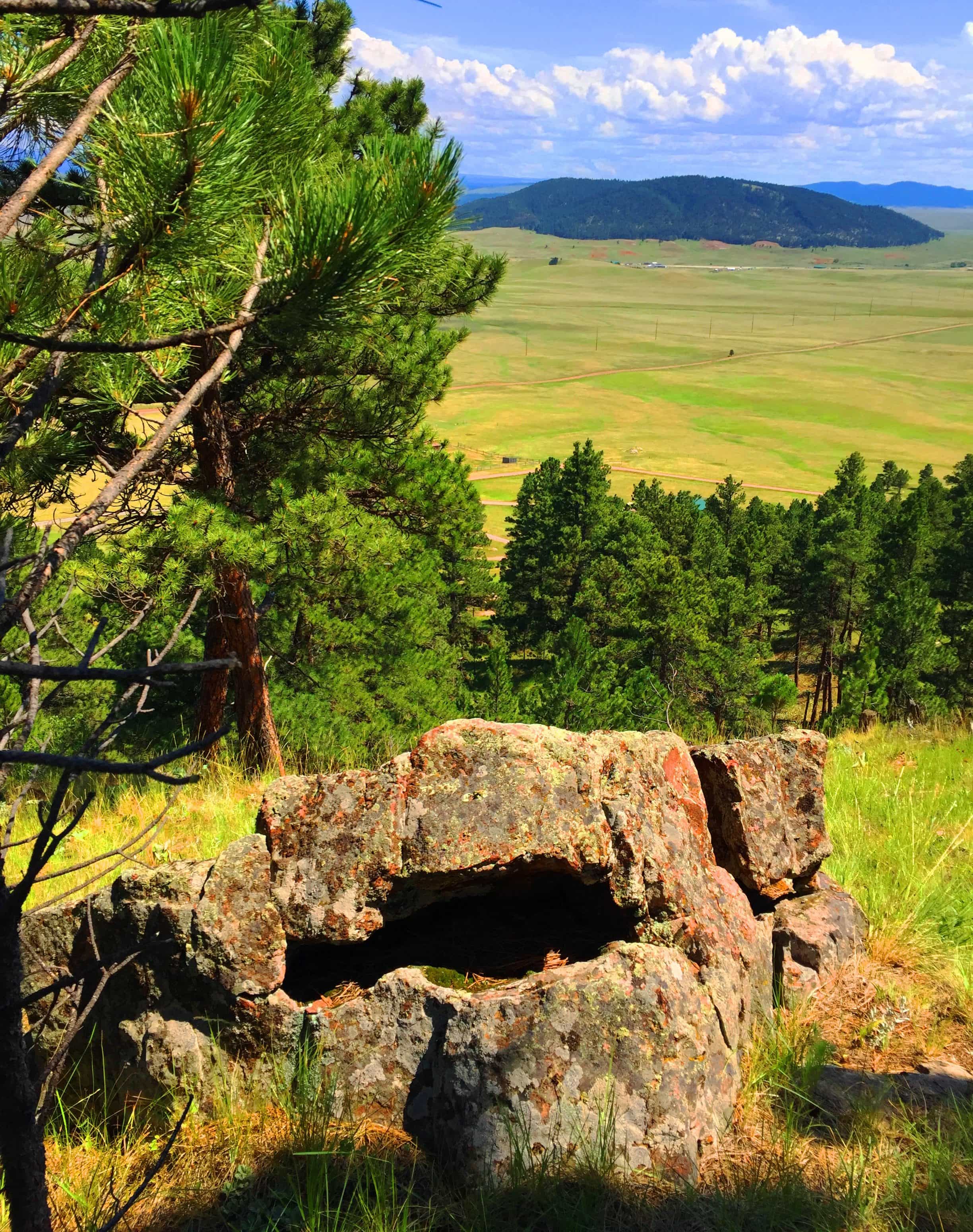 The second third of the trail, the upper trail, becomes gorgeous forest. This is a beautiful stretch of trees and thickets, and there is a temptation to wander into it, leaving the path behind. I don’t recommend going off-trail on a first excursion, but with time, and more knowledge of the range, it might be possible some day in the future.
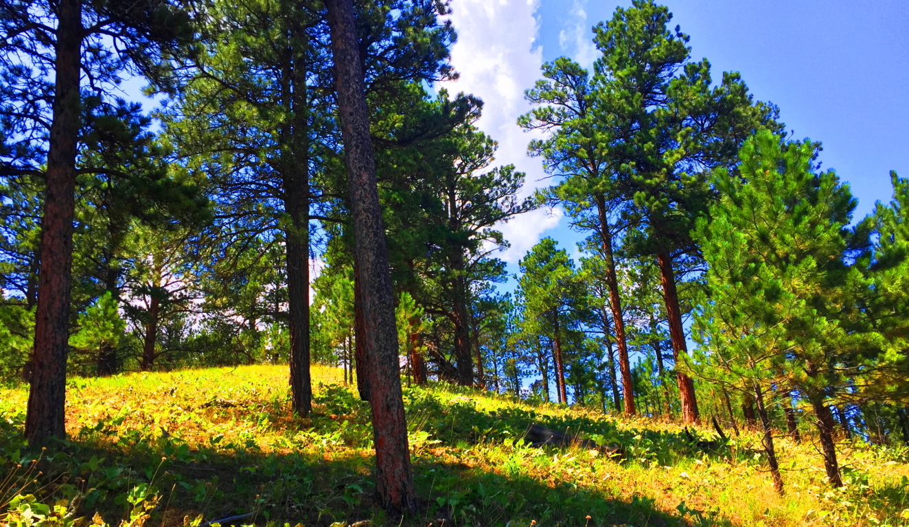
The upper vale in any range, whether it’s the White Mountains of Vermont, or The Berkshires of New York, are almost always a type of secondary dimension. You step through them, only to have them change as you go. Your perspective can change from ‘surrounded by pillars of reddish brown’ to ‘sifting through small shafts of milky-white limbs’; i.e: Ponderosa’s to Birch’s. This might be hard for a hiking layman to understand, but a particular grove can change the way you feel. The Ponderosa Pine grove (Image/Above) is a distinctly different feeling than the Birch grove (Image/Below). Harder still it is to comprehend for many beginners, is that forests, in this manner, teach us about our level of receptivity and perception. Imagine what happen if you chance to walk through 50 forests, or 100, in this lifetime. 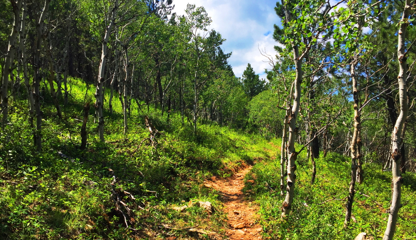 On the higher end of that receptivity is realizing and experiencing sacred zones. They feel beyond Time. Places where megaliths are found are almost always in accordance with this mystical feeling, and we are discovering through dynamic new anthropology that this is anything but wishful thinking. There are entire forests and ranges in New England and Ireland that have connective engineering throughout the entire landscape (See Cavan Burren National Park/Stonestrider.com). The landscape is literally stone-grafted to synergize the experience of moving through it. Most people, even in this age, just can’t get their minds around the idea that the entire landscape is a temple or monument, harnessing very real subtle energies. This particular trail in Wyoming is a chance to see the contrast between landscapes that are inundated with stone-linings, and those that are not, and what that might mean. Why is there not a single stone-lining in these beautiful small-mountains, while in New England there are enough Stone-linings to circle the Earth several times over? What does it mean?
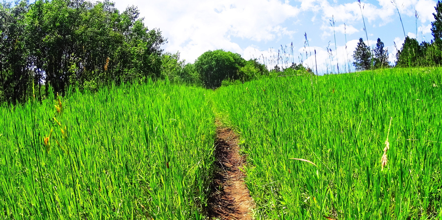 The trail here at Black Hills opens up into elevated fields of thriving grass beds within the glades, with absolutely no stone distinctions. You can almost picture an Arapaho Native materializing out of the woods, with nothing particular on his mind in this absolute tranquility. Prairie Asters emerge along the path, as well as what looks like a lavender Lonicera type flower. Entire fields of these wildflowers appeared across the next range, several miles from this spot, and everything about these beds indicates a vibrant, happy, and healthy zone.

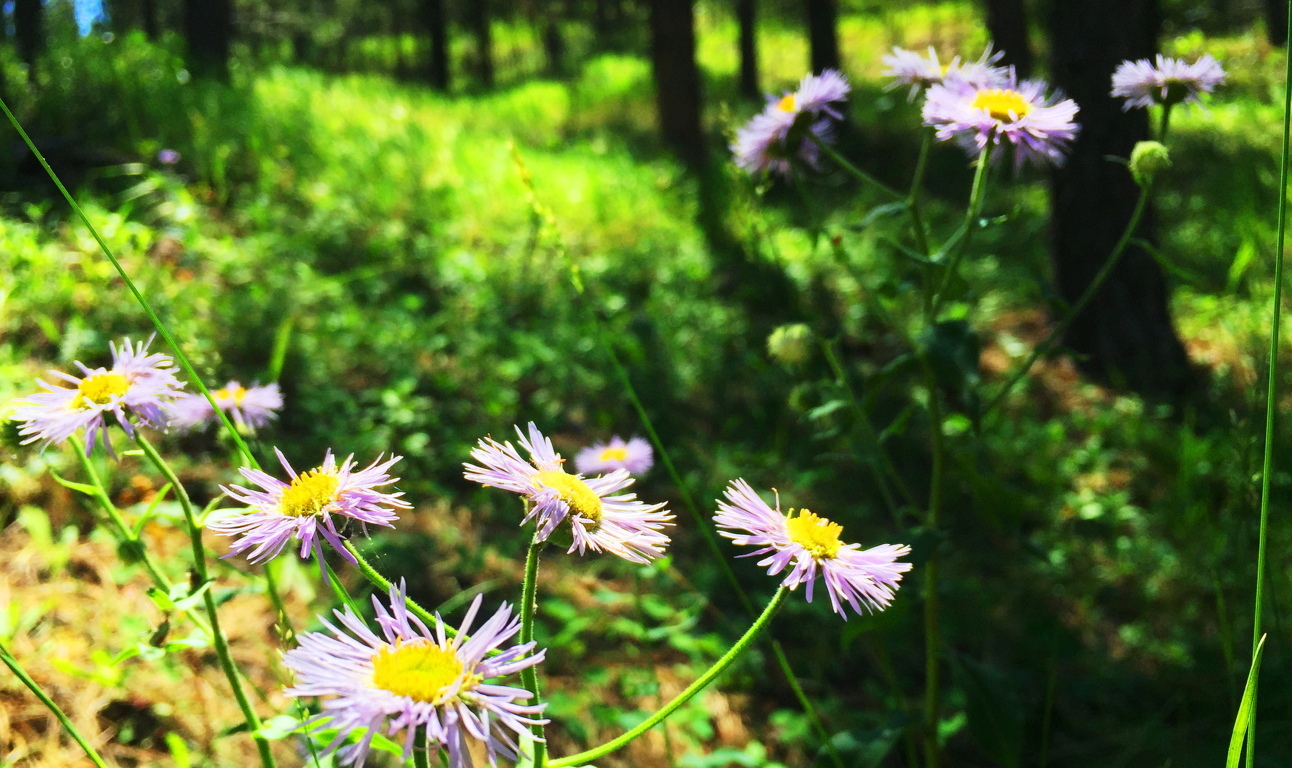
The cover photo of this article, at the very top of the page, looks to be the objective of this Black Hills Trail. It’s a fine view across the valley. This is a place to sit down for a while. Impressively, the trail doesn’t loop back, it continues rolling on through several small Ranges to the north, perhaps as much as another ten miles after this 2.5 mile section.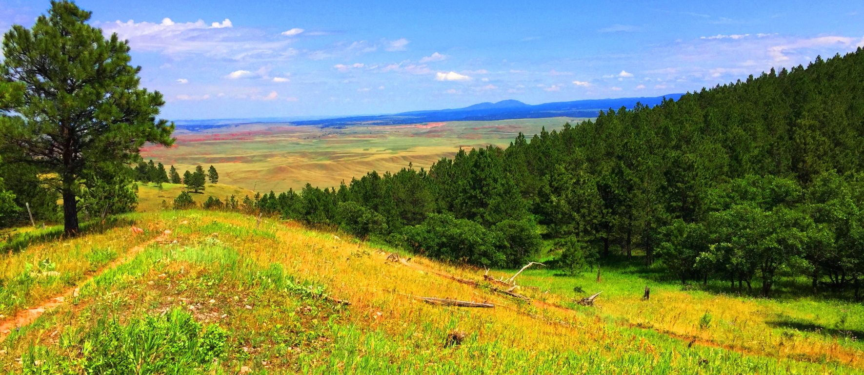
To exit the Trail, simply head back the way you came, and enjoy each ridge and the views they offer as you go.
There are places that are more intrinsically natural than others. Everything about Wyoming says “Don’t worry.” The Black Hills is a Trail that forces you to wonder how many of your problems are self induced. The peace in a place like this is so stunning that there is a cleansing of any spirit that passes through it, like a “landlocked baptism.” Landscapes don’t always have to reveal specific megalithic statements to be sacred. The land itself is at the heart of the ability to feel the sacred. It is entirely possible to see and feel the calm that the Native Americans felt for thousands upon thousands of years, and there are still ancient echoes of what was here before, written in the stone ridges. In a contentious time like this, Black Hills Trail is pure medicine, a regenerating tranquility that can take any modern confusion that you might have, and massage it into a cosmic calm so abundantly represented in the hills of Wyoming. Those who ignorantly accuse places like this of being “boring” are already drowning in a technological pool of hyper-urbanized poison. Wyoming is gorgeous, peaceful, mysterious, and gracious, with each and every step, and each step you take through it, is a step closer to your better-self. Black Hills Wyoming is part of the answer in this world, not a source of division; what more do you need to hear? Explore our world, and leave those that are trying to control and monitor every move you make, far, far, behind. Thanks for reading Stonestrider.com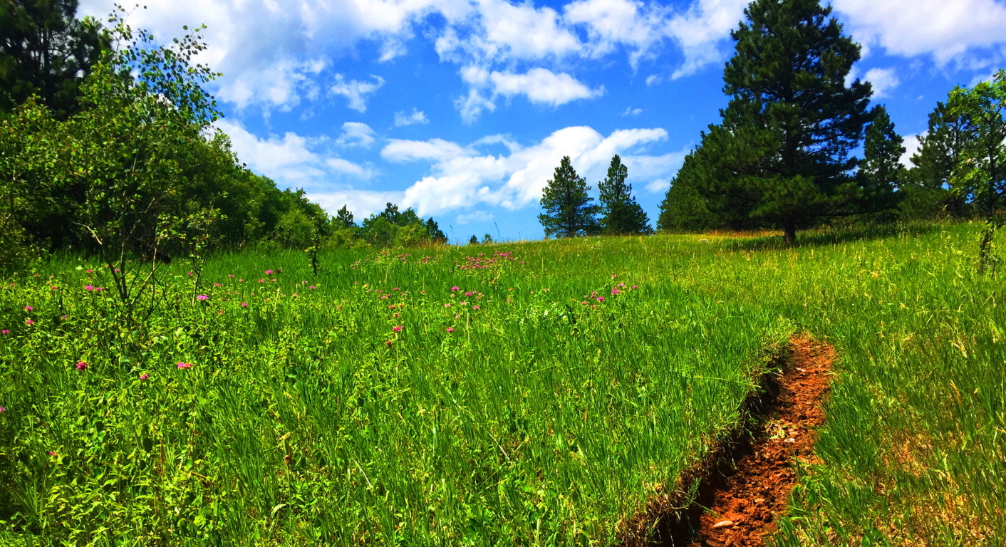
New Grange
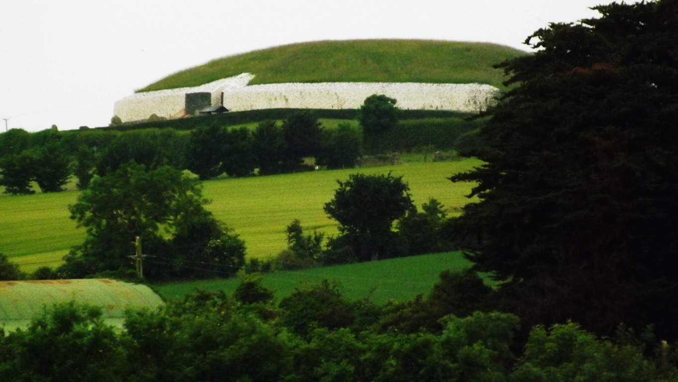
Location: County Meath, Ireland
Note: Every so often, with a little luck and determination, you come across things that give cosmic pause. This article is dedicated to those rare moments rather than the beautiful trails to be found in Ireland that are usually reviewed. Hiking starts to take on a next-level significance when you stumble upon practically impossible things. Sometimes they are small things, like perfectly circular concentric rings imprinted on a stone, high above the Black Valley in Killarney.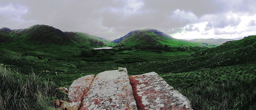 (Image/Below) Sometimes they are jaw-dropping big things, like the balancing Capstone on a giant-sized ‘Proleek Dolmen’ on the boarders of the Mourne Mountains, north of Dublin. (Image/Below) This Dolmen is one of the most massive and well hidden miraculous secrets in all of Ireland, with a 40 ton capstone standing at roughly 15 feet high! Incredible. And yet this pales in comparison to the temple at New Grange. The more you look at that specific area north of Dublin, the more amazing mystery you will find. Just as Egypt’s mystical culture was birthed out of the Nile river, and Babylon’s from the Tigris and Euphrates, Ireland’s incredible spiritual origins were born along the Boyne-River-Valley. Although the Boyne-River-Valley culture was most likely not featured in your mandatory History 2.0 undergraduate course requirements, it definitely should’ve been. Egypt has the Great Pyramid; Babylon had it’s great Tower, and Ireland has the incomprehensible, magical, mystical, temple of New Grange, literally tucked into a curvature above the Boyne River.(Image/Below) New Grange also sponsors other megalithic masterpieces like Knowth, which is an incredible megalithic chamber also located on these grounds.
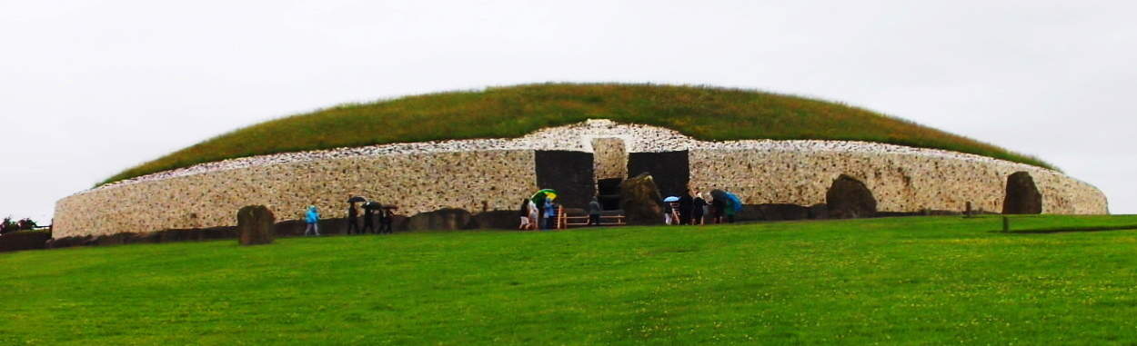
The hedgy river-road that runs along the Boyne River from the hamlet of Rosnaree, just a mile south of New Grange, is the best, and only way to get there. New Grange sits on the highest elevation above the solitary hedge rows and roads without names. You can walk these practically fictional looking hedge-row-paths for days if you are looking to get some trekking in before seeing the Temple, but beware, it would be easy to get lost in this green labyrinth of fields and cart-roads with no names, so make sure you have your device on you to at least navigate at all times. 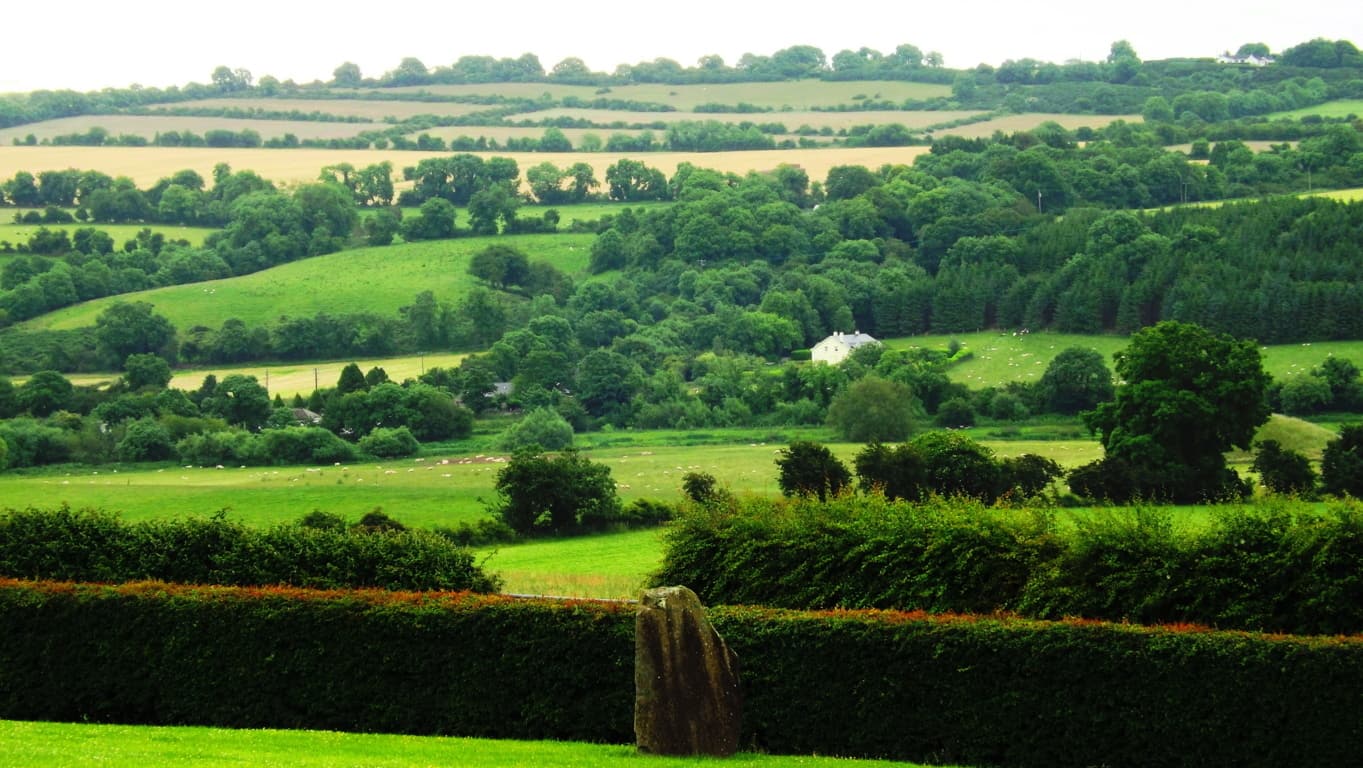
If you are ready to go directly to the Monument go to the Bru-na-Boinne Vistors Center along Staleen Road. Here you will find a ticketed bus line which will take you there. The ride is only 10 minutes, through the hedgy maze. When you arrive at the top of the hill you will be looking at nothing less than a Temple which has stood 2000 years before Moses climbed Mount Sinai. New Grange is older than Stonehenge, The Great Pyramid, and The Parthenon, which puts it in the running for the the oldest Temple on Earth. 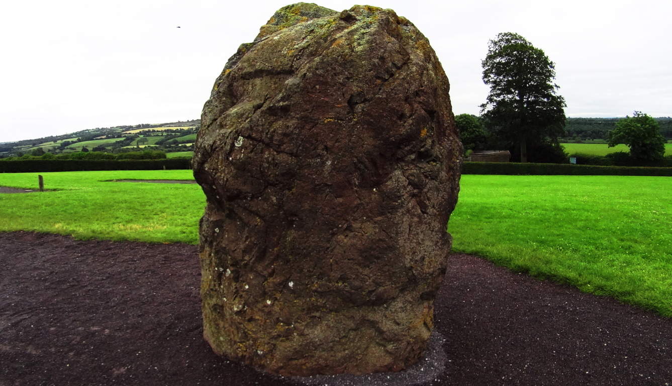 That’s quite a title. The way history has been explained in recent years, you might think that the oldest temple on Earth would look fairly primitive, as human history is generally thought to have gone from basic abilities to very complex ones, but the actual fact appears to be the utter opposite. The construction of New Grange is a study of the highest levels of engineering and accomplishment, bordering on the impossible for a culture not yet capable of using metal tools!? This is a circular mound centered on a main-chamber pathway constructed of roughly 34 level megalithic slabs, each weighing roughly 10 tons (20,000 pounds). Imagine 30 Proleek Dolmens lined perfectly together! Some of the slabs came all the way from the Mourne Mountains to the north, as well as other far off sacred zones. These facts alone start the mind reeling on the impossible story of the stones, which were moved from afar, and finally fit in dry-laid corbel fashion with such perfection that the light of the Solstices shines straight to the heart of the chamber two times a year. This Temple is a celestially connected megalithic miracle. It is surrounded by several massive Standing Stones which are roughly 15-20 tons, and most of them are over 8 feet in height. Moving these stones alone, to what is the highest elevation in this small River Valley, is hard to imagine.
 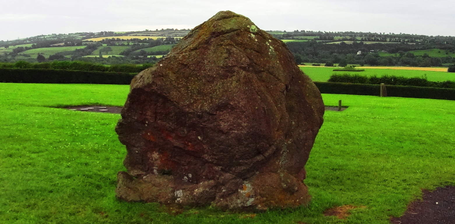 These Standing Stones are territorial markers, and once upon a time, if you passed by these Standing Stones without permission it would certainly have cost you your life. The larger the Standing Stone, the more serious the warning, and sacred the place. In this regard, you will realize that you are standing on truly holy ground.
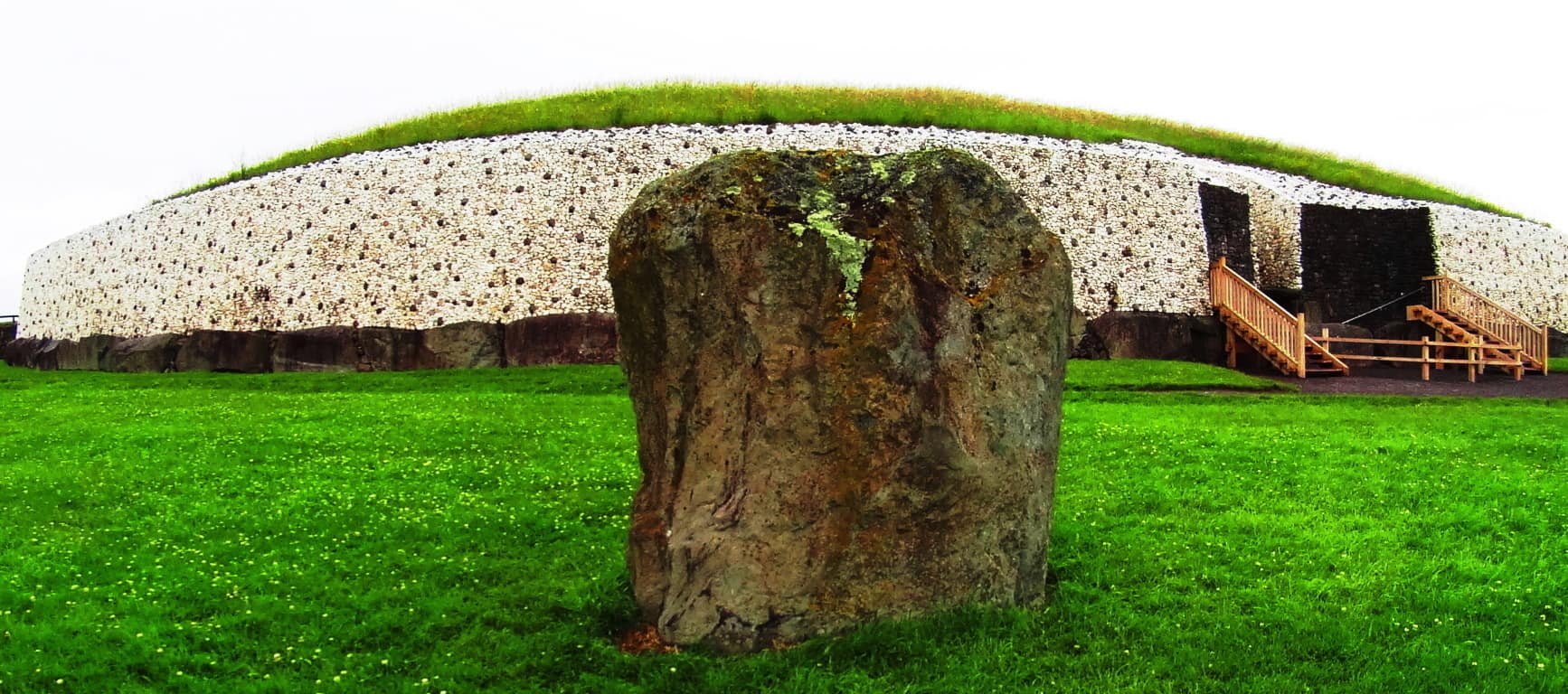 The exterior of the Temple is now lined in a modern white-quartz stone ring. The original Temple was much more concealed and blended into the hill for strategic reasons. It was literally part of the valley. The monumental stone slab at the entrance is one of the most important Celtic relics in the world, with gorgeous iconic Celtic rings imprinted into the megalith. This iconic stone is laid-out in a protective fashion, guarding the entrance, but is also clearly a display. It is a truly magical statement from the beginning of time. Imagine a solitary bean of light on the solstice day shining for only half a minute above this beautiful stone, making it glow, and continuing into the heart of the chamber! It just doesn’t get any better than this. And what’s more, the chambers in New England frequently have the same precise solstice feature. The connections between Celtic and New England antiquity cultures just grows from here, literally.
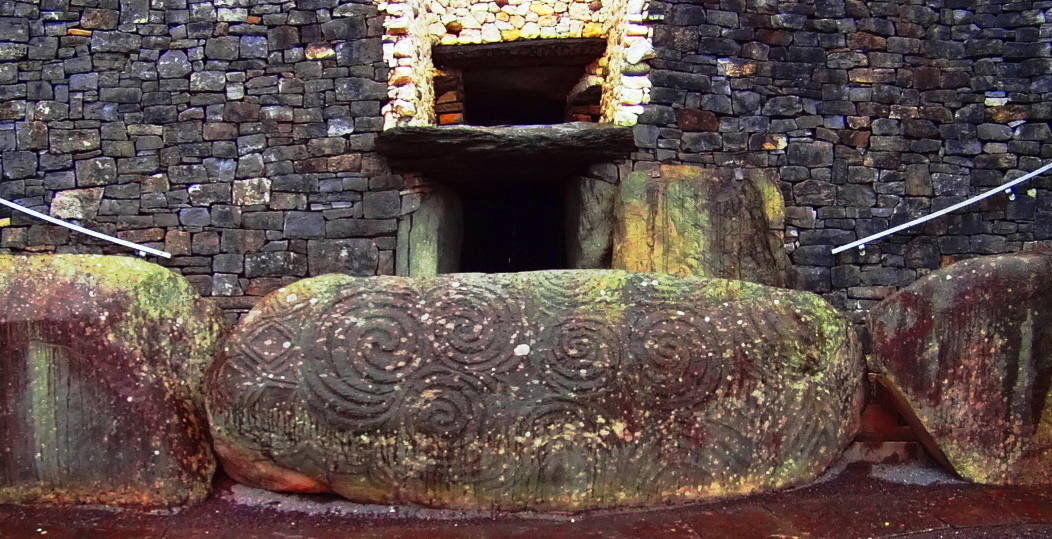
There are several other monumental stones with designs on them around the exterior of the Temple. with specific geometric features to observe on these stones, aside from the spirals. 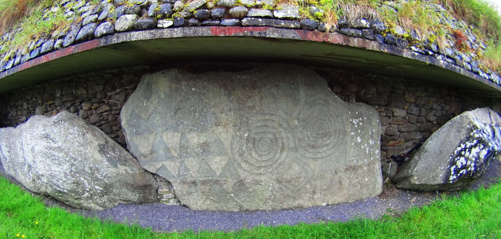 A closer look at this slab opposite the entrance reveals several iconic shapes, and more specifically, interconnected equilateral triangles, as well as mesmerizing Celtic spirals. These are not the only triangles to be found on the megaliths at New Grange. To see the others, we will need to step inside.
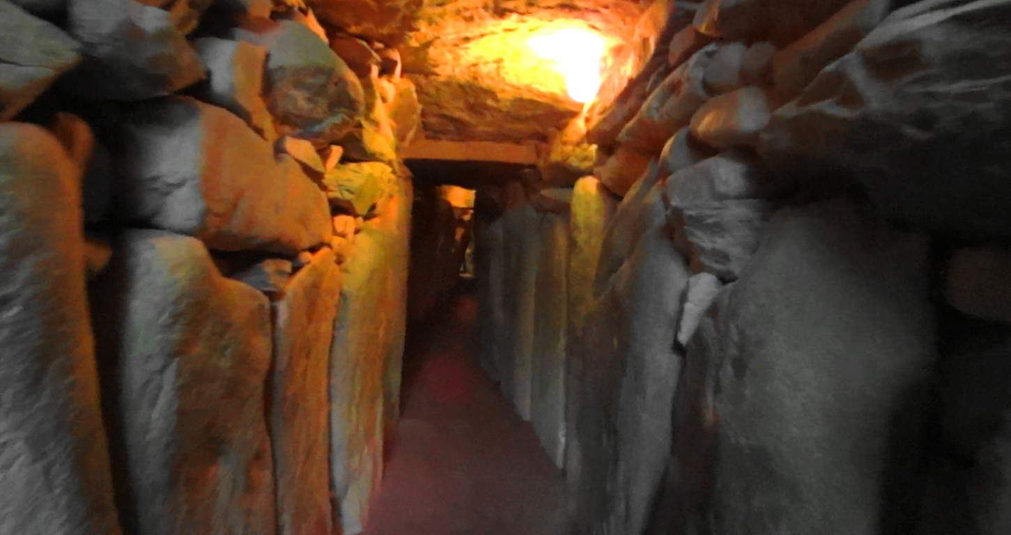 Welcome to the impossible. Here you are entering a chamber of what is the equivalent of 40 Dolmens in one corridor, all fit to perfection leading into a central chamber perfectly aligned to the stars, with a roughly 20 ft high corbel ceiling.
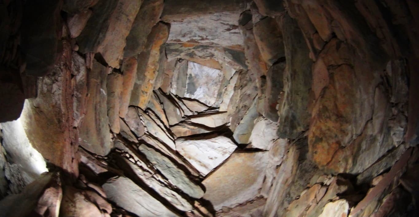 Imagine ancient Ireland, a land where giants roamed across the hills, and dangers unknown lurked beyond the next valley; and then imagine the absolute strength and safety you would feel walking through these impossible stone pillars. Here at least, in the ancient times, you were as safe as any Celt could be. The holistic benefits of living in a synergetic stone temple would most likely be wonderful, in comparison to the huts and wood fortresses of less fortunate clans. At the end of the long singular corridor from the entrance you will encounter stones with imprinted triangles and diamonds before entering the central chamber.
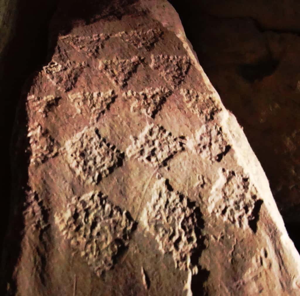
Imprinted on this entryway stone at the main-chamber are distinct equilateral triangles that are seemingly transitioning into diamond shapes. There is profound connection here to the megalithic sites in New England, which utilizes this exact same meme at practically all the megalithic sites. Specifically in New England, you will find equilateral triangles etched into granite by waterfalls, and massive diamond cut stones along ancient trail ways. This is the central megalithic meme in New England, and here are those very same shapes in the heart of the oldest megalithic chamber in the world. Here are some examples of New England megaliths cut exactly into triangles and diamonds.
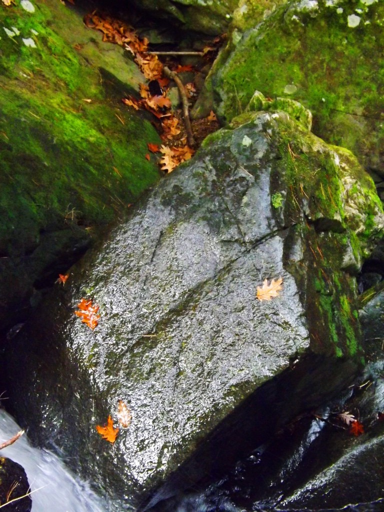
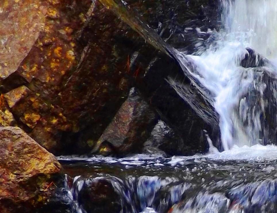

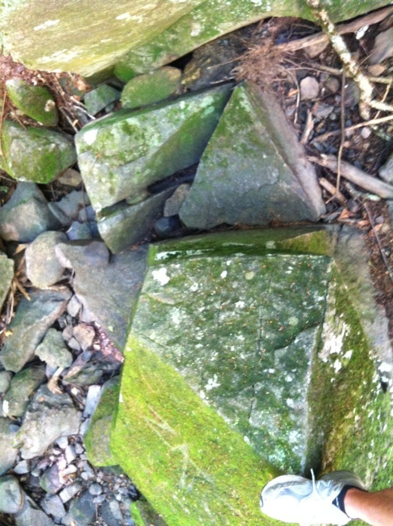
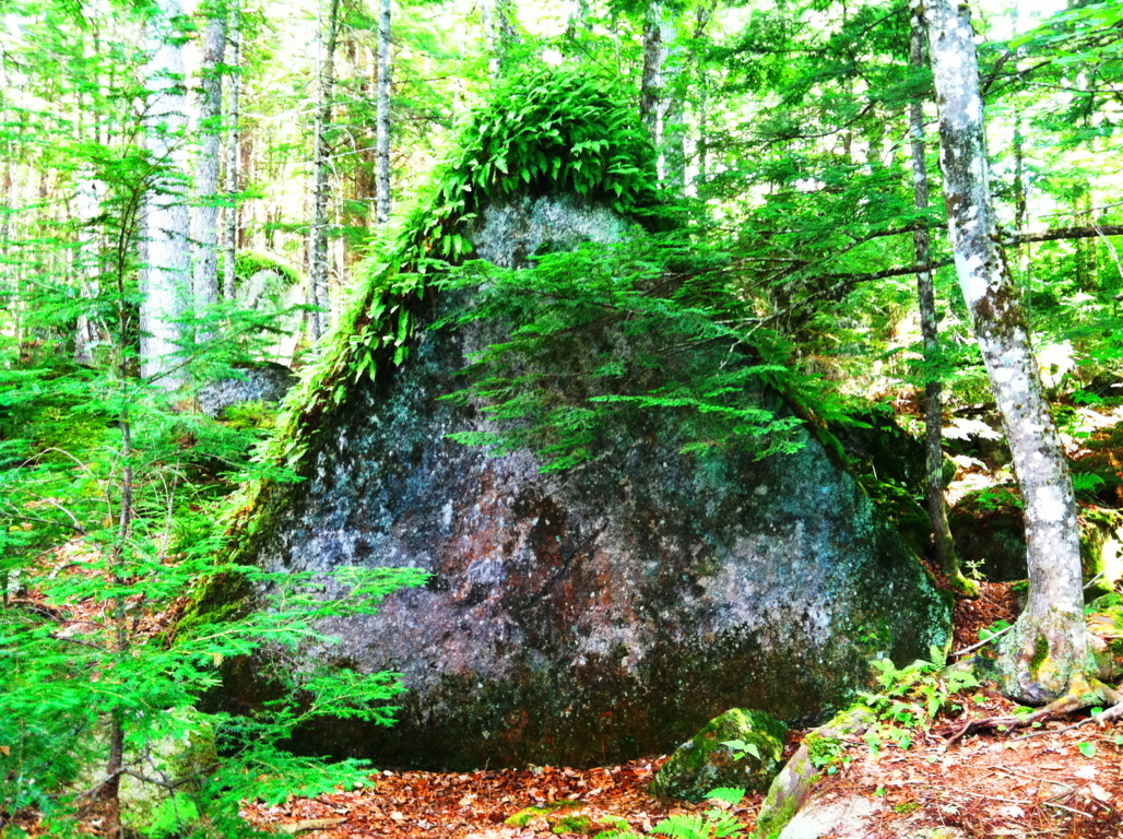
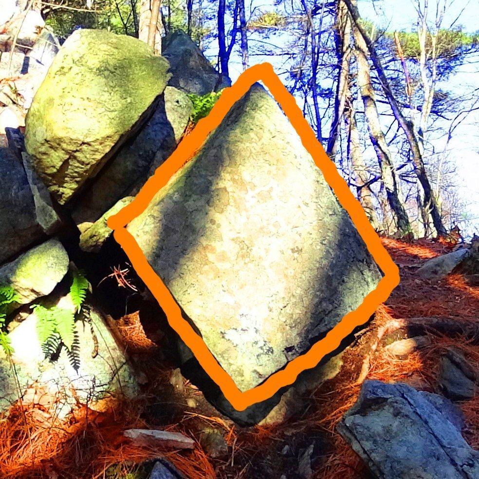
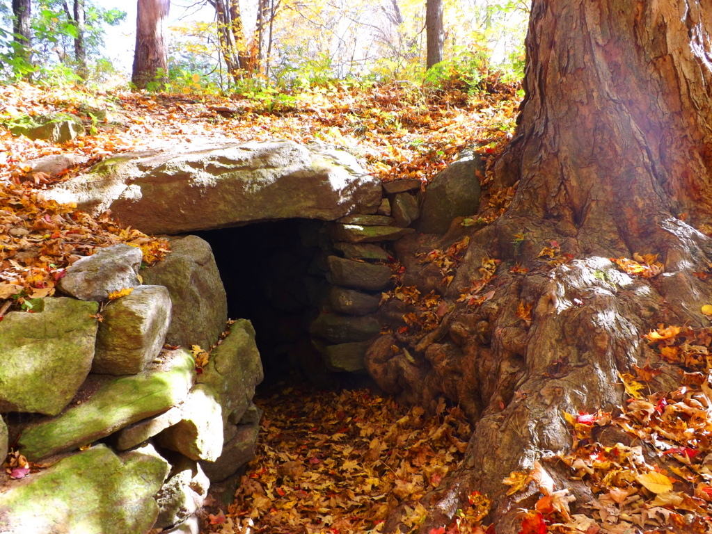
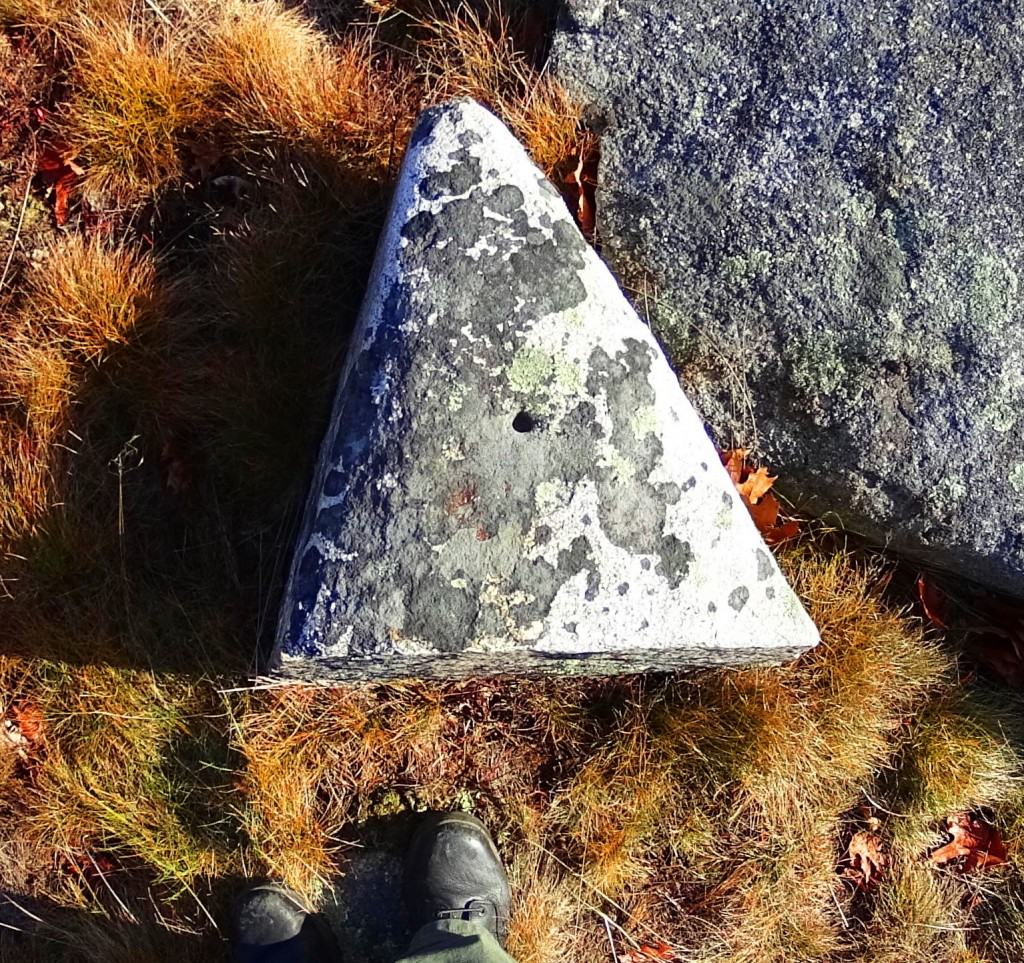
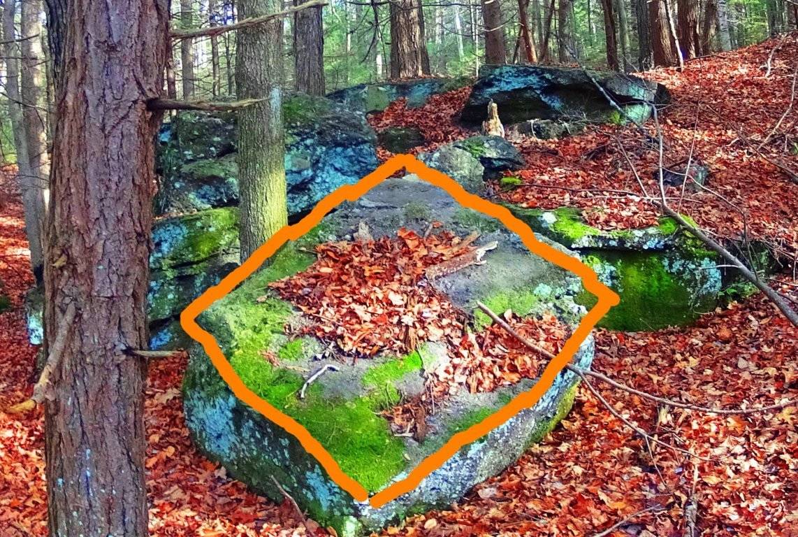
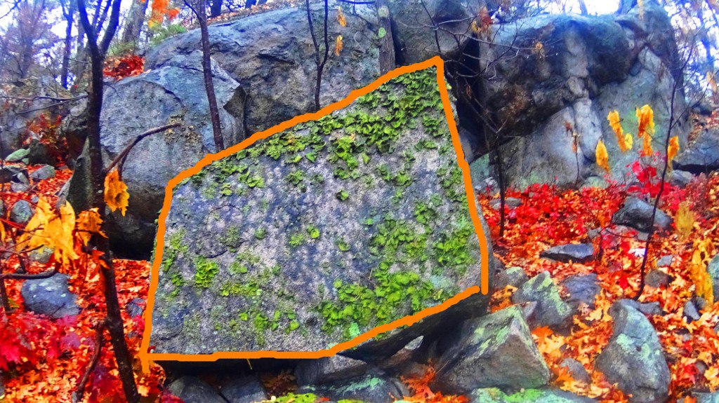
The evidence is too strong to dismiss. It seems highly likely that the megalithic culture that existed in Ireland had a relative culture across the Atlantic in New England. The question will arise: what is so important about triangles and diamond shapes? It might be that the Triangle is the first shape to develop from any linear set of points, and this culture was the first to develop in linear history, and so they claimed the Triangle as their calling card symbol. The ‘diamond’ is the result of the functionary crafting of cross-sections and equilaterals. If you cut a proper X into a stone, the result is four diamond shapes that are consistent with each other, and these utility cross-sections that create diamonds are found all over New England mountain trails. It as if the Neolithic culture were marking zones and territories as a warning to those passing through, and letting us know that the original culture once claimed this area.
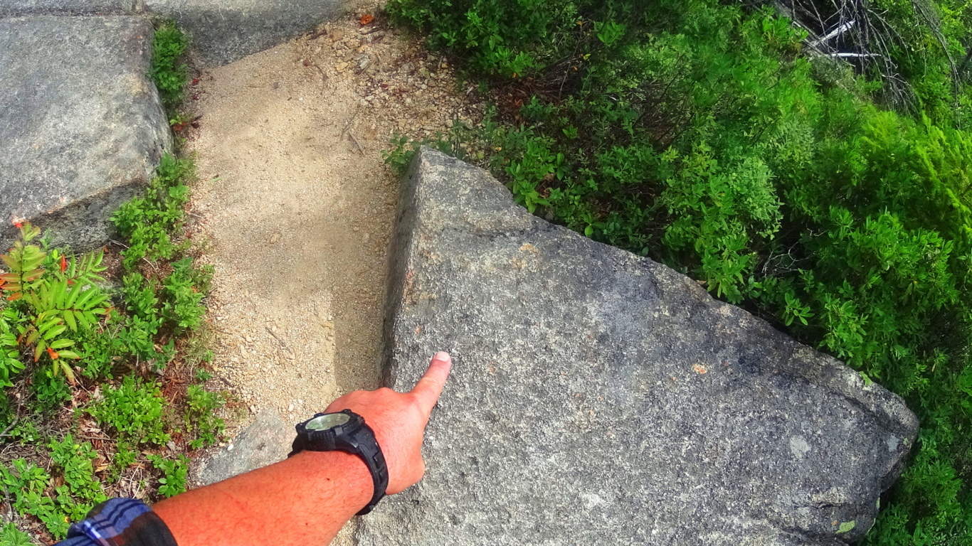
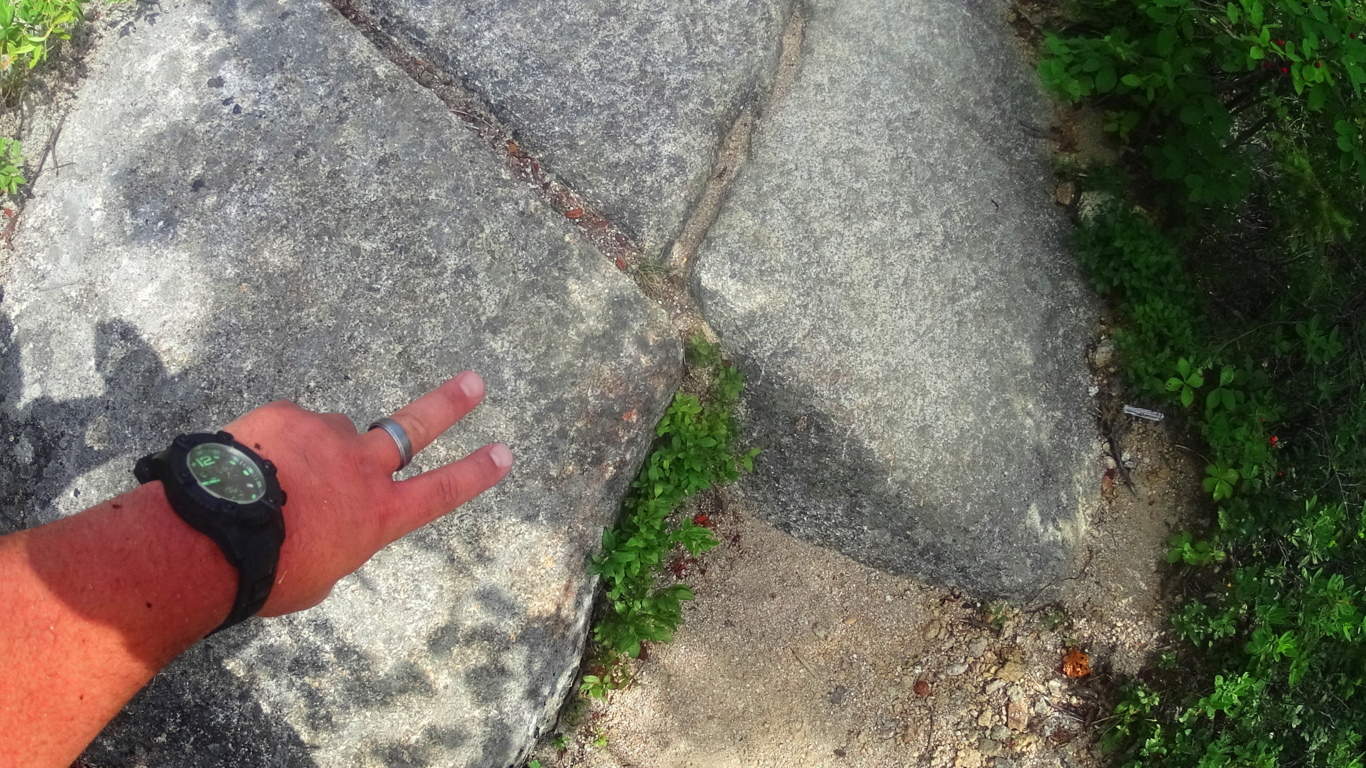
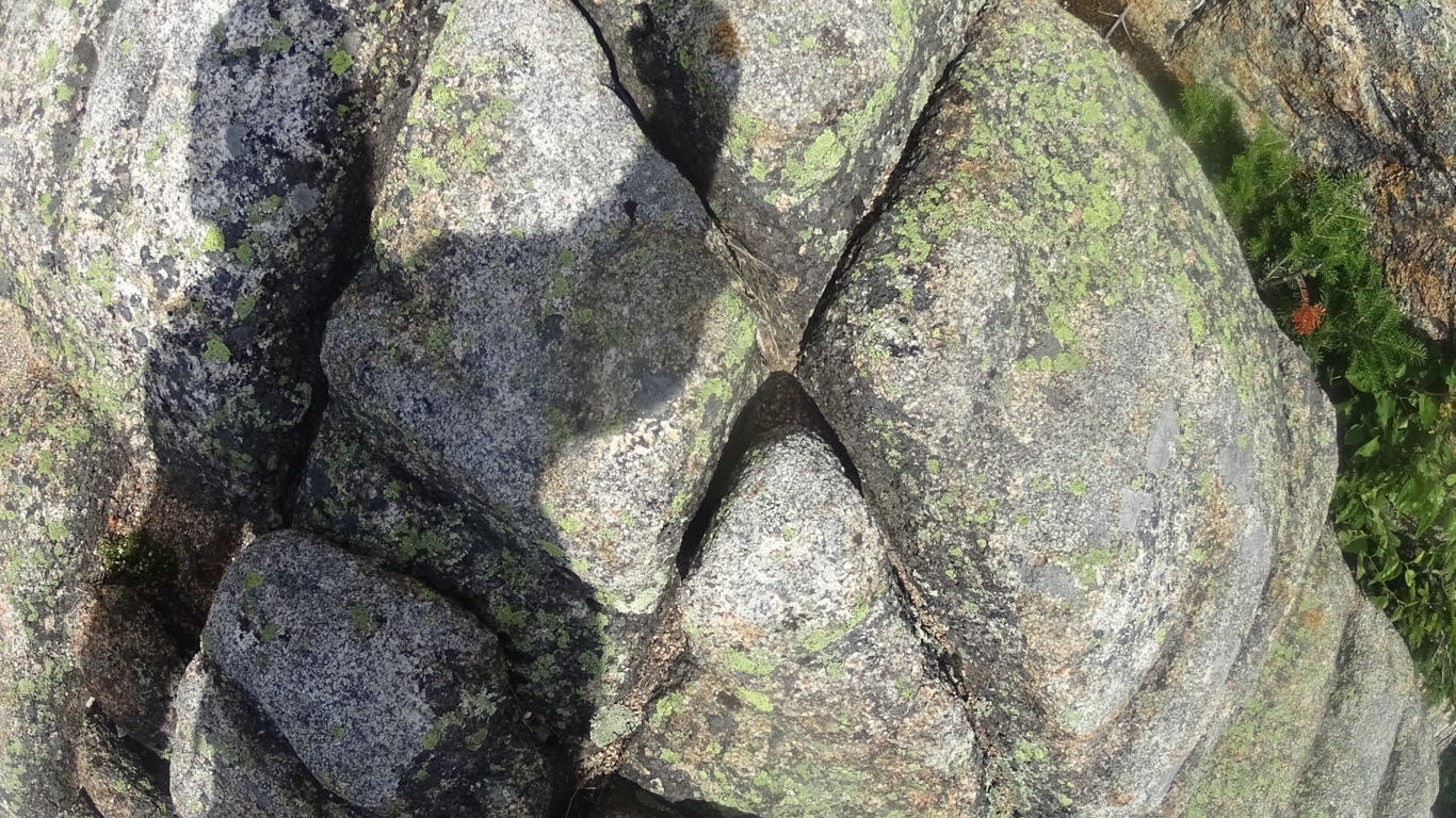
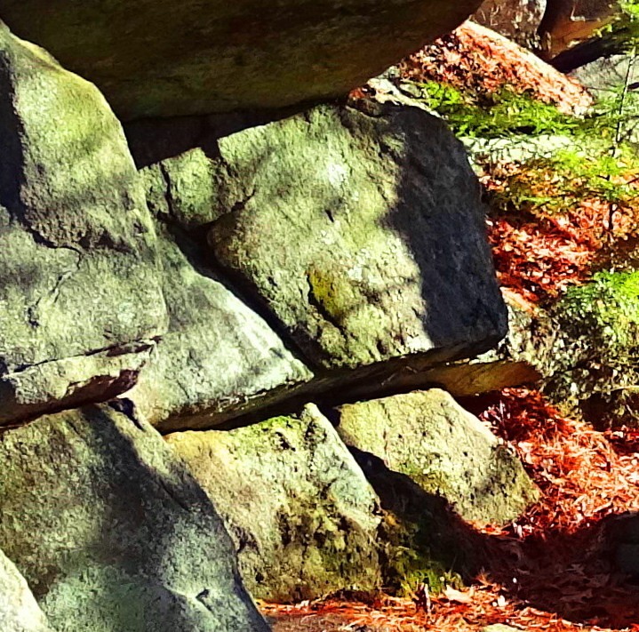
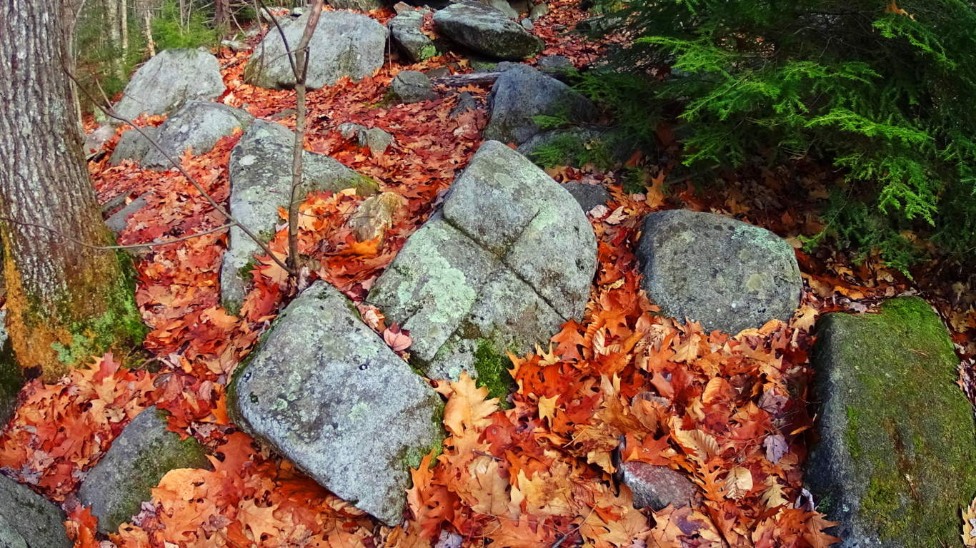
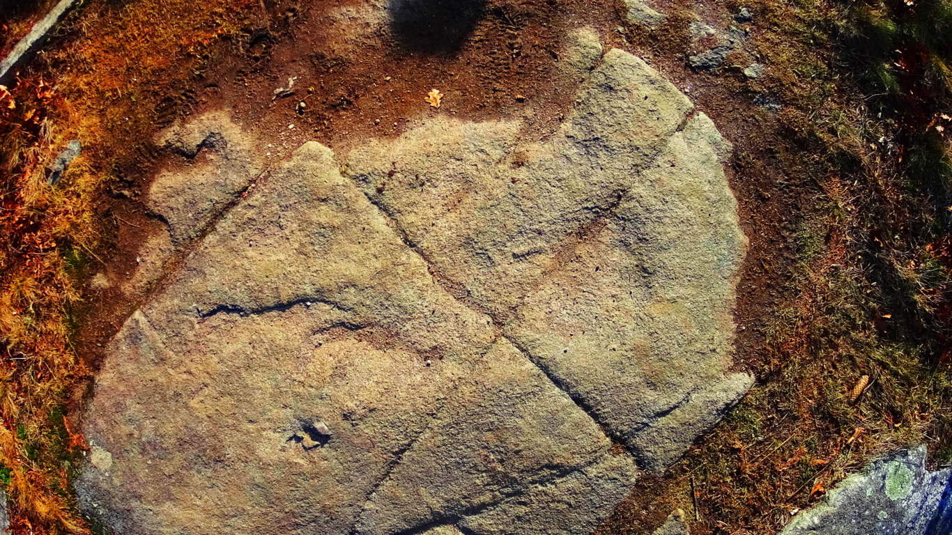
Anther stone in the interior of the chamber at New Grange displays dozens of whimsical triangles and diamonds cascading all over the stone. This just can’t be a coincidence; there must be some relation between New England’s and Ireland’s oldest cultures. 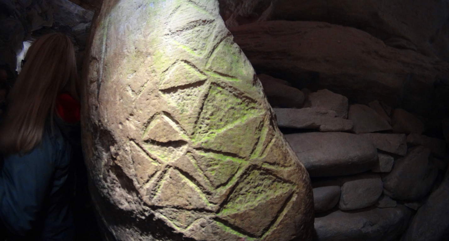 Neolithic Culture: Here is the part of the article that gets surreal and a bit ‘heady’. The history and chronology of how neolithic cultures relate, if they relate, must be found in their works. The works are obviously similar in structure, and also in symbolism. As New Grange is considered the oldest temple in the world, it seems logical that these geometric themes originated here, and spanned-out to the rest of the world. If this is true, then the pre-Celtic neolithic culture in Europe is the original ancestor of the neolithic culture that somehow crossed the Atlantic and ultimately made it’s way to New England. Their works are massive, beyond human in scale, like the Standing Stones outside New Grange.There is also the philosophical aspect of the Triangle, which is a shape specifically relevant to consciousness and divine comprehension. Is the neolithic culture referencing a direct connection to God Itself, like the neolithic tribes of Genesis? This is an intense reference, but according to the Bible the first generation on earth was the ‘Nephilim, meaning: “those who fell from heaven”. The offspring of these angels came from their copulating with human women, and that offspring was said to be Giants. (Genesis: 6) It sounds like extreme science fiction, and yet that’s exactly what the biblical accounts say. Moreover, when the Israelites went into the Promise Land and Joshua scouted out the territory, he found tribes of Giants. Joshua says the tribes he encountered made him feel he was ‘the size of a grasshopper’. What is going there?
With that in mind, you might eventually ask yourself: are these works the productions of these Giants in both Ireland and New England? Why are so many myths based upon Giants? The relations are there, and the relevant meaning of the chosen memes and symbols are there too.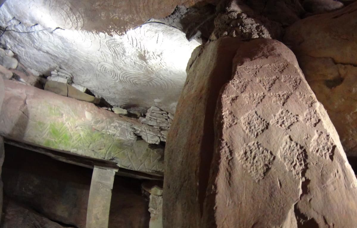 The hard part is, it utterly changes the current story of history, which is evolution based. New Grange is truly an otherworldly ancient temple that evokes wonder and humbling respect for the course of hallowed Time. Our particular modern era looks increasingly like ‘life in a controlled bubble’ when we look at the grand scheme of History. Almost all of our information is pre-packaged and funneled into specific themes, and if you disagree with them, you will be found to be disagreeable and ultimately failed in your assigned studies. The revised history that is given to our children is a set of theories sponsored by commercial academic institutions. The ‘technological era’ is a mere blip of 100 small years at the tail end of 40,000 years of human culture. When we look closely at what the antiquity suggest, it increasingly looks as if our culture is intentionally turning its back on the evidence in order to passively inject a more “convenient” theory of culture, based on erroneous assumptions. New Grange is one of the holiest places in the world, as a temple that has been here since the beginning of anthropological history, it is exquisitely rare. If we are truly sincere about going where the evidence leads us, then we must be prepared to challenge memes that don’t add up. Stonestrider.com isn’t a religious website; it’s about finding the best trails and photos you can, but it is impossible to deny that places like New Grange challenge so many things we assume about human progress. So, even if you are in Dublin just for a few days, plan a morning to visit New Grange. It is something, even with all our modern answers, we still don’t completely understand.
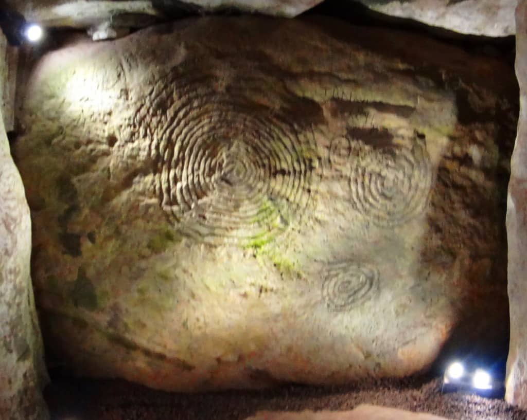 Something incredible, almost otherworldly, took place in antiquity in order to build this temple. Walking into it’s main chamber is like walking into a miracle. It just doesn’t get more sacred than this, and a hillside is sometimes so much more than a hillside, so keep hiking.
Hulapai Mountain
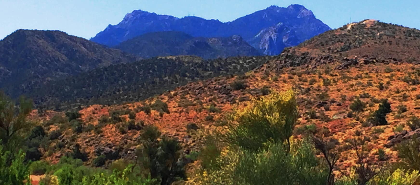
Location: Aspen Peak/Kingman, Arizona/USA
Elevation: 8,417 ft
Prominence: 1700 ft
Note: Half a world away from the ancient Celtic Ranges, where Standing Stones guard the mythical heights of Wales, Ireland, Scotland, and England, are the epic mountains of the American West. Among the vast options of the grand natural spaces that dominate northern California, Montana, Oregon, and Colorado, are the mysterious high Ranges of Arizona. The Hulapai Range is a few miles south-east of Kingman Arizona. From Kingman you will take the ‘Hulapai Mountain Road’ straight into the heart of the Range, climbing slowly upward into a set of elevations that look like an American Mount Sinai. The comparison is a good one. The air here is absolutely void of humidity. With temperatures that climb up to 116 degrees in July, the trees, some half burnt, radiate a charcoal scent which carries on the wind; and you can taste that scent on the back of your tongue. 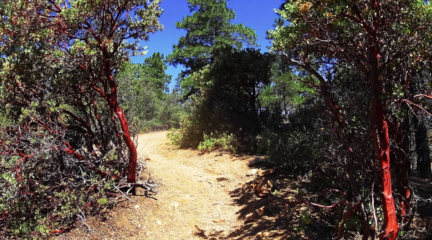 Amazingly, there are some similarities to Celtic mountain ranges here, if you have the right perspective. There are other-worldly rock fixtures, free standing boulders that stack the mountainside, and an amazing magical stone near the peak, which you will see in this article.
 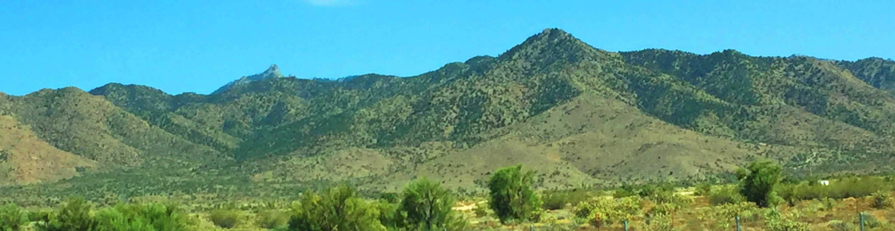 Aspen Peak Trail at Hulapai: As you approach the Range you will notice golden glades, not purely green zones. The bright Ponderosa forest at the belt of these mountains is spacious and inviting . In Celtic Ranges, the signs of the Neolithic Culture usually increase the further up you go. By this logic, if there is Neolithic cultural evidence at Hulapai, the highest peak would most likely yield the most evidence. Aspen Peak is the highest vista in this range, and the focus of this hike. Make sure to bring at least 1.5 gallons of water along with a sports drink for necessary electrolyte/sugar replenishment. Ration your intake. Also bring an extra shirt due to perspiration, several granola bars/ carb eating options, including jellybeans for when you reach the peak.
 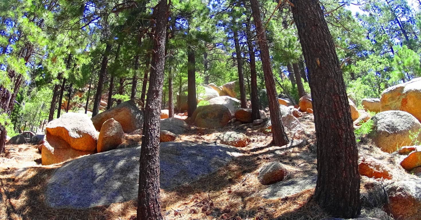 There are options for approaching Aspen Trail. There is a lower entry through the hills and woods off the Hulapai Mountain Road marked by a sign on the left, which is more of a challenge with an extra 1000 ft below the campground trailhead (and about 1.5 miles of extra trail through rocky glades and curiously rounded stones).
 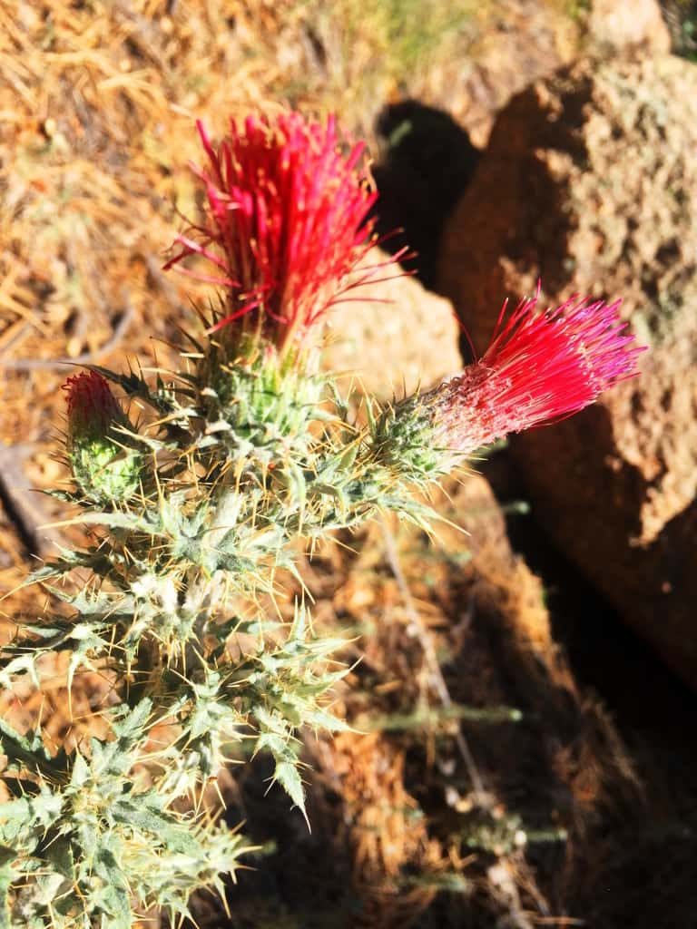 If you want to cut that part of the approach off, you can make your way, by car, passing the Hulapai Ranger Station on the road, and then take the right onto the main campground, which is the more popular entry. After passing the numbered cottages and the RV’s in their designated areas, and you will see the marker for the ‘Aspen Trail’; here you will begin your challenge. Aspen Peak Trail’ is marked with signs on the way up, but remember on the way down to follow the signs that say “Campground” to get back.
The first portion of Aspen Trail is a bold introduction to the Ponderosa Pine “vibe”. Dragonflies with a shiny blue armor orbit dazzling red cactus flowers beneath the forest. (Image/Left) This initial 1000 feet of incline is a winding set of switchbacks and vistas. The boulders here are rounded like leavened bread, adding a unique surreality to the openings in the glades, and there are hundreds of thousands of these rounded fixtures. 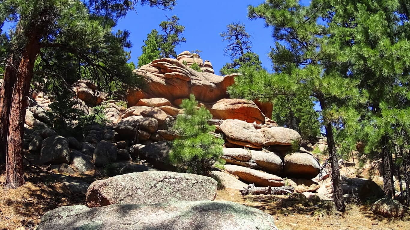
How it is that these boulders came came to be rounded and stacked individually is hard to imagine. As you continue into the 1500 foot level of prominence you will come to the ridge which opens up on the northern view of Kingman and the overall desert plateau.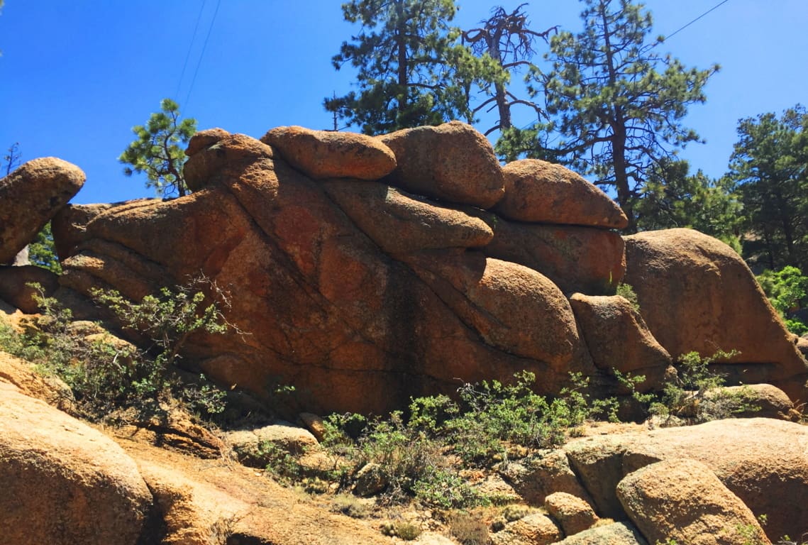 It isn’t just the vastness of this view over the northern ridge, but the stillness that presides over the radiating gold that takes your breath away. Arizona is like “spirituality that happens at a glance”; there’s truly an underlying force that imposes an evolved slowness over everything; it’s the ‘un-rushed’ spirit that survives among the high desert winds. If you move too fast, you just won’t make it. Everything you see is whispering “Pace yourself, and take your time.” The land feels like natures assigned setting for prophecy, which is one hell of a calling card.
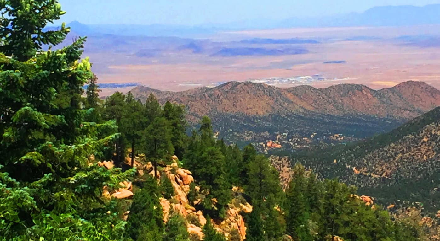
After taking in the northern vista on Aspen Trail’ you will begin to see the peak as you curve slowly around the mountain face, eventually making your way to the southern side. There is a view of the southern ridges beyond as the path first crosses a rickety wooden bridge that is your ‘gateway’ to the uppermost vale.(Image/Below)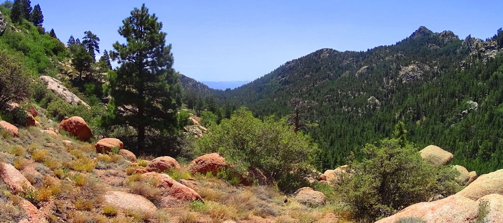
From here something otherworldly happens. Just like in the Celtic heights of enchanted places like the Rowan Valley in Wales, where massive ‘cut’ stones just start to appear out of nowhere, Hulapai seems to support similar ancient stoneworks specifically in the advantageous heights, where anyone approaching would be seen for miles before arrival. There are several stone-linings along the upper path. It is a good possibility that these stones were placed by the Neolithic culture, then supported by the Hulapai tribe, and reinforced in modern times. Clearly the area was sacred for someone if they were taking the time to create stones-works at 8000 feet, which is what we see here. 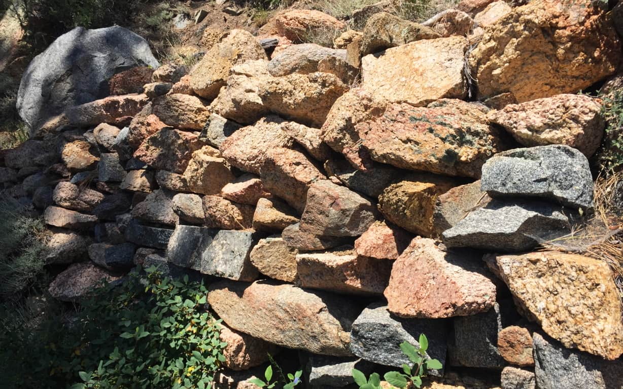 In Celtic elevations, often times when you find stone-linings that begins to announce a sacred zone, there is a singular solitary statement monumentalizing that sacredness. It is beyond astonishing that as you travel a little further along this last 200 yards of trail you will find a single Standing Stone unlike any of the other hundreds-of-thousands of rounded stones you’ve passed. The Standing Stone is cut abruptly on the top, with a a right angle cut into its right side. It stands about 6 feet high, with an absolutely flat-cut face, like a table standing up at about 4 inches in width. It is totally opposite the rounded features of the common boulders here, in every possible way; and it faces the peak.
This Standing Stone is most likely one of the oldest sociological statements in all of Arizona, among hundreds of such statements. If it is related to the Neolithic culture of ancient Celtic places, then this stone is no less than 4000 to 6000 years old. It is truly priceless. It might very well be that this is what is known as a ‘Solar Stone’, marking mid-day on this mountain for eternity. ‘Solar Stones’ appear in Celtic highlands, as well as the New England mountains. It is no mistake that from here you can follow the last portion of Aspen Trail towards a grand monolithic peak laid out dramatically before you. 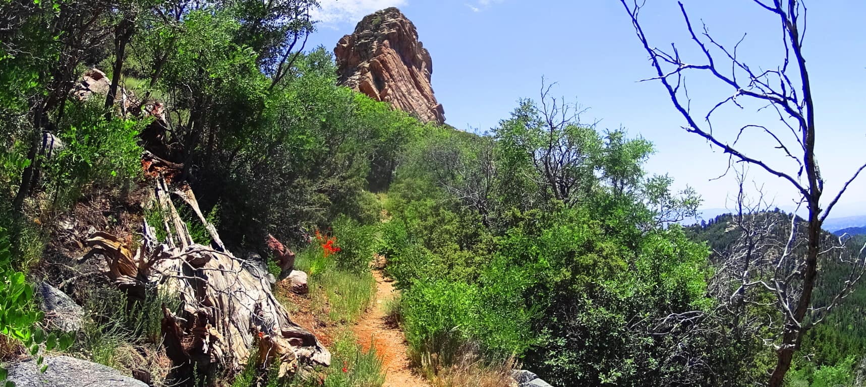 Continue towards this massive pinnacle to make the dramatic Aspen Peak. Even looking at the rock features in this uppermost area, you will see that there is not a single stone cut with right angles at the top and sides, like the Standing Stone that marks the upper trail.
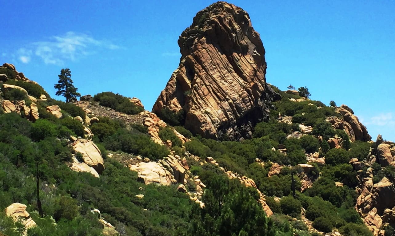
At the peak you are able to see a beautiful northern desert plateau. At this point you are 8,417 feet above Sea-level. 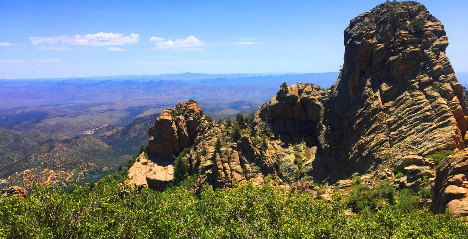
Aspen Trail at Hulapai is a spiritual challenge. You will have to put aside your usual hiking tendencies and regular comforts. Plan carefully. This is a stellar place. There are deer running through the forest below, and a high wind rushing over the desert; it may carry all the way to the Pacific Ocean in California! The Peak here is like an epic guard tower for the entirety of the ‘American West’; Hulapai being on the western edge of the mountain ranges of Arizona, which continue all the way up to the Rockies of Colorado at its eastern edge. The wonders that exist deeper into the Arizona interior are astoundingly worthy of such a “tower”, where the ancients once dwelled, high above the world. Just let it all sink in.
Jacques-Cartier National Park
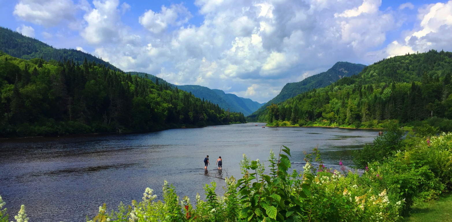
Location: Quebec, Canadian Highlands
Prominence: 2000 feet
Note: Every so often, if you’re a hiker with a few mountain ranges under your belt, you may have the luck to come across a landscape that is basically pristine. In these pristine places, after hiking for a while, you can’t help but notice, what it is that you don’t notice. For example, here at Jacques Cartier National Park, there are no ‘stone-linings’ running through the woods; no Dolmens tilting their capstones at the tops of the hills; no Colonial Period walls dividing the Passes in the heights; and no Standing Stones. Here in this wonderfully peaceful place, you will simply find deep forest glades with uninterrupted streams, and steep mountain ridges overwhelmed with trees; but no signs of the Neolithic works that overwhelm the landscapes just 200 miles south, across the U.S boarder. This is the Atlantic side of Canada, where french is spoken in delightful tones beneath the trees. Here you will find the Black Spruce, beautiful groves of Yellow Birches, millions of Maple trees, and the classic Northern Pine.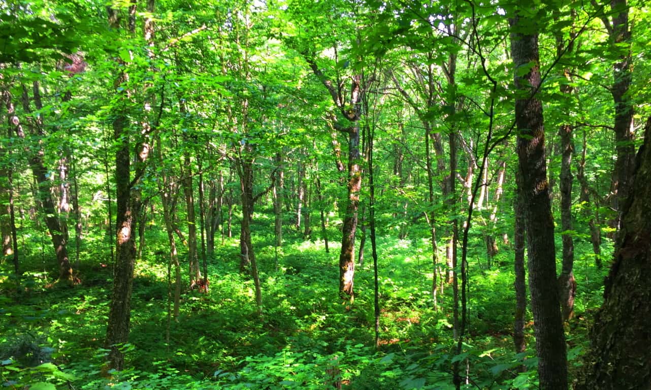 Places without Neoliths: It is just as important to seek out these landscapes, and not lean too hard on the cultural discoveries of antiquity; and furthermore, not “lean” at all during a hike through a place such as this. Just enjoy the luck of being in a gorgeous wilderness. Long before any European explorers, such as Jacque Cartier, had arrived in this particular wilderness in the 1490’s, we should remember that an incredibly beautiful and thriving native culture already existed here. Since the receding of the last Ice Age, this region fostered the indigenous tribes of the Huron, Ottawa, Iroquois, and Mic-Mac. These tribes embraced the landscape in every possible way, and there is so much to embrace. Today, long after this regions Colonial conflicts have played-out, the Range is now known as the The Laurentian Mountains, or Canadian Highlands; complete with dramatic peaks booming out of the valley, and a wide rushing river that runs ultimately down to the imposing northern Atlantic Ocean. In places where there is no Neolithic culture to consider, a more personal exploration can take place. Just one moment with butterfly by the river can bring things into perspective for you, as crazy as that sounds, and that opportunity will find you here. Here, the commercial world of monetized value and the dull overload of inanimate things fades out slowly when staring into the tiger like streaks and spots of a delicate, but tough, Monarch. Great beauty is found in little things. These are the lessons of the forest.
  This place is the perfect opportunity to think about the last time you were in such a vast reserve; realize the curiously challenging feeling that hits all of us initially, when we get into spaces where our hyper-urbanized interactions, with all it’s bells and whistles, aren’t dominating our senses. It’s o.k to feel a little strange; and after a while, with practice, walking into wild spaces can honestly become like walking into a dream. Even the language used to describe hiking in natural spaces becomes poetically philosophical and soothing. Let these themes roll over you like a stream; ride with abandon on the current if you can; catch the Sun, then take shade; climb high, and then look down at what you’ve done. Your mind, as well as your body, will thank you in a place like Jacques Cartier National Park.
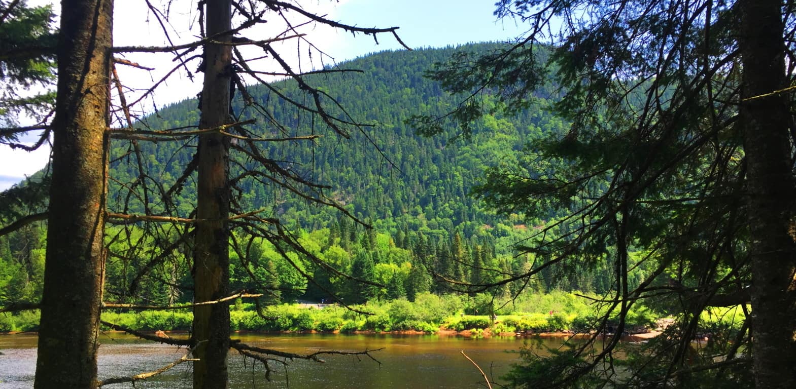
Driving Directions: Just 45 minutes northwest of Quebec, the drive to the gates of this National Park is striking. Follow Route 73 all the way to the park entrance where there is a small entry fee. The 5 mile drive along the Cartier river-valley will take you to the Park-Center, and Parking. During that five mile ride you will realize that you have entered a vast hinterland. This is a 31 square mile reserve of hiking trails, kayak routes, glamping quarters, and snowshoe access, all maintained with total excellence.
Les Cascades Trail: For a great initial experience at Cartier National’ take the Cascades Trail, meaning ‘waterfall’, which stems directly from the Park Center. Begin by crossing the river on the wooden foot-bridge and you will get a wonderful initial perspective on the entire scene, before heading into the forest. The mountains on both sides of the river have a prominence of about 2000 feet, with the River measuring about 200 yards across. The woods are massive here, with rolling knolls and glens supporting every type of Canadian wildlife, including Moose and Deer, which could cross your path at any given moment.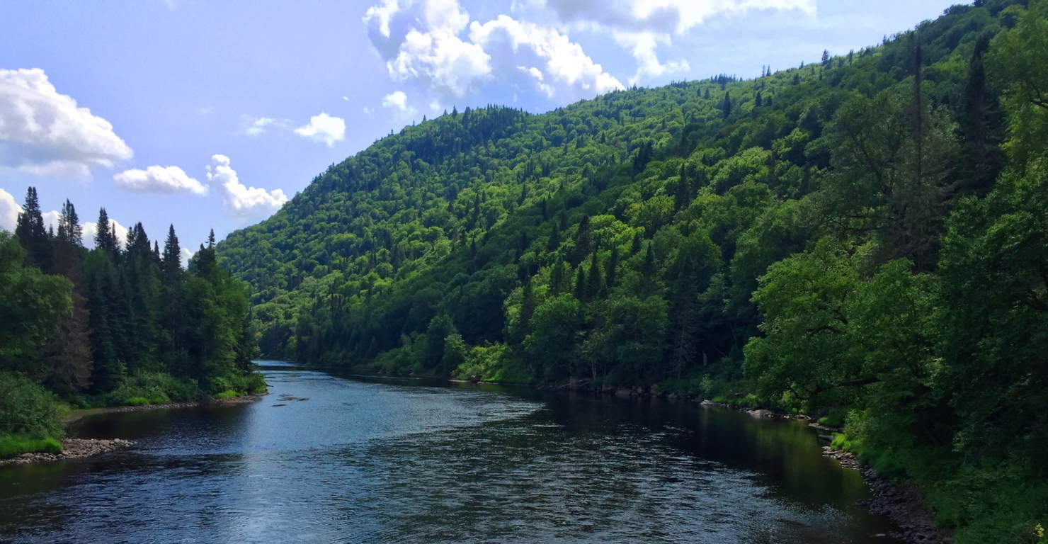 This waterfall trail is a simple loop, so you can be at ease in terms of navigation. The first portion of the lower trail is a relaxing treck along a wide and hilly path running for about 2 miles.
 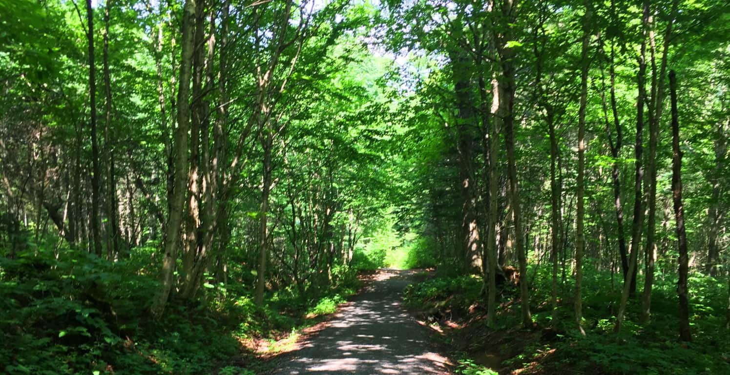 There is a classic stream crossing, with a little wooden bridge just over two miles into the trail. (Image/Below)
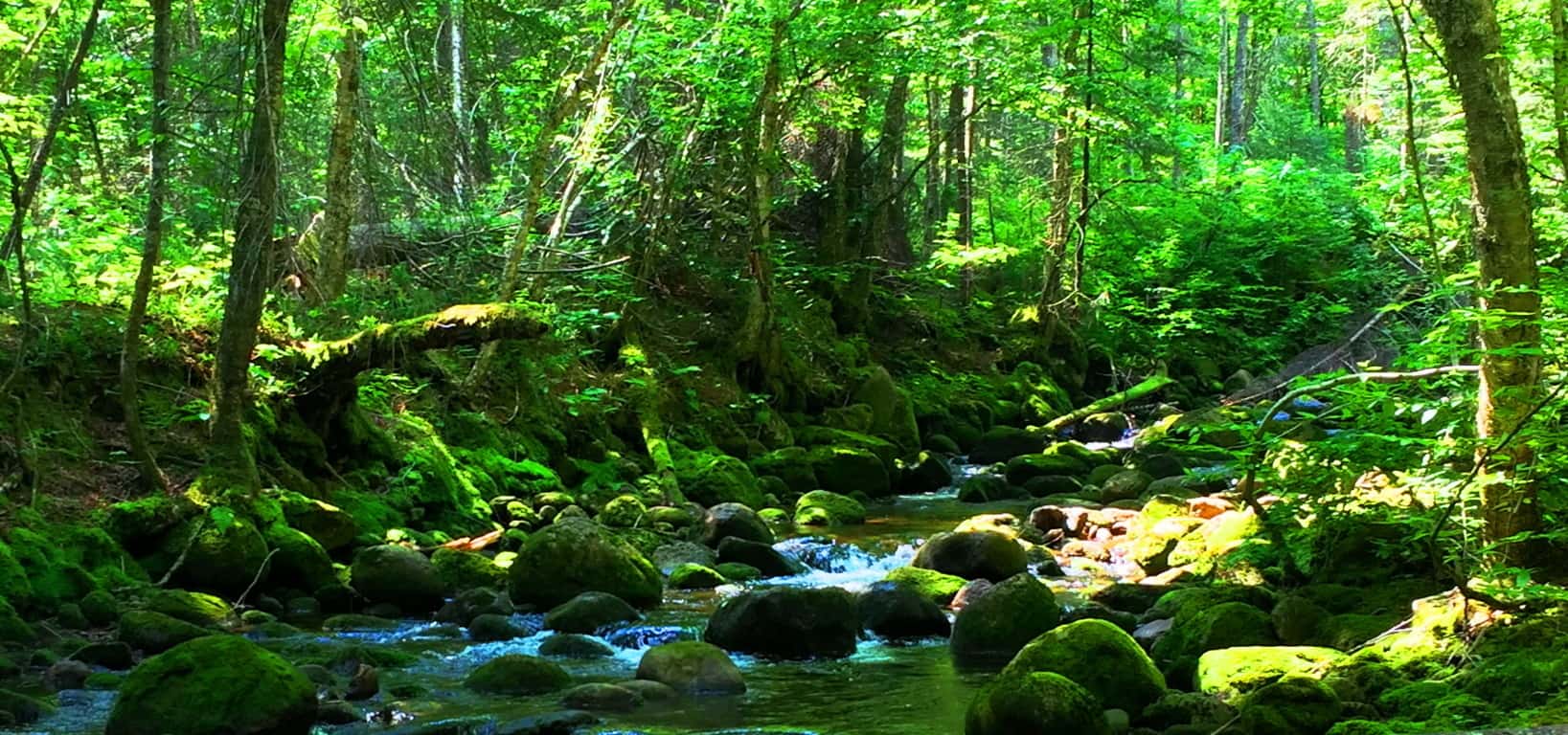 The streams here were beautiful, similar to the cinematic rivulets of Tollymore Forest in Newcastle Ireland, where Season 1 and 2 of Game of Thrones was filmed. (Image/Below)
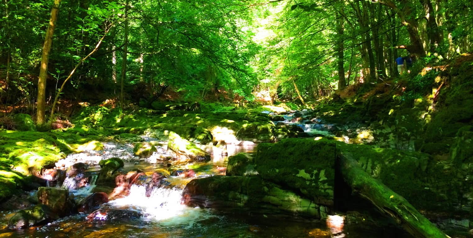 At place like this, by streams that have that “Camelot” type feel, the spiritual side of hiking in big woods can become clear all at once. One of the amazing and very real benefits of basic hiking over time is the “Deja Vu” factor of natural spaces. Obviously natural spaces are going to be similar in many ways; but it is important to reinforce the idea that: just like listening to a song you loved from many years past, which can immediately transport your mind to that former place and Time in your life, streams actually have this very same incredible quality. Where streams rush in deep forests, there can be literal “Deja Vu” flashes, perhaps of other beautiful places like: Tollymore in Ireland, Savoy in Massachusetts, or Glen Coe in Scotland, all of which are vibrationally similar to Les Cascades Trail. When this “Deja Vu” feeling takes place along beautiful streams, the effect on your mind, that “outside Time” feeling, is the very vibe that individuals who practice ‘meditation’ or ‘prayer’ are striving to achieve. Forests are a sacred vehicle for a better state of mind, if you take the time to pass through them. More advanced studies are now coming out revealing the physical and psychological benefits of natural spaces; they refine the palette of your senses, making you capable of accepting the subtle bubbling of a brook; the low booming echo of tall trees stretching in the wind; and every so often, total stillness. Getting back to Cartier National Forest, follow the trail to the left, just after the stream, where the larger stream is dancing down the valley through boulders and stones, and you will begin to climb into the beauty of the third mile. There are many stops along the path to just relax, jump in the water, and generally exhale for a while by the picture-perfect rushing water.
 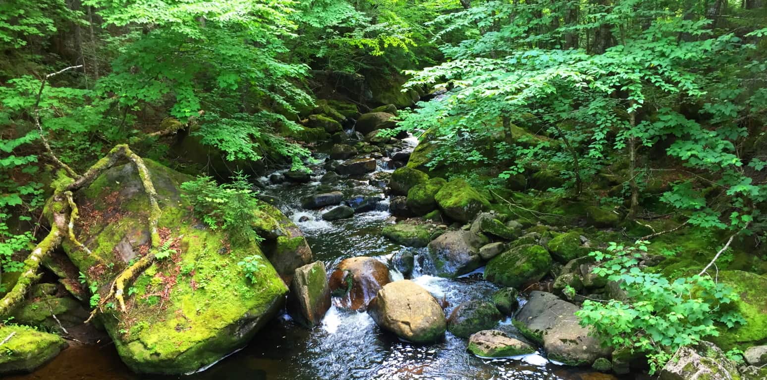 After following the third mile along this waterfall you will eventually cross another wooden bridge and have the choice of heading directly back, or taking the the elevated route to get another 100 feet or so up the valley, which is recommended. At the top of this elevated trail is a heart-warming view of the mountains on the other side of the river-valley.
 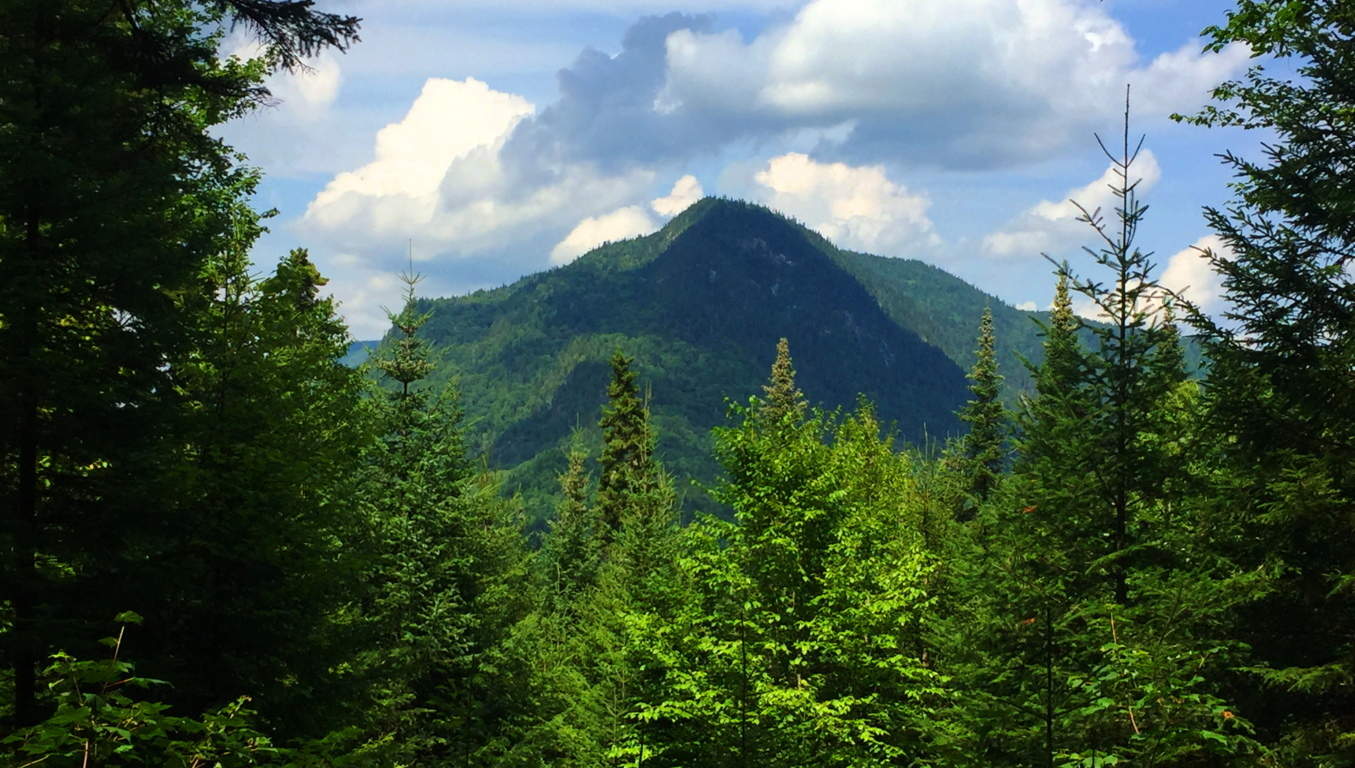 After viewing the mountain you can follow the trail out and back to the beginning with ease.
In a place like this, a forest of supreme tranquility, it can actually be hard to come out at the end of the day. Jacques Cartier National Park is worthy of a lifetime of visits, with kayaks and snowshoes, depending on the time of year. With the new weather pattern that is now dominating roughly the last fifteen years, this particular part of the world is now under snow and ice for 7 months (or more) each year. Canadian winters make Celtic winters look mild at most. Time spent in the warmth of the Sun in Canada is absolutely precious. If you decide to experience the northeast extreme of the North-American Continent, continuing into Canada, go in Summertime. Even Canadians are challenged by the deep winters here. Give Quebec and the beautiful Jacques Cartier National Park a try while the flowers are blooming. This place will bring out the best within you, and in more ways than you might realize. Go well, with each and every step.
Sunset Crater Volcano National Park
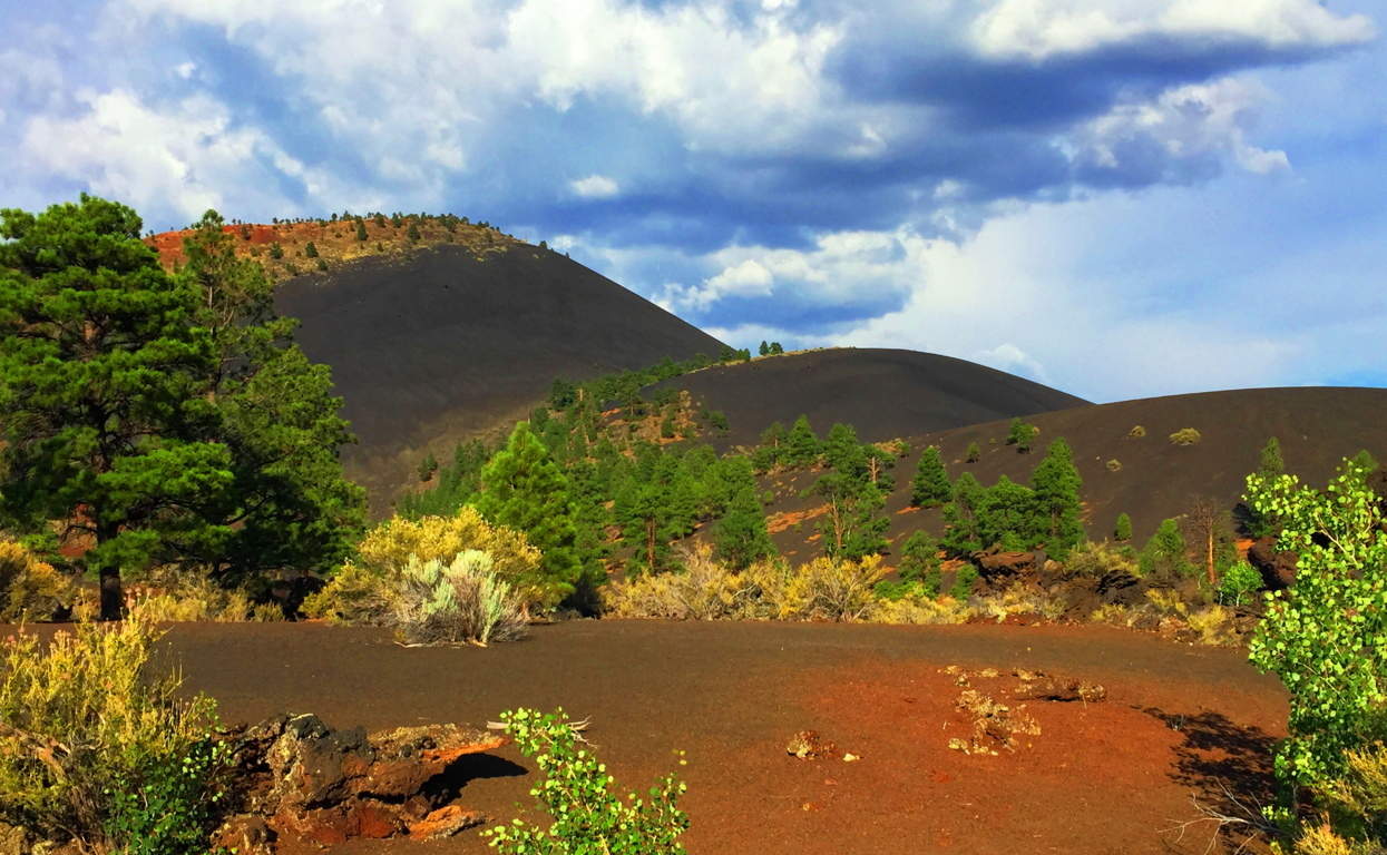 Location: Flagstaff, Arizona/America
Elevation: 8,042 feet/Prominence 1000 feet
Note: When seeking out sacred places, signs for Neolithic Culture will not always reveal themselves. The world is a wide place, teaming with variation and regeneration. In places like Sunset Crater, you will experience real wonder about the regenerative ability of Nature, as well as its explosive potential. This is a relatively new landscape compared to the Ranges of Ireland, Scotland, England, and New England.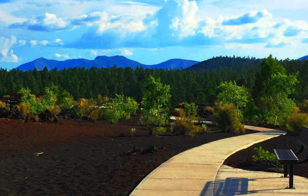 Just like the Celts of the Atlantic coastlines, there are native tribes that have been in this particular place basically forever. These indigenous tribes can attest to the age and variation of the landscape, along with Neolithic legends of their own, which bear striking similarities to those of the Celtic tradition. The Hopi of the Coconino Desert tell stories of “Red-Headed Giants” that ‘terrorized’ this region once upon a time. Isn’t that ironic. Many tribes, such as the Wupakti, migrated away from this scene, out to the very edge of the desert, into mountains and forests, perhaps to get away from the threats that existed out in the wide-open-wild. They came to live in the shadowy-cool forests of what is now Sunset Crater Volcano National Park, the ever-young landscape on the edge of the abyss.
Some places, just by hiking through them, can literally change your dreams at night. After hiking the countryside in Ireland with eyes wide open for just a few days, the only thing you will see when you eventually close your eyes at night, is a bright residual green. (Image/ Below/Left/Glenveagh Mountains/Ireland).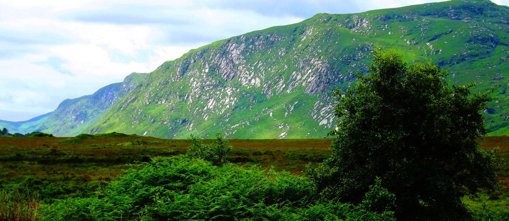 It truly happens. In the high Cococino Desert Plateau of Arizona (Image/Below) where everything you see is, at a minimum, 8000 feet in elevation, the altitude seeps slowly into all five of your senses, and even pushes you into a sixth.
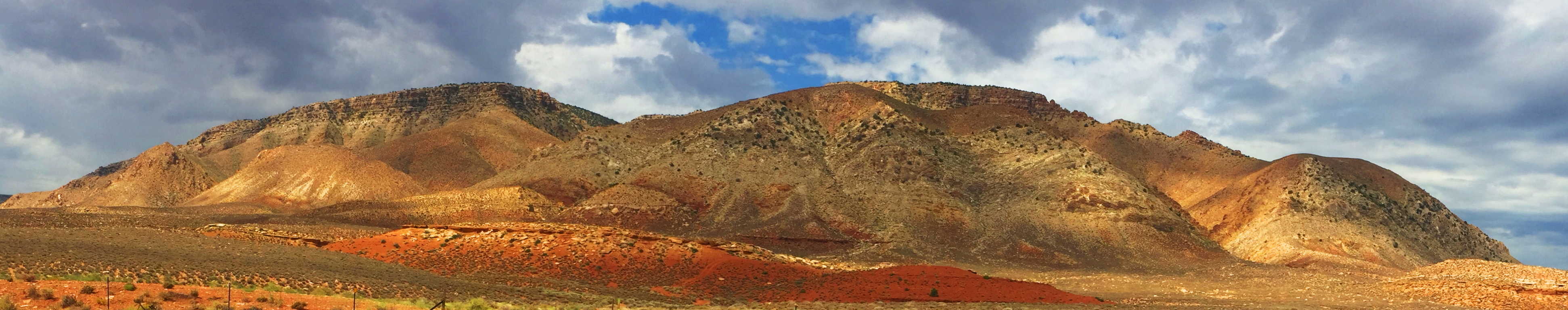 Here your body will begin to sense that it has moved into another world entirely. After a few days on the Cococino Plain of Arizona, the only thing you will see, when you eventually close your eyes at night, is residual white-gold. The perfect example of this is the wide-open panorama of the Grey Mountain (Image/Above), just south of the Grand Canyon. Grey Mountain sits like a white-gold monument welded by the timeless high-winds of the Cococino Plateau. On the extreme southern edge of this “white and gold dimension” is the surreal and vivid oasis of the ‘Sunset Crater Volcano National Park’. (Image/Below)
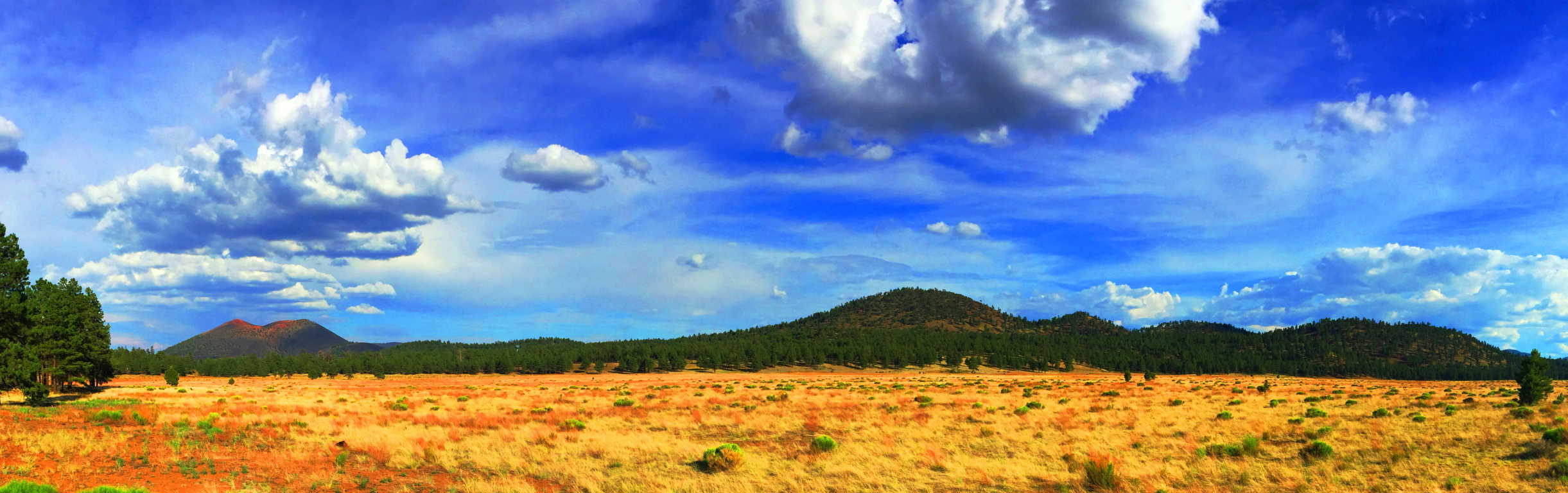 Sunset Crater’ is the captivating edge of the intimidating, but totally scintillated, Cococino Desert scene. From a distance, Sunset’ is the first life-giving glimpse of green after a dauntingly vast span of high desert bush. The Crater’s’ black rock and golden brown soil stand outs like a holy mountain against this dramatic golden-white backdrop, and it is highly likely that the native Americans of this area believed it to be a spiritual monument.
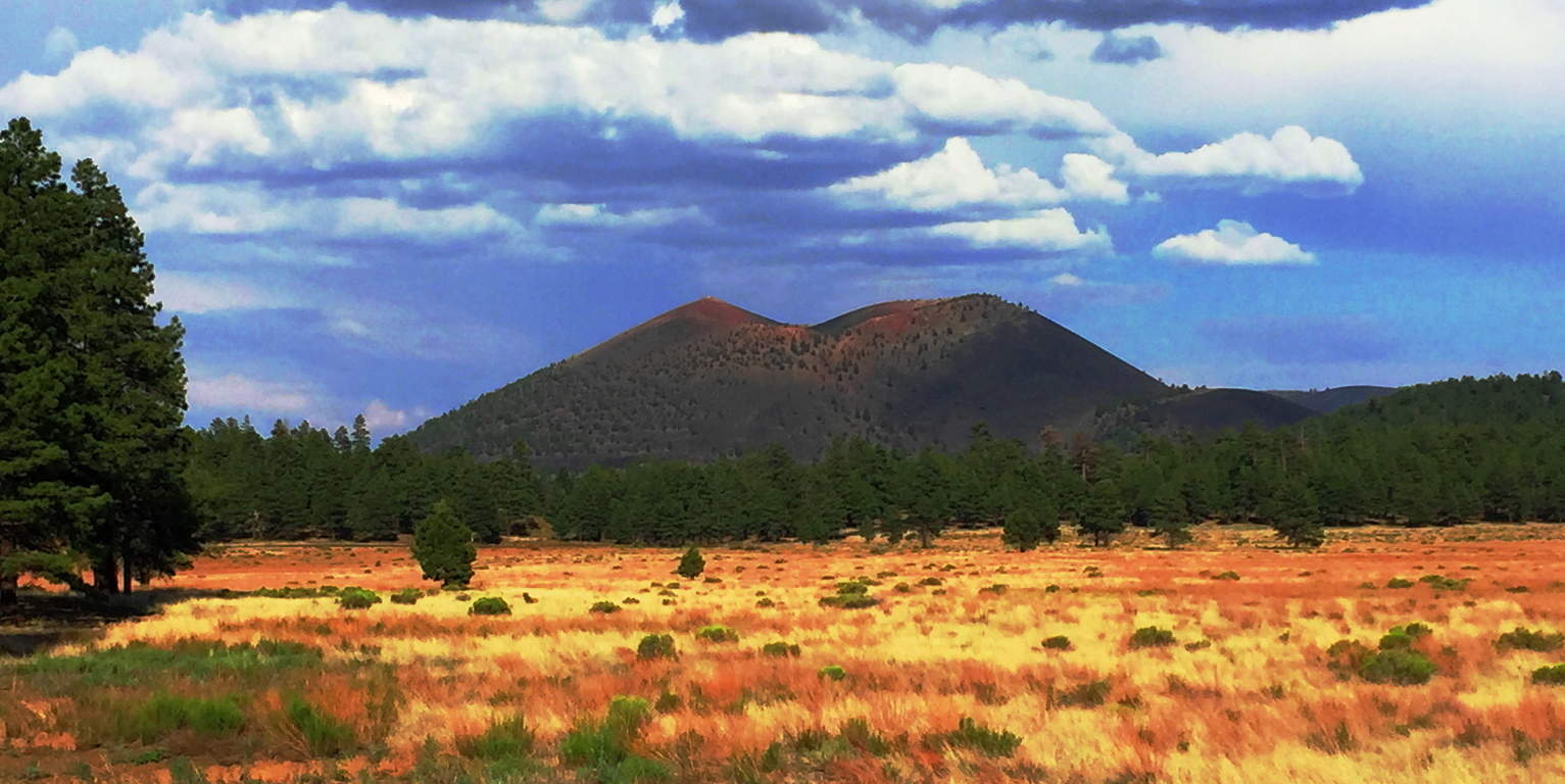 From the base of the Volcano, Sunset’ becomes a deep and jagged black-sea of solidified magma, an other-worldly terrain displaying a tangible timeline of life and death, and then life again, in a single glance.(Image/Below)
 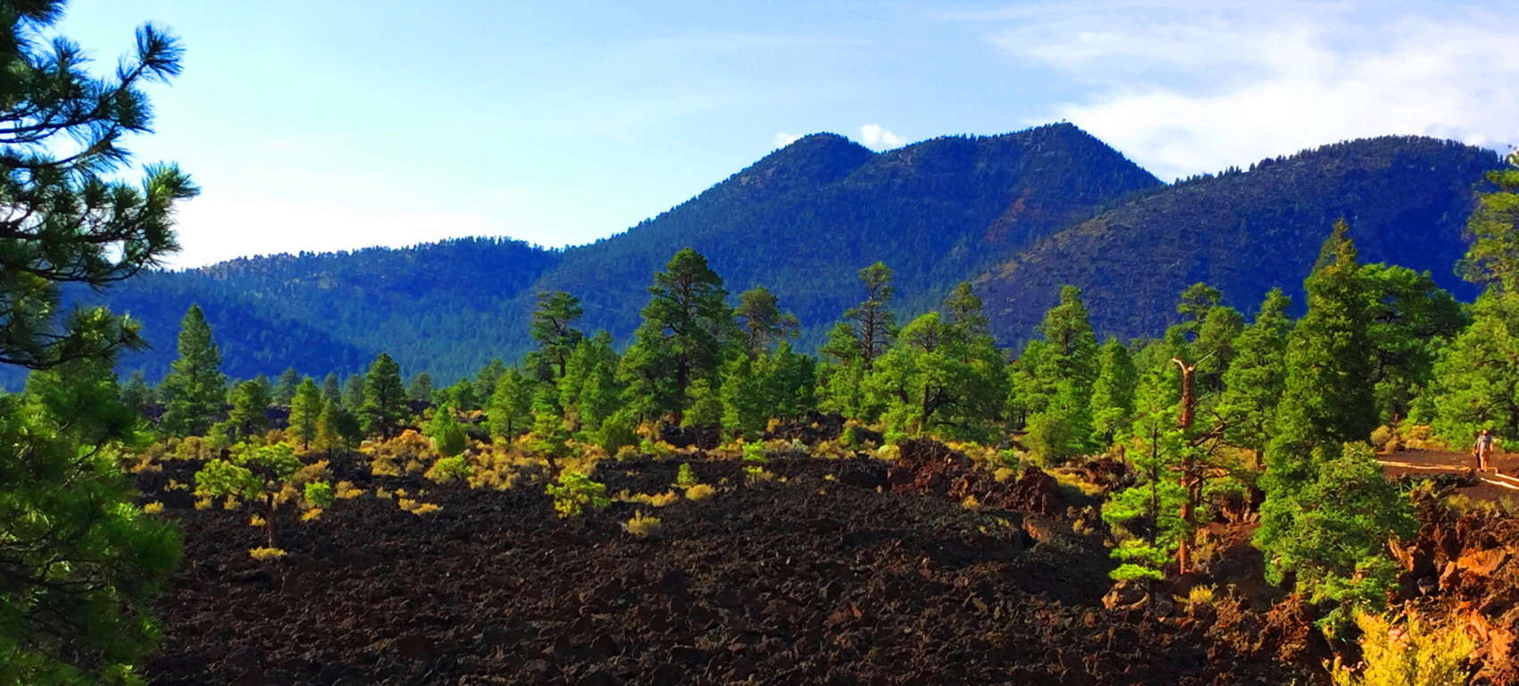 The trail design here at Sunset’ is a short set of ‘Wizard of Oz-looking’ pathways that run through the incredible magma remains. The rocks are sharp and drastic shafts which cut deep into the earth. The smooth white stone platform built for hikers here couldn’t contrast the experience more (Image/Below). It is one surreal stroll.
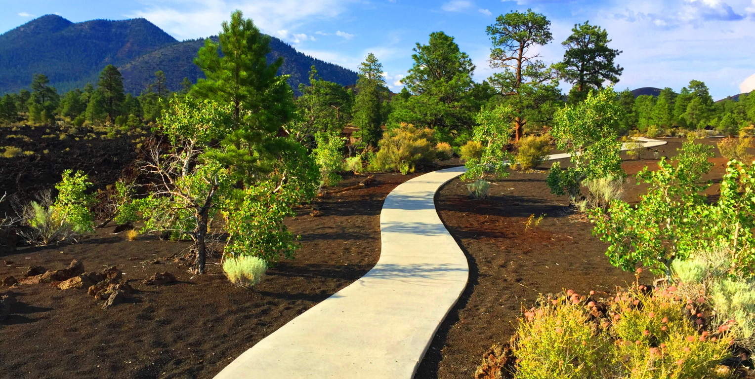 The best trail here is the small road which runs northwest into the newborn forest, around the Volcano. To see this brand-new forest rising up out of what was once magma, ashes, and fire, is to see a spiritual vision. It is a testament to the determination of the force of Life around us; how It finds a way, even in the harshest of environments.
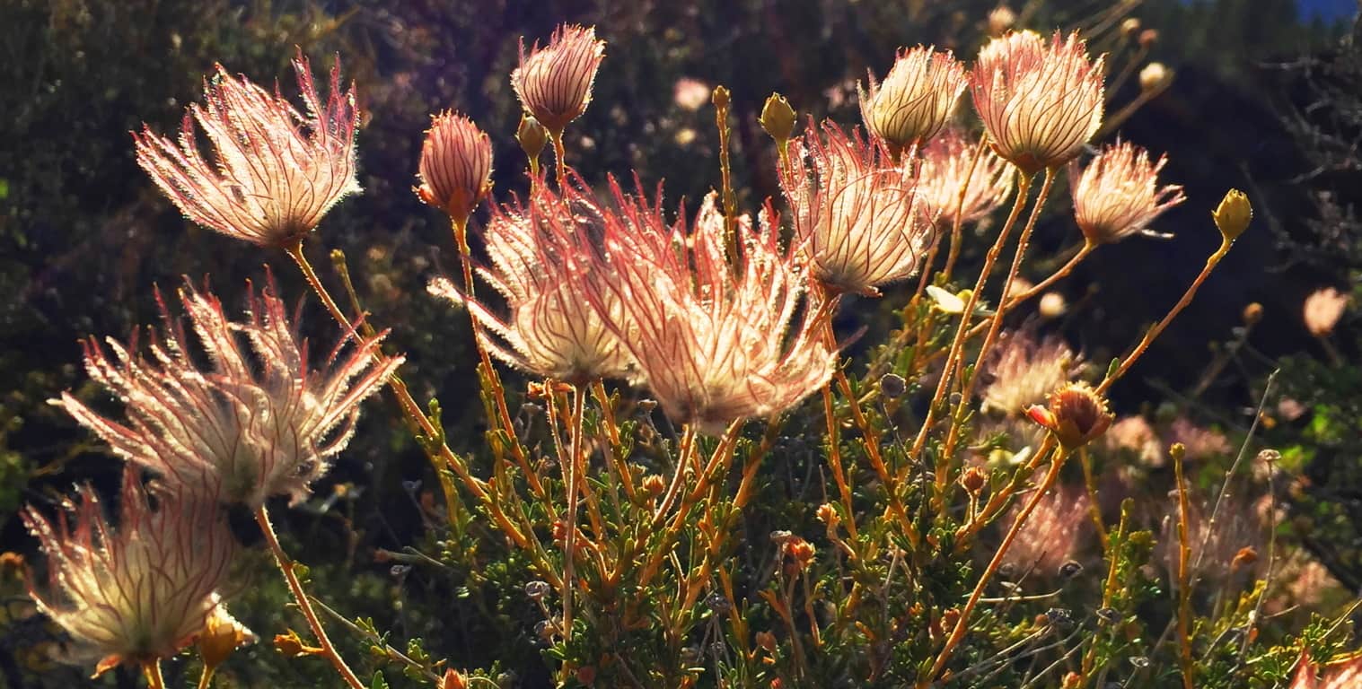 It is truly surreal: What looks like level pavement in the image below, is actually the newest of forests growing straight out of the compiled ashes and magma. The fauna here are tough, resilient, but somehow delicate and soft as well. (Image/Above)
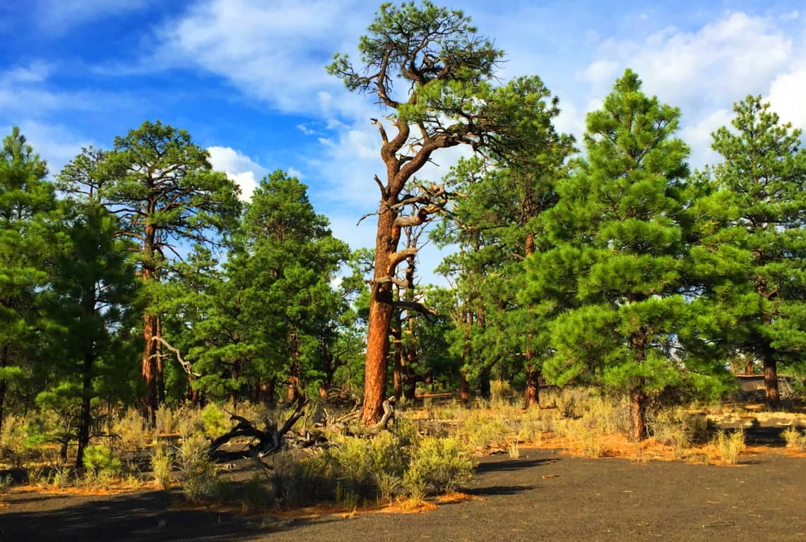 It is forbidden by the Park Service to climb the Crater’, but you can wander into this baby-forest near the western base of the Volcano’. Here you can catch a glimpse of the young glades climbing up the 1000 foot incline. The new growth browns’ the black-rock deep into soil, with the golden brush sprouting-up as a result, pushing the Ponderosa-Pines ever-upward, as if they were climbing The Great Pyramid.
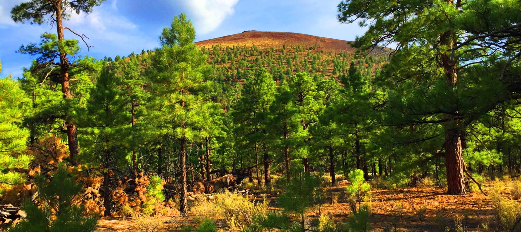
The indigenous Natives of this region, the Wupakti, would’ve seen the dramatic eruption which took place here just over 1000 years ago, from their stone dwellings only a few thousand yards away. Their dwellings remain in the safety of the Ponderosa Pine filled Cococino glades, where once deer and rabbit would’ve been plentiful, before the modern era invaded their tranquil existence. (Image/Below).
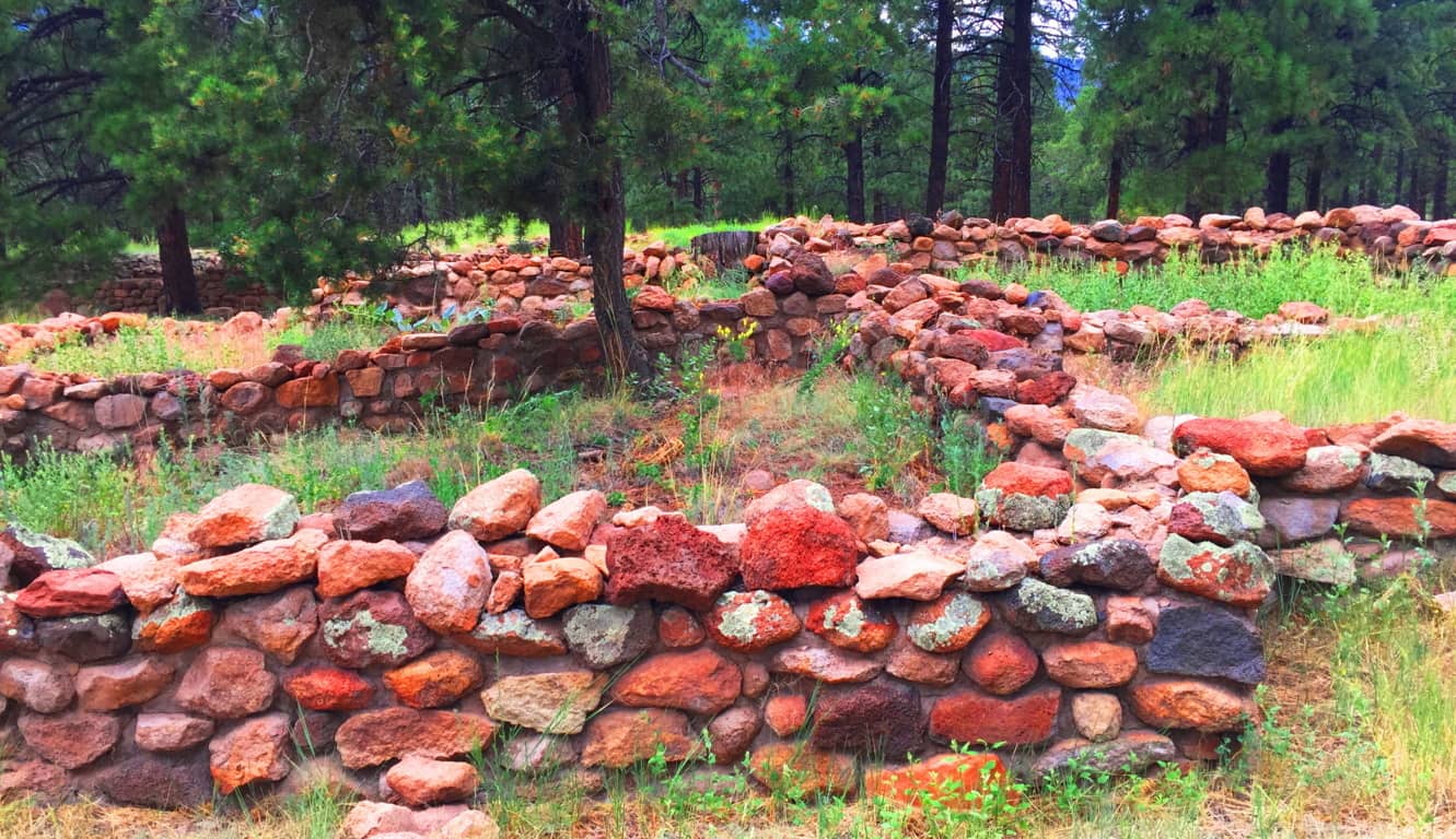 The Wupakti absolutely knew what they were doing when they settled just west of the Volcano. The variety of alternate natural features within a 50-mile radius of Sunset Crater’ is overwhelming. To the north of Flagstaff City, and east of Sunset Crater’, is the striking San Francisco Mountain Range of Arizona, inclusive of four beautiful peaks, with trails, all climbing no less than 12,000 feet. (Image/Below)
 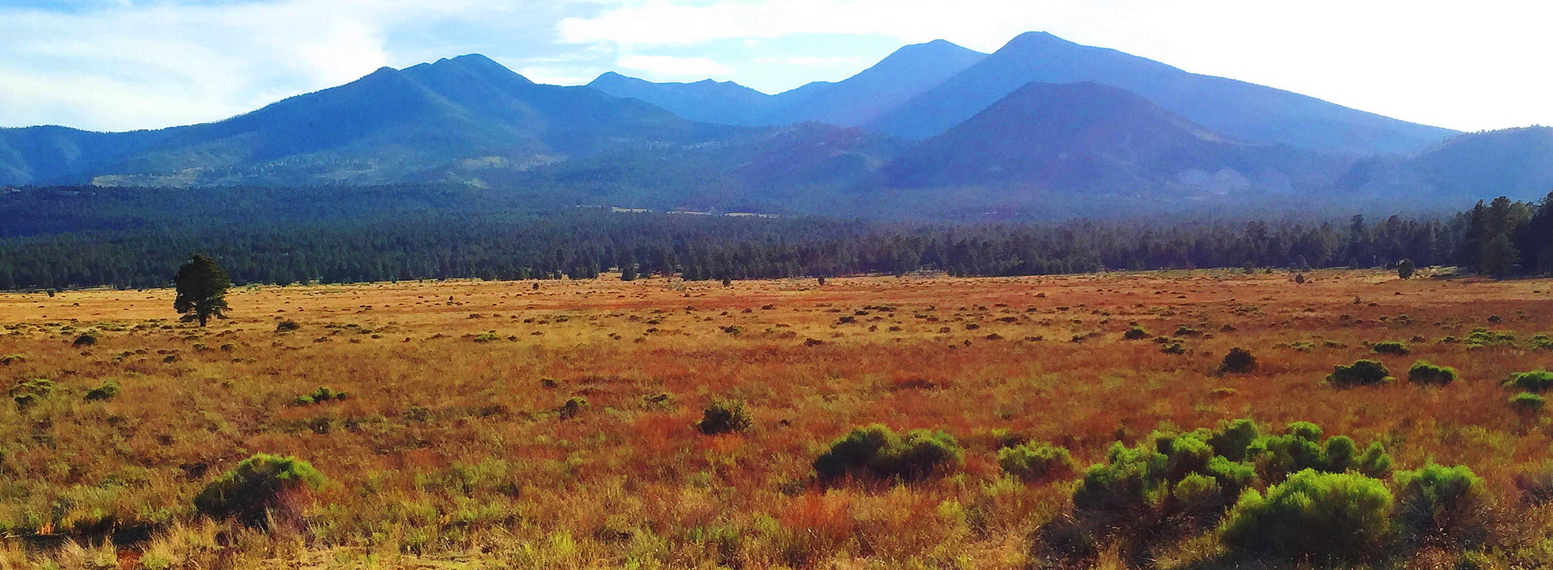 The native cultures here are beautiful and varied. The Wupakti chose to live at the base of these Mountains, within the Forest. The legendary Apache dwelled to the southeast; while the mystical Hopi chose the north, way-out in the desert Canyons, such as the Grand Canyon (Image/Left) and
 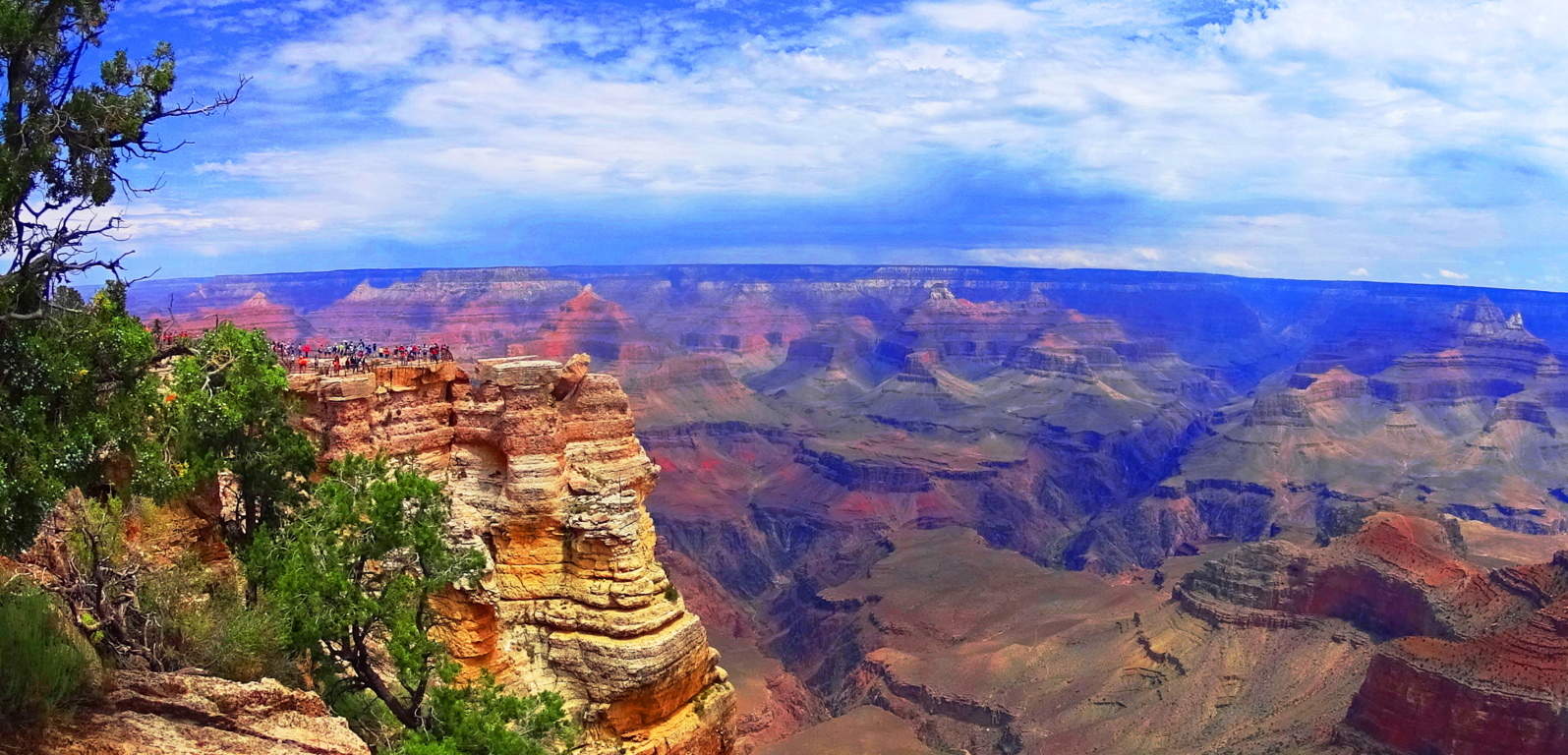 the lessor known, but no less beautiful, ‘Little Colorado Canyon’. All of this is out there in the northern arid abyss that seems to go on forever…(Image/Below)
 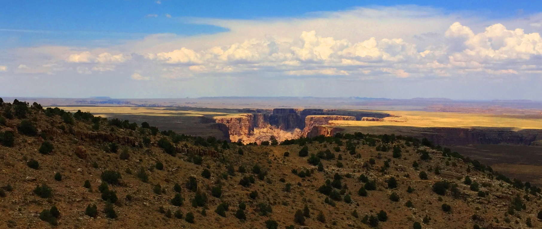 The signs of the Neolithic Culture that existed before the Natives of the region are certainly here, spread across an intensely vast amount of space. Multiple canyons, forests, mountain ranges, and deserts exist here, all with features that show signs of Neolithic culture. If you come to Flagstaff Arizona, visit Sunset Crater’. Experience raw elements of trails containing the Past, Present, and Future in one stellar region. The regenerative force of Nature persists in even the harshest of places. Amazingly, if you investigate the stories of the Wupakti, Hopi, and Apache, you will find myths so similar to Celtic legends, it will astonish you. A hike through Sunset Crater’ makes it all as real as it gets, and in a stunningly beautiful way. Don’t touch the lava if it starts to flow, but definitely enjoy the show.
Donegal
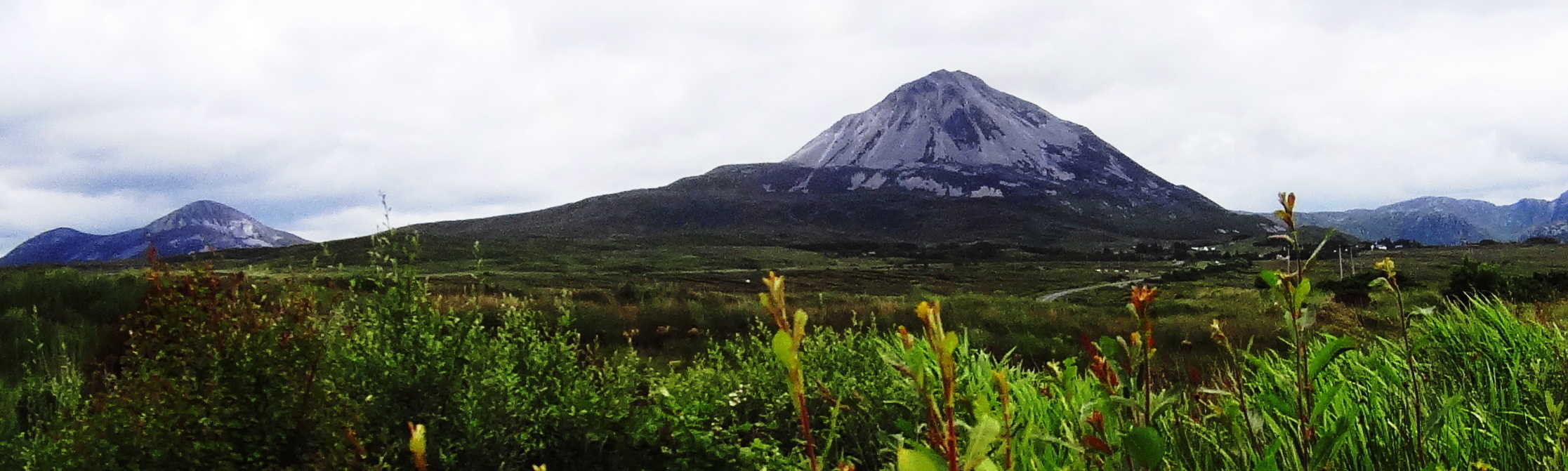
Location: County Donegal/Ireland
Note 1: There are only so many places in the wide world that offer an approachable scene of mountains along with gorgeous coastline in the same incredible hikes. Some examples include exotic places like Santa Barbara/California, Monaco/France, or Whakatane/New Zealand. These epic places all carry that rare majesty of mountain-range combined with coastal experience. These areas, at minimum, are straight-up wonderlands. It pulls on our imaginations and taps our curiosity to even glimpse images of these places. There is yet another place though, no less profound, further up the northern hemisphere, that is so worthy of your attention. For the lucky trailblazers who have stood at the peak of Mount Errigal in County Donegal, Ireland, and turned their gaze North (Image/Below), it becomes scintillatingly clear that this is one of the most incredible mountainous/coastal regions on Earth. This is Donegal, Ireland. If you haven’t found your way there yet, then this is your chance to get a glimpse of this ancient place. Sometimes just a glimpse is all it takes to get you there, like falling in love at a glance. This is the overall goal of Stonestrider.com; not just to show you how beautiful a given place might be, but to give you enough visual substance to put you over the top, and get you to make the decision to get there… in real-time.
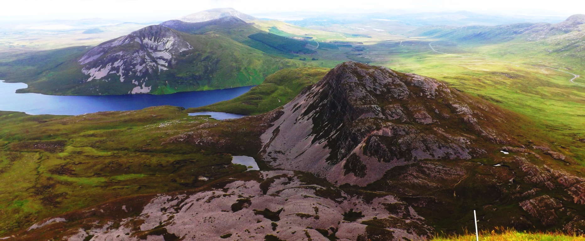 Donegal is a collection of every possible aspect of ancient Irish culture; from the Celtic tradition espousing tales of Giants and great kings, to the related Medieval Period and its dynamic history. In approaching Donegal, the boarder regions to the South and East will be looked at as well. Ireland is an interwoven tapestry of related Counties, and it becomes necessary to describe the beautiful sites that exist en-route to this beautiful northwest corner of the Emerald Isle, as well as Donegal proper. The history here is pretty much on-par with Game of Thrones. There are epic accounts of Viking-raids all over northern Ireland, mingled with Medieval relations between the great Houses that occupied the ancient castles of the region. Donegal Castle has many engaging stories throughout its haunting and epic history. (below/left). There are hundreds of other gorgeous castles dotting the landscape, contrasting the skyline atop cliffs; along crystalline lakes, and dark Atlantic coast.
 There are Dolmens in the heights and forests; Dolmens which are aged 4000 to 6000 years. Stone Circles exist mystically in the fields of each county as well, and are no less significant. Donegal is a veritable soup of historical substance. There is a historical richness and mystical sustenance that locations like Santa Barbara and Whakatane’ just can’t provide. An adventure in Donegal is rich with tangible in-depth substance, true wonder, and every type of magical potential. O.k. Lets begin, to wander in…
The Region: Before entering the dimension that is Donegal, the logistic mystery that surrounds the area should definitely be addressed. Even describing the cartagraphical affiliations of the area creates a bit of a tongue-twister; colors can be used to describe the political designation of Donegal. Donegal is in the physical region of northern Ireland, and more specifically northwestern Ireland, and remains part of the nation of Ireland, which generally continues geographically South from Donegal. Donegal, however, is not in “the nation” of Northern Ireland, which is part of the U.K. The north-eastern part of the island is the U.K. Be aware of this national distinction if you travel anywhere due-north of Dublin, the proud people of this specified region most certainly are.
Note 2: The history of the northerly destinations of Ireland should definitely be looked at for a moment before thinking of traveling through. Deadly conflict has taken place around the area of Belfast due to the occupation of British forces. This controversial occupation extends far back in Time, even before Colonial times, into the Medieval period. Interaction between the British, Scottish, and Norse cultures, are interwoven into the overall ancient history of the region, with the British prevailing into this Modern period. Towns like Newcastle in the Mourne Mountain Range have a proud tradition of being part of the U.K, with hundreds of British flags often displayed in the old-town center, nestled into its beautiful coastal/mountain scene. (Image/Left) Travelers should know that there is no toll, or wall, separating the northeastern region from the rest of Ireland. The beautiful Irish landscape rolls through the entire Island unhindered, and you can pass from county to county freely, regardless of these modern distinctions.
Note 3: A seekers approach to Donegal can definitely start with the Megaliths, among many other beautiful things from era’s past. The ancient monuments of Ireland, its Dolmens, Cairns, Standing Stones, Stone Temples, and Castles, are extremely important for trail-finders. Their initial quality of lending the deepest spiritual significance to the landscape is only the beginning of their impact; they also give hikers something significant to strive for, a goal beyond the typical tourist attractions i.e: places where the locals stare distantly from beyond the parking-lots. Often times, if you set your sights on a sacred site, those beautiful and impossible stones in the illusive distance, wonderful and unpredictable things will appear and happen along the way. An example of this is found on the wonderful trail high above Glenveagh Castle, in Glenveagh National Park. There is a totally unmarked Wedge Tomb in the most dramatic of places, right next to the elevated trail. Finding these relics is not only a natural rush, but it also supports the idea that someone lived in this specific area as far back as the Neolithic Period, and if you explore further, it is likely that you will find more magical anthropological statements, adding to the wonder and mystery of the scene. This Wedge Tomb had that special symmetry that so many Megaliths do (Image/Below)…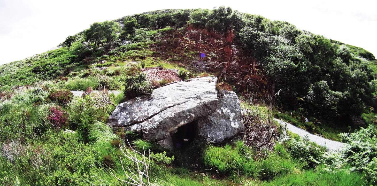 it is placed in the absolute center of the gully, and above an incredibly beautiful Glenveagh Lake. The view just 20 yards away from the Wedge Tomb, is truly spectacular with the Castle in the Frame. It is no wonder that an ancient group/culture found this spot to be a place worth living in, and claimed it with territorial stone statements. Incredible.
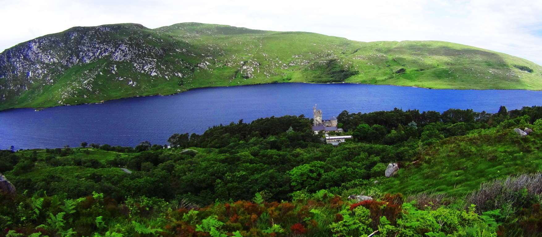 Other times, you can often be hiking and just around the next bend an incredible historic site will just appear practically out of nowhere, as Monea Castle did for me while hiking a roadside in Enniskillen on my way to Donegal.
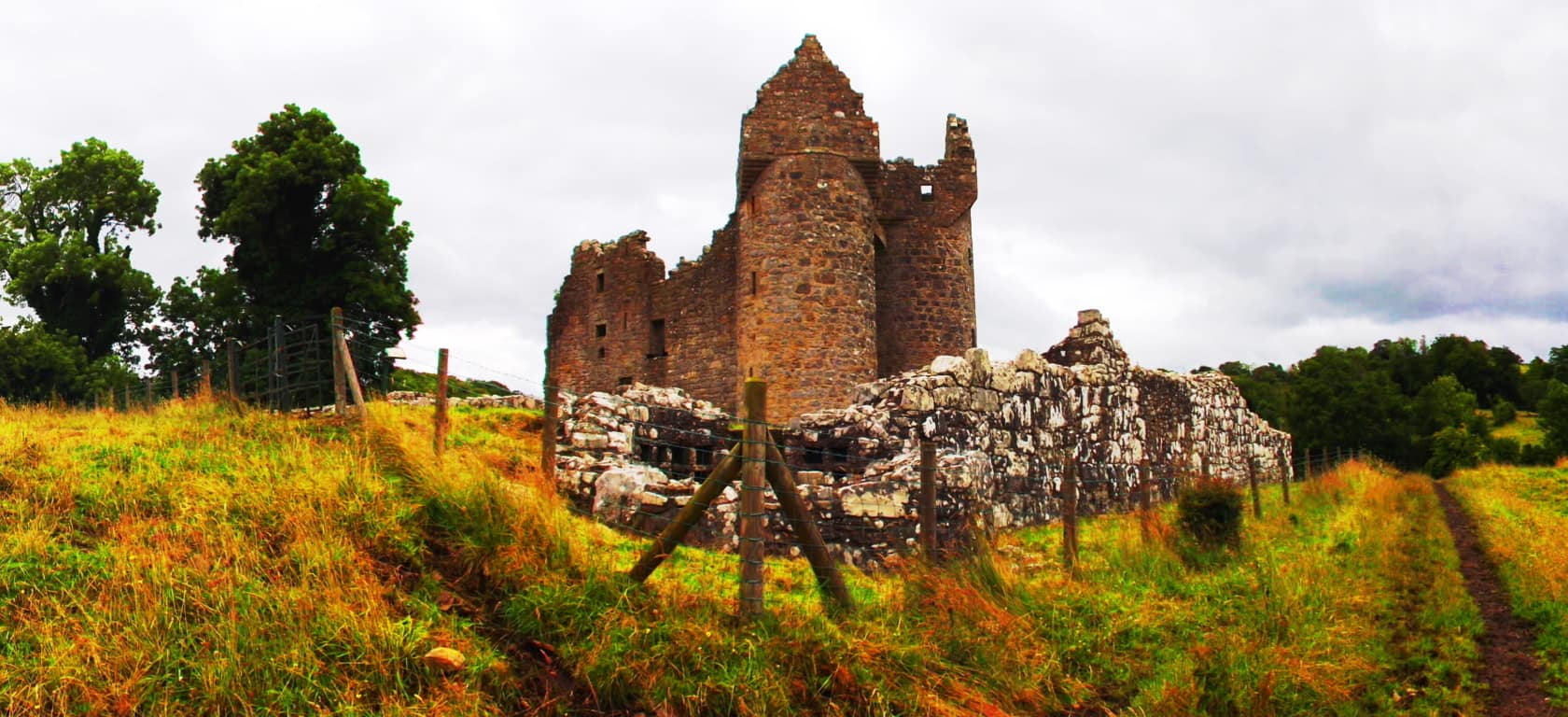 Walking towards a countryside castle like Monea is like wandering into a dream; often without another person for miles, with only the quiet stillness to picture the beautiful life-style that had taken place here hundreds of years ago. (Image/Above) Not far from this very same scene, continuing north on the A35 to enter Donegal from the South, you will discover the approach for Drumskinny Stone Circle. There is countryside for 15 miles in every direction when you arrive. The stillness is shocking. This is the epitome of Stones Circles in Ireland. Drumskinny is in a classic radial form, along with a linear extension of smaller stones, which are certainly worthy of a study beyond the scope of this article. Perhaps there is a celestial connection? Each stone is beautifully unique, like people, and yet the unify into one shape. These places of ancient ceremony have a vibe similar to that of visiting a relative over the landmark age of 100, that is: without words there is an amazing depth to the moment, however still and nearly silent the scene may be.
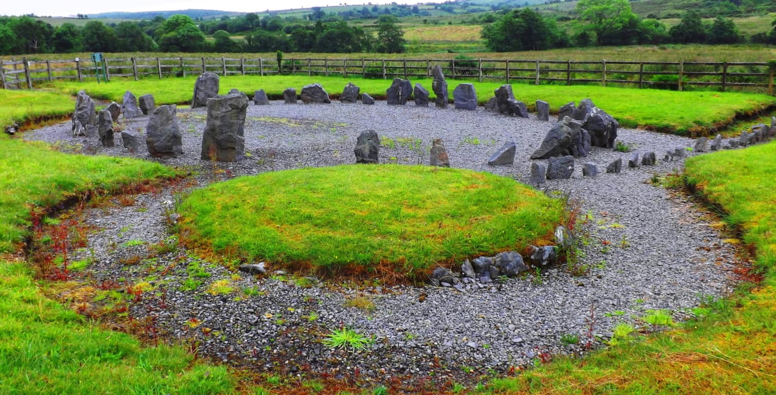 These are the places where the Celts had dwelt for centuries; generations of everyday farmers, householders, and small-business-owners are their descendants. They have survived countless struggles to remain connected to their homesteads. After visiting this beautiful place at the southern edge of Donegal, you will be ready to move North to a region where two Dolmens have stood since the beginning of History. Both the Gortnavern Dolmen, and the Kilclooney Dolmen, are located in County Donegal, and are fantastic options for a multifaceted adventures with a climactic focus.
The Gortnavern Dolmen Excursion: The overall approach to reaching the Gortnavern Dolmen is just as significant as actually finding it. Major roads in Donegal are solitary and singular, while contrastingly, smaller roads often have no names, and lead to the farthest corners of enclosed hedges and fields that seem to go on forever. ‘Moneymore Road’ is a good example of the lessor road experience, located at the southern base of Mount Errigal. This little street gives a reclusive valley perspective of the entire enchanting area. An abandoned stone church sits in the shadow of the Mount Errigal beyond, a truly epic vision. The best and most beautiful approach to the Gortnavern Dolmen, is to pass by Mount Errigal, near Moneymore, and continue through Glenveagh National Park (Image/Below) along the incredible R251. This is a once-in-a-lifetime-drive. From the Hamlet of Mullaghduff the entire R251 scene can be viewed. (Image/Below)
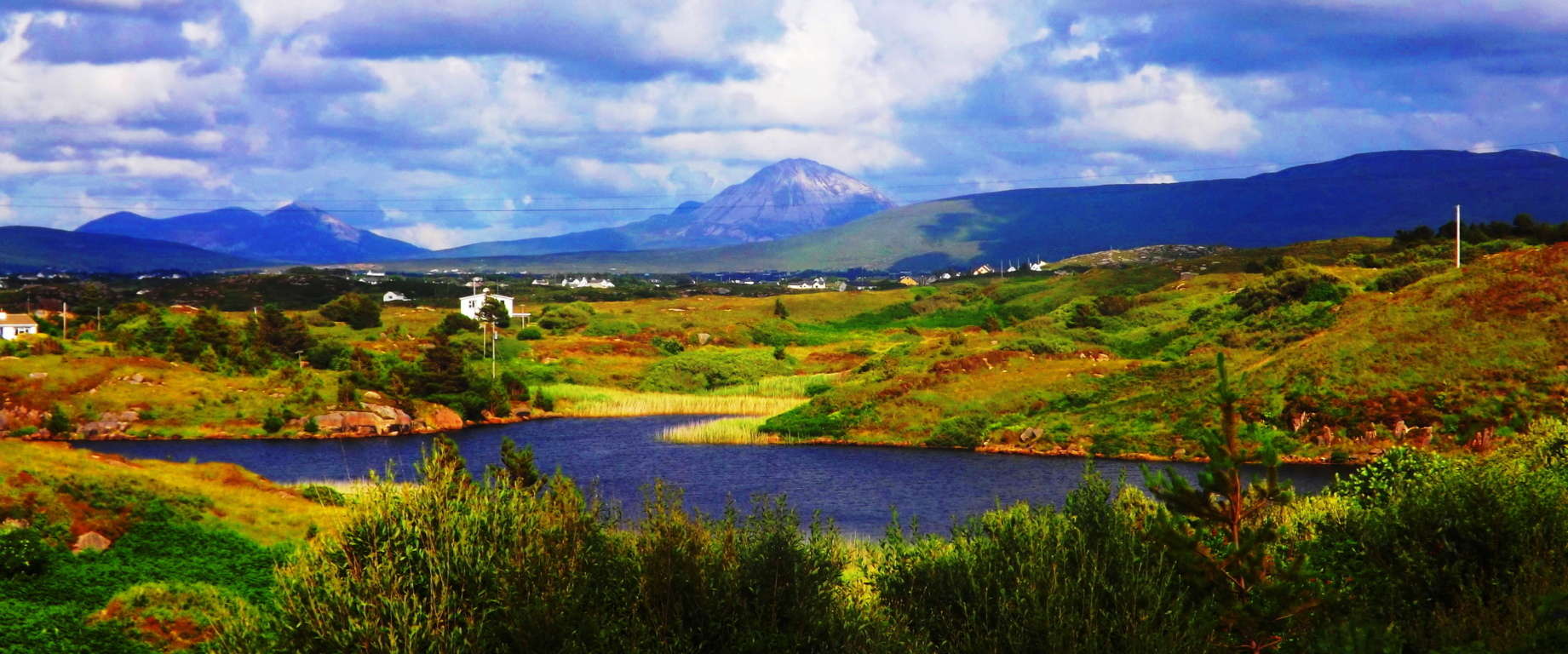 In hamlet of Mullaghduff there are beautiful free-standing boulders in gorgeous places (Image/Below), and incredible lowland waterfalls that are totally untouched, all in their original state. This waterfall (Image/Below), just off the road, doesn’t even have a path or an approach; you simply have to wade through the hedges to get close. I believe that this is a megalithic altar from antiquity, and fully engineered. Look at the fixtures of the interlocked stones; they are clearly “cut-to-fit” and rounded to create a beautiful and massively harnessed release point for the flowing water. Incredible. The entire landscape is enchanted; it truly is.
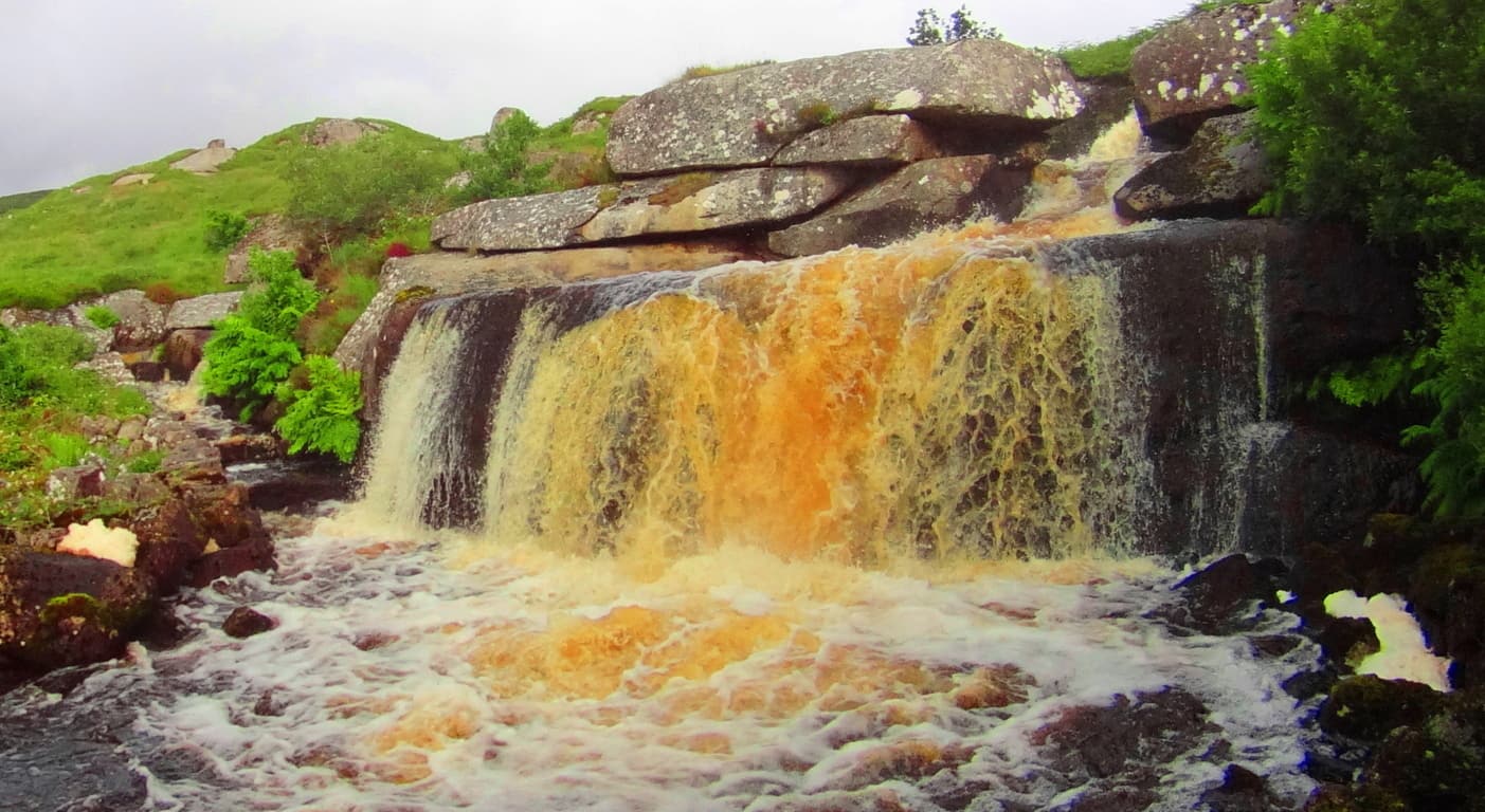 So bring your hiking gear/tall-boots, and be ready to trudge away in order to get close to something beautiful in Donegal. Continuing on, the Gortnavern Dolmen (Image/Below) is only 4 miles from the center of Kerrykeel.
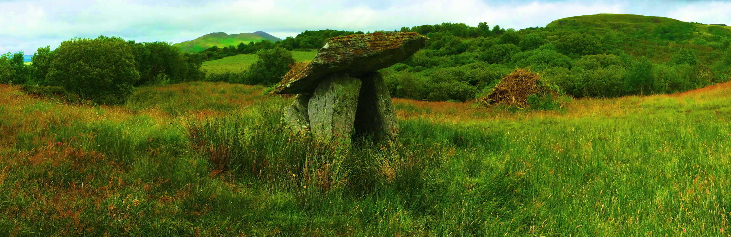 Along the road to Kerrykeel there are local vegetable stands ( 2nd Image/Below/Left) and craft shops. Stop by and converse with these local people! The Irish of Donegal are a people who have lived on the distant northwestern edge of Europe’s continental crossroads for what is now thousands upon thousands of years; take a moment for these unique and amazing souls. Even the small things the Irish country-folk have to do and say, may strike you as rare subtle wisdom, especially when compared to the placative and manic normalities of American and European Post-Modern life. The Gortnavern Dolmen is tucked beautifully into an elevated set of hills, south of the darkly soiled ‘Mount Ranny.’ (You must follow a country road with a small sign for the Dolmen, and then a left onto another country road, above a farm/ i.e: exact instructions to get to the Dolmen are in the “Gortnavern” article of Stonestrider.com, in the ‘Ireland’ section)
This is a 4000 to 6000 year old Portal-Tomb with a massive Capstone which faces the gorgeous Gortnatraw Mountain.(Image/Above) It is a rugged hilltop tapestry; a tangible infinity of farms and hedges amazingly complimented by the intentional angles of these ancient stones; stones that I believe were built to tantalize our perspective.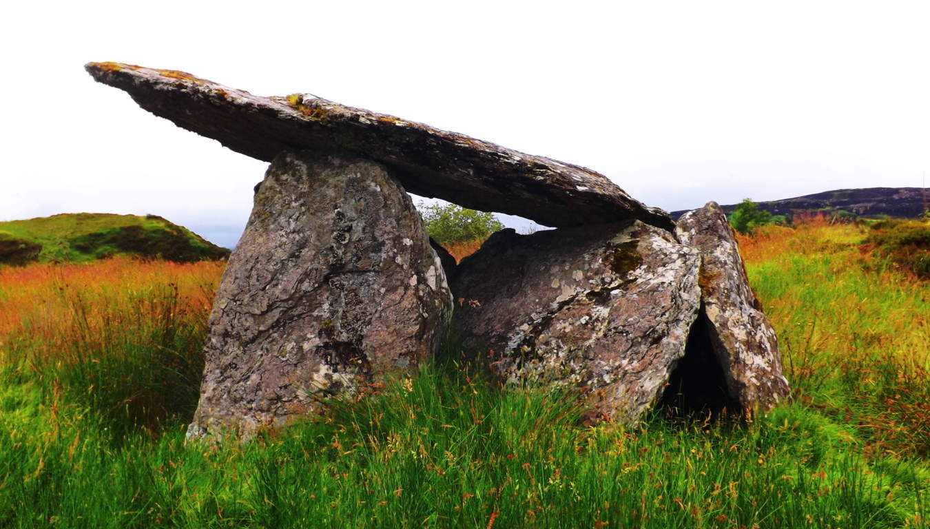 Perhaps 700 generations have passed since the construction of this monument. Dolmens, at this modern point in history, are more rare than any section of amazon forest; at greater risk of extinction than the Orca; and are as rare as a blue diamond. If you see a Dolmen you are truly touching something priceless.
  ( Again, for the more detailed instructions on how to get to the Gorntavern Dolmen please see the “Gortnavern” section in the ‘Ireland’ category of Stonestrider.com, or: https://stonestrider.com/2016/11/07/gortnavern/
Now let’s wander in an entirely different direction.
The Kilclooney Dolmen Excursion: Mount Errigal could be considered the epicenter of County Donegal. It helps to describe the many features of Donegal in reference to its beautiful white peak. The countryside to the East, which heads toward the Gortnavern Dolmen, is an inland scene of enchanted mountains and rolling valleys. The countryside to the South, which leads toward the Kilclooney Dolmen, is a different experience entirely, a coastal scene of cliffs, crescent beaches, rocky caverns, and an amazingly iconographic waterfall. From Errigal head South along the N56 to the R261. The R261 will take you to the Kilclooney Dolmen Centre, where you can take the short hike to the Dolmen. Not far from the Centre, at the farm house just up the road on R261, is an almost hidden, practically forgotten set of stones that was once a beautiful Wedge Tomb. It is unmarked by the side of the road, and clearly, once upon a time, a capstone was balanced above the supporting stones. Amazing. It is just an indicator that there are sacred things, seen, and unseen, all around you here. The entire landscape is a type of natural “temple”, a once synergized region accentuated by stone fixtures that we are still trying to understand in these late Modern times.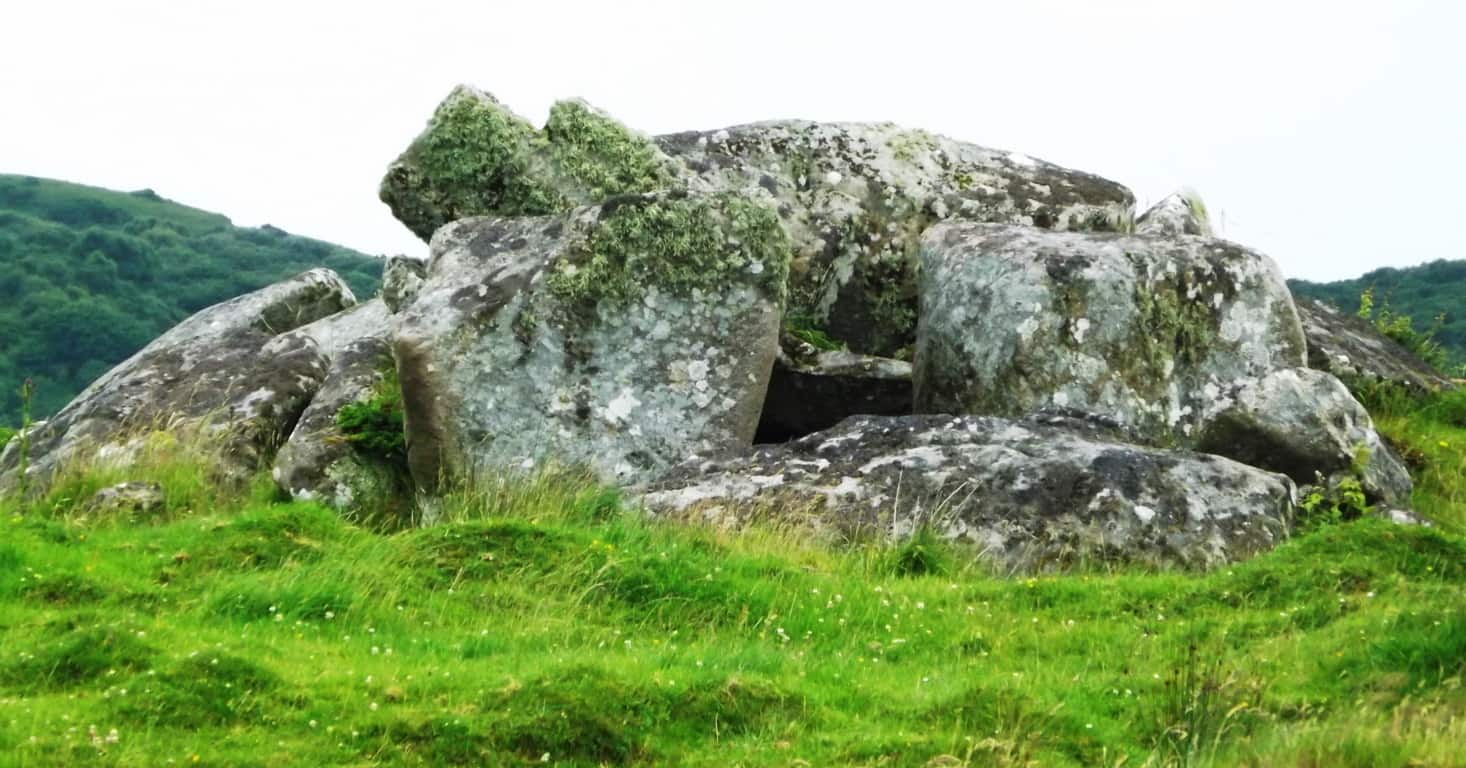 Before you start hiking here, wear ‘tall boots’! Having the right boots is the difference between a challenging experience, or something challengingly wonderful. As is the case with so many indigenous ancient sites, there is not a ‘standard path’ to the Megalith, you simply have to see the Dolmen about 150 yards behind the farmhouse and make your way towards it. For those who understand how wonderful this experience is, the non-commercial experience, the chance to laugh increases and releases with each and every Irish-as-hell step. These are truly special moments in a literally sacred Irish countryside. The terrain here is mossy, with brackish water mixed into tall-brush, and sandy dunes. Your ‘tall boots’ will make an easy walk through the terrain, right up to the ancient stone-lining which runs directly to the Dolmen and Wedge Tomb; they sit atop a small knoll covered with wildflowers and tough moss. Here is a prime example of how stones that look like a “wall” leading up to the Dolmen and Wedge Tomb, are certainly not a wall. These stones are a “Lining”; a veritable cable made of stones, which connects sacred site to sacred site, just like in New England. These stones were never, by definition, a “wall”. The stones of the Lining’ couldn’t stop a single thing passing through this country side, and it was never meant to. The Lining’ is part of an over all scene, all of the same Period, and most likely created by the same individual(s) as an “energy center” for the over-all scene.
 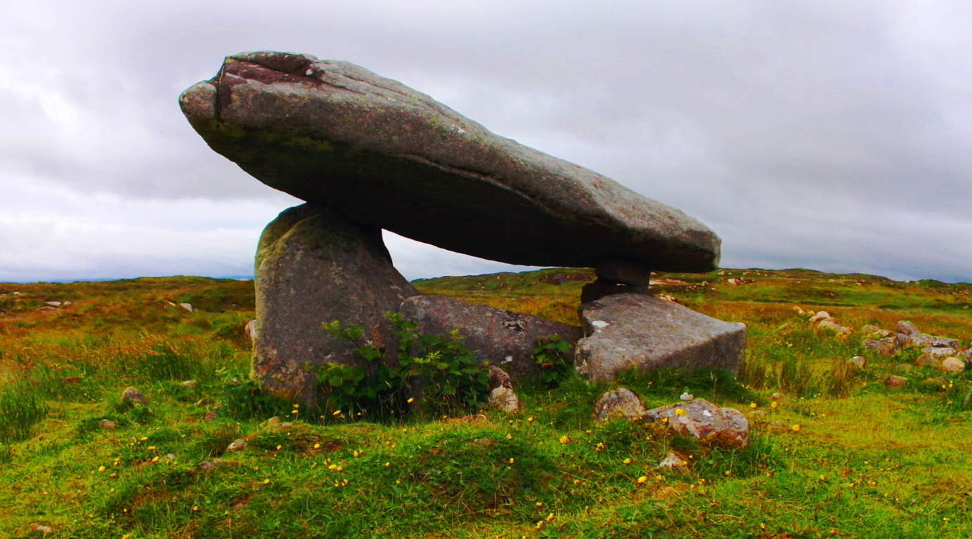 With the Atlantic Ocean only a mile or so beyond, the air here is medicinally salty. This “beach-day breeze” inundates everything, from the moss and grass, to the Dolmen’s very stones. This is an above average size Dolmen, with a massive “satellite-dish-like” 20 ton Capstone. This Capstone is balanced, and set roughly 5 feet above the ground. There is a slightly dilapidated Wedge Tomb with a 5 ton Cap-stone just ten yards away. This Wedge Tomb is no less priceless or significant in an archaeological sense, and certainly beautiful in its own right. Again, like Gortnavern, Poulnabrone, and the dozen or so remaining in-situ Dolmens in Ireland, Kilclooney is roughly 4000 to 6000 years old, and a unique version of the classic Portal Tomb. This is a place to sit and contemplate the scope of Time, the magical possibilities implied by the Stones, and the luck of being alive to see them.
Assaranca Waterfall: Like so many highways in other countries, certain roads simply become other roads, or have two names. After taking in the experience of the Kilclooney Dolmen site, you should continue driving to see the beautiful Assaranca Waterfall on the R261 South, which simply becomes the N56. Not far passed “Northwest Sea Kayaking” business, along the N56, just passed a beautiful white house with a red door, is a road with no name. It is a right-turn road with signs that point and say: “Tra Strand”/Uaimh Caves/Eas’ Waterfall 6 km/: standing clearly for all to see. Take the Right onto this classic Irish road and enjoy the short drive to the beautiful Assaranca Waterfall. The roads here are the hiking trails. This gorgeous region is known as Lackaduff. You can park your car at the waterfall and begin a beautiful hike towards the massive caves within the beautifully looming cliffs, all about 2 miles further up the lane. Small mountains encompass this rugged bay-route pathway, with adorable homes and fields of wildflowers, along with flocks of sheep.
  These are working farmers and fisherman in the area; they are not on vacation, so please be kind to those you meet, whoever that may be. Soon you will arrive to the beach…
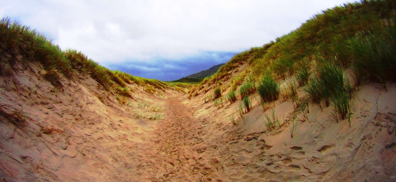 When you arrive take the path into the sand-dunes just at the end of the lane, and head out to the beach toward the caves (on the left.) As other places have been described in Stonestrider.com, this place looks like the perfect Jedi hideaway, perhaps to be found only by the most devout of disciples.
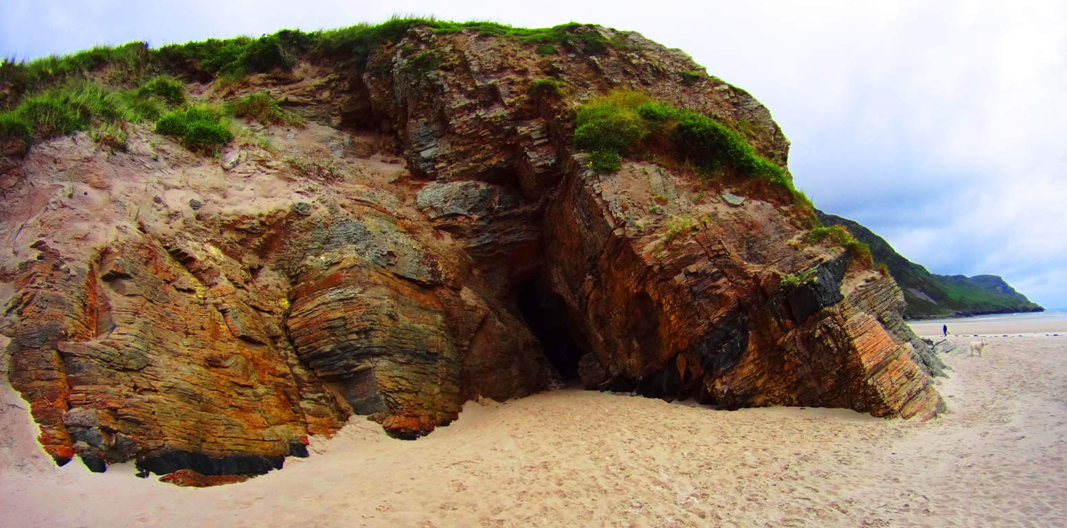 The colors here; the glassy Atlantic Ocean against the super-fine sand; the cliffs and caves under a cloud-sized blanket of green; they create a living canvas that just pours out an absolutely radiating beauty.
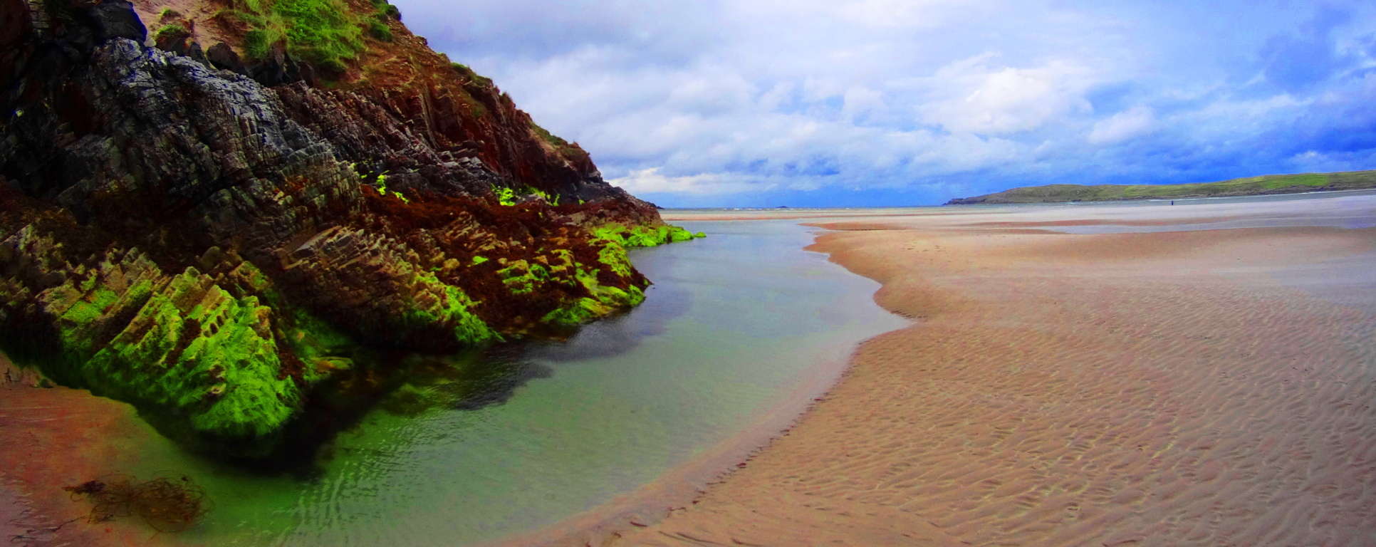
Last Note: Donegal is both rugged and radiant in one. There are striking scenes of mountains that just cut the sky with white stone peaks; there are rolling green ranges of mountain after mountain, after mountain.
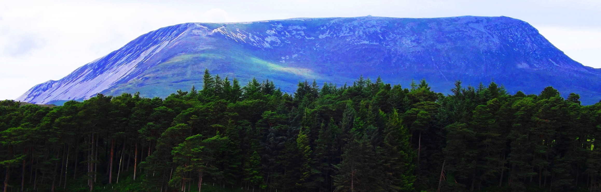 Eventually these mountains slam into a crystalline Atlantic Ocean. The Dolmens in Donegal indicate that the culture of the region is as old as Time itself. Wandering into this County is equivalent to wading into a Celtic Tsunami. The beauty is overwhelming. In every direction there is a pastoral dimension which is vividly painted in every possible variation of green.
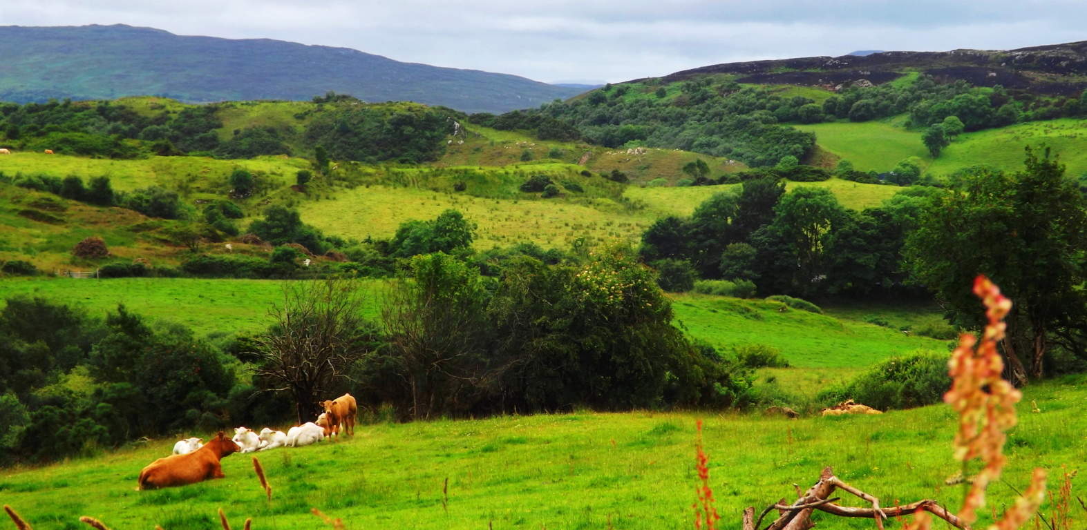
Donegal is so connected to the land, that the entire region is a ‘trail’. You don’t look for “the trail” at ‘Ranny’, the little dark mountain (Image/Below) which sits a valley away from the Gortnavern Dolmen; you simply climb the mountain. The mountain IS THE TRAIL.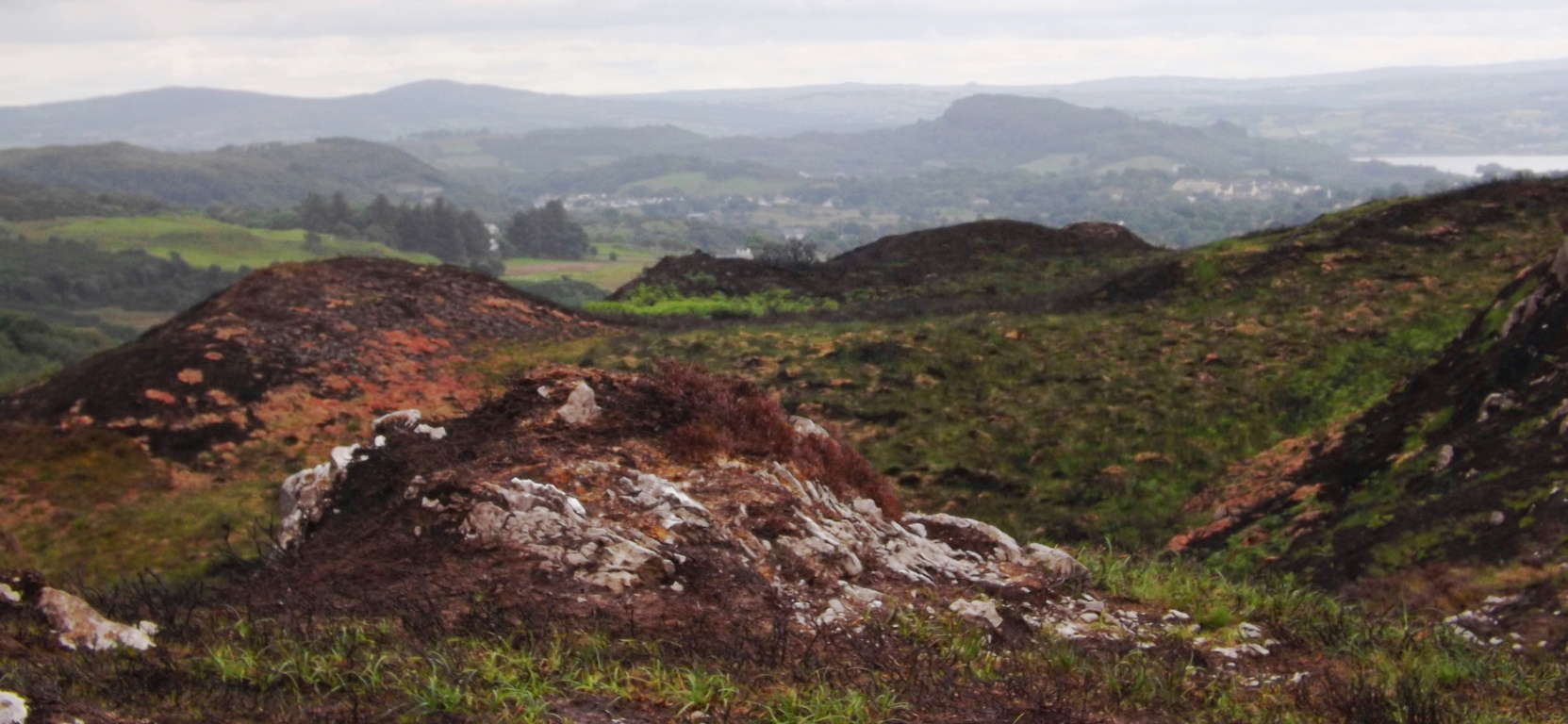 Donegal feels like the landscape that never told a lie. It is the last European coastline upon the vast Atlantic Ocean which cuts jagged jade cliffs into what was for centuries the edge of the known world. Come out and stand on the edge. Seek and Find.