Mount Moosilauke
Elevation: 4,805 ft.
Location: The White Mountains/Benton, New Hampshire/USA
Introduction: Welcome to the dramatic western edge of The White Mountain Range, in New Hampshire/USA!
Mount Moosilauke (Moos-ih-lahk-ee) retains a title given by the Abenaki Native American Tribe; It means: “Rocky face above the trees”. As we will see, the high place at the top of this Mountain, is a definitive and distinct megalithic spiritual zone, where the enchanted stones of the peak mingle intimately with the clouds.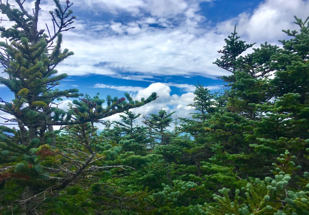
This unique title given by the Abenaki, also indicates a deeper meaning, beyond the name itself. Almost every one of the many White Mountain Peaks has a ‘rocky face above the trees’. Mount Washington, Mount Chocorua, Mount Adams, and Mount Jefferson, all have a ‘rocky face above the trees’. Why single out Mount Moosilauke? There is something special going on here.
I believe that The Abenaki were acknowledging this particular ‘rocky-face’ due to the many unique features that they encountered, and considered spiritually significant when they first saw it. In our time, we see them as Neolithic anthropological features, so ancient, that it seems clear to me that they were there before the Abenaki people had arrived. I can support this with evidence. Let’s take a look at the multi-layered experience of megalithic evidence during this phenomenal climb at Mount Moosilauke.
A Note About ‘Culture’: The ancient stone works found at Mount Moosilauke pre-date the Native American Tribes of New England. The Neolithic Culture you are about to experience on Mount Moosilauke, through this article, created monumental works of stone, in extremely difficult locations, and ways, all of which existed long before any Native American tribes had arrived.
This Megalithic Culture has specific memes (symbols), fixtures (arrangements of stone), and structures (functional centers, small temples,) in the highest elevations all over the world, that mirror, and mimic directly with European Megalithic memes, fixtures, and structures, entire continents away. This would support the idea of a single Megalithic Culture, with a single, common, source of systems. Not hundreds of individual, nomadic, Native America Tribes; Each with its own traditions, with basic tools, and migrations that moved seasonally in the valleys, planting crops, hunting, and fishing game.
I understand that this is very hard for many local researchers to accept, defending the idea that Native Americans created these Neolithic statements; but the evidence and cultural history clearly, and definitively, indicate otherwise. Of course, that statement must be supported with the evidence. So here is yet more evidence, and common Megalithic memes, and structures, from Mount Moosilauke, in New Hampshire, that relate directly to Mountains in Ireland, Arizona, Maine, and other sacred locations and high elevations, thousands of miles away; All these locations crafted in challenging, sophisticated, Megalithic stone.
Ancient Megalithic Memes in New England: Walking along the forest streams of the Franconia Notch Range, some 6 miles west of Mount Moosliauke, just a day before my intense climb, I came upon a six foot tall, equilateral-triangular standing stone, set perfectly in the midst of a quiet stream near Route 3. 
The meme of Megalithic-stone-equilateral-triangles in the Forests of New England, from Massachusetts to Maine, and everywhere in between, is one of the most prevalent and abundant symbols/memes that can be found. On this website alone, there are compiled, and permanently documented, several dozen equilateral triangle memes cut in massive stone in the wilderness.
These stones have significant ‘directionality’, and meaning, yet to be fully understood, or even acknowledge by current anthropology. Academics want us to believe a glacier created these statements? I’m sorry to be blunt here, but how intensely-stupid do these current Post-modern anthropologists think we are? Not to mention the fact that I have NEVER ONCE encountered, in any of the mountain ranges I have climbed, in the entire Western Hemisphere, a single real-time Anthropologist, or Professor, in a DECADE.
Very soon, these arm-chair-anthropologists, that dispute the Megalithic memes, are going to be absolutely disproven, and in the most blatant scientific way possible. With EVIDENCE. The evidence is mounting, and couldn’t be any clearer, that these are intentionally crafted, Megalithic, Neolithic-Period works. So, lets take a look at some examples: 
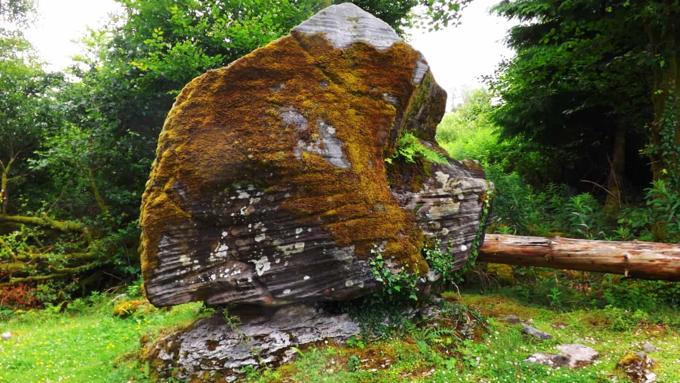
The green equilateral triangle stone pictured in the above image, has a perfectly cut, flat face, standing ten feet high. It might weigh 100 tons. I said 100 tons! It LOOKS LIKE AN ANNOUNCEMENT! BEGGING TO BE NOTICED! THEY ALL DO! It is located in the immense Forest surrounding the sacred Mount Katahdin, in Maine.
The perfectly equilateral stone pictured to the right, is located in a beautiful Forest in Upton Massachusetts. This example is relatively small compared to many of the other statements, at about 3 feet, on each side. It is absolutely set to a stone below it. You could not budge this stone with all your strength. The point is, someone crafted it, fixed into the rock-face below, perfectly, with a tool capable of doing so, cut directly out of the rock. Look at it. It’s perfect.
To add to this Neolithic context, not far from this very spot, is a megalithic chamber, designed in the the exact same internal, structural-fashion, as the Megalithic Chamber at New Grange. An inside (and outside) that most sacred Megalithic chamber at New Grange is….yes, you guessed it, dancing equilateral triangles, cut into the stones.
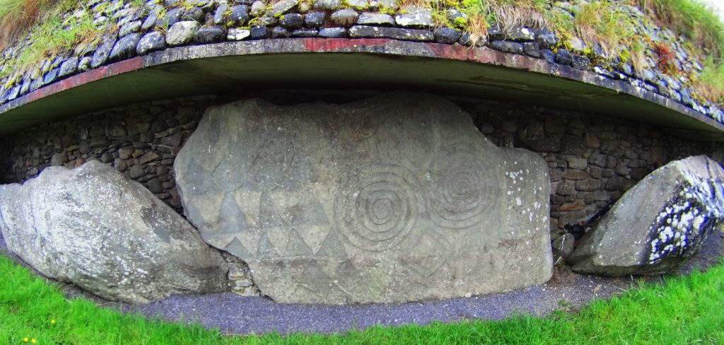

(Images of triangles: Above/Right/Left: New Grange Megalithic Temple, Ireland. One of the oldest in the world.)
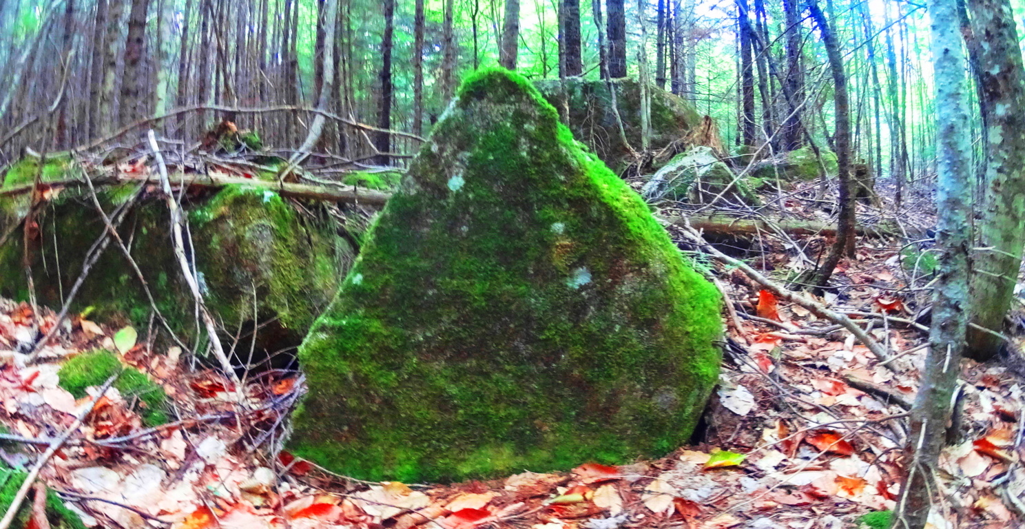
The image below is yet another massive crafted equilateral triangular-stone, found in the Forests of Maine, near Katahdin. Notice the moss covering this stone. For this stone to be cut, and then so covered with moss in this way, means it has been like this for an extremely long period of time; most likely, the very beginning of time, not crafted in the last 500, or even 1000 years. More like 6000 years…
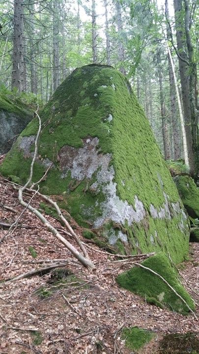
Pictured here, to the right, is another cut, equilateral triangular stone, that is not located in the forest of Maine, but rather, in the forests of Austria. Again, notice the similarity to the stone in Maine, 2500 miles away. And also, notice the indicator of construction in antiquity, alpine moss.
This stunning image to the right, was sent to me by my friend, and researcher, Gunnar Hiptmair, who continues to discover dozens of Neolithic anthropological statements and zones in the Austria and the Alps today. His Facebook profile can be reached directly, here: https://www.facebook.com/profile.php?id=100010469927936
Stemming from this, are countless other examples of equilateral triangles fixed into stone, in New England, and elsewhere. They are so abundant that it suffices to leave these examples to get the point across, and continue forward with the experience at Mount Moosilauke.
Logic About Constructing Megaliths: The ashlar-cut technology in creating these perfectly cut, flattened frontal faces of stone, does not indicate a technologically primitive Native American or Celtic culture(s). These stones were cut, and placed, in specific ways, weighing up to 50 to 100 tons. For Native tribes to move each one, would take a set of completely illogical circumstances, requiring human labor, a time frame, resources, and out-and-out permanence and dedication, that Native American or Celtic tribes would have found absolutely repugnant, annoying, and even ridiculous.
The Winter season in New England is long, deep, and hard. When Spring arrived for the Native tribes, after surviving the deadly Winters, do anthropologists actually think and defend the idea that the very first thing Native Tribes would do after migrating back to the newly warm northern temperatures is, first: go straight back to those impossibly massive stones that they were supposedly moving, before the previous Winter began, (utilizing every ounce of energy, and voluntarily-primitive ingenuity they had) They would immediately abandon their villages, loved ones, and their potential planting/fishing season, and crops, all to move giant rocks?
No. This never happened. It is absurd.
Something else is going on.
This is where things become extremely difficult for local researchers. They are limited to local narratives, local evidence, and local History. They simply cannot comprehend any possibilities outside of the Native American presence. They are forcing a narrative to credit Native American Cultures with the crafting of these megalithic statements, because it is the limit, contextually, historically, and logically, to what these local researchers can understand.
The fact is, there was an earlier Culture, in the Americas, as well as Europe and Israel, as described in every ancient account, and mythic history, which was dominant in these regions of the world. They were Megalithic builders, capable of incredible works of strength and design, that are so permanent, they are still around for us to see today. Let’s turn to the hiking experience for the moment, and move forward with the evidence at this beautiful Mountain.
Hiking Experience And Evidence at Moosliauke: As it is with every serious climb, you need to make sure you are prepared. This is a 4,805 foot climb. Please make sure you are being honest with yourself about how healthy you have been in the last year. Have you been eating right? Are you rested and calm? Have you been training for a tough incline for a few months previous? Do you have a portable water strainer to use in the flowing streams along the trail? And will you be ready to carry your portion of bottled water up the Mountain, on your back? Remember, you need to be hydrating, little by little, the whole way, up, and back. Like myself, you can bring a fully charged iPhone for safety purposes, and music. Bring some kick-ass headphones, and deepen your experience in portions of your climb. Choose a day with good weather, starting as early as possible, with the cool temperatures in the morning, and off you go.
Glencliff Trailhead: Glencliff Traihead, in Glencliff New Hampshire, is located on the ‘Benton State Forest’ side of the Mountain, known as the westerly approach to the peak. From Highway 25 in Glencliff , you will connect and turn right onto High St. You will see Mount Moosilauke to the right. The small trailhead sign, and sandy-square parking lot, about 1.5 miles down the country road on the right. If you reach Glencliff Elderly Home beyond the Trailhead, you’ve gone to far. Turn back, you’ll see it.
Making your way into Glencliff Trailhead, this lower 3rd of the Mountain takes you across a stream, a wide, open wild-field, and into a steady incline of a fairly wide, softened dirt trail in Benton State Forest.
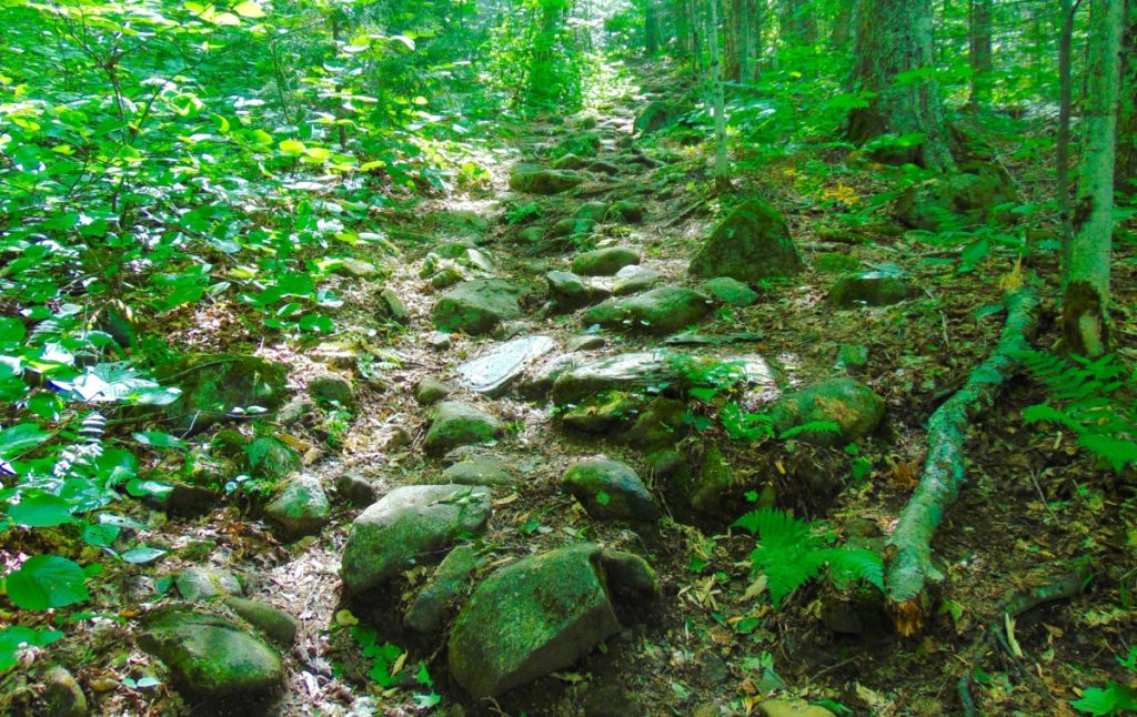
There is a distinct rocky trail that emerges as you steadily make your way up the path. Curiously, the stones seem funneled, collected specifically, in one distinct lining. It is clear that the stones are not sprawled out, as if by a rolling glacier. Stones are collected in one distinct line, straight through the Forest. Although it may be hard to consider for some, this is not random, or the work of The Park Service. As we continue up the Trail, evidence to this effect will emerge.
As the elevation increases the alpine aspects of the Trail emerge, with glowing mossy enclosures and tightening thickets of trees, growing right over the stones, in the cooler temperatures.
Here is strong natural evidence for the chronology of the ecological process in this area, dating all the way back to the beginning of time, if you know how to look, ecologically. It is abundantly clear, as you can see in the image above, that the geology, the rocks, were in the initial layer of the landscape, first. The forest clearly came long after. 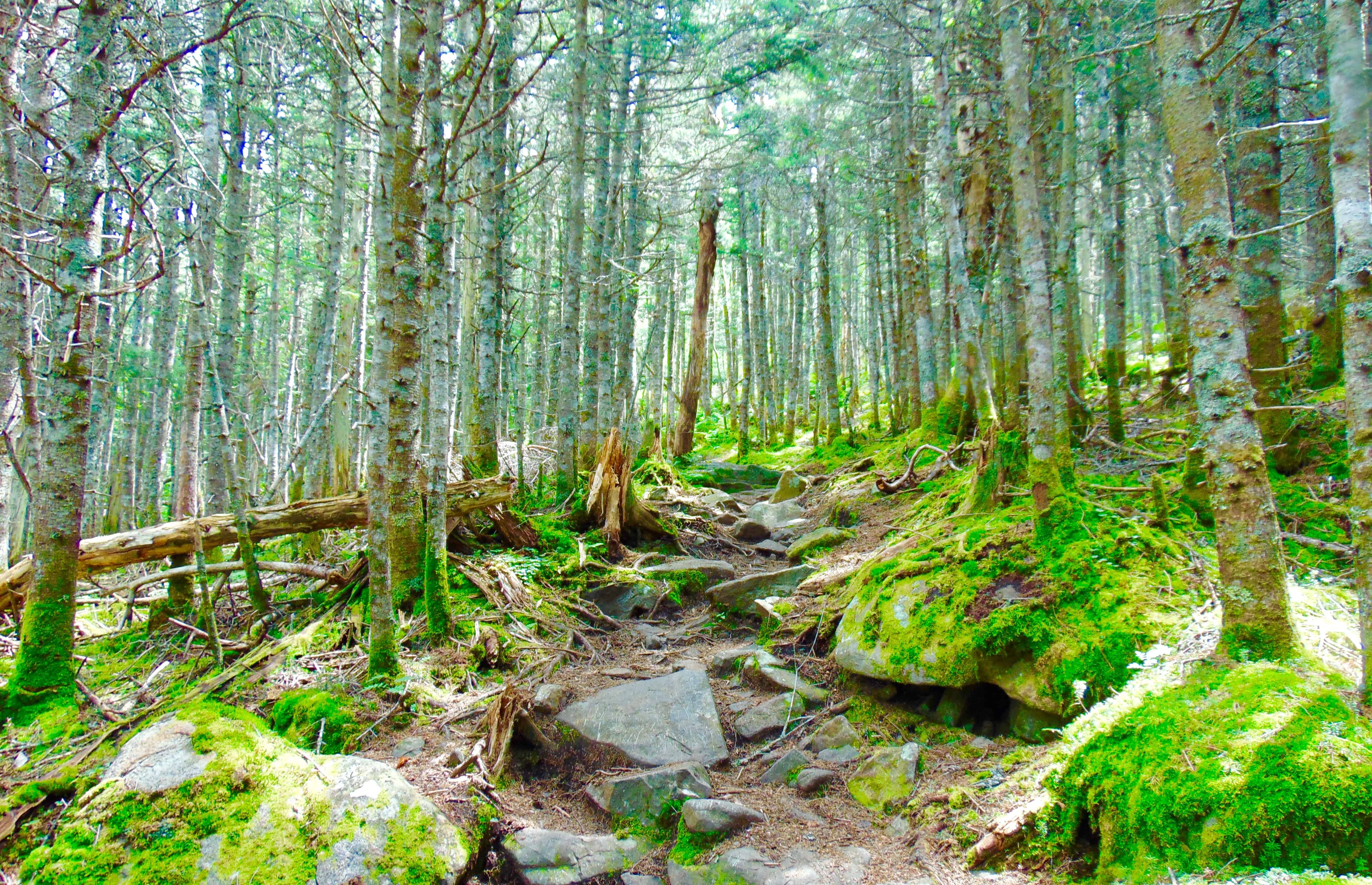
It is a challenge to established how many thousands of years the stones here sat without overgrowth on the open face of the Mountain (like they do in most Celtic Ranges). But it is clear that the Forest, in most areas, has grown up directly over the stones, as we see in the image above.
Please pay attention to the following ecological and anthropological points:
As you can see from the clear grey color of the stones on the pathway, there is no moss at all. This is because alpine moss is extremely sensitive to the touch, and will dissipate growth when contacted externally. The grey stones along the path look to have been ashlar-cut, and worked, distinct from the mossy stones that literally surrounding them. Notice how the pathway stones, the cut stones, have zero amounts of trees, or moss, on top of them? How is that possible? It is because from the earliest possible time, before the Forest had even grown over the rocks here, these stones were touched, and cut specifically as an approach to the peak? Yes. This is an intended pathway of Megalithic construct. It has remained as such, in use by the Native Culture that came long after, as sacred trails, continuing into modern use today.
Just think for a moment. Did the Native Americans cut the pathway stones on these mountains?
They didn’t claim to, so no. Did the Park Service use machines or tools, up to 4,805 ft, to literally cut chronologically related, and level boulders, into flattened halves specifically for stepping up the Mountain? And did they cut down all the trees along the way too? Or was the path always like this, from the very beginning? Please believe me when I tell you, readers and friends, that it would cost millions of dollars in this little country Town, to do such a thing. That never happened. This path, and the hundreds of stony mountain ashlar-cut paths in the Western hemisphere, are specifically crafted, by a Megalithic Culture; a Culture that was gifted technologically, and intent on possessing the Mountain, leaving codes of craftsmanship, from the beginning of Time.
I know this is intensely hard for laymen, and local researchrs to consider, with a locally controlled, “post-modern”-emphasized, public education system, that literally is designed to keep your mental framework historically revised, disconnected from any terrestrial evidence, and ignorant of what actual elite scientists, ecologists, antrhopologists in the government, and Universities, are well aware of. The evidence, scientific, chronological, and logical, indicates a highly advanced Megalithic Culture at the beginning of Time. The Native Americans, and Celts in Europe, knew these constructed paths and stoneworks were present long before they arrived. Just like Peruvian Inca Natives at Machu Piccu, the Megalithic works were there when they arrived. Natives had nothing to do with constructing them.
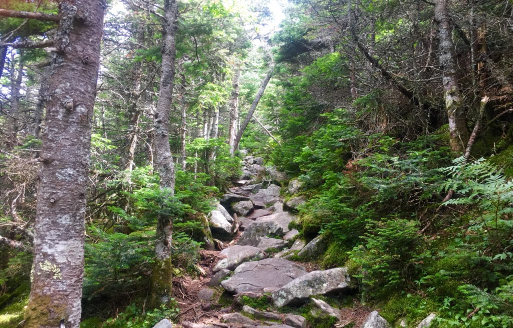
Hiking The Trail: Continuing up theTrail, you should take your time. You will pass two streams running across the path. Pause and take water here, cool off. Jump in! Fill your water bottles. From here, there is no more running water, and you will be on your own. The pathway in the upper 3rd of the Mountain begins to narrow intensely (Image/Above).
Alpine Pine Trees will begin to enclose the stone-steps before you. Here is a chance to pause, speak to the endearingly cool people that are coming and going along this path. While making big climbs, hikers often think and say things that are not common to their lives down below. It may be cathartic for you. Hikers might be needing to get a feeling, or statement out, especially during covid19’s quixotic grip on our society at the moment. Listen to what people are saying. Be kind. These moments could be profound. Singular elevated pathways like this are rare moments in your life. Pay attention.
As you breach the narrow path of the Pines, looking to your left. You begin to realize just how high you’ve climbed. (Image/Below) This is just a preview before completely breaking the tree-line. On a good day, visual potential could be up to 70 miles away, maybe further. Pause and realize, you’re doing a great job. 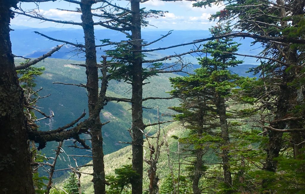
Things start to become pretty special as you continue the quest to break the alpine tree-line. The singular stony path ultimately ends, and you reach a stellar area of level ground with a crossroad of signs. There is the choice to head towards the South Peak, which is 20 minute interlude path to making the actual peak. Make sure you have the energy to take this 20 minute diversion to the view at The South Peak. I did not. I followed the sign pointing to the left, towards Moosilauke Peak.
The pathway here is magical. The relief and surprise of level ground after so much climbing is almost hilarious. It feels easy. This is a high porch, a singular pathway, like a rolled-out soily-soft-carpet, just for you to now come into this upper kingdom in the clouds that you’ve worked so hard to see. You can speedily make your way along the last 1.5 miles of your trek. 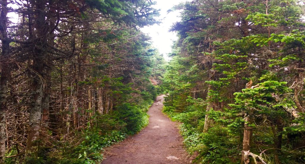
Along this rare level path, you can try to gather your strength. Take your time and enjoy what you’ve earned. It’s the same in life. Don’t go passing by quickly, what took a hard fight to find.
Along this regal and rare path, small stones begin to emerge. The stones are intricate, enchanted, and strange. They seem to be cut in a refined fashion. I have seen this manner of cut before. Take a good look at these stones.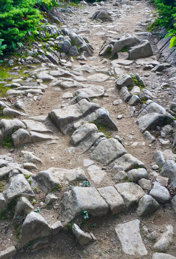 I am willing to bet, that digital analysis of these stone would reveal linearity, symmetry, modeling, and meaning. I am currently working on an ecological analysis system of these rare fixtures. The possibility that this is a miniature map, or modeled version of the overall area, is very real. As we will see, modeling the Mountain Range of the area was an essential practice for the Megalithic builders, in New England, and Europe.
Aside from these theoretic connections, there is a location in Massachusetts that is one of the most sacred groves in the entire world. it is called ‘Bears Den’. At this location there is a hidden waterfall, with a dwelling near by. The entire area seems to have been engineered by a Megalithic builder. There are cut stones, leveled platforms, and the waterfall itself, which is engineered and dedicated, in stone, to (you guessed it) the equilateral triangle.
Images of the rear-side of the waterfall reveal some pretty incredible markings. They will look familiar to you now. Lets have a look at the markings in the rear of that altar. Look at the similarity of these small cut fixtures.
As I mentioned, on the frontal side of this waterfall, there are, etched in permanent stone, undeniable anthropological evidence of the equilateral triangle meme of the Megalithic Culture. 
There it is, again. Perfectly etched in stone. The Equilateral Triangle. Do you think a glacier did that? If you do, then you need to think about how much of your thinking, is someone elses influence.
When are local researchers going to understand that the implications for this clear, and sometimes multi-layered Megalithic evidence, is far beyond the potential of any local nomadically oriented tribes, that have long since vanished? There would be literally millions complicated tools, and an emphasized ‘stone orientation to’ Native-American Culture, beyond anything that we know of them, if infact they constructed these works. They simply could not have done it.
Continuing passed many of these wonderful markings, the path unfolds into a miniature valley, leading up into what looks like a distinctly separate, miniature alpine-mountain. You’ve broken the tree-line. Here before you is what looks like a version the Sacred Mount of Arunachula in Southern India. The majesty of this 4,500 foot piece of elevated earth, is stellar, supreme, and absolutely sacred. 
This zone is protected by the State for its ecological rarity, but in truth, I believe that at the elite level, there are individuals who know that this area is a sacred anthropological zone. The stones here are doubly significant in meaning, compared to the moss.
The approach to the peak is pristine. In every direction, mountains and clouds.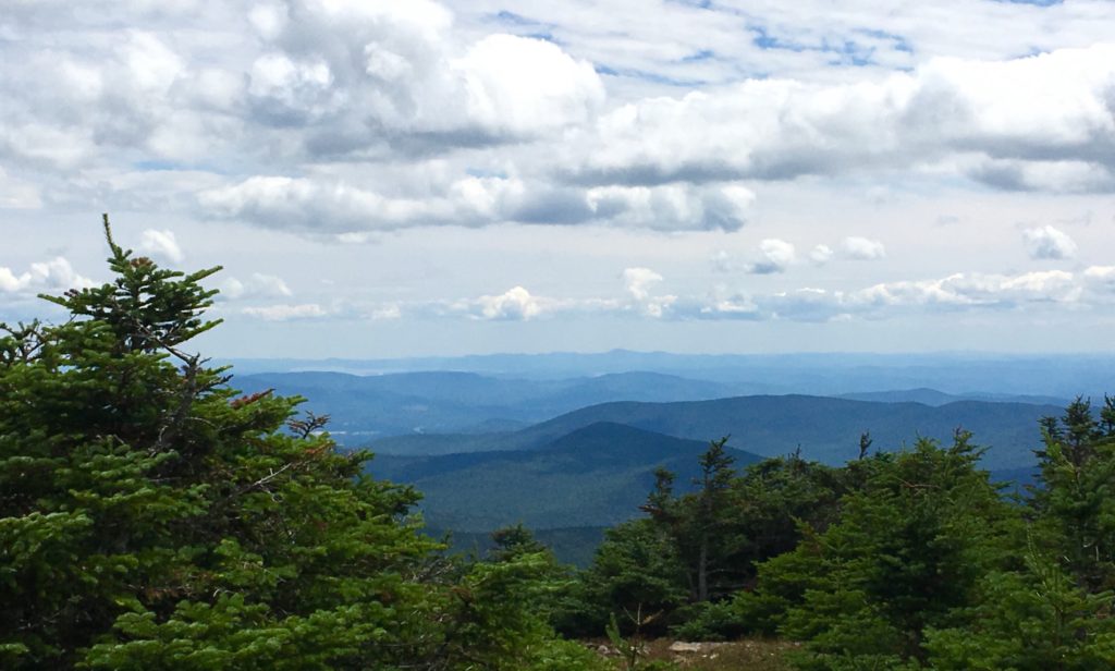
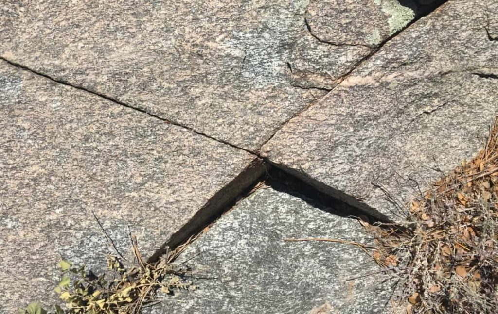
The trees fade out, while stone Cairns line the path. I believe these Cairns are Megalithic statements, perhaps refined by hikers in the last Century, but more likely crafted in antiquity. These Cairns are found even at minor peaks in the hill country. 
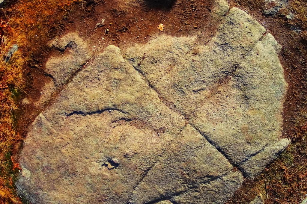
Certain stones along the final approaches at sacred mountains are cut with directionality, pointing directly to the peak. Here is a centrally placed directional stone, directly along the path, just before the peak. Perhaps it will help if readers can see some examples of this Megalithic meme on other locations.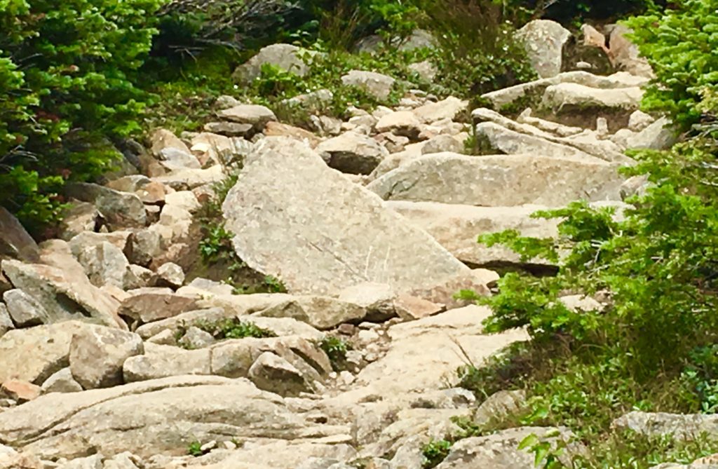 Directional stones have specific parallel sides, leading up to a right-angle-apex of exactly45 degrees.
Sample 1: The image above, as you know, is located near the peak at Mount Moosilauke, New Hampshire. 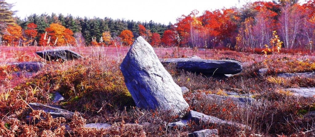 Sample 2: Directional stone located near The Altar at Heath Mass.
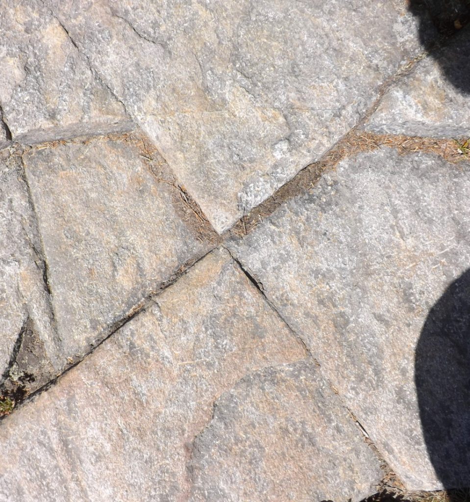
 Sample 3: Located near the peak at Watatic Mountain, Massachusetts.
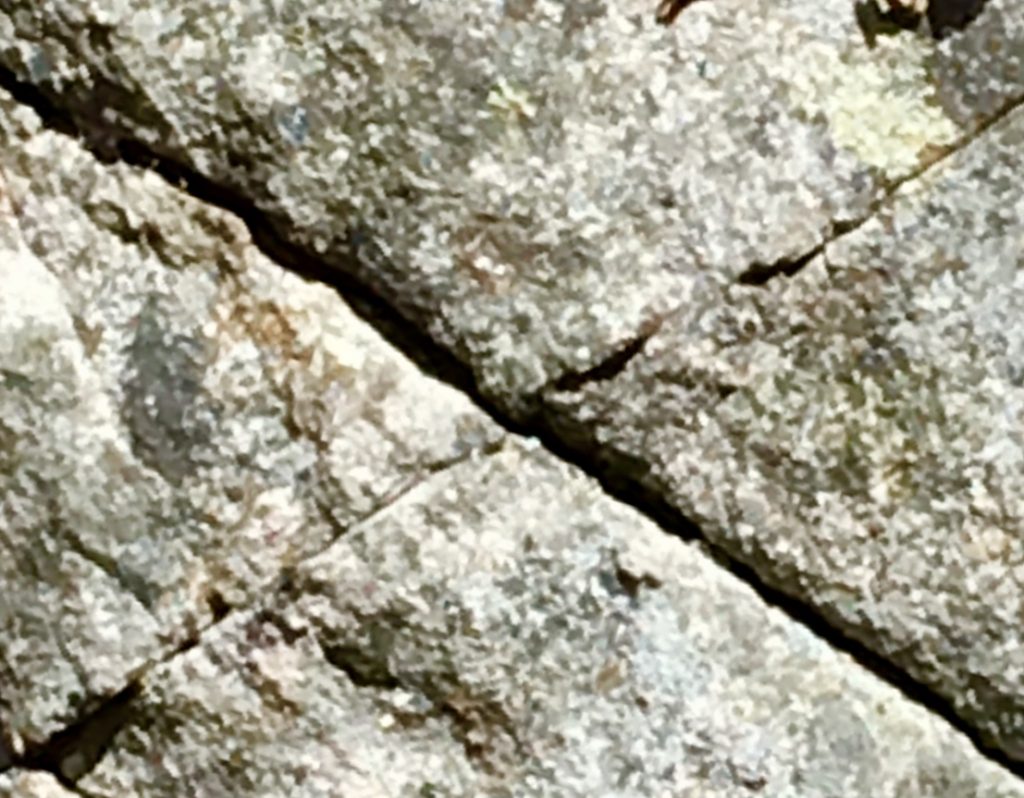
 Sample 4: Located near the peak at Monument Mountain in the Berkshire Range.
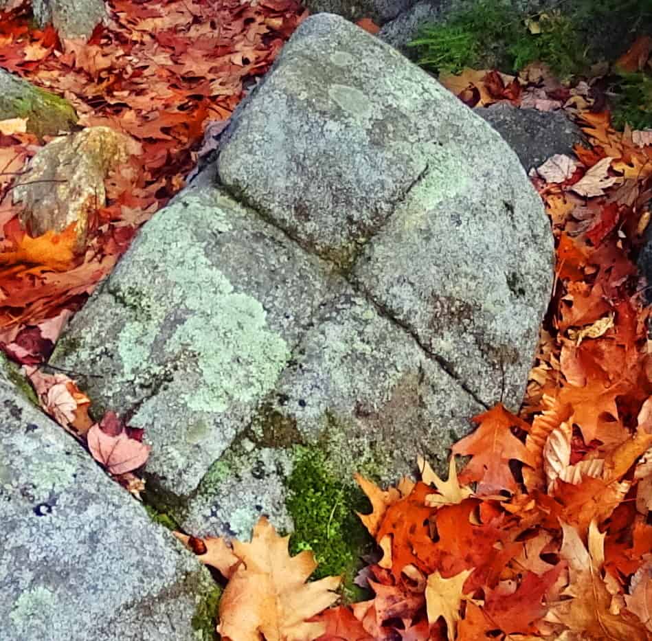
Finally arriving at the peak, people are resting and taking in the scene. A large square stone sitting at the very peak is marked with a perfect equilateral cross-section, supported by a triangle in the lower corner. (Image/Below) These particular meme can also be found at dozens of peaks throughout New England, the American West, and Europe. Here are just a few examples below the one here at Mount Moosilauke. 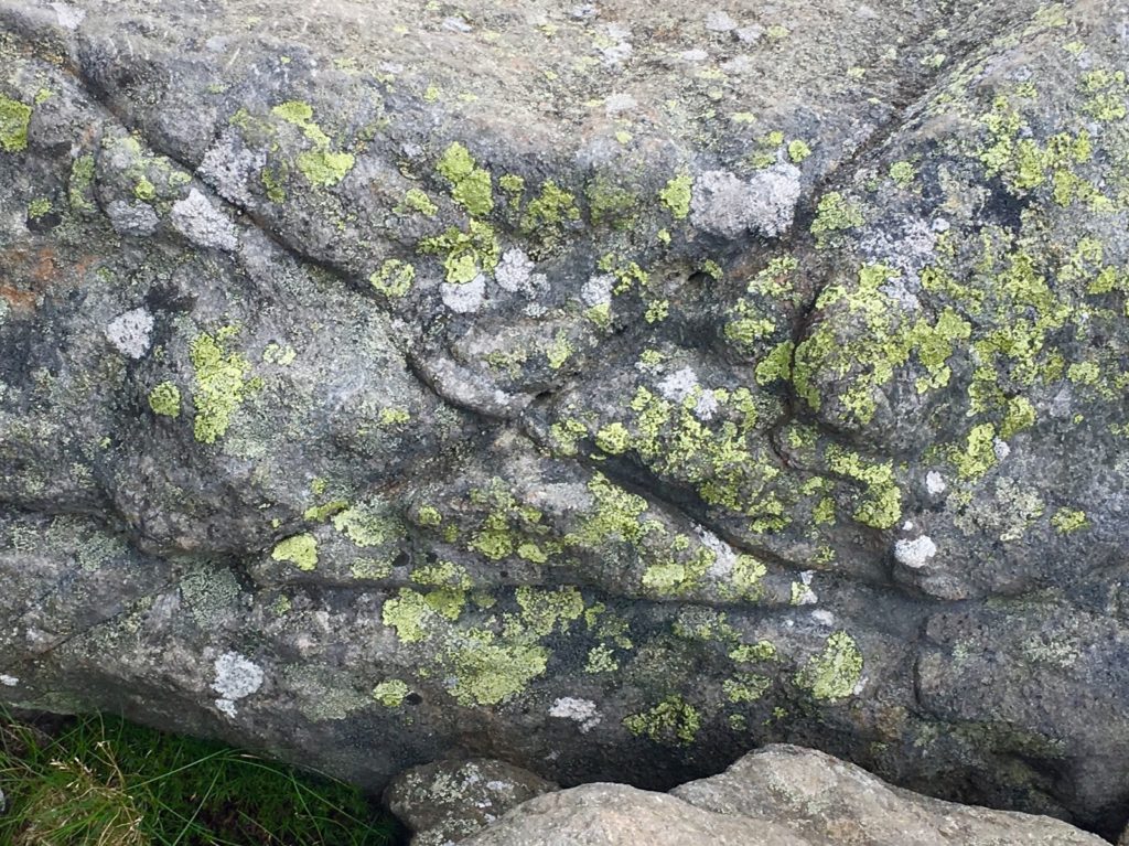
After this stone, the entire White Mountain Range comes into view. In the image below, Mount Washington can be seen in the distance, the highest point in the center. Mount Chocorua can also be seen to the right, below. Stunning. 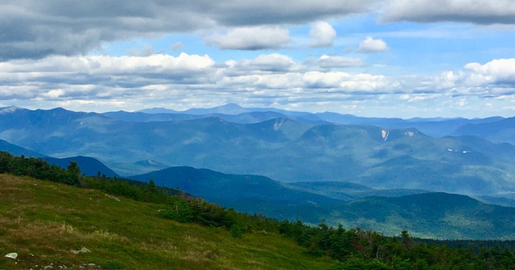
The view to the south, as seen below, is a rolling and rotund descent, with Massachusetts off in the descending peripheral distance.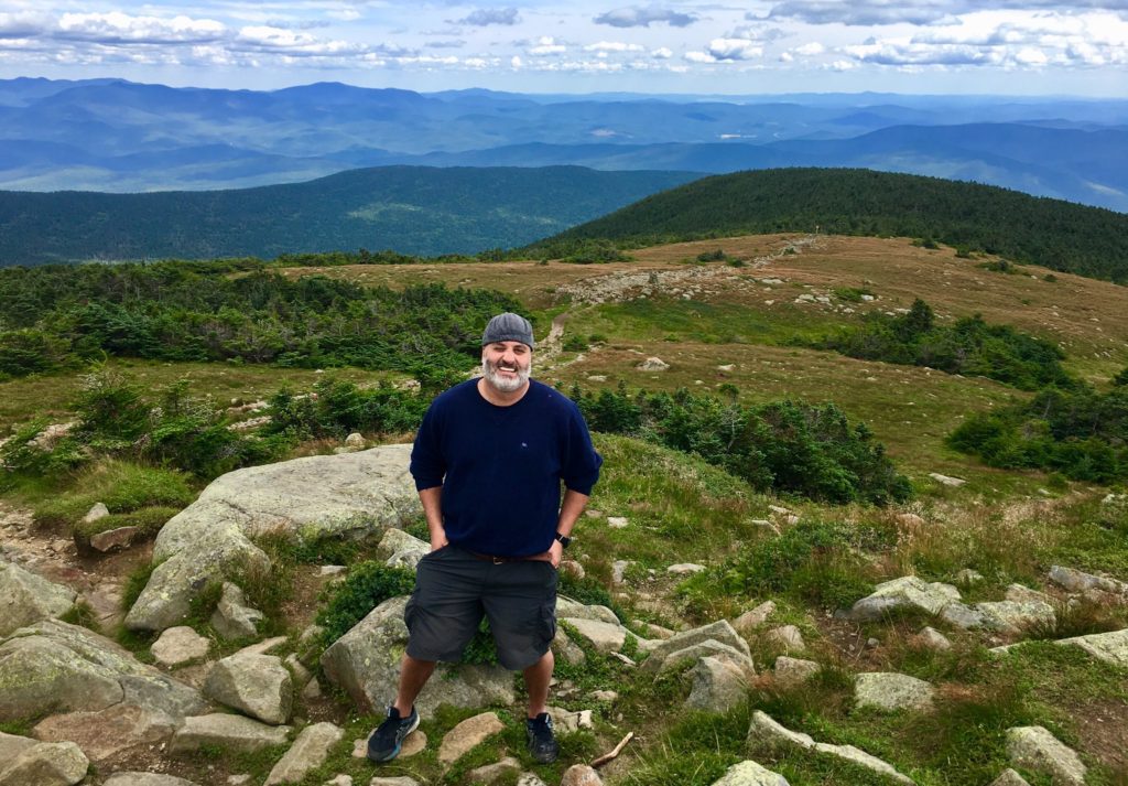
Another interesting fixture here at the peak is a very special arrangement of stones, with a leveled rock layer at the base of these specially stacked rocks, seemingly made specifically to imitate the cut of the mountain-tops, in the secondary background, of the peaks in the greater distance. Although dozens of people sat here at the peak, not one of them noticed this incredible fixture. Notice in the image below, the leveled work in the bottom portion of the rock, with what looks like distance markings of measure along it’s side. What is this doing at the top pf 4,805 foot mountain? This is no accident. These massive stones are placed to mimic the peaks in the secondary distance. 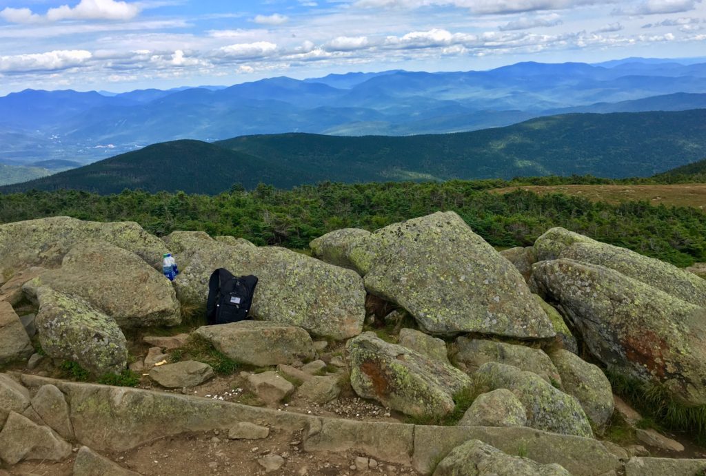
Let’s show another location that displays this type of fixture in Europe. At the peak at Mount Bearnagh, in The Mourn Range of Ireland, the peak contains a set of megalithic fixtures that absolutely imitate the peak of the mountains beyond. The stones are clearly cut, and fixed, into positions to imitate the angles of the ledges beyond. Again, this is clearly no accident, it’s incredible engineering, in stone. 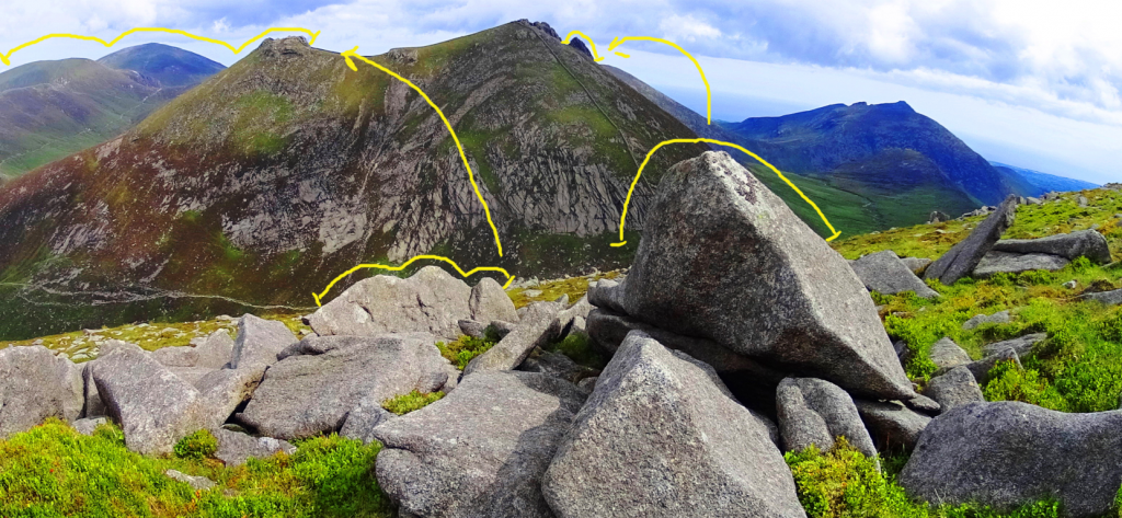 Here is a megalith also located at Mount Bearnagh in Ireland, absolutely crafted to imitate the curvature of the lower valley. At the peak, just one mile from this spot, the boulders are arranged to mimic the mountains of the Range beyond. There is no way that this is random! It’ s intentional, and cultural. How could we not see this!?
 Other examples of stones-marking of peaks, at other mountains, can be found at Mount Katahdin, near the Knifes Edge approach. Look at this exquisite marker, roughly 5 feet tall, pointing directly to the peak in the distance.
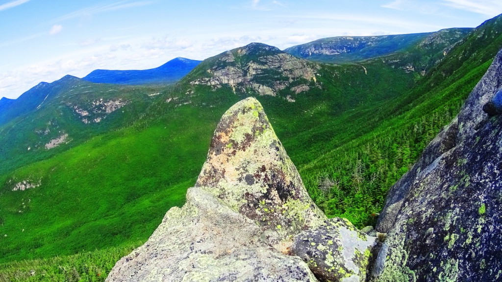
Here is a specifically crafted and placed-megalithic boulder, on the edge of the Sierra Nevada Mountains, in a lake, and shaped to look exactly like the mountains behind. Notice the 3 distinct indents in the boulder as well…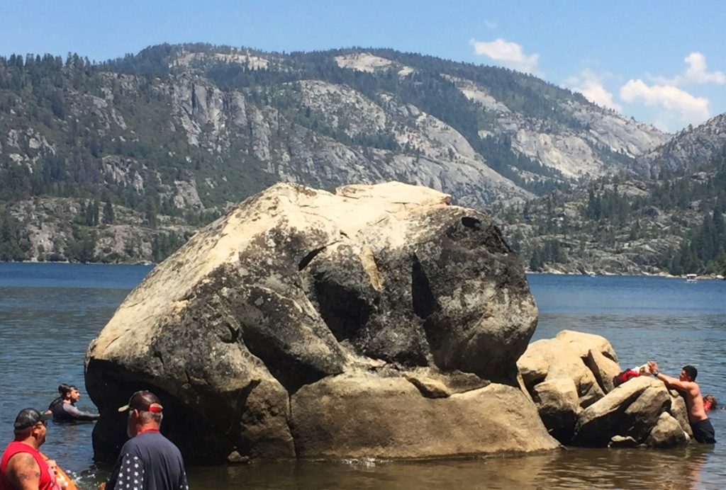
And here is a megalithic boulder at small peak at Upton Massachusetts. It is imitating the small mountain beyond, pointed perfectly to its center. Notice again, 3 distinct indents on the boulder. 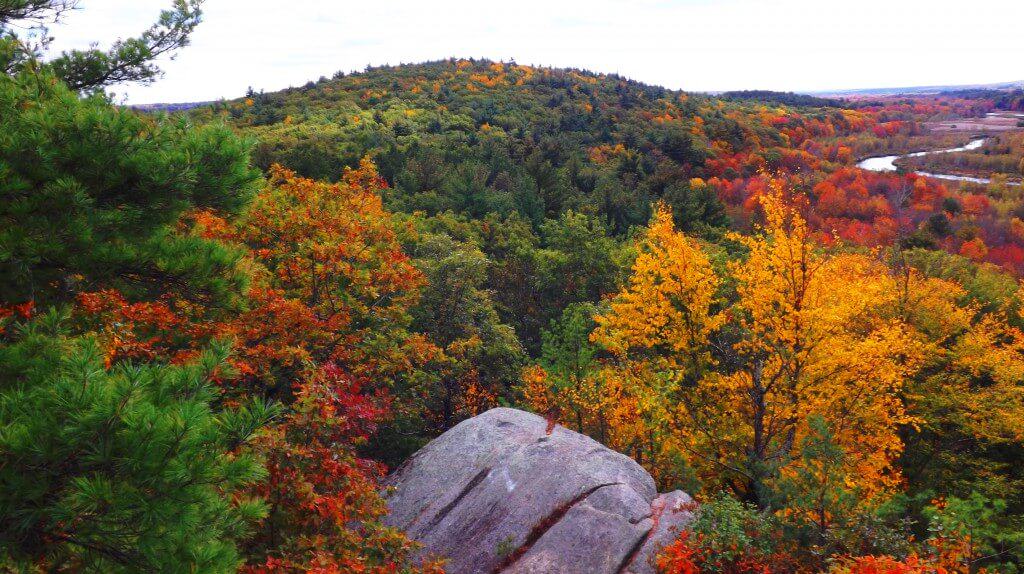
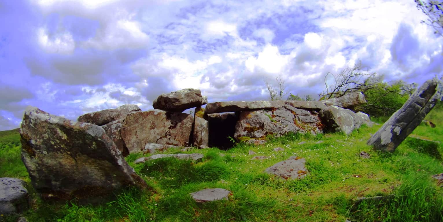
Not two miles from this very beautiful spot in Upton, is one of the finest megalithic chambers in all of New England. To think that these megalithic works are not related would be a serious mistake. They are absolutely related. The Culture that created these works was obviously capable of megalithic design, and large scale. 
The accumulating Megalithic evidence here at Mount Moosilauke, with multiple supported examples from other locations, of memes and fixtures of the exact same stylization, should begin to give serious academic pause for those who have not had the capability to see this evidence, but are now clearly seeing it collected here. Site after site, peak after peak, from Glenn Coe Scotland, to the Sierra Nevada, (and everything in between) are consistent similarities of a single Megalithic Culture, not variations of statements from hundreds of Native Tribes, both Celtic, and American. The evidence point to a Culture that had a singular source of related concepts.
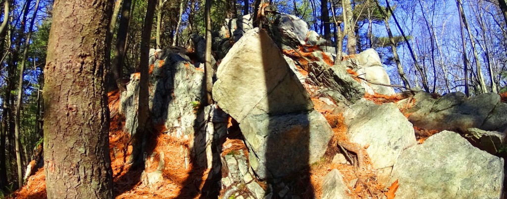
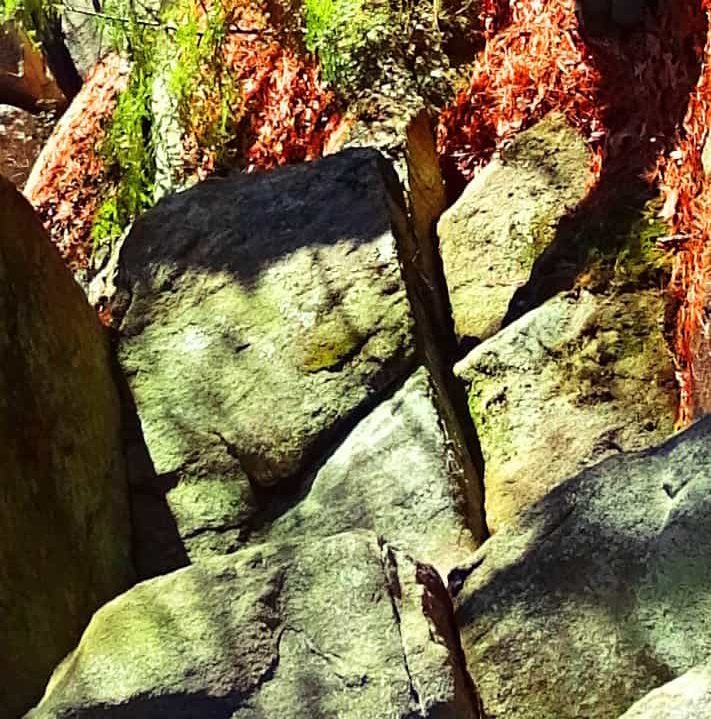
The final Megalithic constructs statements here at the peak of Mount Moosilauke, are perhaps the most important. We find nothing less than an entire complex of leveled stones, stacked into defined sections, spanning perhaps 70 by 30 yards. In its current state it is dilapidated, but a closer look reveals definite distinction, and intended design.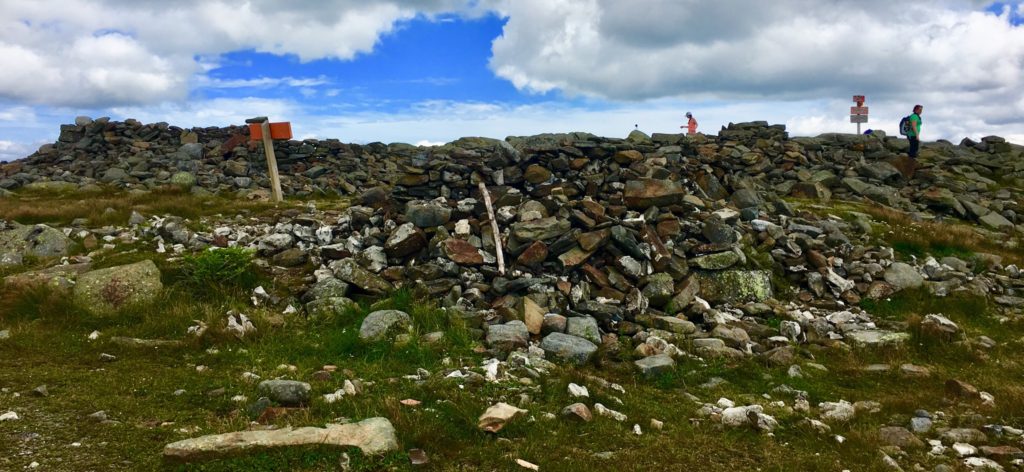
There a several divided square sections of cut, stacked, and leveled stones, which appear to define a particular function within. The section in the image below is absolutely level with the dramatic skyline to the north. There are clearly long and level cut stones worked into this construct, as can be seen, and were most likely crafted specifically for this purpose. 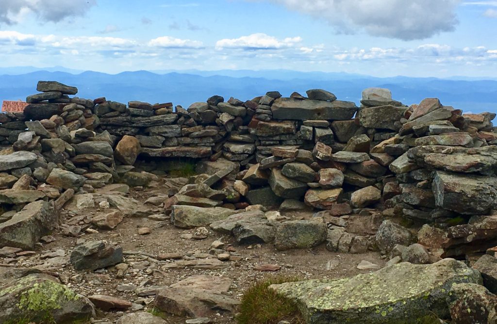
A frontal view of this square space reveals a significant 7 foot high lining of stone, which has clearly been tampered with over time, without any real protections. This particular view shows the significant amount of substance that this Megalithic Chamber once contained. 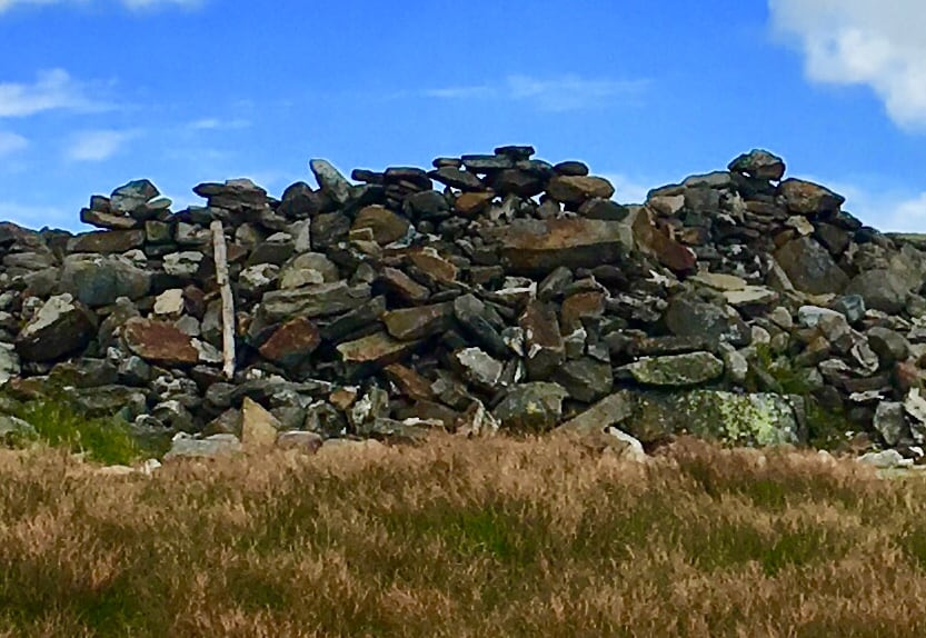
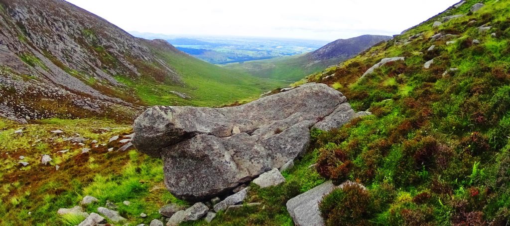
In stark contrast to the square spaces, there is a rounded space, separate from the main constructs, that may have had an alternate purpose, with its alternate shape. 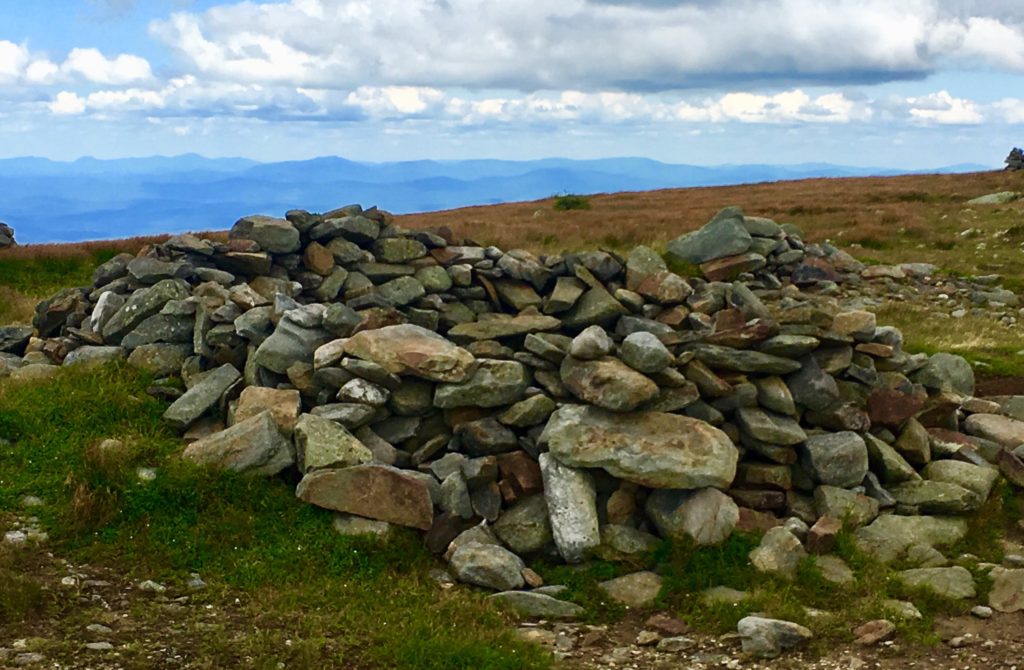 This rounded setting immediately reminded me of another set of rounded Megalithic stones, found in a highly megalithic area, and at a significant elevationm in the Mourn Mountains of Ireland. (Image/Below)
 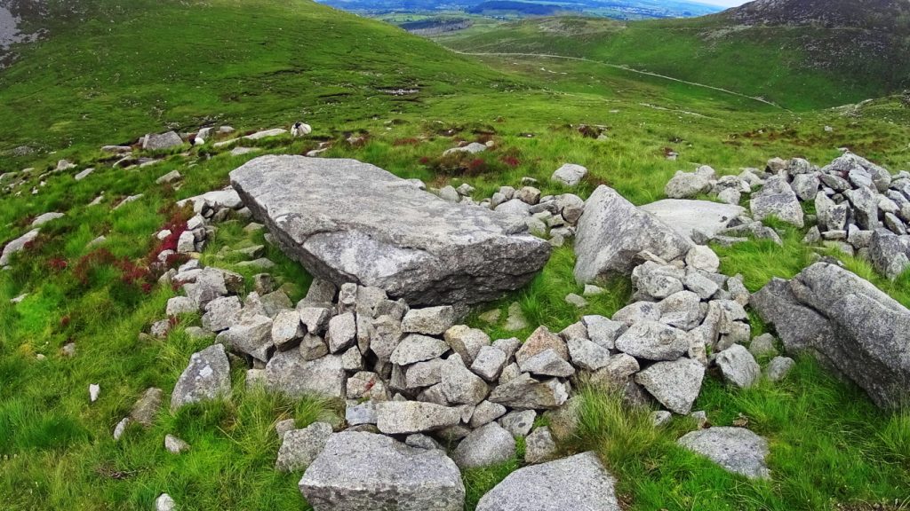 These areas should absolutely be considered National Heritage Sites and archaeological zones, fully acknowledged as a Megalithic Cultural spaces. And yet most passersby simply believe them to be random piles of rocks. How this is being allowed to remain the case is beyond me. There is meaning and intent attached to every one of these works, yet to be understood by so many.
For day hikers, the journey is only halfway done at the peak.
After resting, you need to steadily make your way back down the Mountain. When you make it to the first bubbling stream of water, about 1/3rd the way down, to refill your bottles with your strainer, you will be safe for the rest of the journey. During a trek along a decline, be careful to set your feet squarely, to choose your steps, in order not to turn your ankle. As you make your way, the path will widen, and inevitably drift with the gravity back to the Valley below. I hope hiking sojourners decide to try this climb for themselves, and experience what has been described here. Don’t let anything stop you from continuing to seek out sacred landscapes; Not others, not yourself, and not Covid19, in all its bizarre quixotic strangeness. So many people are waking-up, and truly realizing, that time in the Sun, and in the sacred landscape, is the answer. Thanks for reading. 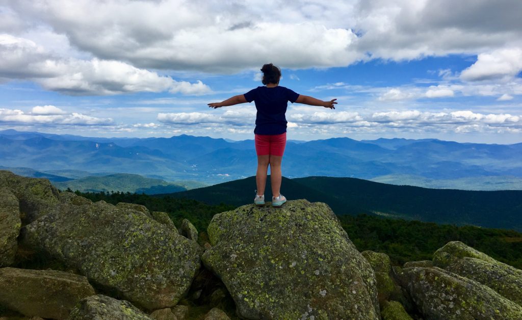
The White Mountains
 Location: New Hampshire/USA
Elevation: 2000-5000 feet
Note: I have wandered into countless forests, to find mysteries that date back to the beginning of time. I never expected to find anything of the sort, just trees and hedge, mingling with the moonrise. At certain times in my life, that would’ve been reason enough to dissipate into the hills with my cameras. I have been that individual, in the far away distance, in one moment, an acknowledging speck in the distant glances of happy travelers from the valley down below, and in the next moment, vanished.
Once I began to see the legitimacy of what is clearly an oppressed anthropological Culture in the woodsy places of the world, I simply couldn’t tell people fast enough. But as I began to inform people, friends and family, I realized that I was actually performing a new type of vanishing. This vanishing was related to the idea of who I used to be, what I used to say and think. I have one friend, in particular, who, when I would point out some fixture in the stones, would say to me: “It can’t just be beautiful can it? It has to be something… more?” Well, I‘m here today, to say to the entire world, in my least vanished state, that yes, sometimes, if you are truly lucky, it can just be beautiful.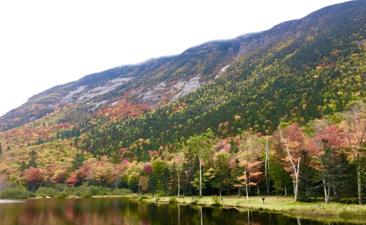
Just look at The White Mountains.
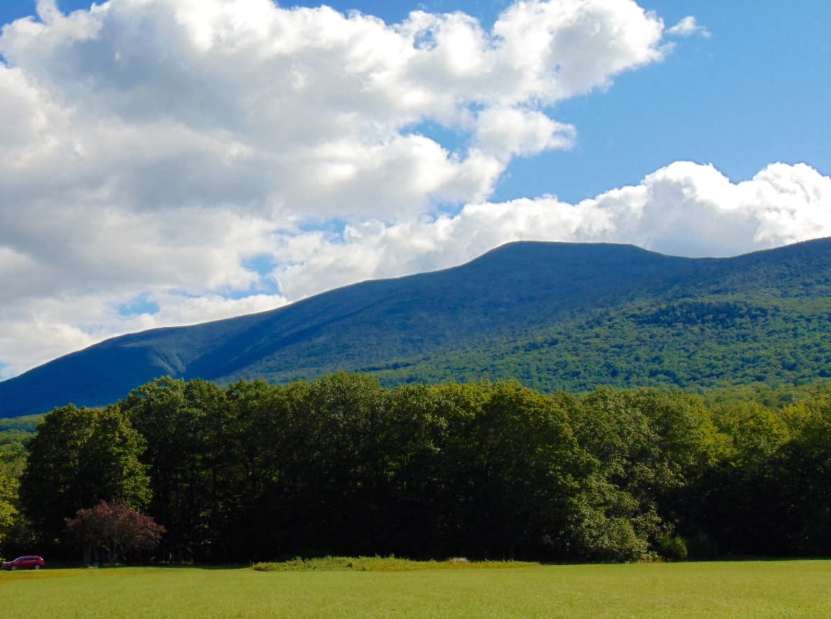
I have travelled many times to the White Mountains intent on the discovery of The Megalithic Culture. In truth, Mount Chocorua, Mount Washington, and more than a half-dozen more of the mingling granite peaks here, in the heart of New Hampshire, hold world-class evidence. But on this excursion, in the Autumn of 2019, although I knew they were certainly there, I would not allow myself to see a single rolling stone. This is the time for trees.
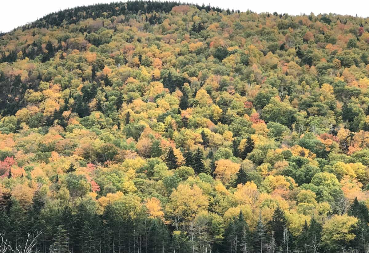
Autumn in New England is a rolling tapestry of trees, an impressionism in real-time, an ocean of foliage. The Mountains roll like stilled tsunamis, continual colors into continual colors, until the sky contrasts the distance. The backdrop of blue, when the Sun is in the sky, fills the scene with brightened colors, deeper shadows, and depth. When a grey mist rolls over the peaks, the shadows seem to vanish, and the colors become slightly more miraculous, against the grey. Ingesting scenes like this somehow creates a mechanism in the heart for turning natural miasmas into rather simple suggestions; like the idea that there is an infinity of everything, spanning in all directions, over the one majestic scene. A true understanding of Nature, that humans are created with a literal connectivity to the lessons of the landscape, becomes clearer in scenes like this. The beauty of the moment is enhanced by the knowledge that it is soon to pass. It underscores the very nature of our lives. To spend time in a space like this is in fact to come many steps closer to what it would be like to wander freely among the stars, blazing against the backdrop of an infinite blackness by the starry billions, and long after you are gone.
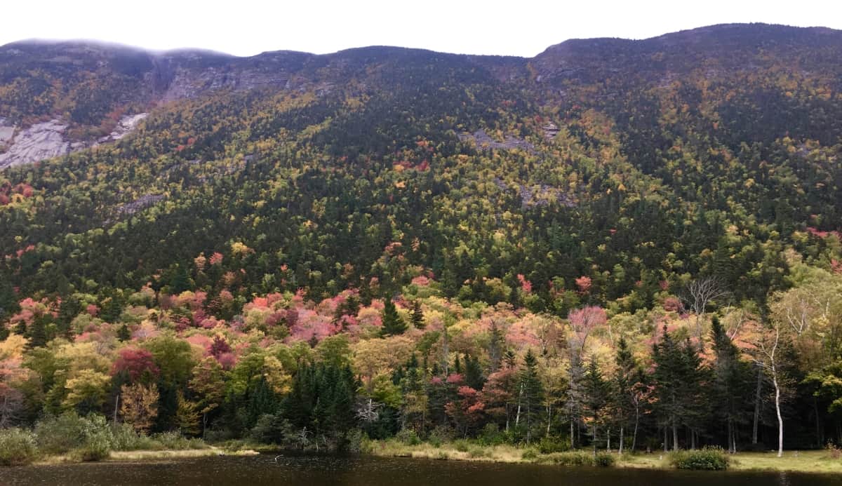
Note 2: Mount Pemigewasset Trail/Franconia Notch State Park/NH
The White Mountains sit at the central heart of the State of New Hampshire. It would be a good guess that the State itself established its original boarders in order to encapsulate this Mountain Range gem. To the West is Vermont, and the beauty of the Green Mountain Range, running throughout. To the Northeast is the massive State of Maine, where Mount Katahdin looms in awe inspiring autonomy, like a section of the Rocky Mountains of Colorado. (Image/Below)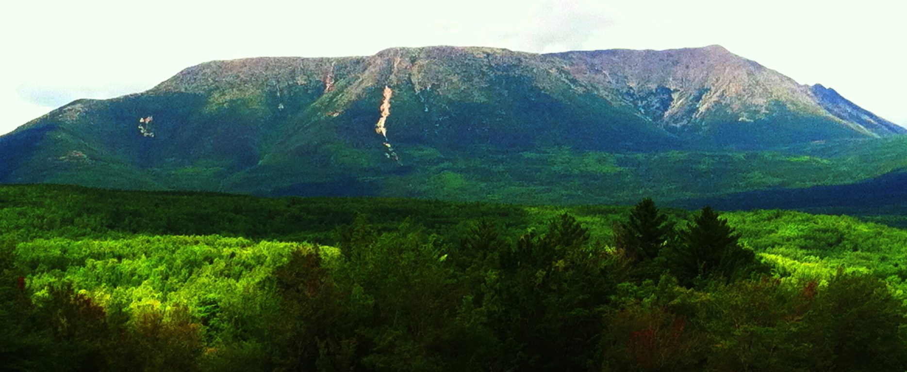
The main highway that runs straight into the White Mountains is Route 93. One of the most popular and beautiful stretches of road in all of New England in Autumn. Make the choice to drive route 93 through the southern portion of the White Mountain Range, and connect to Route 302, which makes an incredibly visceral swing to the East, through the gorgeous White Mountain passes. Just like any of the Celtic Ranges abroad, this region offers excursions into National Parks, Waterfalls, Lakes, and photogenic stretches of valley, all along the main highways. Due to the amount of incredible choices for hiking, as well as its proximity as a gateway to the central Range along Route 93, Franconia Notch State Park was chosen for this Review. Trail choices here include Flume Gorge (easy), Mount Pemigewasset (medium), Little Haystack Falls (hard), and many more. A Ranger on site recommended the stellar view of Mount Pemigewasset Trail (Image/Below), which is achieved by a moderate hiking experience through absolutely classic New England forestry, with very few rocky formations along the way, for a change.
The trail begins on the north side of the Franconia Notch Parking lot. This is an active scene in Autumn, with cars piled along the side of the highway due to the amount of hikers intent on capturing the views of the region. There is a central lodge with a cafeteria, and information center for guided tours into the Mountains. A sign marks the trail for Mount Pemigewasset, along with a distance description of 1.5 miles to the peak. This measure is significantly off. Understand that it is about 2.1miles to the gorgeous peak at Mount Pemigewasset, obviously making the total hiking experience about 4.2 miles. This hike begins beneath a small picturesque bridge which passes beneath a bustling Route 93. 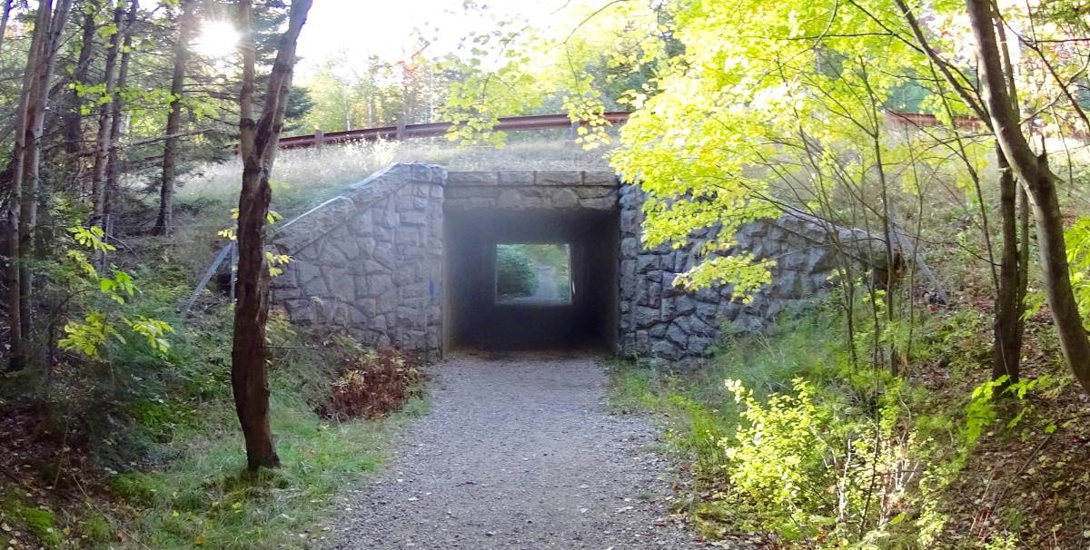 If anything, this bustling is an indicator of exactly what it is you are hoping to get some distance from. Drifting into these Woods is a sonorous escape, where the sound of sifting leaves slowly overcomes the constant murmur of automotive assertion taking place down below. As you slowly climb, the woods whisper over a wide clear path, with roots, rocks, and golden-red leaves. This is a gorgeous forest, on par with the Black Forest of Germany, and beauty of the Scottish Pines in Glen Coe.
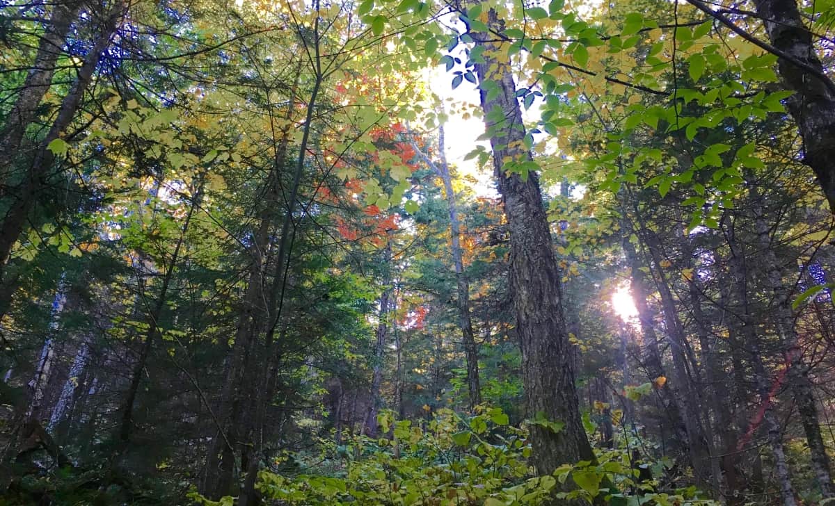
There are no variations on Pemigewasset Trail. You follow the clear rocky path, inundated with gold and rouge. The stones do seem deliberate, but this is not that type of Trail. This is a place to admire the raw and massive force that a New England forest can be, a venerable wonderland of the greatest depth, and degree of beauty. 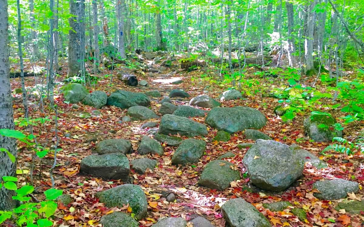 As the incline of the Trail continues the glades begin to change. Families of Birches emerge to greet you at about 2000 feet. Even while hiking in the elevated forests of Wyoming, for example, you might unexpectedly wander into a vast family of Birch trees. They simply pop-up wherever they wish, offering a gorgeous glimpse at the often whimsical mentality of trees; something that many of us just don’t consider in our constant ‘problem-solving state’ of ‘corporate function’, and bullshit. The beauty of where glades decide to grow is a marvel made specifically for hikers to ponder, and has a magic all its own, especially when walking through the miniature white pillars of a plentiful Birch boardwalk, closer to the clouds than the clamoring cars below.
 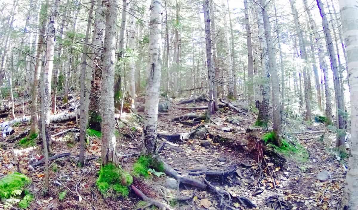 If you reach these Birches you know you are close to one the prettiest small-Mountain views in all of New Hampshire. As you pass through a narrow corridor of small trees, the vista emerges before you. Take your time breaking through, and prepare to receive your reward.
 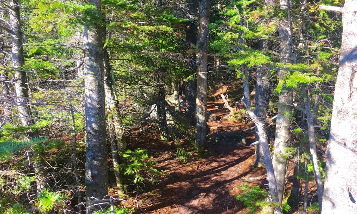 This is a once in a lifetime scene. For those just visiting New England, it may be the only time they see such a vision. This is vista that offers a glimpse of the southerly course leading across New Hampshire back into Massachusetts. The multiplicity of the colors can be disorienting, so do not stand too close to the edge at first, and don’t take selfies near the ledge as well. At the Grand Canyon last year, many people died due to this tendency to ignore the significance of the ledge while leaning-back for their photos. Sit down with your friends, and loved ones, then take the pictures. There is a little bit of forever in the foliage here, sitting down is a small price to ask.
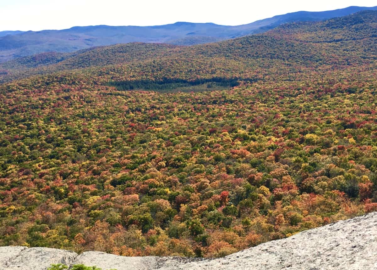 To the West is a view along the edge of the Forest, revealing the edge of the immediate Valley. Somehow, it feels as if you could leap down into the softness of the tree-tops, and bounce out of view in just a few bounds. The scene is that surreal. The stony top-platform feels like a fortress beneath your feet, as the contrast of the soft foliage drifts off over the Valley, and through the woods.
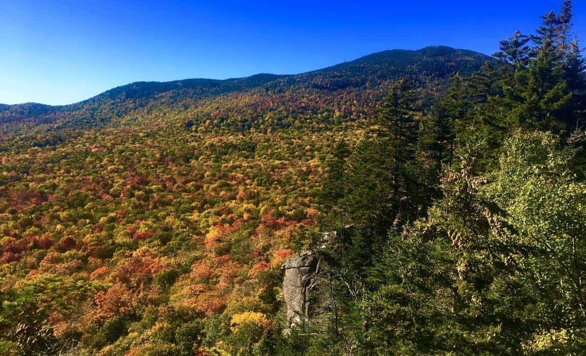 The way back down is doubly easy, as it always is. When you finally arrive back to your car, having seen the foliage, continue onward to the North, up Route 93 to Rt 302, and follow. This is one of the most wonderful drives in all of North America, winding through the Passes of the White Mountains, where hundreds of Waterfalls lay hidden, while some roll down completely open to the road. Silver Cascade Falls is just such an open view along Route 302. (Image/Below)
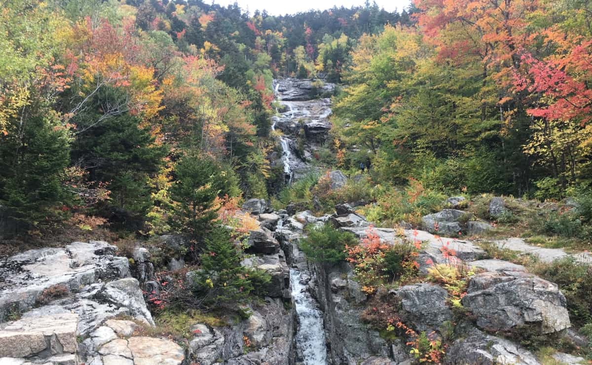 The White Mountains have a blessed status among Ranges; They blush before sleeping, as the Winter sets in and the trees let go. Let it be a lesson to all of us, that all of our growth, and gain, and loss, will one day hang loose, and simply let go. For those who become sad at the notion of this, just remember that the universe of colors for the following year to come, has already been coded. This code, of course, is unable to be seen, but you better believe is more permanent, than even the White Mountain stone. Get into it, and good luck as you go.
Coconino National Forest
Location: Flagstaff, Arizona.
Elevation: 7000 ft
Note: Coconino National Forest raises some amazing questions and answers about what has really taken place in the beautiful forests of the world. Before wandering into any part of the massive Coconino’, it seems appropriate to have a discussion about the very real enchanted statements that exist in sacred zones. Coconino is certainly one of those sacred zones. Therefore, this article begins with a “Forward” in order to offer logical evidence, rather than tired theories from post-modern science, theories which are quickly being understood as totally ridiculous. Here at Stonestrider is some of the most vanguard and comprehensive work on what is actually revealed by these megalithic stone works, and you will learn something incredible from it. There is an anthropological side of hiking in ancient places, and every so often it is important to review connections, patterns, and evidence. By looking at this material, please understand that you are stepping into something truly magical. I thank everyone who takes the time to consider the evidence in the beautiful places of the world by reading an article like this, and we will wander into Coconino after explaining a few wonderful things about what is taking place here.
Forward: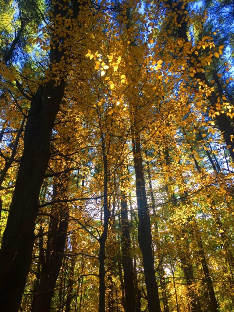 After drifting into roughly 30 forests internationally, and sponsoring this website with many truly challenging expeditions over the course of the last five years, I’m gonna take the chance of going full-on anecdotal for the first time, due to the relevance to The Coconino National Forest featured at the moment, which is one of the largest and most beautiful Pine forests in the entire World (and obviously the continental U.S) Allow me to step back for a moment to set a scene about what Forests mean to me. As a teenager I read, and re–read the works of J.R.R Tolkien, which many students utilized to break the boredom of raw academic classes, ever since the massive novel was first published in the 1950’s. Intrinsic to my photo’s, if you look with a certain eye, are Tolkien’s descriptions; images of mountains, river-glades, and forests which certainly engage all of our imaginations to this day! I realized, while going-over the content for this particular article, that in my mind, before I wander into any forest while out on the trail, that I am always comparing it to one forest in particular from Tolkien’s fictional masterpiece, that forest being Lothlorien. In this regard, I have searched for many years for forests that most closely resembled an enchanted experience, where the deeper you walked in, the more magical and dimensional the experience became. And amazingly enough, from this inspiration I discovered the real-time magic of forests internationally. These are profound discoveries that should be shared, which is the focus of this article.
 Forests often have particular emotional effects on people. Tolkien, in the Lord of The Rings, also creates a polarity about forests. His characters journey through the beautiful, mystical, spacious, ageless, enchanted Forest of Lothlorien; and then later into the dark, rustic, knarly, timeless Forest of Fanghorn. Some are light, and some are dark. And darker still, is Mirkwood Forest in The Hobbit, the epic prequel to L.O.T.R. (There are other forests as well, like the heart-warming Buckland Forest in the opening of LOTR,(#TolkienNerd), plus what you find in Grimm’s Fairy Tales, or Science Fiction stories of today)
The main point of all this ‘fictional forest referencing’ is to understand that forests have, and promote, specific styles and characteristics all their own, just like people. Some are bright and carefree, with pleasant pathways, and golden Autumn leaves, as in New England (Image/Upper-Left); while Other forests, like Ballachulish in Glen Coe Scotland, are dark and looming, with strong and rustic ancient knolls. Walking through Scottish forest is truly intimidating, with a fear of getting lost in the fog and rain; yet the glens are gorgeous! (Image/Upper-Right). Take a look at another Glen in the Snowdon Forests of Wales, which is as pleasant-a-vale you will ever walk through in your life. This particular glade, which almost looks fictional in real-time, are woods made of an extended family of trees, spacious and airy, with an obvious brightness that nearly forces you to squint just to decipher the full scene. (Image/Lower-Left). There is a small standing stone at the top of the knoll in this image, which can’t be seen from this spot.
And along those lines, how could I exclude a forest which is, in my opinion, one of the most enchanting paths that has ever been, which is the smaller, but incredibly beautiful, Kinnitty Forest, in the absolute heart of Ireland. This is a rare Celtic Wood, that has been vanishing steadily since the Colonial Period. Irish forests are particularly rare due the British need for resources across the Celtic Sea just 100 miles away. Kinnittty is a rare gem.(Image/Lower-Right)
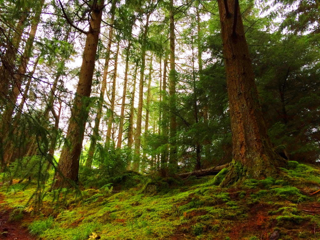
And before finally moving into the deeper meaning of forests, I could not complete this small tour without having a quick glance at the most dense and intimidating forest I’ve ever seen, which is the brilliant Rawah Forest of Medicine Bow National Park in Colorado USA. These are shimmering glades that sway and sift through each other like green-ghosts. In almost all the forests I’ve been I have disappeared into dells that looked to be harboring some kind of clearing or stone-altar; but in Colorado I dared not wander in any away from the old rocky paths. As I have described in other articles, it would be like wondering into the depths of the ocean at night, and like the ocean, it is an overwhelmingly profound statement about the abundance of Nature’s forces, ever blooming in our complicated world. (Image/Below)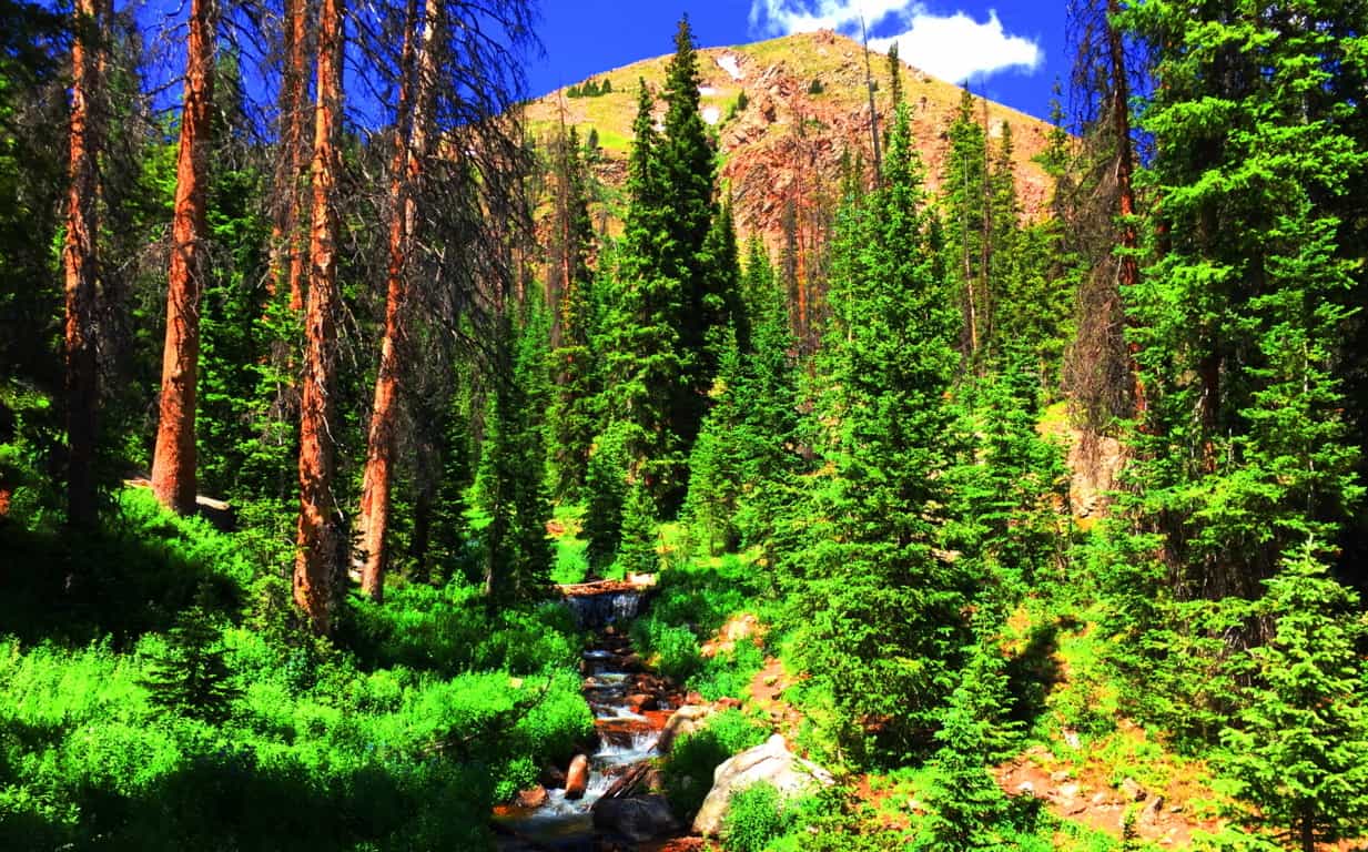 Forest Mysteries: I hope with this brief set of examples that it’s a little more clear how forests have enchanting and unique personalities. This “enchanting” vibe, if you look even closer, doesn’t come from the glades alone; there is something even more strange and mysterious beneath the tree tops. There are megaliths and impossibly crafted stones. This mysterious trend is an international phenomenon, where specific geometric patterns of stones, along with incredible feats of megalithic engineering, emerge deep within the woods, beneath sacred mountainsides, from Glen Coe, Scotland, all the way to Arizona, USA. After establishing proper anthropological and mathematical similarities in stones from forests nearly 3000 latitudinal miles away from each other (that’s North to South) the obvious question emerges: “How can this “glacial” arguement continue to hold up?
  Free-sitting boulders at advantageous vantage points in the forests of New England (Image/Below/Right) Ireland (Image/Left) England, Scotland, and Wales are technically similar to free-sitting boulders in Wyoming, Colorado, and Arizona.
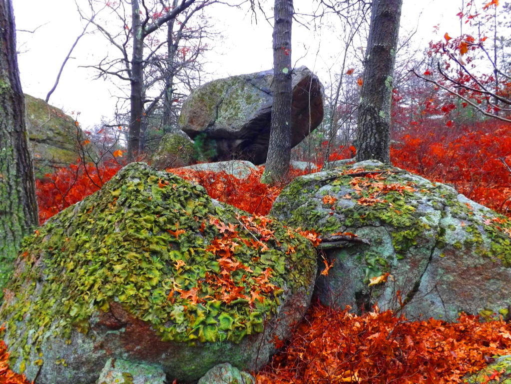 How the hell is this possible? Did the most recent Ice-Age glacier of roughly 40,000 years ago reach all the way down to Arizona’s volcanic mountain deserts? It just doesn’t make sense. Technically, the continent-sized ice mass that covered what would be the American West was called the Cordilleran, which looks to have stopped on the border of what would eventually be Canada. So, simply put, how are scientists claiming that free-sitting boulders like this one in the Coconino Forest in central Flagstaff was moved by the same glacier as the boulders in New England and Ireland? (Image/Lower/Left)
 I examined this Arizona boulder, and more importantly, the slope of the ledge it sits on, and the angle is very telling of how unlikely it is that this boulder remained on this ledge from an at-random geologic process. There is 15 degree slope on the ledge-top, as you can see. To counter that, on the boulder’s base, is a cut of about 15 degrees, fitting the boulder to the ledge perfectly. This is a fixture; an intentional fit, in my opinion. Additionally, there are markings all over this boulder, which is a type of “ledge-boulder” found in sacred zones all over the country. The odds that all of these boulders are placed at random at the very edge of vantage-giving ledges is, to put it blatantly: gastronomical multiplied by gastronomical; impossible.
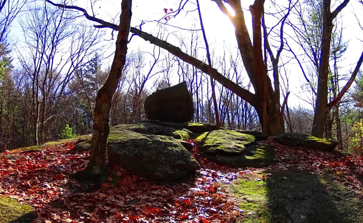
Take a look at yet another free-sitting boulder on a rounded ledge which is ‘vantage-giving’. This boulder is 2500 miles away, in New England. See how rounded this ledge is? For this boulder to remain fixed on top of this rounded precipice it would have to sit in the absolute gravitational center, which it does. Again this an example where if you use logic, and not simply dismiss the statement with brazen theories about ancient ice-sheets, the truth will come out. Someone, or something put this boulder here in order to say: “This is my zone; see how strong I am; beware!”
 If this “territorial fixture” still doesn’t seem realistic to you, take a look at this amazing statement at Cavan Burren National Park in Ireland. It should be understood by the reader that Cavan Burren is filled with sacred megaliths; altars with standing stones, small temples, and Neolithic engineering. Someone claimed this space for themselves in antiquity, and in this space what do we find? A free-sitting boulder perfectly placed on a tiny platform of bedrock. Modern “science” is telling us to believe a massive glacier rolled this single boulder hundreds, or even thousands of miles, only to land it perfectly square and set on this minuscule 4 by 3 foot space of embedded rock? No. Impossible. Absurd. Illogical. And to me, insulting. Again, this is clearly an example of a boulder which was placed by an individual(s) in ancient times, as a statement to others that this zone is occupied, and by someone with incredible strength and know-how. Furthermore, here are some of the Neoliths found within just 25 yards of this boulder:
 (Image/Left) and (Image/Below/Right). How can we go on believing the academic narrative of the post-modernists? They are blatantly lying to us in their white-papers, mini-museums, and gift shops. Why? What do they not want us to conclude? Well, regardless, perhaps these academics didn’t expect someone with a Degree in Western Literature, and some perspective, to make the effort to actually study these places in detail. Perhaps they are RELYING on the fact that people don’t make the effort to stride into these sacred zones from one continent to the next. And these free-standing statements can be found in forests all over the world. Here’s a look at some of the very strange and distinct boulders that remain in Cavan Burren Forest, just 100 yards from the Wedge Tombs. Celtic glades in Ireland are rare, and these boulders are strewn into the landscape like an above ground cable system. Covered in glowing green moss, they just looked to have some positional secret yet to be understood…
And now take a look at a similarly stoic boulder in the forest of Cococino, 4000 miles away. It has precise indents on its side, also with a strange glow, which is of course rusty orange, rather than mossy green. These boulders seem plotted, or planted, rather than randomly tossed about by ice. They are both squared and monumental, as opposed to disheveled. Another very real possibility is that the stones were there long before the forests grew. Were the stones there before the glacier came along? In some forests you can easily see that the stones were there first, as the trees grow straight over the rock. The point is, there are a great many questions that are not answered by the one size fits all modern answers of “glacial displacement.”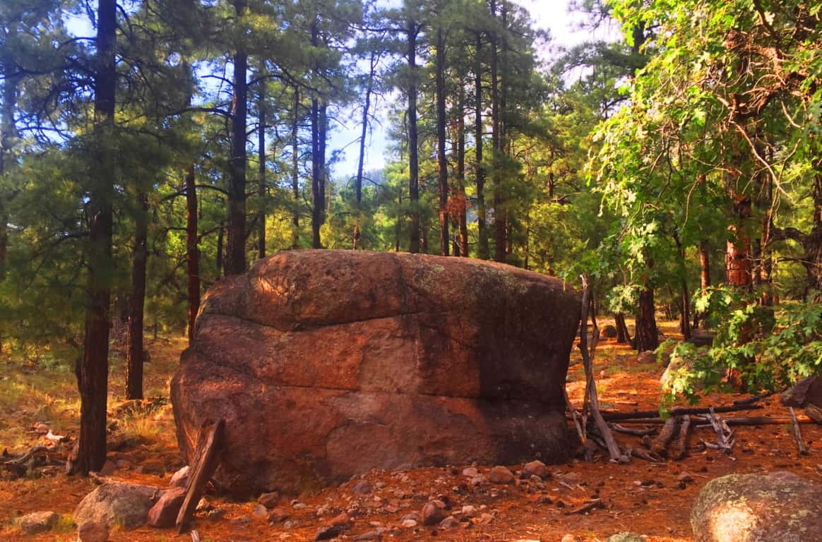 Coconino National Forest: Welcome to a Ponderosa Pine vale that stretches from the northern to southern heart of Arizona. Grand sections of forest emerge all the way from the Grand Canyon down to Sunset Crater Flagstaff, continuing even further down through Oak Creek Canyon, in Sedona. In this environment entire glades of trees are literally on the edge of burning at any given moment. Many trees are already lying prostrate on the ground with limbs seemingly reaching to the heavens, begging to be finally ignited by the Sun. I had just never seen trees like this before.
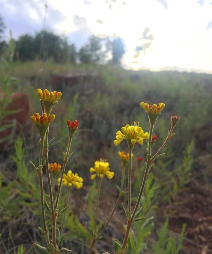
 Even with the challenge of an extremely arid climate, many incredibly delicate and beautiful statements emerge in the dry hedge and shade. These wildflowers just look so resilient against a massive canvas dry-wood in the background.
 You will have to make a decision about where and when you want to wander into the Coconino’. The northern section of the Forest sits at the edge of the Grand Canyon, near the great Southern Rim. This requires traveling through the beautiful desert plain to arrive at the Canyon. The central section of the Forest is roughly 150 miles south of the Grand Canyon, stretching from Sunset Crater National Park to the The San Francisco Peaks, which are the rugged mountains that engulf the city of Flagstaff. Much of the Forest can be found at the base of Mount Humphries, climbing all the way to the peak, which stands at 12,365 feet above Sea Level, and offering 6000 feet of Prominence. That’s a pretty serious climb, and one which I did not make during this particular excursion. The area is truly a wonderland, with possibilities in every direction, and it is nearly impossible to miss a mountain, canyon, or forest trail, in this part of Arizona. Flagstaff is the place where I chose to enter the Coconino first.
 The Coconino Forest at Buffalo Park: There are half a dozen parks and entries for the Forest in Flagstaff. Buffalo Park is a 700 foot elevation hill encompassing about 5 by 15 miles of quiet grassland above, and on the edge of Flagstaff.
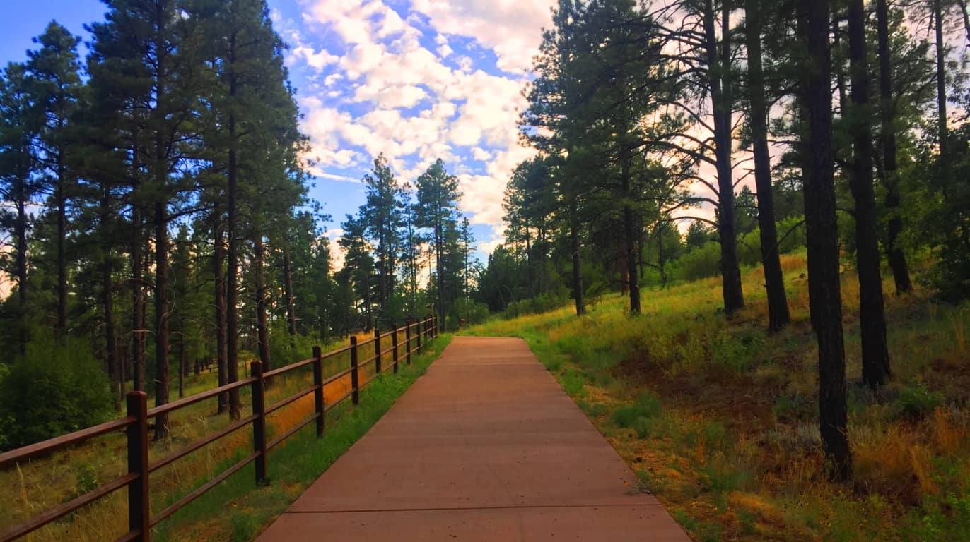 At the top, after sifting through the Forest, the area opens up to a surprisingly vast and peaceful scene. (Image/Below)
 This plateau is like the American West’s rustic version of Ireland’s Hill of Tara (Image/Below/Left) although it was far less lush than the near perfect setting of Tara’. The quiet was very similar though, both hills were places to feel the high winds and absorb the day. It was easy to see that this hill, perhaps 500 years ago, would’ve certainly been a serene place for the Natives, who built stone huts in the deeper forest just a 1000 yards away from here. The size and scale of Coconino and Tara’ is eerily similar.
 The trees and stone-fixtures surrounding the Hill at Buffalo Park seems as enchanted as the megaliths in, say, the Mourne Range in Ireland, or the Berkshire Range in Massachusetts. As explained at the beginning of the article, certain areas felt more like claimed cliff-spaces from the beginning of Time. Buffalo Park is just a teaser to the more dense forest which is closer to Mount Humphries, a beautiful wilderness looming in the immediate distance.
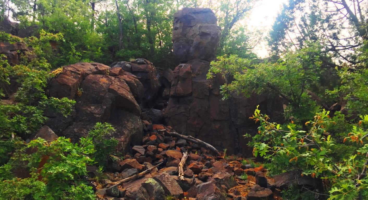
The image above is another look at the small cliff-face with a distinctly placed free-sitting boulder, etched just below the top of the broad hill beyond. I can’t stress it enough, how similar this is to places in New England, where magical things often loom in deep gully’s, which unless you stop and dip down into them, you would simply pass by, gaining no knowledge of the concealed area at all. Here’s another look at the surprising frequency of boulders beneath the trees in this wonderful place. (Image/Below) 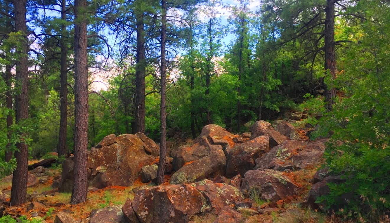
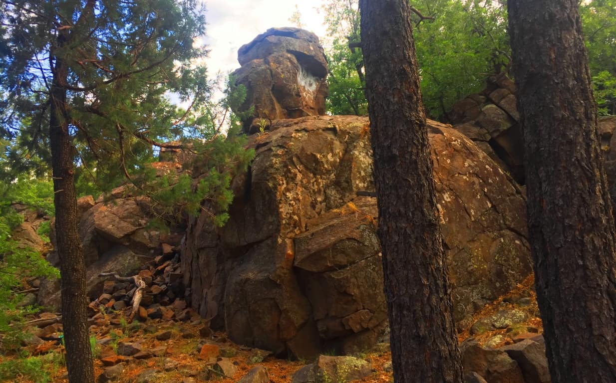
Once you are ready to step into the larger Coconino Forest at the base of Mount Humphries, you can simply drive up to one of the many Trailheads. I used the entrance at Trinity Methodist Church, sitting on the literal edge of the vast woods.  There are dozens of trails winding through this spacious and beautiful set of glades, with massive stones set in incredible positions that give serious pause. This amazing stone was there to greet me as soon as I walked in. (Image/Below) You just can’t make this stuff up.
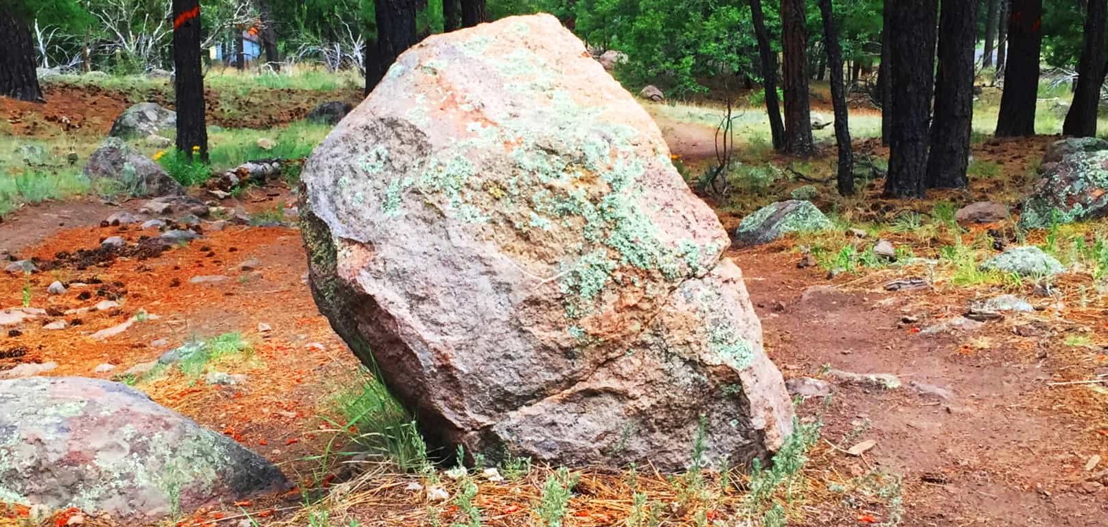
This stone is essentially standing straight up at about 4 feet high, with only a five inch width, which is relatively thin. It is also buried deep within the ground, and make no mistake, this a massive rock. There is a type of streak across the center, with an oblong leaning of the overall shape. I was excited to see a type of “statement stone” as soon as I began my hike. The forest felt strange, mysterious and beautiful. Stones like these in New England are very similar, but this seemed a different style all together! As I progressed further towards the base of the mountain, another stone, more convincing as a Standing Stone, emerged. (image/Below)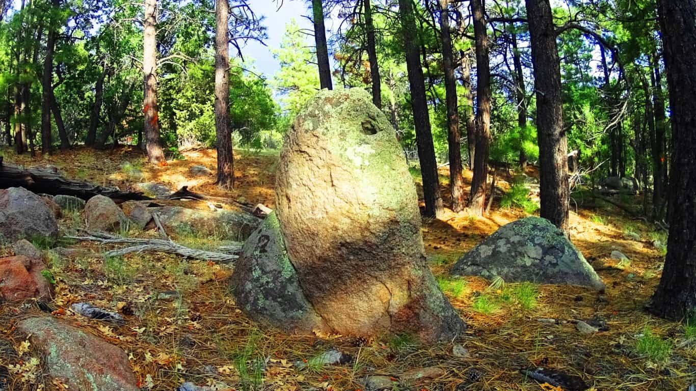
Here is another huge stone standing straight up at about 5 feet tall, and about three inches in width. At this point I was having that moment, just like I’ve had at Cavan Burren National Park in Ireland, and Monument Mountain in Massachusetts, when I said to myself: “O.k, what in God’s name is going on in this enchanted place?” And that feeling of ‘Lothlorien’ begins to sink in, all over again…
Take a look at this boulder above, which was on the edge of the woods. It was so isolated and stoic, extremely similar to the boulder at Cavan Burren National Park I described above. I could not help but feel that this was another territorial marker, just like at Celtic sites. I even pictured it painted with various markings to increase its distinction, as they are depicted in the mythical xbox game Skyrim, protected by giants living their primordial existence.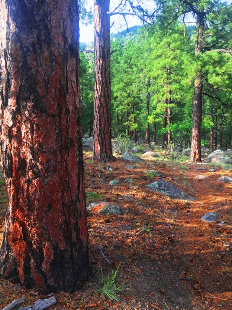 Hundreds of distinct statements like this can be found in the Flagstaff Coconino. Something spectacular is going in this place, so spectacular, that its hard to totally understand. Aside from the threat of fire in July, the place was incredibly peaceful. Against Mount Humphries, the forest seemed ultimately protected from the North, tucked-in enough for the natives to build there homes here, which of-course they did. The trees are spaciously placed with a rusty orange glow along the tough exteriors and the forest floor, very much like New England Pine glades. The air is so dry that you can taste the hovering heat in the pocket of your tongue, like the taste of charcoal in the wind at a barbecue. Any spot is a great spot to sit down, take a nap, take a picture or video, and just fall into the peace and quiet of this massive natural space. It is pure medicine for your mind, against a modern world constantly driving us into the lower aspects of existence, which is the material and monetary contest we experience to survive. The Coconino’ makes you forget, in the best possible way; through the wind in the trees.
Coconino Forest at Oak Creek Canyon/Sedona: After walking out of the Forest at Flagstaff, I had real and tangible reasons to believe that the Neolithic Culture inhabited this place, just like the myths of the Natives speak of. The following day, heading down to the southern extreme of the Coconino’ from Flagstaff, to Oak Creek Canyon, there are two southerly highways. Take the 89A, not Route 17. The 89A is one of the most beautiful back-highways in the country, and scenic Coconino forestry all the way down into the Canyon. The distance from Flagstaff to Oak Creek is only about an hour, the entire trip a wonderful experience. Bring cameras and water, and be ready to freak-out on the beautiful southern extension of the Coconino!
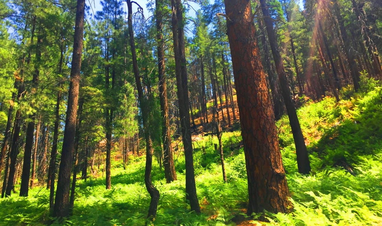
Oak Creek is its own excursion, with magical stones, free-sitting boulders, and habitations well worth several treks. (See “Oak Creek Canyon” at Stonestrider.com for the complete experience.) The most important thing to understand is that the Coconino forest reaches all the way to this southern tip of the central portion of Arizona. This forest is massive and gorgeous, and as mysterious as any Celtic place I’ve ever seen. The trails here are cool and distinct, marked by lonely boulders that seem to be markers, yet again. The Forest grows thickly, with perhaps the tallest of Ponderosa Pines in all Arizona, featured in the very top image of this article. The Coconino Forest is enchanted with a rare Trinity of locations; found in Canyon, Mountain, and Desert. 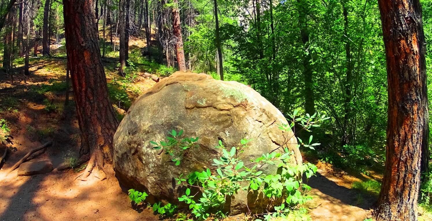
The Coconino Forest of Arizona is another dreamscape with mysterious statements strewn throughout the gigantic woods. It is the majestic wood-belt of Arizona, and in terms of scale, trumping Celtic forests in every possible way. Did the same Neolithic Culture which I believe existed in the forests of Celtic places exist here? I believe they did. Let yourself wander beneath these Pondersa Pines. There are mountains, volcanos, canyons, deserts, and grassy plateaus, where you find this Forest’s trails. It is an all-embracing Forest that pushes through the most arid of environments to ultimately give life and shade to this part of the world. The most important message I can convey at the end of this article is that reading about a forest is all well and good, but entering into one is the overall goal. You can get there and experience this massive life-force for yourself; it’s not a cliche. Seek it out, and find it out. Use your own mind to experience places like this, and don’t let the information-comptrollers and false-history writers deny you your allotted connection and interaction with this amazing primordial source of life in our world. Look and decide for yourself what happened in this gorgeous place. Go strong. Stonestrider.com.
New Grange
Location: County Meath, Ireland
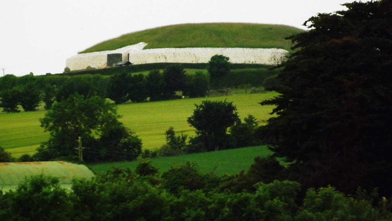
Note: Every so often, with a little luck and determination, you come across things that give cosmic pause. This article is dedicated to those rare moments rather than the beautiful trails to be found in Ireland that are usually reviewed. Hiking starts to take on a next-level significance when you stumble upon practically impossible things. Sometimes they are small things, like perfectly circular concentric rings imprinted on a stone, high above the Black Valley in Killarney. (Image/Below) Sometimes they are jaw-dropping big things, like the balancing Capstone on a giant-sized ‘Proleek Dolmen’ on the boarders of the Mourne Mountains, north of Dublin. (Image/Below) This Dolmen is one of the most massive and well hidden miraculous secrets in all of Ireland, with a 40 ton capstone standing at roughly 15 feet high! Incredible. And yet this pales in comparison to the temple at New Grange.
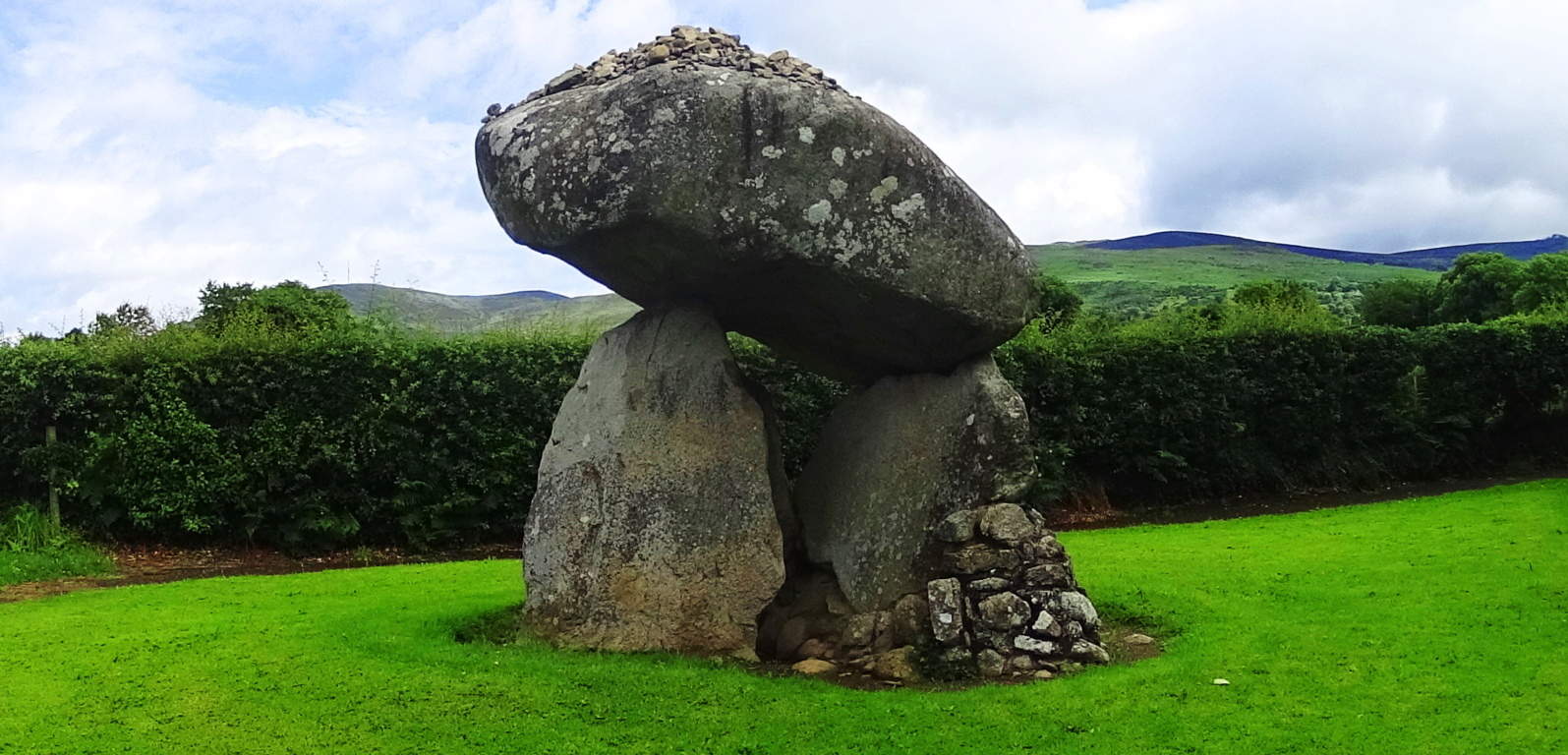 The more you look at that specific area north of Dublin, the more amazing mystery you will find. Just as Egypt’s mystical culture was birthed out of the Nile river, and Babylon’s from the Tigris and Euphrates, Ireland’s incredible spiritual origins were born along the Boyne-River-Valley. Although the Boyne-River-Valley culture was most likely not featured in your mandatory History 2.0 undergraduate course requirements, it definitely should’ve been. Egypt has the Great Pyramid; Babylon had it’s great Tower, and Ireland has the incomprehensible, magical, mystical, temple of New Grange, literally tucked into a curvature above the Boyne River.(Image/Below) New Grange also sponsors other megalithic masterpieces like Knowth, which is an incredible megalithic chamber also located on these grounds.
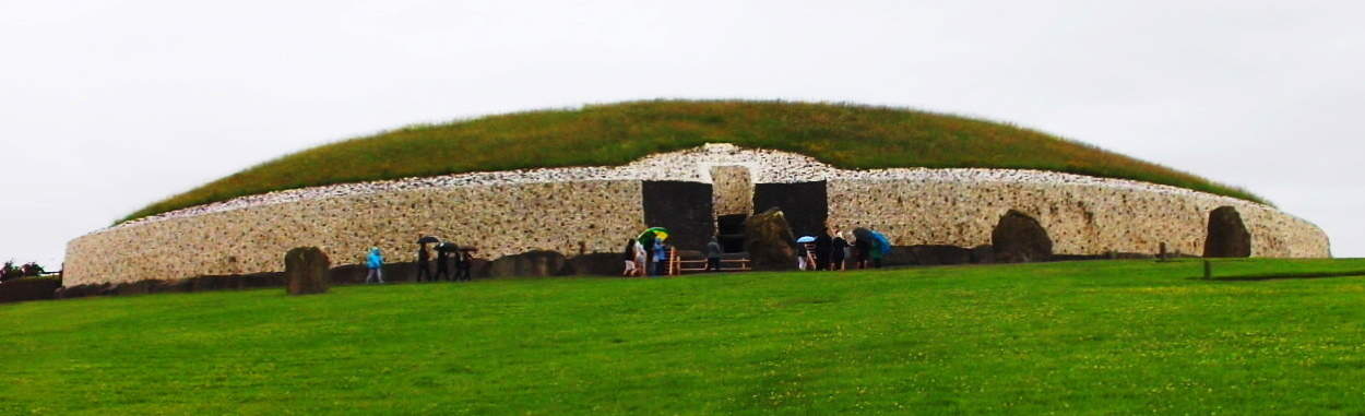
The hedgy river-road that runs along the Boyne River from the hamlet of Rosnaree, just a mile south of New Grange, is the best, and only way to get there. New Grange sits on the highest elevation above the solitary hedge rows and roads without names. You can walk these practically fictional looking hedge-row-paths for days if you are looking to get some trekking in before seeing the Temple, but beware, it would be easy to get lost in this green labyrinth of fields and cart-roads with no names, so make sure you have your device on you to at least navigate at all times. 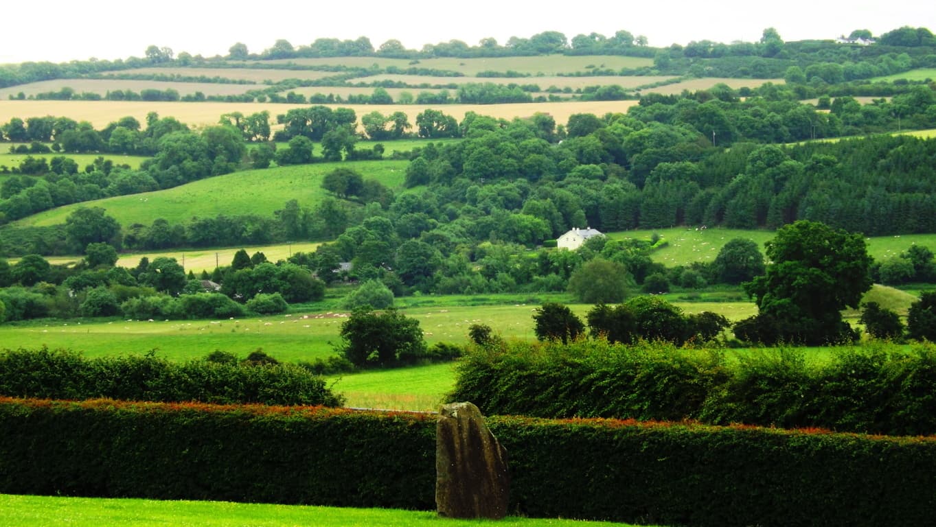
If you are ready to go directly to the Monument go to the Bru-na-Boinne Vistors Center along Staleen Road. Here you will find a ticketed bus line which will take you there. The ride is only 10 minutes, through the hedgy maze. When you arrive at the top of the hill you will be looking at nothing less than a Temple which has stood 2000 years before Moses climbed Mount Sinai. New Grange is older than Stonehenge, The Great Pyramid, and The Parthenon, which puts it in the running for the the oldest Temple on Earth. 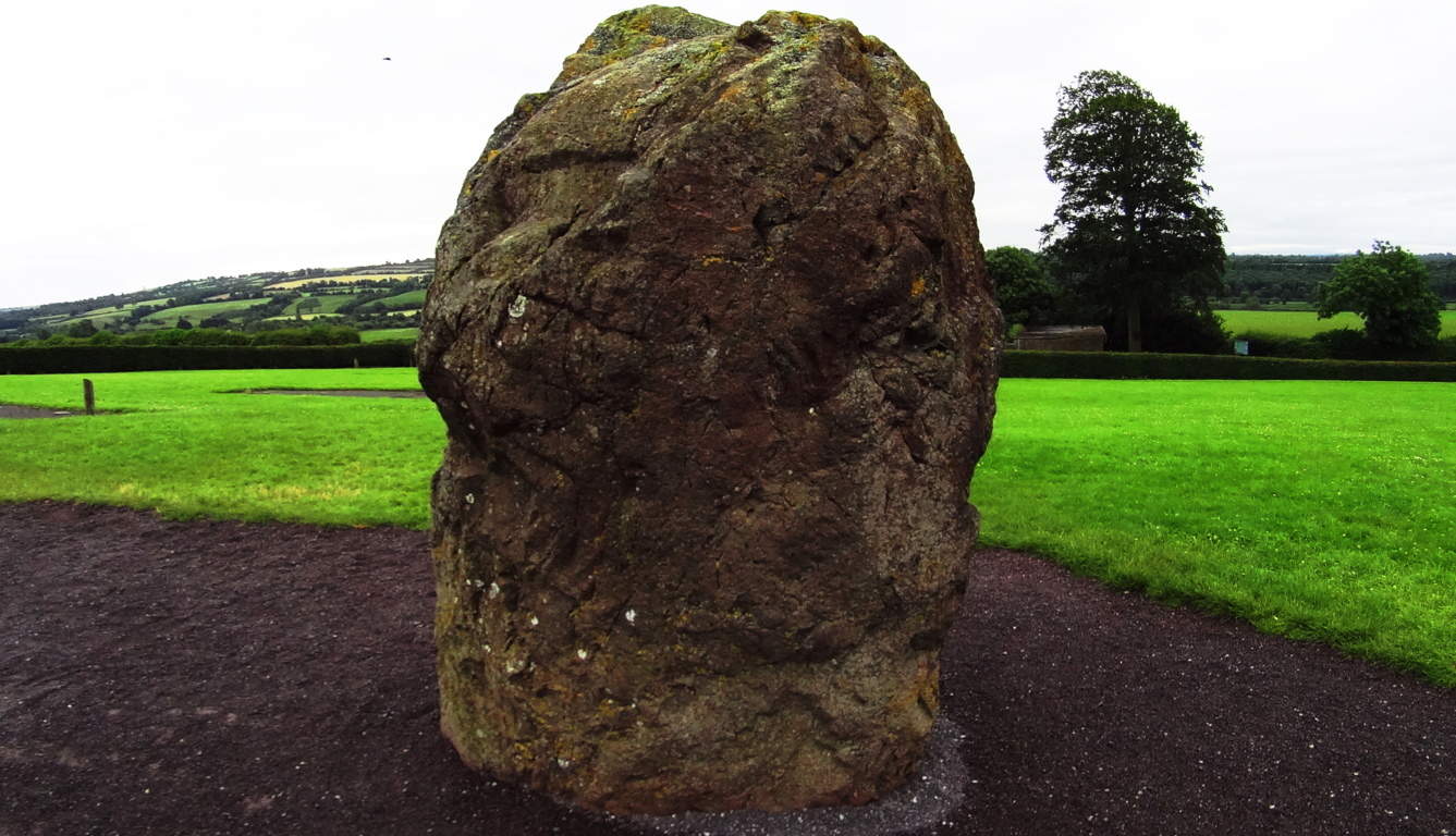 That’s quite a title. The way history has been explained in recent years, you might think that the oldest temple on Earth would look fairly primitive, as human history is generally thought to have gone from basic abilities to very complex ones, but the actual fact appears to be the utter opposite. The construction of New Grange is a study of the highest levels of engineering and accomplishment, bordering on the impossible for a culture not yet capable of using metal tools!? This is a circular mound centered on a main-chamber pathway constructed of roughly 34 level megalithic slabs, each weighing roughly 10 tons (20,000 pounds). Imagine 30 Proleek Dolmens lined perfectly together! Some of the slabs came all the way from the Mourne Mountains to the north, as well as other far off sacred zones. These facts alone start the mind reeling on the impossible story of the stones, which were moved from afar, and finally fit in dry-laid corbel fashion with such perfection that the light of the Solstices shines straight to the heart of the chamber two times a year. This Temple is a celestially connected megalithic miracle. It is surrounded by several massive Standing Stones which are roughly 15-20 tons, and most of them are over 8 feet in height. Moving these stones alone, to what is the highest elevation in this small River Valley, is hard to imagine.
 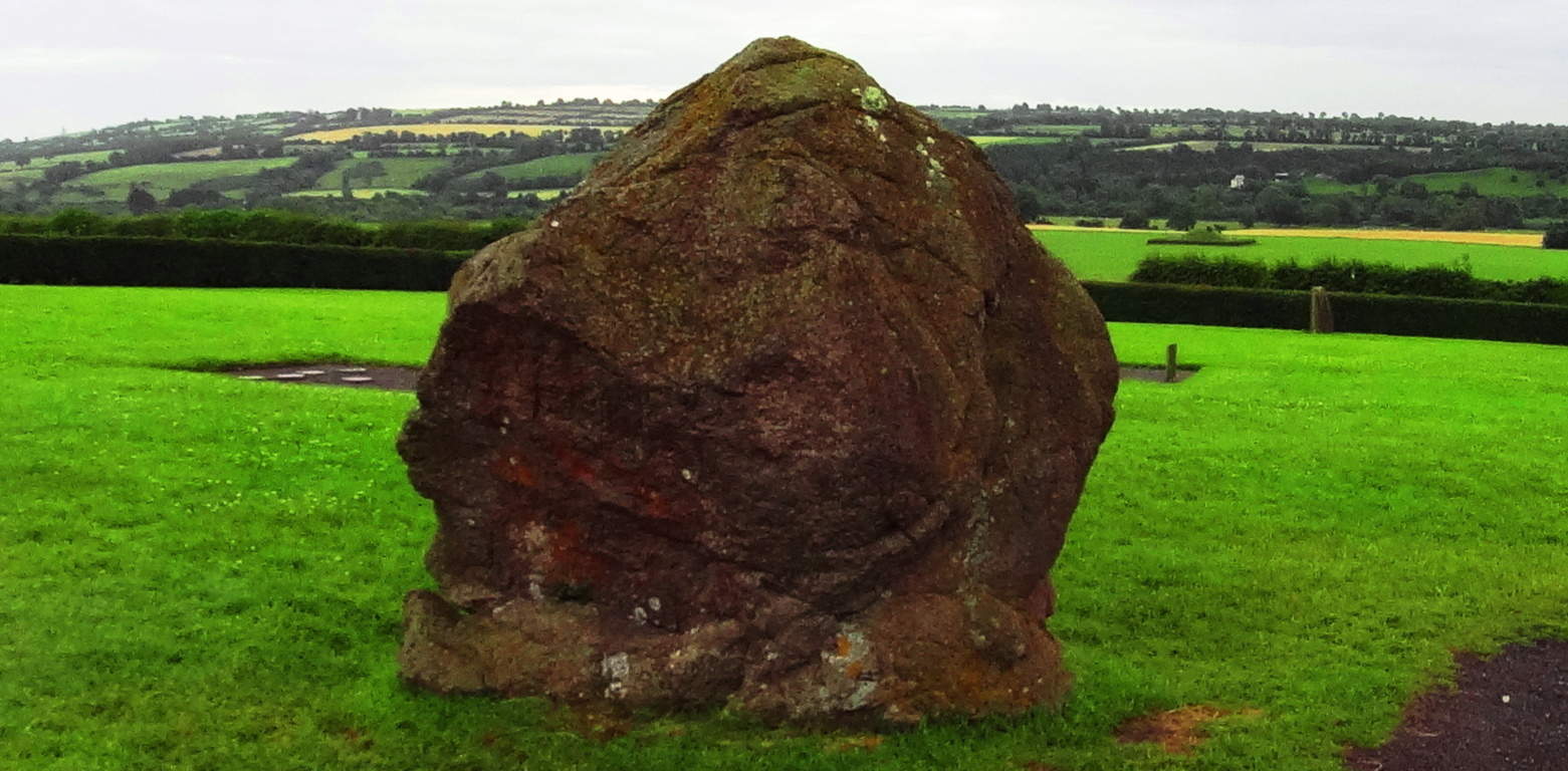 These Standing Stones are territorial markers, and once upon a time, if you passed by these Standing Stones without permission it would certainly have cost you your life. The larger the Standing Stone, the more serious the warning, and sacred the place. In this regard, you will realize that you are standing on truly holy ground.
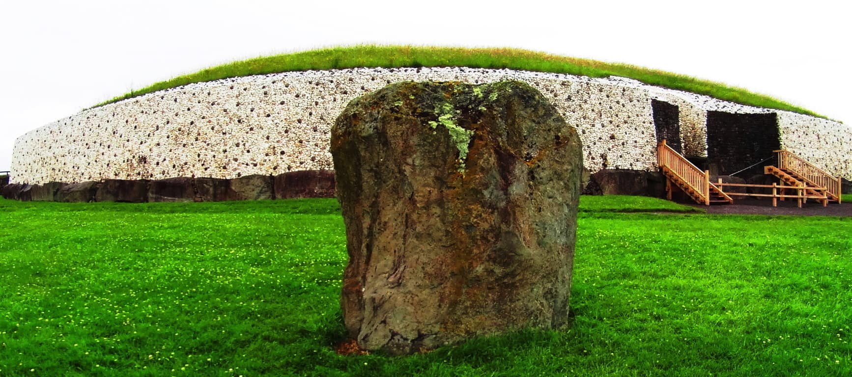 The exterior of the Temple is now lined in a modern white-quartz stone ring. The original Temple was much more concealed and blended into the hill for strategic reasons. It was literally part of the valley. The monumental stone slab at the entrance is one of the most important Celtic relics in the world, with gorgeous iconic Celtic rings imprinted into the megalith. This iconic stone is laid-out in a protective fashion, guarding the entrance, but is also clearly a display. It is a truly magical statement from the beginning of time. Imagine a solitary bean of light on the solstice day shining for only half a minute above this beautiful stone, making it glow, and continuing into the heart of the chamber! It just doesn’t get any better than this. And what’s more, the chambers in New England frequently have the same precise solstice feature. The connections between Celtic and New England antiquity cultures just grows from here, literally.
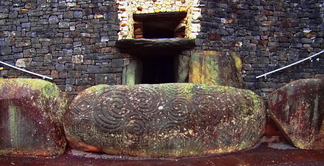
There are several other monumental stones with designs on them around the exterior of the Temple. with specific geometric features to observe on these stones, aside from the spirals.  A closer look at this slab opposite the entrance reveals several iconic shapes, and more specifically, interconnected equilateral triangles, as well as mesmerizing Celtic spirals. These are not the only triangles to be found on the megaliths at New Grange. To see the others, we will need to step inside.
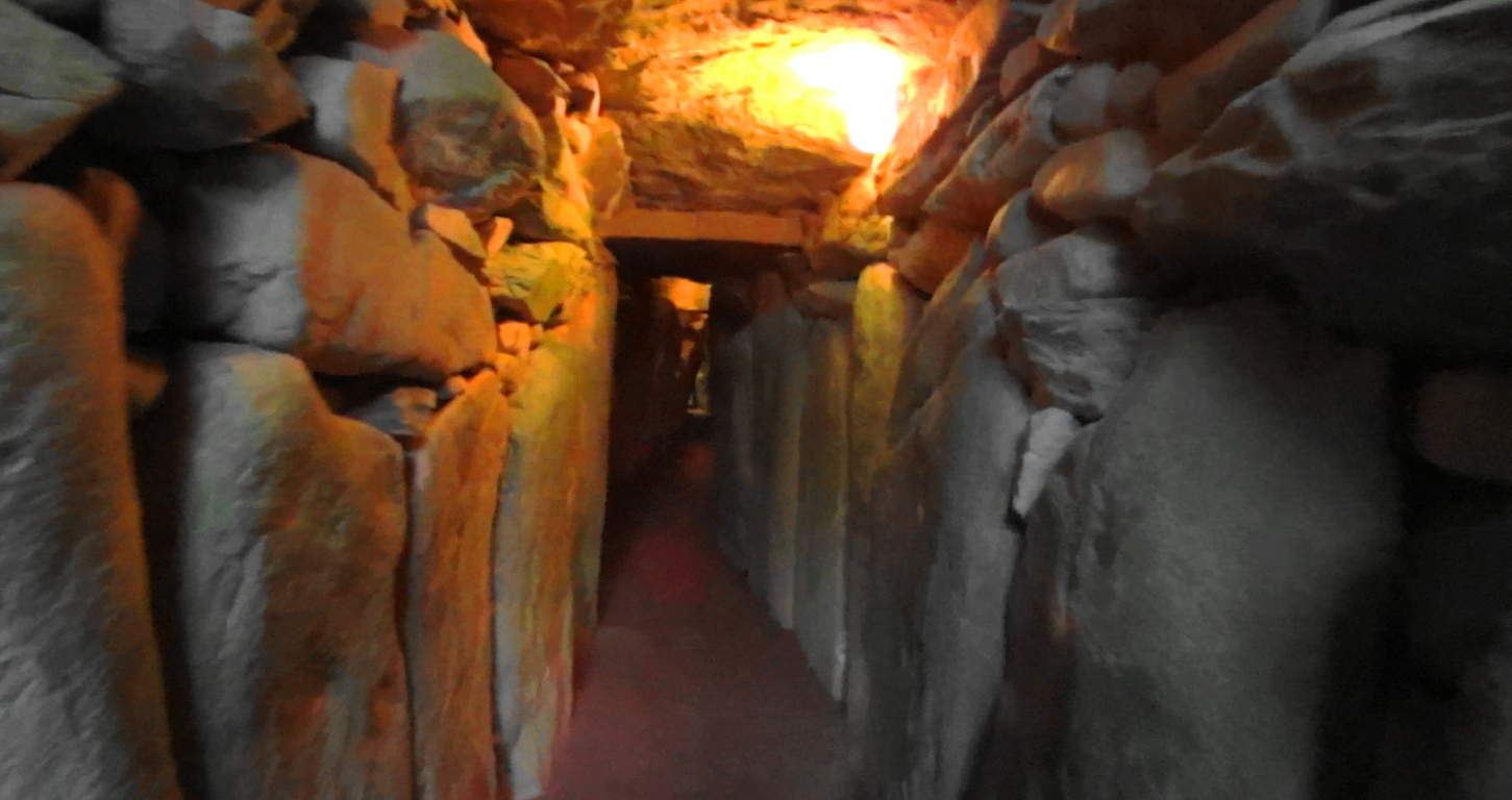 Welcome to the impossible. Here you are entering a chamber of what is the equivalent of 40 Dolmens in one corridor, all fit to perfection leading into a central chamber perfectly aligned to the stars, with a roughly 20 ft high corbel ceiling.
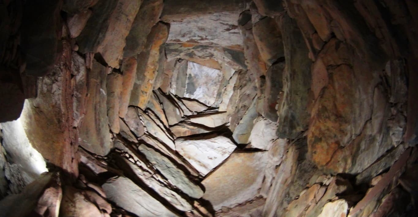 Imagine ancient Ireland, a land where giants roamed across the hills, and dangers unknown lurked beyond the next valley; and then imagine the absolute strength and safety you would feel walking through these impossible stone pillars. Here at least, in the ancient times, you were as safe as any Celt could be. The holistic benefits of living in a synergetic stone temple would most likely be wonderful, in comparison to the huts and wood fortresses of less fortunate clans. At the end of the long singular corridor from the entrance you will encounter stones with imprinted triangles and diamonds before entering the central chamber.
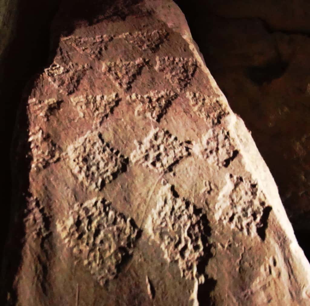
Imprinted on this entryway stone at the main-chamber are distinct equilateral triangles that are seemingly transitioning into diamond shapes. There is profound connection here to the megalithic sites in New England, which utilizes this exact same meme at practically all the megalithic sites. Specifically in New England, you will find equilateral triangles etched into granite by waterfalls, and massive diamond cut stones along ancient trail ways. This is the central megalithic meme in New England, and here are those very same shapes in the heart of the oldest megalithic chamber in the world. Here are some examples of New England megaliths cut exactly into triangles and diamonds.
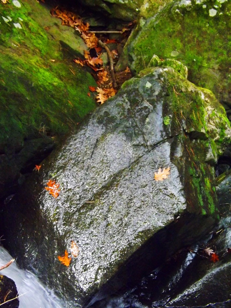
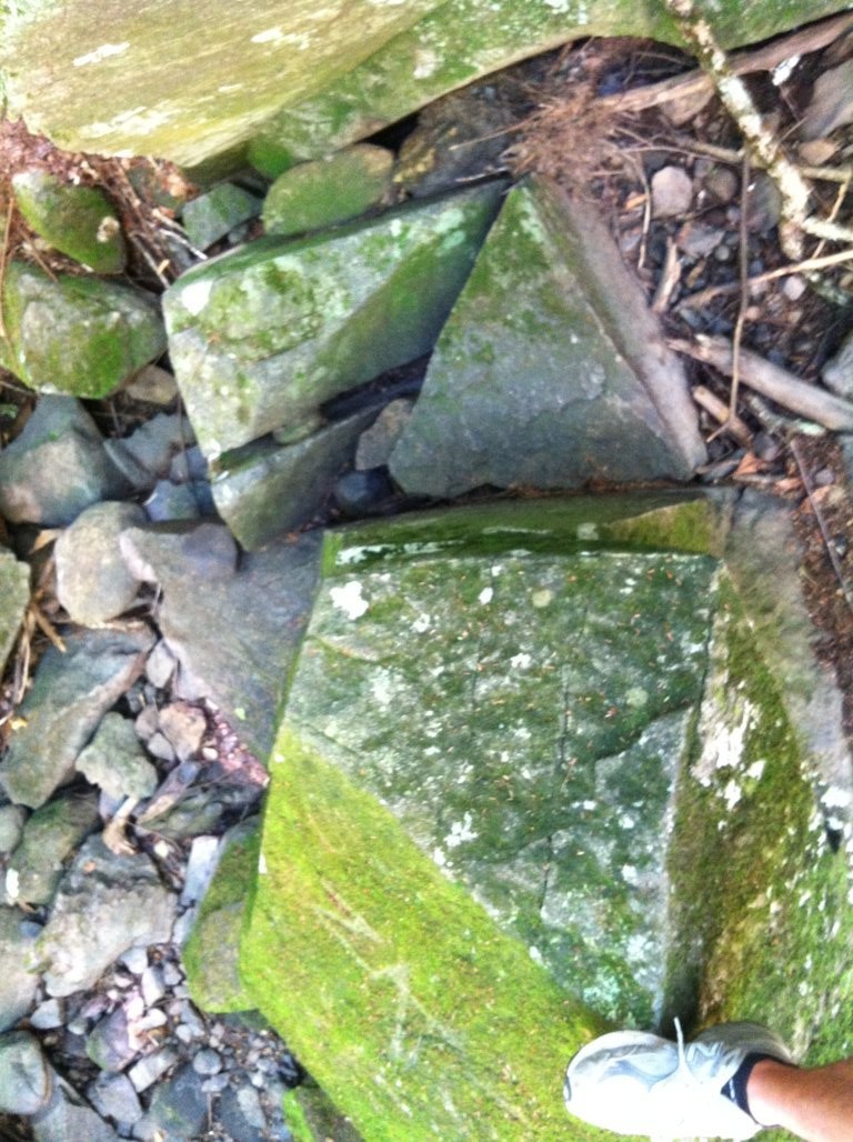
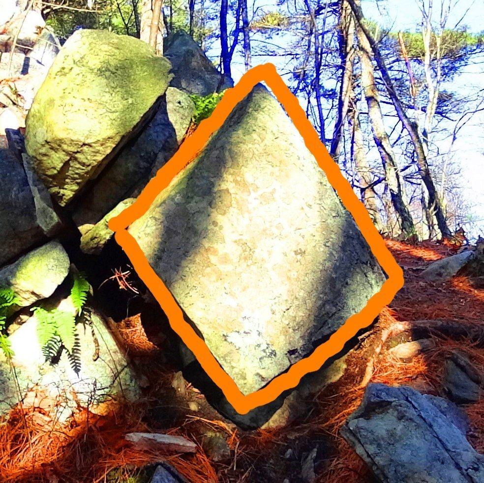
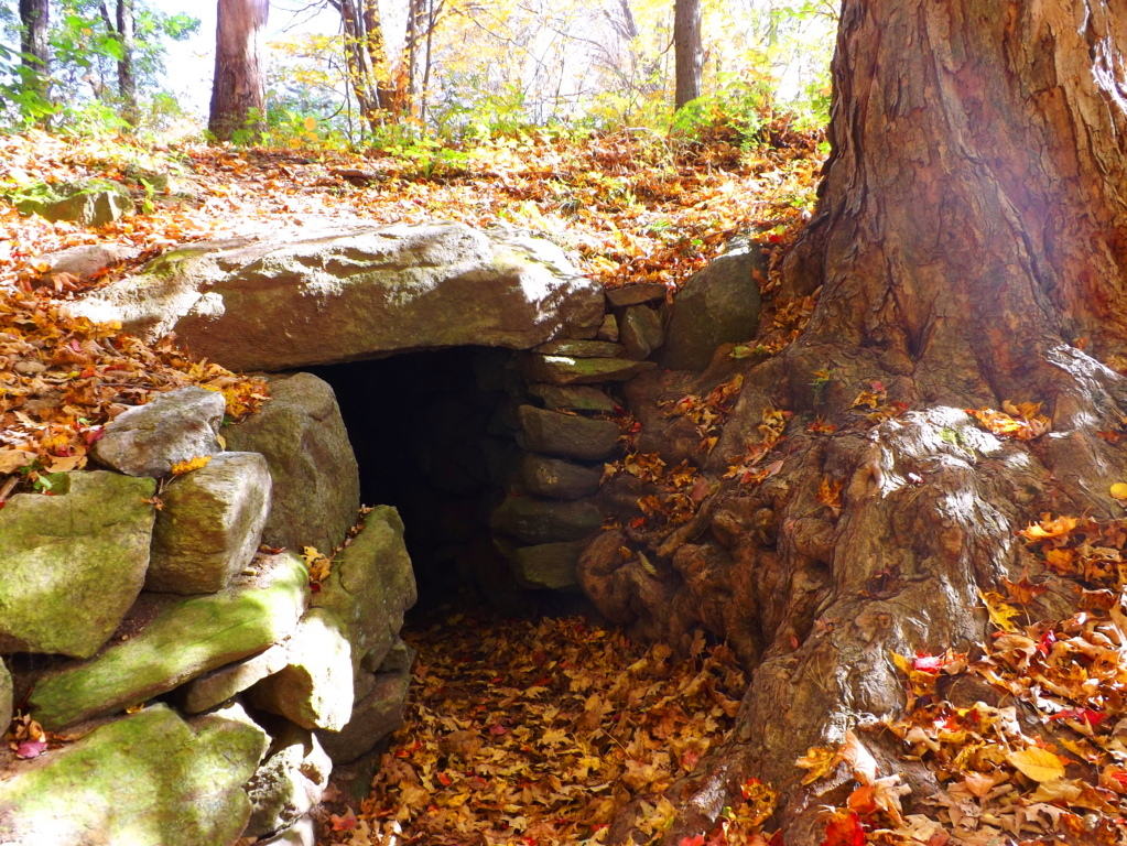
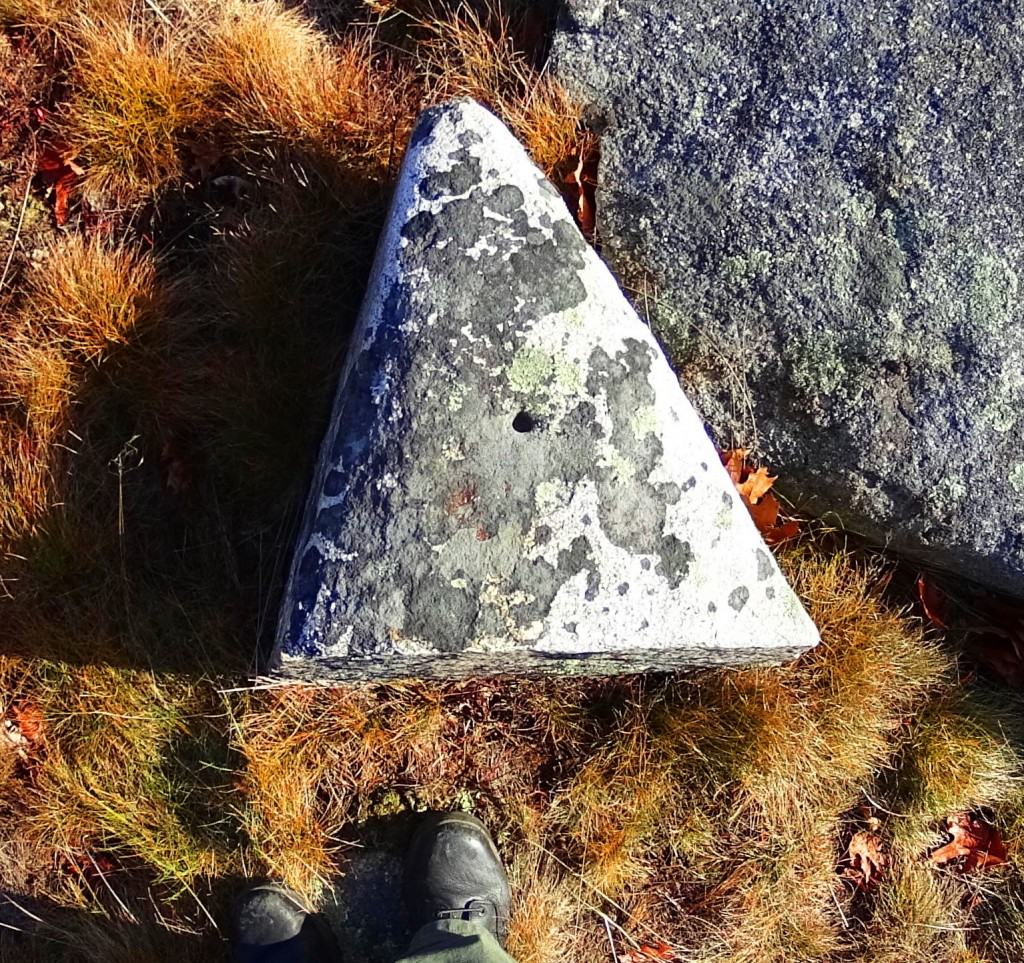
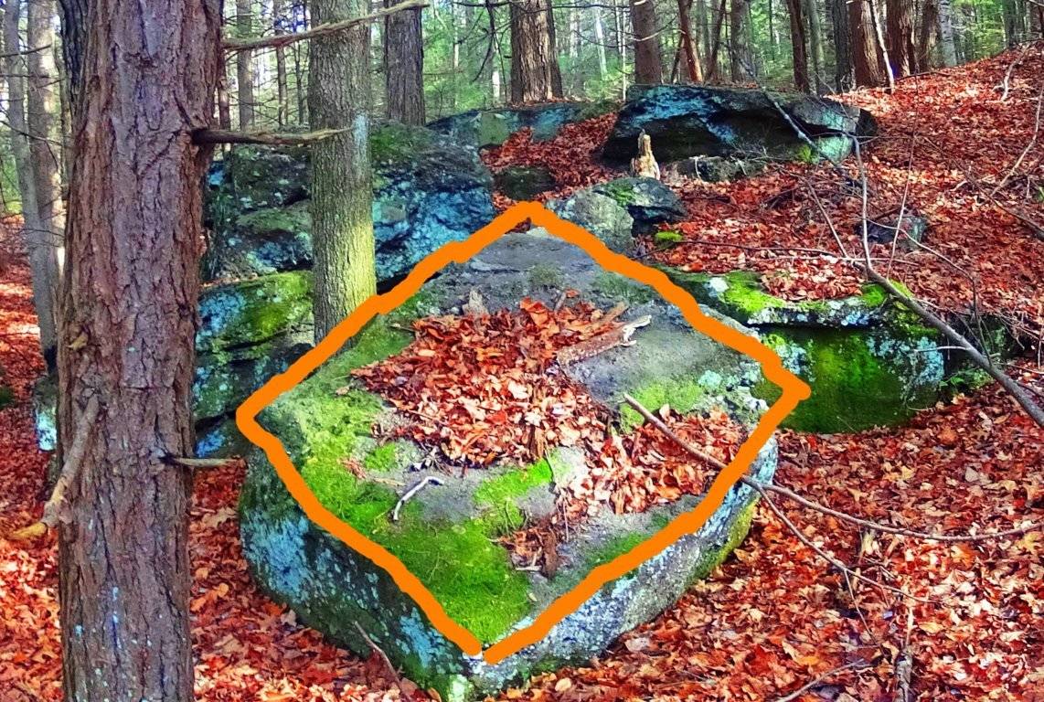
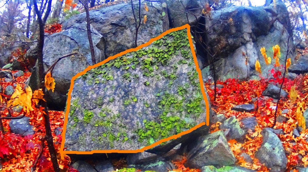
The evidence is too strong to dismiss. It seems highly likely that the megalithic culture that existed in Ireland had a relative culture across the Atlantic in New England. The question will arise: what is so important about triangles and diamond shapes? It might be that the Triangle is the first shape to develop from any linear set of points, and this culture was the first to develop in linear history, and so they claimed the Triangle as their calling card symbol. The ‘diamond’ is the result of the functionary crafting of cross-sections and equilaterals. If you cut a proper X into a stone, the result is four diamond shapes that are consistent with each other, and these utility cross-sections that create diamonds are found all over New England mountain trails. It as if the Neolithic culture were marking zones and territories as a warning to those passing through, and letting us know that the original culture once claimed this area.
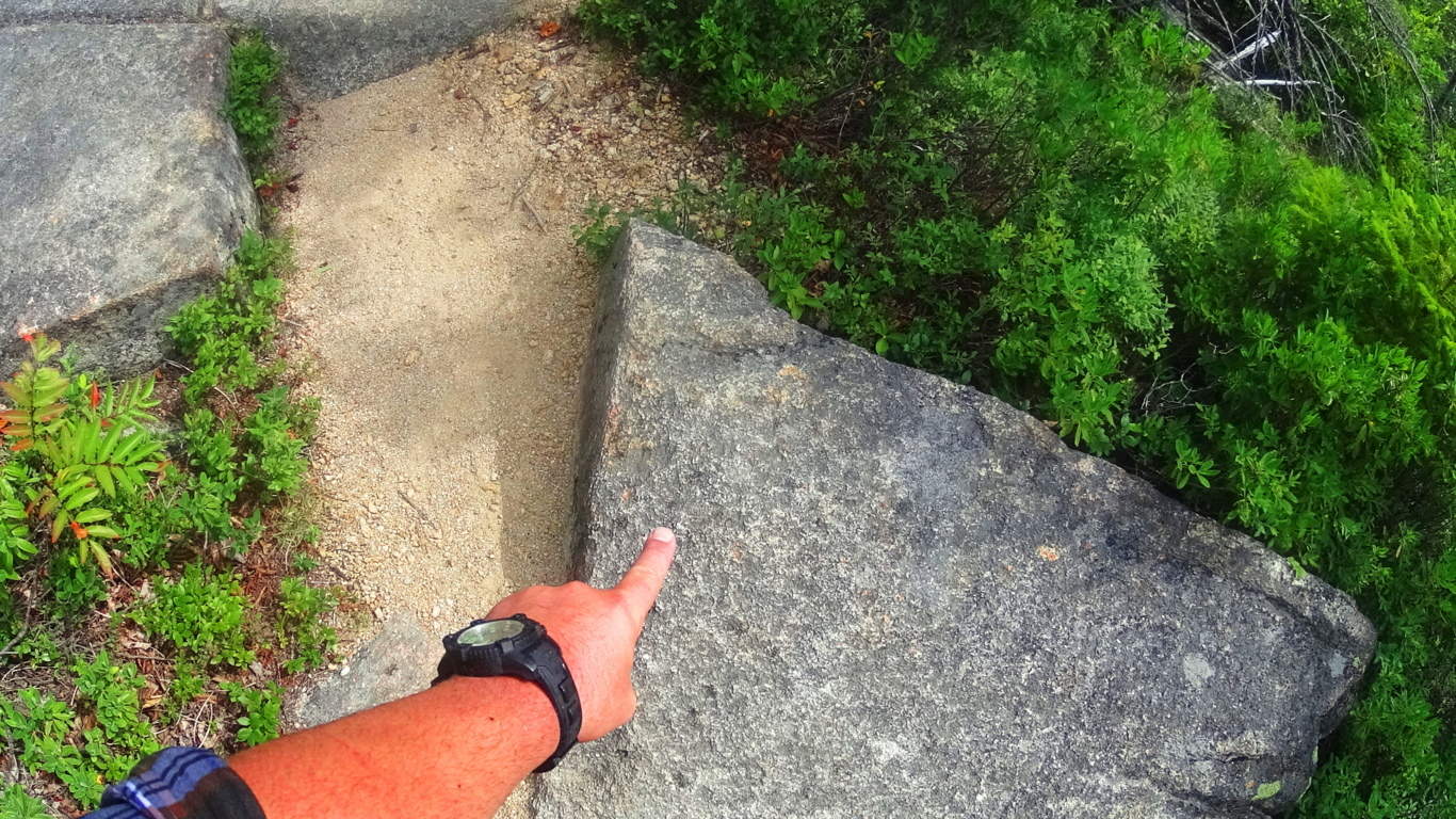
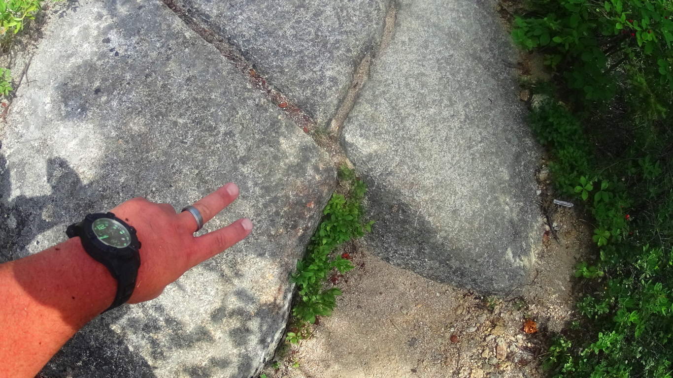
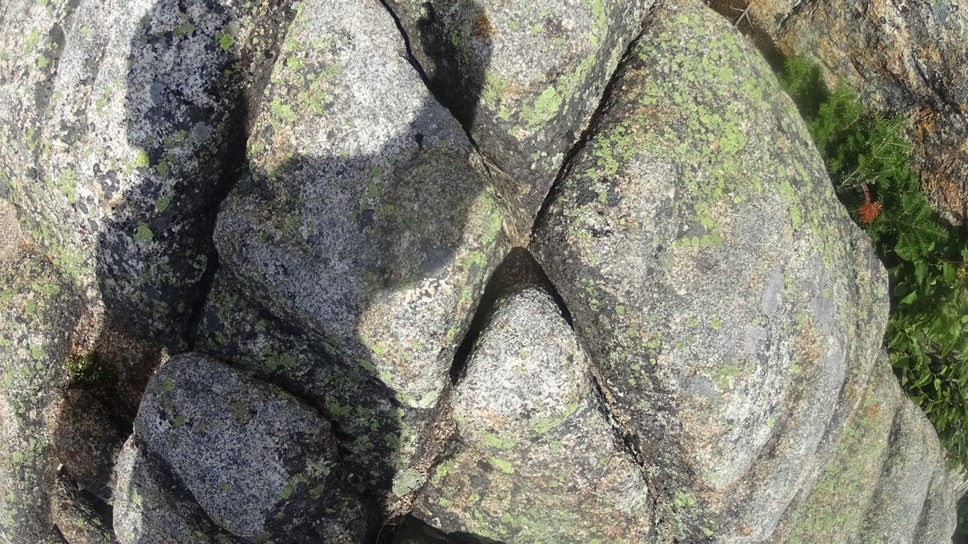
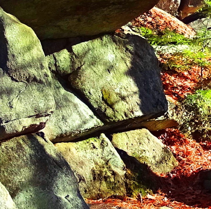
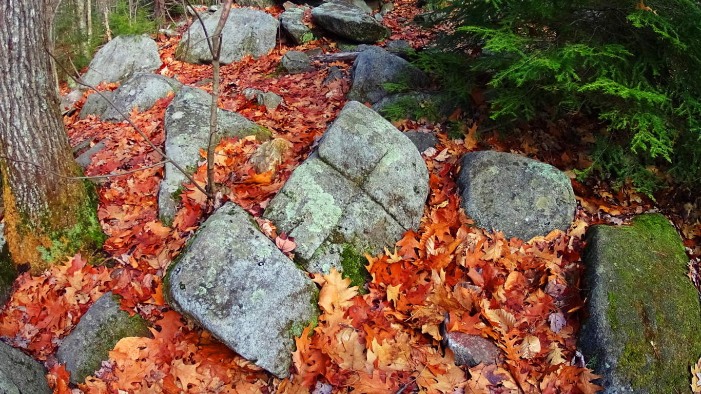
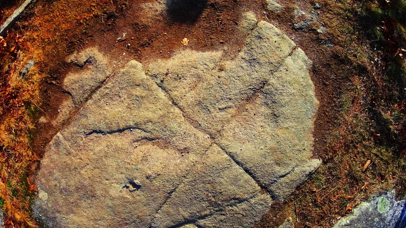
Anther stone in the interior of the chamber at New Grange displays dozens of whimsical triangles and diamonds cascading all over the stone. This just can’t be a coincidence; there must be some relation between New England’s and Ireland’s oldest cultures. 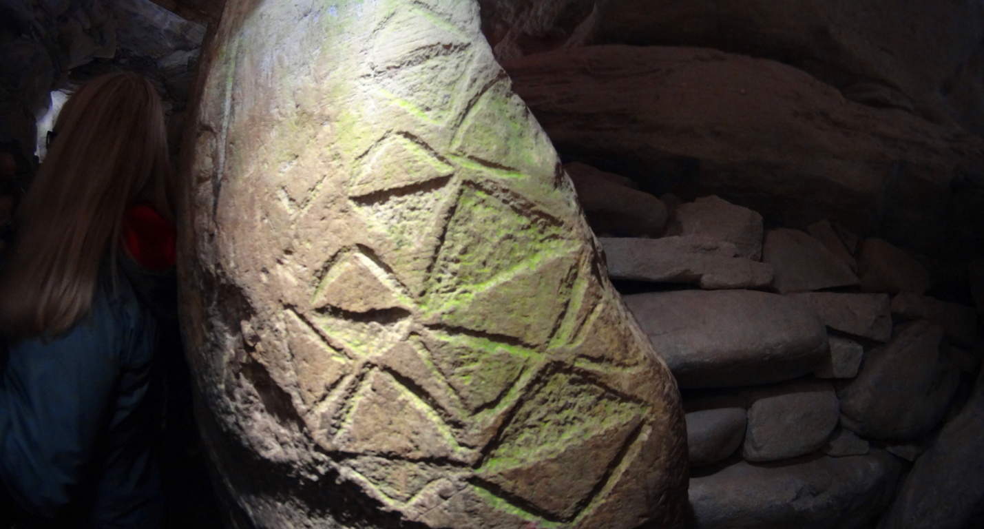 Neolithic Culture: Here is the part of the article that gets surreal and a bit ‘heady’. The history and chronology of how neolithic cultures relate, if they relate, must be found in their works. The works are obviously similar in structure, and also in symbolism. As New Grange is considered the oldest temple in the world, it seems logical that these geometric themes originated here, and spanned-out to the rest of the world. If this is true, then the pre-Celtic neolithic culture in Europe is the original ancestor of the neolithic culture that somehow crossed the Atlantic and ultimately made it’s way to New England. Their works are massive, beyond human in scale, like the Standing Stones outside New Grange.There is also the philosophical aspect of the Triangle, which is a shape specifically relevant to consciousness and divine comprehension. Is the neolithic culture referencing a direct connection to God Itself, like the neolithic tribes of Genesis? This is an intense reference, but according to the Bible the first generation on earth was the ‘Nephilim, meaning: “those who fell from heaven”. The offspring of these angels came from their copulating with human women, and that offspring was said to be Giants. (Genesis: 6) It sounds like extreme science fiction, and yet that’s exactly what the biblical accounts say. Moreover, when the Israelites went into the Promise Land and Joshua scouted out the territory, he found tribes of Giants. Joshua says the tribes he encountered made him feel he was ‘the size of a grasshopper’. What is going there?
With that in mind, you might eventually ask yourself: are these works the productions of these Giants in both Ireland and New England? Why are so many myths based upon Giants? The relations are there, and the relevant meaning of the chosen memes and symbols are there too.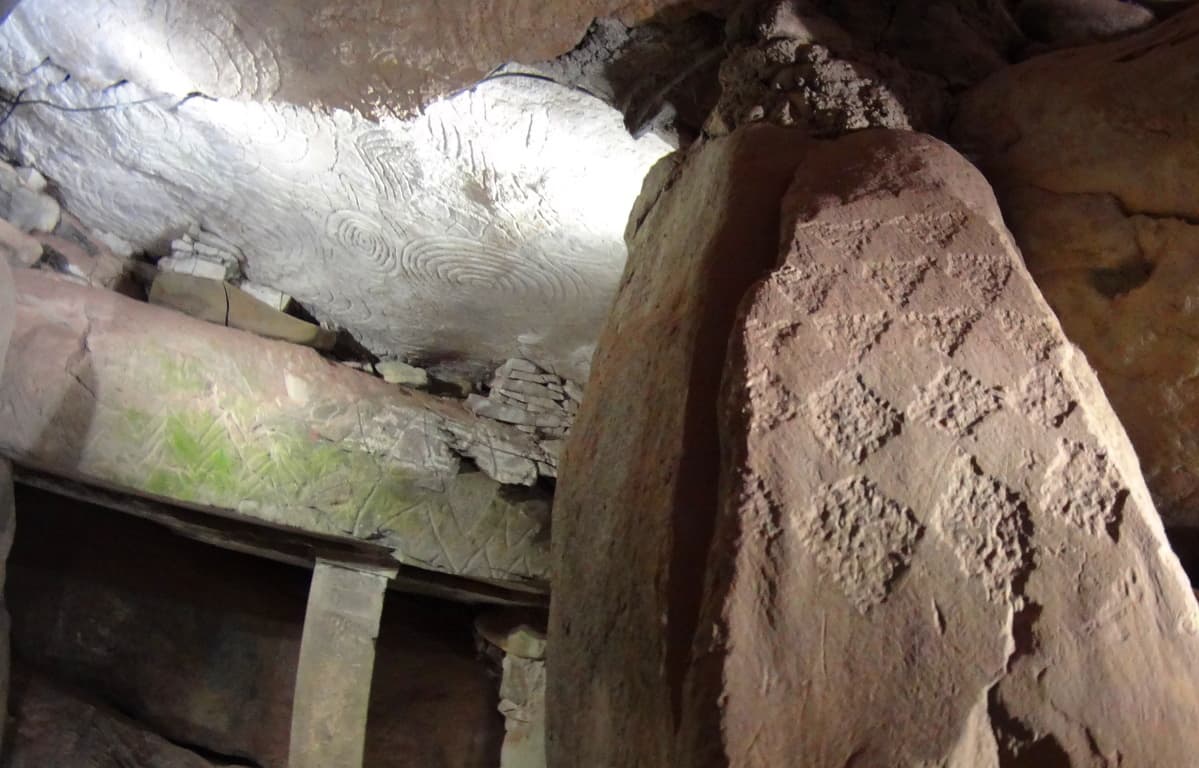 The hard part is, it utterly changes the current story of history, which is evolution based. New Grange is truly an otherworldly ancient temple that evokes wonder and humbling respect for the course of hallowed Time. Our particular modern era looks increasingly like ‘life in a controlled bubble’ when we look at the grand scheme of History. Almost all of our information is pre-packaged and funneled into specific themes, and if you disagree with them, you will be found to be disagreeable and ultimately failed in your assigned studies. The revised history that is given to our children is a set of theories sponsored by commercial academic institutions. The ‘technological era’ is a mere blip of 100 small years at the tail end of 40,000 years of human culture. When we look closely at what the antiquity suggest, it increasingly looks as if our culture is intentionally turning its back on the evidence in order to passively inject a more “convenient” theory of culture, based on erroneous assumptions. New Grange is one of the holiest places in the world, as a temple that has been here since the beginning of anthropological history, it is exquisitely rare. If we are truly sincere about going where the evidence leads us, then we must be prepared to challenge memes that don’t add up. Stonestrider.com isn’t a religious website; it’s about finding the best trails and photos you can, but it is impossible to deny that places like New Grange challenge so many things we assume about human progress. So, even if you are in Dublin just for a few days, plan a morning to visit New Grange. It is something, even with all our modern answers, we still don’t completely understand.
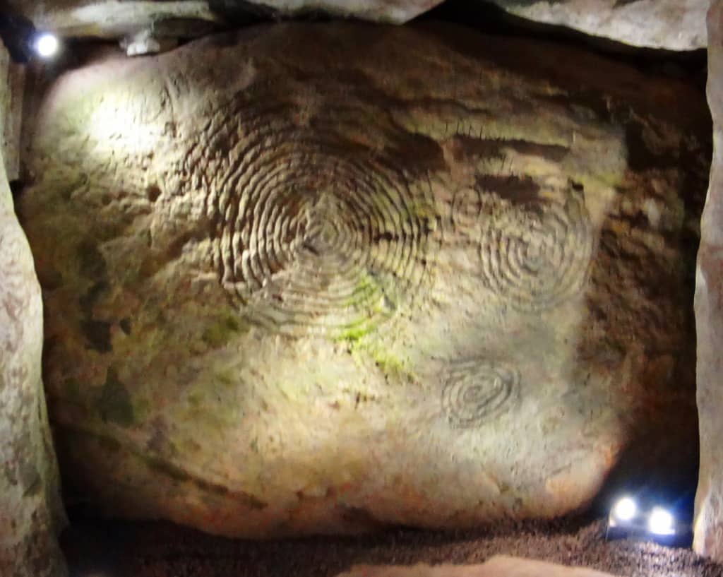 Something incredible, almost otherworldly, took place in antiquity in order to build this temple. Walking into it’s main chamber is like walking into a miracle. It just doesn’t get more sacred than this, and a hillside is sometimes so much more than a hillside, so keep hiking.