Rattlesnake Mountain
Location: Erving, Massachusetts
Elevation: 1,067 ft
Note: Running along the northern border of Massachusetts is a unique set of rolling “small-mountain” ranges. These elevations are too tall to be called mere hills, but too small to be known as full-fledged mountains. Rattlesnake Mountain sits in the heart of this range in the northwestern portion of the state, surrounded by similar small-mountain peaks in Monroe and Savoy to the west, with Watatic to the east. The woodsy entrance for the car park leading to the main trail at Rattlesnake Mountain is nearly hidden, just off Rt 2A, about 100 yards from Maple Ave, in the picturesque country-town of Erving.
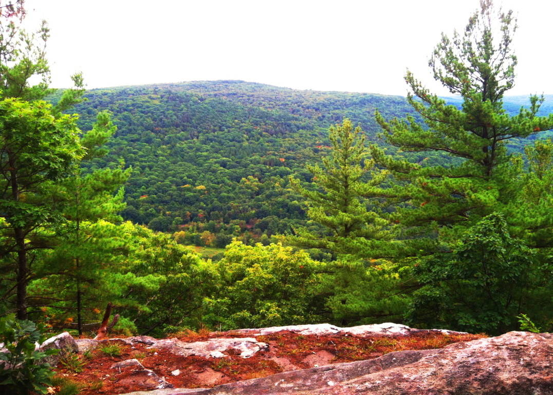
The trail at Rattlesnake’ is essentially a 2.4 mile loop that broadly encircles a massive metamorphic rock ledge. Known as The Farley Ledges, this precipice is enveloped by trees, standing about 220 feet high, and about a mile-and-a-half wide, east to west (image below)…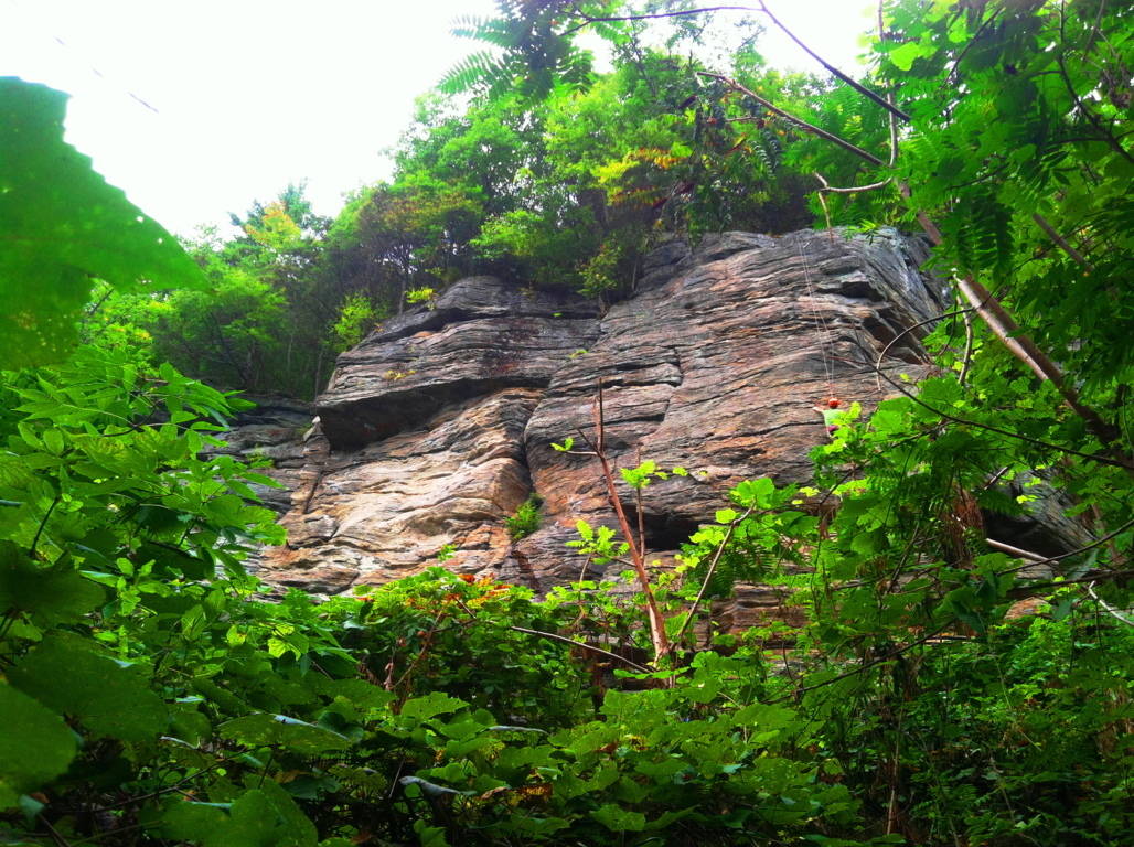 Rock climbers scale this ledge in a world all their own, paying very little attention to the boulders and stones that line the ground below. If they did pay attention, a closer look at these stones reveal something pretty amazing. Here at Rattlesnake’ there is a megalithic mystery that reaches deep into the heart of Massachusetts forests and mountains, a mystery that most often goes unspoken. Simply put, there are hundreds of gigantic cut stones which are measured and marked inundating the forest floor just beneath the ridge. There are pathways that run directly into this “stone playground” where various crafted stones sit (image below)…
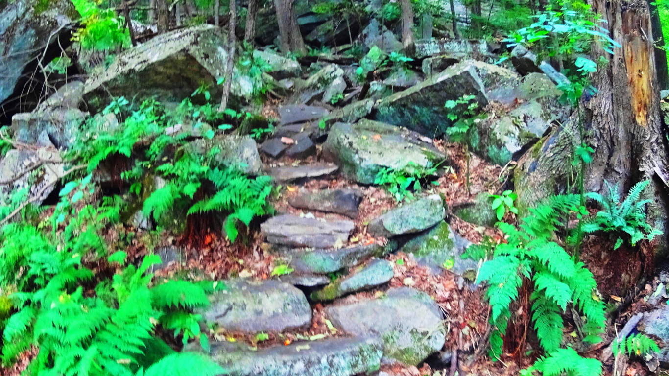 Other megaliths are fixed in some pretty curious positions in arrangements near the trail, winding like a display along the ledge (image below)…
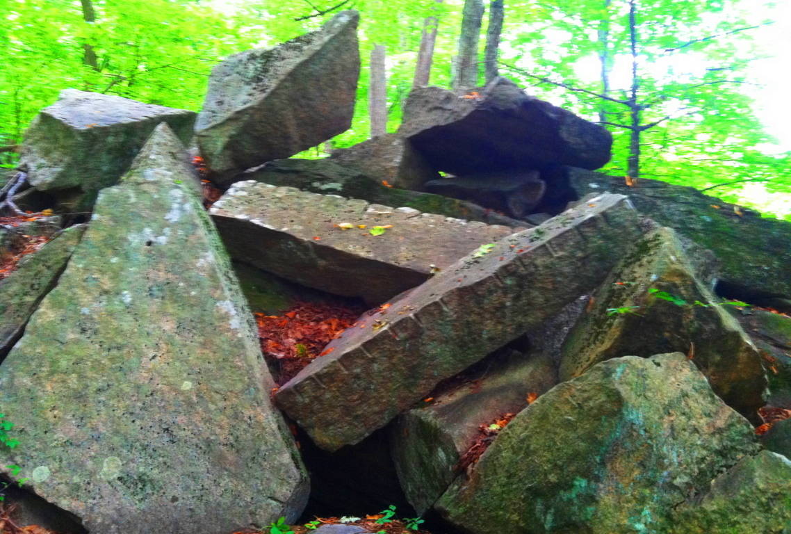 Some of the stones look to be placed in specific places, while others look to have been tossed about like giant toy blocks. The incrementation markings on the huge stones are not in inches or centimeters, they are some other form of measurement entirely. The image above is of two rather long rectangular pieces thrown into a pile at Rattlesnake’. Pieces exactly like this exist at the pass of Mount Bearnagh in Ireland (image below)…
 They also exist at Lynn Woods Reserve in Lynn Massachusetts (image below)…
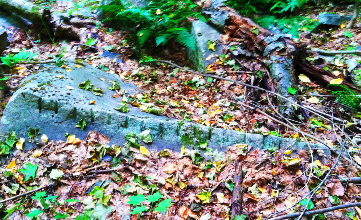
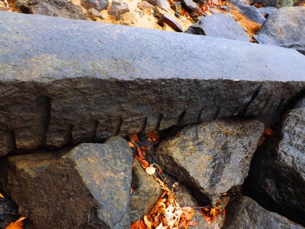 which is 40 miles east of here. Look at the incrementation on the stone in Lynn Woods; between the long marks are 9 short marks. What system of measurement uses increments of 9? And there are countless other places throughout New England where this specific type of rectangular piece can be found. As documented proof of these megalithic stones is slowly compiled, it becomes clear that our modern culture is built directly over what was once a megalithic culture. In old-growth forests and mountain ridges where houses have never been built the evidence for this culture still remains. And please remember, these stones are several tons each, if not more. Whoever cut and placed them, had the ability to do so, and without strain. Other stones beneath the ridge are smaller square pieces (image below)…
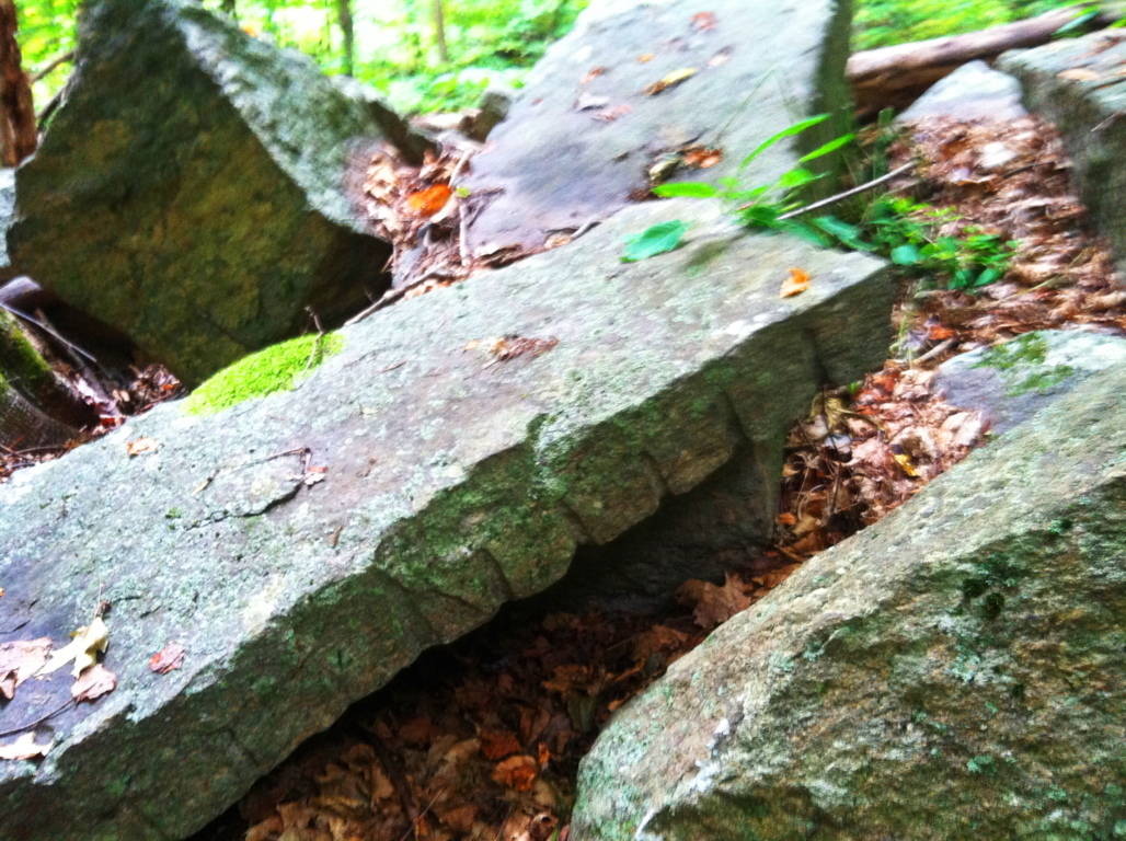
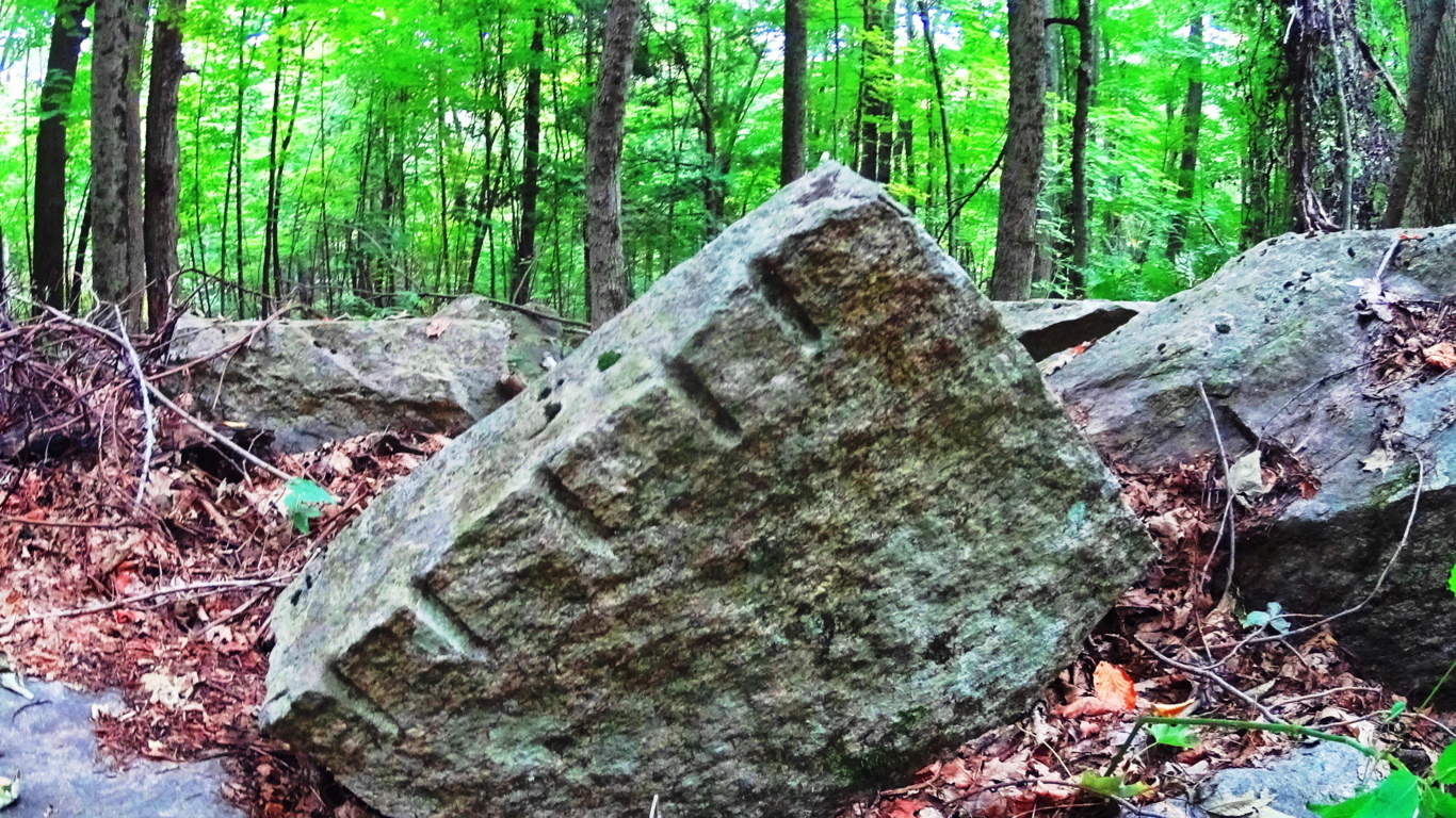
And more stones can be found here, some covered by countless seasons, or are partially entrenched in the earth. It becomes clear that someone literally went to work in this area, and was utilizing megalithic size stones the way a carpenter uses wood blocks (images below)…
As you head east along the initial trail, passing by these monoliths and huge fixtures, there are other stones that emerge which are relevant to the patterns of megaliths in New England. The equilateral triangle has showed its face in stone in almost every deep woods hiking trail and reserve from northern Maine to western Massachusetts. Here, somehow fixed into a boulder, was a perfect equilateral triangle (image below)…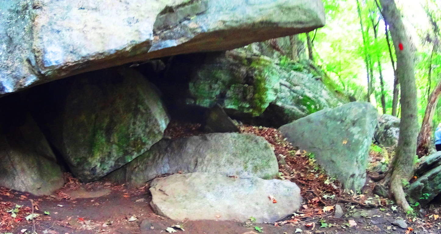 It is at the center of this massive fixture, with a cubicly cut stone to its left, and another perfect equilateral to its right. All of this is under a rock precipice serving as a roof which looks to weigh about 100 tons. The overall symmetrical setting is above (image above), with the central equilateral in the middle, sitting on a perfectly leveled shelf of stone. Please understand, this stone is part of the boulder beneath it; it was carved out to protrude specifically in this fashion. I could not move it. Here’s a closer look (image below)
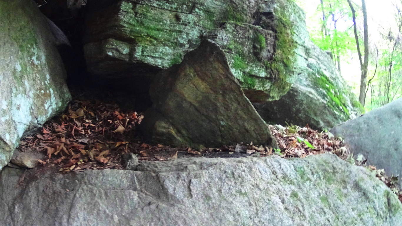 Just a few feet up the trail is another fixture with a equilateral triangle that is guarded by several massive stones. This stone is not only an equilateral, but is a three sided prism that is connected to the boulder beneath it. (image below)
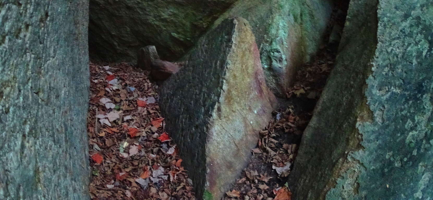 In the woods of Upton Massachusetts there are granite cut equilateral prisms attached to the boulders beneath them (image below), extremely similar to these stones found at Rattlesnake’.
 I believe the Triangle is the megalithic “calling card” of the ancient culture that once dwelt in the hills of New England, just as the Spiral was the calling card of the megalithic culture that once dwelt once dwelt in Ireland. If you recognize this, then you will realize that New England, in its own way, is a landscape that is just as mythical and beautiful as those traditionally endeared in England, Ireland, Scotland, and Wales. When you hike through these small mountains, you’re hiking through zones of ancient mysteries yet to be solved, but can be seen right before your eyes. The trees of woods are spaced amicably, with small groves of baby pines and birches emerging in various areas. Enjoy these beautiful groves (image below )…
 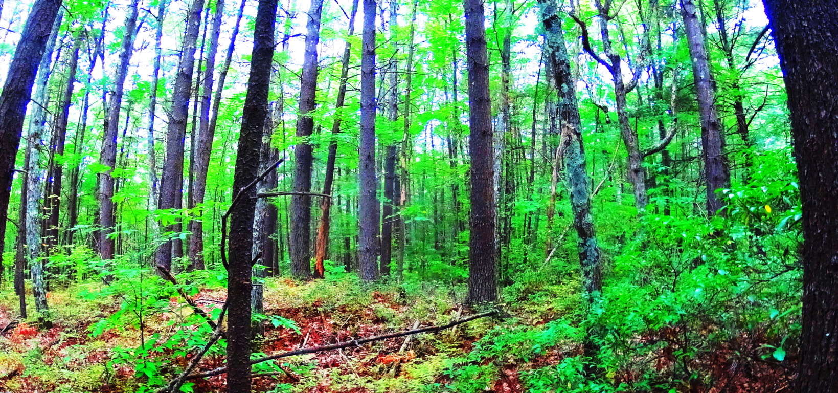 With all of this existing right infornt of you, it can be hard to get back to the natural beauty of the trail ahead, which is another wonderful aspect to hiking the forests of New England and Rattlesnake Mountain. As you step away from these mysterious alters beneath the grand ledge, continue east. After about 1/4 mile you will come to a stream rolling down the mountain from above (image below).
 Turn to follow this stream upward, as you are now on the eastern extremity of the trail (image below).
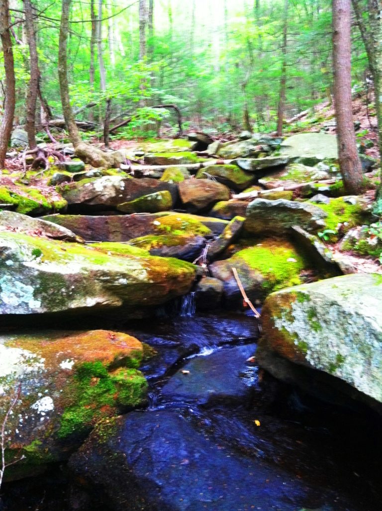
This waterway is so similar to Celtic scenes that you might find at Tollymore Forest in Ireland, or Killarney National Park. The rocks are strewn over the flowing water, with glowing moss beyond. Following the waterways clears the senses and improves your “sound palate” with the soft trickling and smooth rolling of water over stone. This consistency of sound eliminates the sensory overload we experience in our daily lives, which have become controlled blasts of commercial intrusions. One walk along these streams can clear your head for days. Continue up the incline which follows the stream until the trail crosses over the water, to left, at the top of the hillside. The trail continues into an elevated old-growth forest with a classic New England blend of Oak, Maple, Pine, Beech, and Birch trees. Looking northward this forest continues all the way into Vermont.(image below)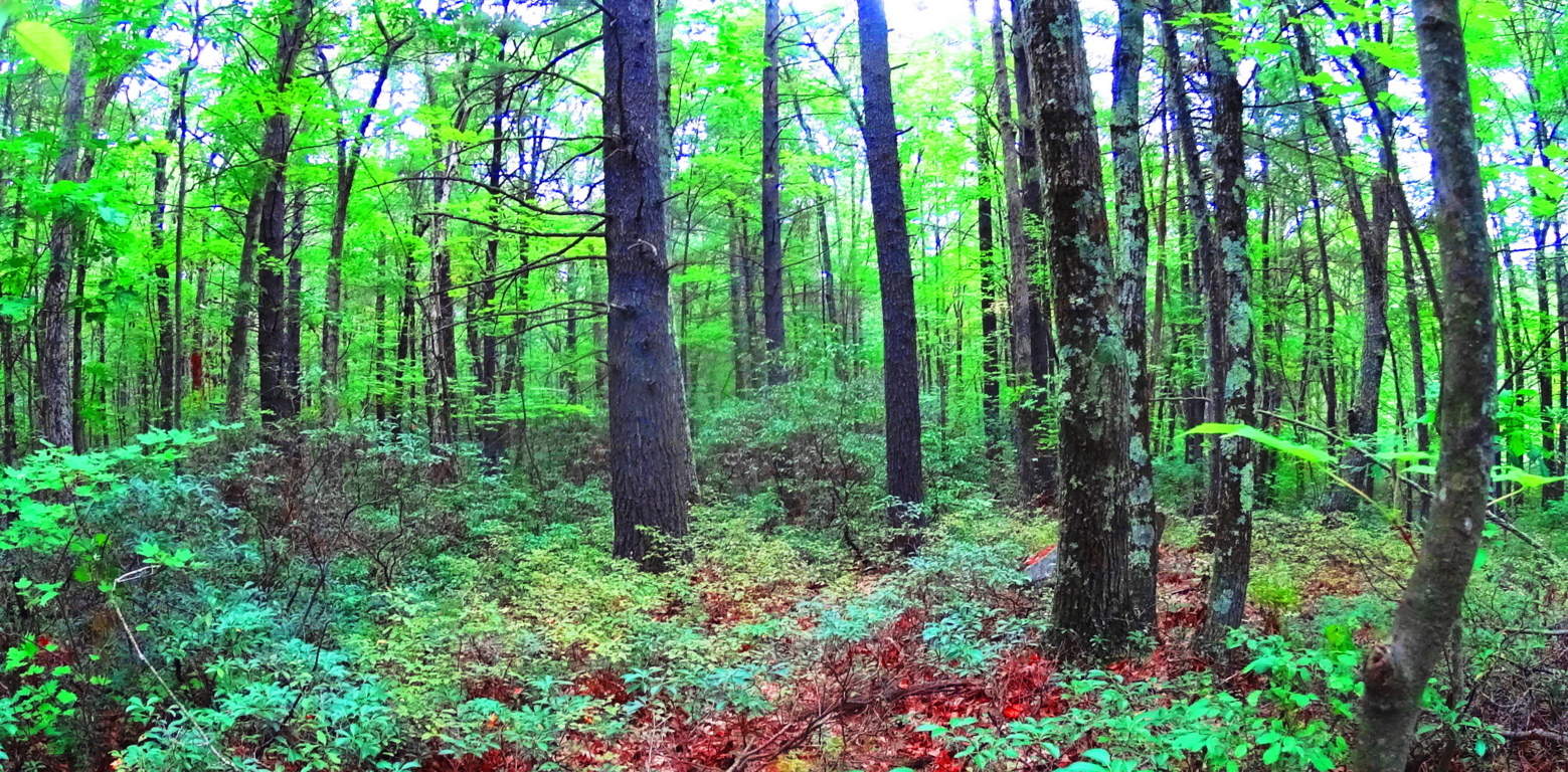 Continuing west on the elevated trail there are minature ledges with tiny pillars creating a tiny cavern on the underside of the precipice (image below)…
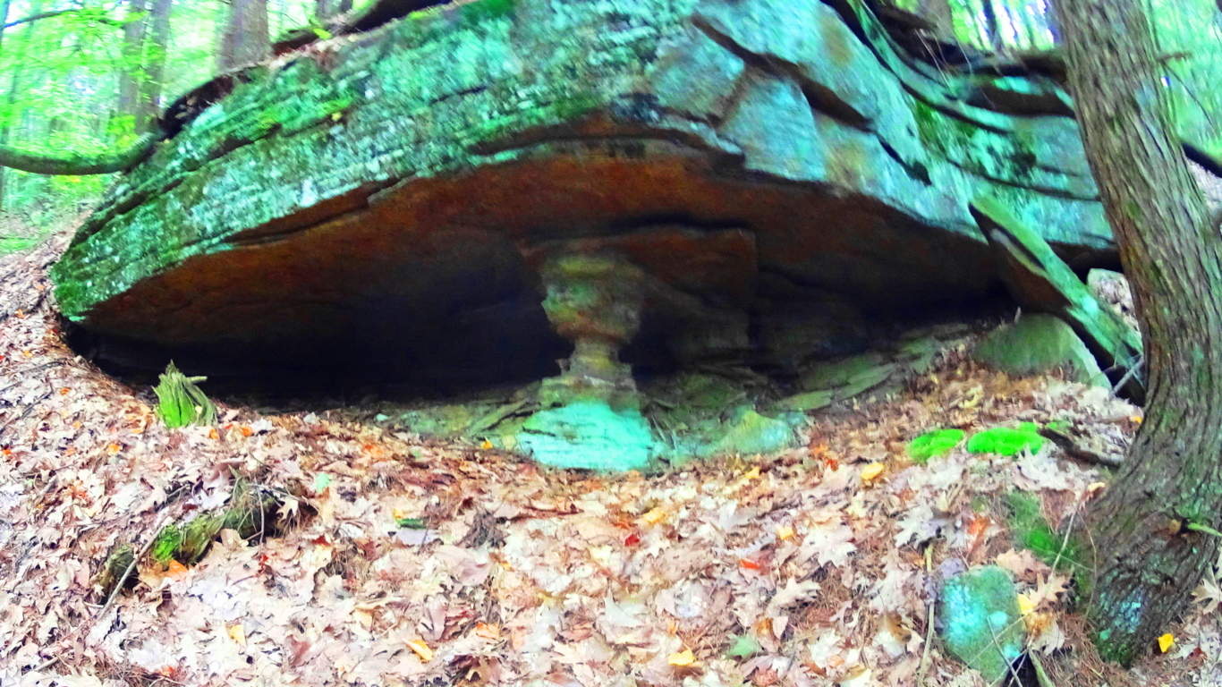 At Cavan Burren National Park in Ireland, where there are some of the most astounding Celtic megalithic monuments in the world, there are also notable stone ledges with the small pillars creating a cavern beneath the tiny granite ridge (image below)…
 After passing these curious small pillars the trail continues west for about a mile, where other large flat cliffs emerge to the north. These gigantic shelves are layered in loose parallel shafts for 50 to 100 yards each, at about 45 feet in height. (image below)
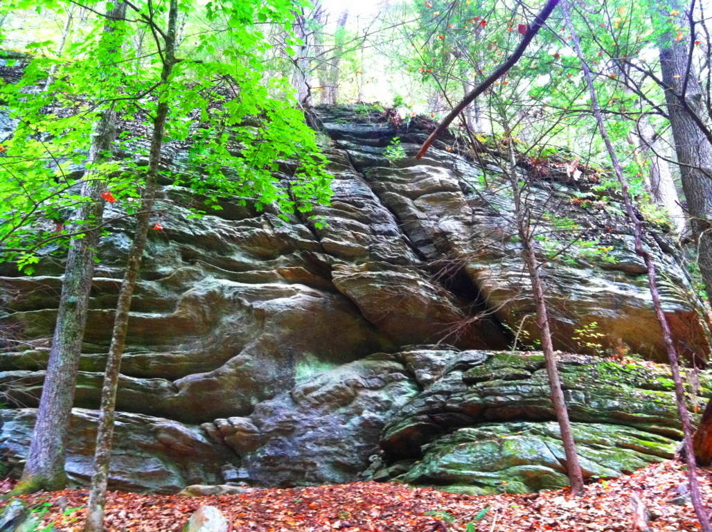
In some places there are small standing stones at the edges of these small cliffs (below)…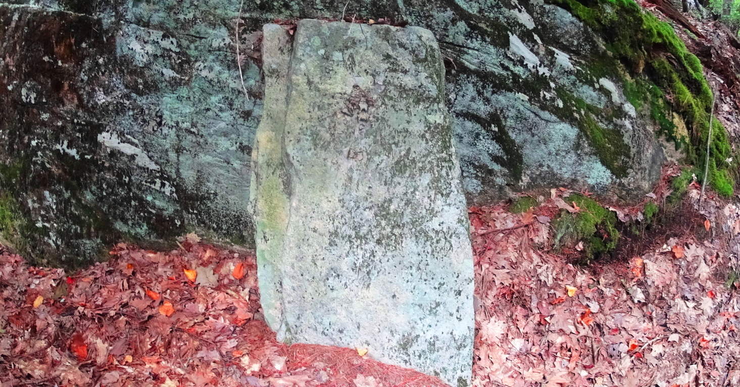
A similar stone in the historically megalithic town of Upton stands, just like this stone in Rattlesnake’, along a large stone-lining near the ancient Upton Chamber (below)…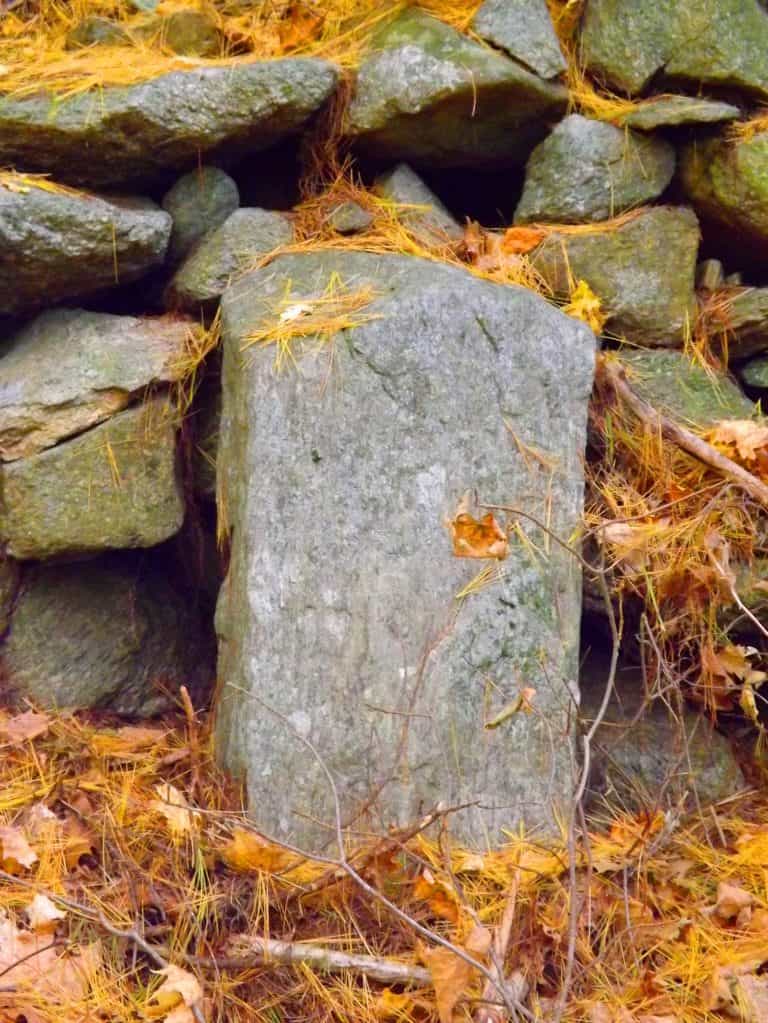
Keep in mind that these are not “small” stones, they are cut and crafted granite pieces that go as far into the ground as they are above; and they are perfectly squared. They are clearly a cultural marker of some kind created in antiquity. You will continue to follow the trail west until it turns left again, towards the western edge of the Farley Ledges, where the best lookout of the trail is found after about another 1/4 mile. The woods on this western edge of the trail are massive shelves and boulders overgrown with classic New England Fauna (image below)…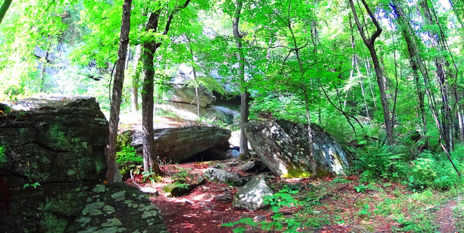 At the western extreme of the trail, over looking Route 2A, is the southerly view of the heart of Massachusetts (image below)…
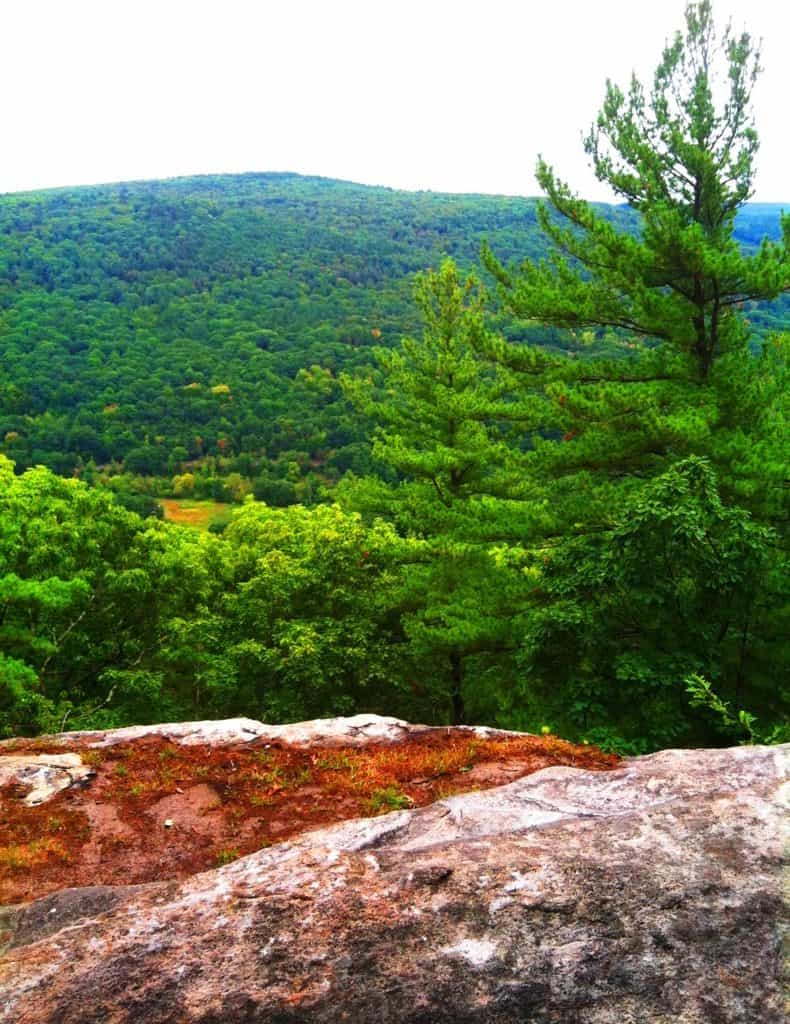
After taking in this view, the last portion of the loop descends back along Farley Ledge to the east. There are miniature canyons below, and gigantic granite walls slicing through the hills (image below)…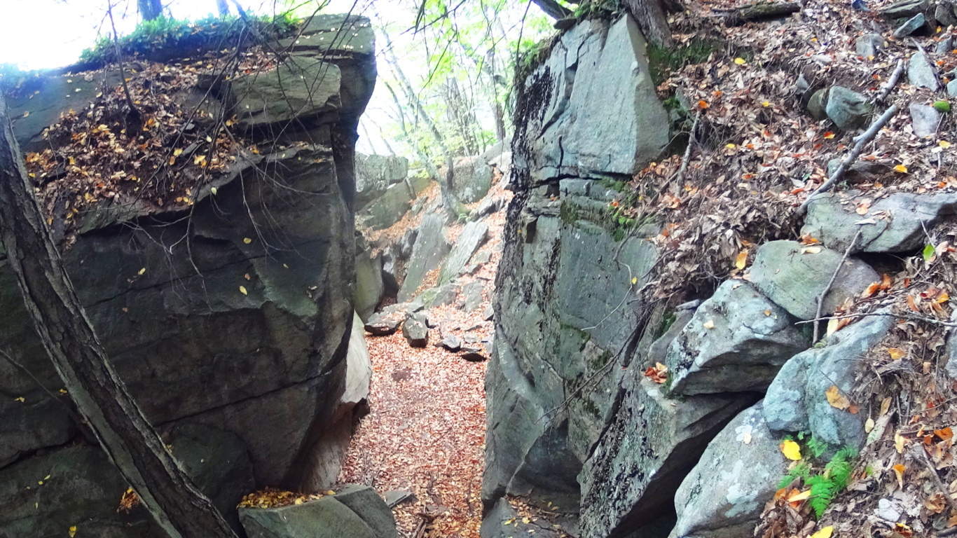 You will eventually come to a lower crossing of the stream at the eastern edge of the trail, then head back down to the megaliths below at Farley Ledge.
Rattlesnake Mountain is yet another example of classic New England hiking that combines practically magical megalithic statements in the forest and mountains with a pristine hiking experience. Time after time, forests and mountains of Celtic and New England places reveal a related megalithic mystery yet to be acknowledged by so many academics. Rattlesnake is clearly one of these sacred places, and it will grant the hiker a vision of something miraculous, something which is calling out to us from a culture that left its mark in a way that will never fade. You can touch these signature stones yourself, see the size and scope of them, walk the trails, and simply wander right into the hallowed wonder of it all.
The Conwy Valley
 Location: Rowen, Wales
Elevation: 1,500 feet
Note: Hiking experiences in the ancient Celtic high country of Wales are, simply put, breathtaking. Snowdonia National Park deservedly hosts a substantial amount of visitors in the north-west portion of Wales, centered around the majestic Mount Snowdon, which is the highest peak in the British Isles south of the Scottish Highlands at 3,560 feet. The history of Wales is interwoven with the preservation of Celtic peoples to its core, known as the last bastion of land that Celtic chieftains would not concede to the invading hoards of Gauls, Visigoths, and Vikings after the Roman withdrawal, circa 410 C.E. The Arthur Legend was born here. This is the very land that King Arthur and his knights defended to preserve the Celtic peoples. This landscape is the original backdrop for the Knights of The Round Table, for Sir Percival’s search for the Holy Grail, King Arthur’s battling of giants at the foot of Mount Snowdon, and Sir Gawain’s search for the mystical Green Knight, among hundreds of other wonderful tales. The countryside has a time honored mythical history that seems to have always inspired adventurers that reach boldly into the next valley for wonderful and magical zones. With that in mind, just 45 minutes north of the popularized Snowdonia tourist scene, sits a more conspicuous, but no less beautiful, opportunity for a truly rustic Celtic hiking experience in the serene Conwy Valley. At the top of this valley, above the small medieval town of Rowen, sits one of the most beautiful Dolmen’s in the world, the Maen Y Bardd Dolmen, and the hike to see it is epic. 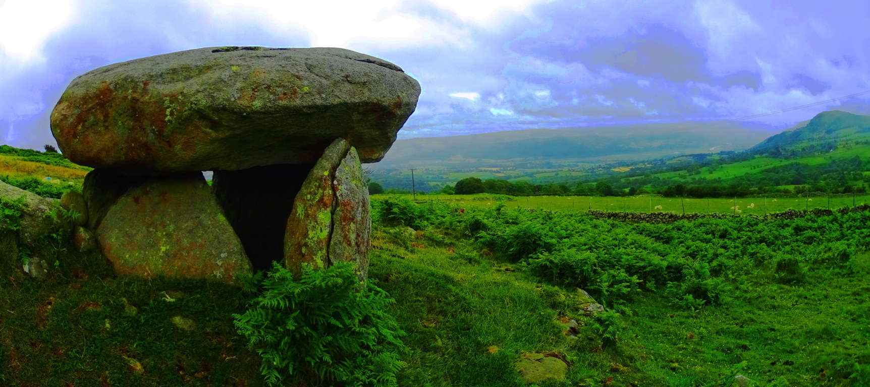 The Legend associated with this particular Dolmen is that of an ancient giant that would toss spears from one end of the Valley to the next, asserting his claim over the landscape, warding off any trespassers. In order to get to the Dolmen a hiker must follow a Roman road that runs beside the spot where it sits today, indicating that this megalith has existed from time immemorial. The Roman incursion of Wales took place around 40 C.E, and they were not known for the tender preservation of the opposing culture, yet they obviously let this Dolmen stand as they passed by. I can only think that they themselves saw that the Dolmen was sacred. The Roman’s were certainly aware of megaliths throughout the known world, and they were perhaps the most aware having conquered so much of it. There are Megaliths in Israel, Greece, Spain, France, England, Scotland, and Wales, and the Romans would have considered them. It’s makes sense that they would have known that the Dolmen had stood for perhaps as long as 3000 to 4000 years prior, and they simply did not dare to destroy something so rare, especially if it had no strategic purpose. In terms of ‘era’s’, this is a hike that will take you from the Modern, to Medieval, from Medieval to the Roman, and from the Roman to the Celtic, all in one day.
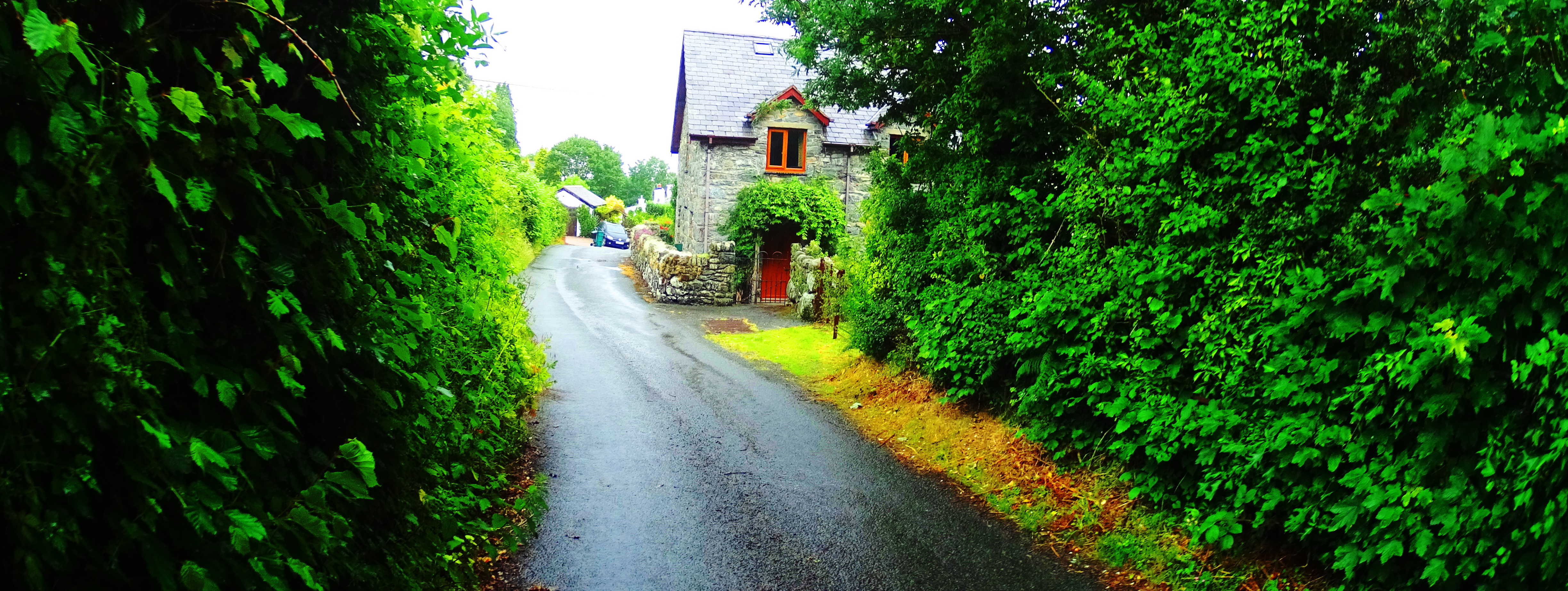 To begin get an early start, and park in Rowen. Head towards the Gwersyll Cefn Cae Campsite road, and pass by it on your right. Continue to follow this road out of town and follow the first farmers-road slightly left towards Parciau Farm. Pass by the last farms on the edge of town to where the road narrows into a country lane, slowly elevating through classic moss blanketed Celtic forest.
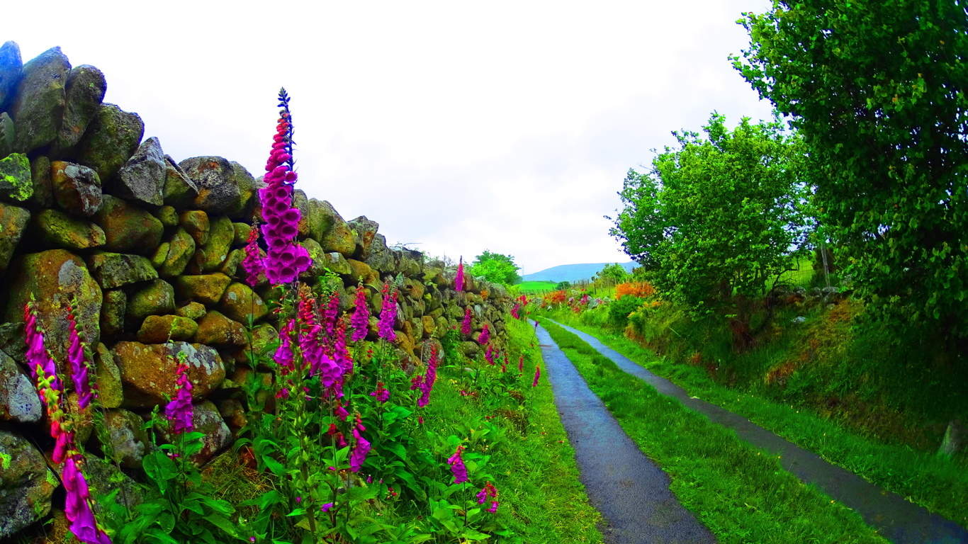
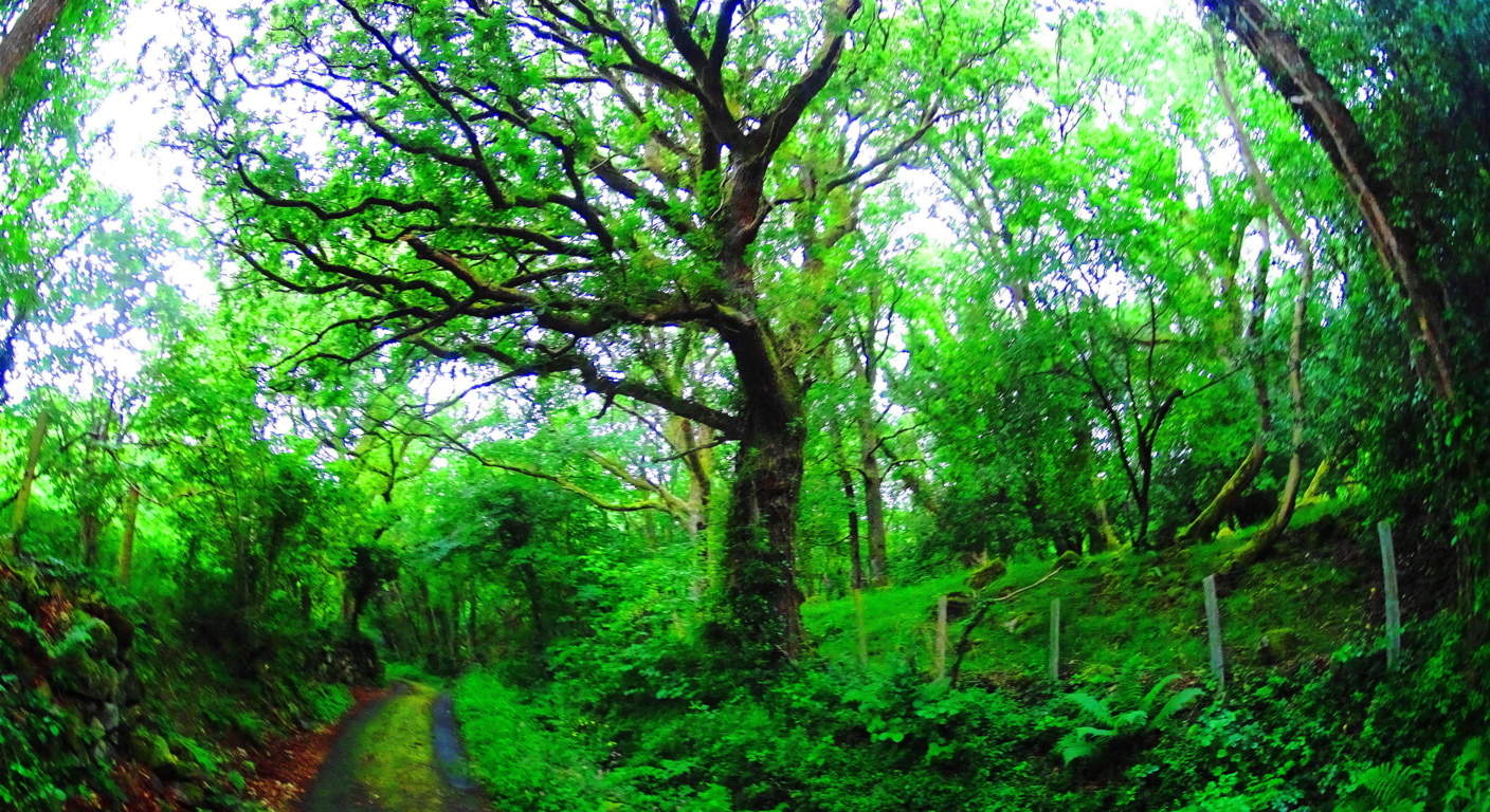 Push for roughly 1 mile through the trees to get above the tree line, where the path changes dramatically. Your trail will become lined with stoic stone-walls and Hawthorn hedges. Knolls and free-standing boulders emerge in every direction. Flocks of sheep scatter and glance from a distance. Fairy Foxglove flowers emerge all around with their striking and small lavender towers.
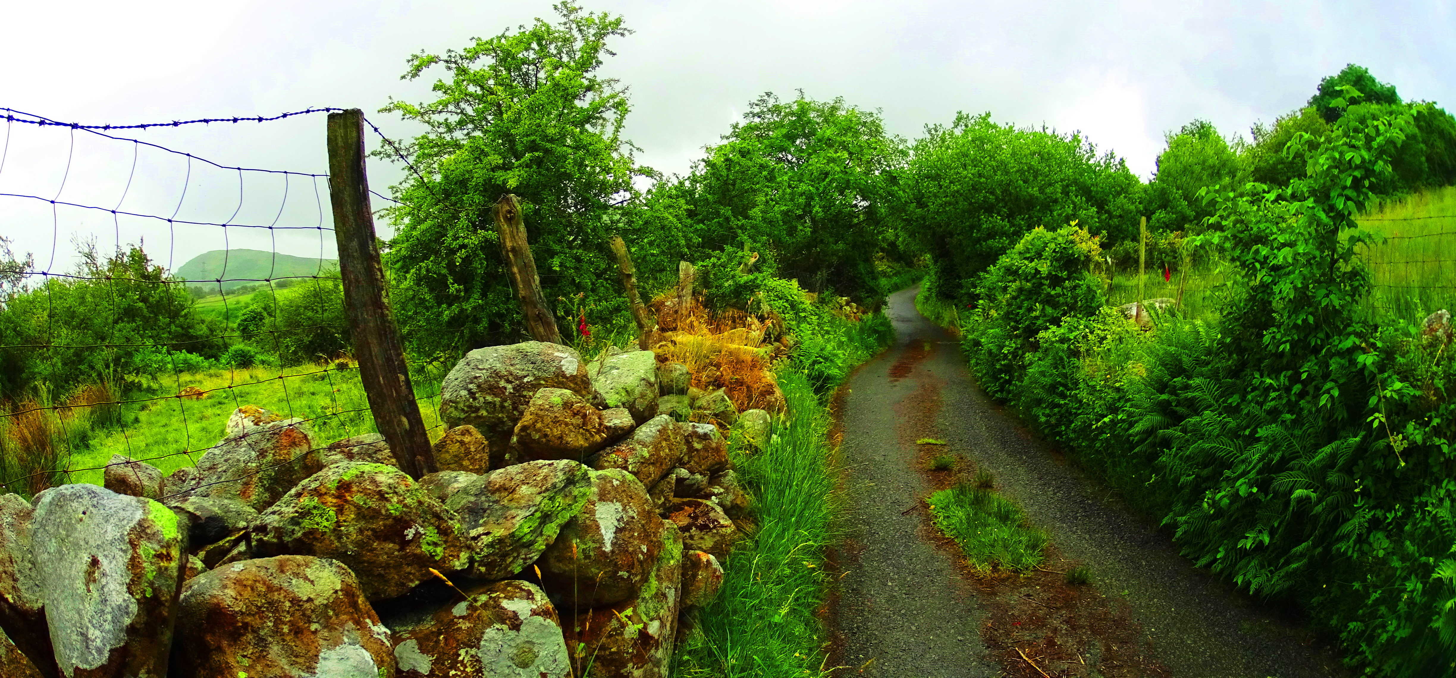 The valley begins to emerge in a beautiful way. Continue for about a mile on this path and you will finally come to an elevated intersection with a panoramic view of the valley.
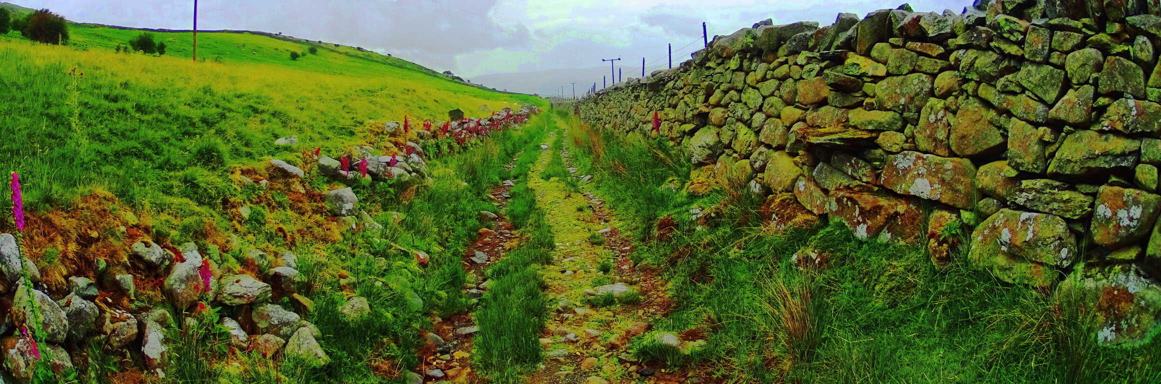 Take the path to the right here, further upward, which is lined with another solid stone wall on your right. You will see, straight ahead and slightly above you, about 1.5 miles away, another road lining the valley above. This is the old Roman road. When you reach this ancient rocky causeway take a right, then follow it for about 1/4 of a mile. On the left of the causeway you will first see a beautiful 8 foot high, 3.5 feet wide granite Standing Stone, roughly 40 yards away.
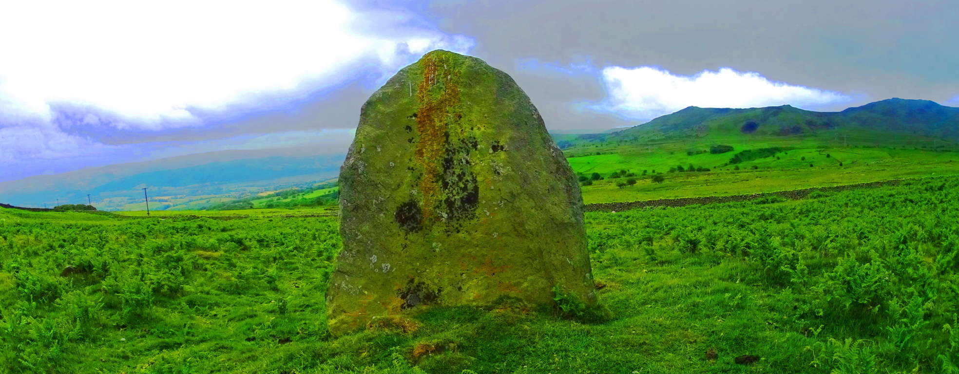 After stopping to appreciate this magnificent stone, continue in the same direction further along the Roman road, and look left again. The Dolmen sits about 50 yards away and can be seen from the road facing the valley below. It is a sight to behold. This is a classic “Portal Tomb” of the same era as the legendary Poulnabrone Dolmen in The Burren Ireland , across the Celtic Sea. Although it may look somewhat small against the broad valley, a closer look reveals a capstone weighing at least 5 tons.
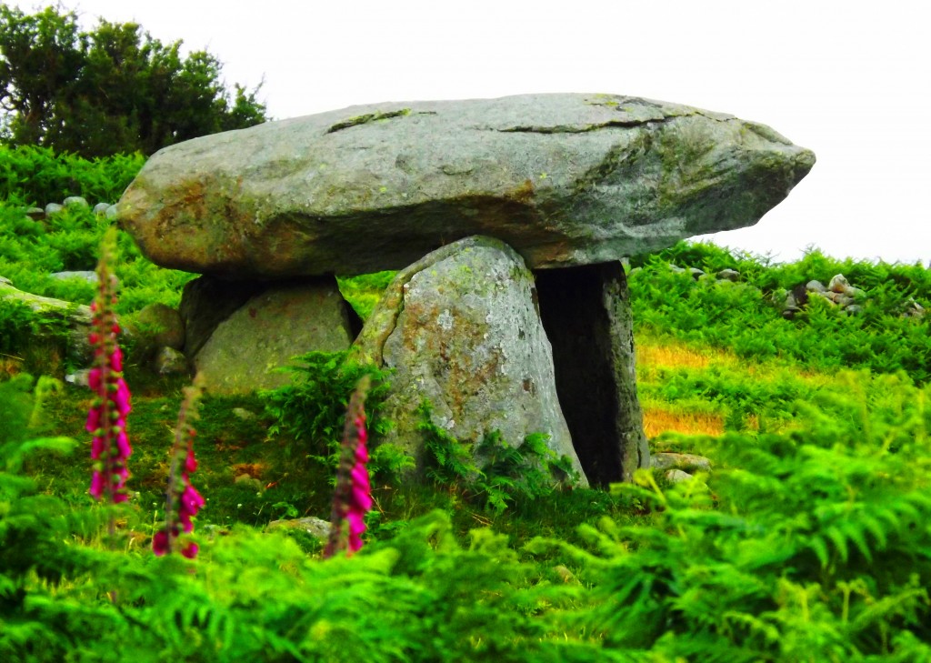 This capstone is directly aligned to a beautiful peak roughly ten miles away across the valley. This is a trait that most Dolmens display: the facing of the most beautiful vantage in the area.
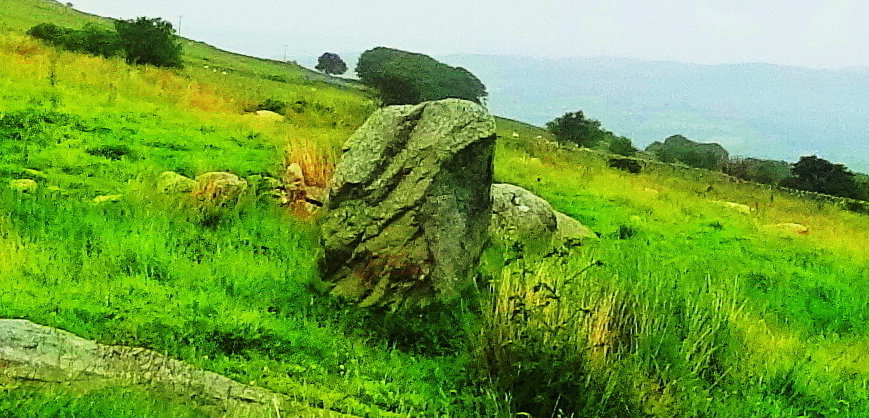 This would indicate that whoever built this Dolmen, even in deep antiquity, had a wonderful sense of Beauty, not to mention the engineering skill to build a megalith at a significant, and somewhat secluded, elevation. After finding the Dolmen hikers have several options on the return.
 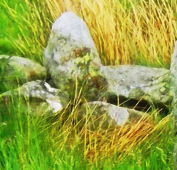 You could continue along the Roman road for about 3 miles and veer to the right, back to Rowan, or go back the way you entered. If you return the way you came, just off the trail, there will emerge other standing stones, much more discreet, but no less significant, mixed into the hedges and knolls. This second Standing Stone stood along the long farmers road connected to the Roman road, 30 yards off to the left. Standing about 7 feet high and three feet wide; It looked to weight at least 5 tons. It has a significant curved incision on its right side, and the remaining piece from that incision was set as a fixture behind it, just to the left.
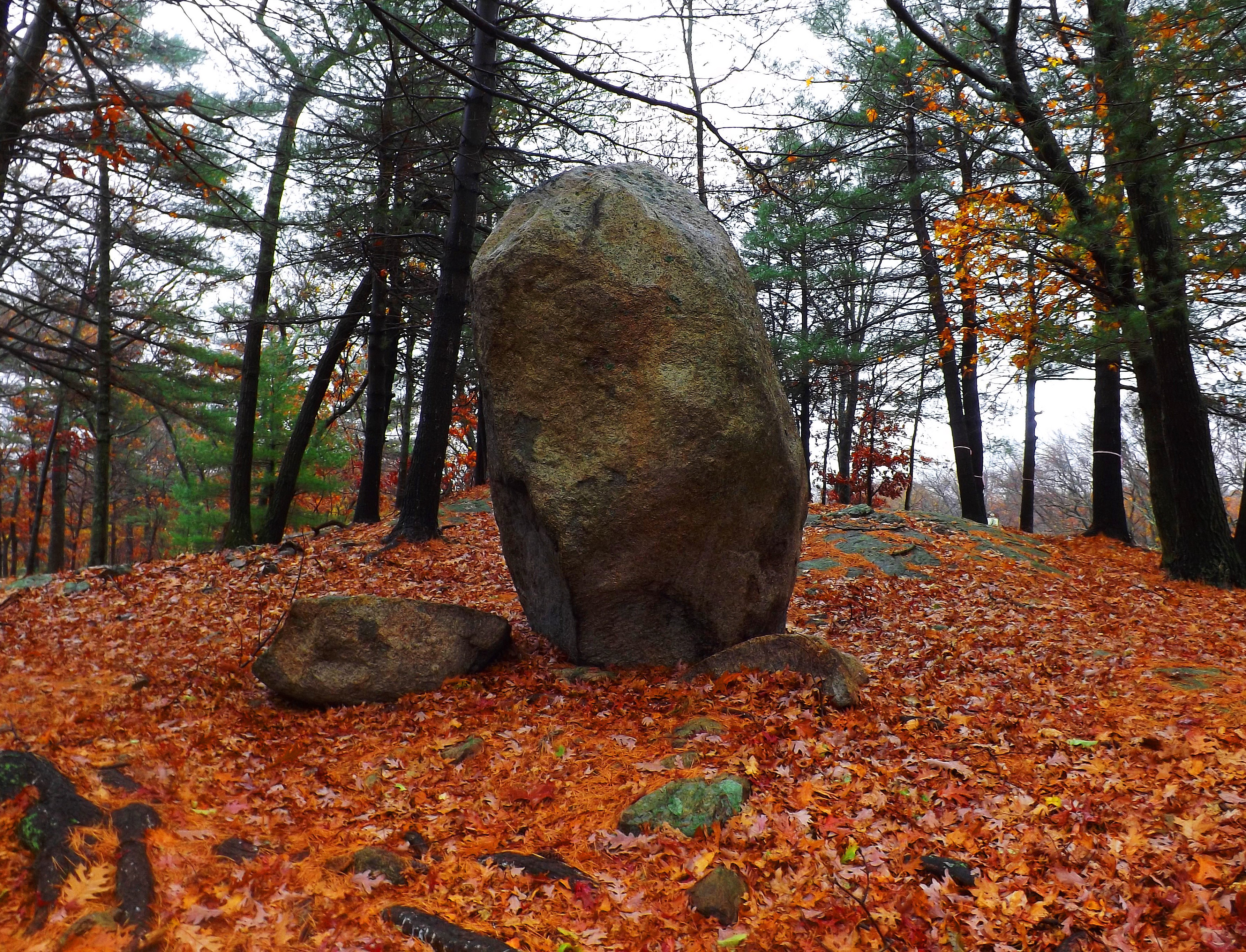 This style can be found at a Standing Stone far across the Atlantic ocean at Lynn Woods in Massachusetts, where cut pieces from the main Standing Stone remain as fixtures in the immediate vicinity (Shown here in the red/orange leaves on the left). Another incredible option for your descent are the stone labyrinth pathways that wind down the valley like something out of a dream.
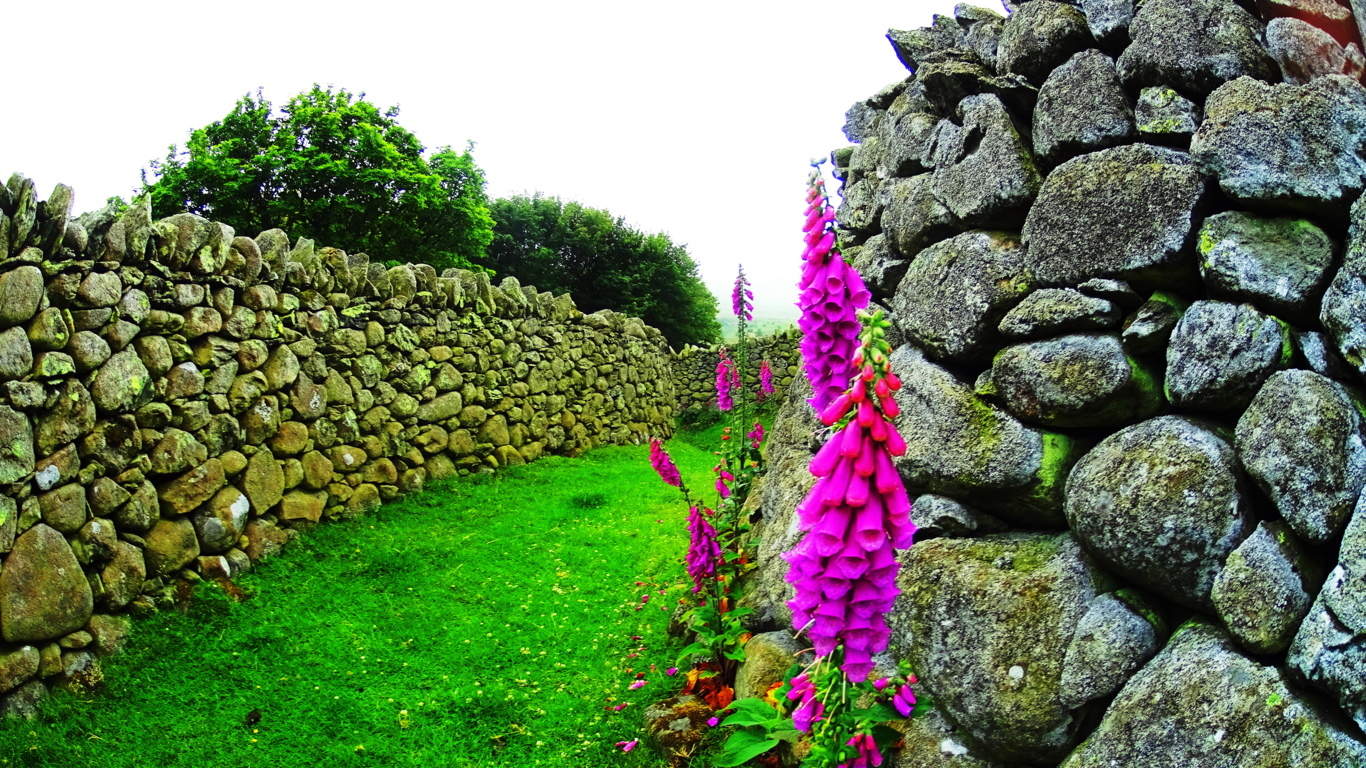 If you choose to explore these options make sure you hike responsibly and mark a fixed point in the landscape in order not to get lost, or even better, bring a compass. The valley is massive; Hiking this high above Rowen there is a good chance that you will be the only individual(s) for possibly five or six miles in every direction. This particular pathway came out near the farmers road that ran down to the forest, just before the farms of Rowen, but be mindful that others exist, and in the valley there are unknown exit points. With all this considered, enjoy the exhilaration of what is obviously a sacred landscape that we know, due to the megaliths it contains, has been appreciated for an incedible span of time that literally reaches back beyond recorded history. This place truly reminded me of a valley in the game Skyrim I love so much. Seeking it out was an achievement born of the inspiration taken from that game, sitting in my room in the dead of winter four months earlier, dreaming of Celtic valleys in Summer. I have to pay it tribute here. If you can dream of these places, you can find them. Seek and find.