Heath Altar Stones
 Loc
Loc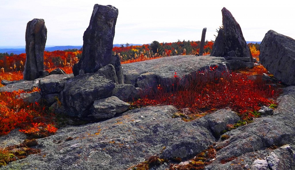 ation: Town of Heath, Massachusetts/USA
Note: The Heath Altar is an incredible Megalithic Period statement, set squarely at the top of a quartz riddled hill, in the town of Heath, in Western Massachusetts. When I took the photograph for the cover of Glenn Kreisberg’s interesting book about ‘Megalithic America’, I did so on my own, without asking permission. I did this because I believe that the Heath Altar is a National Heritage Site, not a rock-pile to be guarded by “KEEP OUT OR GET SHOT’ signs of some old and bitter son-of-a-bitch, in his rocking chair. If any researchers have a problem with this action that I took, get in touch with me via: jpv@stonestrider.com, and we can talk, face to face. Otherwise, grow some balls, and do the work yourself. And check out the book, its an important work for people interested in this megalithic thing’;)
Sad Note About America: America has become a scary place, filled with control freak legislators and rule makers, and Facebook-tough-guys, with a spineless, utterly malleable population of cowards, and forgetful bots, that literally no longer think for themselves, or challenge any authority or narratives. These researchers now talk about me on their corny, stuffy, presumptive websites, and on Facebook, like schoolgirls. Well guess what, local Massachusetts researchers who have never taken a single chance for their research, or ever climbed a single mountain, or spoken with a single farmer in the fields; I’m not waiting around for your dueschbag approval, or anyone else’s, for that matter. I want to find sacred places and see them, up close, for myself. I want to collect evidence, up close. I took pictures inside New Grange, even though the signs said not to; and took pictures at The Heath Altar, because thats exactly why these monuments were left behind, to be studied up close, by us. I don’t have time for the fake researchers, and the bureaucracies of the World ruining everything, to approve. And guess what, I got the photograph for the cover of this book, and inside New Grange, because I had heart. Deal with it.
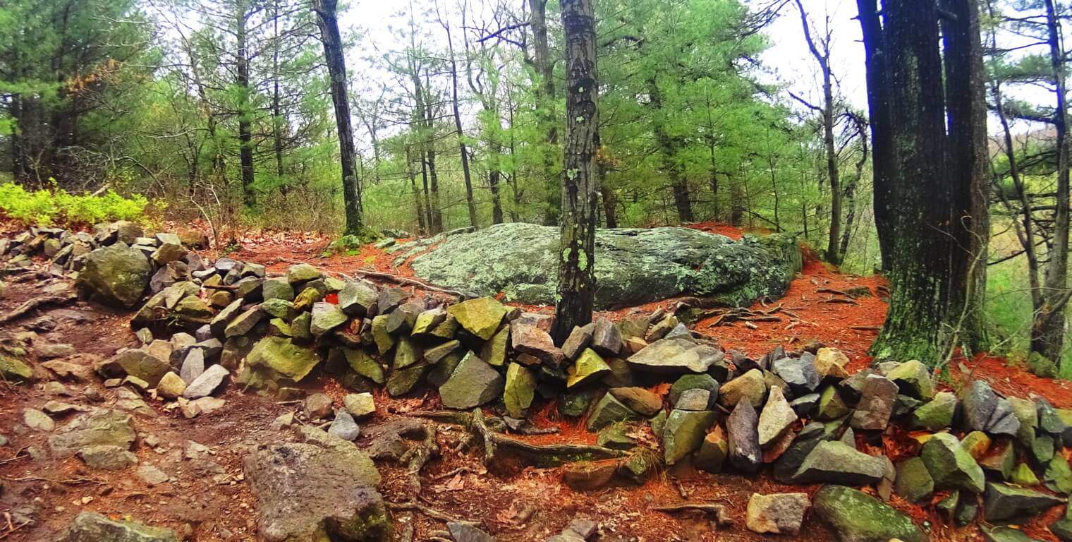
Altars: There are laymen researchers here in New England who struggle with the identity of the makers of this Altar. The ashlar-cut boulders go as deep into the ground, as they do protrude. These boulders are lock-set, like a key in a keyhole, and are too heavy to budge. These stones are set around a square flatted slab of granite, that looks much like a table for performing any amount of varies actions. Local researchers pushing the narrative that Native American tribes built this place, have completely disregarded mass amounts of evidence from similar constructs in Megalithic Ireland, England, Wales, Scotland, France, Italy, and Greece. The Heath Altar is a Neolithic Period construct, created by a Culture that embraced working with massive stones, all throughout New England. The similarity of The Heath Altar, to European Altars, is beyond argument. Below is an image if the Laraghirril Altar Stones, in Ireland. The similarity is un deniable, and has nothing to do with “Native Americans”. 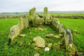 The Celtic Native Tribes did not build the Megalithic Altars in Europe, just as the Native American Tribes did not build the megaliths in America. There was an earlier Culture, with specific memes, logos, and cultural morays, that can be related through directly connecting the blatant symbolism, and coding, of the construct of the megaliths. The abundance of evidence is what this website is about. Look at the most recent discoveries and recent stories; the evidence is there. Equilateral triangles cut not granite, orientations of stones, stone-linings running straight up mountain sides, all of megalithic size, and scale, with quartz harvests in the stonework, along with celestial orientations; all present in the megalithic works. The megaliths show scientific/mathematical evidence of being present long before Celtic or Abenaki/Iroquois Tribes existed in regions where they stand. Just deal with it. The beautiful Native American tribes in the Northeast United States were seasonally nomadic, minimal in their possessions, averse to ego-driven labor and taking constant orders, and humbly simple in their technology and tools. Native Americans do not claim to have built this Altar, and they shouldn’t. The Heath Altar was built by the Megalithic Culture, the first culture on Earth.
 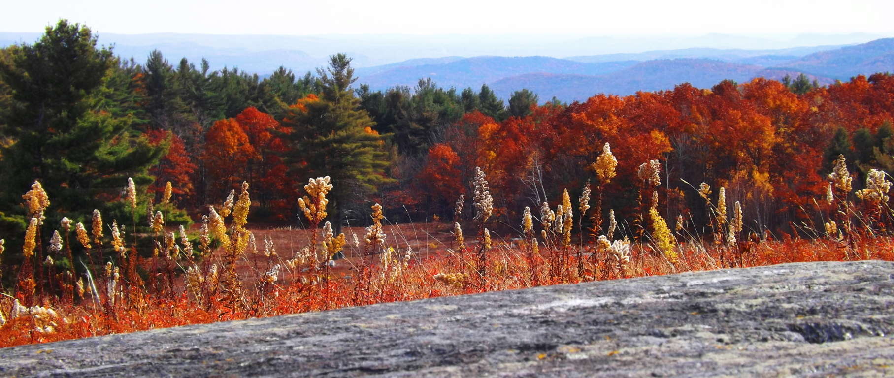 The Town of Heath: The rustic countryside on the boarder of Vermont and central Massachusetts, on the northeastern coast of the U.S, is as picturesque as any scene. Small mountains, rocky hills, Pines, Birches, and Hemlocks, all dot the landscape. The four classic seasons flux distinctly in this part of the world, with a most captivating Autumn.
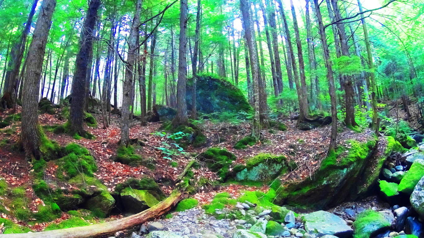
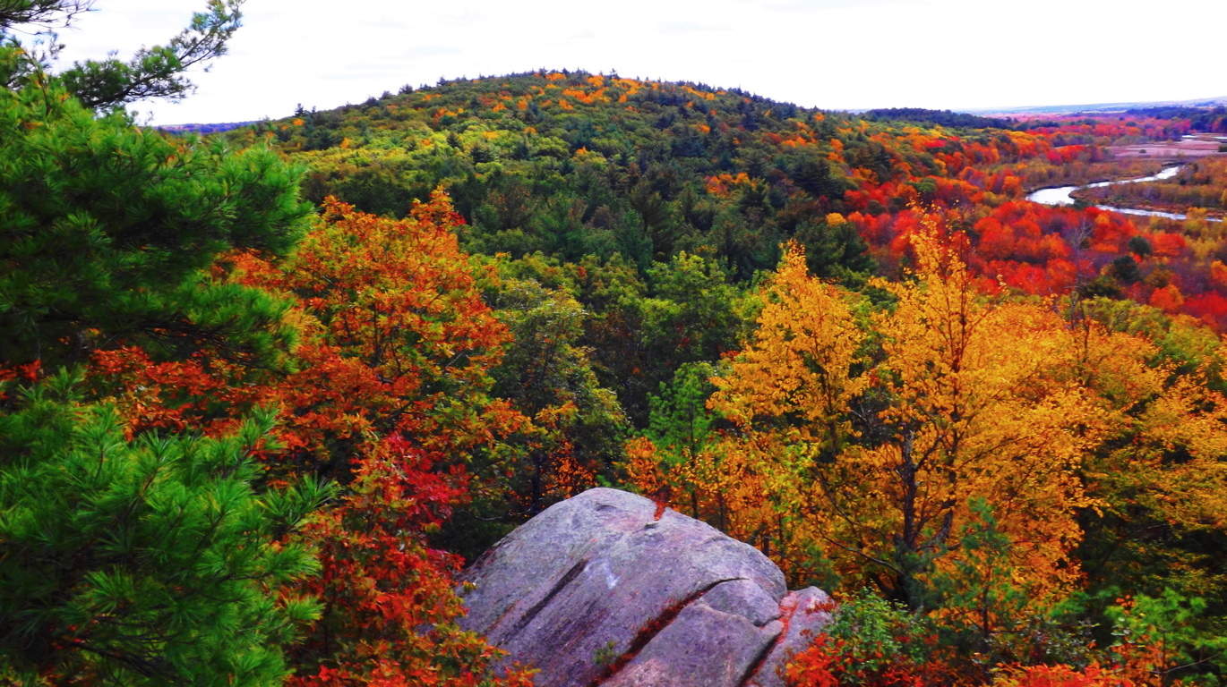
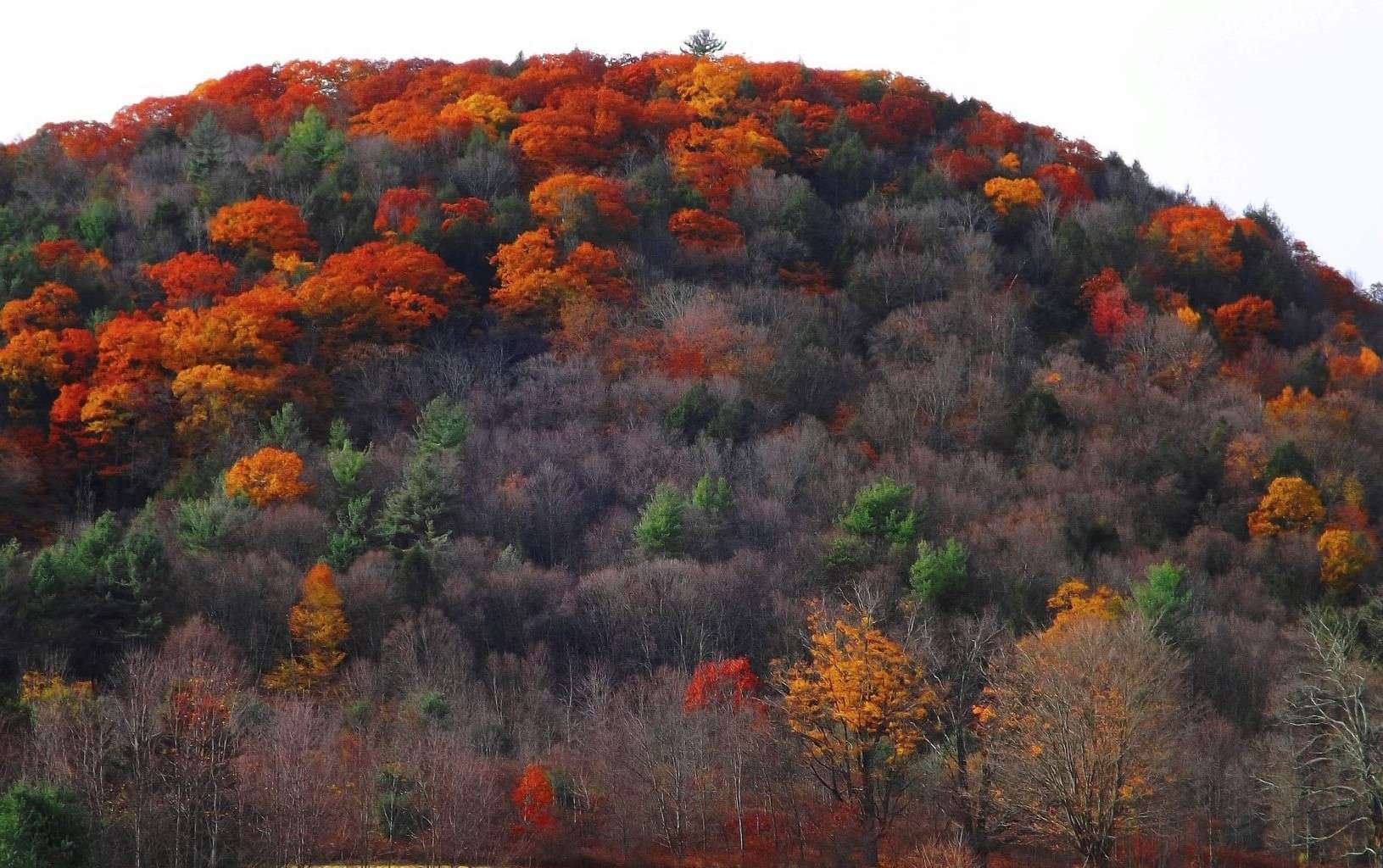 The Green Mountains of Vermont are 15 miles northwest of Heath, along with state preserved trails at Mount Watatic, Monument Mountain, Savoy Falls, and Bears Den, are all within an hour of here (and featured on this site). New England’s first layer is the Megalithic Stones and its Culture. The second layer is the Native American movements, and seasonal migrations, with minimal effect on the landscape. The third layer became the Colonial invasion, and the fourth, and most dominant layer, is of course the modern sub-urban domination of towns and small cities, uprooting and confusing the true history of the landscape in so many regions. But there are still distinct signs and works of the megalithic Culture in the untouched areas, and it is like this in many parts of the world. Where there in modernization, we find megalithic stone works.
  For example, along the streams approaching the area in Heath are megalithic scale irrigation walls that provide ‘pivots’ in the landscape for streams to flow by. This 12 foot high, and beautifully leveled, work of irrigation is only 4 miles from the Heath Altar, adding to the mystique of the overall area.
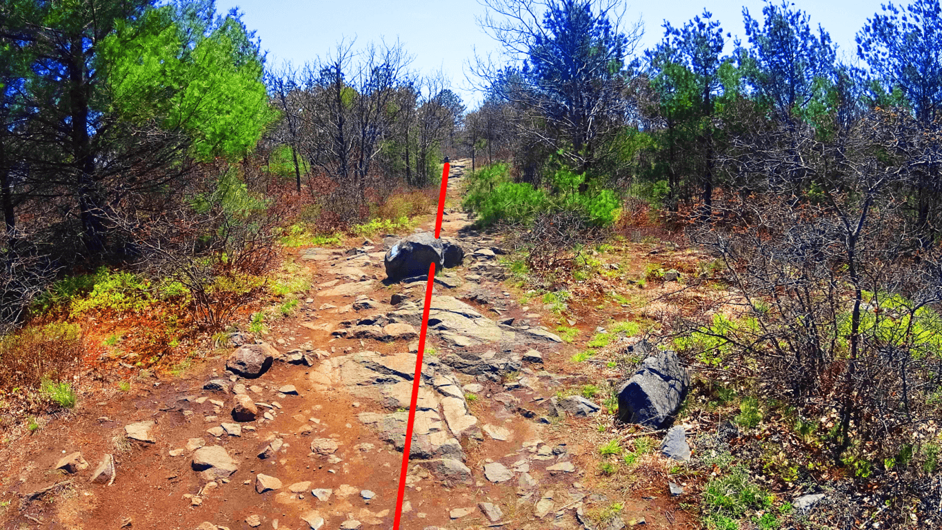
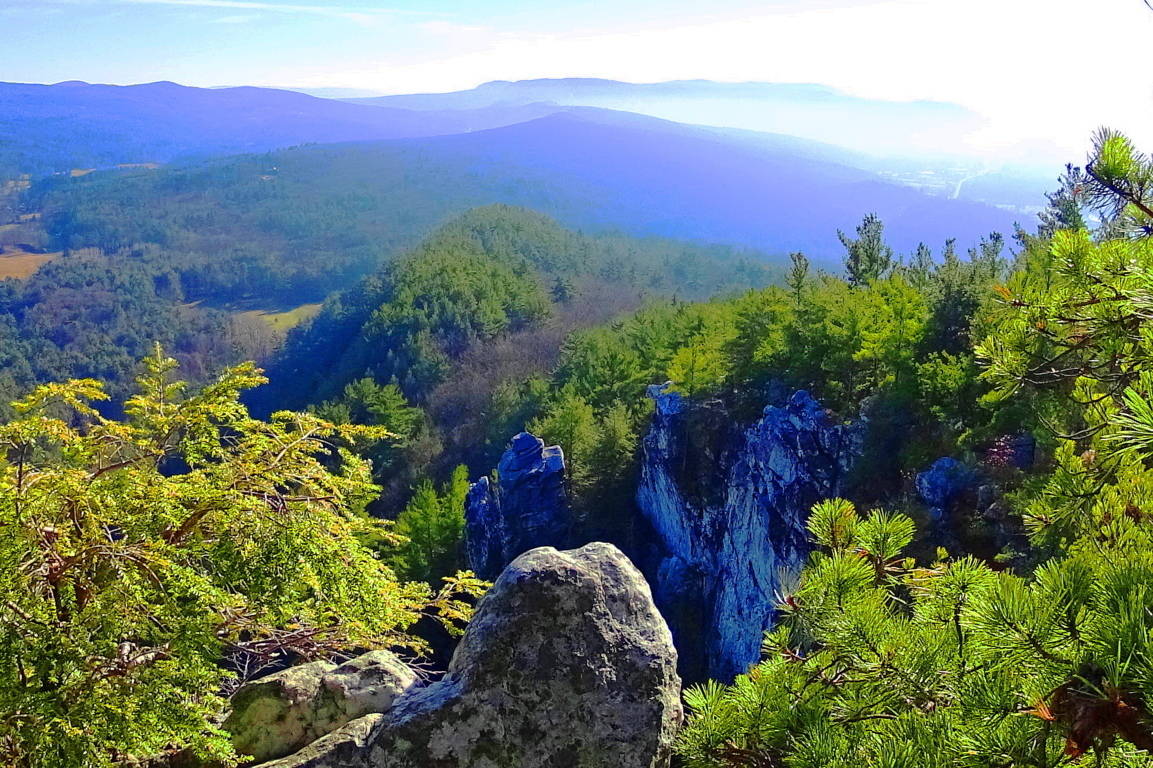
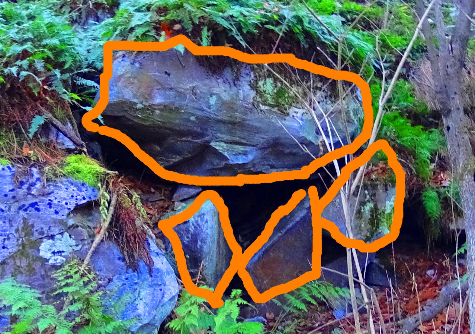
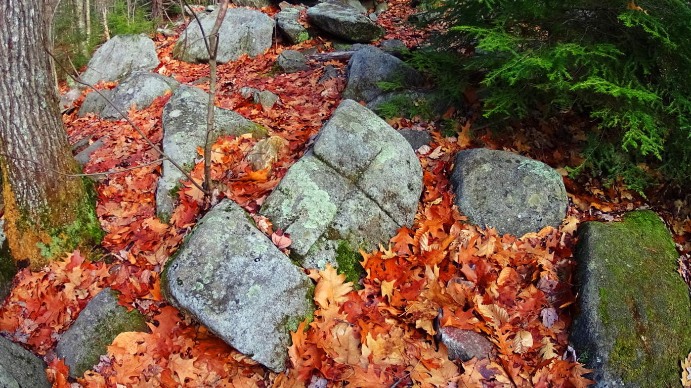
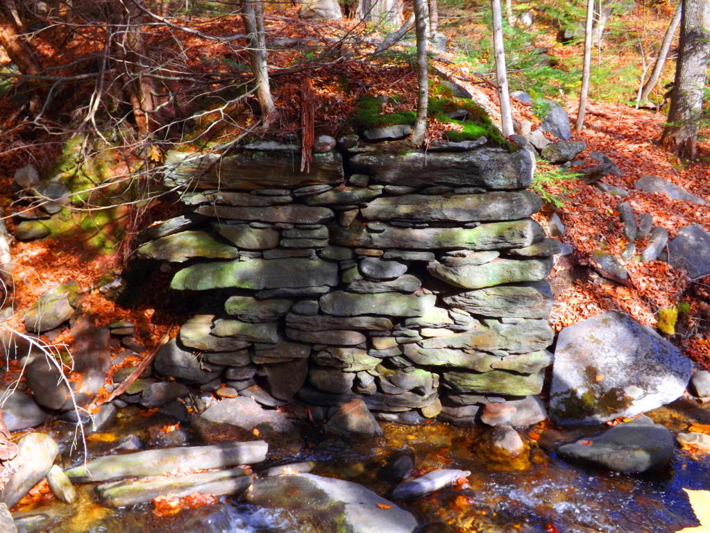 The dry rocky plateau on which the Heath Altar sits radiates hallowed vibrations. This is among the oldest cultural structures on earth. There is a loose symmetry to the scene, with a bed of flat granite at the highest point of the broad hill, guarded at each of it’s four corners by deeply incised, and notched, standing stones. The standing stones here are not flimsy, as depicted in most old articles. These are broad and intimidating megaliths, which can be seen here. (Image/Below) This is the photographic justice this site demands, capturing the grandeur of the overall area as well, not obscured images from old newspaper articles, or desperately zoomed photos from 100 yards away from fearful on-lookers. Everything about this place says Megalithic, not Colonial farmer’s “pet project”, which is what many writers and researchers would also have people attributing credit to. In the United States, the idea of colonials having possibly built these megaliths is often mentioned. It is infuriating, and totally irresponsible. Nothing about this area says ‘colonial’, or Native American, for that matter.
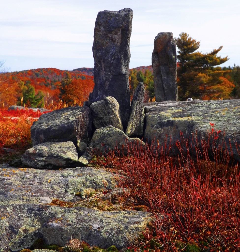 The standing stones are each about 6 feet in height, and a single foot in width. Just beyond the Altar is a fifth standing stone that serves as a kind of head-stone. The ‘stone table’ may have served to support a bonfire, or perhaps it was more of a literal ‘large table’, used for sacrificial rites, or skinning hunted game. Whatever happened at this spot, the builders of this place made it distinct, so it is clear that this was considered a sacred place.
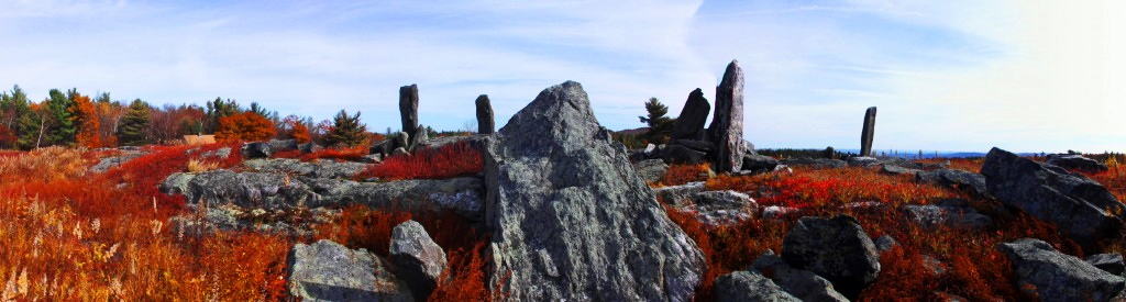 Radiating away from the Altar are smaller standing stones.
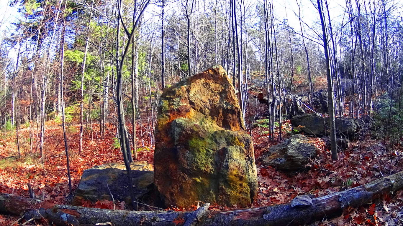
Smaller Standing Stones near by: Here is look at a smaller white marble, 3 feet tall standing stone, almost 50 yards from the top of the hill. Stones like this may have served as a boundary, or warning stone, for others approaching the Alter. It is obvious that this particular stone was also chosen for its beauty.There is also a distinct possibility that these smaller stones are celestially oriented. 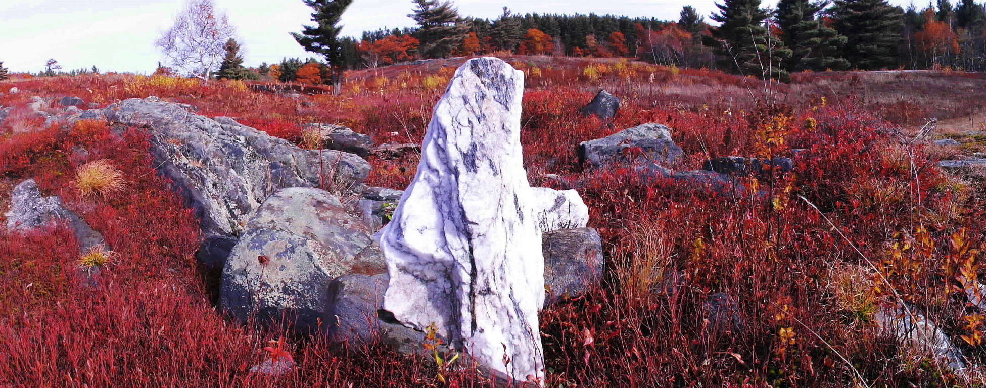 In another area away from the Altar site, possibly fixed to the northerly cardinal direction, sits another standing stone, deep in the ground, and somewhat tilted. This one looks to have been about 8 feet long, although only about 3 feet is above ground, with a darker colored rock face pointing towards Vermont.
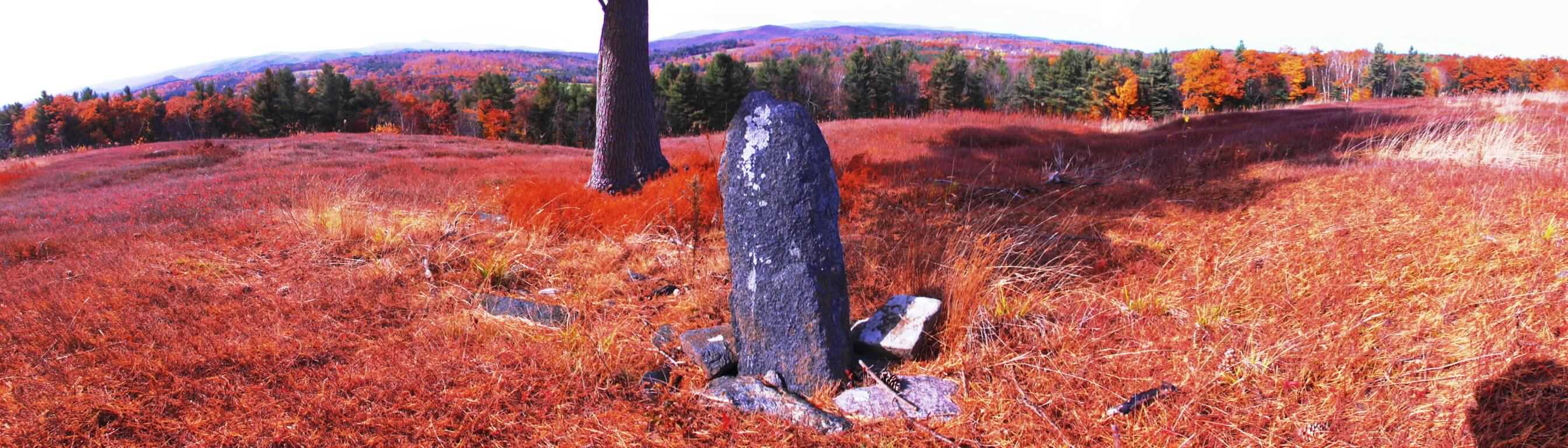 Facing cardinal South is another amazing standing stone that has a 45 degree angular cut, with an ‘arrowhead top’, standing roughly 3 feet high, and 6 inches thick. (Second Image/Below/White Color) This particular type of stone can be found in other parts of New England as well, supporting the idea that it is a singular megalithic culture that occupied this natural space. Pictured below is a massive 45 degree angle New England standing stone with the exact same dimensions as the smaller Heath standing stone. The area that the smaller Heath standing stone is directs our attention to is gorgeous.
 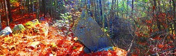 The trees here are stunning at this time of year. Notice also that even the flat granite stones along the ground seem to have been leveled and cut on their sides. The amount of cultural stonework happening here gives the area a type of energy, perhaps like at the Hill of Tara in Ireland, or at the Avebury stone circle in England. The feeling is just overwhelming that someone, a very long time ago, loved this place enough to mark it out in amazingly playful way, with massive stones, that would remain forever.
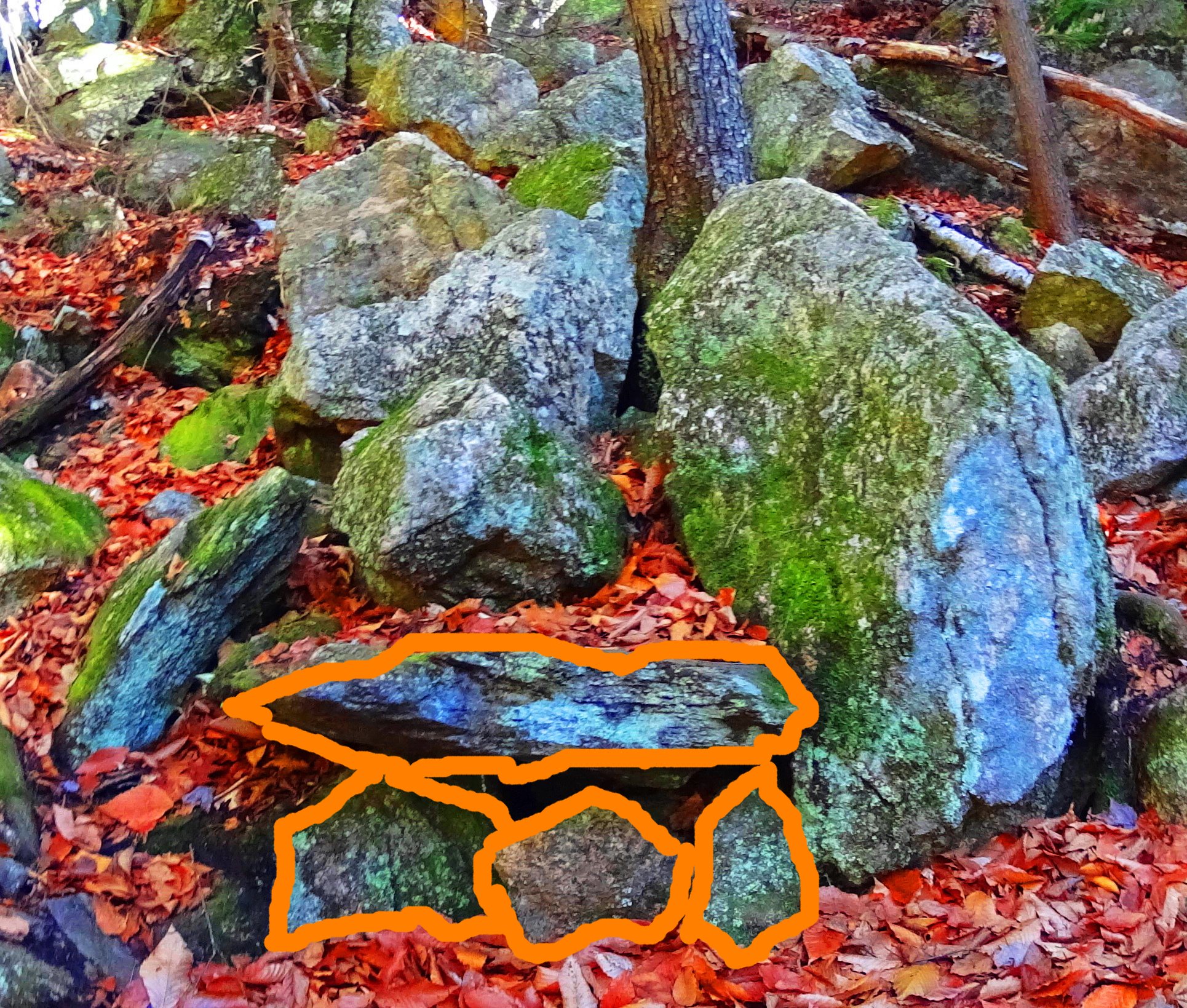
 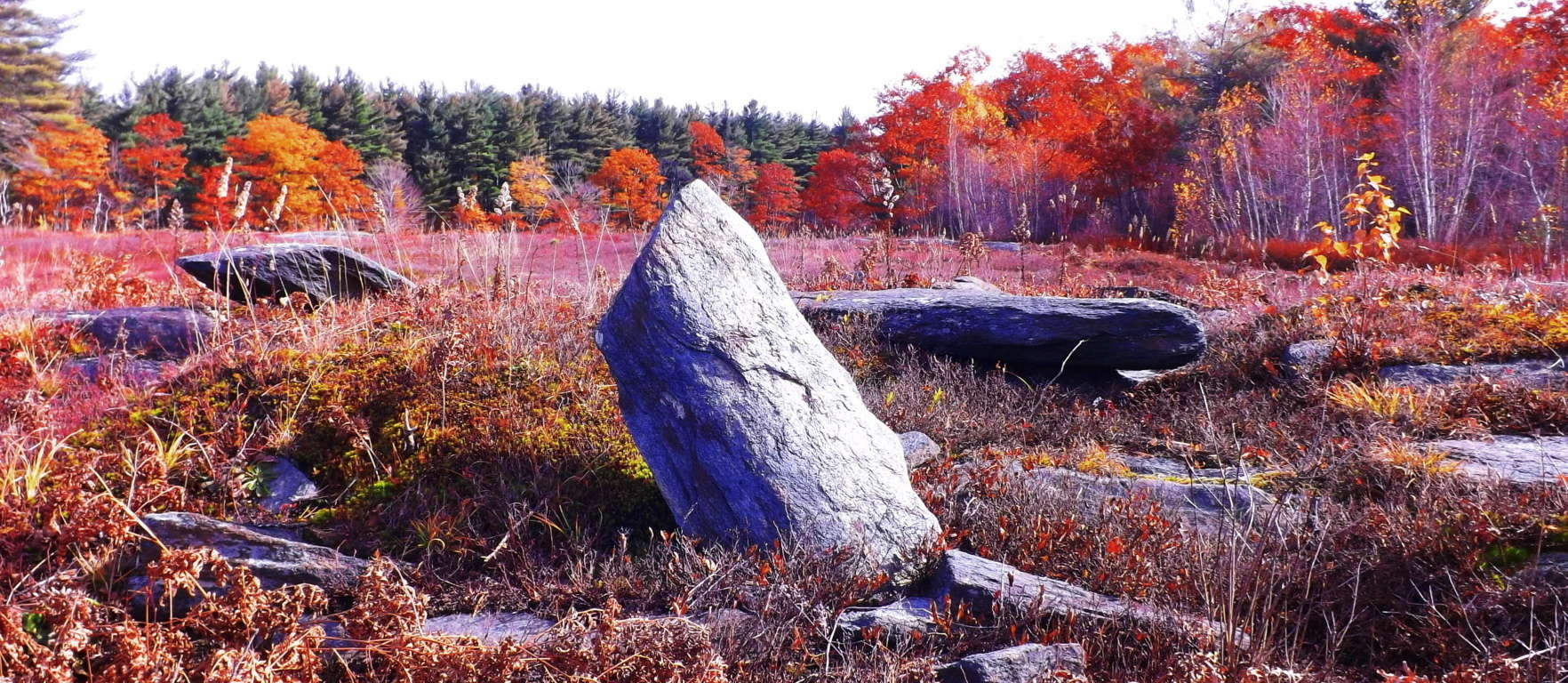 Quartz stones and classic stone-linings: The energy-storing and transferring properties of quartz are well known. Also on this sacred rocky plateau sits one of the most abundant quartz faces in all of New England. The surreal vision it creates against the dry red brush is striking, looking almost like snow. This a clear quartz concentration or harvest, which is very similar to many megalithic areas in Europe.
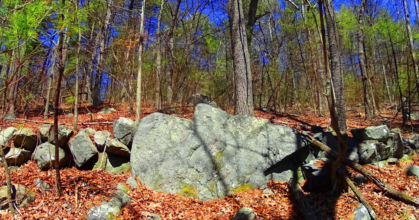
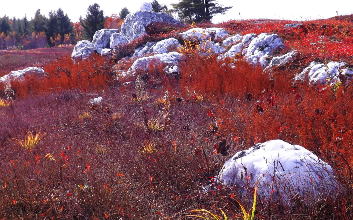 If quartz boulders are purposely scattered throughout the area, it would make sense that this place is a designed kind of ‘energy center’,with quartz absorbing energy from the Sun and connecting stones. This piece below looks to weigh at least half a ton, set proudly above a cut granite slab, near the Heath Altar.
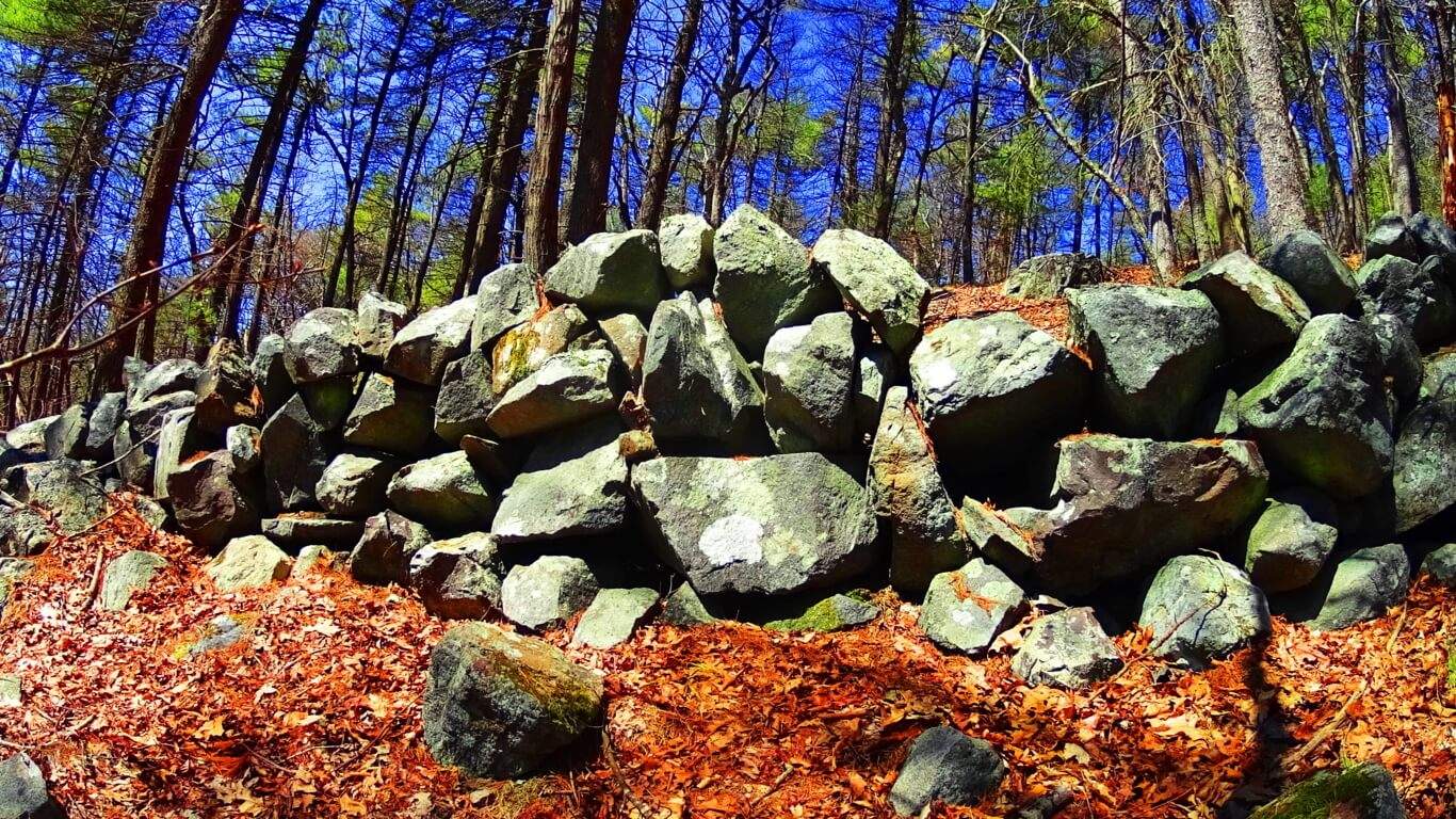
 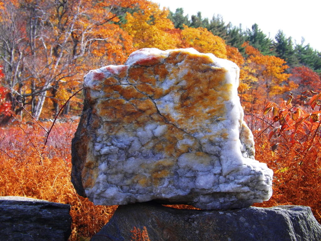 It’s as if megalithic anthropological sites are revealing a knowledge of the properties of stones. If this is true, then this entire area is a type of engineered energy center. Further to the north are classic stone-linings running through the area. These can be found in Cavan Burren National Park in a very similar style, connecting peaks, from hill top to hill top. There are enough of these linings in New England to circle the earth six times, with probably just as many in Ireland and England. This is a monument larger than the great pyramid, simply laid out in a different format. Native Americans mention nothing of building stone-linings enough times to circle the Earth 6 times. Not a word. Someone else did this colossal work.
 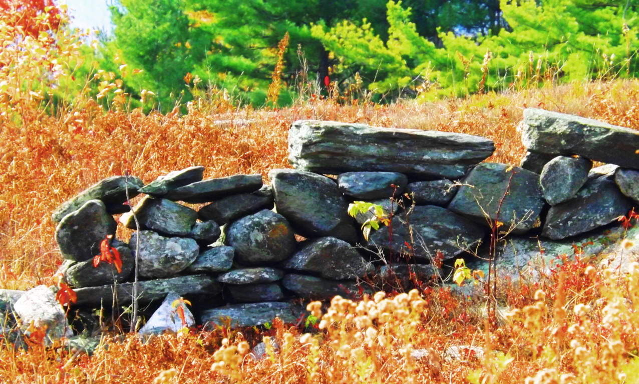 Megalithic New England: There are beautiful subtleties to understand about this place. The elevation of the rocky hill; the distance to the tree’s below, the Altar in the high clearing; as well as the fauna of the tall reeds, mingling with the stones, looking like so many other megalithic zones in Europe. Take a look at the overall similarity between this hill in Heath, and the hill top above Kinnitty Forest in Ireland, where stone-linings and irrigation walls exist in the landscape as well. (Images/Below) It’s as if the landscapes are paternal twins, with exactly similar scaling, with just the different colors to distinguish them. The elevations and patterns of sacred Neolithic places are similar because it was a similar Culture that built them.
  Heath Hilltop (Image/Above)
 Here is the hilltop at Kinnitty (Image/Above)
Summary: Look at all these features at Heath. It’s overwhelming, and obviously a Megalithic Cultural center. Once upon a time these advantageous vistas were chosen by a Megalithic culture. They were absolutely of the same mind, as to what areas were worth inhabiting. The similarity of these chosen areas, the elevations, the circumference of the rocky clearings, the distance to the running streams, and the types of stone being utilized as megalithic, all reveal compelling evidence towards a single ancient Culture, present both in the American Northeast, and the ancient European hills. The Heath Altar Stones are a direct anthropological connection to the Megalithic world, and yet this information is considered ‘alternative‘. It’s absurd when seen first hand, what the academics are clearly ignoring. There is an energy and beauty in central Massachusetts that is on-par with any of the preserved pastoral natural spaces of the European Megalithic world. All it takes is an exploratory hike in the forests and rocky hills of Heath, and you will see, and feel, it for yourself. And that is the more important point, to see it, and feel it for yourself. Don’t let anyone tell you what something is before analyzing it for yourself, or it won’t be long before not one of your ideas will actually be your own. When you find a sacred place, it reveals the sacred potential in you. Go for it.
The Blue Hills Wildlife Preserve
 Location Milton, Massachusetts
Note: The Blue Hills is a quintessential New England hiking area, with the perfect combination of rocky pathways, quiet groves, elevated vistas, and mysterious stones. Trails include the Walcott Loop, the Skyline Trail, Rattlesnake Trail, Great Blue Hill, and dozens of minor trails to be discovered. Great Blue Hill is the highest elevation here at 695 feet. There is over 6000 acres to explore, with the option to mountain-bike, which thousands of people enjoy during the Spring season. There is preserved old-growth forest, inclusive of 100 foot Pines, small Birch groves, Hemlocks, and Oaks. Some of the trails are wide pathways lined with small cut stones, while others are staircases cut right out of the hills. Blue Hills was a sacred place for the Native Americans for thousands of years before the Europeans arrived. We can certainly see why. The Colonials that arrived in the “New World” were fleeing what they considered to be a completely bought-out scene in England, Scotland, and Ireland. Lords and Men-of-property owned, and taxed, all the land, from the Medieval period into the Colonial. The 17th century in Europe was actually a “late’ period in terms of land ownership. Everything was owned. There was nothing left. Christian Puritans found the state of affairs in London, and elsewhere, intolerable. They decided to take their chances on getting their own land across the Atlantic Ocean. When these mostly poor pilgrims, explorers, trappers, and farmers arrived, and began to explore the forests and hills of this wilderness, what they found, in places like Blue Hills, would absolutely astonish them.
 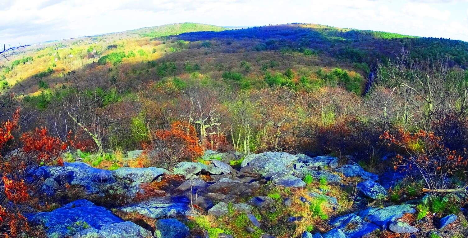 Secret History: The image above is a look at the countryside southwest of the beautiful city of Boston in April 2016. It was in this exact season in 1775 that King George of England issued a mandate to General Thomas Gage for the disarmament of the resistant colonials living in this beautiful region. It was yet another attempt to expand England, and possess these abundantly fertile hills. I have to believe, looking at this picture, that the colonials felt this was a place, if ever there was one, that was absolutely worth fighting for. There is something even deeper about the landscape that colonial farmers must have noticed in their appreciation of the terrain.
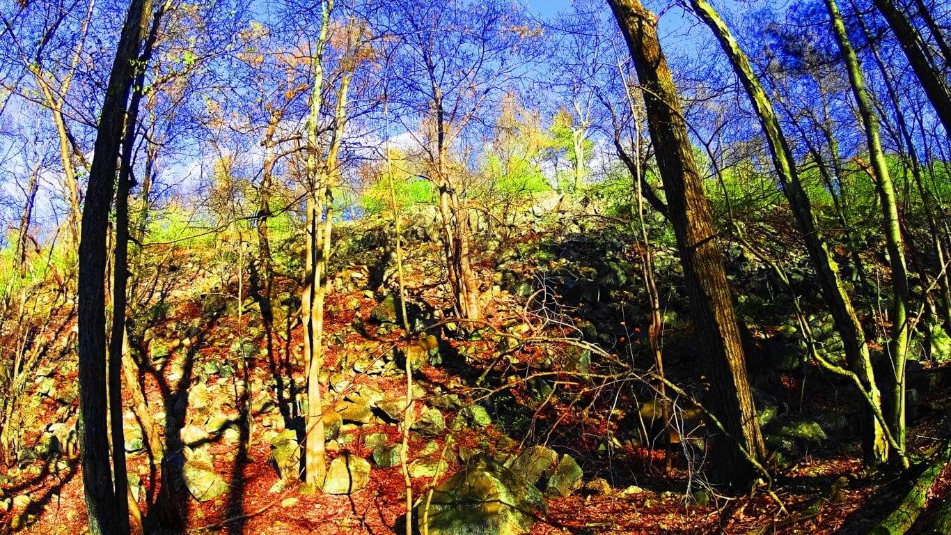 Colonial frontiersmen would have looked for advantageous areas to live, strategically smart elevations close to running streams, with crop potential and forestry for building. Celtic homesteads had been established for almost 1400 years already under the Medieval system back in Ireland and Scotland. Lords possessed the lands with Titles, the best of which long maintained crops, and were often inclusive of megalithic stonewalls that followed riversides to Cairns and Dolmens built in the Celtic era. Men-of-property certainly made the connection that Cairns and Dolmens were a sign of ideal land, almost always placed near resources and advantageous elevations. So it must have seemed miraculous to Colonial frontiersmen when they wandered into the forests and mountains of the “New World” only to discover megalithic stone ‘walls’ already running along the riversides, leading to the most advantageous plots, near streams, peaks, and good soil. Imagine their amazement when they found stone Cairns in these lush areas, with corbel craftsmanship, identical to that of Celtic Cairns in Ireland and England. Native Americans did not claim the stonework. Natives were seasonally nomadic, and were in no way inclined to build stone cities. This is not dismissive of Native American anthropological development. Wooden ‘villages’ expanded into the hundreds of thousands in population in many areas, and were highly sophisticated, but they simply did not work with megalithic stones.
The Unspoken Thing: The unspoken thing about New England, the secret that has gone to the graves of almost every Native American tribe and Colonial woodsmen, is that America was once occupied by a megalithic culture, just like Ireland and England. Imagine if you were a Colonial farmer and you discovered this secret, that the soil and stonework of the ‘New World’ was of the same mystical sanctity of the lands Lords and Title holders had been possessing in domineering fashion throughout European history. Not only was the land giving you the essential signs of quality you were hoping for, but it went a step further, and somehow was revealing Celtic features that you could not in your wildest dreams have imagined existed in this part of the world. It was so completely familiar, but in an entirely new place. They absolutely would’ve taken this as a sign from God, and therefor fought with everything they had to keep it. I truly believe that this was a significant part of the reason why Colonial militiamen met the British on the field of Battle on July 4th of 1776. Colonial farmers must have had in-depth conversations about what they were finding in the woods, Celtic style stone-works that British Lords coveted and valued on their estates for centuries. It would’ve been the ultimate incentive to fight. The Blue Hills Reservation is one of the most beloved remaining testaments to these wonders of the old growth forests, filled with Celtic stonework running along streams, small mountains, and rocky elevations. They are still there today, as the builders obviously intended.
Connections to Ireland: The image below is a stone staircase at one of the main trails at Blue Hills. Notice how this first step is positioned, displaying the markings like an invitation, shown on the top frontal face, rather than tucking it out of sight as masons are trained to do. Whoever built this staircase wanted us to notice the craftsmanship. Everything about it says “notice me”.  The style of incremented cuts on this blue granite stone is in the exact same style as cuts made to white granite on high elevation staircases at Mount Bearnagh, in the beautiful Mourn Mountain Range of northeast Ireland. Here is a look at one of those stones below, quarried in the heights by stone stairs leading up the mountain, but was never placed in the ground for some reason. The styles are identical
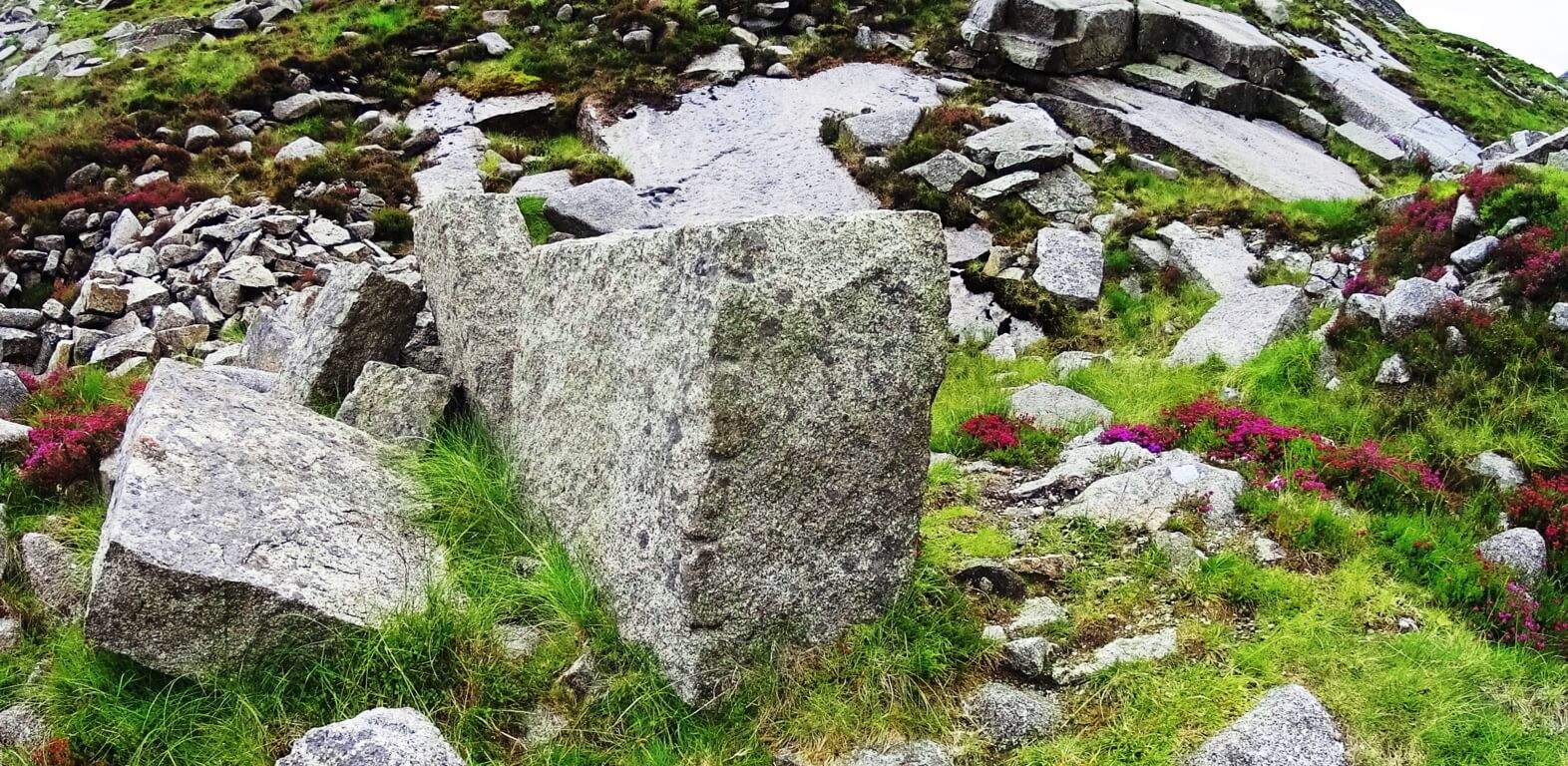 . And just like at Blue Hills, Mount Bearnagh is inundated with other stones all around, that have incremented markings, smoothed surfaces, and right angles.
Features of Blue Hills: Take a look at this amazing granite standing-stone that rests in a beautiful old growth Pine-glade at Blue Hills. It looks like something out of Game of Thrones. It stands at about 7 feet high, and 3 feet in width. There is no other stone comparable to it within the vicinity.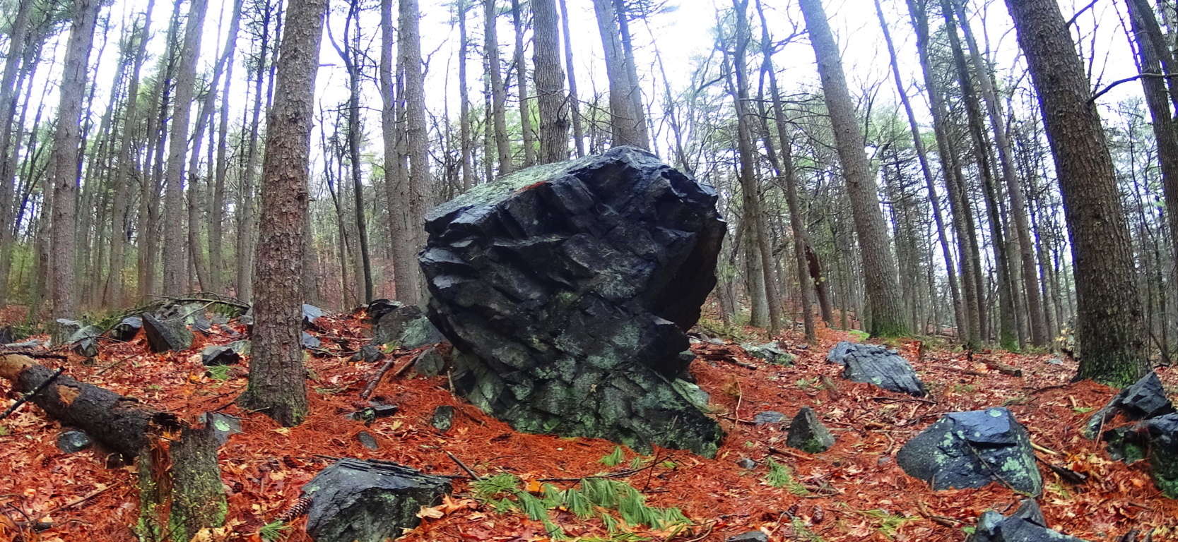 There are angles specifically cut into its sides. It has clearly been worked on. Not only are the angles obvious, but the stones that were cut away are placed all around the area. It looks to be some kind of expression. There are hundreds of thousands of granite pieces that have been worked on all throughout the forests here. Of course, the next question from that statement will be: “What could they do with such a massive amount of cut stones if this happened all over the forests?”
More Irish Connections/Stone-linings: The answer to the question is literally all around the woods: the Stone-linings. What modern anthropologists have mistakingly (and lazily) called “walls”, are more accurately understood to be ‘Stone-linings’ that run, like connecting cables, from peak to peak, and even zig-zag up entire hillsides in some areas. Who builds stone walls that zig zag up a mountain? No one. This Stone-lining phenomenon is also found at Mount Bearnagh in Ireland. Here is a spot in Ireland that illustrates my point clearly; Please take a look at this image of two separate stone projects at the Pass in the heights of Mount Bearnagh; It clearly distinguishes the two structures as absolutely different.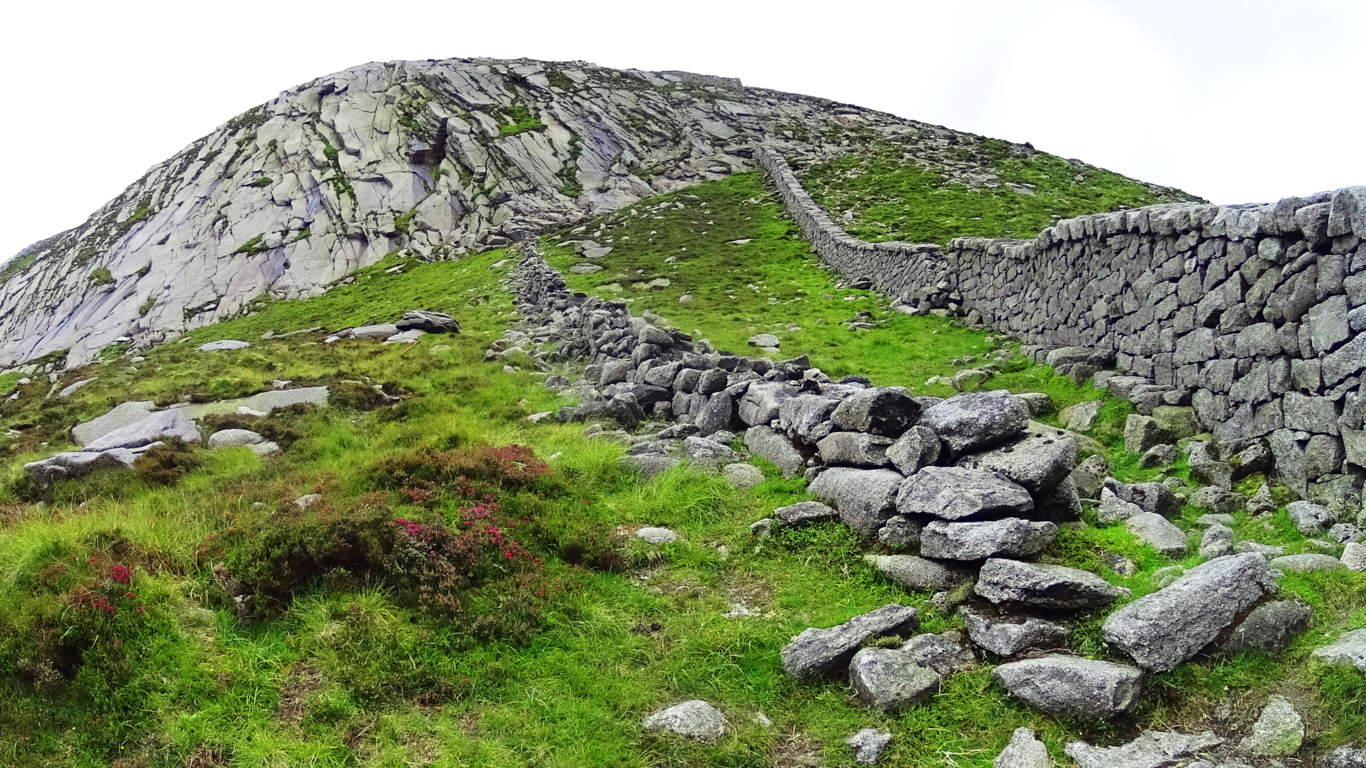
The stones on the far right of this image are clearly crafted as a wall, meant to contain flocks and cattle from drifting into the next valley. It was built by Irish masons in the 17th, or late 18th century. Notice how the stones of this wall are not aligned with the direct center of the mountain beyond, but is right-of-center of the peak, simply stopping once it reaches the cliff side. Since domesticated Cows and Sheep don’t climb vertical cliffs, the purpose of the structure is obviously complete, as a wall. The project on the left in the image, however, is a Stone-lining. It obviously cannot stop the movement of anything. I believe this ‘Lining’ was built by the very first culture in Ireland. As you can see, the stones specifically align towards the center of the mountain beyond, and actually continues up the mountain in massive stacked shelves (if you look close), all the way to the center. What this image doesn’t show us is that in the other direction, the Lining continues towards the center of the opposite peak in the same way. It is evident that this megalithic period structure was intended to connect the peaks, like cables connecting power sources. I have found this same phenomenon at Glenveagh National Park, Ireland, Mount Chocorua New Hampshire, and Mount Monadnock, New Hampshire, as well as dozens of other places. (Noted here on Stonetstrider.com.) One more important thing to consider is that the Irish did not take stones from the Linings to build the wall; Why not? It’s right there, why not use it? The answer is, the Lining is ancient, and sacred, and the Irish know it. They would not touch it. If we now understand that Linings are sacred, and the Blue Hills is literally covered in massive megalithic Linings, that makes the entire Blue Hills Reserve sacred.
Stone-linings (Linings) at Blue Hills: The Blue Hills is a Stone-lining universe. Colonials would’ve seen these stones and been absolutely stunned. Some of them connect the peaks, others zig-zag up the hills as i mentioned before, and some “crown” the massive stone ledges around the peaks, like at Mount Watatic, Massachusetts, (also featured here on Stonestrider.com.) The image below is an example of a fine Lining found on one of the elevated porches at Blue Hills.
 The next Lining is much more substantial, and running straight up the side of one of the small mountains at Blue Hills. There are literally hundreds of these Linings, requiring more work and tools than any team of New England craftsman could ever in ten lifetimes complete. And where are the tools that quarried and crafted these stones? No signs of them, anywhere.
 Here is a dizzying look at several Linings zig-zagging up the mountain side just off one of the trails at Blue Hills. I believe that the stones were part of this scene long before the trees were there. At one time, this hillside looked a lot more like Celtic hills, unobstructed visually. It is harder to see megalithic patterns in New England with countless layers of leaves and trees, but there is some kind of pattern here. Its almost as if the entire hillside is a megalithic statement. The picture below is a hill about 100 yards high, with Linings of 100 to 1000 pound stones everywhere. Unreal. A glacier ripping this hillside would’ve discombobulated any pattern in the stones, not stacked them into Linings that looked to modern eyes like dilapidated walls. Ice did not do this.
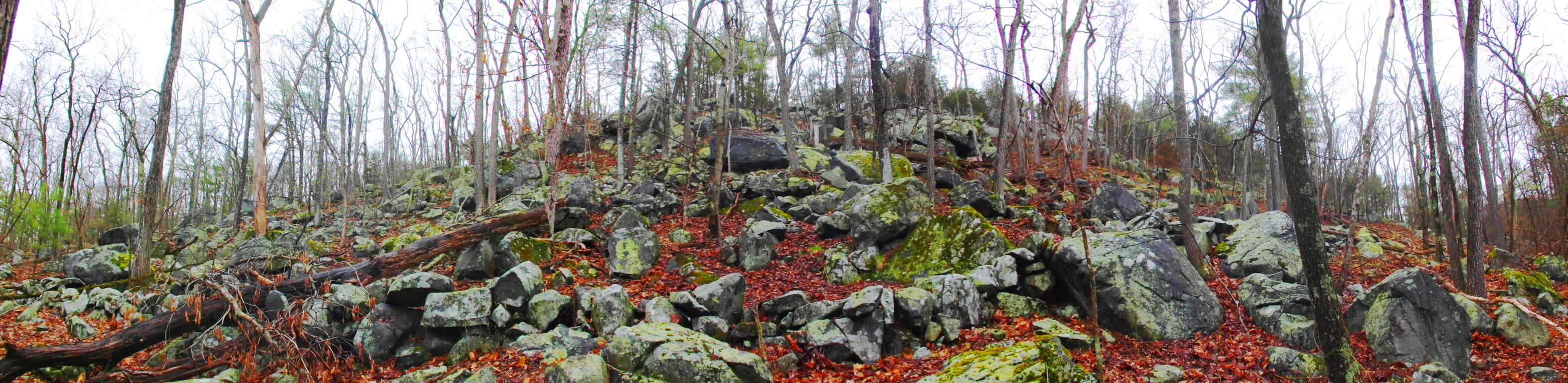 If you follow the Linings through the woods at Blue Hills you will often come across what look to be megalithic size markers, Standing-stone scale slates or boulders that seem almost decorative, or for marking the territory. Take a look at this 7 foot long, 1 foot thick, slab placed along the Lining by one of the lower trails. It looks to be at least 1 ton in weight (2000 pounds). There are cuts on the lower right side of this slab rendering some kind of meaning. It was clearly placed there. It may mark a certain point of the Sun or Moon along the mountainside, or be indicating a direction to follow, all of which are possibilities that the Megalith builders were absolutely concerned with.
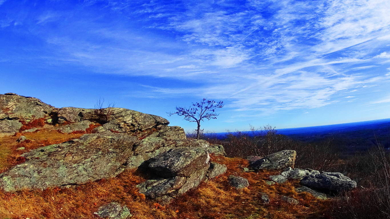
 Elevated Trails at Blue Hills: People from this area of New England love hiking here. With all the stonework taking place beneath the trees, it is impossible for a hiker not to be curious what might be taking place at the hilltops, under the Sun. There are trails that loop in a lengthy approach to the smooth stone porches above, but there are also very direct trails with serious inclines that will take you to the best peaks within 15 intense minutes. One peak has a direct view of Boston twenty miles away, with beautiful, Celtic looking, old growth fauna along the ledges (Image below). You can just make out Boston in the distance.
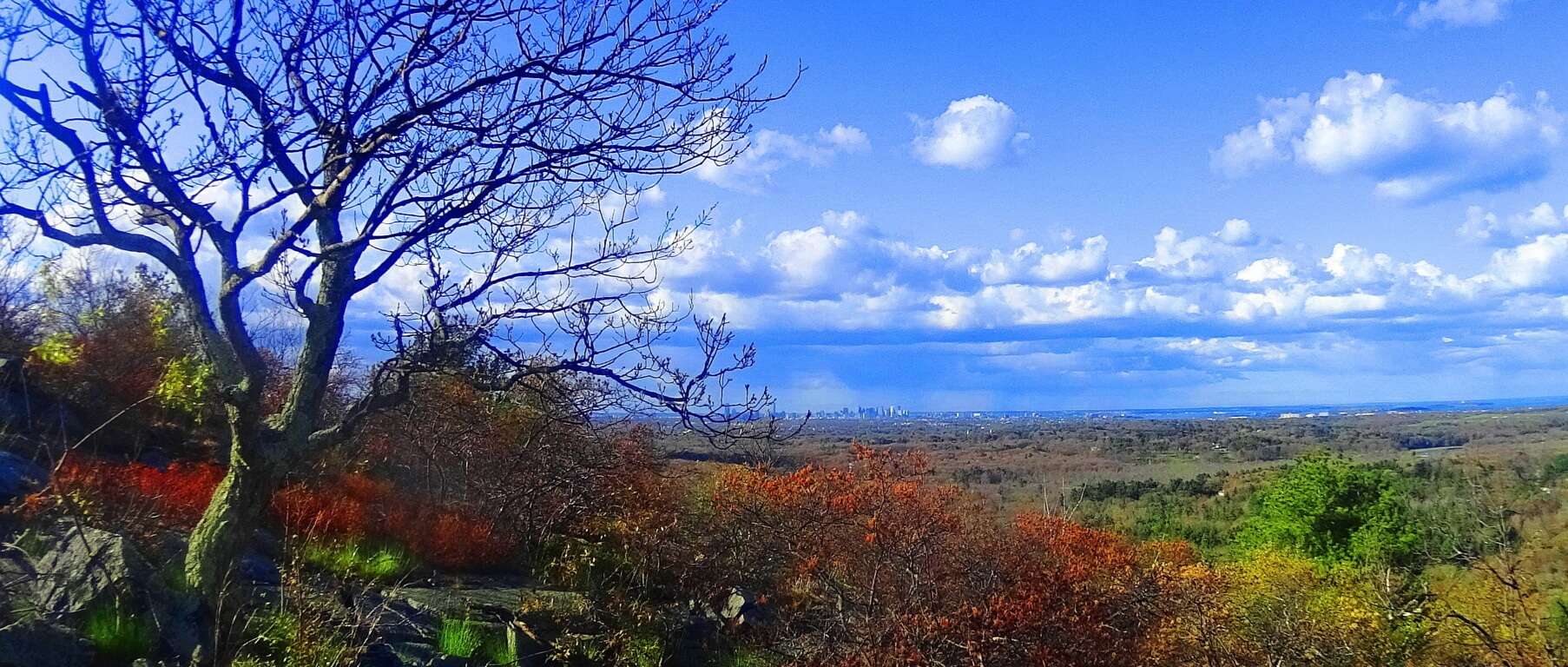 Along these smooth rock porches are stones that are obviously crafted, and serving as markers of some kind. Take a look at these stones on the upper path of “Skyline Trail”, the most popular trail at Blue Hills:
 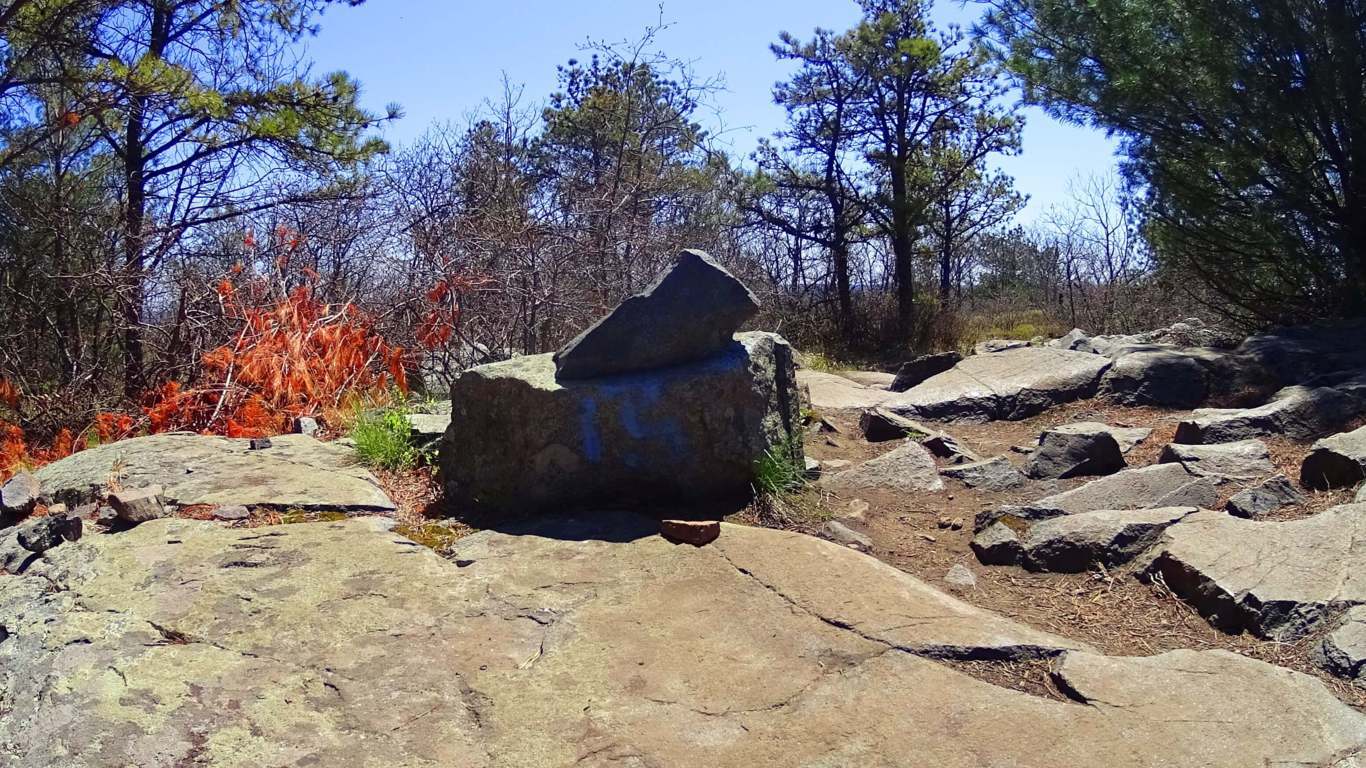 This stone is clearly crafted. Furthermore, looking from this exact stone down the direct path of the trail, are two more crafted, free sitting boulders, perfectly aligned like 1,2,3.
 Around this area are also stones that have clearly been cut away from cliff faces. Take a look at these triangular stones, still standing near the exact indents from which they were cut away from.
 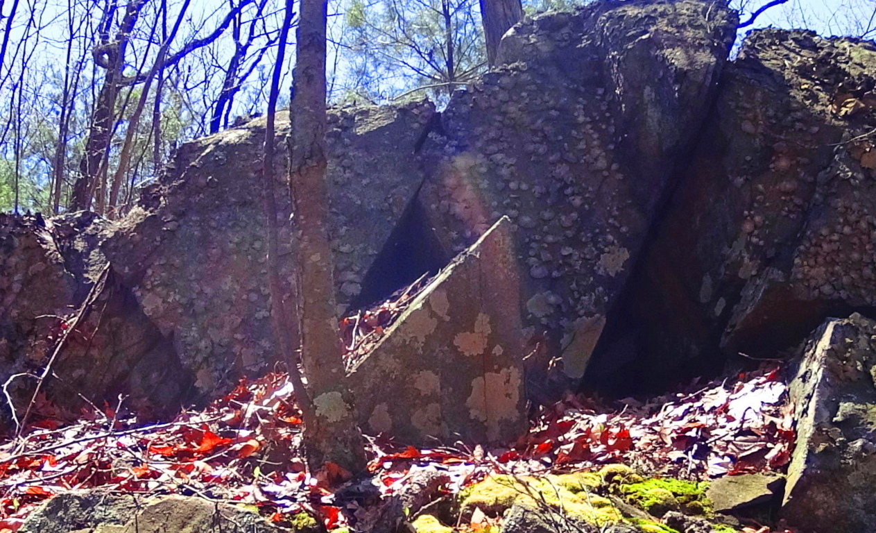 Just for clarity, I highlighted this image so you could see the exact spaces of the cutting, and the right angled triangle stone.
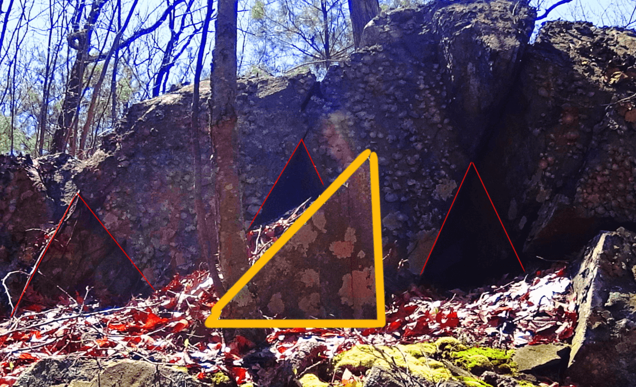 This is evidence of extremely intelligent craftsmanship, conscious of geometric principles. There are also more minor cuts in the stones along the trails, with triangular features. Below is just one example of thousands. They seem directional.
 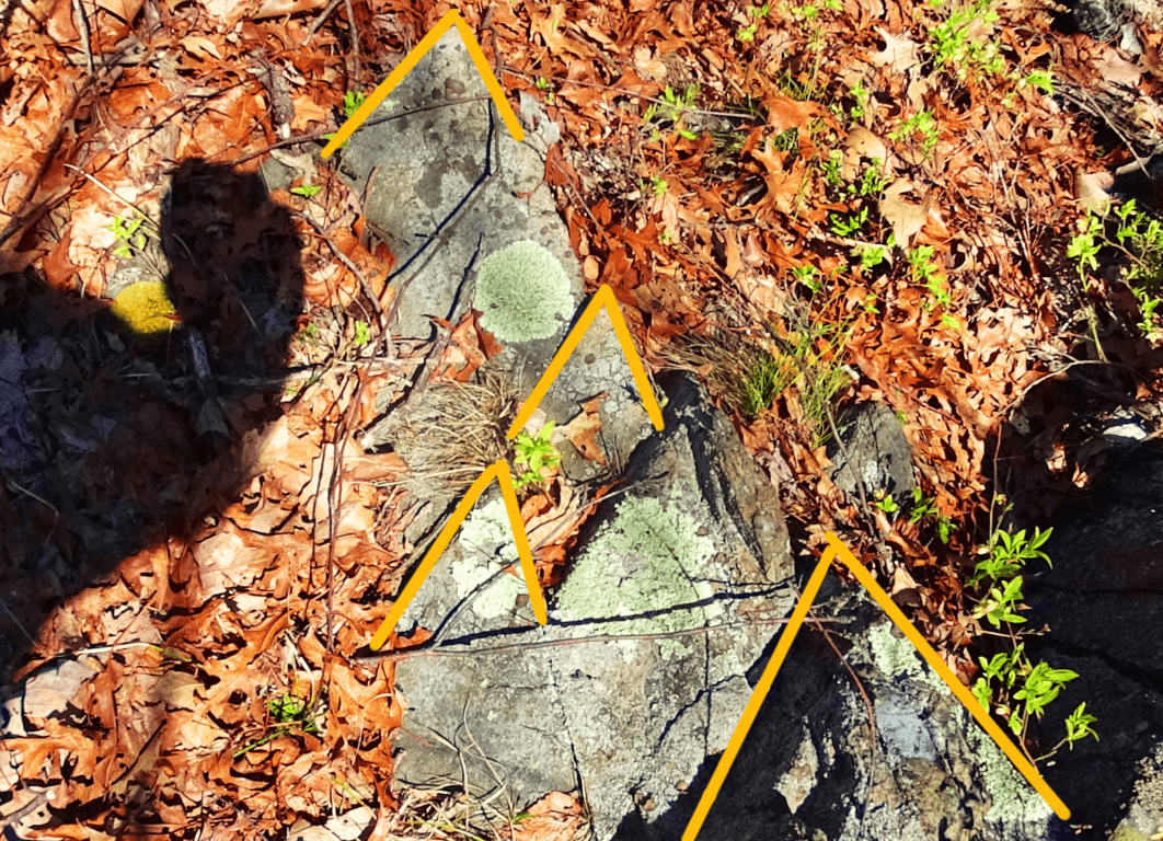 Amazing. The view from the top of Skyline Trail is a classic New England picture. The shadows on the dark granite ledges give a bluish hue to the stones, most likely where the name for this beautiful place derives (top images). We should remember also, that these trails were used by the Native American tribes for thousands of years, before it became “New England”. For the most part, they have taken their sacred knowledge with them into history. Take a hike through the Blue Hills, and see for yourself the unspoken reasons why a community of poor colonial farmers risked their lives against the greatest empire the world had ever known. They knew what we are quickly forgetting, that something entirely mystical took place on this sacred land. Find it, if you can, and go strong.
Monument Mountain
 Location: Great Barrington, Massachusetts/USA
Elevation: 1,642 ft
Note: Monument Mountain is a rare natural gem for Massachusetts. It is not connected to the rolling hills of eastern New England, but rather the beautiful Berkshire Mountain range, which runs through the southwest corner of Massachusetts, before continuing northwest into New York State. In early November the hillsides around Monument Mountain practically glow from the morning frost in the Sunrise, giving it a unique New England appeal…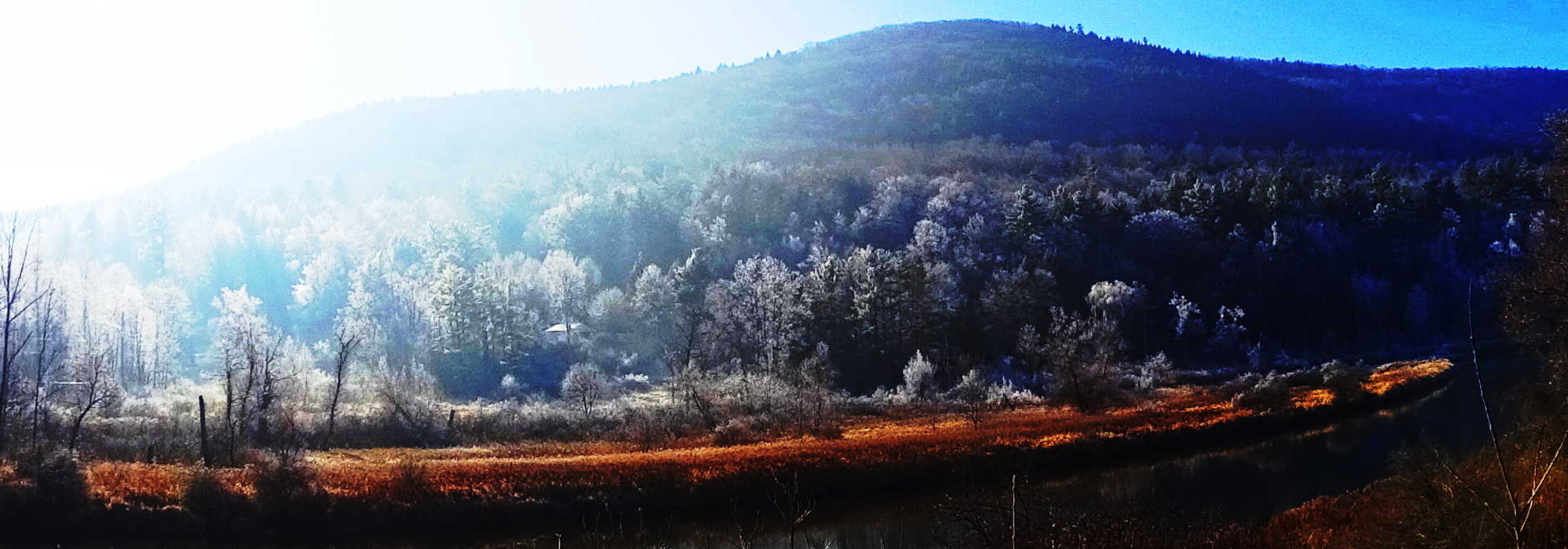 From top to bottom, massive shelves of white-quartzite line the mountainside, with jagged cliffs looming hundreds of feet above the trails, leading to what is known as ‘Squaw-Peak’. Alternative trails are known as “Indian Monument, and”Hickey Trail”, but are both essentially part of the same loop leading to Squaw Peak. As hard as it might be to believe, this is the Macchu Piccu of Massachusetts.
 The trails here lead through glades of old growth forest and quartzite glens. There are White Pines, Hemlocks, Maples, and Birches in the elevated areas, that change the feeling of the trail as you go. The forest is a barrage of overgrowth and ledges, with craggy shelves at every turn.
 Some fixtures were obviously toppled by a glacial game that was played over 10,500 years ago, while other stones do not seem random at all.
The Solar Stones: The initial trail runs through a glade of towering Pines for about a half mile. Soon you will encounter an incline in the path that will lead you into Birch groves, baby Pines, and stony footing. As the trail to Squaw Peak begins to elevate, there are stairs that are clearly cut out of the mountain, leading up to smooth rounded porches.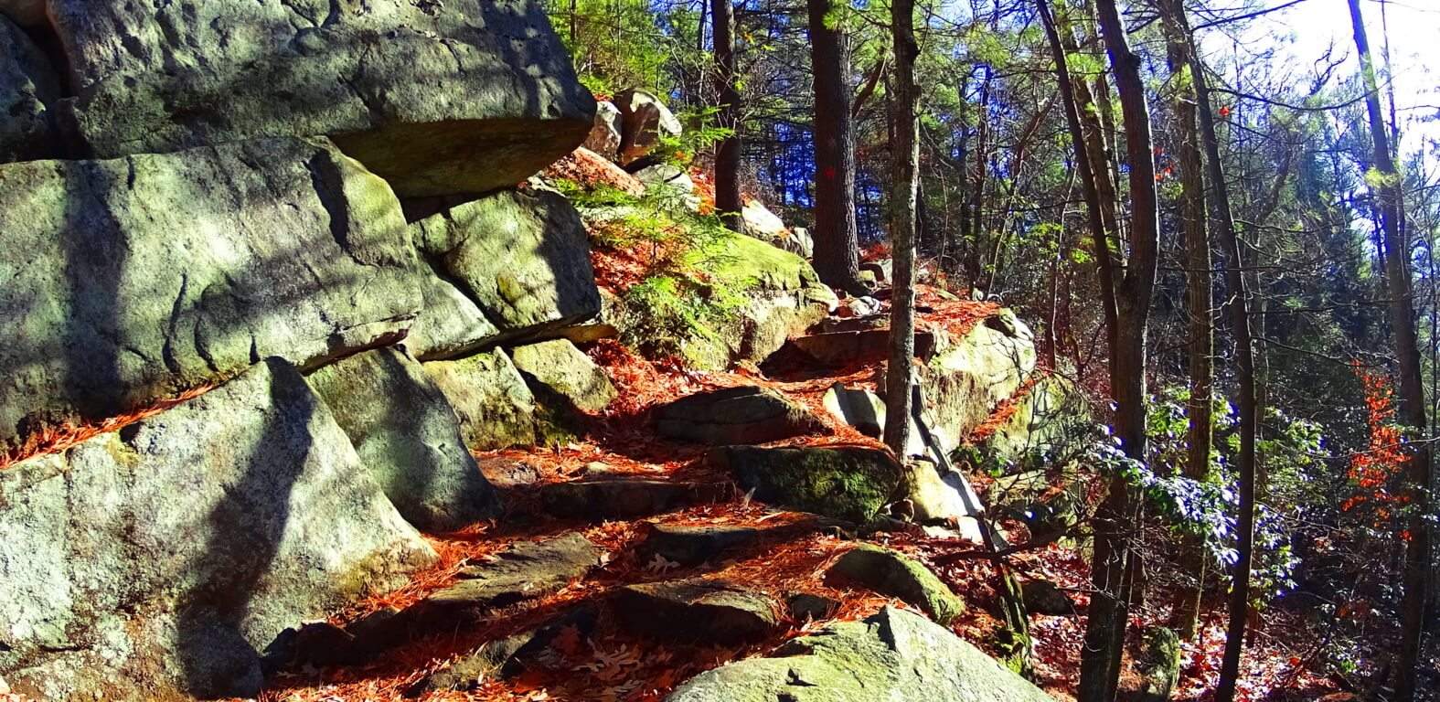 On these porches are stones that have specific angular cuts that are pointing directly at the Sun at mid-day. These stones appear at other sites in New England too. The image below is a prime example of the Solar Stone type at Monument Mountain, approaching Squaw Peak. Before coming to Monument” I had found several stones that were cut exactly like this, shown below. I felt that if stones were cut specifically to be “pointing” at something significant, it would most likely be the Sun. So on this day at Monument Mountain I tested my theory. I climbed to reach Squaw Peak just before Noon, and using this method I came across this exact stone, which points directly at the Sun at Noon. These are the moments that hikers live for. Trail features become both an exploration into natural beauty, and anthropological. Standing there, as the Sun was directly above this stone, I felt as if I was momentarily peeking through a keyhole connected to a culture from the beginning of Time. The “Solar Stones” geometry is essentially: a single long-side leading up to a 45 degree angle, which is then cut, creating an arrow head, or apex, pointing straight up; Then the cut goes back down 45 degrees, to a shorter side, which runs parallel to the long side. These cuts are made in solid granite. Take a look below…
 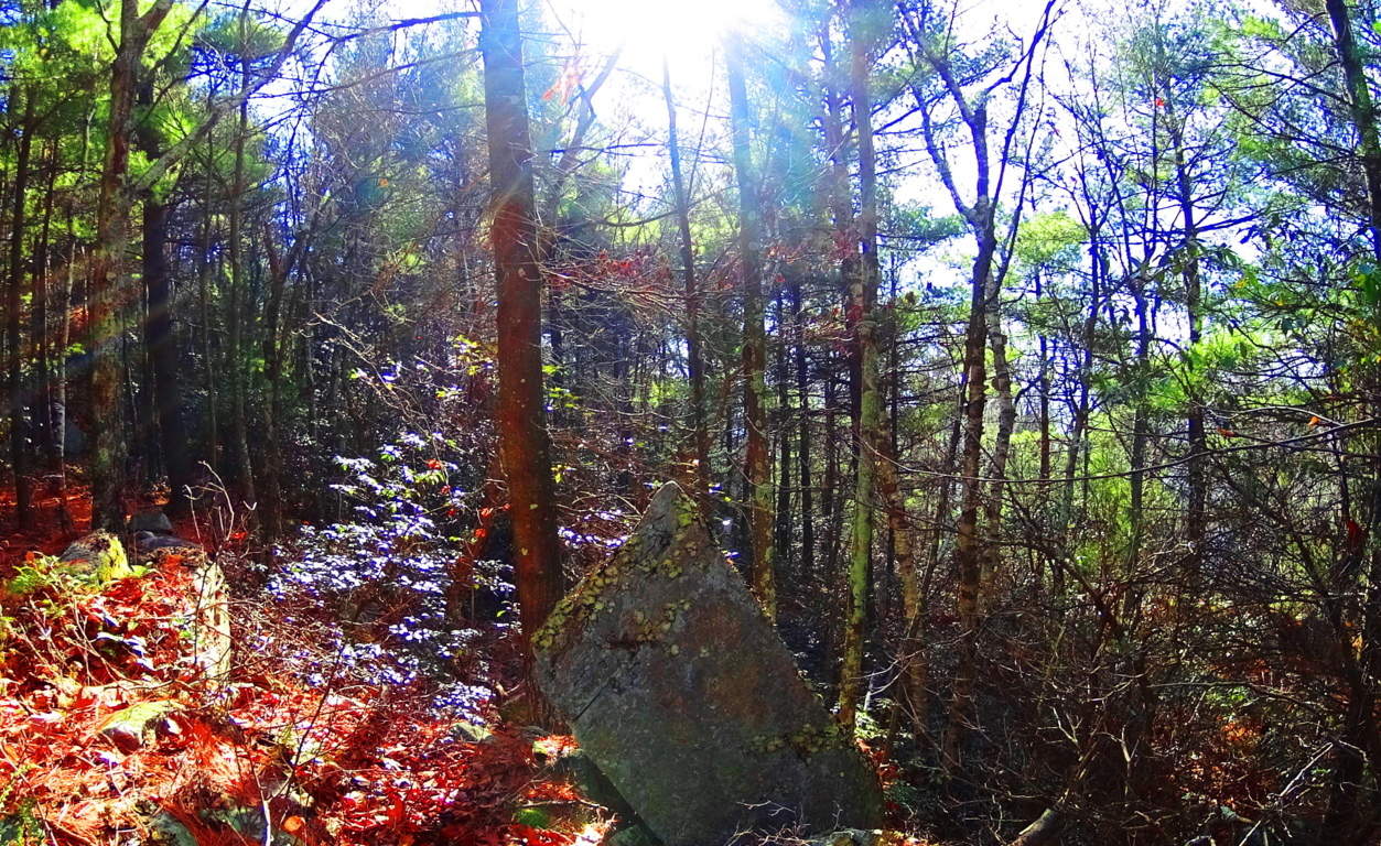 If this were the only stone that I had seen like this, then I would hesitate to publish it here, but I offer some other examples of beautifully cut Solar Stones with the exact same angles and features. This Solar Stone pictured above is located near one of the most significant “Celtic style” alter’s in New England: the Heath Alter, of Massachusetts. Notice the identical angles.
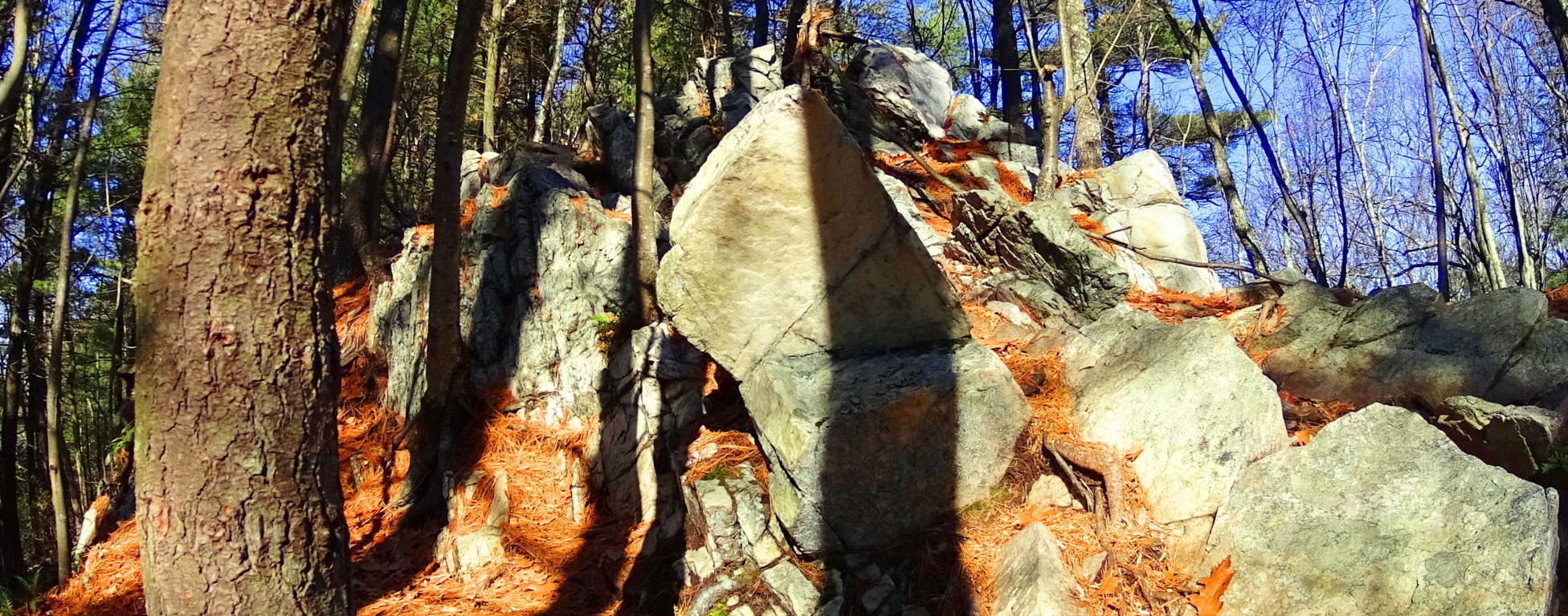 Here again is a Solar Stone with the exact same measurements at a different location.
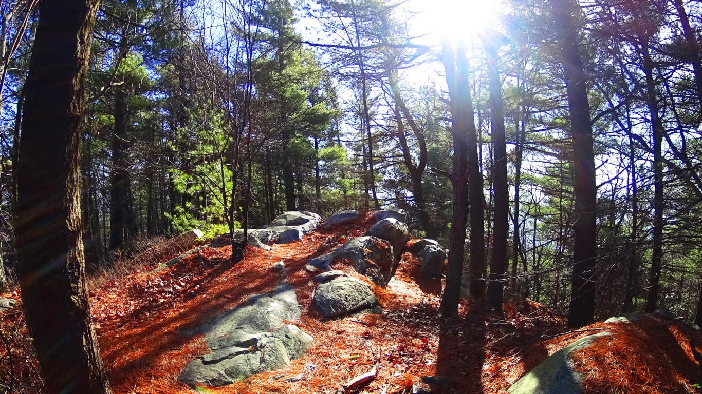 We can at least conclude that whoever created these stones had a sense of ‘symbolism’, which in this case, was to convey how important they felt the Sun was, and that they were very much in tune with its properties.
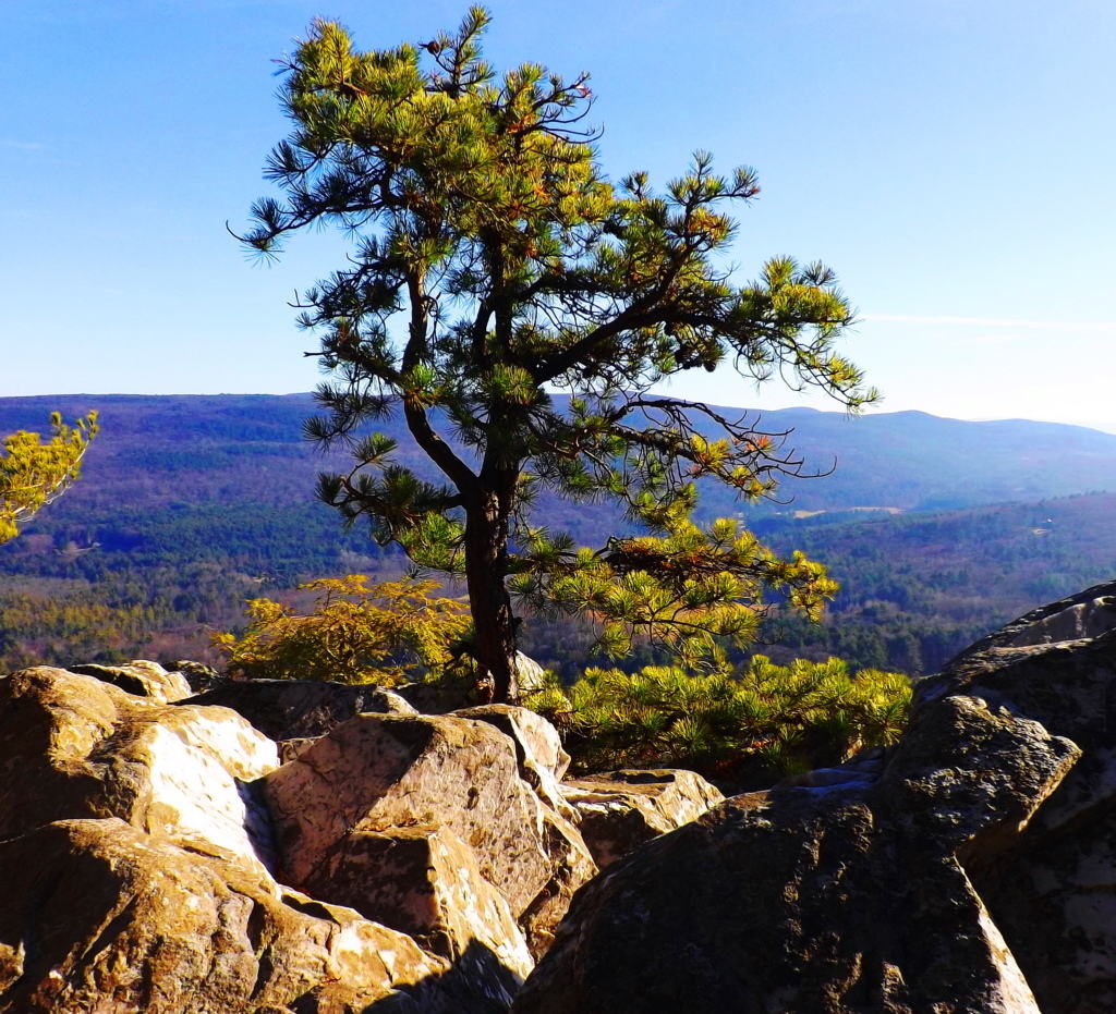 As you continue hiking along, the elevated stone porches emerge (image above) which head directly towards Squaw Peak. Your first clearing will arrive facing north-east, and its phenomenal.
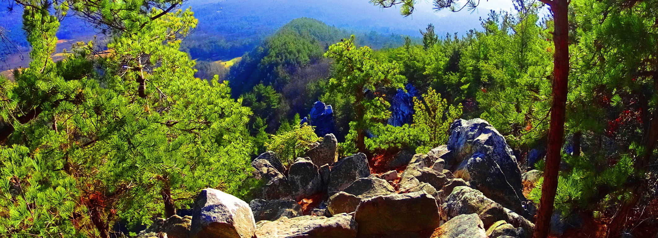
Aligned Stones: The edge of this porch has several stones that are centered and aligned with the massive square tower that stands almost 1000 feet high in the distance. This ledge also seems to be aligned to the peak of the mountain just beyond.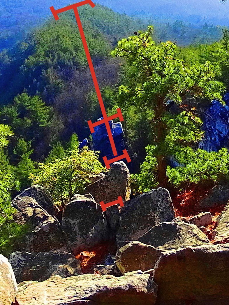 If it weren’t for places like Macchu Piccu, where stones are aligned in amazing ways at high elevations to mountains and peaks, something like this would certainly seem impossible. But notice the stones running in a straight line directly down the center of this porch, with tops that are squared perfectly with each other, as if leveled intentionally. Makes you wonder. What could possibly have done this? (left image) This is the magic of Monument Mountain’s porches.
Pattern Stones: Along the trail at Monument” you will also see a type of stonework that fits a specific pattern. This can also be found at other sites in New England. Here is an image of a long singular megalithic slab specifically placed above three smaller supporting stones. Below this are other spots at Monument”, and other places in New England, with the same dimensions of: the long slab on top, with the three smaller below.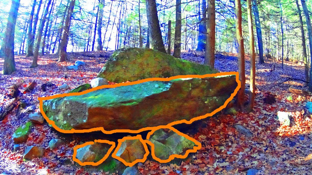 This is easily something you might pass by, believing it to be simple glacial displacement, but have a look at some other patterned stones in New England that fit this exact design.
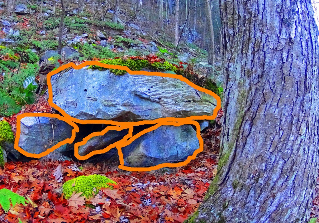
Interestingly, over 2000 miles away, there are Dolmens in Ireland that, in profile, fit this is exact numeric design: one long slab over three lesser stones This example is significantly larger, which is the Gaulstown Dolmen, with a capstone weighing 6 tons, suspended roughly 6 feet in the air. 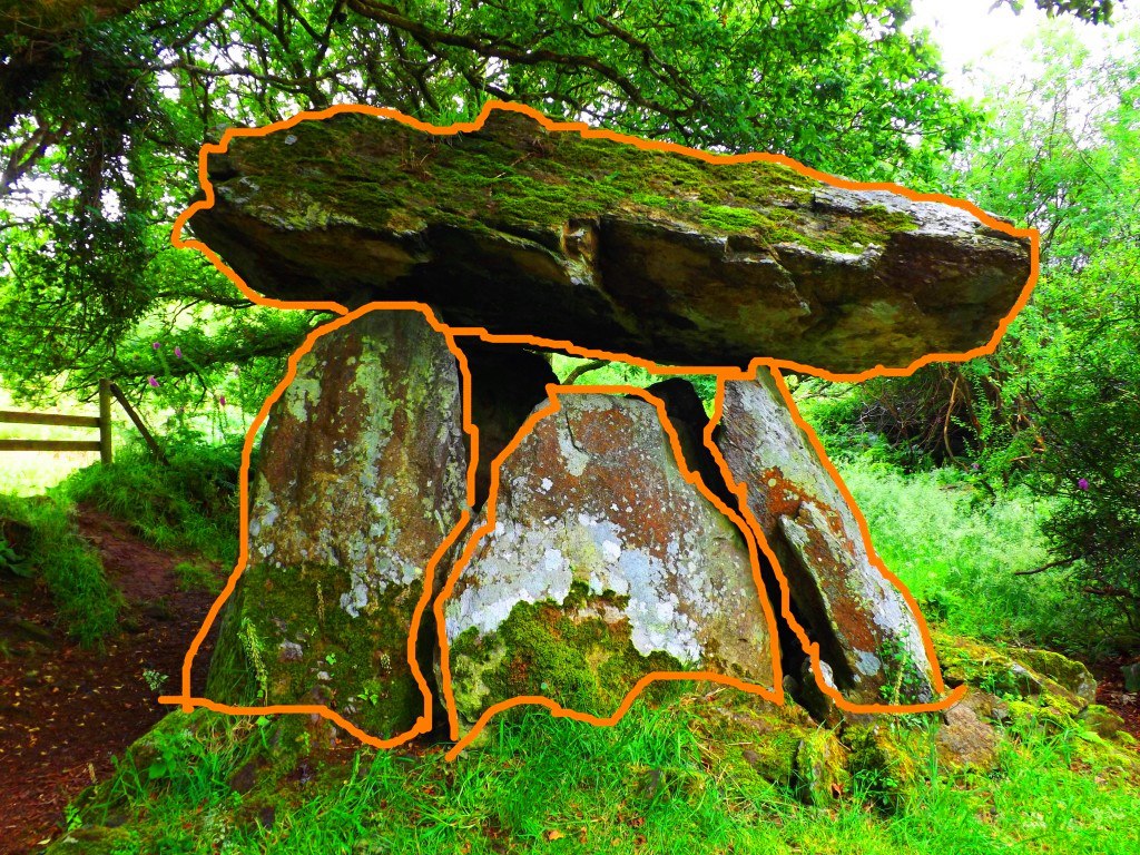 This relationship of 1 over 3 seems to be significant for these fixtures, and for the moment we can only guess at the significance of this.
After continuing along the porch away from the north-east alignment you will find Squaw Peak, which has a wonderful 360 view of the river valley. On a clear day distant peaks cut the clouds at a distance. 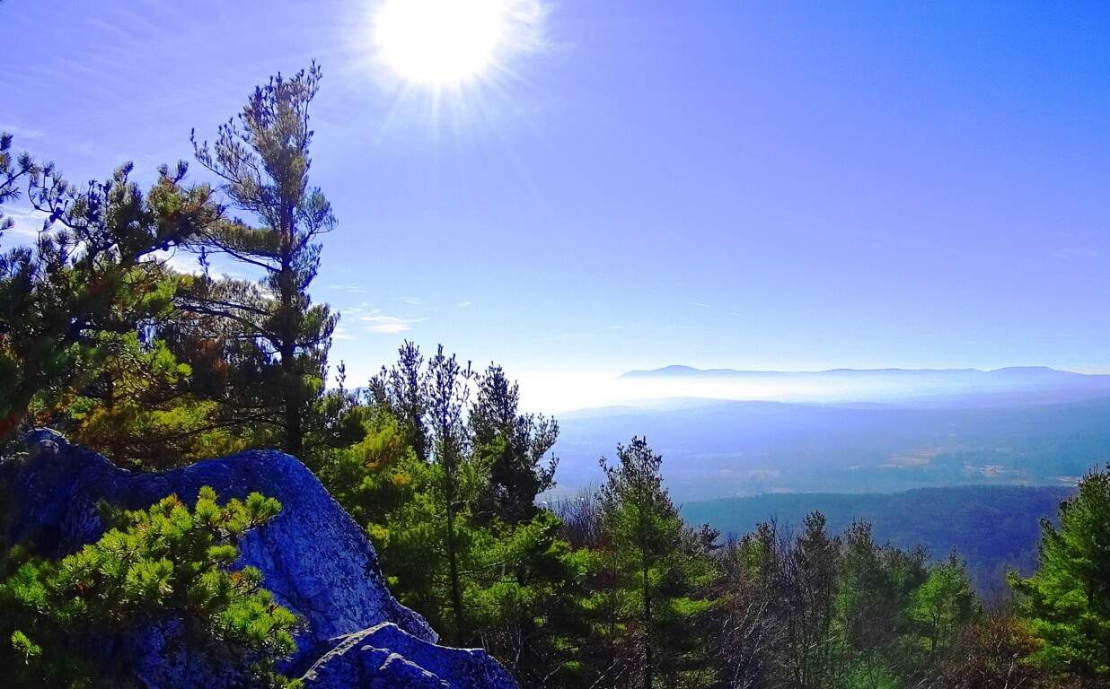 Monument” trails also sponsor some of the more common megalithic features found at places like Mount Monadnock and Mount Watatic. There are classic stone-linings that run straight up the mountain…
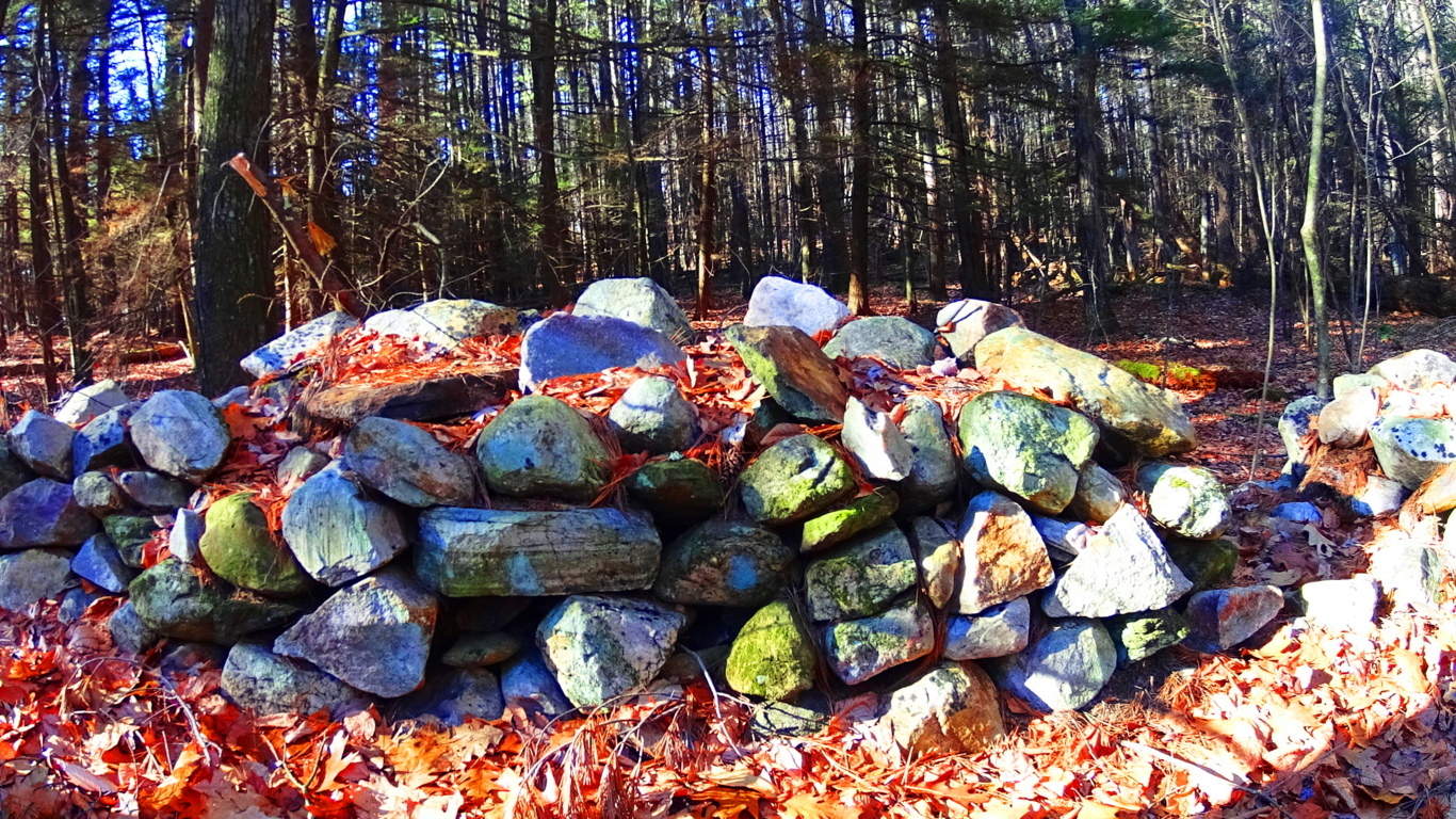 and the mysteriously cut “X” sections, that produces the diamond shape stones that appear all the way into Maine and New Hampshire.
 All of these are found here at Mounument”.
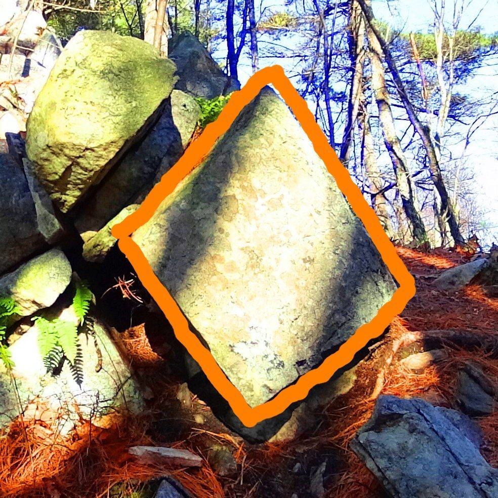 Give yourself an entire day to search out the pathways that lead through this wonderland in south western Massachusetts. Feel the texture and absolute smoothness of the creases in these megaliths as you go. This is an absolutely wonderful hike that stretches for about 4 miles along the larger picturesque loop. Someone loved and appreciated this place in ways we are only just beginning to understand. See it for yourself, the sooner the better.
Upton Massachusetts/USA
 Location: Town of Upton, Massachusetts
Note: In Upton Massachusetts The Blackstone Valley sponsors a full-spectrum ocean of foliage in the Autumn season.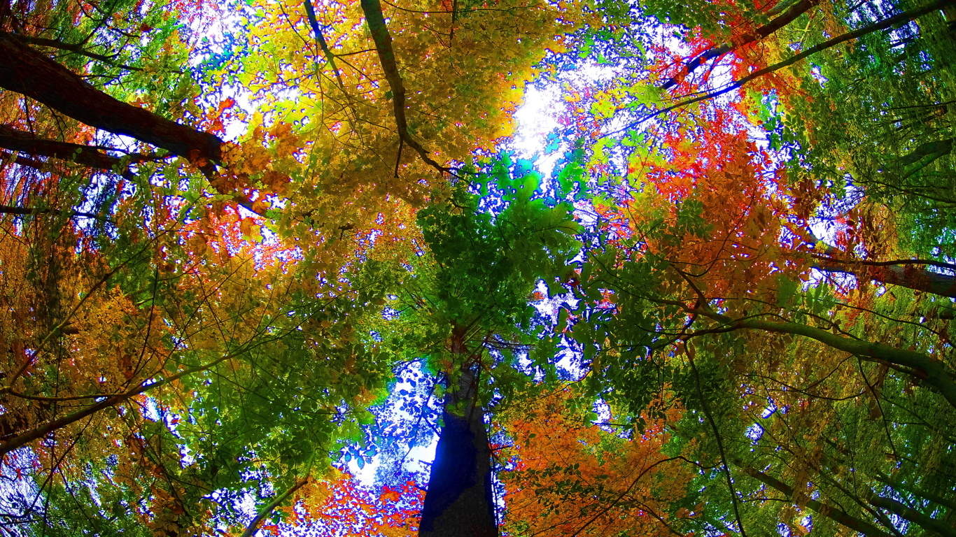 This is a classic New England hamlet that feels more like a rural village sitting just off the Ring of Kerry, rather than central Massachusetts.
 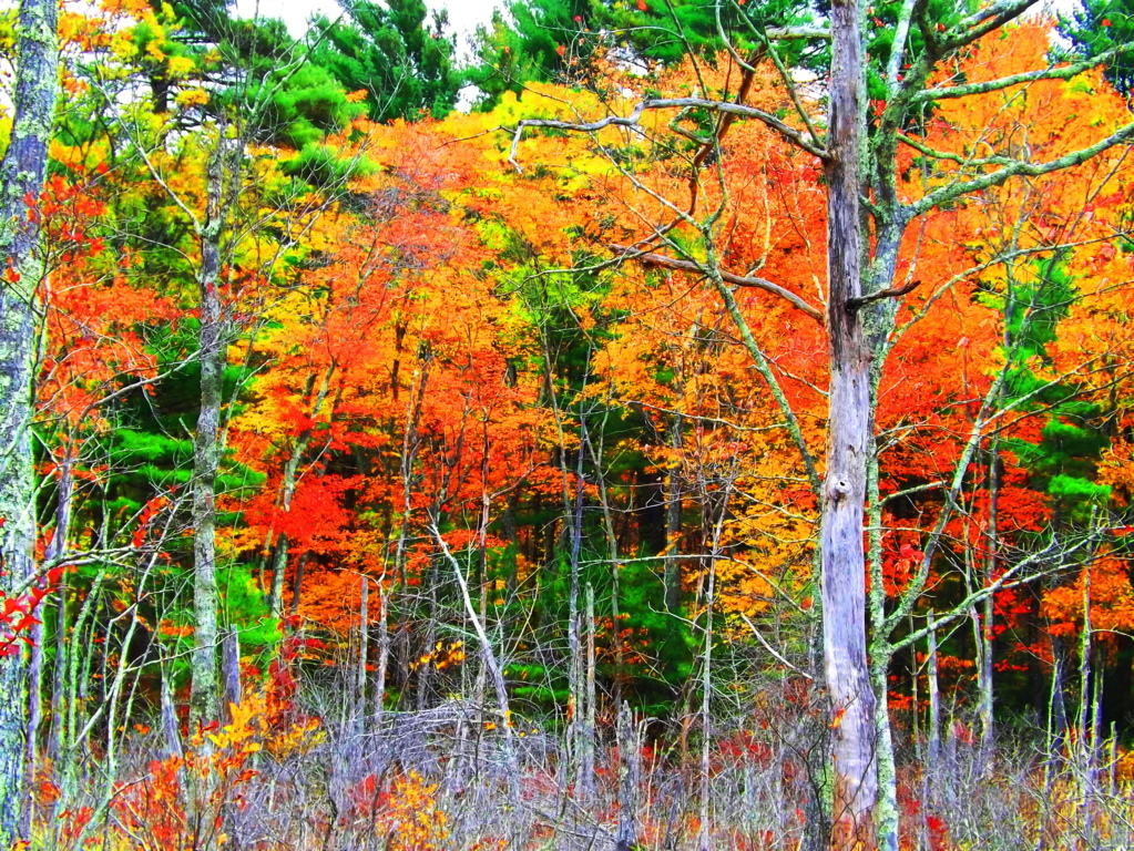 Natural features of the town include a State Forest with roughly 7 miles of trails, with other minor trails leading to stellar places like Look Out Rock (top image). Upton offers-up an “Old World” aesthetic with some very real historical substance, containing one of the finest Wedge Tomb’s in the world, known as the Upton Stone Chamber (image below).
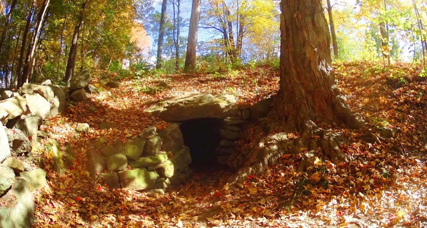 The scale of the Upton Stone Chamber is very similar to the Stone Chamber at the top of the sacred Hill of Tara in Ireland.
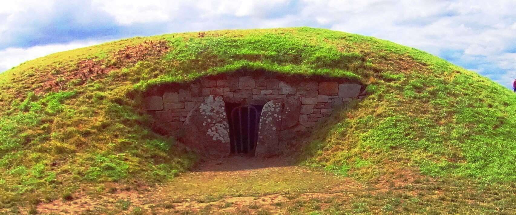 The stonework of the Upton Chamber is exquisite, with dry-laid corbel roofing that opens up from an entry passage into a 15foot dome, crafted into the Earth! The roof has four 5 ton slabs holding up the passage leading to the mini-dome.
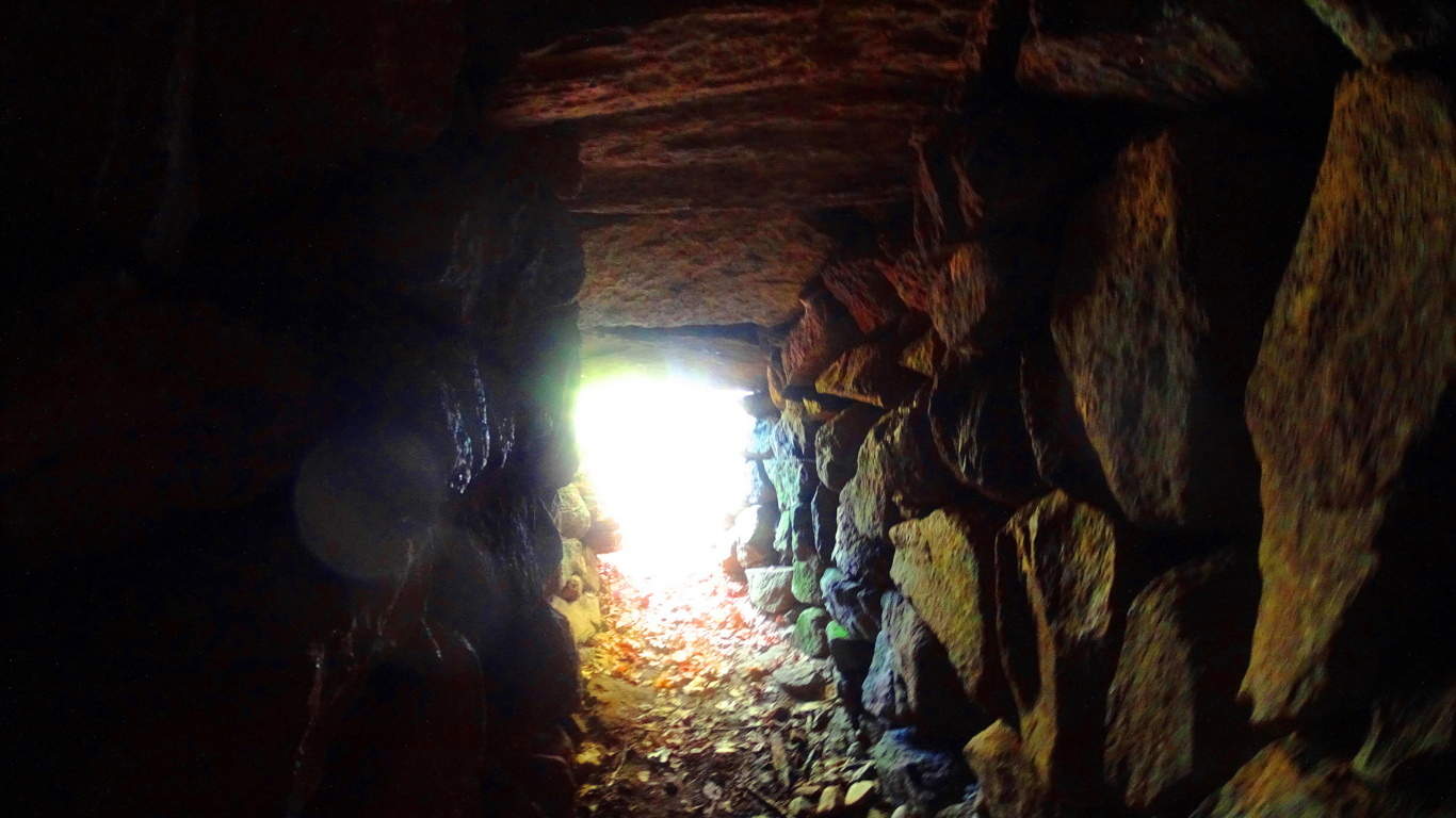 This is of the same style of roofing that was used, on a more massive scale, at New Grange, Ireland, the oldest megalithic site in the World (right image).
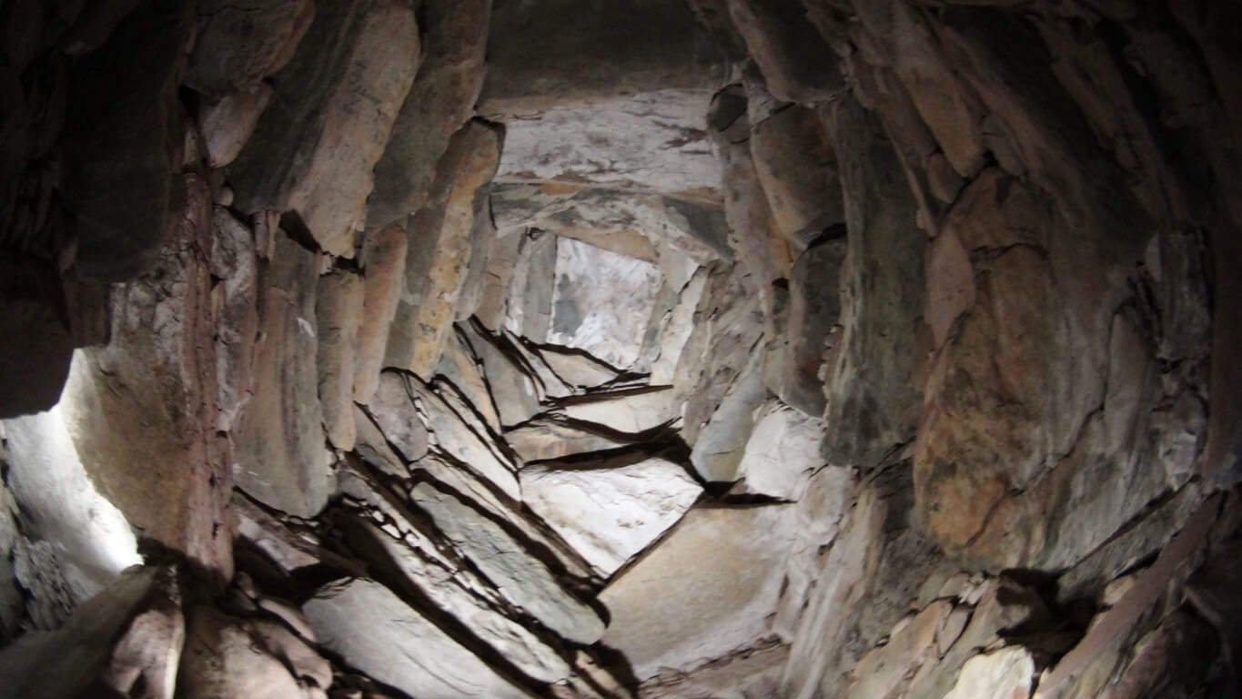 When I entered the Upton Chamber and turned to take pictures, orbs started floating around.(left image) (Click it to look closer). There is energy in these chambers. In general, these are some pretty strong stylistic connections to some very significant places, for just a simple small town in New England.
  Just like in Glenveagh National Park, Ireland (left image), Upton has unique and complex megalithic stones that are beautifully mingled into various features of the landscape, with stone-linings that are much larger than Celtic linings (2nd and 3rd/left images/Upton).
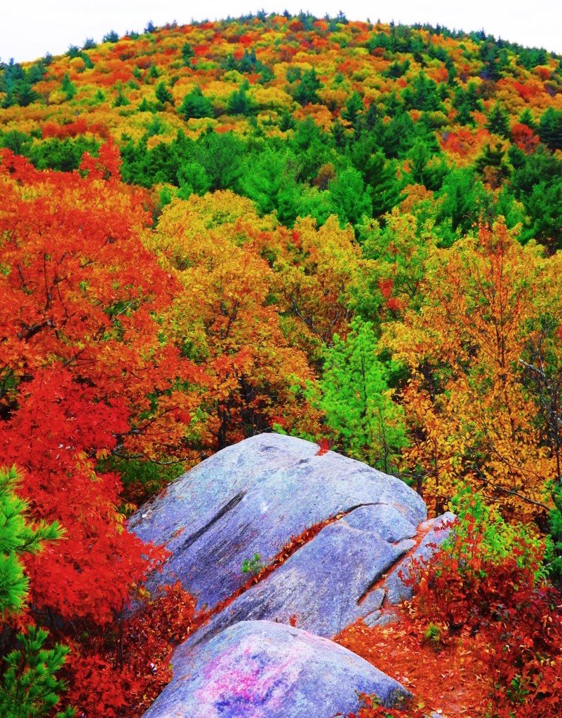 Massive granite boulders are stacked near peaks in the area, and all throughout the elevated trails. Some boulders, however hard it is to believe, seem to have been molded to imitate, and align, to the center of significant peaks in the distance.
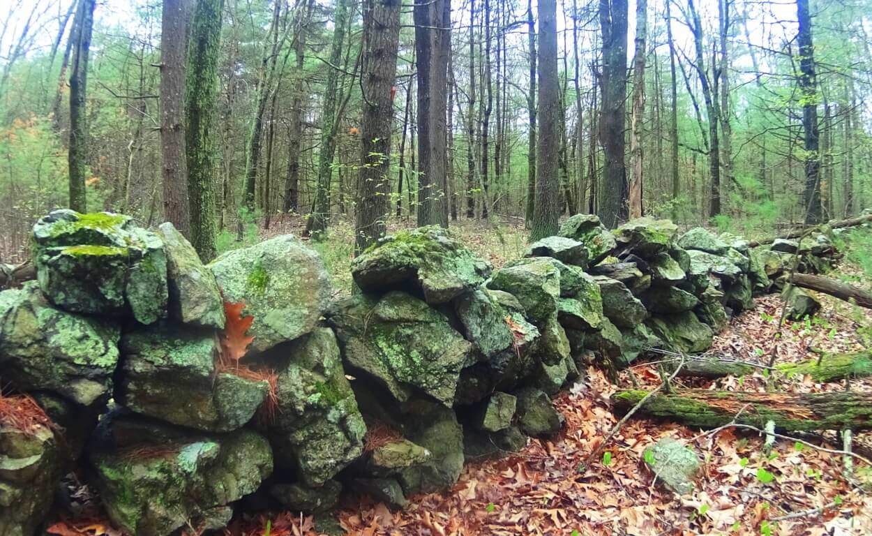 Look Out Rock is an amazing example this, with three parallel grooves carved into its face, seemingly calling attention to the boulder. It points, like an arrow, directly to the top-center of the mountain in the foreground, creating a kind of prismatic display (right image).
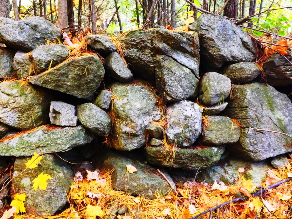 From an anthropological standpoint this is significant information, indicating that this culture was clearly “symmetry conscious”, and not only that, but symmetry capable. They could make it happen. Scope and scale of megalithic work by a culture that is capable of these statements should be reconsidered entirely to understand what is actually taking place. The neolithic culture in Upton, and all over New England, could craft granite boulders like a modern carpenter crafts wood. Forest floors in Ireland and New England look to be made up entirely of granite scraps that are cut from the larger boulders, eventually placed as statements further up the various mountains. This is the reason we find so many stones on elevated trails that have obvious cuts, right angles, and squares. The Blue Hills in Massachusetts (below left), and Mount Bearnagh in Ireland (below right), are prime examples of this. The trails in these sacred places are lined with the scraps of “megalithic carpentry”. If we were to look at the angles of the scraps on the floor of a carpenters cutting-table, the pieces, on their own, are a disheveled mess which doesn’t make any orderly sense, but the significance of each little piece is that they stem from the cutting of a ‘larger block’ on the table.
 The angled granite scraps are the overall proof that craftsmanship took place. Entire trails are lined with scraps of angular granite cuts throughout Ireland, Wales, England, and New England. Returning to Upton, a New-England style Dolmen sits just thirty yards from the peak at Look Out Rock. This is also a trait of sacred neolithic places. Wedge Tombs and Dolmens are often just out of view from the most advantageous spots of their specific site, very much like hikers and campers keep a tent out of the wind fairly close to the beautiful spots they want to photograph and camp near.
 The Wedge Tomb in the heights of Glenveagh Forest, just like Look Out Rock, is centrally aligned to the mountain in front of it, with a Dolmen tucked just 30 yards from the best vantage in Glenveagh National Park. (image on right/Glenveagh Wedge Tomb). Something’s going on here. The boulders on this unique Dolmen (Image below) are cut utilizing massive and graceful lines, with long square boulders fit into each other, balancing perfectly into what looks like a primitive pyramid. The Stones are obviously cut. This Dolmen utilizes a ‘scale-scheme’ with the larger lower boulders, leading up to the smaller capstone at the top (image left).
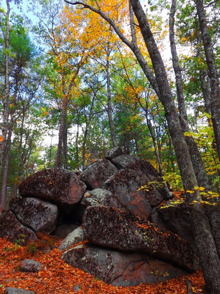 It is an incredibly thoughtful looking structure. In scale (not style) it is very much like the massive Proleek Dolmen in Ireland, which also shows nearly miraculous scale, and balance.
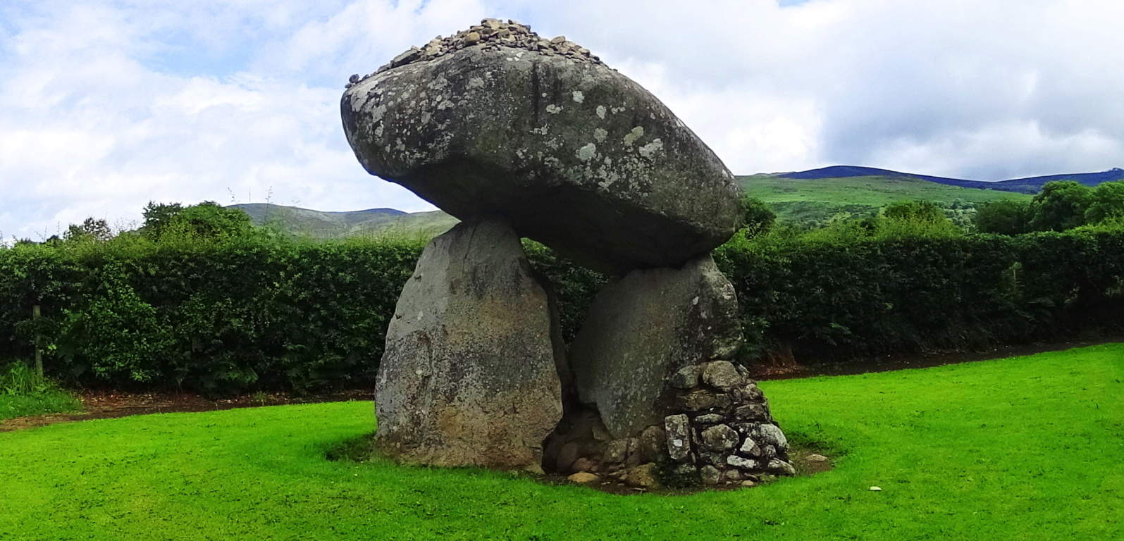 (right image). Interwoven into the old colonial town of Upton, there are ledges with massive megalithic fixtures, huge quartz streaks and balanced boulders. The geological explanation for these features just doesn’t make sense. Scientists usually impose some theory of how glacial ice exploded, or slid, in a certain way to make events like this happen, but it just doesn’t hold up logically. Take a look at these massive quartz parallel shafts, with a free sitting boulder cut and inserted into the underside of the ledge. The boulders may have been cut with the intention of having the quartz grow into the parallel gaps, which reveals an amazing comprehension of how quartz responds to granite in certain positions and places. I wouldn’t put this capability past the megalith builders. It seems that they had total understanding of how to use the landscape, and had the power to mold it as they saw fit. Conceptually, it breaks our reality wide open.
 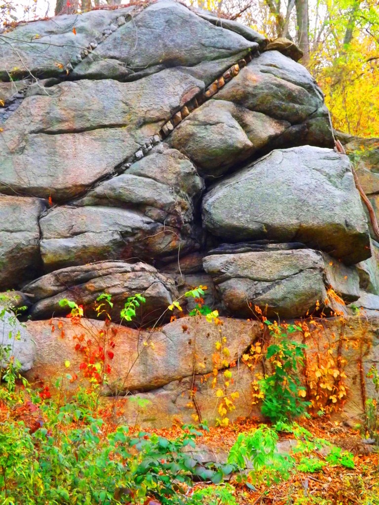 There are stone-linings so massive in Upton, that they look like they were intended to be walked on
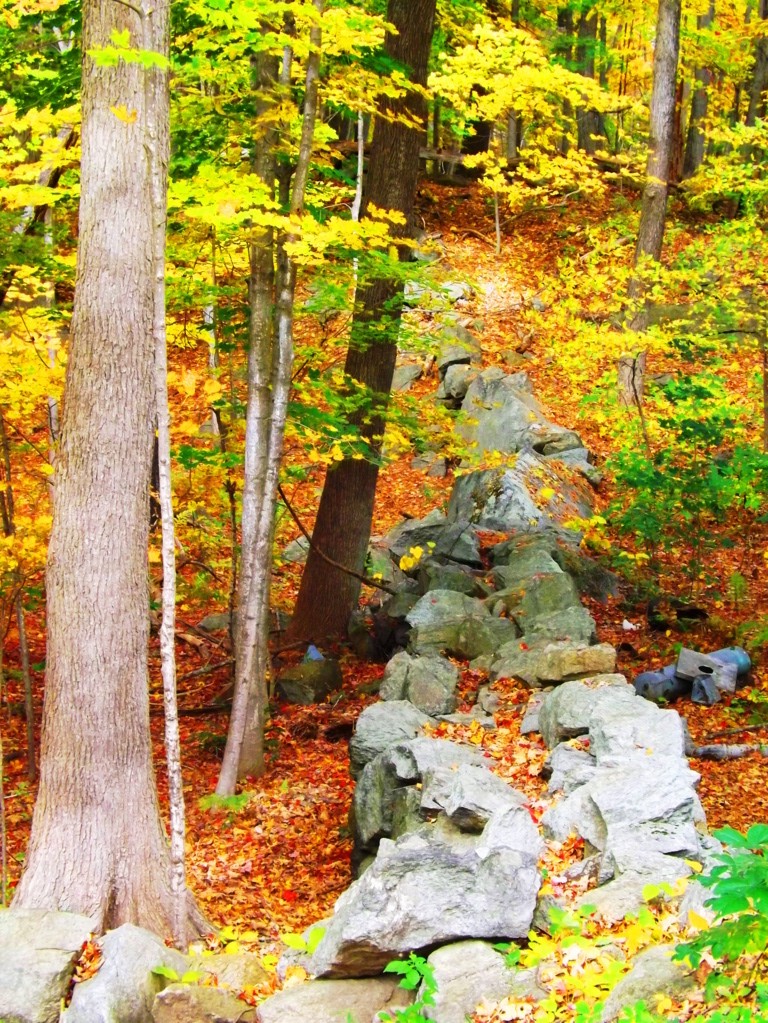 (image left below). Stone-linings literally converge on a Wedge Tomb at Glenveagh National Park from three directions (bottom image) (Click to look closer). These are all indicators that these stones were being used as energy harnesses, connecting features in the landscape, transferring energy from the Sun, to the stones, into the chambers. The entire town of Upton is sitting on a geologically engineered landscape. Take the trails through Upton Forest in October for a ‘fantastic full spectrum’ experience, and hike up to Look Out Rock to see for yourself the aligned ledges and Dolmen. This is truly a sacred and enchanted place in the heart of New England, comparable to any Celtic site. Seek it out.
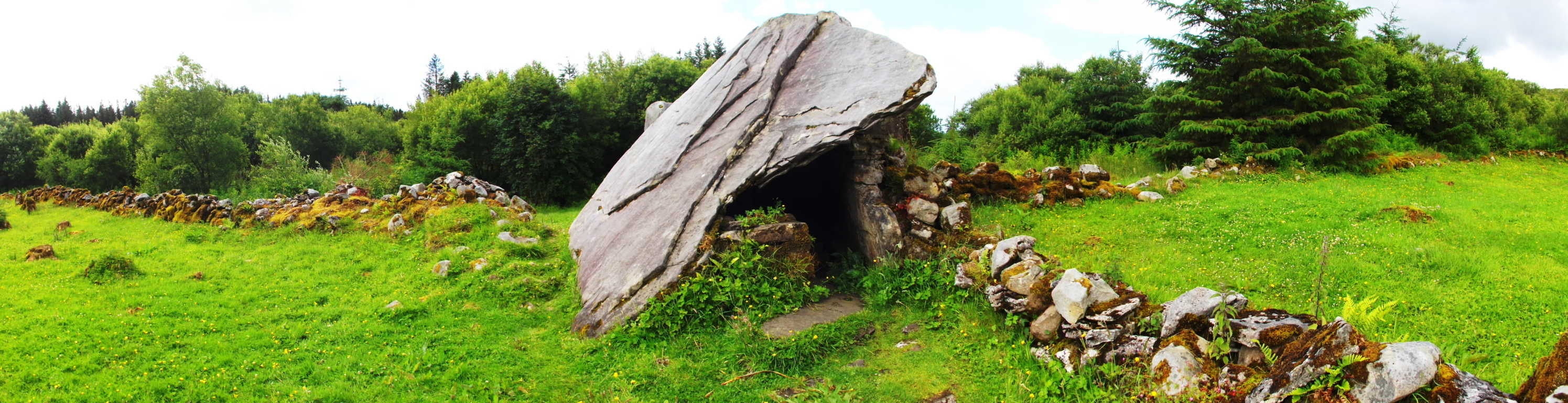
Watatic Mountain
 Location: Ashburnham Massachusetts, U.S.A
Elevation: !,831 feet.
Note: Massachusetts is a haven for the ‘small mountain’ experience, with most trails peaking under 2,000 feet. For hikers with the right vision, the experience on the trails is by no means small, however. A mysterious megalithic culture existed once on the rocky peaks, pine forests, and hilly river-valleys of this area. Strongest similarities show up across the Atlantic in the ancient Celtic elevations. The climb to the top of Watatic Mountain will grant you a great view of the State of Vermont to the north. In Autumn it is a visual miasma of colors, increasing the value of the trail exponentially. The main trail is called Nutting Hill, which is just over three miles long, half of which is just about straight up, so be prepared. The megaliths are here too, making this an anthropological experience. To begin, at ground level a set of small ponds accept the run-off from the mountain. The rocky mountainside deflects the wind coming from the north, stilling the ponds surface like glass as you pass by. The level portion of the trail, just past the water, is only about 150 yards. Immediately strange stone fixtures protrude through the leaves all around. Among these fixtures are more significant signs of “signatures”, or specifically stylized workings in the stone. The ‘X’, or “diamond cross-section” is one of the most popular types.
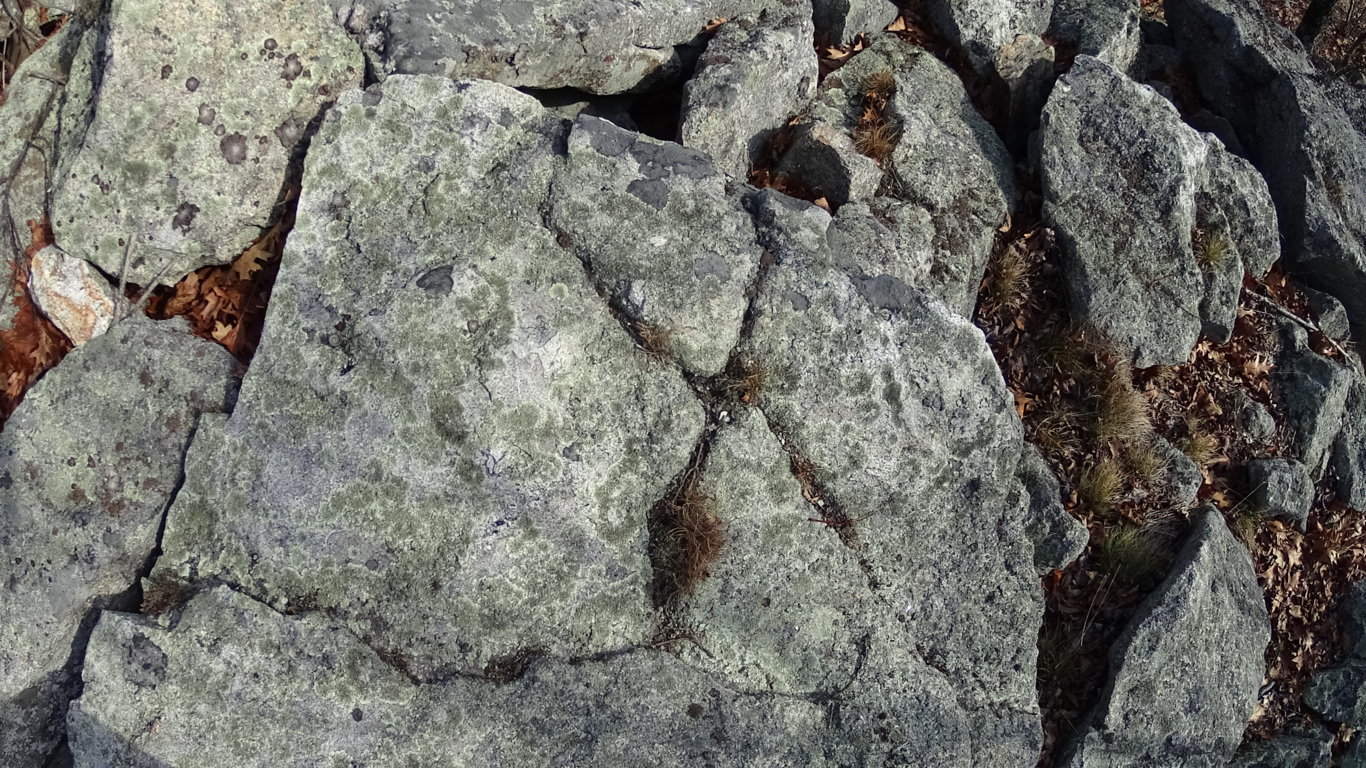
To look at these “X” sections it is nearly impossible to believe that they were created by ‘glacial displacement’. They create symmetries not only on the stones that they are carved into, but also in the stones within the vicinity of that particular signature. They are found on almost every Massachusetts trail where there is significant rock formations, both in the heights, and valleys.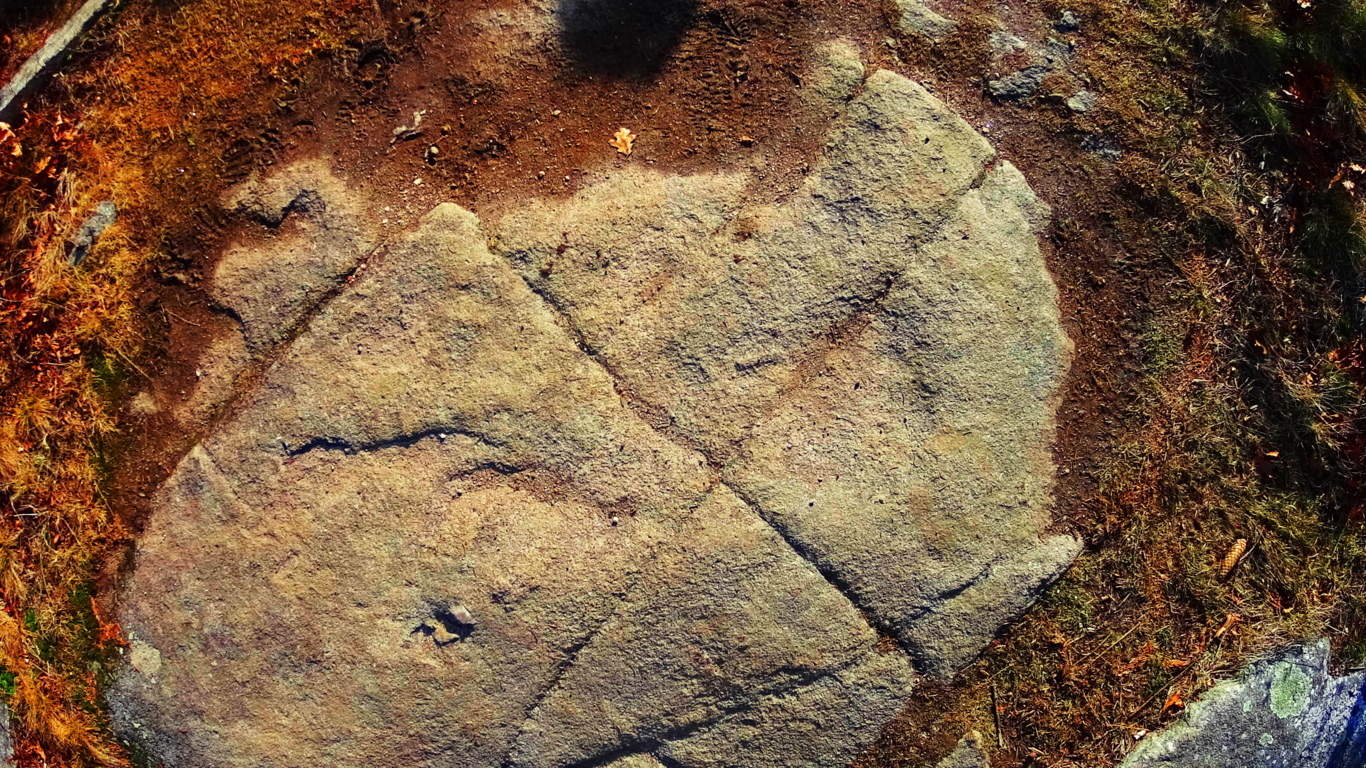 They are also found in the Celtic heights of Ireland.
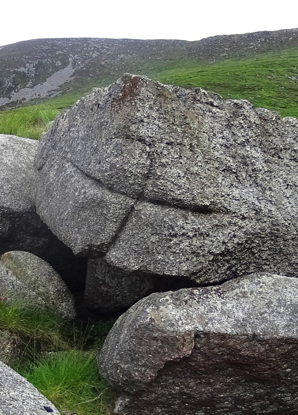 One possibility about the meaning of the “cross section” is that it is a type of utility that insures that if the section is cut, regardless of size, the remaining pieces will fit together if used to build other structures, such as stone-linings (“walls”), dwellings, or irrigation stones. Several examples of this “X” cross section from Watatic are shown here above, as well as one from the heights in the Mourn Mountains in Ireland (right). Before ascension on the trail begins, a classic megalith in the form of a smoothly split boulder, roughly 10 to 15 tons in weight, sits at the base of the mountain, like a gateway. The stone path literally passes straight through this massive cut boulder.
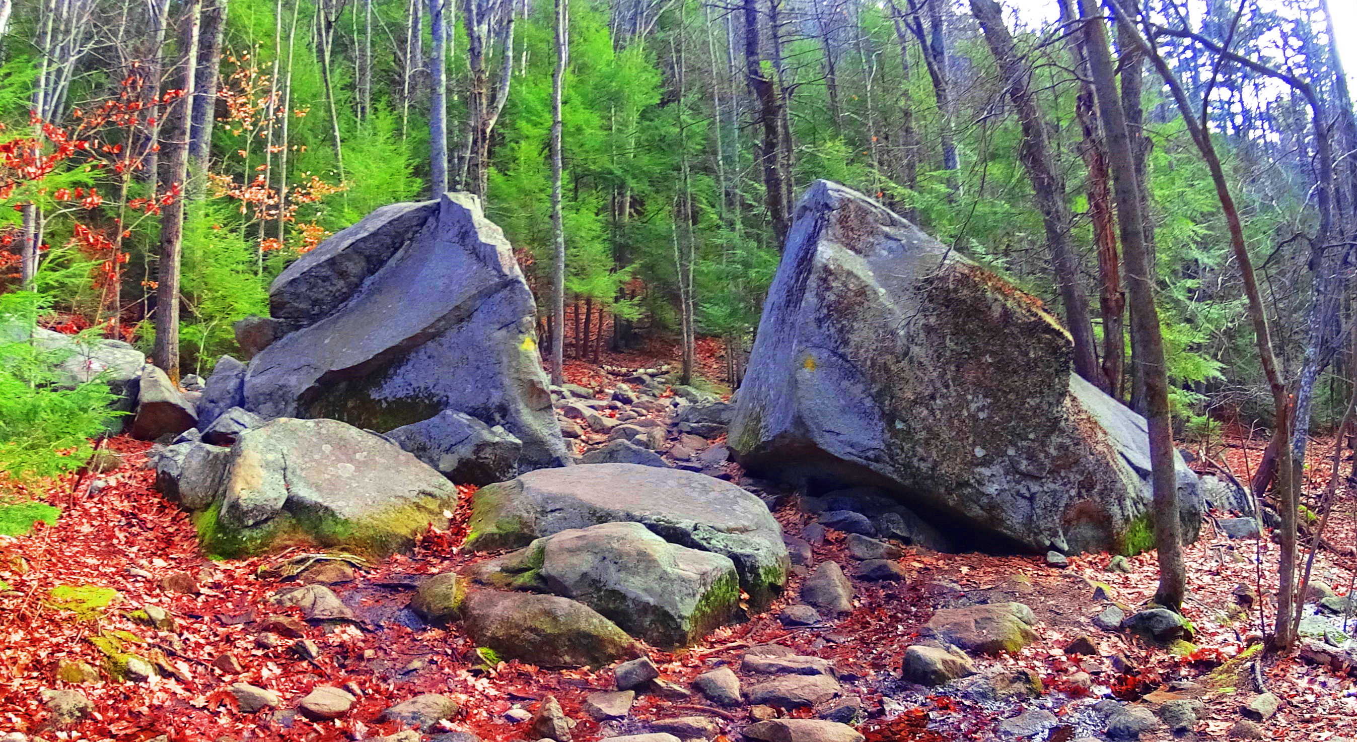 If you stop to examine the area around this megalith, you will find several “cross-sections” waiting to be observed. Continuing, as you begin to climb, a beautiful old-forest glade of pines emerges, and the path becomes wider and rockier. For roughly a mile you will work your way through these pines. Interestingly enough, it is not until you reach about 1,400 feet in elevation, that a “stone-lining” emerges.
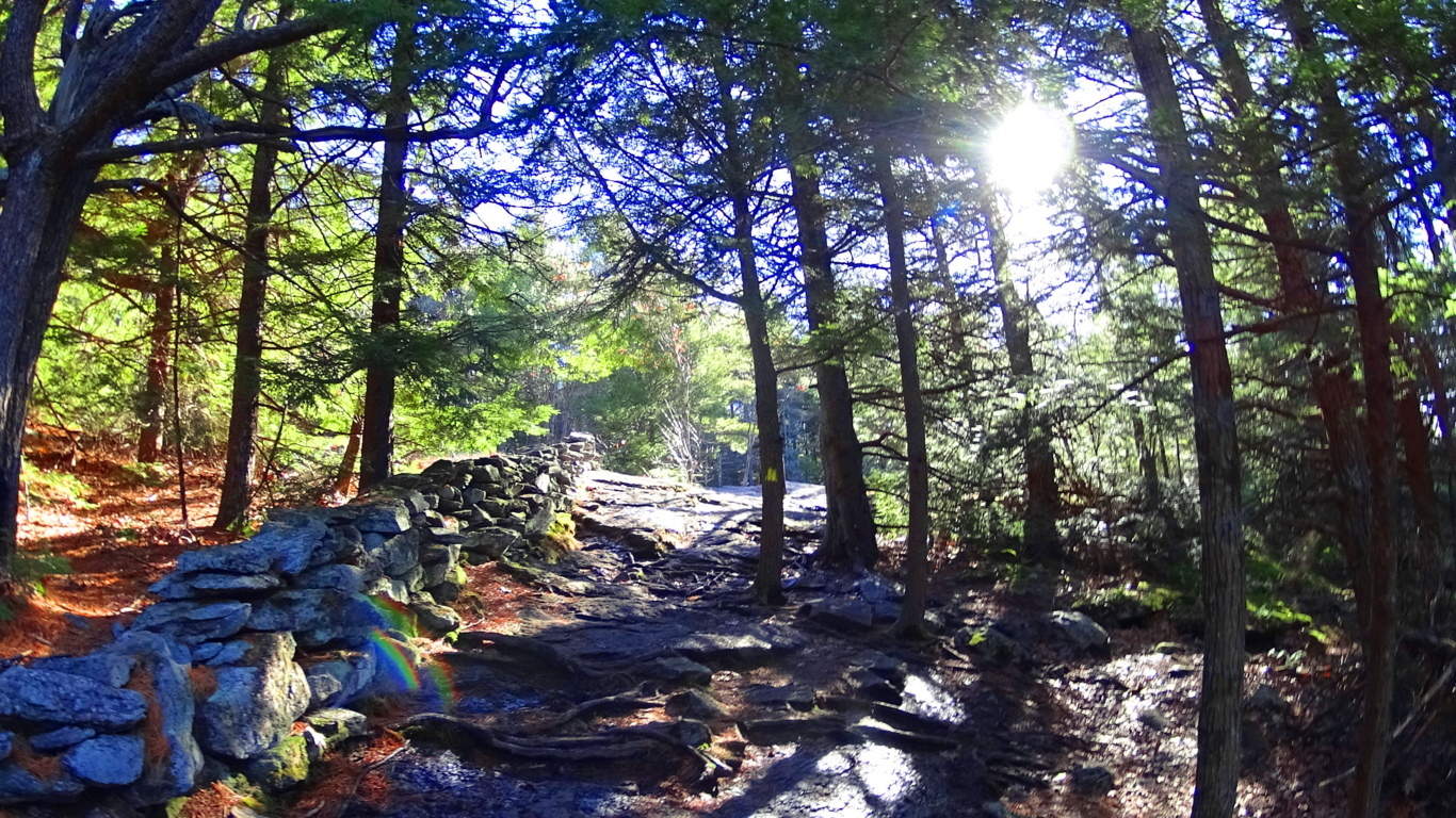 This particular “stone-lining” is another strong piece of evidence against the idea that this type of feature is not a “wall” by any means. It became clear that this feature ran circularly around the dome of the mountain, like a crown on a head. No colonial farm has ever existed at the top of this fairly narrow set of circular porches at Watatic Mountain, where there is no elevated water reserve or pasturing possibility. The case for this being the work of a colonial farmer marking off his territory is illogical. It would be a triply arduous task for any laborer to first gather enough semi-megalithic size stones to lay a three foot high, two foot thick, pile of massive cut rocks around the full circumference of the mountain, at an elevation of about 1,400 feet.
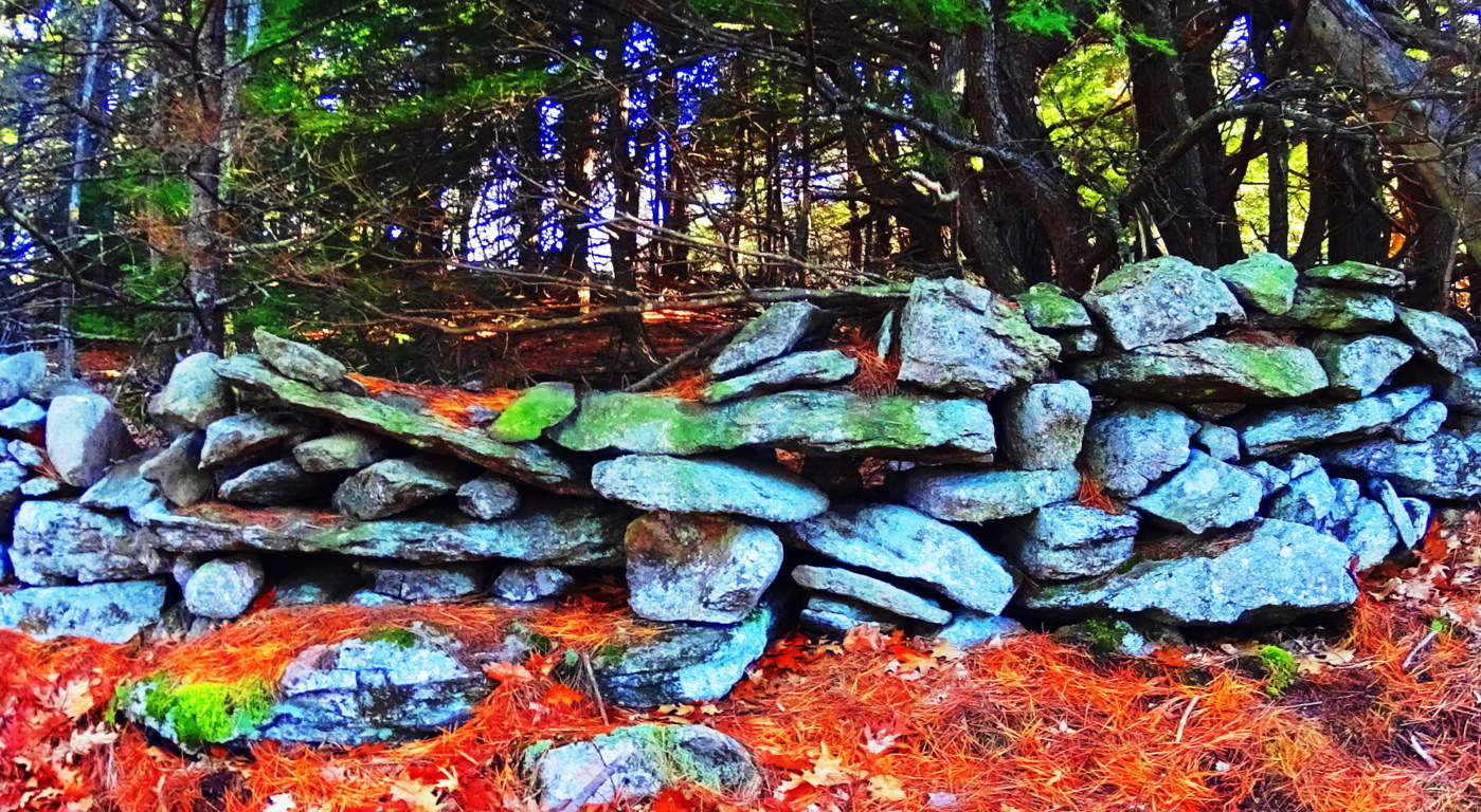 There are no signs that these stones were quarried at the top of Watatic, so they must have come from below. From below, after being crafted, piled, and gathered, the stones would have to be CARRIED UP, AND ALL THE WAY AROUND THE PEAK at an incline of roughly 60 degrees. If a laborer did manage to achieve this impossible feat, actually laying the stones, which weigh anywhere from 50 to 700 pounds each, it would take them a lifetime. Colonial living is an essay in practicality. Labors in Colonial times were conserved to efforts that yielded real sustenance, like digging wells for water, building barns for dairy and protein conservation, and clearing fields for crops. Building a stone wall for no reason around a mountain-side at 1400 feet, where there is no pasture, but only rock, would have been illogical, wasteful, and impractical to the point of preposterous. Something else is going on with these megalithic stone-linings. In places like Cavan Burren National Park in Ireland (Shown in green/right),
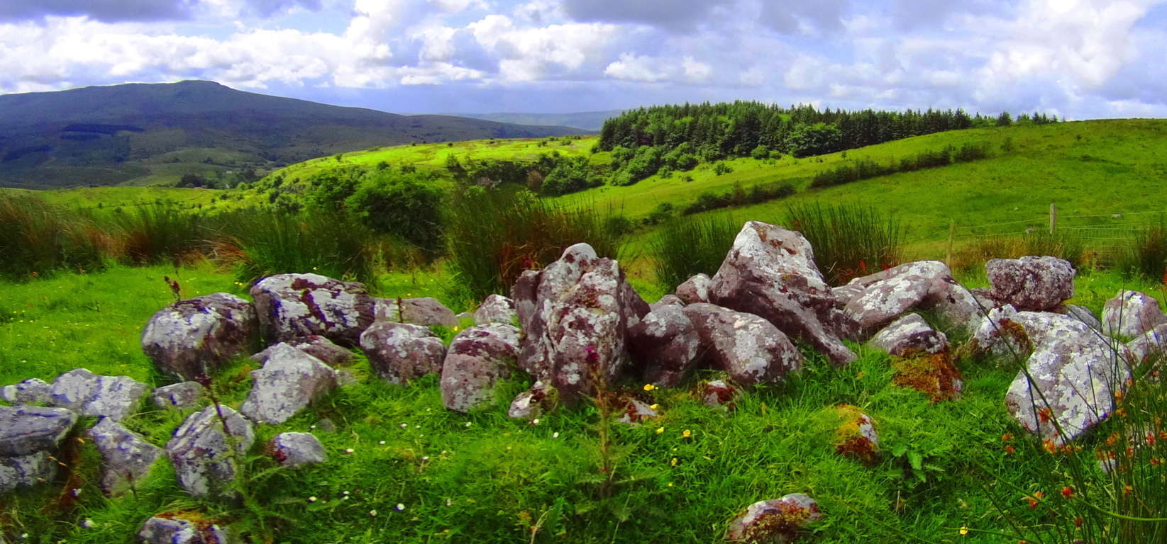 as well as the Blue Hills in south-east Massachusetts (Shown in red and orange, below/left), and the Mourn Mountains in Northern Ireland (Shown in green/left)
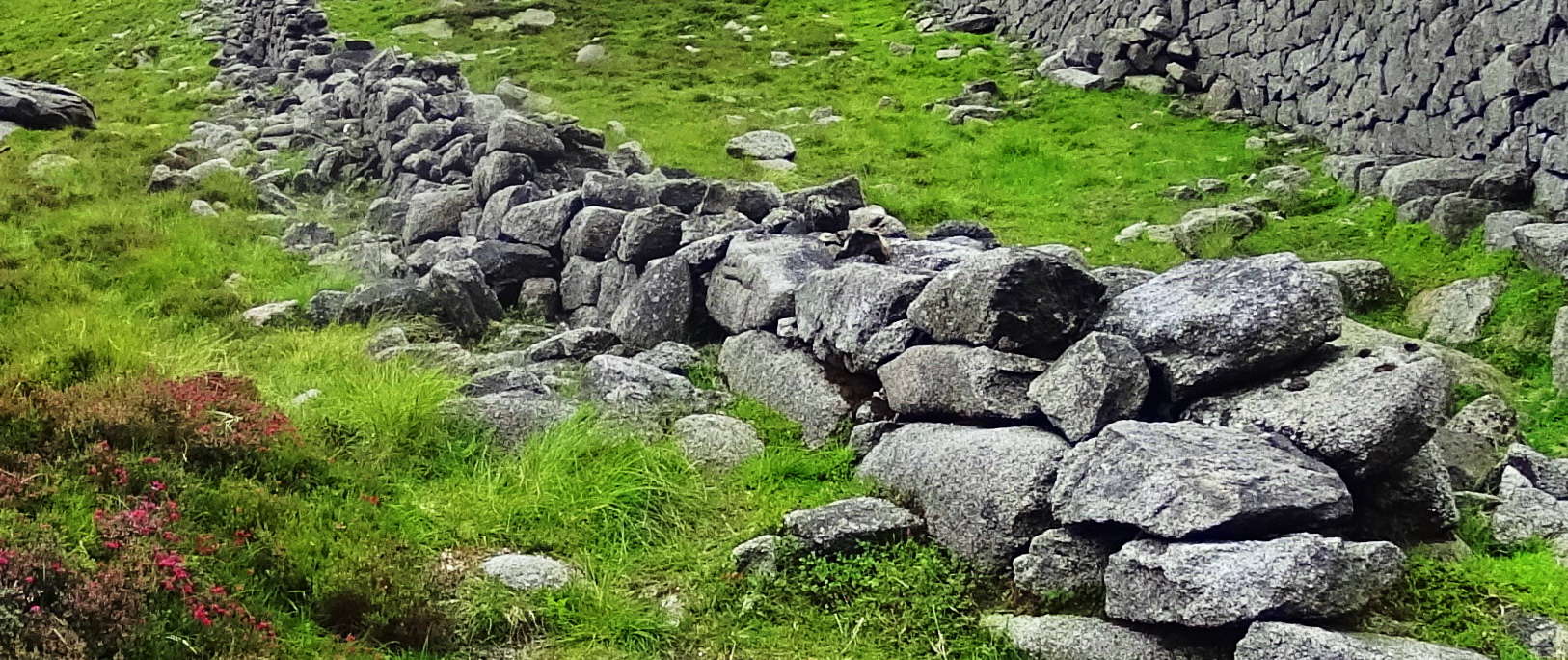 , stone lining seem to be energy connectors, or containers of energy in certain spaces.
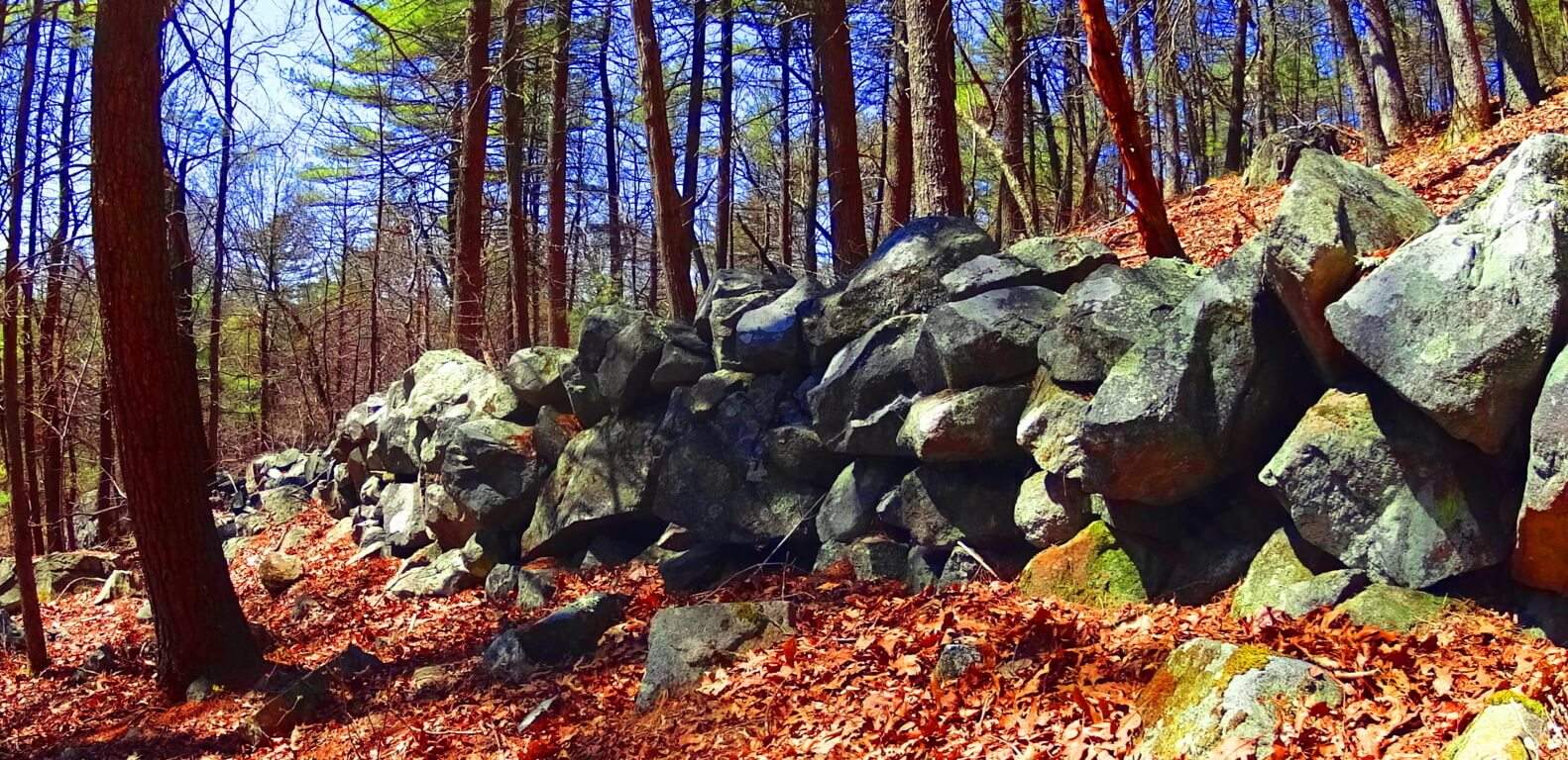 All of these linings are at significant elevations, and are not capable of containing any kind of herds; And this is what is happening at 1,400 feet on Watatic Mountain. Whoever set the stones in place wanted us to understand that the space created within the circle is a sacred energy center, charging the elevated dome of the Mountain with subtle energies. Continuing on again, after passing this 1,400 feet mark, your path will follow the stone-lining for about 100 yards until you cross-over into this special zone. At 1,650 feet there is beautiful Celtic style standing-stone just off to left of the path.
 It stands 6 feet tall, and perhaps 7 feet in width, with a distinctly cut ‘face’ supported by a rotund rear side.
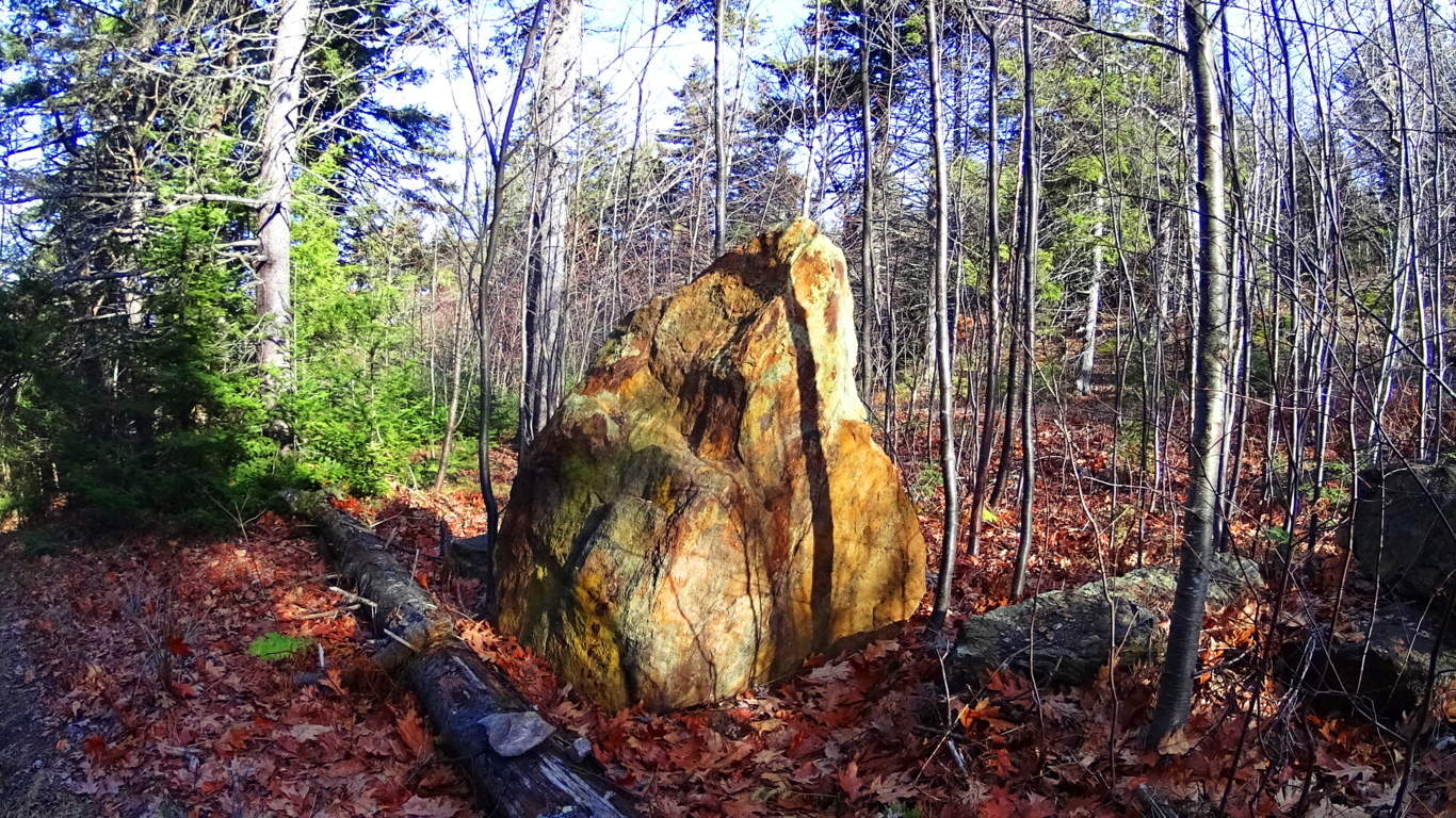 This exact style of “cut-facing with “rotund-rearing” can be found in a gorgeous diamond shaped, white standing-stone, along the castle trail at Glenveagh National Park in Ireland, (shown here in the next two images below).
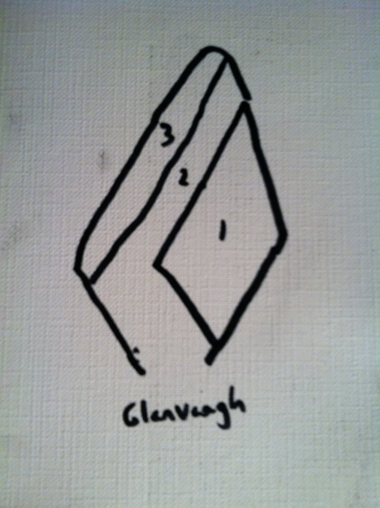
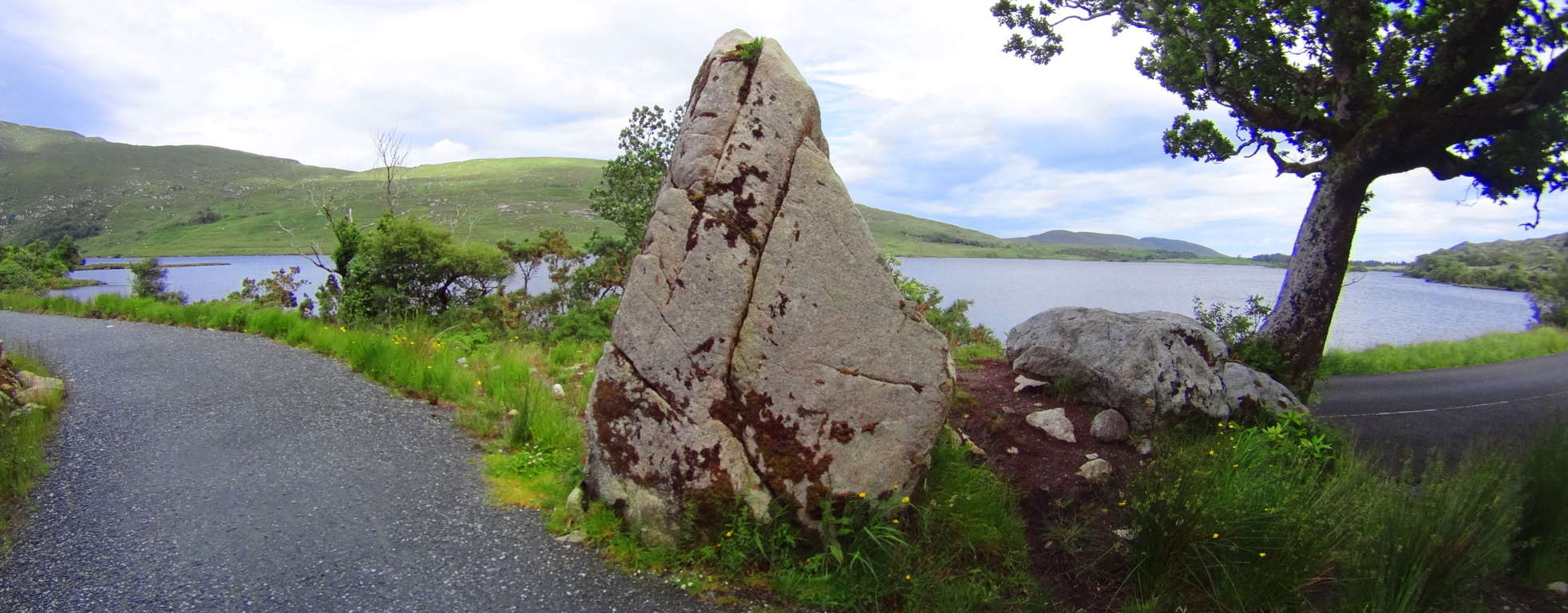
It is impossible to miss the distinctness of the “face” side with the “supporting rounded-rear side” in both stones, and therefor the similarity in craftsmanship. This is pretty solid evidence that the designers of these standing-stones had almost exactly the same knowledge about crafting them, as if they were from the same culture, although separated by an ocean. This is where the story of the Nephilim, as the first anthropological society on Earth, becomes relevant. Obviously the standing-stone at Watatic is so weathered by thousands of years of foliage layered on its distinct face, that it is practically camouflaged into the overgrowth, covering what looks to be pink granite beneath the grime, as opposed to the marble clarity of the Celtic stone, that has not experienced New England foliage. 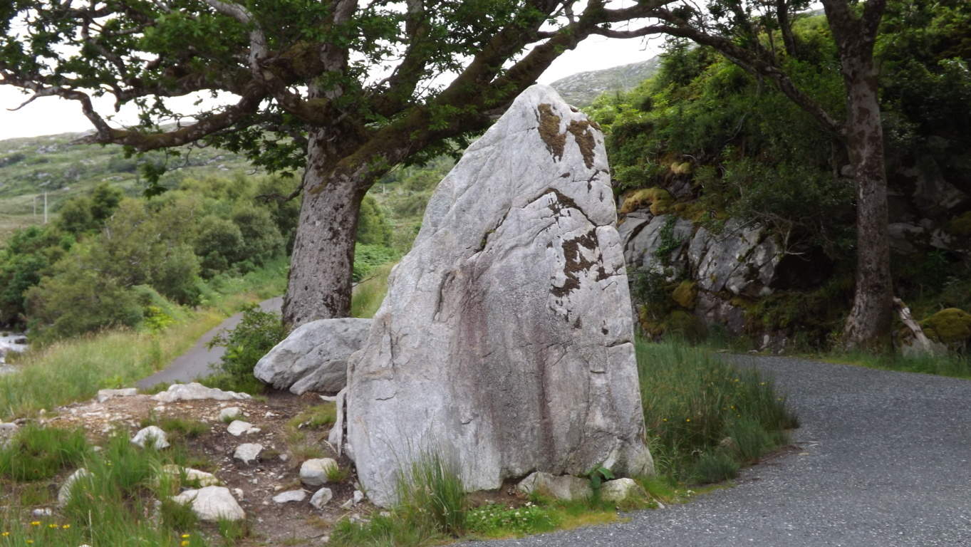 The standing-stone indicates, especailly at such an elevation, that this was once an incredibly endeared and valued space to whoever inhabited it. Finally, a quaintly cut-stone staircase climbs up to the last portion of the heights.
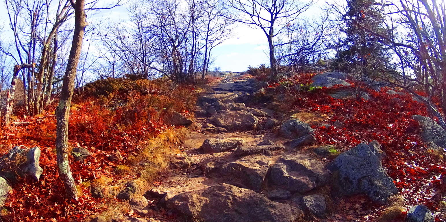 Here you will arrive at a grand porch with a 360 degree view. The rocky trail continues to a larger secondary porch, 50 yards south, lined with pines and rounded granite floors.
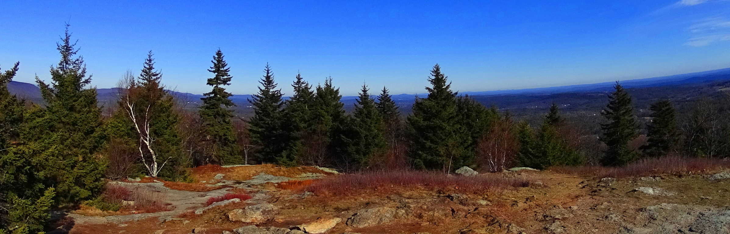 It is well worth the effort to reach the top. Watatic is an essential “small mountain” experience in Massachusetts, literally crowned by ancient megalithic stones. Take a day and see for yourself, you won’t be disappointed.
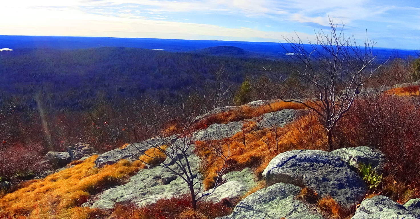
Bear’s Den
 Location: New Salem, Massachusetts
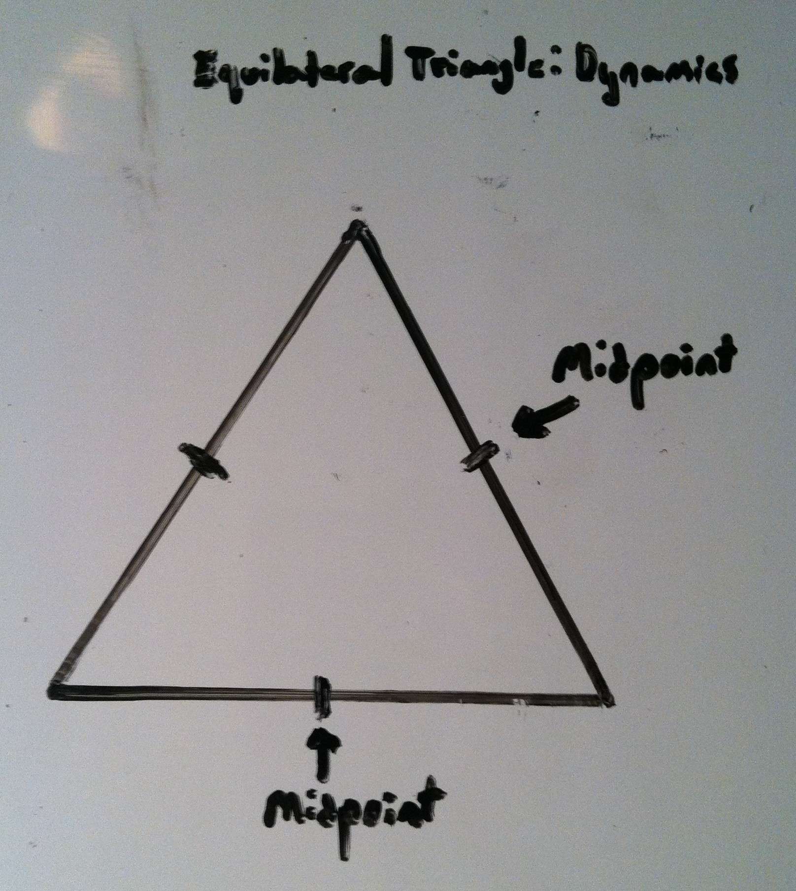
1
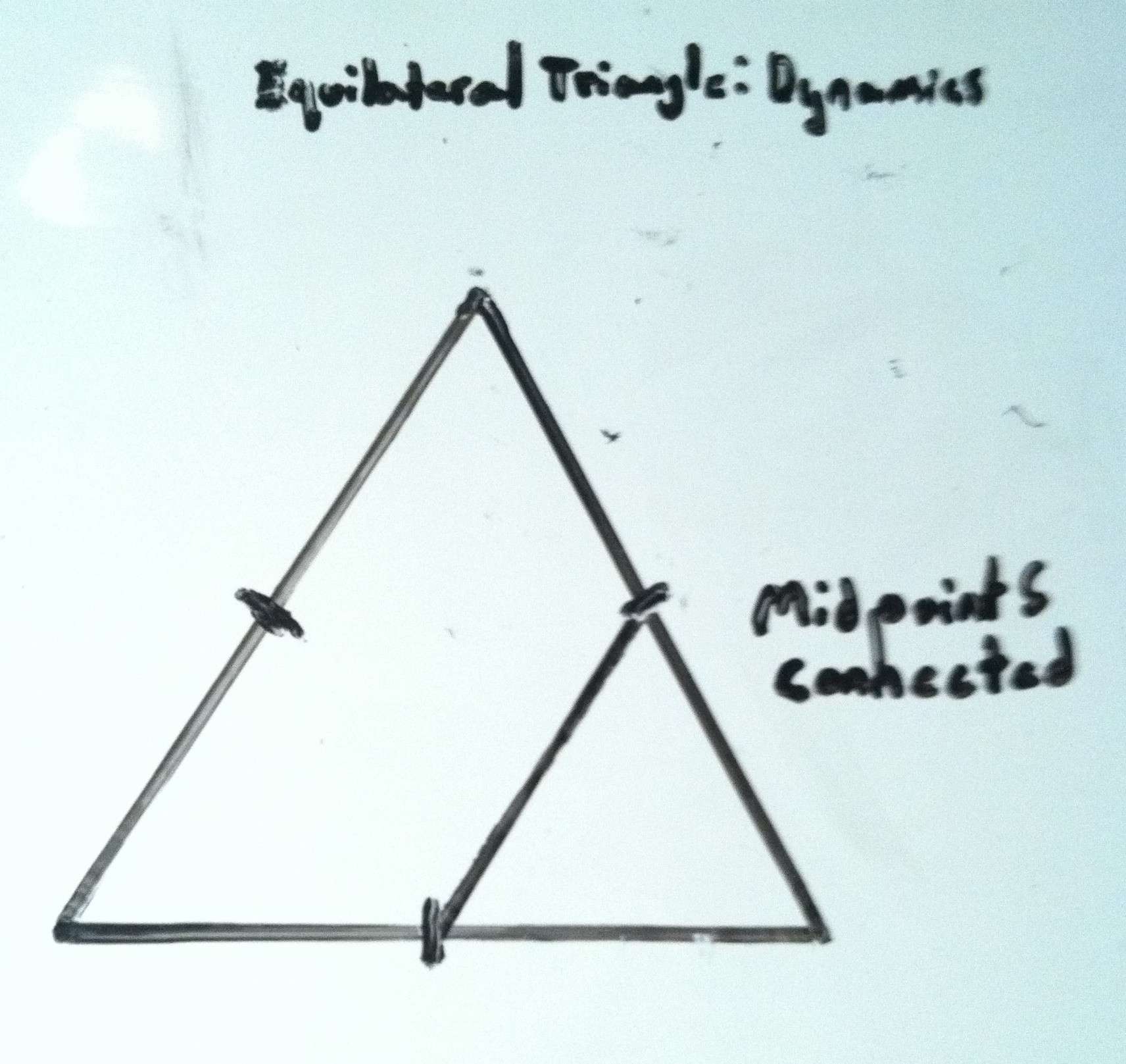
2
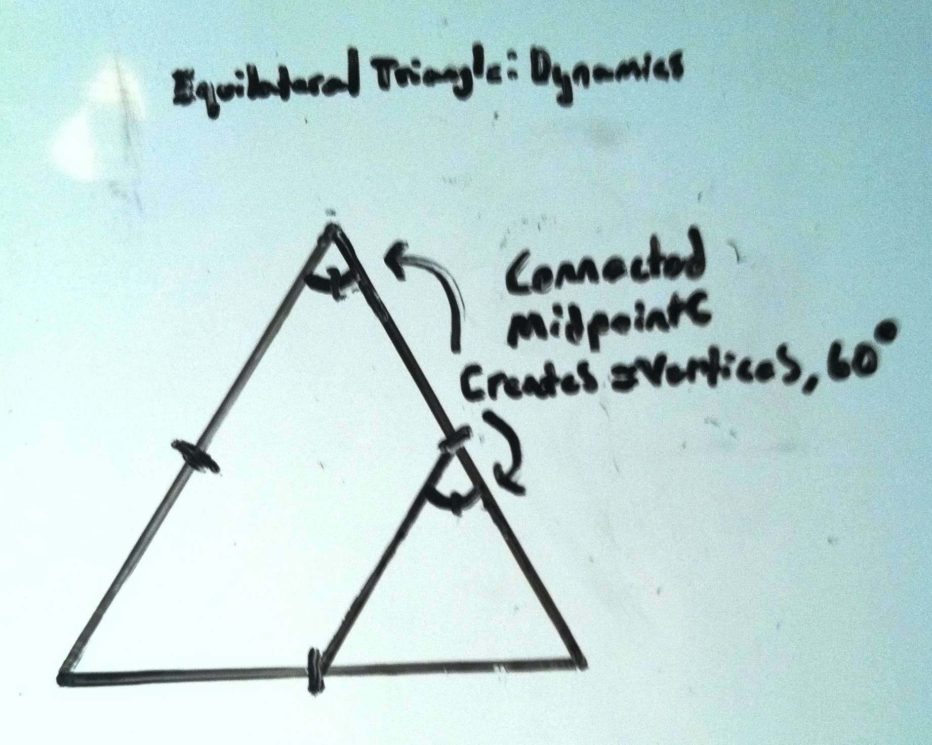
3
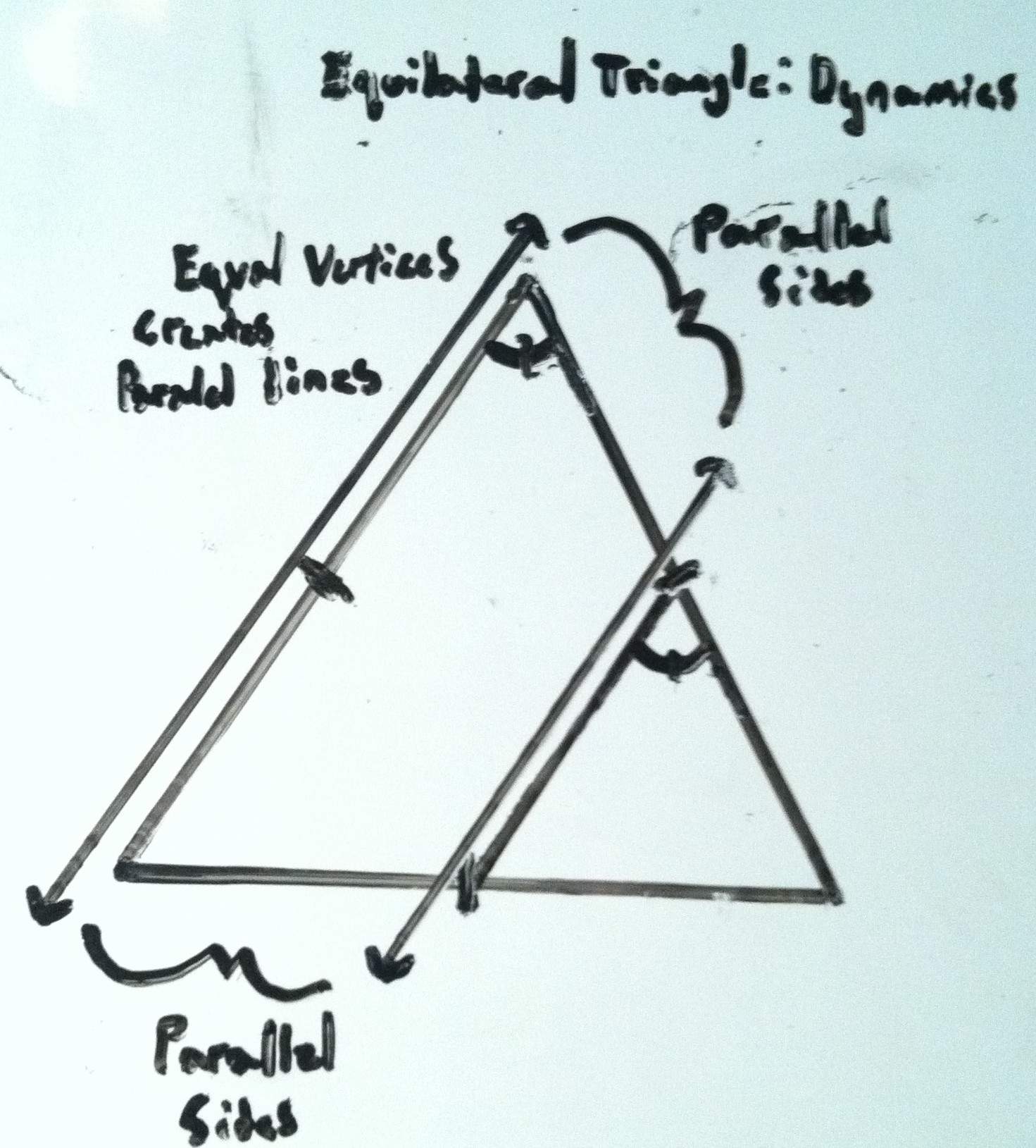
4
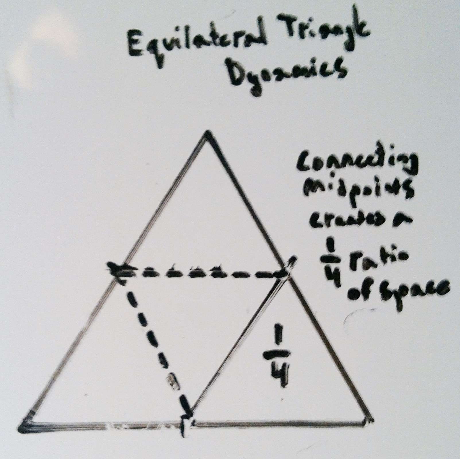
5
Note: Among the initial benefits of hiking… the quiet… the calm… the fluttering of the leaves above, the splashing of streams below, are more miraculous treasures waiting to be discovered. Bear’s Den is one of the most astonishing example’s of this possibility in New England, and even the world. Located just off a quiet road of a small unassuming nature preserve in New Salem Massachusetts, Bear’s Den sits ready to reveal some of the most incredible things a forest can offer on either side of the Atlantic. To begin, tucked into a small gully just beneath the initial trail is an exquisite example of an ancient stone-dwelling. 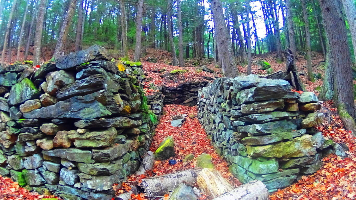 This structure has distinct dry-laid outer walls up to 7 feet high, with unique stones that are each deliberately placed and crafted in an amazing way.
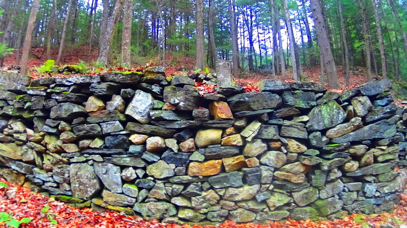 There is an entrance way leading to a single passage that opens on the interior to a leveled-off, stone-supported, bed space.
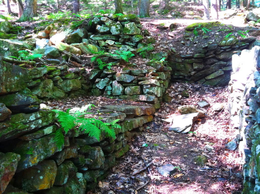 When entering the chamber you feel like you’re in someone else’s home, like a Neolithic apartment for one. There is 4 ton ‘squared’ granite piece sitting high-up on the exterior side wall, across from the bed space that looks very much like a stylistic statement made by the builder. Through sheer size, this megalithic stone says: “Look where I can put this gigantic stone!” This certainly doesn’t look like Colonial work of timely practicality, which usually involves simple cobble and brick, and avoids megalithic size stones. Native Americans were not interested in moving megalithic stones either, or building stone dwellings in north-east America. In terms of historical context, it seems that this structure somehow would’ve been here before the natives arrived, and is not the first instance of ‘megalithic culture’ at the birth of antiquity. This coincides with the claims of native Peruvians, for example. who blatantly claimed that the megalithic structures, built high in the mountains, were there well-before their ancestors arrived.
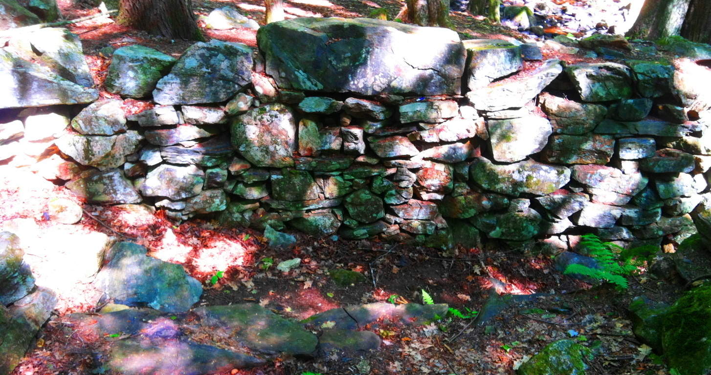 The combination of difficulty, along with the additional craftsmanship of this stone, gets our undivided attention, which is probably the point! To set in place, and perfectly level, a 4 ton granite block that sits 6 feet above the supporting smaller stones, is outstandingly bold to say the least, and incredibly difficult. It’s as if the builder wanted more of a challenge. People in New England that call structures like this a “colonial root cellar” are mentality and logically lacking. It’s the equivalent of calling Stonehenge “just a bunch of big rocks”, when we know it’s obviously so much more. And the intrigue at Bear’s Den just intensifies from here. From the stone-dwelling, follow the trail to the top of the knoll to the north.
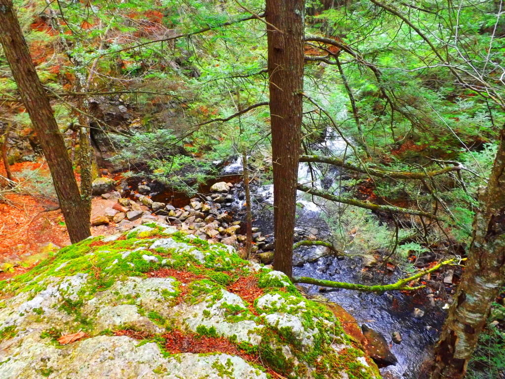 Free-sitting boulders at the top of the knoll are crafted, creating an entrance way and designated view of the waterfall on the other side. Two specifically elevated and leveled stone porches sit facing the waterfall at an intended height from about 25 yards away. What you are about to see is exquisite. The first glance of this picturesque waterfall from this elevated stone-porch reveals multiple features. The stream is split beautifully by a massive stone facade. The water that flows to the right of the main facade funnels through a specifically cut ‘spout’ down into an incredibly crafted leveled pool. This is where the scene begins to become surreal, mathematical, and incredible. Before continuing, take a look at the close-up image of the right side of the ‘funneled waterfall’ (2nd image below) and see if you notice anything unique about it. It’s impossible to miss…
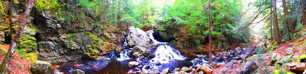
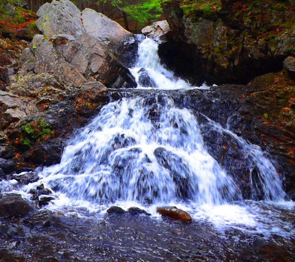
The Emblem Stone: Along the inner line of the perfectly leveled pool receiving the water from the funnel, is a beautiful granite-cut emblem of an equilateral triangle, each side being about two feet long, but looking smaller from a distance. Equilateral triangles DO NOT OCCUR IN NATURE, so we immediately must begin to wonder, who could have done this, and why? If you look closer, there is also a line inside the triangle clearly connecting the midpoints of two sides. A line that connects the midpoints of two sides creates an angle of 60 degrees.
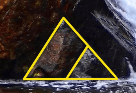 It appears that this emblem is depicting a specific geometric relationship. (Shown on the right) All of a sudden, the waterfall too, is an anthropological site.
Simple Geometry: (Please look to the diagrams 1-5 above to see the proofing of these ratio’s and parallels): At this time a few simple geometric explanations are required which only take a moment. Due to the midpoints being connected within the triangle, the vertices of the smaller triangle become equal to the vertices of the larger outer triangle, at exactly 60 degrees. Further still, since the vertices of both triangles become equal, the sides of both the larger and smaller triangle therefor become parallel. When these relationships are proven, the smaller triangle is revealed to be exactly 1/4 ratio of the entire figure. This is absolutely astonishing. Logically we must accept a few things at this time. First, it should be understood that whoever etched this emblem did so in granite, and for a reason. We have to conclude that the designer absolutely intended for us to notice it. In fact, the only guarantee that it would be noticed, is to etch it in granite. Second, the specific geometry of the emblem is a message, a coded stone, informing us that the designer was obviously well aware of Sacred Geometry. Third, if someone from antiquity is leaving us a coded emblem with specific geometric relationships, it demands our utmost attention, and we should be adamant to observe any other relationships taking place, relevant to this emblem.
The Funneled Waterfall Parallel: It is logical to follow the lines of the parallels that have been established by this emblem to see if there is any further connections on the waterfall overall. If we continue the line of the left side of this coded emblem, we see that it connects DIRECTLY to another crafted feature. Continuing along this exact line is a crafted stone funnel where the water is harnessed specifically to a single focal point. This exact line is becoming a longer parallel. 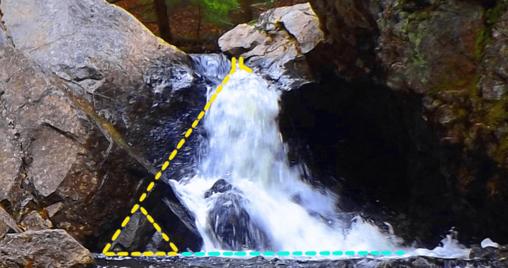 You can see the distinct whiteness of the water blasting out of the funnel. At this point something astonishing is beginning to emerge. The possibility that the ’emblem stone’ is a coded statement for relationships relevant to the entire waterfall is becoming possible. If this parallel line extends to a specific point on the larger structure, is it possible that this line will have a matching larger parallel on the other side of the waterfall, just like the lines of the emblem? Is it possible that another larger triangle can be established relative to this right-side portion of the scene? Let’s continue to try and find features that fit the ratios and angles. If we continue to implement the information the emblem conveys, from this top funnel point we can implement a 60 degree angle, and draw a line downward at this specific angle. We will then continue to draw that line down to a point where we can implement another 60 degree line at the base. If we do this, another perfect triangle emerges, depicting an outline of the ‘funneled-side-waterfall’ on the right-lower side, exactly as depicted in the right-lower side of the emblem stone.
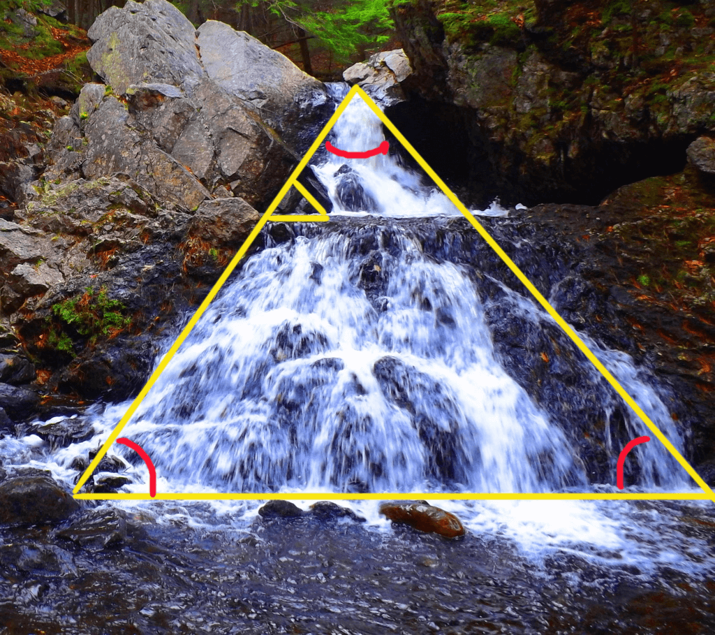 From here, if we want to see if there is a ratio-appropriate parallel to the ‘funnel-waterfall-triangle’ on the 3/4 side of the scene, we need to step back to where we can see the entire picture again.
The Top Central Boulder: Returning to the leveled stone porch, we must look for a central point where a larger parallel line can converge, in accordance with the pattern on the emblem. Remember that the emblem depicts a specific 1/4th ratio for the smaller triangle within, therefor, a higher point in the 3/4ths section on the right should specifically exist. Let’s continue to look for this intentional designation. If we examine the upper-left portion of the overall waterfall, we DO see something specific. Looking down from the center of the elevated porch, directly below is a set of distinct stones that serves as a central bridge that connects the land across the stream with the granite facade. If we follow this line we can see that it directs our eyes straight ahead to the exact high-point on the massive frontal/main granite piece, where there is a distinct crease cut into the rock (double click o image to the right to look closer). Directly above and behind that crease is a free-standing boulder, placed centrally (circled at the top. in yellow).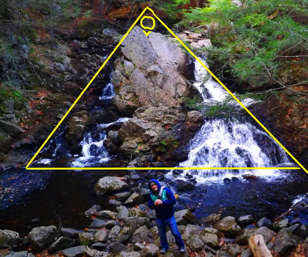
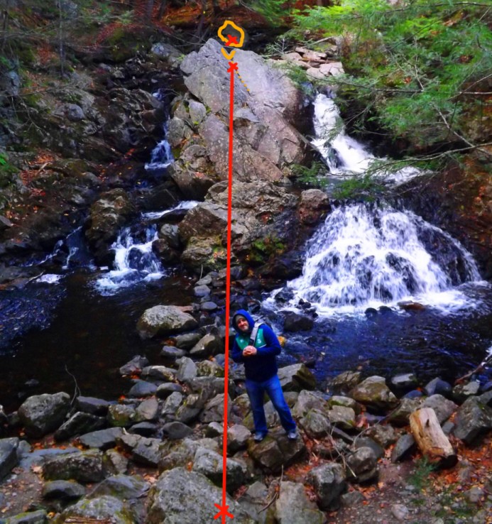 It is certainly important to check these points of significance to ensure that they are not arbitrary. It appears that the aligned stoned bridge is directing us towards this specific boulder. If you cross this bridge, which is completely linear, and climb up to the cut crease, then make your way to the centrally placed boulder behind the facade, and turn around, there is something spectacular we are intended to see.
The Aligned Rear Altar: Here we see what looks to be a type of “water-altar” embedded behind the uppermost granite facade where the crease is. The cut line of this uppermost crease is even more distinct from the back side, revealing an exact cut that extends as an incision deep into the granite at a 45 degree angle.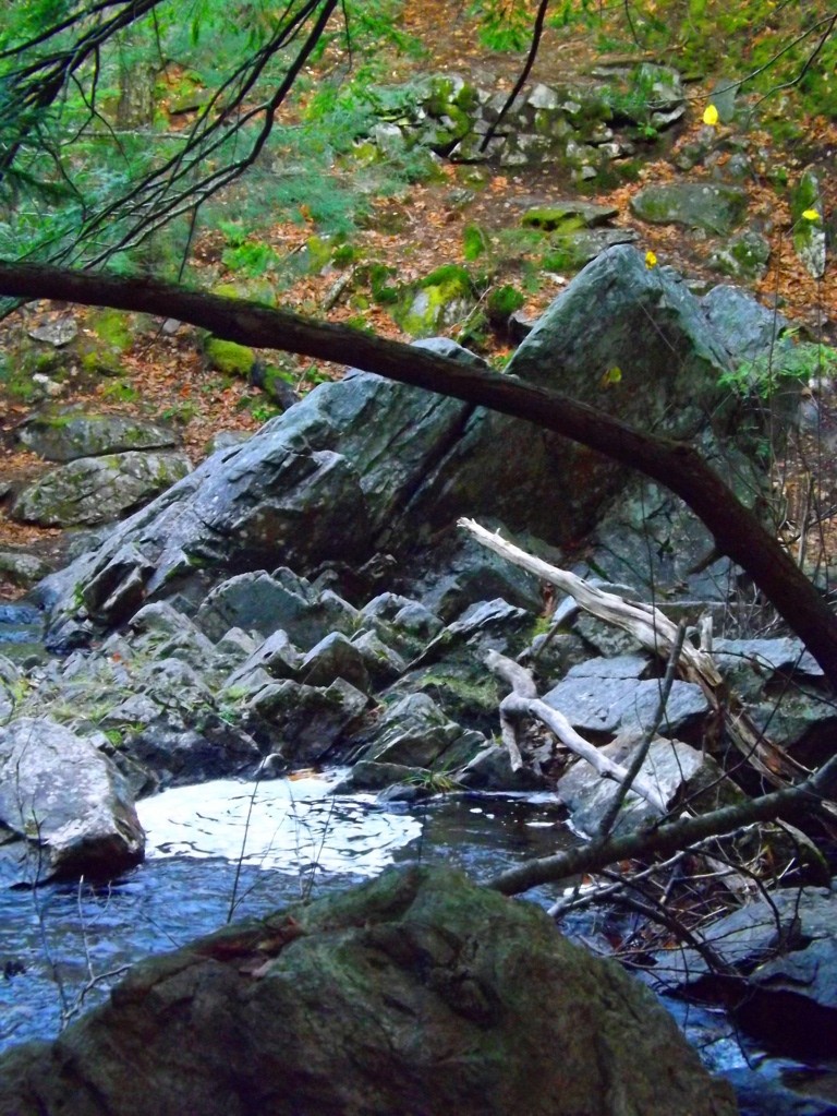 Looking back now from the center of the boulder, through the crease, back to the elevated porch, is a perfectly straight line, as well as a perfectly leveled line (Image marked below, left). The alignment, symmetry, AND elevation, are all absolutely exact. This rear section is obviously another type of ‘alter’ intended to be found by use of the information given to us by the emblem. Along the line of the ‘high point crease’ is a circularly cut whirlpool, with a back drop of smaller stones with little incisions that follow the 45 degree lining of the top most crease. These are blatantly angled cuts in solid granite. This is also the exact spot where the water divides into two sections, cascading down to the left and to the right onto the frontal facade (Image to the right). As the high point of division for the stream, it is further justification as an identified high point to the main frontal facade. All of this information serves to reveal the free standing boulder behind the uppermost crease as a central high point, intended for us to discover by the efforts of the designer of this waterfall. With this important piece of information, we can go back to the elevated porch on the frontal side of the waterfall, and utilize the ‘top boulder’ as our fixed point for the parallel line we are hoping to find, which will logically coincide as a parallel with the ‘funnel-waterfall-triangle’ line on the more minor lower left side of the overall facade, just at the top corner and the mid-line corner coincide on the emblem.
The overall waterfall and the emblem are the same: If we extend the ‘funnel-waterfall-triangle’ lines, at the angle of 60 degrees indicated to us by the information within the ’emblem stone’, this line will run straight to the peak of the ‘top boulder’. It all comes together from here. The outer line connecting the ‘funnel-waterfall-triangle’ to the specific point of the ‘top central boulder’ is enough information to allow us to complete the picture. 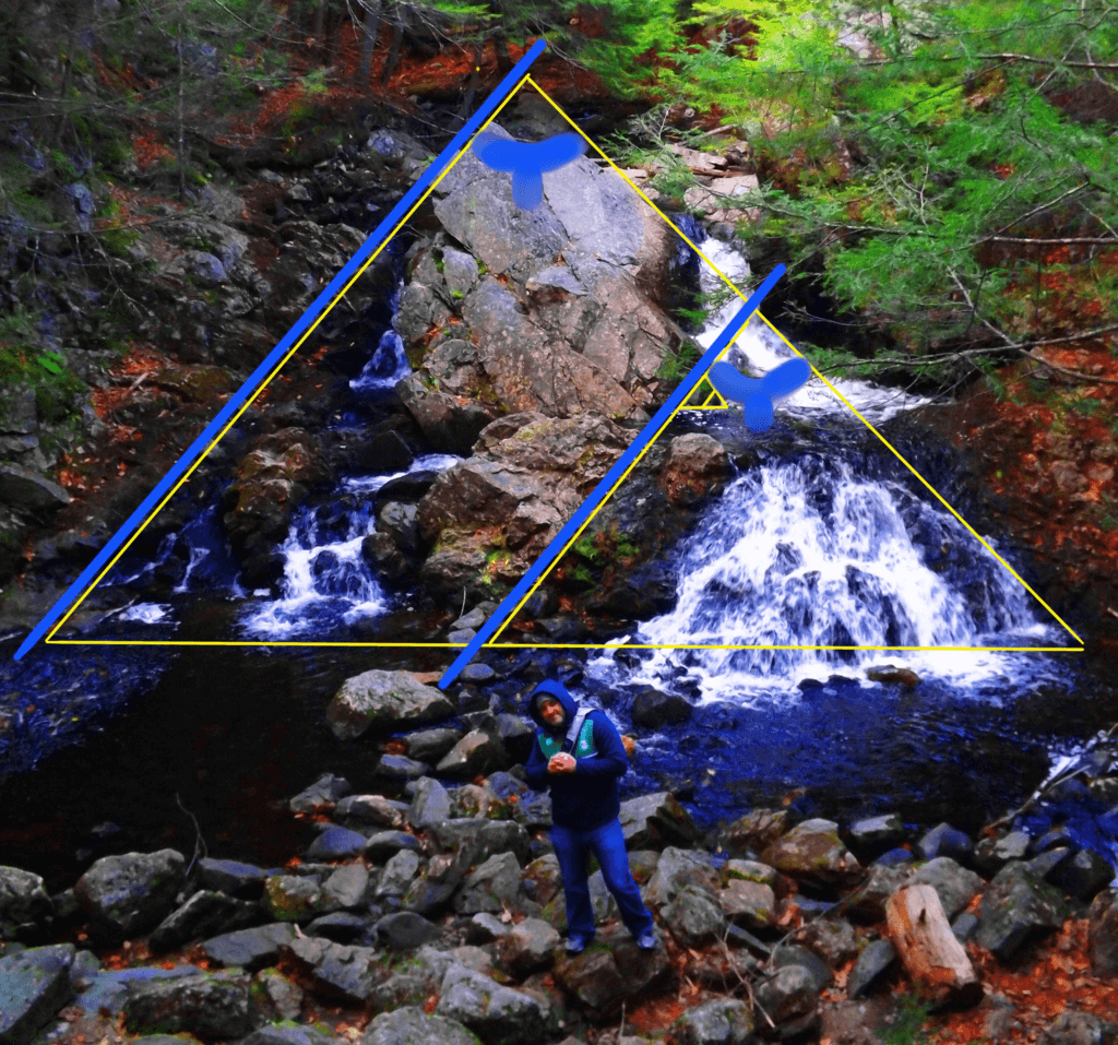 If we again use the 60 degree angle implied by the emblem stone, we can now draw the parallel line we were searching for, that coincides with the ’emblem-to-funnel’ line. We draw the line as a parallel from the ‘top boulder’ down, and the picture begins to emerge in full. The parallel lines are in specific ratio as well, so it becomes impossible to miss. If we match the 60 degree corner of the established ‘outer right-side line’ on the right-side extremity of the waterfall, we can define a 60 degree corner on the left-side extremity and run a base line from one end of the fall to the other. Here we see that THE RATIOS OF THE ORIGINAL CODED EMBLEM EMERGE AGAIN IN THE OVERALL WATERFALL (displayed below). We now see, by definition, that the 1/4 ratio portion of the overall triangle is the ‘funneled waterfall triangle’ with the ‘leveled pool’ on the minor right corner. It’s a perfect fit. What we have discovered is that the ’emblem stone’ is nothing less than an embedded, ratio-specific ‘keystone’ that opens up the possibility of comprehending the entire picture.
Mystical Beauty: There are so many question that come from discoveries like this. Who would have the ability and knowledge in antiquity to create an engineered, ratio-specific, waterfall from cut granite? This just doesn’t coincide with the evolutionary depiction of history, where humans are depicted as primordially primitive. Perhaps the builder was not entirely human? It’s not just the magnitude of understanding, its the ability to carry it out that’s really moving. The emblem shows us the mind of the engineer of this waterfall; That beautiful ideas can have a core principle, and be carried out into complexity by the consistency of defined ratios and principles. To do this in antiquity is earth shattering. It seems likely that the engineer of this masterpiece lived in, and also designed, the elegantly simple and beautiful stone-dwelling just over the hill. It makes sense. The stream flows from the waterfall, around the hill, straight to the dwelling, and beyond.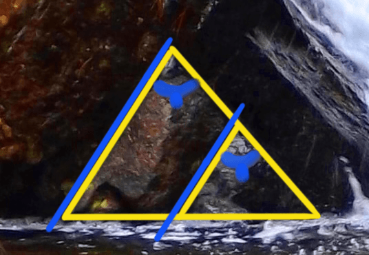
It is a captivating scene.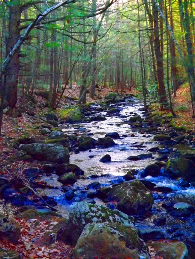 For a moment, picture a pristine Era at the beginning of Time, when the water was clean and drinkable. This area was carved-out as a place of pure joy and regeneration, perhaps in the very first Era. It is at least one of the oldest functioning engineered sanctuaries in the world. It’s haunting; where trails run along the river above the waterfall and below, through the forest and back to the stone-dwellingl for a 2.5 mile loop.
The Equilateral Triangle: The equilateral triangle is a feature that actually shows up in many New England forests in several different ways. In my personal explorations for content for Stonestrider.com, I’ve seen large granite cuts, subtle small granite pieces on mount Watatic, Massachusetts, with holes somehow drilled smoothly into the exact center. and massive granite slabs in deep woods with 60 degree quartz stripes across the face (bottom images). On my way out of Bear’s Den on my most recent visit this September, just down stream from the waterfall, I discovered another cut equilateral triangle, this time laying right beside the boulder it was cut from (green stones on the lower left).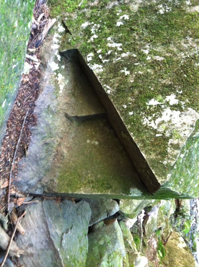
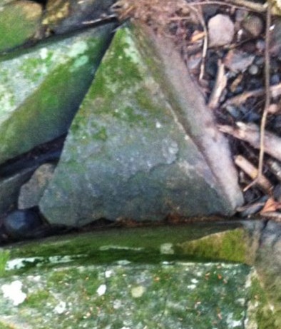 This is Neolithic meme in New England of incredible and profound significance. The culture that appreciated this specific geometric shape engineered it into their lives, in their work, and in their hearts. The ancient Israelite immortalized the equilateral triangle in their designs of the Ark of The Covenant and later in the Temple, as instructed by Ashem (Yahweh,God). A functional living monument dedicated to this shape conveys a message across the Ages, which is that the builders were connected intimately with this divine principle. If you explore the forest and mountains of New England, as well as the Celtic high country, it is only a matter time before you discover this for yourself. Hope to see you out there.
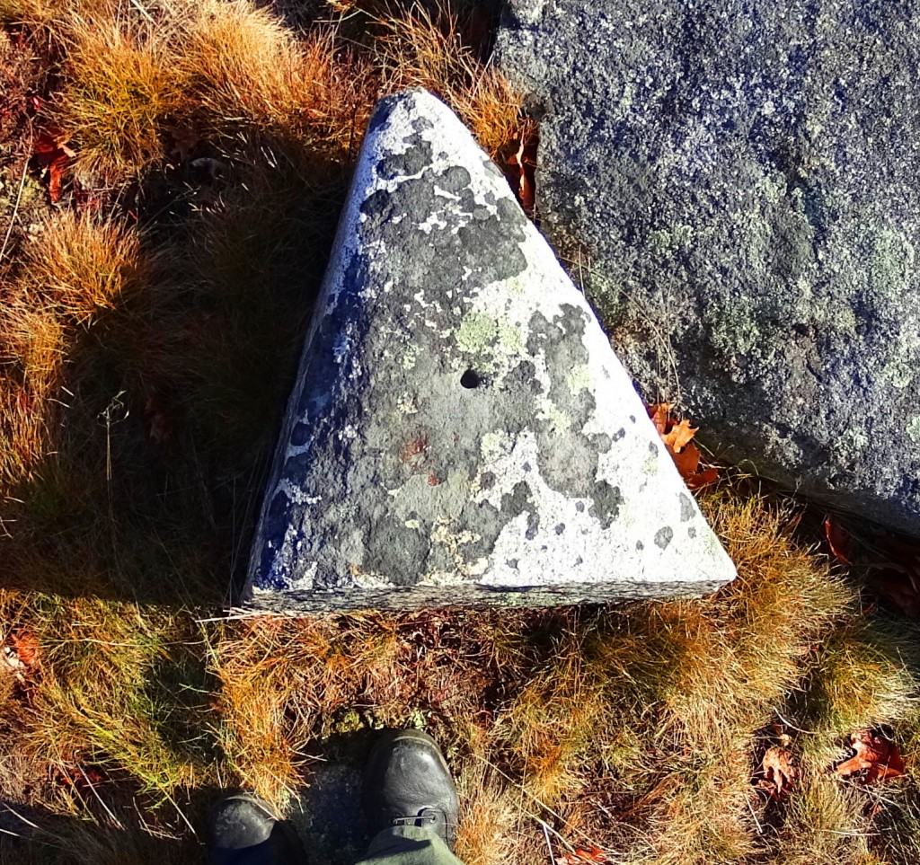
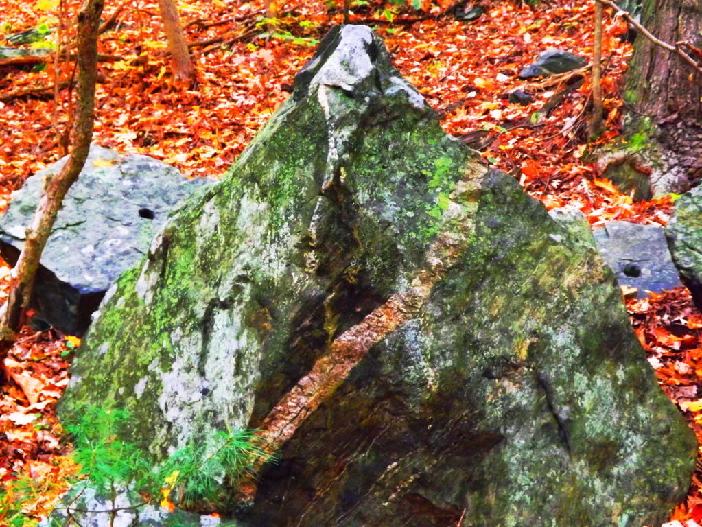

Purgatory Chasm
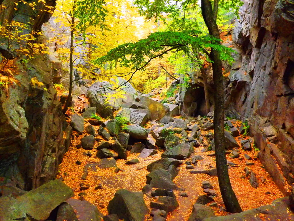 Location: Purgatory Chasm State Reservation/Sutton, Massachusetts/U.S.A
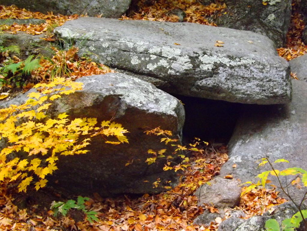
New England Wedge Tomb at Purgatory Chasm
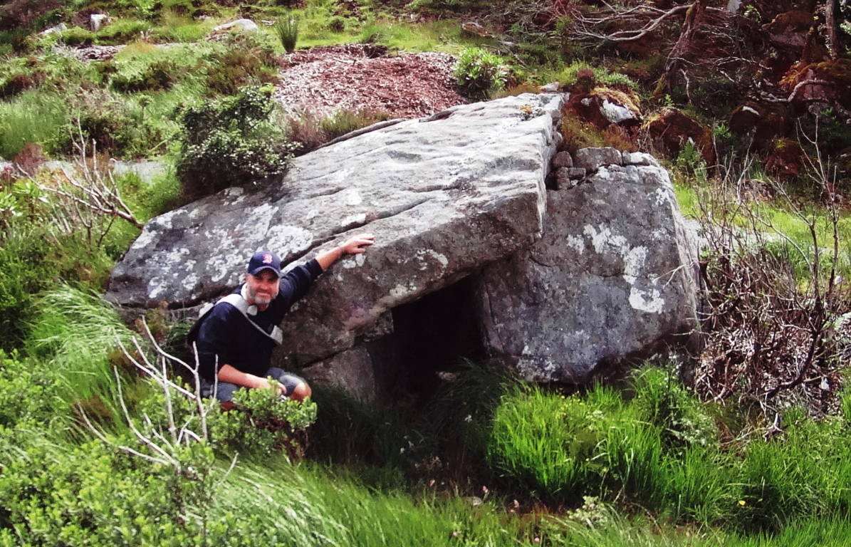
Irish Wedge Tomb at Glenveagh

Triangular tunnel entrance
Note: The forests of Massachusetts are perhaps most well known for the prismatic foliage that unfolds during the brief and breathtaking Autumn season. What is less well known, and yet no less breathtaking, are the megalithic statements that exists deep within, and beneath, those forests. Yet another astounding example of this is “Purgatory Chasm” in the small New England town of Sutton.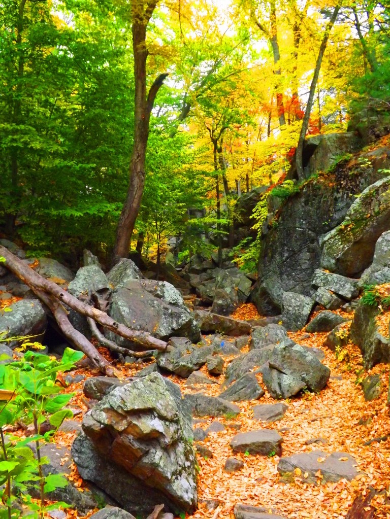 It is nothing less than a miniature canyon, of all things, with thousands of free-sitting-boulders, crafted stones, Wedge Tombs, and triadically oriented alters, all carved out of solid granite. Click on the images to get a closer look. The boulders here are so massive, that gigantic fallen trees, perhaps 80 t0 100 feet tall, and 150 years old (or older), look more like young trees that have been tipped by a storm in photos. Although this area is only a 1.5 mile loop, it is a non-stop tour of inconceivable stone statements from start to finish. It’s also a fantastic chance to practice your footing and climbing for other rocky trails.
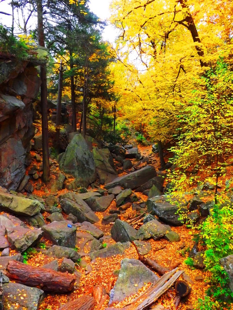 This small canyon has areas of 50 to 70 foot high granite enclosures, like solid walls shooting straight up from a bedrock floor, running about 100 feet across for just over half a mile. In this space huge White Pines, Cedars, Hemlocks, and Birches grow straight out of the rock, almost 100 feet high. Megalithic sites in New England often feature stones that have been crafted to highlight an equilateral triangular arrangement. Without seeing it, time after time, it would be very hard to believe. But again and again, stones are found to be arranged specifically to create this triangle (Pictured below). Furthermore, perfectly strong tree’s grow off the top of these arrangements. It’s as if whoever created these fixtures knew that the trees would grow on them, like grafting plants in a green house, but on a Jurassic scale, and using a “granite container”.
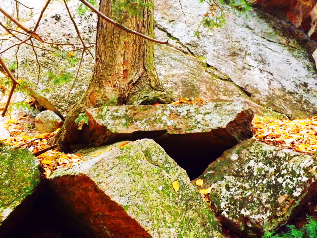 Certain arrangements in these stones are nearly identical to rock statements I have documented in Ireland, particularly the Wedge Tomb type. The Wedge Tomb is an arrangement where a long and flatly crafted megalithic boulder is placed specifically over a supporting “corner boulder” as a “roof piece”. A frontal boulder is then planted as a sort of “sign” beside the empty space created by the “roof” and “corner” stones. Several examples are shown here with the small Wedge Tomb in the heart of Purgatory Chasm (first two images above). There is also a distinct four-foot-high Standing Stone with three circular incisions running right through its granite face, and a small Dolmen with a perfectly triangular gap featured at its core (pictured on the left). Even the openings to the rock caverns look to have been intentionally set so the entrance-way would be a “triangular”, looking from the inside-out (Image: center/above). The area is inundated with fine golden leaves of New England Autumns past, giving this pathway a unique luster that hikers will rarely find anywhere else. Seek it out:)
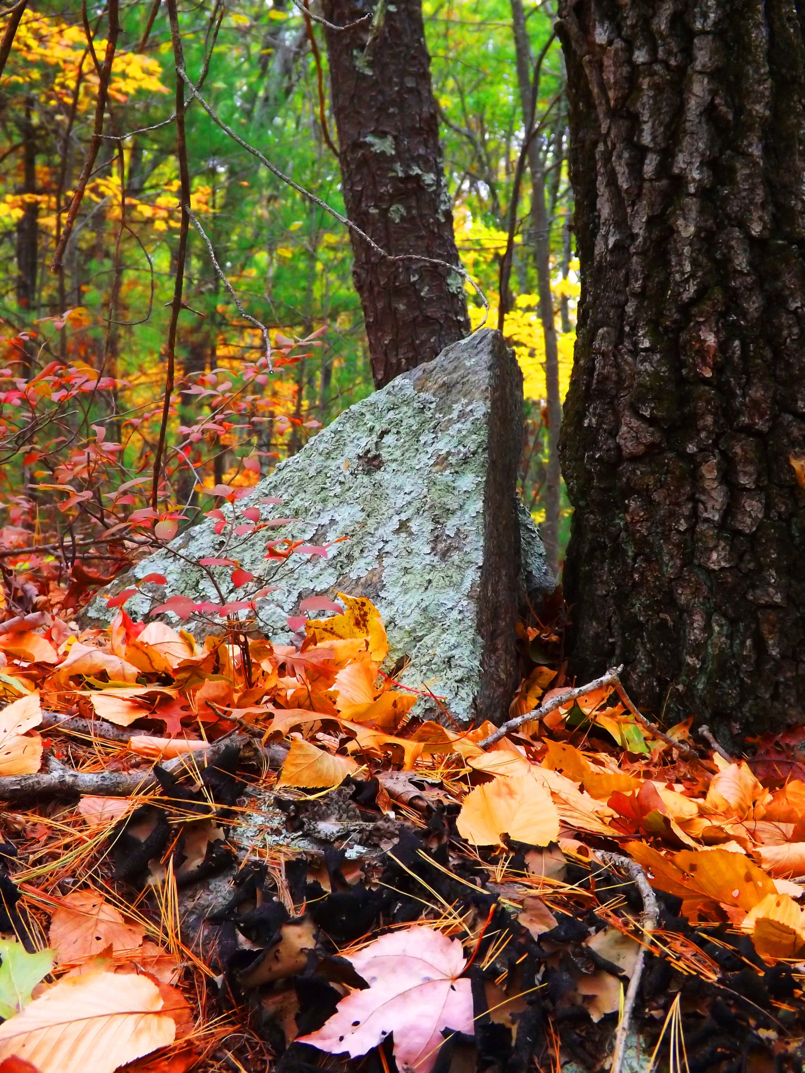
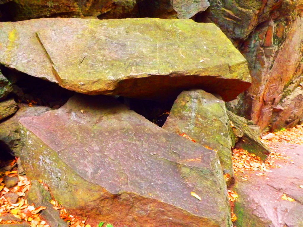
Lynn Woods Trail/Secret Megaliths
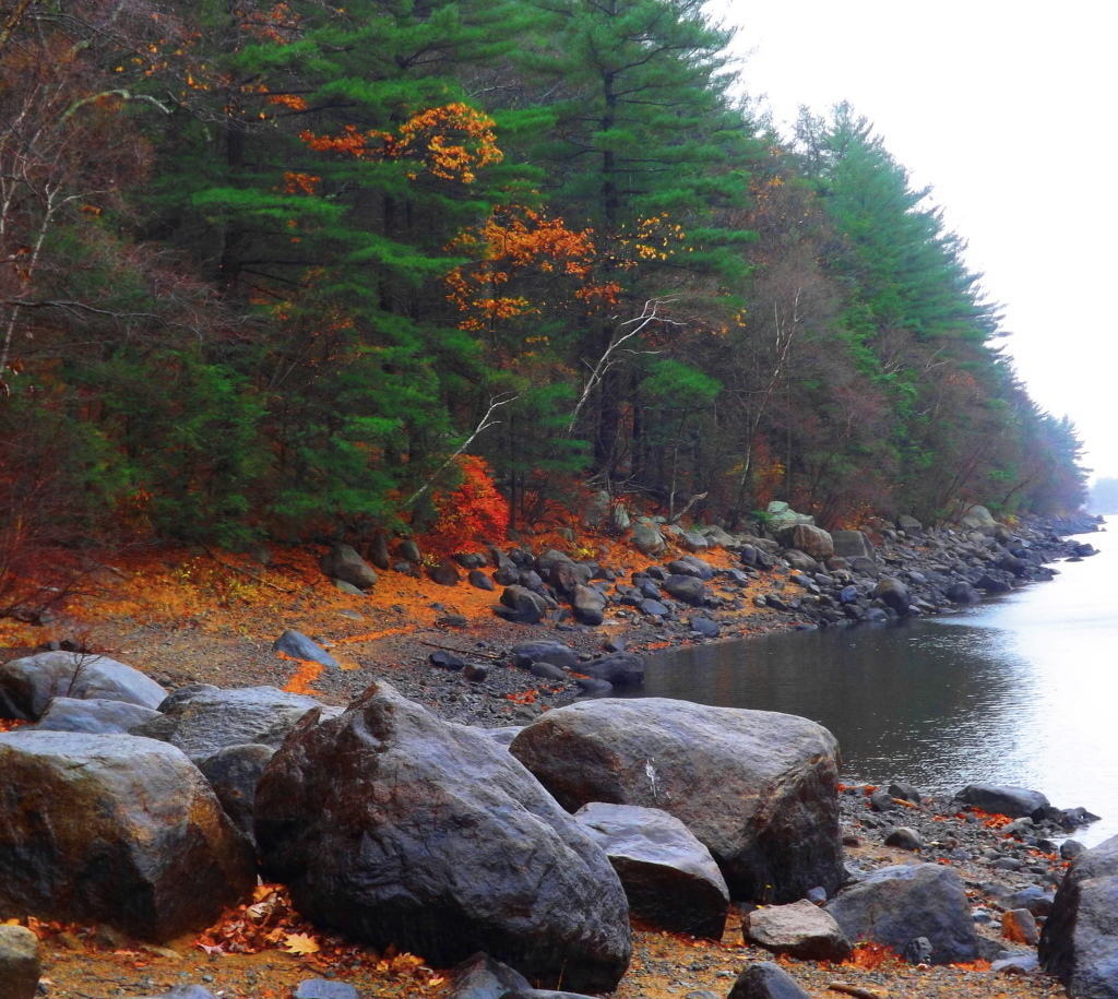 Location: Lynn Woods/Massachusetts/North West of Boston
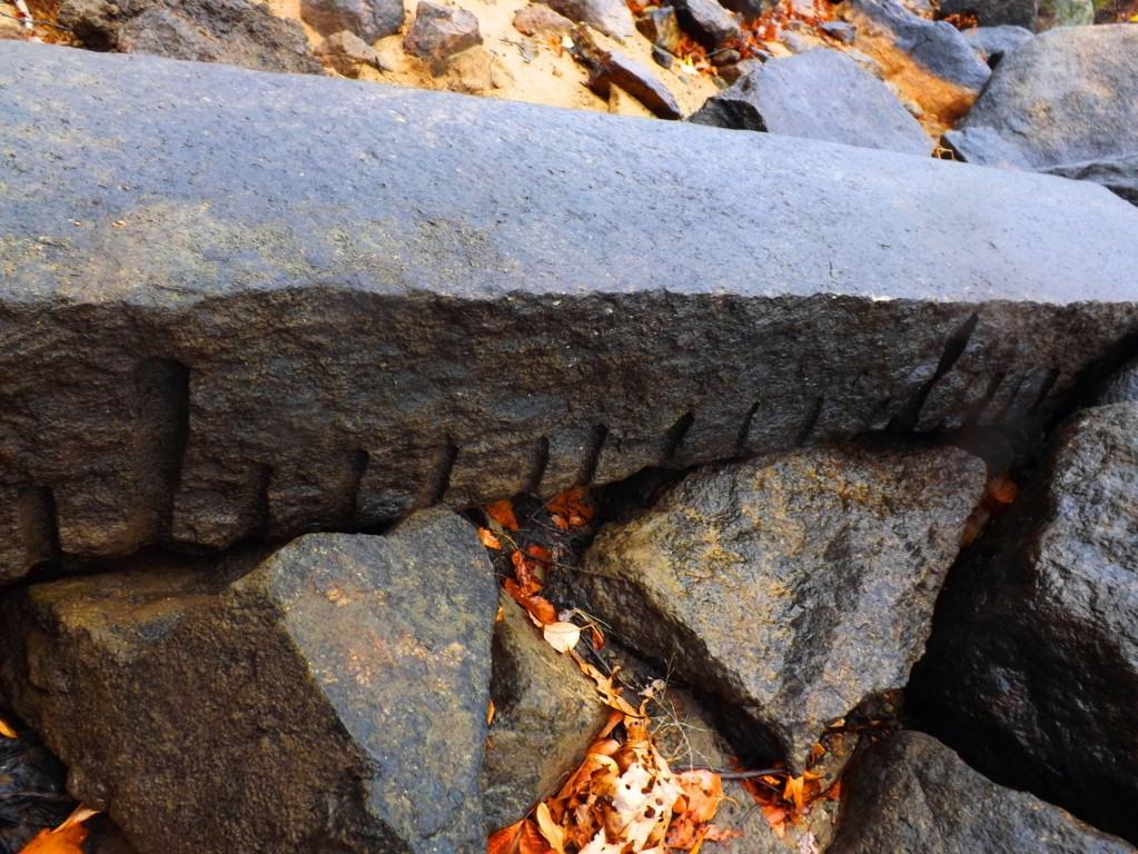
Lynn Woods/Long Piece

Ireland/Long Piece
The beautiful trails at Lynn Woods are roughly 8 miles of preserved old forestry, centered around a crystal-blue lake. The small but exquisite area is surrounded by the little city of Lynn, north-west of Boston. Paths run along the lake to the east, or west into the forest, where after roughly 2.5 miles of elevated trail, a scenic stone tower appears on top of the most significant elevation in the reserve. Mountain bikers, dog-lovers, and runners utilize the area to the fullest in the Summer, continuing well into the Fall, when the trees begin to glow a luminary red, yellow, and orange. Bright Birch groves emerge with swaying Maple’s and Pines that reflect off the water while trekking along.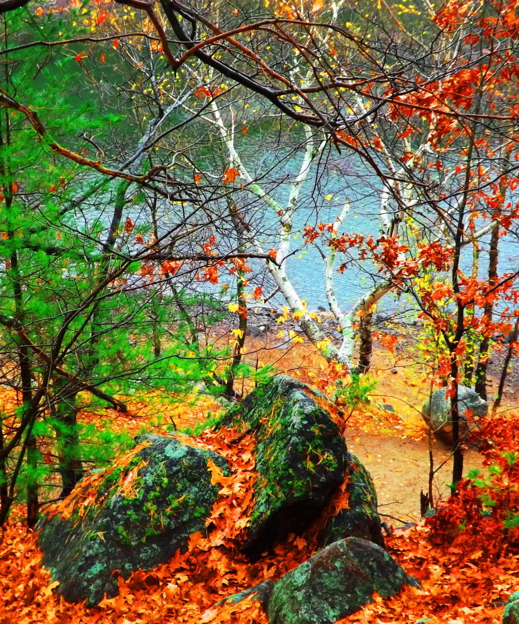 Anyone visiting this particular area of Massachusetts looking not to venture too far from Boston, but wanting to experience quintessential New England fauna and foliage, should hike right into Lynn Woods for a picturesque day. Although signs are posted for patrons to stay on the trail, there is an abundance of anthropological statements in the beautiful stone fixtures deep in the woods, and along the lake waterline. A careful and experienced hiker can certainly take the time to appreciate some of these incredible stone fixtures that host markings with measurement styles and stone types similar to those found in the Celtic heights of the mountains of Donegal Ireland, making them potentially 4000 to 6000 years old. A marvelous long piece sits close to the water at the start of the eastern trail, among other cut stones with distinct markings. The measurements on this long piece reveal 9 spaces of smaller cuts between the longer cuts: a system based on 11 spaces as a ‘full span’. The colonial ‘foot; is not represented in these works. A fantastic crafted boulder sits just off the eastern trail directly along the waterline. It displays an enigmatic 45* degree set of linear incisions running directly across the face of the rock.
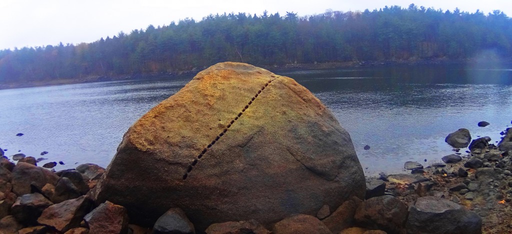 Interestingly enough, Lynn Woods is a also home to the largest Standing Stone in Massachusetts, found just a half mile into the very beginning of the trail from the parking area: take an immediate left after walking the short distance, an climb to the very top of the hill, just outside of the woods, and you will find the Standing Stone.
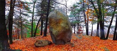 It is beautifully set standing roughly 11 feet high and 3 feet in width. I am guessing that this stone weighs at least 5 tons. Similar to many Celtic standing stones, there is a second smaller stone that was obviously cut off from the main standing piece, ‘smaller’ meaning it weighs about 900 pounds or so. It sits eternally just to the left of the megalith. For real antiquarians, in the deeper forest, there are free standing boulders and massive megalithic fixtures on the top of the rolling hills continuing away from the lake.
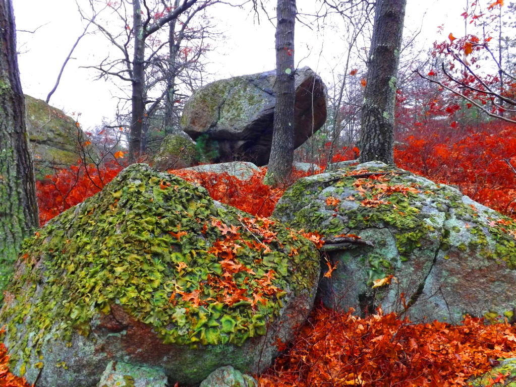 One of the most amazing pieces in all of New England is 4 miles into the eastern trail, just to the right of the path. This massive 20 ton granite stone stands 8 feet high, and is an incredible display of precision made parallel cuts, and measuring metrics. The stone is incised through nothing less than four full feet of solid granite rock. There are mathematical statements in this stone still to be deciphered, and it is truly priceless. When considering the megaliths of Lynn Woods it has to transcend the simple label of ‘nature reserve’. Lynn Woods makes the roll of Stonestrider.com due to these obviously sacred statements of megalithic expressions, so similar to the Celtic world, making it extremely likely that they are from deep antiquity. Unfortunately, all of these stones are not even noted in New England anthropological society, until now; Yet if they were in Ireland, England, Wales, or Scotland, they would be revered and protected. This place is one of the best kept anthropological secrets in all of New England.
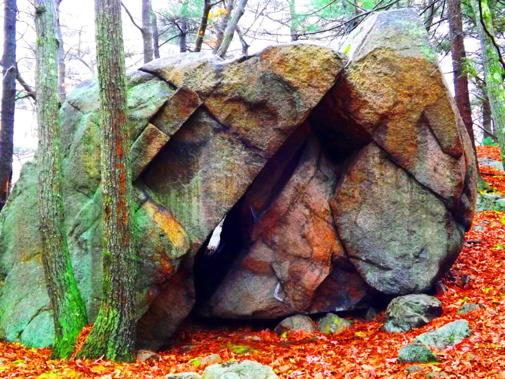
Tully Lake/Forest of Neolithic Engineering
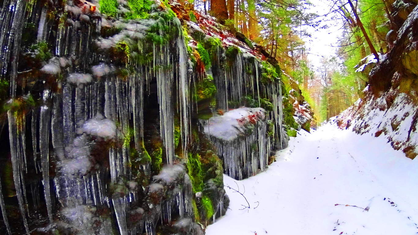 Location: Athol Massachusetts
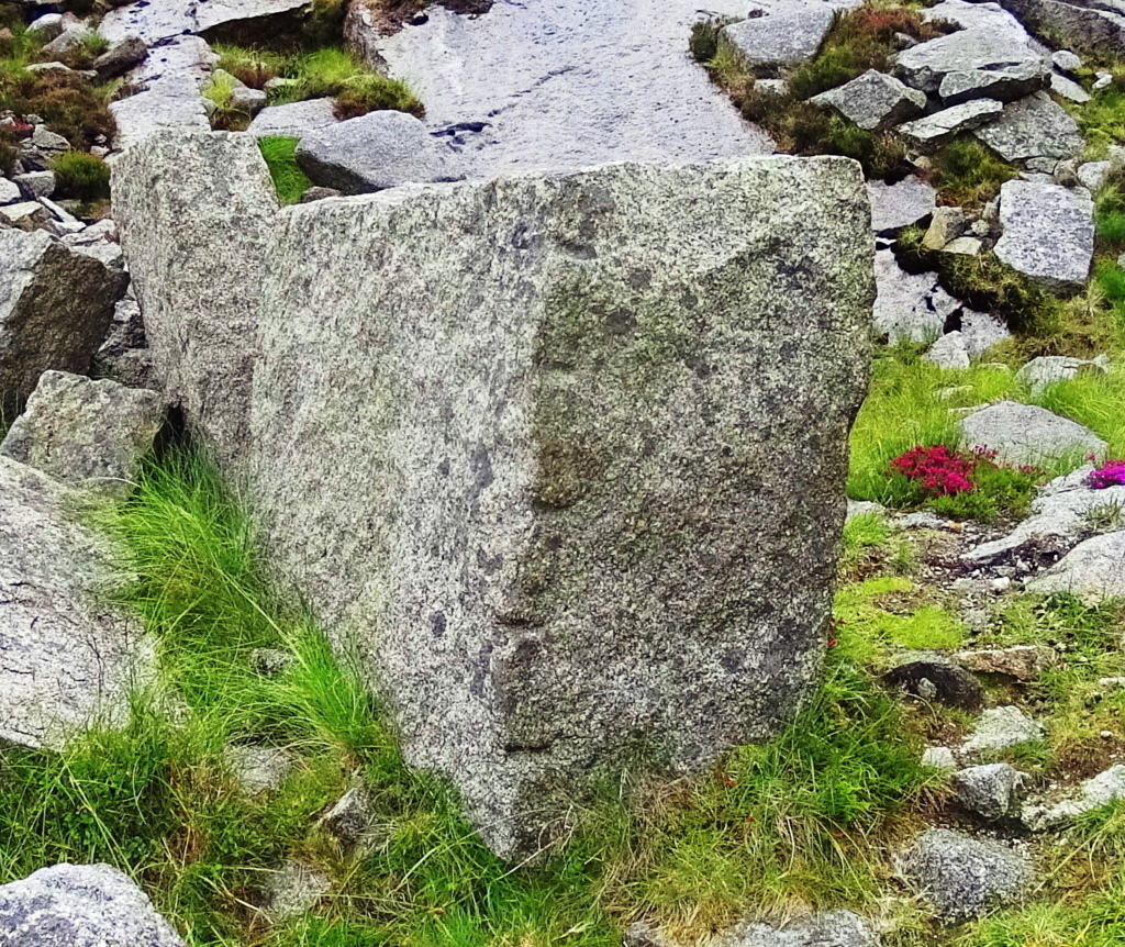
Ireland
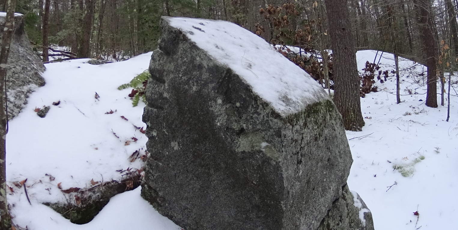
Tully Lake
Note: Tully Lake Trail is nothing less than a kingdom of cut stones enveloped by gorgeous old growth forest in the heart of New England. The main trail loops down along the lake for about two miles, and then back into the elevated forest for another five. It is a challenging hike in winter, but enchanting. As you begin to progress into the glades of tall pines, birch, and maple, it becomes impossible to ignore the crafted megaliths lining the hillsides. It becomes abundantly clear that whoever engineered these incredible stones wanted them to be noticed. It is a venerable masonic work area, with standing stones, cut boulders, stone linings, and ancient stone dwellings. Furthermore, the stonework is not arbitrarily placed, but is clearly set in a specific manner, although beneath a blanket of snow it is difficult to decipher on a blustery December day. The clarity of the markings on these stones is astonishing. Similar styles of measurement for the cutting of megaliths exist at Mount Bearnagh in the Mourne Range of Ireland, and also most notably in the Lynn Woods further east of here in Massachusetts. Observing the scale of what are clearly measurement markings for cutting, (which I must add is certainly not inches, but some other grand standard) allows us to consider what the craftsman of the stones considered to be ‘scale’.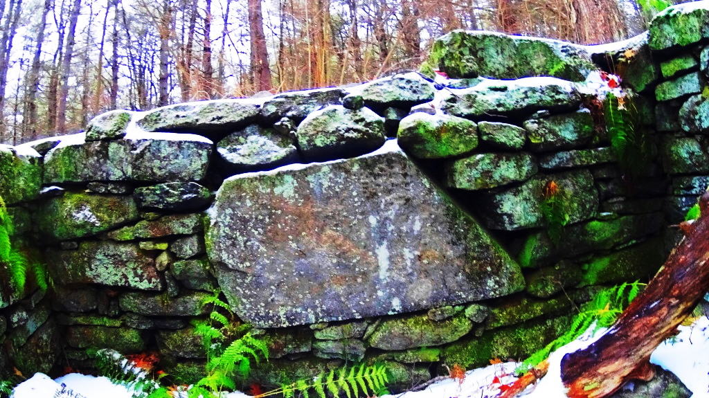 And that scale is MASSIVE. The stones also reveal incredibly complicated curvatures, extremely hard to create in large granite pieces.
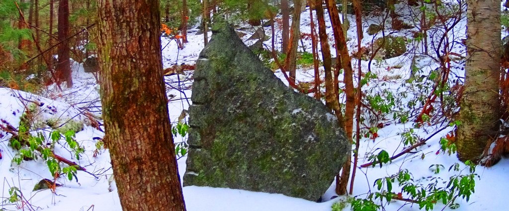 The entire forest is inundated with stone statements that cry out for observation. Consistent with other old-growth trails all over the world, this forest contains the remnants of what I believe is the one time home of the craftsman of this area. Sitting roughly four miles into the loop of the main trail, unlabelled in any way, to the right of the pathway while heading back towards the entrance, I saw an incredible stone foundation of what was once clearly someones home. This site featured a beautifully dry-laid and grand cut-stone looking to weigh at least 2 tons, embedded perfectly into the foundation. The amount of care and effort that went into placing just this one megalithic center-piece must have been challenging. With sites like this, a trail becomes a priceless anthropological zone on the level of Tollymore Forest in Ireland, and Monument Mountain in the southern Berkshires of Massachusetts.
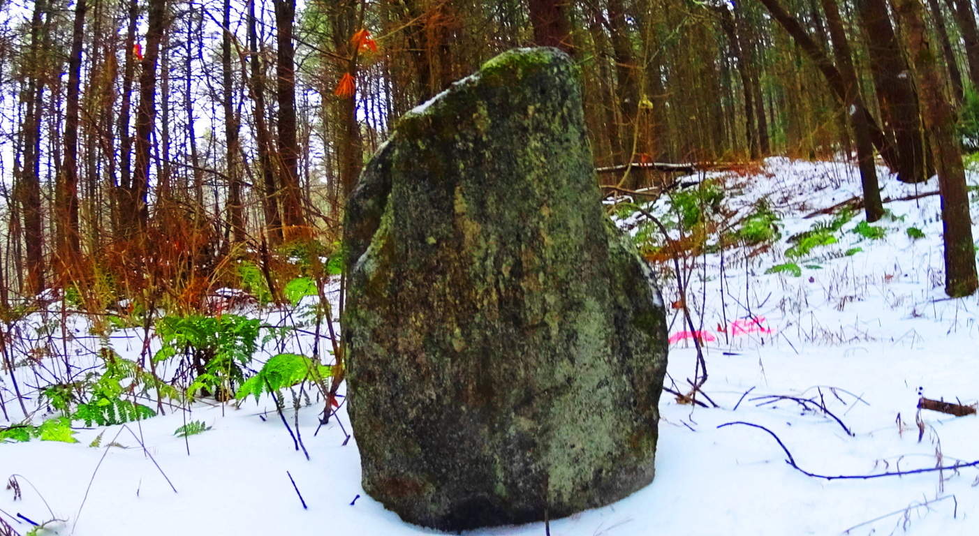 To find an ancient dwelling, or one definitive standing stone in a single New England forest is rare, but to find several is truly exhilarating. Further along the trail there is a stone connected to a stone-lining (‘wall’) looking very much like a Celtic ‘directional stone’, almost identical to types I have seen in England.
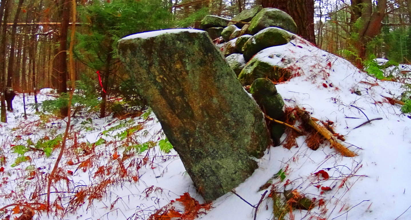 Celtic areas have preserved these stones and properly noted them as important anthropological statements from a culture perhaps 6000 years in the past, but New England has failed to do so here. Ironically, this somehow makes New England’s ancient sites feel a bit more pristine than even Celtic areas that are well known, because the stones have not been touched, or even visited by anyone knowingly seeking the works of a neolithic culture. When considering that almost every massive boulder in the forest contains some form of crafting, whether it be boulders split in half, or simply marked by incisions of some type, the amount of energy that would have been put into this effort is astounding, and so worth noting. And all the time, behind fixture after fixture of colossal craftsmanship, is mile upon mile of zig-zagging stone linings sliding through the trees.
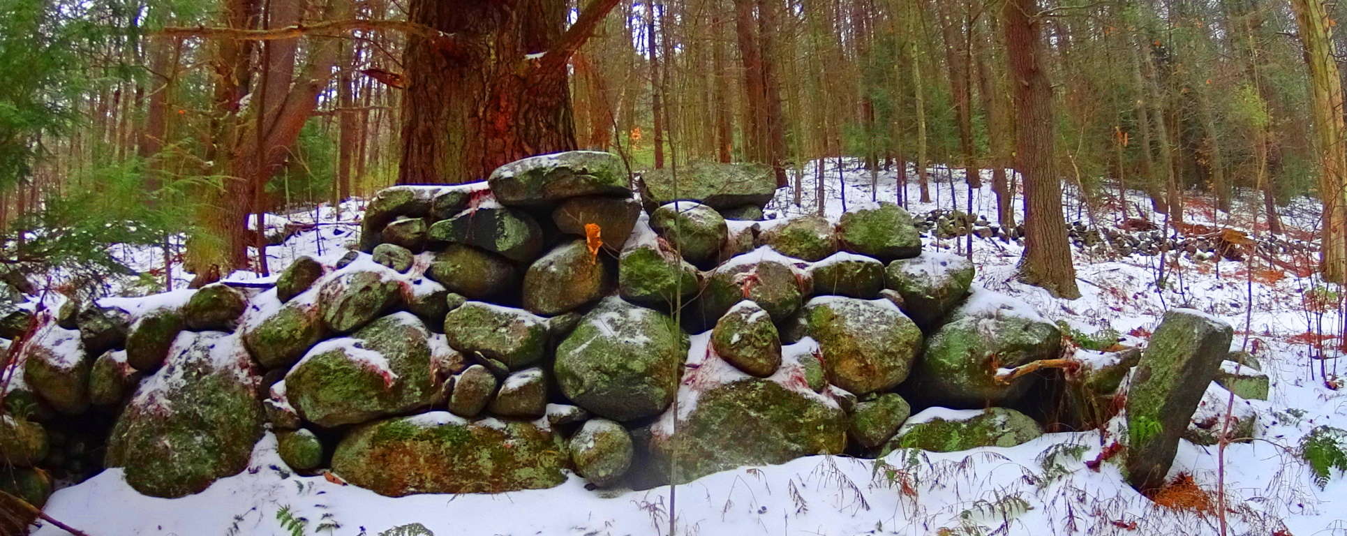 Close consideration of these works reveal that these efforts are not mere random ‘holes’ in the rock, but linearly lined incisions.
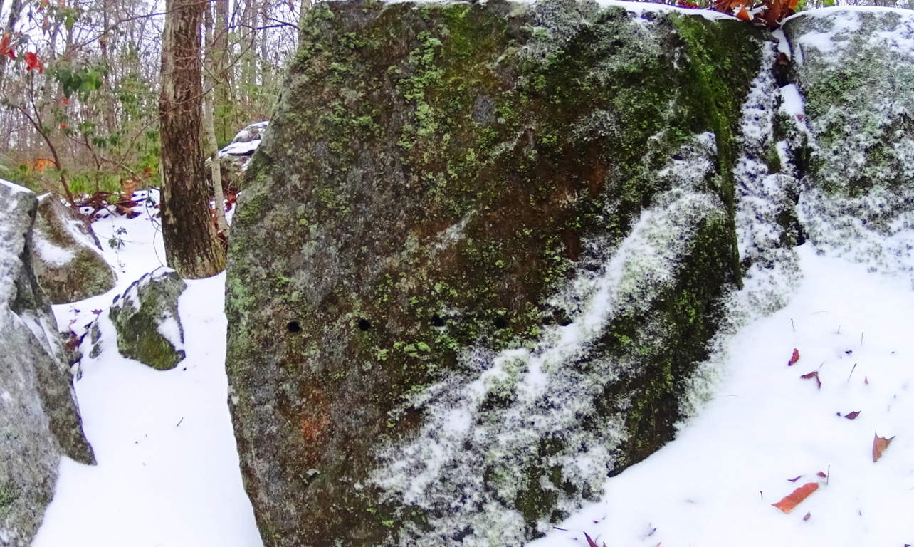 And cuts along the edges of these megaliths are measurements, not random markings. Some of the craft work is truly artistic, revealing a joy in the artistry. Some stones are set in pairs, others are laid out as massive fixtures, seeming to have a functional flare. Hiking through these pathways is a pure wonder that pushes the boundaries of our understanding of what might have taken place clear back to the beginning of Time.
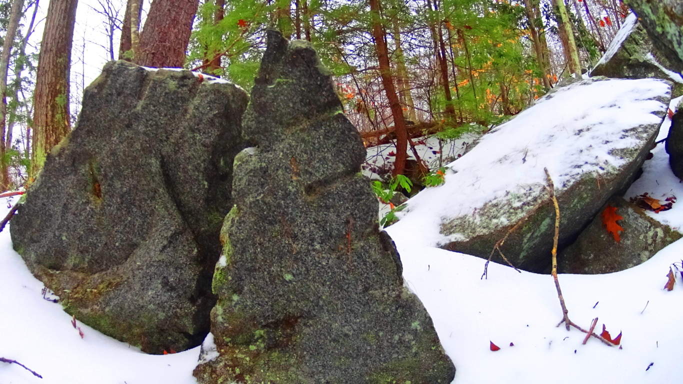 The stones themselves seem to insist that it may not be the linear evolutionary line that postmodern texts have been pushing for the last 100 years. It is clear that technology existed in antiquity, and was utilized in this incredible daydream of a forest. On an international scale of 1 to 10 for sacred forests, Tully Lake is a 15. Seek and find it out for yourself, something truly magical took place here.
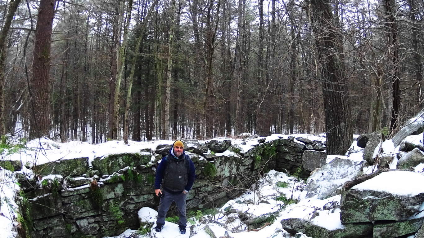
Sculptured Rocks Reserve/Groton, New Hampshire/U.S.A
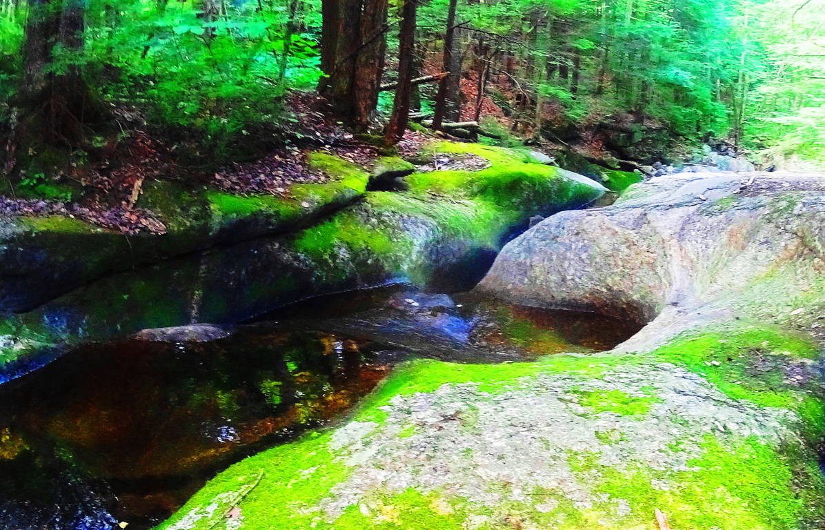 Location: Cockermouth River, Groton New Hampshire
Note: Sculptured Rock Natural Reserve is a watery wonderland of falls rushing within the forests and small mountains of Groton New Hampshire. A hiker has the option of following the falls as far as they wish by hopping from stone to stone, or perhaps stopping to splash around in the amazing still pools created by the rocks.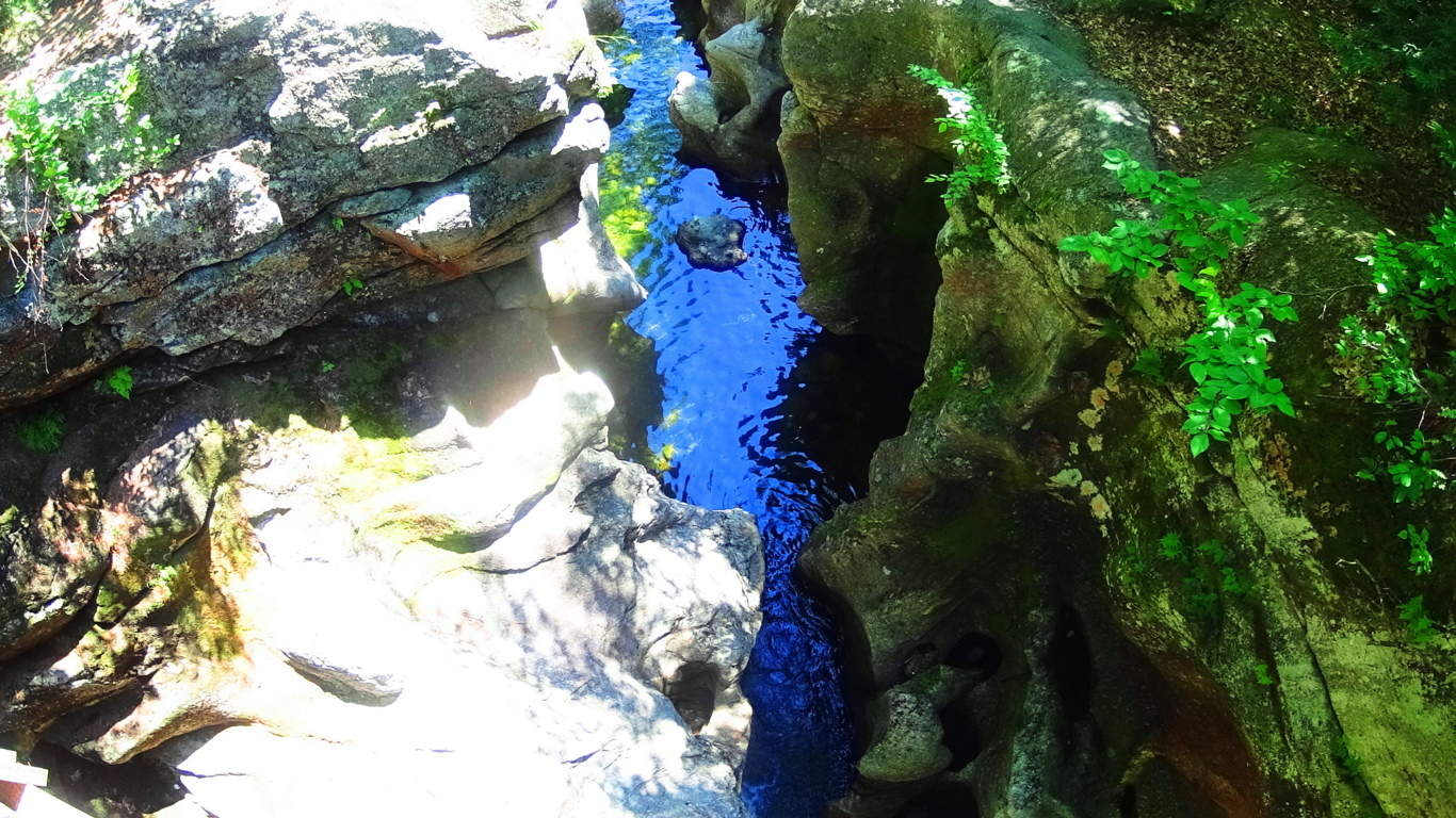 Trails also run away from the fall into the forest, where other works of ancient stone and crafting can be found, such as Cairns, and ‘directional stones’ from another epoch. The area is a notable anthropological site, with an authentic ancient stone dwelling nestled close to the designated forest trail, and several massive stone enclosures of megalithic scale further down the fall to the south.
 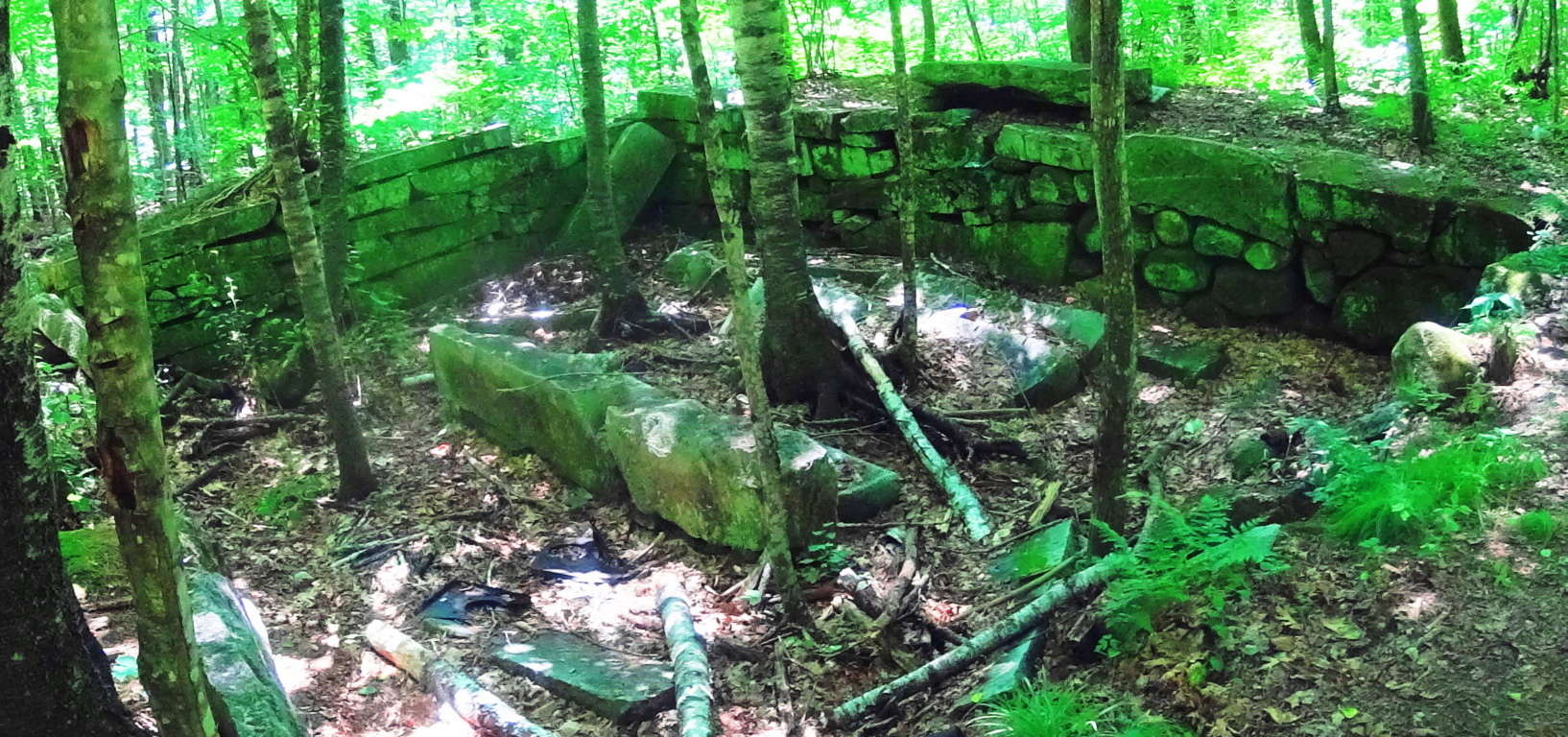 I believe these works, due to their scale and placement, to be PRE Native American, built by a culture yet to be acknowledged by current anthropological historians.
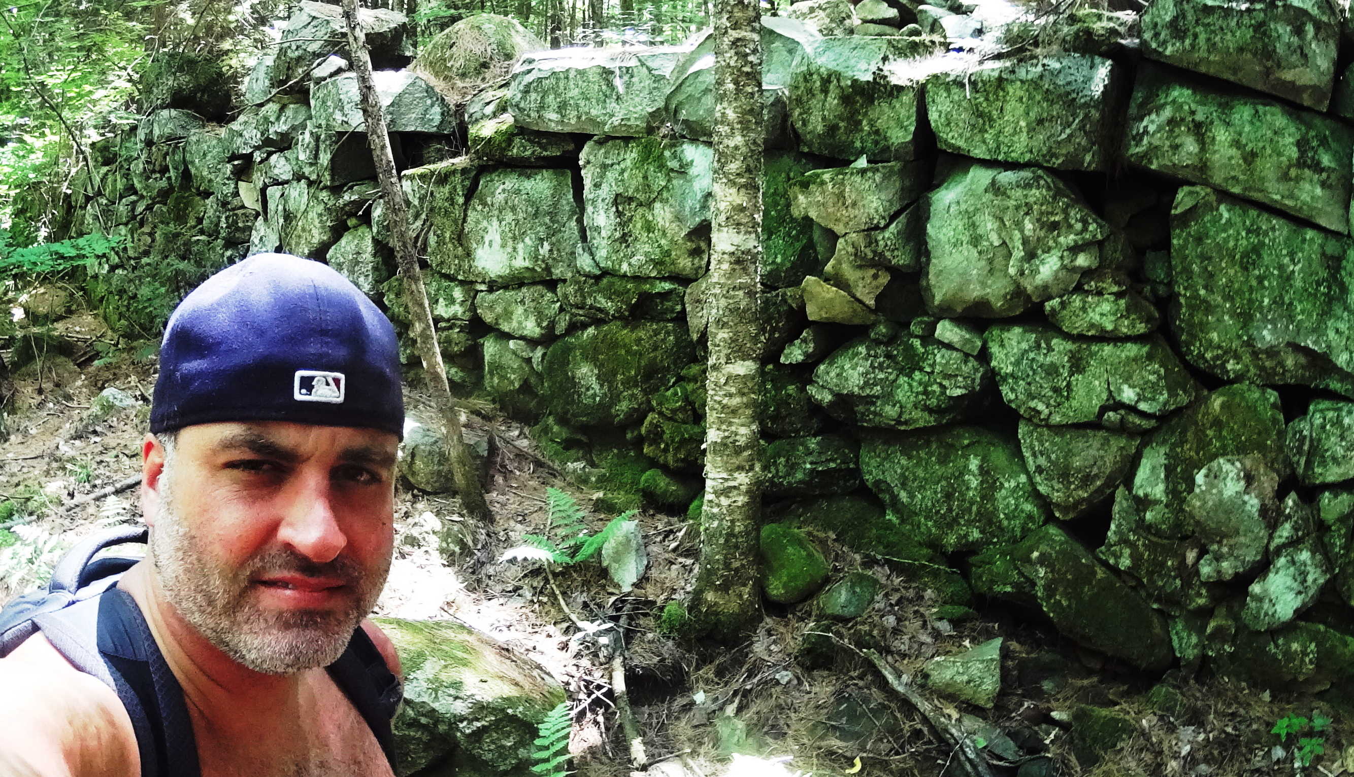 The main water artery, the Cockermouth River, is filled with free standing boulders that sit in an incredibly smooth stone tunnel of what looks to be sculpted rocks. This is very similar to the style of many free standing boulders in Northern Ireland’s rivers, but on a much larger scale. There are literally thousands of these free standing boulders. Away from the Cockermouth River, further north, are several wild rivers without trails running up small mountains enclosing the area.
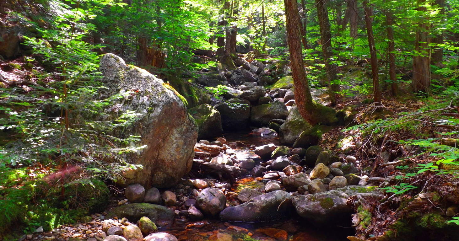 For an experienced and prepared hiker, I recommend the very real adventure of following a waterfall up the mountain by stepping on its stones. Following small mountain falls is an amazing experience due to the fact that the features of the fall become increasingly impressive the higher up you go. Wide stone porches and steps that look to be carved right out of the mountain support fully flowing falls that dance down the stones. Somehow these features leave plenty of dry space along the way, allowing for great footing beside stone porches and pools while ascending the fall.
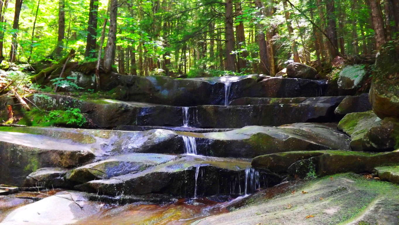 One of the best parts of following a wild fall in New Hampshire is the option to jump in, or plop down in the middle of water-slide like tube of water-flow, and cool down along the way.
 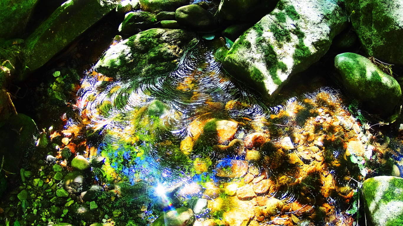 The beautiful combination of sculpted waterways, dynamic waterfalls, ancient forestry/ stonework, literally from the beginning of time, make Sculptured Rock Reserve one of the best kept secrets for outdoor enthusiasts. It is one part water-filled canyon, another part Celtic rock haven, with waterfalls that truly spark the imagination. Sculptured Rock has a sacred feel. Seek it out.