Kings Canyon National Park
 Location: California, USA/Central-Sierra Mountains
Elevation: 1,300 ft.
Prominence: 14,490 ft
Note: So here we go again! There’s that crazy moment of “holy sh#t” here that makes the whole thing worth it, right from the start. At first glance, the raw ugly ruggedness with which this supreme scene has existed should hit you pretty hard. There is a cosmically harrowing vibe here, with a depth so broad that it seems to almost want to pull you in. Gravitas. On approach you will emerge from the beautiful Sequoia Forest heights, to be suddenly struck by an inestimable depth of imploding rock. Just driving here is no piece of cake either. First, the small mountains of Tulare County California, shimmering in dry gold (Image/Below) recline eternally as the dramatic ‘gates’ to the overall kingdom of the majestic Sierra Nevada Mountain Range. You must crest the small mountain roads of Tulare, and reach about 7000 feet above the Valley, just to approach the secret singular road into Kings Canyon, and descend again into the 7000 feet you just climbed! This is the rocky naval of ancient California, with ‘heavy-weight’ mountain statistics that hold as many truly sacred secrets as it does mesmerizing statements of ‘size’ and ‘scale’. Welcome to Kings Canyon, God’s rocky deep pocket.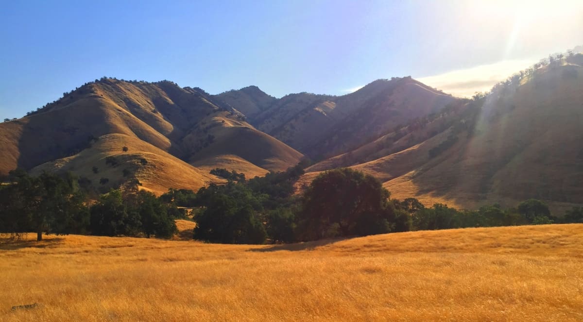
This is literally a secret rock-kingdom that suddenly appears out of the Sequoia National Forest, like a stone-age Lhasa, tucked-into the massive enclosure of the Himalayas. In ancient times, the Natives that first explored this place would’ve absolutely been the ‘rangers’ of their tribes, super tough, with a spiritual connection to the landscape that made them the most capable for the needs and challenges of this descent. Really try to let yourself imagine the gritty resourcefulness of the ancient peoples that took this place on. A wrong step here means your life. The supreme forces of Mortality and Nature are dramatically at play in this rusty eternity. Here, it’s about balance; it’s about centering yourself; it’s about the significance of each step. Accepting the lessons of this place puts you in touch with a more rugged, more balanced, more real version of yourself. When returning to the mundane world, sitting on some couch with friends or family, a voice in your mind may possibly echo, behind all the chatter: “Deeper, simpler, tougher, stronger…you”; and somehow, it’s the remnant of the voice of Kings Canyon National Park inside you.
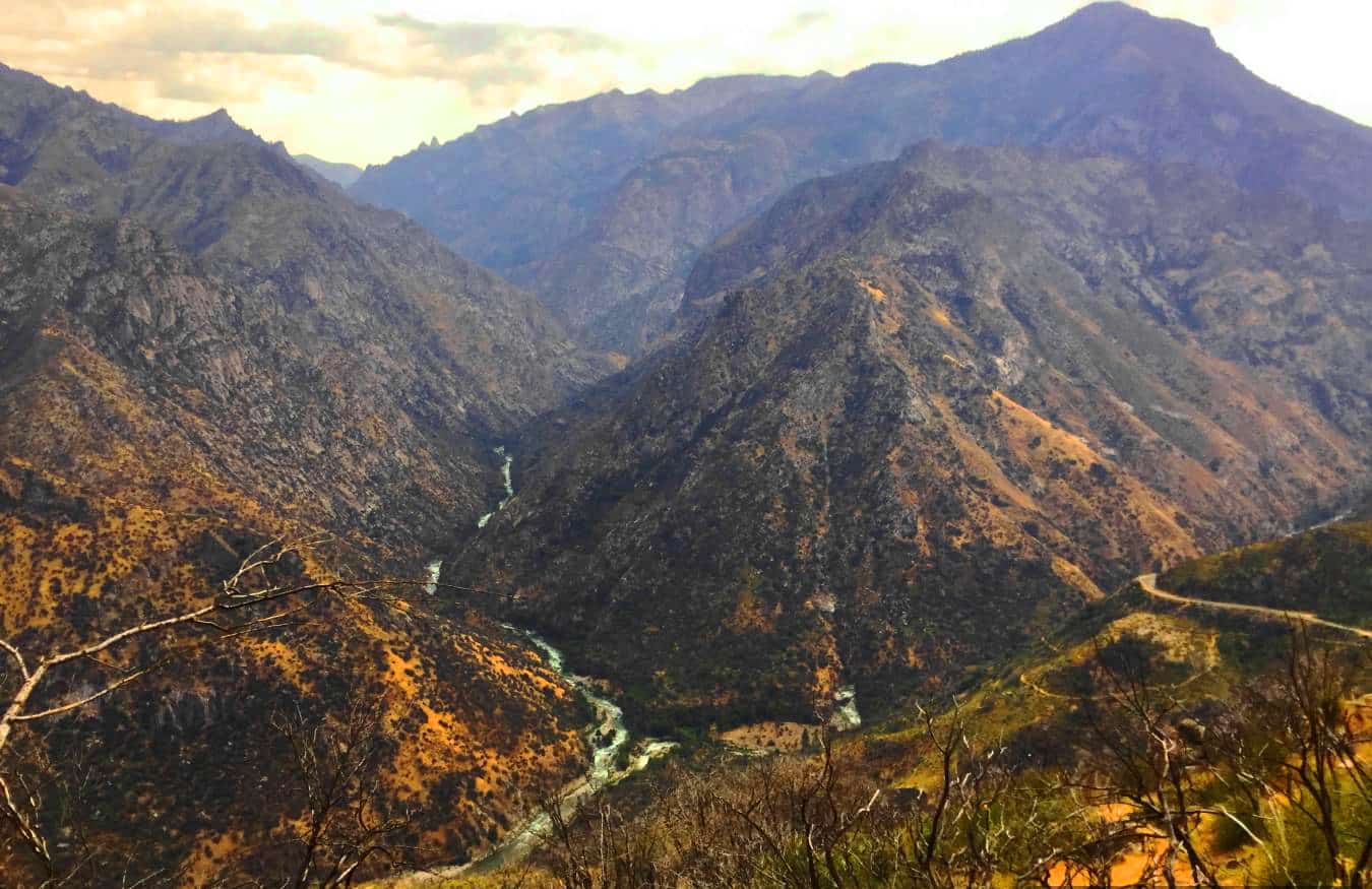
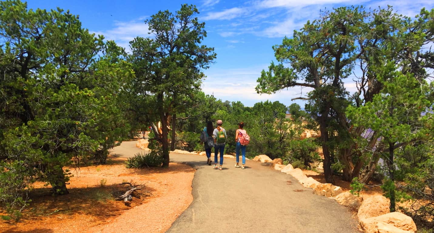
Returning to the realities of the present day, Nature enthusiasts of today make their way down in a vehicle, of-course. Tune up, gear up, and then go. Don’t get stuck on the side of a highway that barely clings to 14,000 feet of gravity gone wild because you forgot to check the oil. Have the car and supplies ready. Eventually, after about an hour of ‘marble-running’ your way along the highway, you will come to the dramatic base of the Canyon highway. (Image/Below) 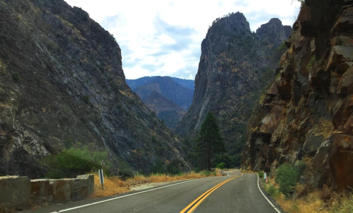 Take this dramatic stretch of singular highway all the way to its very end. You will come to the circle of campgrounds, trailheads, a ranger station, and even a restaurant, which all serve as a fine oasis against the intensity and concentration that comes from finally surfing a vehicle all the way down here. The hardest trails, Like John Muir Trail’, or Rae Lakes Trail’ are steep treks out of the Canyon to elevated lakes that feel miraculous in such a place. Medium level trails like Paradise Valley Trail’ or Mist Falls Trail’ are river-hikes that take you to gorgeous Falls, and multi-colored pools. Roaring River Falls Trail, a relaxing mostly level forest trail, winds through the various channels to a gorgeous Waterfall, and is highly recommended for first time hikers.
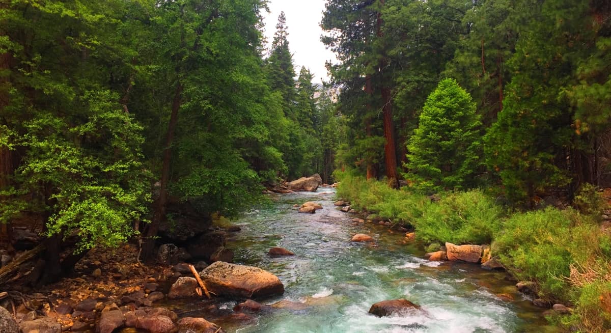 Roaring River Falls Trail: After the effort of reaching this sunken stone bastion, a trek along the Canyon floor on Raoring River Falls Trail’ is a good choice for a relaxing photogenic foot-path experience. The views of river-ways rushing and rolling also produce a breeze that sings through the trees, which seems surprising when surrounded by this stadium of stone. The miraculous channels of the Kings River, Scenic River, and Kings Wild River, all branch off, and then merge-up again, in various places throughout the base of the Canyon’. It must have been the shimmering blue of the canyon waterways that truly enticed the first Natives to take the chance of inhabiting this rugged scene. In some places the hue of the river is a deep green, while in others an icy blue, pushing the palette of your vision, and testing any assumptions about what could be around the next bend. Unassuming wilderness.
 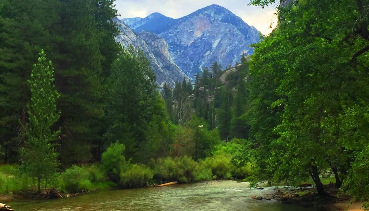 The trailhead parking-lot is less than a quarter mile from the very end of the single Park’ road. It’s located just on the right of the road, passed the campgrounds and restaurant. Park, grab your gear, and cross the bridge to follow the path along the river to your left, and the massive Canyon wall. This is a hike along a gorgeous river oasis, complete with rare Redwoods, Birch, Ponderosa Pine, and Maple, all gathered in grand familial groves along the flowing water.
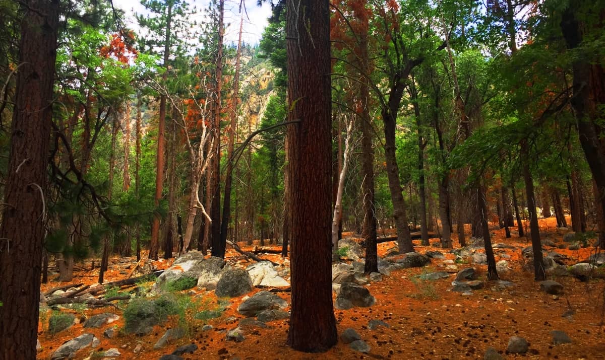 Settling into the rhythm of the Trail here, where immaculate and utterly impervious stone meets a shimmering freshwater rush, you may consider the amount of profound ideas that have emerged out of extreme and contrasting natural spaces such as this; the Anointing of Jesus in the River Jordan, against the vast arid backdrop of the Shamaliyah Desert; The River Nile connecting, like a chord, to the Great Pyramids, rolling out of the Sahara; or perhaps the birth-myth of The Hopi Native American Tribe, said to have emerged from beneath the Grand Canyon in the beginning of Time, to dwell along what would be known as the Colorado River. There is extremity here, on many levels. It seems that beautiful moments and realizations have emerged in the harshest of places, which may very well be Nature’s way of saying that regions, even on the verge of burning, are capable of revealing something abundantly profound and beautiful. Roaring River Falls’ provides precisely this kind of heartfelt contrast. The Trail dips through tall glades of the toughest trees you’ve ever seen, and you can feel the enclosure of rock, like a massive hug waiting to happen.
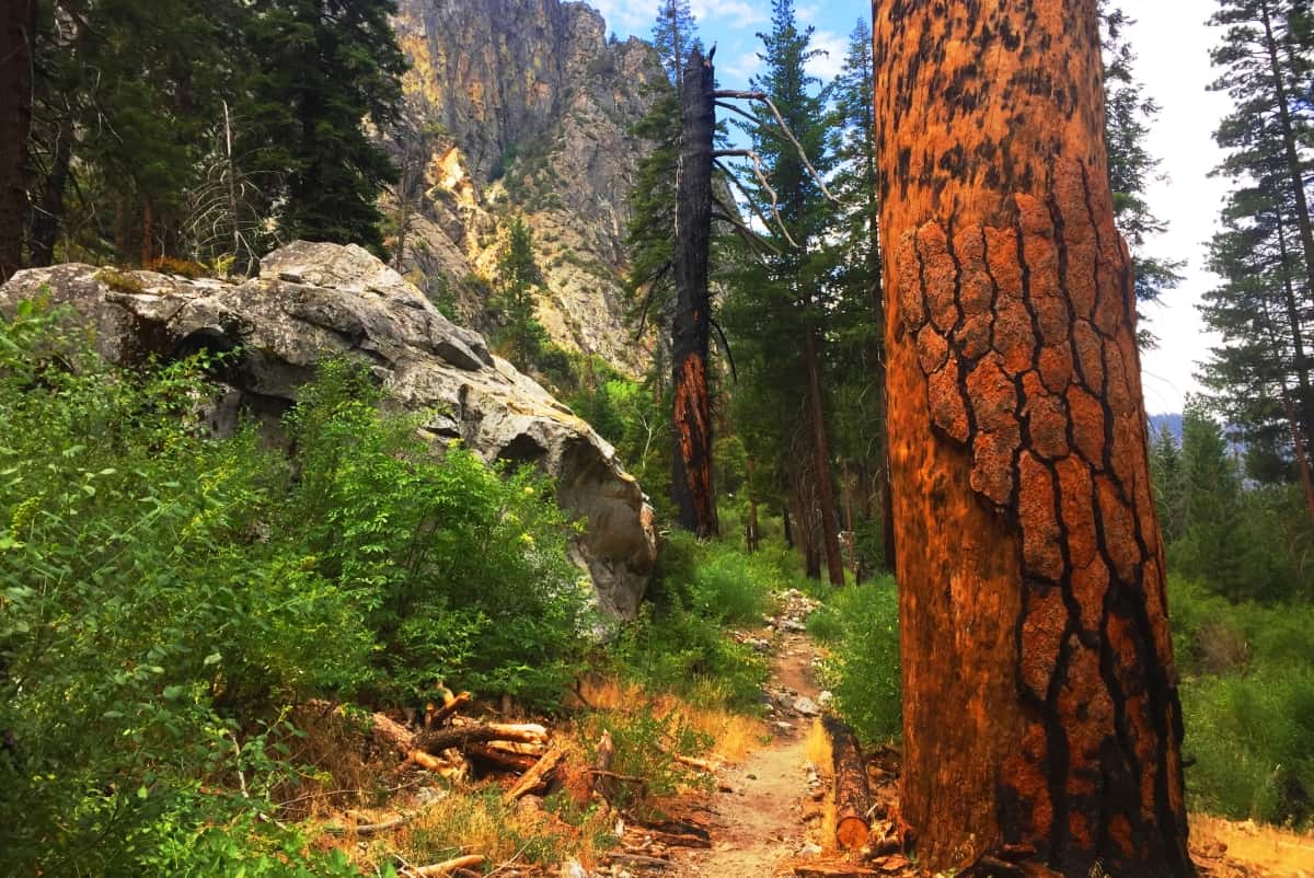 No more than about 2.5 miles along this path will lead you to your reward, The Roaring River Fall! This blast of a bright-blue-pool, which emerges against the rusty Canyon façade, is nothing less than a slice of liquid Heaven heaved against stone as hot as flint in friction. Just the steel-blue color of the circular pool here alone, is medicine on your eyes, where the trees literally have charcoal in their veins, and the stones glow golden grey.
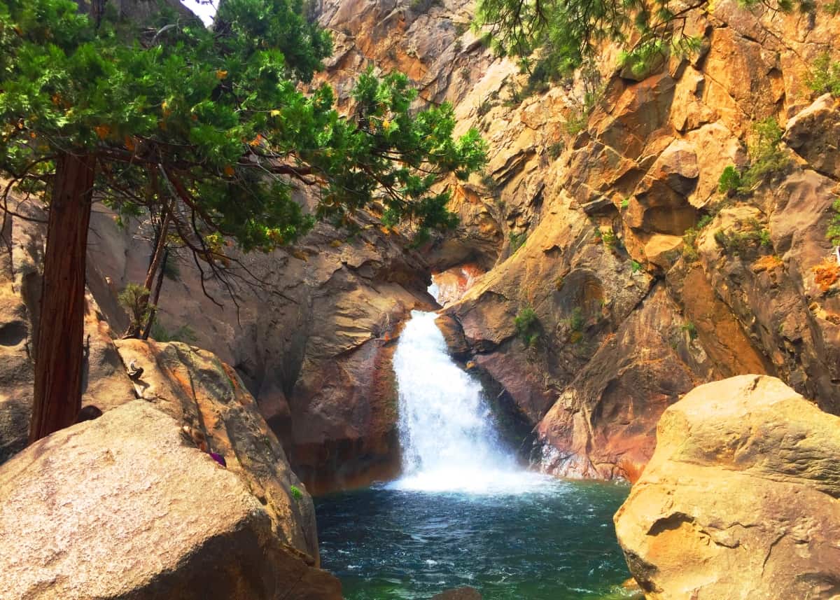 This is a great spot. Take a moment. Dunk your head. Scenes like this for the Native peoples would have been like the ultimate pool party. After finally stepping away from Roaring River Fall, there is an opportunity to cross over to the other side of the narrow Canyon, along the road, and search for signs of Neolithic Cultural statements. These signs in Ireland, and New England, along with the dozens of other sacred zones explored at Stonestrider.com, have come to be known as: stone-linings, standing stones, cairns, and many, many, other wonderful statements from the ancient world. The Jack Kerouac side of strolling this road is hard to deny; stepping with a sense of surreal cinematic freedom along a secluded stretch of road embedded in a massive Sierra Nevada Mountain chain!… as the Irish say: “Good on you.”
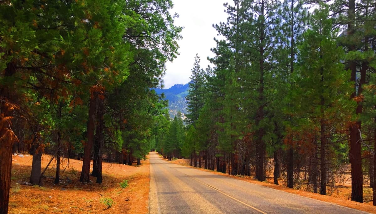 About a mile-and-a-half down the road, headed north, and back towards the Roaring River Falls Trailhead, the forest begins to reveal stonework, mixing and matching among the trees. Stone-linings, similar to those found within the forests of Massachusetts/New England/USA, and the heights of Glenveagh Mountain in Ireland, as well as the valleys beyond Mount Snowden, in Wales, are found here in this miraculous place. These are the signs of a Neolithic Culture that once dwelt all across ancient America, and the World.
 Following a stone-lining is spiritual process, an act of hope and faith that it might connect you to something spectacular, and lo-and-behold it will in Kings Canyon. Just along a trail to the left of the road, a stone-lining zigged-and-zagged its way to a beautiful seven foot standing stone, unlike any other stone anywhere in sight. This Standing Stone also had a 45 degree streak cut across the center, which is a common meme among standing-stones in other parts of the world, as described here at Stonestrider.com.
 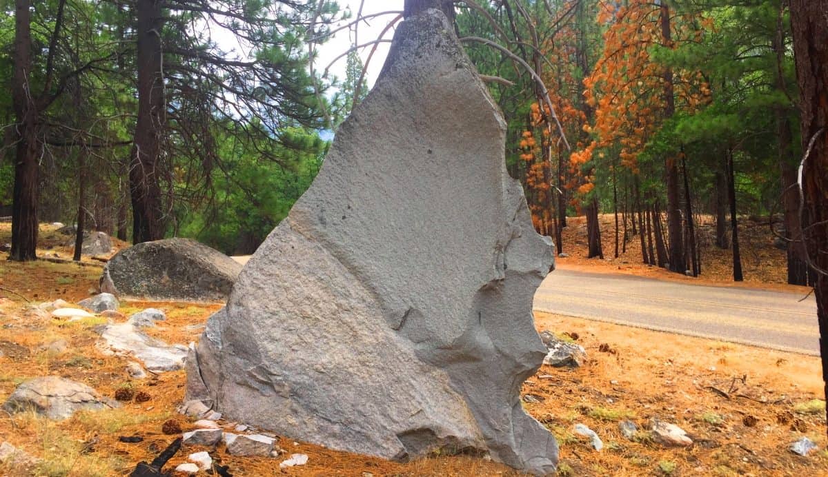 If you take notice of the particular rounded “E” shape on the lower right side of the Standing Stone, it may serve to help you understand that this stone was absolutely “stood-up”. It just so happens that not even 10 feet away is a massive boulder with a rounded “E” shape in it’s side, and face. Clearly this Standing Stone was sliced precisely from this boulder.
 If you were to take this Standing-Stone and lay it across the boulder, matching the rounded “E” shapes to each other, it would fit absolutely flush; in shape, in interior roundness, right up to the jagged tip. Take a look at the common view of stones just beyond this area, leading up to the Canyon Walls; it is totally and absolutely disheveled, indistinct, and completely contrasted to the Standing-Stone. There is literally nothing else like it in sight; It literally just stands out among a universe of low-lying rotund stones. (Image/Below)
 Another tangible sign of a sacred Neolithic zone is the appearance of mass amounts of quartz growing beneath the hardened face of the rocks. There is quartz all over the boulders in the vicinity of the Standing Stone here; beautiful sections of glowing quartz, shining and expanding in the face of this arid dimension. This is also prominent in sacred groves and spaces at Neolithic sites all across the globe. From Ireland to California, the Ancients chose places to be based on factors like vantage, resources, and the presence of quartz. The properties of quartz are well known to science in this present day. We use quartz in our computers and cell-phones to basically redistribute electrical charge. This stone literally harnesses and balances energy, creating stability just by it’s mere presence, even in the harshest environments. (Image/Below) Quartz would also pick up on the subtle friction and electricity coming from the river, which is abundant in this miraculous place. Someone knew exactly what they were doing when they claimed this area, engineering a gorgeous Standing Stone to claim the spot, and warn others that it was claimed; God knows how long ago.
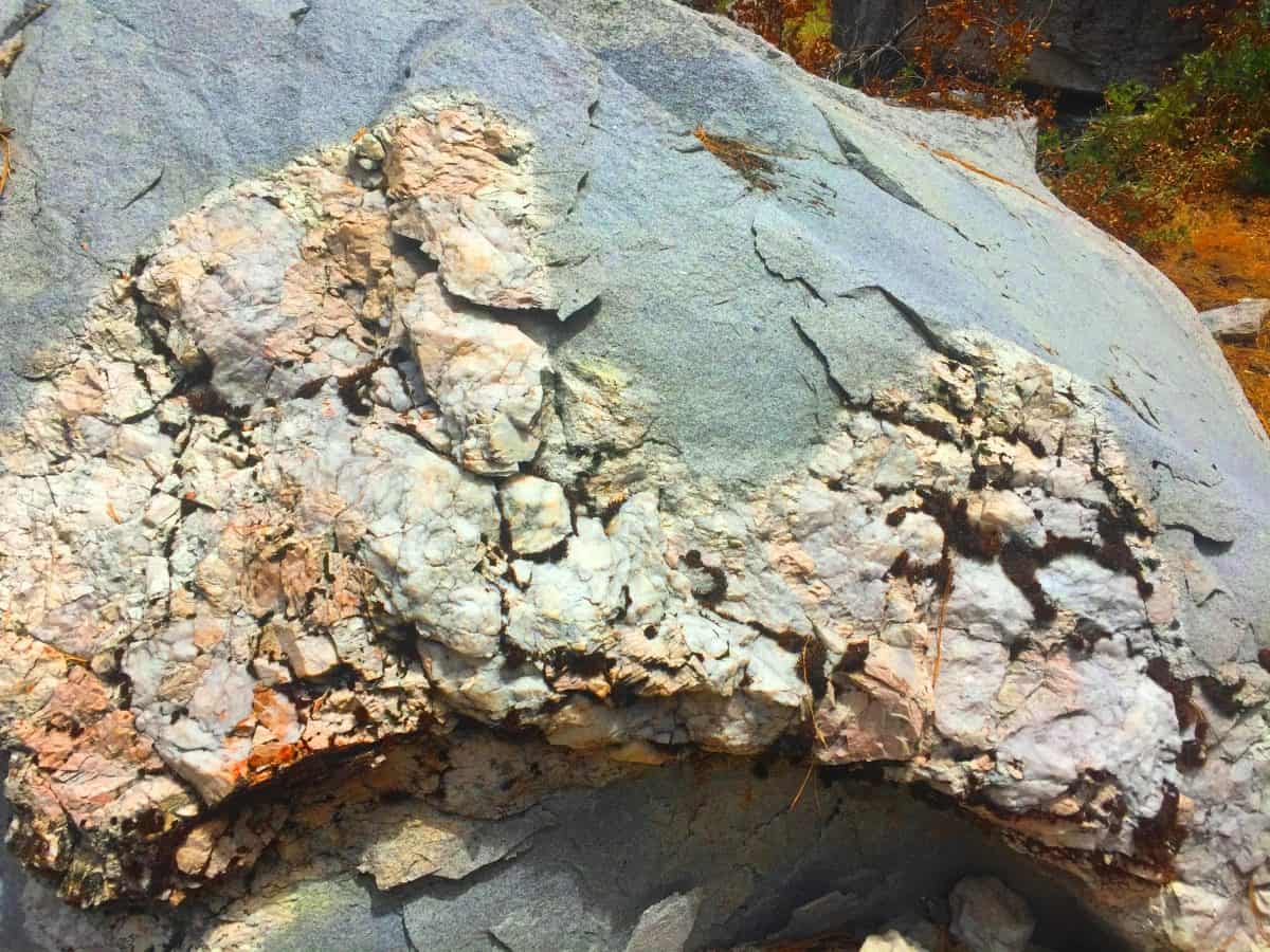 On the way out of this magical and mysterious place, stop and sit down at the campground if you can. There are people here from over the World; Japan, India, China, Switzerland, and of-course America. Speak with these folks. The look on their faces is like they have found the ancient water-wells of someplace like the Sinai desert perhaps, and are now saved by presence of water. And just look at the beauty of Grizzly Falls, located near the entrance of the Park!
 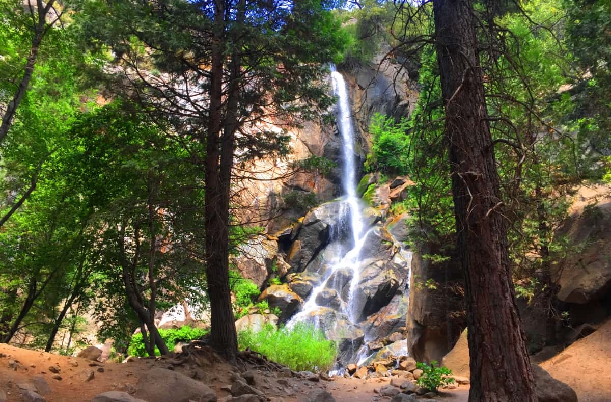 It’s nearly impossible to imagine gorgeous waterfalls like this from the arid vista far above, and yet there are many to be found here. Beyond Grizzly Falls, the western side of the Canyon is marvelous, with quartz-stone chasms and ‘ultimate stone-stances’, all against a fantastic few of successfully quenching Ponderosa Pine trees, protesting in contrasting jade against the stone and the sky. What a scene!
 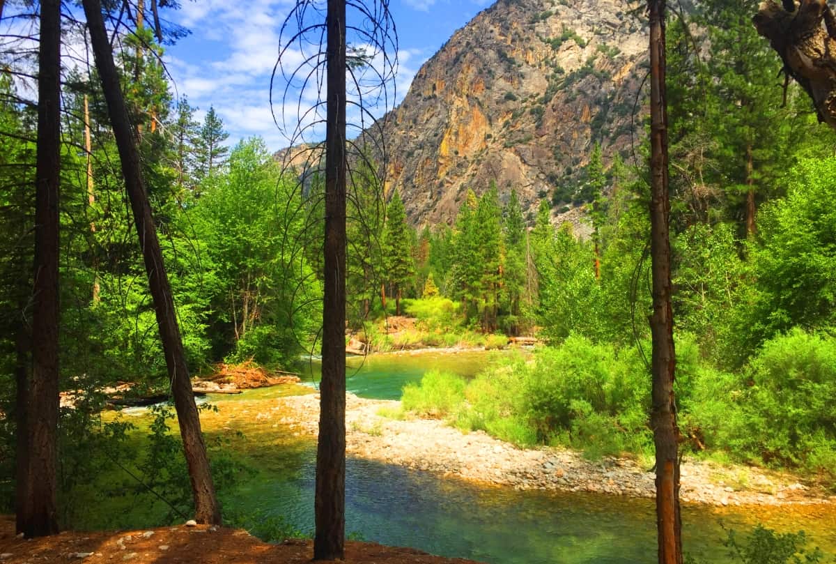 Kings Canyon National Park is a full spectrum gem, secretly shining from the depth of California’s primordial core. Just to get here requires a mandate of grit. Elegant and extreme contrasts exist here to push our understanding into realizations about what is truly important; i.e: Just the simple presence of Water, is Life itself. A humble set of well placed steps can successfully carry you through even the steepest of consequences…etc, etc…
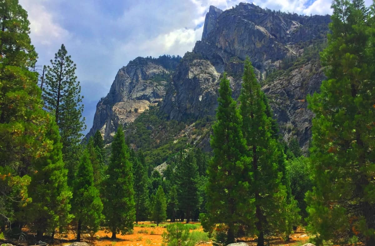 In a place where the trees are vulnerable to burning to ashes at any given moment, maybe take one of those moments to appreciate the small stabilities that exist in your life, keeping you from that burn. Beauty can prevail anywhere in Nature, even in the deepest parts of the world, harsh and hidden within massive mountain ranges. Kings Canyon is like a fortress built by the Universe, made specifically for remembering the essentials. Perhaps this is why so much spiritual thought has come out of the arid wastelands and chasms of the world; they just put what’s important front-and-center. Come to Kings Canyon National Park and experience the road-less-travelled, the wisdom of canyons, and the possible apparition of fire amongst trees, at any given time. What? A forests of apparitional fire in a quartz canyon.. where the ancients once lived in magical unison with the landscape! What more can I say? Go strong. Stonestrider.com
Devil’s Tower National Park
Location: Crook County/Wyoming/USA
Elevation: 5,100 feet above Sea Level
Prominence: 1,267 feet
Note: The only way to introduce the most mysterious small Mountain in America, which looms 1000 feet above the Black Hills Forest of Wyoming/USA, is to contextualize it by mentioning other places with very similar megalithic traits. Just to get you in the mood, take a look at these places: A coastline in Northern Ireland made entirely of hexagonal stones (Image/Left); 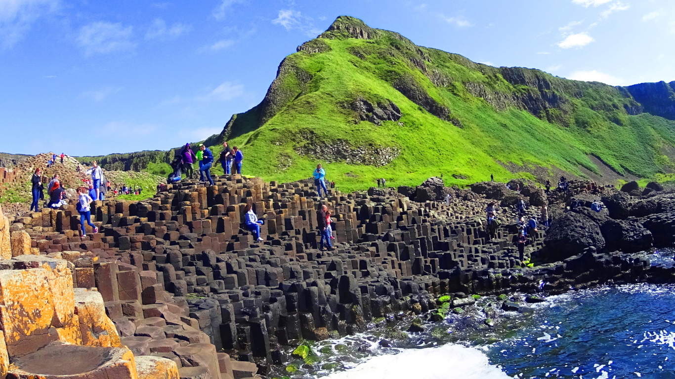 an elegantly scenic mountain ridge where three perfectly square slabs of stone, with absolutely concentric rings imprinted on its face, sits stoically above the beautiful Black Valley of Killarney, Ireland. (Image/Below); or a secret grove where a…
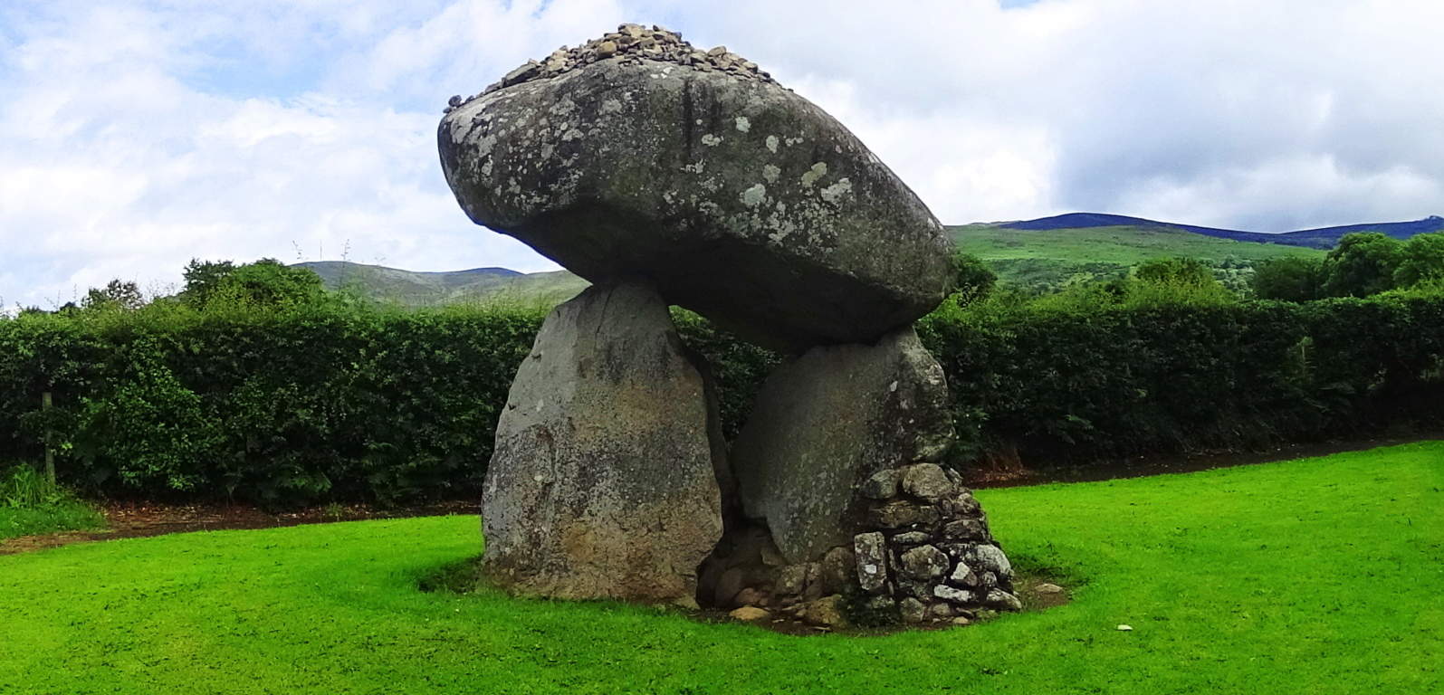
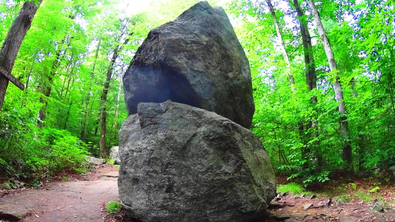
 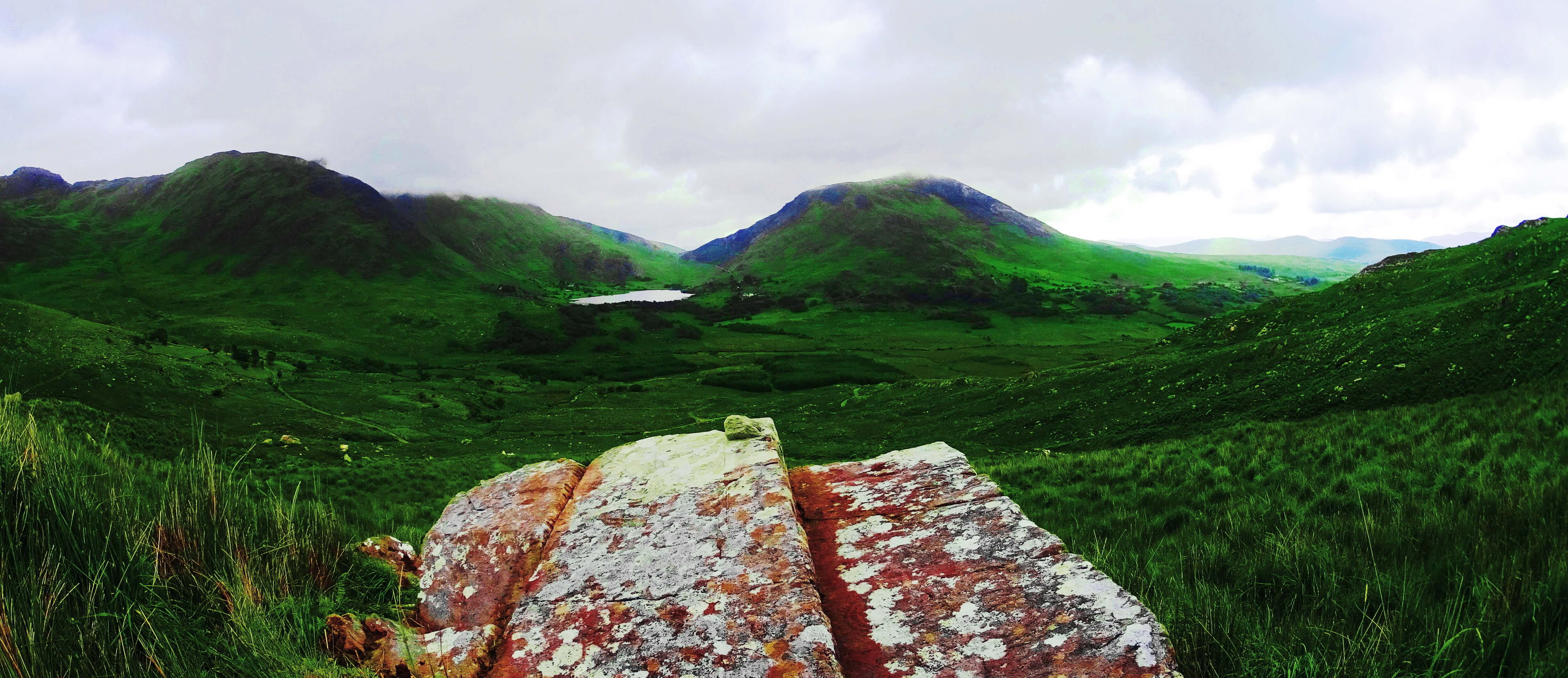 40 ton boulder balancing 15 feet high, supported by three standing stones, in Ravensdale Ireland, looms just south of the Mourn Mountains (Image/Left); or how about two colossally stacked, and perfectly balanced boulders, tucked deep within a Forest in Massachusetts/USA, each weighing about 30 tons, where the top boulder is balanced at about ten feet high. (Image/Right);
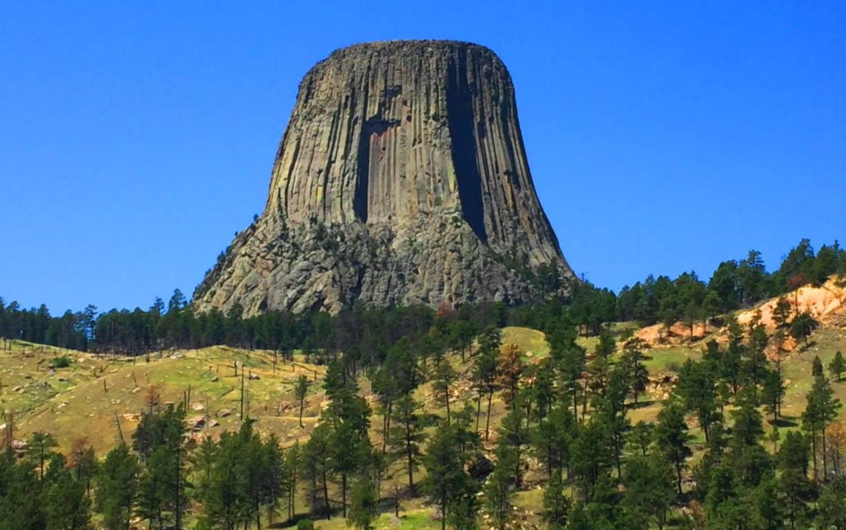
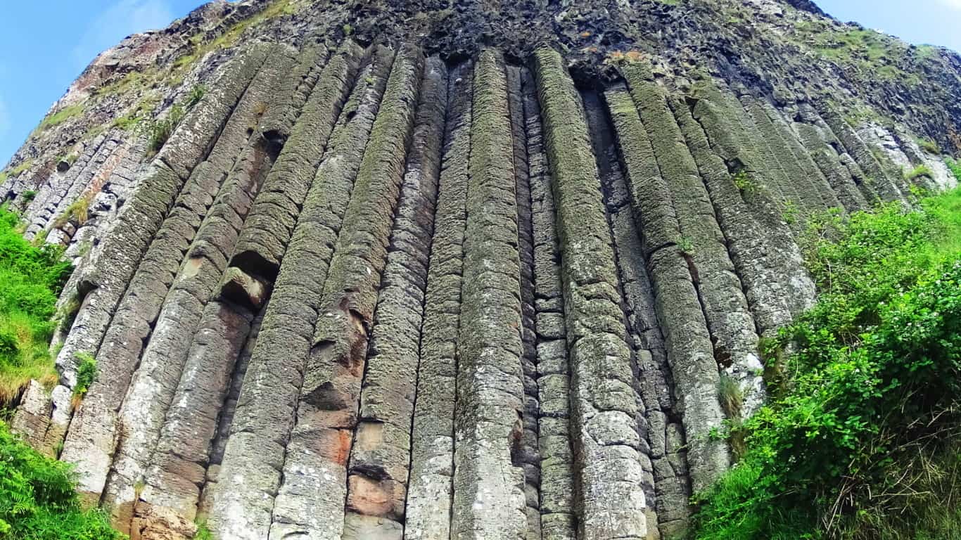
and last, there is an entire Mountain in Wyoming/USA that is completely sculpted into perfectly parallel square shafts reaching 1000 feet high for over a mile in circumference.(Images/Top/and Below) This is The Devil’s Tower National Park.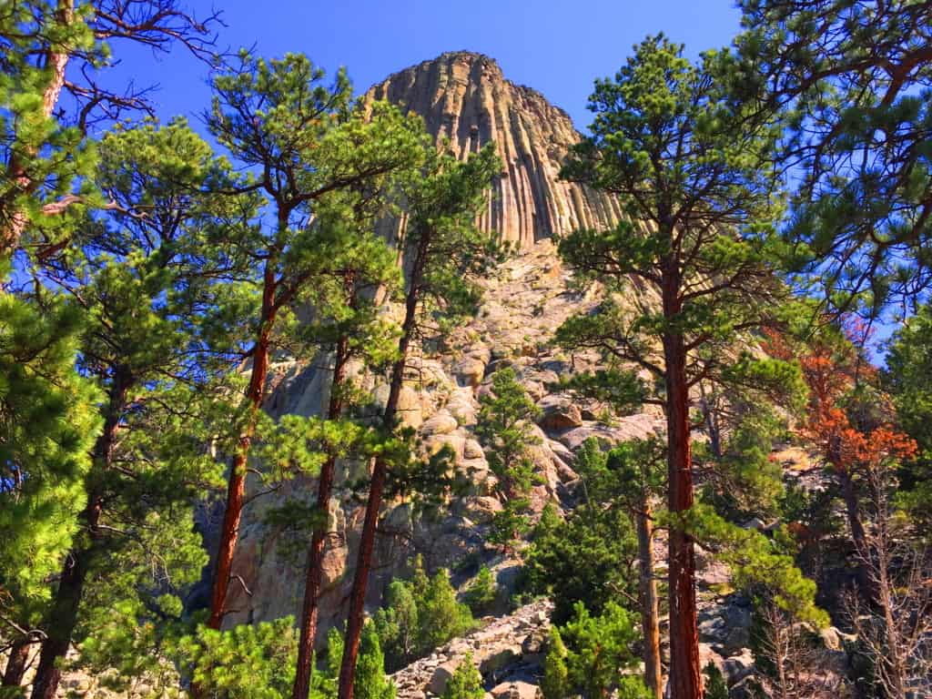 In this era of informational sharing, places that were once thought to be singular anomalies on Earth are now being connected to similar statements across the globe. Not only are these places being connected through physical similarities, but we find that the strange explanations that have been used to justify their unique features are also very similar, (as if it was decided uniformly in some boardroom far from the public, perhaps in the Smithsonian’s basement in the early Century) The bizarre explanations don’t make sense, especially when you see these places first hand, and get a look at the attributes that are not described online; traits like the elevated parallel shafts above the coastline at Giant’s Causeway Ireland, which is the most similar place to the Devil’s Tower in the World. We will look at the problems with the explanations, and the disregarding of certain evidence later in the article; but for the moment lets enjoy the mysterious scene above the grand Plain in Wyoming. The Devil’s Tower is an exceptional place, making it very hard to look away. It is almost guaranteed that you haven’t seen anything like this in your life. The Tower’ sits isolated above the golden-green landscape, an absolute silhouette. Even from far away, it is easy to see the unique exterior of geometric stones. Seniors and children alike will stare wide-eyed as they approach the Trail surrounding the Tower’. Human’s have wondered about this place forever. Lets have a look…
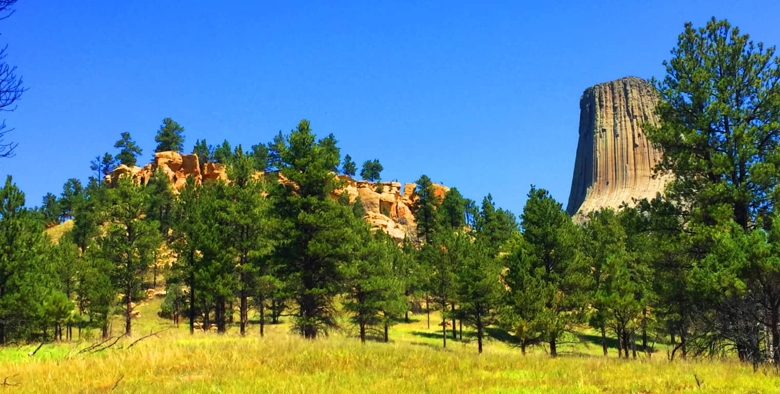 Trails at Devil’s Tower National Park: The main Trail here is straight-forward and interactive; it basically circles the Tower’, winding past massive boulders which can be climbed, all surrounded by Ponderosa Pine Forest. The Forest supports wildlife in abundance; Deer, Hedgehogs, Hawks, and Grey Squirrels wander freely.
 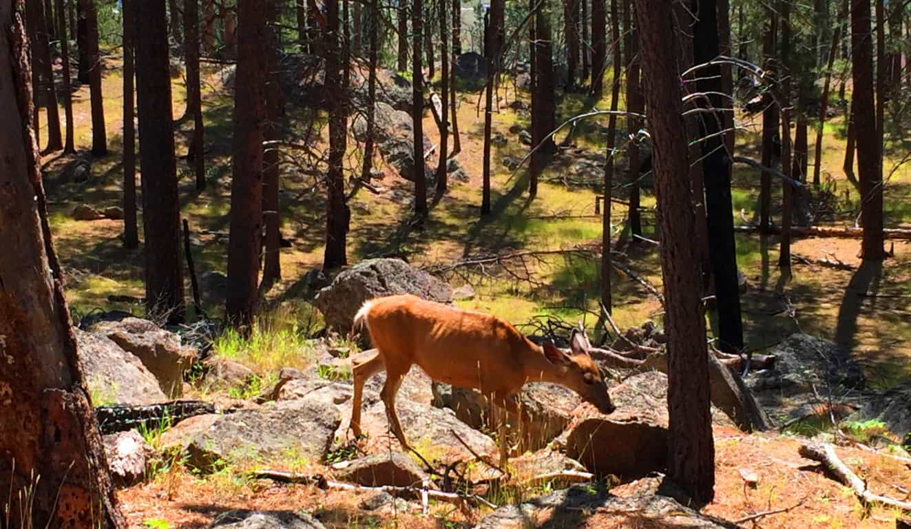 There are other trails that drift away from The Tower’ if you are interested in a longer trek. Everything sort of circumambulates Devil’s Tower, the longer trails being the more distant concentric from the small Mountain.
  The broad and beautiful landscape of Wyoming is what makes the Devil’s Tower so significant; there is simply nothing else like it on the North American Continent. It is the tranquility of this scene that is striking once you arrive. The Tower’, however, does not look as if it was quietly created, but rather, it seems is as if whatever sculpted it was most likely the loudest sound this valley ever heard. It just looks that way, with huge boulder’s all disheveled at the base, perhaps like giant crumbs from the most massively creased cake of all time.
 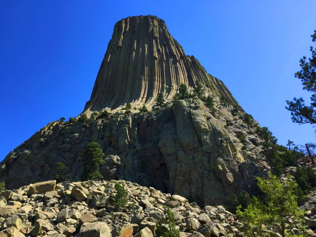 A Confusing Geological Scene: A geologic diversity exists throughout the Park’, with variations in specific stone and coloration. Below is an image of the lower portion of the Park’, where hundreds of hedgehogs have burrowed opposite these bright red ledges. The difference between these ‘red-ledges’ and the upper Tower’s white stone ridge is so distinct, so completely different, that it is hard to accept the current “volcanic explanation” about the birth of the Tower’. “Scientists” have basically stated that The Tower’ was created through a “volcanic event”, and yet the lava dispersion is restricted absolutely to the Tower’, while the lower scene reveals absolutely no similarity, or any other signs relating to this…”volcanic event“. If both areas experienced the same flow of lava, why are they so completely different? How did the lava-flow go upward, or simply stop flowing downward, to build The Tower without affecting the ridge below’?! No other active lava flow that we currently see on earth, like in Hawaii, Italy, or Japan, does anything remotely like this. And where is the active lava here in this landlocked and level landscape? How could the information centers possibly endorse this explanation? There is no sign of any active volcanic source beneath, or around, The Tower’. Amazingly, there is another small Mountain, in another part of the world, with exactly the same logical dilemma concerning the “lava-flow explanation“. Now lets compare both scenes…
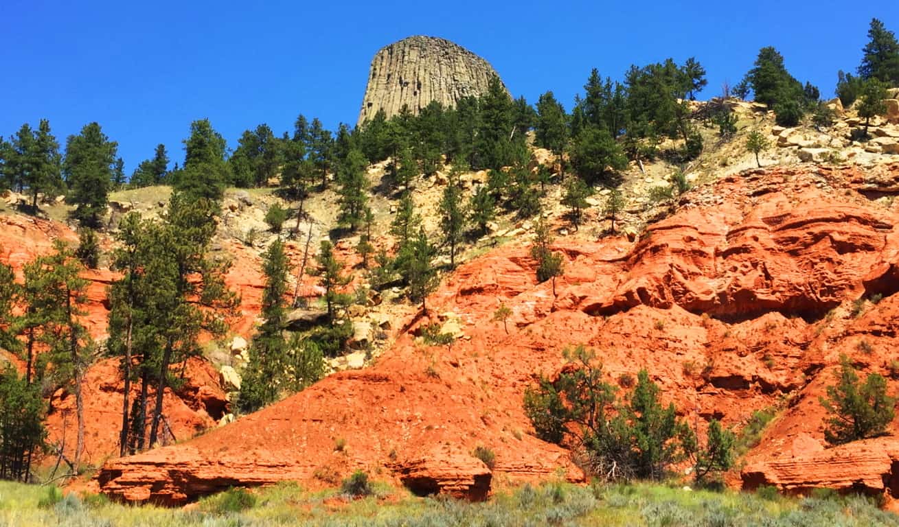 International Connections to Devil’s Tower: Many times, if international hiking and anthropology become part of your life, synchronicity and moments of wonder will happen. It’s one of the reasons hiking becomes a lifestyle. Crazy connections happen. On July 13th 2016, I would first see the inexplicable parallel hexagons carved into the mountainside at Giant’s Causeway, in Northern Ireland. And exactly one year to the very day, July 13th 2017, I would be standing 2,300 miles away, beneath another impossible set of parallel shafts, etched into a Mountainside in Wyoming/USA. The similarities between these sites are astounding, in every possible way
Take a look at the parallel shafts along the side of Devil’s Tower; do they look at all like flowing liquid/lava?(Image/Below/Left) At “The Giant’s Causeway”in Northern Ireland, look at the parallel shafts etched into that small Mountain above the coastline.(Image/Below/Right) Again,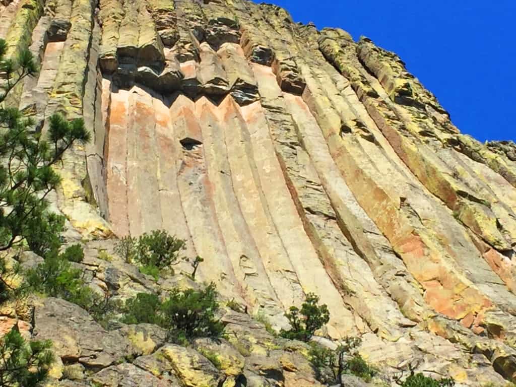
 there is no look of lava-flow whatsoever, but the very same parallel shafts. This is cause for true wonder. It is interesting that the parallel shafts in the small Mountainside at Giant’s Causeway are not advertised. Most people would never know or see anything about them unless they had hiked the trail personally. It is a good bet that the people who control the information about these sites know full-well that most people have a hard time carving out the time to see them for themselves. At Giant’s Causeway only the famous hexagonal stones on the coastline are advertised. Why wouldn’t the shafts in the mountain be advertised? Perhaps because it doesn’t fit the “lava-flow” narrative. The lower portion of the coastline is a patio of hexagonal stones, which is what they say was created by a lava-flow coming out of the Ocean; but how did the lava come out of the water, and then up a small Mountain 200 yards away, without leaving any trail of lava between the Coastline and the Mountain? (Image/Above/Right) Look at the coastline of hexagonals below, this distinct statement simply stops! And then almost 300 yards away, and 200 yards up, a section of parallel hexagonal shafts is carved right into the ledge, as you see above? Totally illogical. There is nothing but consistent green ledge and rounded regular stone between the two places, NOT lava flow.
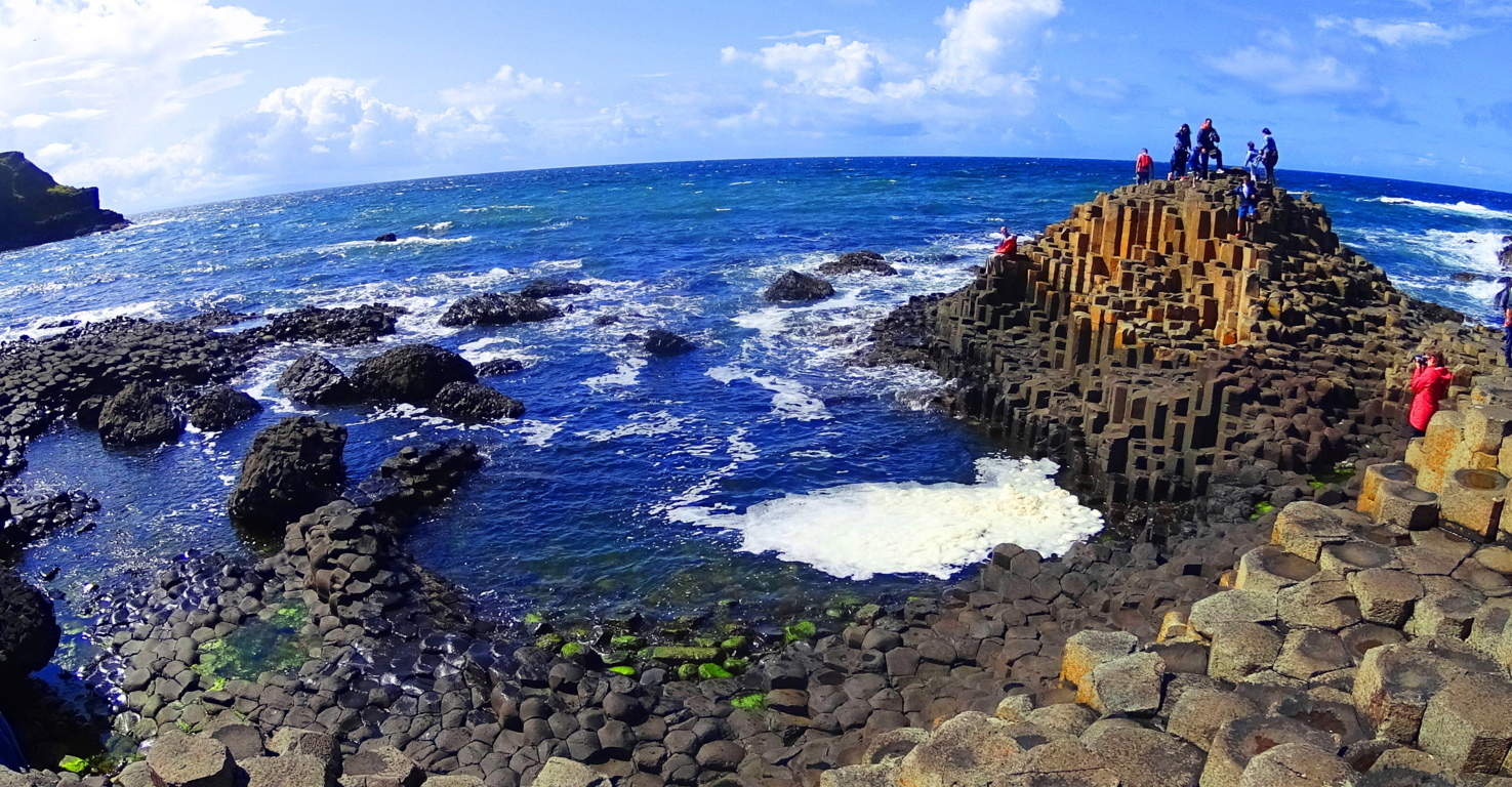 Below is another perspective on the separate statements at Giant’s Causeway. Clearly these are two very separate sections of geometric stones from the coast to the upper ridge. What in God’s name are these scientists talking about? It’s as if they give us explanations that sound….
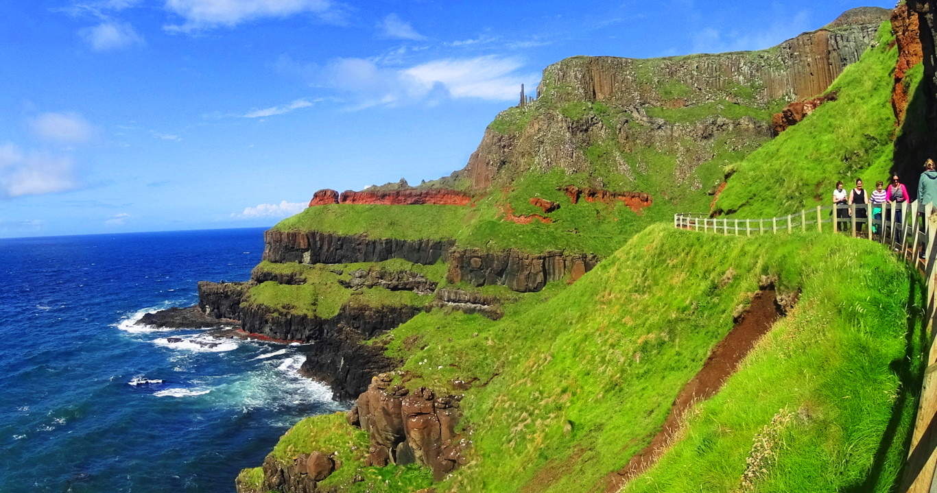 just “scientific” enough to keep less informed people totally bewildered. And there are more places of parallel stone shafts in the world; on the island of Sardinia/Italy, Scotland, and Russia, to name a few. How can these explanations hold up for us? These are the moments that people should start to see that if you just accept the explanations of others, you can pass up your universal human right to know the truth. I hope my readers are starting to understand that connecting the dots in the world for yourself is possible, and places like Devil’s Tower and Giant’s Causeway are literally there to inspire you into galvanizing your own perspective.
Dreamscape Wyoming: Returning to the landscape at Devil’s Tower in Wyoming, the hills and ledges drift away with a steady consistency, making Devil’s Tower that much more incredible, and bizarre.
The vastness of Wyoming is supremely humbling. You can drive, and drive, and drive, and drive, and the land just keeps going. It was only after I experienced this spacious dimension that I had a realization about how the Native Americans must have felt about the land. The Lakota and the Cheyenne must have been so deeply connected that it must have seemed that no one and nothing could ever displace them; they were fully embraced, protected, and immersed in the land.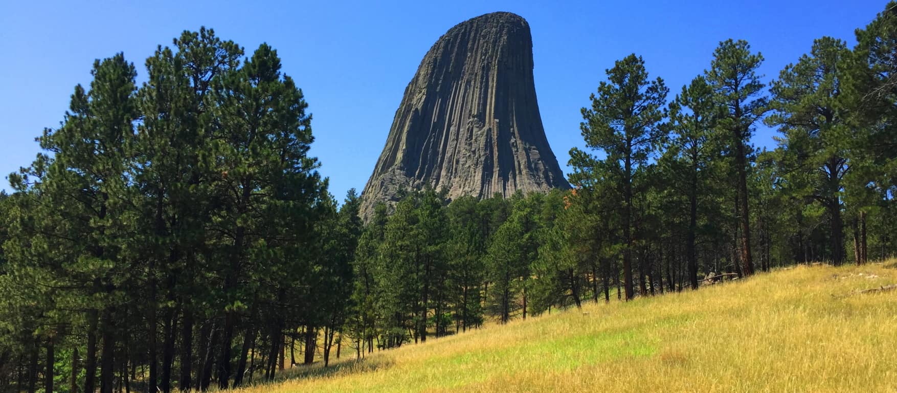 The Union Army arriving on the Prairie would’ve been like an invading army of Aliens emerging, in the hundreds of thousands, from the clouds over the world of today. And the Native Americans say that there were people here before them, tribes of violent Giants that they were forced to hunt, and finally exterminate. If you feel that this ancient story is completely absurd, just understand that the account of the Tribes of Israel upon entering the Promised Land in the Old Testament is exactly the same. Moses sends Joshua with his spies to explore the new land before them, and they return with reports of Giants inhabiting the heights of what is now the Mountains of Israel (Numbers 13:33) Most “educated” people simply choose to ignore this information, and dismiss it as myth. What are these people afraid of? The Devil’s Tower forces us to reconsider the information we accept in our lives; how we accept information. It is a place that challenges you, and pushes you to consider possibilities that are hard to fathom. Whatever the actual case may be, the Devil’s Tower is a magnet for our imaginations, a mysterious refuge that pulls us boldly towards it. This has been a sacred refuge for as long as anyone can possibly remember, and should be shown to the entire world in this unique and wonderful light. There are connections and relations at megalithic sites that make a difference in how we perceive and understand the world. That in itself is enough reason to get out there, and take a look. Thanks for reading, and please share this article with a friend. Stonestrider.com
The Grand Canyon

Location: Grand Canyon National Park/Arizona/USA
Elevation: 6,804 feet above Sea Level
Depth: 6,093 feet to the base
Note: The Grand Canyon isn’t just one of the biggest chasms on Earth, it’s a place to mark the phases of the world. Let yourself imagine an earlier phase of History, a phase when a troop of Native Americans of the Arizona desert plateau , perhaps Hopi, Navajo, or Hulapai, are slowly making their way across the high plain. They are going back to their Garden of Eden, to the bass of the Grand Canyon. The approach starts many miles away, through broad Plateau’s brush, and surrealist cloud cover. They make their way back to the beginning, through the Coconino Forest, and along the rolling hills at the edge of the desert.
 They are walking in, taking their time, without even an ounce of fear. The Hopi, keenly aware of the stars, observed that it is time to go back, to descend into the The Canyon’ and celebrate the origin of their people, a people they believe literally emerged from beneath the base of The Grand Canyon, once upon a beautiful time. In sandals, or even bare feet, they arrive at Grey Mountain…
 Perhaps after spending the night at the base of Grey Mountain, making a fire and eating, they continue into the region of canyons. The landscape becomes a waking dream. They pass by a smaller Canyon to the east (Little Colorado Canyon/Image Below). The beauty of that Canyon is enticing, with a massive cloud hovering above, lending the area shade, where no other shade can be found for perhaps dozens of miles.
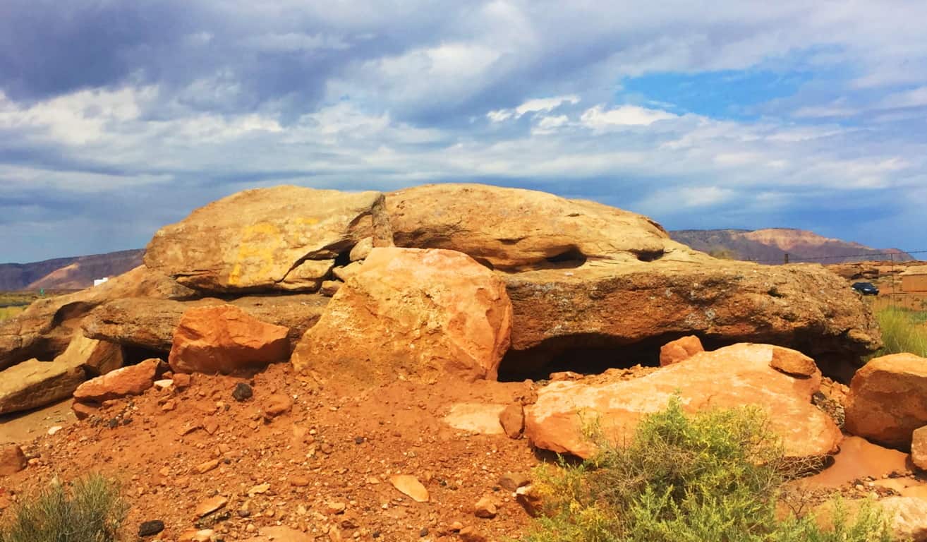
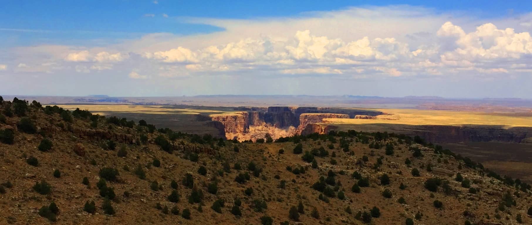 Out among these mountains and small canyons are megalithic cairns which look to have been constructed specifically with flattened boulders, very similar to structures in Ireland. Take a look at one of the huge layered cairns that sits directly in front of, and parallel to, Grey Mountain here in Arizona (Image/Below/Left). Now take a look at a cairn in Kilclooney Ireland that sits parallel to a small mountain (sacred zone) in County Donegal (Image/Below/Right). Cairns in Ireland are estimated to have been constructed roughly 4000 to 6000 years ago, and by the look of this desert cairn, it may very well have been constructed in the same early period. These structures are both dilapidated, but it is clear that the original condition of these cairns were once much more orderly, and certainly served a specific function. The overall idea to consider by referencing and comparing megaliths is to realize that a similar Megalithic culture did exist in the high Arizona Desert, many thousands of years ago, and we should acknowledge this.
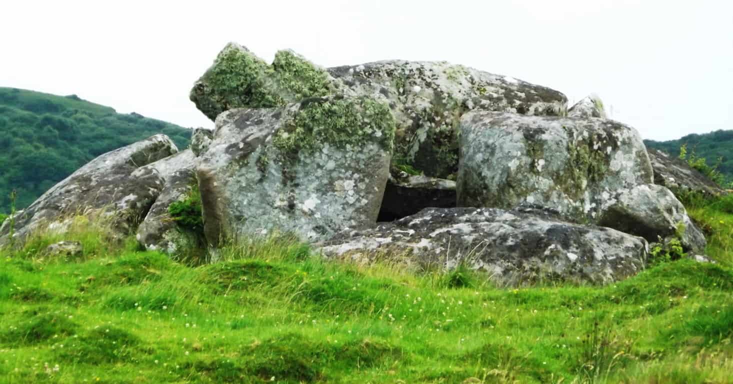
Continuing their journey, the natives would’ve drifted ever closer to the Kaibab Forest, silent as ghosts. They wade into the trees and brush, where they rest in the shade, and watch a storm-cloud approach, like a slow-rolling blessing from above.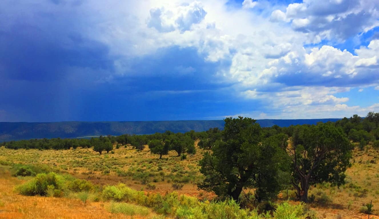 The brush becomes glades of tall pines, as the terrain rises slightly. The absolute lack of humidity topples many of the trees, half burnt into the ground, while surprisingly, there is a somewhat miraculous amount of greenery as well, which would be an incredibly welcoming sight after passing the open desert.
 They breach the tree-line after a few days, and like a green-curtain pulled back, the Canyon is suddenly revealed. It is astounding, to say the least. This is the naval of the world; the center of everything; the most sacred place; and what is now known to us as the South Rim of “The Grand Canyon”. The Hopi never took this stellar scene for granted. Perhaps they would’ve camped and rested here, watching the stars for the evening, before finally ascending into the sacred place.
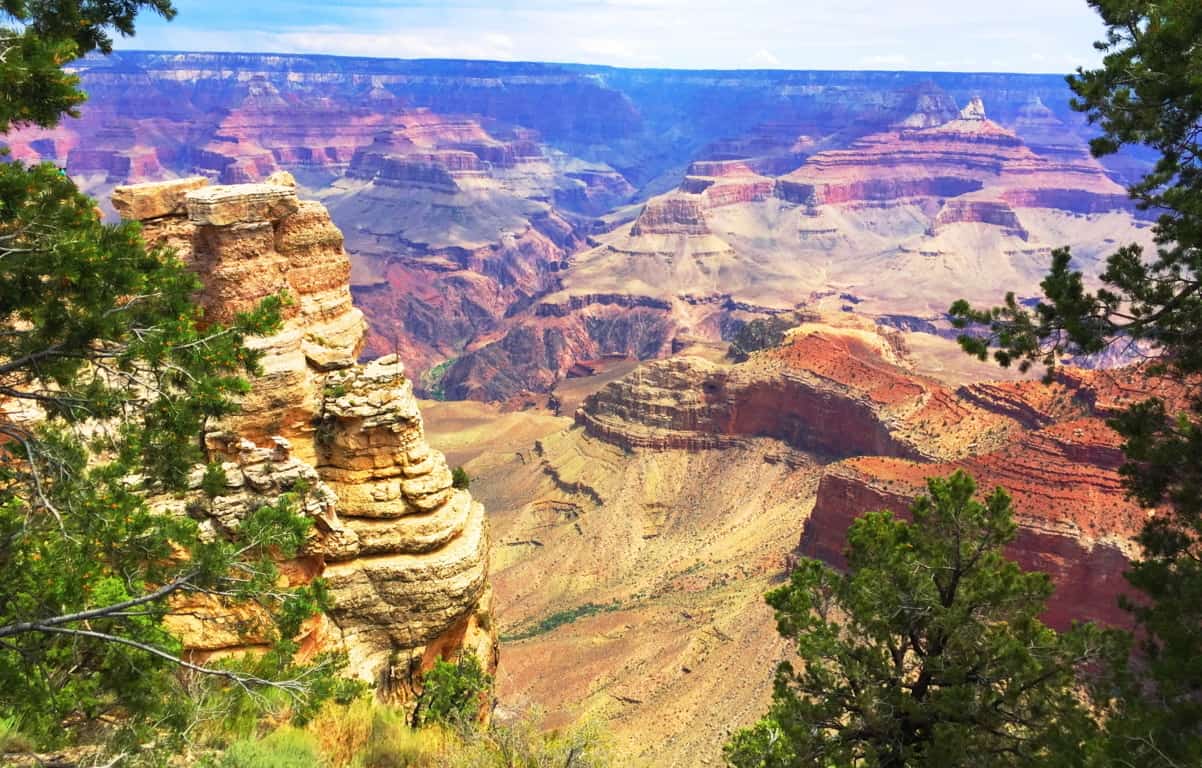
South Rim Trail: Opening with a semi-fictional narrative about what most likely took place for perhaps 10,000 years with the indigenous tribes of this region seems the most appropriate way to honor this sacred space. The statistics should be secondary, as well as what the modern world has done to ‘The Grand Canyon’. The Hopi truly believed an elaborate myth that is still accessible today. They would return to the very area at the base of the Canyon’ annually in order to remember their magical beginning. It is worth noting that the Judeo-Christian myth credits God with making human-kind out of the soil of the Earth in a central ‘Eden’ as well; a strangely similar story of human origin. It is important to include the incredible landscape that surrounds the Grand Canyon as well; the the dusty hills on the edge of the desert near Flagstaff; Grey Mountain; the beautiful Little Colorado Canyon; and the Kaibab National Forest, which is the last natural statement before the Grand Canyon’ itself. All of this runs along a beautiful and well constructed highway.
Directions: From Flagstaff AZ to the Grand Canyon their are a few options for making the amazing drive north. To see the places mentioned above, take Highway 89 North to Highway 64 west. It’s that simple. 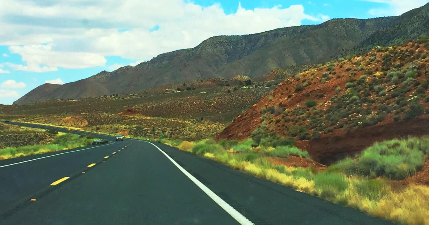 The Grand Canyon is a 277 mile long, by 18 mile wide, gap in the Earth. It is 6000 feet from to bottom where we find a river running through the stone. The Colorado River runs straight through the center of Canyon’ from North-east to South-west. The “official” story is that the Colorado River cut this Canyon.. (Although I find this very difficult to believe) Below is an image of The Colorado River from the South Rim.
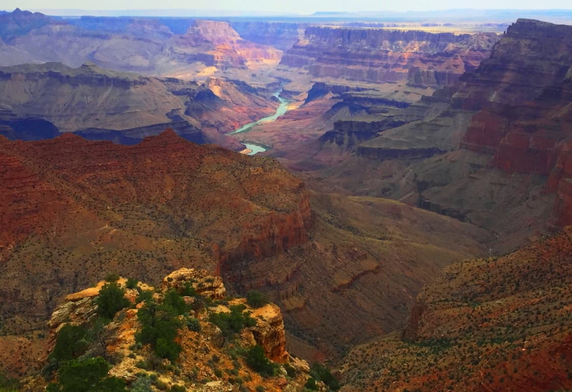 The idea that Colorado River carved this Canyon is illogical for many reasons, and many Geologists challenge this theory. The Canyon is filled with temple-like elevations that have absolute right-angles which in no way coincide with the idea of slow rolling water erosion. In fact, most of the geology at The Grand Canyon points to this chasm being created in a somewhat rapid spasm of massive force, not a slow process. Layers of stone point to the preservation of fauna in distinct singular periods, not an evolved encasing of step-by-step progressions of species; there are no interval species in the strata. There is no indicator of an “evolved erosional process” given to us by our high school text books, but rather, something much more forceful and immediate created this place. How could this be? There are more mysteries than answers here, even at this digitally analytical point in history.
 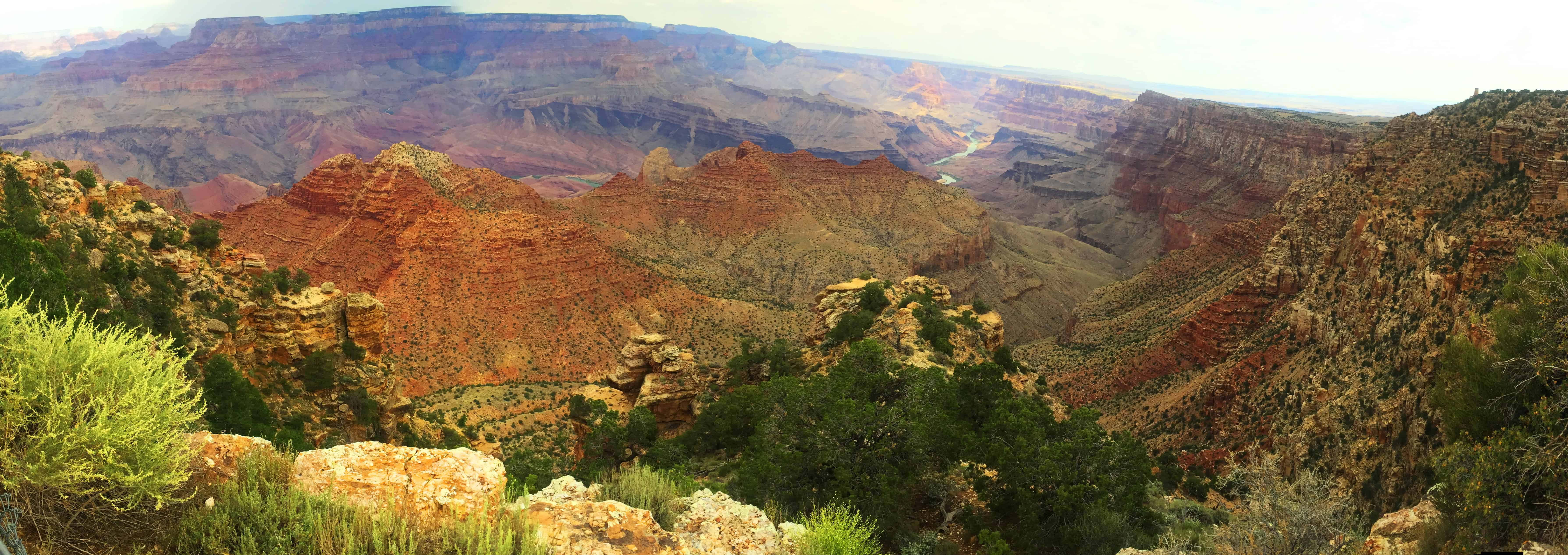 Mysteries: Across the Canyon near the North Rim is just one of the many elevations within the Canyon that has been given a Coptic name by early century archaeologists:’Isis Temple’. A majority of megalithic works all around the world usually reveal a symmetrical style. Even from many miles away, the symmetry of Isis Temple can be seen, with a lower entrance at the center, aligned with a five-sided pinnacle at the top. This would’ve been a major undertaking by any Neolithic culture. Artifacts with strange symbols have been found within the entry cavern at Isis Temple, along with artifacts in several other labeled elevations within the Canyon.(Image/Below) The Hopi do not take credit for any megalithic craftsmanship in the Canyon, so these “temples” must have been made by someone else. Who could’ve done this? Every thing points to a Megalithic Culture, similar to the one found in Celtic places.
There are also Free-standing boulders in hard-to-explain places, and Standing-Stone fixtures all throughout the lower Canyon’. Along the South Rim there are ledges where boulders, weighing perhaps 20 tons, sit on thin ledges high above the Colorado River. (Image/Below)  It is extremely hard to explain how a boulder such as this came to sit on such a narrow and level ledge, roughly 4000 feet above the base of the chasm. This is one of the most dramatic examples of a Free-standing-boulder I had ever seen, among hundreds of examples stemming from Ireland, Scotland, England, all the way to Arizona. Below is the full view of where this boulder sits. What an incredible scene.
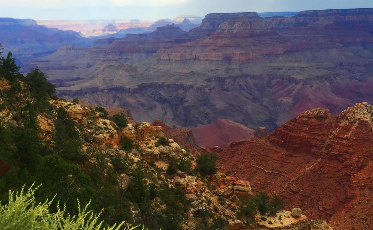 Someone at Grand Canyon National Park is certainly aware of the possibility of Megalithic culture, and Standing-Stones, as the Park has created an artificial Standing Stone set up along the South Rim Trail.
 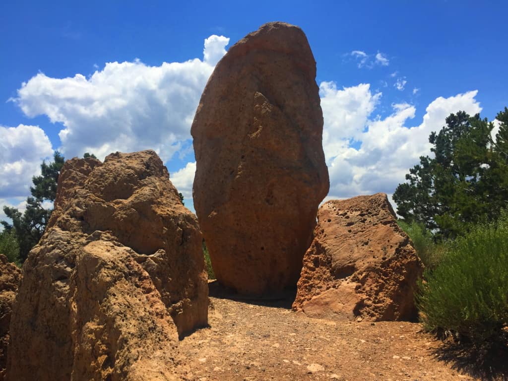 Everything about a Standing Stone like this says “Megalith”.(Image/Below) Just like Megaliths in England, Scotland, Ireland, and New England, Standing-Stones like this usually indicate the claiming of a specific area by those skilled enough to place the Stone; and they had to be strong enough, and smart enough, to do it. Below is the image of a Standing-Stone of the exact same proportion at Avebury Stone Circle in England, 5,200 miles away.
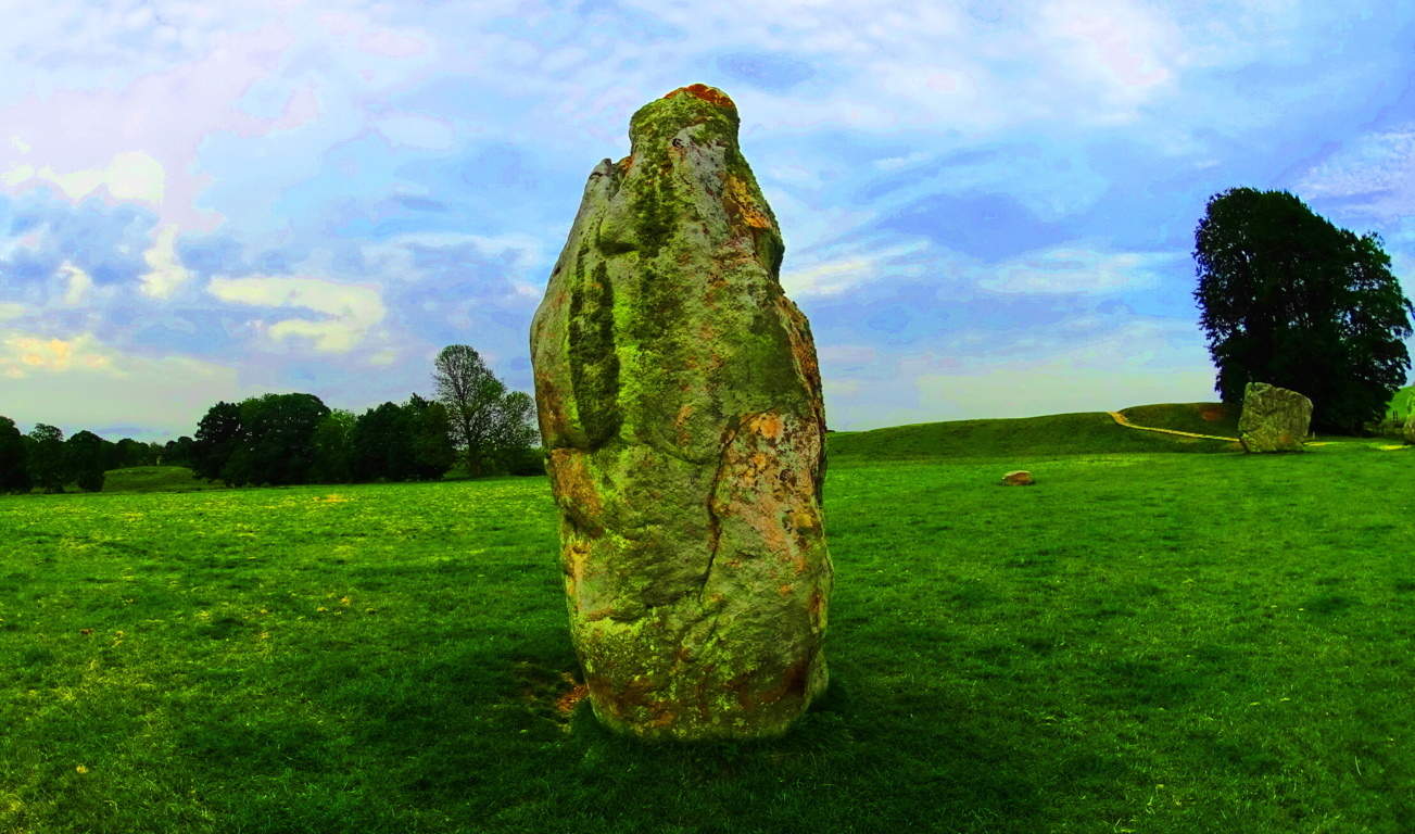 In England, Megalithic culture is acknowledged. In the United States, Megalithic anthropology is suppressed, and mocked; but here on the South Rim there is an opportunity to decide for yourself if a Megalithic culture may have existed in this beautiful place. The South Rim Trail is the best beginner option for the Grand Canyon. The Trail’ is a curvy surreal pathway that takes you through dozens of photographic options for this portion of the Park. (Image/Below)
 You can simply step off the Trail’ at any time to capture the scenes that appeal to you here. The massive cliffs and chasms have a magnetic quality which seems to call out to the explorer in all of us. The image below is a perfect example of the photogenic power and quality that exudes from the South Rim.
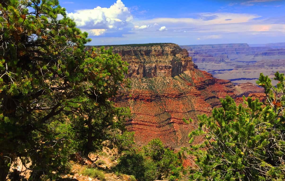
Final Note: The Grand Canyon is a study for every generation. The Canyon’ has qualities that are surprisingly subtle for such a massive space. Before the constraints of the National Park constructed in our current era, a young tribesman, that had yet to come to this area, would’ve wandered into the Kaibab Forest with literally no awareness of the massive vortex of space lying before him. From the Forest there are no signs of the Canyon. It appears so suddenly after clearing the tree-line, so “out-of-nowhere”, that the underlying message is that you truly never know what you may find out on the trail. It is as if Nature itself is trying to tell us: “Never make assumptions; something truly awe-inspiring might be waiting just up the path.”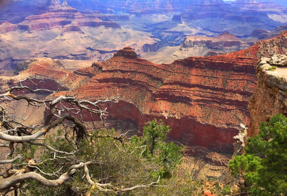 This article is an introduction to the South Rim Trail of Grand Canyon National Park. The South Rim is the more convenient approach for the trails to the bottom of the Canyon, complete with guides, mules, and horses. Be over prepared with water and sunscreen in your packs, along with a small medical kit. For those attempting to make it to the bottom for the first time, the South Rim is your best bet. The South Rim approach is about 4 miles total to the base, while the North Rim is about 8. The upper South Rim Trail is obviously a photographers paradise with a leisurely path that allows you access to ledges which drop a mile, straight down. The glowing goldish’ texture of the stone is mesmerizing to us. The symmetric elevations that rise as temples out of the base, near the Colorado River, force us to wonder almost impossible things. There is even a celestial theory that the temples of the Grand Canyon coincide with the belt of Orion’s major stars.. (Google it). The natural beauty of this place, the vastly humbling abyss of stone, is clearly presented for us to consider. The capability of Nature, and the luck of being alive to witness it, is also part of this experience. But the last thing, a thing that seems to exist in every protected space, from the American West, to the Celtic heights of Scotland, is the earliest Neolithic culture that seems to leave its mark on every sacred space on Earth. All these things are there for you at Grand Canyon National Park. Remember, there is no need to get too close to the ledge, rather, step back a little, and listen to what the landscape is telling you. And always go strong. Happy New Year!
Dedication: This article is dedicated to my father Robert Vincent Vigneau, who passed away yesterday peacefully after a life of international travel and odyssey. Thank you dad for teaching me, at a very young age, to step into foreign lands with curiosity, logic, respect, and no fear. I love you, rest in peace. Robert Vincent Vigneau 1943-2017
Lake Agnes State Forest
Location: Rocky Mountains/Steamboat Springs/Colorado/USA
Elevation: 10,290ft
Prominence: 459ft
Note: Any time the overall goal of your hike is found in a place that looks like a scene out of Avatar, you really can’t lose. “Avatar-type” places are the icing-on-the-cake of a well planned expedition, so absolutely “pencil-in” trips with extraordinary natural features. I penciled-in Lake Agnes State Forest just a few days before I arrived, looking over google maps with a friend, and received the Avatar-type ending we were hoping for, in spades. Just look at this scene! The view from the Trailhead could easily be mistaken for nothing less than the Swiss Alps; but it’s not the Alps, it’s the Colorado Rockies. Make sure you bring the cameras for this one..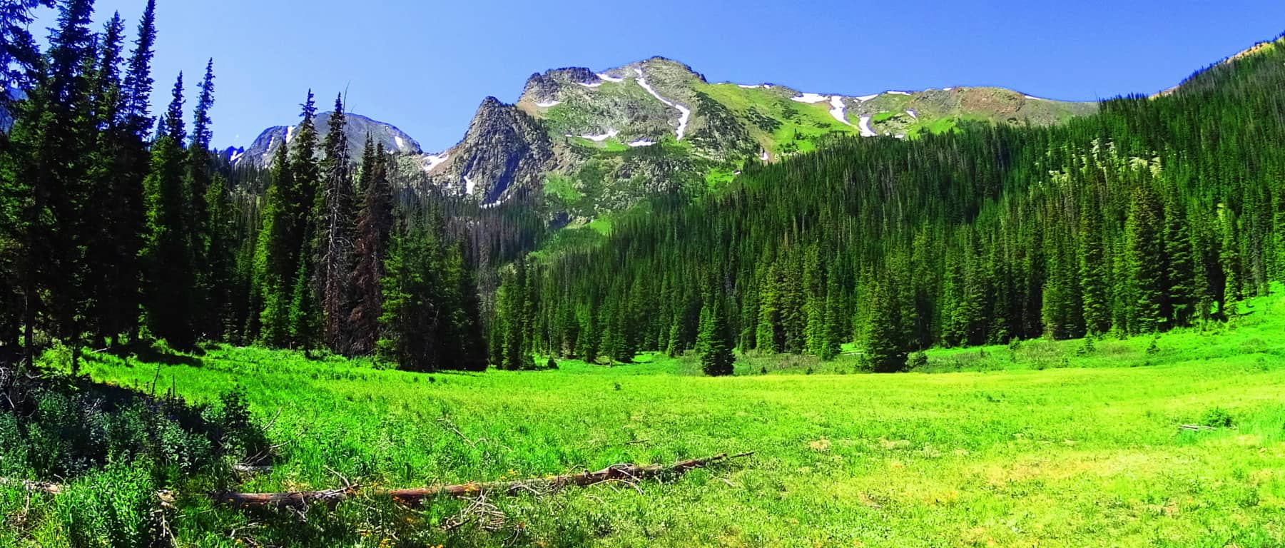
To Trailhead: Unlike Mount Clark or Bear Mountain, for Lake Agnes you will not need a 4X4 vehicle to reach the Trailhead, a regular car will do fine. Coming from Walden Colorado (an Americana hamlet and biker haven nestled just south of Wyoming, in the heart of Medicine Bow National Park). You can take Route 14 South almost the entire drive, following Little Muddy Creek the entire way on the right. After about 35 minutes, merge onto Route 40 South, and take it just a few miles before turning Right onto Road 186, the final country lane before reaching the Trailhead, with vehicles parked near the entrance. The low-maintenance aspect of getting to Lake Agnes is one of its draws, along with the comfortable half-day-or-less distance of the beautiful hike.
Lower Trail: The initial trail is a tunnel of tall and pristine Pine trees, regal in strength and height. With the mountain views at the first segment of the hike, it’s a wonder people continue to the next phase at all, with these massive jade colored peaks, and mesmerizing forest, beckoning the cameras. 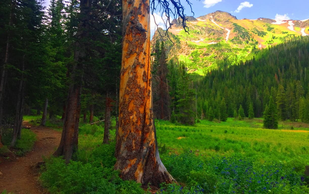 A profound view of Mount Baker, sitting several miles to the north, comes into view as you begin the 45 minute climb required of you. Each switchback-porch gives a slightly better angle on the mountains beyond.
 The trail continues around Lake Agnes, and back again, requiring a short trek through beautiful glades, with a path running directly over a rockslide on the edge of the Lake. The cliffs are streamline and massive. The scale of the mountain ridges are humbling beyond measure.
  The trailhead opening of Lake Agnes is a truly majestic scene, with a 100 yard field of velvet wildflowers pointing straight at Mount Baker to the North, which was glowing like an earthen-colored diamond.
  The image below is a wonderful example of how the Trail looks heading into the forest. The trees are vibrant and sturdy beyond measure, while the mossy forest-floor practically glows on a sunny day. It is quintessential forest, much deeper and more dangerous than any Celtic woods. Brown Bears are out there. Make plenty of noise on a trail; let them know you’re out there. You simply don’t want to startle any creatures of the forest. If you do come across a Brown Bear unexpectedly, do not make eye-contact, stay as calm as you can, and back away slowly and silently. (Studying up on wildlife encounters in the region(s) you are visiting is of course always a good idea)
 The eastern side of the dell at Lake Agnes is a phalanx of cliff-faces and striking rock facades. To the west, the valley rolls down in an ocean of green. (Image/Below)
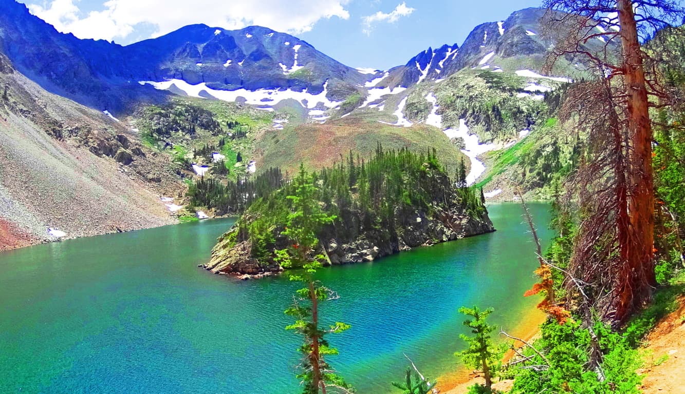
 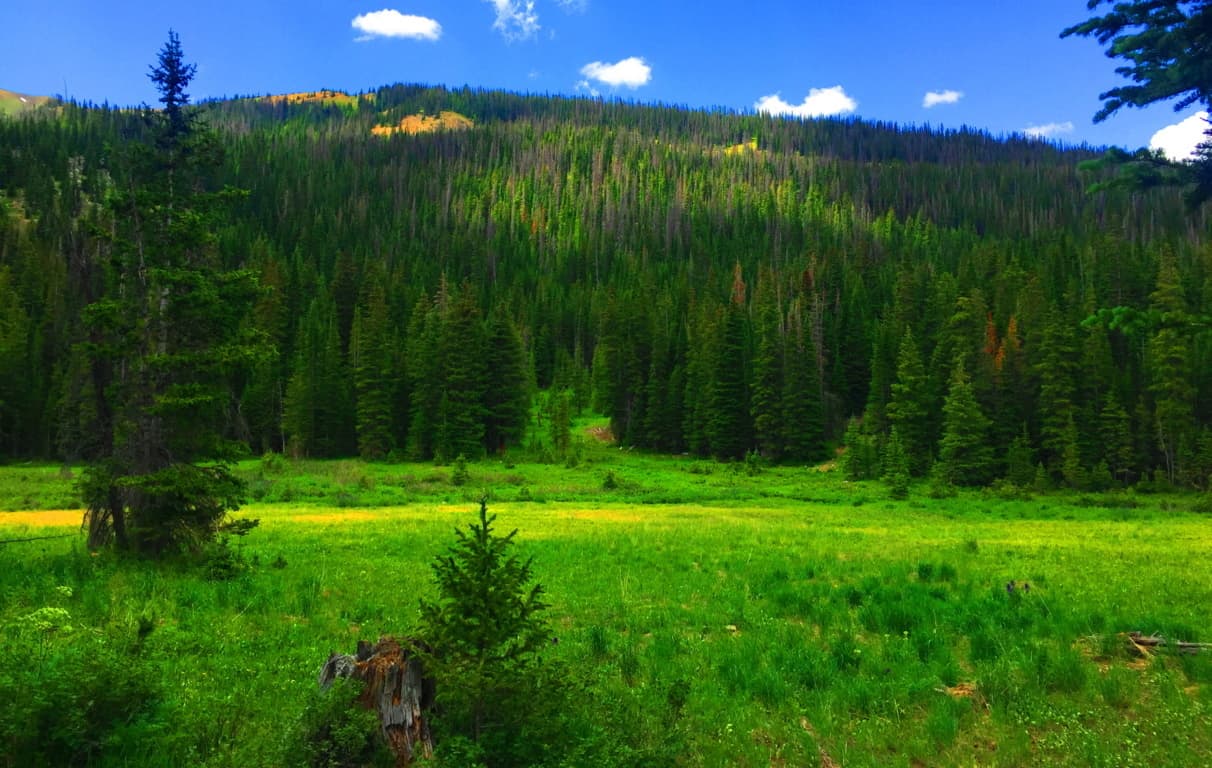 The Upper Trail: Welcome to the higher elevations of Colorado in July, where snow remains on the heights of the upper vale, even while the forest is in full-bloom. The water here is so clear that it reflects vividly, like a lens, curious combinations of snow white, forest-green, avalanche-grey, and blue sky. This a virtual stadium of natural perfection, where the upper-deck is hard blue stone, and the lower section a universe of sliding rocks capped with indents of glowing snow along the highest ridges. Lakes Agnes Trail is a cozily short ‘loop-trail’, only bout 3.5 miles in length. The first portion of the trail is a fairly challenging 45 minute climb to the Lake inclosure, sitting 10,290 magical feet above Sea-Level. Up here you can really feel the elevation. If you continue the woodsy loop around the Lake you will see how the small pond actually changes colors from different perspectives. The initial look of the pool looks like a deep, yet radiant blue (Image/Top), but change the angle further up the trail, and it becomes a solid green, as depicted in the image below. This is truly a wonderful place
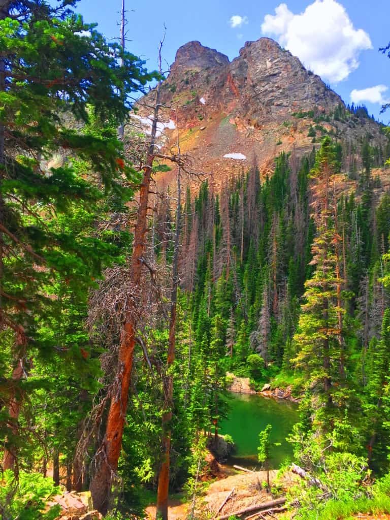
There are many stones with markings that look like linear sections which were cut smoothly, across the rock face. (Image/Below) This section reminded me of a curious solitary stone with strangely marked sections at The Blue Hills Trail in New England, some 2000 miles away. (Image/Below) The sections of the New England stone is not linear, but clearly chiseled, with the small sections that were cut away sitting all around the boulder. How di these markings and results happen?
The phenomenon of stones that seem to be blatantly crafted is no fluke. There are extreme examples of this phenomenon in many other places across the globe, many of which are noted here at Stonestrider.com. But this was the limit to what I saw of signs which seemed related to the Neolithic Culture. For the most part Lake Agnes itself is the jewel of this excursion. If you come to northern Colorado this would be a great trail to begin with as a warm up for the other mountains of The Rockies. When you get to the Lake yo will understand.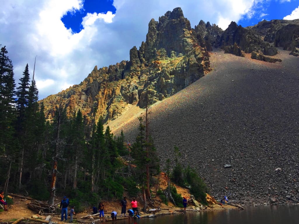 Don’t just seek it out, find it out. You’ll be glad that you did. Thanks for reading, and go strong.
Coconino National Forest
Location: Flagstaff, Arizona.
Elevation: 7000 ft
Note: Coconino National Forest raises some amazing questions and answers about what has really taken place in the beautiful forests of the world. Before wandering into any part of the massive Coconino’, it seems appropriate to have a discussion about the very real enchanted statements that exist in sacred zones. Coconino is certainly one of those sacred zones. Therefore, this article begins with a “Forward” in order to offer logical evidence, rather than tired theories from post-modern science, theories which are quickly being understood as totally ridiculous. Here at Stonestrider is some of the most vanguard and comprehensive work on what is actually revealed by these megalithic stone works, and you will learn something incredible from it. There is an anthropological side of hiking in ancient places, and every so often it is important to review connections, patterns, and evidence. By looking at this material, please understand that you are stepping into something truly magical. I thank everyone who takes the time to consider the evidence in the beautiful places of the world by reading an article like this, and we will wander into Coconino after explaining a few wonderful things about what is taking place here.
Forward: After drifting into roughly 30 forests internationally, and sponsoring this website with many truly challenging expeditions over the course of the last five years, I’m gonna take the chance of going full-on anecdotal for the first time, due to the relevance to The Coconino National Forest featured at the moment, which is one of the largest and most beautiful Pine forests in the entire World (and obviously the continental U.S) Allow me to step back for a moment to set a scene about what Forests mean to me. As a teenager I read, and re–read the works of J.R.R Tolkien, which many students utilized to break the boredom of raw academic classes, ever since the massive novel was first published in the 1950’s. Intrinsic to my photo’s, if you look with a certain eye, are Tolkien’s descriptions; images of mountains, river-glades, and forests which certainly engage all of our imaginations to this day! I realized, while going-over the content for this particular article, that in my mind, before I wander into any forest while out on the trail, that I am always comparing it to one forest in particular from Tolkien’s fictional masterpiece, that forest being Lothlorien. In this regard, I have searched for many years for forests that most closely resembled an enchanted experience, where the deeper you walked in, the more magical and dimensional the experience became. And amazingly enough, from this inspiration I discovered the real-time magic of forests internationally. These are profound discoveries that should be shared, which is the focus of this article.
 Forests often have particular emotional effects on people. Tolkien, in the Lord of The Rings, also creates a polarity about forests. His characters journey through the beautiful, mystical, spacious, ageless, enchanted Forest of Lothlorien; and then later into the dark, rustic, knarly, timeless Forest of Fanghorn. Some are light, and some are dark. And darker still, is Mirkwood Forest in The Hobbit, the epic prequel to L.O.T.R. (There are other forests as well, like the heart-warming Buckland Forest in the opening of LOTR,(#TolkienNerd), plus what you find in Grimm’s Fairy Tales, or Science Fiction stories of today)
The main point of all this ‘fictional forest referencing’ is to understand that forests have, and promote, specific styles and characteristics all their own, just like people. Some are bright and carefree, with pleasant pathways, and golden Autumn leaves, as in New England (Image/Upper-Left); while Other forests, like Ballachulish in Glen Coe Scotland, are dark and looming, with strong and rustic ancient knolls. Walking through Scottish forest is truly intimidating, with a fear of getting lost in the fog and rain; yet the glens are gorgeous! (Image/Upper-Right). Take a look at another Glen in the Snowdon Forests of Wales, which is as pleasant-a-vale you will ever walk through in your life. This particular glade, which almost looks fictional in real-time, are woods made of an extended family of trees, spacious and airy, with an obvious brightness that nearly forces you to squint just to decipher the full scene. (Image/Lower-Left).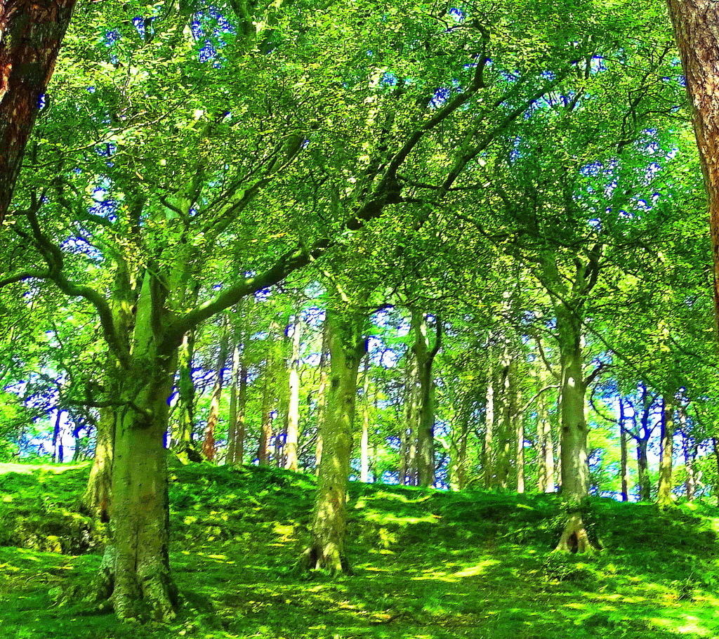 There is a small standing stone at the top of the knoll in this image, which can’t be seen from this spot.
And along those lines, how could I exclude a forest which is, in my opinion, one of the most enchanting paths that has ever been, which is the smaller, but incredibly beautiful, Kinnitty Forest, in the absolute heart of Ireland. This is a rare Celtic Wood, that has been vanishing steadily since the Colonial Period. Irish forests are particularly rare due the British need for resources across the Celtic Sea just 100 miles away. Kinnittty is a rare gem.(Image/Lower-Right)
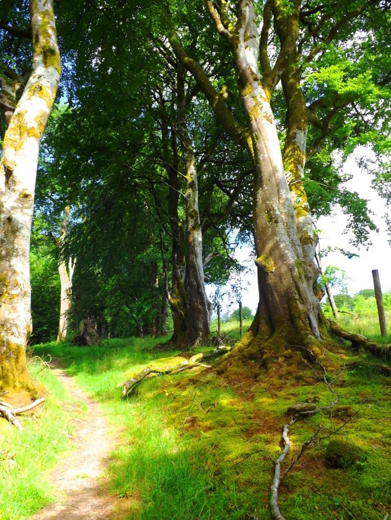
And before finally moving into the deeper meaning of forests, I could not complete this small tour without having a quick glance at the most dense and intimidating forest I’ve ever seen, which is the brilliant Rawah Forest of Medicine Bow National Park in Colorado USA. These are shimmering glades that sway and sift through each other like green-ghosts. In almost all the forests I’ve been I have disappeared into dells that looked to be harboring some kind of clearing or stone-altar; but in Colorado I dared not wander in any away from the old rocky paths. As I have described in other articles, it would be like wondering into the depths of the ocean at night, and like the ocean, it is an overwhelmingly profound statement about the abundance of Nature’s forces, ever blooming in our complicated world. (Image/Below)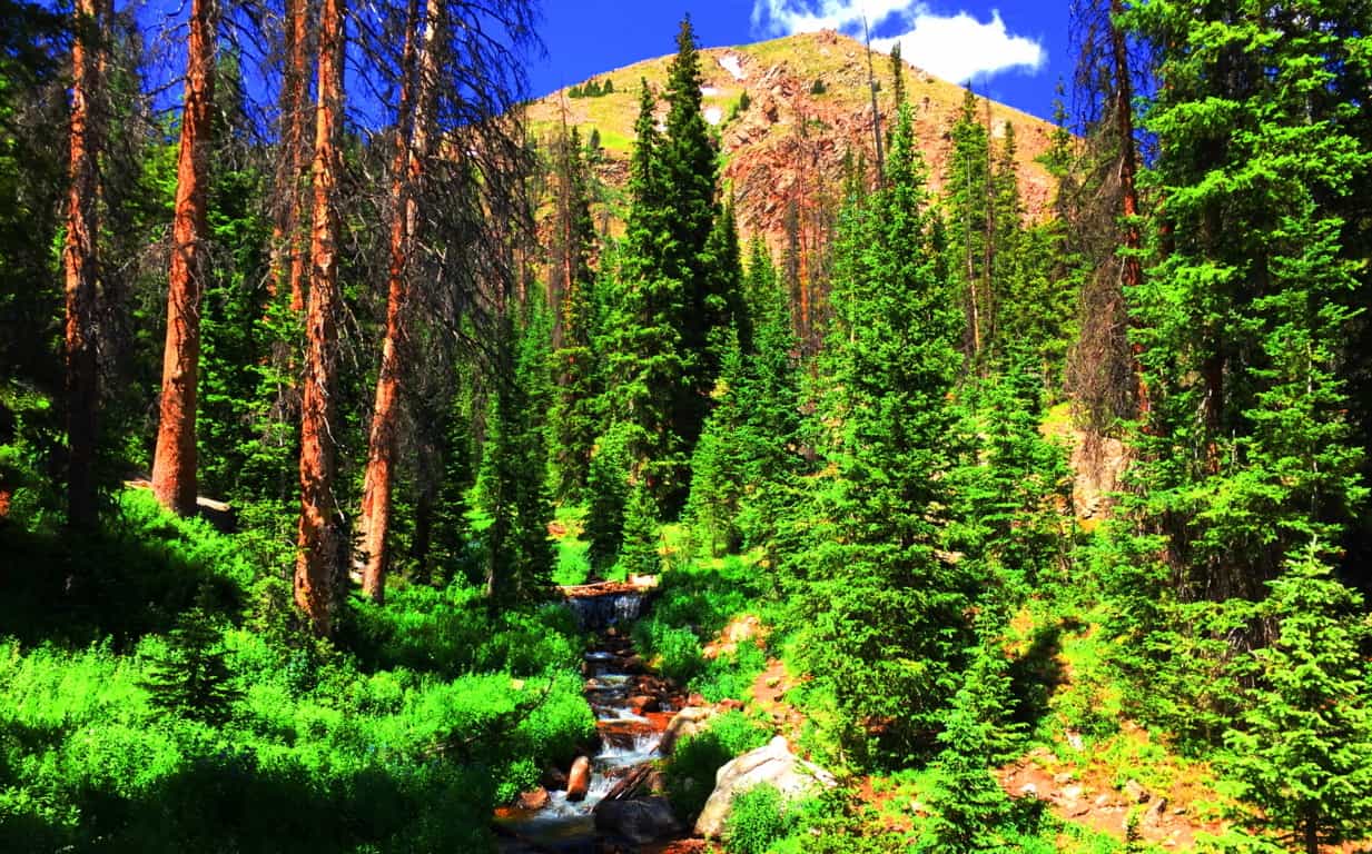 Forest Mysteries: I hope with this brief set of examples that it’s a little more clear how forests have enchanting and unique personalities. This “enchanting” vibe, if you look even closer, doesn’t come from the glades alone; there is something even more strange and mysterious beneath the tree tops. There are megaliths and impossibly crafted stones. This mysterious trend is an international phenomenon, where specific geometric patterns of stones, along with incredible feats of megalithic engineering, emerge deep within the woods, beneath sacred mountainsides, from Glen Coe, Scotland, all the way to Arizona, USA. After establishing proper anthropological and mathematical similarities in stones from forests nearly 3000 latitudinal miles away from each other (that’s North to South) the obvious question emerges: “How can this “glacial” arguement continue to hold up?
  Free-sitting boulders at advantageous vantage points in the forests of New England (Image/Below/Right) Ireland (Image/Left) England, Scotland, and Wales are technically similar to free-sitting boulders in Wyoming, Colorado, and Arizona.
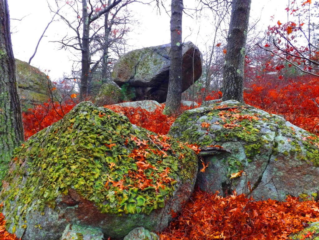 How the hell is this possible? Did the most recent Ice-Age glacier of roughly 40,000 years ago reach all the way down to Arizona’s volcanic mountain deserts? It just doesn’t make sense. Technically, the continent-sized ice mass that covered what would be the American West was called the Cordilleran, which looks to have stopped on the border of what would eventually be Canada. So, simply put, how are scientists claiming that free-sitting boulders like this one in the Coconino Forest in central Flagstaff was moved by the same glacier as the boulders in New England and Ireland? (Image/Lower/Left)
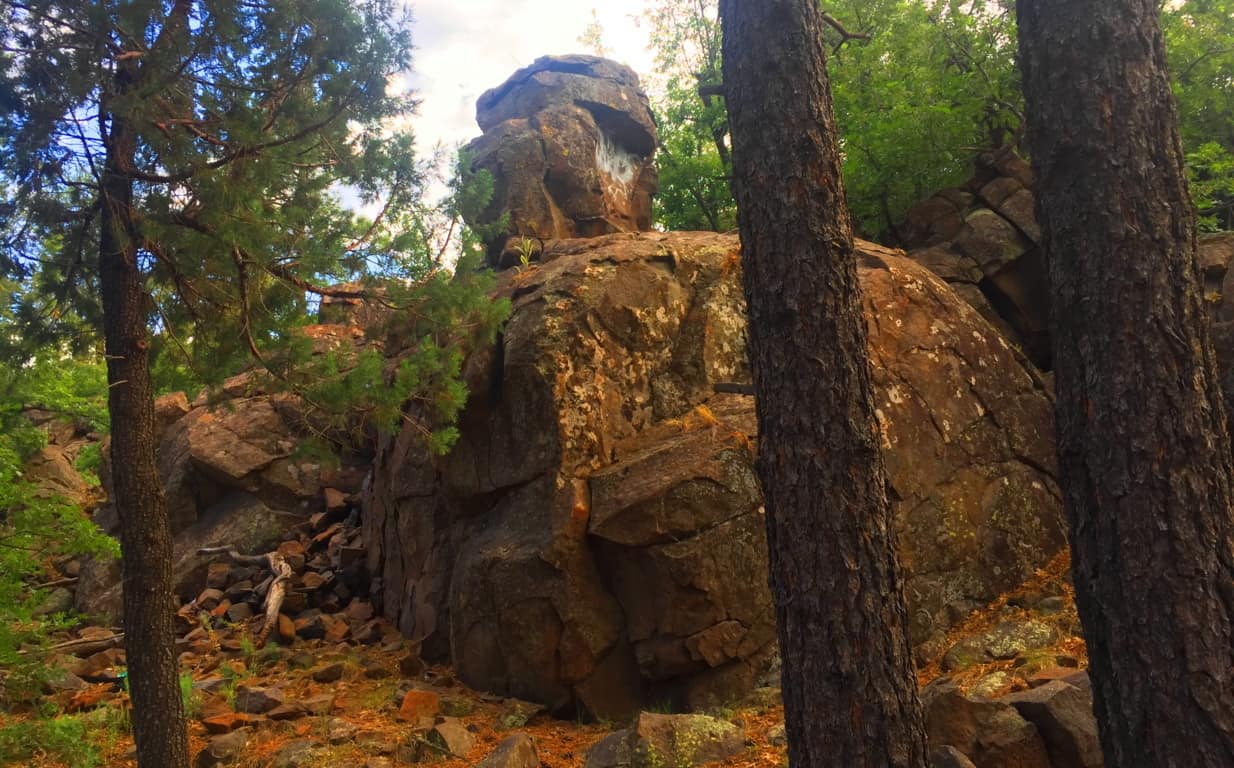 I examined this Arizona boulder, and more importantly, the slope of the ledge it sits on, and the angle is very telling of how unlikely it is that this boulder remained on this ledge from an at-random geologic process. There is 15 degree slope on the ledge-top, as you can see. To counter that, on the boulder’s base, is a cut of about 15 degrees, fitting the boulder to the ledge perfectly. This is a fixture; an intentional fit, in my opinion. Additionally, there are markings all over this boulder, which is a type of “ledge-boulder” found in sacred zones all over the country. The odds that all of these boulders are placed at random at the very edge of vantage-giving ledges is, to put it blatantly: gastronomical multiplied by gastronomical; impossible.
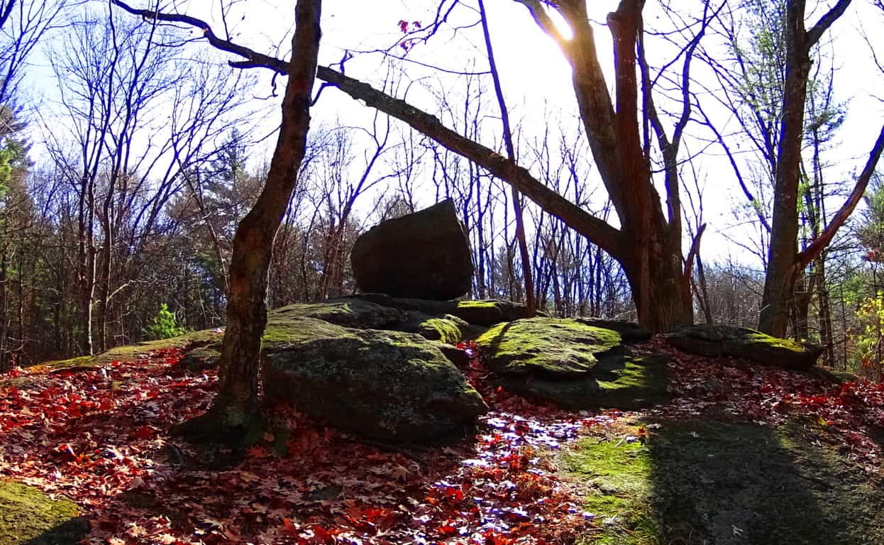
Take a look at yet another free-sitting boulder on a rounded ledge which is ‘vantage-giving’. This boulder is 2500 miles away, in New England. See how rounded this ledge is? For this boulder to remain fixed on top of this rounded precipice it would have to sit in the absolute gravitational center, which it does. Again this an example where if you use logic, and not simply dismiss the statement with brazen theories about ancient ice-sheets, the truth will come out. Someone, or something put this boulder here in order to say: “This is my zone; see how strong I am; beware!”
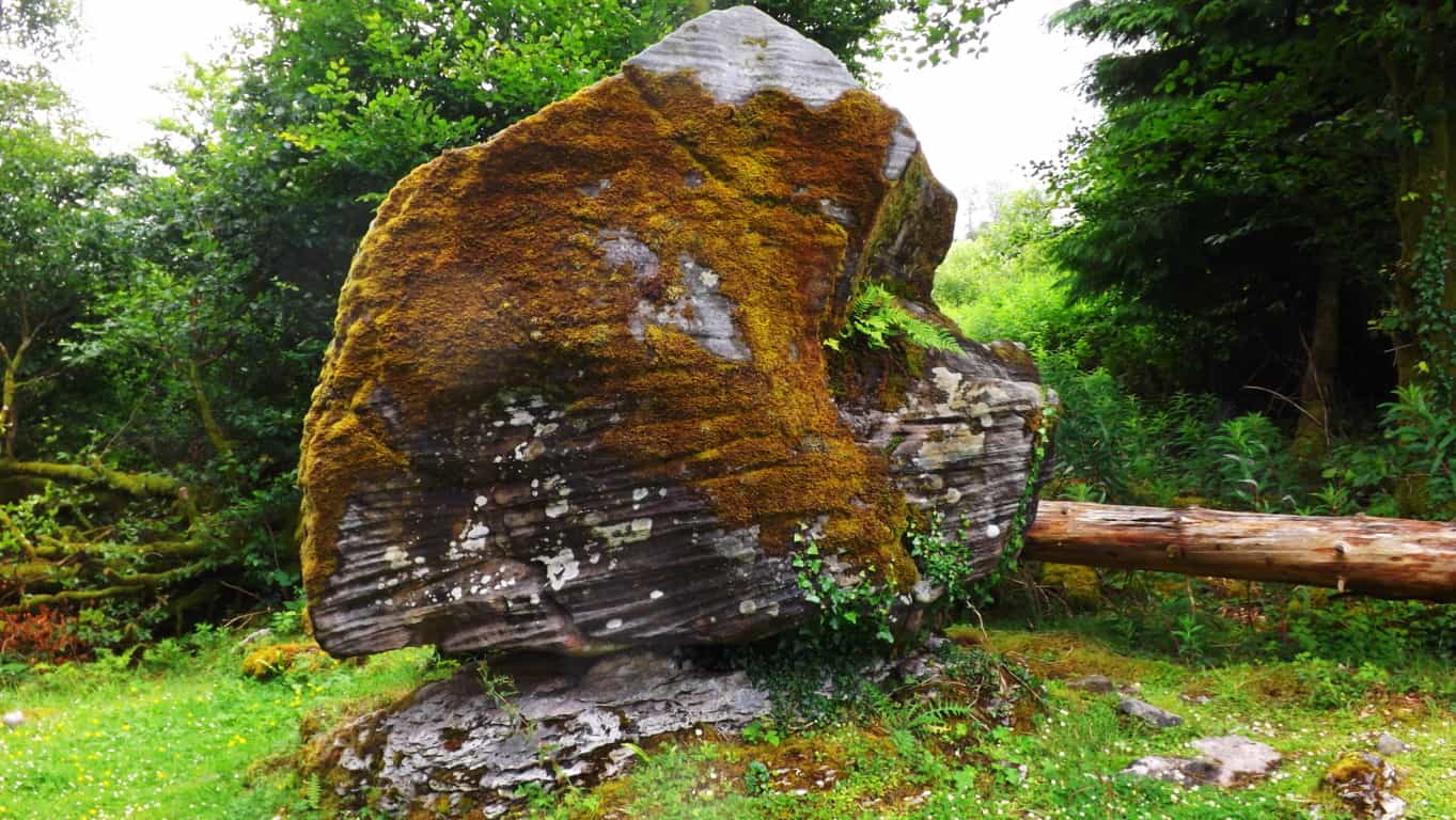 If this “territorial fixture” still doesn’t seem realistic to you, take a look at this amazing statement at Cavan Burren National Park in Ireland. It should be understood by the reader that Cavan Burren is filled with sacred megaliths; altars with standing stones, small temples, and Neolithic engineering. Someone claimed this space for themselves in antiquity, and in this space what do we find? A free-sitting boulder perfectly placed on a tiny platform of bedrock. Modern “science” is telling us to believe a massive glacier rolled this single boulder hundreds, or even thousands of miles, only to land it perfectly square and set on this minuscule 4 by 3 foot space of embedded rock? No. Impossible. Absurd. Illogical. And to me, insulting. Again, this is clearly an example of a boulder which was placed by an individual(s) in ancient times, as a statement to others that this zone is occupied, and by someone with incredible strength and know-how. Furthermore, here are some of the Neoliths found within just 25 yards of this boulder:
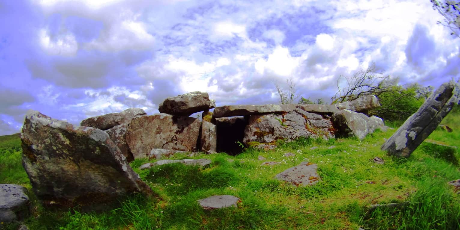 (Image/Left) and (Image/Below/Right). How can we go on believing the academic narrative of the post-modernists? They are blatantly lying to us in their white-papers, mini-museums, and gift shops. Why? What do they not want us to conclude? Well, regardless, perhaps these academics didn’t expect someone with a Degree in Western Literature, and some perspective, to make the effort to actually study these places in detail. Perhaps they are RELYING on the fact that people don’t make the effort to stride into these sacred zones from one continent to the next. And these free-standing statements can be found in forests all over the world. Here’s a look at some of the very strange and distinct boulders that remain in Cavan Burren Forest, just 100 yards from the Wedge Tombs. Celtic glades in Ireland are rare, and these boulders are strewn into the landscape like an above ground cable system. Covered in glowing green moss, they just looked to have some positional secret yet to be understood…
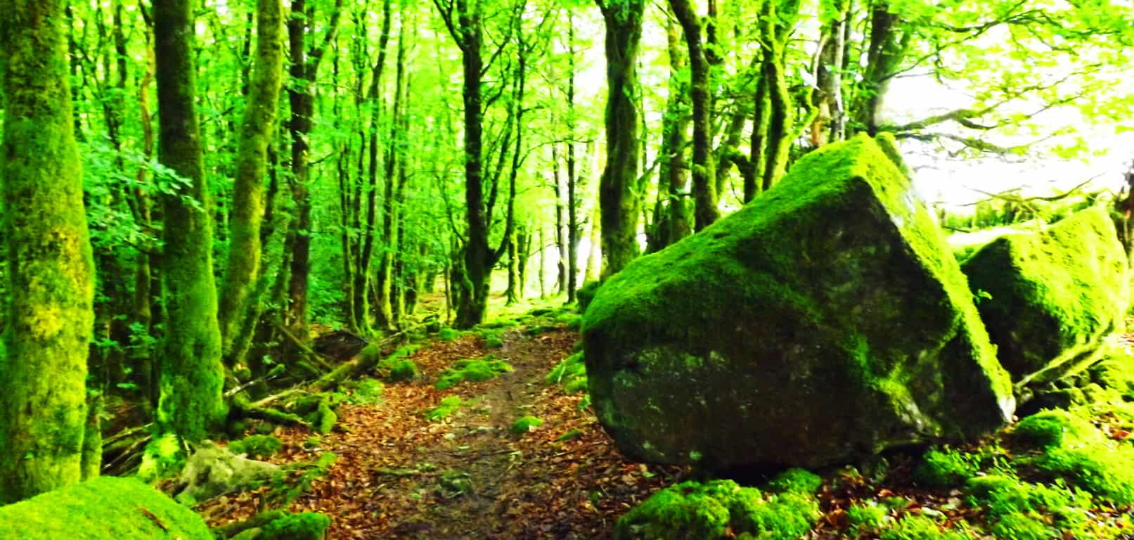
And now take a look at a similarly stoic boulder in the forest of Cococino, 4000 miles away. It has precise indents on its side, also with a strange glow, which is of course rusty orange, rather than mossy green. These boulders seem plotted, or planted, rather than randomly tossed about by ice. They are both squared and monumental, as opposed to disheveled. Another very real possibility is that the stones were there long before the forests grew. Were the stones there before the glacier came along? In some forests you can easily see that the stones were there first, as the trees grow straight over the rock. The point is, there are a great many questions that are not answered by the one size fits all modern answers of “glacial displacement.”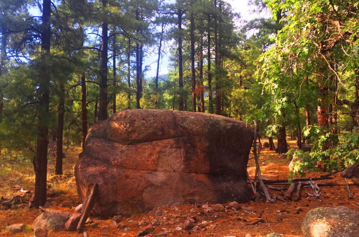 Coconino National Forest: Welcome to a Ponderosa Pine vale that stretches from the northern to southern heart of Arizona. Grand sections of forest emerge all the way from the Grand Canyon down to Sunset Crater Flagstaff, continuing even further down through Oak Creek Canyon, in Sedona. In this environment entire glades of trees are literally on the edge of burning at any given moment. Many trees are already lying prostrate on the ground with limbs seemingly reaching to the heavens, begging to be finally ignited by the Sun. I had just never seen trees like this before.
 Even with the challenge of an extremely arid climate, many incredibly delicate and beautiful statements emerge in the dry hedge and shade. These wildflowers just look so resilient against a massive canvas dry-wood in the background.
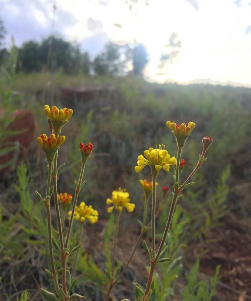
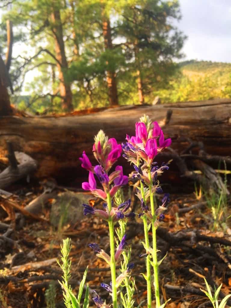
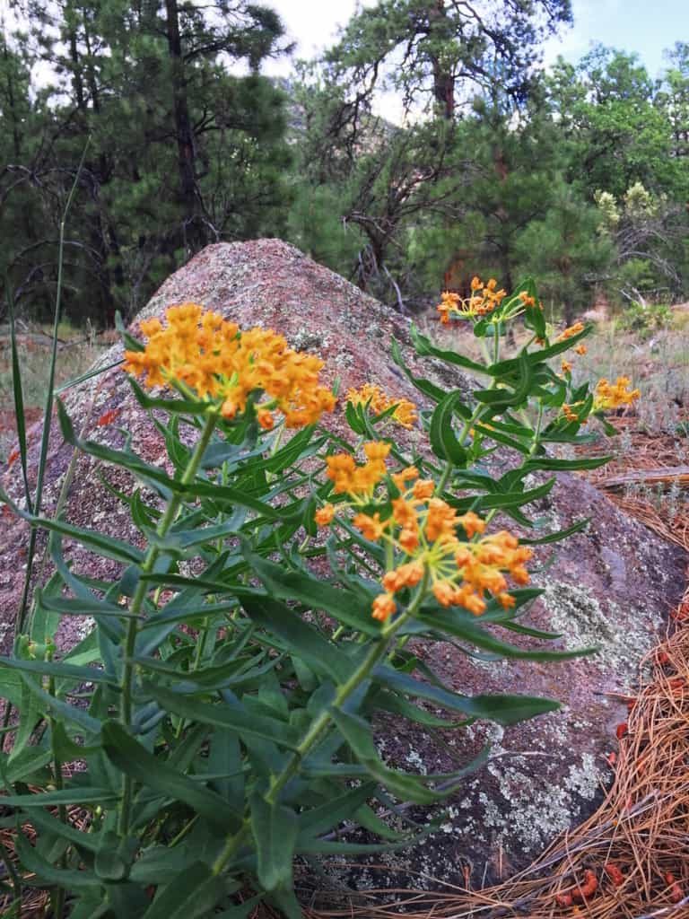 You will have to make a decision about where and when you want to wander into the Coconino’. The northern section of the Forest sits at the edge of the Grand Canyon, near the great Southern Rim. This requires traveling through the beautiful desert plain to arrive at the Canyon. The central section of the Forest is roughly 150 miles south of the Grand Canyon, stretching from Sunset Crater National Park to the The San Francisco Peaks, which are the rugged mountains that engulf the city of Flagstaff. Much of the Forest can be found at the base of Mount Humphries, climbing all the way to the peak, which stands at 12,365 feet above Sea Level, and offering 6000 feet of Prominence. That’s a pretty serious climb, and one which I did not make during this particular excursion. The area is truly a wonderland, with possibilities in every direction, and it is nearly impossible to miss a mountain, canyon, or forest trail, in this part of Arizona. Flagstaff is the place where I chose to enter the Coconino first.
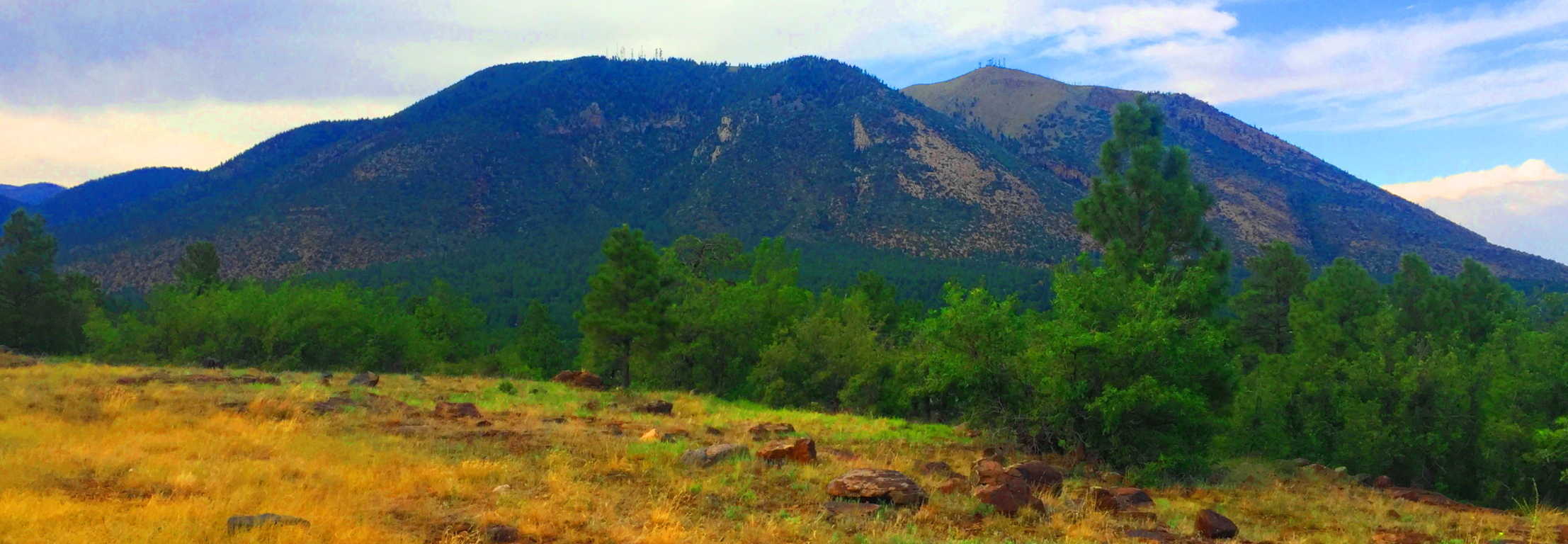 The Coconino Forest at Buffalo Park: There are half a dozen parks and entries for the Forest in Flagstaff. Buffalo Park is a 700 foot elevation hill encompassing about 5 by 15 miles of quiet grassland above, and on the edge of Flagstaff.
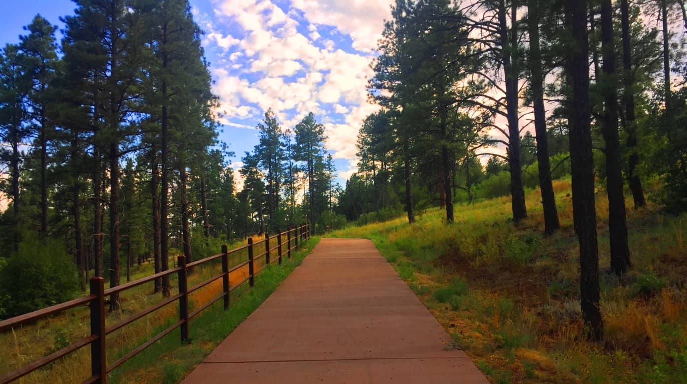 At the top, after sifting through the Forest, the area opens up to a surprisingly vast and peaceful scene. (Image/Below)
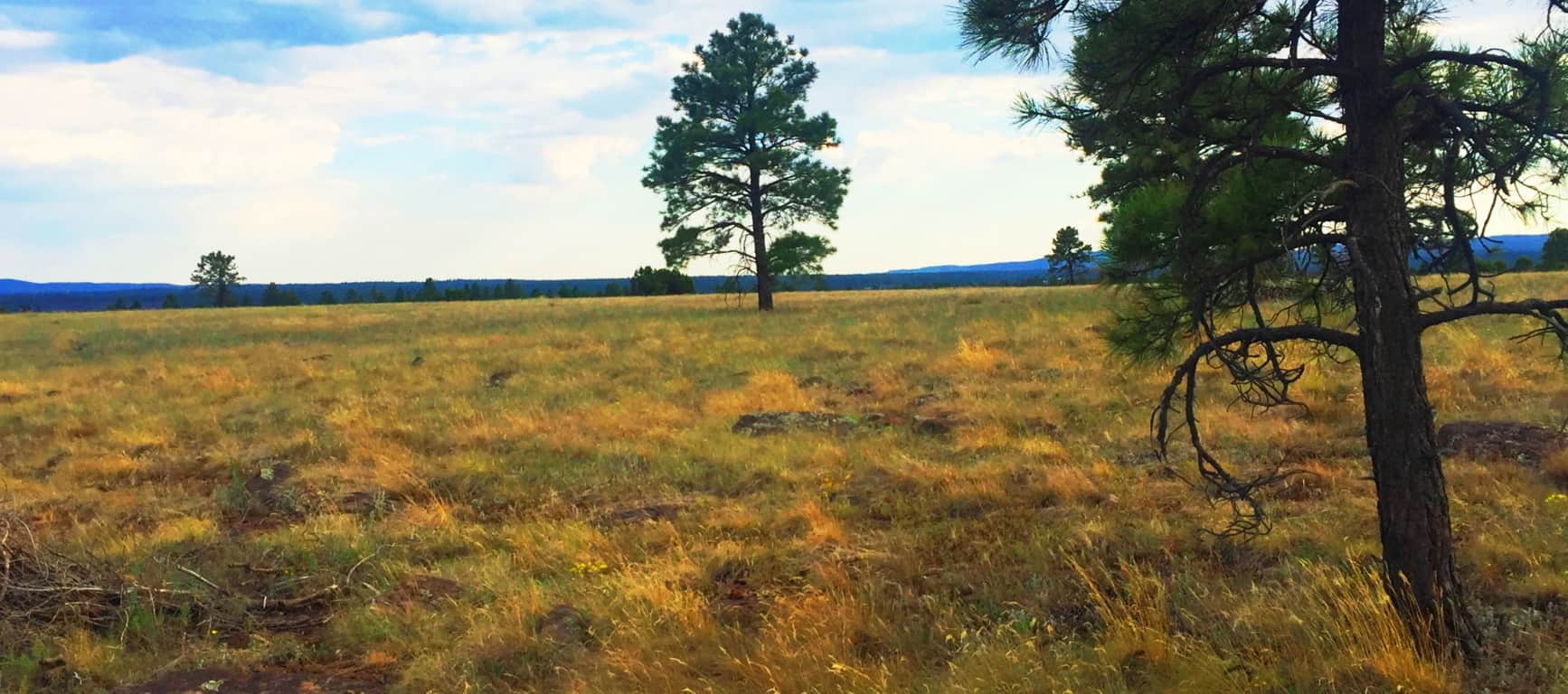 This plateau is like the American West’s rustic version of Ireland’s Hill of Tara (Image/Below/Left) although it was far less lush than the near perfect setting of Tara’. The quiet was very similar though, both hills were places to feel the high winds and absorb the day. It was easy to see that this hill, perhaps 500 years ago, would’ve certainly been a serene place for the Natives, who built stone huts in the deeper forest just a 1000 yards away from here. The size and scale of Coconino and Tara’ is eerily similar.
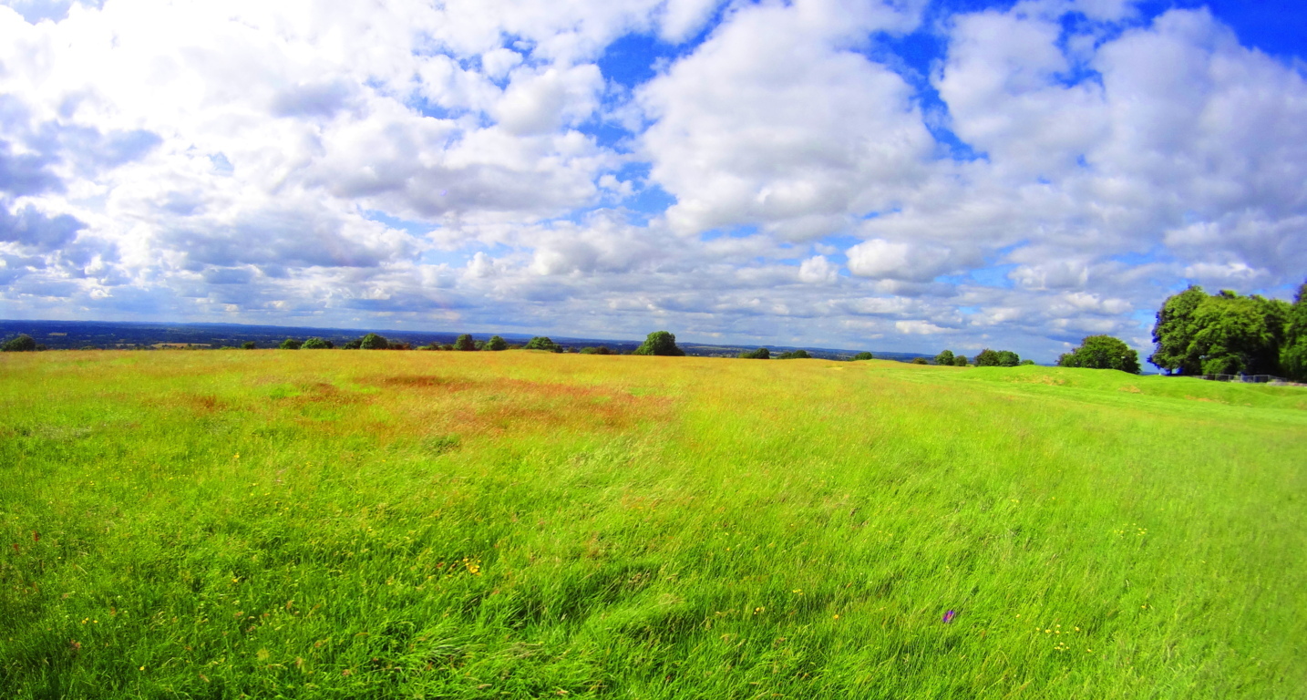 The trees and stone-fixtures surrounding the Hill at Buffalo Park seems as enchanted as the megaliths in, say, the Mourne Range in Ireland, or the Berkshire Range in Massachusetts. As explained at the beginning of the article, certain areas felt more like claimed cliff-spaces from the beginning of Time. Buffalo Park is just a teaser to the more dense forest which is closer to Mount Humphries, a beautiful wilderness looming in the immediate distance.
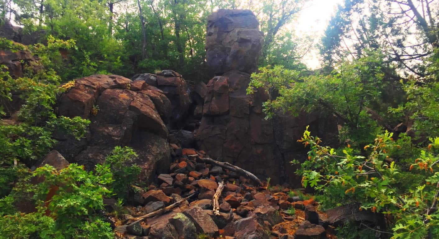
The image above is another look at the small cliff-face with a distinctly placed free-sitting boulder, etched just below the top of the broad hill beyond. I can’t stress it enough, how similar this is to places in New England, where magical things often loom in deep gully’s, which unless you stop and dip down into them, you would simply pass by, gaining no knowledge of the concealed area at all. Here’s another look at the surprising frequency of boulders beneath the trees in this wonderful place. (Image/Below) 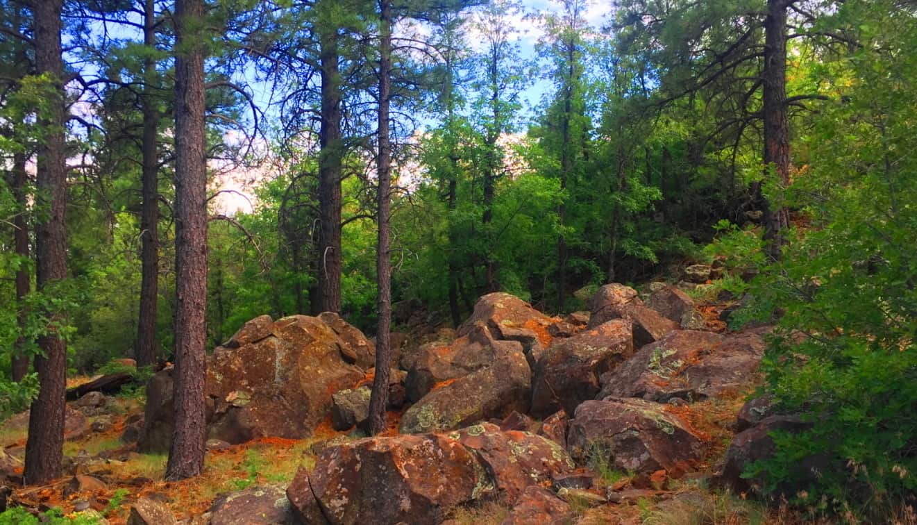
Once you are ready to step into the larger Coconino Forest at the base of Mount Humphries, you can simply drive up to one of the many Trailheads. I used the entrance at Trinity Methodist Church, sitting on the literal edge of the vast woods.  There are dozens of trails winding through this spacious and beautiful set of glades, with massive stones set in incredible positions that give serious pause. This amazing stone was there to greet me as soon as I walked in. (Image/Below) You just can’t make this stuff up.
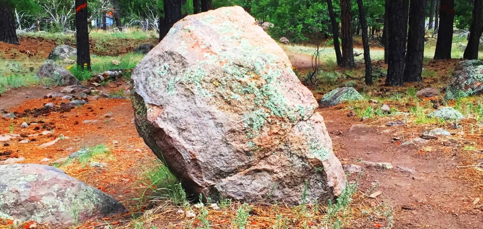
This stone is essentially standing straight up at about 4 feet high, with only a five inch width, which is relatively thin. It is also buried deep within the ground, and make no mistake, this a massive rock. There is a type of streak across the center, with an oblong leaning of the overall shape. I was excited to see a type of “statement stone” as soon as I began my hike. The forest felt strange, mysterious and beautiful. Stones like these in New England are very similar, but this seemed a different style all together! As I progressed further towards the base of the mountain, another stone, more convincing as a Standing Stone, emerged. (image/Below)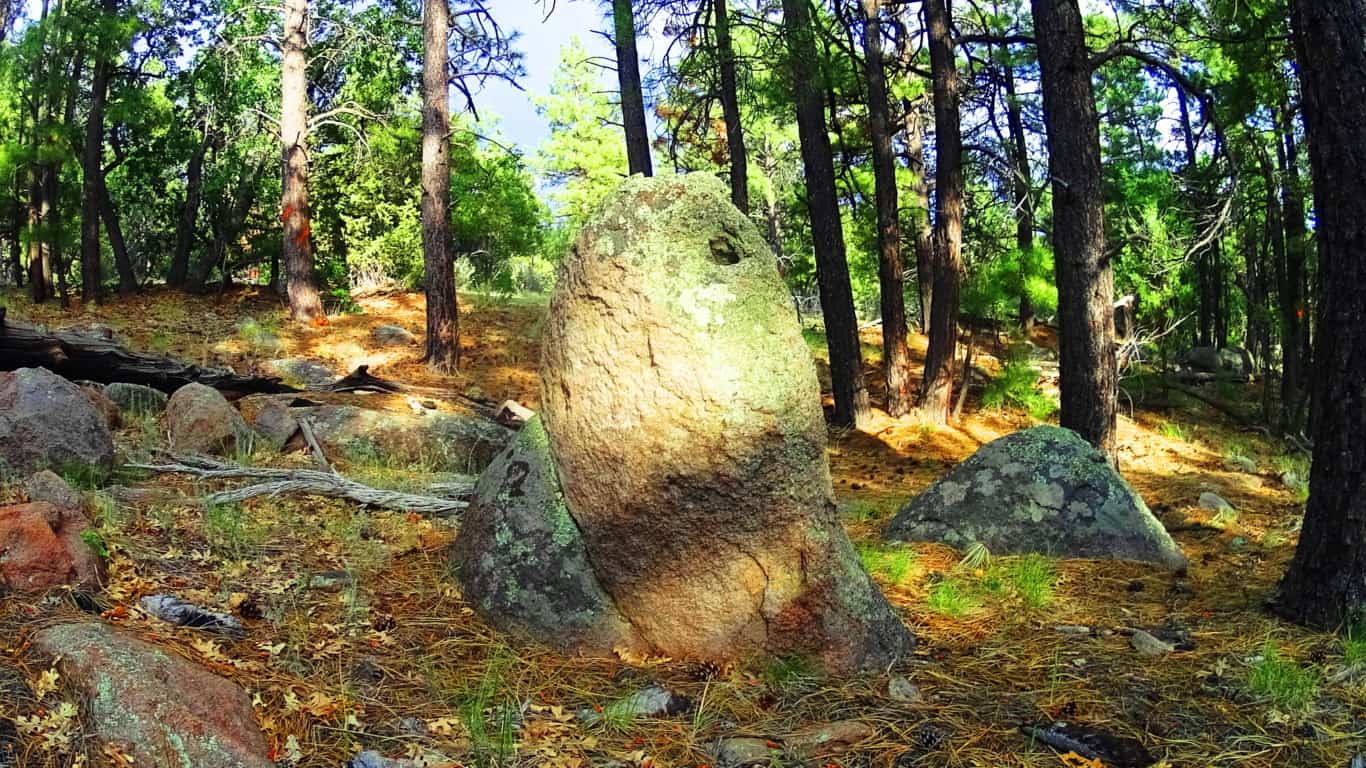
Here is another huge stone standing straight up at about 5 feet tall, and about three inches in width. At this point I was having that moment, just like I’ve had at Cavan Burren National Park in Ireland, and Monument Mountain in Massachusetts, when I said to myself: “O.k, what in God’s name is going on in this enchanted place?” And that feeling of ‘Lothlorien’ begins to sink in, all over again…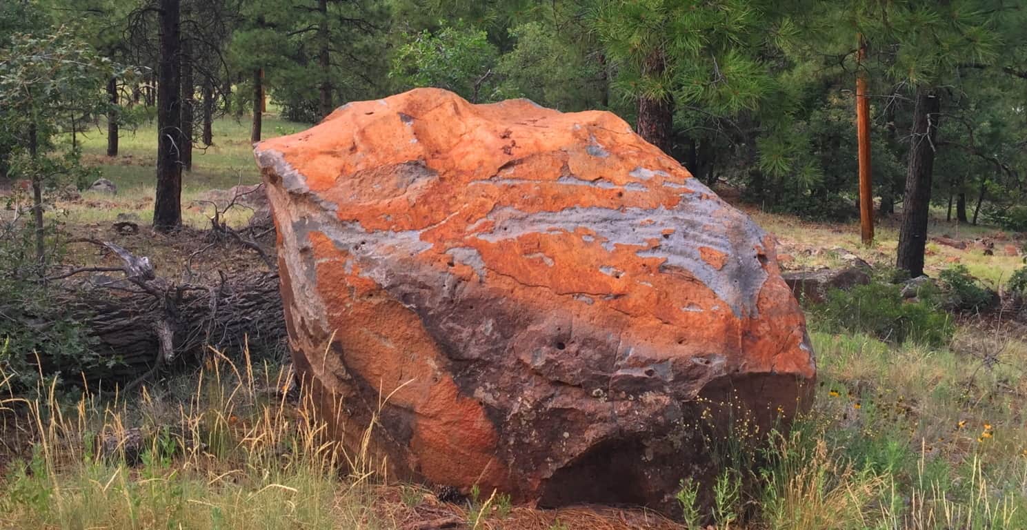
Take a look at this boulder above, which was on the edge of the woods. It was so isolated and stoic, extremely similar to the boulder at Cavan Burren National Park I described above. I could not help but feel that this was another territorial marker, just like at Celtic sites. I even pictured it painted with various markings to increase its distinction, as they are depicted in the mythical xbox game Skyrim, protected by giants living their primordial existence.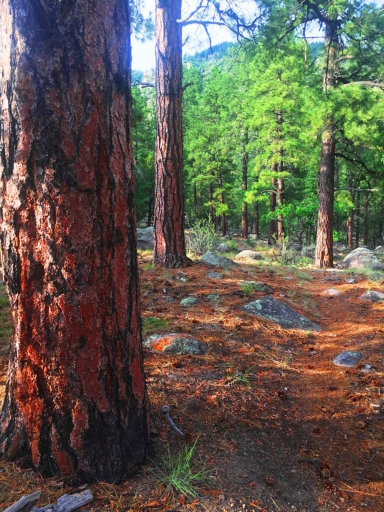 Hundreds of distinct statements like this can be found in the Flagstaff Coconino. Something spectacular is going in this place, so spectacular, that its hard to totally understand. Aside from the threat of fire in July, the place was incredibly peaceful. Against Mount Humphries, the forest seemed ultimately protected from the North, tucked-in enough for the natives to build there homes here, which of-course they did. The trees are spaciously placed with a rusty orange glow along the tough exteriors and the forest floor, very much like New England Pine glades. The air is so dry that you can taste the hovering heat in the pocket of your tongue, like the taste of charcoal in the wind at a barbecue. Any spot is a great spot to sit down, take a nap, take a picture or video, and just fall into the peace and quiet of this massive natural space. It is pure medicine for your mind, against a modern world constantly driving us into the lower aspects of existence, which is the material and monetary contest we experience to survive. The Coconino’ makes you forget, in the best possible way; through the wind in the trees.
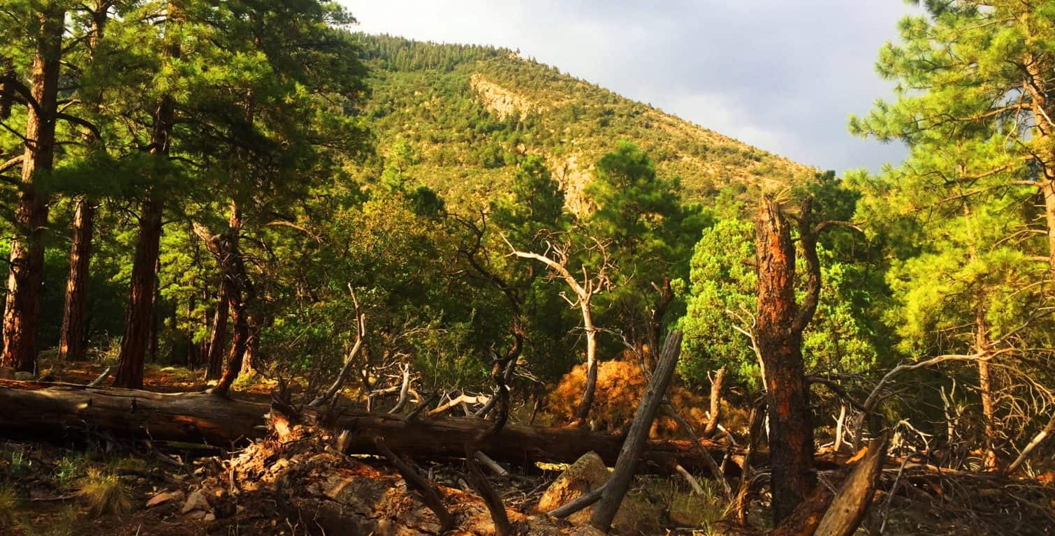
Coconino Forest at Oak Creek Canyon/Sedona: After walking out of the Forest at Flagstaff, I had real and tangible reasons to believe that the Neolithic Culture inhabited this place, just like the myths of the Natives speak of. The following day, heading down to the southern extreme of the Coconino’ from Flagstaff, to Oak Creek Canyon, there are two southerly highways. Take the 89A, not Route 17. The 89A is one of the most beautiful back-highways in the country, and scenic Coconino forestry all the way down into the Canyon. The distance from Flagstaff to Oak Creek is only about an hour, the entire trip a wonderful experience. Bring cameras and water, and be ready to freak-out on the beautiful southern extension of the Coconino!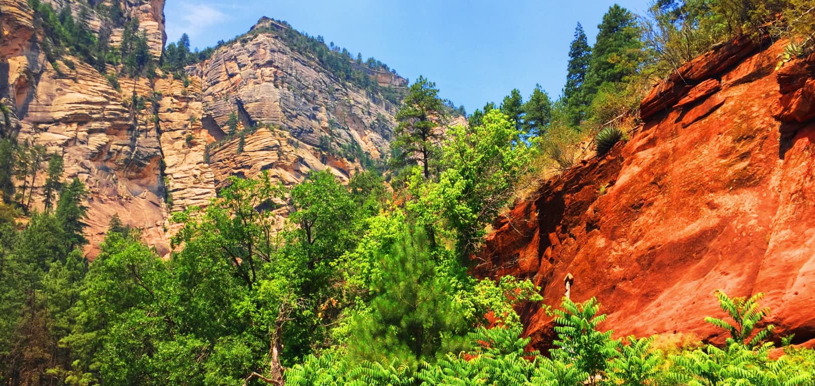
Oak Creek is its own excursion, with magical stones, free-sitting boulders, and habitations well worth several treks. (See “Oak Creek Canyon” at Stonestrider.com for the complete experience.) The most important thing to understand is that the Coconino forest reaches all the way to this southern tip of the central portion of Arizona. This forest is massive and gorgeous, and as mysterious as any Celtic place I’ve ever seen. The trails here are cool and distinct, marked by lonely boulders that seem to be markers, yet again. The Forest grows thickly, with perhaps the tallest of Ponderosa Pines in all Arizona, featured in the very top image of this article. The Coconino Forest is enchanted with a rare Trinity of locations; found in Canyon, Mountain, and Desert. 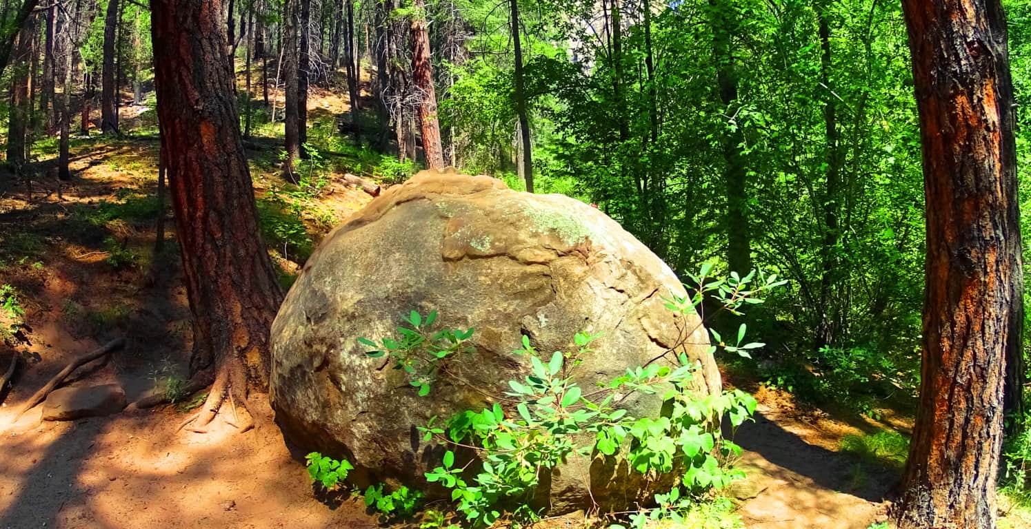
The Coconino Forest of Arizona is another dreamscape with mysterious statements strewn throughout the gigantic woods. It is the majestic wood-belt of Arizona, and in terms of scale, trumping Celtic forests in every possible way. Did the same Neolithic Culture which I believe existed in the forests of Celtic places exist here? I believe they did. Let yourself wander beneath these Pondersa Pines. There are mountains, volcanos, canyons, deserts, and grassy plateaus, where you find this Forest’s trails. It is an all-embracing Forest that pushes through the most arid of environments to ultimately give life and shade to this part of the world. The most important message I can convey at the end of this article is that reading about a forest is all well and good, but entering into one is the overall goal. You can get there and experience this massive life-force for yourself; it’s not a cliche. Seek it out, and find it out. Use your own mind to experience places like this, and don’t let the information-comptrollers and false-history writers deny you your allotted connection and interaction with this amazing primordial source of life in our world. Look and decide for yourself what happened in this gorgeous place. Go strong. Stonestrider.com.
Black Hills National Forest
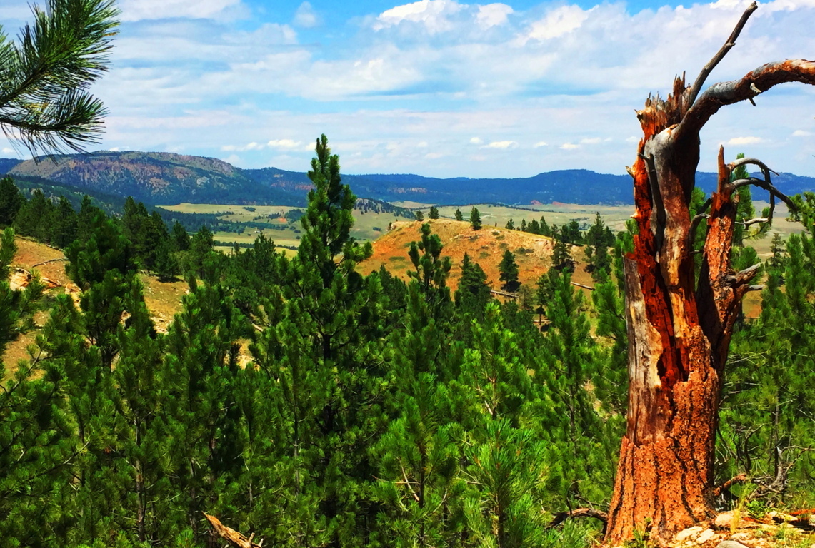
Location: Sundance, Wyoming/USA
Elevation: 3,100 ft
Prominence: 1200 ft
Note: Before you begin reading I already know what you’re thinking: “What could possibly be exciting about Wyoming? (yawn)” It’s a fair question, and something that should be addressed straight-away. The answer might surprise you a little. The truth is, the answer is totally related to what kind of hiker you are, and somewhat philosophical. You have to ask yourself: “Am I a trailblazing, stone-kicking, seeker of sacred zones in the misty heights?” “A geared-up ‘earthbound-astronaut-in-boots’ made for 10,000 feet above sea-level?” “Am I wading waist-deep in the Irish-muck to get to the distant hill where the Dolmen sits?” “Am I willing to go to that way-out-there place which others dismiss as too inconvenient?” In other words, are you passionate about breaking the domesticated spell of post-modern life? Or…are you the needy type? Do you need attention and noise? Are you in the habit of speaking constantly, needing to hear about this, that, and the other thing from the social-media feed? Do you need lots of stuff at your disposal? Do you need to be close to a metropolis and all its accoutrements? Do you need a constant phone/computer signal? If so, you’re not alone; but let’s put distant, hard to reach, places into perspective;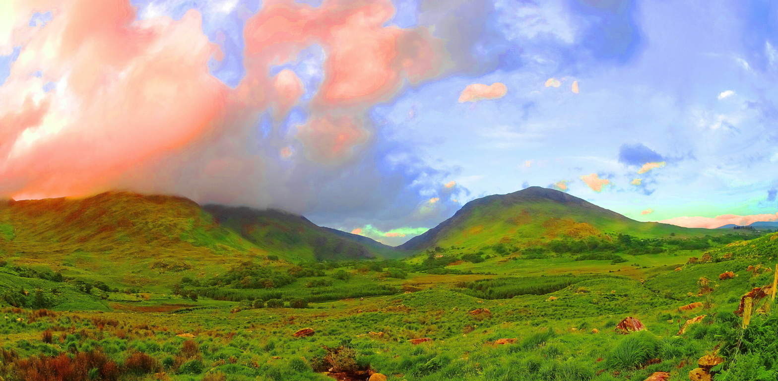 If, for example, you were to show up in a place like Killarney Ireland (Image/Left) with this needy attitude, a Killarney which is a darkly magical, mostly wet, Celtic wilderness of eternal greenery, you could perhaps say the same needy things you say of Wyoming, like: “Oh man, it’s just farms and mountains without a soul in sight”… etc etc etc. And with this needy attitude you will have already failed. You might as well go on a cruise and do the thing where you get off the boat, and then back on, after looking at a mountain from the beach, for about ten minutes. Awful. The point is this: the only real difference between the stellar beauty of a romantic wilderness like Killarney, and the lessor known wilderness of The Black Hills (Image/Below), is only the basics of fauna of the landscapes, and that’s it.
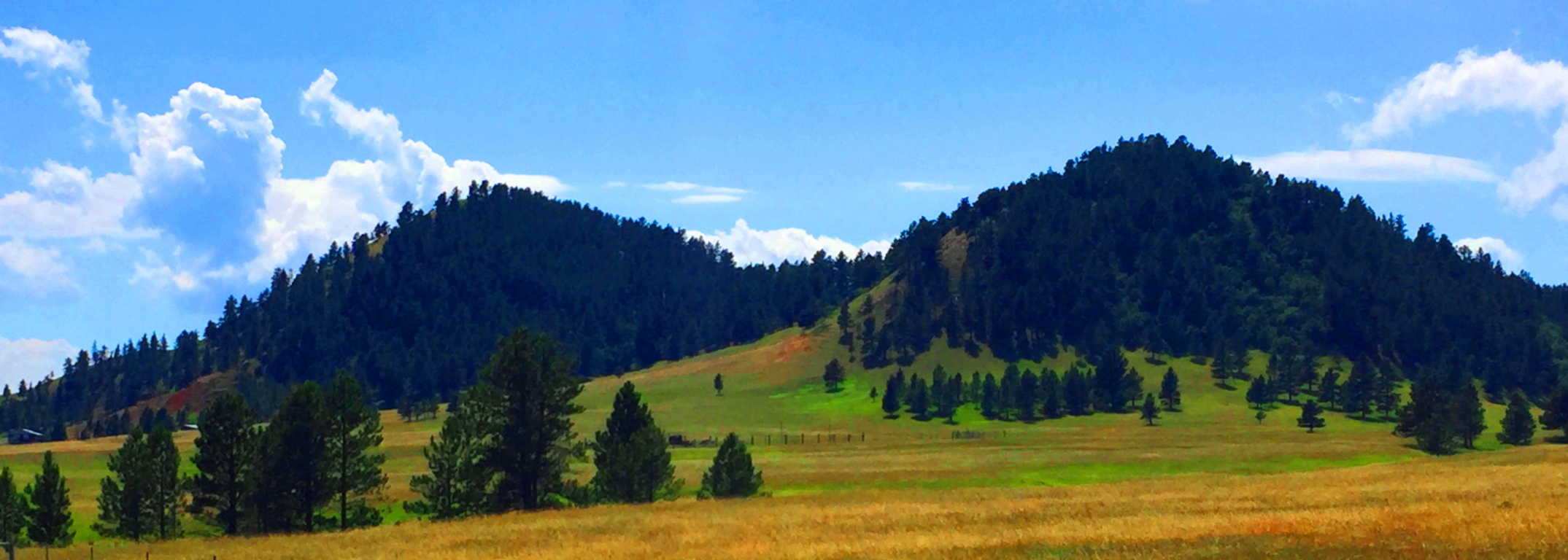 That’s all. The potential for wonder and exploration is just as possible in Wyoming as it is anywhere else on Earth. Both are haunting and spacious, eccentrically-far from any city, and soooo quiet that they are equally capable of making you face that illusive, money-bound, noise factory, you currently know as…. yourself. The Black Hills in Wyoming is yet another dream-scape that can heal your senses and sooth your thoughts. There are romantic signs in the mountains of a history that goes right back to the primordial beginning of Time, just like Celtic sites. If you open your eyes in this way, Black Hills Wyoming is a vast mystical zone, just waiting to embrace you.
 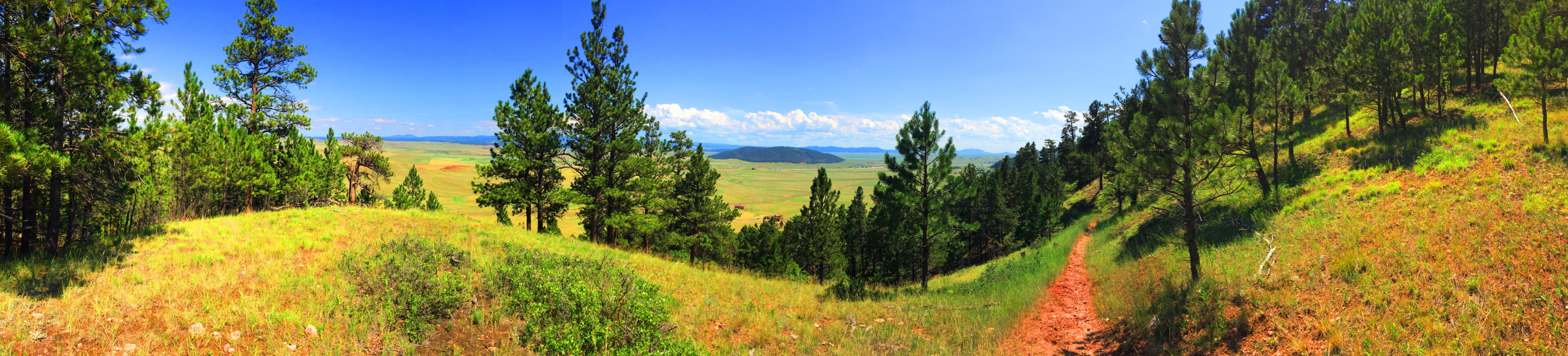 In American modern cinema, in films such as ‘Dances With Wolves’, ‘The Last of The Mohicans”, or “The Revanent”, there is an image of the “spiritually in-tune” Native American. This image of the stoic, quiet minded, spiritually animated native, is not easily grasped by the domesticated culture we now find ourselves in, where almost 65% of the population has now been forced to inhabit cities. It is hard to comprehend the once spiritual state of the Native American in such a postmodern situation. But, if cities are the mechanism for our domestication, than places like Black Hills National Forest in Wyoming, are the mechanism for cosmic-quiet, and a confident solitude that the Native Americans once knew. When you enter them, the quiet is practically a persona to be interacted with, not just a lack of meaningless bustle and monotonous motion. You can truly realize this in this absolutely vast space, and slightly hypnotizing slopes of the Black Hills.
Even the image of this wide-open landscape can’t do the actual scale justice. South of this place, the Wyoming Plain rolls like an intermediary dimension between Heaven and Hell, neither rising nor falling, just continuing into an ever distant blue horizon. Some History: Obviously no Roman Army ever traversed this place, like in England or France, although, I have to think that the Caesars would have been tempted by the idea of crossing such a vast stretch of accessible land, like when they penetrated the high Plains of Scotland, where they were eventually turned back by the Picti (Scottish Natives). So, who did walk in this place in Wyoming? The Arapaho, Cheyenne, Ute, and Shoshone all inhabited this vast space as warrior-hunters of the Plains. We now know that most of their ancestors wandered over the land-bridge while hunting animals from the East-Eurasian Continent to what is now Alaska, created by the receding Ice-Age some 40,000 years ago. Once upon a time, this Plain was inundated with Buffalo, an animal by which nearly every human need can be resourced. The native tribes, amazingly, say that they were NOT the first to inhabit this place, but rather, the ancient myths tell of a race of “Celtic looking (caucasion) red-haired giants” who were already here when the natives arrived. Strangely enough, the Native Israelite tribes encountered the exact same thing when they entered Israel from Arabia, discovering giants in the hills, which is recorded in Semetic Scripture: ‘Numbers 13:32’. The Mayan and Inca say the very same thing. The megaliths of South America were there BEFORE THEY ARRIVED. In fact, nearly every Native American tribe has stories of giants controlling the heights of the mountains and hills. And these are the oldest stories that the tribes have to offer, which are now faded into inaccuracy and mere myth, due to the genocide that came for the natives in the modern Era. Like the native Scottish Picti tribes, these Native Americans were at-one with the landscape, and also like the Picti, when a foreign army came marching through, they decided to paint themselves for battle, and fight. Of-course it wasn’t the Roman Army which wandered into the heights of Wyoming, but The Union Army, a far more advanced and devastating force, and we know how that story ends. Don’t let this wide-open space and silence fool you; although it is profoundly peaceful there are mysteries and epic events which took place here, making it that much more haunting in the heights of the trail. The natives called this place “The Black Hills”, although I am not entirely sure how they could have…
 The scene is a dry green and golden haze that embeds striking patches of massive trees and knolls. It all booms-out over the region as if it never ends. The trails are not what you would call ‘a going concern’, but are still marked by the classic cursive lettering and soil-brown signs that were erected at the turn of the century. I’ve waited my entire life to see one of these particular types of signs; seeing one means you’re in the Great North West of America; a rock-star zone for hikers. This is the listed trail-head for the Black Hills, down a lulling farm-road, about 7 miles from the classically Americana town of Sundance Wyoming, population 1,182. Sundance has veterans who died for the United States memorialized in the center of Town, along with home-like breakfast parlors and ice-cream shops straight out of a Norman Rockwell painting. But these people aren’t lost to the Times, as you might ignorantly assume; they are a deeply rustic, tough, and caring people who look you straight in the eye, and extend a helping hand in a moments notice.
 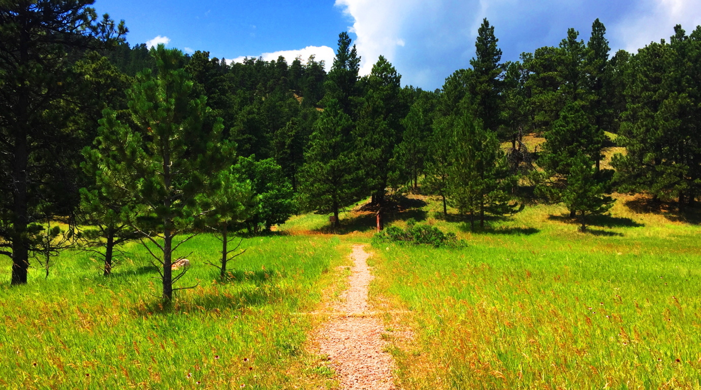 Black Hills Trail: Entering this trail is as pleasant as it gets. There are distinct and clear heights in front of you, with a breeze and swaying grass beneath spaciously assorted Pines.
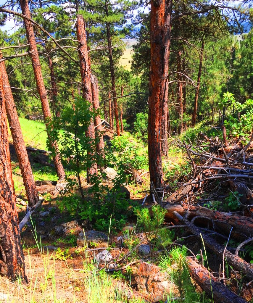 The path appears to be a modern work of Cub Scouts and campers from the last 100 years. There are no signs of the ancient stony paths found in Celtic heights, New England, or northern Colorado. The one factor that is entirely unique to this space is the level of quiet, if that is possible to measure. It is simply a denser quiet. Even the regular sounds of hawks or wild goats are not heard in these hills. It will make you more aware of yourself in return. Often times it’s a moment to say to yourself: “Well, at least I’m not in my office/in traffic/on-line/ etc etc etc. The Trail switches back a few times as you ascend a solid soil pathway through the Ponderosa treeline (Image/Left). As the hillside reveals itself, there are stones that begin to pop up, of a type I had never seen before. As the trail levels off near the top of the initial knoll, it begins to veer into the deeper woods, and boulders akin to what is found on the ledges of New England, begin appear. I have to admit that the ledges and boulders here were so ancient looking, so old, that I realized I had never seen this specific type before. Ancient Wyoming boulders are practically rust colored with orange and brown spots. (Image/Below/Right) This is very similar to the pattern on Alpine stones found in the heights of Mount Katahdin (Below/Left). Look at the Same rare spotted pattern, although they are very different colors.
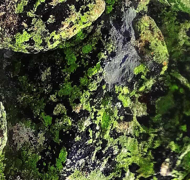
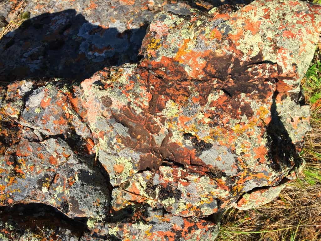 There are also boulders in auspicious vantage points throughout the early portion of the upper trail.(Image/Below) You can see cut-sections of ancient hillside stone, with a free standing boulder on the upper left corner in the image, in an advantageous vantage-point above, just like on New England ledges. Whoever put these boulders there are the first occupants of this land, before the Native Americans arrived.
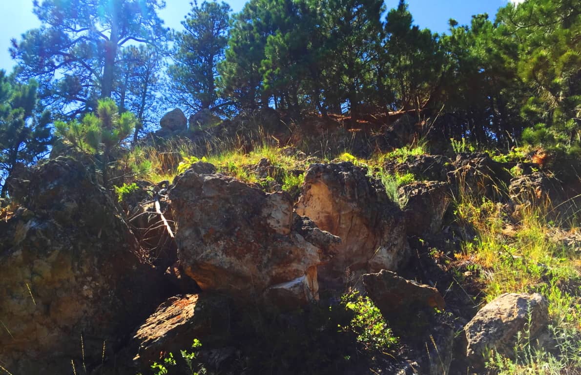 The places where the stones are cut, and stacked, on top of each other are most often the most beautiful views facing outward, not hidden in the forest. Again, this is so similar to Ireland and New England that it is nearly impossible to ignore. Look how distinctly the stone is cut and set in a fixture in the image below.
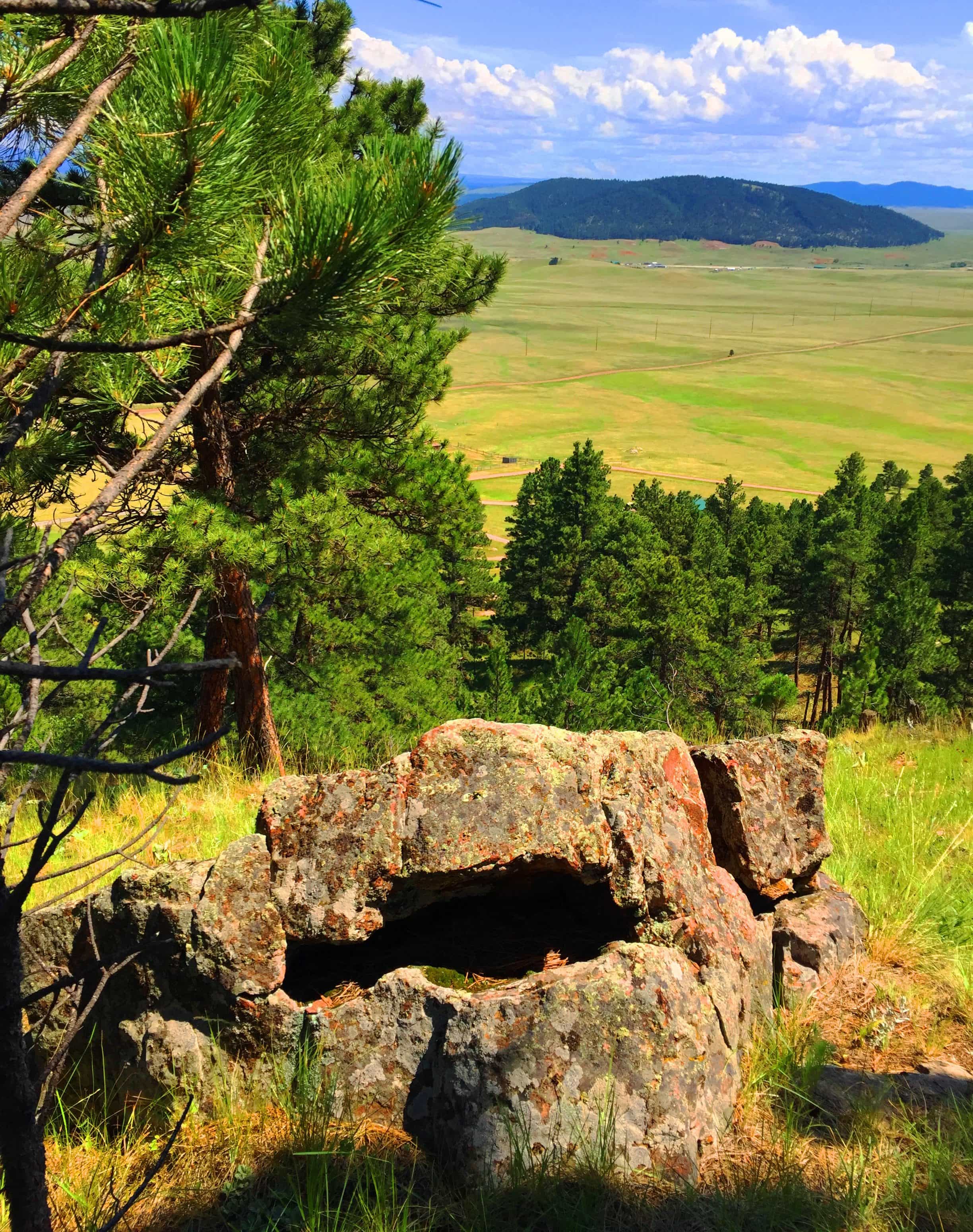 The second third of the trail, the upper trail, becomes gorgeous forest. This is a beautiful stretch of trees and thickets, and there is a temptation to wander into it, leaving the path behind. I don’t recommend going off-trail on a first excursion, but with time, and more knowledge of the range, it might be possible some day in the future.
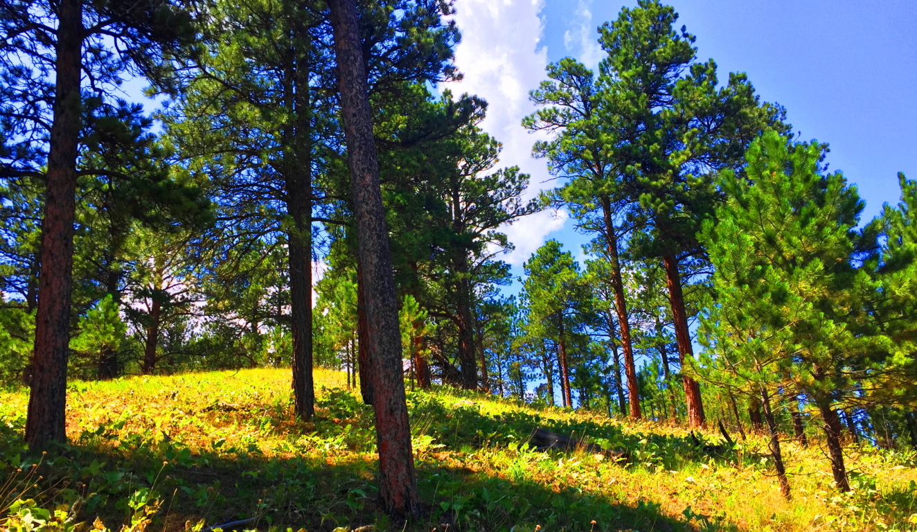
The upper vale in any range, whether it’s the White Mountains of Vermont, or The Berkshires of New York, are almost always a type of secondary dimension. You step through them, only to have them change as you go. Your perspective can change from ‘surrounded by pillars of reddish brown’ to ‘sifting through small shafts of milky-white limbs’; i.e: Ponderosa’s to Birch’s. This might be hard for a hiking layman to understand, but a particular grove can change the way you feel. The Ponderosa Pine grove (Image/Above) is a distinctly different feeling than the Birch grove (Image/Below). Harder still it is to comprehend for many beginners, is that forests, in this manner, teach us about our level of receptivity and perception. Imagine what happen if you chance to walk through 50 forests, or 100, in this lifetime. 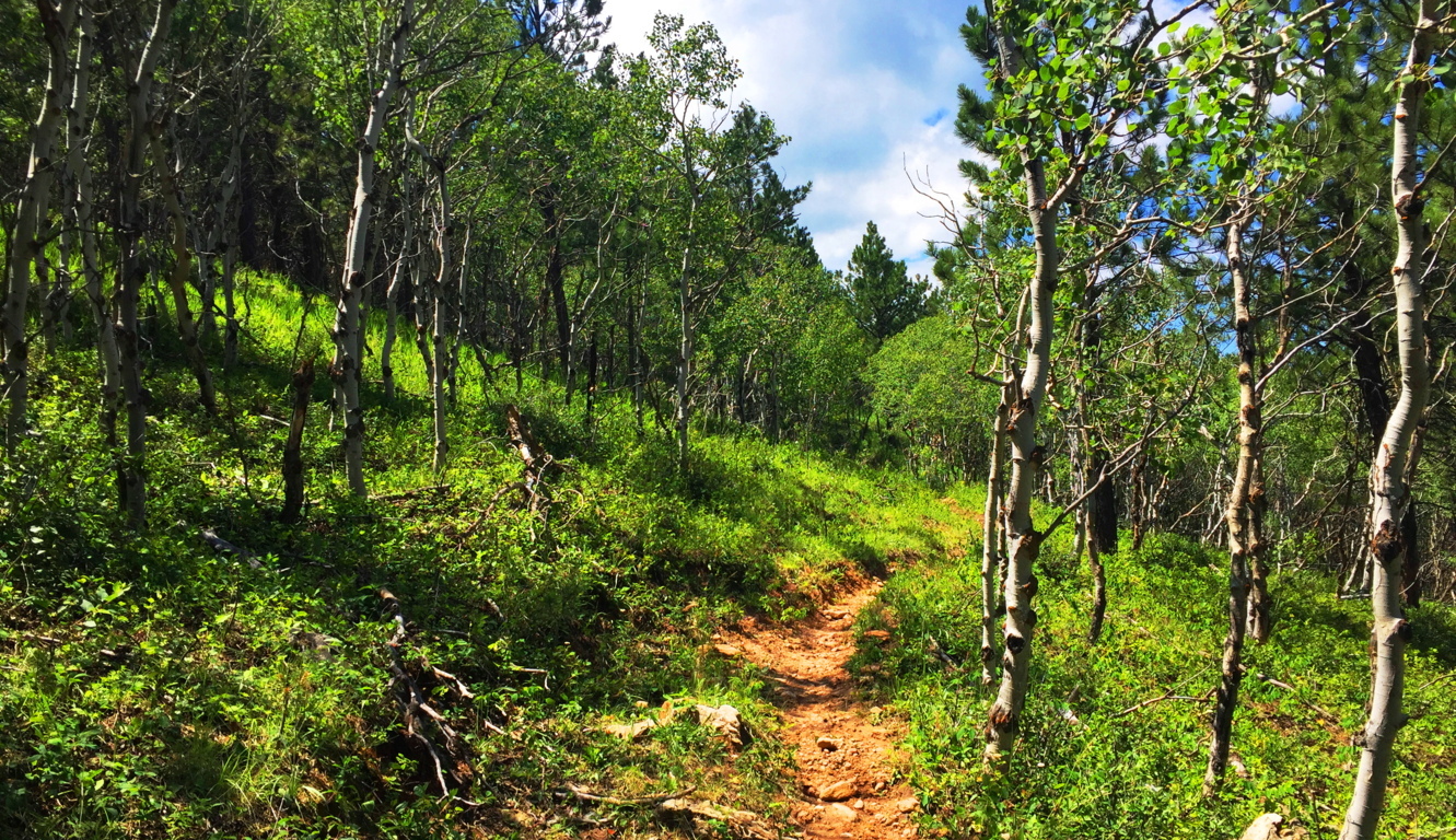 On the higher end of that receptivity is realizing and experiencing sacred zones. They feel beyond Time. Places where megaliths are found are almost always in accordance with this mystical feeling, and we are discovering through dynamic new anthropology that this is anything but wishful thinking. There are entire forests and ranges in New England and Ireland that have connective engineering throughout the entire landscape (See Cavan Burren National Park/Stonestrider.com). The landscape is literally stone-grafted to synergize the experience of moving through it. Most people, even in this age, just can’t get their minds around the idea that the entire landscape is a temple or monument, harnessing very real subtle energies. This particular trail in Wyoming is a chance to see the contrast between landscapes that are inundated with stone-linings, and those that are not, and what that might mean. Why is there not a single stone-lining in these beautiful small-mountains, while in New England there are enough Stone-linings to circle the Earth several times over? What does it mean?
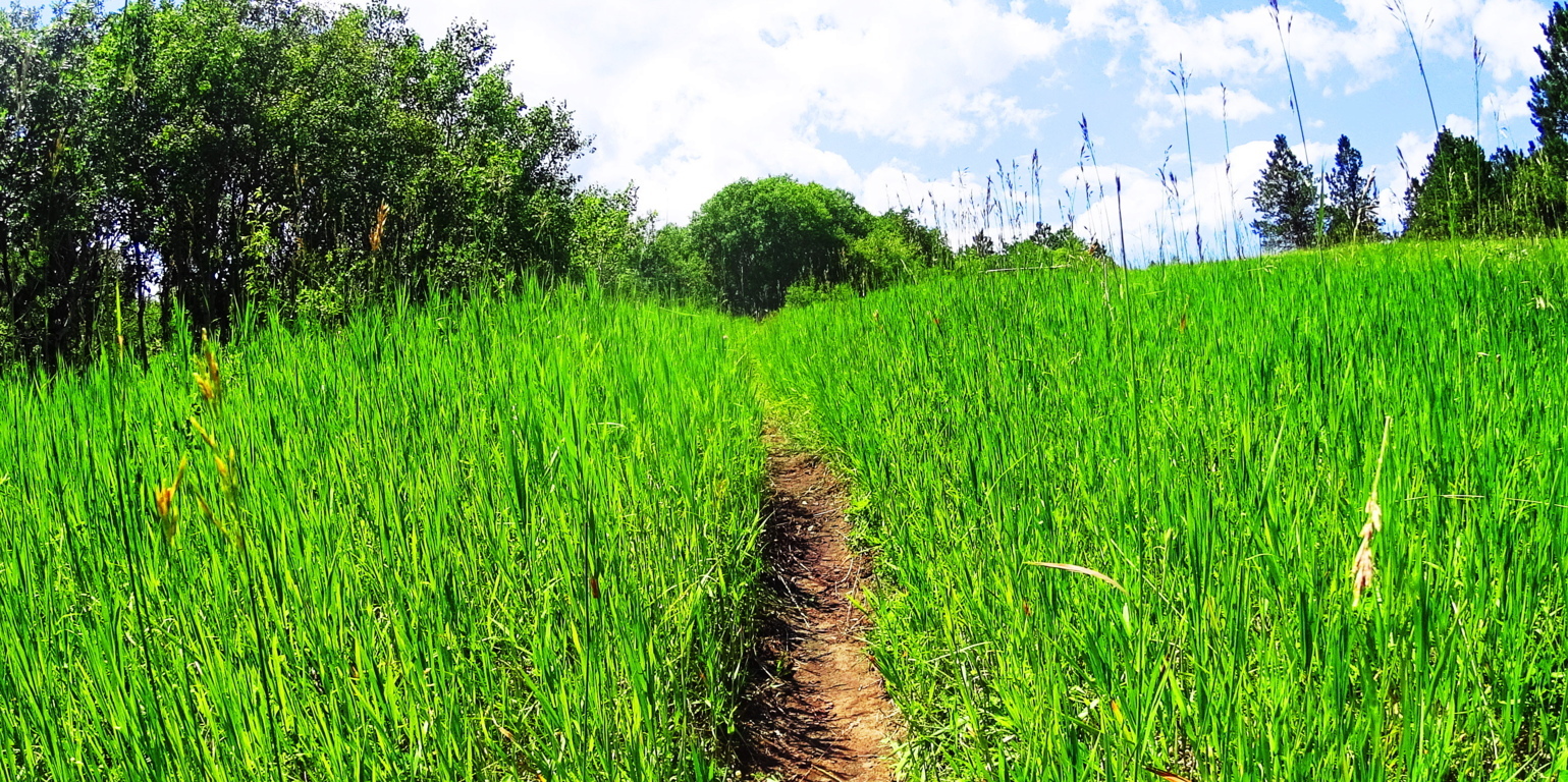 The trail here at Black Hills opens up into elevated fields of thriving grass beds within the glades, with absolutely no stone distinctions. You can almost picture an Arapaho Native materializing out of the woods, with nothing particular on his mind in this absolute tranquility. Prairie Asters emerge along the path, as well as what looks like a lavender Lonicera type flower. Entire fields of these wildflowers appeared across the next range, several miles from this spot, and everything about these beds indicates a vibrant, happy, and healthy zone.

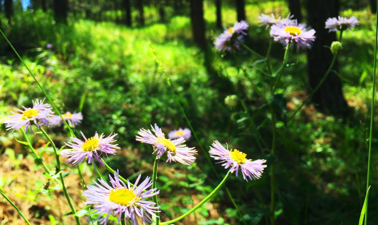
The cover photo of this article, at the very top of the page, looks to be the objective of this Black Hills Trail. It’s a fine view across the valley. This is a place to sit down for a while. Impressively, the trail doesn’t loop back, it continues rolling on through several small Ranges to the north, perhaps as much as another ten miles after this 2.5 mile section.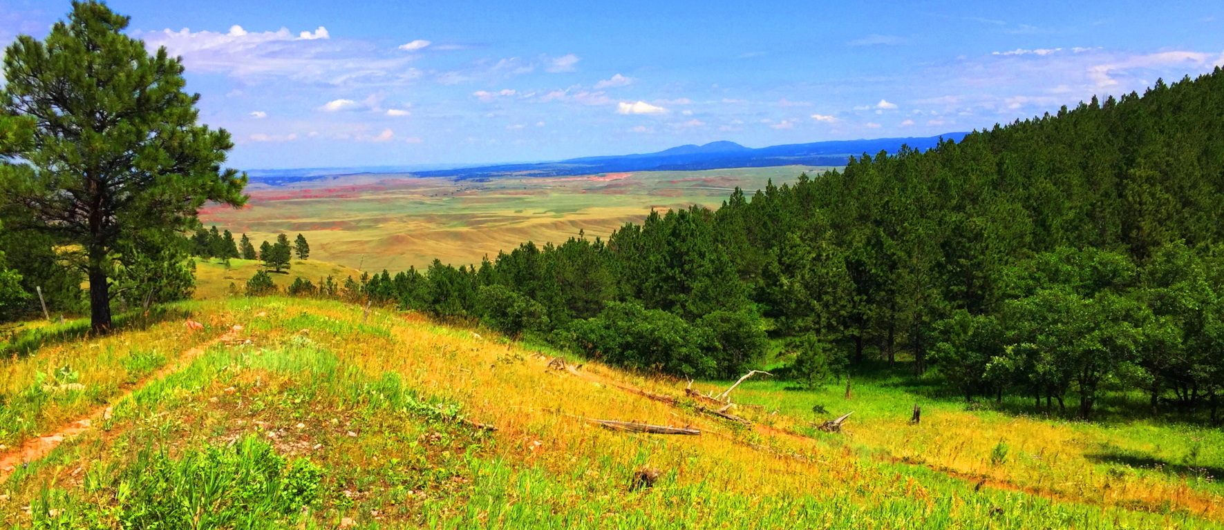
To exit the Trail, simply head back the way you came, and enjoy each ridge and the views they offer as you go.
There are places that are more intrinsically natural than others. Everything about Wyoming says “Don’t worry.” The Black Hills is a Trail that forces you to wonder how many of your problems are self induced. The peace in a place like this is so stunning that there is a cleansing of any spirit that passes through it, like a “landlocked baptism.” Landscapes don’t always have to reveal specific megalithic statements to be sacred. The land itself is at the heart of the ability to feel the sacred. It is entirely possible to see and feel the calm that the Native Americans felt for thousands upon thousands of years, and there are still ancient echoes of what was here before, written in the stone ridges. In a contentious time like this, Black Hills Trail is pure medicine, a regenerating tranquility that can take any modern confusion that you might have, and massage it into a cosmic calm so abundantly represented in the hills of Wyoming. Those who ignorantly accuse places like this of being “boring” are already drowning in a technological pool of hyper-urbanized poison. Wyoming is gorgeous, peaceful, mysterious, and gracious, with each and every step, and each step you take through it, is a step closer to your better-self. Black Hills Wyoming is part of the answer in this world, not a source of division; what more do you need to hear? Explore our world, and leave those that are trying to control and monitor every move you make, far, far, behind. Thanks for reading Stonestrider.com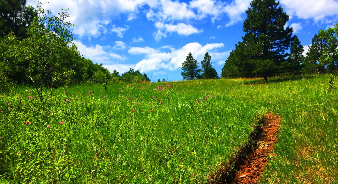
Red Rocks National Park

Location: Sedona/Arizona/USA
Elevation: 3,900 ft
Note: Welcome to the place in every persons imagination where ‘epic Quests’ take place. This is the ‘impossible wasteland’ of mythic tales, like Don Quixote, or The Song of Roland. This is the backdrop that provides ultimate silhouettes, and inexplicable skylines. Colors radiate from both the sky and stones, and these stones are nothing less than solid-rock skyscrapers. People come here to turn monumental pages in their lives, and to leave the East behind. 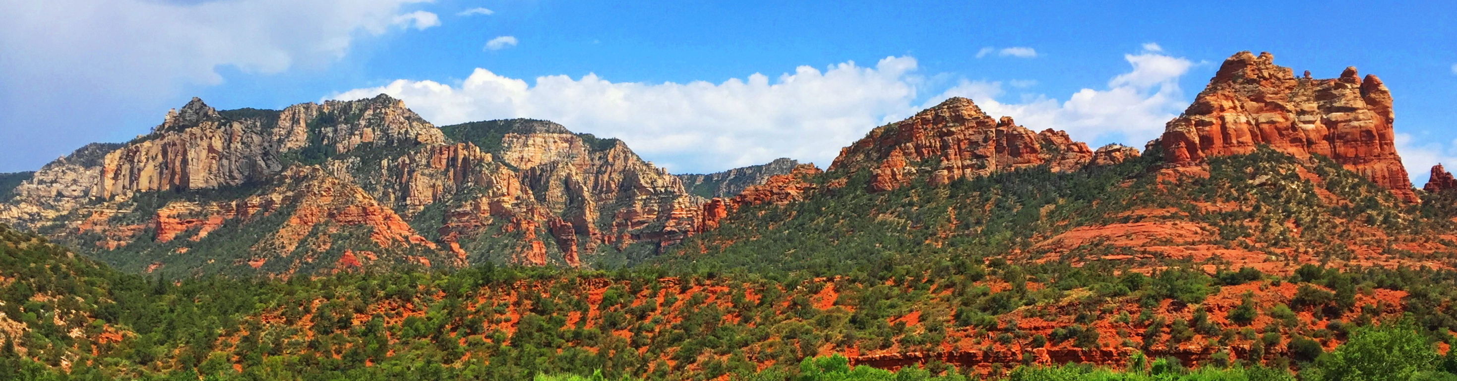 Nearly every conversation from the local people, from artists and hikers alike, includes the idea that Sedona changes lives. The trails at Red Rocks National Park, where Sedona is located, feels like the natural stage for the places in which Jesus preached, or The Crusades. Precious waterways roll beneath tunnels of reeds, cutting through a universe of rock, looking like miniatures of The River Jordan. The river is actually Oak Creek, which is also the name for the main trail leading from the visitors center. (Image/Below)
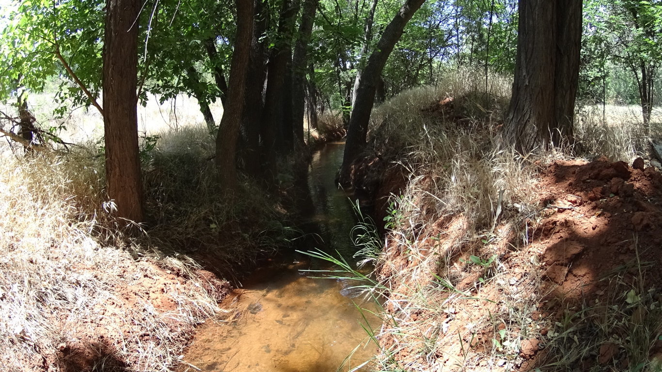 Their are just so many associations that are possible in one glance, that all you can really do is catch your breath…
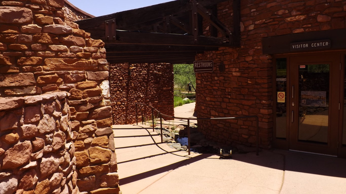
………………………………………………………………………………………………………………………………………………………………………………………………………..

Myths: Native to this landscape are the Anasazi, a people that carved their dwellings out of the highest livable portions of the upper canyons, as well as concealed rock dwellings on the Plain. The upper Anasazi dwellings are so elevated that they can only be reached by rope. Why would an entire culture build homes so high above their essential resources? What was roaming the plain that required a great height to steer clear from? Interestingly enough, the Anasazi myths, just like the Celtic ones, are of Giants.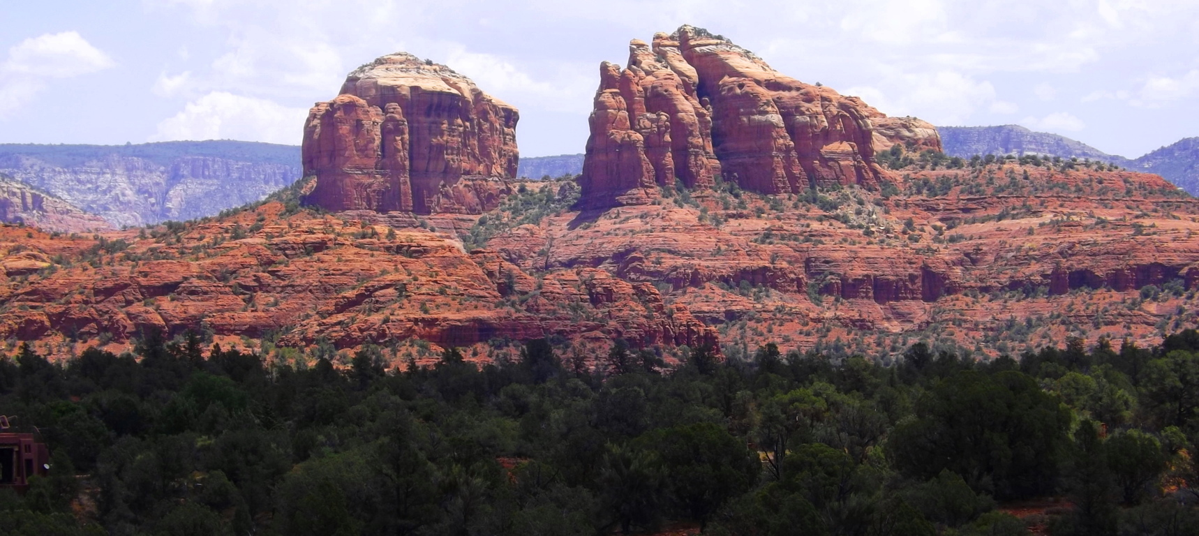 Why do all the oldest cultures insist that they experienced Giants? Something to think about, and this is the place to do it. As it is with so many places in the American West, there is a toughness to everything you see, but even with that toughness, a delicate beauty refuses to be ignored, which can be seen in the color of the wildflowers at Oak Creek Trail.
Oak Creek Trail: Red Rocks’ is sprawled-out massively to the east of Sedona. Oak Creek Trail is the best introductory experience here, with about five miles of options that head into ridges where photos can be beautifully made. You cross the Oak Creek Bridge and wander into a rare reality. The amazing thing here, in 105 degrees of heat in July, is that the fauna finds a way, and colorful statements emerge in the landscape. (Image/Below)
After crossing the bridge and heading up a few of the ridges you can turn north and see this epic space. There are hills and rock towers, forests and grand ridges, with miniature canyons, all in one glance.
  The concentrated ridges truly look like temples. Perhaps that is why one of the more major statements in the park is called Cathedral Rock.
Cathedral Rock Trail: Cathedral Rock’ has its own trailhead, but can be reached by a 8 mile trail from the Oak Creek route. This longer route required preparation and expertise. Any trail passing through the High Plain will require 1.5 gallons of water and food in your pack, along with a small med kit. Respect this wilderness. From the trailhead at Cathedral Rock, which can be reached by a simple and brief car ride, there is a fantastic loop that takes you around the ‘Cathedral’. There is a type of reverence here, with the Cathedral in sight, as if something otherworldly once happened at this beautiful place. 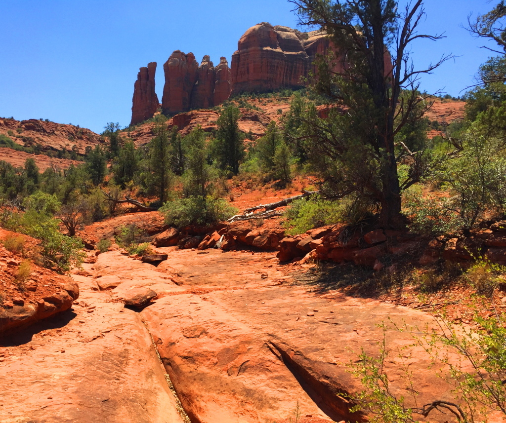 Like a meditation center, hikers can be found circulating the massive Rock, and camping out in groups of spiritual seekers. There are trails for biking as well, for those who are prepared for the rocky terrain..
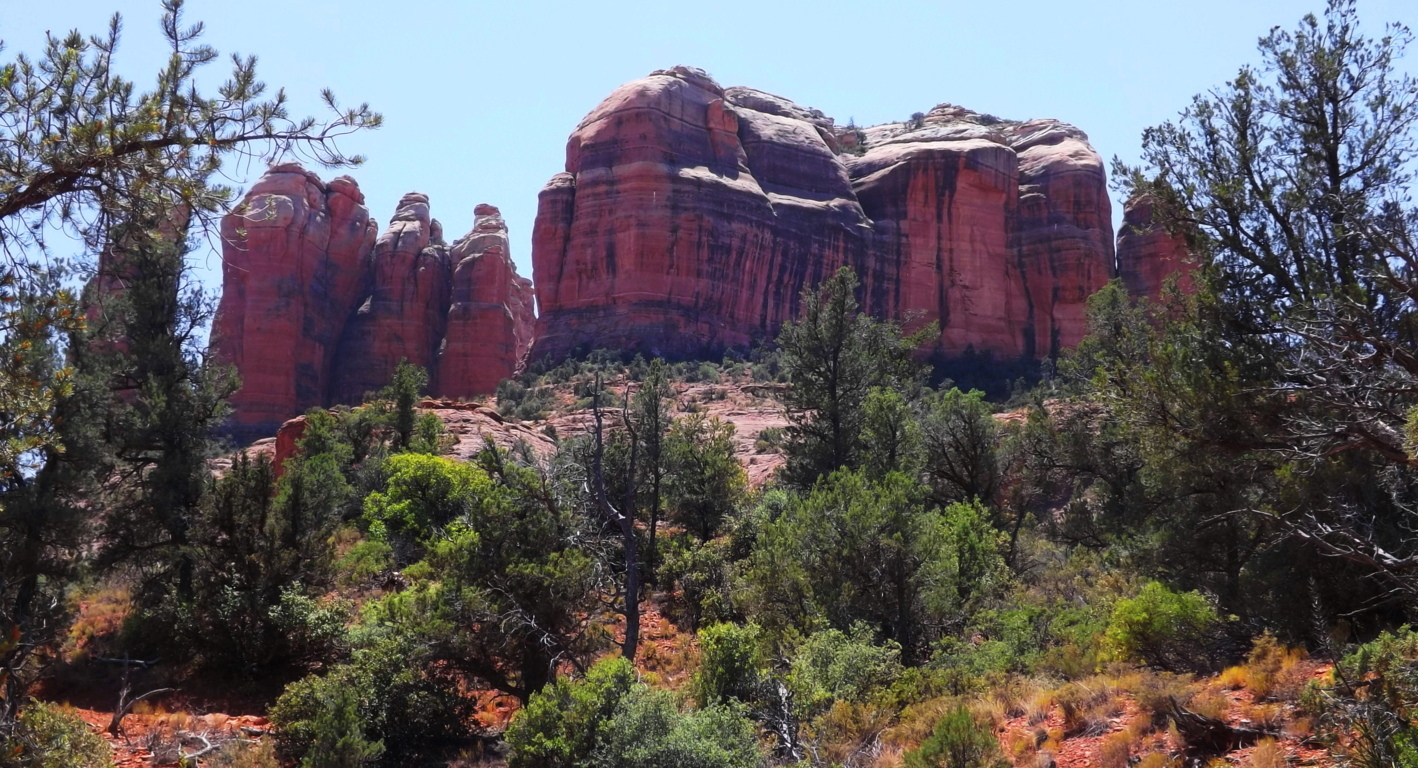 There are offshoots of the main trail here that are hard to understand. Some of the bedding of the rocks look as if water once rushed over the stone, obviously in another Era. Amazingly, there are cross section here, delicately etched into the stone, just like in the rocks of the trails back East.
 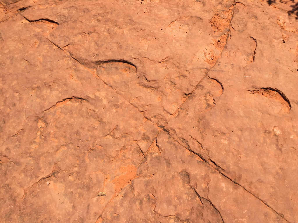 This one, pictured on the left, is at Cathedral Rock Trail; the one on the right is at Watatic Trail, 1800 miles away.
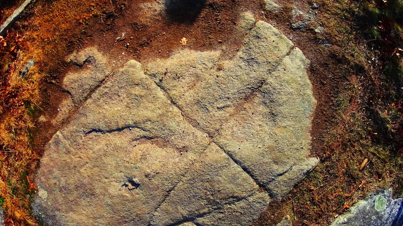 What is the meaning of these cross sections, which are found in the ancient rocky sites of the world? As described in other articles, I believe they are the “calling card” of a Neolithic Culture, which created cross section of triangles as a utility for building, as well as a tribute to the divine concept, which is The Axis of creation, a philosophical concept from the beginning of Time.
There are deep cuts in the landscape leading away from the wide bed-rock faces. They are tempting to climb into, but beware of snakes, and other wildlife. There are also stones that are clearly cut, and not average debris, but the amount of possibilities as to who may have done this work are too general to specify. 
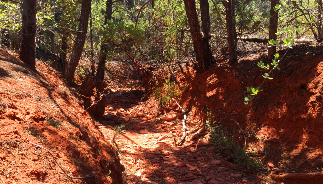
Red Rocks National Park is a place unlike any other in the world. One could spend a life time hiking and researching its epic features and indigenous mysteries. The colors here, the scale of everything you see, is overwhelming. For those first-timers, try these basic trails first, and make time to visit Sedona. There is a vibrant Arts community here, with a social scene to match. Arizona, overall, is a hiking paradise. You can feel that something incredible took place her once, however hard it is to put your finger on. Perhaps the myths are just a hint as to what this place was before the West invaded.
Red Rocks National Park is just one of just dozens of national parks, each one being an absolute gem, like Oak Creek Canyon, Grand Canyon, Hulapai Mountain, and Sunset Crater, just to name a few. An experience here increases your overall ability as a hiker, drastically, as you are moving in 105 degree heat, roughly 4000 feet above Sea-Level. When you go home you will be significantly stronger. The energy is obviously radiant, but purifying and straight-forward, without any room for wasted effort or lazy mistakes; yet in places where the stakes are higher, the value of the experience enters into that realm of spiritual appreciation that makes hiking the very real meditation that it is. Red Rocks National Park is that experience. Give it a shot if you can, and go strong.
Medicine Bow National Park
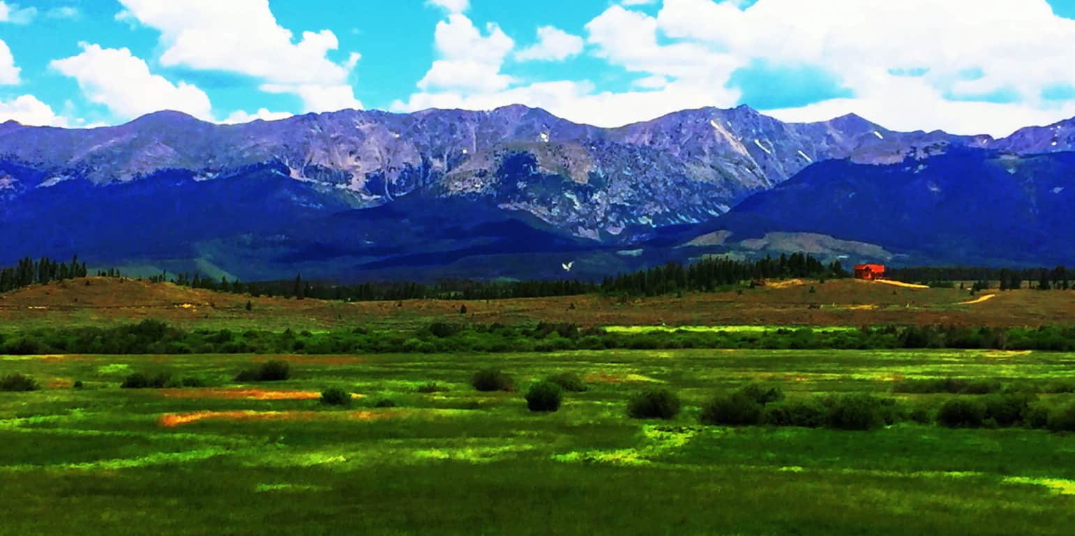
Location: Clark Peak/Rocky Mountains/Colorado
Elevation: 12,953
Prominence: 2,753
Note: If the mountain ranges of Ireland, Wales, and England could be said to be like rolling waves of infinite green…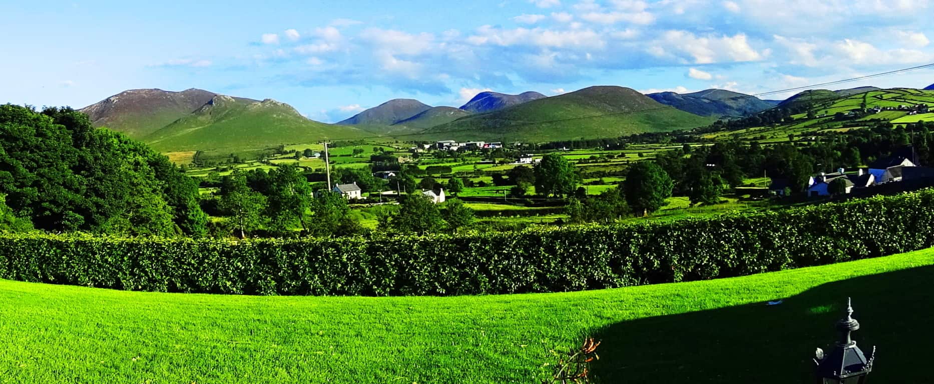 …then the Colorado Rockies of the northwest United States could be said to be nothing less than a rock-solid “tsunami of blue stone”, frozen forever along the landscape, above the western world.
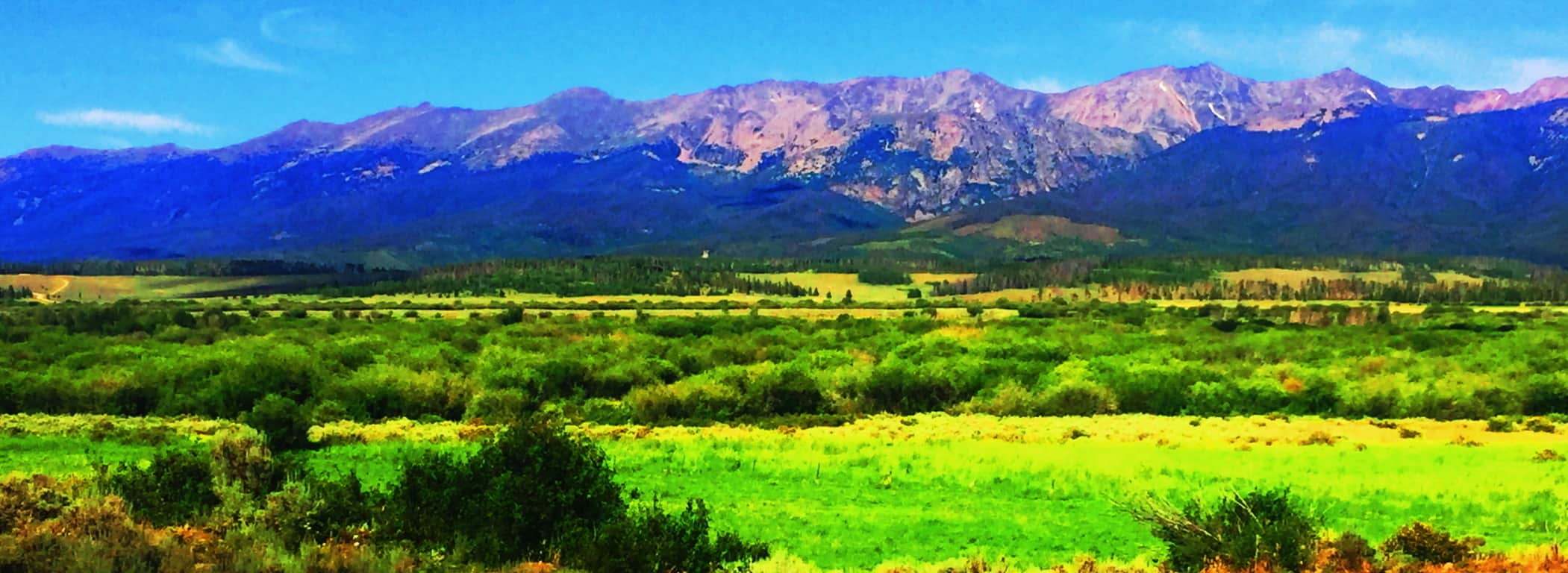 There is no other possible introduction to this juggernaut of a mountain range. Clark Peak, our destination for this article, sits in the southern Medicine Bow National Park. The northern Medicine Bow National Park, across the state line in Wyoming, is an auspicious type of “warm-up” for the grandeur of The Rockies. Southern Wyoming’s Medicine Bow’ features a unique lessor-known range, with ‘chocolate-milk’ looking soil, seemingly poured all over the ledges, standing at what looks to be about 2000 inviting feet of prominence with the highway running right through them. (Image/Below)
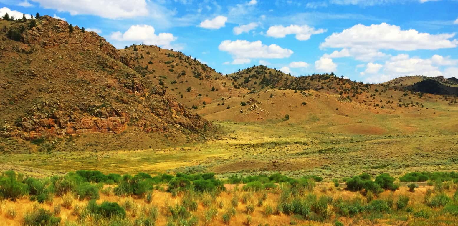 These are surprisingly dramatic yet relatively anonymous mountains, a mere preview to what looms just across the State line. They are absolutely worthy of many an expedition for certain, but remain in the reputational shadow of what awaits in Colorado. To its credit, a mere glimpse of these small peaks reveals a warm and distinct beauty, truly inviting. Everything about this small range says “jump up here for a day!” Like so many people just passing through, this place was passed by in order to reach the Rocky Mountains of Colorado.
Clark Peak Trail: The feel of Colorado is vast and rustic, and yet it leaves natural space for significant delicate statements also. Trails are thickly bedded with wildflowers of every possible color, like the approach to the mythical city of Oz. Brown Bears and Moose roam the mountains and forests, but for the most part steer clear of the trails. The high plain sits about 9000 feet above sea-level, supporting a universe of fauna. 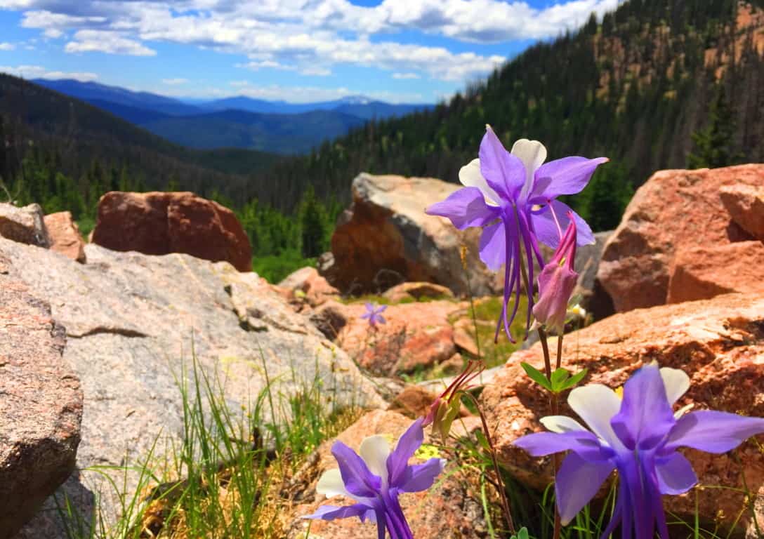 Accessing the elevated trails of Medicine Bow National Park in high country like this requires a 4×4 vehicle, plain and simple. The highest peak of Medicine Bow’, above the northern Rockies, is Clark Peak, looming just shy of 13,000 feet above sea-level. There are basically three levels of trail-heads, each a bit further up the Trail than the next. The first trail-head approaching Clark Peak is at the end of a wide dirt track that passes a small lake on the far edge of the mountains. To start from the first trail-head could basically take more than a day to complete the ascent and return. Most hikers attempting the peak desire an entry that reaches to at least the second trail-head. You should not attempt the second or third trail-head without a 4×4 truck, and prepare to rent a 4×4 for your excursion. Below is an image of the Clark Peak approach. Above the high basin on the left is your destination, where a large still-water pool awaits.
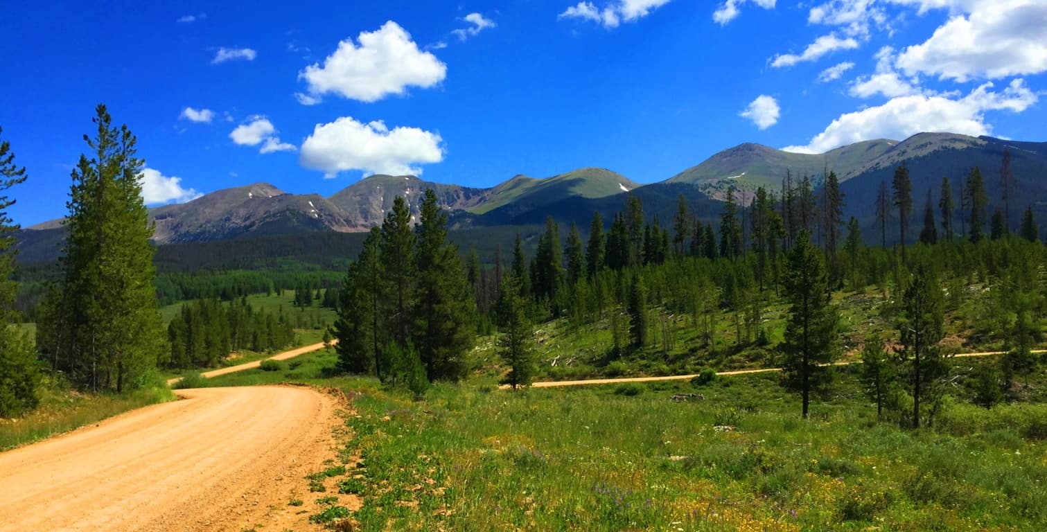 The second trail-head begins about 5 miles into the lower vale, so when you ditch the truck on the side of the track, the forest will already be surrounding you, and perhaps in a way it has never done before (even for seasoned cross trainers.) If this is your first hike in Colorado, you are stepping into a type of hiking phantasy from the moment you get out of the truck.
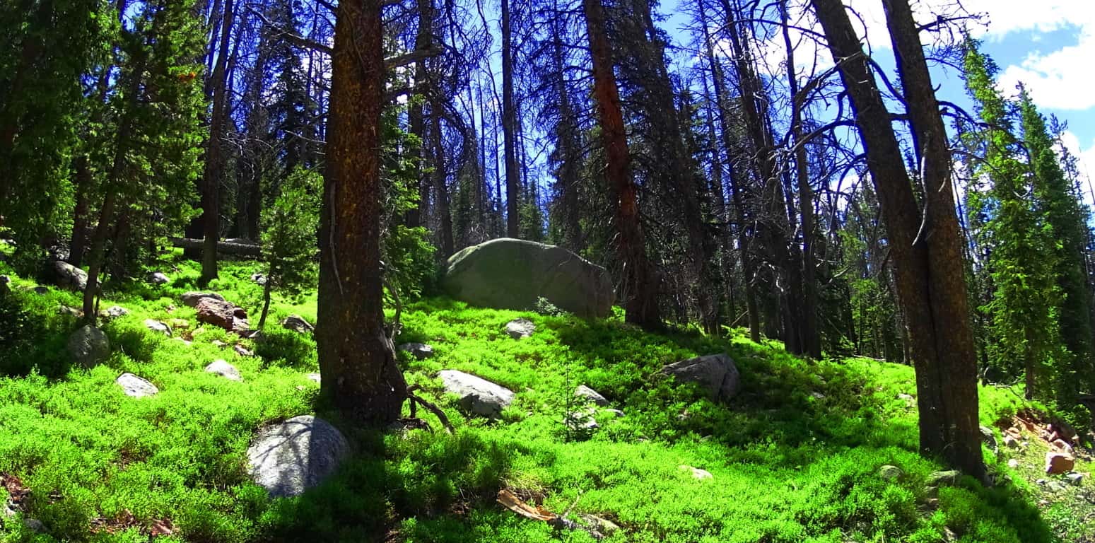 The tallness and fineness of the Aspen trees, Blue Spruces, Douglas Firs, Ponderosa Pines, and Lodgepole Pines, creates a literal euphoric vibe in the forest. From a distance, the woodlands seem to be blending into each other somehow. When the shafts of sunlight hit these trees, it is hard to focus on any single thing; it’s as if the trees are literally vibrating into each other. There is a type of enchantment here, a vastness to these glades that gives a very physical impression. The thickets here look as dense and deep as any ocean, and just like the ocean, to go too deep un-prepared could prove fatal. Respect this wilderness, pack properly, study-up, and stay on the trail when inside the forest. The basics here are about being aware of ‘forest-fire warning-levels’ and the restrictions to using flame, the possibility of bringing bear-spray (or even a fire-arm), and never leaving cooked food/food goods unburied or littered in the forest; it will draw the Brown Bears if you are lazy and careless with your goods. Stay sharp and aware, ready to have a great experience.
Very much like in the Mourn Mountains in Ireland, after the lower valley roads begin to elevate, they usually blend into a stone road trail that is almost certainly an ancient pathway. I wondered if I would find such a thing in a wilderness so far removed from Celtic characteristics, and to my delight I did. The look of these rocky tracks are surprising in the initial heights of any mountain range. In many places it seems that these ancient pathways were the very first roads on Earth, navigating the high mountain passes built by the most ancient Culture on Earth, the Neolithic Culture. Here is a look at the ancient stone-road at Mount Bearnagh in Ireland. (Image/Below) 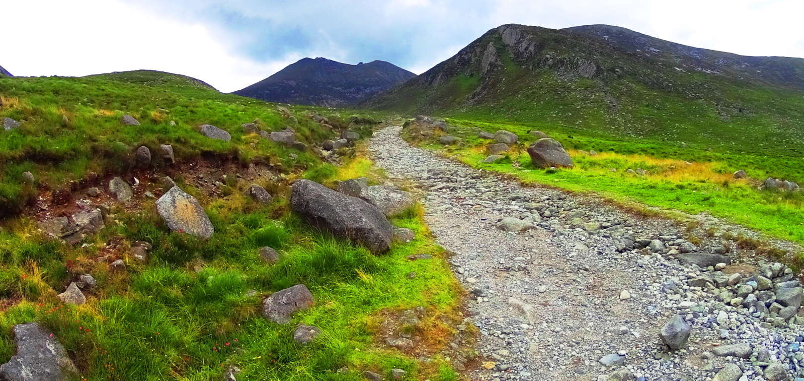 And now here is a look at the nearly identical width grade, and angle of an ancient stone-path in Colorado.(Image/Below) Many of these approaches have been re-worked from a much older original path that has been there (for all intents and purposes) forever. In Ireland it would be the Gaelic/Celtic Culture that identified and revised the ancient paths, while in Colorado, the Native Americans would have been the first to observed and acknowledge these trails as “sacred pathways”, or “pathways of the spirits.” These origin roads had existed long before even their earliest ancestors had arrived. The point is, there is very good reason to believe that an even more ancient culture existed here before the natives, a culture capable of building and engineering with megalithic stones. To my great wonder, some of these signs of “cut stones” and a singular pathways with a specific measurement (roughly 4.5 feet across) in the high mountains appeared here on Clark Peak Trail. A deciphering look at the old pathways alone, however, is not enough evidence to support the idea of a Neolithic existence in this place; it will be in the heights that Wedge Tombs, Cairns, Standing Stones, and Vantage Stones reveal themselves, as we know from Celtic ranges. I admit that this was on my mind as I ascended the beautiful valley with one of my oldest and best friends.
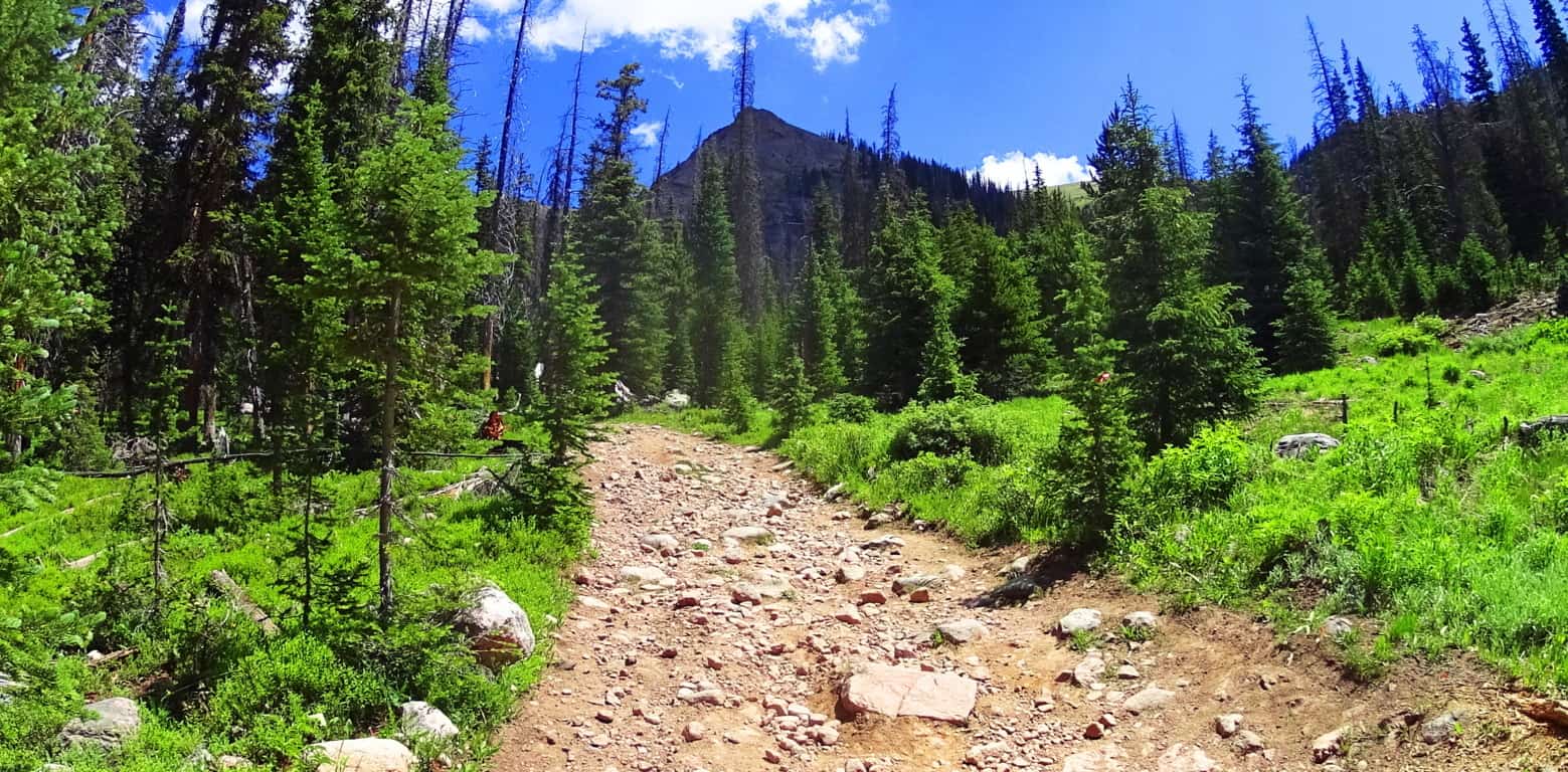
As the old rocky road begins to narrow into a winding path, bustling streams and narrow log bridges emerge. The stream runs almost directly towards Clark Peak, in a line of sight that is classic Colorado; Pines and abundant overgrowth pointing to the peak as if it were a temple corner stone. The basin at the upper portion of the trail comes into clear view here, along with a grand clearing in the middle of the vale, about a mile ahead on the trail. A clearing of this scale, where the tree-line abruptly ends, is indicative of a glacial rockslide, which is what we found. The trail continues across the fallen rocks where you catch a first glimpse of the curvature of the glowing moss and speckled glades of the upper basin, which still had somewhat miraculous patches of snow, in July! The absolute dryness of the comfortable cool air preserves the snow in the heights, giving subtle surreal contrast against the hillsides. 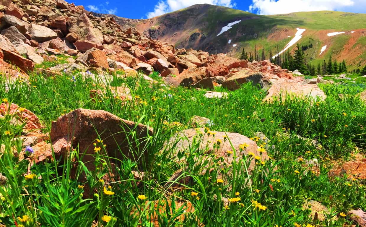 While trekking through a massive rockslide a chronology of the natural events of the mountain comes into perspective. The receding of the last Ice Age left entire mountainsides inundated with random boulders in spastic shambles. Intriguingly, some of the boulders seem to have broken away from the riotously random placement-pattern. One massive ‘squared’ boulder, at the base of the rockslide, seems to be sitting perfectly centered on the incredible scene of the mountains below and beyond. In the upper valley at Mount Bearnagh, of the Mourn Mountain Range of Ireland, not only are there boulders that seem cinematically placed, but they also seem to have been, somehow, hewn to match the shape of the valley beyond. (Image/Below)
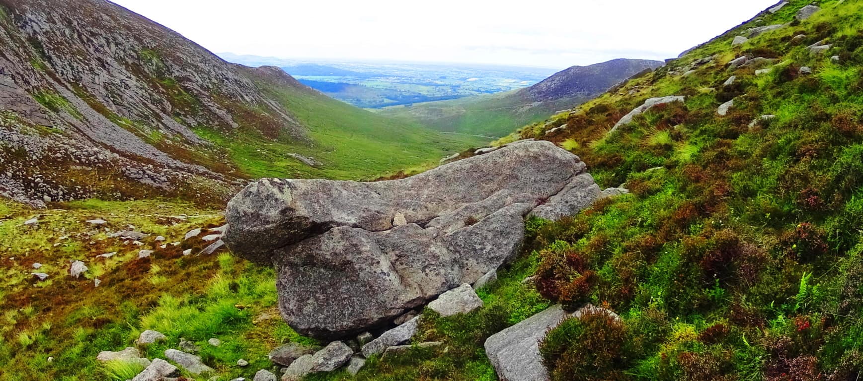
There are also “seat boulders” at the pass at Bearnagh, which absolutely look to have been placed at a cinematic point on the valley, as a place where you could sit and watch anyone approaching slowly from below.(Image/Below)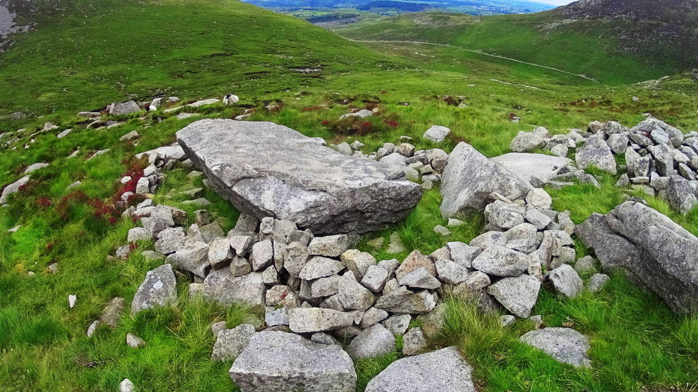 Here at Clark Peak Trail there sits an auspiciously placed boulder which looks more like a “seat” then a random resting place from a rockslide. This ‘squared’ boulder is perfectly centered on the vision that is the brilliant view of The Rockies beyond.(Image/Below) The other stones of this scene are compiled in stacks, tightly packed together, way off to the side of this beautiful seat; and the possibility that it was intentionally placed there becomes very real after considering its perfect symmetrical placement at the dead center of the valley. Only the Neolithic culture, the culture that had the strength and skills to build New Grange, or arrange massive stones in The Mourn Mountains; or masterfully craft the Sarsons at Stonehenge, has the capability to do something of this scale in antiquity. Clark Peak Trail, as you progress, begins to show signs of Neolthic Culture. Clark Peak Trail may very well have been home to the very same Neolithic Culture that marked and roamed the peaks of ancient Europe.
 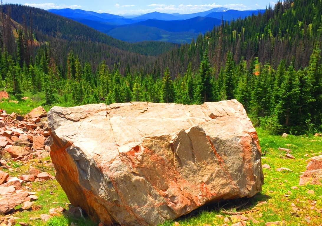 From this gorgeous spot the Trail runs over the landslide stones and into the curvature of the upper basin, where the scene becomes truly surreal. Beautiful fields of wildflowers decorate the mouth of the basin. Campers pitch their tents here on soft glowing beds of grass and singular Pines. The view is like trekking the natural porch taking you straight to Valhalla.
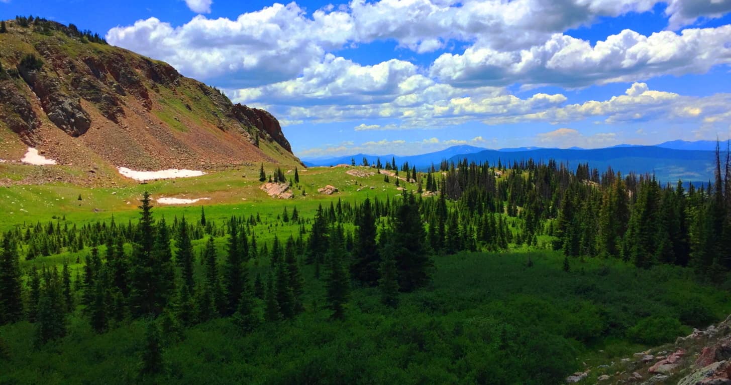
Neolithic Cultures seem to have had the capacity to recognize sites of great beauty. In many places, for example, Standing Stones and Dolmens are found facing the most gorgeous scenes of the heights they occupy. The Standing Stone of the Conwy Valley in Wales overlooks the sacred valley just north of the most revered mountain of the entire Celtic World, Mount Snowdon. (Image/Below) That’s pretty significant placement…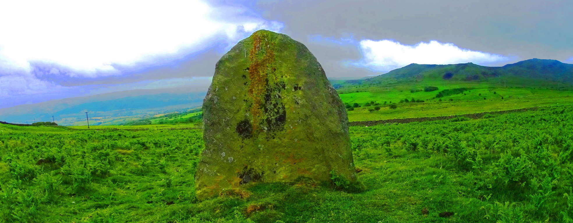 Here at Clark Peak Trail, standing distinctly above the glacial rubble is an equally significant statement, a Standing Stone that was almost certainly placed to acknowledge the incredible beauty of the valley beyond, along with the elevated basin on which it sits. This is an incredible statement of epic proportion that signals an anthropological link to the cultural practices of a Neolithic Culture a Continent, and Ocean away. To find this here was one of the most exciting moments of my life. It vindicates the idea that the heights of the world, mountain ranges in Celtic, Semitic, and Native American places, were once occupied by a Neolithic Culture that had significantly similar practices in marking-out sacred territories with megaliths. Those who dismiss America as a place void of Celtic-esque culture are slowy being dismissed as academic charlatans, theorizing from afar, never to be found in the heights where the answers are, only in the cities where the money is. This may be the worlds first international glimpse at an absolutely gorgeous American Standing Stone in the heights of the Colorado Rockies, on Clark Peak Trail, of Medicine Bow National Park. (Image/Below)
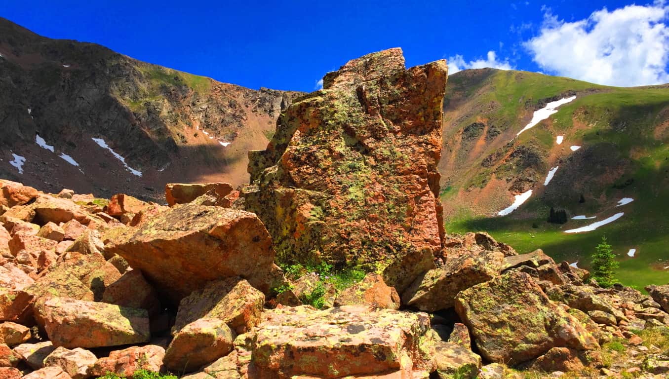
This Standing Stone is 6 feet high and 4 feet thick, looming on the left ridge just above the main Trail along the upper basin fields. The most distinct crafted cut of this Stone’ is along the entirety of Its right side. At the top of the Stone’ there is a distinctly straight top ‘cut’, with an indented ‘top’ slant above it. The left side contains two smaller ‘levelly’ crafted indents. It is so distinctly different than any of the other stones in the basin that I was left to wonder how it was possible that not one person had acknowledged it before?! Additionally, like so many Standing Stones, there is a distinctly marked Cairn on the ledge below, a fairly large crafted cavern where the designers of this Stone would’ve kept objects of value tucked-away. A set of large parallel streaks marks the stone above the trademark opening at the bottom right of the boulder. Do you see any streaks in any of the stones around the area? No, you don’t. The stone is marked for a reason, it was obviously a valued setting in the basin for whoever claimed it.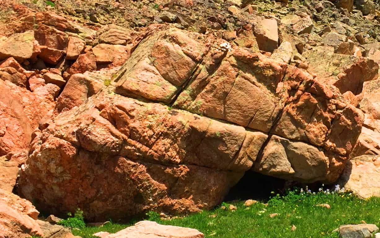 This Cairn Colorado was one of the largest I had ever seen. Other Cairns of this nature could be found in Ireland, New England and practically ever other Celtic peak. Take a look at these very similar Cairns to be found in Ireland and New England: It is true that they look very natural, but their attributes are almost always the same, containg an emblematic “side” which covers a specific gap on the right side, and are in areas where other amazing stones have been blatantly crafted. These Cairns are almost always found near sacred stone statements in the landscape, meaning they are indicative of a specific area that was inhabited by craftsman of the Neolithic Era.
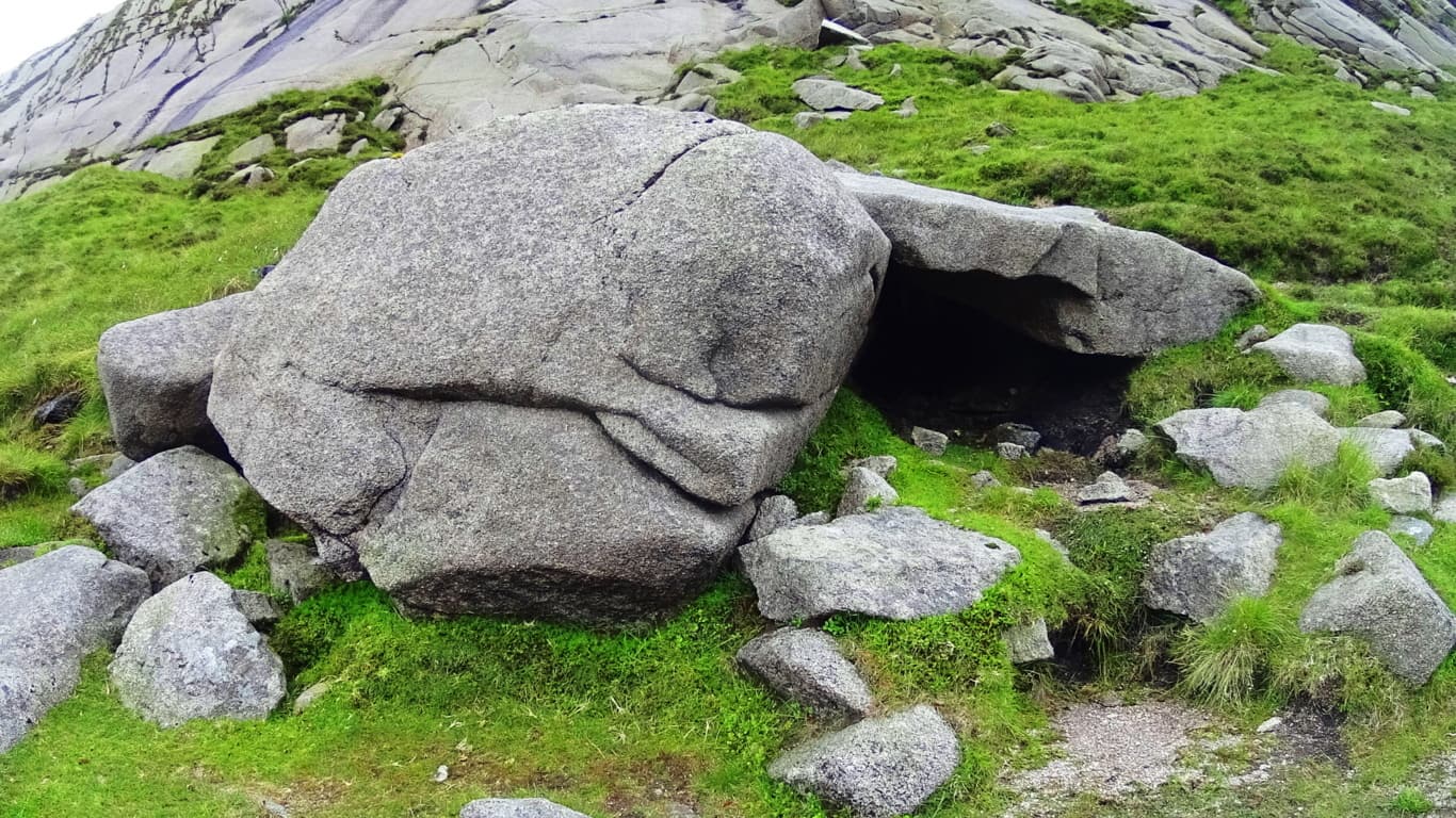
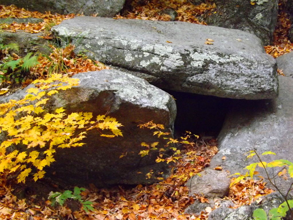
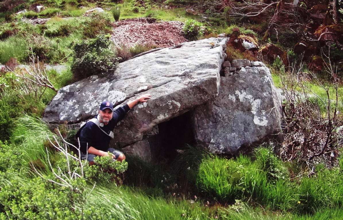 From the Standing Stone here in Colorado, the last portion of the Trail runs up the Basin. Tucked into the Basin is a lovely hidden lake, which at one time would’ve been a perfect source of drinking water for anyone trying to occupy these heights. All the elements for survival are there. Make your way up the final narrow pathway, where beneath a ledge of millions of stones, none of which look anything like the ones that we have identified as ‘crafted’, sits the stellar pool. Here is the final elevated path into the high basin the image below:
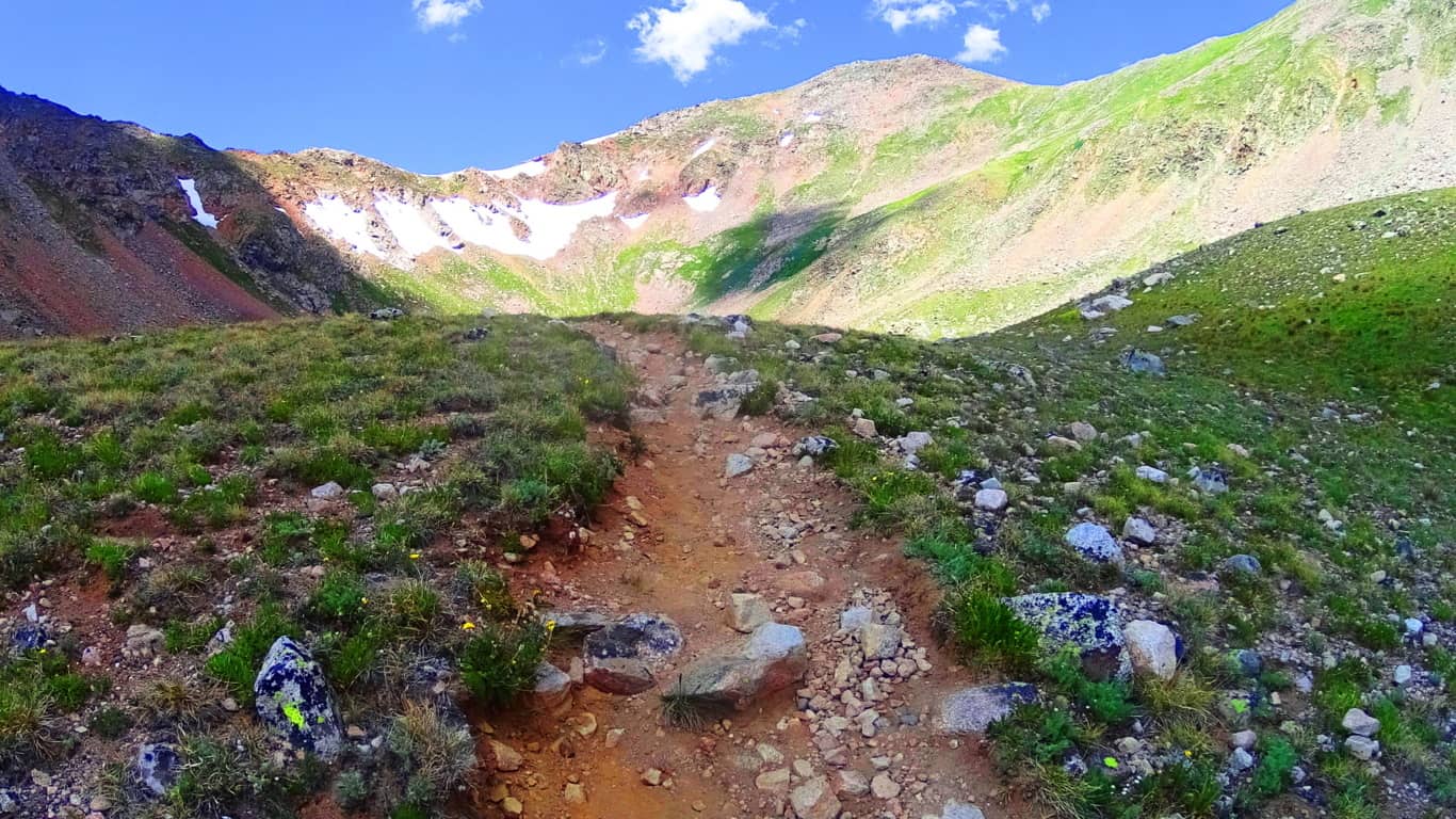 And here is the reflective pool. Imagine looking down on this pool on a clear night to look at the stars! It may very well be that the Standing Stone is pointing to a specific constellation in the night sky, or some meaningful designation of that nature. It would require more time than I had on this fine day to discover such things. But it is truly safe to say that most Standing Stones have a multi-contextual meaning, and here in Colorado, with a crystalline clear sky in July, that possibility is very real.
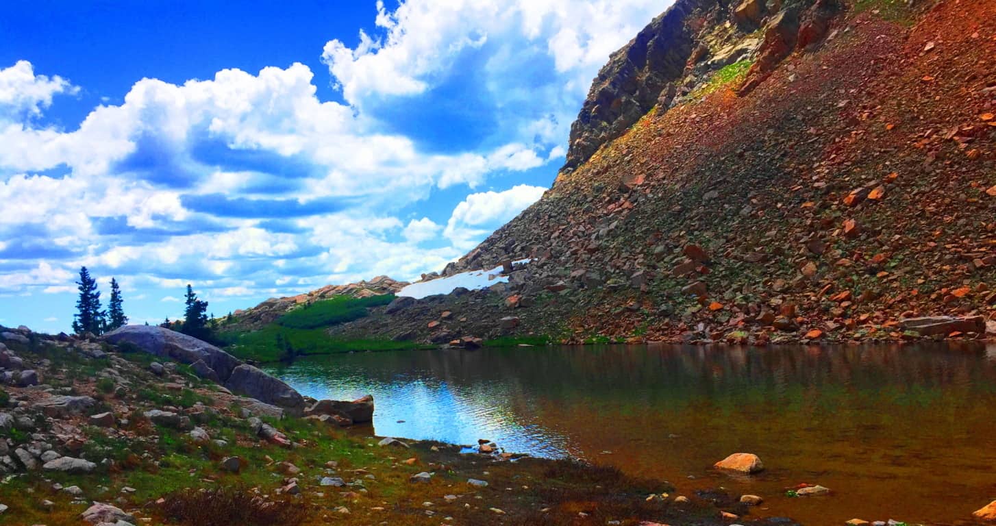
This is one of the highest basins in Colorado, and the country. Like so many beautiful Celtic trails, things here slowly blend into child-like wonder. You are humbled. A look back from the Lake displays a gorgeous jade animation of the entire basin, with the High Plain of the Rocky Mountains beyond, along with drifting clouds that practically touch the upper crags. There is a very real temptation to break all convention and remain in this place, however reclusive it may sound. If a Neolithic individual did decide to live here, the set up for a fantastic existence seems perfectly clear; you could keep a flock in the lower basin, keep a fire by the upper lake, drink a never ending supply of water, and monitor the entire scene from the Standing Stone vantage. Logically it makes sense here.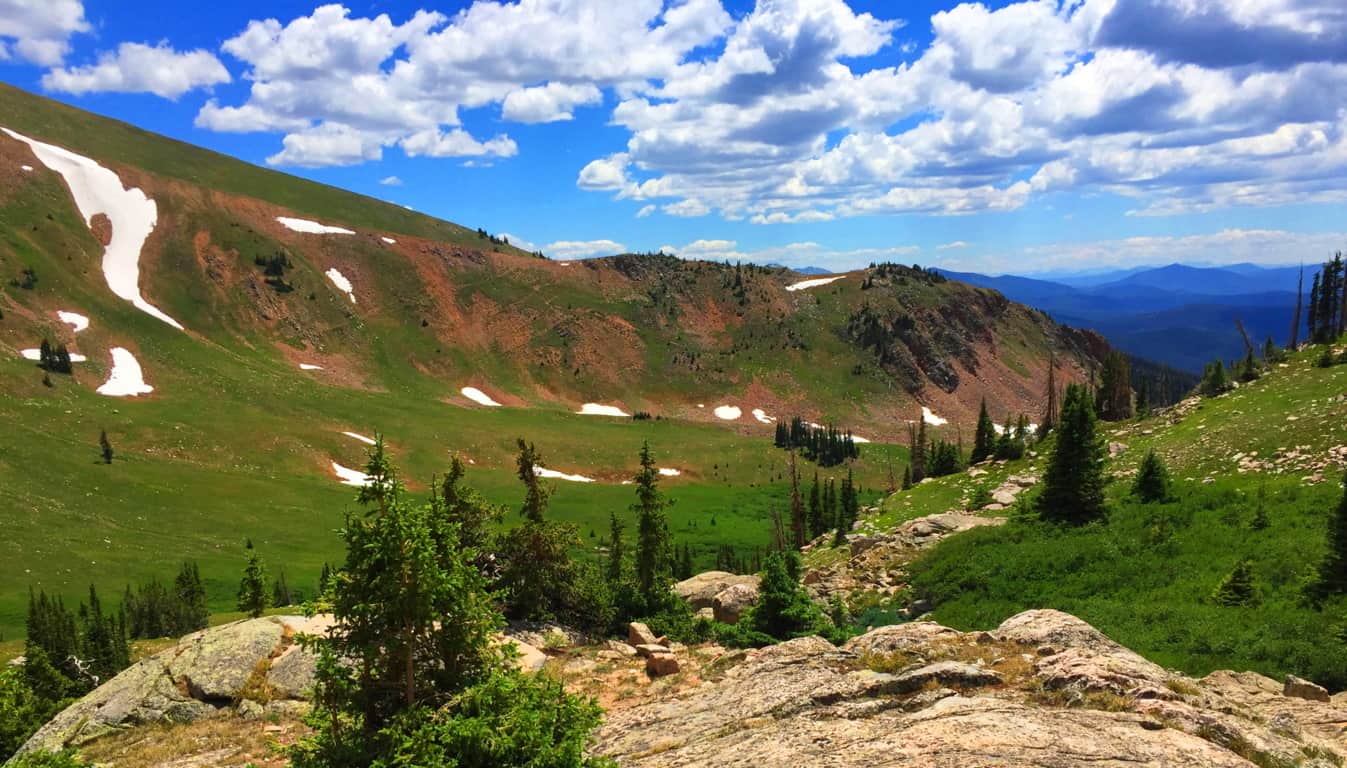 As someone who was trying to scale the heights of Glen Coe Scotland while caught in a rain storm exactly one year earlier, I could not help but feel that Clark Peak Colorado is one of the most comfortable challenges you will ever engage in the month of July. The air temperature and quality in near perfect, pristine, and so delightful. The wildflowers exude an overwhelming spectrum of statements, where entire mountain glens are covered in violet, steel-blue, glowing wild yellow, and subtle bits of auburn.(Image/Below)
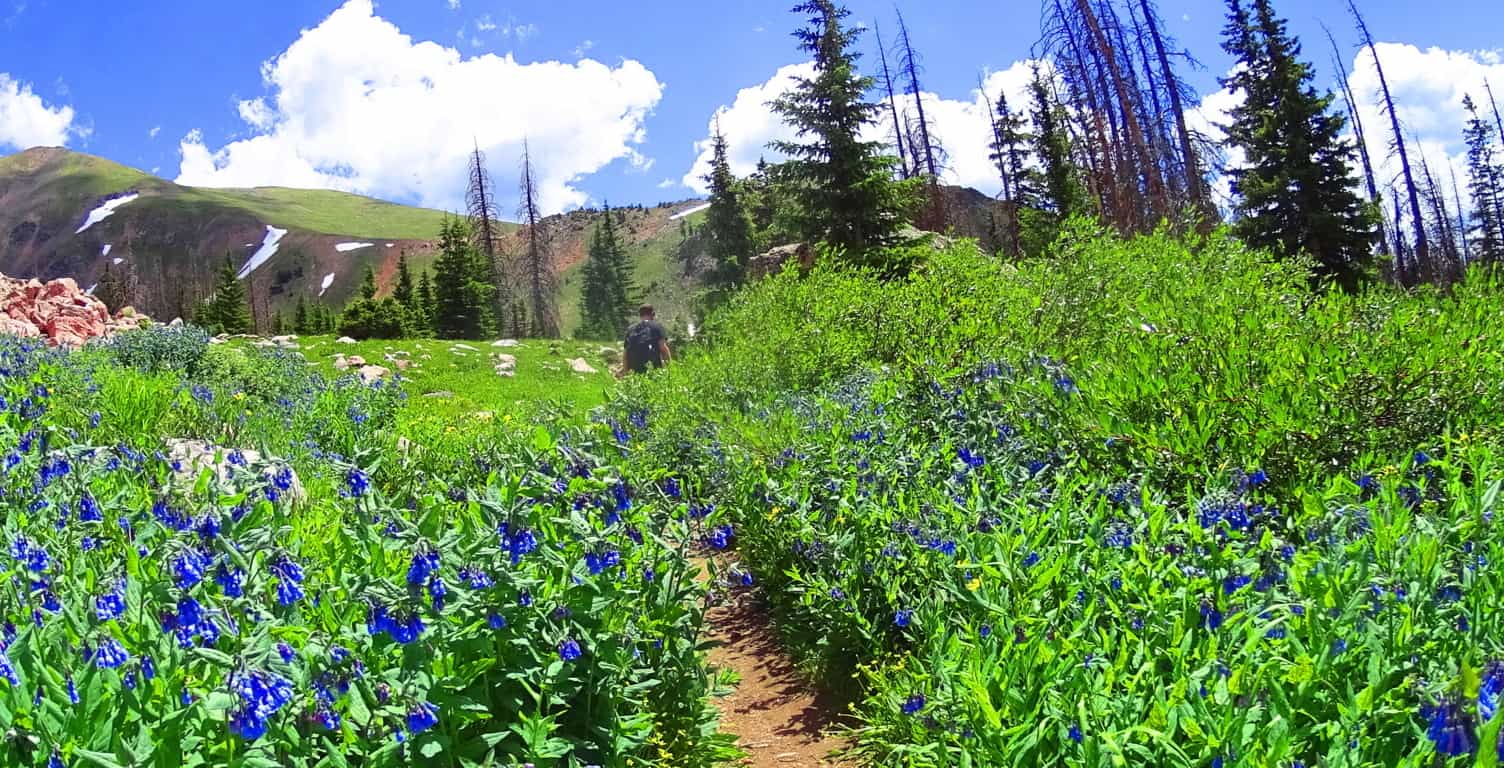 It is understandable if readers are still not sold on the idea of a Neolithic Culture in the heights of these mountains. To some people they might see a mere stone where there is an actual cultural statement. It has taken six years of challenging research in some of the most off-the-grid locations on earth to finally begin to see the patterns of a very real Neolithic Culture. Only after dozens of expeditions have the specific memes begun to reveal themselves. It is not just the evidence itself, but the context of the evidence: the position of a stone in a particular way in a valley; the paring of stone statements in not just one valley, but dozens. There is a very real consistency. It is hard to tell if the Standing Stone here at Clark Peak was there before the rockslide, and was later engulfed by the rush of stone, or if it was placed squarely into the stones after the fact? But the most important, and truly obvious thing, is that there is no other stone even remotely like it in the entire basin, which is what I mean by context. And moreover, the place where it stands, like so many other Standing Stones across the world, is most likely the most advantageous, as well as beautiful, vantage on the entire valley; it’s as if someone wanted to claim the best of what the valley had to offer. I’ve seen this in literally dozens of mountain ranges. The overall point is that hiking and ‘striding’ will take YOU there. You can go and size up the strangeness of these megaliths for YOURSELF. You don’t need my opinion, you can get there and judge on your own! When you do I believe the realness of these statement will hit you….will make it real.
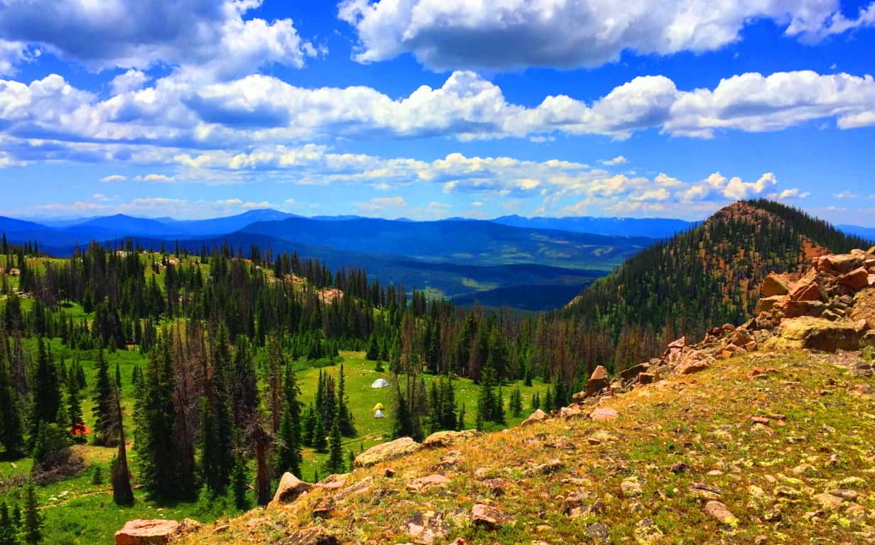 Clark Peak, from the second level trail-head, is one of the single most relaxing and cool hikes in the entire world.The reward in this place far outweighs the work, which is not usually the case for international hiking. Aside from the evidence, there is also that feeling of total tranquility in the Colorado heights, a feeling in all honesty, I have only felt once before in my life, ironically, by the Standing Stone in Wales, at the top of the gorgeous Conwy Valley. At Conwy, a Standing Stone and a Cairn both sit atop the heights, just like in this gorgeous basin in Colorado, paired together like a chair and table, but in an ancient-stone kind of way. So… plan a week or so at the cottages of the tiny American hamlet of Walden Colorado. Take the time to do what it takes to get to the trailheads for Clark Peak, which sits at the eastern edge of Medicine Bow National Park, one of the most scintillated and stellar National Parks on Earth. Find your way, and the way, amazingly, will find you. Go strong. A special thanks to my great friend and confidant Christopher Frohlich for providing his style, skill, and understanding of the grand Colorado landscape. Couldn’t have done this without you Fro’, thank you.
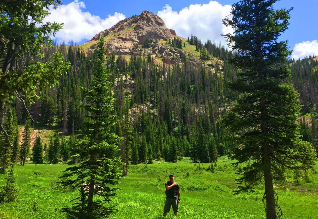
Hulapai Mountain
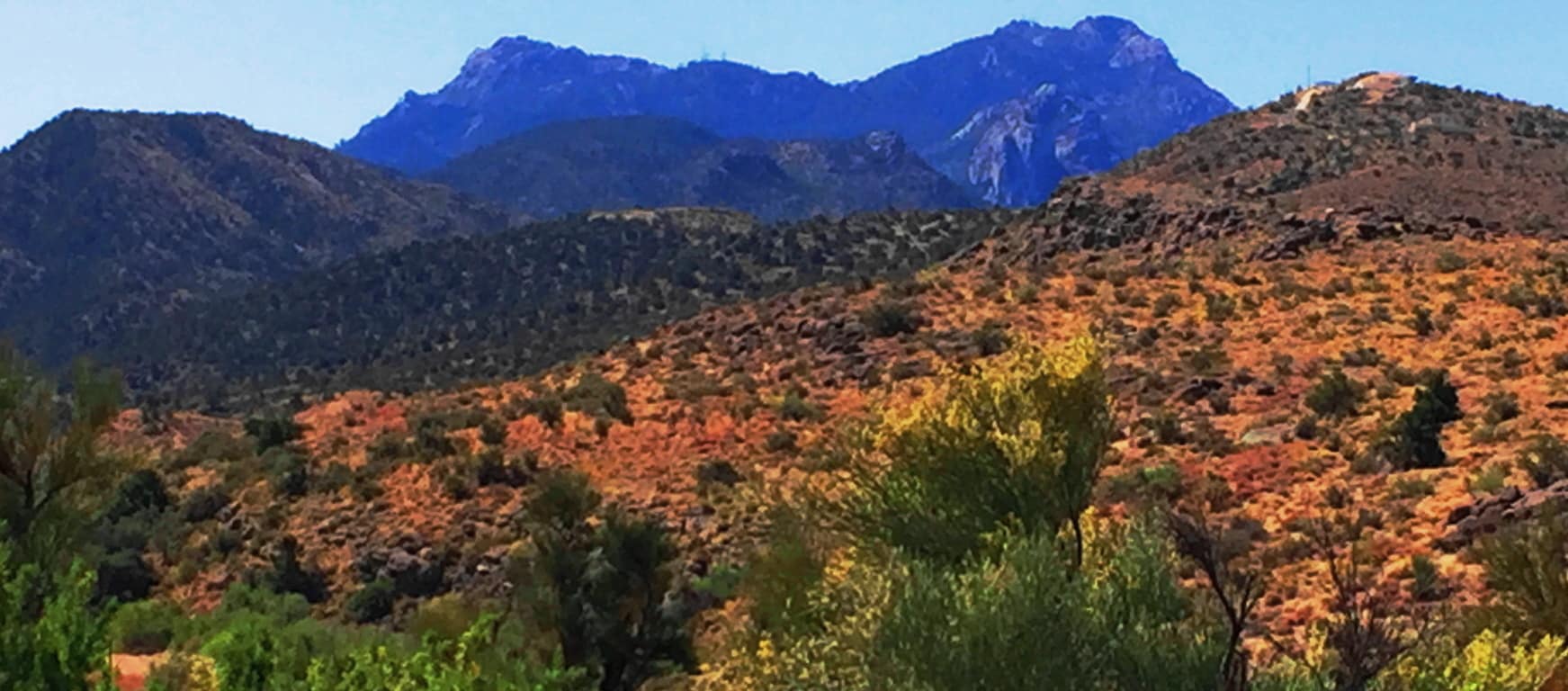
Location: Aspen Peak/Kingman, Arizona/USA
Elevation: 8,417 ft
Prominence: 1700 ft
Note: Half a world away from the ancient Celtic Ranges, where Standing Stones guard the mythical heights of Wales, Ireland, Scotland, and England, are the epic mountains of the American West. Among the vast options of the grand natural spaces that dominate northern California, Montana, Oregon, and Colorado, are the mysterious high Ranges of Arizona. The Hulapai Range is a few miles south-east of Kingman Arizona. From Kingman you will take the ‘Hulapai Mountain Road’ straight into the heart of the Range, climbing slowly upward into a set of elevations that look like an American Mount Sinai. The comparison is a good one. The air here is absolutely void of humidity. With temperatures that climb up to 116 degrees in July, the trees, some half burnt, radiate a charcoal scent which carries on the wind; and you can taste that scent on the back of your tongue. 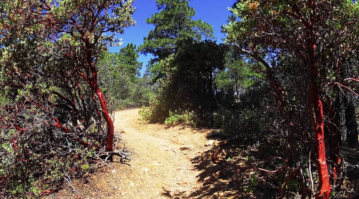 Amazingly, there are some similarities to Celtic mountain ranges here, if you have the right perspective. There are other-worldly rock fixtures, free standing boulders that stack the mountainside, and an amazing magical stone near the peak, which you will see in this article.
 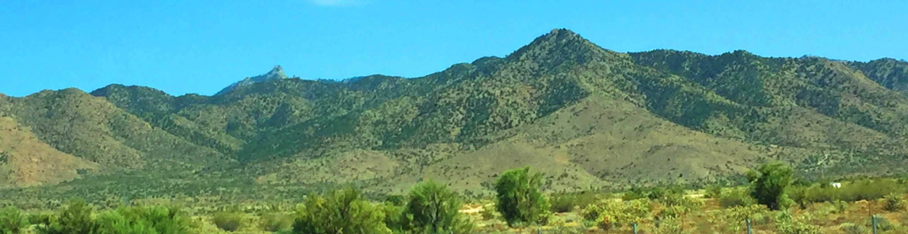 Aspen Peak Trail at Hulapai: As you approach the Range you will notice golden glades, not purely green zones. The bright Ponderosa forest at the belt of these mountains is spacious and inviting . In Celtic Ranges, the signs of the Neolithic Culture usually increase the further up you go. By this logic, if there is Neolithic cultural evidence at Hulapai, the highest peak would most likely yield the most evidence. Aspen Peak is the highest vista in this range, and the focus of this hike. Make sure to bring at least 1.5 gallons of water along with a sports drink for necessary electrolyte/sugar replenishment. Ration your intake. Also bring an extra shirt due to perspiration, several granola bars/ carb eating options, including jellybeans for when you reach the peak.
 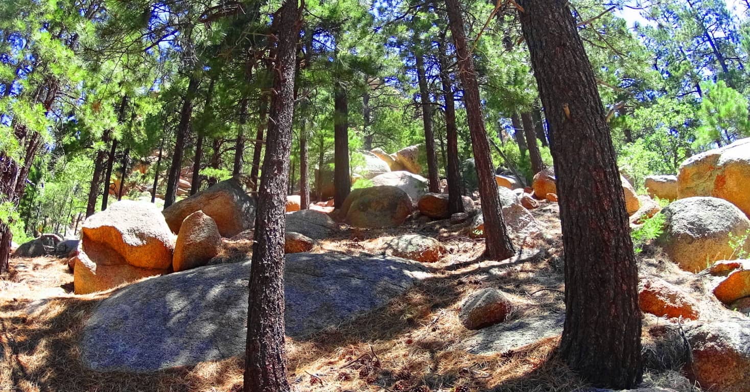 There are options for approaching Aspen Trail. There is a lower entry through the hills and woods off the Hulapai Mountain Road marked by a sign on the left, which is more of a challenge with an extra 1000 ft below the campground trailhead (and about 1.5 miles of extra trail through rocky glades and curiously rounded stones).
 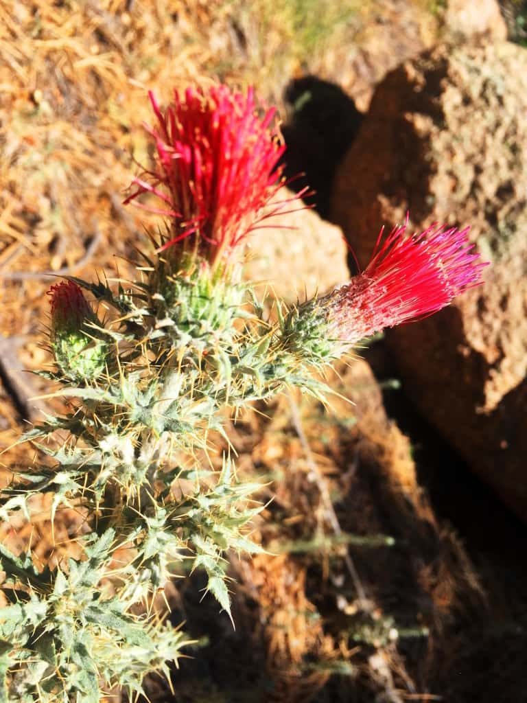 If you want to cut that part of the approach off, you can make your way, by car, passing the Hulapai Ranger Station on the road, and then take the right onto the main campground, which is the more popular entry. After passing the numbered cottages and the RV’s in their designated areas, and you will see the marker for the ‘Aspen Trail’; here you will begin your challenge. Aspen Peak Trail’ is marked with signs on the way up, but remember on the way down to follow the signs that say “Campground” to get back.
The first portion of Aspen Trail is a bold introduction to the Ponderosa Pine “vibe”. Dragonflies with a shiny blue armor orbit dazzling red cactus flowers beneath the forest. (Image/Left) This initial 1000 feet of incline is a winding set of switchbacks and vistas. The boulders here are rounded like leavened bread, adding a unique surreality to the openings in the glades, and there are hundreds of thousands of these rounded fixtures. 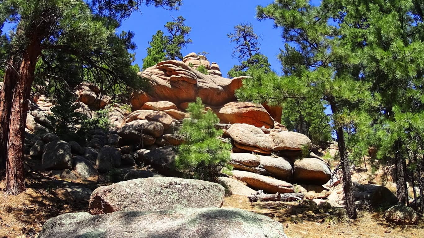
How it is that these boulders came came to be rounded and stacked individually is hard to imagine. As you continue into the 1500 foot level of prominence you will come to the ridge which opens up on the northern view of Kingman and the overall desert plateau.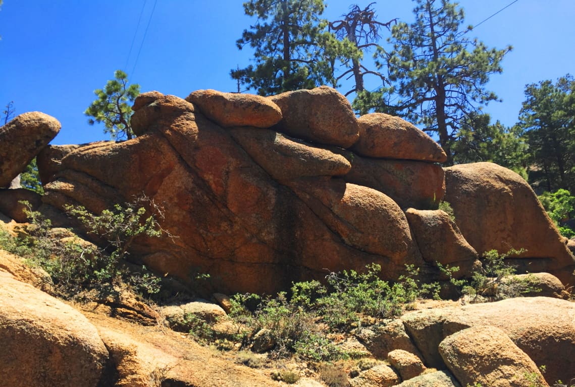 It isn’t just the vastness of this view over the northern ridge, but the stillness that presides over the radiating gold that takes your breath away. Arizona is like “spirituality that happens at a glance”; there’s truly an underlying force that imposes an evolved slowness over everything; it’s the ‘un-rushed’ spirit that survives among the high desert winds. If you move too fast, you just won’t make it. Everything you see is whispering “Pace yourself, and take your time.” The land feels like natures assigned setting for prophecy, which is one hell of a calling card.
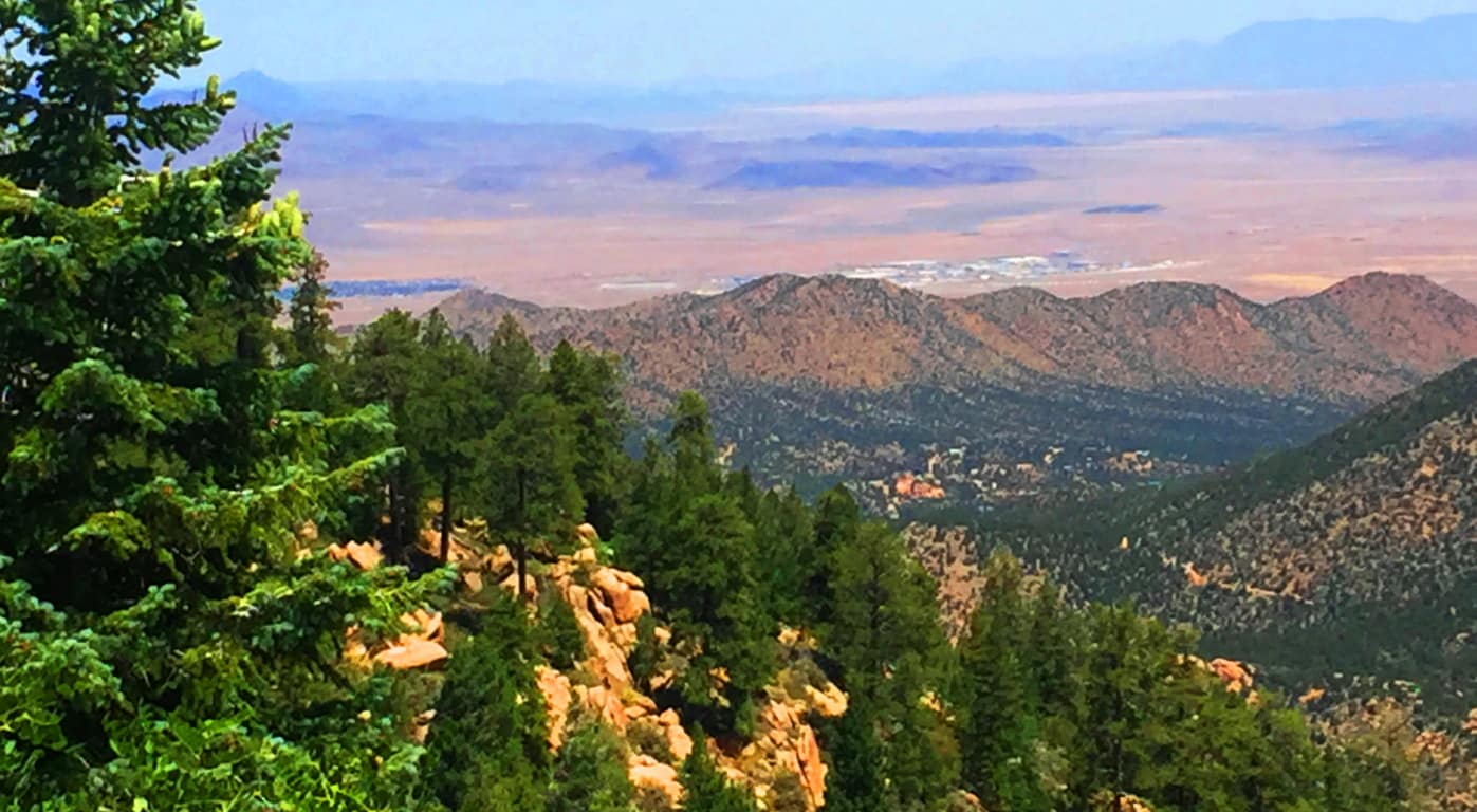
After taking in the northern vista on Aspen Trail’ you will begin to see the peak as you curve slowly around the mountain face, eventually making your way to the southern side. There is a view of the southern ridges beyond as the path first crosses a rickety wooden bridge that is your ‘gateway’ to the uppermost vale.(Image/Below)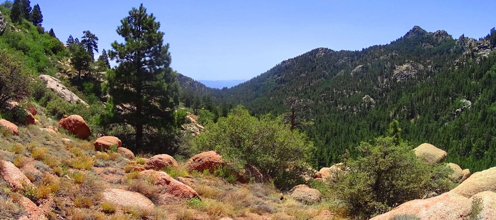
From here something otherworldly happens. Just like in the Celtic heights of enchanted places like the Rowan Valley in Wales, where massive ‘cut’ stones just start to appear out of nowhere, Hulapai seems to support similar ancient stoneworks specifically in the advantageous heights, where anyone approaching would be seen for miles before arrival. There are several stone-linings along the upper path. It is a good possibility that these stones were placed by the Neolithic culture, then supported by the Hulapai tribe, and reinforced in modern times. Clearly the area was sacred for someone if they were taking the time to create stones-works at 8000 feet, which is what we see here. 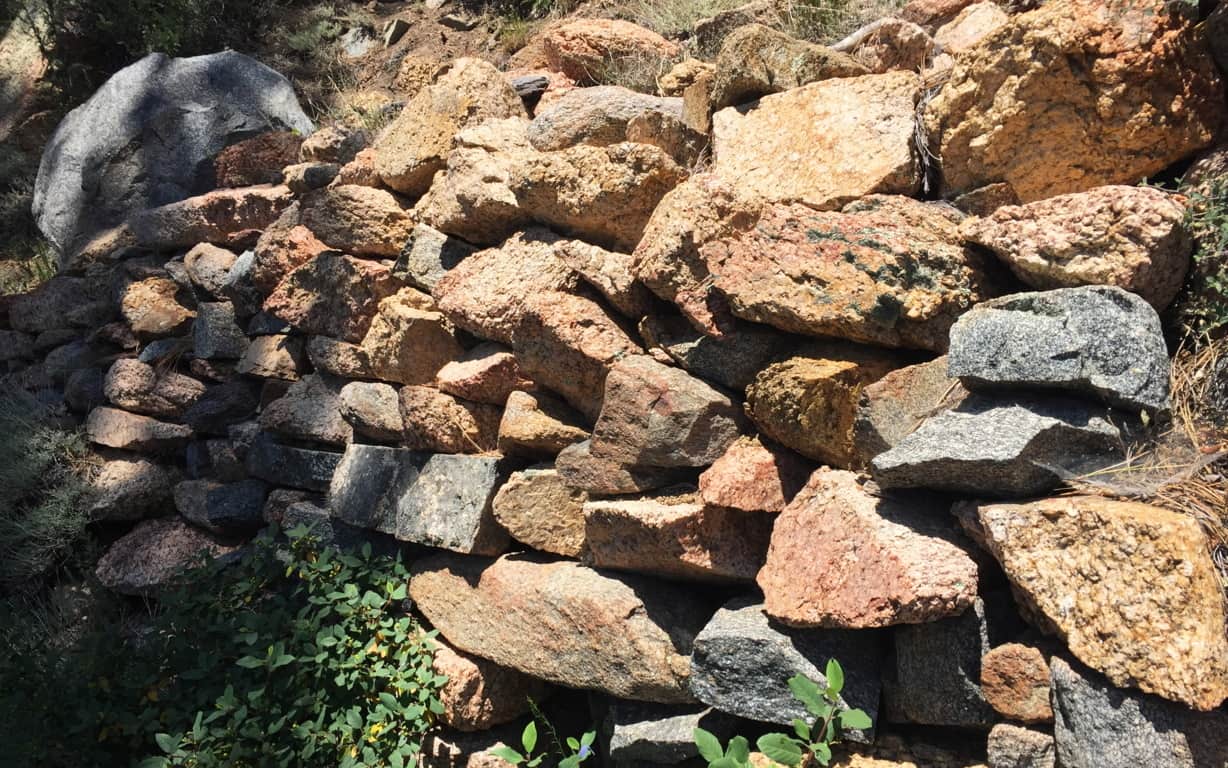 In Celtic elevations, often times when you find stone-linings that begins to announce a sacred zone, there is a singular solitary statement monumentalizing that sacredness. It is beyond astonishing that as you travel a little further along this last 200 yards of trail you will find a single Standing Stone unlike any of the other hundreds-of-thousands of rounded stones you’ve passed. The Standing Stone is cut abruptly on the top, with a a right angle cut into its right side. It stands about 6 feet high, with an absolutely flat-cut face, like a table standing up at about 4 inches in width. It is totally opposite the rounded features of the common boulders here, in every possible way; and it faces the peak.
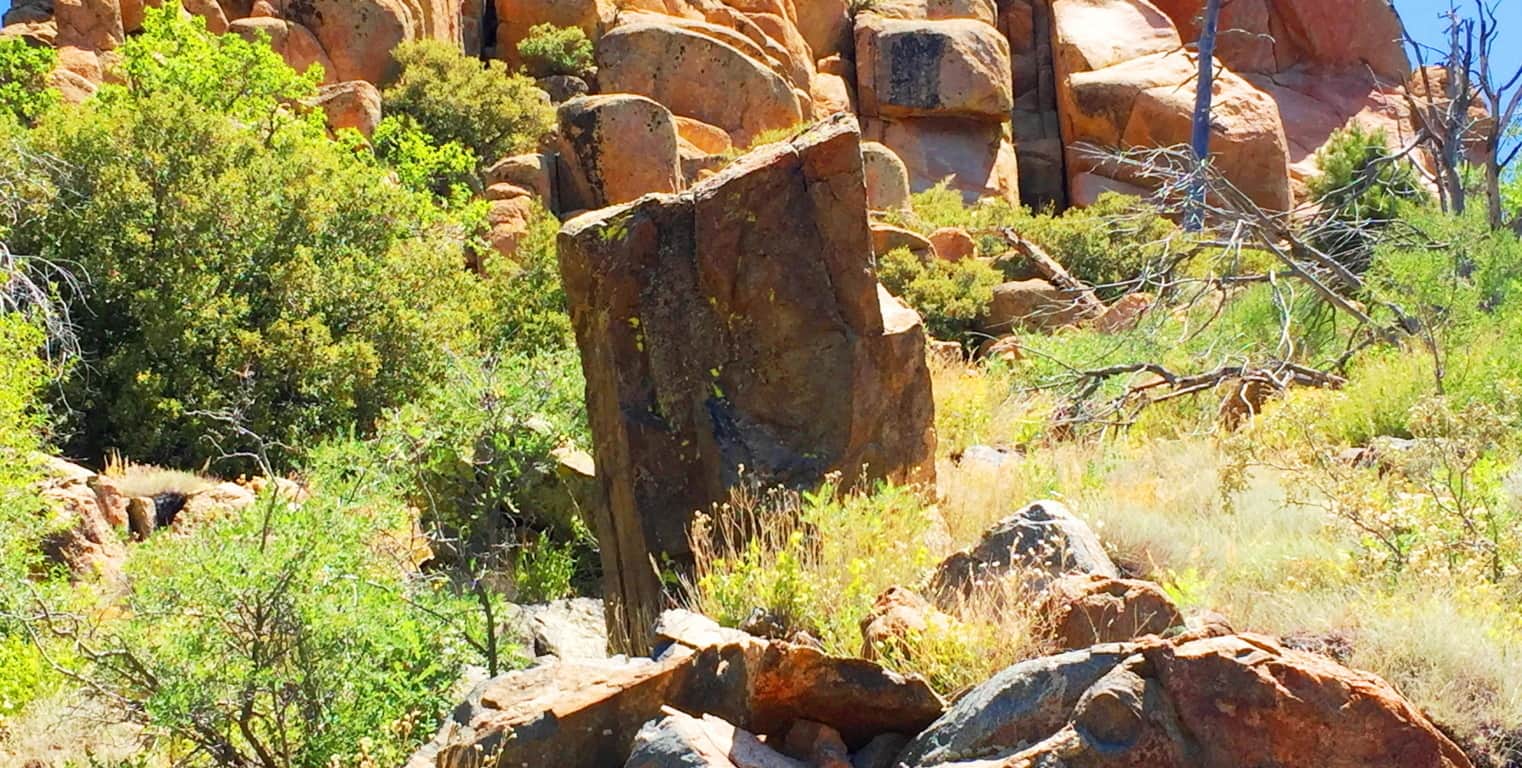
This Standing Stone is most likely one of the oldest sociological statements in all of Arizona, among hundreds of such statements. If it is related to the Neolithic culture of ancient Celtic places, then this stone is no less than 4000 to 6000 years old. It is truly priceless. It might very well be that this is what is known as a ‘Solar Stone’, marking mid-day on this mountain for eternity. ‘Solar Stones’ appear in Celtic highlands, as well as the New England mountains. It is no mistake that from here you can follow the last portion of Aspen Trail towards a grand monolithic peak laid out dramatically before you. 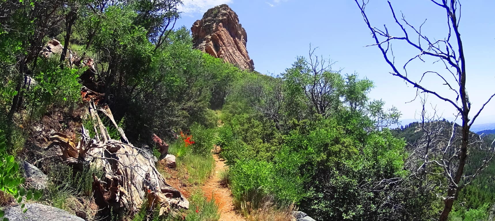 Continue towards this massive pinnacle to make the dramatic Aspen Peak. Even looking at the rock features in this uppermost area, you will see that there is not a single stone cut with right angles at the top and sides, like the Standing Stone that marks the upper trail.
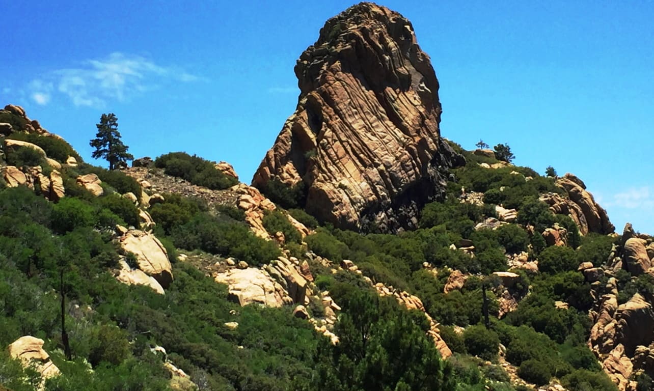
At the peak you are able to see a beautiful northern desert plateau. At this point you are 8,417 feet above Sea-level. 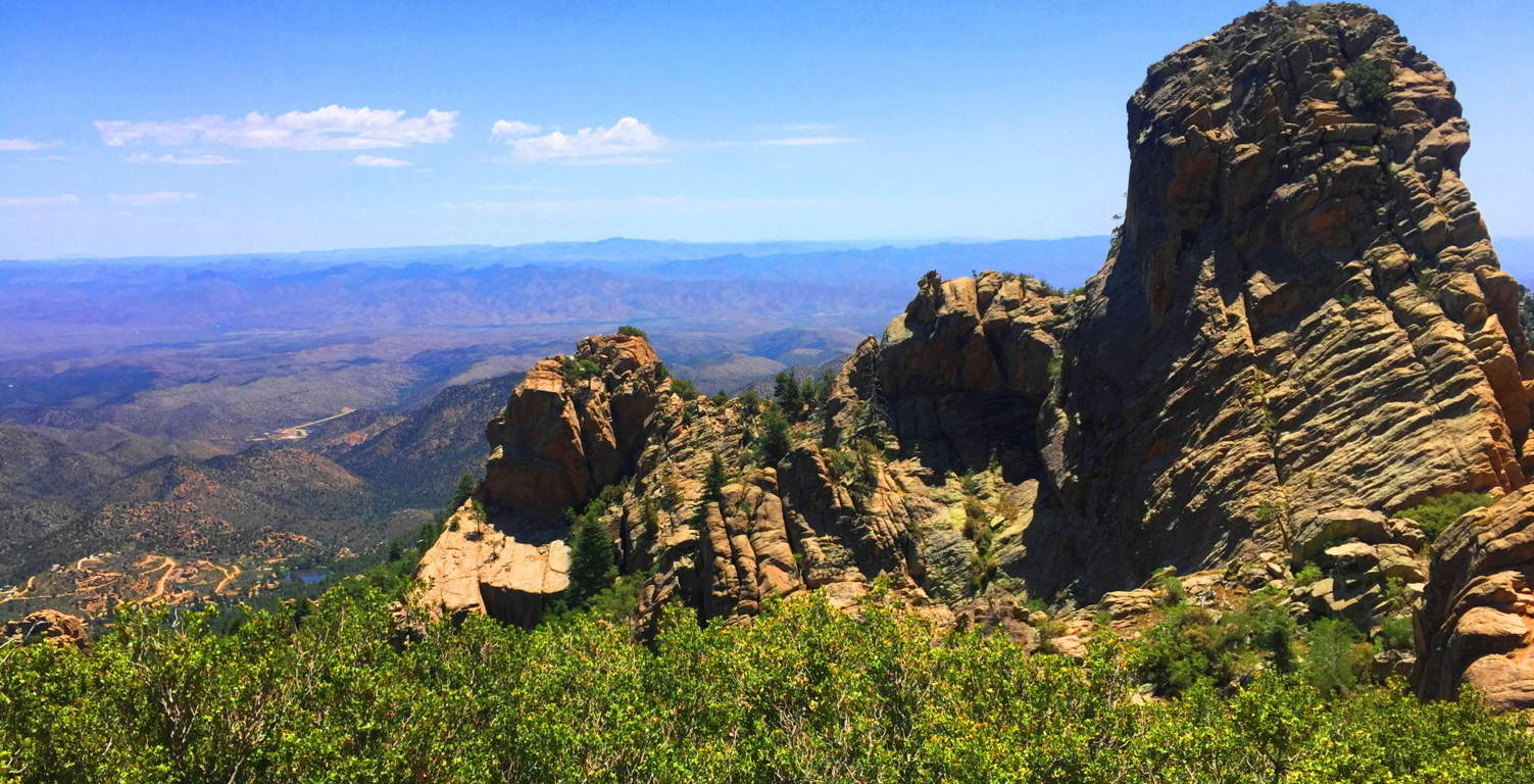
Aspen Trail at Hulapai is a spiritual challenge. You will have to put aside your usual hiking tendencies and regular comforts. Plan carefully. This is a stellar place. There are deer running through the forest below, and a high wind rushing over the desert; it may carry all the way to the Pacific Ocean in California! The Peak here is like an epic guard tower for the entirety of the ‘American West’; Hulapai being on the western edge of the mountain ranges of Arizona, which continue all the way up to the Rockies of Colorado at its eastern edge. The wonders that exist deeper into the Arizona interior are astoundingly worthy of such a “tower”, where the ancients once dwelled, high above the world. Just let it all sink in.
Sunset Crater Volcano National Park
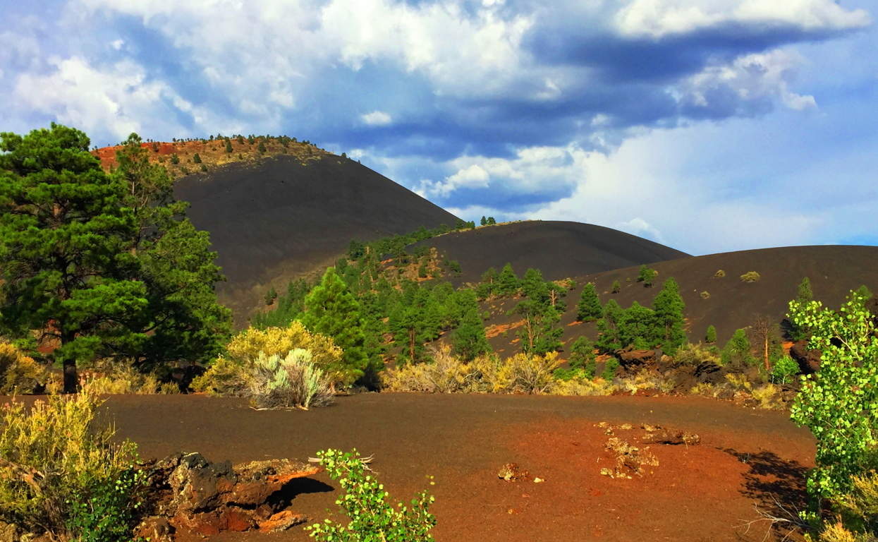 Location: Flagstaff, Arizona/America
Elevation: 8,042 feet/Prominence 1000 feet
Note: When seeking out sacred places, signs for Neolithic Culture will not always reveal themselves. The world is a wide place, teaming with variation and regeneration. In places like Sunset Crater, you will experience real wonder about the regenerative ability of Nature, as well as its explosive potential. This is a relatively new landscape compared to the Ranges of Ireland, Scotland, England, and New England.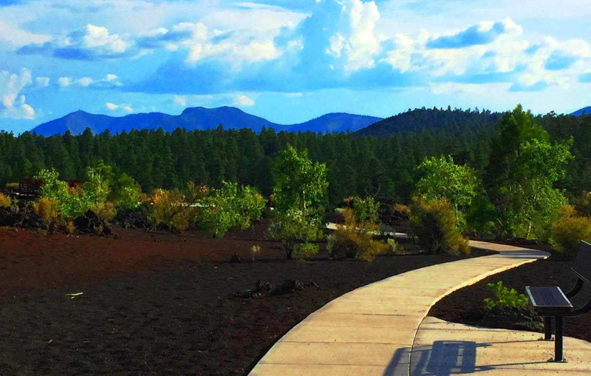 Just like the Celts of the Atlantic coastlines, there are native tribes that have been in this particular place basically forever. These indigenous tribes can attest to the age and variation of the landscape, along with Neolithic legends of their own, which bear striking similarities to those of the Celtic tradition. The Hopi of the Coconino Desert tell stories of “Red-Headed Giants” that ‘terrorized’ this region once upon a time. Isn’t that ironic. Many tribes, such as the Wupakti, migrated away from this scene, out to the very edge of the desert, into mountains and forests, perhaps to get away from the threats that existed out in the wide-open-wild. They came to live in the shadowy-cool forests of what is now Sunset Crater Volcano National Park, the ever-young landscape on the edge of the abyss.
Some places, just by hiking through them, can literally change your dreams at night. After hiking the countryside in Ireland with eyes wide open for just a few days, the only thing you will see when you eventually close your eyes at night, is a bright residual green. (Image/ Below/Left/Glenveagh Mountains/Ireland).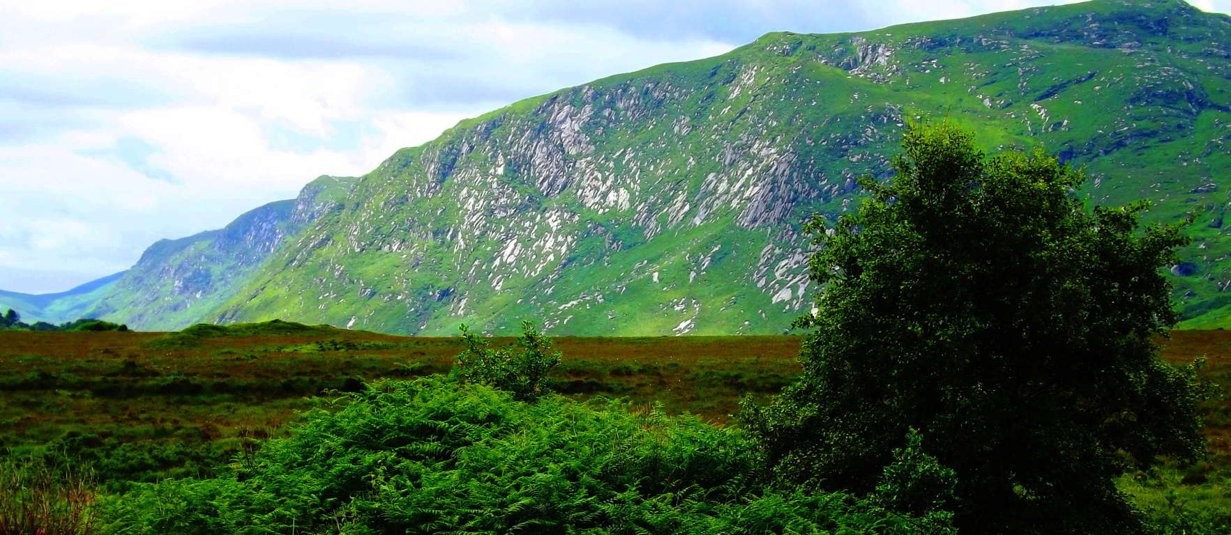 It truly happens. In the high Cococino Desert Plateau of Arizona (Image/Below) where everything you see is, at a minimum, 8000 feet in elevation, the altitude seeps slowly into all five of your senses, and even pushes you into a sixth.
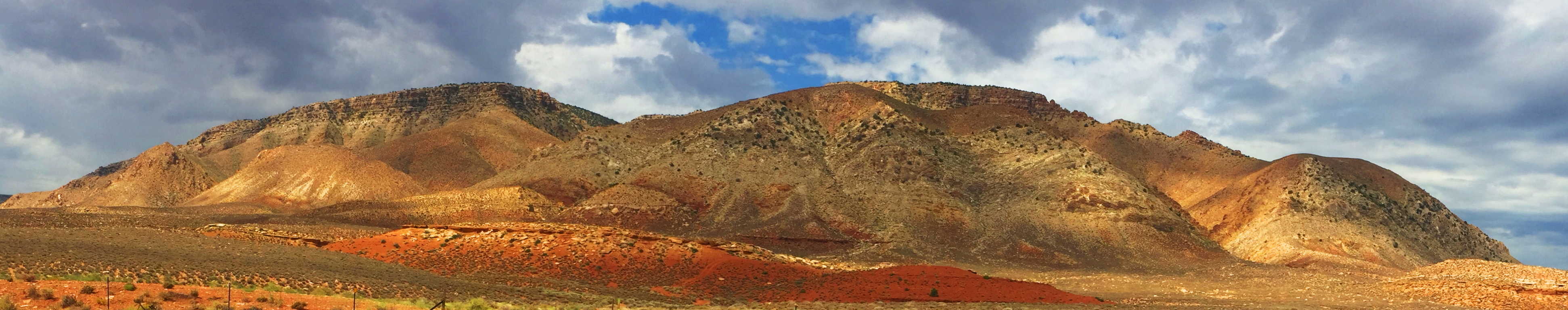 Here your body will begin to sense that it has moved into another world entirely. After a few days on the Cococino Plain of Arizona, the only thing you will see, when you eventually close your eyes at night, is residual white-gold. The perfect example of this is the wide-open panorama of the Grey Mountain (Image/Above), just south of the Grand Canyon. Grey Mountain sits like a white-gold monument welded by the timeless high-winds of the Cococino Plateau. On the extreme southern edge of this “white and gold dimension” is the surreal and vivid oasis of the ‘Sunset Crater Volcano National Park’. (Image/Below)
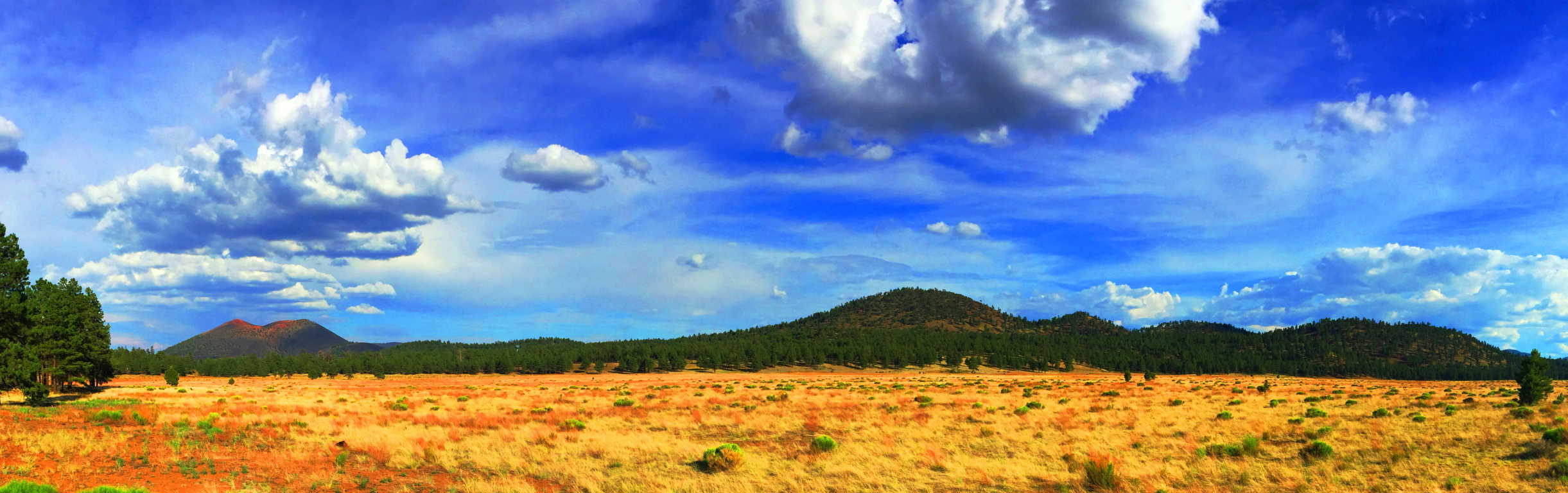 Sunset Crater’ is the captivating edge of the intimidating, but totally scintillated, Cococino Desert scene. From a distance, Sunset’ is the first life-giving glimpse of green after a dauntingly vast span of high desert bush. The Crater’s’ black rock and golden brown soil stand outs like a holy mountain against this dramatic golden-white backdrop, and it is highly likely that the native Americans of this area believed it to be a spiritual monument.
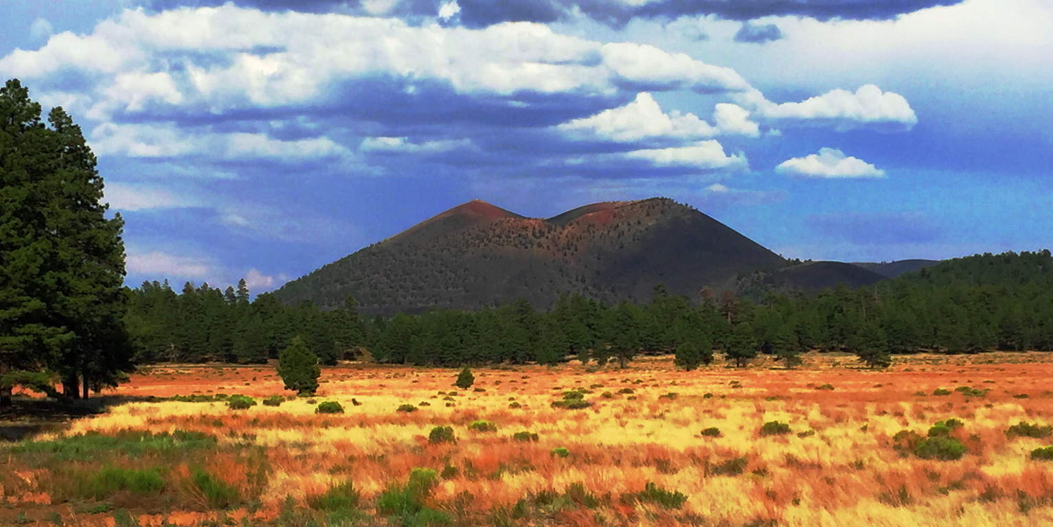 From the base of the Volcano, Sunset’ becomes a deep and jagged black-sea of solidified magma, an other-worldly terrain displaying a tangible timeline of life and death, and then life again, in a single glance.(Image/Below)
 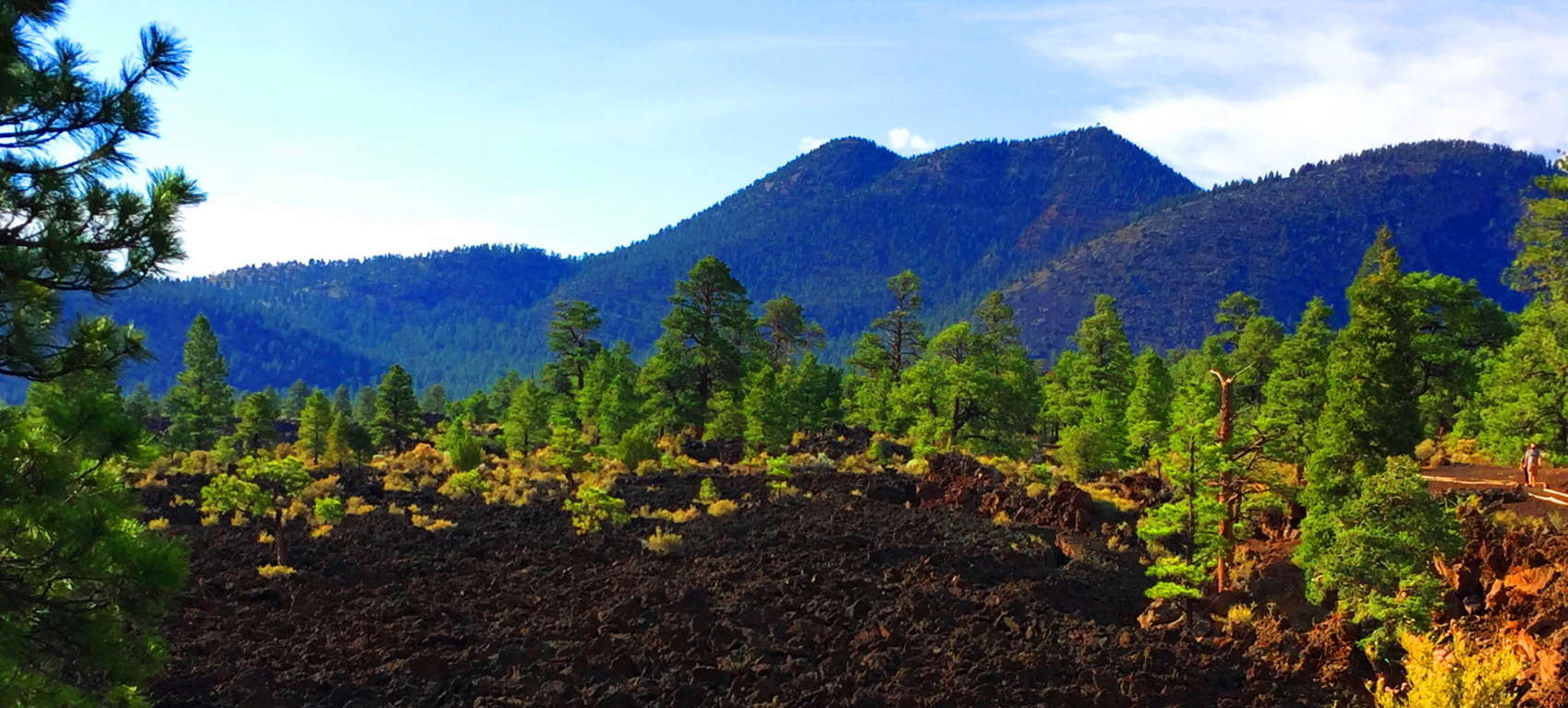 The trail design here at Sunset’ is a short set of ‘Wizard of Oz-looking’ pathways that run through the incredible magma remains. The rocks are sharp and drastic shafts which cut deep into the earth. The smooth white stone platform built for hikers here couldn’t contrast the experience more (Image/Below). It is one surreal stroll.
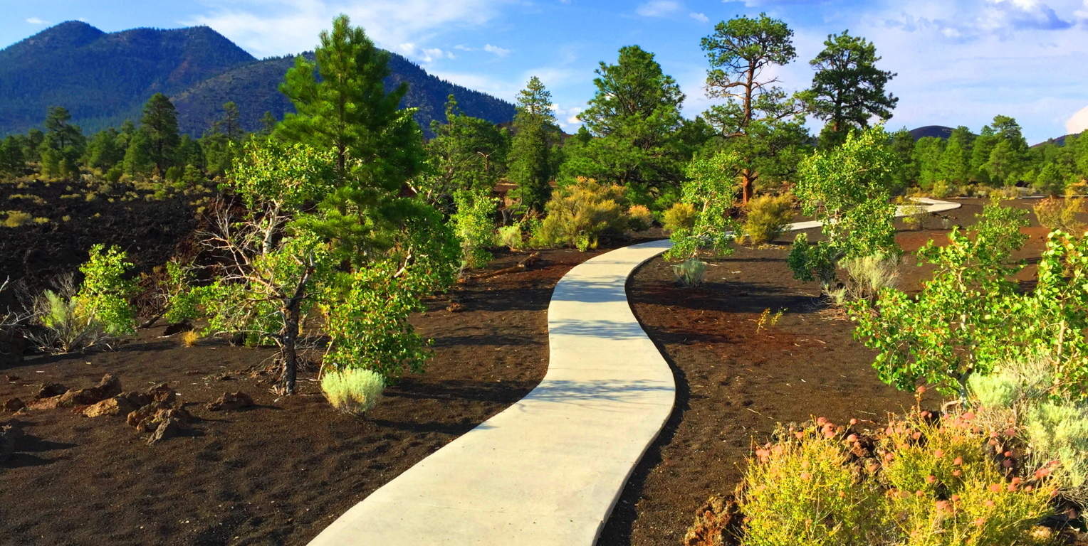 The best trail here is the small road which runs northwest into the newborn forest, around the Volcano. To see this brand-new forest rising up out of what was once magma, ashes, and fire, is to see a spiritual vision. It is a testament to the determination of the force of Life around us; how It finds a way, even in the harshest of environments.
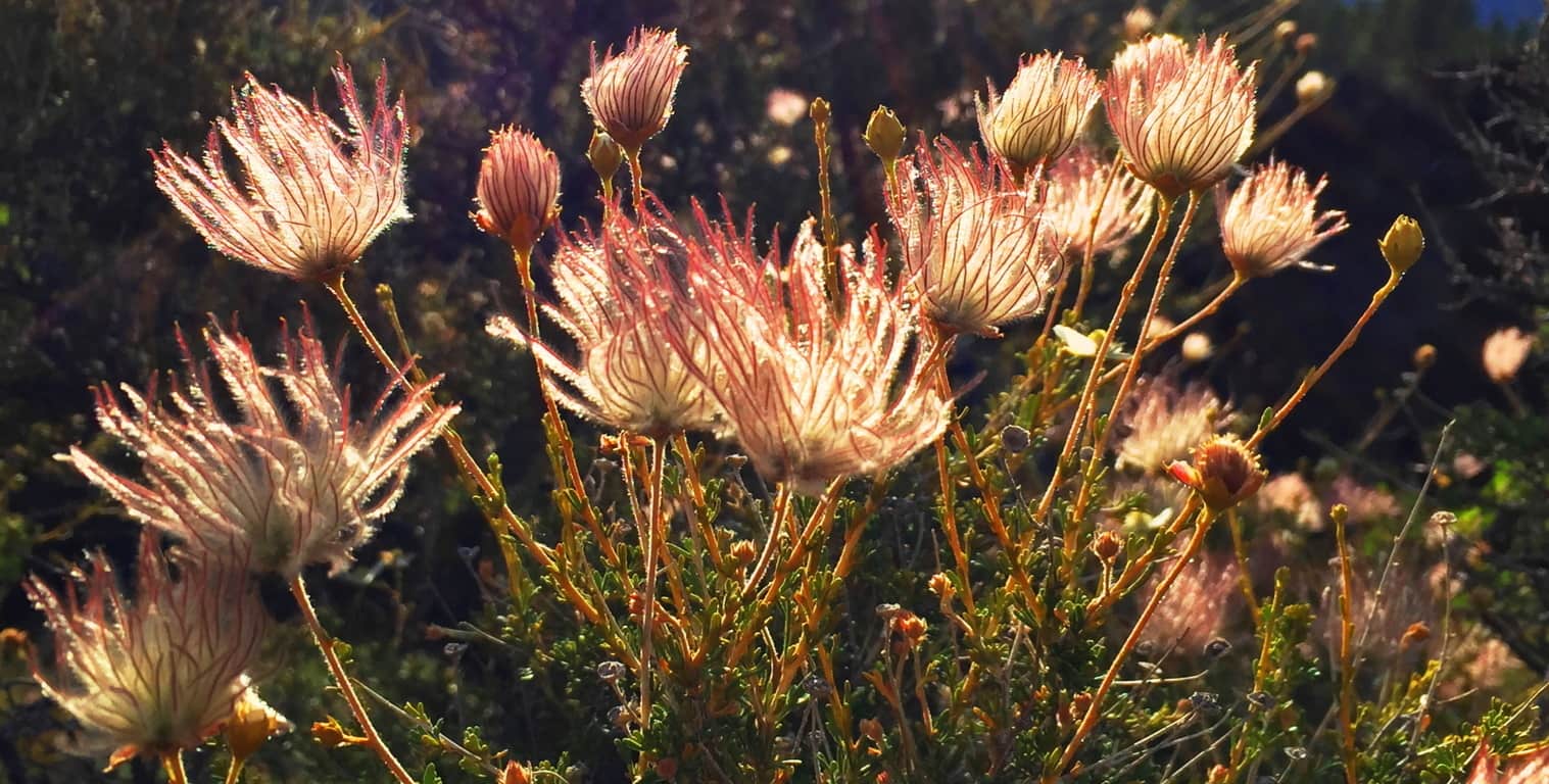 It is truly surreal: What looks like level pavement in the image below, is actually the newest of forests growing straight out of the compiled ashes and magma. The fauna here are tough, resilient, but somehow delicate and soft as well. (Image/Above)
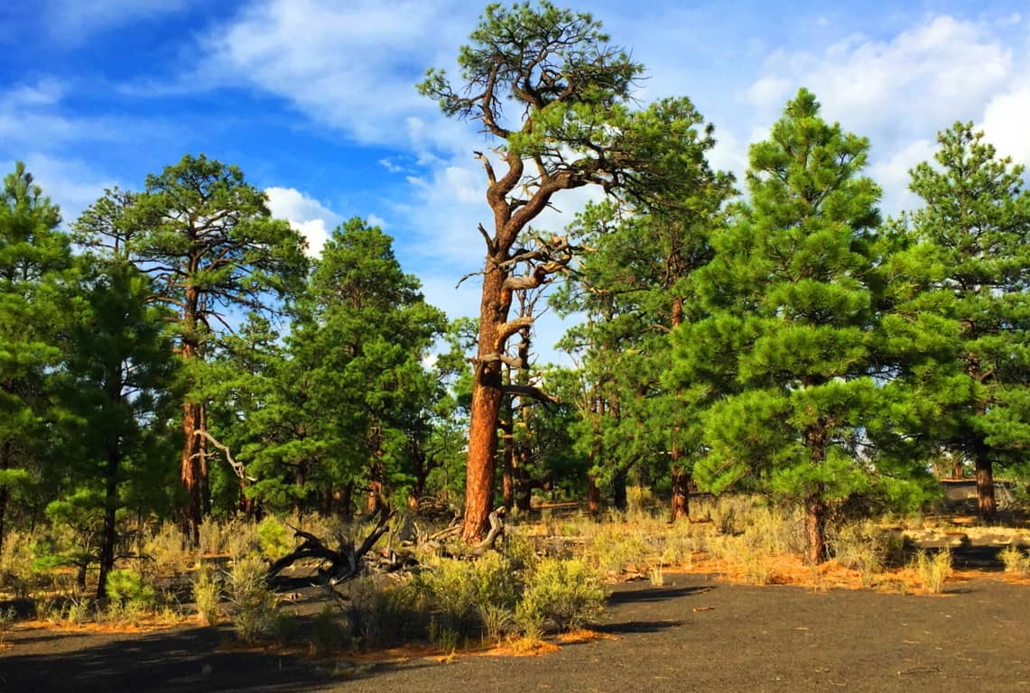 It is forbidden by the Park Service to climb the Crater’, but you can wander into this baby-forest near the western base of the Volcano’. Here you can catch a glimpse of the young glades climbing up the 1000 foot incline. The new growth browns’ the black-rock deep into soil, with the golden brush sprouting-up as a result, pushing the Ponderosa-Pines ever-upward, as if they were climbing The Great Pyramid.
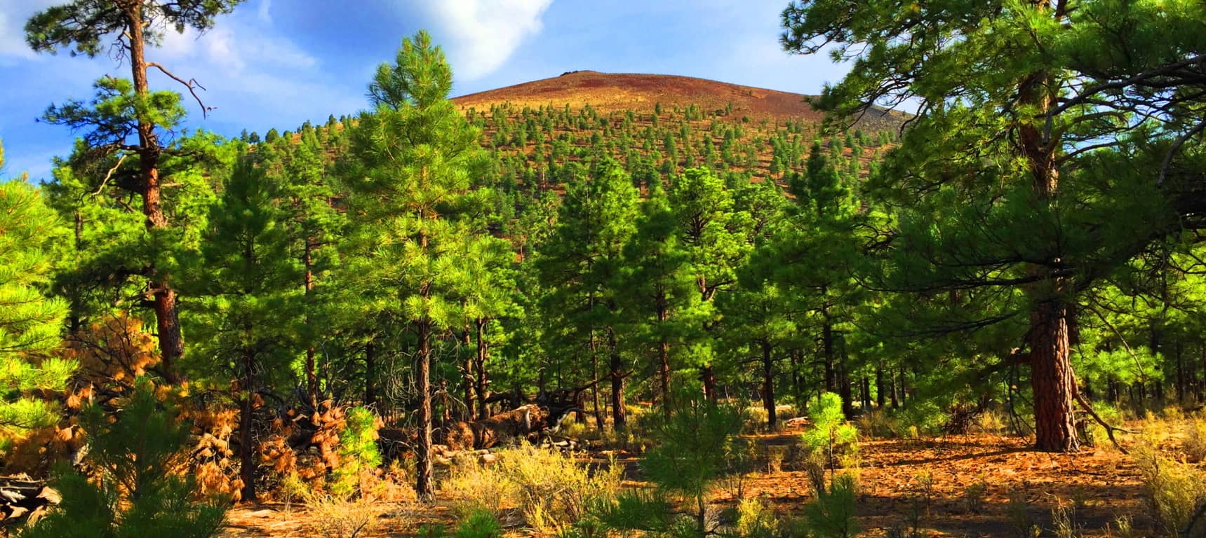
The indigenous Natives of this region, the Wupakti, would’ve seen the dramatic eruption which took place here just over 1000 years ago, from their stone dwellings only a few thousand yards away. Their dwellings remain in the safety of the Ponderosa Pine filled Cococino glades, where once deer and rabbit would’ve been plentiful, before the modern era invaded their tranquil existence. (Image/Below).
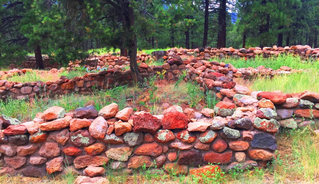 The Wupakti absolutely knew what they were doing when they settled just west of the Volcano. The variety of alternate natural features within a 50-mile radius of Sunset Crater’ is overwhelming. To the north of Flagstaff City, and east of Sunset Crater’, is the striking San Francisco Mountain Range of Arizona, inclusive of four beautiful peaks, with trails, all climbing no less than 12,000 feet. (Image/Below)
 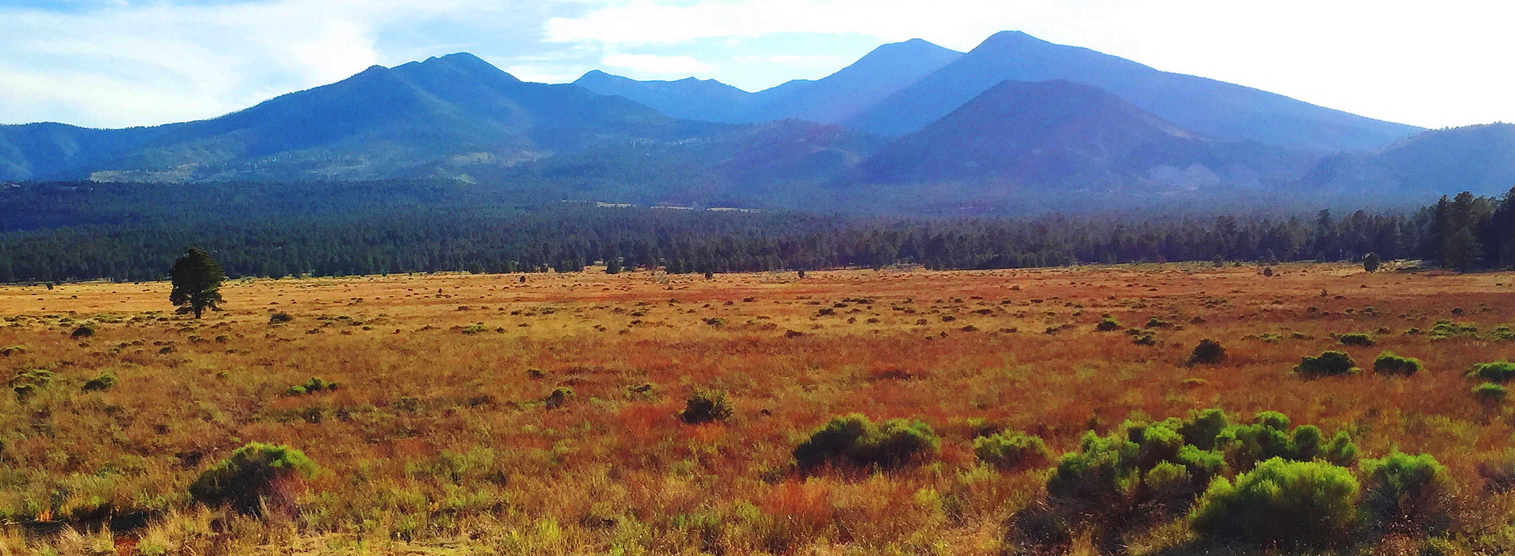 The native cultures here are beautiful and varied. The Wupakti chose to live at the base of these Mountains, within the Forest. The legendary Apache dwelled to the southeast; while the mystical Hopi chose the north, way-out in the desert Canyons, such as the Grand Canyon (Image/Left) and
 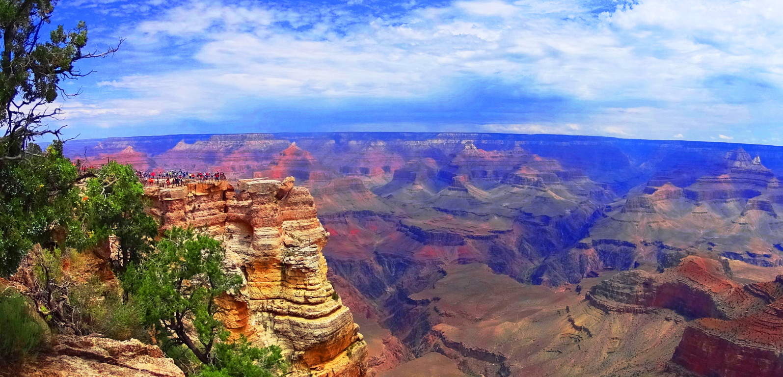 the lessor known, but no less beautiful, ‘Little Colorado Canyon’. All of this is out there in the northern arid abyss that seems to go on forever…(Image/Below)
  The signs of the Neolithic Culture that existed before the Natives of the region are certainly here, spread across an intensely vast amount of space. Multiple canyons, forests, mountain ranges, and deserts exist here, all with features that show signs of Neolithic culture. If you come to Flagstaff Arizona, visit Sunset Crater’. Experience raw elements of trails containing the Past, Present, and Future in one stellar region. The regenerative force of Nature persists in even the harshest of places. Amazingly, if you investigate the stories of the Wupakti, Hopi, and Apache, you will find myths so similar to Celtic legends, it will astonish you. A hike through Sunset Crater’ makes it all as real as it gets, and in a stunningly beautiful way. Don’t touch the lava if it starts to flow, but definitely enjoy the show.